

 Travel guide
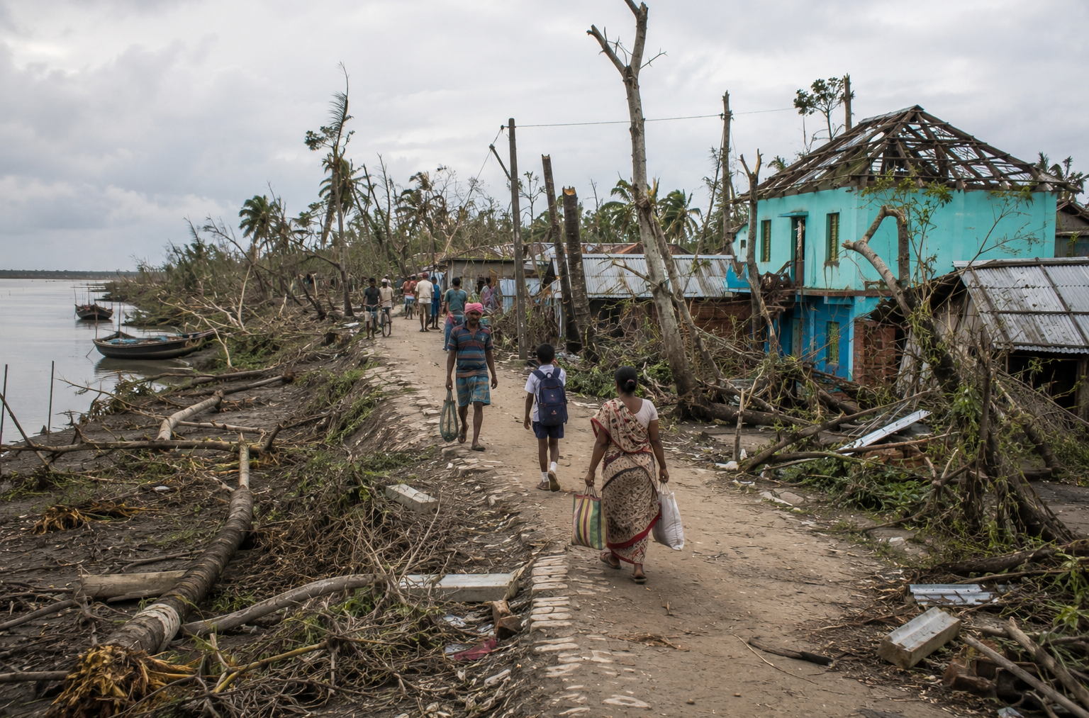
The Sundarban cyclone season is not one continuous period. The Bay of Bengal has two important windows of cyclone activity: April–May during the pre-monsoon season and October–December during the post-monsoon season. May and November are particularly significant months.
However, being in a cyclone-prone season does not mean a cyclone is continuously affecting the Sundarbans. Actual travel conditions depend on the specific weather system, its track and intensity, tides, river conditions and official advisories.
The Sundarbans is one of the world’s most remarkable coastal ecosystems and one of the regions most closely connected to the forces of the Bay of Bengal.
Here, a cyclone is never just a storm.
- It is wind meeting water.
- It is a tidal surge entering narrow channels.
- It is embankments under pressure.
- It is saltwater reaching farms and freshwater ponds.
- It is mangrove roots holding together vulnerable shorelines.
And, eventually, it is a forest and its communities beginning the long process of recovery.
Understanding the cyclone season in the Sundarbans therefore means looking beyond a weather forecast. It means understanding how storms interact with tides, rivers, mangroves, islands, villages and the wider coastal landscape.
When Is the Cyclone Season in the Sundarbans?
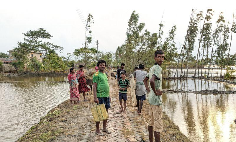
The Bay of Bengal experiences its most important tropical cyclone activity during two broad seasonal windows:
- April–May: the pre-monsoon cyclone period
- October–December: the post-monsoon cyclone period
Among these months, May and November are particularly important for cyclone activity.
The broader seasonal pattern can be understood like this:
| Month | Cyclone Activity in the Sundarbans |
| January–February | Generally lower cyclone activity |
| March | Pre-monsoon activity begins increasing |
| April | Cyclone risk becomes more significant |
| May | Major pre-monsoon cyclone month |
| June–September | Monsoon season; tropical systems can still occur |
| October | Post-monsoon cyclone activity returns |
| November | Major post-monsoon cyclone month |
| December | Cyclone activity generally begins declining |
This seasonal pattern is important for anyone researching Sundarbans weather or planning a trip.
But there is an important distinction: Cyclone season does not mean cyclone conditions every day.
A cyclone-prone month simply means the probability of significant tropical weather systems is higher. A particular trip still depends on the actual forecast, the location and movement of any storm, river and tidal conditions, and official safety advisories.
Why Is the Sundarbans So Vulnerable to Cyclones?
The geography of the Sundarbans explains much of its vulnerability.
The mangrove forest sits across the delta formed by the Ganges, Brahmaputra and Meghna river systems, where land meets the Bay of Bengal through a vast network of rivers, creeks, channels and tidal waterways.
Much of this landscape is:
- low-lying
- tidal
- constantly changing
- intersected by rivers and creeks
- exposed to the Bay of Bengal
- dependent on embankments for protection in inhabited areas
This creates a unique relationship with storms.
A cyclone approaching the Sundarbans can bring several hazards simultaneously:
- Strong winds can damage vegetation, homes, boats and infrastructure.
- Storm surge can push seawater far beyond normal tidal levels.
- High tides can increase the amount of water entering already vulnerable areas.
- Heavy rainfall can contribute to flooding and drainage problems.
- Embankment breaches can allow saline water to enter agricultural land and settlements.
- Wave action and erosion can reshape shorelines and damage islands.
That is why cyclone impacts in the Sundarbans cannot be understood by wind speed alone.
Cyclone, Storm Surge and Tide: What Is the Difference?
These terms are often used together, but they describe different things.
Cyclone
A cyclone is a large rotating tropical weather system that can produce destructive winds, heavy rainfall and dangerous coastal conditions.
Storm Surge
Storm surge is an abnormal rise in coastal water level caused primarily by a storm’s winds pushing seawater toward the coast, with atmospheric pressure also contributing.
Tide
Tides are the regular rise and fall of sea level caused mainly by the gravitational effects of the Moon and Sun.
The danger becomes greater when these processes overlap. Imagine a cyclone arriving while the tide is already high. The storm does not need to create the entire water level by itself. It is adding its force to water that is already elevated.
This interaction can turn a powerful storm into an even more destructive coastal event.
Why High Tide Can Make a Cyclone More Dangerous
One of the most important things to understand about the Sundarban cyclone season is that the timing of a storm matters as much as the storm itself.
A cyclone making landfall close to high tide can produce substantially different consequences from the same cyclone arriving during a lower tidal phase.
This is particularly important in the Sundarbans because tidal water moves through a dense network of rivers and creeks.
When storm surge combines with a high tide, water levels can rise dramatically.
The result can include:
- overtopping of embankments
- flooding of low-lying islands
- saline water entering agricultural land
- erosion of riverbanks
- damage to settlements
- disruption of boat transportation
- prolonged recovery after the storm has passed
This is one reason coastal cyclone risk is not simply a matter of asking, “How strong is the cyclone?”
A better question is: How strong is the cyclone, where is it going, and what is the water doing when it arrives?
Aila 2009: When the Water Became the Disaster
Cyclone Aila remains one of the clearest examples of how wind, storm surge, tides and vulnerable infrastructure can combine in the Sundarbans.
Aila struck on 25 May 2009, affecting large parts of coastal West Bengal and Bangladesh.
In the aftermath, the scale of damage to embankments demonstrated how devastating storm-driven water can become in a low-lying delta.
Across the affected areas under the West Bengal Irrigation and Waterways Department, approximately 3,122 kilometres of embankments were assessed. Around 177 kilometres were washed away or breached, while approximately 601 kilometres suffered severe damage.
The storm also coincided with an important tidal phase. At Sagar Island, a tidal surge of around 3.3 metres above the predicted level was observed.
This illustrates an essential lesson about the Sundarbans: The greatest danger from a cyclone may not always be the wind. Sometimes, it is the water.
Once seawater crosses or breaks an embankment, the consequences can continue long after the cyclone itself has moved away.
Amphan 2020: A Super Cyclone Crosses the Sundarbans
On 20 May 2020, Super Cyclonic Storm Amphan made landfall across the West Bengal–Bangladesh coast near the Sundarbans.
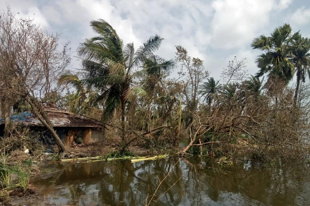
The cyclone developed into an extremely powerful system over the Bay of Bengal, reaching maximum sustained winds of approximately 155–165 km/h, gusting up to 185 km/h around landfall.
The consequences extended far beyond immediate wind damage.
The cyclone affected:
- mangrove vegetation
- shorelines
- agricultural land
- aquaculture areas
- embankments
- settlements
- freshwater resources
- coastal ecosystems
Scientific assessments following Amphan documented significant changes in mangrove vegetation and shoreline conditions.
The event demonstrated something fundamental about the Sundarbans: A cyclone does not simply pass over the forest. It interacts with the entire coastal system.
The storm can alter vegetation, sediment movement, riverbanks and salinity conditions while simultaneously affecting the people who live around the forest.
Remal 2024: A More Recent Reminder
Cyclone Remal provided another recent reminder of the continuing exposure of the Sundarbans and coastal West Bengal to severe tropical weather.
In May 2024, Severe Cyclonic Storm Remal crossed the Bangladesh and adjoining West Bengal coast between Sagar Island and Khepupara.
At landfall, sustained winds were approximately 110–120 km/h, gusting up to 135 km/h.
The system also produced heavy to extremely heavy rainfall and a significant storm surge.
For the Sundarbans and surrounding coastal districts, Remal once again highlighted the combined threat posed by:
- strong winds
- storm surge
- heavy rainfall
- tidal flooding
- embankment vulnerability
- saline water intrusion
Cyclones such as Aila, Amphan and Remal belong to different years and had different characteristics, but together they show why cyclone preparedness remains essential across the Sundarbans landscape.
The Sundarbans Has Been Shaped by Repeated Cyclones
See it for yourself
A private journey shaped around you — your group, your pace, your interests. Book a free consultation.
Cyclones are not new to the Sundarbans.
The forest has evolved within a landscape shaped by tides, sediment, erosion, freshwater flows, salinity and storms.
Every major cyclone leaves a different signature.
- Some trees may lose branches or fall completely.
- Some shorelines retreat.
- Some channels become wider.
- Some areas receive new sediment.
- Some agricultural fields become saline.
- Some embankments fail.
- Some communities are displaced temporarily—or face a much longer recovery.
The forest itself can regenerate, but recovery is not always immediate. The Sundarbans is therefore best understood as a dynamic coastal system, not a static forest. Storms are one of the forces continually reshaping it.
How Mangroves Protect the Sundarbans From Cyclones
The mangrove forest is more than wildlife habitat.
It also functions as a natural coastal defense system.
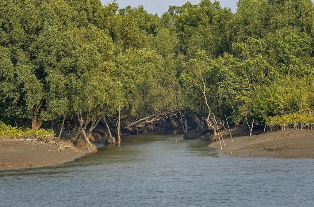
Dense mangrove vegetation, tangled roots and complex forest structure can help slow water movement, reduce wave energy and trap sediment.
The forest can therefore absorb part of the physical energy generated by coastal storms before that energy reaches more exposed areas.
This is one reason mangrove conservation matters far beyond biodiversity.
The mangrove ecosystem provides benefits related to:
- coastal protection
- shoreline stability
- sediment trapping
- carbon storage
- fisheries
- wildlife habitat
- local livelihoods
In a region repeatedly exposed to cyclones, the health of the mangrove forest is closely connected to the resilience of the wider coastal environment.
The Forest That Protects the Coast Can Also Be Damaged
It is important not to describe mangroves as an invincible natural shield.
They provide protection, but they are also exposed to the same forces they help absorb. A severe cyclone can damage large areas of vegetation through:
- uprooting
- branch breakage
- canopy loss
- saltwater stress
- erosion
- prolonged inundation
After a major storm, the forest may look dramatically different.
Recovery depends on species, location, soil conditions, salinity, freshwater availability, sediment dynamics and the severity of the disturbance.
This creates a fascinating ecological paradox: The forest protects the coast, while the coast’s storms continually test the forest.
The Hidden Aftermath: Saltwater Intrusion
One of the most important impacts of a cyclone in the Sundarbans may not be visible immediately.
It is salinity.
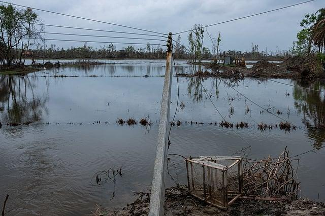
When storm surge or tidal water enters inhabited islands and agricultural areas, seawater can contaminate soil and freshwater sources.
This can create problems long after the wind has disappeared.
Saltwater intrusion can affect:
- agriculture
- drinking water
- ponds
- soil quality
- freshwater ecosystems
- mangrove vegetation
- local livelihoods
For farming communities, this can be particularly serious.
A field may remain physically intact while becoming difficult to cultivate because of increased soil salinity.
This is why cyclone recovery in the Sundarbans cannot be measured only by rebuilding damaged houses or repairing roads.
The ecological and agricultural consequences can continue for months or even longer.
Is Climate Change Making the Sundarbans More Vulnerable?
Climate change adds another layer of complexity to cyclone risk.
It would be inaccurate to simply say that climate change causes more cyclones. The science is more nuanced.
However, climate change is associated with several changes that matter greatly for coastal regions.
These include stronger evidence for an increase in the proportion of the most intense tropical cyclones, heavier rainfall associated with tropical cyclones, and rising peak wind speeds in the strongest storms.
At the same time, rising sea levels increase the baseline water level from which storm surges occur.
For a low-lying delta such as the Sundarbans, that distinction is critical.
The question is therefore not only: “Are there more cyclones?”
It is also: “What happens when a cyclone arrives in a coastal environment where sea levels are higher, land is vulnerable to erosion, and freshwater and agricultural systems are sensitive to salinity?”
That is the more important climate-risk question for the Sundarbans.
Why Sea-Level Rise Matters in the Sundarbans
The Sundarbans is a low-lying coastal landscape where tides constantly reshape the boundary between land and water.
Rising sea levels can increase the frequency and severity of extreme coastal water levels associated with tropical cyclones.
This means that even if cyclone frequency itself does not dramatically increase, the consequences of individual storms can become more serious when the baseline sea level is higher.
Combine: sea-level rise + storm surge + high tide + heavy rainfall + erosion + embankment vulnerability
and the overall coastal risk becomes much more complicated.
That is why the future resilience of the Sundarbans depends not only on disaster response, but also on mangrove conservation, coastal planning, resilient infrastructure, early warning systems and adaptation.
Does Cyclone Season Mean the Sundarbans Is Closed?
No.
This is an important distinction for travellers.
The existence of a cyclone season does not mean that the Sundarbans is automatically closed for tourism throughout those months.
The official general tourism window is commonly considered October to March, although tourism activity can extend beyond this period and different seasons offer different experiences.
What matters is the actual weather situation.
If an active cyclone, severe weather system or official warning affects the region, safety takes priority.
Boat operations, ferry services, forest access and itineraries can be restricted or suspended depending on conditions and official instructions.
Therefore, travellers should never interpret “cyclone season” as either: “There will definitely be a cyclone.”
or
“The Sundarbans is always unsafe.”
Neither statement is accurate. The correct approach is to understand the seasonal risk and check the actual forecast before travelling.
Can You Visit the Sundarbans During Cyclone Season?
Travel during a cyclone-prone period requires more flexibility than travel during a stable weather window.
If there is no active cyclone or significant warning, conditions may still be suitable for travel depending on the season and local situation.
But weather in the Bay of Bengal can change quickly.
For travellers, the most important considerations are:
1. Check official weather warnings
Always monitor current weather information and official cyclone alerts before departure.
2. Keep your itinerary flexible
Do not build a trip around an itinerary that cannot adapt to changing weather.
3. Respect boat restrictions
The Sundarbans is fundamentally a water-based destination. If authorities or experienced boat operators determine that conditions are unsafe, do not attempt to continue simply because the weather looks manageable from land.
4. Follow local administration and forest authorities
Forest access, waterways and tourism operations may be affected by weather conditions.
5. Avoid last-minute assumptions
A clear morning does not guarantee safe conditions later in the day when a tropical system is developing nearby.
The goal is not to fear the cyclone season.
It is to respect it.
What Should Travelers Do If a Cyclone Is Forecast?
If a cyclone is forecast to affect the Sundarbans or surrounding coastal areas during your trip, safety should immediately become the priority.
Travellers should:
- monitor official advisories
- follow instructions from local authorities
- stay in approved and secure accommodation when advised
- avoid unnecessary movement on waterways
- postpone boat travel if conditions are unsafe
- maintain communication with your travel operator
- keep essential documents and belongings protected
- allow flexibility for delays or itinerary changes
The most important principle is simple: Never treat a cyclone warning as a minor inconvenience.
The Sundarbans is a remote, tidal and water-dominated environment. Conditions that appear manageable elsewhere can become significantly more challenging here.
Why Early Warning Systems Matter
In a cyclone-prone landscape, preparation can save lives.
Modern cyclone forecasting and early warning systems allow authorities and communities to track storms, communicate risk and begin evacuation or protective measures before the most dangerous conditions arrive.
This is particularly important in the Sundarbans because many communities live on low-lying islands and depend heavily on waterways.
Early warning can provide crucial time to:
- move people to safer locations
- secure boats and equipment
- protect livestock
- prepare shelters
- safeguard essential supplies
- restrict unsafe travel
- reduce exposure to storm surge
The difference between receiving a warning early and receiving it too late can be enormous.
Why the Sundarbans Cannot Be Understood Through Wind Speed Alone
Cyclone categories and wind speeds are useful, but they tell only part of the story.
Consider two storms with similar wind speeds. Their impacts could still be very different depending on:
- landfall location
- storm size
- forward speed
- storm surge
- tidal timing
- rainfall
- river conditions
- embankment condition
- shoreline exposure
- population density
- preparedness
This is especially important in the Sundarbans.
A cyclone approaching a densely inhabited island during high tide can create a very different disaster profile from a storm of similar intensity following another track or arriving during a different tidal phase.
So when thinking about Sundarban cyclone risk, always think in systems—not numbers alone.
The Sundarbans Is More Than a Cyclone-Prone Coast
It is easy to describe the Sundarbans only through danger.
- Cyclones.
- Tigers.
- Tides.
- Flooding.
- Salinity.
- Erosion.
But that would miss what makes the landscape extraordinary.
The Sundarbans is also a place of remarkable ecological resilience.
- Mangrove forests regenerate.
- Sediment builds new land.
- Tides redistribute nutrients.
- Wildlife adapts to extreme environmental conditions.
- Communities continue to live alongside a constantly changing landscape.
The same forces that make the Sundarbans vulnerable also help create its unique ecological character.
Water is not simply a threat here. It is the force that shapes the forest. And storms are part of that story.
The Wild Orbit Expert Advice
Planning a Sundarban trip during the cyclone-prone months requires flexibility, not fear.
Cyclone activity can change quickly, and conditions on the rivers and waterways may become unsuitable for boat travel even when weather on land appears manageable.
Before travelling, check official weather warnings, follow local administration and forest department instructions, and keep your itinerary flexible enough to respond to changing conditions.
If you’re planning to explore the Sundarbans, choosing the right travel window, monitoring weather conditions and travelling with an experienced local expedition team can make the journey safer and more rewarding.
At The Wild Orbit, we plan Sundarban journeys around seasonal conditions, local knowledge and responsible exploration—helping travellers experience the mangrove wilderness with greater awareness and respect for the environment.
FAQs
When is the Sundarban cyclone season?
The main cyclone-prone periods are April–May and October–December, corresponding broadly to the pre-monsoon and post-monsoon cyclone seasons in the Bay of Bengal.
Which month has the highest cyclone risk in the Sundarbans?
May and November are particularly important cyclone months in the Bay of Bengal. However, cyclone risk varies from year to year and depends on the actual weather systems that develop.
Is the Sundarbans safe during cyclone season?
The answer depends on current conditions. Being in cyclone season does not mean a cyclone is actively affecting the region. However, if an official cyclone warning is issued, travellers should follow authorities and postpone or modify travel plans as necessary.
Can I visit the Sundarbans in May?
May is within a major pre-monsoon cyclone window, so weather conditions require closer monitoring. Travel decisions should be based on the actual forecast, official warnings and local operating conditions rather than the calendar alone.
Can I visit the Sundarbans in October and November?
October and November fall within the post-monsoon cyclone period. These months can offer suitable travel opportunities, but travellers should monitor weather forecasts because tropical systems can develop during this period.
What makes cyclones especially dangerous in the Sundarbans?
The combination of strong winds, storm surge, high tides, heavy rainfall, low-lying terrain, erosion and embankment vulnerability can make cyclone impacts particularly severe.
Do mangroves protect the Sundarbans from cyclones?
Yes. Mangroves can help reduce wave energy, slow water movement, trap sediment and stabilise shorelines. However, they are not an absolute barrier and can themselves suffer significant damage during severe cyclones.
Which cyclones have severely affected the Sundarbans?
Major storms including Aila in 2009, Amphan in 2020 and Remal in 2024 demonstrate the continuing exposure of the Sundarbans and surrounding coastal areas to severe tropical weather.
Does climate change mean there will be more cyclones in the Sundarbans?
The relationship is complex. Climate science does not support a simple statement that climate change will necessarily produce more cyclones overall. However, there is stronger evidence for changes such as greater intensity among the strongest tropical cyclones, heavier cyclone rainfall and higher coastal water levels due to sea-level rise.
What should I do if a cyclone warning is issued during my Sundarban trip?
Follow official instructions immediately. Avoid unnecessary boat travel, stay in approved safe locations when advised, maintain contact with your travel operator and be prepared for itinerary changes or cancellation.
What to Remember About the Sundarban Cyclone Season
The Sundarban cyclone season is best understood as a period of heightened coastal risk—not a period when cyclones are constantly present.
The two main windows are April–May and October–December, with May and November standing out as important months for cyclone activity.
But the real story is much larger than the calendar.
In the Sundarbans, cyclone risk is created by the interaction of wind, water, tides, storm surge, rivers, mangroves, embankments, salinity and low-lying land.
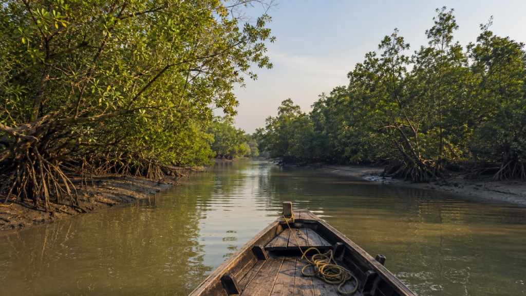
Aila showed how storm surge and embankment failure can transform coastal flooding into a long-lasting disaster.
Amphan demonstrated the enormous ecological force of an extreme cyclone.
Remal provided a more recent reminder that the region remains exposed.
And through it all, the mangrove forest continues to perform one of its most important roles: protecting a vulnerable coast while adapting to the forces that continually reshape it.
For travellers, the lesson is not to avoid the Sundarbans out of fear.
It is to understand the environment, respect the weather, follow official guidance and travel responsibly.
If you’re ready to experience the Sundarbans responsibly, explore our Sundarban trips and start planning your journey with The Wild Orbit.
Plan your private Sundarban expedition
A private journey shaped around you — your group, your pace, your interests. Book a free consultation.