

 Travel guide
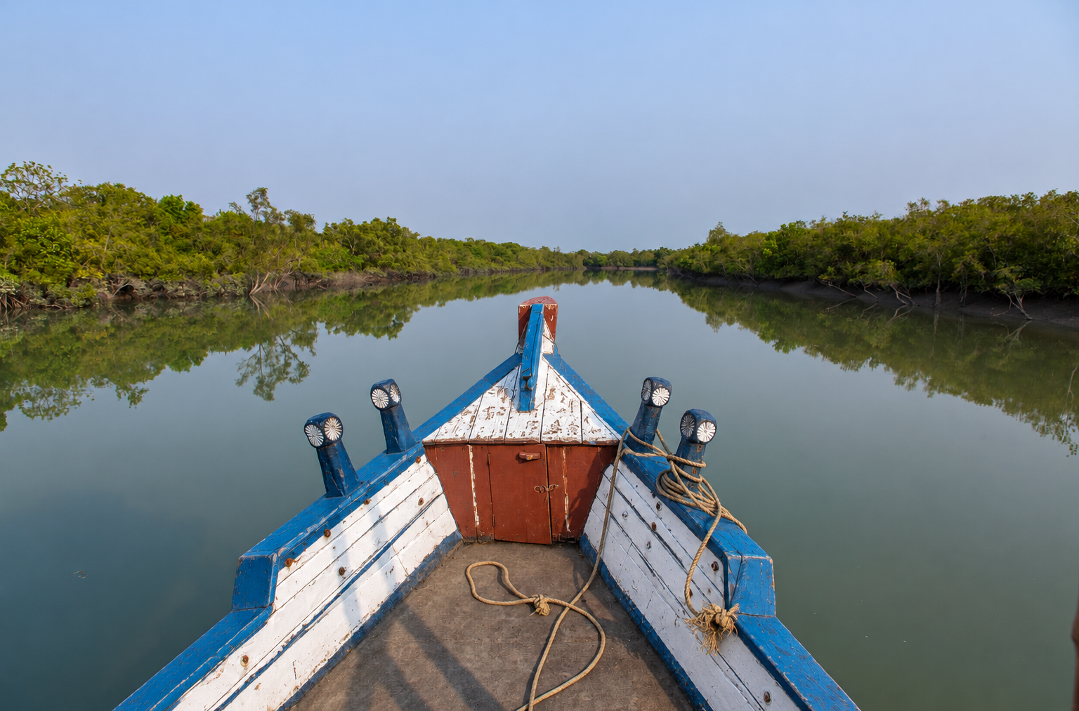
The Sundarbans is a forest shaped by water.
Here, rivers do not simply flow through the landscape. Tides move through them—filling creeks, uncovering mudflats, changing currents and constantly redrawing the boundary between land and water.
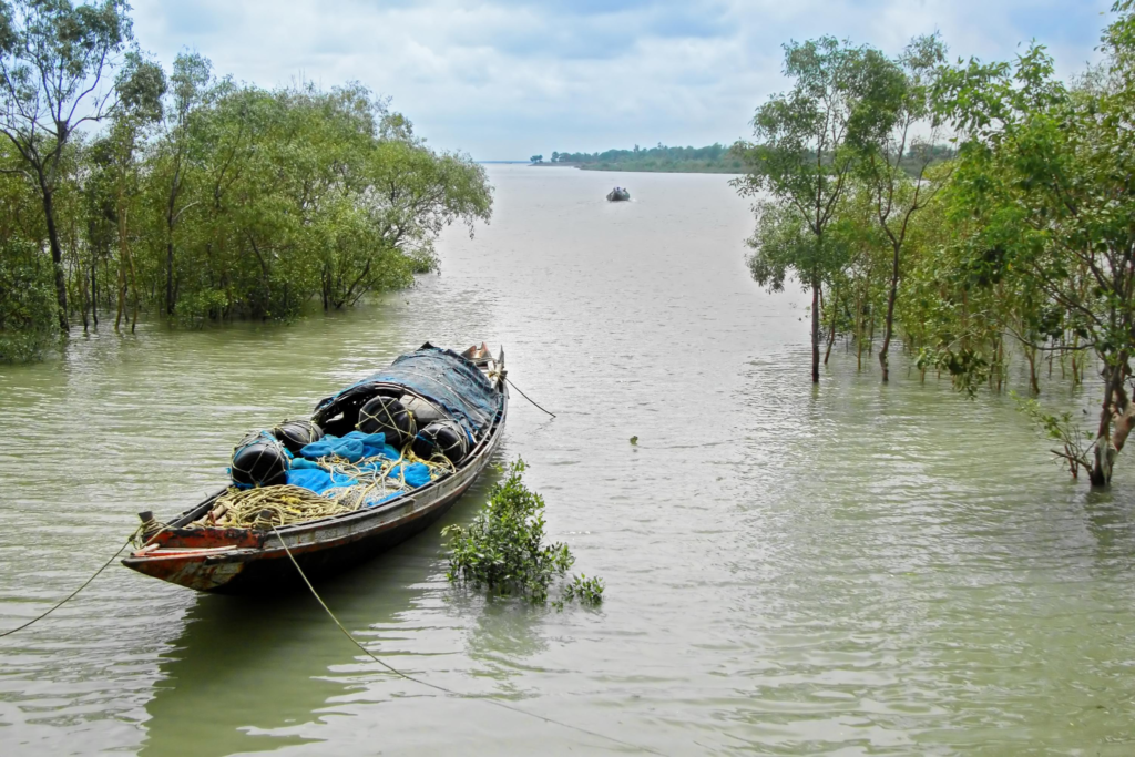
For anyone exploring the Indian Sundarbans, understanding the tide is therefore more than knowing when high or low water occurs. It is about understanding how the landscape behaves.
- A rising tide can transform a narrow creek.
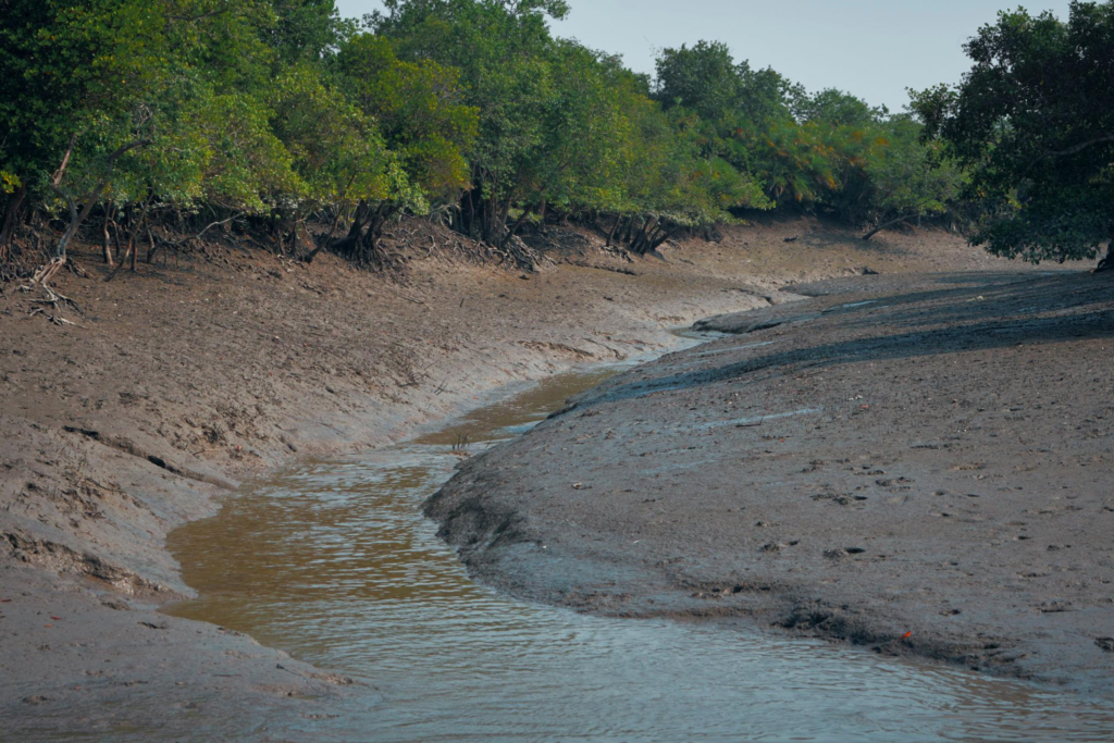
- A falling tide can reveal mudflats that were underwater earlier.
- Currents change, waterways take on a different character, and the relationship between islands and water constantly shifts.
For an expedition, these changes matter.
But there is an important distinction: tide is only one part of Sundarbans expedition planning. Weather, wind, river conditions, route, channel depth, boat characteristics, local knowledge and operational restrictions can all influence what happens on the water.
This guide explains how tides work in the Sundarbans, why they matter for boat expeditions and wildlife, why conditions differ between locations, and how travellers should use tide information responsibly.
What Should You Know About Sundarbans Tides?
What are tides in the Sundarbans?
Tides are the regular rise and fall of water levels caused primarily by the gravitational influence of the Moon and Sun, with local geography shaping how tidal water behaves in rivers, estuaries and coastal waterways.
Why are tides important in the Sundarbans?
The Indian Sundarbans is a tidal estuarine landscape. Tidal movement influences water levels, currents, mudflats, creeks, mangrove habitats and the conditions encountered during boat expeditions.
Does the entire Sundarbans have the same tide?
No. Tidal conditions vary between locations. The tide travels through a complex network of estuaries, rivers and creeks, and local channel shape, depth and geography influence its movement.
Why can places such as Netidhopani, Bonnie Camp and Burirdabri be tide-dependent?
These destinations are reached through tidal waterways and intertidal landscapes. Changing water levels can influence channel depth, currents, boat movement and the character of the route. Actual accessibility depends on the specific route, weather, boat, local conditions and operational guidance.
Should travellers check tide information before an expedition?
Yes. Tide information is useful for planning, but it should never be treated as a standalone timetable. It needs to be considered alongside the route, weather and local water conditions.
Is high tide better for wildlife?
Not necessarily. High and low tides create different habitats and viewing conditions. Wildlife activity depends on species behaviour, habitat, season, weather, time of day and many other factors.
What Is a Tide?
A tide is the periodic rise and fall of coastal and estuarine water levels.
The primary astronomical forces behind tides are the gravitational effects of the Moon and Sun. However, the tide that people actually experience at a particular location is also shaped by the physical geography of that place.
The shape of the coastline, seabed, estuaries, rivers and channels can influence how tidal water moves.
This becomes especially important in the Sundarbans.
Instead of one simple coastline, the region contains an intricate network of islands, rivers, estuaries, tidal creeks, channels and intertidal mudflats.
As tidal water moves through this network, its timing, depth and current can differ from one location to another.
So, when talking about tides in the Sundarbans, location matters.
Why Is the Sundarbans a Tidal Forest?
The Sundarbans is a vast mangrove ecosystem occupying a deltaic environment where freshwater and marine influences interact.
In the Indian Sundarbans, tidal water moves through an extensive estuarine network connected to the Bay of Bengal.
This constant movement of water is one of the forces shaping the ecosystem.
Tides influence:
- when mudflats are exposed or submerged
- how water moves through creeks and channels
- the movement and redistribution of sediments
- periodic flooding of mangrove environments
- access to feeding areas for aquatic and intertidal organisms
- the appearance of islands and waterways
- conditions encountered during boat expeditions
The Indian Sundarbans predominantly experiences a semi-diurnal tidal pattern, meaning it generally experiences two high-water and two low-water periods during a tidal day. Local tidal timing, range and behaviour vary across the estuarine system.
That distinction is important.
The Sundarbans is not simply a forest crossed by tidal water. It is a tidal ecosystem whose landscape and life are deeply connected to the movement of that water.
How Does the Tidal Cycle Work in the Sundarbans?
The Indian Sundarbans predominantly has a semi-diurnal tidal regime.
In simple terms, the water generally rises and falls through repeating cycles, creating periods of high water and low water.
But the tide does not arrive everywhere simultaneously.
A tidal wave moves through the estuarine system. As it travels through wider rivers, branching channels and narrower creeks, the physical characteristics of each waterway influence how the tidal signal is expressed.
This can create differences in:
- tidal timing
- water level
- tidal range
- current strength
- duration of tidal phases
For travellers, this leads to one of the most important principles in understanding the Sundarbans: a tide prediction for one location should not automatically be treated as the exact tide condition somewhere else in the Sundarbans.
One Tide Chart Does Not Represent the Whole Sundarbans
This deserves special attention.
There is no single tide timetable that accurately describes every waterway and destination across the Indian Sundarbans.
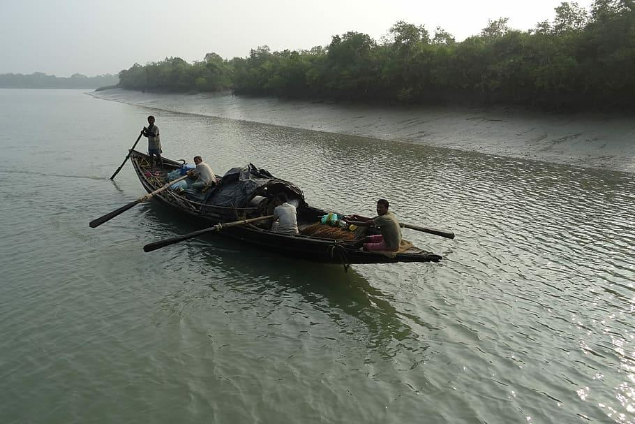
A tide prediction is associated with a particular location or reference point. As tidal water travels through the Sundarbans’ interconnected waterways, local geography can change how that tidal movement appears farther along the system.
This is particularly relevant when an expedition travels between different waterways and destinations.
For example, conditions experienced on routes associated with Sajnekhali, Sudhanyakhali and Dobanki should not automatically be assumed to be identical to conditions encountered farther south or along routes leading toward Netidhopani, Bonnie Camp or Burirdabri.
This does not mean that every destination has an entirely separate tidal system. They are part of the wider tidal landscape.
It means that local conditions matter.
The farther an expedition travels through the complex network of waterways, the more important it becomes to interpret tidal information in relation to the actual route.
High Tide vs Low Tide
The simplest way to understand tides is to think about high water and low water.
What Happens During High Tide?
High tide is the stage when water levels reach a local high point before beginning to fall.
In the Sundarbans, higher water can cover mudflats and change the appearance and character of waterways.
Creeks that appear narrow or partially exposed during lower water can become substantially more water-filled.
For a boat expedition, this can change the conditions encountered along the route.
What Happens During Low Tide?
Low tide is the stage when water levels reach a local low point before beginning to rise again.
As water recedes, intertidal mudflats, exposed roots, shallow channels and feeding areas can become visible.
The forest can appear dramatically different.
Neither high tide nor low tide is universally “better.”
They reveal different sides of the same tidal ecosystem.
Rising Tide vs Falling Tide
High and low tide describe water level.
Rising and falling tide describe water movement.
A rising tide, or flood tide, occurs as water moves landward through the tidal system.
A falling tide, or ebb tide, occurs as water moves back toward the sea.
This distinction matters because moving water creates currents.
Two moments with similar water levels can still present different conditions depending on whether the tide is rising or falling.
For boat expeditions, this is one reason why experienced local interpretation is valuable. A tide prediction can describe expected tidal behaviour, but the actual conditions on a particular waterway depend on the broader environment.
What Are Spring Tides?
Spring tides occur around the new moon and full moon.
During these periods, the gravitational relationship between the Moon and Sun generally produces a greater difference between high and low water.
The term “spring tide” has nothing to do with the spring season.
In the Sundarbans, spring-tide periods can influence the strength and character of tidal movement.
However, the local effect still depends on the geography and hydrodynamics of the particular waterway.
What Are Neap Tides?
Neap tides occur around the quarter phases of the Moon.
They generally produce a smaller difference between high and low water than spring tides.
For travellers, these terms are useful because they explain why the strength and range of tidal movement can vary during the lunar cycle.
You do not need to become a tidal scientist before visiting the Sundarbans.
But understanding these basic terms makes it easier to understand what your expedition team means when discussing water conditions.
Why Are Netidhopani, Bonnie Camp and Burirdabri More Tide-Dependent?
Some Sundarbans destinations make the relationship between the tide and the journey particularly important.
This is because reaching them involves travelling through tidal waterways where water level and channel conditions can influence the character of the route.
Netidhopani
The journey toward Netidhopani takes travellers through the southern waterways of the Indian Sundarbans before reaching its historic watchtower area.
The destination is therefore not simply a point on land that can be considered independently of the water journey.
The condition of the waterways along the route matters.
As water levels change, the character of channels, currents and surrounding intertidal landscapes can change as well.
This makes tide awareness an important part of understanding an expedition toward Netidhopani.
Bonnie Camp
Bonnie Camp is known for its watchtower and extensive mangrove surroundings.
The journey to this part of the Sundarbans involves tidal waterways where changing water levels and channel conditions can influence boat movement.
Again, tide should not be interpreted as a simple “accessible” or “inaccessible” switch.
Actual navigation depends on the specific route, water depth, boat characteristics, weather and local operational knowledge.
Burirdabri
At Burirdabri, the connection between land, mudflat and water can become especially apparent.
As tidal water advances and retreats, the intertidal landscape changes.
This can influence the visual character of the route and conditions encountered by boats.
The important point is not that Burirdabri has a special tide of its own.
It is that the journey to destinations such as Burirdabri depends on moving through a tidal landscape where local water conditions matter.
What About Sajnekhali, Sudhanyakhali and Dobanki?
The same principle applies to the core tourism region.
Sajnekhali, Sudhanyakhali and Dobanki are reached through the interconnected waterways of the Sundarbans.
Their routes are part of a living tidal system.
As the tide rises and falls, the waterways and surrounding intertidal landscape change.
For travellers, this is one reason a Sundarbans boat expedition cannot be understood simply as a fixed road journey where the scenery remains constant.
The route itself is part of the experience and the route moves with the water.
How Do Tides Affect a Sundarbans Boat Expedition?
Tides can influence several practical aspects of a boat journey.
1. Water Depth
Water depth changes as the tide rises and falls. This can affect conditions within individual channels and creeks.
2. Tidal Current
Moving tidal water creates currents. The strength and direction of those currents can vary with the tidal phase and local waterway.
3. Route Conditions
The navigability of a particular channel depends on more than tide alone. Channel depth, boat characteristics, route, weather, local knowledge and operational restrictions can all matter.
4. Landscape Appearance
The same creek can look completely different at different stages of the tide. A water-filled channel can later reveal mudflats and exposed intertidal surfaces.
5. Expedition Planning
Tide information can help expedition planners understand how water conditions are expected to change during a journey. But it should always be considered together with the actual route and wider environmental conditions.
How Do Tides Influence Wildlife in the Sundarbans?
Tides are deeply connected to life in mangrove and intertidal ecosystems. As water rises and falls, it changes access to feeding areas and aquatic habitats.
- Fish, crabs, molluscs and other organisms respond to changing water conditions.
- Birds may use exposed mudflats and shallow areas, while aquatic species occupy flooded channels.
- Mangrove organisms are adapted to regular tidal inundation and changing environmental conditions.
This creates a constantly shifting ecological landscape. For wildlife observers, however, one principle is important: the tide influences habitat conditions, but it does not guarantee a wildlife sighting.
Animal behaviour is also influenced by season, weather, habitat, time of day, food availability, disturbance and chance.
Is High Tide or Low Tide Better for Wildlife?
There is no universal answer. Different tidal conditions create different viewing opportunities.
Higher water may offer:
- more extensive water-filled channels
- different boat-access conditions
- aquatic activity within flooded waterways
- a landscape dominated by water
Lower water may reveal:
- exposed mudflats
- intertidal feeding areas
- crabs and other intertidal organisms
- exposed mangrove structures
- birds using shallow or uncovered areas
Therefore, the best wildlife experience is not necessarily about finding the “perfect” tide.
It is about understanding how the tide interacts with the habitat and the species you hope to encounter.
Tides and the Sundarbans Mudflats
Mudflats are among the clearest places to observe the work of the tide. When water recedes, intertidal surfaces become exposed.
These areas can reveal:
- burrows
- feeding marks
- tracks
- small crustaceans
- molluscs
- shallow channels
When the tide returns, the same landscape gradually disappears beneath the water.
This transformation is part of the natural functioning of the intertidal ecosystem. It also shows why the Sundarbans should not be viewed simply as a forest. It is simultaneously a mangrove forest, estuary, mudflat, island and tidal waterway system.
Tides and Mangrove Life
Mangroves exist in an environment where water levels, salinity and sediment conditions constantly change.
Their specialised root systems interact with this intertidal environment.
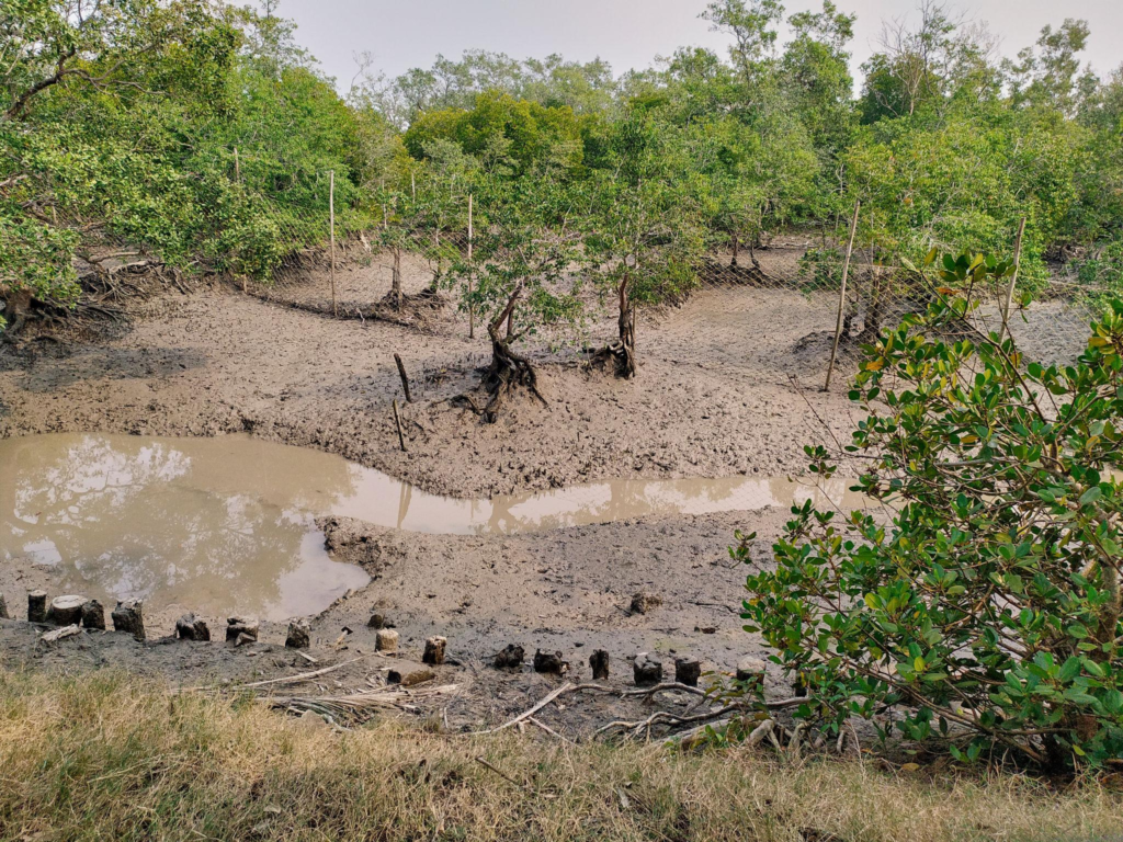
The tidal zone supports a productive food web connecting mangrove vegetation with fish, crustaceans, molluscs, birds and other wildlife.
The tide therefore has a role far beyond raising and lowering the water. It helps shape the physical and ecological environment in which the Sundarbans exist.
Tide, Weather, Wind and River Conditions
One of the biggest mistakes travellers can make is treating a tide prediction as a complete description of conditions on the water.
It is not.
Actual conditions can also be influenced by:
- wind
- rainfall
- freshwater flow
- atmospheric conditions
- river morphology
- channel geometry
- sedimentation
- local currents
- seasonal conditions
- recent weather events
This is why responsible expedition planning considers tide, weather and route together. A predicted tide describes expected astronomical tidal behaviour.
The actual water encountered by a boat is the result of that tidal cycle interacting with the physical and environmental conditions of the day.
Tide Prediction vs Actual Water Conditions
A tide prediction is primarily an astronomical prediction.
It tells us what tidal behaviour is expected based on known astronomical cycles and local tidal characteristics.
In India, official tidal information and prediction services are available through organisations including the Survey of India and INCOIS.
But travellers should understand the difference between:
Predicted Tide
What astronomical calculations indicate should happen at a particular reference location.
Actual Water Conditions
What the water is actually doing at a specific place and moment after local environmental factors are considered.
This distinction is crucial.
A tide prediction is a planning reference—not a guarantee of exactly what the water will look like from your boat.
When Should You Check Tide Information?
Tide information is most useful when considered as part of the expedition planning process.
Before travelling, consider:
- The expedition date.
- The intended route.
- The waterways involved.
- Expected tidal conditions.
- Weather and wind.
- Local operational guidance.
- Applicable forest, navigation and safety restrictions.
Most importantly, check which location the tide information refers to.
Do not take a prediction for one reference location and assume it represents every creek, island or destination across the Sundarbans.
How Should Travellers Use Tide Information?
Think of tide information as a decision-support tool, not a sightseeing timetable.
A useful planning framework is: Tide prediction → route → weather → local conditions → operational decision
Instead of asking only: “What time is high tide?”
ask:
- Where does this prediction apply?
- What waterway will the expedition actually use?
- Is the tide rising or falling?
- What are the expected weather and wind conditions?
- How might local currents affect the route?
- What is the current advice from the boat crew or expedition operator?
This is the difference between simply reading a tide table and understanding the Sundarbans.
The Wild Orbit Tide Guide: Our Expert Perspective
A Sundarbans expedition should be planned with the tide—not around the tide alone.
A tide chart can provide valuable information about the expected astronomical cycle. But it cannot independently describe every condition you will encounter on the water.
A more complete picture considers: Tide + Route + Weather + Wind + Water Conditions + Local Knowledge + Safety
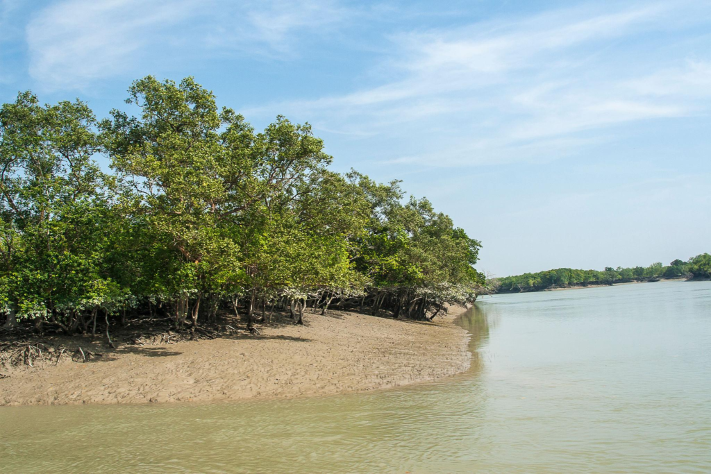
This becomes particularly important when an expedition travels toward destinations such as Netidhopani, Bonnie Camp or Burirdabri, where the journey involves navigating through the Sundarbans’ complex tidal waterways.
The same principle applies closer to the core tourism region around Sajnekhali, Sudhanyakhali and Dobanki.
The tide is not a fixed appointment. It is part of a moving landscape.
Read the tide. Understand the waterway. Then let the Sundarbans reveal itself.
Common Sundarbans Tide Myths
Myth 1: There is one tide time for the entire Sundarbans.
See it for yourself
A private journey shaped around you — your group, your pace, your interests. Book a free consultation.
Reality: Tidal timing and conditions vary across the estuarine network. Location matters.
Myth 2: High tide is always better for wildlife.
Reality: Different tidal stages reveal different habitats and influence different wildlife behaviours. There is no universally best tide for wildlife.
Myth 3: Low tide means boats cannot move.
Reality: Navigation depends on the particular waterway, channel conditions, boat characteristics, route, weather and local operational knowledge—not simply whether the tide is labelled “low.”
Myth 4: A tide prediction tells you exactly what the water will look like.
Reality: A prediction describes expected tidal behaviour at a reference location. Actual conditions can be affected by geography, weather, wind, freshwater flow and other environmental factors.
Myth 5: Spring tide means the same thing everywhere.
Reality: Spring tides are associated with the lunar cycle, but their local expression depends on the characteristics of individual waterways and estuaries.
Myth 6: Every destination has a completely separate tide.
Reality: Destinations such as Netidhopani, Bonnie Camp and Burirdabri are part of the wider tidal system of the Indian Sundarbans. What differs is how tidal water propagates through the particular waterways used to reach them.
Sundarbans Tide Glossary
Tidal Day
The period used to describe the recurring cycle of tidal movement relative to the Earth’s rotation and the Moon’s position. It is slightly longer than a standard solar day.
High Tide
The stage when local water level reaches a high point before beginning to fall.
Low Tide
The stage when local water level reaches a low point before beginning to rise.
Flood Tide
The incoming or rising phase of the tide.
Ebb Tide
The outgoing or falling phase of the tide.
Tidal Range
The difference in water level between high water and low water.
Tidal Current
The horizontal movement of water associated with the rise and fall of the tide.
Spring Tide
A period around the new and full moon when the tidal range is generally greater.
Neap Tide
A period around the quarter moons when the tidal range is generally smaller.
Semi-Diurnal Tide
A tidal pattern that generally produces two high-water and two low-water periods during a tidal day.
How to Use Tide Information Responsibly
Tide information is valuable, but it should always be used responsibly.
For travellers, that means:
- use reliable and relevant tide information
- check the location associated with the prediction
- understand whether the information describes a reference station or another location
- avoid applying one location’s prediction indiscriminately across the Sundarbans
- consider weather and local water conditions
- follow the instructions of authorised local boat operators and relevant authorities
- never treat an online tide chart as a substitute for operational safety guidance
Official Indian sources such as the Survey of India and INCOIS provide tidal information and prediction resources.
For an expedition, the safest interpretation is always the one that considers the specific route and current local conditions.
The Sundarbans Is Measured in Tides
Spend enough time in the Sundarbans and you begin to notice something.
The forest is never quite the same.
- A creek widens.
- A mudflat disappears.
- Water begins moving through a channel.
- Mangrove roots become surrounded by water.
- A landscape that looked open earlier becomes submerged.
Then, gradually, the water retreats and reveals another version of the forest.
This is the rhythm of the Sundarbans. The tide does not simply change the scenery. It helps create the scenery.
Planning Sundarban Travel? Start With the Rhythm of the Forest.
Understanding the tide is only the beginning of planning a meaningful journey into the Sundarbans.
Your expedition also involves choosing the right route, understanding the character of different waterways, deciding which destinations to explore, preparing for changing conditions and allowing enough time to experience the forest beyond a simple checklist of sights.
Whether your interest lies in wildlife, mangroves, tidal landscapes, watchtowers or the quieter stories of the waterways, the right expedition plan can make the difference between simply visiting the Sundarbans and genuinely experiencing it.
The Wild Orbit approaches the Sundarbans as a living landscape—not simply a tourist destination.
Explore Our Sundarban Trip
Ready to experience the Indian Sundarbans beyond the map?
Explore our Sundarban Trip and discover an expedition shaped around the forest, its waterways, wildlife and ever-changing tidal landscape.
From the waterways around Sajnekhali, Sudhanyakhali and Dobanki to deeper journeys toward destinations such as Netidhopani, Bonnie Camp and Burirdabri, every route offers a different perspective on this extraordinary mangrove world.
Because in the Sundarbans, the journey is never just about where you go.
It is about understanding the landscape as you move through it.
FAQs
Does the Sundarbans have high and low tides?
Yes. The Indian Sundarbans is a tidal estuarine environment where water levels regularly rise and fall under the influence of astronomical tides and local estuarine conditions.
How many tides occur in the Sundarbans?
The Indian Sundarbans predominantly exhibits a semi-diurnal tidal pattern, generally involving two high-water and two low-water periods during a tidal day. Local tidal timing and behaviour can vary by location.
Why are tides important in the Sundarbans?
Tides influence water levels, currents, mudflats, mangrove habitats, sediment movement and conditions encountered during boat expeditions.
Does every Sundarbans island have the same tide?
No. Tidal timing, range and water movement can vary between locations because tidal water travels through a complex network of estuaries, rivers and creeks.
Why are some Sundarbans destinations more tide-dependent?
Destinations such as Netidhopani, Bonnie Camp and Burirdabri are reached through tidal waterways and intertidal landscapes. Changing water levels can influence channel conditions and boat movement along parts of the route.
Is high tide good for a Sundarbans boat safari?
High tide can create different navigation and viewing conditions, but it should not automatically be considered better. The experience depends on the route, weather, wildlife behaviour and local conditions.
Is low tide good for seeing wildlife?
Low tide can expose mudflats and intertidal feeding areas, which may create interesting wildlife-viewing opportunities. However, wildlife sightings are never guaranteed.
What is a spring tide?
A spring tide occurs around the new and full moon phases and generally produces a larger tidal range than a neap tide.
What is a neap tide?
A neap tide occurs around the quarter phases of the Moon and generally produces a smaller difference between high and low water.
Can tide conditions be different between Sajnekhali and Netidhopani?
Yes. They are part of the same wider tidal system, but tidal water propagates through different waterways and local geography can influence timing, water levels and currents.
Are Netidhopani, Bonnie Camp and Burirdabri dependent on the tide?
Their journeys involve tidal waterways, so changing water levels and channel conditions can be important considerations. However, actual navigation and accessibility depend on the specific route, weather, boat characteristics, local conditions and operational guidance.
Should I check the tide before visiting the Sundarbans?
Yes. Tide information can be useful for expedition planning, but it should be considered alongside weather, route, local water conditions and operational guidance.
Where can I find official Indian tide information?
The Survey of India provides tidal information and prediction resources, while INCOIS provides Predicted Astronomical Tide information.
Is a tide prediction a guarantee of actual water conditions?
No. A prediction provides expected astronomical tidal behaviour for a particular reference location. Actual local water conditions can be influenced by geography, weather, wind, freshwater flow and other environmental factors.
The Sundarbans Moves With the Tide
The Sundarbans is not a forest you simply enter. It is a living landscape that changes with the movement of water.
The same creek can look completely different as the tide rises and falls. Mudflats appear and disappear, waterways change, currents shift, and wildlife responds to the constantly moving boundary between land and water.
That is why understanding tides matters before an expedition.
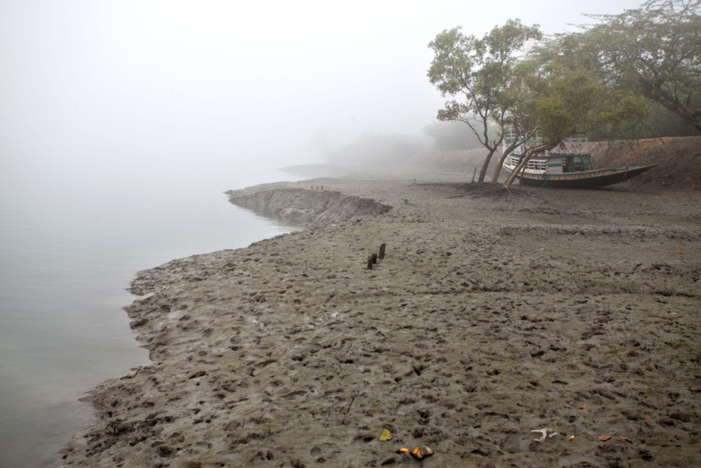
Tide information can help you understand the character of the waterways, anticipate changing conditions and appreciate why the Sundarbans never offers exactly the same experience twice.
But a tide prediction is only one part of the picture. Local water conditions, weather, wind, currents, route, boat characteristics and the experience of the expedition crew all matter when navigating the Sundarbans.
The best way to experience the Sundarbans is not to travel against its rhythm, but to understand it.
At The Wild Orbit, we see the tide as more than a boating condition. It is one of the forces that gives the Sundarbans its character.
Plan your private Sundarban expedition
A private journey shaped around you — your group, your pace, your interests. Book a free consultation.