Encyclopedia
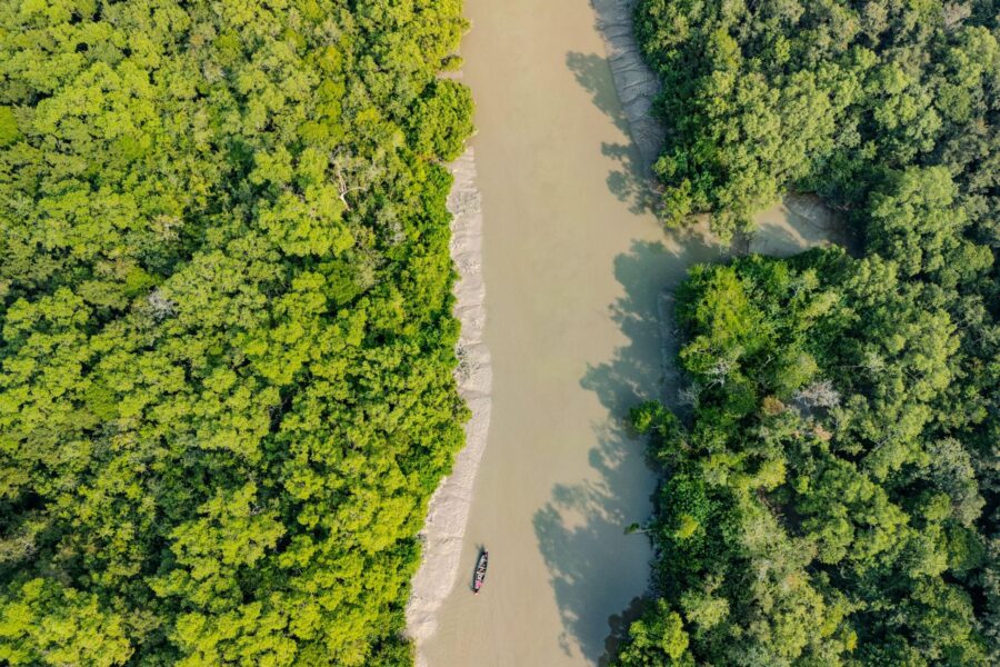
At the southern edge of the Indian Sundarbans, Dalhousie is a forested island shaped by tides, sediment and the shifting geometry of the delta.
It is not an inhabited island with villages, roads or permanent tourism infrastructure. The National Centre for Sustainable Coastal Management’s Data Web on Island Environment and Protection (DWIEP) identifies Dalhousie as an uninhabited continental island in West Bengal, with no permanent population or infrastructure recorded. The same database places it in the Bay of Bengal, between Chaimari Island and Bhangaduni Island, at approximately 21°37′04.80″ N, 88°44′31.20″ E.
The current DWIEP database records Dalhousie’s mapped area as 92.454 sq km and its shoreline at approximately 46 km. It also describes the terrain as swampy or marshy, with alluvial soil and an elevation of about 10 metres. These figures should be understood as measurements associated with a particular database and mapping framework, not as permanent physical dimensions.
That qualification matters in Dalhousie’s case.
The island belongs to one of the most dynamic deltaic environments on Earth. Across the Sundarbans, tidal channels, creeks and rivers continually redistribute water and sediment. Some shorelines retreat while others build outward. Earlier remote-sensing research has documented significant land loss from Dalhousie, demonstrating that the island’s geographical boundaries have changed substantially over time.
Dalhousie therefore cannot be understood simply as a green shape surrounded by blue water.
It is a piece of the Sundarbans delta in motion.
Its geography is inseparable from the waterways around it, its mangrove forest and the tidal forces that repeatedly redraw the edge between land and water. The wider Sundarbans itself is characterised by a network of tidal channels, river creeks and numerous islands formed largely from recent alluvial deposits.
For The Wild Orbit, Dalhousie is significant precisely because it offers a way to understand that larger system. Before looking at its mangroves, wildlife or conservation value, it is necessary to understand where the island sits and why its physical setting matters.
Dalhousie At a Glance
- Location: Indian Sundarbans, South 24 Parganas, West Bengal, India.
- Geographic Position: Approximately 21°37′04.80″ N, 88°44′31.20″ E.
- Island Type: Uninhabited mangrove forest island within the wider Sundarbans delta.
- Mapped Area: Approximately 92.45 sq km in the current NCSCM island profile.
- Shoreline: Approximately 46 km.
- Terrain: Predominantly low-lying, swampy and marshy terrain shaped by tidal flooding, sediment deposition and erosion.
- Soil: Mainly alluvial sediments associated with the active deltaic environment.
- Elevation: Approximately 10 metres in the NCSCM island profile, although elevation across a tidal island is not uniform.
- Nearby Islands: Dalhousie lies in the southern Sundarbans island landscape, with Bhangaduni and Chaimari among the nearby forested islands.
- Human Settlement: None recorded on the island itself in the referenced island profile.
- Infrastructure: No established permanent visitor infrastructure is recorded on the island.
- Hydrological Setting: Surrounded by tidal channels and estuarine waters influenced by the daily rise and fall of the tide.
- Mangrove Environment: Characterised by intertidal mangrove vegetation, mudflats, creeks and waterlogged terrain.
- Wildlife: Forms part of the wider Sundarbans habitat supporting mangrove-associated birds, reptiles, fish, crustaceans and other wildlife. Species presence on Dalhousie itself should not be assumed without site-specific evidence.
- Environmental Character: A dynamic landscape where shoreline position, sediment movement, tidal inundation and vegetation can change over time.
- Erosion Sensitivity: Dalhousie has been identified in scientific studies as an area experiencing significant shoreline change and erosion.
- Accessibility: Dalhousie is not a conventional tourist-accessible island. There are no established public visitor facilities or permanent tourist infrastructure on the island. Access to the surrounding Sundarbans is regulated and may depend on forest permissions, designated routes, tides, weather and applicable Forest Department rules.
- Best Viewed As: A forest-and-water landscape for scientific, ecological and documentary understanding, rather than a conventional sightseeing destination.
- Research Value: Particularly relevant for studying mangrove ecology, tidal processes, shoreline change, sediment dynamics and environmental change in the Sundarbans.
Geographic Setting
Dalhousie lies within the southern Indian Sundarbans, where the low-lying delta of the Ganges-Brahmaputra-Meghna system approaches the Bay of Bengal through an intricate network of tidal rivers, creeks and islands.
The island’s recorded position is approximately 21°37′04.80″ N and 88°44′31.20″ E. DWIEP places it between Chaimari and Bhangaduni islands and classifies it as a continental island within West Bengal.
This geographical position places Dalhousie firmly within the lower, more marine-influenced part of the Sundarbans.
Here, the landscape is extremely low-lying. The ground is composed largely of alluvial material deposited through the wider river-estuarine system, while tidal water regularly enters the surrounding channels and wetlands. The result is a landscape in which the distinction between terrestrial and aquatic environments is unusually fluid.
Historical geographical descriptions of the Sundarbans capture this character particularly well: the region consists of numerous islands, tidal channels and river creeks, with land gradually declining toward the coast until land and water become difficult to distinguish from one another. The soils are composed of relatively recent alluvial deposits, including sand, clay and silt carried by rivers and streams.
Dalhousie belongs to this environment rather than standing apart from it.
Its geography is consequently better understood as part of a tidal deltaic network than as an isolated island in the conventional coastal sense.
Rivers Flowing Beside the Island
- Matla River system — one of the major tidal systems of the southern Indian Sundarbans and an important geographical reference for the eastern and southern island landscape.
- Gosaba River system — part of the interconnected tidal network farther east and north-east of the southern forest islands.
- Smaller tidal creeks and channels — form the immediate waterways through which tidal water circulates around the forest islands.
Maps of the wider Sundarbans identify the Matla and Gosaba among the major river systems of the Indian part of the delta and show Dalhousie within the southern forest-island complex.
The relationship between Dalhousie and these waterways is more important than simply knowing their names. In the Sundarbans, rivers are not fixed boundaries separating one island from another. Their channels transport water and sediment, respond to tidal forces and can change their relationship with adjacent land over time.
That is one reason an island’s geography must always be considered together with its hydrology.
Nearby Forest Blocks
- Dalhousie Island Reserve Forest — the forested island landscape associated with Dalhousie.
- Bhangaduni Island Reserve Forest — the neighbouring protected forest island that frequently appears alongside Dalhousie in studies of the southern Sundarbans.
- Other southern Sundarbans reserve-forest landscapes — form the wider ecological setting around the island.
Dalhousie and Bhangaduni are particularly important in scientific studies of shoreline change because both are forested and uninhabited islands exposed to the physical processes of the southern Sundarbans. Historical remote-sensing research examined the two islands together when analysing long-term shoreline modification.
Nearby Inhabited Islands & Human Settlements
Dalhousie itself is uninhabited. DWIEP records nil population and no infrastructure on the island.
The human geography of the surrounding Sundarbans therefore exists mainly on other inhabited islands and mainland-connected areas.
- Gosaba and its surrounding inhabited islands form an important human-settlement region farther north in the Sundarbans.
- Pathar Pratima provides an important mainland and administrative context to the southern Sundarbans.
- Namkhana and other access areas connect the wider southern Sundarbans with mainland West Bengal.
The Census of India records Gosaba as a community development block within South 24 Parganas, containing numerous inhabited villages.
This contrast between inhabited and uninhabited islands is fundamental to understanding Dalhousie.
Across the Sundarbans, people have built villages, cultivated land and developed livelihoods on many islands. Dalhousie represents a different landscape: a forest island without permanent settlement.
That does not make it disconnected from human life.
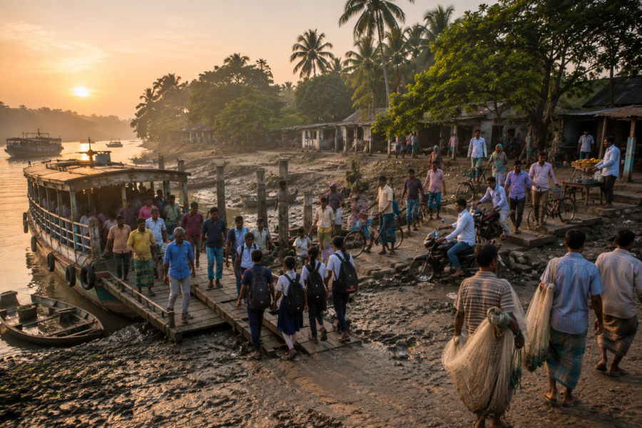
The waterways surrounding it are part of the same regional system on which fishing, transport, forest-based livelihoods and conservation depend.
Landscape Character
The first impression of Dalhousie is not likely to be of a conventional island landscape.
There is no permanent settlement spreading across the shoreline, no road network dividing the interior and no built waterfront defining the island’s identity. Instead, the landscape is dominated by low-lying forest, tidal water and muddy intertidal margins.
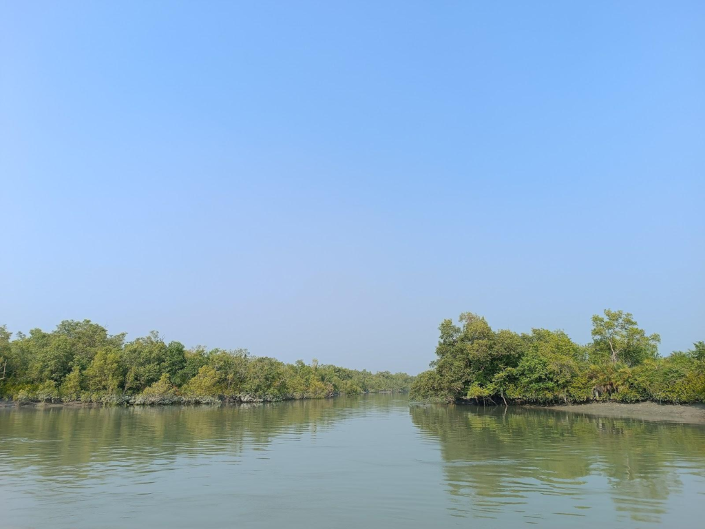
DWIEP describes the island’s terrain as swampy or marshy, with alluvial soil and a recorded elevation of about 10 metres. It records no infrastructure and no permanent population.
At the edge of the forest, the landscape changes with the tide.
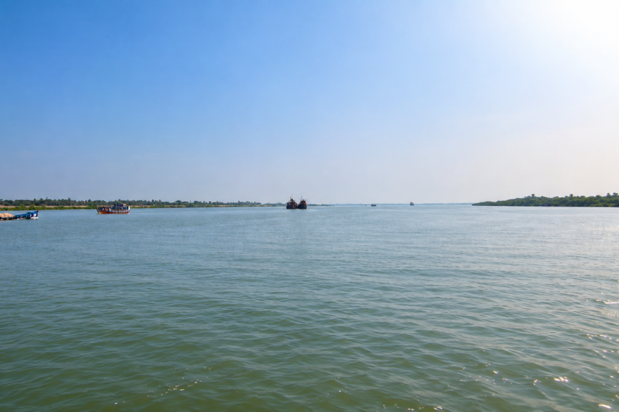
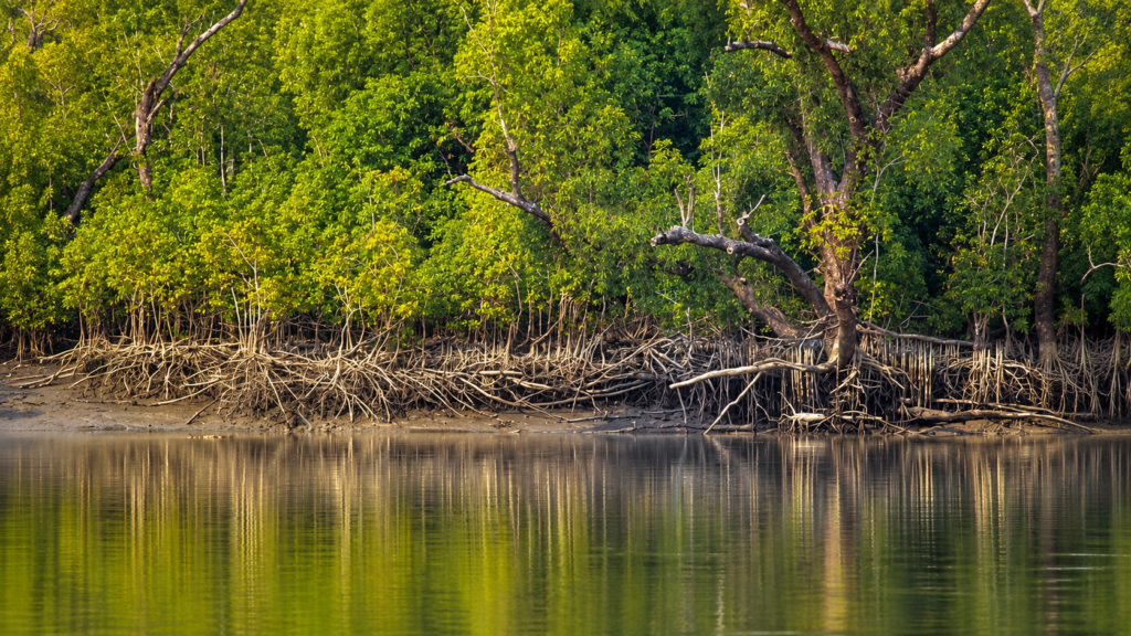
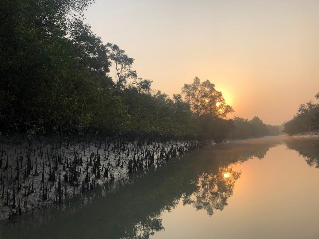
A channel may appear broad and open when the water is high, while exposed mud and shallow margins become more prominent as the tide falls. Roots and trunks occupy ground that is periodically flooded, while the outer edge of the forest meets water rather than a conventional dry-land shoreline.
This is characteristic of the wider Sundarbans.
The region’s low elevation, recent alluvial soils and dense network of waterways produce an environment in which land is continuously influenced by tidal inundation and sediment movement.
A Landscape Without a Fixed Edge
One of the most important things to understand about Dalhousie is that its shoreline is not a permanent line.
Historical satellite analysis has documented substantial changes in the island’s boundary. A long-term study of Sundarbans islands found that Dalhousie experienced significant land loss over the period examined, placing it among the islands where erosion has played a major role in shaping the landscape.
This does not mean that every part of the island is retreating at the same rate.
Nor does it mean that erosion is the only process operating in the surrounding Sundarbans. The delta also creates new sedimentary land through accretion in appropriate settings. Research on the wider Sundarbans shows that erosion and land formation operate together, although their balance varies considerably between locations and through time.
Dalhousie’s particular story has been strongly influenced by erosion.
That makes the island especially useful for understanding how a mangrove forest can occupy land that is itself physically unstable.
Forest, Mud and Water
From the perspective of a naturalist, Dalhousie’s landscape is best understood as a sequence rather than a collection of separate features.
There is open tidal water.
- Then mud and sediment.
- Then the edge of the mangrove forest.
- Then the denser interior vegetation.
The boundaries between these zones are influenced by tidal height, sediment deposition, erosion, vegetation growth and the shape of individual channels.
The same landscape can therefore look markedly different within the course of a single tidal cycle.
This is one reason satellite imagery and field observation need to be interpreted carefully. A high-tide image may show water occupying areas that appear to be forest or land under different conditions. Remote-sensing research on Dalhousie has specifically examined the difficulty of distinguishing periodically submerged mangrove vegetation from open water in satellite imagery.
A Forest Island, Not a Lost Island
It is tempting to describe an erosion-prone Sundarbans island only through the language of disappearance.
Dalhousie requires more precision.
It is an uninhabited mangrove island undergoing measurable geomorphological change.
Those are different ideas.
Its forest remains part of a functioning tidal ecosystem even as portions of its shoreline retreat. Its present mapped area is only a measurement of the island at a particular point in time. And its future form cannot be understood simply by extending one historical rate of erosion indefinitely.
The more useful question is not whether Dalhousie is “disappearing.”
It is how the island, its mangrove forest and its surrounding waterways are responding to the continuing forces that shape the southern Sundarbans.
That question leads naturally from geography into hydrology, mangrove ecology and wildlife—the subjects that define the next part of Dalhousie’s story.
Rivers and Water Systems
Around Dalhousie, water is not simply the element that separates one piece of land from another.
It is the force that continually connects them.
The island lies within the lower tidal environment of the Indian Sundarbans, where river channels, creeks, mudflats and mangrove forest form a single interconnected system. UNESCO describes the Sundarbans as a landscape of islands and waterways shaped by tidal influence, flooding, sediment deposition and delta formation.
For Dalhousie, this means that its geography cannot be separated from the movement of water around its margins.
The principal river systems associated with the island’s wider setting are the Matla and Gosaba systems, together with the smaller tidal creeks and channels that dissect and surround the southern forest islands. These waterways connect the forest to the larger estuarine system and ultimately to the Bay of Bengal.
The water itself is not uniform.
Freshwater arriving through the delta mixes with saline water entering from the Bay of Bengal. The resulting estuarine environment changes according to season, river discharge, tidal phase, rainfall and the position of individual channels.
The Daily Pulse of the Tide
A Sundarbans island experiences a landscape that changes through the day.
At high tide, water advances into creeks and across lower intertidal surfaces. As the tide falls, mudbanks and shallow margins emerge again. Mangrove roots that were partly surrounded by water become more exposed, while feeding areas for many intertidal organisms appear along the retreating waterline.
This repeated flooding and exposure is fundamental to the ecosystem.
The Sundarbans is an unusually clear example of an ecosystem in which tidal processes help determine where plants can establish and how animals use the landscape. UNESCO identifies tidal influence and plant colonisation as among the continuing ecological processes that shape the Sundarbans.
The tide also determines how sediment moves.
Water entering a creek can carry suspended silt and fine sediment. When current velocity changes, some of that material settles. Elsewhere, stronger flows can remove sediment from a bank or channel margin.
Over long periods, these small movements accumulate into changes in the shape and elevation of the land.
That is why the shoreline of Dalhousie cannot be considered a static boundary.
Water, Sediment and the Island
The relationship between water and sediment is particularly important in a delta.
The Sundarbans was created from sediments delivered by the great river systems of the Bengal Basin. Tidal action subsequently remodels those deposits, redistributing sediment through channels and across intertidal areas. UNESCO identifies the Sundarbans as an ongoing example of delta formation, tidal influence and colonisation of newly formed deltaic islands.
At Dalhousie, the same processes operate on a local scale.
- A mudflat can become colonised by vegetation.
- A creek bank can erode.
- A channel can widen.
- Sediment can accumulate somewhere else.
Mangrove roots can trap additional particles once vegetation becomes established.
The result is a landscape in which hydrology, vegetation and geomorphology continually influence one another.
When the Water Becomes More Saline
Salinity is another major ecological variable.
The southern Sundarbans receives a stronger marine influence than areas farther inland. During periods of reduced freshwater discharge, saline water can penetrate farther through the tidal network. During the monsoon, increased rainfall and river discharge can alter the balance again.
This matters because mangrove species do not all respond to salinity in exactly the same way.
Some tolerate higher salinity than others. Changes in salinity can therefore influence where different plant communities establish, grow and regenerate.
Research on Sundarbans hydrology has documented the importance of tidal fluctuation, sedimentation, waterlogging and salinity in determining mangrove distribution and physiological stress.
The water around Dalhousie is therefore part of the island’s ecology, not merely its scenery.
Mangrove Ecosystem
When the tide moves away from Dalhousie’s forest edge, the most revealing feature is not the exposed mud itself.
It is what grows within it.
Mangroves occupy the narrow environmental zone between land and water where ordinary terrestrial forests would struggle to survive. Their ability to tolerate periodic inundation, saline or brackish water and oxygen-poor sediments allows them to form forests in places where many other plants cannot.
The Government of West Bengal’s Integrated Coastal Zone Management material records a diverse mangrove flora in the Sundarbans, including true mangroves, mangrove-associated plants and salt-tolerant species. It also describes a succession in which pioneer vegetation colonises newly deposited intertidal mud before mangrove communities become established.
This process is important for understanding Dalhousie.
The forest is not simply sitting on old, stable land.
Mangroves participate in the formation and stabilisation of the intertidal environment itself.
A Forest Built for Flooding
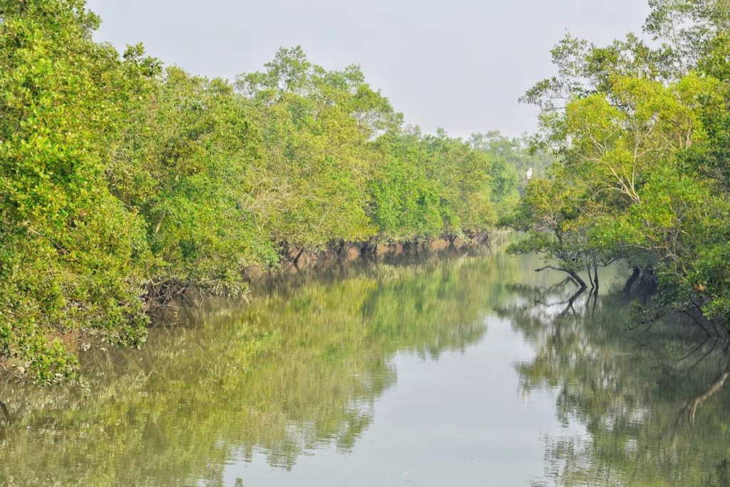
Mangrove plants have evolved specialised adaptations to an environment where the ground may be saturated with water for long periods.
One of the most recognisable adaptations is the development of specialised roots that help plants exchange gases in waterlogged sediment.
Depending on the species, these can include upright breathing roots, spreading support roots and other specialised structures.
The exact form varies between mangrove species.
In the Sundarbans, plants such as Avicennia, Sonneratia, Rhizophora, Ceriops and Bruguiera occupy different ecological positions, although the composition of any particular forest patch depends on local elevation, salinity, sediment conditions and tidal inundation. West Bengal’s coastal-zone documentation describes these genera among the mangrove communities developing across the intertidal landscape.
The scientific explanation is simple but important: the shape of a mangrove forest is partly a record of the conditions under which it grows.
The Ground Beneath the Trees
Mangrove soil is very different from the dry, oxygen-rich soil found beneath most terrestrial forests.
Water fills many of the spaces between sediment particles. Organic material accumulates. Fine sediments are deposited and redistributed by tides.
This creates a difficult environment for plant roots.
Mangroves have evolved mechanisms to cope with it.
Their root systems can slow water movement close to the ground and trap suspended sediment. As organic material accumulates and fine particles settle, the forest floor can gradually build vertically under suitable conditions.
But that process has limits.
If erosion removes sediment faster than vegetation can establish or the substrate can build, the shoreline can retreat even where the forest itself remains biologically active.
That distinction becomes especially important at Dalhousie.
Mangroves can contribute to shoreline stability, but they are not an invisible seawall capable of stopping all erosion.
UNESCO describes the wider Sundarbans mangrove system as a shore stabiliser, storm barrier and nutrient and sediment trap, while also emphasising that tidal erosion and deposition continually reshape the land.
Mangroves and Tidal Elevation
Not every mangrove receives exactly the same amount of tidal flooding.
Small differences in elevation can determine how frequently a particular part of the forest is inundated.
Research on Sundarbans hydrology has found that mangrove establishment and distribution are strongly influenced by tidal fluctuation and the height of the land relative to tidal levels.
That creates ecological zones.
Lower surfaces may experience more frequent inundation.
Slightly higher areas may spend longer periods exposed.
Different mangrove species and associated plants can occupy these positions according to their tolerance and reproductive strategies.
In other words, the forest has an ecological topography that cannot always be seen simply by looking at a flat map.
A Forest That Can Disappear on a Satellite Image
Dalhousie presents an unusual remote-sensing challenge.
Some of its mangrove vegetation is periodically submerged during high tides. Research using Sentinel-2 imagery found that low and sparse mangrove vegetation can become difficult to distinguish from open water under certain tidal conditions. The study specifically examined Dalhousie because of this problem.
This has an important consequence for interpreting satellite imagery.
A dark or water-covered patch does not automatically mean that mangrove forest has been permanently lost.
The timing of image acquisition matters.
A satellite image is a snapshot.
The Sundarbans is a moving tidal landscape.
Mangroves as Habitat
A mangrove forest is not a single habitat.
Its canopy, trunks, branches, roots, mud surface, shallow pools and surrounding channels provide different environments for different organisms.
- Fish use submerged areas.
- Crabs occupy mud and root zones.
- Molluscs attach to surfaces or live within sediment.
- Insects occupy foliage and decaying organic matter.
- Birds feed along exposed mudbanks and shallow water.
- Reptiles and mammals use the forest and waterways at different times.
The result is a three-dimensional ecosystem extending from the sediment below the waterline to the forest canopy above it.
UNESCO describes the Sundarbans as supporting exceptional biodiversity across terrestrial, aquatic and marine environments.
The Forest and the Shoreline
The ecological relationship between mangrove vegetation and the shoreline is particularly important at Dalhousie.
When mangroves establish on suitable intertidal sediment, their roots and stems can increase surface roughness, slow water movement locally and help retain some suspended material.
But shoreline protection is a matter of balance.
Where erosion is stronger than the ability of the forest and sediment system to compensate, the coastline can retreat.
Recent research covering the Indian Sundarbans from 1973 to 2023 identified Dalhousie as one of the major shoreline-change hotspots, with a reported island-boundary shift of approximately 2,321 metres over the study period.
This does not mean that the entire 2,321 metres represents uniform land loss across the island.
It represents a measured boundary change identified through a particular remote-sensing methodology.
That distinction is scientifically important.
The forest and the shoreline are related, but they are not the same measurement.
Wildlife
The wildlife of Dalhousie has to be understood at two different levels.
The first is the confirmed island-specific evidence available for Dalhousie itself.
The second is the much larger body of evidence describing wildlife throughout the Indian Sundarbans.
The second tells us what kinds of ecological communities the surrounding landscape can support. It should not automatically be interpreted as proof that every species occurs on Dalhousie itself.
That distinction is especially important for an uninhabited protected forest island where systematic public species inventories are much less extensive than for better-known wildlife-viewing locations.
A Wildlife Landscape Built Around Water
The structure of the Dalhousie ecosystem creates opportunities for both terrestrial and aquatic wildlife.
- Fish and crustaceans occupy the tidal channels and shallow waters.
- Molluscs and other invertebrates inhabit sediment and submerged surfaces.
- Crabs use exposed mud and mangrove-root environments.
- Waterbirds exploit shallow water and mudflats.
- Forest birds use the canopy and vegetation.
- Larger animals occupy the forest and its margins.
This means that the island should not be thought of as a forest with wildlife living inside it.
It is better understood as a forest-water mosaic.
The boundaries between habitats are constantly changing with the tide.
Fish and Aquatic Life
The waterways around the Sundarbans are highly productive environments.
Mangrove systems provide structurally complex shallow-water habitats that can function as feeding and nursery areas for aquatic organisms. UNESCO identifies the Sundarbans as a wetland nursery for marine organisms and notes its importance for aquatic and benthic biodiversity.
The Indian Sundarbans also supports a wide diversity of fish and invertebrate life.
This productivity is linked to the movement of nutrients and organic matter through the estuarine system.
- Leaves fall from the forest.
- Organic matter decomposes.
- Tidal water redistributes material through creeks and mudflats.
- Small organisms feed on this material.
- Larger organisms feed on them.
The result is a food web that crosses the boundary between forest and water.
Crabs and the Intertidal World
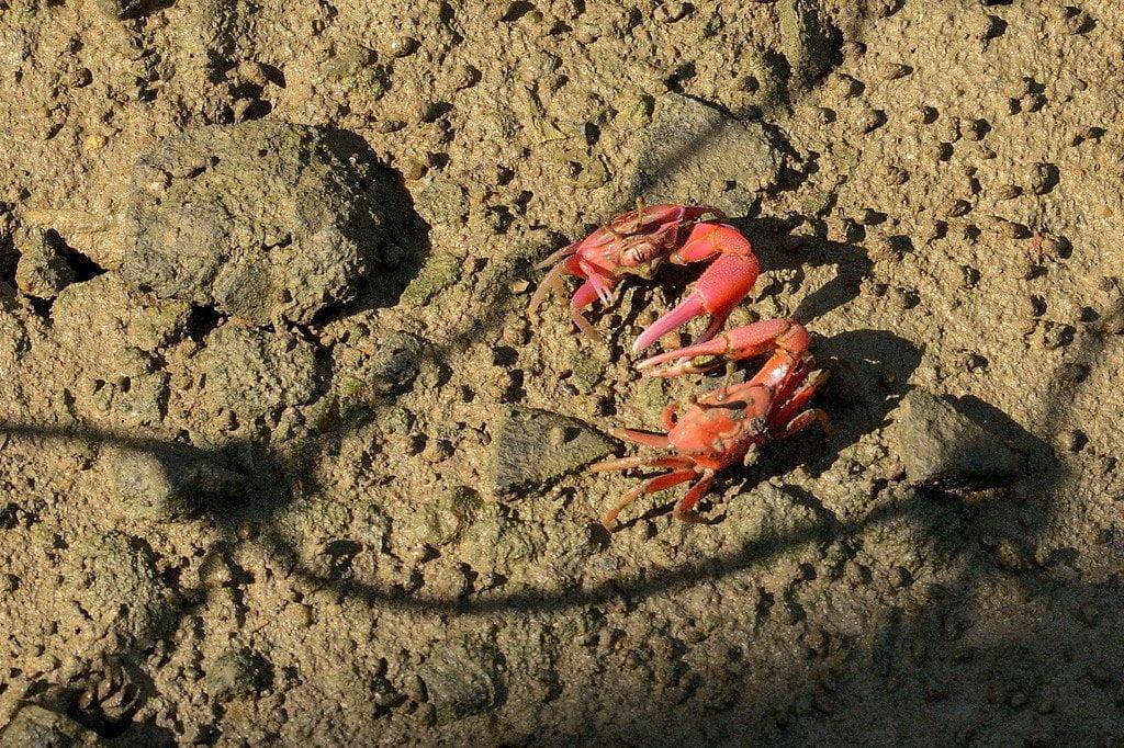
Some of the most ecologically important animals in a mangrove forest are also among the easiest to overlook.
Crabs occupy mudflats, creek margins and the spaces around mangrove roots.
Their burrowing and feeding activities disturb sediment and contribute to bioturbation—the physical mixing and restructuring of sediment by living organisms.
This means that even an apparently empty mudbank can be biologically active.
Research in the Indian Sundarbans has documented organisms such as burrowing mud lobsters in intertidal mangrove mudflats and recognised their role in the functioning of mangrove environments.
The lesson for Dalhousie is broader than any one species.
Much of the island’s ecological activity occurs below eye level.
The mud is not inert.
It is habitat.
Birds
Birdlife is one of the most visible expressions of the Sundarbans’ wetland ecology.
Across the wider Sundarbans, waterways, mudflats, mangrove edges and forest canopies support resident and migratory birds.
UNESCO’s documentation of the Sundarbans recognises its rich birdlife, including waterbirds, raptors and forest birds. The broader Sundarbans World Heritage ecosystem supports hundreds of bird species across its wetland and forest habitats.
At a place such as Dalhousie, bird habitat is closely linked to the tidal cycle.
When mudflats are exposed, shallow feeding areas become available.
When the tide rises, fish and other aquatic prey become more accessible in different parts of the system.
Forest birds occupy another ecological layer altogether.
The result is a constantly changing bird landscape rather than a fixed checklist of species that can be expected at a particular point.
Reptiles
The wider Indian Sundarbans provides habitat for several important reptiles, including the Saltwater Crocodile (Crocodylus porosus), water monitors, snakes and other species adapted to wetland and mangrove environments.
UNESCO identifies crocodiles and other reptiles among the significant fauna associated with the Sundarbans ecosystem.
But again, caution is necessary.
The presence of a species in the Sundarbans does not by itself establish a current, regularly occurring population on Dalhousie.
For a definitive Dalhousie species list, systematic island-specific survey data would be required.
The Royal Bengal Tiger
The Royal Bengal Tiger (Panthera tigris tigris) is the most famous animal associated with the Sundarbans.
The mangrove environment has shaped unusual tiger behaviour. Tigers in the Sundarbans are capable swimmers and move through a landscape of creeks, tidal rivers and forest islands. UNESCO recognises the Sundarbans as a distinctive tiger habitat and notes the species’ adaptation to an almost amphibious environment.
But Dalhousie should not be presented as a guaranteed tiger-viewing location.
The scientifically responsible statement is that Dalhousie forms part of the broader protected mangrove landscape in which tiger habitat exists, while a specific current tiger occurrence on Dalhousie would require appropriately documented island-level evidence.
That distinction protects both scientific accuracy and the reality of wildlife observation.
A wild tiger is not a scheduled attraction.
Wildlife Without a Human Trail
There is another important dimension to Dalhousie’s wildlife value.
The island has no permanent human settlement.
That does not mean the forest is untouched by every human influence—the entire Sundarbans exists within a wider region shaped by navigation, resource use, conservation management and climate pressures.
But the absence of permanent settlement distinguishes Dalhousie from many inhabited Sundarbans islands.
There are no village roads crossing its interior.
No agricultural fields define its landscape.
No permanent embankment separates a residential settlement from the forest.
Its ecological structure is therefore dominated by the relationship between forest, tidal water, sediment and wildlife.
The Wildlife Story Is Bigger Than the Tiger
It is easy to reduce the Sundarbans to its most recognisable animal.
Dalhousie demonstrates why that is inadequate.
A functioning mangrove ecosystem depends upon organisms that are rarely photographed: plankton, worms, molluscs, crustaceans, insects and microorganisms.
They support fish.
- Fish support birds and larger predators.
- Vegetation provides organic matter.
- Roots create shelter.
- Mud provides habitat.
- Tides connect the entire system.
UNESCO’s description of the Sundarbans emphasises this extraordinary breadth of biodiversity across terrestrial, aquatic and marine environments rather than treating the ecosystem as a tiger habitat alone.
The ecological significance of Dalhousie therefore lies not simply in whether a visitor sees a tiger, crocodile or rare bird.
It lies in the existence of a functioning mangrove landscape capable of supporting an interconnected web of life.
Ecological Importance
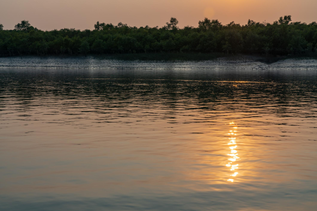
Dalhousie’s importance is not defined by a single species, a single forest compartment or a single environmental service.
Its value comes from the way mangrove forest, tidal water, sediment, wildlife and shoreline processes operate together.
The island belongs to one of the world’s most extensive mangrove ecosystems. UNESCO describes the Sundarbans as an exceptional example of ongoing ecological processes associated with tidal influence, delta formation, sediment deposition and the colonisation of newly formed islands.
Dalhousie represents one part of that larger process.
Its uninhabited status is particularly significant. Unlike inhabited Sundarbans islands, where houses, agriculture, embankments and roads interact directly with the natural environment, Dalhousie’s landscape is primarily organised around forest and tidal processes.
That makes it valuable not because it is isolated from the human world, but because it provides an example of how a forested deltaic island behaves when permanent settlement is absent.
A Mangrove System Rather Than a Collection of Trees
Mangroves perform several ecological functions simultaneously.
Their roots provide structure within shallow water and muddy sediment. Their foliage captures sunlight and produces organic matter. Fallen leaves enter the detrital food web, while roots and trunks create shelter for aquatic organisms.
The forest therefore connects the terrestrial and aquatic parts of the ecosystem.
- Water transports nutrients and organic matter.
- Mangrove vegetation modifies the movement of water close to the ground.
- Sediment accumulates in some places and is removed in others.
- Animals move through these habitats according to tides, food availability and shelter.
This interconnectedness is why the ecological importance of Dalhousie cannot be reduced to the number of trees growing on the island.
Shoreline Protection
Mangroves can reduce the energy of waves and currents near the shore, trap sediment and contribute to the stability of intertidal surfaces.
UNESCO identifies the Sundarbans mangrove system as a natural storm barrier, shoreline stabiliser and sediment and nutrient trap.
But this function has to be understood carefully.
Mangroves do not prevent all coastal erosion.
Where tidal currents, waves, storms or other geomorphological forces remove sediment faster than the forest can accumulate or retain it, the shoreline can retreat even when mangrove vegetation remains present.
Dalhousie demonstrates this distinction particularly clearly.
Habitat and Biodiversity
The island’s mangrove forest provides habitat across several ecological layers.
The submerged and semi-submerged root zone supports aquatic organisms.
- Mudflats and creek margins provide feeding areas.
- The forest floor supports invertebrates and reptiles.
- The canopy provides habitat for birds and insects.
- Larger animals can use the forest interior and its margins.
- The ecological value of this arrangement lies in the connectivity between habitats.
A fish does not depend on the river alone.
A bird feeding on a mudflat may depend indirectly on productivity generated within the wider mangrove system.
A predator may depend on prey that uses both aquatic and terrestrial environments.
The ecosystem is therefore better understood as a network than as a series of separate habitats.
Nursery Functions
Mangrove environments are particularly important for juvenile aquatic organisms.
The complicated structure created by roots, shallow channels, mudbanks and submerged vegetation can provide shelter from larger predators while also supporting food resources.
UNESCO identifies the Sundarbans as an important nursery for marine organisms and recognises its aquatic and benthic biodiversity.
This function extends the ecological importance of Dalhousie beyond its shoreline.
What happens within the forest can influence the productivity of the surrounding water.
Carbon Stored in Mangrove Landscapes
Mangroves are also important carbon-storing ecosystems.
Carbon is held not only in living vegetation but also in the organic-rich sediments accumulated beneath mangrove forests.
Because these sediments can remain waterlogged and oxygen-poor, decomposition can occur differently from that in many terrestrial ecosystems.
The result is an ecosystem capable of retaining substantial amounts of carbon over long periods.
However, the amount of carbon stored by an individual island cannot responsibly be estimated from generic Sundarbans figures alone.
A Dalhousie-specific carbon estimate would require appropriate field measurements of biomass and sediment carbon.
The broader ecological principle is well established; the precise quantity for Dalhousie is not established by the sources used here.
The Physical Change of an Island
Dalhousie’s ecological importance becomes even clearer when its physical geography is considered.
The island is not stationary.
Its shoreline has changed substantially over the period covered by historical remote-sensing studies.
One study examining shoreline dynamics in the Indian Sundarbans found that Dalhousie experienced significant erosion between 1979 and 2011. The researchers reported a reduction in mapped island area from 76.51 sq km in 1979 to 60.32 sq km in 2011, equivalent to approximately a 21 percent reduction over that study period.
This is one of the most important quantitative findings in Dalhousie’s environmental history.
But it requires context.
The figures represent mapped areas derived through the study’s methodology and dates. They should not be directly compared with the current DWIEP figure of 92.454 sq km as though one represents a simple continuation of the other.
Different studies can use different satellite imagery, shoreline definitions, tidal conditions, spatial resolutions and analytical techniques.
The correct conclusion is therefore not: “Dalhousie is now exactly X square kilometres smaller.”
The defensible conclusion is: Long-term remote-sensing research has documented substantial shoreline and area change at Dalhousie, with erosion playing a major role.
That distinction is important for a scientifically responsible article.
Erosion and Accretion
See it for yourself
A private journey shaped around you — your group, your pace, your interests. Book a free consultation.
A delta is shaped by two opposing processes.
- Erosion removes sediment.
- Accretion adds or accumulates sediment.
Both can occur within the same broader region.
A shoreline may retreat on one side of an island while sediment accumulates somewhere else. A tidal channel can widen in one location while another mudflat builds outward.
This means that the Sundarbans cannot be understood simply as land that is steadily disappearing.
It is a sedimentary landscape undergoing continuous redistribution.
UNESCO describes the Sundarbans as a dynamic delta where tidal processes, erosion and deposition continually modify the islands.
Dalhousie’s recent history indicates that, at its exposed margins, erosion has frequently outweighed compensating land formation.
That makes the island an important case study in the physical vulnerability of mangrove landscapes.
Why Is Dalhousie Eroding?
There is no single mechanism responsible for the island’s shoreline change.
Several processes interact.
Tidal Currents
Tides move enormous quantities of water through the Sundarbans twice daily.
Where currents become concentrated around channels, bends or exposed shorelines, they can increase the ability of water to transport sediment away from a bank.
The exact effect varies according to channel geometry, tidal stage and sediment availability.
Wave Action
The southern Sundarbans is increasingly influenced by marine conditions as the landscape approaches the Bay of Bengal.
Waves can remove loose sediment from exposed margins, particularly where vegetation does not provide sufficient structural resistance.
Cyclones and Storm Surges
The Bay of Bengal is highly exposed to tropical cyclones.
Major storms can temporarily increase water levels and wave energy, producing rapid erosion along exposed shorelines.
The impact of an individual cyclone depends on its trajectory, intensity, storm surge, wave conditions, tidal phase and the physical form of the coastline at the time.
It would therefore be misleading to attribute all of Dalhousie’s long-term erosion to cyclones alone.
Sediment Supply
The wider Sundarbans depends on sediment delivered through the deltaic river system.
Changes in sediment transport can alter whether particular sections of the coast gain or lose material.
The balance is highly localised.
An island may receive sediment through one channel while losing it along another shoreline.
Relative Sea-Level Change
The relationship between land elevation and sea level also matters.
Relative sea-level change includes both changes in the level of the sea and changes in the elevation of the land itself.
In a low-lying delta, even modest changes in this relationship can influence tidal inundation and shoreline stability.
The Sundarbans is particularly sensitive because much of the landscape lies only slightly above tidal levels.
The 1979–2011 Shoreline Record
The long-term study of Dalhousie provides one of the clearest historical windows into the island’s physical transformation.
Using satellite imagery and GIS-based analysis, researchers compared the island’s shoreline over several decades.
Their results indicated substantial erosion.
The study reported that Dalhousie’s area decreased from 76.51 sq km in 1979 to 60.32 sq km in 2011. It also identified strong shoreline retreat along exposed portions of the island.
The researchers examined Dalhousie together with neighbouring Bhangaduni because both islands are uninhabited, forested and exposed to the dynamic coastal environment of the southern Sundarbans.
The value of this study is not simply the percentage of land lost.
It provides evidence that shoreline change at Dalhousie is not a recent visual impression.
It has been measurable over decades.
What More Recent Research Shows
More recent remote-sensing research has continued to identify Dalhousie as an erosion-sensitive island.
A study examining shoreline change across the Indian Sundarbans between 1973 and 2023 identified Dalhousie and Bhangaduni among the major shoreline-change hotspots. The research reported an approximately 2,321-metre shift in the Dalhousie Island boundary over the study period.
The significance of this result is not that the island has moved uniformly by 2,321 metres.
A shoreline does not retreat like a straight line.
Different sections can behave differently.
The measurement represents spatial change detected through the study’s methodology across the analysed period.
That is why shoreline-change research should be read as a record of changing boundaries, not as a simple countdown to the island’s disappearance.
Dalhousie and the Question of “Disappearing Islands”
The phrase “disappearing island” is powerful.
It is also potentially misleading.
An island can lose substantial land without every part of its shoreline retreating at the same rate.
- Vegetation can colonise new sediment.
- A creek can migrate.
- A mudflat can develop.
- A forest edge can retreat.
- An island’s outline can change while its ecological processes continue.
This is why Dalhousie should be described as an erosion-affected and dynamically changing mangrove island, rather than simply as an island that is disappearing.
The distinction is more than semantics.
It changes how conservation is understood.
If the objective were merely to preserve today’s boundary, the logical response would be to attempt to hold the shoreline in place.
But the Sundarbans is a functioning delta.
Its ecological character depends on the movement of water and sediment.
A rigid attempt to freeze every shoreline could itself alter natural processes.
The conservation challenge is therefore more complex: How can the ecological functions of the mangrove system be maintained while allowing the delta to remain a dynamic landscape?
Mangroves Can Resist Erosion — But Not Everywhere
Mangrove roots provide physical complexity along the shoreline.
They can slow water close to the substrate and encourage sediment retention.
Where sediment supply and tidal conditions are favourable, mangroves can contribute to the development of more stable intertidal surfaces.
But their protective capacity has limits.
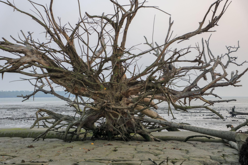
If a shoreline is subjected to persistent erosion, vegetation may eventually be undermined.
Once the substrate supporting the trees is removed, even a mature mangrove stand can be lost from the shoreline.
This produces an important feedback: erosion can remove mangroves, while the loss of mangroves can reduce the biological structures that help retain sediment.
That does not mean mangrove loss always causes erosion.
The relationship is site-specific and depends on hydrodynamics, sediment availability, vegetation type, elevation and other factors.
But at an erosion-sensitive island such as Dalhousie, the interaction between vegetation and geomorphology is central to understanding future change.
A Landscape That Must Be Measured Through Time
A single photograph of Dalhousie can show the forest.
It cannot show the island’s history.
A satellite image can reveal the shoreline.
It cannot, by itself, explain every process that created that shoreline.
A field observation can document exposed roots, mudbanks or eroding edges.
It represents only one moment in a much longer cycle.
Understanding Dalhousie therefore requires time-series evidence.
Researchers use historical satellite imagery, geographic information systems, shoreline extraction methods and repeated observations to reconstruct how the island has changed.
This is one reason the island is scientifically valuable.
Its transformation can be studied through multiple decades of remotely sensed evidence.
Why Dalhousie’s Area Figures Differ
A reader may encounter several different numbers for Dalhousie’s area.
The current DWIEP profile records 92.454 sq km.
The historical shoreline study cited above measured 60.32 sq km in 2011 and 76.51 sq km in 1979.
These numbers should not automatically be interpreted as an error in one source.
They come from different periods and potentially different shoreline definitions and mapping procedures.
In a changing delta, the date of measurement matters.
So does the method.
An island’s mapped boundary can also vary depending on whether a study uses the visible high-water line, a vegetation boundary, a manually interpreted shoreline or another remote-sensing threshold.
The safest editorial practice is therefore to retain the source-specific figure and identify its context rather than manufacture a single “true” area.
What Dalhousie Tells Us About the Sundarbans
Dalhousie’s greatest ecological lesson may be that forest health and land stability are not the same thing.
A mangrove forest can remain ecologically functional while its outer boundary changes.
Conversely, a shoreline can appear stable for a period while ecological conditions inside the forest are changing.
The island therefore illustrates the need to monitor both:
- biological indicators, such as vegetation condition and biodiversity;
- physical indicators, such as shoreline position, elevation, sediment movement and tidal inundation.
This is particularly important in the context of climate change.
The Sundarbans is exposed to rising sea levels, increasingly complex coastal hazards and changes in rainfall and freshwater conditions. But the response of any individual island cannot be predicted from climate change alone.
- Local geomorphology matters.
- Channel position matters.
- Sediment supply matters.
- Vegetation matters.
- Storm exposure matters.
Dalhousie’s future will be determined by the interaction of these forces.
Ecological Importance Beyond the Shoreline
The importance of Dalhousie extends beyond the question of whether the island gains or loses land.
Its mangrove ecosystem participates in wider regional processes.
- It provides habitat.
- It stores organic carbon.
- It contributes to nutrient cycling.
- It supports aquatic productivity.
- It provides structural complexity for wildlife.
- It forms part of a connected tidal landscape.
And its forest helps demonstrate how mangrove ecosystems function under conditions of regular saline and tidal stress.
This is why conserving an island such as Dalhousie is not simply about preserving a particular outline on a map.
The larger objective is maintaining the ecological processes that allow the Sundarbans to continue functioning as a mangrove delta.
Environmental Change Does Not Have a Single Cause
It is tempting to attach one explanation to Dalhousie’s erosion.
- Climate change.
- Cyclones.
- Sea-level rise.
- Tidal currents.
- Human intervention.
- Sediment reduction.
Each may be relevant in particular contexts.
But the available evidence supports a more careful interpretation.
Dalhousie’s shoreline is changing because it exists within a highly dynamic deltaic and coastal environment where multiple physical processes interact.
- Climate change can alter the conditions under which those processes operate.
- Cyclones can produce episodic shocks.
- Tides operate every day.
- Sediment moves continuously.
- The relative contribution of each factor varies through space and time.
That is the scientifically defensible picture.
The Future of Dalhousie
No responsible source can provide a precise date for when Dalhousie might lose a particular percentage of its current area.
Nor can historical erosion rates simply be projected forward indefinitely.
The island’s future will depend on changing sediment supply, tidal dynamics, storm activity, relative sea level, vegetation response and broader deltaic processes.
What can be stated with confidence is that Dalhousie has undergone significant shoreline change over recent decades and remains part of a physically dynamic section of the Sundarbans.
Its future is therefore not a question of whether the island will remain exactly as it appears today.
The more useful question is how its forest, waterways and shoreline will reorganise as the delta continues to evolve.
That is a much more accurate way to understand environmental change in the Sundarbans.
History
Dalhousie’s history is inseparable from the much larger history of the Sundarbans as a forested delta.
Unlike inhabited islands such as Gosaba or Sagar, Dalhousie does not have a documented history of permanent settlement, agricultural expansion or village formation that defines its identity. Contemporary island records classify it as uninhabited, with no permanent population and no infrastructure recorded in the island profile.
That absence is historically significant.
Much of the northern and northwestern Sundarbans was progressively opened to human settlement and cultivation during the colonial period, while substantial areas of the southern mangrove forest remained under forest administration. The wider history of the region therefore contains two contrasting landscapes: reclaimed and inhabited islands on one side, and protected forest islands on the other.
By the late nineteenth century, substantial areas of the Indian Sundarbans had been designated as Reserved Forest. National Tiger Conservation Authority material describing the broader Sundarbans records that 4,856 sq km had been designated Reserved Forest by 1878–79.
This forest-management history provides important context for Dalhousie.
The island’s present character is not simply the result of geography. It is also connected to the historical decision to retain substantial portions of the southern Sundarbans as forest rather than convert them entirely to settled agricultural land.
Dalhousie Within the Colonial Sundarbans
The colonial transformation of the Sundarbans was extensive.
Land was surveyed, forests were classified, embankments were constructed in some areas and portions of the delta were brought under cultivation and settlement.
But the ability to reclaim land was never uniform.
The physical environment became increasingly difficult toward the seaward islands, where tidal flooding, salinity, cyclones and shifting channels made permanent settlement more vulnerable.
Dalhousie belongs to this less-settled southern forest landscape.
Its history is consequently better documented through forest administration, geography and environmental change than through the conventional historical markers of villages and built heritage.
That is an important distinction.
There is no evidence in the sources reviewed for this article that Dalhousie developed into a permanent agricultural settlement comparable with the better-known inhabited islands of the northern Sundarbans.
A Forest Landscape Protected Through Time
The modern protected-area system developed much later than the nineteenth-century Reserved Forest system.
The Sundarban Tiger Reserve was established in 1973, the core area was constituted as a National Park in 1984, and the Sundarbans National Park was subsequently recognised as a UNESCO World Heritage Site. West Bengal Government sources record this progression from Tiger Reserve to National Park and international recognition.
The broader Sundarbans Biosphere Reserve was established in 1989. The Wildlife Institute of India describes the biosphere reserve as encompassing the Sundarban Tiger Reserve, Sundarban National Park and associated protected areas in West Bengal.
Dalhousie’s contemporary conservation setting needs to be understood within this layered history.
The island is not protected by a single designation operating in isolation.
It forms part of a wider landscape protected through forest management, wildlife conservation, tiger conservation, biosphere-reserve management and international heritage recognition.
The History of the Name
The name Dalhousie presents an interesting historical question.
The name is well established in modern geographic records, but the authoritative sources reviewed for this article do not provide sufficient primary evidence to establish exactly why this particular Sundarbans island was given the name Dalhousie.
The most obvious historical association is with Lord Dalhousie, the British Governor-General of India from 1848 to 1856.
However, an association that appears plausible is not the same as a documented naming history.
No reliable primary source located for this article establishes that the island was definitively named after Lord Dalhousie, nor does the evidence reviewed provide a sufficiently clear alternative explanation.
The responsible conclusion is therefore simple: The island’s name is established; its precise naming origin remains insufficiently documented in the sources reviewed.
That uncertainty should remain part of the article rather than being replaced by an attractive but unsupported historical story.
Culture and Folklore
Dalhousie presents an unusual case for this section.
The island itself has no documented permanent settlement culture comparable to the inhabited islands of the Sundarbans, and the sources reviewed do not provide a sufficiently reliable body of Dalhousie-specific folklore, village traditions or oral-history material to justify attributing a distinct folklore tradition to the island.
That does not mean Dalhousie exists outside the cultural landscape of the Sundarbans.
It means the distinction between island-specific culture and regional Sundarbans culture must be maintained.
The Cultural Landscape Around the Forest
The inhabited Sundarbans has a deep relationship with the forest and water.
Fishing, boat travel, honey collection, forest work and agriculture have historically connected communities with an environment that can provide livelihoods while also presenting considerable danger.
This relationship has produced a rich cultural landscape of songs, stories, religious practices, seasonal customs and oral traditions.
But those traditions belong to the wider Sundarbans cultural region, not automatically to Dalhousie.
The absence of permanent settlement on Dalhousie means that it is more appropriate to discuss the island as part of the environmental setting within which Sundarbans culture developed than to invent a Dalhousie-specific folklore tradition.
Bonbibi and the Forest
One of the most important cultural traditions associated with the wider Sundarbans is the worship of Bonbibi, a protective figure whose stories are deeply connected with people’s encounters with the forest.
Bonbibi traditions are particularly important because they express a cultural understanding of the forest as both a source of livelihood and a potentially dangerous environment.
The tradition is found across communities associated with the Sundarbans and crosses religious boundaries in ways that reflect the region’s distinctive social history.
But there is no reason to claim that Dalhousie itself possesses a unique Bonbibi shrine or island-specific ritual unless a reliable source establishes it.
The more accurate interpretation is that Dalhousie belongs to the environmental world represented within Sundarbans cultural traditions.
- The forest exists beyond the village.
- The river separates and connects communities.
- The tide determines when boats can move.
- And the forest carries both livelihood and danger.
Those realities are central to Sundarbans culture.
Why the Absence of Folklore Matters
For a documentary publication, an absence of evidence is itself useful information.
Many places acquire stories through repetition.
An island is given a famous name, a supposed historical connection is repeated, and eventually the repetition begins to look like proof.
Dalhousie is a good example of why that process needs to be resisted.
The Wild Orbit’s role is not to make every island appear to have a dramatic legend.
It is to distinguish what is documented from what remains unknown.
For Dalhousie, the strongest story is not an invented legend.
It is the documented relationship between forest, water, conservation and environmental change.
Conservation Significance
Dalhousie’s conservation significance begins with something deceptively simple:
it remains a forest island without permanent settlement.
In a delta where human settlements occupy many islands and where embankments, agriculture and infrastructure have transformed large parts of the landscape, an uninhabited mangrove island represents an important form of ecological continuity.
Its value is therefore both biological and geographical.
The island provides mangrove habitat while also preserving a section of the tidal landscape in which natural processes remain highly visible.
Part of a Larger Protected Landscape
Dalhousie must be understood within the wider protected architecture of the Indian Sundarbans.
The Sundarban Tiger Reserve was created in 1973.
The present National Park core was established in 1984.
The broader Sundarbans Biosphere Reserve was established in 1989.
The region’s international importance was subsequently recognised through UNESCO World Heritage status. West Bengal Government sources document this progression, while the Wildlife Institute of India describes the Biosphere Reserve as incorporating the Tiger Reserve and National Park within the wider protected landscape.
The UNESCO designation is particularly important because it recognises not merely individual species, but the ecological processes operating across the Sundarbans.
UNESCO identifies the property for its ongoing delta formation, tidal influence, sedimentation, plant colonisation and exceptional terrestrial and aquatic biodiversity.
Dalhousie’s conservation significance therefore extends beyond the island itself.
Protecting the island contributes to maintaining part of the larger system.
Protection Does Not Freeze the Island
One of the most important conservation lessons from Dalhousie is that legal protection and physical stability are different things.
- The island can be protected from permanent settlement and still lose shoreline.
- The forest can remain protected while tidal channels change.
- Mangroves can continue growing while portions of the outer coastline retreat.
Earlier research documented substantial erosion at Dalhousie over several decades, while more recent satellite studies continue to identify the island as an area of significant shoreline change.
This means conservation cannot be measured only by whether the island’s legal status remains unchanged.
It must also consider:
- forest condition
- biodiversity
- hydrological connectivity
- sediment processes
- shoreline movement
- tidal inundation
- salinity
- storm exposure
- habitat continuity
The island’s ecological integrity depends on the interaction of all these elements.
Erosion as a Conservation Issue
Erosion is not simply a geological curiosity at Dalhousie.
It has ecological consequences.
When a shoreline retreats, mangrove habitat can be lost.
Creeks can widen or migrate.
Mudflats can change shape.
The location of shallow-water habitat can shift.
Wildlife using particular forest edges or intertidal zones may encounter a different physical environment over time.
At the same time, new sediment deposits elsewhere can create opportunities for mangrove colonisation.
Conservation therefore needs to account for change rather than assume permanence.
This is particularly important in the Sundarbans, where UNESCO identifies erosion, deposition and tidal processes as intrinsic parts of the landscape.
Climate Change and the Southern Sundarbans
The broader environmental pressures facing the Sundarbans include salinisation, coastal erosion, cyclones and changes in hydrological conditions.
The Government of India has reported ongoing efforts addressing salinisation, erosion and other threats to the mangrove ecosystem, including mangrove restoration, coastal-zone management, monitoring of salinity and hydrological changes, shoreline-erosion monitoring and conservation of tiger habitat.
These initiatives operate at landscape scale rather than being a Dalhousie-specific intervention programme.
That distinction is important.
There is not enough public evidence to claim that a particular restoration project has transformed Dalhousie itself.
What can be said is that Dalhousie exists within a Sundarbans landscape where these environmental pressures and conservation responses are already recognised at governmental and scientific levels.
Conservation Through Science
Dalhousie’s changing shoreline also demonstrates why long-term monitoring matters.
- A forest may appear unchanged from a boat.
- A satellite image can reveal gradual retreat.
- Aerial or field surveys can identify changes that are difficult to detect from the water.
Repeated measurements can then reveal whether a shoreline is stabilising, retreating or building outward.
The National Tiger Conservation Authority maintains monitoring protocols specifically for the Sundarbans Tiger Reserve, reflecting the broader shift toward systematic, science-based wildlife management.
For a landscape such as Dalhousie, conservation science therefore extends beyond counting animals.
It includes understanding the physical environment on which those animals depend.
Why Uninhabited Islands Matter
The absence of permanent settlement gives Dalhousie a particular conservation value.
On inhabited islands, conservation must negotiate directly with homes, agriculture, roads, embankments, fishing activity and local livelihoods.
On an uninhabited forest island, the primary conservation challenge is different.
The question becomes how to maintain: forest + water + sediment + wildlife + natural processes.
This does not mean the island is isolated from human influence.
Its climate, hydrology, conservation policies, surrounding navigation and regional environmental conditions are all connected to human activity.
But the absence of permanent settlement means that the island retains a form of ecological continuity that is increasingly valuable in a densely used delta.
Conservation Is Not About Preserving a Photograph
A photograph can capture Dalhousie at one moment: mangroves standing along a muddy shore, a tidal creek moving through the forest, perhaps birds crossing above the canopy.
But conserving Dalhousie does not mean ensuring that this exact arrangement remains unchanged.
The Sundarbans is a living delta.
- Its channels move.
- Its sediments shift.
- Its forest expands in some places and retreats in others.
- Its wildlife responds to changing habitat.
- Its shorelines change.
A conservation strategy that ignores those natural processes could protect an image while weakening the ecosystem that produced it.
The more meaningful goal is to maintain the ecological functions and connectivity of the mangrove landscape while allowing natural geomorphological processes to continue.
Dalhousie’s Place in the Future Sundarbans
Dalhousie’s future will depend on processes operating far beyond its shoreline.
- River discharge influences sediment.
- Tides redistribute water and material.
- Cyclones periodically disturb the coast.
- Sea-level conditions influence inundation.
- Mangroves respond to elevation and salinity.
- Wildlife responds to habitat.
Conservation management determines what forms of human access and intervention are permitted.
No single factor controls the outcome.
That is why Dalhousie is valuable as a conservation case study.
It demonstrates that protecting the Sundarbans is not simply a matter of protecting individual animals or planting trees.
It means protecting an interconnected deltaic system.
And in that system, an uninhabited forest island can be as important for what it preserves as for what it reveals.
The Conservation Lesson of Dalhousie
Dalhousie offers a quiet but important lesson.
A protected forest is not a frozen landscape.
Protection creates the conditions in which ecological processes can continue.
- It does not stop tides.
- It does not stop sediment from moving.
- It does not stop storms.
- It does not guarantee that a shoreline will remain in the same position.
The purpose of conservation is therefore not to prevent the Sundarbans from changing.
It is to ensure that the ecological system remains capable of functioning while it changes.
For Dalhousie, that means maintaining mangrove habitat, protecting wildlife, monitoring shoreline and hydrological change, and preserving the integrity of the surrounding tidal environment.
The island’s story is ultimately not one of permanence.
It is one of resilience within a changing delta.
And that is precisely why its conservation matters.
Visitor Information
Dalhousie should be understood first as a protected, uninhabited forest island, not as a conventional tourist destination.
The current National Centre for Sustainable Coastal Management island profile records no permanent population and no infrastructure on Dalhousie. That immediately changes what “visiting” means.
There is no ordinary village centre to explore, no road network through the island and no conventional accommodation or visitor infrastructure.
The appropriate way to understand Dalhousie is through the authorised waterways and protected forest landscape surrounding it, subject to the rules applicable at the time of travel.
Can You Visit Dalhousie Island?
A map location should not be interpreted as permission to land.
The Sundarban Tiger Reserve regulates entry into the protected forest. Its official visitor information describes controlled entry, permits and movement through registered boats and launches.
For Dalhousie specifically, the safest editorial position is therefore: Do not assume that landing, walking ashore or entering the forest is permitted.
Whether a boat can approach a particular section, whether landing is permitted at any point, and which routes are available depend on current Forest Department regulations, permitted navigation routes, weather, tides and operational conditions.
Rules can change.
Visitors should confirm current requirements with the relevant Forest Department or authorised reserve authorities before travelling.
Is Dalhousie a Tourist Spot?
Not in the usual sense.
Dalhousie does not function like an inhabited Sundarbans destination such as Gosaba, where visitors encounter settlements and established local infrastructure.
Its significance is ecological.
A visitor may encounter the island as part of a wider authorised journey through the southern Sundarbans, but the purpose should be observation of the landscape rather than treating the island as a place to disembark and explore independently.
That distinction is particularly important in a protected mangrove ecosystem.
Boat-Based Observation
For a forest island such as Dalhousie, the boat is not simply a means of transportation.
It is the practical boundary between visitor observation and protected forest.
From the water, it is possible to observe the relationship between:
- tidal channels
- mudbanks
- mangrove edges
- exposed roots
- forest canopy
- birds
- changing water levels
- shoreline morphology
This perspective is also more faithful to the character of the island.
Dalhousie is a landscape defined by water.
The most meaningful observations often come from watching how that water interacts with the forest.
Photography
Dalhousie’s landscape can be particularly valuable for documentary photography because the subject is not a single landmark.
The photographic story lies in relationships: water against mangrove, roots against mud, forest against sky, and shoreline against tide.
Photographers should maintain appropriate distance from wildlife and follow all reserve regulations.
No photograph justifies approaching an animal, leaving an authorised route, landing illegally or disturbing the forest.
The wider Sundarbans is a protected wildlife landscape, and responsible photography begins with allowing the ecosystem to remain undisturbed.
What Visitors Should Not Do
Visitors should not:
- assume that an island shown on a map is open for unrestricted access;
- land without explicit permission;
- enter forest areas outside authorised routes;
- approach wildlife for photographs;
- feed wildlife;
- leave waste behind;
- disturb birds or nesting areas;
- collect plants, shells, wood or other natural material;
- ignore Forest Department instructions;
- treat a protected forest as an ordinary sightseeing location.
The guiding principle is simple: Observe without altering the landscape.
Research and Educational Visits
Dalhousie has greater significance for ecological and geographical study than for conventional sightseeing.
Researchers interested in mangrove ecology, remote sensing, shoreline change, tidal processes, biodiversity or environmental history may find the island particularly relevant.
However, research access is not the same as tourist access.
Scientific work within protected areas requires the appropriate permissions and should be coordinated with the responsible authorities.
The island’s uninhabited status makes it especially important that research activity does not introduce unnecessary disturbance.
Seasonal Character
Dalhousie does not have a single appearance throughout the year.
Its character changes with rainfall, river discharge, salinity, cloud cover, tidal conditions and the frequency of storms.
The forest remains the same ecosystem, but the physical expression of that ecosystem changes.
Winter
The cooler and generally drier months provide relatively stable conditions across much of the Sundarbans.
Rainfall is lower than during the monsoon.
Visibility can improve.
The waterways remain strongly tidal, but the landscape may feel more settled than during periods of heavy rain and storm activity.
This is also a period when wintering and migratory birds contribute to the wider bird diversity of the Sundarbans.
For an observer, winter can reveal the structure of the landscape clearly:
mangrove edges, exposed mud, channels and distant forest become easier to distinguish.
Pre-Monsoon
The months before the monsoon bring increasing heat and atmospheric instability.
Humidity rises.
Thunderstorms become more frequent.
The Bay of Bengal also becomes increasingly important to weather conditions affecting the southern Sundarbans.
For boat-based exploration, conditions can change quickly.
The forest itself begins to take on a different visual character as rainfall increases and freshwater conditions change.
Monsoon
The monsoon transforms the relationship between land and water.
- Rainfall increases.
- River discharge changes.
- Freshwater enters the estuarine system in greater quantities.
- Cloud cover becomes persistent.
- Low-lying areas can experience increased inundation.
The mangrove ecosystem is adapted to this seasonal rhythm, but the exact response varies according to local elevation, tidal conditions and freshwater influence.
The monsoon should not be thought of simply as a period when the Sundarbans becomes “wet.”
The Sundarbans is already a wetland.
The monsoon changes the balance and intensity of processes already operating there.
Post-Monsoon
After the main monsoon period, water levels, vegetation and atmospheric conditions begin to shift again.
The southern Sundarbans remains vulnerable to cyclonic systems originating over the Bay of Bengal during the broader post-monsoon cyclone season.
This is particularly relevant for Dalhousie because of its exposed southern setting and documented shoreline sensitivity.
A cyclone can alter the coastline rapidly through storm surge, waves and strong currents.
But the long-term shape of the island is determined by the cumulative interaction of many processes, not by a single storm.
Tides Matter More Than the Calendar
Seasonality provides one layer of change.
The tide provides another.
A visitor can observe a different Dalhousie within the same day simply because the water has moved.
At high tide:
- creek margins become submerged
- low intertidal surfaces disappear beneath water
- mangrove roots may be partially inundated
- channels become visually broader
At low tide:
- mudflats emerge;
- root structures become more visible
- shallow channels become easier to distinguish
- feeding areas for intertidal wildlife may appear
This daily rhythm is fundamental to understanding the island.
Dalhousie’s seasonal character therefore cannot be separated from its tidal character.
The Wild Orbit’s Interesting Facts About Dalhousie
1. Dalhousie is uninhabited
The current DWIEP island profile records zero population and no infrastructure on Dalhousie.
2. It is a forest island rather than a settlement island
Its present identity is defined primarily by mangrove forest and tidal processes rather than by permanent human habitation.
3. Dalhousie lies within the southern Indian Sundarbans
Its geographical setting places it within the lower, marine-influenced portion of the delta.
4. The island’s boundaries have changed substantially
Historical remote-sensing research documented significant erosion and reduction in mapped area during the late twentieth and early twenty-first centuries.
5. Different sources give different island areas
The current DWIEP profile records 92.454 sq km, while an earlier scientific study measured 60.32 sq km in 2011. These figures come from different datasets and dates and should not be treated as directly interchangeable.
6. Dalhousie’s mangroves can be difficult to distinguish from water in satellite imagery
Research has examined how periodically submerged mangrove vegetation on the island can complicate remote-sensing classification.
7. Dalhousie has been identified as a shoreline-change hotspot
Research covering the Indian Sundarbans between 1973 and 2023 identified Dalhousie among areas experiencing significant shoreline change.
8. The island is closely associated with Bhangaduni in erosion research
The two uninhabited forest islands have frequently been examined together when researchers study shoreline dynamics in the southern Sundarbans.
9. Its ecological importance extends beyond large wildlife
Mangrove roots, mudflats, aquatic organisms, insects, fish, crustaceans and microorganisms collectively support the ecosystem.
10. Dalhousie demonstrates that protected does not mean physically static
The island can remain protected and forested while its shoreline continues to change.
11. Its name has an unresolved historical origin
The island is unquestionably known as Dalhousie, but the sources reviewed do not establish with sufficient certainty why it received that name.
12. A map cannot tell the whole story
The shape of Dalhousie changes over time.
A map records one moment.
The delta keeps moving.
FAQs
Where is Dalhousie Island?
Dalhousie is an uninhabited forest island in the southern Indian Sundarbans of West Bengal. Its current DWIEP profile places it at approximately 21°37′04.80″ N, 88°44′31.20″ E.
Is Dalhousie Island inhabited?
No. The current island database records Dalhousie as uninhabited, with nil population and no infrastructure.
What is the area of Dalhousie Island?
The current DWIEP database records approximately 92.454 sq km. Earlier scientific mapping produced different measurements, including 60.32 sq km for 2011. Because Dalhousie’s shoreline is changing and different studies use different methods and dates, the figures should always be quoted with their source context.
Is Dalhousie Island disappearing?
Dalhousie has experienced significant erosion and shoreline change, but describing it simply as “disappearing” would be an oversimplification. Different parts of a deltaic island can erode, stabilise or accumulate sediment at different times.
Can tourists visit Dalhousie Island?
Dalhousie is not a conventional tourist destination. It is an uninhabited protected forest island. Access within the Sundarban Tiger Reserve is regulated, and visitors should not assume that landing or entering the island is permitted. Current Forest Department rules and permissions should be checked before travel.
Can you stay overnight on Dalhousie Island?
There is no permanent tourist accommodation or settlement infrastructure recorded on the island. An overnight stay on the island should therefore not be assumed to be possible or permitted.
Can you walk on Dalhousie Island?
Not unless specifically authorised by the relevant authorities. The absence of settlement or infrastructure does not mean unrestricted public access.
Is Dalhousie part of the Sundarbans protected landscape?
Yes. Dalhousie forms part of the protected forest landscape of the Indian Sundarbans. The wider region is protected through overlapping conservation designations including the Sundarban Tiger Reserve, National Park and Biosphere Reserve.
Is Dalhousie inside the Sundarban Tiger Reserve?
Dalhousie is situated within the southern protected Sundarbans landscape associated with the Tiger Reserve. Current access and exact administrative boundaries should be checked against official Forest Department information before a visit.
Can you see Royal Bengal Tigers on Dalhousie?
The Royal Bengal Tiger is an important species of the Sundarbans, but Dalhousie should not be presented as a guaranteed tiger-viewing location. A wider Sundarbans species record should not automatically be interpreted as proof of a current tiger presence on this particular island.
Does Dalhousie have mangroves?
Yes. Dalhousie is a forested mangrove island, and scientific remote-sensing research has specifically examined its mangrove vegetation.
Why is Dalhousie important?
Its importance comes from its combination of mangrove habitat, protected status, uninhabited condition, tidal connectivity and significant long-term shoreline change.
Why is Dalhousie eroding?
Its shoreline is influenced by interacting processes including tidal currents, wave action, sediment transport, storms, changing hydrological conditions and relative sea-level dynamics. No single process adequately explains the island’s entire erosion history.
Does mangrove forest stop erosion?
No. Mangroves can trap sediment and reduce water and wave energy locally, but they cannot prevent all erosion. If sediment is removed faster than the shoreline can compensate, mangrove habitat itself can retreat.
What river is near Dalhousie?
Dalhousie lies within the tidal river network associated with the Matla and Gosaba systems, together with numerous smaller channels and creeks.
What is Dalhousie known for?
It is best understood as an uninhabited mangrove forest island and an important example of shoreline change within the southern Indian Sundarbans.
Why does Dalhousie have different area measurements in different sources?
Because island area depends on when and how the shoreline is measured. Different satellite datasets, mapping techniques, shoreline definitions and observation dates can produce different results.
Who was Dalhousie Island named after?
The precise origin of the island’s name has not been sufficiently established by the authoritative sources reviewed for this article. A connection with Lord Dalhousie may appear plausible, but it should not be presented as a confirmed historical fact without documentary evidence.
Is Dalhousie connected with Sundarbans folklore?
The wider Sundarbans has extensive cultural traditions, including Bonbibi traditions associated with people’s relationship with the forest. However, the sources reviewed do not establish a distinct Dalhousie-specific folklore tradition.
Is Dalhousie important for researchers?
Yes. Its combination of mangrove ecology, tidal inundation, remote-sensing challenges, shoreline change and protected forest status makes it relevant to ecological, geographical and environmental research.
What is the best way to understand Dalhousie?
Not as a conventional destination.
Understand it as a living piece of the Sundarbans delta—a forest island shaped by tides, sediment, mangroves, wildlife and continuous environmental change.
The Changing Landscape of Dalhousie
Dalhousie does not announce itself.
There is no permanent settlement on its shores and no built landmark that tells a visitor where the island begins.
Instead, its presence emerges gradually.
- A forest edge appears beyond the water.
- The tide moves through a narrow channel.
- Mud becomes visible as the water falls.
- Mangrove roots stand in sediment.
- Birds move along the exposed margin.
Then the tide returns and part of the landscape disappears beneath the water again.
This is Dalhousie’s most important lesson.
The island is not a fixed object surrounded by water.
It is part of a delta that is continually being reshaped.
- Its mangroves grow within the intertidal environment.
- Its roots interact with sediment.
- Its creeks carry water through the forest.
- Its wildlife occupies habitats that change with the tide.
- Its shoreline has retreated substantially in documented periods.
And yet the forest remains part of a functioning ecological system.
That apparent contradiction is what makes Dalhousie worth understanding.
It shows that conservation does not mean freezing nature in place.
- A protected island can change.
- A mangrove forest can remain ecologically important while its outer boundary moves.
- A shoreline can retreat without the entire ecosystem disappearing.
- And a map that looks permanent can represent only one moment in the life of a delta.
Dalhousie therefore belongs to a different category of Sundarbans story.
- It is not primarily a story about a village.
- It is not a story about a monument.
- It is not even primarily a story about a single species.
It is a story about land, water and life existing in constant negotiation.
The island’s future cannot be reduced to a prediction that it will simply “disappear.” Its trajectory will depend on the continuing interaction of tides, sediment, storms, sea level, river discharge, mangrove growth and erosion.
What can be documented is already remarkable.
Dalhousie has changed.
It continues to change.
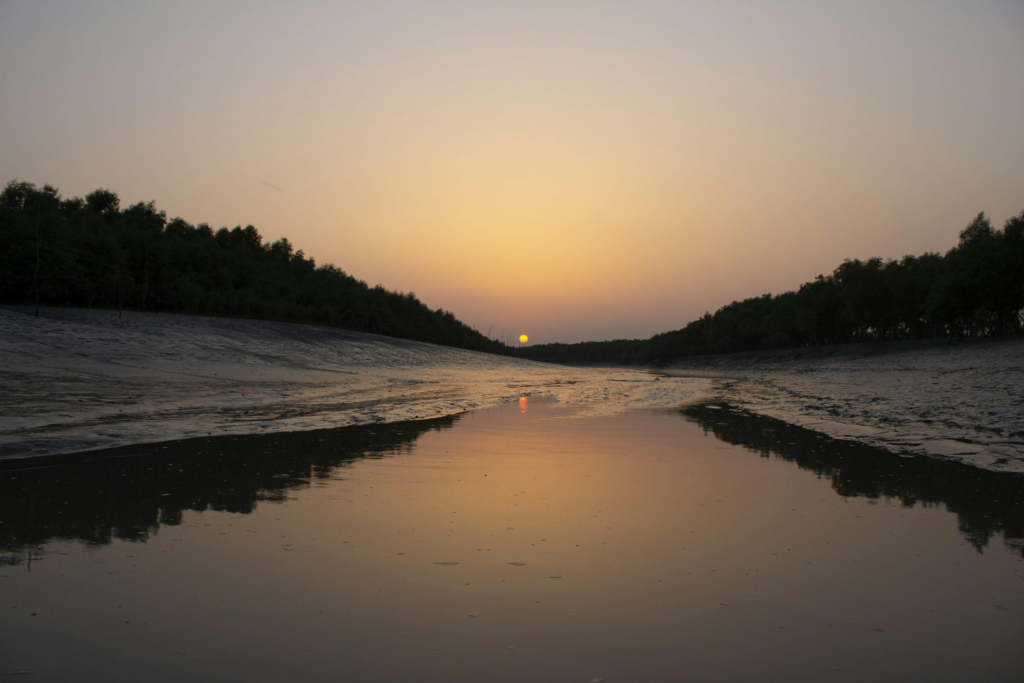
And its forest remains a living part of one of the world’s most important mangrove ecosystems.
To understand Dalhousie, therefore, is to understand something fundamental about the Indian Sundarbans: the landscape is not defined by where the land ends.
It is defined by the relationship between land and water.
And that relationship is never still.
Plan your private Sundarban expedition
A private journey shaped around you — your group, your pace, your interests. Book a free consultation.