 Encyclopedia
At first light, Ajmalmari rarely announces itself with dramatic scenery. The tide moves quietly through broad estuarine channels, muddy banks emerge for only a few hours before disappearing again, and the mangrove canopy seems almost uniform from a distance. Yet a closer observation reveals a landscape in constant motion. Salt-laden tides reshape creek margins twice each day. Pneumatophores—specialized breathing roots—rise from waterlogged mud like thousands of dark pencils, while fiddler crabs, mudskippers, and countless invertebrates begin their daily activity between the roots. This understated landscape is one of the least discussed yet ecologically significant forest blocks within the Indian Sundarbans.
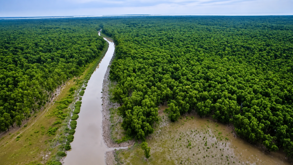
Ajmalmari is not an inhabited island in the conventional sense, nor is it a tourism destination defined by watchtowers or visitor infrastructure. Instead, it forms part of the western mangrove forests administered by the West Bengal Forest Department, where ecological processes operate with comparatively little direct human disturbance. Although it receives far less public attention than locations such as Sajnekhali, Dobanki or Netidhopani, Ajmalmari contributes to the integrity of the Sundarbans as a continuous tidal mangrove ecosystem supporting biodiversity, shoreline stability, carbon storage, and wildlife movement.
Within the administrative framework of the Indian Sundarbans, Ajmalmari is recognised as one of the seven forest blocks managed under the 24-Parganas (South) Forest Division. This distinguishes it from the fifteen forest blocks administered under the Sundarban Tiger Reserve’s Project Tiger Division. Together, these forest blocks form an interconnected network rather than isolated forests, linked by tidal rivers that transport sediments, nutrients, saline water, fish larvae and organic matter throughout the delta.
Ecologically, Ajmalmari also tells a story of resilience. Historical vegetation assessments describe parts of the forest block as degraded compared with some eastern sectors of the Sundarbans, with extensive stands of stunted mangroves dominated by Avicennia officinalis, Ceriops decandra and Phoenix paludosa. Even so, these forests continue to perform essential ecological functions, providing habitat, stabilising sediments and contributing to the recovery and persistence of the western mangrove landscape.
Ajmalmari at a Glance
Location: Western Indian Sundarbans, South 24 Parganas, West Bengal
Administrative Division: 24-Parganas (South) Forest Division
Landscape Type: Reserved Mangrove Forest Block
Ecosystem: Tidal Mangrove Forest
Protection Status: Protected Forest under the West Bengal Forest Department
UNESCO Context: Forms part of the larger Sundarbans Biosphere landscape
Dominant Habitat: Intertidal mangrove forest, tidal creeks and estuarine mudflats
Major Ecological Role: Mangrove conservation, wildlife habitat, sediment stabilisation and blue carbon storage
Public Access: Restricted; managed primarily for conservation and forest administration
Accessibility: Access is restricted. Ajmalmari is managed primarily for conservation and forest administration, and visitors generally view the forest from authorised waterways rather than entering its protected interior.
How to Reach Ajmalmari
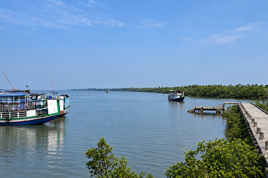
Ajmalmari lies within the western Indian Sundarbans and is accessible only through the region’s river network. There are no roads leading into the forest block itself, and visitors can observe the area only from authorised boats operating in the permitted waterways surrounding the protected forest.
From Kolkata to the Sundarbans
By Air
The nearest airport is Netaji Subhas Chandra Bose International Airport. From the airport, travel by road to one of the official embarkation points—most commonly Godkhali, Sonakhali, or Dhamakhali—before continuing by boat into the Sundarbans.
By Train
Take a suburban train from Sealdah South Railway Station to Canning Railway Station, a journey of about 1½ hours. From Canning, shared vehicles and local transport connect travellers to Godkhali Jetty or Sonakhali, where licensed boats operate into the Sundarbans’ waterways.
By Road
Travellers can drive or take buses from Kolkata to Godkhali, Sonakhali, Dhamakhali, Raidighi, or Najat. These river jetties serve as gateways to different parts of the Sundarbans, with Godkhali being the most commonly used boarding point for authorised boat journeys.
Reaching the Waters Around Ajmalmari
After boarding a licensed boat from Godkhali, Sonakhali, or another authorised jetty, navigation continues through the Sundarbans’ tidal rivers toward the western forest landscape. Ajmalmari is viewed from the surrounding waterways, particularly the Ajmalmari River and the Thakuran River, which define much of the forest block’s boundary. Nearby settlements such as Maipith serve as reference points along the western approach, but entry into the protected forest itself is not permitted without Forest Department authorisation.
Important Access Regulations
Before planning a visit, keep these official regulations in mind:
- Ajmalmari is a protected forest, not an open-access tourist site.
- Boat entry into protected areas is permitted only through registered boats operating under Forest Department regulations.
- Visitors must remain within authorised tourism waterways and designated zones.
- Entry into restricted forest interiors requires official permission from the West Bengal Forest Department.
Geographic Setting
Ajmalmari occupies the western sector of the Indian Sundarbans, where the immense Ganga–Brahmaputra–Meghna Delta gradually transitions into the Bay of Bengal. Like every forest block in the Sundarbans, its boundaries are defined not by roads or fences but by rivers, tidal creeks and constantly shifting estuarine channels.
Rather than existing as an isolated island, Ajmalmari functions as part of an intricate hydrological network linking neighbouring forest blocks, inhabited islands and estuarine waterways. Twice every day, astronomical tides flood and drain the forest floor, transporting sediments and nutrients that sustain mangrove growth across the landscape. The forest therefore behaves less like a static woodland and more like a living coastal system whose structure changes continuously with water movement.
Its position on the western side of the mangrove landscape also exposes it to strong tidal influences entering from the Bay of Bengal. Studies of estuarine hydrodynamics indicate that tidal energy propagates northward through the Ajmalmari River and associated channels, influencing erosion, sediment deposition and channel morphology across the surrounding forests.
Unlike the more tourism-oriented eastern sectors of the Indian Sundarbans, Ajmalmari remains primarily a conservation landscape where ecological integrity takes precedence over visitor infrastructure. This relative isolation has helped preserve large tracts of mangrove habitat despite natural disturbances and long-term environmental change.
Rivers Flowing Beside Ajmalmari
The surrounding waterways determine nearly every ecological process within Ajmalmari. Rather than serving merely as boundaries, these rivers deliver sediments, regulate salinity, influence forest composition and provide movement corridors for aquatic organisms.
The principal rivers associated with Ajmalmari include:
- Ajmalmari River
- Thakuran River
- Numerous unnamed tidal creeks connecting the forest interior
- Estuarine channels influenced by the Matla River system
Government boundary descriptions for the proposed West Sundarban Wildlife Sanctuary Eco-sensitive Zone identify both the Ajmalmari River and Thakuran River as defining waterways surrounding the forest block.
These rivers experience semi-diurnal tides, meaning water levels rise and fall approximately twice each day. During spring tides, large sections of the forest floor become inundated, while low tides expose broad mudflats rich in burrowing invertebrates that support fish, wading birds and crustaceans.
Nearby Forest Blocks
Ajmalmari forms part of a larger network of western Sundarban forest blocks.
Important neighbouring forest blocks include:
- Herobhanga
- Dulibhasani
- Chulkati
- Chandkhali
- Chamta
- Matla (farther east within the Project Tiger Division)
These neighbouring forests collectively create a nearly continuous mangrove habitat across western South 24 Parganas, allowing ecological processes and wildlife movements to occur across administrative boundaries rather than within isolated units.
Nearby Inhabited Islands and Human Settlements
Although Ajmalmari itself is a protected forest, several inhabited islands lie nearby along its northern and western margins.
Documented neighbouring settlements include:
- Maipith
- Nagenabad
- Sridharnagar
- Chandanpiri
- Purba Sripatinagar
- Rakhalpur
- Satyadaspur
- Sitarampur
These settlements illustrate the characteristic juxtaposition found throughout the Indian Sundarbans, where densely inhabited islands exist immediately adjacent to protected mangrove forests. For local communities, the surrounding rivers provide fisheries, transportation routes and livelihoods, while the mangrove forests help buffer storm surges and coastal erosion.
Landscape Character
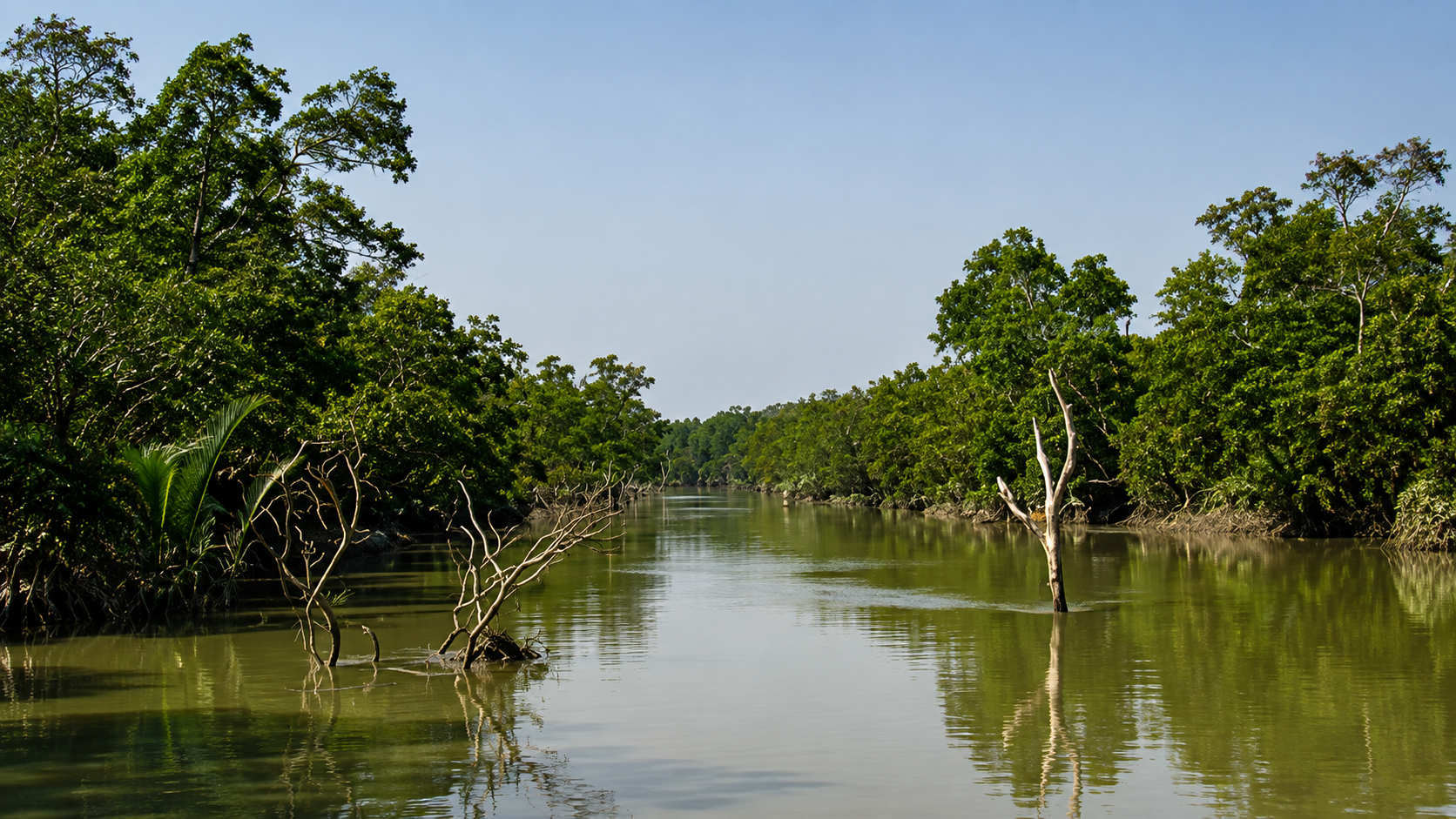
Standing on the edge of Ajmalmari at low tide, the landscape appears almost monochromatic. Fine grey-brown sediments stretch across exposed mudbanks, interrupted only by dense mangrove stands whose roots disappear beneath shallow tidal pools. There are no cliffs, hills or rocky shorelines. Instead, subtle differences in elevation—sometimes only a few centimetres—determine whether a patch of land remains submerged twice each day or supports mature mangrove trees.
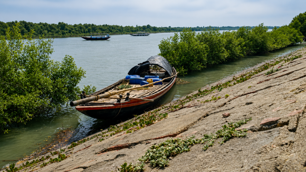
The terrain reflects thousands of years of delta formation. Sediments transported from the Himalayan river systems settle gradually within estuarine channels before being redistributed repeatedly by tidal currents. Every monsoon, every cyclone and every spring tide modifies the shape of creek banks and mudflats.
Vegetation follows these physical gradients closely. Slightly elevated levees support taller mangrove stands, while frequently inundated depressions often contain stunted vegetation, salt-tolerant shrubs or open mudflats colonised by pioneer species. Historical vegetation surveys describe extensive areas within Ajmalmari where Avicennia officinalis and Ceriops decandra dominate, accompanied by Phoenix paludosa in the understorey and scattered Heritiera fomes in the southern reaches.
One of the defining characteristics of Ajmalmari is its relative openness compared with denser eastern forest blocks. Remote-sensing analyses have identified higher levels of landscape fragmentation in the western Sundarbans, including Ajmalmari and neighbouring Dulibhasani, largely reflecting historical disturbance and proximity to inhabited areas. Even fragmented mangrove landscapes, however, continue to perform critical ecological functions by stabilising coastlines, supporting biodiversity and facilitating natural regeneration.
Geological Formation
Ajmalmari owes its existence to one of Earth’s youngest and most dynamic deltaic systems. The island forms part of the lower Ganga–Brahmaputra Delta, created through the long-term deposition of sediments transported from the Himalayas by the Ganges, Brahmaputra and Meghna river systems.
Unlike rocky islands formed through volcanic or tectonic processes, Ajmalmari is built almost entirely from unconsolidated alluvial sediments. Clay, silt and fine sand accumulate where tidal currents lose energy, gradually creating low-lying landforms that are subsequently colonised by salt-tolerant pioneer vegetation. Mangrove roots then trap additional sediments, accelerating land formation while simultaneously protecting the shoreline from erosion.
This geomorphological cycle never truly ends. Sediment deposition, tidal erosion, cyclones, sea-level fluctuations and changing river discharge continuously reshape the island. As a result, Ajmalmari should not be viewed as a fixed landmass but as an evolving component of a living delta.
Tidal Systems and Hydrology
No force shapes Ajmalmari more profoundly than the tide.
Approximately every twelve hours, seawater advances inland through interconnected rivers and creeks before retreating once again. These semi-diurnal tides regulate salinity, transport sediments, disperse nutrients and determine the distribution of virtually every plant and animal within the forest.
Hydrological studies from the central Indian Sundarbans demonstrate that tidal circulation strongly influences dissolved oxygen, nutrient dynamics and overall estuarine water quality. Meanwhile, geomorphological research highlights the importance of tidal energy moving through the Ajmalmari River in driving erosion and channel evolution across adjacent forest margins.
For mangrove trees, these daily floods represent neither disturbance nor stress—they are essential ecological processes. The forests have evolved specialised adaptations, including aerial roots and salt-management mechanisms, enabling them to survive where most terrestrial vegetation would quickly perish.
As the tide ebbs, the forest briefly reveals the hidden architecture beneath its canopy: an intricate maze of roots, burrows, tidal pools and sediment channels. Within a few hours, the incoming tide conceals the landscape again, reminding observers that in Ajmalmari, water is not merely a feature of the environment—it is the force that creates, sustains and continually transforms the forest.
The Living Mangrove Ecosystem
As the incoming tide begins to creep through Ajmalmari’s narrow creeks, the forest undergoes a remarkable transformation. Mudbanks disappear beneath silty estuarine water, fiddler crabs retreat into their burrows, and thousands of aerial roots gradually vanish below the rising tide. Within a few hours, what had appeared to be dry forest becomes a partially submerged ecosystem where land and sea merge into a single living landscape.
This daily transition defines the ecological identity of Ajmalmari. Unlike terrestrial forests, whose ecological processes are largely driven by rainfall and soil, mangrove ecosystems are governed by tidal inundation, salinity gradients, sediment deposition and the constant exchange of nutrients between rivers and the sea. Every plant, animal and microorganism inhabiting Ajmalmari has evolved to survive within this dynamic environment.
Although the western Sundarbans have experienced greater historical disturbance than some eastern forest blocks, Ajmalmari continues to support a functioning mangrove ecosystem that contributes to biodiversity conservation, shoreline stabilization, nutrient cycling and carbon sequestration. Research indicates that even forests with comparatively lower canopy density remain ecologically valuable because they sustain food webs, provide habitat connectivity and facilitate natural regeneration across the delta.
The Mangrove Forest Structure
At first glance, Ajmalmari’s vegetation appears uniform. However, the forest consists of several distinct ecological layers, each performing specialised functions.
Emergent Canopy
The tallest mangrove trees form an irregular canopy that intercepts sunlight, moderates temperature and reduces evaporation. Their extensive root systems stabilize sediments deposited by tidal currents while protecting creek banks from erosion.
Middle Layer
Beneath the canopy grows a mixture of medium-sized mangrove species adapted to varying salinity levels. This layer provides nesting habitat for birds, shelter for reptiles and important feeding areas for numerous insects.
Understory
Dense shrubs, juvenile mangroves and salt-tolerant palms occupy the lower vegetation layer. Their tangled growth creates refuge for juvenile fish during high tides and for small mammals and reptiles during low tide.
Forest Floor
The true engine of Ajmalmari lies beneath its vegetation. The muddy substrate supports billions of bacteria, fungi, worms, molluscs and crustaceans responsible for decomposing leaf litter and recycling nutrients throughout the ecosystem.
Twice each day, tidal waters redistribute these nutrients across the forest floor, making mangrove ecosystems among the world’s most productive coastal habitats.
Dominant Mangrove Flora
Ajmalmari belongs to the western mangrove belt of the Indian Sundarbans, where species composition reflects local salinity, sediment characteristics and tidal inundation patterns.
Historical vegetation surveys and ecological studies identify several characteristic mangrove species within Ajmalmari and adjacent western forest blocks.
Avicennia
Species of Avicennia are among the dominant trees within Ajmalmari.
These hardy mangroves tolerate relatively high salinity and frequently colonise newly deposited sediments. Their dense fields of pencil-like pneumatophores rise vertically from the mud, allowing underground roots to obtain oxygen even when submerged beneath tidal water.
These breathing roots also trap fine sediments, gradually raising the forest floor and encouraging further mangrove colonisation.
Ceriops decandra
One of the characteristic mangrove trees of western Sundarbans forests, Ceriops decandra occupies slightly elevated intertidal zones where inundation is less prolonged.
Its arching stilt-like roots reinforce unstable sediments while its elongated propagules enable successful reproduction within tidal environments. Rather than producing dormant seeds, the developing seedlings begin growing while still attached to the parent tree before eventually dropping into surrounding mud.
This reproductive strategy significantly improves establishment within constantly changing tidal habitats.
Sundari
The Sundari (Heritiera fomes) remains the iconic tree of the Sundarbans and gives the region its name.
Although Sundari populations are considerably more abundant in fresher eastern sectors of the delta, scattered individuals continue to occur within parts of Ajmalmari where local salinity conditions permit their survival.
The species has historically formed one of the most economically and ecologically significant timber trees of the delta, although increasing salinity and disease have affected its distribution over recent decades.
Phoenix paludosa
The dense thickets of Phoenix paludosa, a mangrove palm, are among the defining features of many western Sundarbans forests.
Growing as impenetrable clusters, these palms provide shelter for nesting birds, juvenile reptiles and numerous small mammals while helping stabilise creek margins against erosion.
Excoecaria agallocha
Commonly known as the Blind-your-eye Mangrove, this species occurs throughout many Sundarbans forest blocks.
Its latex can irritate skin and eyes, illustrating one of many remarkable chemical adaptations evolved by mangrove plants against herbivores.
Remarkable Adaptations of Mangrove Plants
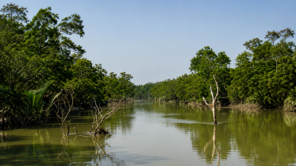
Few plant communities demonstrate evolutionary innovation as effectively as mangroves.
Breathing Roots
Because waterlogged mud contains very little oxygen, many mangrove species produce specialised aerial roots called pneumatophores that protrude above the sediment during low tide.
Tiny pores known as lenticels allow atmospheric oxygen to enter the underground root system.
Salt Management
Mangrove trees cannot simply absorb seawater like freshwater plants.
Different species employ different strategies:
- Excluding salt before water enters roots
- Excreting salt through specialised leaf glands
- Storing salt within older leaves that are eventually shed
These physiological mechanisms allow trees to survive where most terrestrial vegetation cannot.
Vivipary
Instead of producing dormant seeds, several mangrove species begin germinating while still attached to the parent tree.
Once mature, these elongated propagules fall into surrounding mud or float with tidal currents until they encounter suitable substrate.
This remarkable adaptation greatly improves seedling establishment within unstable coastal environments.
Mammals of Ajmalmari
Although sightings are uncommon, Ajmalmari forms part of the wider wildlife landscape supporting several mammal species characteristic of the Indian Sundarbans.
Royal Bengal Tiger (Panthera tigris tigris)
The Royal Bengal Tiger remains the ecological apex predator of the Sundarbans.
Ajmalmari contributes to the larger habitat network used by tigers moving through interconnected forest blocks. Rather than remaining confined within administrative boundaries, individual tigers traverse tidal rivers and mangrove channels while establishing territories based on prey availability and habitat quality.
Their ability to swim considerable distances distinguishes Sundarbans tigers from many other tiger populations across Asia.
Fishing Cat (Prionailurus viverrinus)
The Fishing Cat represents one of the most specialised wetland predators in South Asia.
Preferring tidal creeks, mudflats and mangrove margins, it feeds primarily on fish, crustaceans and amphibians.
Its partially webbed feet and exceptional hunting skills make it particularly well adapted to mangrove ecosystems.
Jungle Cat
The Jungle Cat occupies forest edges, grasslands and transitional habitats adjoining mangrove forests.
Although more elusive than the Fishing Cat, it contributes to controlling rodent populations throughout the landscape.
Small Indian Civet
Nocturnal by nature, the Small Indian Civet feeds opportunistically on fruits, insects, crustaceans, small vertebrates and carrion.
Its omnivorous diet helps recycle nutrients while dispersing seeds across forest habitats.
Smooth-coated Otter
Where fish populations remain abundant, Smooth-coated Otters patrol tidal creeks searching for prey.
Highly social and intelligent, these mammals serve as indicators of healthy aquatic ecosystems.
Birds of Ajmalmari
Morning in Ajmalmari begins with sound before movement.
The harsh calls of herons echo across exposed mudflats while kingfishers patrol creek margins searching for small fish trapped in receding tidal pools. Brahminy Kites circle overhead, taking advantage of warming air currents rising above the mangrove canopy.
Ajmalmari supports numerous resident and migratory bird species owing to its combination of mudflats, tidal creeks, mangrove forests and estuarine waters.
Representative bird groups include:
- Black-capped Kingfisher
- Brown-winged Kingfisher
- White-throated Kingfisher
- Collared Kingfisher
- Brahminy Kite
- White-bellied Sea Eagle
- Grey Heron
- Purple Heron
- Little Egret
- Great Egret
- Intermediate Egret
- Eurasian Curlew
- Common Redshank
- Whimbrel
- Sandpipers
- Cormorants
- Oriental Darter
Many migratory shorebirds arrive during winter, taking advantage of nutrient-rich mudflats exposed during low tide.
Reptiles and Amphibians
Ajmalmari’s intertidal environment supports several reptile species adapted to saline wetlands.
Among the most significant are:
- Saltwater Crocodile
- Water Monitor Lizard
- King Cobra
- Monocled Cobra
- Banded Krait
- Checkered Keelback
- Various geckos and skinks
The Saltwater Crocodile represents one of the ecosystem’s largest predators, occupying rivers, estuaries and tidal creeks where it feeds opportunistically on fish, birds and mammals.
Water Monitor Lizards frequently forage along exposed mudbanks during low tide, searching for crabs, molluscs, eggs and carrion.
Aquatic Biodiversity
Although hidden beneath opaque estuarine water, the aquatic ecosystem surrounding Ajmalmari supports extraordinary biological productivity.
The tidal rivers function as nurseries for numerous marine and estuarine fish species.
Common groups include:
- Mullets
- Catfish
- Gobies
- Mudskippers
- Threadfin fishes
- Barramundi
- Various prawns
- Mud crabs
- Horseshoe crabs (locally in parts of the Sundarbans)
- Oysters
- Clams
- Numerous planktonic organisms
These aquatic communities sustain higher predators including birds, reptiles, otters and tigers while supporting fisheries in surrounding inhabited islands.
The Hidden Engineers of the Mangrove
The smallest inhabitants often perform the greatest ecological work.
- Fiddler crabs constantly excavate burrows that improve sediment aeration.
- Mudskippers graze on algae growing across exposed mud surfaces.
- Marine worms recycle organic matter.
- Microbial communities decompose millions of fallen mangrove leaves annually, releasing nutrients back into the ecosystem.
Without these largely unseen organisms, the productivity of Ajmalmari’s mangrove forest would rapidly decline.
Ecological Interactions
Ajmalmari functions not as a collection of independent species but as a tightly connected ecological network.
- Mangrove trees trap sediments.
- Leaf litter feeds microorganisms.
- Microorganisms nourish crabs.
- Crabs become prey for birds.
- Fish feed on aquatic invertebrates.
- Fishing Cats hunt fish.
- Tigers prey upon herbivores moving through the forest.
Every tidal cycle reconnects these relationships by transporting nutrients across rivers, creeks and mudflats.
Rather than acting as isolated habitats, Ajmalmari’s forests, waterways and sediments operate together as one integrated ecosystem whose stability depends on the health of every component.
Ecological Importance
Ajmalmari is far more than a protected patch of mangrove forest. It functions as an integral component of the ecological infrastructure that enables the Indian Sundarbans to operate as a connected landscape.
Unlike terrestrial forests, where ecological processes often remain confined within forest boundaries, mangrove ecosystems depend upon the continuous exchange of water, sediments, nutrients and organisms through tidal rivers.
- Every high tide brings suspended sediments, microscopic plankton and dissolved nutrients into Ajmalmari’s creeks.
- Every ebb tide redistributes organic matter back into the estuary, supporting food webs that extend well beyond the forest itself.
Because of this tidal connectivity, the ecological value of Ajmalmari cannot be measured solely by its tree cover. Its significance lies equally in the rivers flowing around it, the mudflats exposed twice daily, the submerged creek systems and the countless organisms that move between land and water with each tidal cycle.
A Critical Link Within the Western Sundarbans
The Indian Sundarbans consist of numerous forest blocks separated by tidal rivers but functioning as one ecological landscape.
Ajmalmari contributes to this connectivity in several important ways.
Wildlife Movement
Large mammals, particularly the Royal Bengal Tiger (Panthera tigris tigris), do not recognise administrative boundaries.
The tidal rivers surrounding Ajmalmari are regularly crossed by swimming tigers moving between adjacent forest blocks in search of prey, mates or new territories. Such landscape connectivity helps maintain genetic diversity across the wider tiger population.
Similarly, Fishing Cats, otters, monitor lizards and numerous bird species utilise multiple forest blocks throughout their life cycles.
Fish Nursery Habitat
Many commercially important estuarine fish begin life within sheltered mangrove creeks.
The intricate network of submerged roots provides protection from predators while abundant plankton and organic matter supply food for juvenile fish.
As these fish mature, they disperse into larger estuaries and eventually the Bay of Bengal, supporting both marine ecosystems and coastal fisheries.
In this way, Ajmalmari contributes directly to the productivity of fisheries far beyond its own boundaries.
Carbon Storage
Mangrove forests are among the planet’s most efficient natural carbon sinks.
Unlike most terrestrial forests, mangroves store significant quantities of carbon not only within their trunks and branches but also beneath the soil.
The waterlogged sediments of Ajmalmari accumulate partially decomposed organic matter over centuries, locking away what scientists describe as blue carbon.
Protecting mangrove forests therefore contributes not only to biodiversity conservation but also to global climate-change mitigation.
Coastal Protection
Every cyclone demonstrates another ecological service provided by Ajmalmari.
Dense mangrove vegetation reduces wave energy before storm surges reach inhabited islands.
Root systems bind unconsolidated sediments together, slowing erosion while encouraging further sediment deposition.
Although mangroves cannot eliminate cyclone impacts, they significantly reduce shoreline erosion and help stabilize vulnerable sections of the delta.
Nutrient Cycling: The Hidden Engine
The remarkable productivity of Ajmalmari depends upon an ecological process rarely noticed by visitors.
Each year, millions of mangrove leaves fall onto the forest floor.
Rather than becoming waste, this leaf litter forms the foundation of an intricate decomposition system.
- Bacteria and fungi begin breaking down organic matter almost immediately.
- Small crustaceans feed upon partially decomposed material.
- Worms recycle nutrients within the sediment.
- Tidal waters transport dissolved organic matter into adjacent creeks.
- Plankton utilise these nutrients.
- Fish consume plankton.
- Birds, reptiles and mammals feed upon the fish.
This continuous recycling transforms fallen leaves into the energy supporting one of India’s richest coastal food webs.
Ajmalmari and Biodiversity Conservation

Although famous primarily for tigers, the Sundarbans support extraordinary biological diversity across multiple taxonomic groups.
Ajmalmari contributes to conserving this biodiversity by protecting habitat for:
- Mangrove tree communities
- Salt-tolerant shrubs
- Estuarine fish
- Crustaceans
- Molluscs
- Amphibians
- Reptiles
- Resident birds
- Migratory shorebirds
- Mammals
- Microbial communities essential for nutrient cycling
Importantly, many ecological interactions remain poorly studied.
Scientists continue investigating how salinity, sea-level rise and changing river discharge influence species distributions across different forest blocks, including those in the western Sundarbans.
This scientific uncertainty highlights the continuing importance of long-term ecological monitoring.
Geological History
Ajmalmari’s history began long before humans entered the Sundarbans.
The island emerged gradually through the accumulation of sediments carried from the Himalayas by the Ganges, Brahmaputra and Meghna river systems.
Over thousands of years, enormous volumes of silt settled within the lower delta.
Tidal currents redistributed these sediments repeatedly, creating low-lying mudflats.
Salt-tolerant pioneer plants colonised newly deposited ground.
Their roots trapped additional sediments.
Mangrove forests gradually expanded.
The result is the dynamic delta landscape visible today.
Unlike ancient geological formations, however, Ajmalmari remains geologically young.
Its boundaries continue changing under the influence of tides, river currents, cyclones and sediment transport.
In ecological terms, the island is still evolving.
Human Relationship with Ajmalmari
Although Ajmalmari itself remains a protected forest, surrounding communities have interacted with its rivers and resources for generations.
Historically, people living on neighbouring inhabited islands depended upon surrounding waterways for:
- Fishing
- Crab collection
- Traditional navigation
- Small-scale transport
- Honey collection in designated forest areas
- Collection of non-timber forest products under regulated conditions
This relationship has always required careful balance.
Mangrove forests support local livelihoods while simultaneously protecting villages from coastal hazards.
Overexploitation, however, can threaten both biodiversity and long-term community resilience.
Consequently, modern conservation increasingly recognises the importance of combining ecological protection with sustainable livelihood opportunities.
Climate of Ajmalmari
Ajmalmari experiences a humid tropical coastal climate strongly influenced by the Bay of Bengal.
Three broad seasons shape ecological conditions throughout the year.
Summer (March–June)
See it for yourself
A private journey shaped around you — your group, your pace, your interests. Book a free consultation.
- Temperatures frequently exceed 35°C.
- Evaporation increases salinity within shallow creeks.
- Many mangrove species experience physiological stress during prolonged dry periods.
- Thunderstorms occasionally provide temporary freshwater inputs.
Monsoon (June–September)
- Southwest monsoon rainfall transforms the landscape.
- Freshwater inflow reduces salinity.
- River discharge increases dramatically.
- Sediment transport reaches annual maxima.
- Mangrove growth accelerates under abundant moisture.
- Numerous fish species begin breeding during this period.
Winter (November–February)
Winter brings cooler temperatures and relatively stable weather.
- Migratory birds arrive from Central Asia and northern Eurasia.
- Visibility improves.
Lower humidity creates favourable conditions for ecological surveys and wildlife observation.
Cyclones: A Natural Force
Few ecosystems experience tropical cyclones as frequently as the northern Bay of Bengal.
Ajmalmari has undoubtedly been influenced by numerous severe storms over centuries.
- Strong winds defoliate mangrove canopies.
- Storm surges inundate forest interiors.
- Creek banks erode.
- Large trees occasionally fall.
- Yet these disturbances also initiate ecological renewal.
- New sediments create opportunities for mangrove colonisation.
- Canopy openings allow sunlight to reach seedlings.
- Organic debris enriches forest soils.
Mangrove ecosystems have evolved alongside cyclones and possess remarkable capacity for recovery when allowed to regenerate naturally.
Conservation Challenges
Despite legal protection, Ajmalmari faces several long-term environmental pressures.
Sea-Level Rise
Global sea-level rise threatens low-lying mangrove forests through increased inundation and shoreline erosion.
Even relatively small increases in water level may alter species composition across tidal landscapes.
Increasing Salinity
Changes in freshwater inflow from upstream river systems influence salinity throughout the western Sundarbans.
Higher salinity favours some mangrove species while reducing the competitiveness of others, particularly the Sundari tree.
Coastal Erosion
Tidal currents continuously reshape riverbanks.
Where erosion exceeds sediment deposition, sections of mangrove forest may gradually disappear.
Climate Change
Changing rainfall patterns, rising temperatures and more intense tropical cyclones introduce additional uncertainty into the future dynamics of the Sundarbans.
Long-term ecological monitoring remains essential for understanding these cumulative impacts.
Forest Management
Ajmalmari is managed by the West Bengal Forest Department as part of the protected forest network within the Indian Sundarbans.
Management priorities include:
- Habitat protection
- Prevention of illegal resource extraction
- Wildlife monitoring
- Mangrove restoration where necessary
- Fire prevention
- Boundary surveillance
- Biodiversity conservation
- Support for scientific research
These management activities contribute to maintaining ecological integrity while balancing conservation with the needs of neighbouring communities.
Scientific Importance
Ajmalmari functions as a natural laboratory for studying coastal ecology.
Researchers investigate topics including:
- Mangrove succession
- Sediment dynamics
- Salinity gradients
- Blue carbon storage
- Estuarine fisheries
- Tiger ecology
- Bird migration
- Climate adaptation
- Coastal resilience
- Remote sensing of mangrove cover
Because the Sundarbans represent one of the world’s largest continuous mangrove ecosystems, findings from Ajmalmari often contribute to broader understanding of tropical coastal environments globally.
Looking Ahead
Ajmalmari demonstrates that conservation is not simply about protecting charismatic wildlife. It is about preserving an intricate network of rivers, sediments, mangroves, microorganisms and ecological relationships that have evolved together over thousands of years.
The forest’s future will depend upon continued scientific research, adaptive management, landscape-scale conservation and the resilience of both nature and the communities living alongside it.
Can Visitors Explore Ajmalmari?
Unlike Sajnekhali, Sudhanyakhali, Dobanki or Netidhopani, Ajmalmari is not a conventional tourism destination.
There are:
- No permanent tourism facilities
- No interpretation centre
- No public watchtower
- No designated nature trail
- No accommodation within the forest
The area is managed primarily for forest protection, biodiversity conservation and ecological management.
Most visitors who pass through adjacent waterways encounter Ajmalmari only from a licensed vessel navigating nearby tidal rivers. Access into protected forest areas is governed by regulations issued by the West Bengal Forest Department, and entry may be restricted depending on conservation requirements, research activities and forest management priorities.
For responsible travellers, the greatest experience often comes not from entering the forest itself but from quietly observing its changing landscape from authorised waterways while respecting wildlife and protected-area regulations.
Responsible Nature Exploration
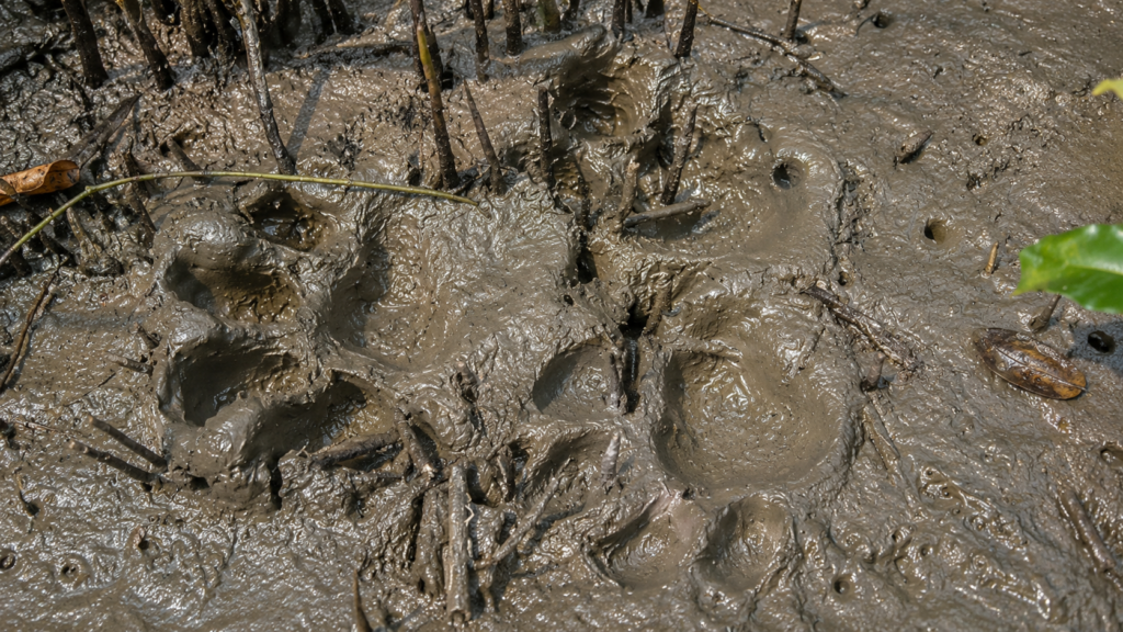
The Wild Orbit advocates exploration founded on respect rather than intrusion. Protected mangrove forests such as Ajmalmari should be approached as living ecosystems rather than recreational spaces.
If travelling through surrounding waterways, responsible behaviour includes:
- Following all Forest Department regulations.
- Remaining within authorised navigation routes.
- Avoiding loud music or unnecessary noise.
- Never attempting to attract or disturb wildlife.
- Maintaining a safe distance from all animals.
- Never feeding birds, mammals or reptiles.
- Avoiding litter and single-use plastics.
- Supporting licensed local guides and boat operators.
- Respecting seasonal restrictions imposed for conservation.
In landscapes governed by tides and wildlife, patience often reveals more than movement. Quiet observation is the essence of documentary exploration.
Why Ajmalmari Matters
Many protected forests become famous because they are easily accessible. Ajmalmari demonstrates that ecological importance is not determined by visitor numbers.
Its significance lies in several interconnected functions:
1. Habitat Connectivity
Ajmalmari forms part of a continuous network of mangrove forests that allows wildlife—including tigers, Fishing Cats, otters and birds—to move across the western Sundarbans.
2. Coastal Protection
Dense mangrove vegetation reduces wave energy, stabilises shorelines and helps protect neighbouring inhabited islands from erosion and storm surges.
3. Blue Carbon Storage
Mangrove sediments accumulate organic carbon over centuries, making Ajmalmari an important contributor to natural climate regulation.
4. Fisheries Support
The forest’s creeks serve as nursery habitats for numerous estuarine fish and crustacean species that later support coastal fisheries throughout the delta.
5. Biodiversity Conservation
From microscopic decomposers to apex predators, Ajmalmari supports multiple levels of biological diversity that together sustain ecological resilience.
Future Conservation Priorities
Protecting Ajmalmari requires a landscape-scale approach extending well beyond the forest block itself.
Important priorities include:
Strengthening Mangrove Restoration
Natural regeneration should be supported wherever degraded creek margins and eroding shorelines require ecological recovery.
Maintaining Hydrological Connectivity
Healthy tidal exchange remains essential for nutrient transport, sediment deposition and fish migration.
River systems surrounding Ajmalmari should therefore remain free from activities that significantly disrupt natural water movement.
Long-Term Ecological Monitoring
Climate change introduces increasing uncertainty regarding:
- Sea-level rise
- Salinity changes
- Sediment dynamics
- Mangrove species composition
- Wildlife distribution
Continuous scientific monitoring enables adaptive conservation planning.
Community Participation
Neighbouring communities have long depended upon the Sundarbans for livelihoods.
Successful conservation increasingly recognises that protecting forests and supporting sustainable local livelihoods are complementary rather than competing objectives.
Climate Adaptation
Mangrove conservation represents one of the most effective nature-based solutions for increasing resilience against cyclones, coastal erosion and changing climatic conditions.
Protecting Ajmalmari contributes directly to the long-term resilience of the western Indian Sundarbans.
The Wild Orbit’s Interesting Facts About Ajmalmari
- Ajmalmari forms part of the western mangrove forests of the Indian Sundarbans rather than the core tourism circuit.
- It is administered under the 24-Parganas (South) Forest Division, distinguishing it from the forest blocks managed by the Sundarban Tiger Reserve.
- The forest experiences semi-diurnal tides, flooding and draining approximately twice every day.
- Mangrove trees survive here using specialised aerial roots that obtain oxygen from the atmosphere rather than waterlogged soil.
- Fallen mangrove leaves become the foundation of one of the world’s most productive estuarine food webs.
- Ajmalmari contributes to blue carbon storage, helping remove atmospheric carbon dioxide through long-term sediment accumulation.
- The surrounding waterways serve as nursery grounds for many commercially important fish species.
- Tigers inhabiting the Sundarbans are accomplished swimmers capable of crossing wide tidal rivers separating forest blocks.
- Every cyclone reshapes portions of the forest through erosion, sediment deposition and natural regeneration.
- Although relatively little known among tourists, Ajmalmari remains an important component of one of the world’s largest continuous mangrove ecosystems.
FAQs
Where is Ajmalmari located?
Ajmalmari is situated within the western Indian Sundarbans in South 24 Parganas district of West Bengal, where it forms part of the protected mangrove forest landscape.
Is Ajmalmari inhabited?
No.
Ajmalmari itself is a protected forest block. Human settlements occur on neighbouring inhabited islands outside the forest.
Can tourists visit Ajmalmari?
General tourism infrastructure is absent. Access is regulated by the West Bengal Forest Department, and visitors usually observe the area from authorised waterways rather than entering the forest.
Why is Ajmalmari important?
Its mangrove forests provide wildlife habitat, support fisheries, stabilise sediments, store carbon and contribute to the ecological connectivity of the western Sundarbans.
Which animals live in Ajmalmari?
Representative wildlife includes the Royal Bengal Tiger, Fishing Cat, Smooth-coated Otter, Water Monitor, Saltwater Crocodile, numerous kingfishers, herons, egrets, raptors and diverse estuarine fish.
Why do mangrove trees have breathing roots?
Waterlogged mangrove soils contain very little oxygen.
Specialised aerial roots called pneumatophores extend above the mud during low tide, allowing trees to absorb atmospheric oxygen.
Does Ajmalmari help protect nearby villages?
Yes.
Its mangrove vegetation helps reduce shoreline erosion and weakens storm surges, contributing to coastal resilience across neighbouring inhabited islands.
What is blue carbon?
Blue carbon refers to carbon captured and stored by coastal ecosystems such as mangrove forests, salt marshes and seagrass meadows.
Mangrove sediments can retain this carbon for centuries.
Is Ajmalmari affected by climate change?
Like the wider Sundarbans, Ajmalmari faces long-term pressures from sea-level rise, increasing salinity, coastal erosion and changing cyclone patterns.
Why is Ajmalmari less famous than other Sundarbans locations?
Unlike destinations developed for wildlife tourism, Ajmalmari functions primarily as a conservation landscape with limited public access, making it less visible despite its ecological significance.
In the Rhythm of the Mangroves
As the final tide of the day slips quietly through Ajmalmari’s winding creeks, the forest returns to the appearance with which it began—calm, understated and seemingly unchanged. Yet beneath that tranquil surface, millions of ecological interactions continue uninterrupted.
- Mangrove roots anchor fresh sediments.
- Crabs recycle fallen leaves.
- Juvenile fish shelter among submerged roots.
- Birds follow the retreating tide across exposed mudflats.
Somewhere within the forest, a tiger may cross a tidal channel that has connected these mangroves for centuries.
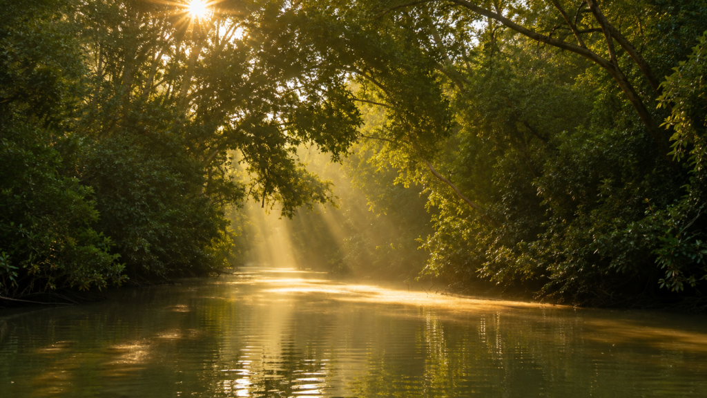
Ajmalmari is a reminder that the greatest ecological landscapes are not always the most celebrated. Its importance lies not in monuments or visitor facilities but in the quiet persistence of natural processes that sustain the wider Sundarbans. Every tidal exchange, every regenerating mangrove and every surviving wildlife corridor reinforces the resilience of this extraordinary delta.
To understand Ajmalmari is to appreciate that conservation is not merely about protecting a single forest block. It is about safeguarding the interconnected rivers, sediments, wildlife and mangroves that together form one of the planet’s most remarkable coastal ecosystems.
In a rapidly changing world, places like Ajmalmari demonstrate that resilience begins with healthy ecosystems. The continued protection of this western mangrove frontier is therefore not only a regional conservation priority but also part of a global effort to preserve biodiversity, strengthen climate resilience and deepen our understanding of the living landscapes of the Indian Sundarbans.
Plan your private Sundarban expedition
A private journey shaped around you — your group, your pace, your interests. Book a free consultation.