 Encyclopedia
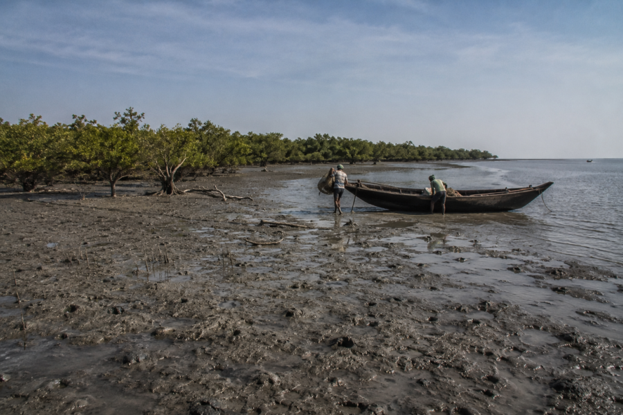
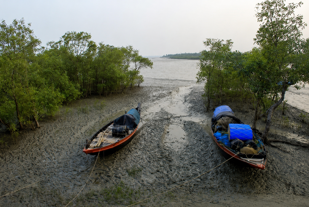
As the tide begins to fall across the southern edge of the Indian Sundarbans, wide mudflats slowly emerge from beneath opaque brown estuarine water. Thousands of breathing roots puncture the exposed sediment like miniature forests beneath the forest itself. Creeks that appeared broad and navigable only hours earlier narrow into winding channels bordered by dense mangroves. In this constantly changing landscape lies Bhangaduni, one of the least understood yet ecologically significant forest islands within the Indian Sundarbans.
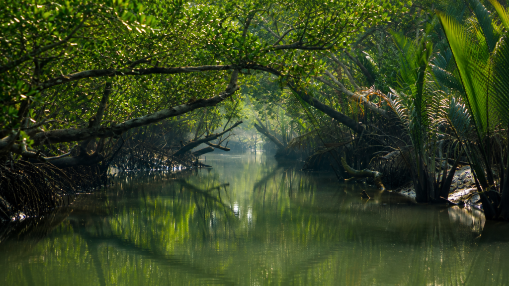
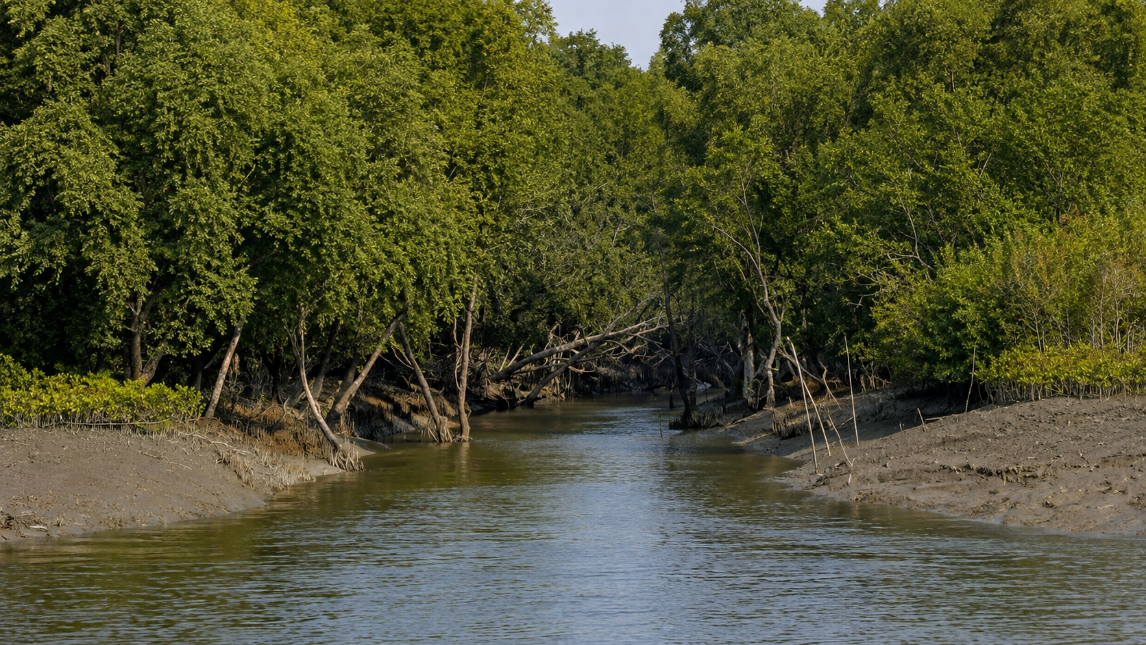
Unlike the inhabited islands of the northern delta, Bhangaduni remains entirely within the protected forest landscape. Its isolation, tidal creeks, extensive mangrove cover and proximity to the Bay of Bengal have allowed natural ecological processes to continue with comparatively little direct human modification. The island forms part of the southern wilderness where river, forest and sea merge into one of Earth’s most dynamic coastal ecosystems.
Bhangaduni is more than a single island. It represents a living example of how the Ganges–Brahmaputra–Meghna Delta continues to evolve through sediment deposition, tidal erosion and mangrove succession. Every creek, mudbank and mangrove stand reflects thousands of years of interaction between freshwater carried from the Himalayas and saline water pushed inland by the Bay of Bengal. These forces continually reshape the island’s shoreline, alter tidal channels and influence the distribution of vegetation and wildlife.
Located between Dalhousie Island and Mechua Island near the southern sector of the Indian Sundarbans, Bhangaduni covers approximately 34.5 square kilometres and is recognised as a protected marine and forest landscape within the Sundarbans ecosystem.
Although visitors occasionally pass nearby during authorised forest expeditions, relatively little public information exists about the island itself. This absence of widespread documentation makes Bhangaduni an important subject for understanding the geography, ecology and natural functioning of the Indian Sundarbans beyond its more familiar destinations.
Bhangaduni at a Glance
Name: Bhangaduni Island
Location: Southern Indian Sundarbans, West Bengal
Island Type: Continental deltaic island
Approximate Area: 34.5 km²
Protection Status: Protected forest and Marine Protected Area
Administrative Region: South 24 Parganas, West Bengal
Ecosystem: Intertidal mangrove forest
Landscape: Tidal creeks, mudflats, mangrove forest and estuarine shoreline
Human Settlement: None
Primary Ecological Role: Mangrove habitat, estuarine biodiversity and coastal protection.
Accessibility: No public road access; the island is reachable only by boat through authorised forest routes with permission from the West Bengal Forest Department.
How to Reach Bhangaduni
Reaching Bhangaduni Island is unlike visiting the popular watchtowers of the Sundarbans. The island has no roads, jetties for tourists, or public ferry services, and it lies within the protected southern forest landscape of the Indian Sundarbans. The only practical way to approach the island is by authorised registered boats operating under the West Bengal Forest Department’s regulations, and landing on the island is generally not permitted for visitors.
Step 1: Reach Kolkata
Kolkata is the nearest major gateway to the Sundarbans.
By Air: Netaji Subhas Chandra Bose International Airport is approximately 110 km from the Sundarbans embarkation points.
By Rail: Sealdah Railway Station is the main departure point for local trains heading toward the Sundarbans.
Step 2: Travel to the Boat Boarding Point
The most reliable access route is via Godkhali Jetty, the principal gateway for authorised Sundarbans boat safaris.
By Train: Take a local EMU train from Sealdah to Canning (about 1.5 hours), then continue by shared vehicle or taxi to Godkhali Jetty.
By Road: Private cars, taxis and buses can travel directly from Kolkata to Godkhali, Sonakhali or Dhamakhali, all recognised embarkation points for registered boats entering the Sundarbans.
Step 3: Enter the Protected Forest by Boat
From Godkhali or Dhamakhali, visitors must board a registered boat with an authorised ecotourism guide, as required by the Sundarbans Tiger Reserve authorities. Entry into the reserve is permitted only through licensed boats operating on approved routes.
Reaching the Bhangaduni Sector
Bhangaduni lies in the remote southern sector of the Sundarbans near the Bay of Bengal, beyond the regular tourism circuit of Sajnekhali, Sudhanyakhali and Dobanki. Access to its surrounding waterways is generally possible only on long-range authorised forest cruises, research expeditions or special itineraries operated with Forest Department approval. Boats typically observe the island from the surrounding tidal channels rather than allowing visitors to disembark.
Entry Regulations
- Travel only on registered boats approved by the Sundarban Tiger Reserve.
- Follow all instructions of the authorised ecotourism guide.
- Do not attempt to land on Bhangaduni without explicit Forest Department permission.
- Movement outside designated tourist waterways and entry into protected core forest areas are prohibited.
Geographic Setting
Bhangaduni occupies the southern reaches of the Indian Sundarbans where the immense delta gradually dissolves into the Bay of Bengal. This region marks the transition between terrestrial forest and shallow coastal waters, creating an environment dominated by tides rather than rivers alone.
Unlike inland forest compartments where freshwater influence remains relatively stronger during the monsoon, Bhangaduni experiences substantial marine influence throughout the year. Twice every day the advancing tide transports saline water deep into its creek network before retreating again, exposing fresh layers of nutrient-rich sediment.
The island lies between Dalhousie Island and Mechua Island, positioned within an extensive network of tidal waterways that connect the interior mangrove forests with the open sea. Rather than existing as an isolated landmass, Bhangaduni functions as one component of a continuously changing estuarine landscape in which land and water remain inseparable.
Its geographical importance extends beyond its boundaries. Situated close to the southern coastline, the island forms part of the natural buffer protecting the interior Sundarbans from direct marine forces, while simultaneously supporting sediment deposition and mangrove regeneration.
Rivers Flowing Beside Bhangaduni
The hydrological setting of Bhangaduni is defined by a network of tidal rivers and estuarine channels rather than a single freshwater river. The surrounding waterways connect the island to the broader Sundarbans estuarine system.
Major surrounding water bodies include:
- Thakuran River estuarine system
- Western tidal channels connecting toward Dalhousie sector
- Eastern tidal creeks leading toward Mechua sector
- Southern estuarine waters opening toward the Bay of Bengal
Because many channels naturally migrate over time through erosion and sediment deposition, the precise configuration of creeks may change over decades, a characteristic feature of the active Sundarbans delta.
Nearby Forest Blocks
Bhangaduni is surrounded entirely by protected mangrove forests forming part of the larger Sundarbans Tiger Reserve landscape.
Nearby protected forest areas include:
- Dalhousie Forest sector
- Mechua Forest sector
- Southern coastal mangrove forests
- Tiger Reserve core landscape
Together, these forest blocks create a continuous habitat supporting ecological connectivity across the southern Sundarbans.
Nearby Islands and Human Settlements
Forest Islands
- Dalhousie Island
- Mechua Island
- Adjacent unnamed mangrove islands
- Southern tidal sandbars
Human Settlements
There are no permanent human settlements on Bhangaduni itself. The nearest inhabited regions occur considerably farther north within the inhabited islands of the Indian Sundarbans. Access to Bhangaduni is generally limited to authorised forest personnel, researchers and permitted vessels operating under the regulations of the West Bengal Forest Department.
Geological Evolution of Bhangaduni
The story of Bhangaduni began long before the island itself existed.
For thousands of years, the Ganges, Brahmaputra and Meghna river systems have transported enormous quantities of sediment from the Himalayas toward the Bay of Bengal. Each monsoon delivers fresh loads of sand, silt and clay that gradually accumulate across the delta.
As tidal currents redistribute these sediments, submerged shoals slowly rise above average tidal levels. Once exposed frequently enough, salt-tolerant pioneer mangrove species establish themselves on these unstable mudbanks. Their roots trap additional sediment, accelerating land formation.
Through repeated cycles of deposition and vegetation growth, temporary mudflats gradually develop into stable mangrove islands.
Bhangaduni represents one such mature deltaic island, yet its formation remains an ongoing process rather than a completed geological event. Even today, its shorelines continue to advance in some locations while retreating in others, illustrating the remarkable dynamism of the Sundarbans landscape.
Delta Formation and Sedimentation
The Indian Sundarbans constitute the western portion of the world’s largest active delta. Unlike mountainous landscapes shaped primarily by tectonic uplift, this environment is created through the continuous balance between sediment deposition and coastal erosion.
Several interacting processes govern the evolution of Bhangaduni:
- River-borne sediment transported from upstream catchments
- Daily tidal flooding
- Cyclonic storm surges
- Coastal wave action
- Mangrove root stabilisation
- Natural channel migration
Mangroves perform a critical engineering role in this system. Their complex root structures reduce current velocity, allowing suspended particles to settle. Over time, these deposits raise the elevation of intertidal surfaces sufficiently to support additional vegetation.
This natural partnership between sediment and mangroves has enabled islands such as Bhangaduni to persist despite continual exposure to strong tidal forces. However, the same processes that build land can also remove it. Shoreline erosion remains a normal characteristic of active deltaic environments, particularly following severe cyclones or shifts in tidal channels.
Landscape Character
The first impression of Bhangaduni is not of towering forest but of subtle complexity.
At high tide, much of the lower shoreline disappears beneath brown estuarine water, leaving only dense mangrove canopies visible above the flooded roots. As water retreats, expansive mudflats emerge together with countless pneumatophores—specialised aerial roots that enable mangrove trees to breathe in oxygen-poor soils.
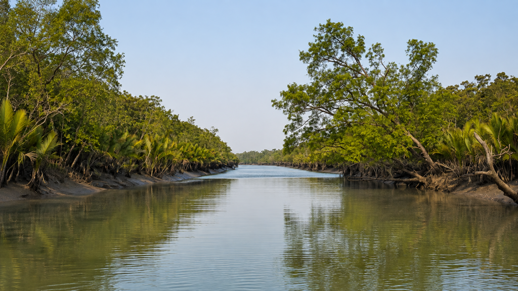
The terrain remains almost completely flat. Elevation differences of only a few centimetres determine whether an area floods daily, seasonally or only during exceptional tides. These slight variations strongly influence vegetation patterns across the island.
Near the shoreline, salt-tolerant pioneer species dominate recently deposited sediments. Farther inland, more established mangrove communities occupy comparatively stable ground where organic matter has accumulated over many years.
The result is a landscape that changes dramatically over the course of a single tidal cycle without any alteration in weather.
Tidal Dynamics
Life on Bhangaduni is governed by tides rather than clocks.
Semi-diurnal tides typically inundate much of the island’s lower margins twice each day, transporting nutrients, larvae, plankton and suspended sediment throughout the creek system. During spring tides associated with new and full moons, floodwaters extend farther inland than during neap tides.
These regular inundation cycles determine nearly every ecological process on the island.
Mangrove seed dispersal depends on tidal currents carrying floating propagules to suitable locations. Fish migrate into flooded forests to feed during high tide before retreating with falling water. Nutrient exchange occurs as organic material moves between forest floor, creeks and estuary.
Rather than separating land from water, tides integrate both into one functioning ecological system. This continual exchange is one of the defining characteristics of the Sundarbans and underpins the productivity of islands such as Bhangaduni.
Rivers and Water Systems
The waterways surrounding Bhangaduni are estuarine in nature, meaning they contain varying mixtures of freshwater and seawater depending on season, tidal stage and river discharge.
During the southwest monsoon, increased river flow slightly reduces salinity across parts of the delta. In the dry season, marine influence becomes stronger as freshwater discharge declines.
The creek network performs several ecological functions:
- transporting nutrients;
- redistributing sediment;
- supporting aquatic biodiversity;
- regulating salinity;
- facilitating tidal exchange; and
- maintaining connectivity between mangrove habitats.
Because the channels remain naturally mobile, their width, depth and navigability evolve over time through erosion and deposition.
Mangrove Ecosystem
Bhangaduni supports one of the world’s most specialised forest ecosystems.
Mangroves thrive under conditions that would prove hostile to most terrestrial plants: saline water, unstable sediment, tidal flooding and oxygen-deficient soils. Their survival depends upon remarkable structural and physiological adaptations developed over millions of years.
The forest contributes directly to:
- shoreline stabilisation;
- carbon storage;
- sediment retention;
- nursery habitat for fish and crustaceans;
- nutrient cycling; and
- protection against coastal erosion.
Collectively, these ecological services extend well beyond the island itself, benefiting the wider Sundarbans Biosphere Reserve and adjacent coastal waters.
Dominant Mangrove Species
Although species composition varies with salinity and elevation, Bhangaduni supports characteristic Sundarbans mangrove communities that include:
- Sundari (Heritiera fomes)
- Gewa (Excoecaria agallocha)
- Goran (Ceriops decandra)
- Keora (Sonneratia apetala)
- Avicennia species
- Dhundul (Xylocarpus granatum)
- Passur (Xylocarpus mekongensis)
These species occupy different ecological niches depending on tidal inundation frequency, soil salinity and sediment stability. Their combined presence increases habitat diversity while enhancing the resilience of the mangrove ecosystem.
Soil, Salinity and Hydrology
The substrate beneath Bhangaduni consists primarily of fine alluvial clay, silt and organic-rich estuarine sediments deposited through successive tidal cycles.
Salinity fluctuates seasonally. Monsoon rainfall dilutes surface waters, while the dry season increases marine influence throughout the estuary. These fluctuations influence seed germination, species distribution and overall forest productivity.
The island’s hydrology is therefore controlled not by groundwater alone but by the interaction of rainfall, river discharge, evaporation and twice-daily tidal flooding.
Ecological Processes
Bhangaduni functions as an active ecological engine within the Indian Sundarbans.
Organic matter produced by mangrove leaves enters surrounding creeks where decomposition supports bacteria, fungi, plankton and detritus-feeding organisms. These organisms sustain larger invertebrates, juvenile fish, reptiles, birds and mammals, linking terrestrial forest with estuarine food webs.
Mangrove roots simultaneously stabilise sediment while creating sheltered nursery habitats for numerous aquatic species. Shorebirds forage across newly exposed mudflats, fish exploit flooded forests during high tide, and predators move through the landscape in response to these changing conditions.
Rather than existing as separate ecosystems, forest, creek, mudflat and estuary operate as interconnected components of one continuously functioning delta.
Documentary Observation
A falling tide reveals the true architecture of Bhangaduni. The forest appears to rise on thousands of slender breathing roots emerging from dark grey mud. Small rivulets drain silently toward the nearest creek while fiddler crabs scatter across freshly exposed sediment. The air carries the mixed scent of salt, decomposing leaves and wet clay. Above the mangrove canopy, the calls of distant waterbirds drift across an otherwise quiet landscape. Within a few hours, the returning tide will erase these mudflats once again, reminding every observer that on Bhangaduni, the landscape is never fixed—it is rewritten twice each day.
Habitat Diversity
Although Bhangaduni appears as a continuous mangrove forest from a distance, it comprises several distinct habitats, each supporting characteristic communities of plants and animals.
Dense Mangrove Forest
The interior is dominated by mature mangrove vegetation, providing shelter for mammals, reptiles, insects and numerous resident bird species. Dense canopies regulate temperature and humidity while extensive root systems create structurally complex habitats.
Intertidal Mudflats
Twice daily, receding tides expose broad mudflats rich in organic matter. These areas support benthic organisms such as polychaete worms, molluscs, crabs and mudskippers, forming important feeding grounds for wading birds.
Tidal Creeks
A network of narrow creeks connects the island with surrounding estuarine channels. These waterways function as migration routes for fish, crustaceans, reptiles and occasionally swimming mammals.
Estuarine Edge
The interface between forest and open water supports juvenile fish, prawns and numerous invertebrates while providing hunting opportunities for crocodiles and piscivorous birds.
Mammalian Diversity
The mammals of Bhangaduni have evolved remarkable behavioural adaptations to survive in a landscape regularly inundated by tides. Unlike terrestrial forests, movement, hunting and territorial behaviour are strongly influenced by changing water levels.
Royal Bengal Tiger (Panthera tigris tigris)
The Royal Bengal Tiger is the apex predator of the Indian Sundarbans and one of the most iconic inhabitants of Bhangaduni. Sundarbans tigers exhibit behavioural adaptations rarely observed elsewhere, including routine swimming across tidal channels, navigation through mangrove creeks and hunting in muddy intertidal environments.
Unlike tigers inhabiting inland forests, individuals in the Sundarbans frequently encounter saline conditions and fragmented habitats separated by waterways. Their territories often encompass multiple forest islands connected by tidal creeks.
Primary prey includes:
- Spotted Deer
- Wild Boar
- Rhesus Macaque
- Occasionally reptiles and smaller mammals
Because Bhangaduni forms part of the protected core forest, it contributes to maintaining habitat connectivity essential for sustaining tiger populations across the southern Sundarbans.
Fishing Cat (Prionailurus viverrinus)
Perfectly adapted to wetland ecosystems, the Fishing Cat occupies creek margins, muddy banks and shallow tidal channels throughout suitable mangrove habitats.
Its partially webbed feet, dense water-resistant fur and exceptional swimming ability allow it to exploit aquatic prey unavailable to most other wild cats.
Diet commonly includes:
- Fish
- Crabs
- Prawns
- Frogs
- Small reptiles
The species is generally nocturnal and extremely elusive, making direct observations relatively uncommon.
Jungle Cat (Felis chaus)
The Jungle Cat inhabits elevated portions of the mangrove landscape where vegetation provides cover for stalking rodents, birds and reptiles.
Compared with the Fishing Cat, it relies less heavily on aquatic habitats and demonstrates greater preference for drier forest patches.
Small Indian Civet (Viverricula indica)
This nocturnal omnivore contributes to seed dispersal while feeding on fruits, insects, reptiles and small vertebrates. Its secretive behaviour allows it to occupy dense vegetation with minimal human detection.
Smooth-coated Otter (Lutrogale perspicillata)
Where fish populations remain healthy, Smooth-coated Otters utilise tidal creeks and estuarine channels for cooperative hunting.
Highly social by nature, family groups often coordinate movements while pursuing schools of fish through shallow waterways.
Their presence generally indicates productive aquatic ecosystems with relatively intact food chains.
Spotted Deer (Axis axis)
The Spotted Deer represents the primary large herbivore of the Sundarbans and forms the principal prey base for the Royal Bengal Tiger.
Small herds browse mangrove vegetation, particularly young leaves and grasses occurring in relatively elevated areas.
Despite appearing abundant locally, their distribution fluctuates according to vegetation availability, freshwater access and predator activity.
Wild Boar (Sus scrofa)
Wild Boars forage extensively across forest floors and muddy creek margins, rooting through sediment in search of roots, tubers, crabs, molluscs and fallen fruits.
Their digging behaviour contributes to soil turnover and nutrient cycling while simultaneously influencing seed germination.
Rhesus Macaque (Macaca mulatta)
Groups of Rhesus Macaques inhabit portions of the mangrove forest where fruiting trees provide seasonal food resources.
These adaptable primates consume fruits, leaves, flowers, insects and occasionally crustaceans collected from tidal margins.
Avian Diversity
Bhangaduni supports a rich assemblage of resident and migratory birds owing to its mixture of mangrove forests, mudflats, tidal creeks and estuarine waters.
Resident Birds
Common resident species include:
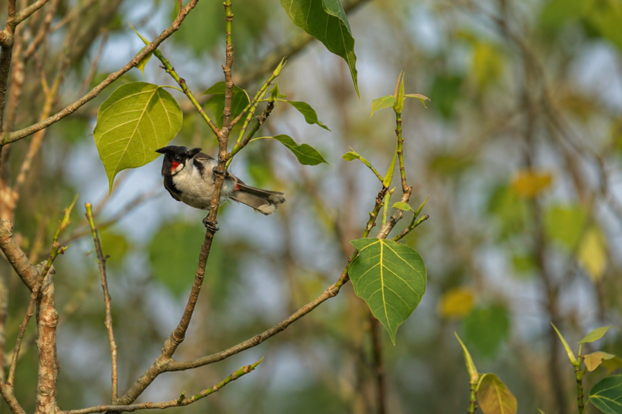
- Collared Kingfisher
- Black-capped Kingfisher
- White-throated Kingfisher
- Brown-winged Kingfisher
- Lesser Adjutant
- Purple Heron
- Grey Heron
- Little Egret
- Great Egret
- Pond Heron
- Black-crowned Night Heron
Many depend upon tidal cycles to locate fish, crustaceans and amphibians concentrated in shallow waters.
Winter Migrants
See it for yourself
A private journey shaped around you — your group, your pace, your interests. Book a free consultation.
During winter, migratory shorebirds arrive from Central Asia and northern Eurasia.
Typical visitors include:
- Sandpipers
- Plovers
- Curlews
- Whimbrels
- Greenshanks
- Redshanks
These birds exploit nutrient-rich mudflats exposed during low tide before continuing along the East Asian–Australasian Flyway.
Raptors
Birds of prey occupy upper trophic levels within the island’s avian community.
Representative species include:
- White-bellied Sea Eagle
- Brahminy Kite
- Osprey (winter visitor)
- Changeable Hawk-Eagle
These predators regulate fish and small vertebrate populations while reflecting the health of the surrounding estuarine ecosystem.
Reptilian Diversity
Saltwater Crocodile (Crocodylus porosus)
The Saltwater Crocodile is the largest living reptile and occupies tidal rivers, estuaries and larger creeks surrounding Bhangaduni.
An ambush predator, it relies on camouflage and patience rather than pursuit.
Juveniles feed primarily on fish, insects and crustaceans, whereas larger adults consume fish, birds, reptiles and mammals.
Water Monitor (Varanus salvator)
Frequently encountered near muddy banks, Water Monitors forage opportunistically on fish, crabs, carrion, eggs and small vertebrates.
Excellent swimmers, they move easily between mangrove roots and tidal creeks.
Indian Rock Python (Python molurus)
The Indian Rock Python occasionally occupies dense mangrove vegetation where it ambushes birds and mammals.
Although capable swimmers, individuals are observed infrequently because of their secretive behaviour.
King Cobra (Ophiophagus hannah)
The King Cobra inhabits suitable forested habitats within the Sundarbans, where it preys primarily upon other snakes.
Encounters remain rare, and the species generally avoids human presence whenever possible.
Fish Diversity
The tidal waters surrounding Bhangaduni function as important nursery grounds for numerous estuarine and marine fish.
Representative groups include:
- Mullets
- Catfish
- Gobies
- Perches
- Croakers
- Barramundi
- Milkfish
- Anchovies
Many species enter flooded mangrove forests during high tide to feed among submerged roots before returning to deeper channels as water recedes.
This daily migration significantly enhances nutrient exchange between aquatic and terrestrial ecosystems.
Crustaceans and Molluscs
Crustaceans dominate intertidal food webs.
Important groups include:
- Fiddler Crabs
- Mud Crabs
- Hermit Crabs
- Penaeid Prawns
- Shrimps
Molluscs include:
- Oysters
- Nerite Snails
- Mangrove Gastropods
These organisms recycle organic matter while serving as essential prey for fish, birds and reptiles.
Insects and Other Invertebrates
Despite often receiving little attention, insects form the foundation of terrestrial biodiversity within Bhangaduni.
Representative groups include:
- Dragonflies
- Damselflies
- Butterflies
- Moths
- Ants
- Termites
- Beetles
- Mosquitoes
- Bees
- Wasps
These organisms perform essential ecological functions including pollination, decomposition and nutrient recycling.
The Mangrove Food Web
Energy enters the ecosystem primarily through mangrove vegetation.
- Fallen leaves decompose into detritus.
- Detritus supports bacteria and fungi.
- These microorganisms nourish worms, molluscs and crustaceans.
- Small fish consume these organisms.
- Larger fish feed upon smaller fish.
- Birds, crocodiles and mammals prey upon aquatic fauna.
- The Royal Bengal Tiger occupies the apex of the terrestrial food web.
Unlike grassland ecosystems driven largely by grazing herbivores, the Sundarbans depend heavily upon detritus-based nutrient cycling initiated by mangrove leaf litter.
Ecological Importance of Bhangaduni
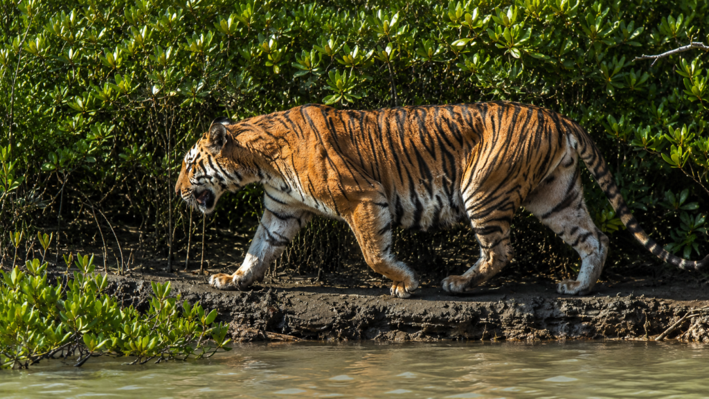
The ecological value of Bhangaduni extends well beyond its geographical boundaries.
Its mangrove forests:
- Stabilise newly deposited sediments.
- Reduce coastal erosion.
- Store significant quantities of blue carbon.
- Support breeding grounds for commercially important fisheries.
- Maintain habitat connectivity for wide-ranging mammals.
- Protect inland regions from storm surges.
- Improve water quality through sediment filtration.
- Sustain biodiversity across multiple trophic levels.
Because the island remains free from permanent human settlement, natural ecological processes continue with relatively limited direct disturbance compared with inhabited portions of the delta.
Role Within the Indian Sundarbans
Bhangaduni contributes to the resilience of the wider Sundarbans ecosystem by acting as:
- A protected mangrove refuge.
- A component of the Royal Bengal Tiger landscape.
- A nursery habitat for estuarine fish.
- A feeding ground for migratory birds.
- A natural sediment trap.
- A coastal buffer against cyclonic storm surges.
- A reservoir of mangrove genetic diversity.
Its conservation therefore supports not only local biodiversity but also the long-term ecological stability of the Indian Sundarbans as a whole.
Geological History and Landscape Evolution
Bhangaduni is a relatively young landform in geological terms. Like the rest of the Sundarbans, it owes its existence to the immense sediment load carried by the Ganges–Brahmaputra–Meghna river system over thousands of years.
The island did not emerge through volcanic activity or tectonic uplift. Instead, it developed gradually as suspended silt and clay settled within the estuarine environment. Pioneer mangrove species stabilised these deposits, allowing successive generations of vegetation to establish themselves and create increasingly permanent land.
Even today, Bhangaduni continues to evolve. Shorelines migrate, creeks shift their courses and mudbanks appear or disappear depending on tidal currents, seasonal river discharge and cyclonic events. This continual reshaping is a defining characteristic of the Indian Sundarbans and demonstrates that the landscape remains an active delta rather than a static landmass.
Historical Context Within the Sundarbans
Historical references to the southern Sundarbans are comparatively limited because these remote mangrove forests remained difficult to access for much of recorded history. Dense vegetation, tidal channels, unpredictable navigation and the presence of dangerous wildlife discouraged permanent settlement.
During the colonial period, British surveyors mapped many of the region’s rivers and islands to improve navigation and forest administration. While northern sections of the Sundarbans experienced timber extraction and land reclamation, the southern forest islands, including Bhangaduni, largely retained their natural character because of their isolation and ecological importance.
Consequently, Bhangaduni has remained predominantly a forest landscape rather than an agricultural or urban one.
Navigation and Maritime Importance
Although uninhabited, Bhangaduni occupies an important position within the estuarine waterways of the southern Sundarbans.
Historically, tidal rivers surrounding the island have been used by:
- Forest Department patrol vessels
- Scientific research expeditions
- Licensed fishing boats operating outside protected zones
- Coast Guard and maritime security vessels
- Wildlife monitoring teams
Navigation in this region requires careful understanding of tidal currents. Water depths can change significantly within a few hours, while submerged mudbanks may emerge during low tide. Experienced boat operators rely on tidal charts, local knowledge and continuous observation rather than fixed routes.
These waterways also serve as ecological corridors, allowing aquatic organisms and wide-ranging species such as the Royal Bengal Tiger and Saltwater Crocodile to move between neighbouring forest islands.
Human Connections
Unlike inhabited islands where agriculture and fishing villages dominate the landscape, Bhangaduni has remained free from permanent settlement.
Human interaction occurs primarily through:
- Forest protection
- Scientific research
- Biodiversity monitoring
- Coastal surveillance
- Limited authorised navigation
This limited human presence has enabled ecological processes to continue with relatively little direct disturbance.
For nearby fishing communities, however, the waters surrounding Bhangaduni have traditionally represented productive fishing grounds. Estuarine fisheries support local livelihoods throughout parts of the Sundarbans, although fishing within protected areas remains strictly regulated to minimise ecological impacts.
Traditional Fishing and Resource Use
The estuarine waters surrounding Bhangaduni support diverse fish and crustacean populations that contribute to regional fisheries.
Historically, communities living farther north have harvested:
- Estuarine fish
- Mud crabs
- Prawns
- Shrimp seed (historically, though now regulated)
- Molluscs
Resource use in the Sundarbans has always depended on seasonal cycles, tidal conditions and weather. Sustainable management has become increasingly important as fishing pressure, habitat change and climate-related impacts affect estuarine ecosystems.
Protected forest islands such as Bhangaduni play an important role in maintaining breeding populations that replenish surrounding fisheries.
Scientific Research
Although Bhangaduni is not as extensively documented as some better-known sectors of the Sundarbans, it contributes to numerous scientific studies focused on the wider delta.
Research topics include:
Mangrove Ecology
Scientists investigate how mangrove species respond to salinity gradients, sediment dynamics and sea-level change.
Coastal Geomorphology
Satellite imagery and field observations help monitor shoreline evolution, erosion and sediment deposition.
Tiger Ecology
Camera trapping, pugmark surveys and habitat assessments contribute to understanding tiger distribution within the southern Sundarbans.
Estuarine Fisheries
Researchers examine nursery habitats, fish recruitment and nutrient exchange between mangrove forests and surrounding waters.
Climate Change
Long-term monitoring evaluates the impacts of rising sea levels, increasing salinity, cyclones and changing sediment supply on coastal ecosystems.
Collectively, these studies improve understanding of one of the world’s most complex mangrove landscapes.
Conservation Significance
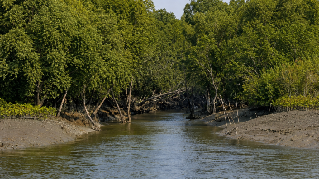
Bhangaduni forms part of one of the most internationally significant conservation landscapes on Earth.
The wider Sundarbans are recognised for:
- Exceptional mangrove biodiversity
- Habitat for the Royal Bengal Tiger
- Important estuarine fisheries
- Coastal protection
- Carbon storage
- Migratory bird habitat
- High ecological productivity
Because Bhangaduni remains largely undisturbed, it serves as an important reference landscape for studying relatively intact mangrove ecosystems.
Its forests contribute to maintaining ecological connectivity between neighbouring islands while supporting numerous species adapted to tidal environments.
Role Within the Tiger Reserve
Bhangaduni lies within the protected landscape associated with the Sundarban Tiger Reserve.
Rather than existing as isolated populations, tigers move across multiple forest islands connected by tidal channels. Maintaining uninterrupted habitat is therefore essential for:
- Genetic exchange
- Territory establishment
- Dispersal of young individuals
- Long-term population resilience
Protecting islands such as Bhangaduni helps sustain the larger tiger landscape across the Indian Sundarbans.
Climate Change and Sea-Level Rise
Few ecosystems illustrate the challenges of climate change more clearly than the Sundarbans.
Bhangaduni faces several interacting pressures:
Rising Sea Level
Gradual increases in sea level increase the frequency and duration of tidal inundation while accelerating shoreline erosion.
Increasing Salinity
Reduced upstream freshwater flow combined with marine intrusion may alter mangrove species composition over time.
Stronger Cyclones
Recent decades have demonstrated that severe tropical cyclones can dramatically reshape coastlines, uproot forests and redistribute sediment across the delta.
Changing Sediment Dynamics
Alterations in river discharge and coastal processes influence the balance between land formation and erosion.
The future stability of Bhangaduni will depend upon how these interacting processes evolve during the coming decades.
Cyclones and Natural Disturbance
Cyclones are natural components of the Bay of Bengal environment.
Major storms generate:
- Storm surges
- Extreme winds
- Saltwater inundation
- Tree damage
- Creek modification
- Shoreline erosion
Although these events can appear destructive, mangrove ecosystems possess remarkable regenerative capacity.
Seed dispersal following storms often initiates natural forest recovery, while newly deposited sediment creates opportunities for mangrove colonisation.
This cycle of disturbance and regeneration has shaped the Sundarbans for centuries.
Human-Induced Pressures
Despite its protected status, Bhangaduni remains influenced by broader environmental pressures affecting the Sundarbans.
These include:
- Climate change
- Illegal resource extraction
- Marine pollution
- Plastic debris transported by tides
- Changes in freshwater availability
- Upstream river regulation
- Unsustainable fishing practices outside protected zones
Because ecological systems remain interconnected, activities occurring far beyond the island can influence its long-term environmental health.
Conservation Management
The protection of Bhangaduni depends upon coordinated conservation involving multiple institutions.
Management priorities include:
- Anti-poaching patrols
- Habitat monitoring
- Wildlife population surveys
- Mangrove conservation
- Navigation regulation
- Scientific research
- Community engagement
- Climate adaptation planning
Long-term conservation increasingly integrates field observations with satellite monitoring, geographic information systems (GIS), drone surveys and ecological modelling to better understand environmental change across the delta.
Why Bhangaduni Matters
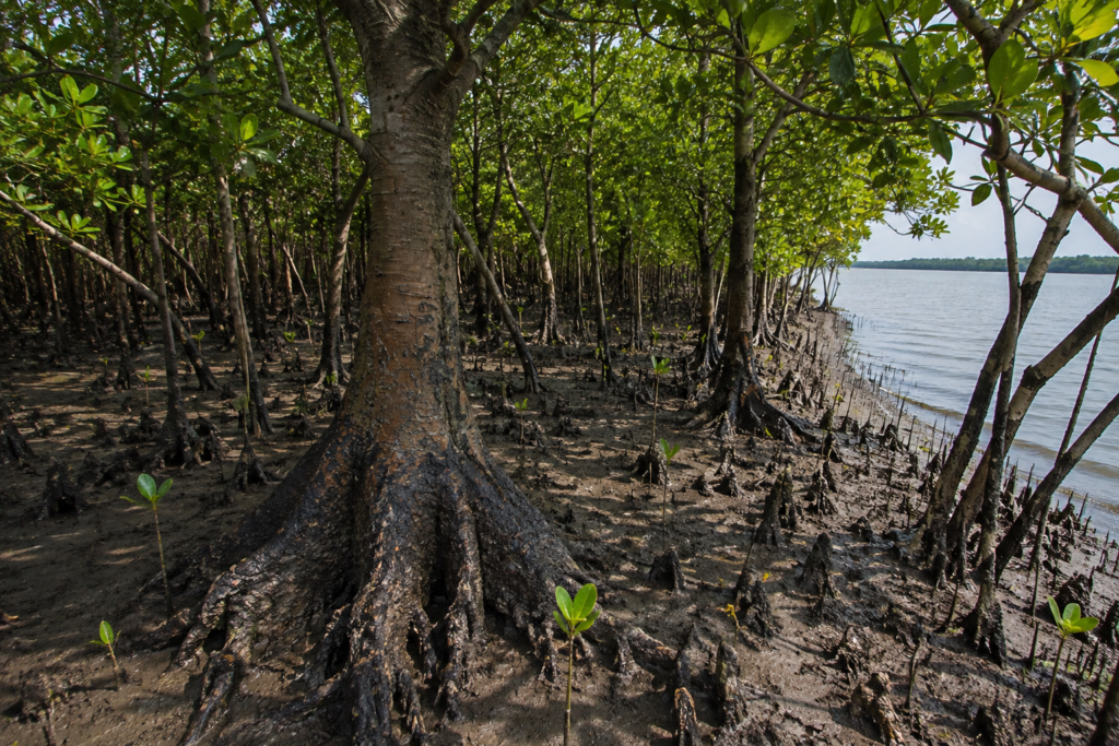
Bhangaduni represents something increasingly rare in the modern world—a large coastal ecosystem where natural ecological processes continue with comparatively limited direct human modification.
Its importance extends beyond wildlife alone.
The island:
- Protects biodiversity.
- Supports estuarine fisheries.
- Stores substantial quantities of carbon.
- Stabilises coastal sediments.
- Buffers storm surges.
- Maintains habitat connectivity.
- Provides opportunities for scientific research.
- Demonstrates the resilience of mangrove ecosystems.
As climate change reshapes coastlines globally, landscapes such as Bhangaduni offer valuable insights into how natural coastal systems respond to environmental change.
Seasonal Character
Winter (November–February)
Winter is generally regarded as the most stable season within the Indian Sundarbans. Cooler temperatures, lower humidity and clearer skies improve visibility across tidal waterways.
Characteristic features include:
- Comfortable daytime temperatures
- High visibility for wildlife observation
- Increased activity of migratory birds
- Relatively calm estuarine conditions
- Reduced rainfall
Many raptors and shorebirds arrive during this period, making winter particularly important for ornithological studies.
Summer (March–May)
Summer brings increasing temperatures, stronger solar radiation and higher evaporation rates.
Seasonal characteristics include:
- Rising salinity in many estuarine channels
- Heat stress on vegetation
- Lower freshwater availability
- Increased evaporation
- More pronounced tidal exposure during daytime
Many mammals become more active during cooler morning and evening hours while remaining sheltered during the hottest parts of the day.
Southwest Monsoon (June–September)
The southwest monsoon fundamentally transforms Bhangaduni.
Heavy rainfall combines with increased river discharge to modify water levels, salinity and sediment transport.
Typical conditions include:
- Frequent rainfall
- Fresh sediment deposition
- Strong tidal currents
- Extensive flooding of mangrove forests
- High primary productivity
This season plays a critical role in replenishing nutrients throughout the ecosystem.
Post-Monsoon (October)
As rainfall declines, river discharge gradually decreases while vegetation remains lush following the monsoon.
This transitional period often features:
- Improving visibility
- Healthy mangrove growth
- Abundant aquatic life
- Active bird populations
- Stable navigation conditions before winter
Seasonal Wildlife Patterns
Wildlife activity varies considerably throughout the year.
Winter
- Peak migratory bird diversity
- Excellent visibility
- Active raptors
- Moderate crocodile basking
Summer
- Increased nocturnal mammal activity
- Greater dependence on shaded habitats
- Fish concentrated within permanent waterways
Monsoon
- Extensive fish migration
- High breeding activity among many aquatic organisms
- Expanded feeding opportunities for wading birds
Post-Monsoon
- Vigorous mangrove growth
- Abundant insect populations
- Increased activity among juvenile fish and crustaceans
Birdwatching Opportunities
Bhangaduni contributes to the remarkable avian diversity of the Indian Sundarbans.
Depending upon the season, observers may encounter:
Kingfishers
- Brown-winged Kingfisher
- Black-capped Kingfisher
- Collared Kingfisher
- White-throated Kingfisher
Herons and Egrets
- Grey Heron
- Purple Heron
- Little Egret
- Great Egret
- Intermediate Egret
Shorebirds
- Sandpipers
- Curlews
- Whimbrels
- Plovers
- Greenshanks
Raptors
- Brahminy Kite
- White-bellied Sea Eagle
- Osprey
- Changeable Hawk-Eagle
Because the island lies within a protected forest landscape, bird observations are generally made from authorised boats navigating surrounding tidal channels rather than from land.
Wildlife Photography
Bhangaduni offers opportunities to document authentic mangrove ecosystems rather than guaranteed sightings of iconic wildlife.
Successful wildlife photography depends upon:
- Patience
- Understanding tidal cycles
- Quiet navigation
- Appropriate light conditions
- Respect for wildlife
Photographers frequently document:
- Mangrove landscapes
- Pneumatophores
- Mudflats
- Crocodiles
- Kingfishers
- Wading birds
- Mangrove roots
- Tidal reflections
Wildlife should never be disturbed for photography.
Scientific Importance
Bhangaduni functions as a valuable natural laboratory for understanding:
- Mangrove succession
- Coastal geomorphology
- Blue carbon storage
- Estuarine ecology
- Climate adaptation
- Sediment transport
- Habitat connectivity
- Predator-prey interactions
Long-term ecological monitoring conducted across the Sundarbans continues to improve scientific understanding of these complex processes.
Responsible Exploration
Although Bhangaduni is not a conventional tourist destination, authorised expeditions passing nearby should follow strict ecological principles.
Respect Protected Areas
Remain within designated navigation routes and comply with all regulations issued by the West Bengal Forest Department.
Maintain Distance from Wildlife
Animals should always determine the distance of an encounter. Boats should never pursue wildlife for closer views.
Avoid Noise Pollution
Excessive engine noise and loud conversations disturb birds and mammals that depend upon quiet habitats.
Leave No Waste
Plastic, fishing line and other debris present long-term threats to estuarine wildlife and should never enter the ecosystem.
Observe Without Interfering
The objective of responsible exploration is understanding rather than interaction.
Why Bhangaduni Deserves Greater Recognition
Compared with better-known locations such as Sajnekhali, Sudhanyakhali or Dobanki, Bhangaduni receives relatively little public attention.
Its significance lies not in visitor infrastructure but in its ecological integrity.
The island demonstrates:
- Natural delta formation
- Intact mangrove ecosystems
- Tidal ecological processes
- Habitat connectivity
- Coastal resilience
- Long-term conservation value
Understanding lesser-known islands such as Bhangaduni expands appreciation of the Sundarbans beyond a handful of popular destinations.
The Wild Orbit’s Interesting Facts About Bhangaduni
- Bhangaduni is an entirely uninhabited forest island.
- The island forms part of the southern protected mangrove landscape of the Indian Sundarbans.
- Its shoreline is continually reshaped by tides, sediment deposition and erosion.
- Mangrove roots stabilise sediment while providing nursery habitat for fish and crustaceans.
- The surrounding waterways support estuarine food webs linking marine and terrestrial ecosystems.
- The island contributes to habitat connectivity for wide-ranging species such as the Royal Bengal Tiger and Saltwater Crocodile.
- Seasonal changes in freshwater flow influence salinity, vegetation and aquatic biodiversity.
- Bhangaduni illustrates how mangrove forests act as natural barriers against coastal storms while storing significant amounts of blue carbon.
FAQs
Where is Bhangaduni located?
Bhangaduni is a protected forest island situated in the southern Indian Sundarbans of West Bengal near the Bay of Bengal.
Is Bhangaduni inhabited?
No. There are no permanent human settlements on the island.
Why is Bhangaduni important?
The island supports intact mangrove ecosystems, contributes to coastal protection, maintains biodiversity and forms part of the larger protected landscape of the Indian Sundarbans.
Can tourists visit Bhangaduni?
General tourism infrastructure does not exist on the island. Access is restricted and generally limited to authorised activities under the regulations of the West Bengal Forest Department.
Which animals occur around Bhangaduni?
The surrounding ecosystem supports the Royal Bengal Tiger, Fishing Cat, Saltwater Crocodile, Water Monitor, Spotted Deer, numerous bird species, estuarine fish and diverse crustaceans typical of the Indian Sundarbans.
What type of forest grows on Bhangaduni?
The island supports intertidal mangrove forests dominated by salt-tolerant tree species adapted to regular tidal flooding.
How do tides influence the island?
Twice-daily tidal cycles regulate sediment deposition, nutrient exchange, fish movement, mangrove regeneration and wildlife behaviour, making tides the fundamental ecological driver of the island.
Why are mangroves important here?
Mangroves stabilise shorelines, reduce coastal erosion, trap sediment, store carbon, support fisheries and provide habitat for an extraordinary diversity of wildlife.
A Last Look at Bhangaduni
As evening settles across Bhangaduni, the last light reflects from tidal channels winding through dense mangrove forests. Shorebirds retreat to their roosts, crocodiles disappear beneath opaque estuarine water, and the forest gradually absorbs the sounds of the day. The rising tide once again conceals the mudbanks that only hours earlier supported countless ecological interactions.
Bhangaduni is neither defined by monuments nor by permanent settlements. Its identity lies in continual transformation. Land emerges and disappears with the tides, mangroves stabilise newly deposited sediment, wildlife adapts to ever-changing conditions, and ecological processes continue largely uninterrupted within one of the world’s most remarkable coastal landscapes.
In an era of accelerating climate change and increasing pressure on coastal ecosystems, Bhangaduni offers an important lesson. Healthy mangrove forests are not merely collections of trees; they are living infrastructure that protects coastlines, sustains biodiversity, supports fisheries, stores carbon and maintains the ecological resilience of the world’s largest delta.
To understand Bhangaduni is to understand the essence of the Indian Sundarbans—a landscape where river, forest and sea exist in perpetual dialogue, and where the rhythm of the tide continues to shape one of Earth’s last great mangrove wildernesses.
Plan your private Sundarban expedition
A private journey shaped around you — your group, your pace, your interests. Book a free consultation.