 Encyclopedia
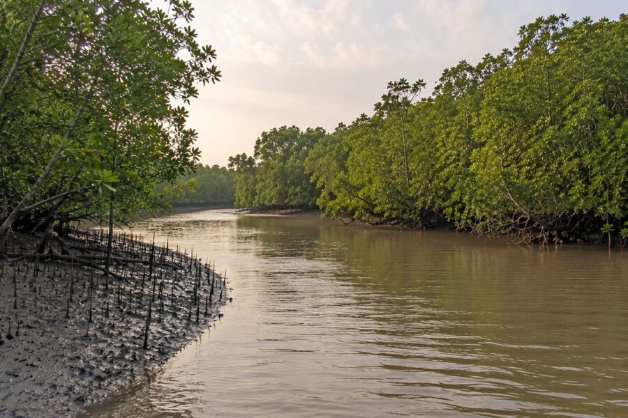
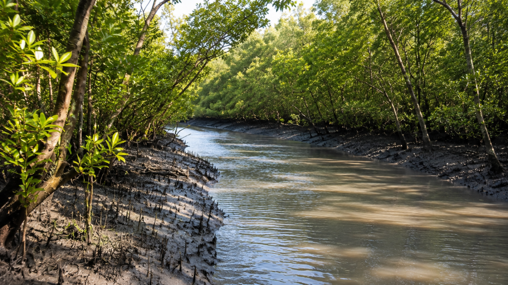
As the tide begins to ebb, the muddy banks of Chamta slowly emerge from beneath the estuarine water. Hundreds of pencil-like mangrove roots stand exposed across the soft sediment while distant mudflats glisten under the changing light. The forest appears still, yet every tidal cycle quietly rearranges the landscape. Channels deepen, creeks shift, crabs rework the mud, and the mangroves continue their slow adaptation to one of Earth’s most dynamic coastal ecosystems.
Few landscapes in the Indian Sundarbans demonstrate the intimate relationship between tides, mangrove forests, and wildlife as clearly as Chamta. Located deep within the protected mangrove wilderness of the Sundarbans Biosphere Reserve, Chamta is not simply a named forest location—it represents an extensive tract of tidal forest shaped continuously by freshwater, seawater, sediment deposition, erosion, and biological adaptation.
Unlike inhabited islands of the lower delta, Chamta remains largely untouched by permanent human settlement. Instead, it belongs to the vast protected forest landscape administered by the West Bengal Forest Department, where ecological processes unfold with minimal direct human influence. The area forms part of one of the world’s largest contiguous mangrove forests and contributes to the ecological integrity of the Indian Sundarbans, a UNESCO World Heritage landscape and one of the planet’s most important tiger habitats.
Chamta is best understood not as an isolated destination but as part of a living estuarine system. Every creek, mudflat, tidal channel, mangrove stand, and salt marsh functions as a connected component of a larger ecological network. Water moving through nearby rivers transports nutrients, redistributes sediment, influences salinity, and creates the environmental conditions upon which mangrove species and wildlife depend.
Its significance therefore extends well beyond geography. Chamta provides habitat for estuarine crocodiles, numerous fish species, crustaceans, migratory birds, resident raptors, reptiles, and mammals including the Royal Bengal Tiger (Panthera tigris tigris). These species are linked through food webs that ultimately begin with tidal energy and mangrove productivity.
Rather than dramatic scenery, Chamta offers a documentary lesson in ecological resilience. The forest changes hour by hour as tides rise and fall, yet the broader ecosystem has maintained its essential character for centuries despite cyclones, changing river courses, and continual environmental disturbance.
Chamta At a Glance
- Location: Protected forest region within the Indian Sundarbans, West Bengal.
- Administrative Status: Reserve Forest within the Sundarbans Tiger Reserve and Biosphere Reserve.
- Landscape Type: Intertidal mangrove forest.
- Ecosystem: Tidal estuarine mangrove ecosystem.
- UNESCO Status: Part of the larger Sundarbans World Heritage ecosystem.
- Dominant Processes: Tides, sediment deposition, salinity fluctuation, and estuarine hydrology.
- Human Settlement: None within the protected forest.
- Accessibility: Accessible only by licensed boats through designated waterways, subject to Forest Department regulations.
- Primary Ecological Importance: Mangrove habitat, wildlife refuge, tiger landscape, and estuarine biodiversity.
- Conservation Significance: Integral component of India’s largest protected mangrove ecosystem.
Geographic Setting
Chamta lies within the southern reaches of the Indian Sundarbans, where the distributaries of the Ganges, Brahmaputra, and Meghna river systems gradually merge into the northern Bay of Bengal. The region occupies one of the most geomorphologically active deltaic landscapes on Earth, where rivers continually transport enormous volumes of sediment that are redistributed through tidal action.
Unlike conventional terrestrial forests with fixed boundaries, Chamta exists within a constantly evolving coastal environment. Riverbanks migrate, creeks widen or narrow, mudflats appear and disappear, and vegetation colonizes newly deposited sediment while older areas may be gradually eroded.
The landscape belongs entirely to the lower tidal delta. Ground elevations are extremely low, often differing by only a few decimeters across large areas. Consequently, even modest changes in tidal height influence extensive portions of the forest.
This exceptionally flat topography makes hydrology the dominant force controlling ecological conditions. The duration and frequency of tidal inundation determine soil salinity, oxygen availability, sediment texture, and ultimately the distribution of mangrove vegetation.
From a conservation perspective, Chamta functions as part of a much larger protected forest mosaic rather than an isolated management unit. Wildlife routinely moves across connected forest blocks using creeks, mudflats, and continuous mangrove cover, reinforcing the importance of maintaining landscape-scale ecological connectivity.
How to Reach Chamta
Reaching Chamta is fundamentally a river journey. There is no conventional road route into the protected Chamta forest, and visitors should not treat Chamta as an independently accessible tourist spot.
From Kolkata to the Sundarbans
For visitors travelling from Kolkata, the most established approach is to travel south toward the Sundarbans’ riverine gateways.
By Train
The nearest major railhead for the Sundarbans Tiger Reserve is Canning. Local trains operate from Sealdah toward Canning, after which road transport can be used toward the designated boat boarding areas.
By Road
From Kolkata, visitors can travel by road toward Godkhali or Dhamakhali, depending on the authorized boat route and arrangements for the particular visit. West Bengal Tourism also identifies Sonakhali, Raidighi, Canning and Najat as road approaches to the wider Sundarbans river system.
By Air
The nearest major airport is Netaji Subhas Chandra Bose International Airport. From the airport, the journey continues by road to a designated Sundarbans boarding point and then by boat.
The Boat Journey
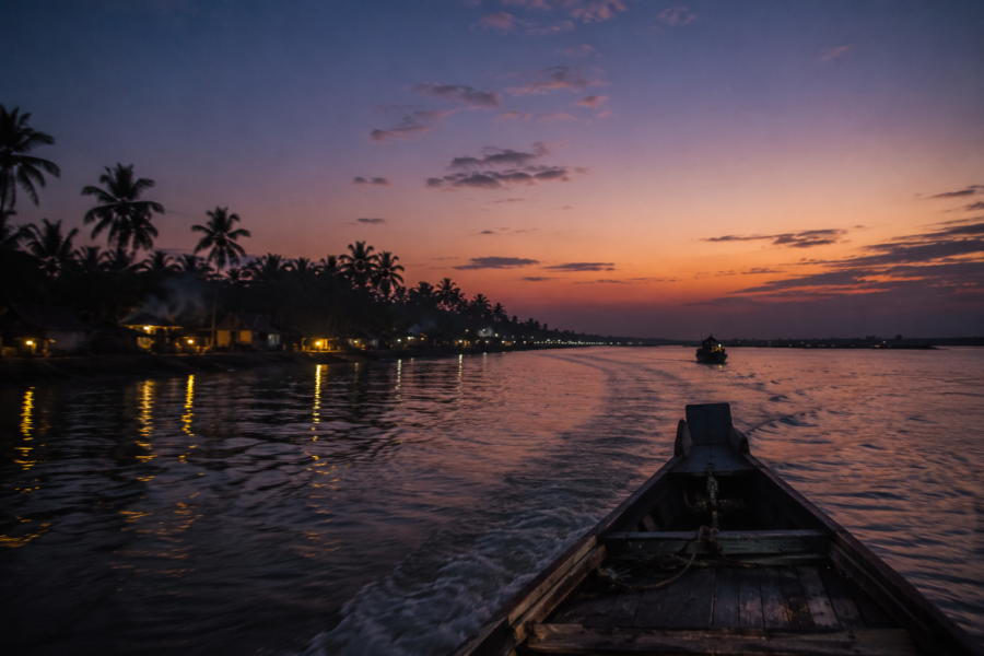
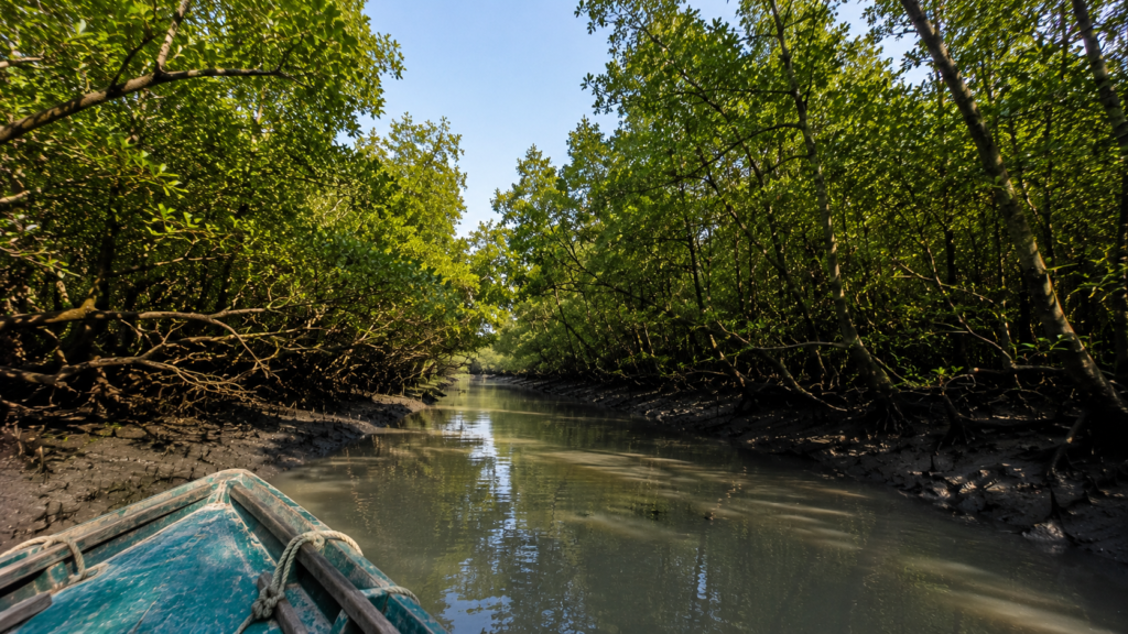
The final approach to Chamta is through the Sundarbans’ interconnected waterways. The Tiger Reserve states that boats and launches are the only means of transport inside the reserve, and entry is permitted through registered boats operating under the reserve’s management system.
This is important when planning a visit: reaching Godkhali or Dhamakhali does not mean that a visitor can independently sail to Chamta. Access to protected forest areas and waterways is controlled by the Forest Department, and the actual route depends on the authorized navigation circuit, permits and prevailing management restrictions.
A Simple Route to Think About
Kolkata → Canning → Godkhali/Dhamakhali → Authorized boat → Sundarbans waterways → Permitted Chamta-area route
Geographic Context
Although Chamta is widely recognized within the protected forest landscape of the Indian Sundarbans, published boundaries and locally used place names can vary among navigation charts, Forest Department references, and scientific literature. Like many locations within the delta, its extent is best understood as part of a broader interconnected forest system rather than a precisely defined geographic entity. Where exact administrative boundaries differ among sources, this article follows the broader ecological interpretation rather than assigning rigid limits.
Nearby Major Rivers
Chamta’s ecological character is influenced by several major tidal rivers that regulate water exchange throughout the surrounding forest landscape.
These include:
- Matla River
- Gosaba River
- Bidya River
- Raimangal River (broader eastern Sundarbans influence)
- Numerous unnamed tidal creeks and distributary channels
Rather than flowing in a single downstream direction, these waterways experience twice-daily tidal reversals. Water entering from the Bay of Bengal carries saline influence inland, while freshwater inputs during the monsoon alter salinity gradients across the forest.
The interaction between these water masses creates highly variable environmental conditions that distinguish the Sundarbans from most riverine forests elsewhere in India.
Surrounding Forest Landscape
Chamta forms part of a continuous protected mangrove forest connected with several important forest sectors across the Indian Sundarbans. Depending on administrative classification and ecological mapping, adjacent protected areas include forest blocks associated with regions such as:
- Netidhopani
- Panchamukhani
- Dobanki landscape
- Chulkati
- Arbesi region
Together, these forests provide uninterrupted habitat for wide-ranging wildlife, particularly the Royal Bengal Tiger, Fishing Cat (Prionailurus viverrinus), Spotted Deer (Axis axis), Wild Boar (Sus scrofa cristatus), and numerous bird species.
Because wildlife frequently crosses administrative boundaries, conservation planning increasingly focuses on preserving ecological connectivity rather than managing individual forest compartments in isolation.
Landscape Character
Chamta exemplifies the classic appearance of the Indian Sundarbans.
Instead of towering tropical rainforest trees, the forest consists of medium-height mangrove vegetation adapted to saline, oxygen-poor soils. Dense stands of mangroves are intersected by countless tidal creeks, mudbanks, and shallow channels that continually reshape the terrain.
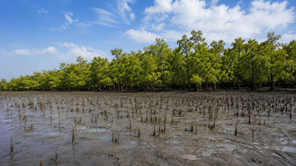
One of the most distinctive visual features is the extensive field of pneumatophores—specialized aerial roots that protrude vertically from the mud. During low tide, these root systems resemble dense natural spikes covering the exposed sediment. As the tide returns, they gradually disappear beneath the rising water.
This rhythmic transformation defines the landscape. Every six hours, the forest effectively changes appearance as water levels rise and fall, altering visibility, wildlife movement, and habitat availability.
At low tide, fiddler crabs emerge across the exposed mud while mudskippers move between shallow pools left behind by the receding water. Egrets patrol the creek margins, probing soft sediment for fish and crustaceans. Within a few hours, the returning tide submerges the entire scene, forcing both predators and prey to adjust their movements once again.
The soils remain waterlogged for much of the year and contain limited oxygen, creating conditions unsuitable for most terrestrial plants. Mangrove species survive here through remarkable physiological adaptations that allow them to tolerate salinity, unstable sediments, and frequent inundation.
Cyclones periodically reshape portions of the forest by toppling trees, depositing fresh sediment, and opening temporary gaps in the canopy. Yet these disturbances are also part of the ecosystem’s natural renewal cycle, allowing regeneration and succession to occur over time.
Rivers and Water Systems
Water is the defining force behind every ecological process in Chamta.
Unlike inland forests where rainfall primarily governs hydrology, Chamta is controlled by tidal exchange between the Bay of Bengal and the delta’s intricate river network. Semi-diurnal tides typically inundate large portions of the forest twice each day, transporting sediment, nutrients, larvae, organic matter, and dissolved salts throughout the ecosystem.
The resulting hydrological complexity produces a landscape of extraordinary diversity. Main rivers feed secondary channels, which branch into narrow creeks before dispersing into countless tidal inlets winding through mangrove stands.
Each channel performs a distinct ecological function:
- Transporting suspended sediments
- Regulating soil salinity
- Supporting fish migration
- Connecting wildlife habitats
- Dispersing mangrove propagules (seedlings)
- Recycling organic nutrients
Freshwater availability varies seasonally. During the southwest monsoon, increased river discharge lowers salinity across much of the forest, encouraging rapid plant growth and influencing breeding cycles for many aquatic species. In the dry season, reduced freshwater inflow allows saline conditions to extend farther inland, favoring mangrove species adapted to higher salt concentrations.
This seasonal oscillation creates environmental gradients rather than uniform conditions, enabling numerous plant and animal communities to coexist across relatively small geographic distances.
The hydrological stability of Chamta therefore depends not only on local rivers but on the health of the entire Ganges delta system. Alterations to upstream river flow, sediment supply, sea-level rise, or climate-driven changes in rainfall have the potential to influence ecological conditions throughout the forest over coming decades.
The Mangrove Ecosystem
Mangrove ecosystems occupy the narrow ecological boundary between terrestrial and marine environments. Chamta lies within this transition zone, where fluctuating salinity, unstable sediments, and tidal flooding create conditions unsuitable for most conventional forest vegetation.
Mangroves are uniquely adapted to survive here. Rather than resisting tidal flooding, they have evolved specialized physiological and structural mechanisms that enable them to flourish in saline, oxygen-deficient soils.
Several key environmental factors define the mangrove ecosystem in Chamta:
- Semi-diurnal tidal flooding
- Variable salinity influenced by season and river discharge
- Fine alluvial sediments deposited by estuarine currents
- Waterlogged, oxygen-poor soils
- Frequent cyclonic disturbances
- Continuous sediment erosion and deposition
These conditions produce an ecosystem in constant transition. No portion of the forest remains environmentally identical throughout the year, yet the overall ecological balance persists through the resilience of mangrove communities.
Adaptations That Allow Mangroves to Survive
One of the defining characteristics of Chamta is the extraordinary range of adaptations displayed by its mangrove flora.
Pneumatophores: Breathing in Waterlogged Soil
The soft mud beneath Chamta contains very little oxygen because it remains saturated for much of the year. To overcome this limitation, many mangrove species develop specialized aerial roots known as pneumatophores.
These roots protrude vertically above the sediment during low tide, allowing gases to diffuse into internal tissues before the returning tide submerges them once again.
The extensive fields of pencil-like pneumatophores visible throughout Chamta are among the most recognizable features of the Sundarbans landscape.
Salt Regulation
Living in saline water presents a major physiological challenge. Different mangrove species employ different strategies:
- Excluding salt at the root surface
- Excreting excess salt through specialized leaf glands
- Storing salts in older tissues before shedding leaves
These mechanisms enable mangroves to maintain internal water balance despite growing in environments that would quickly dehydrate most terrestrial plants.
Vivipary: Seeds That Germinate Before Falling
Many mangrove species produce propagules rather than dormant seeds.
Instead of waiting until they reach the soil, embryos begin developing while still attached to the parent tree. Once detached, these elongated propagules float with tidal currents until they become lodged in suitable sediment, where they rapidly establish new seedlings.
This remarkable reproductive strategy increases the likelihood of successful colonization in a constantly shifting tidal landscape.
Principal Mangrove Flora of Chamta
Chamta supports a diverse assemblage of true mangroves and associated coastal vegetation characteristic of the Indian Sundarbans. Species composition varies according to salinity, tidal influence, soil characteristics, and local hydrology.
Prominent species include:
Sundari (Heritiera fomes)
The Sundari tree gives the Sundarbans its name and remains one of the most ecologically and historically significant mangrove species of the delta. It generally favors areas with relatively lower salinity, although its distribution has declined in parts of the Sundarbans because of changing hydrological conditions and disease.
Gewa (Excoecaria agallocha)
Gewa is among the most widespread mangrove trees within the Indian Sundarbans. It often forms extensive stands across moderately saline environments and contributes significantly to forest structure.
Its milky latex can irritate skin and eyes, earning it cautionary recognition among local forest workers.
Goran (Ceriops decandra)
Goran commonly dominates higher-salinity areas and forms dense thickets along many tidal creeks.
Its compact growth provides important refuge for numerous birds, reptiles, and smaller mammals while stabilizing sediment against tidal erosion.
Keora (Sonneratia apetala)
Keora frequently colonizes newly deposited mudflats because of its rapid growth and tolerance of unstable sediments.
By establishing vegetation on young alluvial deposits, it often plays a pioneering role in ecological succession.
Avicennia Species
Species such as Grey Mangrove (Avicennia marina) and related members of the genus occupy extensive portions of the delta.
Their dense fields of pneumatophores contribute substantially to sediment stabilization and nutrient cycling.
Other Common Mangrove Associates
Additional vegetation recorded throughout the Indian Sundarbans includes:
- Dhundul (Xylocarpus granatum)
- Passur (Xylocarpus mekongensis)
- Kankra (Bruguiera gymnorhiza)
- Baen (Avicennia officinalis)
- Hental Palm (Phoenix paludosa)
- Tiger Fern (Acrostichum aureum)
Species dominance within Chamta varies according to localized environmental gradients rather than remaining uniform across the landscape.
Wildlife of Chamta
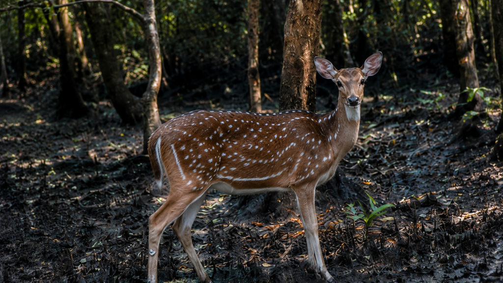
The ecological richness of Chamta arises from the remarkable diversity of wildlife supported by its interconnected habitats. Mudflats, tidal creeks, mangrove canopy, salt marshes, and river channels each provide distinct ecological niches occupied by specialized species.
Although many visitors associate the Sundarbans primarily with the Royal Bengal Tiger, Chamta’s biodiversity extends far beyond a single flagship species.
Mammals
Royal Bengal Tiger (Panthera tigris tigris)
Chamta forms part of one of the world’s only mangrove tiger habitats.
Unlike tigers inhabiting inland forests, Sundarbans tigers have adapted to tidal environments where swimming between islands, navigating muddy substrates, and responding to shifting coastlines form part of their ecological routine.
Their movements are strongly influenced by prey availability, tidal conditions, freshwater access, and habitat connectivity.
Fishing Cat (Prionailurus viverrinus)
The Fishing Cat is among the most specialized carnivores inhabiting Asian wetlands.
Within Chamta, tidal creeks and shallow pools provide ideal hunting grounds where fish, crabs, amphibians, and other aquatic prey are abundant.
Primarily nocturnal and highly secretive, it is rarely observed despite being widely distributed across suitable wetland habitats.
Spotted Deer (Axis axis)
Large herds of Spotted Deer browse mangrove foliage and young shoots throughout many parts of the Sundarbans.
They represent one of the principal prey species for tigers and play an important ecological role in vegetation dynamics through selective browsing.
Wild Boar (Sus scrofa cristatus)
Wild Boar forage extensively across mudflats and forest floors, feeding on roots, crustaceans, fallen fruits, invertebrates, and carrion.
Their rooting behavior also contributes to soil disturbance and nutrient redistribution.
Small Mammals
Other mammals recorded within the broader Sundarbans landscape include:
- Small Indian Civet
- Jungle Cat
- Smooth-coated Otter
- Rhesus Macaque
- Indian Grey Mongoose
The abundance of these species varies according to habitat type and prey availability.
Birds
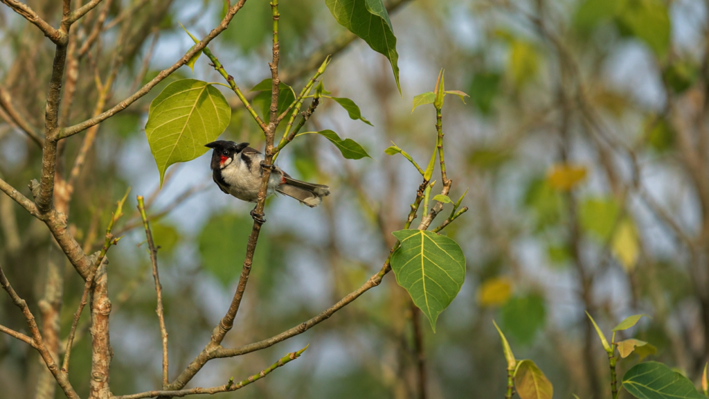
Chamta supports a rich avifauna owing to the diversity of feeding habitats created by tidal rivers, mudflats, mangrove canopy, and open water.
Resident and migratory birds exploit different ecological niches throughout the year.
Commonly recorded groups include:
- White-bellied Sea Eagle
- Brahminy Kite
- Lesser Adjutant
- Black-capped Kingfisher
- Brown-winged Kingfisher
- Collared Kingfisher
- Grey-headed Fish Eagle
- Egrets
- Herons
- Sandpipers
- Plovers
- Whimbrels
- Curlews
- Bee-eaters
- Drongos
- Sunbirds
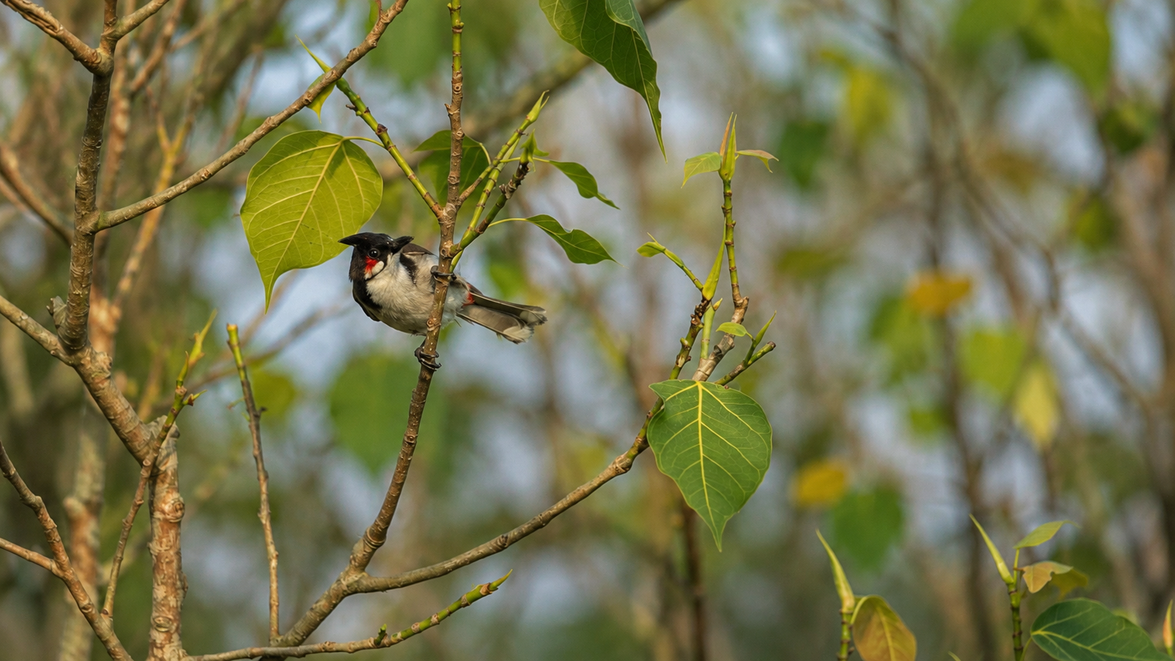
Bird diversity changes seasonally as migratory shorebirds arrive during the northern winter while resident species continue breeding within the mangrove forest.
Reptiles
Chamta’s estuarine habitats support numerous reptiles specially adapted to saline environments.
Notable species include:
- Saltwater Crocodile (Crocodylus porosus)
- Water Monitor (Varanus salvator)
- King Cobra (Ophiophagus hannah) (recorded in the broader Sundarbans landscape)
- Indian Python (Python molurus)
- Various water snakes and sea snakes associated with estuarine habitats
Saltwater Crocodiles occupy tidal rivers and creeks where they function as apex aquatic predators.
Amphibians and Aquatic Life
Although less conspicuous than mammals and birds, aquatic organisms form the ecological foundation of Chamta.
These include:
- Mudskippers
- Gobies
- Mullets
- Catfish
- Estuarine prawns
- Mud crabs
- Horseshoe crabs (localized records within the wider delta)
- Numerous molluscs and polychaete worms
Collectively, these organisms recycle nutrients, process organic matter, and support higher trophic levels throughout the food web.
The Mangrove Food Web
Chamta’s ecological productivity begins with sunlight captured by mangrove vegetation and microscopic algae.
Fallen mangrove leaves accumulate on the forest floor, where fungi and bacteria initiate decomposition. This partially decomposed material—known as detritus—forms the basis of one of the world’s most productive estuarine food webs.
The sequence is broadly as follows:
- Mangrove leaves and organic matter fall into tidal waters.
- Microorganisms decompose this material.
- Small crustaceans, worms, and molluscs consume the detritus.
- Fish feed on these invertebrates.
- Larger fish, reptiles, birds, and mammals prey upon smaller aquatic organisms.
- Apex predators such as crocodiles and tigers occupy the highest trophic levels.
Rather than relying solely on living vegetation, much of Chamta’s biological productivity depends on this continuous recycling of organic material through detrital pathways.
Ecological Resilience
Chamta is frequently exposed to disturbances including cyclones, storm surges, erosion, saline intrusion, and shifting river channels. Yet these events do not simply damage the ecosystem—they also contribute to its renewal.
Cyclones may topple mature trees, but they can also create canopy openings that allow sunlight to reach the forest floor, promoting regeneration. Fresh sediment deposited during storms may provide new substrates for mangrove colonization, while tidal redistribution helps reconnect habitats altered by erosion.
This capacity to absorb disturbance and recover over time is one of the defining characteristics of the Sundarbans ecosystem. Rather than existing in a static equilibrium, Chamta remains resilient because it has evolved alongside the natural variability of tides, sediment movement, and coastal storms.
Ecological Importance
The Sundarbans is often described as the world’s largest contiguous mangrove forest, but this designation reflects more than geographic scale. It represents an ecological network in which each forest block contributes to the health and resilience of the whole.
Chamta performs several critical ecological functions:
- Providing habitat for numerous terrestrial and aquatic species.
- Supporting breeding and nursery grounds for fish, crustaceans, and molluscs.
- Stabilizing sediment and reducing shoreline erosion.
- Cycling nutrients through mangrove leaf litter and detrital food webs.
- Sequestering significant quantities of “blue carbon” within vegetation and waterlogged soils.
- Maintaining ecological connectivity between adjacent forest habitats.
The loss or degradation of any substantial mangrove area can reduce the resilience of the broader ecosystem by interrupting these interconnected processes.
Chamta as a Wildlife Corridor
Large mammals such as the Royal Bengal Tiger do not recognize administrative boundaries within the Sundarbans. Their movements are influenced by prey availability, freshwater sources, territorial behavior, tidal conditions, and habitat quality rather than mapped forest compartments.
Chamta forms part of a continuous forest mosaic that enables wildlife to move between adjacent habitats with minimal fragmentation. This connectivity is particularly important for species with extensive home ranges, allowing genetic exchange and reducing the isolation of local populations.
Beyond mammals, the interconnected network of tidal creeks and rivers also functions as an aquatic corridor. Fish migrate through these waterways in response to tidal cycles, seasonal freshwater inflows, and reproductive needs, while mangrove propagules are dispersed naturally by tidal currents, contributing to forest regeneration across the landscape.
Maintaining these ecological linkages is therefore essential to the long-term health of the Indian Sundarbans.
Carbon Storage and Climate Regulation
Mangrove forests are increasingly recognized as some of the most efficient natural carbon sinks on Earth. Unlike many terrestrial forests, mangroves store carbon not only in their trunks, branches, and roots but also within deep layers of waterlogged sediment.
Because decomposition proceeds slowly in oxygen-poor soils, organic material accumulates over long periods, locking away carbon that might otherwise return to the atmosphere.
Chamta contributes to this broader process of blue carbon storage through:
- Long-lived woody vegetation.
- Extensive root systems.
- Organic-rich sediments.
- Continuous deposition of leaf litter.
- Limited decomposition under anaerobic conditions.
The protection of intact mangrove forests therefore supports both regional biodiversity and global climate mitigation efforts.
Nursery Grounds for Aquatic Life
Chamta’s creeks and sheltered tidal channels serve as important nursery habitats for numerous estuarine organisms.
Young fish, prawns, and crabs benefit from:
- Protection among dense mangrove roots.
- Abundant organic food resources.
- Reduced wave energy.
- Shallow, productive waters.
- Complex underwater habitat.
Many commercially important marine and estuarine species spend their early life stages within mangrove ecosystems before dispersing into larger rivers or coastal waters.
Consequently, the ecological value of Chamta extends well beyond the boundaries of the forest itself, influencing fisheries and aquatic biodiversity across the northern Bay of Bengal.
Environmental History
The history of Chamta is inseparable from the geological evolution of the Ganges-Brahmaputra-Meghna Delta.
Over thousands of years, enormous volumes of sediment transported from the Himalaya have accumulated at the river mouths, gradually forming the low-lying delta that now supports the Sundarbans. Rivers have repeatedly changed course, new islands have emerged, and older landforms have been reshaped or lost through erosion.
Within this dynamic landscape, mangrove vegetation has continually colonized newly deposited sediments, creating the characteristic mosaic of forest islands, mudflats, tidal creeks, and estuarine channels that define the region today.
Unlike ancient mountain forests that may remain geographically stable for millennia, the Sundarbans is a landscape in perpetual transformation. Chamta itself reflects this ongoing process of deposition, erosion, and ecological succession.
Human Presence and Historical Use
Although Chamta remains a protected forest without permanent settlement, humans have interacted with the surrounding Sundarbans for centuries.
Historically, local communities entered portions of the forest to collect:
- Honey
- Beeswax
- Fish
- Crabs
- Fuelwood (before stricter protections)
- Nypa palm and other forest products
These activities were traditionally shaped by both ecological knowledge and cultural respect for the risks associated with entering tiger habitat.
Today, access to protected areas such as Chamta is regulated under forest management frameworks intended to balance conservation objectives with sustainable resource use and scientific research.
Because historical records specific to Chamta are relatively limited, much of its documented history is understood within the broader environmental and administrative history of the Indian Sundarbans rather than as an isolated locality.
Conservation Significance
Chamta occupies an important position within one of India’s highest-priority conservation landscapes.
The surrounding protected area contributes to several overlapping conservation designations, including:
- Sundarbans Tiger Reserve.
- Sundarbans Biosphere Reserve.
- UNESCO World Heritage Site (within the larger protected Sundarbans landscape).
- Ramsar-recognized wetland values through the wider Sundarbans ecosystem.
These designations recognize the exceptional biodiversity, ecological processes, and global conservation importance of the region.
Protection focuses not only on charismatic wildlife but also on preserving ecological functions such as tidal hydrology, mangrove regeneration, estuarine productivity, and habitat connectivity.
Scientific Research
Chamta and the wider Sundarbans continue to attract scientific interest across multiple disciplines.
Research topics commonly include:
Mangrove Ecology
Scientists investigate how different mangrove species respond to changing salinity, sediment dynamics, and sea-level rise.
Tiger Ecology
Long-term monitoring programs examine tiger distribution, habitat use, prey availability, movement patterns, and conservation management within mangrove environments.
Hydrology
Researchers study tidal dynamics, freshwater inflows, sediment transport, and river morphology to understand how changing hydrological conditions influence ecosystem health.
Climate Change
The Sundarbans serves as a globally important natural laboratory for understanding:
- Sea-level rise.
- Saltwater intrusion.
- Cyclone impacts.
- Coastal resilience.
- Mangrove adaptation.
- Carbon sequestration.
Biodiversity Monitoring
Camera traps, bird surveys, aquatic sampling, vegetation mapping, and remote sensing contribute to ongoing efforts to document changes in species composition and habitat condition.
Long-term ecological monitoring is particularly important because many environmental changes occur gradually over decades rather than becoming immediately apparent.
Seasonal Character
Although the Sundarbans experiences tidal change every day, seasonal variation also plays a major role in shaping ecological conditions within Chamta.
Summer (March–June)
See it for yourself
A private journey shaped around you — your group, your pace, your interests. Book a free consultation.
Temperatures rise steadily, evaporation increases, and salinity often becomes more pronounced before the arrival of the southwest monsoon.
Wildlife activity frequently concentrates around freshwater sources where available.
Monsoon (June–September)
Heavy rainfall reduces surface salinity across much of the forest.
River discharge increases substantially, transporting fresh sediment while influencing nutrient availability and vegetation growth.
The landscape appears lush, though navigation may become more challenging because of strong currents, heavy rainfall, and reduced visibility.
Post-Monsoon (October–November)
Fresh vegetation flourishes following the rains.
Improved visibility and relatively stable weather conditions benefit ecological surveys and wildlife observations.
Winter (December–February)
Cooler temperatures characterize the forest.
Many migratory shorebirds and waterbirds arrive from northern breeding grounds, increasing avian diversity throughout tidal mudflats and estuarine habitats.
Lower humidity and clearer skies also improve visibility across the river network.
Climate and Cyclones
Chamta lies within a cyclone-prone region of the northern Bay of Bengal.
Tropical cyclones periodically bring:
- High winds.
- Storm surges.
- Saltwater inundation.
- Tree damage.
- Sediment redistribution.
- Riverbank erosion.
While severe storms may temporarily alter forest structure, mangrove ecosystems possess remarkable resilience. Regeneration often begins rapidly through natural recruitment, vegetative recovery, and the establishment of propagules on newly deposited sediment.
However, increasing cyclone intensity, combined with sea-level rise and changing hydrological conditions, presents long-term conservation challenges that continue to be the subject of scientific research.
Emerging Conservation Challenges
Despite its protected status, Chamta is not isolated from broader environmental pressures affecting the Sundarbans.
Key challenges include:
- Rising sea levels associated with climate change.
- Altered freshwater inflows affecting salinity gradients.
- Coastal erosion and sediment redistribution.
- Increasing frequency of extreme weather events.
- Invasive species in localized areas.
- Plastic and marine debris transported by rivers and tides.
- Human-wildlife conflict in adjacent inhabited regions, particularly involving tigers.
Effective conservation therefore depends not only on protecting individual forest blocks but also on maintaining the ecological processes that sustain the entire delta.
Documentary Reflection
Chamta demonstrates that the strength of the Sundarbans lies not in permanence but in adaptability. Its rivers shift, tides reshape its shorelines, cyclones alter its canopy, and salinity fluctuates with the seasons. Yet through these continual changes, the mangrove ecosystem persists—absorbing disturbance, regenerating naturally, and supporting an extraordinary diversity of life. Understanding Chamta means recognizing that conservation is not about preserving a frozen landscape, but about safeguarding the dynamic natural processes that allow this remarkable forest to endure.
Responsible Exploration
Chamta is situated within a highly protected section of the Indian Sundarbans. Unlike inhabited islands, it is not an independent tourist destination and should not be viewed as a place for unrestricted exploration.
Access to the surrounding waterways is governed by the West Bengal Forest Department, and all movement within protected areas is subject to applicable permits, regulations, and designated navigation routes.
Visitors should remember that the primary purpose of these forests is biodiversity conservation, not recreation.
Responsible exploration involves:
- Respecting all Forest Department regulations.
- Remaining on authorized boats and designated waterways.
- Maintaining a safe distance from wildlife.
- Never attempting to attract or feed animals.
- Avoiding loud noise that disturbs birds and mammals.
- Leaving no plastic, food waste, or pollutants.
- Supporting licensed operators who follow conservation guidelines.
- Recognizing that wildlife sightings are never guaranteed and should not be expected.
The true experience of Chamta lies in observing ecological processes rather than searching for dramatic encounters with large animals.
Understanding the Landscape as a Living Ecosystem
One of the most common misconceptions about the Sundarbans is that it consists of isolated attractions connected by rivers.
In reality, Chamta functions as one component of an immense ecological network.
- Its creeks connect with larger rivers.
- Its rivers exchange water with the Bay of Bengal.
- Its mangroves stabilize sediments deposited from the Himalayan river system.
- Its wildlife moves across multiple forest blocks.
- Its tides influence habitats many kilometres away.
Viewing Chamta through this system’s perspective reveals why conservation must operate at the landscape scale rather than focusing only on individual species or isolated forest compartments.
Why Chamta Matters Beyond the Sundarbans
Although Chamta occupies a relatively small portion of the vast Sundarbans, the ecological processes occurring within it have significance extending far beyond the delta itself.
Healthy mangrove forests contribute to:
- Coastal protection against storm surges.
- Long-term carbon storage.
- Nursery habitats supporting marine fisheries.
- Biodiversity conservation.
- Sediment stabilization.
- Scientific understanding of climate adaptation.
- Global efforts to conserve mangrove ecosystems.
Consequently, protecting Chamta also supports ecological resilience throughout the northern Bay of Bengal.
The Wild Orbit’s Interesting Facts About Chamta
1. The Forest Changes Twice Every Day
Unlike most forests, Chamta undergoes dramatic physical transformation every tidal cycle. Areas that appear as dry mudflats during low tide may lie beneath several metres of water only hours later.
2. Trees Breathe Above the Ground
Many mangrove species survive waterlogged soils by producing aerial roots known as pneumatophores, allowing oxygen to reach underground tissues during low tide.
3. New Land Is Constantly Being Created
Sediment carried from the Himalaya continues to build portions of the Sundarbans. Newly deposited mudbanks may eventually become colonized by pioneering mangrove species, initiating the formation of new forest.
4. Mangrove Leaves Feed the Entire Ecosystem
Rather than becoming waste, fallen leaves are broken down by microorganisms into nutrient-rich detritus that supports fish, crustaceans, molluscs, and ultimately larger predators.
5. Tigers Swim Between Forest Islands
The Royal Bengal Tigers inhabiting the Sundarbans are well adapted to tidal environments and are capable of swimming across wide estuarine channels while moving between suitable habitats.
6. Chamta Has No Permanent Human Settlement
Unlike many islands within the inhabited Sundarbans, Chamta remains part of the protected mangrove forest without permanent villages or agricultural land.
7. Cyclones Help Shape the Forest
Although destructive, cyclones also contribute to ecological renewal by redistributing sediment, opening canopy gaps, and creating opportunities for natural regeneration.
8. Mangroves Store Carbon Underground
A substantial proportion of the carbon captured by mangrove ecosystems is stored within saturated sediments rather than only in tree trunks and branches.
FAQs
Where is Chamta located?
Chamta is a protected mangrove forest area within the Indian Sundarbans of West Bengal. It forms part of the larger Sundarbans Tiger Reserve and Biosphere Reserve.
Is Chamta an inhabited island?
No. Chamta is not known as a permanently inhabited island. It forms part of the protected forest landscape managed for biodiversity conservation.
Why is Chamta ecologically important?
Chamta provides habitat for mangrove vegetation, estuarine wildlife, birds, reptiles, fish, crustaceans, and mammals while contributing to sediment stabilization, nutrient cycling, carbon storage, and ecological connectivity across the Sundarbans.
Which animals can be found in Chamta?
The surrounding forest supports species including the Royal Bengal Tiger (Panthera tigris tigris), Fishing Cat (Prionailurus viverrinus), Spotted Deer (Axis axis), Wild Boar (Sus scrofa cristatus), Saltwater Crocodile (Crocodylus porosus), Water Monitor (Varanus salvator), numerous birds, fish, crabs, molluscs, and other estuarine wildlife.
Why do mangrove trees have roots above the ground?
Waterlogged soils contain very little oxygen. Many mangrove species develop aerial roots called pneumatophores, enabling them to absorb oxygen during low tide.
Can visitors freely enter Chamta?
No. Access to protected forest areas is regulated by the West Bengal Forest Department and is subject to applicable permissions, designated waterways, and conservation regulations.
What is the best season for ecological observation?
Each season reveals different ecological characteristics. Winter generally offers comfortable weather and high bird diversity, while the monsoon demonstrates the powerful influence of freshwater inflow on the mangrove ecosystem.
Why are tides so important in Chamta?
Tides regulate nearly every ecological process within the forest, including sediment transport, salinity, nutrient exchange, fish migration, mangrove regeneration, and wildlife movement.
Does climate change affect Chamta?
Yes. Like the wider Sundarbans, Chamta faces long-term pressures associated with sea-level rise, changing salinity, altered river discharge, coastal erosion, and increasingly intense tropical cyclones.
The Future of Chamta
Chamta reminds us that the Indian Sundarbans is not defined by isolated landmarks but by relationships—between rivers and tides, mud and mangroves, predators and prey, storms and regeneration. Every tidal cycle reshapes the landscape, yet the forest endures because its ecological systems have evolved to accommodate continual change.
- To walk through an inland forest is often to experience permanence.
- To understand Chamta is to appreciate impermanence.
Riverbanks migrate, sediments accumulate, salinity fluctuates, and vegetation adapts in response. Even the footprints of a tiger may disappear beneath the returning tide within hours. What persists is not the exact form of the landscape but the resilience of the processes that sustain it.
Chamta therefore stands as more than a protected mangrove forest. It represents one of the finest examples of how nature can thrive within constant environmental change. Its value extends beyond the boundaries of the Sundarbans, contributing to coastal protection, global biodiversity, climate regulation, and the scientific understanding of estuarine ecosystems.
Protecting Chamta is ultimately about safeguarding these living processes. As long as tides continue to flow through its creeks, mangroves continue to colonize fresh sediment, and wildlife continues to move across its interconnected forests, Chamta will remain an enduring expression of the remarkable ecological resilience of the Indian Sundarbans.
Plan your private Sundarban expedition
A private journey shaped around you — your group, your pace, your interests. Book a free consultation.