 Encyclopedia
The first thing visible from the ferry is not land.
It is an absence.
A dark interruption in the estuary where maps insist an island still exists.
Before dawn, the Muriganga River looks less like water and more like moving iron.
The tide drags silently past the jetty near Kachuberia on nearby Sagar Island, carrying uprooted reeds, fragments of bamboo, and the cold smell of silt from somewhere upriver.
Fishermen stand beside their narrow wooden boats with hurricane lamps swinging in the wind. Nobody speaks loudly here before sunrise. The river is too large for that.
The boatman points ahead with the edge of his chin.
“Ghoramara.”
At first, nothing appears.
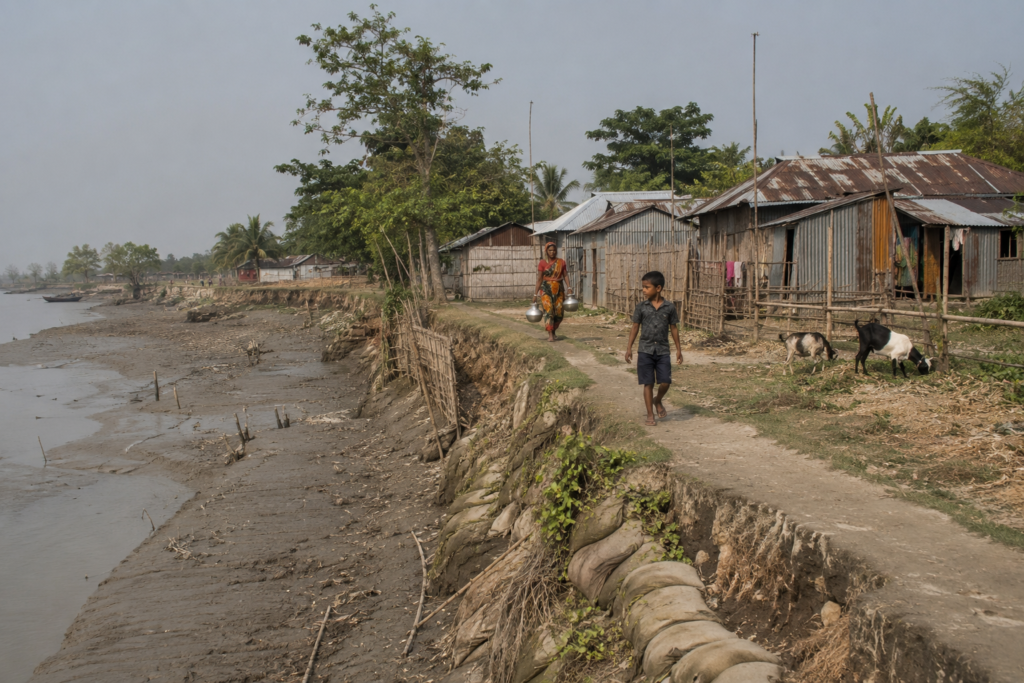
Then slowly, through the grey estuarine haze, the island emerges not as a coastline but as a wounded edge. No dramatic beaches. No palm-fringed arrival. Only embankments patched with mud, bamboo reinforcement poles leaning at uncertain angles, and a scattering of trees standing dangerously close to the waterline, as though the river has already decided their fate.
The boat engine coughs.
A flock of egrets lifts from the shallows.
And Ghoramara Island arrives exactly as its reputation suggests — not as a destination, but as a frontier.
Not a frontier between land and sea.
A frontier between existence and disappearance.
First Encounter
As the ferry nears the island’s muddy landing, Ghoramara begins revealing its textures.
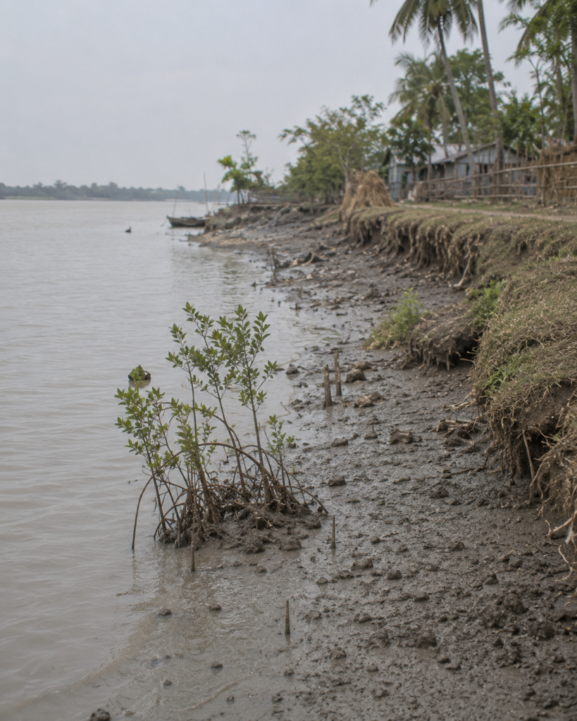
The shoreline is uneven, visibly bitten away in sections where the river has collapsed entire embankments over decades.
Fresh scars of erosion remain exposed in damp vertical walls of earth. At low tide, roots hang naked above the mudflats. Children in school uniforms move carefully along narrow, raised pathways while women carry plastic containers of drinking water from community sources inland.
Nothing here feels permanent.
The houses are built with that understanding.
Many are assembled from corrugated tin, bamboo, salvaged wood, tarpaulin, and concrete fragments reused from older homes already claimed by the river.
- Courtyards sit barely above tidal level.
- Goats wander beside embankments reinforced with sandbags.
- Small shrines painted in fading blue and saffron stand improbably close to collapsing riverbanks.
The island does not greet visitors romantically.
It confronts them immediately with vulnerability. And yet life moves with astonishing normalcy.
- Tea boils in roadside stalls.
- Nets dry on bamboo frames.
- A transistor radio crackles with Bengali songs from the mainland.
Someone repairs a fishing net beside a neem tree while a bicycle bell rings somewhere inside the settlement.
Ghoramara is not abandoned.
It is inhabited with defiance.
Island Identity
Most islands in the Sundarbans are introduced through their forests.
Ghoramara is introduced through erosion.
Situated within the estuarine labyrinth of the lower Hooghly system in South 24 Parganas district of West Bengal, the island lies southwest of Kolkata and north of Sagar Island, surrounded by restless tidal channels that continuously reshape its boundaries. Administratively, it falls within the Sagar Community Development Block.
But statistics alone fail to explain Ghoramara.
- Maps record its shrinking size.
- Census tables record declining population numbers.
- Scientific papers discuss shoreline retreat and hydrodynamic shifts.
Yet none of those measurements fully capture the psychological geography of the island — a place where residents can identify former football grounds, vanished temples, and lost rice fields now lying beneath tidal water.
Older inhabitants still speak of the island in terms of what no longer exists.
- The school that disappeared.
- The mango orchards swallowed by the river.
- The pathways children once used before the embankment collapsed.
Ghoramara’s dominant identity is unmistakable:
it is a climate frontier island.
Not merely because of sea-level rise, but because every aspect of life here is negotiated against erosion, saline intrusion, storms, migration, and uncertainty.
Even the island’s shape is unstable.
Scientific observations suggest Ghoramara was once considerably larger before severe erosion dramatically reduced its landmass over the twentieth century.
The island itself likely emerged historically through shifting sedimentary processes associated with the Hooghly estuary, particularly after geomorphological changes affecting nearby Sagar Island.
Today, settlement clusters survive along the remaining habitable sections, connected by embankment roads and narrow pathways crossing ponds, cultivated plots, and fragile mud embankments.
The island feels temporary because, in geological terms, it is.
The Rivers That Shaped The Island
By sunrise, the Muriganga changes colour.
Grey becomes bronze.
The incoming tide curls against the embankments with a force disproportionate to its silence. Standing atop the raised earthen defenses, it becomes clear that rivers here are not passive landscapes. They are architects.
And executioners.
Ghoramara exists within one of the most dynamic estuarine systems on Earth.
The Hooghly River, descending from the Ganges system, divides and disperses through countless tidal channels before meeting the Bay of Bengal.
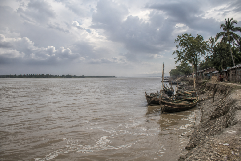
Around Ghoramara, these channels — especially the Muriganga and adjacent estuarine currents — shape every aspect of habitation.
The rivers determine where boats can move.
- Where embankments collapse.
- Where farming remains possible.
- Where settlements retreat.
Even conversations are organized around tides.
People here rarely discuss distance in kilometers alone. They discuss crossings according to current strength, tidal timing, monsoon conditions, and erosion risk.
A tea seller near the embankment explains casually: “During rough tides, the river decides whether you travel.”
The statement sounds philosophical until one watches the currents.
The estuary surrounding Ghoramara is not smooth water. It churns unpredictably, particularly during monsoon months and cyclonic conditions. Scientific studies have linked shoreline retreat here to complex interactions between tidal hydrodynamics, sediment transport, reduced freshwater discharge, and human interventions affecting the lower Hooghly system.
In many places, the embankments are all that separate habitation from tidal inundation.
And the embankments themselves are fragile.
- Villagers walk atop them daily because they double as roads.
- Children cycle along them.
- Fishermen drag nets across them.
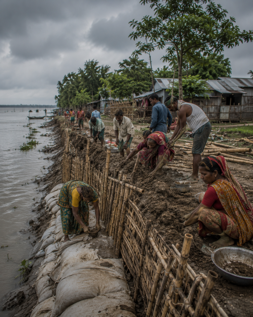
Yet cracks appear everywhere — repaired repeatedly with mud, bamboo piling, and local labour.
On Ghoramara, infrastructure is a temporary negotiation. Not permanence.
Historical Footprints
By midmorning, the island begins to heat under a white estuarine sun. The pathways narrow between ponds and cultivated plots. Coconut trees lean inland as if shaped permanently by cyclone winds.
History here survives mostly in fragments.
Unlike older mainland settlements with monumental architecture, Ghoramara’s past has often been erased physically by the rivers themselves. What remains lives in administrative records, oral memory, colonial references, and the geography of disappearance.
The island’s modern settlement history is tied closely to the wider human transformation of the Sundarbans delta during the colonial period. Across the nineteenth century, large sections of tidal forest and marshland were progressively reclaimed for cultivation and habitation through embankment construction and organized settlement schemes.
Like many islands of the lower delta, Ghoramara became part of that frontier landscape — a zone where reclaimed land promised cultivation but demanded constant battle against water.
- Settlers arrived gradually.
- Fishing communities.
- Agricultural families.
- Boatmen.
- Labourers connected to the river trade.
- Small-scale cultivators are seeking land.
The estuary offered opportunity, but never security.
Historical references suggest the island once supported far larger settled areas than exist today. Several neighboring landmasses, including the vanished Lohachara Island and Bedford Island, were similarly affected by erosion across the twentieth century.
The memory of Lohachara still haunts Ghoramara.
Because its disappearance proved something terrifying:
An inhabited island here can actually vanish.
Not metaphorically.
Completely.
Older residents remember families relocating in phases — first shifting homes inland, then migrating toward Sagar Island, Kakdwip, or the mainland when erosion made survival impossible. Environmental displacement became normalized long before the phrase “climate refugee” entered the public vocabulary.
Yet despite repeated predictions of disappearance, Ghoramara persists.
- Reduced.
- Damaged.
- But inhabited.
Historical Personalities & Transformations
The island’s transformations are less associated with famous national figures and more with administrators, local organizers, teachers, ferry operators, embankment workers, and panchayat leaders who shaped survival on the margins of the estuary.
In Ghoramara, influence is often measured through practical acts.
- Who organized repairs after storms?
- Who negotiated rehabilitation?
- Who arranged transport during medical emergencies?
- Who kept schools functioning after embankment breaches?
Local governance structures became especially critical as repeated erosion displaced households and reduced cultivable land. Gram-level administration evolved not simply around development, but around adaptation.
The post office at Mud Point became one such unlikely symbol.
Established during the colonial era, it once served as part of a communication network warning ships and authorities about storms and river dangers in the Hooghly estuary. Later, it remained important as one of the few reliable communication points for island residents.
Even today, people speak of Mud Point not merely as a location, but as a connection to the outside world.
In islands threatened by isolation, communication itself becomes infrastructure.
Folklore & Legends
By afternoon, the tide begins rising again.
A group of elderly men sits beneath a tree near a tea stall overlooking the embankment. Conversations drift between politics, fishing conditions, embankment repairs, and storms. Then, naturally, toward Bonbibi.
No discussion of the delta remains entirely secular.
Even on an island with limited forest cover compared to deeper Sundarbans regions, the spiritual geography of the estuary remains deeply connected to the larger mythology of the mangrove world.
Bonbibi — protector of those entering dangerous landscapes — still exists in local consciousness not as distant folklore but as practical belief. Fishermen and crab collectors crossing tidal channels often invoke her protection before entering risky waters.
Dakshin Ray, associated historically with tiger lore and forest danger, appears less frequently in everyday conversation on Ghoramara than in forest-fringe islands deeper within the mangrove zones. Yet the wider cosmology of river spirits, dangerous tides, and unseen estuarine forces remains alive.
The river itself carries personality here.
People speak of it almost as an entity capable of anger.
A woman repairing fishing nets says quietly: “The river takes what it wants.”
Not metaphorically.
Literally.
Entire family histories on Ghoramara are divided into before and after erosion events.
Some residents can point toward open water and identify former village locations now submerged beneath tidal currents.
The drowned geography becomes part of oral memory.
A vanished landscape still mentally inhabited.
Life Between The Tides
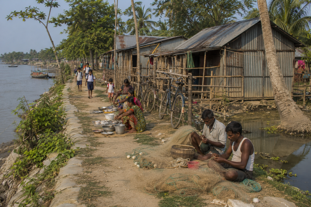
The afternoon slows under humid air thick with the smell of mud, fish, woodsmoke, and drying nets.
Daily life on Ghoramara follows the logic of tides more than clocks.
- Fishing remains central to survival for many families.
- Small boats move through tidal creeks and estuarine channels catching fish, shrimp fry, and crabs depending on season and river conditions.
- Nets hang everywhere — beside homes, across courtyards, over embankments.
Agriculture survives where salinity allows.
Paddy cultivation once dominated larger portions of the island, but saline intrusion and erosion have significantly reduced productive farmland over time. Some plots still support rice, vegetables, and seasonal crops, though uncertainty remains constant.
Water defines labour here.
Women often spend long hours managing household water collection because saline contamination affects drinking sources. Ponds are protected carefully. Tube wells become essential community assets.
Children walk to school along raised embankment roads exposed to monsoon damage.
Electricity supply remains inconsistent in parts of the island.
- Mobile connectivity fluctuates.
- Ferry schedules depend heavily on weather and tides.
Yet life continues with remarkable routine.
- A barber works beneath a tin roof beside the embankment.
- Schoolboys play cricket on a shrinking open field.
- Someone repairs a bicycle tube beside a tea stall.
- Someone else dries fish on bamboo racks facing the river.
Ghoramara’s daily life is not defined only by disaster.
It is defined by persistence.
Walking Through The Villages
Toward late afternoon, the island reveals its quieter details.
The villages are not dense in the manner of mainland Bengal settlements. Houses appear scattered between ponds, embankments, trees, and cultivated patches, giving the landscape a porous quality where water always feels nearby.
Courtyards are swept clean.
- Tulsi platforms rise beside entrances.
- Mosquito nets dry in the sunlight.
Many homes display signs of repeated reconstruction — older foundations beside newer tin walls, abandoned sections overtaken by weeds, repaired storm damage visible in mismatched materials.
- Temples here are modest.
- So are mosques.
The scale reflects both economic reality and environmental uncertainty. Monumental construction feels almost impractical on land that may not endure.
- Tea stalls function as information exchanges.
- Fishermen discuss tides.
- Farmers discuss salinity.
- Young men discuss migration opportunities toward Kolkata or farther away.
Everyone discusses embankments.
Because embankments are survival.
In many sections, the pathways themselves feel provisional, bending around eroded edges or newly repaired breaches. Some stretches open directly onto exposed riverbanks where the estuary appears alarmingly close to habitation.
Standing there, it becomes impossible not to understand the island psychologically.
Everyone here lives with spatial memory.
People remember where the river used to be.
And where it will likely reach next.
Sounds Of The Island
Ghoramara is never truly silent.
- But its sounds are unlike mainland Bengal.
- The island breathes through water.
Even while walking inland, the tide remains audible somewhere beyond the embankments — a distant slapping rhythm against mudbanks, bamboo piling, and anchored boats.
During high tide, the estuary produces a constant low roar, especially when strong winds move upriver from the Bay of Bengal.
The rest of the soundscape arrives in layers.
- Metal utensils are washed beside ponds.
- Goats bleating from raised courtyards.
- The sputtering engine of a diesel irrigation pump.
- Cycle bells on narrow embankment paths.
- Radio broadcasts carrying football commentary from Kolkata.
- A temple bell rings softly before evening prayers.
And birds.
Always birds.
- Drongos are calling from the electric wires.
- Pond herons lift suddenly from marsh edges.
- Parakeets screeching across the settlement at dusk.
In deeper twilight, another sound emerges — the sharp mechanical clicking of crickets and estuarine insects rising from grassland patches near the embankments. The island seems to change its acoustic identity after sunset.
The river becomes louder.
Humans quieter.
Wildlife Expedition
Ghoramara does not possess the dense tiger-haunted forests associated with the deeper protected regions of the Sundarbans Biosphere Reserve.
Its wildlife experience is subtler.
- Fragmented.
- Estuarine.
- Edge-adapted.
Yet for a patient observer, the island remains ecologically alive.
Birdlife is the most visible companion to daily existence.
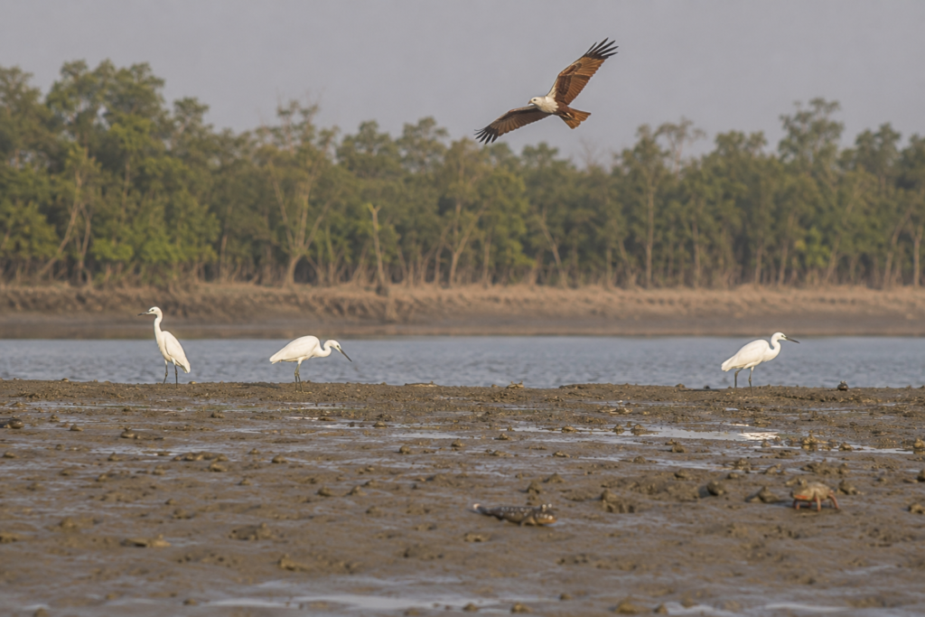
- Brahminy kites circle above fishing zones scanning exposed tidal flats for scraps.
- Little cormorants dive repeatedly in narrow channels beside the embankments.
- Egrets and pond herons follow fishing activity with opportunistic precision.
During winter months, migratory species occasionally appear across the estuarine wetlands surrounding the island, using tidal mudflats and shallow water zones as temporary feeding grounds.
The mud itself contains life.
Tiny crabs emerge in synchronized movement during low tide, vanishing instantly at vibration or shadow.
Mudskippers — those amphibious fish perfectly evolved for tidal existence — flick and leap across exposed flats with prehistoric awkwardness.
The estuary around Ghoramara also forms part of a wider aquatic ecological corridor connected to the lower Sundarbans delta.
Irrawaddy dolphins and Gangetic dolphins have been recorded in sections of the Hooghly estuary and adjoining river systems, though sightings remain unpredictable and seasonal.
Residents speak more frequently of snakes than mammals.
- Water snakes.
- Rat snakes.
- Occasional cobras.
During monsoon flooding, reptiles often move closer to habitation as embankments weaken and water spreads inland.
Fishing cats — elusive wetland predators associated with delta ecosystems — are known from parts of the wider Sundarbans landscape, though reliable observations specifically around Ghoramara are limited and should not be exaggerated.
And tigers?
The island exists within the broader cultural geography of tiger country, but confirmed tiger presence on Ghoramara itself is not a defining ecological reality in the way it is for forest-fringe islands deeper inside protected mangrove zones.
Fear here comes less from predators than from water.
Mangrove Chronicles
Toward the island’s eroded southern edges, the vegetation changes.
- The air becomes saltier.
- The soil is darker and softer beneath the feet.
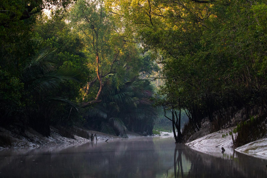
Mangroves appear not as dense forests but as surviving defensive lines against the estuary.
Clusters of mangrove vegetation persist along vulnerable shorelines and mudflats where tidal inundation remains frequent.
Species associated with the lower delta — including gewa, goran, and patches of mangrove scrub adapted to saline conditions — play critical ecological roles in stabilizing sediment and reducing wave energy.
Their roots resemble architecture built by water itself.
- Twisted.
- Exposed.
- Interlocking.
These are not decorative trees.
They are survival systems.
Where mangroves remain intact, erosion sometimes slows. Where they disappear, embankments often face direct assault from tides and cyclonic surges.
Residents understand this relationship intuitively.
Many islanders describe mangroves not simply as vegetation but as barriers between habitation and destruction.
Yet conservation on Ghoramara is complicated by pressure for habitable land. Every meter lost to erosion increases demand on remaining settlement zones. Ecological protection and human survival are frequently forced into uneasy negotiation.
- In some places, embankments have replaced mangrove buffers.
- In others, mangroves are reclaiming abandoned land after human retreat.
The island itself seems undecided whether it belongs more to people or to the estuary.
Explorer’s Field Notes
Field Note: Mid-Estuary Wind
Late afternoon winds arrive abruptly across the Muriganga. One moment the river lies flat beneath silver light; the next, small waves begin striking exposed mudbanks with audible force. Local boatmen adjust moorings instinctively before conditions visibly worsen.
Field Note: Embankment Geometry
The embankments are not uniform structures.
- Some sections consist of reinforced mud walls strengthened with bamboo and sandbags.
- Others show recent concrete intervention. Many carry visible scars from overtopping during previous cyclones.
Field Note: Salinity
Freshwater ponds are protected with unusual care. Several are elevated or shielded from direct tidal contamination. Residents frequently discuss water quality during conversations about storms.
Field Note: Migration
Many younger residents speak of employment outside the island — Kolkata, Haldia, Kerala, Chennai. Migration appears woven into the island economy not merely for opportunity, but as adaptation.
Nightfall On The Island
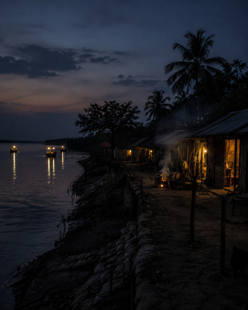
Sunset arrives quickly over the estuary.
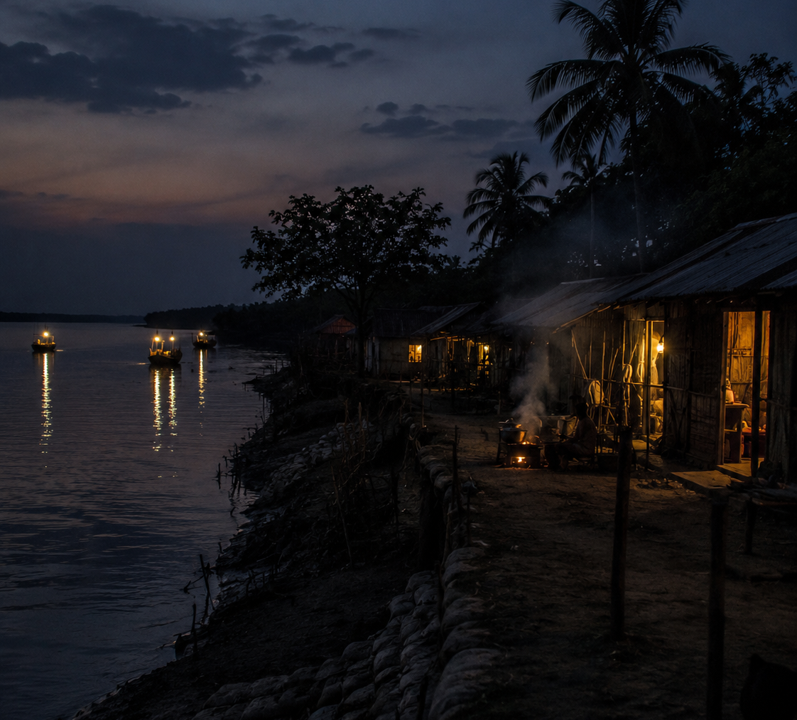
The western horizon beyond Sagar Island turns copper-orange while the Muriganga darkens into bands of black water reflecting scattered fishing lights.
- Smoke from evening cooking fires drifts low across the settlements.
- A loudspeaker somewhere broadcasts evening prayers before fading into the wind.
And suddenly, Ghoramara feels isolated.
- Ferries slow.
- Movement decreases.
- The mainland becomes psychologically distant.
Electric lights flicker unevenly across the island, interrupted by occasional outages. In darker sections, kerosene lamps still glow inside homes. The embankments empty except for fishermen and returning boats timing their crossings against the tide.
At night, the island’s fragility becomes more apparent.
The river cannot be seen clearly.
Only heard.
- Waves striking embankments.
- Boat engines moving invisibly through darkness.
- Wind rattling tin roofs.
For residents, nights during storm season carry particular tension. Strong winds after dark can trigger immediate anxiety because embankment breaches often become most dangerous when visibility disappears.
Several islanders describe sleeping lightly during cyclone warnings.
Listening continuously.
Waiting for the sound of water.
The Seasons Of The Island
Winter
Winter is the gentlest season on Ghoramara.
- The humidity retreats.
- Skies sharpen into pale blue expanses above the estuary.
- Fishing activity increases during calmer river conditions.
- Migrating birds occasionally appear along exposed mudflats and wetlands.
- Morning fog sometimes hangs low across the Muriganga, softening the island into near-monochrome silence.
This is the season when the embankments feel temporarily stable.
Predictable.
Spring
Spring arrives subtly.
- New vegetation appears around ponds and settlement edges while temperatures begin rising rapidly by late March.
- Farmers monitor soil salinity carefully before planting seasonal crops.
- Dust and dry wind replace winter clarity.
The river grows restless again.
Summer
Summer on Ghoramara is oppressive.
- Heat reflects upward from mud embankments and stagnant tidal pools.
- Drinking water becomes more difficult to manage.
- Humidity thickens the air even before monsoon clouds arrive.
- Storms begin appearing on distant horizons.
Everyone watches them.
Monsoon
The monsoon transforms the island completely.
- Rainwater floods pathways.
- Embankments soften.
- Tidal currents intensify.
- Boats move cautiously through swollen channels carrying supplies, fish, and passengers between islands.
The Muriganga expands psychologically during monsoon.
- Crossings feel longer.
- More dangerous.
- More uncertain.
Post-Monsoon
Post-monsoon months carry both relief and damage assessment.
- Families repair homes.
- Fields recover where possible.
Embankments are inspected constantly for weak sections before cyclone season intensifies again over the Bay of Bengal.
Cyclone Season
There is no true “safe” cyclone season in the lower delta anymore.
Storms have become part of the island’s modern chronology. People remember years through cyclones.
- Aila.
- Bulbul.
- Amphan.
- Yaas.
Each name marks a different wound.
Cyclones And Survival
Near one embankment breach repaired after severe tidal damage, an elderly man points toward the river and says:
“The water came from there.”
He raises his hand above chest height.
Cyclones are not abstract weather events on Ghoramara.
They are living invasions.
Cyclone Aila in 2009 severely affected large parts of the Sundarbans delta, including embankment failures, saline flooding, and agricultural destruction across vulnerable islands. Later storms such as Amphan in 2020 caused extensive damage again, exposing the continuing fragility of delta settlements.
On Ghoramara, storms do more than damage houses.
They accelerate erosion.
Storm surges weaken embankments already under pressure from tidal currents. Once protective structures fail, saline water floods agricultural fields and ponds, sometimes rendering land unusable for extended periods.
Recovery becomes cyclical.
- Repair.
- Rebuild.
- Wait.
- Repeat.
Yet survival systems have evolved.
Cyclone shelters now play critical roles during severe weather warnings. Local administration, ferry coordination, and embankment monitoring become emergency infrastructure.
Residents maintain informal communication networks to warn each other about rising tides, dangerous currents, and vulnerable embankment sections.
Adaptation here is not theoretical climate policy.
It is a daily behaviour.
- Homes are built differently.
- Boats are anchored differently.
- People store food differently.
- Children learn storm awareness early.
The island itself has become a living classroom in climate resilience.
Oral Histories
After dark, conversations lengthen.
Without daytime labour, memory surfaces more easily.
- One resident recalls former agricultural land now lying beneath the estuary.
- Another describes relocating a family home twice within a single generation.
- Someone remembers orchards.
- Someone remembers a football field.
- Someone else remembers the exact location of a vanished temple now underwater.
These memories matter because Ghoramara’s geography changes faster than official narratives can record.
Several academic and journalistic accounts over recent decades have documented population displacement associated with erosion on the island.
Families have migrated toward Sagar Island, Kakdwip, mainland Bengal, and beyond in search of stability.
Yet many residents remain deeply attached to the island despite uncertainty.
Because home here is not measured through permanence alone.
It is measured through familiarity.
- Through graves.
- Through ponds excavated by grandparents.
- Through temples rebuilt after storms.
- Through fishing routes known instinctively from childhood.
Ghoramara survives partly because memory refuses surrender.
Food Of The Island
Dinner arrives late in many households after fishing work and evening chores end.
The food reflects the estuary.
Fish dominates daily meals wherever possible — hilsa when affordable and seasonally available, smaller estuarine fish varieties, dried fish, prawns, crabs, and river catch adapted to fluctuating availability.
Rice remains central despite agricultural difficulties.
Vegetables are often seasonal and shaped heavily by soil salinity and local cultivation conditions. Lentils, pumpkin, potato, brinjal, and leafy greens appear frequently when available.
Mustard oil perfumes nearly everything.
Tea stalls serve sweet tea thick with sugar beside fried snacks, biscuits, and seasonal items brought from mainland markets by ferry.
During storms and difficult monsoon periods, diets become simpler and more dependent on stored dry goods.
Food on Ghoramara is inseparable from logistics.
Everything depends on ferries, tides, weather, and the uncertain productivity of land and river.
Island Economy
Even before dawn, the economy of Ghoramara is already moving.
- Boats leave with tides.
- Fish traders wait at landing points.
- Women sort nets beside homes.
The island economy rests on a fragile combination of fishing, small-scale agriculture, wage labour, seasonal migration, and government-linked employment schemes.
Fishing remains one of the most important livelihood systems, particularly for households with direct access to boats or estuarine fishing networks.
Crab collection and shrimp-related activity also contribute to local income patterns in surrounding tidal zones.
Agriculture has become increasingly uncertain because of erosion and salinity intrusion. Productive land has reduced significantly over time in several sections of the island.
Migration therefore, functions as economic adaptation.
Young residents increasingly seek employment outside the island in construction, transport, service work, factories, and urban labour markets across India.
Money returns through remittances.
People leave physically but remain economically connected.
Ghoramara’s economy is therefore both local and dispersed — an island sustained partly by absent workers.
Then & Now
The difference between historical Ghoramara and present-day Ghoramara is visible not through archives alone, but through spatial emptiness.
- Older maps show larger landmass areas.
- Older residents describe longer walking distances between settlements and the river.
Today, many former pathways end abruptly at eroded banks.
Scientific studies, satellite imagery, and environmental reporting have repeatedly documented substantial land loss affecting Ghoramara over decades.
But numbers alone cannot capture the emotional reality of watching geography disappear within a lifetime.
Children growing up today inherit a different island from their grandparents.
- Smaller.
- More fragile.
- More uncertain.
Yet paradoxically more globally significant.
Because Ghoramara has become one of the most internationally discussed examples of environmental vulnerability in the Bengal delta, an island frequently referenced in conversations about sea-level rise, displacement, and climate adaptation.
The world studies Ghoramara partly because the island may represent futures awaiting other coastlines.
Ferry Routes & Hidden Paths
Reaching Ghoramara is less a journey across distance than a negotiation with tides.
From Kolkata, the route gradually leaves behind highways, suburban rail corridors, and crowded mainland settlements before entering the estuarine world of South 24 Parganas.
Trains and roads lead toward Kakdwip and Harwood Point — still firmly attached to continental Bengal — but beyond that point, geography begins breaking apart into ferries, channels, mudbanks, and islands.
- The transition feels psychological.
- The mainland ends slowly.
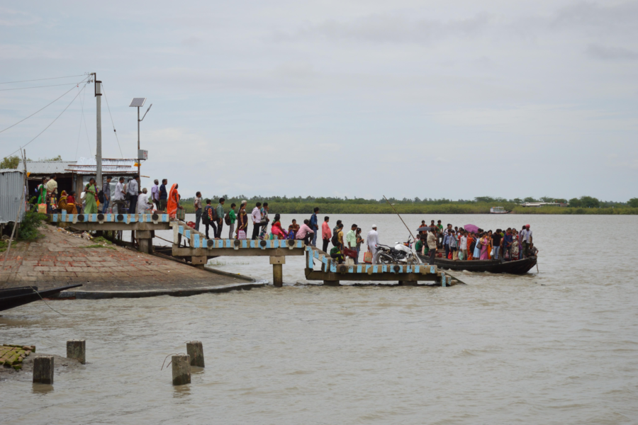
Travellers heading toward the lower estuary usually move first toward Lot No. 8 at Harwood Point, where ferries cross toward Kachuberia on Sagar Island.
From there, smaller local transport systems and boat crossings connect to surrounding settlements and islands depending on tide, season, and weather conditions.
Ghoramara itself is approached through smaller ferry points and local boat routes linked to Mud Point and nearby embankment settlements. Routes vary because river conditions vary.
That uncertainty is part of the island’s geography.
There is no dramatic gateway arch announcing arrival.
- Only river.
- Mud landing points.
- And embankments rising cautiously above the tide.
During monsoon months, crossings become significantly more difficult.
Strong winds and swollen estuarine currents delay or suspend local movement entirely.
Boat operators often rely on deep practical knowledge of tidal behaviour rather than formal navigation systems.
On some mornings, ferries wait for the river to permit movement.
The estuary remains the final authority.
Photography Expedition Guide
Ghoramara is not a landscape of postcard beauty.
It is a landscape of atmosphere. The island rewards patience more than spectacle.
Sunrise Photography
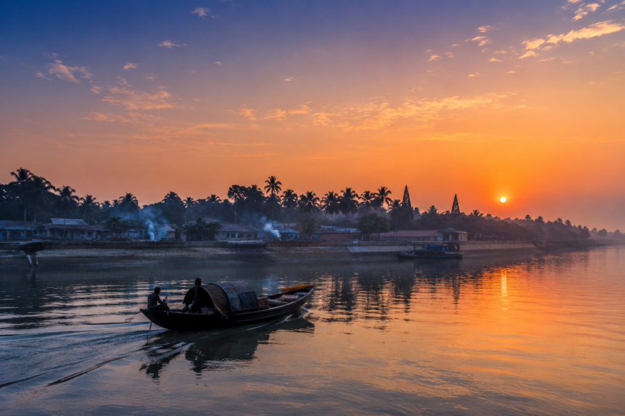
The best sunrise conditions emerge along embankments facing the Muriganga estuary, particularly during winter and post-monsoon mornings when fog softens the river into layered silhouettes.
Photographers should watch for:
- ferry movement through mist
- fishing boats against first light
- egrets lifting from tidal flats
- silhouettes of embankment walkers
- reflections in protected freshwater ponds
The light here changes quickly.
Golden tones often last only minutes before becoming harsh estuarine white.
Human Landscape Photography
Ghoramara’s most powerful visual subjects are human adaptations to environmental instability.
Not staged portraits.
- Observed resilience.
- Repairing embankments.
- Drying fishing nets.
- Children walking raised pathways.
- Cyclone reconstruction.
- Water collection.
- Salt-affected fields.
These scenes require sensitivity and permission, particularly in vulnerable communities accustomed to being photographed as symbols of climate crisis.
The island deserves documentation without exploitation.
Wildlife Photography
Winter months provide the best opportunities for estuarine bird observation along exposed mudflats and shallow water zones.
Useful focal subjects include:
- Brahminy kites
- pond herons
- egrets
- cormorants
- tidal crab activity
- mudskippers
- fishing scenes during low tide
The ecology here is subtle rather than dramatic.
Telephoto patience matters more than luck.
Monsoon Photography
Monsoon transforms the island visually but also creates dangerous movement conditions. Flooded pathways, collapsing embankments, and unstable river crossings make photography expeditions risky during severe weather periods.
Yet this season reveals Ghoramara’s true elemental identity: water, mud, wind, survival.
Expedition Notes
The River Eats Quietly
Erosion here rarely arrives with cinematic collapse.
Often the river advances incrementally — a little embankment lost after each monsoon, another pond contaminated by salinity, another section weakened before the next cyclone.
Disappearance occurs through repetition.
Trees Lean Inland
Along vulnerable shorelines, many surviving trees visibly angle away from the estuary. Their exposed roots reveal years of shoreline retreat more honestly than official measurements.
Embankments Are Social Spaces
They are not merely flood defenses.
People walk them, fish from them, gather upon them, repair them, argue on them, and measure danger through them.
On Ghoramara, embankments function almost like communal arteries.
Memory Works As Cartography
Residents frequently describe vanished locations with astonishing precision.
- “This was the market.”
- “That was our pond.”
- “The school stood there.”
They point toward open water.
Connected Landscapes
See it for yourself
A private journey shaped around you — your group, your pace, your interests. Book a free consultation.
No island in the lower Sundarbans exists in isolation.
Ghoramara belongs to a shifting network of estuarine relationships shaped by water routes, sediment movement, migration, ecology, and memory.
To the south lies Sagar Island — larger, more populated, and historically significant as a major pilgrimage landscape associated with Gangasagar. Yet even Sagar shares Ghoramara’s exposure to cyclones, tidal erosion, and estuarine instability.
To the north and east stretch wider channels connecting toward Kakdwip, Namkhana, and the densely inhabited margins of the lower delta.
Beyond the visible horizon lies the deeper Sundarbans mangrove system — one of the largest tidal mangrove forests on Earth — though Ghoramara itself stands more on the estuarine frontier than inside dense forest terrain.
Nearby vanished or heavily transformed islands remain psychologically connected to Ghoramara’s story.
Lohachara especially survives in conversation almost like a cautionary ghost.
Its disappearance changed how residents across the estuary understood permanence.
Even birds connect these landscapes.
Migratory species move between mudflats, wetlands, estuarine shallows, and mangrove corridors regardless of human administrative boundaries.
The river system itself ignores maps.
Oral Histories Of Disappearance
Near evening, stories grow more specific.
An elderly resident recalls relocating his house using salvaged tin sheets and bamboo after the river consumed the original settlement edge.
Another remembers crossing longer distances as a child before erosion shortened the island. Someone speaks of weddings once attended in villages that no longer exist.
One woman remembers carrying drinking water across sections of land now permanently underwater.
These are not dramatic speeches.
They are ordinary recollections delivered calmly.
That calmness may be the island’s most remarkable feature. Elsewhere, environmental catastrophe is often discussed as future threat.
On Ghoramara, environmental transformation is already archived inside personal memory.
And yet many residents reject narratives portraying the island only as tragedy.
Because life continues.
- Children still attend school.
- Fishing boats still leave before dawn.
- Festivals still occur.
- People still marry, cook, argue, migrate, return, rebuild.
The island survives not because danger disappeared, but because daily life refuses surrender.
Food Of The Estuary
Morning markets on and around the island reveal the practical diet of tidal Bengal.
Fish arrives first.
Small estuarine catches spread across plastic sheets and metal trays while buyers inspect freshness through touch and smell rather than appearance alone.
Crabs tied with strips of fibre move slowly in baskets beside prawns and drying fish.
Rice remains foundational.
So does salt.
In an environment where freshwater itself becomes precious, cooking practices evolve carefully around available resources.
Mustard oil dominates flavour profiles.
Green chilies appear constantly.
Smoked and dried fish become important during difficult weather periods when transport systems weaken.
Tea stalls function as social centers where labourers, fishermen, ferry workers, and visitors exchange information about tides, storms, politics, migration, and embankments over small glasses of intensely sweet tea.
Food here is not curated cuisine.
It is an adaptation.
The Wild Orbit Quick Facts
Location
Lower Hooghly estuary, South 24 Parganas district, West Bengal, India
Administrative Block
Sagar Community Development Block
Dominant Identity
Climate frontier island shaped by erosion, tidal instability, migration, and estuarine survival
Approximate Coordinates
Near the Muriganga estuary north of Sagar Island
Surrounding Waters
Muriganga River and the connected Hooghly estuarine channels
Nearest Major Transit Points
Kakdwip, Harwood Point (Lot No. 8), Kachuberia
Landscape Type
Estuarine settlement island with embankments, tidal mudflats, fragmented mangrove patches, ponds, and agricultural remnants
Ecological Highlights
Estuarine birdlife, mudflats, tidal ecology, mangrove-edge vegetation, delta hydrology
Primary Livelihoods
Fishing, small-scale agriculture, wage labour, migration-linked income
Major Environmental Challenges
Erosion, saline intrusion, cyclones, embankment collapse, displacement
Best Season For Expedition Exploration
Winter and post-monsoon months for safer crossings, clearer skies, and stable visibility
The Wild Orbit Expedition Snapshot
Accessibility
Moderate to difficult depending on season, tides, and ferry conditions
Wildlife Potential
Subtle but rewarding for estuarine bird and tidal ecology observation
Photography Potential
Exceptional for documentary, environmental, riverine, and climate-landscape photography
Cultural Richness
High — especially for oral histories, adaptation narratives, estuarine livelihoods, and disappearing landscapes
Historical Interest
High — climate transformation, settlement history, delta migration, embankment culture
Solitude Level
High outside ferry points and local market clusters
The Wild Orbit Explorer Connections
Readers exploring Ghoramara should naturally continue toward:
- Sagar Island and Gangasagar
- Kakdwip ferry networks
- Muriganga estuary crossings
- Lower Hooghly tidal systems
- Sundarbans embankment landscapes
- climate adaptation zones of the Bengal delta
- disappearing island geographies
- mangrove restoration corridors
- estuarine fishing settlements across South 24 Parganas
The island is best understood not as isolated territory, but as part of a living delta constantly reorganizing itself.
FAQs
1. Where is Ghoramara Island located?
Ghoramara Island lies in the lower Hooghly estuary within South 24 Parganas district of West Bengal, north of Sagar Island.
2. Why is Ghoramara Island famous?
The island is internationally known for severe erosion, shrinking landmass, environmental displacement, and climate vulnerability in the Sundarbans delta region.
3. Is Ghoramara part of the Sundarbans?
Yes. It belongs to the wider Sundarbans estuarine landscape, though it is not a dense mangrove forest island like protected core forest zones.
4. How do people reach Ghoramara?
Access usually involves rail or road travel toward Kakdwip and Harwood Point, ferry crossings toward Sagar Island, and smaller local boat connections depending on tides and weather.
5. Which river surrounds Ghoramara?
The island is closely associated with the Muriganga estuary and connected Hooghly tidal channels.
6. Why is the island shrinking?
Erosion, tidal hydrodynamics, cyclones, sediment changes, saline processes, and estuarine instability all contribute to land loss.
7. Has population declined on Ghoramara?
Yes. Many families have migrated because of erosion and environmental uncertainty.
8. What are the main livelihoods?
Fishing, estuarine labour, small-scale farming, migration-based income, and informal work.
9. Is agriculture still possible?
Limited agriculture survives in some areas, though salinity and land loss have reduced productivity.
10. Are mangroves present on the island?
Small mangrove patches and estuarine vegetation remain along vulnerable tidal sections.
11. Are tigers found on Ghoramara?
The island is culturally connected to tiger-country folklore, but it is not known as an active tiger landscape like deeper forest regions.
12. What wildlife can visitors observe?
Birdlife, mudflat ecology, estuarine species, crabs, mudskippers, and tidal wetland ecosystems.
13. Which season is best for exploration?
Winter and post-monsoon months usually provide safer conditions and clearer visibility.
14. Is monsoon travel risky?
Yes. Strong tides, flooding, ferry disruption, and embankment instability increase risks significantly.
15. What is Mud Point?
Mud Point is an important landing and communication location historically associated with estuarine movement and river navigation.
16. Did nearby islands disappear completely?
Yes. Lohachara Island is among the most cited examples of heavily eroded or vanished islands in the region.
17. Are embankments important here?
Absolutely. Embankments protect settlements from tidal flooding and function as roads and community spaces.
18. What kind of houses are common?
Tin-roofed, bamboo-supported, and cyclone-adapted homes dominate much of the island.
19. Is freshwater scarce?
Freshwater management is a major challenge because salinity affects ponds and groundwater.
20. Do ferries operate year-round?
Generally, yes, but schedules and safety depend heavily on tides and weather.
21. Is electricity reliable?
Supply exists but may remain inconsistent during severe weather or infrastructural damage.
22. What does the island sound like at night?
Waves against embankments, boat engines, insects, wind, and distant river movement dominate the soundscape.
23. Why do researchers study Ghoramara?
It provides a major case study in erosion, displacement, delta ecology, and climate adaptation.
24. Can photographers document the island responsibly?
Yes — with sensitivity, consent, and awareness that residents are communities rather than climate symbols.
25. What makes Ghoramara emotionally unique?
Its landscape contains a living memory of disappearance. Residents remember land that no longer exists.
26. Does the island still feel inhabited despite erosion?
Very much so. Daily life remains active, resilient, and deeply rooted despite uncertainty.
27. Is Ghoramara a tourism destination?
Not in the conventional sense. It is better understood as an estuarine human landscape shaped by environmental change.
How To Reach Ghoramara Island
From Kolkata
Travellers usually begin from Kolkata by train or road toward Kakdwip in South 24 Parganas.
Rail Route
Local trains from the Sealdah South section connect to Kakdwip railway station. From there, road transport leads toward Harwood Point.
Road Route
Road travel follows the Diamond Harbour corridor toward Kakdwip and Harwood Point.
Ferry Crossing
From Lot No. 8, ferries cross the Muriganga toward Kachuberia on Sagar Island. Additional local boat or ferry routes connect onward, depending on tide and operational conditions.
Seasonal Notes
Monsoon crossings can become difficult or delayed due to weather and strong currents.
Explorer Tips
- Begin your journey early to allow enough time for ferry crossings and exploration.
- Check local ferry schedules in advance, as timings may vary with tides and weather.
- Monitor tide conditions carefully before planning river crossings.
- Carry sufficient drinking water, especially during warmer months.
- Wear sturdy, non-slip footwear suitable for muddy embankments and uneven terrain.
- Keep cameras, phones, and important belongings in waterproof bags during boat travel.
- Stay informed about weather forecasts, particularly during the monsoon and cyclone seasons.
- Respect local communities and always ask permission before photographing people or private property.
- Avoid walking on damaged embankments or freshly eroded riverbanks, especially after heavy rain or high tide.
- Leave no trace behind and help protect Ghoramara’s fragile estuarine ecosystem.
Things To See Around Ghoramara
Muriganga Estuary
The defining river landscape shapes erosion, transport, fishing, and island identity.
Embankment Roads
The best way to understand settlement vulnerability and estuarine adaptation.
Mud Point
Historically important river communication and ferry zone.
Tidal Mudflats
Especially active during low tide for bird observation and estuarine ecology.
Nearby Sagar Island
Connected culturally, geographically, and historically through ferry networks and delta life.
Ferry Crossings At Dawn
One of the most atmospheric experiences in the lower estuary.
Village Courtyards
Subtle but revealing spaces showing architecture adapted to cyclones and salinity.
Pond Networks
Essential freshwater systems protected carefully by residents.
Winter Bird Activity
Particularly rewarding for patient observers along wetland edges and shallow estuarine zones.
Continue The Journey
Leaving Ghoramara does not mean leaving its story behind.
The island lingers long after the ferry pulls away, not because of what stands upon it today, but because of everything the river has reshaped over generations.
Every crossing across the Muriganga carries echoes of disappearing shorelines, rebuilt homes, and lives continually adapting to the rhythms of water.
From Ghoramara, the estuary unfolds in countless directions.
Southward lies Sagar Island, where the sacred waters of Gangasagar draw pilgrims from across India, adding another layer to the cultural landscape of the lower delta.
Northward, Kakdwip reconnects the islands to the mainland, serving as a gateway where river journeys begin and end.
Beyond these familiar routes, the waterways spread deeper into the Indian Sundarbans, weaving through mangrove forests, tidal creeks, remote islands, and wildlife habitats where the influence of the tides is felt every day.
Each island possesses its own geography, history, and relationship with the rivers. Some are shaped by dense mangrove forests, others by agriculture, fishing, or centuries of settlement.
Ghoramara is defined by erosion and resilience, but its story becomes even richer when understood alongside the wider delta.
The estuary also carries memories of islands that have changed beyond recognition. Places such as Lohachara remain part of the collective memory of the Sundarbans, reminding visitors that the geography of this delta has never been fixed. Here, rivers redraw maps as naturally as they carry sediment toward the Bay of Bengal.
To continue exploring Ghoramara is to continue exploring the Sundarbans itself—its rivers, islands, embankments, wildlife, communities, and living traditions. Every crossing reveals another chapter in one of the world’s most dynamic estuarine landscapes.
Because Ghoramara does not end at its shoreline.
It continues through every conversation about climate, migration, erosion, resilience, and the remarkable relationship between people and the ever-changing waters of the Bengal delta.
Leaving Ghoramara Behind
The last ferry leaves as the evening tide begins to rise.
Standing quietly on the deck, Ghoramara slowly retreats into the widening estuary.
- First the embankments disappear behind the curve of the river.
- Then the silhouettes of coconut palms and scattered houses dissolve into the fading light.
For a few moments, the island exists only as a thin dark line between water and sky before it, too, becomes part of the horizon.
The engine hums steadily toward the mainland, but the mind lingers behind.
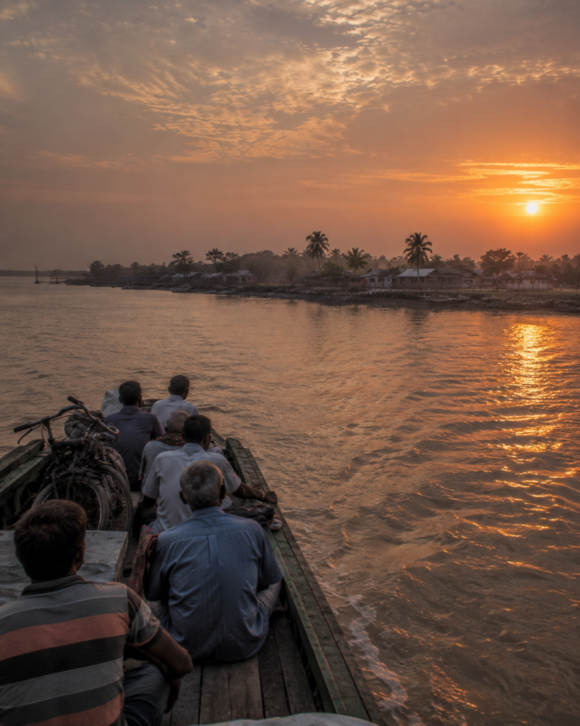
Somewhere beyond the stern, waves continue to strike the embankments that protect homes, ponds, fields, and memories. They arrive with the same rhythm they have followed for generations, patiently reshaping the shoreline one tide at a time.
Tomorrow, long before sunrise, fishing boats will return to the river.
- Children will walk the embankments on their way to school.
- Farmers will inspect fields shaped by salt and fresh water.
- Neighbours will gather at tea stalls, speaking of the weather, the tides, and the river as they always have.
Someone will reinforce another stretch of embankment.
Someone will remember a village that no longer appears on today’s maps.
Someone will point across the water and quietly say, “Our home once stood there.”
Perhaps that is what makes Ghoramara unforgettable.
It is not simply an island defined by erosion or climate change. It is a place where every tide redraws the landscape, yet life continues with remarkable determination.
Here, resilience is not celebrated as an extraordinary achievement; it is woven into ordinary mornings, familiar ferry crossings, and generations of people who have learned to live beside a river that never truly stands still.
As darkness settles across the estuary, Ghoramara disappears from view.
Its story does not.
It drifts with the tide through the rivers of the Indian Sundarbans—carried in memory, shaped by water, and waiting for the next traveller willing to slow down, cross the estuary, and listen to an island that continues to endure at the restless edge of the delta.
Plan your private Sundarban expedition
A private journey shaped around you — your group, your pace, your interests. Book a free consultation.