 Encyclopedia
The river was already awake long before dawn.
At 4:47 AM, somewhere south of Kolkata and deep inside the lower delta of Bengal, our wooden launch drifted through a channel of dark water that reflected nothing but fragments of stars. The tide was rising. One could hear it more than see it—the slow push of incoming water pressing against muddy banks hidden in darkness.
A distant engine echoed through the river. Then silence again. Not complete silence. Sundarbans silence. The kind filled with invisible sounds. A night heron called from somewhere among mangroves. Mudskippers splashed in the shallows.
The wind carried a faint scent of salt mixed with wet earth.
Far ahead, a single lantern moved across the river like a wandering firefly. Perhaps a fisherman returning before sunrise. Perhaps a crab collector crossing to another embankment before the day’s heat arrived.
The boatman pointed ahead.
“Patharpratima.”
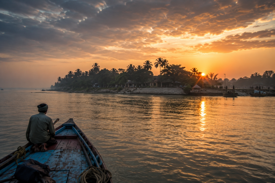
At first, there was nothing. Only darkness. Then slowly, as the eastern horizon turned from black to indigo, shapes emerged.
- A line of trees.
- An embankment.
- Scattered houses.
The outline of one of the largest inhabited islands in the Indian Sundarbans. Patharpratima does not reveal itself dramatically. Unlike some islands that rise suddenly from water, Patharpratima appears gradually, as though assembled by light itself. Minute by minute, the island came into focus.
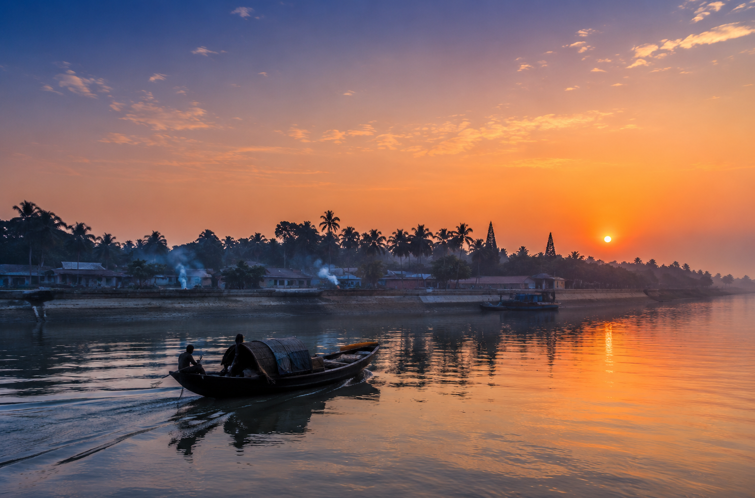
Smoke rose from cooking fires. A temple loudspeaker crackled to life. Somewhere, a rooster announced the arrival of morning. By the time the first orange light touched the river, the island stood fully revealed—vast, inhabited, cultivated, and intricately tied to the tidal rhythms that created it.
The journey had begun.
First Encounter
Approaching Patharpratima by river provides the clearest understanding of its character.
Unlike smaller islands scattered through the delta, Patharpratima possesses a sense of scale. The shoreline extends far beyond what the eye can easily follow.
- Embankments trace long curves along riverbanks.
- Clusters of homes appear behind rows of coconut palms.
- Fishing boats rest against muddy slopes waiting for the tide.
- Women walk toward the tube wells carrying metal containers.
- Children in school uniforms cycle along narrow roads atop embankments.
The island feels simultaneously isolated and connected. Isolated because water surrounds it.
Connected because rivers serve as highways.
At one landing point, passengers disembark carrying vegetables, sacks of rice, fishing nets, bicycle parts, and occasionally livestock. The scene resembles a river port more than an island village. This is one of the defining characteristics of Patharpratima.
It is not merely an island. It is a living node within the wider Sundarbans landscape. Every arrival jetty functions as a doorway.
- People flow constantly between islands.
- Goods move between markets.
- News travels by ferries.
- Ideas travel through schools and mobile networks.
Yet despite these connections, the island retains an unmistakable frontier feeling.
- Beyond settlements lie creeks.
- Beyond creeks lie mangroves.
- Beyond mangroves begins the forest.
- Beyond the forest lies uncertainty.
The same uncertainty that has shaped human life here for generations.
Island Identity
As daylight expanded across the landscape, the true dimensions of Patharpratima became apparent. Administratively, Patharpratima serves as the center of the Patharpratima Community Development Block within the South 24 Parganas district of West Bengal.
Yet administrative descriptions reveal little about what the island actually feels like. To understand Patharpratima, one must understand scale. The block contains numerous inhabited islands distributed across the lower Sundarbans, but the island commonly referred to as Patharpratima forms one of the principal population centers of the region.
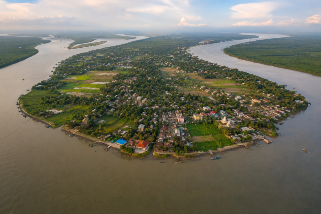
Villages spread across reclaimed land protected by embankments. Gram Panchayats administer local affairs. Schools, markets, health centers, temples, mosques, and ferry ghats connect communities that remain deeply dependent upon rivers.
Population density varies. Some stretches feel busy and semi-urban by Sundarbans standards. Others remain remarkably rural. The settlement pattern follows the logic of water.
- Homes cluster where embankments provide protection.
- Roads often parallel riverbanks.
- Markets emerge near ferry crossings.
- Schools occupy relatively elevated ground.
Nothing here is accidental. Everything has evolved according to the rules imposed by tides and rivers. The island’s geography is therefore not merely a backdrop. It is the central force shaping everyday life.
The Rivers That Built The Island
Every Sundarbans island has parent rivers.
Patharpratima has several. Standing atop an embankment after sunrise, one quickly notices that the island exists because rivers allow it to exist—and threaten it simultaneously. The great tidal rivers surrounding this landscape include channels linked to the Muriganga, Thakuran, Saptamukhi, Curzon Creek system, and numerous subsidiary waterways that weave through the lower delta.
Locals often speak about rivers the way other people speak about neighbors. Not abstract geographical features. Living presences. Each river possesses its own temperament.
- One river is known for strong currents.
- Another for dangerous erosion.
- Another for good fishing.
- Another for difficult crossings during storms.
These waterways carried settlers. They transported timber. They enabled colonial administration. They brought salt traders, fishermen, honey collectors, schoolteachers, election officials, doctors, and relief workers.
Long before roads connected portions of the region, rivers performed every essential function.
Even today, they remain indispensable.
At high tide, water rises dramatically against embankments. At low tide, mudbanks emerge. Channels widen and narrow. Boats adjust schedules according to lunar cycles. Entire routines remain synchronized with tidal movements. A visitor quickly realizes that clock time and tidal time coexist here.
And tidal time often wins.
Historical Footprints
The history of Patharpratima is inseparable from the broader history of human settlement in the Sundarbans. Several centuries ago, much of this region consisted of tidal wilderness.
- Mangroves dominated.
- Wildlife moved freely.
- Human habitation remained sparse and vulnerable.
The transformation began gradually.
- Successive waves of settlers reclaimed land.
- Forests were cleared.
- Embankments were constructed.
- Agricultural plots emerged where mangrove roots once stood.
- Colonial administrations accelerated aspects of this process.
- Land reclamation became an economic project.
- Revenue depended on cultivation.
- Settlements expanded accordingly.
The work was extraordinarily difficult. Every acre demanded labor.
- Trees had to be removed.
- Water managed.
- Soils stabilized.
- Floods survived.
- Disease endured.
Many of today’s villages exist because earlier generations persisted against environmental conditions that frequently resisted permanent settlement. The island, therefore, contains an invisible archaeological record.
Not monuments.
Not palaces.
But landscapes shaped by effort.
- Every embankment tells part of the story.
- Every cultivated field reflects generations of adaptation.
Historical Personalities & Transformations
Unlike major urban centers, Patharpratima’s history survives largely through local memory and institutional influence rather than through grand monuments.
- Schoolteachers are remembered.
- Doctors are remembered.
- Community organizers are remembered.
- Religious leaders who established places of worship are remembered.
Freedom movement participants from the wider South 24 Parganas region influenced political consciousness across these islands. Post-independence development brought new transformations.
- Schools expanded.
- Healthcare access improved gradually.
- Road networks increased.
- Electricity reached settlements.
- Communication technologies reduced isolation.
Yet perhaps the most influential figures remain anonymous.
- The embankment builders.
- The farmers who reclaimed land.
- The boatmen who connected villages.
- The women who maintained households through repeated floods and cyclones.
The history of Patharpratima belongs largely to ordinary people performing extraordinary acts of persistence.
Folklore & Legends
By mid-morning, beneath a banyan tree near a tea stall, conversation shifted from history to stories. That transition felt entirely natural. In the Sundarbans, folklore is rarely separated from reality.
It exists alongside it. A fisherman spoke of Bonbibi. Not as mythology.
- As presence.
- As protection.
- As memory.
- As cultural inheritance.
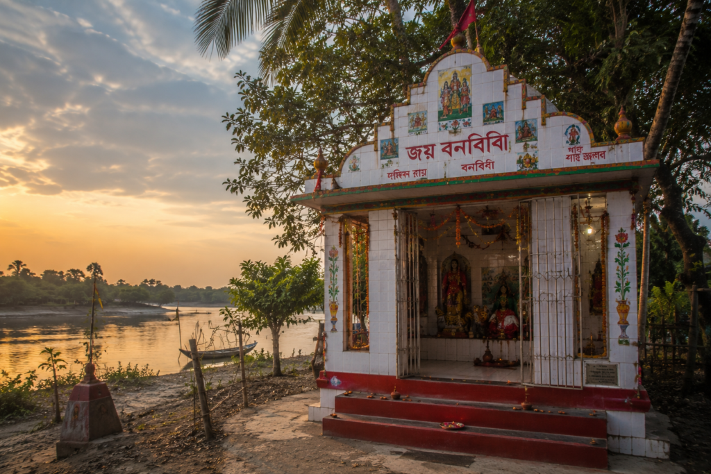
The story remains familiar across much of the delta.
- Bonbibi, guardian of forest people.
- Dakshin Ray, associated with tiger power and wilderness.
- Shah Jongoli, companion and protector.
Yet each island tells these stories differently. Patharpratima possesses its own variations. Its own emphasis. Its own interpretations.
Some elders describe encounters in creeks where strange lights appeared. Others speak about stretches of river avoided at night. Certain stories involve storms that arrive without warning. Others concern fishermen who survived impossible circumstances after invoking divine protection.
What matters is not whether every story can be verified.
What matters is what the stories reveal.
They reveal a landscape where human beings never fully dominate nature. A landscape where humility remains practical wisdom. A landscape where rivers, forests, and tides retain agency.
That understanding remains deeply embedded within Patharpratima’s cultural identity.
Life Between The Tides
By late morning, the island’s daily rhythm had become visible.
- Fishing nets dried beside homes.
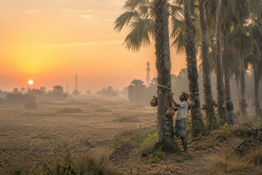
- Women sorted vegetables harvested from small agricultural plots.
- Motorcycles navigated narrow roads.
- Schoolchildren moved between classrooms.
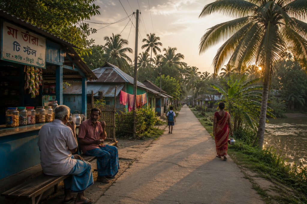
At a creekside landing, fishermen prepared boats for the next tidal cycle. Life here unfolds according to a timetable partly written by water.
- High tide determines movement.
- Low tide determines opportunity.
- Fishing schedules adapt.
- Crab collectors adapt.
- Transport schedules adapt.
- Agriculture adapts.
Even household activities sometimes adapt. The tide functions almost like an invisible community clock. Everyone knows where it stands. Everyone responds accordingly. The result is a culture of remarkable environmental awareness.
People read water levels instinctively. They notice current changes. They anticipate weather shifts. Knowledge accumulates through observation rather than formal instruction.
And nowhere is this knowledge more evident than among those whose livelihoods depend directly upon rivers.
Walking Through The Villages
Near noon, we left the embankment road and entered a village lane. Immediately, the atmosphere changed.
- The river disappeared behind trees.
- Human details came into focus.
- Courtyards swept clean.
- Coconut palms casting moving shadows.
- Hand-painted walls.
- Children playing cricket.
- Goats resting beneath the shade.
- Small shrines decorated with marigolds.
- The architecture reflects necessity more than style.
Yet necessity often creates beauty. Some homes are brick. Others combine brick, wood, and corrugated materials. Many yards contain fruit trees.
- Ponds serve practical purposes.
- Domestic life extends outdoors.
- Tea stalls function as informal meeting halls.
Every village possesses its own personality.
- Some feel busy.
- Some feel quiet.
- Some revolve around markets.
- Others around ferry points.
But all share a close relationship with water. One never walks far before encountering evidence of rivers.
- A canal.
- A pond.
- A jetty.
- A fishing net.
- A boat engine is being repaired.
Water remains present even when unseen.
Sounds of the Island
By early afternoon, Patharpratima begins to reveal itself through sound.
Not through landmarks.
Not through scenery.
Through acoustics.
Every island in the Sundarbans has a distinct soundscape, shaped by rivers, people, weather, wildlife, and geography. Patharpratima’s soundscape is richer than many because it sits at the crossroads of settlement and wilderness. Standing atop an embankment after midday, the first thing one notices is the layered nature of the sound.
No single noise dominates.
Everything overlaps.
A ferry horn echoes across a river channel. Somewhere behind a cluster of coconut trees, a bicycle bell rings.
- A fisherman shouts instructions while unloading nets.
- A distant loudspeaker broadcasts devotional songs.
- The wind rustles through betel nut palms.
- A crow interrupts the silence.
Then another. And another. The island never becomes truly quiet. Even when human activity fades, nature continues speaking. Near creeks, one hears the rhythmic popping sounds produced by mudskippers.
- Mangrove leaves scrape against one another during strong winds.
- Kingfishers announce territorial claims.
- Bee-eaters issue sharp calls from electric wires.
Occasionally, the sound of an approaching boat arrives long before the vessel itself becomes visible.
- The engine noise bends across the water.
- Travels farther than expected.
- Echoes strangely from riverbanks.
- Late afternoon introduces another layer.
- Schoolchildren returning home.
- Markets are becoming busier.
- Tea stalls are filling with conversation.
The island begins talking to itself. As sunset approaches, religious sounds emerge.
- Temple bells.
- Evening prayers.
- Conch shells.
- The call to prayer drifts across the water.
No single tradition dominates. The sounds coexist. As they have for generations. After dark, the island transforms once more. Human voices fade. Insects inherit the night. And somewhere beyond the embankments, hidden among creeks and mangrove shadows, the wild Sundarbans begins speaking in its own language.
Wildlife Expedition
No exploration of Patharpratima can ignore wildlife.
Even though much of the island is inhabited and cultivated, the surrounding landscape remains deeply connected to one of the world’s most remarkable ecological systems. The Sundarbans never truly ends at the forest boundary. Its influence extends across rivers, mudflats, creeks, and inhabited islands.
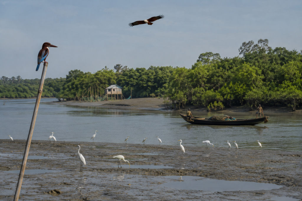
Wildlife travels.
- Birds cross daily between settlements and forests.
- Fish migrate through tidal channels.
- Reptiles move along riverbanks.
And occasionally, larger animals remind humans that the boundary between civilization and wilderness remains porous.
Birds
For birdwatchers, Patharpratima offers an extraordinary observational platform. The diversity changes according to season, habitat, and tidal conditions.
Common sightings include:
- White-throated Kingfisher
- Collared Kingfisher
- Black-capped Kingfisher
- Brahminy Kite
- Black Kite
- Egrets
- Pond Herons
- Little Cormorants
- Indian Pond Herons
- Green Bee-eaters
- Drongos
- Red-wattled Lapwings
Winter brings migratory visitors. Mudflats become temporary airports for birds traveling enormous distances. Patient observers often discover unexpected species simply by spending time beside creeks and estuaries.
Mammals
Large mammals remain difficult to observe on the inhabited portions of the island.
Yet evidence of their wider presence exists everywhere. Fishing communities remain acutely aware of tiger movements in adjacent forest zones.
Reports occasionally circulate regarding tiger crossings between islands and forested areas, though such incidents are uncommon and closely monitored.
More frequently encountered are:
- Fishing cats
- Small Indian civets
- Jackals
- Fruit bats
- Various rodents
Many remain nocturnal and therefore largely invisible to casual visitors.
Reptiles
The Sundarbans landscape naturally supports reptilian life.
Among those reported across the broader region are:
- Water monitor lizards
- Garden lizards
- Various snake species
- Mud-dwelling reptiles inhabiting creek systems
Locals often possess detailed knowledge about reptile behavior, particularly in relation to seasonal flooding.
Aquatic Life
Perhaps the most important wildlife of Patharpratima lives beneath the water.
The rivers support:
- Numerous estuarine fish species
- Prawns
- Crabs
- Mollusks
- Juvenile marine fish utilizing mangrove nurseries
Dolphin sightings occasionally occur within larger river systems connected to the lower delta, though observations are unpredictable and dependent on season and location. The island’s economy depends heavily upon these aquatic ecosystems.
Every fishing net tells part of the ecological story.
Every crab trap reflects the productivity of tidal waters.
Mangrove Chronicles
To understand Patharpratima, one must understand mangroves.
Not as plants.
- As engineers.
- As architects.
- As guardians.
- As negotiators between land and sea.
Though much of Patharpratima itself consists of reclaimed and inhabited land, nearby mangrove ecosystems continue performing essential ecological functions. Standing beside a tidal creek, one begins to appreciate its complexity.
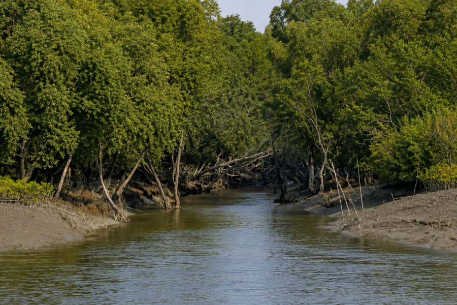
- Roots emerge from mud like sculptures.
- Branches twist toward sunlight.
- Leaves shimmer with salt crystals.
Nothing about the landscape appears accidental.
Mangroves survive where many other plants would fail.
- They tolerate salinity.
- They endure flooding.
- They stabilize sediment.
- They reduce erosion.
- They create nurseries for fish.
- They provide shelter for countless species.
Across the wider Sundarbans region, species commonly include:
- Sundari
- Gewa
- Goran
- Keora
- Dhundul
- Passur
- Bain
Each occupies slightly different ecological niches. Together, they form one of the most productive ecosystems on Earth.
Yet mangroves are not merely ecological assets. For generations, they have influenced culture.
People fear them.
Depend upon them.
Respect them.
Sometimes worship them.
The relationship remains complicated.
- A honey collector entering mangrove forests sees opportunity.
- A fisherman sees livelihood.
- A villager facing a cyclone sees protection.
- A conservationist sees biodiversity.
All perspectives are true.
And all converge around the mangroves surrounding Patharpratima.
Explorer’s Field Notes
05:11 AM
- River is still dark.
- The incoming tide is audible before visible.
- A single fishing boat crossing the channel.
No conversation.
Only engine noise.
05:43 AM
- First kingfisher sighting.
- Perched on a bamboo pole overlooking the creek.
- Morning mist lifting.
06:29 AM
The school bell rings from a distant settlement.
Children are already visible along the embankment road.
07:17 AM
Fish auction beginning near the landing point.
Voices suddenly dominate the soundscape.
Riverbank becomes active.
08:42 AM
Large flock of egrets feeding in exposed mudflat.
Low tide conditions.
Crab activity visible.
10:06 AM
Tea stall discussion shifts from fishing conditions to weather forecasts.
Cyclone memories still influence everyday conversations.
12:31 PM
- Heat intensifies.
- Village lanes largely empty.
- Dogs asleep beneath trees.
- Boat traffic has been reduced.
02:14 PM
- Incoming tide returning.
- Mudbanks gradually disappear.
- Several fishing boats are preparing for departure.
04:38 PM
- Market activity is increasing.
- Vegetable vendors arrive from neighboring settlements.
05:57 PM
- The temple bell is audible.
- Call to prayer follows shortly after.
- The evening atmosphere changes immediately.
07:46 PM
- Insect chorus dominates the landscape.
- Stars visible between clouds.
- Boat movement continues despite the darkness.
09:13 PM
Settlement quiet.
River remains active.
Nightfall on the Island
See it for yourself
A private journey shaped around you — your group, your pace, your interests. Book a free consultation.
Night arrives differently in the Sundarbans.
It does not descend suddenly. It spreads. The western horizon dims. Trees become silhouettes. The river darkens.
One by one, lights appear.
- A shop.
- A home.
- A ferry landing.
- A distant fishing vessel.
From an embankment, the island resembles a constellation scattered across darkness. The most remarkable transformation occurs in perception. Distances become uncertain. River channels widen mysteriously. Sounds travel farther.
A dog barking half a kilometer away seems close enough to touch. The night also restores awareness of isolation. During daylight, ferries and markets create a sense of connectivity.
After sunset, water becomes more significant.
One begins noticing how completely rivers surround the landscape. The island feels suspended. Floating between sky and tide. For generations, Patharpratima’s inhabitants have lived with this sensation. It becomes normal.
For visitors, it remains unforgettable.
The Seasons of the Island
Patharpratima never remains the same for long.
The seasons reshape everything.
Winter
December to February brings the gentlest conditions.
- Clear skies.
- Cool mornings.
- Migratory birds.
- Improved visibility.
- Agricultural activity thrives.
- River journeys become more comfortable.
The landscape appears calm.
Spring
Spring arrives subtly.
- Trees flower.
- Bird activity increases.
- Temperatures begin rising.
- Agricultural transitions become visible.
The island feels temporarily balanced between cool and hot seasons.
Summer
- Heat dominates.
- Humidity intensifies.
- Afternoons become difficult.
- Thunderstorms occasionally provide relief.
- Rivers shimmer beneath harsh sunlight.
- Daily routines adjust accordingly.
Monsoon
The monsoon transforms Patharpratima completely.
- Rain alters visibility.
- Fields flood.
- Creeks expand.
- River currents strengthen.
- Travel becomes less predictable.
The island feels alive with water.
Post-Monsoon
Perhaps the most visually dramatic season.
- Vegetation flourishes.
- Fields turn intensely green.
- River systems stabilize.
The landscape appears renewed.
Cyclone Season
Though cyclones can occur outside narrow seasonal windows, the period remains a time of vigilance. Weather forecasts become community knowledge. Preparedness becomes routine. Every household understands the stakes.
Cyclones and Survival
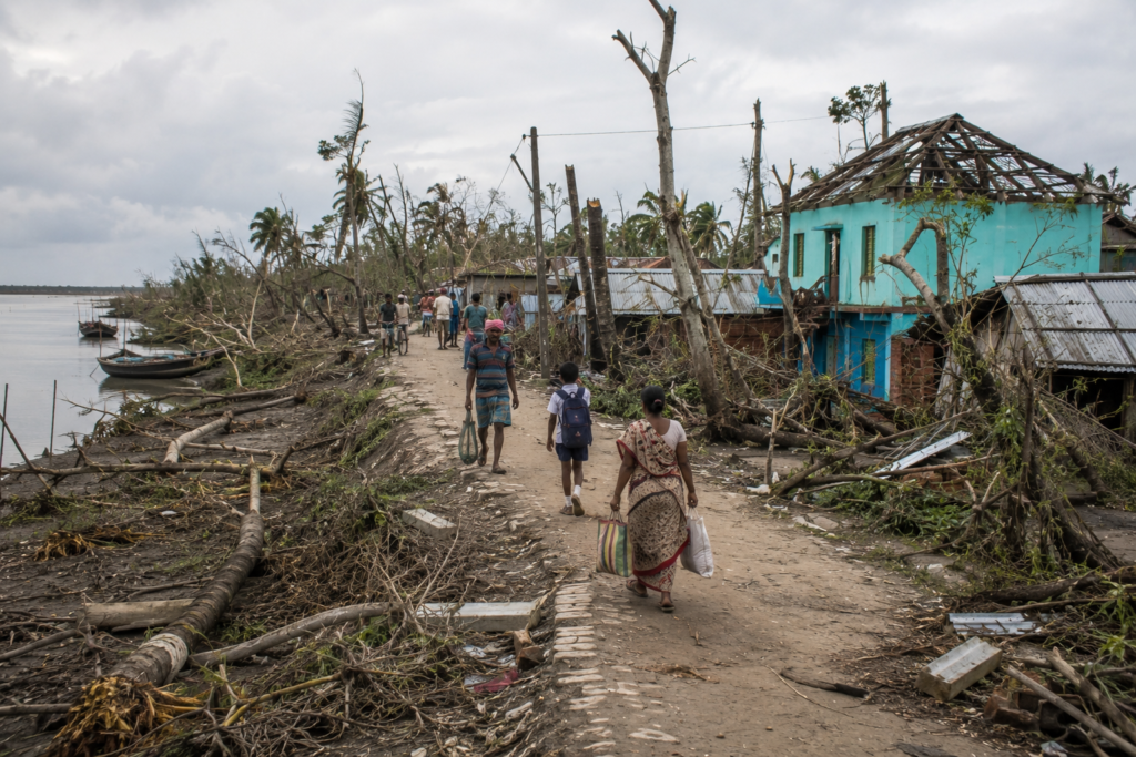
No modern history of Patharpratima can avoid cyclones. The island has witnessed some of the most powerful storms ever recorded in the Bay of Bengal.
Names remain etched into collective memory.
- Aila.
- Bulbul.
- Amphan.
- Yaas.
Each storm altered landscapes.
Each left stories.
Each tested embankments.
Each revealed resilience.
The effects extend far beyond immediate destruction.
- Salinity intrudes into agricultural land.
- Livelihoods disappear.
- Homes require rebuilding.
- Infrastructure demands repair.
- Recovery becomes a long process.
Yet perhaps the most remarkable aspect is how quickly communities adapt. Walking through villages today, one sees evidence everywhere.
- Raised structures.
- Strengthened embankments.
- Cyclone shelters.
- Emergency planning.
The island survives because adaptation has become part of its identity. Resilience here is not an abstract concept. It is a daily practice.
Oral Histories
Near sunset, conversations often become historical.
Older residents remember landscapes younger generations never saw. A fisherman in his seventies described riverbanks that existed decades ago but have since disappeared.
A retired teacher recalled journeys that once required entire days by boat. A farmer spoke about agricultural changes following major cyclones.
These memories create an alternative archive. One not found in government records. One not preserved in official reports. An archive of lived experience.
Many stories begin similarly: “There used to be…”
- There used to be more trees.
- There used to be different fish.
- There used to be wider fields.
- There used to be smaller markets.
Yet these stories rarely become nostalgic complaints. Instead, they document adaptation. The island changes. People change with it. That has always been the Sundarbans way.
Food of the Island
As darkness settles and cooking fires illuminate courtyards, Patharpratima reveals another layer of identity.
Food.
The island’s cuisine reflects its environment. Fish dominate. Not because of culinary fashion. Because rivers provide.
Daily meals commonly revolve around:
- Rice
- Fresh fish
- Seasonal vegetables
- Lentils
- Leafy greens
Fish species vary according to season and availability. Crab also occupies an important place within local food culture and economy. Markets showcase the diversity of aquatic life supported by nearby rivers. Seasonality remains crucial.
- Mangoes arrive.
- Jackfruit arrives.
- Winter vegetables arrive.
Everything follows environmental rhythms. Festivals introduce special foods. Religious occasions create distinctive culinary traditions. Family gatherings produce recipes passed between generations.
Food here functions as memory.
- As ecology.
- As the economy.
- As culture.
To eat in Patharpratima is to consume the landscape itself—the rivers, fields, ponds, seasons, and histories that sustain life on the island.
Ferry Routes & Hidden Paths
The most accurate map of Patharpratima does not exist on paper.
It exists in the minds of boatmen. A visitor looking at a conventional map sees rivers, islands, roads, and settlements. A boatman sees timing.
- Currents.
- Depth.
- Wind direction.
- Seasonal changes.
- Dangerous crossings.
- Safe shortcuts.
The island’s transportation network operates on multiple layers. The first layer consists of roads running along and across embankments. Motorcycles, bicycles, small vehicles, and pedestrians move between villages. The second layer consists of ferry routes. These routes are lifelines.
Throughout the day, vessels cross rivers carrying students, farmers, teachers, traders, health workers, and entire families. At busy crossings, ferries rarely remain idle. Passengers arrive continuously. Conversations begin before boarding and often continue after disembarkation.
The river crossing itself becomes a social space. The third layer is invisible to outsiders. These are the hidden paths.
- Narrow creeks.
- Unmarked channels.
- Seasonal waterways.
Routes known primarily by fishermen, crab collectors, and experienced navigators. Some exist only during certain tidal conditions. Others disappear after cyclones reshape the landscape. A creek passable during the monsoon may become inaccessible in winter.
A shortcut used for years may suddenly vanish due to erosion. The geography remains fluid. Nothing is guaranteed permanent. Even routes possess life cycles. Walking through Patharpratima eventually teaches a simple lesson: Roads connect villages.
Rivers connect worlds.
Photography Expedition Guide
Photographing Patharpratima requires patience rather than equipment.
The island rewards observation. The best images rarely announce themselves. They emerge gradually. The finest sunrise photographs begin before sunrise.
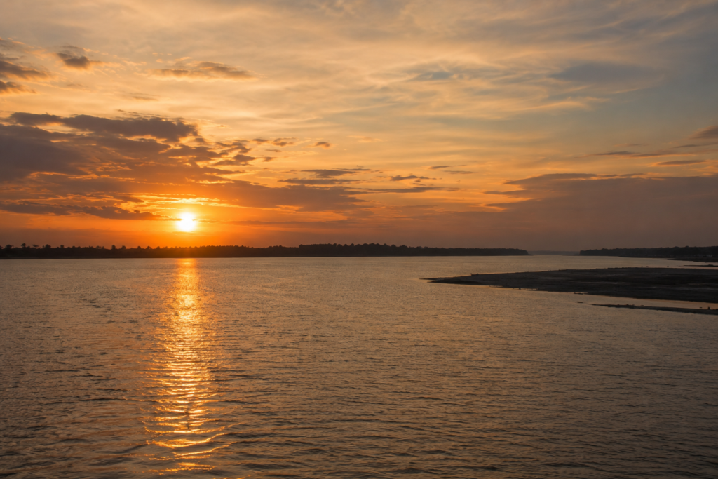
The eastern horizon over wide river channels often produces dramatic layers of color reflected across tidal water. Mist during winter mornings creates atmospheric conditions rarely found in urban landscapes.
Photographers willing to wake before dawn discover a different island. One suspended between darkness and daylight.
- A kingdom of silhouettes.
- Fishermen pushing boats into the water.
- Birds crossing river corridors.
- Smoke rising from distant settlements.
River Landscapes
The embankments provide exceptional vantage points.
From these elevated paths, photographers can document:
- Tidal movements
- Fishing activity
- Seasonal agriculture
- Human-river interactions
- Storm clouds are approaching across open water
Unlike dramatic mountain landscapes, the beauty here is horizontal.
Subtle.
Layered.
The eye must learn to appreciate distance.
Wildlife Photography
Bird photography opportunities occur throughout the year.
Patience is essential.
- Kingfishers remain among the most rewarding subjects.
- Brahminy kites often patrol rivers.
- Egrets gather on mudflats during low tide.
Winter brings additional possibilities as migratory species arrive. The challenge is less about locating wildlife and more about understanding behavior. The island rewards naturalists. Not trophy hunters.
Cultural Photography
Village life offers countless opportunities for documentary photography.
Yet Patharpratima demands respect. The strongest images emerge through interaction.
- Conversation first.
- Photography second.
- Tea stalls.
- Markets.
- Boat repair yards.
- Fishing landings.
- Agricultural fields.
Each reveals a different aspect of island life.
- The objective should never be collecting images.
- The objective should be understanding people.
- The photographs follow naturally.
Sunset Photography
Sunsets along major riverbanks often produce extraordinary light. Cloud formations over estuarine landscapes create dramatic compositions. The final glow frequently lingers long after the sun disappears. Photographers who leave early miss the best moments. The Sundarbans often reveals its finest colors after sunset.
Expedition Notes
Certain observations do not fit neatly into categories. Yet they define the experience of Patharpratima. These are the details recorded in notebooks. The moments that remain after facts fade.
Observation 1
Many homes maintain ponds.
To outsiders, they appear decorative. They are not. They represent water security, food resources, domestic utility, and historical adaptation.
Each pond has a purpose.
Observation 2
Trees are rarely random.
- Coconut palms.
- Betel nut.
- Mango.
- Jackfruit.
- Banana.
Planting decisions reflect generations of environmental knowledge. The landscape is partly cultivated memory.
Observation 3
Children possess remarkable geographical awareness. Many can identify ferry routes, neighboring islands, and river systems with an ease that surprises urban visitors. Water teaches geography from childhood.
Observation 4
Cyclones remain present even when absent.
They appear in conversations.
- Architecture.
- Agriculture.
- Preparedness.
- Memory.
The landscape remembers storms.
Observation 5
Distance functions differently here. Five kilometers may require multiple transport modes. A nearby settlement across water may feel farther than a distant village connected by road. The river changes perception.
Connected Landscapes
No island exists alone within the Sundarbans.
Patharpratima forms part of a vast ecological and cultural network. Its relationships extend in every direction. To the north lie more densely settled portions of the delta.
To the south, the landscape gradually transitions toward increasingly wild territories associated with protected forest regions. To the east and west, rivers create both barriers and connections.
Nearby islands share histories.
- Trade routes.
- Marriage networks.
- Educational institutions.
- Religious traditions.
- Environmental challenges.
A market on one island may depend upon produce from another. A schoolteacher may cross multiple rivers each week. A fisherman may work waters associated with several islands. The boundaries on administrative maps rarely capture these realities. The true geography of the Sundarbans is relational.
Everything connects.
- The same kingfisher may hunt across several islands in a single day.
- The same tidal pulse reaches countless settlements.
- The same cyclone affects entire regions simultaneously.
Patharpratima, therefore, functions as a chapter within a much larger story. To understand it fully requires looking beyond its shoreline.
Rivers as Ecological Corridors
The rivers surrounding Patharpratima are often described as transportation routes.
They are much more. They function as ecological corridors. Invisible highways for life.
- Fish migrate through them.
- Larval species drift with currents.
- Birds follow river systems during seasonal movements.
- Nutrients travel enormous distances through tidal exchange.
The river is not simply water between two pieces of land. The river is the system itself. Standing on a ferry during an incoming tide reveals this clearly. The water appears alive. Not metaphorically.
Literally.
Countless organisms move beneath the surface. Many invisible. Many essential. The productivity of local fisheries depends upon these ecological processes. So does agriculture. So does biodiversity.
Human settlements survive because river systems remain functional. The connection is direct.
And increasingly important.
Climate change, salinity shifts, erosion, and altered hydrological patterns threaten delicate balances established over centuries. Understanding rivers as living corridors rather than waterways may become one of the most important conservation lessons of the coming decades.
Oral Landscapes and Place Memory
Certain places on Patharpratima possess stories attached to them.
Not official histories. Local histories. A bend in a river where a cyclone boat once survived impossible conditions. A field reclaimed after devastating flooding. An old ferry point no longer in use. A vanished settlement remembered only by elders.
These locations rarely appear on maps.
Yet they remain important. Communities preserve them through storytelling. A visitor may walk past such places without noticing anything unusual. An elder sees something different.
Layers of memory. The landscape becomes an archive. Not written. Remembered. This phenomenon appears throughout the Sundarbans. But it feels especially powerful in Patharpratima because environmental change is so visible. When rivers shift course, memories become geographical markers.
People remember where shorelines once existed. Where forests once stood. Where homes once survived. Or disappeared. The island contains multiple versions of itself.
The present one.
And those preserved in memory.
Food, Trade, and River Commerce
By late afternoon, activity around markets illustrates another essential aspect of Patharpratima.
Commerce.
The island economy has always depended upon movement. Goods rarely remain local.
- Fish move outward.
- Rice moves inward and outward.
- Vegetables circulate between settlements.
- Construction materials arrive by road and river.
Fuel arrives.
Medicines arrive.
School supplies arrive.
Commerce follows waterways as naturally as fish. The market atmosphere reflects this connectivity. Vendors know river schedules. Boat operators know market schedules.
Everything interlocks.
Unlike isolated frontier communities elsewhere in the world, Patharpratima functions as part of a remarkably interconnected economic landscape. Yet the river remains central.
- A disrupted ferry route affects livelihoods.
- A damaged embankment affects trade.
- A cyclone affects everything.
Economic resilience, therefore, depends heavily upon transportation resilience. The two cannot be separated.
Island Economy
The economy of Patharpratima reflects both opportunity and vulnerability.
Agriculture remains important.
- Rice cultivation dominates many areas.
- Vegetables contribute significantly to household economies.
- Seasonal variation influences production.
Farmers continually adapt to soil conditions, salinity challenges, and weather uncertainty.
Fisheries
Fishing remains among the most important economic activities.
Rivers provide livelihoods for thousands. Fish species vary according to season, habitat, and tidal conditions. Crab collection has become particularly significant in parts of the Sundarbans economy. Demand extends far beyond local markets.
Aquaculture
In some areas, aquaculture contributes to household income. The balance between traditional agriculture and water-based livelihoods continues evolving.
Small Enterprise
- Tea stalls.
- Repair workshops.
- Retail shops.
- Transportation services.
- Local markets.
These enterprises form the economic foundation of everyday life. They rarely appear in economic reports. Yet collectively they sustain communities.
Migration
Like many deltaic regions, Patharpratima also experiences migration.
Some residents seek employment elsewhere in West Bengal or across India. Income earned outside the island often supports households back home. Migration becomes another adaptation strategy. Another way of managing uncertainty.
Then & Now
One of the most revealing conversations occurred with a retired schoolteacher.
He described the Patharpratima of his childhood. The differences were striking.
- More river travel.
- Fewer roads.
- Less electricity.
- Greater isolation.
- Different agricultural practices.
- Smaller markets.
- Slower communication.
Yet some things remain unchanged.
- The tide still dictates schedules.
- Storms still command respect.
- Rivers still shape opportunity.
- Community networks remain strong.
The island has modernized.
But it has not abandoned its environmental realities. This creates a fascinating tension.
- Smartphones coexist with traditional weather knowledge.
- Digital payments coexist with river ferries.
- Modern education coexists with folklore.
- Solar lights coexist with cyclone preparedness.
The old and the new are not competing. They are adapting together. That may be the defining characteristic of contemporary Patharpratima. Not resistance to change. Adaptation to change.
The same principle that has allowed people to survive here for generations.
The Wild Orbit Quick Facts
Island Name
Patharpratima
Administrative Location
South 24 Parganas, West Bengal
Administrative Block
Patharpratima Block
Region
Indian Sundarbans Delta
Approximate Coordinates
21.85°N – 88.30°E (central block region)
Landscape Type
Tidal deltaic island system protected by embankments
Dominant Habitats
- Agricultural land
- Village settlements
- Tidal creeks
- Mudflats
- Mangrove fringes
- Riverbanks
Major Rivers & Waterways
- Saptamukhi River
- Thakuran River
- Associated tidal creeks and distributaries
Nearest Major Urban Gateway
Kolkata
Nearest Common Transit Hubs
- Kakdwip
- Namkhana
Wildlife Highlights
- Kingfishers
- Brahminy Kites
- Egrets
- Estuarine fish diversity
- Fishing Cat habitat in the wider landscape
- Mangrove-associated biodiversity
Best Expedition Season
November to February for comfortable exploration and birdlife observation.
The Wild Orbit Expedition Snapshot
Accessibility
★★★★☆
Patharpratima is remote but reachable. The journey itself becomes part of the experience.
Wildlife Potential
★★★★☆
The surrounding landscape offers excellent opportunities for observing delta ecology.
Photography Potential
★★★★★
Exceptional river light, human stories, seasonal landscapes, and atmospheric weather.
Cultural Richness
★★★★★
The island represents one of the most fascinating human adaptations within the Sundarbans.
Historical Interest
★★★★☆
Land reclamation, migration, settlement history, and environmental transformation create a layered narrative.
Solitude Level
★★★☆☆
Villages remain active and populated, but numerous riverbanks and creeks still offer remarkable quiet.
Explorer Score
9.1 / 10
Not because it is untouched.
Because it is alive.
FAQs
1. Is Patharpratima part of the Sundarbans?
Yes. It forms an important inhabited section of the Indian Sundarbans.
2. Is it a forest island?
No. It is primarily inhabited and cultivated, though deeply connected to nearby mangrove ecosystems.
3. Why is Patharpratima important?
Because it represents the intersection of river ecology, human resilience, agriculture, fishing, and Sundarbans culture.
4. Which district does it belong to?
South 24 Parganas.
5. Is it surrounded by rivers?
Yes. Rivers define both its geography and identity.
6. What language is spoken here?
Primarily Bengali.
7. Are ferry services important?
They are essential.
8. Does agriculture dominate the landscape?
Large portions of the inhabited landscape are agricultural.
9. Is fishing a major occupation?
Yes.
10. What fish are commonly caught?
Species vary seasonally throughout the estuarine ecosystem.
11. Is crab collection practiced?
Yes, in parts of the wider region.
12. Are mangroves present?
Yes, especially in adjacent habitats and tidal zones.
13. Can migratory birds be seen?
Winter is often the best season.
14. Are tigers found on the island?
The island itself is inhabited. Tiger presence is generally associated with nearby forest zones.
15. Does the island experience cyclones?
Frequently enough that preparedness forms part of everyday life.
16. What is the biggest environmental challenge?
Cyclones, salinity intrusion, erosion, and climate-related change.
17. Is the island densely populated?
Many parts are actively settled.
18. Are schools present?
Yes, education infrastructure forms an important part of community life.
19. Are markets important?
Markets function as economic and social centers.
20. What is the best season for photographers?
Winter and post-monsoon periods.
21. Does folklore remain important?
Very much so.
22. Is Bonbibi worshipped here?
Bonbibi traditions remain culturally significant across the wider Sundarbans landscape.
23. What makes Patharpratima different from forest islands?
Human settlement dominates the landscape while remaining inseparable from the surrounding wilderness.
24. Is migration common?
Many families maintain economic links outside the island.
25. Why should researchers study Patharpratima?
Because it offers a living example of adaptation within one of the world’s most dynamic delta systems.
How To Reach Patharpratima
Reaching Patharpratima feels less like transportation and more like a gradual transition into the delta.
- The city releases you slowly.
- Concrete gives way to fields.
- Fields give way to rivers.
- Rivers give way to islands.
And eventually, the Sundarbans takes over.
From Kolkata
Most journeys begin in Kolkata.
Travelers generally move southward through the lower districts toward the Sundarbans gateway region.
Rail Journey
Suburban rail services connect Kolkata with southern transit points, including routes toward:
- Kakdwip
- Namkhana
The train ride itself becomes an introduction to the changing landscape.
Road Journey
Road travel passes through increasingly rural terrain.
- Markets become smaller.
- Canals become larger.
- The presence of rivers becomes impossible to ignore.
Ferry Crossings
Eventually, roads stop.
Water begins.
Ferry crossings connect islands, settlements, and transportation corridors.
Schedules depend on local conditions and operational realities.
During Monsoon
Journeys become slower.
Weather influences movement.
Additional time should always be allowed.
Explorer’s Note
Do not rush the approach. The route is part of the story. Watch the rivers. Observe the changing vegetation. Notice how gradually mainland assumptions disappear.
Things To See Around Patharpratima
The most rewarding discoveries around Patharpratima are rarely monuments.
They are relationships.
River Embankments
Some of the finest observations come simply from walking elevated embankments during changing tides.
Ferry Ghats
Landing points reveal the true rhythm of island life. Everything passes through them.
Local Markets
Markets function as social observatories. Agriculture, fisheries, trade, and conservation intersect here.
Village Landscapes
The villages themselves are destinations.
- Courtyards.
- Ponds.
- Shrines.
- Schools.
- Tea stalls.
All reveal how people inhabit a tidal world.
Creek Systems
Creeks provide insight into the ecological structure of the delta.
Nearby Island Connections
The wider region naturally connects with landscapes associated with:
- Gosaba
- Basanti
- Kultali
- Sagar Island
Each reveals a different interpretation of life in the delta.
Wildlife Observation Zones
Creek margins, mudflats, riverbanks, and mangrove edges often provide the richest ecological experiences.
Continue The Journey
Patharpratima is not an endpoint.
It is a doorway. Spend a day here, and questions begin multiplying.
- Where does that river go?
- What lies beyond the next creek?
- How do neighboring islands differ?
- Which stories belong to other shores?
The delta encourages movement. Not hurried movement. Curious movement. From Patharpratima, the explorer naturally begins looking toward other islands, other rivers, other histories.
- Toward the mangrove forests.
- Toward forgotten ferry routes.
- Toward oral traditions carried between settlements by generations of boatmen.
The journey expands.
As all good journeys should.
Beyond Patharpratima
The departure began at dusk.
The tide had turned. Water pressed quietly against the embankment as the boat eased away from shore. Along the riverbank, evening lights appeared one by one.
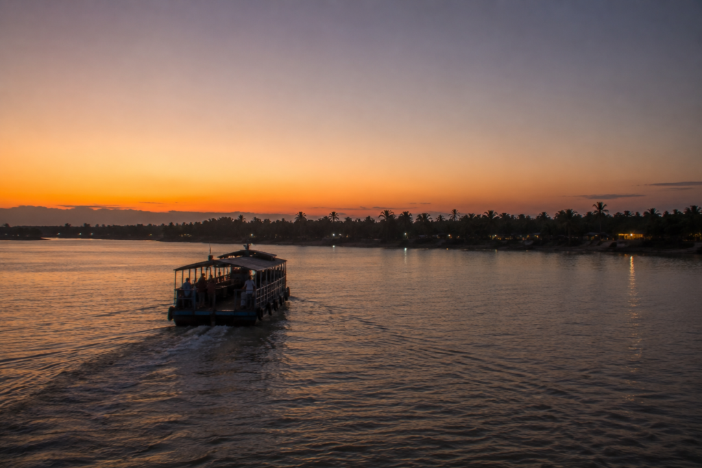
A tea stall glowed beneath a tin roof. A bicycle moved along the crest of the embankment. Somewhere behind the trees, a temple bell rang. Then faded. The boat drifted into the channel.
Gradually, the island began withdrawing into the distance. Fields disappeared first.
Then houses. Then trees. Only silhouettes remained. The river widened. Darkness gathered across the water. Patharpratima did not leave dramatically.
It receded the same way it had first appeared that morning—slowly, patiently, almost reluctantly. A final cluster of lights shimmered against the horizon. Then even those became indistinguishable from the stars above. The engine continued its steady rhythm. The tide carried us northward.
Behind us remained an island built by rivers, defended by embankments, sustained by memory, and shaped by generations who learned to live between land and water.
In the Sundarbans, some places are visited. Others are experienced.
Patharpratima belongs firmly to the second category.
Long after the shoreline vanishes, the island remains. Not on the map. But in the mind, like the sound of a distant ferry crossing a river in the dark.
Plan your private Sundarban expedition
A private journey shaped around you — your group, your pace, your interests. Book a free consultation.