 Encyclopedia
At the southern edge of the Indian Sundarbans, the mangrove forest opens toward the estuarine waters of the Matla River and the Bay of Bengal. Here lies the landscape known as Kalash, a remote forest-and-coastal area associated with the Forest Department’s Kalash Camp and the seaward Kalash Island and beach.
Kalash Camp is located in the Chulkathi-1 Forest Block of the South 24 Parganas Forest Division, while Kalash Island and its beach lie farther south at the Matla estuary. These names are often used together, but they should not be treated as identical places.
The geographic position gives Kalash a distinctive character within the Sundarbans. The area lies where protected mangrove forest, a broad tidal river system and a sea-facing coastal landscape meet. A government waterway study identifies the downstream Matla stretch around Kalas Island as the section where the river approaches and joins the Bay of Bengal; it also records dense forest, protected tiger habitat and the Chulkathi Camp/watchtower in this remote stretch.
Kalash is therefore best understood not simply as a camp or beach, but as a southern Sundarbans landscape shaped by forest, estuary, tides and the coast.
Kalash At a Glance
- Location: Southern Indian Sundarbans, South 24 Parganas, West Bengal
- Forest administration: South 24 Parganas Forest Division
- Forest block: Chulkathi-1
- Forest facility: Kalash Camp
- Associated coastal landscape: Kalash Island and Kalash Beach
- Major river: Matla River
- Geographic setting: Matla estuary and the southern coastal Sundarbans
- Nearest major marine environment: Bay of Bengal
- Access character: Primarily a boat-based forest destination
- Landscape: Mangrove forest, tidal river, estuarine channels and sea-facing coastal habitat
- Important geographic distinction: Kalash Camp and Kalash Island/Beach are separate but closely connected locations
How to Reach Kalash
Kalash is reached by road and then by boat. The most specifically documented approach to Kalash Island is through Jharkhali in South 24 Parganas.
From Kolkata to Jharkhali
Travel by road from Kolkata towards Canning and Basanti, continuing to Jharkhali. The West Bengal Department of Sundarban Affairs identifies Jharkhali as one of the routes into the Sundarbans.
Jharkhali to Kalash
From Jharkhali, the journey continues by motorboat through the Sundarbans waterways. The government’s Sundarbans access information specifically describes the route through the Matla and Bidyadhari river systems, via the connecting canals, and states that Kalash Island is accessible by this route.
There is no direct road connection to Kalash. The final approach is by water, so the boat journey needs to be arranged as part of the expedition or authorised forest visit.
Permissions and Forest Access
Kalash lies within a protected forest landscape. Visitors should arrange the required Forest Department permissions and authorised boat access before travelling rather than treating Kalash as an independently accessible beach or sightseeing point.
Forest Department visitor guidance also requires visitors to follow designated routes and applicable instructions while inside protected areas.
Practical Route
Kolkata → Canning/Basanti → Jharkhali → Motorboat → Matla–Bidyadhari river system → Kalash
Travel time on the water should not be given as a fixed figure because the actual journey depends on the route, tide, weather and boat operations.
Important: Access arrangements, landing permissions and seasonal restrictions can change. Confirm the current Forest Department rules and access conditions before planning a Kalash visit.
Geographic Setting
Kalash lies in the southern part of the Indian Sundarbans in South 24 Parganas, West Bengal. The landscape is considerably more remote and seaward than many of the better-known visitor locations in the northern and central portions of the Sundarbans.
The Forest Department’s Kalash Camp is associated with the Chulkathi-1 Forest Block within the South 24 Parganas Forest Division. A Wildlife Institute of India document identifies Kalash as one of only two protection camps then operating inside this southern forest division and places the camp within the Chulkati forest landscape.
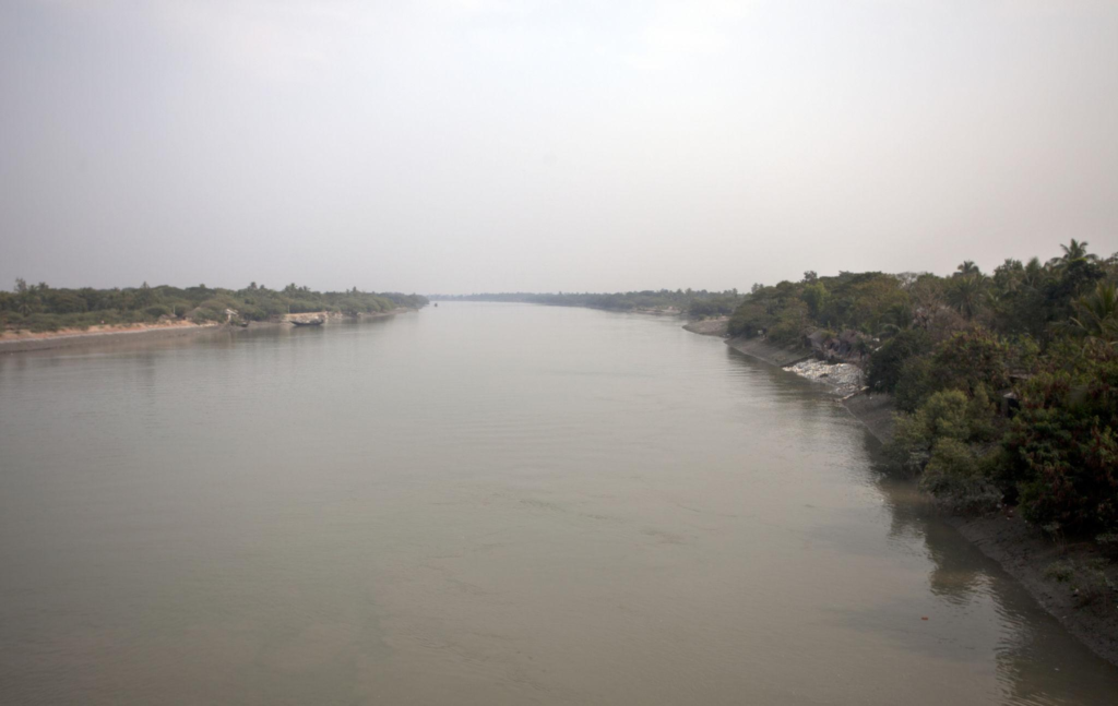
The downstream geography is dominated by the Matla River. The Inland Waterways Authority of India’s detailed project report for National Waterway 97 describes the downstream Matla stretch from Baluchery Island toward Kalas Island as the section approaching the Bay of Bengal. The report records dense forest along the banks, protected tiger habitat and the Chulkathi Camp/watchtower in this otherwise uninhabited stretch.
The relationship between the forest camp and the beach is important. Kalash Camp is the forest-side location, while Kalash Island Beach lies farther south toward the Matla estuary. Current local documentation explicitly distinguishes the two and describes boat access from the camp toward the beach.)
Rivers Flowing Beside the Island
- Matla River — the principal river associated with Kalash and its southern estuarine setting.
- Matla estuary — the downstream water environment where the river approaches the Bay of Bengal.
- Bidyadhari–Matla river system — relevant to the wider route and tidal-water network connecting Kalash with the southern Sundarbans. The Government of West Bengal identifies the Matla and Bidyadhari systems on the Jharkhali–Kalash route.
The Matla is particularly important to Kalash because the landscape lies near its downstream estuary rather than beside an enclosed inland creek. The IWAI study records the river becoming approximately 15 km wide near its junction with the Bay of Bengal, illustrating the scale of the estuarine environment around the southern end of this river system.
Nearby Forest Blocks
- Chulkathi-1 Forest Block — the documented location of Kalash Camp.
- Chulkati Forest Block — the broader forest-block designation used in Wildlife Institute of India material concerning protection infrastructure around Kalash.
The difference between Chulkathi-1 and Chulkati appears to reflect the more specific block designation used in current descriptions versus the broader terminology used in institutional material. The article should therefore avoid inventing a larger list of adjacent forest blocks unless those relationships can be established from authoritative mapping.
Nearby Inhabited Islands & Human Settlements
Kalash itself is primarily a protected forest landscape, not a conventional inhabited island settlement.
The principal human-access references for reaching the southern Sundarbans around Kalash include:
- Jharkhali
- Namkhana
- Ramganga
The Department of Sundarban Affairs identifies these as access points to the wider Sundarbans and specifically records Kalas Island as accessible from the Jharkhali route.
The downstream Matla stretch around Kalas Island is notably different from an inhabited riverbank. The IWAI assessment records no civilisation along the surveyed banks except the Chulkathi Camp/watchtower, reflecting the remote and protected character of this part of the landscape.
For that reason, it would be misleading to populate this section with a long list of nearby villages or islands simply because they appear elsewhere in Sundarbans travel itineraries. Only settlements with a direct and demonstrable geographic relationship to Kalash should be retained in the final article.
Landscape Character
Kalash has a different visual character from the enclosed creeks and densely forested interiors that often define images of the Sundarbans.
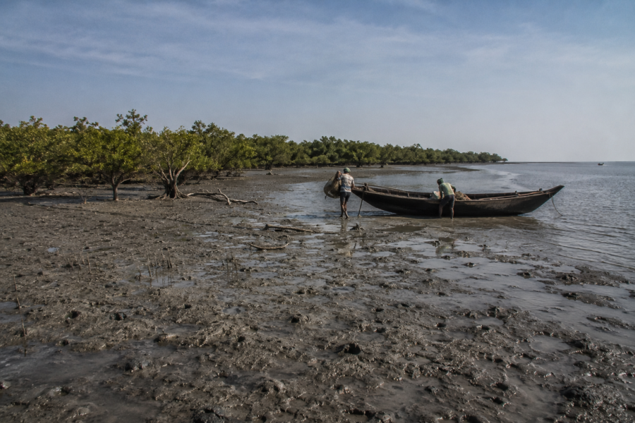
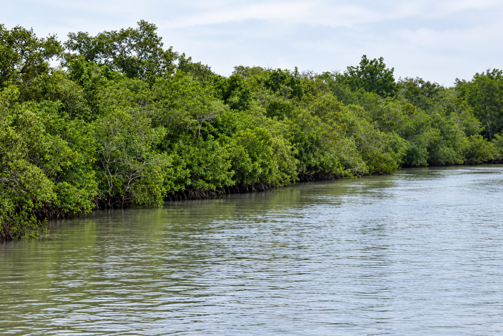
Here, the forest approaches an open estuarine and coastal environment. The Kalash Camp sits within a mangrove forest, while the associated Kalash Beach opens toward the Matla estuary and the Bay of Bengal. Scientific research describes Kalash Island as consisting of the Kalash Camp and the beach beside it, forming part of the Sundarbans National Park at the Matla estuary.
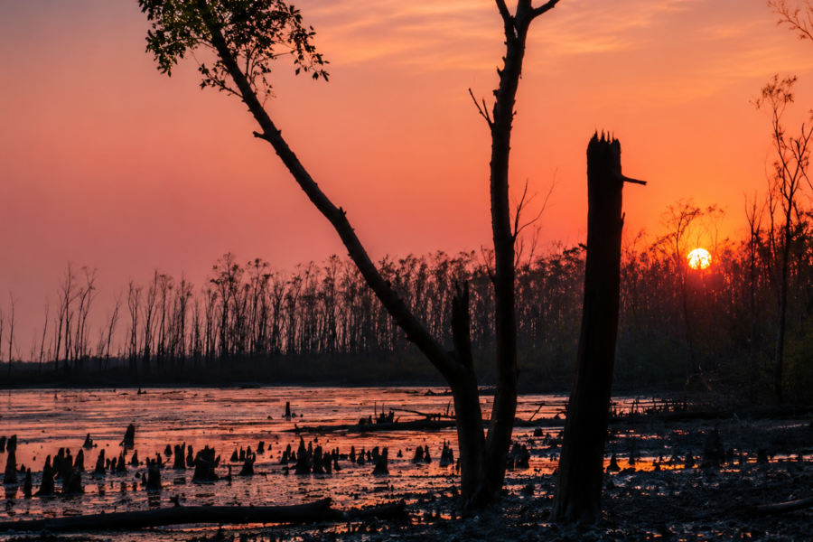
The transition from forest to open water is not a sharp ecological boundary. Tidal channels, wet sediments, intertidal ground and coastal margins connect these habitats. Across the wider Sundarbans, tidal rivers, creeks, estuaries, mudbanks, sandy beaches and low-lying islands form one continuously changing deltaic landscape.
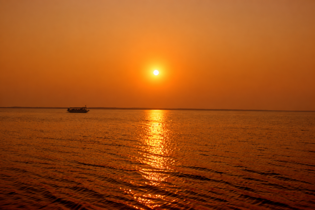
At Kalash, this relationship is particularly apparent because the landscape faces the sea.
The shoreline is shaped by the movement of water rather than remaining fixed. Tides alternately expose and cover parts of the intertidal zone, while river discharge, sediment movement, wave action and storms contribute to longer-term changes in the coast.
This dynamism is fundamental to understanding Kalash. It is not a static beach beside a static forest, but part of a delta whose landforms are continually being modified by water.
The wider Sundarbans is described by the Government of West Bengal as a highly dynamic environment influenced by tides, flooding, salinity and cyclones.
Rivers and Water Systems
The Matla River is central to Kalash’s physical environment.
Kalash lies at the downstream end of the Matla system, where the river approaches its estuarine connection with the Bay of Bengal. The river therefore carries both the characteristics of a major tidal channel and the influence of the open coastal environment.
The Matla is part of the larger Hooghly–Matla estuarine system, an extensive network of interconnected rivers, channels and creeks associated with the Sundarbans. Scientific research describes the Indian Sundarbans as a land–ocean boundary within the Ganges-Brahmaputra delta, crossed by several estuarine distributaries including the Matla and Bidya.
Tides are fundamental to how this system operates.
Water moves through the estuary in both directions, carrying dissolved substances and suspended material between the mangrove environment and coastal waters. Research on mangrove systems in the Hooghly–Matla region shows that tidal exchange is an important pathway for the movement of dissolved and particulate matter between mangrove forests and adjacent waters.
The water around Kalash is therefore not simply a transport route for boats.
It is part of an active ecological system in which sediments, nutrients, organic matter and organisms move through the estuary.
Tidal Influence
The physical appearance of Kalash changes with the tide.
As water levels fall, sections of intertidal sediment become exposed. When the tide rises, these surfaces are covered again, reconnecting them with the surrounding estuarine water.
This repeated flooding and exposure creates different ecological conditions over relatively short periods.
Research across the Indian Sundarbans demonstrates that the physical and chemical properties of waters surrounding mangroves vary with tidal conditions. In one study, salinity and other hydrographic characteristics changed between high and low tide, illustrating the strong influence of tidal exchange on the mangrove environment.
For Kalash, this means that the visible landscape at any particular moment represents only one stage in a continuous tidal cycle.
Sediment and Shoreline
Sediment is another important component of the Kalash landscape.
The Sundarbans is a delta built and continually modified by the movement of river-borne sediment, tidal currents and coastal processes. Shorelines within the region can retreat or advance over time rather than remaining permanently fixed.
Research on Indian Sundarbans islands has documented shoreline migration and links this dynamism to factors including sediment supply, wave action, relative sea-level change, land subsidence and compaction.
These processes are relevant to understanding any sea-facing Sundarbans landscape, including Kalash, but they should not be converted into a specific erosion rate for Kalash unless a dedicated study establishes one.
That distinction is important: regional coastal processes are well documented; a Kalash-specific rate requires Kalash-specific evidence.
Mangrove Ecosystem
The mangrove forest is the ecological foundation of the Kalash landscape.
Mangroves occupy the intertidal environment where land is regularly influenced by saline or brackish water. Their distribution is closely connected to elevation, inundation, salinity, sediment and local hydrology.
The Government of West Bengal describes the Sundarbans as supporting true mangroves, mangrove-associated plants and salt-tolerant vegetation. It also notes a relationship between plant succession and the relative elevation of land and the length and frequency of tidal inundation.
This helps explain why mangrove vegetation does not appear uniformly across the landscape.
Lower intertidal surfaces can initially be occupied by salt-tolerant plants. As sediment accumulates and conditions change, mangrove seedlings can establish, eventually contributing to more developed mangrove vegetation.
The forest therefore reflects the physical history of the ground beneath it.
Mangrove Adaptation
Mangrove plants survive conditions that are difficult for most terrestrial vegetation.
They must tolerate:
- periodic tidal inundation
- waterlogged soils
- fluctuating salinity
- unstable sediments
- low-oxygen conditions within saturated soils
Different mangrove species use different structural and physiological adaptations to cope with these conditions.
The result is a forest that is closely tied to the physical environment rather than independent of it.
Mangrove and Sediment
Mangrove vegetation also interacts with the sediment around it.
Roots and accumulated organic material can slow water movement locally and help retain sediments, while the wider mangrove system acts as a zone where sediment and nutrients are exchanged between land and water. The Wildlife Institute of India’s Sundarbans overview describes mangrove forests as shore stabilisers and nutrient and sediment traps, while also recognising the region’s exposure to erosion, inundation and other coastal hazards.
This does not mean that mangroves prevent erosion everywhere.
The Sundarbans remains a highly dynamic delta, and mangrove shorelines can themselves be eroded when physical forces exceed the capacity of vegetation and sediment deposition to maintain the edge.
Mangrove–Estuary Connection
The most important point about Kalash’s mangroves is that they cannot be understood separately from the Matla.
The forest receives the influence of tidal water, while the estuary receives material originating from the forest and surrounding land.
Mangrove litter contributes organic material to the estuarine food web. Microbial communities process organic matter within sediments and water, while tidal movement redistributes dissolved and particulate material.
Research specifically conducted at Kalash examined the microbial diversity of this mangrove-estuarine environment and recorded seasonal measurements of parameters including temperature, salinity, dissolved oxygen, organic carbon and nitrogen. The study recorded salinity values of 22–27 practical salinity units (psu) in its Kalash samples collected between 2012 and 2014. These are study-period measurements, not a permanent or current salinity value for the site.
That qualification matters because salinity in an estuarine landscape changes with season, rainfall, freshwater input, tides and location.
A Forest at the Edge of the Sea
Kalash’s ecological character ultimately comes from the meeting of three environments:
mangrove forest → tidal estuary → coastal sea
The beach is not separate from the mangrove system. The estuary is not separate from the forest. And the forest itself is continuously influenced by the movement of water.
That connectivity is what makes Kalash representative of the broader Sundarbans while giving it a distinctly coastal character.
The landscape seen from a boat may appear simple—trees, water and an open shoreline but beneath that view is a continuously functioning system of tidal exchange, sediment movement, plant growth, decomposition and nutrient cycling.
For Kalash, the defining physical process is therefore not simply the presence of mangroves.
It is the constant interaction between mangrove land and moving water.
Wildlife
Kalash lies within a protected southern Sundarbans landscape, so its wildlife should be understood as part of the wider mangrove ecosystem rather than as a fixed list of animals guaranteed at one location.
The strongest evidence connects Kalash with Royal Bengal Tigers, Olive Ridley Turtles, coastal birds and other wildlife associated with mangrove and estuarine habitats. Scientific studies conducted specifically around Kalash provide additional evidence of the area’s biological importance.
Royal Bengal Tiger
The Royal Bengal Tiger (Panthera tigris tigris) is one of the most important mammals associated with the Kalash landscape.
Government tourism material identifies Kalash as part of the tiger habitat of the Sundarbans and specifically describes a freshwater pond near the camp that is used by wildlife.
The presence of a freshwater source is significant in a landscape surrounded by tidal and saline waters. Freshwater availability is naturally limited across the Sundarbans, and freshwater bodies can therefore have importance for terrestrial wildlife.
A Wildlife Institute of India assessment also identifies Kalash as a protection camp within the South 24 Parganas forest landscape and emphasises the importance of strengthening protection infrastructure in this southern forest area.
The important point for visitors is that tiger habitat does not mean predictable tiger sightings. A tiger may move through forest without becoming visible from a boat or camp.
Kalash should therefore be understood as habitat rather than as a wildlife-viewing guarantee.
Olive Ridley Turtle
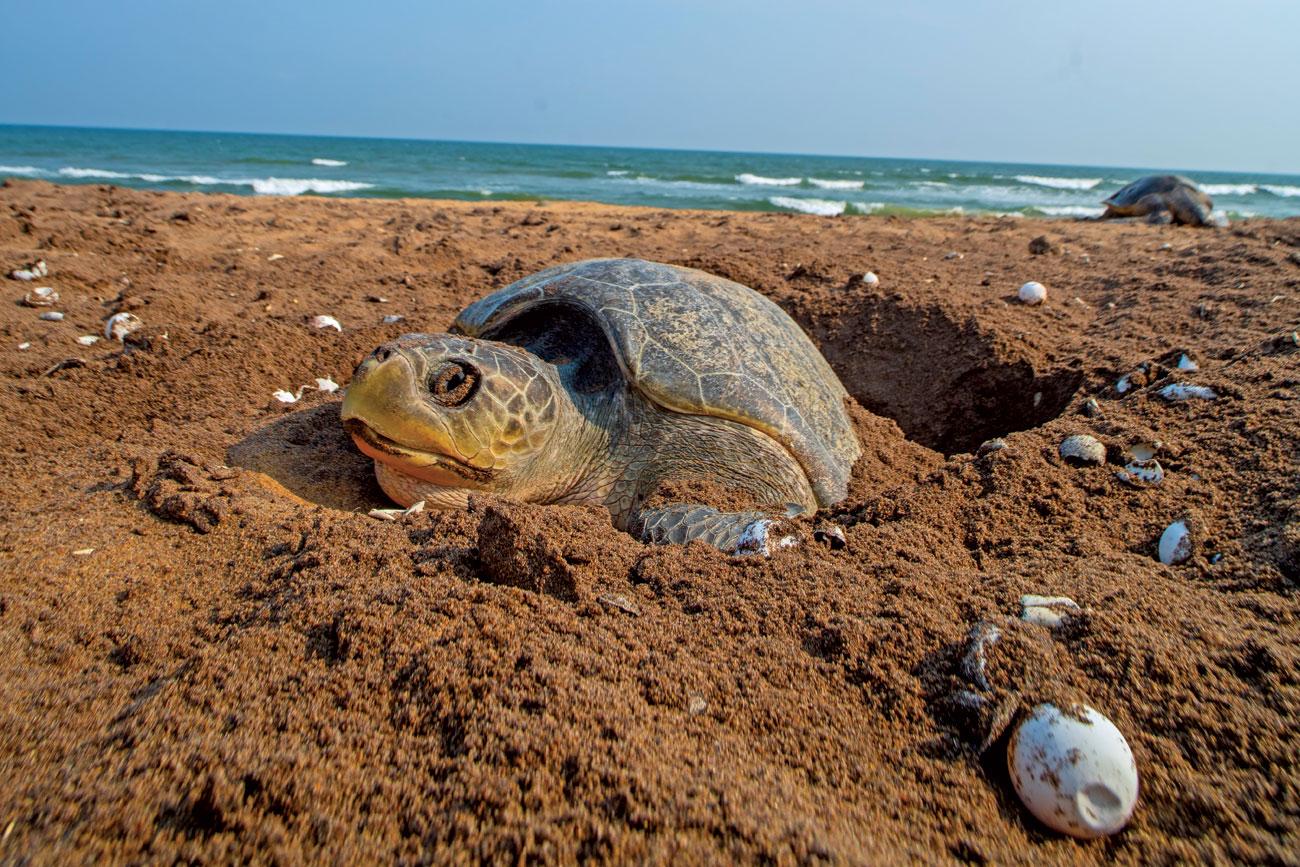
The strongest species-specific conservation connection between Kalash and the coast is the Olive Ridley Turtle (Lepidochelys olivacea).
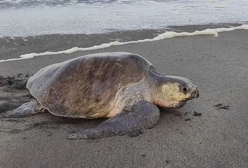
Scientific surveys have documented Olive Ridley nesting on Kalash Beach. A West Bengal marine-turtle review recorded 303 nests at Kalash during the 2000–01 nesting season, followed by 10 nests during 2001–02.
The difference between those two seasons is important.
It demonstrates that historical nesting activity at Kalash has varied considerably and that one season’s nesting figure cannot be used as a permanent measure of the beach’s turtle population.
Earlier conservation literature also identifies Kalash among the sea-facing beaches used by Olive Ridleys in the Sundarbans. The nesting beaches of the region are exposed to natural predation as well as human disturbance, making protection of suitable coastal habitat an important conservation consideration.
Olive Ridleys do not simply need a beach.
Successful nesting depends on the availability and physical condition of suitable sandy substrate, access to the beach, seasonal conditions and the survival of eggs and hatchlings after nesting.
Kalash is therefore significant because it represents a point where the terrestrial mangrove landscape connects directly with a marine turtle’s reproductive habitat.
Coastal Birds and Waders
See it for yourself
A private journey shaped around you — your group, your pace, your interests. Book a free consultation.
The open character of Kalash Beach creates habitat that differs from the enclosed mangrove creeks.
Coastal birds and waders use beaches, exposed intertidal sediments and shallow waters for feeding and resting. A review of avian diversity in the greater Sundarbans specifically records the Great Thick-knee, also known as the Great Stone-curlew (Esacus recurvirostris), from Kalash Beach.
Gulls and other coastal birds have also been documented in the wider Kalash beach environment.
The importance of the beach for birds is closely connected to the tide. As water retreats, previously submerged feeding surfaces become available. Small invertebrates and other organisms associated with the intertidal zone can then become accessible to birds.
When the tide returns, the same feeding ground disappears beneath the water.
This makes the Kalash shoreline a constantly changing feeding environment rather than simply an open sandy area.
Estuarine and Intertidal Wildlife
The wildlife of Kalash extends well beyond the larger animals that are easiest for visitors to recognise.
The estuary supports organisms associated with:
- tidal sediments
- shallow water
- mangrove roots
- organic-rich mud
- sandy coastal substrate
- submerged and exposed intertidal surfaces
Research conducted specifically at Kalash has examined microbial communities associated with the mangrove-estuarine environment. The study found substantial microbial diversity and investigated relationships between microbial communities and environmental conditions including salinity, dissolved oxygen, organic carbon and nitrogen.
These organisms rarely attract the attention given to a tiger or turtle, but they are fundamental to the ecosystem.
Microorganisms participate in the decomposition of organic matter and the cycling of nutrients, helping convert material produced within the mangrove ecosystem into forms that can move through the estuarine food web.
The ecological importance of Kalash therefore extends from large predators to organisms invisible to the unaided eye.
Reptiles and Other Sundarbans Wildlife
The broader southern Sundarbans supports reptiles and other wildlife characteristic of mangrove ecosystems, including species associated with freshwater bodies, tidal channels and forest habitats.
However, a species occurring in the wider Sundarbans should not automatically be described as a confirmed Kalash record.
This distinction is particularly important for a definitive Wild Orbit article. The available sources establish Kalash as wildlife habitat and specifically document several important species and ecological groups, but they do not justify creating an exhaustive Kalash-specific species checklist from general Sundarbans fauna.
Accordingly, species such as Saltwater Crocodile, Water Monitor, Fishing Cat, Wild Boar and other Sundarbans animals should only be included under Kalash if a reliable source establishes their occurrence specifically in the Kalash landscape.
This keeps the article evidence-based rather than turning a regional species list into a false site-specific record.
Ecological Importance
Kalash’s ecological importance comes from the way several habitats meet within one protected landscape.
A Coastal Habitat Within the Sundarbans
Much of the public image of the Sundarbans is dominated by mangrove forest and tidal creeks. Kalash adds another important component: sea-facing sandy habitat.
That beach provides a physical environment capable of supporting organisms that cannot use the dense mangrove interior in the same way.
Olive Ridley nesting is the clearest example.
The beach therefore contributes to the ecological diversity of the wider Sundarbans rather than being an ecological interruption to the forest.
A Link Between Terrestrial and Marine Systems
Kalash connects terrestrial mangrove habitat with an estuarine and marine environment.
Organic material produced in the forest enters tidal waters. Sediment moves through the estuary. Intertidal organisms respond to the alternating exposure and inundation of the shoreline. Marine turtles use the sandy beach for nesting, while coastal birds use exposed intertidal areas.
These processes demonstrate that the boundary between forest and sea is ecological rather than absolute.
Freshwater Within a Saline Landscape
The freshwater pond associated with Kalash Camp adds another habitat component.
In a landscape dominated by tidal water, freshwater bodies can provide important drinking opportunities for terrestrial wildlife. Government tourism material specifically identifies wildlife use of the freshwater pond near Kalash Camp.
This creates a small but important contrast within the broader saline environment.
The ecological value of Kalash therefore comes partly from habitat diversity at a very local scale: forest, freshwater, tidal water, intertidal ground and sandy coast.
Kalash Beach & Turtle Nesting Habitat
Historical Olive Ridley nesting records give Kalash a direct connection to marine conservation.
The 303 nests documented during 2000–01 demonstrate that Kalash Beach has supported substantial nesting activity in at least some years. But the following year’s much lower figure also demonstrates the variability of nesting activity.
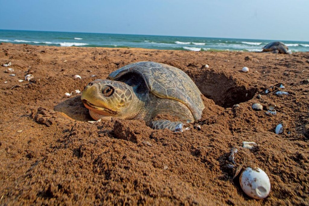
This makes long-term monitoring more meaningful than relying on a single season.
For conservation purposes, the question is not simply whether turtles have nested at Kalash. It is whether suitable nesting habitat continues to remain available and whether nesting females, eggs and hatchlings can complete the reproductive cycle under changing environmental and human conditions.
A Wildlife Protection Landscape
Kalash is also important because it forms part of a managed wildlife landscape rather than an unregulated coastal area.
The presence of a Forest Department protection camp reflects the need to manage human activity within a habitat used by large wildlife.
This is particularly relevant in the Sundarbans, where rivers and creeks do not create a simple separation between people and protected forest. Boats, forest personnel, researchers, visitors and wildlife operate within the same larger tidal landscape.
Conservation at Kalash therefore involves more than protecting individual species.
It involves maintaining the habitats and ecological processes that allow the different components of the landscape to continue functioning together.
History
The documented history of Kalash is closely connected to the development of forest protection and management in the southern Sundarbans rather than to the history of a permanent human settlement.
The wider Sundarbans has a long history of formal forest administration. Protection of the Indian Sundarbans landscape developed through successive stages of forest reservation, wildlife protection and eventually protected-area management. The Sundarban Tiger Reserve was created in 1973, the present core area was established as a National Park in 1984, and the broader Sundarbans was recognised as a Biosphere Reserve in 1989. The Sundarbans National Park was subsequently recognised as a UNESCO World Heritage Site.
Kalash belongs to this larger history of increasingly formal protection of the southern forest.
The Forest Department established Kalash Camp as a protection and management facility within the remote southern forest. Wildlife Institute of India material identifies Kalash among the protection camps of the South 24 Parganas Forest Division, reflecting the importance of maintaining a forest presence in an area where access is primarily by water and wildlife movement is an important management consideration.
The camp’s role has not been limited to tourism.
A government account of forest-camp development records that the employment and campsite-development model used at Bonnie Camp was subsequently extended to Kalash and Chulkati, with local people participating through MGNREGA-supported activities. The account describes this as an effort to create alternative income opportunities while building cooperation between forest personnel and surrounding communities.
This provides an important historical context for understanding Kalash today.
The camp represents a point where forest protection, local participation and controlled access to a remote protected landscape intersect.
Kalash and Scientific Research
Kalash has also become a site of scientific investigation.
Research has used the Kalash landscape to study the mangrove-estuarine environment, including environmental conditions and microbial communities. Other studies have investigated the coastal and sedimentary processes of the western and southern Sundarbans, with Kalash Beach specifically included in Geological Survey of India investigations of shoreline and geological conditions.
Marine-turtle research has provided another important historical record.
Surveys undertaken around the beginning of the 21st century identified Kalash Island as an Olive Ridley nesting site, alongside several other sea-facing islands of the Sundarbans. A preliminary survey conducted in 2000 recorded four nests at Kalash Island during its field observations, while subsequent surveys documented substantially larger numbers during the 2000–01 nesting season.
These historical records are useful not because they establish a permanent nesting population, but because they demonstrate that the beach has repeatedly been recognised as suitable marine-turtle habitat.
A Changing Coastal Landscape
Kalash’s recent history also has to be understood against the changing physical geography of the Sundarbans.
The Geological Survey of India has undertaken systematic investigations of shoreline changes across the western Sundarbans, including Kalash Beach. A 2026 court record referring to those investigations states that the Indian Sundarbans collectively lost more than 250 square kilometres of land between 1969 and 2019, particularly in sea-facing and southern estuarine areas. The same record attributes shoreline change to a combination of geological, sedimentary and anthropogenic factors.
The figure refers to the Indian Sundarbans as a whole, not to Kalash alone.
That distinction is important. It demonstrates the scale of regional coastal change without allowing a regional statistic to be incorrectly presented as a Kalash-specific erosion measurement.
Kalash’s history is therefore not simply a record of human activity. It is also the history of a coastal landscape that continues to change physically while its protection and management systems evolve around it.
Culture and Folklore
Kalash does not have the same level of documented folklore associated with some better-known Sundarbans locations.
There is no sufficiently authoritative evidence in the sources reviewed for attributing a distinctive traditional legend, temple tradition or historical myth specifically to Kalash.
For that reason, the article should not manufacture a folklore narrative merely because the Sundarbans as a whole has a rich cultural tradition.
Instead, Kalash’s cultural context is best understood through its relationship with the wider human landscape surrounding the protected forest.
People and the Southern Forest
The Sundarbans is not an empty wilderness separated completely from human society.
Communities around the forest have historically depended on the wider coastal and estuarine environment for livelihoods, including fishing and other resource-based activities. The Government of West Bengal notes that coastal populations in the Sundarbans depend on ecosystem goods and services for their livelihoods and that conservation measures must therefore be considered alongside livelihood needs.
This relationship is particularly relevant to places such as Kalash because the forest boundary is also a working landscape.
Forest protection affects where people can travel and extract resources. At the same time, local cooperation can contribute to effective management.
Government documentation concerning Kalash and Chulkati camps records local participation in campsite development through MGNREGA and describes the resulting relationship between forest guards and nearby villagers.
This is a more useful cultural story for Kalash than attaching an unsupported legend to the place.
Living With a Protected Forest
The cultural significance of the southern Sundarbans also comes from the relationship between people and a landscape that can provide resources while simultaneously presenting serious risks.
The forest is a source of ecological services and livelihood opportunities, but it is also tiger habitat and a dynamic coastal environment exposed to storms, flooding and erosion.
Conservation therefore cannot be understood entirely as a matter of keeping people away from nature.
It also involves creating systems in which surrounding communities can participate in and benefit from responsible management while protected areas retain their ecological function.
For Kalash, this relationship is particularly visible through the forest camp itself: a government protection facility operating within a remote forest while maintaining practical connections with nearby communities.
Folklore: What We Should Not Claim
The wider Sundarbans has an extensive cultural tradition surrounding forests, rivers, Bonbibi, Dakkhin Rai, wildlife and the risks faced by people entering the forest.
However, those traditions belong to the broader cultural landscape of the Sundarbans and should not automatically be presented as Kalash-specific folklore.
Unless a primary or credible cultural source establishes a particular tradition as specifically connected with Kalash, the definitive article should leave it out.
That restraint is consistent with The Wild Orbit’s editorial principle of never turning assumptions or general regional knowledge into site-specific facts.
Conservation Significance
Kalash’s conservation significance comes from the combination of protected mangrove forest, estuarine habitat, coastal beach, wildlife habitat and documented marine-turtle nesting.
The area therefore represents several conservation priorities at the same time.
Protection of Mangrove Habitat
The wider Sundarbans is internationally recognised for its ecological importance.
UNESCO describes the Sundarbans as the world’s largest mangrove forest and identifies the region as an exceptional example of ecological processes involving monsoon flooding, delta formation, tidal influence and plant colonisation. It also recognises the mangrove ecosystem’s importance to aquatic, benthic and terrestrial organisms.
The mangrove forest provides more than wildlife habitat.
It contributes to shoreline stability, traps sediments and nutrients, provides habitat for aquatic and terrestrial organisms, and acts as part of the coastal landscape’s natural defence against storms and flooding.
Kalash’s position within this system gives its forest habitat significance beyond the boundaries of the individual camp.
Marine Turtle Conservation
The coastal beach gives Kalash an additional conservation role.
Historical surveys recorded Olive Ridley nesting at Kalash Island and other sea-facing sandy islands of the Sundarbans.
The available evidence also shows why nesting at Kalash should not be described simply as a successful or stable annual phenomenon.
Nesting numbers have varied substantially between survey periods. The broader West Bengal literature also records low nesting intensity in some years and significant predation of nests by wild animals.
A later review notes that Olive Ridleys nest at low densities on beaches and islands throughout the Sundarbans and identifies threats to nests and hatchlings, including predation and historical human pressures. It also notes that relocating eggs long distances to hatcheries can itself affect hatching success.
This makes protection of natural nesting habitat an important conservation consideration.
Natural Predation Is Part of the Ecosystem
Turtle conservation at Kalash cannot be reduced to protecting every nest from predators.
Historical Sundarbans research has identified tigers, wild boar and Water Monitor Lizards among predators of turtle nests or nesting turtles.
Predation is a natural ecological process.
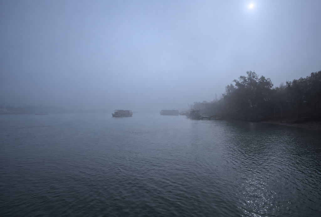
The conservation challenge is therefore to understand the entire nesting system rather than assuming that every loss represents a conservation failure.
This distinction is especially important in a wildlife publication. A nest eaten by a wild predator is part of natural ecosystem dynamics, while disturbance caused by human activity is a different management issue.
Coastal Erosion and Shoreline Change
Kalash is also significant because it lies within a highly dynamic coastal system.
The Geological Survey of India has specifically included Kalash Beach in geological and shoreline investigations of the western Sundarbans.
Regional evidence shows substantial long-term land loss in the Indian Sundarbans, especially in sea-facing and southern estuarine areas. The causes are complex and include natural geological processes, sediment dynamics and human influences.
This matters for Kalash because a sandy turtle-nesting beach depends on the continued existence and physical suitability of coastal habitat.
If shoreline position changes, the location and extent of suitable nesting ground can change with it.
However, the available evidence does not justify assigning a specific erosion rate to Kalash without a dedicated Kalash dataset.
Cyclones and Coastal Pressure
The Sundarbans is exposed to severe coastal weather.
The Government of West Bengal identifies coastal erosion, salinity, cyclones and other pressures as major management concerns in the Sundarbans and wider West Bengal coastal zone.
For Kalash, these pressures are particularly relevant because of its seaward position.
A coastal storm can affect several components simultaneously:
- shoreline morphology
- beach nesting habitat
- mangrove vegetation
- sediment distribution
- freshwater availability
- wildlife movement
- human access
This is another reason Kalash should be understood as a connected ecological system rather than as a single beach or forest camp.
Conservation and Local Participation
Effective conservation in the Sundarbans also has a human dimension.
Government documentation on southern Sundarbans camps describes the use of MGNREGA-supported employment at Kalash and Chulkati as part of a broader effort to create alternative income opportunities and improve cooperation between local communities and forest personnel.
The approach reflects a broader conservation principle recognised in West Bengal’s coastal-management planning: biodiversity protection and livelihood concerns are interconnected, particularly where communities depend on coastal ecosystem services.
For Kalash, this means conservation is not only about restricting access.
It also involves maintaining the institutions, forest protection systems and community relationships needed to manage a remote protected landscape over the long term.
Why Kalash Matters
Kalash brings together several conservation priorities within one landscape:
- mangrove forest protection
- tiger habitat protection
- coastal and estuarine habitat conservation
- marine-turtle nesting habitat
- coastal bird habitat
- shoreline and sediment monitoring
- management of human access
- local participation in forest-related activities
Its significance therefore comes from connectivity.
Protecting the beach without understanding the estuary would be incomplete.
Protecting the forest without understanding the coast would be incomplete.
And protecting wildlife without considering the people and institutions surrounding the forest would also be incomplete.
Kalash demonstrates the larger conservation reality of the Sundarbans: the forest, river and coast function as one system, while conservation must work across all three.
Visitor Information
Kalash is a remote protected-forest destination reached by water, rather than a conventional road-accessed tourist site.
The Department of Sundarban Affairs identifies Jharkhali as one of the routes into the southern Sundarbans and specifically notes that Kalas Island can be reached from Jharkhali by motorboat through the Matla and Bidyadhari river systems. Other southern access points include Namkhana, Ramganga, Jamtala, Raydighi and Najat.
Because Kalash lies within a protected forest landscape, a visit is subject to Forest Department rules and permissions. West Bengal’s forest visitor guidance states that visitors entering forest areas should carry the required permit, follow their guide, remain on designated routes and avoid activities that disturb wildlife or damage the environment.
Current Visitor Verification
Before travelling, visitors should verify:
- current Forest Department permission requirements
- current conservation charges
- whether Kalash Camp is open
- whether Kalash Beach landing is permitted
- seasonal restrictions
- boat requirements
- current weather and river conditions
The West Bengal Forest Department’s visitor system states that visitors to protected areas must carry original identification when required and follow the terms and conditions applicable to their booking or visit.
Responsible Behaviour
Kalash is wildlife habitat before it is a visitor destination.
Visitors should:
- remain with the authorised guide or group
- follow designated routes
- keep noise low
- avoid littering
- avoid plastic and other non-degradable waste
- never feed wildlife
- never collect plants, shells or other natural material
- never attempt to approach wildlife
- follow Forest Department instructions
- avoid disturbing nesting or resting animals
These principles are consistent with West Bengal’s official forest visitor guidance.
Seasonal Character
WINTER | NOVEMBER–FEBRUARY
- Cooler conditions
- Generally more comfortable conditions for boat-based exploration
- Strong coastal character
- Historically documented Olive Ridley nesting activity
- Good period for observing the changing relationship between forest, estuary and beach
The Department of Sundarban Affairs has traditionally identified October to March as the best general period for visiting the Sundarbans. This is a broad Sundarbans recommendation, not a guarantee of conditions specifically at Kalash.
For Kalash, winter is particularly significant because historical turtle research documented Olive Ridley nesting during the broader winter nesting period.
SPRING | MARCH–APRIL
- Increasing temperatures
- Warmer and increasingly humid conditions
- Changing vegetation and wildlife activity
- Transition toward the hotter pre-monsoon period
The coastal environment remains strongly controlled by tides, so the appearance of the beach and intertidal zone can change substantially during the day.
SUMMER | MAY–JUNE
- Hot and humid conditions
- Increasing pre-monsoon weather
- Greater exposure to storms and strong winds
- Conditions increasingly dependent on weather and water movement
The southern coastal position makes weather conditions an important consideration for boat-based travel.
MONSOON | JUNE–SEPTEMBER
- Heavy rainfall
- Rougher weather conditions possible
- Strong tidal and storm influence
- Reduced suitability for ordinary visitor movement
- Potential seasonal restrictions
AUTUMN | SEPTEMBER–OCTOBER
- Transition away from the monsoon
- Changing weather and water conditions
- Increasing suitability for boat-based exploration as conditions stabilise
- Beginning of the broader cooler visiting season
Autumn is also a useful period for observing how the coastal landscape changes following the monsoon.
The Wild Orbit’s Interesting Facts About Kalash
- Kalash is both a forest and coastal landscape.
The name is associated with Kalash Camp as well as the seaward Kalash Island and beach. - Kalash Camp and Kalash Beach are not identical locations.
They are connected parts of the same landscape but should be described separately. - The Matla River is central to Kalash’s geography.
The landscape lies near the river’s downstream estuarine environment. - Kalash has documented Olive Ridley nesting.
Historical surveys recorded substantial nesting activity in some seasons, including 303 nests during 2000–01. - Nesting numbers can vary dramatically.
The following documented season recorded only 10 nests, demonstrating why historical peak numbers cannot be treated as a permanent population estimate. - Kalash Beach has documented coastal bird habitat.
Research has recorded coastal birds and waders, including the Great Thick-knee. - A freshwater pond occurs near Kalash Camp.
Government tourism material identifies it as being used by wildlife. - Kalash has been scientifically studied.
Research has investigated its mangrove-estuarine microbial communities and environmental conditions. - Kalash Beach has been included in geological investigations.
The site has been examined as part of wider studies of shoreline and geological change in the western Sundarbans. - The landscape is continually changing.
Tides, sediment movement, erosion, deposition, storms and sea-level-related processes all contribute to the changing character of the southern Sundarbans. - Kalash is not an assured wildlife-sighting location.
The presence of tiger habitat means wildlife may use the area, but sightings remain unpredictable. - Visitor rules can change.
Access, landing permissions, conservation charges and seasonal restrictions should be checked before every visit.
FAQs
Where is Kalash located?
Kalash is located in the southern Indian Sundarbans in South 24 Parganas, West Bengal. Kalash Camp is associated with the Chulkathi-1 Forest Block, while the associated Kalash Island and beach extend toward the Matla estuary.
Is Kalash an island?
The terminology is not completely uniform. Kalash Island/Kalas Island refers to the seaward landscape, while Kalash Camp refers to the Forest Department facility within the surrounding forest. The two should not be treated as interchangeable names.
What is Kalash famous for?
Kalash is particularly associated with its southern coastal setting, mangrove forest, Matla estuary, wildlife habitat, coastal birds and historically documented Olive Ridley turtle nesting.
Is Kalash Beach the same as Kalash Camp?
No. They are connected locations within the same broader Kalash landscape, but the camp and the beach should be geographically distinguished.
Which river is beside Kalash?
The Matla River is the principal river associated with Kalash. The area lies near the downstream Matla estuary as it approaches the Bay of Bengal.
Can you see a Royal Bengal Tiger at Kalash?
Kalash lies within the Sundarbans tiger landscape and tiger use of the wider area is documented. However, a tiger sighting cannot be guaranteed.
Are Olive Ridley turtles found at Kalash?
Yes. Historical scientific surveys have documented Olive Ridley nesting at Kalash Beach.
Does Kalash have Olive Ridley turtles every year?
The available evidence does not justify saying that nesting occurs at a constant level every year. Historical surveys show substantial variation between seasons.
Can visitors walk on Kalash Beach?
Current visitor information indicates restrictions on landing at the beach, while older government material describes controlled access. Because regulations can change, visitors should confirm the current Forest Department rule before travelling.
How do you reach Kalash?
Kalash is reached by boat. The Department of Sundarban Affairs identifies Jharkhali as a route to Kalas Island through the Matla and Bidyadhari systems.
Do you need permission to visit Kalash?
Access to protected Sundarbans forest areas is regulated. Visitors should obtain the required Forest Department permission and follow the applicable entry and boat regulations.
What is the best time to visit Kalash?
The broader Sundarbans visitor guidance identifies October to March as a favourable general visiting period. Kalash also has particular ecological interest during the winter turtle-nesting season. However, exact conditions and access depend on Forest Department regulations, tides and weather.
Is Kalash open during the monsoon?
Protected areas in West Bengal traditionally have a seasonal closure but the exact rule applicable to a particular site should always be verified with the Forest Department.
Is Kalash suitable for birdwatching?
Yes. Its combination of coastal beach, intertidal habitat, shallow water and surrounding mangrove forest provides habitat for coastal birds and waders. Specific records include the Great Thick-knee.
Is Kalash suitable for photography?
The landscape offers opportunities for documentary photography of mangroves, estuarine scenery, birds, coastal habitat and changing tidal conditions. Wildlife and visitor regulations should always take priority over photography.
Is Kalash a tourist beach?
It is better understood as a protected coastal wildlife landscape than as a conventional recreational beach. Access is regulated and the surrounding forest is wildlife habitat.
Why is Kalash important for conservation?
Kalash brings together mangrove forest, estuarine waters, coastal habitat and documented marine-turtle nesting. It also lies within a protected wildlife landscape used by species including the Royal Bengal Tiger.
Is Kalash part of the Sundarbans National Park?
Scientific literature describing the Kalash study area places Kalash within the Sundarbans National Park landscape. Administrative and access terminology can vary between sources, so protected-area designations should be checked against current Forest Department documentation when used for operational purposes.
The Last Word on Kalash
At Kalash, the Sundarbans does not end at the water.
The forest continues into the rhythm of the tide, the estuary carries the influence of the river toward the sea, and the coastal beach provides a habitat that is different from the mangroves behind it.
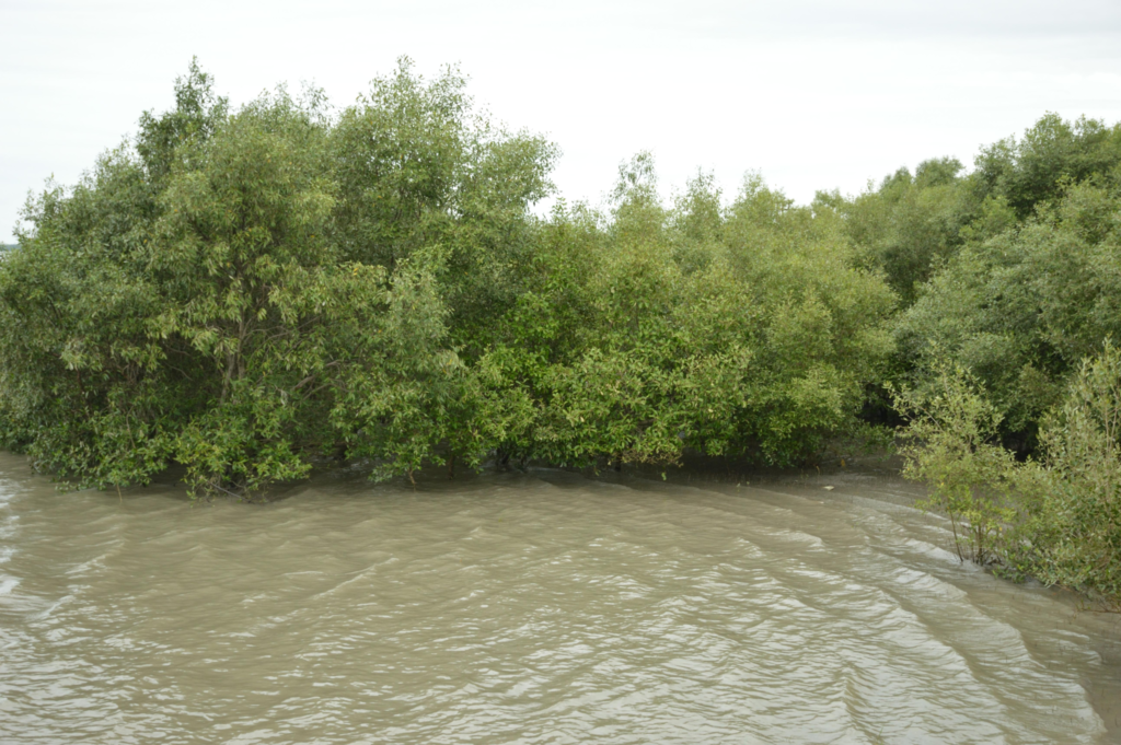
This is a landscape shaped continuously by movement.
- The tide exposes and covers the intertidal ground.
- Sediment is deposited and carried away.
- Mangroves establish where physical conditions allow them to survive.
- Birds use the exposed shore. Marine turtles have historically come ashore to nest.
- Tigers move through the surrounding forest, often unseen.
None of these processes exist in isolation.
Kalash is important because it makes the connections visible.
The camp represents the human system established to protect and manage a remote forest. The beach represents the coastal edge of that protected landscape. The Matla represents the moving water that links the forest to the wider delta and the sea.
Its conservation value therefore cannot be reduced to a single species or attraction.
Kalash is a meeting point of mangrove, river, coast and wildlife.
- Its shoreline may change.
- Its wildlife may remain unseen.
- Its tides may transform the same stretch of ground within hours.
That constant change is not an exception to the Sundarbans.
It is the defining character of the landscape.
To understand Kalash is to understand that the southern Sundarbans is not a collection of isolated islands, forests and beaches. It is one interconnected living system, continually reshaped by water and sustained by the delicate relationship between land, river, sea and life.
Plan your private Sundarban expedition
A private journey shaped around you — your group, your pace, your interests. Book a free consultation.