 Encyclopedia
As the tide begins to recede, the dense green canopy of Halliday Island emerges above the muddy shoreline, its mangrove roots gripping sediment that has been shaped by centuries of tidal movement. There are no permanent villages, cultivated fields, or roads here. Instead, the landscape is defined by brackish creeks, intertidal mudflats, and mangrove forests that breathe with every changing tide. This small island, lying close to the Bay of Bengal in the western Indian Sundarbans, represents one of the region’s most intact examples of a protected estuarine ecosystem.
Halliday Island is best known as the Halliday Island Wildlife Sanctuary, one of the three wildlife sanctuaries that form part of the Sundarban Biosphere Reserve. Despite covering only 5.95 square kilometres, the sanctuary plays a disproportionately important ecological role by protecting mangrove habitats that support mammals, reptiles, resident and migratory birds, estuarine fish, crustaceans, and countless invertebrates. The island also serves as an important refuge within the wider mosaic of protected forests that together sustain the world’s largest mangrove ecosystem.
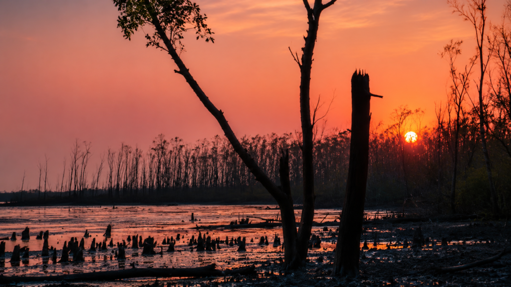
Unlike many inhabited islands of the Indian Sundarbans, Halliday Island remains free from permanent human settlement. Its protected status allows natural ecological processes to dominate, while the twice-daily tides continually reshape the shoreline through erosion, sediment deposition, and nutrient exchange. These processes sustain the mangrove vegetation that forms the foundation of the island’s biodiversity.
Although relatively small, Halliday Island occupies a strategic position within the western Sundarbans. It contributes to coastal resilience by stabilising sediments, reducing wave energy, supporting fisheries through nursery habitats, and providing shelter for wildlife moving between adjacent protected forests. Its significance therefore extends far beyond its physical size, illustrating how even a modest mangrove island can become an essential component of a much larger ecological network.
Halliday Island at a Glance
Official Name: Halliday Island Wildlife Sanctuary
Location: Indian Sundarbans, South 24 Parganas District, West Bengal
Protected Status: Wildlife Sanctuary
Year of Notification: 1976
Area: 5.95 km²
Biosphere: Sundarban Biosphere Reserve
Dominant Habitat: Tidal mangrove forest
Surrounding River: Matla River
Human Settlement: None within the sanctuary
Primary Conservation Value: Mangrove ecosystem, estuarine biodiversity, and wildlife habitat
Accessibility: Accessible only by licensed boats through designated waterways, subject to Forest Department regulations and prior permission.
Geographic Setting
Halliday Island occupies the southwestern sector of the Indian Sundarbans, where the immense Ganges–Brahmaputra–Meghna Delta gradually merges into the Bay of Bengal. The island lies within South 24 Parganas District of West Bengal and forms part of the protected landscapes administered under the Sundarban Biosphere Reserve.
Geographically, Halliday Island belongs to a dynamic delta rather than a stable terrestrial landscape. Every tidal cycle transports suspended sediment through the surrounding estuarine channels, gradually altering shorelines, creek margins, and mudflats. The island itself represents one stage in this continuing process of delta formation, where deposition, erosion, salinity, and vegetation remain in constant balance.
Unlike inhabited islands enclosed by embankments, Halliday Island experiences natural tidal flooding across much of its landscape. This unrestricted interaction between river and forest maintains the ecological conditions required for mangrove communities to regenerate and adapt. Seasonal changes in freshwater discharge from the upstream river systems, combined with saline tidal inflow from the Bay of Bengal, create a complex gradient of salinity that influences vegetation patterns across the island.
Because Halliday Island remains largely undisturbed by permanent human activity, it offers scientists and conservation managers an important reference landscape for understanding how mangrove ecosystems function under relatively natural conditions. Its ecological processes mirror many of those that once characterised much larger areas of the western Sundarbans before widespread reclamation for agriculture and settlement.
How to Reach Halliday Island
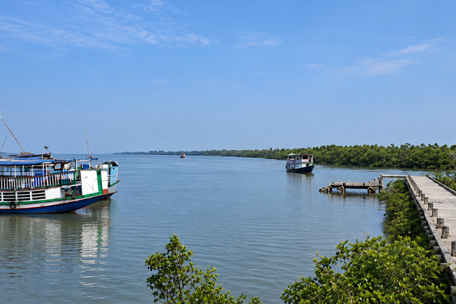
Halliday Island cannot be reached directly by road or rail. Like much of the protected forest landscape of the Sundarbans, the sanctuary is surrounded by tidal waterways, and the final approach must be made by boat. Halliday Island Wildlife Sanctuary is bounded on all sides by the Matla River, making river transport fundamental to any authorised approach to the island.
For visitors travelling from Kolkata, the journey therefore involves two stages: reaching one of the established gateways to the Sundarbans by road or rail, followed by travel through the tidal waterways in an authorised vessel.
By Air
The nearest major airport is Netaji Subhas Chandra Bose International Airport. From the airport, travellers must continue overland towards one of the riverine gateways serving the Sundarbans before transferring to a boat. There is no airport or airstrip on Halliday Island.
By Train
Rail travel from Kolkata provides access to several parts of the western Sundarbans. West Bengal Tourism identifies Canning as one of the principal rail gateways to the Sundarbans, with regular local trains operating from Sealdah South. Depending on the planned river route, other southern approaches may involve travelling towards the Namkhana region.
The railway journey does not provide direct access to Halliday Island. A road transfer and subsequent boat journey are required to enter the riverine landscape.
By Road
From Kolkata, road connections lead towards several recognised gateways to the Sundarbans, including Canning, Sonakhali, Raidighi, Namkhana and Najat. The appropriate departure point depends upon the authorised boat route and the wider itinerary being followed.
Travellers should therefore confirm the current embarkation point before beginning the journey rather than assuming that a particular Sundarbans jetty provides direct access to Halliday Island.
By Boat
The final approach to Halliday Island is entirely by water.
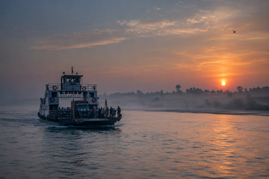
Motorised boats navigate the tidal rivers and channels of the western Sundarbans, eventually entering the Matla river system surrounding the sanctuary. The character of this journey is determined by the tides: water levels, currents, exposed mudbanks and navigability can change substantially within a matter of hours.
Halliday Island should not be understood as an island with a conventional passenger ferry service or public landing point. It is a protected wildlife sanctuary, and access to protected areas of the Sundarbans is governed by forest regulations.
Visitors should use authorised vessels and confirm current permissions, permitted routes and access conditions with the West Bengal Forest Department or an appropriately authorised operator before travelling.
Rivers Flowing Beside Halliday Island
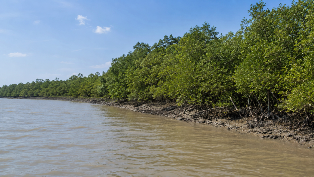
- Matla River — surrounds the sanctuary and forms its defining hydrological boundary. The original 1976 sanctuary notification describes Halliday Island as being bounded on all sides by the Matla River. The Matla is among the largest tidal estuaries in the Indian Sundarbans, carrying powerful tidal currents that influence shoreline erosion, sediment deposition, and mangrove regeneration throughout the sanctuary.
Nearby Forest Blocks
- Dullibhasani Forest Block (Compartment 7 Part): within which Halliday Island Wildlife Sanctuary was originally notified.
- Sundarban Tiger Reserve: lies immediately to the east of the sanctuary’s Eco-Sensitive Zone.
- West Sundarban Wildlife Sanctuary Eco-Sensitive Zone: lies to the west.
Nearby Islands and Human Settlements
Halliday Island itself has no permanent human settlement. The island is managed entirely as protected forest, helping minimise direct human disturbance to wildlife.
Nearby geographic references include:
- Dullibhasani Island
- Chaimari Island
- Other inhabited islands of the western Indian Sundarbans occur farther inland beyond the sanctuary’s protected boundaries, separated by tidal channels and reserve forests.
Landscape Character
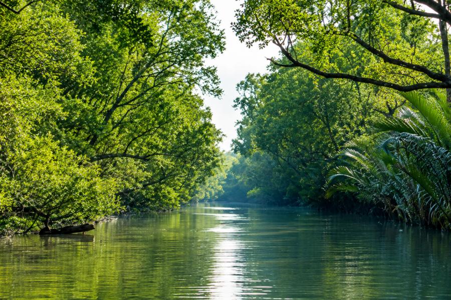
At first glance, Halliday Island appears as a continuous expanse of mangrove forest rising from the tidal waters of the Matla estuary. A closer observation, however, reveals a landscape shaped by countless ecological transitions. Dense mangrove stands gradually give way to exposed mudflats, narrow tidal creeks weave through the forest interior, and elevated natural levees support vegetation that differs subtly from the lower, frequently inundated areas. Every feature reflects the continuous interaction between land, river, and sea.
Unlike the reclaimed agricultural islands found elsewhere in the Indian Sundarbans, Halliday Island has retained its natural geomorphology. There are no embankments restricting tidal flow, no permanent roads fragmenting habitats, and no villages interrupting ecological processes. Instead, the island functions as an uninterrupted estuarine landscape where natural succession, erosion, and sediment deposition continue much as they have for centuries.
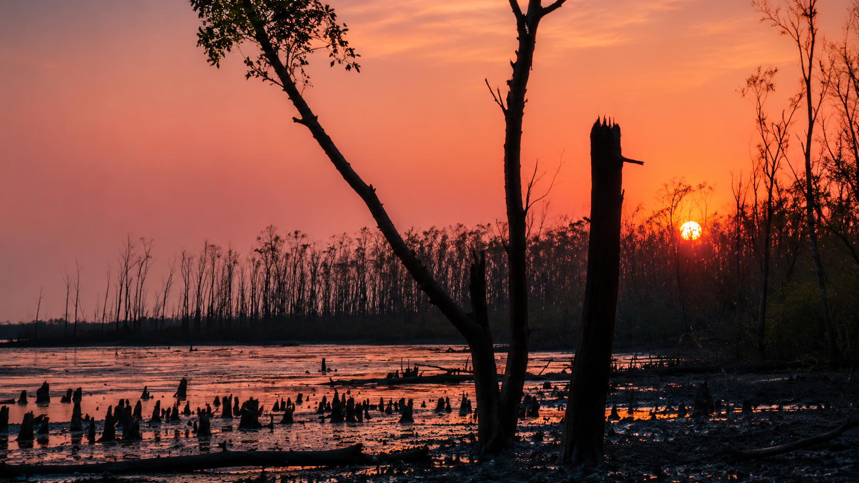
The shoreline is highly dynamic. During low tide, extensive mudbanks emerge along the island’s margins, exposing a rich feeding ground for wading birds, mudskippers, fiddler crabs, and other intertidal organisms. As the tide returns, these same mudflats disappear beneath several metres of brackish water, illustrating the extraordinary environmental rhythm that defines life throughout the Sundarbans.
The forest canopy itself is relatively low compared with many inland tropical forests, generally ranging between 5 and 15 metres in height depending on species composition, salinity, and local site conditions. Twisted trunks, salt-tolerant shrubs, aerial roots, and dense understory vegetation create a structurally complex habitat capable of supporting a remarkable diversity of wildlife despite the sanctuary’s modest size.
A Landscape in Constant Motion
Few landscapes in India change as frequently as Halliday Island. Unlike mountainous regions, where geological change occurs over thousands or millions of years, the Sundarbans evolve with every tidal cycle. Shorelines migrate, creek mouths widen or narrow, sandbars appear and disappear, and new sediment layers accumulate continuously.
This dynamism is driven by the interaction of several natural forces:
- Semidiurnal tides entering from the Bay of Bengal.
- Seasonal freshwater discharge from the Ganges river system.
- Monsoonal rainfall.
- Cyclonic storms.
- Continuous transport and deposition of fine alluvial sediments.
These processes ensure that Halliday Island is never truly static. Instead, it exists in a perpetual state of ecological adjustment, where vegetation, soil, and hydrology respond constantly to changing environmental conditions.
Geological Formation
Halliday Island owes its existence to one of the largest sedimentary systems on Earth—the Ganges–Brahmaputra–Meghna Delta. Over thousands of years, rivers originating in the Himalayas have transported enormous quantities of silt, clay, and fine sand toward the Bay of Bengal. As river velocities decrease near the coast, these sediments settle, gradually forming mudbanks that become colonised by pioneer mangrove vegetation.
Mangroves play a crucial engineering role in this process. Their complex root systems trap suspended sediments carried by tidal waters, stabilising newly formed mudflats and allowing additional material to accumulate. Over time, this positive feedback between vegetation and sediment deposition transforms unstable tidal flats into established mangrove islands.
Halliday Island therefore represents both a geological and a biological creation. Without the continuous delivery of sediment by rivers or the stabilising influence of mangrove roots, the island would gradually erode under the influence of tides and waves.
The soils of Halliday Island consist primarily of recent alluvial deposits rich in clay and silt. These fine sediments retain moisture effectively but become waterlogged during prolonged inundation. Salinity, oxygen availability, and tidal frequency all influence soil chemistry, creating environmental gradients that determine which mangrove species can thrive in different parts of the sanctuary.
The Role of Sediment
Sediment is often overlooked as a component of biodiversity, yet it underpins nearly every ecological process within Halliday Island.
Sediments:
- provide the physical foundation for mangrove forests
- transport nutrients that sustain primary productivity
- store significant quantities of organic carbon
- support burrowing invertebrates
- influence creek formation and drainage
- determine long-term shoreline stability
Even small changes in sediment supply—whether caused by upstream river regulation, altered freshwater flows, or sea-level rise—can reshape the island’s future.
Tidal Environment
Halliday Island experiences a semidiurnal tidal regime, meaning that two high tides and two low tides occur approximately every twenty-four hours. These tides govern nearly every ecological process within the sanctuary.
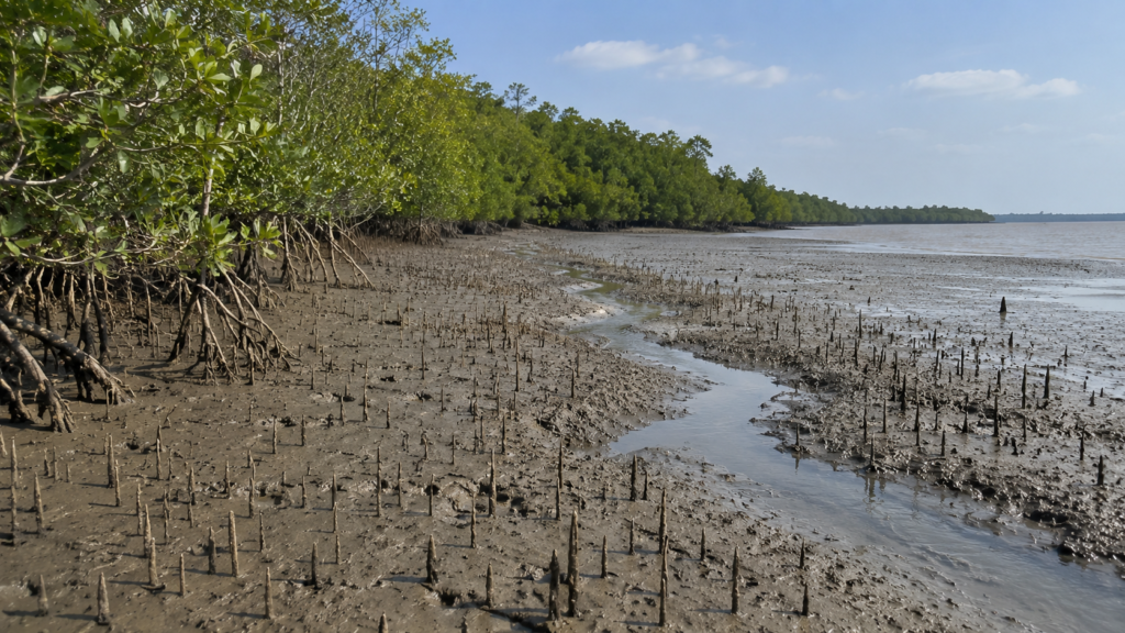
Rather than acting as a simple rise and fall of water level, tides function as the island’s circulatory system. Each incoming tide transports oxygenated water, dissolved nutrients, plankton, fish larvae, and suspended sediments into the mangrove forest. As the tide recedes, organic matter, decomposing leaf litter, and nutrients are carried back into surrounding estuarine waters, supporting productivity far beyond the island itself.
This exchange links Halliday Island with the wider Sundarbans ecosystem. Nutrients generated within the mangrove forest contribute to nearby fisheries, while aquatic organisms carried inland during tidal inundation become food for birds, reptiles, and mammals.
Living with Saltwater
One of the defining environmental characteristics of Halliday Island is salinity. Because the sanctuary lies close to the Bay of Bengal, tidal waters contain significant amounts of dissolved salt. The degree of salinity varies seasonally, generally decreasing during the southwest monsoon when freshwater discharge from upstream rivers increases.
Mangrove plants exhibit remarkable adaptations that allow them to survive under these conditions. Some species exclude salt at their roots, others excrete excess salt through specialised leaf glands, while certain mangroves store salt in older leaves before shedding them. These physiological adaptations enable vegetation to flourish where most terrestrial plants could not survive.
Salinity also influences wildlife distribution. Fish communities, crustaceans, molluscs, and plankton all respond to seasonal changes in salt concentration, creating a dynamic ecological mosaic throughout the year.
Weather and Seasonal Dynamics
Halliday Island experiences a tropical monsoon climate characterised by three broad seasons:
Summer (March–June): High temperatures and increasing salinity place physiological stress on many organisms. Evaporation intensifies, and exposed mudflats may become extremely warm during low tide.
Monsoon (June–September): Heavy rainfall lowers surface salinity, replenishes freshwater inputs, and delivers additional sediment. Vegetation growth accelerates, while tidal creeks become highly productive nurseries for aquatic life.
Winter (November–February): Cooler temperatures and relatively stable weather create favourable conditions for resident wildlife and migratory birds. Reduced humidity and calmer seas also improve visibility within the forest landscape.
Although these seasonal patterns recur annually, each year’s conditions vary according to rainfall, river discharge, cyclonic activity, and regional climatic fluctuations.
Documentary Reflection
Halliday Island demonstrates that permanence is not a defining feature of nature. Every shoreline, creek, mudflat, and mangrove stand exists within an ongoing dialogue between sediment, water, vegetation, and time. What appears fixed today may shift after a single monsoon season or an unusually powerful cyclone. Yet this continual change is not a sign of instability—it is the very process through which the Sundarbans renew themselves.
Understanding Halliday Island therefore requires looking beyond its physical boundaries. The island is not an isolated fragment of land but a living expression of the dynamic estuarine forces that have shaped the Indian Sundarbans for millennia. In the next part, we explore how these environmental conditions support one of the world’s most specialised mangrove ecosystems, from salt-tolerant trees to the extraordinary diversity of mammals, birds, reptiles, fish, and invertebrates that depend upon them.
The Living Mangrove Ecosystem
As the rising tide enters Halliday Island through countless creeks and channels, it disappears beneath the forest canopy, flooding the roots of trees that have evolved specifically for life between land and sea. Unlike terrestrial forests, where rainfall provides the primary source of water, the mangroves of Halliday Island are sustained by an intricate balance of tidal inundation, sediment deposition, freshwater input, and saline estuarine conditions. Every tidal cycle delivers nutrients, oxygen, plankton, and fine sediments that maintain one of India’s most productive coastal ecosystems.
Although Halliday Island occupies less than six square kilometres, its mangrove forest performs ecological functions that extend far beyond its boundaries. It stabilises shorelines, stores significant quantities of carbon, supports marine food webs, provides breeding habitats for fish and crustaceans, and shelters a remarkable diversity of wildlife. In many respects, the forest operates as a biological engine that helps sustain the wider western Sundarbans.
Mangrove Forest Composition
Halliday Island supports a mixed mangrove community typical of the western Indian Sundarbans, although species composition varies according to elevation, soil characteristics, salinity, and the frequency of tidal inundation.
Areas exposed to daily tidal flooding are generally occupied by highly salt-tolerant pioneer species capable of colonising unstable sediments. Slightly elevated zones, where flooding is less frequent, support taller and more diverse mangrove communities. This gradual transition creates a mosaic of habitats rather than a uniform forest.
The forest is characterised by dense canopies, interlocking root systems, pneumatophores protruding from the mud, and an abundance of decomposing organic matter that fuels nutrient cycling throughout the estuary.
Dominant Mangrove Species
Several characteristic mangrove species occur within Halliday Island and the surrounding Sundarbans ecosystem.
Sundari (Heritiera fomes)
The Sundari tree, from which the Sundarbans derives its name, remains one of the region’s most iconic mangrove species. It prefers comparatively less saline conditions and contributes substantially to canopy formation where environmental conditions remain favourable.
Gewa (Excoecaria agallocha)
Gewa is among the most widespread mangrove trees in the Indian Sundarbans. It tolerates a broad range of salinity levels and frequently dominates mixed mangrove forests.
Goran (Ceriops decandra)
Goran commonly forms dense stands on moderately elevated ground. Its complex root systems help stabilise sediments while providing shelter for numerous invertebrates.
Keora (Sonneratia apetala)
Keora often colonises newly deposited mudflats. Rapid growth allows it to establish vegetation on young sediments, making it an important pioneer species in delta formation.
Avicennia Species
Species such as Grey Mangrove (Avicennia marina) and related members of the genus occupy highly saline zones. Their dense fields of pencil-like pneumatophores increase oxygen availability within oxygen-poor soils.
Although these species differ in physiology and habitat preference, together they create the structural diversity necessary to support Halliday Island’s wildlife.
Remarkable Mangrove Adaptations
Life in a tidal estuary presents challenges rarely encountered by terrestrial plants.
Mangroves have evolved remarkable adaptations, including:
- specialised aerial roots that absorb oxygen from the atmosphere
- salt exclusion at the root surface
- salt secretion through specialised leaf glands
- buoyant propagules capable of floating with tidal currents before establishing new seedlings
- flexible trunks and branches that withstand strong tidal flows and cyclonic winds
These adaptations allow mangroves to occupy ecological niches unavailable to most plant species.
Documentary Observation
At low tide, the forest floor resembles a field of slender spikes as thousands of pneumatophores emerge from the saturated mud. Between them, fiddler crabs wave their enlarged claws while mudskippers rest beside shallow pools. Above, fallen mangrove leaves gradually decompose beneath fungal growth and microbial activity, beginning a nutrient cycle that ultimately supports fish, birds, reptiles, and mammals throughout the estuary.
Wildlife of Halliday Island
Although relatively small, Halliday Island supports a rich assemblage of wildlife characteristic of protected mangrove ecosystems. Much of this biodiversity depends directly upon tidal productivity rather than terrestrial vegetation alone.
The sanctuary functions both as permanent habitat and as a refuge for animals moving between adjacent protected forests.
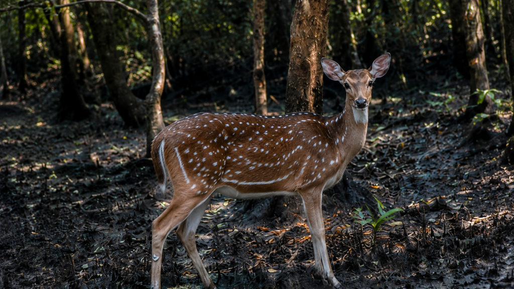
Mammals
Royal Bengal Tiger (Panthera tigris tigris)
The Royal Bengal Tiger represents the sanctuary’s most celebrated species. Tigers within the Sundarbans exhibit behavioural adaptations unlike those of inland populations, including extensive swimming ability and regular movement across tidal creeks.
While Halliday Island is not among the largest tiger habitats, individuals may occasionally move through the surrounding protected landscape as part of wider territorial ranges.
Fishing Cat (Prionailurus viverrinus)
The Fishing Cat is particularly well adapted to mangrove wetlands, feeding on fish, crustaceans, amphibians, and other aquatic prey. Dense vegetation and tidal creeks provide ideal hunting habitat.
Jungle Cat (Felis chaus)
This medium-sized felid occupies dense vegetation and reed beds where it preys upon rodents, birds, reptiles, and small mammals.
Small Indian Civet (Viverricula indica)
Nocturnal and elusive, the Small Indian Civet contributes to seed dispersal and regulation of small vertebrate populations.
Smooth-coated Otter (Lutrogale perspicillata)
Although rarely observed, otters inhabit estuarine waterways throughout the Sundarbans, where abundant fish populations provide suitable foraging opportunities.
Birds
Halliday Island’s position within the estuarine delta makes it valuable for both resident and migratory birds.
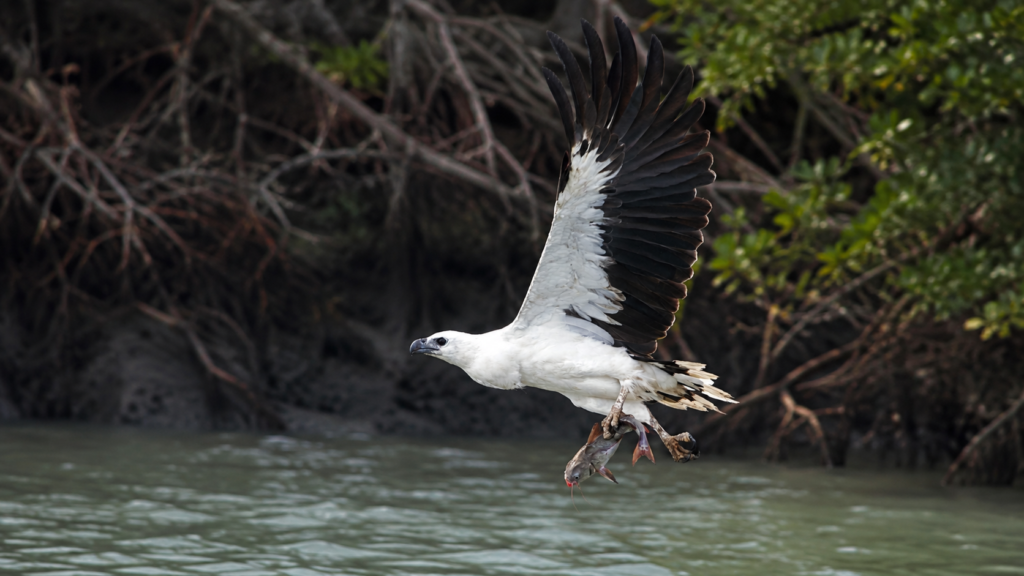
Common groups include:
- Egrets
- Herons
- Pond Herons
- Kingfishers
- Brahminy Kites
- White-bellied Sea Eagles
- Black-capped Kingfishers
- Collared Kingfishers
- Lesser Adjutants
- Sandpipers
- Plovers
- Whimbrels
- Curlews
- Terns
The exposed mudflats become particularly important during low tide when shorebirds feed on worms, molluscs, and crustaceans buried within soft sediments.
Reptiles
The mangrove environment supports numerous reptile species.
Saltwater Crocodile (Crocodylus porosus)
The Saltwater Crocodile occupies tidal rivers and creeks throughout the Sundarbans. As an apex predator, it helps maintain ecological balance within estuarine food webs.
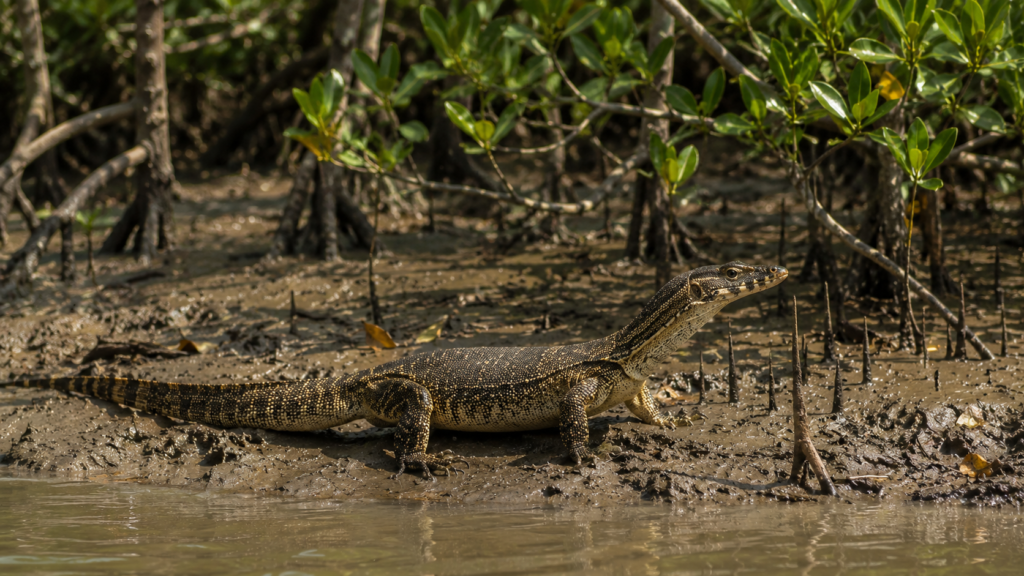
Water Monitor (Varanus salvator)
Water Monitors are frequently encountered along creek margins where they feed opportunistically on fish, crabs, eggs, carrion, and small vertebrates.
Several snake species—including both venomous and non-venomous forms—also inhabit the sanctuary’s mangrove forests, although encounters are generally infrequent due to dense vegetation.
Fish and Aquatic Life
Halliday Island’s tidal waters function as nursery grounds for numerous commercially and ecologically important fish species.
Juvenile fish utilise submerged mangrove roots as shelter from predators while feeding on plankton and detritus carried inland by tidal currents.
Common estuarine groups include:
- Mullets
- Catfish
- Gobies
- Perches
- Glassfishes
- Threadfins
These fish populations sustain higher predators including birds, crocodiles, Fishing Cats, and otters.
Crustaceans and Molluscs
The intertidal mud supports extraordinary densities of invertebrates.
Prominent groups include:
- Fiddler Crabs
- Mud Crabs
- Hermit Crabs
- Mangrove Crabs
- Shrimps
- Oysters
- Mud Snails
- Bivalves
These organisms accelerate decomposition, recycle nutrients, aerate sediments, and provide essential prey for birds, reptiles, and fish.
Insects and Pollinators
Although often overlooked, insects play indispensable ecological roles.
Butterflies, bees, flies, beetles, ants, dragonflies, and numerous aquatic insects contribute to:
- pollination
- decomposition
- nutrient cycling
- food-web stability
- biological control of smaller organisms
During flowering seasons, mangrove blossoms attract diverse insect communities that also support nectar-feeding birds.
Ecological Importance
Halliday Island performs ecological functions that extend well beyond its modest geographical extent.
Coastal Protection
Dense mangrove root systems reduce wave energy, stabilise sediments, and minimise shoreline erosion during storms and cyclones.
Carbon Storage
Mangrove forests are among the world’s most efficient natural carbon sinks. Carbon is stored not only within living trees but also within deep organic-rich sediments that accumulate over centuries.
Nursery Habitat
Countless marine organisms spend their juvenile life stages among submerged mangrove roots before dispersing into larger estuarine and coastal waters.
Biodiversity Refuge
As a protected sanctuary free from permanent human settlement, Halliday Island provides secure habitat for numerous species that depend upon relatively undisturbed mangrove forests.
Nutrient Cycling
Leaf litter falling from mangrove trees decomposes into organic matter that forms the base of highly productive estuarine food webs, ultimately supporting fish populations and higher predators throughout the Sundarbans.
Halliday Island Within the Sundarbans Landscape
Ecologically, Halliday Island cannot be understood in isolation. It forms part of an interconnected network of protected forests, tidal rivers, mudflats, and estuaries extending across the Indian Sundarbans. Wildlife moves between these habitats, nutrients circulate through tidal waters, and sediment transported by rivers continually reshapes the landscape.
Its importance therefore lies not simply in the species found within its boundaries but in its contribution to the resilience of the entire mangrove ecosystem. Even a sanctuary covering only a few square kilometres strengthens ecological connectivity across one of the world’s most complex coastal landscapes.
History of Halliday Island
Long before the establishment of modern conservation policies, Halliday Island was part of the vast, uninterrupted mangrove wilderness that once extended across much of the Ganges–Brahmaputra–Meghna Delta. Unlike many neighbouring islands that were gradually reclaimed for agriculture during the nineteenth and twentieth centuries, Halliday Island remained largely untouched because of its tidal isolation, dense mangrove vegetation, and challenging environmental conditions.
The island’s ecological value became increasingly recognised during the latter half of the twentieth century, as scientific understanding of mangrove ecosystems expanded. The Sundarbans were acknowledged not merely as a collection of forests but as one of the world’s most important estuarine ecosystems, supporting exceptional biodiversity while protecting India’s eastern coastline.
Recognising the need to conserve representative mangrove habitats, the Government of West Bengal officially notified Halliday Island Wildlife Sanctuary in 1976 under the Wildlife (Protection) Act. Covering 5.95 square kilometres, the sanctuary was established to safeguard mangrove forests and the wildlife dependent upon them. Today, it forms part of the larger Sundarban Biosphere Reserve, contributing to one of India’s most significant protected-area networks.
Unlike nearby inhabited islands, Halliday Island has never undergone extensive embankment construction or permanent settlement. This relative absence of human modification has allowed natural ecological processes—including tidal inundation, sediment deposition, and mangrove succession—to continue with comparatively little interruption.
Conservation Significance
Although small in area, Halliday Island performs ecological functions that are critical to the resilience of the western Indian Sundarbans.
A Protected Mangrove Refuge
See it for yourself
A private journey shaped around you — your group, your pace, your interests. Book a free consultation.
Protected mangrove islands such as Halliday Island provide secure habitat for wildlife that is increasingly vulnerable to habitat fragmentation elsewhere in coastal South Asia. By maintaining intact mangrove vegetation, the sanctuary supports breeding, feeding, and resting habitats for numerous species throughout the year.
Its value lies not simply in the number of species present but in preserving the ecological processes that sustain those species.
Supporting the Sundarbans Landscape
Halliday Island should not be viewed as an isolated protected area.
Instead, it forms part of an interconnected conservation landscape that includes:
- Sundarban Tiger Reserve
- Sundarban National Park
- Lothian Island Wildlife Sanctuary
- West Sundarban Wildlife Sanctuary
- numerous reserve forest blocks
- tidal rivers and estuarine channels
Wildlife frequently moves between these habitats, while tidal waters continually transport nutrients, sediments, larvae, and organic matter throughout the landscape.
The ecological integrity of the Sundarbans therefore depends upon the protection of many relatively small habitats functioning together as a single interconnected ecosystem.
Carbon Storage and Climate Regulation
Mangrove forests rank among Earth’s most effective natural carbon sinks.
Halliday Island contributes to climate regulation by storing carbon in:
- living trees
- extensive root systems
- waterlogged soils
- accumulated organic sediments
Because decomposition proceeds slowly within oxygen-poor mangrove soils, significant quantities of carbon remain locked underground for centuries.
Protecting mangrove forests therefore contributes simultaneously to biodiversity conservation and climate-change mitigation.
Natural Coastal Defence
Cyclones have shaped the Bay of Bengal coastline throughout recorded history.
Halliday Island’s mangrove forests reduce wave energy through dense root systems and complex vegetation structure. Although no mangrove forest can eliminate cyclone impacts entirely, healthy mangroves help reduce erosion, trap sediments, and slow storm surges before they reach inland environments.
This natural protective function has become increasingly important as climate change contributes to rising sea levels and the potential for more intense tropical cyclones.
Nursery for Estuarine Fisheries
Many commercially valuable fish and crustacean species depend upon mangrove habitats during their juvenile life stages.
Submerged mangrove roots provide:
- shelter from predators
- abundant food resources
- relatively calm water conditions
- complex structural habitat
By supporting early life stages of numerous aquatic organisms, Halliday Island contributes indirectly to fisheries throughout surrounding estuarine waters.
Scientific Importance
Because Halliday Island remains largely free from permanent human settlement, it offers researchers an opportunity to study relatively undisturbed mangrove ecological processes.
Scientific investigations conducted throughout the wider Sundarbans have examined:
- mangrove succession
- salinity gradients
- sediment transport
- shoreline dynamics
- carbon sequestration
- wildlife ecology
- climate-change impacts
- estuarine biodiversity
Protected islands such as Halliday Island provide valuable long-term reference sites for understanding how mangrove ecosystems respond to environmental change.
Conservation Challenges
Despite its protected status, Halliday Island faces several environmental pressures that affect the wider Sundarbans.
Climate Change
Projected sea-level rise may increase shoreline erosion, alter salinity patterns, and influence mangrove species composition over coming decades.
Cyclonic Storms
Major tropical cyclones periodically reshape coastlines through:
- storm surges
- saline inundation
- wind damage
- sediment redistribution
- tree mortality
Although mangrove forests have evolved under cyclone regimes, increasingly intense storms may place additional stress on vulnerable habitats.
Salinity Changes
Altered freshwater flows upstream, combined with sea-level rise, can modify salinity throughout estuarine channels.
Such changes influence:
- mangrove regeneration
- fish communities
- aquatic invertebrates
- soil chemistry
- overall ecosystem productivity
Human Activities Beyond Sanctuary Boundaries
Although Halliday Island itself remains protected, ecological processes do not recognise administrative boundaries.
Activities occurring elsewhere within the delta—including pollution, upstream river regulation, unsustainable resource extraction, and habitat modification—may indirectly influence ecological conditions within the sanctuary.
Seasonal Character
Although Halliday Island remains ecologically active throughout the year, each season presents distinct environmental conditions.
Summer (March–June)
High temperatures increase evaporation, resulting in elevated salinity across exposed mudflats.
Wildlife activity often concentrates around tidal creeks where cooler conditions persist.
Southwest Monsoon (June–September)
Heavy rainfall transforms the landscape.
Freshwater input reduces surface salinity, vegetation growth accelerates, and mangrove seedlings establish more successfully on newly deposited sediments.
The monsoon also delivers enormous quantities of sediment that continue shaping the island’s shoreline.
Post-Monsoon (October–November)
As rainfall decreases, skies become clearer and tidal waters stabilise.
Many bird species become increasingly visible along exposed mudflats.
Winter (November–February)
Winter provides relatively comfortable climatic conditions.
Lower humidity and improved visibility favour wildlife observation, while migratory shorebirds and waterbirds increase seasonal biodiversity across estuarine habitats.
Visitor Information
Halliday Island is not a conventional tourist destination. Its primary purpose is wildlife conservation rather than recreation.
Access is generally possible only through authorised boat routes operating within the western Indian Sundarbans and remains subject to regulations issued by the West Bengal Forest Department. Visitors should always verify current permissions, entry requirements, and route availability before planning a visit, as regulations may change.
Those fortunate enough to observe the island should remember that they are entering a protected ecosystem where wildlife welfare takes precedence over visitor experience.
Responsible behaviour includes:
- maintaining quiet while near wildlife
- avoiding litter and plastic waste
- remaining inside authorised vessels
- respecting forest department regulations
- refraining from feeding or disturbing animals
- avoiding unnecessary noise
- supporting responsible eco-tourism practices that prioritise conservation
The Wild Orbit’s Interesting Facts About Halliday Island
- Halliday Island Wildlife Sanctuary covers only 5.95 km², making it one of the smaller protected areas within the Indian Sundarbans.
- The sanctuary was officially established in 1976.
- It has no permanent human settlement.
- The island is surrounded by the Matla River, one of the Sundarbans’ major tidal estuaries.
- Every high tide delivers nutrients and sediments that help sustain the mangrove ecosystem.
- Mangrove roots stabilise newly deposited mud while creating habitat for juvenile fish and countless invertebrates.
- The sanctuary contributes to the wider ecological connectivity of the Sundarban Biosphere Reserve despite its relatively small size.
- Halliday Island illustrates how natural tidal processes continue to shape the delta without extensive human modification.
FAQs
Where is Halliday Island located?
Halliday Island lies within the western Indian Sundarbans in South 24 Parganas District, West Bengal.
Is Halliday Island inhabited?
No. There is no permanent human settlement within Halliday Island Wildlife Sanctuary.
Why is Halliday Island protected?
The sanctuary protects representative mangrove habitats, estuarine biodiversity, and the ecological processes that sustain the Sundarbans.
Which river surrounds Halliday Island?
The sanctuary is surrounded by the Matla River.
When was Halliday Island Wildlife Sanctuary established?
The sanctuary was officially notified in 1976.
Can tourists freely visit Halliday Island?
No. Access is regulated by the West Bengal Forest Department and depends on current conservation guidelines and permissions.
Why are mangroves important here?
Mangroves stabilise shorelines, support fisheries, store carbon, provide wildlife habitat, and protect coastal areas from erosion and storm impacts.
Does Halliday Island support tigers?
The sanctuary forms part of the wider protected Sundarbans landscape where Royal Bengal Tigers occur, although sightings on Halliday Island itself are uncommon and cannot be guaranteed.
What makes Halliday Island ecologically significant?
Its relatively undisturbed mangrove ecosystem supports biodiversity, carbon storage, nutrient cycling, shoreline stability, and ecological connectivity across the western Sundarbans.
Which season is best for wildlife observation?
Winter generally offers clearer weather and improved opportunities for observing resident and migratory birds, although wildlife activity varies naturally throughout the year.
A Small Island with a Larger Ecological Role
As evening approaches, the incoming tide once again begins to erase the footprints left upon the exposed mud. Water gradually rises around the mangrove roots, fish return with the flood tide, and the forest resumes its familiar rhythm beneath the fading light. Nothing appears hurried, yet every moment contributes to the continuous renewal of the landscape.
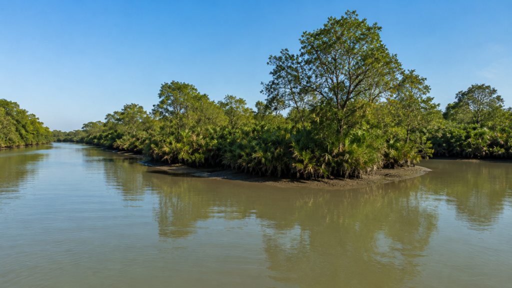
Halliday Island demonstrates that ecological significance cannot be measured by size alone. Within less than six square kilometres, it preserves natural tidal processes, supports specialised mangrove communities, shelters estuarine wildlife, stores carbon, and strengthens the resilience of the wider Sundarbans. Protected from permanent settlement and shaped by the enduring dialogue between river and sea, the island remains a living example of how dynamic coastal ecosystems function when allowed to follow their natural rhythms.
In an era of accelerating environmental change, Halliday Island stands not merely as a protected forest, but as a reminder that the health of the Sundarbans depends upon safeguarding every interconnected component of this remarkable delta. Through careful conservation, scientific understanding, and responsible stewardship, this small sanctuary continues to play an essential role in sustaining one of the world’s most extraordinary mangrove landscapes.
Plan your private Sundarban expedition
A private journey shaped around you — your group, your pace, your interests. Book a free consultation.