 Encyclopedia
Before dawn, the river is only a sound.
Not a landscape. Not yet an island. Only water moving through darkness.
The boat leaves the mainland while the stars still linger above the southern horizon. Somewhere beyond the black water lies Kultali—a name spoken often in the Sundarbans, but rarely understood beyond maps, census records, embankment reports, and ferry schedules.
The tide is turning. You hear it before you see it. The wooden hull creaks. Mudbanks release trapped air with soft sighs. Invisible fish break the surface. A distant egret calls once and falls silent.
To the east, the sky begins to loosen. Not sunrise. Only a faint dilution of darkness. The river widens. The boatman points ahead.
“There.”
At first, there is nothing.
- Then a shadow.
- Then another.
- Then the horizon itself begins rising from the water.
Kultali emerges slowly.
Not as a dramatic island. Not as a wilderness. But as a long, low world stitched together by embankments, creeks, mangroves, villages, fields, ferries, prayers, storms, and survival. This is not merely an island. It is one of the most inhabited frontiers of the Indian Sundarbans.
A place where rivers remain stronger than roads.
Where geography still dictates destiny. Where every household understands tides as intimately as clocks. And where the future is negotiated daily against water.
First Encounter
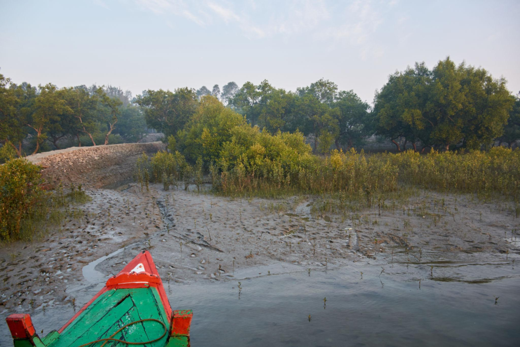
As daylight gathers, details appear.
A line of earthen embankment rises above the river. Behind it stand coconut palms bent by years of cyclonic wind.
- Banana groves emerge from the morning haze.
- Small fishing boats lie tilted on exposed mud.
- A woman walks along the embankment carrying water vessels.
- A boy cycles past a pond where ducks scatter into ripples.
There is no dramatic arrival. Kultali does not reveal itself all at once. It unfolds gradually.
- The riverbank shows the first clues.
- Freshly repaired embankments.
- Bamboo reinforcements.
- Fishing nets are drying beside houses.
- Prayer flags fluttering beside shrines.
The scent of wet earth arrives before the scent of people.
- Then smoke.
- Breakfast fires.
- Rice is being cooked.
- Tea boiling.
The island is awake and the tide has already begun shaping the day.
Island Identity
Kultali exists within the southern reaches of the South 24 Parganas district in the Indian Sundarbans.
Administratively, it forms the Kultali Community Development Block within the Baruipur Subdivision. The block covers roughly 306 square kilometres and had a population of about 229,000 according to the 2011 Census. The region remains entirely rural, spread across numerous villages and gram panchayats, including Deulbari, Gopalganj, Gurguria-Bhubaneswari, Jalaberia I and II, Kundakhali-Godabar, Maipith-Baikunthapur, and Meriganj I and II.
Yet statistics fail to describe what Kultali truly is. Kultali is a landscape assembled from reclaimed delta. A human settlement balanced between rivers and forest. A transitional zone. To one side lie densely inhabited villages. To another lies the wilderness edge of the Sundarbans.
The island’s villages carry names that repeat through ferry conversations and market gossip:
- Meriganj.
- Maipith.
- Baikunthapur.
- Gopalganj.
- Dakshin Garankati.
- Kaikhali.
- Debipur Gurguria.
- Kishorimohanpur.
Names that sound ordinary until you understand that each sits within one of the world’s most dynamic tidal environments. The island is bordered and defined by rivers.
Without them, there would be no Kultali.
With them comes both life and danger.
The Rivers That Built Kultali
Every Sundarban island has a dominant character.
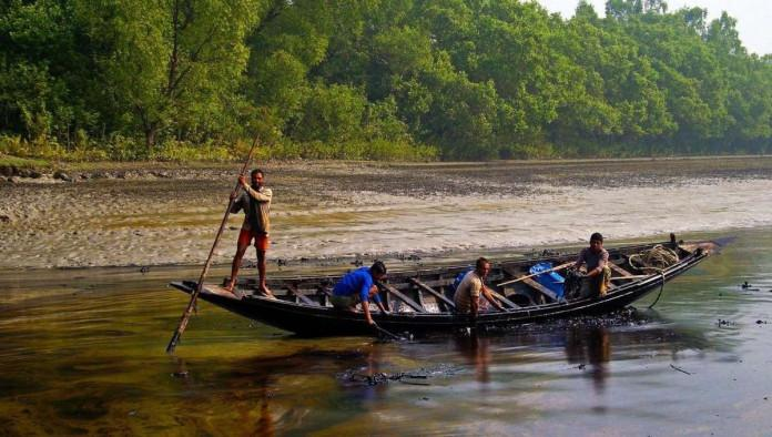
For Kultali, that character is water. Particularly, the great tidal rivers that surround and shape it. The Thakuran River is perhaps the most influential.
Wide, restless, and constantly reshaping its banks, the Thakuran acts as both protector and threat. Villages such as Purba Gurguria have long experienced erosion and embankment pressure because of the river’s changing behaviour. Standing beside the Thakuran at low tide feels like standing beside a living creature.
The river breathes.
- It expands.
- It withdraws.
- It remembers no fixed shape.
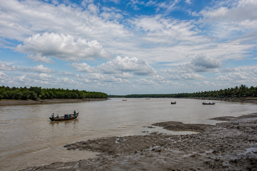
Elsewhere, channels connect Kultali to the wider river network of the delta. Water from the Matla system, tidal creeks, distributaries, and innumerable smaller channels move through the landscape twice daily.
The island’s geography is therefore never static.
- Mud shifts.
- Banks collapse.
- New shoals emerge.
- Old channels narrow.
Every generation inherits a slightly different map.
Boatmen understand this instinctively. Ask them about distance and they answer with tides rather than kilometres. Ask them about routes and they answer with water depth rather than roads.
The rivers are not barriers. They are the original highways.
Long before roads connected villages, boats carried rice, fish, timber, honey, livestock, and people between settlements. Even today, many journeys remain inseparable from water.
Historical Footprints
The history of Kultali is inseparable from the broader story of Sundarban reclamation.
Centuries ago, much of this landscape was mangrove forest and tidal wilderness. The southern Bengal delta was a shifting frontier.
Settlements emerged gradually through a long process of forest clearance, embankment construction, and agricultural expansion. Historical accounts suggest that large portions of the Sundarbans remained heavily forested for centuries before systematic reclamation accelerated under colonial administration.
The British viewed these lands through an economic lens.
- Forest became potential farmland.
- Tidal land became taxable land.
- Embankments expanded.
- Settlers arrived.
- New villages appeared.
Communities from different parts of Bengal migrated into the delta seeking land and opportunity.
- Life was difficult.
- Malaria was common.
- Cyclones frequent.
- Tiger encounters are not uncommon.
Yet people stayed.
Generation after generation transformed forest margins into cultivated settlements. The result is modern Kultali.
A place that still bears the marks of that struggle. Walk through older villages and you encounter ponds excavated decades ago. Ancient embankment alignments. Settlement clusters that reveal how people gradually occupied safer ground. History here survives not through monuments but through landscape.
Historical Personalities &Transformations
Unlike urban centres, Kultali’s history is rarely told through famous names. Its transformation emerged through collective effort.
- Local school founders.
- Community organisers.
- Panchayat leaders.
- Religious figures.
- Agricultural innovators.
People who helped villages survive floods, expand education, establish healthcare, and strengthen embankments. Many of their names remain known only locally. Yet their influence persists.
- A school standing beside a creek.
- A temple rebuilt after a cyclone.
- A ferry route was maintained despite repeated storm damage.
- A cooperative helping fishermen access markets.
The story of Kultali is less about singular heroes and more about generations of resilience.
Folklore and Legends
By mid-morning, conversation drifts toward the forest and inevitably toward Bonbibi. No matter how modern the Sundarbans become, Bonbibi remains present.
- In tea stalls.
- In shrines.
- In fishing boats.
- In stories exchanged before entering dangerous waters.
An elderly fisherman in Maipith describes her not as mythology but as protection.
“Forest has rules,” he says.
“Bonbibi reminds people of those rules.”
Stories of Dakshin Ray—the tiger lord—still circulate.
So do warnings about greed.
- About entering the forest without respect.
- About spirits that inhabit creeks.
- About voices heard across water during fog.
Few storytellers insist these tales are literally true. That misses the point. Folklore in the Sundarbans functions as ecological memory. The stories teach caution.
- Humility.
- Balance.
A recognition that humans do not fully control this landscape and perhaps never will.
Life Between the Tides
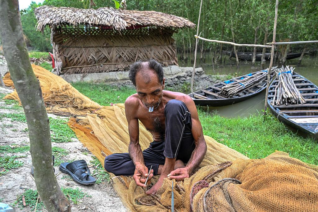
By late morning, Kultali reveals its true rhythm. The tide chart governs everything.
- Fishing schedules.
- Boat departures.
- Crab collection.
- Net repairs.
- Market timing.
Even school attendance in some areas. Men return with catches from tidal rivers. Women sort fish beneath shaded courtyards. Children navigate embankment paths as naturally as city children navigate streets.
Agriculture remains central.
- Paddy fields stretch across reclaimed land.
- Vegetable cultivation supplements household income.
- Fishing provides another pillar.
Many families combine multiple livelihoods.
- A farmer may also fish.
- A fisherman may collect crabs.
- A labourer may migrate seasonally for work.
Economic flexibility is not a strategy. It is a necessity.
Villages, Wildlife, Mangroves & the Long Shadow of Water
By noon, the morning softness has vanished. The sky over Kultali becomes immense.
- Clouds retreat.
- Light hardens.
- The rivers turn metallic.
- The embankments radiate heat.
And the island reveals the details that dawn concealed.
The Sundarbans can seem deceptively uniform on maps—a maze of green islands divided by blue channels. But walking through Kultali quickly destroys that illusion.
- Every village has its own rhythm.
- Every embankment carries its own history.
- Every pond, temple, field, and tea stall tells a different story about living on the edge of water.
The best way to understand Kultali is not by crossing it quickly. It is by:
- Walking slowly.
- Listening more than speaking.
- Observing more than searching.
Because the island reveals itself in fragments.
Walking Through the Villages
The footpaths leave the embankment and weave inward. Immediately, the landscape changes.
- The river disappears behind earthen walls.
- The island becomes intimate.
- Narrow lanes pass between ponds fringed with water hyacinth.
- Courtyards open beneath coconut palms.
- Goats sleep beneath bamboo fences.
- Children race barefoot between houses.
Unlike many mainland villages, homes in Kultali often reveal a practical relationship with uncertainty.
- Raised plinths.
- Cyclone-resistant modifications.
- Storage platforms built above expected flood levels.
Older residents can often identify previous flood marks on walls with unsettling precision.
“That was Aila.”
A finger points halfway up a structure. “And that one was Amphan.”
- Another mark.
- Another year.
- Another memory.
The village landscape is therefore not merely residential. It is a living archive of disasters survived.
In parts of Maipith and Baikunthapur, ponds dominate the visual landscape. Every pond serves multiple purposes.
- Water storage.
- Fish culture.
- Household use.
- Microclimate regulation.
- Social gathering.
- Children learn to swim in these ponds.
- Women wash utensils beside them.
- Fishermen repair nets nearby.
- Egrets hunt along their margins.
- Dragonflies patrol above their surfaces.
The pond is often the quiet centre of village life.
- Not the road.
- Not the market.
The water.
Further ahead, small temples appear. Some painted brightly. Others were weathered by decades of monsoon rain. A little farther stands a mosque whose loudspeaker rests silent until prayer time. Religious structures here rarely dominate the landscape.
They blend into it. Markers of community rather than monuments. Faith in Kultali often exists alongside practical realities.
- People pray.
- Then repair embankments.
- People attend festivals.
- Then prepare for cyclones.
Spirituality and survival coexist comfortably. Neither excludes the other.
Schools emerge unexpectedly.
- A concrete building beside a pond.
- A playground partially shaded by banyan trees.
- Rows of bicycles outside classrooms.
Education occupies a complex place in the Sundarbans.
For many families, schooling represents possibility. A route beyond the uncertainties of fishing, farming, and seasonal migration. Teachers often become some of the most influential figures in village life.
Not because they hold authority. But because they connect isolated communities to larger worlds.
The Midday Market
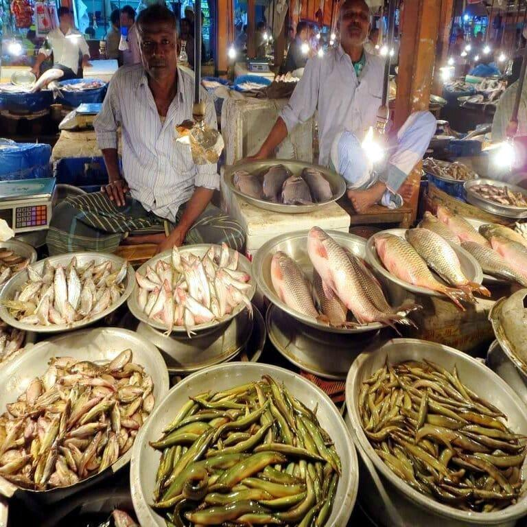
By early afternoon, the island’s markets become the most revealing places of all. A market is where Kultali talks to itself.
- Not formally.
- Not politically.
- But continuously.
Fish arrive first.
Silver flashes of hilsa when available.
Mullet.
Prawn.
Small river fish still carrying traces of tidal mud.
Crabs were tied carefully to prevent escape.
Nearby sit vegetable sellers.
- Pumpkin.
- Bottle gourd.
- Brinjal.
- Green chillies.
Seasonal produce from surrounding fields.
The market smells of fish, coriander, tea leaves, river water, diesel fuel, and earth.
- Conversations overlap.
- News travels faster than mobile networks.
- Someone discusses weather forecasts.
- Another talks about embankment repairs.
- Someone else debates fish prices.
- A boatman’s arrival generates immediate attention.
Markets in the Sundarbans function as information exchanges as much as economic centres. People come for goods.
They stay for news.
Sounds of the Island
See it for yourself
A private journey shaped around you — your group, your pace, your interests. Book a free consultation.
Most places are remembered visually. Kultali is remembered acoustically.
Stand quietly enough and the island becomes an orchestra. The first layer is wind.
Always wind.
- Moving through coconut leaves.
- Across paddy fields.
- Over embankments.
- Across exposed mudflats.
The second layer is birds.
- Kingfishers produce sharp calls from electric wires.
- Drongos issue metallic notes.
- Bee-eaters chatter from exposed branches.
- Egrets announce their presence with surprisingly harsh voices.
The third layer belongs to people.
- Bicycle bells.
- Children calling across ponds.
- Women discussing household tasks.
- Fishermen shouting instructions while unloading catches.
- Tea stall conversations flow uninterrupted for hours.
Then comes machinery.
- Boat engines.
- Water pumps.
- Generators.
- The practical sounds of island life.
And beneath everything lies the river. Always present. Even when unseen.
A distant rushing.
A soft slap against mudbanks.
The constant pulse of the tide.
The island’s heartbeat.
Wildlife Expedition
By mid-afternoon, the heat begins to ease. This is when naturalists become restless. The best wildlife hours approach. Kultali occupies a fascinating ecological position. Unlike islands deeper inside protected forest zones, Kultali is heavily inhabited. Yet wildlife remains remarkably present. Not despite human settlement. But alongside it.
The boundaries between human and wild worlds are often surprisingly porous.
Birds of Kultali
Birdlife appears everywhere.
Kingfishers dominate visual encounters.
- The brilliant blue flash of a White-throated Kingfisher.
- The hovering precision of a Pied Kingfisher.
- The smaller Common Kingfisher skims low above water.
Each occupies slightly different ecological niches. Together, they create constant movement.
- Egrets patrol fields.
- Pond Herons transform from muddy brown invisibility into startling white flight.
- Black Drongos perch on wires, launching aerial attacks against insects.
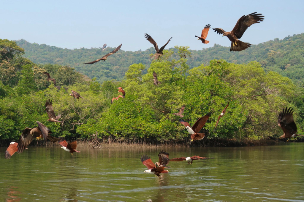
- Brahminy Kites circle above rivers.
Their chestnut plumage glows in afternoon sunlight. Near creeks, waders become more common.
- Sandpipers.
- Redshanks.
- Plovers.
Seasonal migratory visitors depend upon the time of year. The diversity surprises visitors. The birds do not. For locals, they are simply part of daily life.
Reptiles and Amphibians
The Sundarbans never allows complete forgetfulness regarding reptiles.
Water monitors occasionally appear along muddy creek margins. Their prehistoric silhouettes instantly attract attention.
Snakes remain part of island ecology, though sightings are often brief.
- Rat snakes.
- Water snakes.
- Occasionally venomous species.
Residents learn awareness early. Not fear.
Awareness.
Frogs emerge dramatically during monsoon months. The night air can become saturated with amphibian calls. A reminder that even heavily inhabited landscapes retain wild dimensions.
Mammals of the Edge
The larger mammals remain elusive.
Jackals occasionally appear near less populated areas.
Fishing cats inhabit parts of the broader Sundarban ecosystem, though direct sightings remain uncommon and unpredictable.
Otters are occasionally reported from suitable waterways.
Most encounters occur indirectly.
- Tracks.
- Scat.
- Stories.
- Brief glimpses.
- Evidence rather than spectacle.
This is typical of true wildlife observation. The absence of sightings often reveals as much as the sightings themselves.
The Tiger Question
Eventually, every conversation in the Sundarbans reaches tigers.
Kultali sits near landscapes influenced by the larger tiger ecology of the region. Direct tiger presence within populated areas is neither routine nor predictable. Yet tiger stories remain woven into community memory.
- Some involve livestock.
- Some involve river crossings.
- Some are decades old.
Others are recent enough to still generate discussion. Whether seen or unseen, the tiger remains psychologically present. A reminder that the world’s largest mangrove forest still surrounds much of human life here.
Mangrove Chronicles
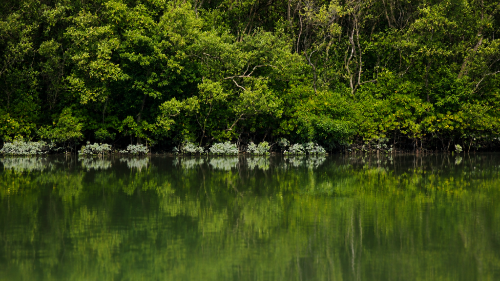
Toward evening, the expedition moves closer to creeks where mangroves survive. The mood changes immediately.
- Villages feel distant.
- The air becomes heavier.
- More saline.
- More ancient.
- Mangroves do not behave like ordinary forests.
- They appear deliberate.
- Watchful.
- Adaptive.
Every species seems engineered for difficulty.
The Avicennia trees stand on muddy banks like patient sentinels. Pneumatophores rise from the mud around them. Thousands of breathing roots.
At low tide, they resemble a submerged army emerging from beneath the earth. Nearby, clusters of gewa and other mangrove associates occupy slightly different elevations. Each species negotiates salinity differently. Each occupies a specific ecological territory. The forest reveals extraordinary specialisation.
Nothing here is accidental.
Mangroves perform tasks impossible to fully appreciate from photographs.
- They stabilise soil.
- Reduce erosion.
- Provide nursery habitat for fish.
- Support crustaceans.
- Store carbon.
- Moderate storm impacts.
- Support entire food webs.
And perhaps most importantly for Kultali, they create a buffer between human settlement and environmental chaos. Where mangroves disappear, vulnerability increases. Local people understand this better than many policymakers. Because they have witnessed the difference firsthand.
A fisherman repairing nets beside a creek summarises the relationship simply.
“If the mangrove survives, we survive.”
Few ecological statements could be more concise or more accurate.
Explorer’s Field Notes
05:12 AM
River still hidden beneath darkness. First distant call of an egret.
05:46 AM
The eastern horizon develops a faint orange band. Embankment silhouette becomes visible.
06:18 AM
First sighting of a White-throated Kingfisher near the riverside electric wire.
07:03 AM
The incoming tide begins covering exposed mudbanks.
08:21 AM
Smoke from breakfast fires drifts above village ponds.
09:44 AM
Schoolchildren cycling toward classrooms along the embankment road.
11:07 AM
Fishing nets spread for drying near the Maipith settlement.
12:53 PM
Market activity reaches peak intensity. The fish section is busiest.
02:16 PM
Heat haze is visible above paddy fields.
03:41 PM
Brahminy Kite observed circling over the river channel.
04:38 PM
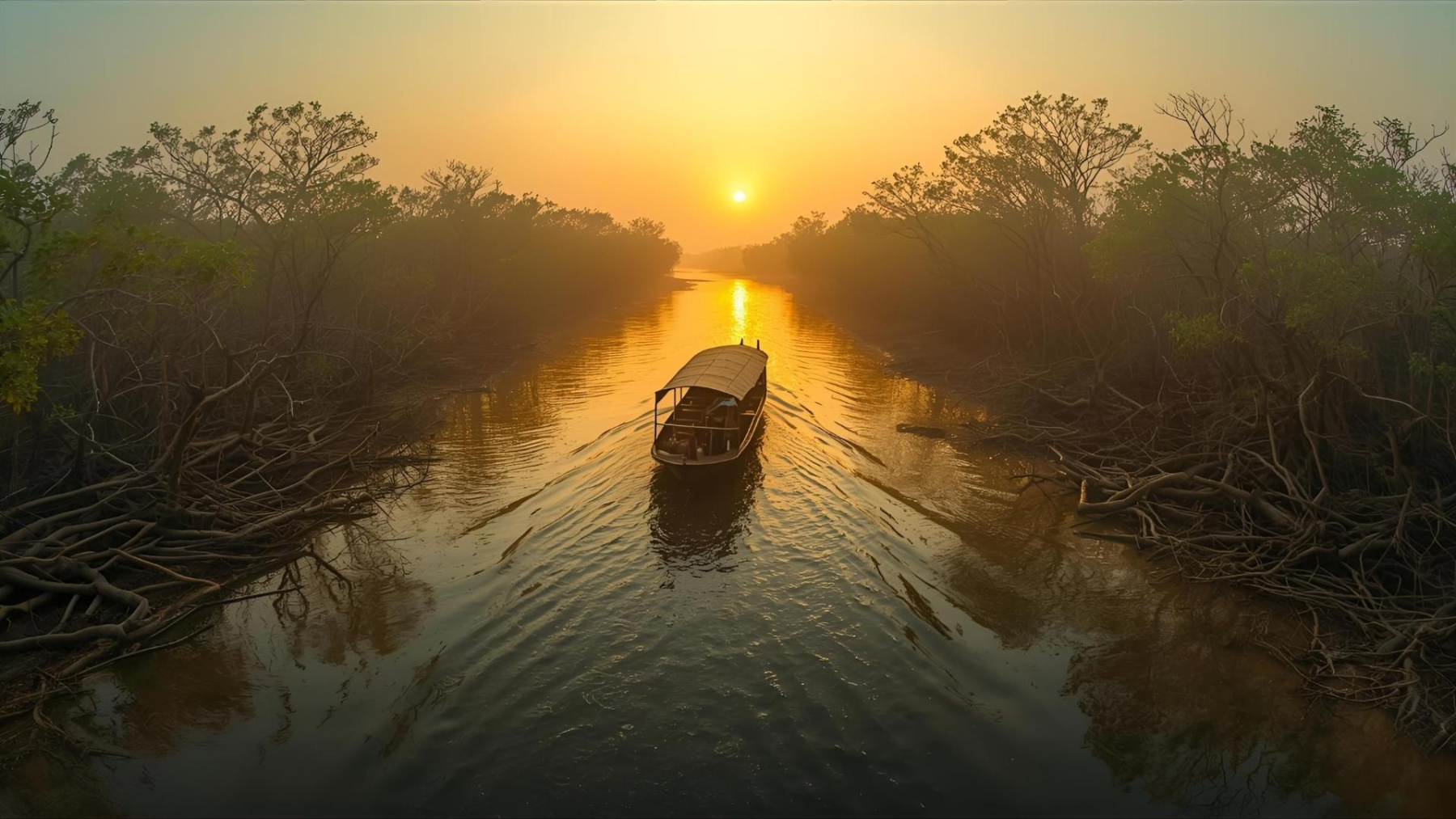
Low-angle sunlight transforms mangrove creek into bronze reflections.
05:27 PM
Evening prayer call travels across the water.
06:11 PM
First bats emerge from trees.
06:42 PM
The river disappears into darkness faster than expected.
Nightfall on the Island
Sunset arrives subtly.
No dramatic mountain horizon. No towering skyline. Only light is withdrawing across the water.
- The rivers turn copper.
- Then grey.
- Then black.
The last glow lingers above the western horizon. Reflections soften across ponds and tidal creeks.
For a few quiet moments, the island seems suspended between day and night.
- Fishing boats return.
- Smoke rises from kitchens.
- The market empties.
- The embankments become quieter.
- Birds surrender the sky.
- Bats inherit it.
One by one, village lights appear. Tiny islands within the larger island. The darkness here differs from urban darkness. It feels deeper.
- Older.
- More complete.
- Stars become visible.
- Tides continue moving unseen.
The river resumes its nocturnal voice, and somewhere beyond the visible horizon, the greater Sundarban forest waits in silence.
The Seasons of Kultali
To understand Kultali, one must understand that there is not one island. There are many versions of the same island. Each season creates a different world.
Winter
- The clearest skies.
- Migratory birds.
- Cool mornings.
- Golden light.
- Maximum visibility across rivers.
Spring
- Flowering trees.
- Gentler temperatures.
- Increased agricultural activity.
- A season of preparation.
Summer
- Humidity intensifies.
- Ponds shrink.
- Storm clouds begin gathering.
- Heat dominates afternoons.
Monsoon
- Water returns everywhere.
- Fields transform.
- Creeks swell.
- Travel becomes unpredictable.
- Life adjusts accordingly.
Post-Monsoon
- The landscape glows green.
- Fresh growth appears.
- Fishing improves in many areas.
Cyclone Season
The season everyone watches most carefully.
- Forecasts become essential.
- Rivers become threatening.
- Communities become vigilant.
Because history has taught hard lessons.
Cyclones and Survival
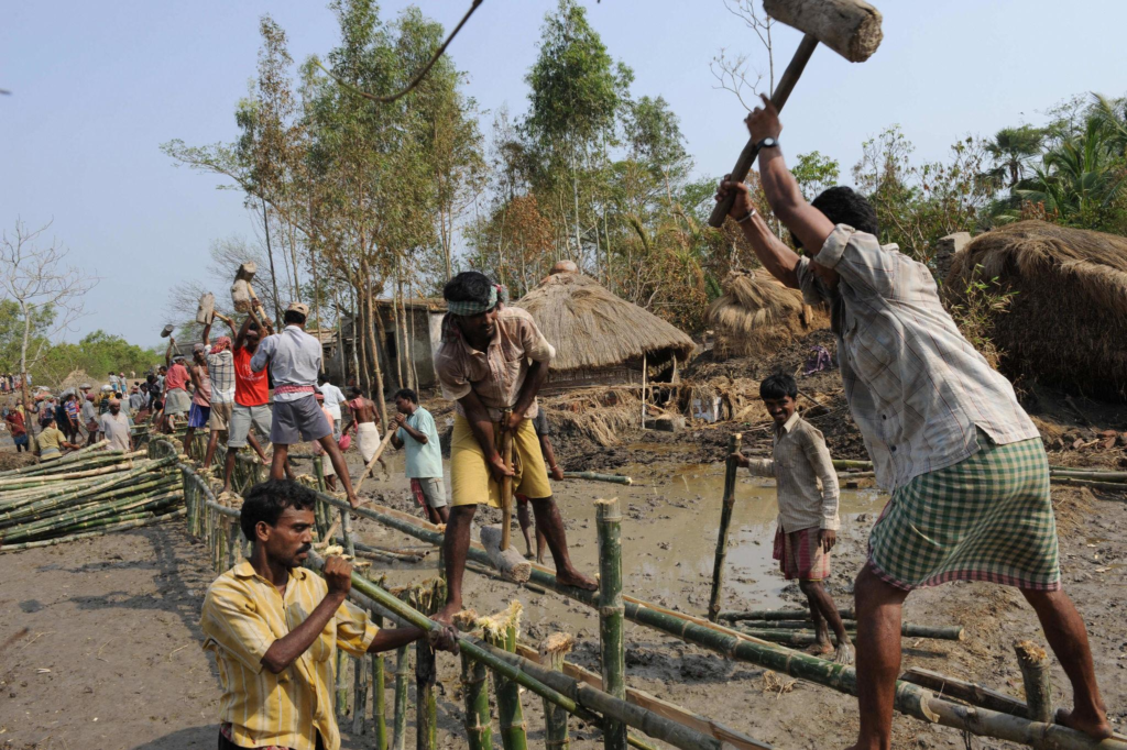
The Sundarbans do not fear storms because they are unfamiliar. They fear storms because they remember them.
Every generation in Kultali possesses its own cyclone vocabulary. Older residents remember storms that arrived before satellite forecasts became common. Middle-aged residents speak about the devastating impact of Cyclone Aila in 2009. Younger residents discuss Cyclone Amphan in 2020.
More recent memories include Yaas and other severe weather systems that pushed tidal waters against already vulnerable embankments. Unlike inland disasters, cyclones here are rarely a single event.
The storm itself may last hours. Its consequences can last years. An embankment breach can allow saline water to enter agricultural land. A single tidal surge may destroy crops for multiple growing seasons.
- Freshwater ponds become contaminated.
- Fish stocks shift.
- Livelihoods change.
- Families migrate temporarily or permanently.
The storm leaves.
The recovery remains.
Walk along older embankments and people still point toward locations where breaches occurred. The landscape remembers.
- A curve in the embankment.
- A newer section of reinforcement.
- A stand of recently planted mangroves.
Each marks a previous confrontation with water. Yet perhaps the most remarkable feature of Kultali is not vulnerability. It is an adaptation.
Cyclone shelters have become part of planning. Community warning systems have improved. Weather information now travels rapidly through mobile networks. Local organisations participate in preparedness initiatives. Villagers monitor embankment conditions constantly.
Resilience here is not a slogan. It is a daily practice. A skill learned through necessity.
Ferry Routes and Hidden Paths
Maps suggest roads connect places.
In Kultali, rivers often matter more. The true geography of the island is revealed through movement. A traveller arriving from Kolkata eventually discovers that reaching Kultali involves transitions.
- Train to road.
- Road to the ferry.
- Ferry to the embankment.
- Embankment to the village.
- Village to creek.
- Creek to river.
Movement here is layered and every layer reveals a different landscape.
The ferry is not merely transportation. It is a social space.
- A floating marketplace.
- A conversation platform.
- A community corridor.
People board carrying vegetables, fish baskets, school bags, construction materials, and occasionally livestock. Nobody appears surprised. Everything belongs. The river route has always accommodated diversity.
Beyond the main crossings are lesser-known channels.
- Narrow creeks.
- Seasonal routes.
- Footpaths crossing embankments.
- Tracks used by fishermen.
- Informal connections between settlements.
These hidden pathways rarely appear in guidebooks. Yet they often reveal the island most honestly.
- A photographer walking one of these routes may discover:
- A solitary fishing platform.
- A shrine beneath a banyan tree.
- A kingfisher is hunting above a creek.
- A pond reflecting storm clouds.
The quieter routes often tell the richer stories.
Photography Expedition Guide
Kultali rewards patience more than equipment. The best photographs emerge from observation rather than pursuit. This is not a landscape that reveals itself instantly.
It unfolds slowly. Often unexpectedly.
Sunrise
The eastern embankments overlooking tidal channels provide extraordinary opportunities during winter mornings.
- Mist rising from water.
- Fishing boats emerging from darkness.
- Silhouetted coconut palms.
The moment before full daylight is often more powerful than sunrise itself.
Midday Documentary Photography
Village life becomes visible during late morning.
- Markets.
- Boat repairs.
- Agricultural activity.
- School routes.
- Tea stalls.
These scenes reveal the social landscape of the island. Human stories dominate the frame.
Mangrove Photography
Creeks near forest-edge environments offer compelling compositions.
- Breathing roots.
- Reflections.
- Mud patterns.
- Tidal textures.
Photographers often discover that mangroves reward close observation. The details become landscapes themselves.
Wildlife Photography
Bird activity peaks during early morning and late afternoon.
- Kingfishers remain among the most accessible subjects.
- Brahminy kites provide dramatic aerial opportunities.
- Migratory birds increase possibilities during the winter months.
Patience matters. Movement matters more.
Monsoon Photography
The monsoon transforms Kultali into an entirely different visual world.
- Storm clouds.
- Flooded fields.
- Emerald vegetation.
- Reflections everywhere.
The atmosphere becomes cinematic. Though conditions become considerably more challenging.
Connected Landscapes
No island in the Sundarbans exists independently. Kultali is part of a larger ecological and cultural network. The rivers ensure that connections remain constant.
- People move.
- Fish move.
- Sediment moves.
- Stories move.
Nothing remains isolated for long.
To the east and southeast lie landscapes increasingly influenced by protected mangrove ecosystems. Beyond the inhabited edges begins a different Sundarban.
- A wilder one.
- A quieter one.
A landscape where human presence becomes occasional rather than dominant.
Nearby settlements and islands maintain long-standing relationships with Kultali.
- Boats exchange goods daily.
- Markets influence one another.
- Families maintain connections across rivers.
- Religious festivals attract visitors from neighbouring communities.
- Marriage networks frequently extend beyond individual islands.
The river separates.
The river connects.
Both statements are true.
For explorers interested in understanding the broader Sundarban mosaic, Kultali serves as an important bridge between human settlement and wilderness frontier. It occupies a threshold. And thresholds are often where the most interesting stories emerge.
Oral Histories: Memories Carried by Water
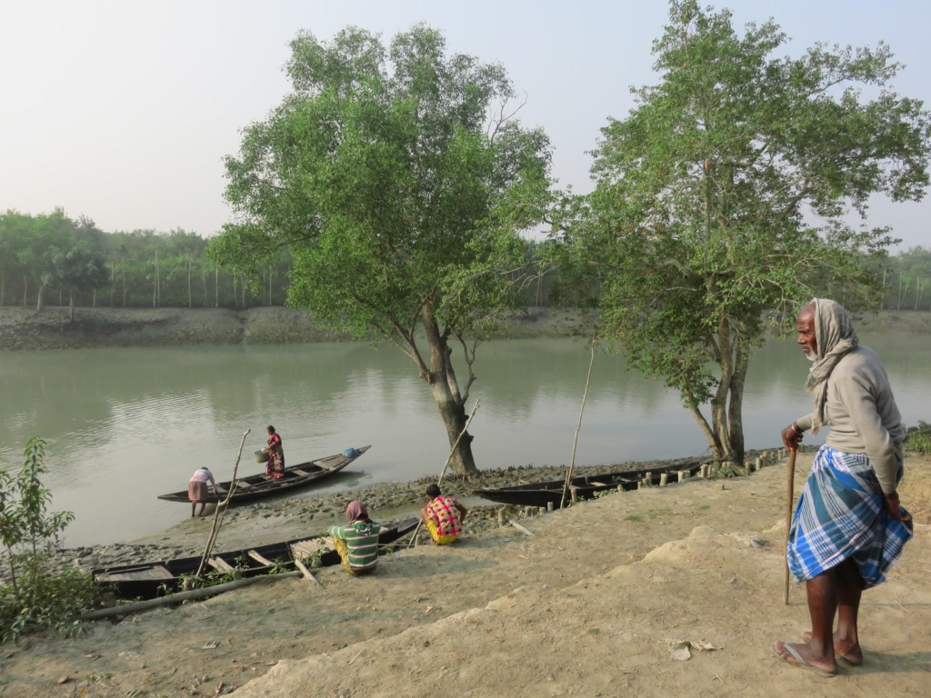
Late evening often produces the best conversations.
- The heat has faded.
- Work is complete.
- People become reflective.
- Stories surface.
One elderly resident recalls a time when river journeys required greater caution.
“There were fewer engines then.”
He smiles.
“You listened to tides more carefully.”
The statement sounds simple. Yet it contains an entire historical transition. Technology changed. The river did not.
Another villager remembers a devastating flood. Not through measurements. Not through official records. But through objects.
“A fishing net was found hanging in a tree.”
That image survived decades. The numbers did not.
A retired schoolteacher describes educational changes. Years ago, many students left school early to support household livelihoods. Today, more continue their education. Some travel beyond the Sundarbans. Some return. Others do not.
Migration has become one of the island’s defining modern stories.
These oral histories reveal something important. The history of Kultali is rarely preserved in archives. It survives through memory. Through conversation. Through repeated storytelling. The island remembers itself orally.
Food of the Island
Food in Kultali reflects geography.
- What grows.
- What swims.
- What survives.
- What seasons allow
Rice remains central. It is the anchor around which meals are constructed.
Fish occupy an equally important role.
- River fish.
- Brackish-water species.
- Seasonal catches.
- Small fish dried for preservation.
- Crabs and prawns contribute significantly to local livelihoods and cuisine.
Vegetables vary seasonally.
- Pumpkin.
- Bottle gourd.
- Spinach.
- Eggplant.
- Beans.
Local markets reveal the agricultural calendar more accurately than any report.
During festivals, households prepare traditional Bengali sweets and special dishes linked to religious and family celebrations. Food becomes memory. A connection between generations. A cultural archive carried through recipes rather than documents.
Tea deserves special mention.
Not because it is unique. But because it is everywhere. Tea stalls function as informal institutions.
- Information centres.
- Weather stations.
- Political forums.
- Social clubs.
- Field offices for fishermen.
- Observation posts for elders.
A simple cup of tea often unlocks an hour of stories.
Island Economy
The economy of Kultali remains deeply connected to natural systems. Agriculture remains essential. Paddy cultivation dominates much of the landscape. Yet agriculture alone rarely sustains households completely.
Diversification is common.
Fishing remains one of the most important livelihoods. The rivers provide opportunity. They also impose risk. Success depends upon tides, weather, fuel costs, seasonal conditions, and ecological health.
Crab collection has become increasingly significant for many families. The international demand for mud crabs has created economic opportunities throughout portions of the Sundarbans. Yet this dependency also links local livelihoods to global markets.
Migration forms another economic layer. Many residents seek employment in Kolkata and other urban centres.
- Construction work.
- Service industries.
- Industrial labour.
Remittances subsequently flow back into island households. Modern Kultali therefore extends beyond its physical boundaries. Part of its economy operates elsewhere.
Small businesses continue emerging.
- Shops.
- Transport services.
- Aquaculture initiatives.
- Agricultural enterprises.
Local entrepreneurship remains an important component of contemporary change.
Then and Now
Imagine Kultali fifty years ago.
- Fewer roads.
- Fewer engines.
- Less connectivity.
- More dependence on river navigation.
- Greater isolation.
A different relationship with distance.
Now imagine present-day Kultali.
- Mobile networks.
- Improved transportation.
- Expanded education.
- Solar technology.
- Cyclone forecasting systems.
- Greater integration with regional markets.
- More migration.
- More external influence.
Yet certain elements remain unchanged.
- The tides still dictate schedules.
- The rivers still shape geography.
- Cyclones still command respect.
- Mangroves still provide protection.
- Boats still matter.
And every generation still learns that permanence is an illusion in the delta.
The island has changed dramatically. The landscape has not surrendered its essential character. That is perhaps Kultali’s most remarkable achievement.
The Wild Orbit Quick Facts: Kultali
| Category | Details |
| Location | Southern part of South 24 Parganas District, West Bengal |
| Administrative Block | Kultali |
| Subdivision | Baruipur |
| Physiographic Region | Indian Sundarbans Delta |
| Approximate Area (Block) | ~306 sq km |
| Population (2011 Census Block) | ~229,000 |
| Major Gram Panchayats | Deulbari, Gopalganj, Gurguria-Bhubaneswari, Jalaberia I & II, Kundakhali-Godabar, Maipith-Baikunthapur, Meriganj I & II |
| Major Rivers | Thakuran River and associated tidal channels |
| Landscape Type | Reclaimed deltaic island system |
| Primary Livelihoods | Agriculture, fishing, crab collection, wage labor, migration-based income |
| Ecosystem | Mangrove-fringe tidal delta |
| Nearest Major Urban Gateway | Kolkata |
| Best Season for Exploration | November–February |
| Cyclone Exposure | High |
| Wildlife Highlights | Kingfishers, Brahminy Kites, waterbirds, reptiles, estuarine biodiversity |
| Expedition Character | Human-wildland frontier |
The Wild Orbit Expedition Snapshot
Accessibility: 8/10
Kultali is comparatively accessible by rail and ferry combinations. The journey itself becomes part of the experience.
Wildlife Potential: 7/10
Not a core wildlife safari destination. Yet remarkably rewarding for birdwatchers, river naturalists, and ecological observers.
Photography Potential: 9/10
Among the strongest visual landscapes in the inhabited Sundarbans. Light, water, river geometry, village life, mangroves, and weather constantly create photographic opportunities.
Cultural Richness: 10/10
The island offers deep insights into contemporary Sundarban life.
- Migration.
- Faith.
- Adaptation.
- Agriculture.
- Fishing.
- Cyclone resilience.
All is visible within a single day.
Historical Interest: 8/10
Reclamation history, colonial-era transformation, settlement expansion, and environmental adaptation create significant historical depth.
Solitude Level: 6/10
This is a lived landscape rather than an isolated wilderness. Yet quiet embankments and tidal creeks can still provide moments of profound solitude.
FAQs
1. Is Kultali an island?
Kultali is part of the inhabited island landscape of the Indian Sundarbans, surrounded and shaped by tidal rivers and creeks.
2. Where is Kultali located?
In the South 24 Parganas district of West Bengal, within the Indian Sundarbans.
3. Which river is most associated with Kultali?
The Thakuran River plays a major role in shaping the region.
4. Is Kultali inside the Sundarbans?
Yes. It forms part of the inhabited Sundarban delta landscape.
5. Can tigers be found in Kultali?
Tiger presence is primarily associated with protected forest zones, though tiger stories and historical interactions remain part of local memory.
6. What is the main livelihood here?
Agriculture, fishing, crab collection, and migrant labour.
7. Is fishing important?
Fishing remains one of the island’s most important economic activities.
8. Are mangroves present?
Yes, particularly along creeks, riverbanks, and forest-edge areas.
9. What language is spoken?
Bengali is the dominant language.
10. What makes Kultali unique?
Its position between densely inhabited settlements and the ecological frontier of the Sundarbans.
11. Is birdwatching worthwhile?
Exceptionally so, especially during winter.
12. Does the island experience cyclones?
Frequently compared with many inland regions.
13. How important are embankments?
They are essential for protection from tidal flooding.
14. Are ferries still important?
Very much so.
Many journeys remain tied to river transport.
15. Does agriculture depend on seasons?
Extensively.
Monsoon patterns strongly influence cultivation.
16. What kind of fish are commonly caught?
Various freshwater and brackish-water species, depending on season and location.
17. Are there local markets?
Numerous village markets support daily economic activity.
18. Is migration common?
Yes.
Many households maintain economic links to urban centres.
19. What role does Bonbibi play?
Bonbibi remains a powerful cultural and spiritual figure in Sundarban folklore.
20. Are schools present throughout the block?
Yes, educational institutions are widely distributed across villages.
21. Is photography rewarding in winter?
Winter provides some of the clearest atmospheric conditions.
22. What season offers the most dramatic landscapes?
Monsoon and post-monsoon periods often create striking scenery.
23. Are rivers still the primary transport corridors?
In many situations, yes.
24. What is the biggest environmental challenge?
Cyclones, erosion, salinity intrusion, and climate-related vulnerability.
25. Why do researchers study Kultali?
Because it represents one of the world’s most important human-delta interfaces.
26. Is Kultali suitable for cultural exploration?
It is one of the richest cultural landscapes in the inhabited Sundarbans.
27. What defines daily life here?
The rhythm of tides.
How to Reach Kultali
Reaching Kultali feels less like travelling to a destination and more like entering a different geographical logic.
The city gradually dissolves.
Roads narrow.
Rivers widen.
The delta takes over.
From Kolkata
Most journeys begin from Kolkata. The route generally follows rail or road corridors toward the southern reaches of South 24 Parganas. As urban density fades, fish ponds begin appearing.
Then agricultural land. Then tidal waterways. The Sundarbans announce themselves long before the forests appear.
By Rail
Travellers often use suburban rail routes connecting Kolkata with southern stations serving Sundarban-bound passengers. From there, shared vehicles, buses, and local transport continue toward ferry points and interior roads leading into Kultali.
The railway journey itself becomes an anthropological transition. Every station reveals a gradual shift from metropolitan Bengal to delta Bengal.
By Road
Road access has improved considerably over recent decades.
- Highways eventually yield to narrower regional roads.
- Markets become smaller.
- Bridges become more frequent.
- Embankments begin replacing conventional road edges.
The landscape becomes unmistakably Sundarban.
By Ferry
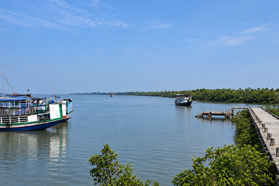
The ferry remains the most memorable stage. Even when not strictly necessary, water crossings define the emotional arrival. Standing on a ferry deck while watching mudflats, fishing boats, kingfishers, and mangrove-fringed channels provides the first true introduction to Kultali.
During Monsoon
Travel requires flexibility.
- Heavy rain.
- Waterlogging.
- Strong tides.
And occasional weather disruptions can alter plans quickly. The delta respects no timetable. Visitors learn this rapidly.
Explorer’s Route Advice
- Arrive early.
- Travel slowly.
- Allow time for river crossings.
- Speak with boatmen.
- Spend time on embankments.
- Watch the tide change.
Kultali rewards patience.
Not speed.
Things To See Around Kultali
The best places around Kultali are rarely announced by signboards. They reveal themselves gradually.
The Thakuran River
The river itself is among the region’s greatest attractions.
- Morning mist.
- Tidal reversals.
- Fishing activity.
- Migratory birds.
- Changing light.
The river never appears the same twice.
Maipith
One of the most significant inhabited landscapes in the block. Walking here provides insight into settlement patterns, agricultural adaptation, and daily Sundarban life.
Baikunthapur
A landscape where village life and river ecology intersect beautifully. Particularly rewarding during early morning and late afternoon.
Meriganj
Offers valuable perspectives on embankment life and community resilience.
Village Markets
Markets provide perhaps the most authentic cultural experience available.
- Observe.
- Listen.
- Avoid rushing.
The market reveals the island’s pulse.
Mangrove-Fringe Creeks
The transitional spaces between settlement and forest provide some of the most fascinating ecological observations.
Embankment Roads
Among the finest observation platforms in the Sundarbans. They offer uninterrupted views of rivers, fields, villages, birds, boats, and weather systems.
Seasonal Wetlands
Winter and post-monsoon periods often attract waterbirds and provide compelling photographic opportunities.
Continue The Journey
No expedition ends in Kultali. It expands. The rivers encourage continuation.
- Follow the Thakuran downstream and new landscapes emerge.
- Explore neighbouring inhabited islands and different versions of Sundarban life appear.
- Travel toward forest-edge regions and ecological narratives become stronger.
- Follow folklore and Bonbibi stories and an entirely different map reveals itself.
- Trace migration routes and discover how the Sundarbans connects to Kolkata and beyond.
The delta is not a collection of isolated islands. It is one immense interconnected story. Kultali is merely one chapter. A remarkable chapter. But still only one.
The Return Across the Water
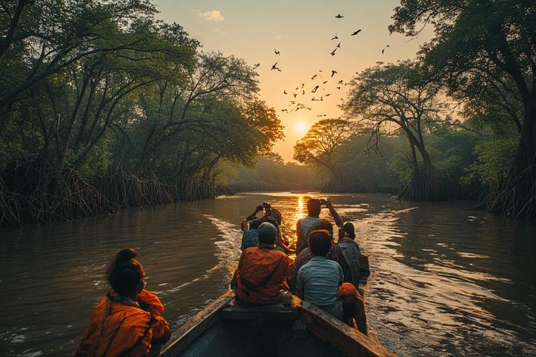
The departure happens quietly. No ceremony. No announcement. Just a rising tide and a boat preparing to leave.
The last light of day stretches across the Thakuran River. Fishermen become silhouettes. The embankments soften into shadow. Smoke from evening kitchens drifts above coconut trees before dissolving into the gathering dusk.
The boat pulls away.
- Slowly.
- Almost reluctantly.
- The distance grows.
- Details disappear.
- First, the people.
- Then the houses.
- Then the embankments.
Only the outline remains.
A dark shape suspended between river and sky. For a moment, Kultali appears less like an island and more like a memory. A memory built from mud and tide. From storms survived and stories carried. From mangrove roots gripping uncertain ground. From generations who learned that permanence is not found in the landscape, but in the determination to remain within it.
- The river widens.
- Night deepens.
- The island recedes.
And somewhere behind the darkness, beyond the reach of the boat’s fading wake, Kultali continues its ancient conversation with the tides—exactly as it did yesterday, exactly as it will tomorrow, waiting for the next explorer willing to listen.
Plan your private Sundarban expedition
A private journey shaped around you — your group, your pace, your interests. Book a free consultation.