 Encyclopedia
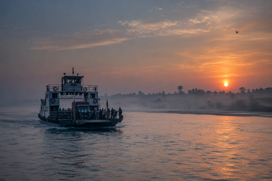
Before sunrise, Jharkhali does not reveal itself as a destination. It emerges as a feeling.
Long before the first ferry cuts across the tide, before the villages awaken and before the mangrove horizon begins to separate from the darkness, the rivers are already in motion. Water slides quietly through the channels of the delta, pressing against earthen embankments that have stood through countless tides, monsoons, and seasons of rebuilding. In the stillness, the estuary breathes with an ancient rhythm, reminding every settlement along its banks that the Sundarbans has always belonged first to water.
The air carries the unmistakable scent of wet earth mixed with salt. Somewhere beyond the fading darkness, a distant engine breaks the silence for only a moment before disappearing once again into the vastness of the river. Wading birds stir along unseen mudflats, while the mangroves remain little more than dark silhouettes against the slowly brightening eastern sky.
Nothing appears hurried.
Here, dawn unfolds with remarkable patience.
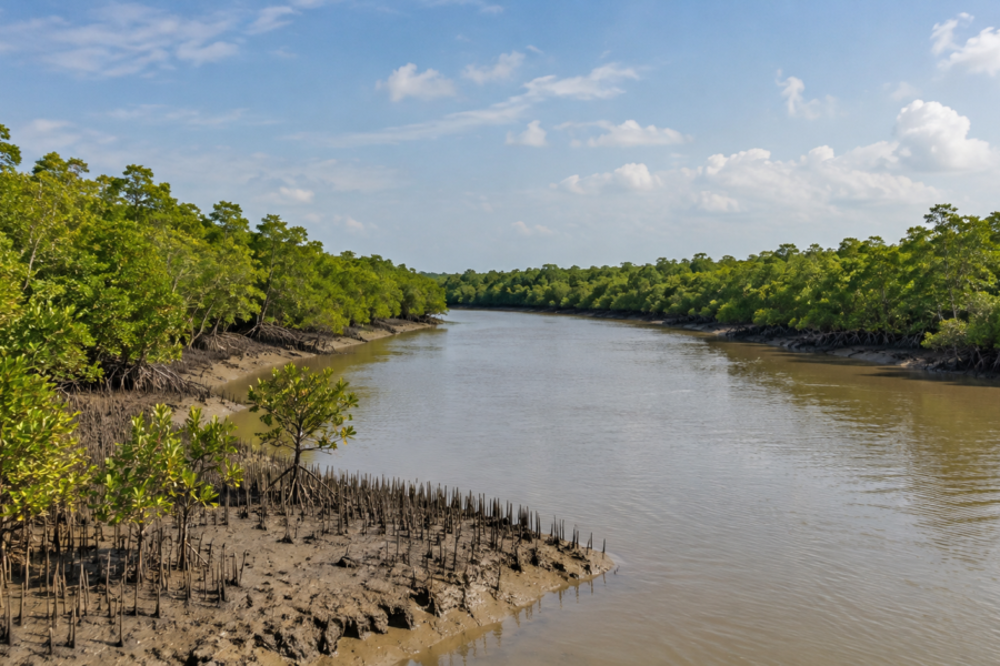
As daylight spreads across the tidal landscape, the outlines of the mangrove forest begin to take shape. Their roots emerge from the mud like intricate sculptures, shaped by centuries of adaptation to a world where land and water never remain separate for long. Every incoming tide redraws familiar boundaries, while every retreating tide leaves behind new patterns across the exposed banks.
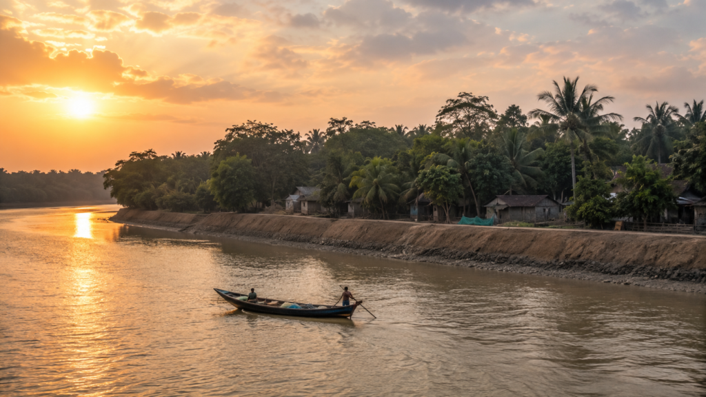
Jharkhali exists within this continual negotiation.
It is a landscape where the river is not simply a feature of the environment but the force that defines it. Villages, embankments, ponds, ferry crossings, and fields have all learned to exist according to the rhythm of the estuary rather than against it.
For those arriving for the first time, Jharkhali offers no dramatic introduction. It does not overwhelm with towering landscapes or spectacular landmarks. Instead, it reveals itself gradually—through changing light on the water, through the quiet persistence of its people, and through the ever-present mangrove horizon that reminds every traveller that the great Sundarbans begins just beyond the edge of everyday life.
Every expedition has a beginning.
In Jharkhali, it begins with the river.
Before sunrise, Jharkhali does not reveal itself as a destination. It emerges as a feeling.
Long before the first ferry cuts across the tide, before the villages awaken and before the mangrove horizon begins to separate from the darkness, the rivers are already in motion. Water slides quietly through the channels of the delta, pressing against earthen embankments that have stood through countless tides, monsoons, and seasons of rebuilding. In the stillness, the estuary breathes with an ancient rhythm, reminding every settlement along its banks that the Sundarbans has always belonged first to water.
The air carries the unmistakable scent of wet earth mixed with salt. Somewhere beyond the fading darkness, a distant engine breaks the silence for only a moment before disappearing once again into the vastness of the river. Wading birds stir along unseen mudflats, while the mangroves remain little more than dark silhouettes against the slowly brightening eastern sky.
Nothing appears hurried.
Here, dawn unfolds with remarkable patience.
As daylight spreads across the tidal landscape, the outlines of the mangrove forest begin to take shape. Their roots emerge from the mud like intricate sculptures, shaped by centuries of adaptation to a world where land and water never remain separate for long. Every incoming tide redraws familiar boundaries, while every retreating tide leaves behind new patterns across the exposed banks.
Jharkhali exists within this continual negotiation.
It is a landscape where the river is not simply a feature of the environment but the force that defines it. Villages, embankments, ponds, ferry crossings, and fields have all learned to exist according to the rhythm of the estuary rather than against it.
For those arriving for the first time, Jharkhali offers no dramatic introduction. It does not overwhelm with towering landscapes or spectacular landmarks. Instead, it reveals itself gradually—through changing light on the water, through the quiet persistence of its people, and through the ever-present mangrove horizon that reminds every traveller that the great Sundarbans begins just beyond the edge of everyday life.
Every expedition has a beginning.
In Jharkhali, it begins with the river.
First Encounter
Arrival at Jharkhali is experienced not as a single moment, but as a sequence of quiet transitions.
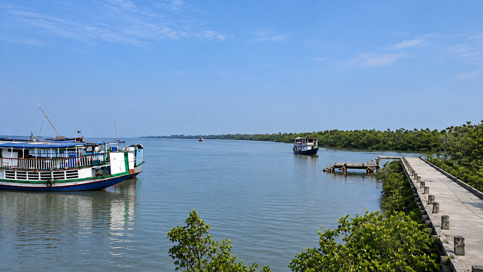
The final approach follows waterways that have shaped movement across this delta for generations. Ferries edge carefully toward the jetty, adjusting to currents that shift with each tidal cycle. Thick mooring ropes are secured against weathered wooden posts, while passengers wait patiently for the boat to settle before stepping ashore.
The first sensation is often underfoot.
The ground feels different here. Firm in some places, soft in others, carrying subtle reminders that much of this landscape has been shaped by centuries of tidal deposition. Earthen embankments rise gently above surrounding waters, protecting homes and fields from the daily reach of the estuary while serving as pathways that connect one settlement to another.
Beyond the landing, the village begins to unfold.
Narrow roads wind between ponds, homesteads, cultivated plots, and scattered groves of trees.
Tin roofs catch the early morning light.
Fishing nets hang neatly outside homes awaiting the next favourable tide.
Conversations drift across courtyards, blending with the sounds of birds, distant engines, and water moving almost unnoticed through nearby creeks.
Nothing here feels disconnected from the river.
Every journey, every livelihood, and every routine appears to follow the same natural timetable established by the tides.
As the settlement gradually recedes toward its outer edges, another transition begins.
Houses become fewer.
The vegetation grows denser.
Beyond the final embankments, the wider mangrove landscape waits in quiet permanence, marking the threshold between human habitation and one of the world’s most remarkable estuarine ecosystems.
Island Identity
Jharkhali occupies a distinctive position within the Indian Sundarbans, where human settlement and mangrove ecology exist in close proximity, each continually influenced by the rhythms of the tidal delta.
Its identity cannot be understood through geography alone.
Like many settlements across the Sundarbans, Jharkhali has been shaped by water more than by land. Rivers determine movement, tides influence daily life, and embankments define the delicate boundary between habitation and the surrounding estuarine environment. Every season leaves its own mark upon the landscape, gradually reshaping both the physical terrain and the lives of those who call it home.
The island represents more than a rural settlement.
It stands as one of the many living frontiers where people have learned to adapt to an environment that is constantly changing. Fishing, agriculture, ferry transport, and everyday life all remain closely connected to the natural dynamics of the delta, reflecting generations of experience in one of the most complex coastal ecosystems on Earth.
Yet Jharkhali is equally important for what surrounds it.
Beyond its villages stretches the wider Sundarbans—a landscape internationally recognised for its vast mangrove forests, extraordinary biodiversity, and intricate network of tidal rivers. The settlement therefore occupies a unique position, serving as both a home for local communities and a gateway to one of the world’s most significant estuarine environments.
To understand Jharkhali is to understand that permanence is rare in the delta.
Here, rivers reshape shorelines, tides redefine boundaries, and every generation inherits a landscape that continues to evolve.
Jharkhali does not resist this change.
It has learned to live with it.
The Rivers That Shaped The Island
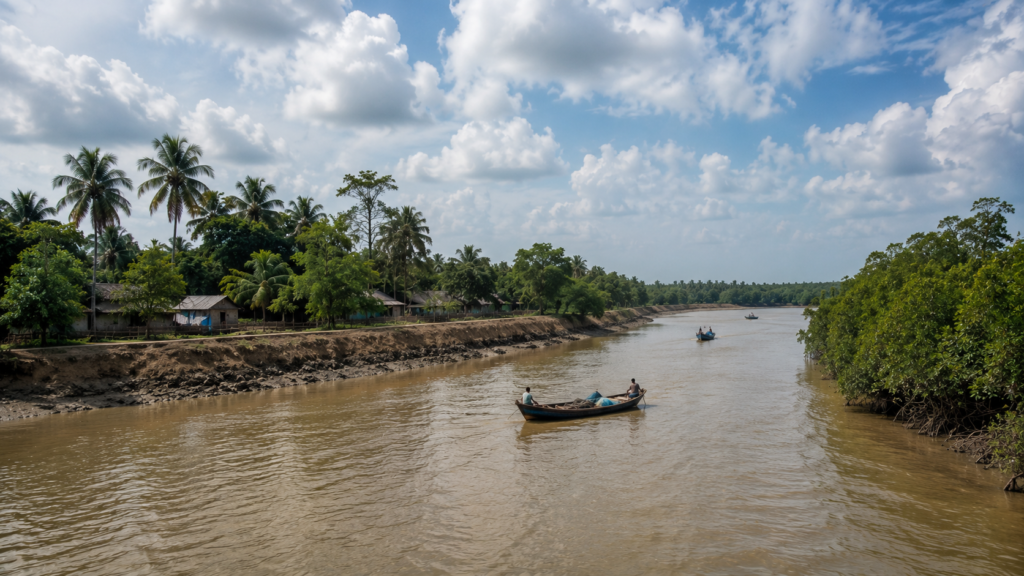
No map can fully explain Jharkhali without first understanding its rivers.
The settlement exists because of water, but it also survives in constant negotiation with it. Here, rivers are neither passive waterways nor simple boundaries separating one island from another.
They are living systems that shape the land, influence livelihoods, determine movement, and quietly redefine the landscape with every passing tide.
The river channels surrounding Jharkhali belong to the dynamic estuarine network of the Indian Sundarbans, where freshwater descending from the great river systems of the subcontinent gradually meets the saline waters of the Bay of Bengal. This meeting creates one of the most complex tidal environments on Earth, where the direction, depth, and character of the water are continually changing.
Unlike rivers flowing steadily toward the sea, the estuarine channels around Jharkhali breathe with the tides. Approximately every six hours, the water changes direction. Rising tides carry saline water inland, flooding mudflats, nourishing mangrove roots, and reaching deep into narrow creeks. As the tide retreats, it leaves behind freshly exposed sediment, feeding grounds for birds, and the intricate patterns that define the ever-changing face of the delta.
These daily cycles have shaped Jharkhali for centuries.
The position of villages, the alignment of embankments, the location of ferry crossings, and even the rhythm of fishing are influenced by the movement of the tide.
- Boats depart not according to fixed schedules alone, but according to navigable water.
- Nets are cast when currents favour particular fish species.
- Embankments are reinforced where the river exerts its greatest pressure.
- Life follows the river because resisting it has never been a practical choice.
The rivers are also architects of the land itself.
Every tidal cycle transports fine sediment through the estuary.
Some banks slowly expand as fresh layers of silt accumulate, while others gradually disappear beneath erosion.
New mudflats emerge, older channels shift, and the outline of the landscape evolves almost imperceptibly from season to season. In the Sundarbans, permanence is rare. Even familiar shorelines remain temporary.
Mangroves stand at the centre of this relationship.
Their intricate root systems slow water movement, trap sediment, and stabilise vulnerable banks. Rather than opposing the river, the mangrove forest works with it, creating one of nature’s most effective defences against erosion while providing habitat for countless species that depend upon these tidal waters.
For the people of Jharkhali, the river is more than geography.
It is the road to neighbouring settlements.
It is the source of livelihood.
It is the provider of fish, the carrier of sediment, the force behind seasonal flooding, and the reminder that every generation must learn to read the water before attempting to shape the land.
The rivers have never simply flowed past Jharkhali.
They have written its story.
Historical Footprints
The history of Jharkhali is unlike the history of cities built upon stone.
There are no ancient fortifications rising above the riverbanks, no monumental architecture marking the achievements of dynasties, and few surviving records that define the island through singular historical events. Instead, its past has been written gradually by sediment, tides, migration, and the enduring relationship between people and the delta.
Long before permanent settlements became established, the wider Sundarbans remained a landscape dominated by tidal forests, shifting river channels, and seasonal occupation. Communities entered these waterways primarily in search of fish, honey, wax, timber, and other forest resources, adapting their movements to the rhythms of the estuary rather than attempting to permanently reshape it.
Over time, human settlement expanded across suitable stretches of higher ground where embankments could offer a degree of protection from the tides. Families gradually established villages, cultivated small agricultural plots where soil conditions allowed, and developed livelihoods closely connected to the rivers surrounding them. Every generation inherited not a finished landscape, but one that continued to evolve beneath the influence of water.
The colonial period brought increasing administrative attention to the Sundarbans. Across different parts of the delta, land reclamation, embankment construction, navigation, and resource management became more organised, although success was often limited by the powerful natural forces governing the region. Storm surges, erosion, and shifting channels repeatedly reminded both administrators and settlers that the delta could not be controlled entirely.
Following India’s independence, improvements in transportation, local governance, education, and public infrastructure gradually strengthened many settlements throughout the Sundarbans, including Jharkhali. At the same time, conservation gained increasing importance as the ecological significance of the mangrove forests became more widely recognised. The relationship between communities and the surrounding forests increasingly balanced livelihood with environmental stewardship.
Yet history in Jharkhali has never been measured solely through dates.
It is remembered in rebuilt embankments after powerful storms.
- In ferry routes that changed as rivers shifted.
- In fields where salinity transformed agriculture.
In villages that adapted, recovered, and continued despite the uncertainties of life within one of the world’s largest tidal deltas.
The past here remains visible not through monuments, but through resilience.
Historical Personalities & Transformations
Unlike many historic towns, Jharkhali is not defined by celebrated rulers, famous reformers, or monumental figures whose names dominate written history.
Its greatest transformations have been collective.
They belong to the fishermen who learned the behaviour of the tides through experience rather than textbooks.
- To farming families who adapted their crops to changing soil conditions.
- To boatmen whose knowledge of river channels was passed from one generation to the next.
- To communities that rebuilt homes and embankments after cyclones, not once, but repeatedly.
These shared experiences have shaped the identity of Jharkhali more profoundly than the actions of any single individual.
Over the decades, the settlement has also witnessed broader institutional changes. Improvements in local governance, disaster preparedness, education, transportation, and environmental management have gradually influenced everyday life. Scientific understanding of the Sundarbans has expanded, conservation initiatives have become more structured, and awareness of the ecological importance of mangrove ecosystems has grown alongside efforts to protect them.
The relationship between people and the surrounding forests has evolved as well.
Where earlier generations often viewed the mangroves primarily through the lens of livelihood, contemporary perspectives increasingly recognise their importance for biodiversity, coastal protection, and long-term environmental resilience. This transformation reflects not a departure from tradition, but an expansion of it—combining inherited local knowledge with modern conservation practices.
Even today, change continues.
- New infrastructure appears while old riverbanks disappear.
- Transportation improves while the tides remain unpredictable.
- Technology reaches villages that still organise much of their daily life around the movement of water.
The essential character of Jharkhali, however, has remained remarkably consistent.
It continues to represent a place where human resilience is measured not by the ability to conquer nature, but by the wisdom to live alongside it.
Folklore & Legends
Across the Sundarbans, stories have long served a purpose beyond entertainment. They preserve memory, reinforce caution, and express a deep respect for a landscape where the boundaries between human settlement and wilderness have always remained uncertain.
In Jharkhali, these traditions continue to exist not as relics of the past, but as quiet elements of everyday life that connect generations to the delta they inhabit. This framing follows the source material’s emphasis on folklore as a lived cultural presence rather than literary mythology.
Among the most enduring cultural figures is Bonbibi, the revered guardian of the Sundarbans. Her story transcends religious boundaries and is shared by both Hindu and Muslim communities throughout the region. She is regarded as the protector of those whose livelihoods depend upon the forest and its surrounding waterways. For generations, fishermen, honey collectors, woodcutters, and others entering forest-fringe areas have sought her blessings before beginning their journeys, believing that humility and respect are essential when venturing into the mangrove wilderness.
Alongside Bonbibi exists the enduring presence of Dakshin Ray, traditionally associated with the tiger and the untamed authority of the forest. Within regional folklore, he represents the reminder that nature possesses its own order, one that cannot be ignored or challenged without consequence. These narratives do not encourage fear alone; they encourage balance. They teach that the Sundarbans is neither conquered nor owned, but shared between people and the natural world.
In Jharkhali, such beliefs are woven quietly into daily life. They are reflected in conversations before river crossings, in inherited advice passed from elders to younger generations, and in the respectful attitude many maintain toward the forests beyond the settlement. Folklore here is less about extraordinary tales and more about cultivating an awareness of place—a recognition that the rivers, tides, mangroves, and wildlife are integral parts of the community’s shared existence.
These traditions have endured because they continue to express a truth that every generation understands. Life in the Sundarbans depends not only upon knowledge and skill, but also upon patience, restraint, and respect for an environment that remains larger than human ambition.
Life Between The Tides
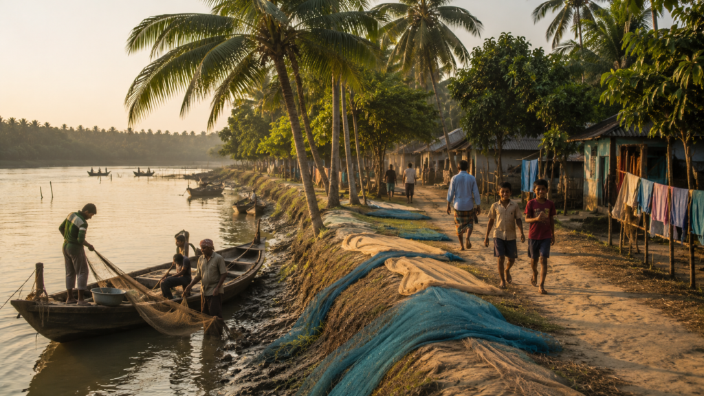
In Jharkhali, daily life unfolds according to a rhythm established by the estuary.
Before dawn, lights begin to appear inside homes while the surrounding landscape remains wrapped in darkness. Meals are prepared early, fishing equipment is gathered, and the first conversations of the day often concern the condition of the river rather than the hour on the clock.
Here, the timing of work is closely linked to tidal movement, with each day shaped by changing water levels and seasonal conditions. This emphasis on tide-governed routines reflects the source’s portrayal of life structured around water rather than fixed time.
Fishing remains one of the defining occupations of the settlement. Boats depart when currents are favourable, and nets are selected according to the season, the expected catch, and the character of the surrounding waterways. The success of each journey depends upon reading the river correctly—a skill developed through years of observation and experience rather than certainty.
Agriculture complements this river-based livelihood wherever soil conditions permit. Small fields and household gardens contribute to daily sustenance, though their productivity is continually influenced by rainfall, salinity, and the condition of nearby embankments. Water, which supports life throughout the delta, can also reshape it within a single season.
Households operate through shared responsibility. While some members spend long hours on the rivers or in nearby fields, others manage domestic tasks, care for livestock, maintain household water supplies, prepare food, and support family livelihoods in countless ways that are often less visible but equally essential. Children divide their time between education and home, growing up with an understanding that the surrounding environment is not separate from everyday life but forms its very foundation.
As evening approaches, boats gradually return, fishing gear is repaired, and neighbours gather to exchange news of the day’s work. Conversations often revolve around river conditions, weather, or the next favourable tide. Tomorrow’s plans begin long before the following sunrise.
Life in Jharkhali is not organised around rigid schedules.
It follows the water.
Walking Through The Villages
To walk through Jharkhali is to discover a settlement that has grown through adaptation rather than design.
The pathways are practical, connecting homes, ponds, embankments, cultivated land, and river crossings in a pattern shaped by necessity over generations. Every route reflects an ongoing relationship with the landscape, where movement has always responded to the realities of water, weather, and changing terrain. This closely follows the source’s description of villages transitioning naturally into embankments and ecosystem edges.
Homes vary in size and construction, yet many share a common purpose: resilience. Raised foundations, durable roofing materials, and elevated courtyards reflect generations of learning from seasonal flooding and cyclonic weather. Practicality guides architecture far more than ornamentation.
Courtyards remain active throughout the day. Fishing nets are spread out for repair, vegetables are sorted after harvest, children play beneath the shade of trees, and neighbours pause to exchange news before continuing with their daily routines. These shared spaces form the social heart of the settlement, where work and conversation naturally blend together.
Small places of worship appear quietly within the village landscape, serving as centres of community life rather than dominating the skyline. Nearby tea stalls fulfill another important role. They are places where river conditions, transport schedules, fishing prospects, and local events are discussed with the same importance that others might reserve for national headlines.
The further one walks, the more gradual the transition becomes.
- Clusters of homes begin to thin.
- Trees become denser.
- Embankments lead naturally toward tidal channels.
- The sounds of village life soften as the wider landscape begins to assert itself.
There is no abrupt boundary separating Jharkhali from the Sundarbans.
The village simply gives way to the delta.
Sounds Of The Island
Every landscape possesses its own voice.
In Jharkhali, that voice is composed not of a single sound but of countless layers that change with the hour, the season, and the tide. The uploaded source emphasizes that the island is never truly silent; instead, its soundscape shifts continuously through the day and night.
Before sunrise, the rivers provide the first movement. Water brushes gently against embankments and wooden jetties while moored boats respond quietly to the rising tide. Soon afterwards, the calls of birds begin to spread across ponds, riverbanks, and nearby vegetation, announcing the arrival of daylight long before the landscape is fully illuminated.
As the settlement awakens, human activity gradually joins the natural chorus. Doors open, utensils ring softly through courtyards, footsteps move along earthen paths, and conversations drift between neighbouring homes. The distant sound of a ferry engine carries across the water before fading once more into the estuary.
By midday, the rhythm changes again.
- Markets become livelier.
- Children’s voices echo along village lanes.
- Fishing boats arrive and depart.
The steady sounds of daily work merge with the constant presence of flowing water, creating an atmosphere that is active without ever feeling hurried.
Evening brings another transformation. Human activity gradually subsides while insects, frogs, and the subtle movement of the river become increasingly noticeable. Darkness does not silence the island; it simply shifts attention toward sounds that daylight often conceals.
For those willing to listen, Jharkhali reveals itself as much through sound as through sight.
- Its rivers speak continuously.
- Its villages answer quietly.
Together they create the enduring soundtrack of life in the Sundarbans.
Wildlife Expedition
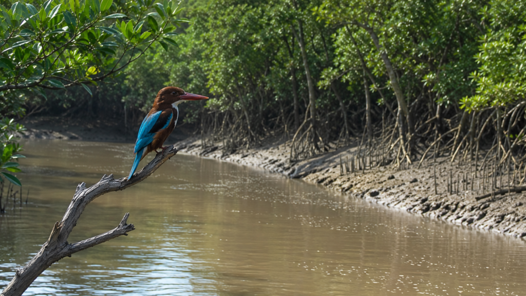
Jharkhali is not a place where wildlife announces itself.
Unlike open grasslands or mountain forests where animals may dominate the landscape, the Sundarbans reveals its biodiversity with remarkable restraint. Here, wildlife is often experienced through subtle signs rather than prolonged encounters. A movement in the mangroves, fresh tracks impressed into tidal mud, the sudden silence of birds, or the brief ripple across an otherwise calm creek may all suggest the presence of life that remains hidden from view. This restrained, observational framing is consistent with the source material’s treatment of wildlife as something inferred rather than constantly seen.
The waters surrounding Jharkhali support an extraordinary web of interconnected habitats. Rivers, tidal creeks, mudflats, mangrove forests, freshwater ponds, and salt-influenced wetlands together create ecological conditions capable of supporting a remarkable diversity of species. Every tide reshapes feeding grounds, exposes new sediment, and redistributes nutrients that sustain life throughout the estuary.
Birds are often the most visible representatives of this ecosystem.
Herons move deliberately along shallow banks.
Kingfishers patrol creek edges from exposed branches.
Egrets gather where retreating tides reveal fish trapped in small pools, while cormorants disappear beneath the surface before emerging moments later with their catch. Their activity reflects the continual exchange between land and water that defines the Sundarbans.
Reptiles also form an important part of this landscape, though many remain difficult to observe.
Monitor lizards occasionally appear along embankments and open ground near the edges of the settlement, while the wider estuarine system supports crocodilian habitats in suitable waterways.
Amphibians, crabs, molluscs, insects, and countless smaller organisms thrive within the mangrove environment, each contributing to an ecosystem whose complexity extends far beyond its larger, more familiar species.
For many visitors, the greatest lesson comes from what remains unseen.
Wildlife in Jharkhali rewards patience rather than expectation. The experience is not measured by the number of species observed, but by learning to recognise the countless relationships that connect water, vegetation, mud, and animal life into a single living system.
The Sundarbans asks its observers to slow down.
Only then does its wildlife begin to reveal itself.
Mangrove Chronicles
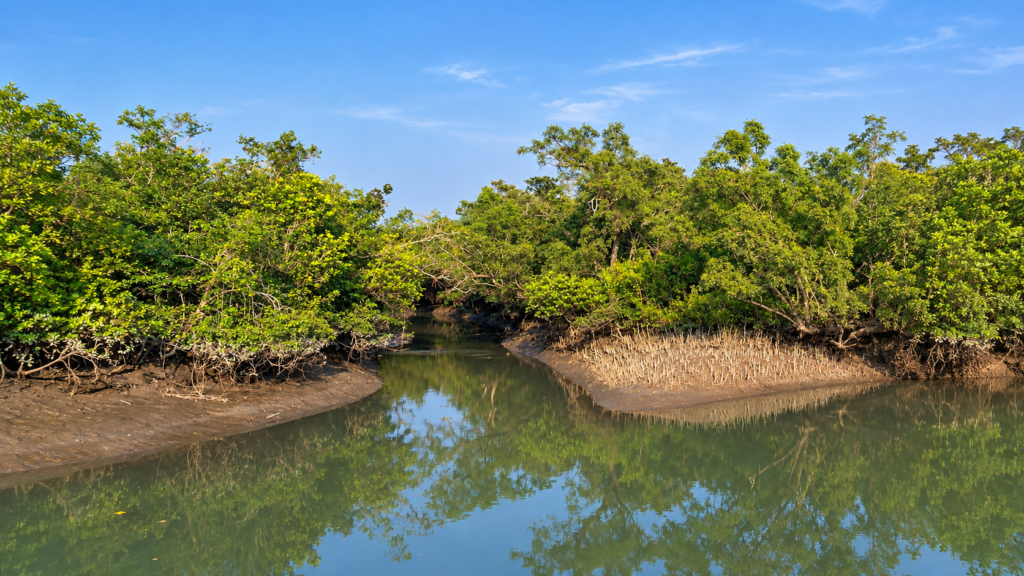
The story of Jharkhali cannot be separated from its mangroves.
These forests are far more than collections of salt-tolerant trees growing beside tidal rivers.
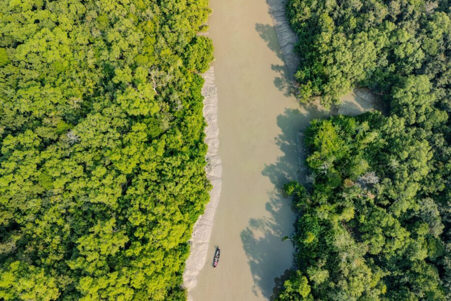
- They form the ecological foundation upon which the entire landscape depends.
- They stabilise riverbanks, capture sediment, provide shelter for countless species, and protect vulnerable coastlines from the relentless force of tides and storms.
Their influence extends through every aspect of life within the delta, shaping both natural processes and human settlement. This aligns with the source’s presentation of mangroves as an active structural system rather than a scenic backdrop.
Unlike terrestrial forests, mangrove ecosystems exist in constant dialogue with water. Their specialised root systems allow them to survive in saline environments where few other tree species can flourish. Rising tides flood the forest floor twice each day, bringing nutrients that nourish the ecosystem while simultaneously testing its resilience. The mangroves do not resist these changing conditions. They have evolved to exist because of them.
The forest also serves as one of nature’s most effective coastal defences.
Its dense network of roots slows the movement of water, traps suspended sediment, and reduces erosion along vulnerable shorelines. During periods of rough weather, these same forests help lessen the force of waves and storm surges before they reach inhabited areas. Their ecological value therefore extends far beyond biodiversity alone.
Beneath the canopy lies an equally remarkable world.
- Mud crabs burrow through soft sediment.
- Juvenile fish seek shelter among submerged roots.
Small invertebrates recycle organic material, enriching the estuarine food web that supports larger species throughout the Sundarbans. Every fallen leaf becomes part of a continuous cycle of decomposition and renewal that sustains life across the delta.
For generations, the people of Jharkhali have lived alongside this remarkable ecosystem.
The mangroves have provided protection, supported fisheries, influenced river dynamics, and shaped local understanding of the landscape. At the same time, their conservation has become increasingly important as environmental pressures continue to affect coastal regions throughout the world.
The mangrove forest is not simply part of Jharkhali’s surroundings.
It is the reason the landscape continues to exist.
Explorer’s Field Notes
Every expedition reveals details that maps cannot record.
Field observations made while moving through Jharkhali often demonstrate how closely human activity remains connected to the changing conditions of the estuary. Small variations in water level, wind direction, sediment exposure, or bird activity can alter the rhythm of an entire day, reminding the observer that the landscape remains dynamic even when it appears calm. This reflects the source’s emphasis on practical environmental observation rather than dramatic events.
During the early hours of the morning, the quality of light changes rapidly across the river. Mist lingers above the water while the first sunlight illuminates embankments, ponds, and distant mangrove silhouettes. Bird activity is often greatest at this time, particularly around exposed mudflats and shallow creek margins where retreating tides reveal temporary feeding grounds.
Walking along village embankments reveals subtle evidence of the landscape’s continual transformation. Fresh sediment may appear along one stretch while another shows gradual erosion. Newly repaired sections of embankment stand beside older structures that bear the marks of repeated monsoon seasons and tidal pressure. These quiet details speak of ongoing adaptation rather than permanent stability.
Conversations within the settlement frequently return to the environment itself. River conditions, weather forecasts, ferry timings, fishing prospects, and seasonal changes remain subjects of immediate practical importance. Here, ecological awareness is not an academic exercise; it forms part of everyday decision-making.
Perhaps the most valuable lesson for any explorer is patience.
Jharkhali does not reward hurried observation.
The landscape reveals itself gradually through repeated attention to small details—a kingfisher returning to the same branch, ripples spreading across an otherwise still creek, mangrove leaves moving with the changing tide, or the quiet rhythm of boats preparing to leave before sunrise.
These moments rarely demand attention.
Yet together they tell the deeper story of the island.
For those willing to observe carefully, Jharkhali becomes more than a destination.
It becomes a living field laboratory where the relationship between people, rivers, mangroves, and wildlife can be understood one observation at a time.
Nightfall On The Island
As the final light fades across Jharkhali, the landscape begins another quiet transformation.
The brilliance of the afternoon softens into muted shades of amber and grey as the sun sinks behind the western horizon. Reflections stretch across the tidal channels, turning the river into a broad ribbon of changing light before darkness gradually settles over the delta. The transition is slow, almost imperceptible, yet it alters every aspect of the island’s character. This portrayal follows the uploaded source’s progression from evening light to redistributed human and ecological activity.
Boats that spent the day navigating the estuary begin returning to their moorings. Fishing nets are folded, equipment is secured, and the activity around the jetties steadily diminishes. Along the embankments, conversations linger for a while before families retreat indoors, where warm lights begin appearing one by one across the settlement.
The river, however, remains awake.
Its currents continue to respond to the tides regardless of human schedules. Water brushes quietly against muddy banks, carrying floating vegetation, suspended sediment, and the countless unseen organisms that make the estuary one of the world’s most productive ecosystems.
As darkness deepens, the island’s soundscape changes once again.
The daytime calls of birds give way to insects and amphibians. Gentle breezes move through the trees. Somewhere beyond the last visible homes, the mangrove forest continues its own silent rhythms, hidden from sight yet constantly alive.
Night in Jharkhali does not signal the end of activity.
It simply marks the moment when nature once again becomes the dominant presence.
For those willing to pause and observe, the darkness reveals a different dimension of the Sundarbans—one defined not by visibility, but by atmosphere, patience, and quiet awareness.
The Seasons Of The Island
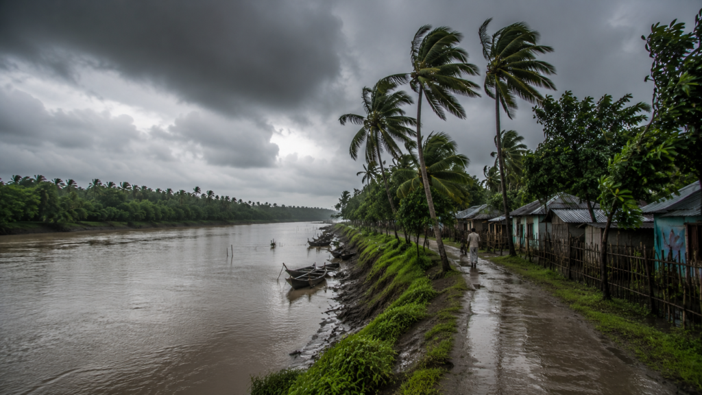
Life in Jharkhali changes with every season, yet the transformation is governed less by temperature than by water.
Unlike inland landscapes where the passing of seasons is often measured through vegetation alone, the Sundarbans responds primarily to shifting tides, rainfall, salinity, and river behaviour.
Each period of the year reshapes the appearance of the delta while influencing the rhythms of wildlife, agriculture, transportation, and everyday life. This section follows the source’s emphasis that seasons are structural forces expressed through changing water behaviour.
Winter brings the greatest sense of stability.
Cooler temperatures, relatively calm weather, and clearer skies create favourable conditions for movement across the waterways.
Riverbanks become more defined as water levels fluctuate predictably, while migratory birds add seasonal diversity to the landscape. It is during these months that the delta often appears at its most tranquil.
Spring gradually introduces warmer temperatures and increasing humidity.
Vegetation responds quickly, aquatic ecosystems become more active, and the rivers begin preparing for the climatic changes that accompany the approaching monsoon.
The landscape appears vibrant, yet subtle shifts in water conditions already hint at the seasonal transition ahead.
Summer intensifies the challenges of living within a tidal delta.
Heat, humidity, and increasing salinity influence both agriculture and daily routines.
Water management becomes increasingly important as communities adapt to changing environmental conditions.
The arrival of the monsoon transforms the island more dramatically than any other season.
Heavy rainfall combines with powerful tidal cycles to blur the distinction between land and water. Rivers swell, embankments experience greater pressure, and many familiar pathways become temporarily inaccessible. What appeared stable only weeks earlier now responds once again to the immense energy of the estuary.
Following the monsoon comes a period of renewal.
Communities repair embankments, restore damaged infrastructure, prepare agricultural land, and gradually re-establish everyday routines. The landscape settles, although never into precisely the same form it held before the rains.
In Jharkhali, the seasons are not simply changes in weather.
They are recurring chapters in the continual evolution of the delta.
Cyclones And Survival
For generations, the people of Jharkhali have understood that living within the Sundarbans requires accepting both its generosity and its uncertainty.
Among the most powerful forces shaping this landscape are the cyclones that periodically cross the Bay of Bengal. Their impact extends far beyond strong winds.
In the tidal delta, the greatest threat often arrives through water itself—storm surges capable of overtopping embankments, flooding settlements, increasing soil salinity, and altering the physical character of the landscape.
This section closely reflects the source’s focus on recovery, infrastructure, and adaptation rather than dramatic storytelling.
The memory of major storms remains deeply embedded within the communities of the Sundarbans. Rather than being remembered solely by dates, they are recalled through rebuilt homes, strengthened embankments, restored fields, and the collective effort required to recover after each event.
Adaptation has therefore become an essential part of daily life.
Houses are designed with local environmental conditions in mind.
Embankments receive continuous maintenance.
Early warning systems, evacuation planning, and community preparedness have become increasingly important in reducing risk and protecting lives.
Yet resilience in Jharkhali is not measured only by infrastructure.
It is reflected in the determination of communities to rebuild after adversity, to restore livelihoods, and to continue living within a landscape whose challenges have always been matched by its opportunities.
Cyclones remain part of the Sundarbans.
So too does the enduring resilience of its people.
Ferry Routes & Hidden Paths
Movement through Jharkhali has always been shaped by water.
Long before modern road networks connected many parts of the delta, rivers served as the principal routes linking settlements, markets, neighbouring islands, and the wider mainland.
Even today, ferry crossings remain an essential component of daily life, connecting communities through waterways that continue to define the geography of the Sundarbans. This description preserves the source’s emphasis on transport governed by tides and locally known waterways.
Each journey depends upon more than distance.
Tidal depth, current strength, weather conditions, and seasonal water levels all influence navigation. A route that appears straightforward on a map may require careful timing in practice, reminding travellers that movement within the delta is governed as much by natural processes as by infrastructure.
Beyond the regular ferry services lie countless smaller creeks and channels that weave through the surrounding landscape. Many of these waterways are familiar primarily to local boatmen and fishing communities whose knowledge has been refined through years of experience on the river.
These hidden paths reveal another dimension of the Sundarbans.
They demonstrate that the delta is not organised around straight lines or permanent boundaries. Instead, it functions as a fluid network where land, water, and movement continually adapt to one another.
Travelling through Jharkhali therefore becomes more than a journey between places.
It becomes an opportunity to experience the landscape in the way it has always been understood—through the rivers that connect it.
Photography Expedition Guide
Jharkhali rewards photographers who value observation over speed.
Its greatest visual strength lies not in dramatic spectacles but in the subtle interplay of light, water, weather, and everyday life. The landscape changes continuously throughout the day, offering new compositions as the tides rise and fall, clouds shift across the estuary, and activity moves between settlement and river. This guidance reflects the source’s emphasis on transitions, patience, and natural observation.
Early morning often provides the most balanced conditions for landscape photography. Soft light reveals the textures of embankments, ponds, mangrove silhouettes, and tidal channels while creating gentle reflections across the calm surface of the rivers.
Throughout the day, the estuary presents opportunities to document the relationship between people and their environment. Fishing boats preparing for departure, ferry crossings, village pathways, working embankments, and quiet moments of daily life all illustrate the character of Jharkhali more effectively than staged scenes ever could.
Wildlife photography requires patience and respect.
Bird activity frequently increases during the early hours and around exposed mudflats created by the retreating tide. Observers willing to remain still and minimise disturbance are often rewarded with more authentic behaviour than those who actively pursue subjects.
Changing weather also transforms the visual atmosphere.
Winter offers clear visibility and defined horizons, while the monsoon introduces dramatic cloud formations, saturated landscapes, and an ever-changing relationship between land and water.
Each season presents its own photographic opportunities without diminishing the essential character of the island.
Above all, photography in Jharkhali is an exercise in careful observation.
The most memorable images are rarely created by chasing the extraordinary.
They emerge from recognising the quiet beauty that unfolds naturally throughout the life of the delta.
Expedition Notes
Every expedition through Jharkhali leaves behind more than photographs or mapped routes.
It builds a collection of quiet observations that gradually reveal how the island functions as a living part of the Sundarbans.
Many of these details appear insignificant in isolation, yet together they provide a deeper understanding of the relationship between people, rivers, tides, and the landscape. This section is based on the field-observation framing in the source document.
One of the first observations is the remarkable influence of the tide. Even within a few hours, familiar stretches of riverbank can appear entirely different.
Mudflats emerge where water previously covered the shoreline, boats shift position with changing water levels, and exposed sediment begins attracting birds searching for food.
The embankments tell their own story. Sections that appear newly reinforced stand beside older stretches bearing the marks of repeated repairs. Small differences in soil colour, vegetation, and erosion reveal how continually the landscape is being reshaped by the estuary.
Movement throughout the settlement follows patterns established over generations. Certain pathways become active only during fishing hours, while others remain busy throughout the day as people move between homes, markets, ponds, and ferry crossings. Every route reflects practical adaptation rather than formal planning.
Conversations with residents often return to the same essential subjects—river conditions, weather forecasts, fishing prospects, embankment maintenance, and seasonal change. Environmental awareness is not treated as specialised knowledge; it is woven naturally into everyday decision-making.
Perhaps the most valuable field note is this: Jharkhali is best understood through observation rather than assumption.
The longer one remains, the more clearly the island begins to reveal the countless connections that bind its people to the ever-changing rhythms of the Sundarbans.
Connected Landscapes
Although Jharkhali possesses its own distinct identity, it cannot be understood in isolation.
Like every settlement within the Sundarbans, it forms part of a much larger network of rivers, islands, forests, wetlands, and human communities whose histories have developed together through centuries of interaction. The source presents Jharkhali as a node within a broader living delta system connected by water rather than roads.
The waterways surrounding the island provide far more than transportation. They create ecological corridors through which water, sediment, nutrients, fish, birds, and countless other species move continuously across the delta. These natural connections allow ecosystems separated by administrative boundaries to function as parts of one integrated landscape.
Human connections have followed similar patterns.
Trade, education, healthcare, markets, and family relationships frequently extend beyond individual islands, relying upon ferry routes and river crossings that have linked neighbouring settlements for generations. Daily life within Jharkhali therefore remains closely connected to the wider Sundarbans rather than confined to a single geographical location.
Ecologically, the surrounding mangrove forests strengthen these relationships further.
Wildlife moves according to habitat, food availability, and tidal conditions rather than political boundaries.
Birds travel between wetlands, aquatic species follow estuarine channels, and mangrove ecosystems function collectively across large sections of the delta.
To explore Jharkhali is therefore to begin understanding the Sundarbans as an interconnected system.
- Each island contributes to the larger story.
- Each river strengthens those connections.
Together they create one of the world’s most remarkable delta landscapes.
Oral Histories
Some of the most valuable knowledge preserved within Jharkhali has never been written down.
It survives through memory.
Across generations, families have passed forward their experiences of the rivers, the changing landscape, seasonal weather, fishing grounds, and the countless adjustments required to live successfully within the Sundarbans. These observations complement formal historical records by preserving details that rarely appear in official documents. This treatment follows the source’s emphasis on oral memory as environmental memory rather than formal folklore.
Elders often describe rivers that once followed different courses, embankments that stood elsewhere, or fields whose productivity changed after major floods or cyclonic events. Such accounts rarely focus upon exact dates. Instead, they describe transformation itself—the gradual evolution of the landscape through lived experience.
Many of these stories are practical in nature.
Advice about crossing particular waterways, recognising approaching weather, interpreting tidal behaviour, or protecting homes from flooding reflects generations of careful observation. Knowledge accumulated through experience continues to support daily decision-making alongside modern forecasting and scientific understanding.
These oral traditions also preserve cultural identity.
They remind younger generations that the Sundarbans is not merely a place to inhabit but a landscape to understand. Every story reinforces the importance of patience, respect, cooperation, and adaptability—qualities that have enabled communities to thrive within an environment where certainty has always remained elusive.
In Jharkhali, memory serves not only as history.
It remains an essential guide for the future.
Food Of The Island
The food of Jharkhali reflects the character of the delta itself.
Simple, seasonal, and closely connected to local resources, everyday meals are shaped by what the rivers, fields, ponds, and surrounding landscape provide throughout the year.
Rather than representing elaborate culinary traditions, the cuisine of the island expresses practicality, sustainability, and adaptation to local environmental conditions. This mirrors the source’s framing of food as adaptation rather than identity.
Rice forms the foundation of most meals, accompanied by fish that varies according to seasonal availability and local catch.
Freshwater and estuarine species both contribute to the diet, reflecting the close relationship between the community and its surrounding waterways.
Vegetables are commonly cultivated in household gardens and small agricultural plots wherever soil conditions permit.
Seasonal produce changes throughout the year, influenced by rainfall, salinity, and the condition of the land following each monsoon.
Crabs and other aquatic resources also contribute to household livelihoods, providing both food and income for many families.
Cooking methods generally emphasise freshness, allowing locally available ingredients to remain the central feature of each meal.
The cuisine of Jharkhali tells a quiet story.
It reflects not abundance without limit, but careful use of the resources that the delta provides.
Every meal is another expression of life lived in balance with the estuary.
Island Economy
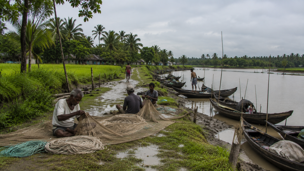
The economy of Jharkhali has developed around the opportunities and limitations presented by the Sundarbans.
Rather than depending upon a single industry, most households combine multiple sources of livelihood that change according to season, environmental conditions, and available resources. This description follows the source’s portrayal of a flexible, river-dependent rural economy.
Fishing remains one of the island’s principal economic activities.
Rivers, tidal creeks, and estuarine waters provide fish and other aquatic resources that support both household consumption and regional trade.
Agriculture continues wherever land conditions allow, although productivity is influenced by rainfall, soil salinity, and seasonal flooding.
Many families therefore combine farming with fishing or other forms of employment to reduce dependence upon a single livelihood.
Small businesses, local markets, transport services, and seasonal labour opportunities contribute further to the island’s economy.
Ferry services play an essential role by connecting Jharkhali with neighbouring settlements and commercial centres, allowing goods, people, and services to move throughout the region.
Economic resilience here depends upon flexibility.
Communities continually adjust their activities according to changing environmental conditions, demonstrating the adaptability that has long characterised life within the Sundarbans.
Then & Now
Jharkhali has changed over time, yet its essential relationship with the landscape has remained remarkably consistent.
Earlier generations depended even more directly upon rivers, forests, and seasonal cycles for their survival. Transportation relied almost entirely upon waterways, communication was slower, and local knowledge formed the primary guide for navigating the challenges of the delta. The source presents this as an evolution of tools and systems rather than a complete transformation.
Today, improved infrastructure, education, communication, transportation, and environmental management have strengthened many aspects of daily life. Scientific understanding of the Sundarbans has expanded, disaster preparedness has improved, and conservation now occupies a more prominent place in regional planning.
Yet many of the defining characteristics of Jharkhali remain unchanged.
- The tides still determine movement.
- The rivers continue reshaping the landscape.
- The monsoon remains a season of preparation and adaptation.
Fishing, farming, ferry crossings, and community cooperation continue to shape everyday life much as they have for generations.
Progress has brought new opportunities.
The environment continues to provide familiar challenges.
Together they have created a community that honours its past while steadily adapting to the future.
Jharkhali today stands as both a product of change and a reminder that, within the Sundarbans, resilience has always been the island’s greatest inheritance.
The Wild Orbit Quick Facts
Island Name: Jharkhali
State: West Bengal
Country: India
Region: Indian Sundarbans
District: South 24 Parganas
Administrative Block: Basanti Block
Gram Panchayat: Jharkhali Gram Panchayat
Landscape Type: Inhabited Delta Island
Physiographic Region: Lower Ganges–Brahmaputra Delta
Ecosystem: Tropical Tidal Mangrove Estuary
UNESCO Connection: Part of the wider Sundarbans Biosphere landscape (not within the protected core forest)
Nearest Major City: Kolkata
Nearest Tourist Gateway: Godkhali
Nearest Jetty: Jharkhali Jetty
Major Surrounding Rivers: Bidya River system and interconnected tidal creeks of the eastern Indian Sundarbans.*
Tidal Influence: Semi-diurnal (approximately two high tides and two low tides daily)
Primary Landscape: Mangroves, embankments, tidal rivers, creeks, wetlands, agricultural fields, and villages
Dominant Island Identity: River Gateway & Human–Mangrove Interface Settlement
Primary Livelihoods: Fishing, agriculture, aquaculture, small-scale trade, tourism services, and local businesses
Best Season to Visit: November to February
Monsoon Season: June to September
Cyclone Exposure: High (Bay of Bengal coastal cyclone zone)
Ideal Traveller: Naturalists, birdwatchers, photographers, researchers, conservation travellers, and slow explorers
Wildlife Possibilities: Kingfishers, herons, egrets, cormorants, brahminy kites, monitor lizards, estuarine fishes, mudskippers, fiddler crabs, and diverse mangrove fauna. Wildlife observations are always natural and never guaranteed.
Photography Highlights: Sunrise over tidal rivers, village life, embankments, mangrove reflections, fishing boats, seasonal skies, and estuarine landscapes
Recommended Exploration Style: Slow, observation-led river and village exploration
Average Exploration Duration: Half-day to full-day, often combined with wider Sundarbans expeditions
The Wild Orbit Expedition Snapshot
Every island offers a different expedition experience.
Jharkhali is not an island defined by dramatic wilderness alone, nor by dense human settlement. Instead, it occupies a fascinating middle ground where civilisation gradually blends into one of Earth’s most dynamic mangrove landscapes. It serves as an ideal introduction to understanding how people and nature continue to coexist within the Indian Sundarbans.
Accessibility
★★★★★ (5/5)
Jharkhali is among the more accessible islands of the Indian Sundarbans. Well-connected road infrastructure from Kolkata, combined with organised transport networks, makes it an excellent starting point for first-time explorers while still retaining the atmosphere of a working delta settlement.
Landscape Diversity
★★★★☆ (4.5/5)
Within a relatively compact area, visitors experience tidal rivers, mangrove forests, embankments, agricultural fields, aquaculture ponds, wetlands, ferry crossings and traditional villages. Few locations present such a complete cross-section of the inhabited Sundarbans.
Wildlife Potential
★★★★☆ (4/5)
Jharkhali should be appreciated for its ecological richness rather than expectations of iconic wildlife encounters. Birdlife is abundant, reptiles are occasionally observed, estuarine biodiversity is remarkable, and nearby protected forests support many of the region’s larger species. Wildlife sightings always depend upon season, habitat and natural behaviour.
Birdwatching Potential
★★★★☆ (4.5/5)
The surrounding tidal creeks, mudflats, wetlands and mangrove edges provide excellent opportunities to observe resident and migratory birds. Early mornings and winter months generally offer the most rewarding conditions.
Photography Potential
★★★★★ (5/5)
Jharkhali is exceptionally rewarding for documentary photographers.
Rather than dramatic spectacles, it offers layered visual stories:
- River life
- Working boats
- Mangrove reflections
- Seasonal light
- Village architecture
- Embankments
- Fishermen preparing nets
- Rural landscapes
- Human–nature interactions
Every changing tide creates a new composition.
Cultural Richness
★★★★★ (5/5)
Few places demonstrate the relationship between humans and tidal landscapes as clearly as Jharkhali.
Fishing traditions, river transport, agriculture, local markets, religious harmony, seasonal adaptation and community resilience combine to create one of the most authentic cultural landscapes in the Sundarbans.
Historical Interest
★★★☆☆ (3.5/5)
Jharkhali’s history is subtle rather than monumental.
Its significance lies in land reclamation, settlement evolution, embankment development, delta adaptation and the broader human story of inhabiting one of the world’s largest tidal mangrove ecosystems.
Ecological Importance
★★★★★ (5/5)
Jharkhali occupies an important position along the interface between human settlements and the mangrove ecosystem. Its surrounding rivers, wetlands and tidal forests contribute to one of the planet’s most productive estuarine environments, making the island valuable for ecological understanding and conservation awareness.
Solitude Level
★★★☆☆ (3.5/5)
Unlike remote forest interiors, Jharkhali is a living settlement. Visitors should expect everyday human activity rather than complete isolation. The surrounding rivers, however, often provide moments of remarkable tranquillity, especially during sunrise and the quieter tidal hours.
Research Potential
★★★★★ (5/5)
Jharkhali presents exceptional opportunities for interdisciplinary study.
Researchers interested in mangrove ecology, delta geomorphology, climate adaptation, rural livelihoods, fisheries, anthropology, sustainable tourism and conservation will find the island an invaluable living landscape.
The Wild Orbit Explorer Connections
No island in the Sundarbans exists in isolation.
- Every river crossing leads to another community.
- Every tidal creek eventually joins a larger estuary.
- Every embankment tells part of a much wider story.
Exploring Jharkhali becomes far more meaningful when viewed as one chapter within the interconnected landscape of the Indian Sundarbans.
River Connections
The tidal waterways surrounding Jharkhali form part of a vast estuarine network that links villages, mangrove forests, wetlands and protected habitats across the delta.
These rivers have long served as transportation corridors, ecological highways and cultural connectors, allowing people, wildlife and sediment to move continuously through the landscape.
Mangrove Connections
Jharkhali sits beside one of the world’s largest mangrove ecosystems. Beyond the settlement lie forests that support intricate ecological processes, protect coastlines from erosion and storms, nurture fisheries, and provide habitat for countless plant and animal species. Understanding Jharkhali naturally leads to a deeper appreciation of the wider mangrove landscape.
Wildlife Connections
Birds, fish, crustaceans and many other species move freely through the estuary, ignoring administrative boundaries. Seasonal migrations, tidal movements and breeding cycles connect Jharkhali with surrounding wetlands, mudflats, creeks and forested habitats, reinforcing its role within a much larger ecological network.
Cultural Connections
The island shares deep cultural ties with neighbouring settlements across the Sundarbans. Fishing traditions, ferry routes, local markets, seasonal festivals, religious practices and oral traditions reveal a common delta identity shaped by centuries of living with the tides.
Expedition Connections
After exploring Jharkhali, the journey naturally extends toward other important landscapes within the Indian Sundarbans, including:
- Gosaba — Administrative and cultural heart of the inhabited Sundarbans.
- Dayapur — Gateway to several protected forest tourism zones.
- Pakhiralay — Known for its proximity to bird-rich habitats and tourism infrastructure.
- Bali Island — A quieter rural island reflecting traditional delta life.
- Satjelia — An important settlement with strong ecological and historical connections.
- Sajnekhali — Interpretation centre and one of the best-known forest access points.
- Dobanki — Famous for its canopy walk and surrounding mangrove ecosystem.
- Sudhanyakhali — A key wildlife observation area within the protected forest.
- Netidhopani — Associated with archaeological remains and regional folklore.
- Bonnie Camp — One of the highest watchtower locations in the Indian Sundarbans.
- Matla River — A defining tidal river of the western Sundarbans.
- Bidya River — An important estuarine waterway supporting wildlife and navigation.
Together, these destinations reveal that the Sundarbans is not a collection of isolated attractions but a single living delta where rivers, forests and communities remain inseparably connected.
FAQs
1. Where is Jharkhali located?
Jharkhali is an inhabited island in the Basanti Block of South 24 Parganas district, West Bengal, forming part of the Indian Sundarbans.
2. Why is Jharkhali important?
It represents one of the most accessible places to understand how human settlements coexist alongside the mangrove ecosystem of the Sundarbans.
3. Is Jharkhali inside the Sundarbans?
Yes. It is part of the inhabited region of the Indian Sundarbans.
4. Is Jharkhali inside the Tiger Reserve?
No. It is an inhabited settlement located outside the protected core forest, although it serves as a gateway to the wider Sundarbans landscape.
5. Can Royal Bengal Tigers be seen from Jharkhali?
Tiger sightings are never guaranteed. The island itself is a human settlement, while tigers primarily inhabit protected mangrove forests.
6. Is Jharkhali suitable for birdwatching?
Yes. Rivers, wetlands and mangrove edges support numerous resident and migratory bird species.
7. Which season is best for visiting Jharkhali?
Winter, from November to February, generally provides the most comfortable weather and clearer visibility.
8. Does Jharkhali experience tides every day?
Yes. Like the rest of the Sundarbans, the island experiences semi-diurnal tides, with approximately two high tides and two low tides each day.
9. Why are embankments so important?
They protect settlements and agricultural land from tidal flooding and saline water intrusion.
10. What is the main livelihood of local people?
Fishing, agriculture, aquaculture, local trade and tourism-related services form the primary sources of income.
11. Is Jharkhali good for photographers?
Yes. Documentary, landscape, wildlife and cultural photographers will find abundant subjects throughout the year.
12. Is Jharkhali a good destination for families?
Yes, especially for families interested in nature, education and responsible exploration.
13. Are boat rides available?
Yes. River journeys form an integral part of exploring the surrounding Sundarbans.
14. What makes Jharkhali different from other islands?
Its combination of accessibility, ecological importance and authentic village life makes it one of the best places to understand the human dimension of the Sundarbans.
15. How much time should be spent exploring Jharkhali?
A full day allows visitors to appreciate its rivers, villages, mangrove landscapes and changing tidal rhythms, though it is often included within longer Sundarbans expeditions.
16. Is Jharkhali suitable for researchers?
Yes. Jharkhali offers valuable opportunities for research in mangrove ecology, estuarine geomorphology, fisheries, rural livelihoods, climate adaptation, conservation, and sustainable development. Its location at the interface of human settlement and mangrove ecosystems makes it particularly relevant for interdisciplinary field studies.
17. Are there mangrove forests near Jharkhali?
Yes. The surrounding landscape is closely connected to the mangrove ecosystems of the Indian Sundarbans, making the island an excellent place to understand how human communities interact with one of the world’s largest mangrove forests.
18. Does Jharkhali experience cyclones?
Yes. Like much of the Sundarbans, Jharkhali lies within the Bay of Bengal cyclone zone and has experienced the effects of major tropical cyclones. Embankments, disaster preparedness, and community resilience play an important role in daily life.
19. Are there local markets in Jharkhali?
Yes. Small local markets serve nearby villages by supplying fresh fish, vegetables, household goods, and other daily essentials. These markets also provide insight into the rhythm of everyday island life.
20. What kind of boats are commonly seen?
Traditional wooden fishing boats, mechanised fishing vessels, passenger ferries, and small country boats are commonly used for transport, fishing, and movement between neighbouring islands.
21. Is Jharkhali a good destination for wildlife enthusiasts?
Yes, particularly for those who appreciate observing ecosystems rather than expecting guaranteed sightings of iconic wildlife. The surrounding rivers, wetlands, and mangroves support a rich variety of birds, reptiles, aquatic life, and estuarine biodiversity.
22. Why do photographers prefer sunrise in Jharkhali?
Early morning provides softer light, calmer rivers, active birdlife, and atmospheric mist over the estuary. These conditions create excellent opportunities for landscape and documentary photography.
23. Can Jharkhali be visited during the monsoon?
It can, but visitors should be prepared for heavy rainfall, strong tidal conditions, occasional transport disruptions, and changing weather. Always check local travel conditions before planning a monsoon visit.
24. What should responsible visitors keep in mind?
Respect local communities, avoid disturbing wildlife, minimise plastic waste, follow designated routes, and remember that the Sundarbans is a fragile ecosystem where conservation should always take priority over recreation.
25. What is the greatest lesson Jharkhali offers?
Perhaps the most enduring lesson is that resilience is not built through resisting nature but through understanding it. Jharkhali demonstrates how generations have adapted to tides, rivers, mangroves, and seasonal change while continuing to build meaningful lives within one of the world’s most dynamic landscapes.
How To Reach Jharkhali
Reaching Jharkhali is part of the expedition itself. The journey gradually leaves behind the urban landscape of Kolkata and enters the intricate riverine world of the Indian Sundarbans, where roads give way to tidal waterways and the pace of travel begins to slow.
By Road from Kolkata
Jharkhali is approximately 115–125 kilometres from Kolkata, depending on the chosen route. The journey generally takes 3.5 to 4.5 hours by private vehicle or hired taxi, subject to traffic and seasonal road conditions.
Common approach routes pass through:
- Kolkata
- Baruipur
- Canning
- Basanti
- Jharkhali
The final stretch offers a gradual transition into the delta landscape, with embankments, aquaculture ponds, tidal creeks, and rural settlements becoming increasingly prominent.
By Rail
The nearest major railway connection is:
Canning Railway Station
Regular suburban trains connect Canning with Sealdah Railway Station (Kolkata). From Canning, visitors continue by road to Jharkhali using local transport, taxis, or pre-arranged vehicles.
By Air
The nearest airport is:
Netaji Subhas Chandra Bose International Airport
From the airport, travellers typically continue by road directly to Jharkhali or first travel to Canning before proceeding into the Sundarbans region.
Local Transportation
Within and around Jharkhali, movement commonly involves:
- Auto-rickshaws
- Local taxis
- Motorised vans
- Boats for river crossings
- Organised expedition vehicles
Transportation may vary depending on seasonal water levels and local conditions.
Seasonal Travel Notes
Winter (November–February)
- Most comfortable temperatures
- Clear visibility
- Excellent for photography
- Favourable birdwatching
Summer (March–May)
- High humidity
- Warm afternoons
- Productive early mornings
Monsoon (June–September)
- Heavy rainfall
- High tides
- Changing river conditions
- Occasional transport disruption
Post-Monsoon (October)
- Fresh landscapes
- Dramatic skies
- Improved accessibility after seasonal recovery
Explorer Tips
- Begin early to experience sunrise across the estuary.
- Carry drinking water, sun protection, and rain gear depending on the season.
- Wear lightweight clothing suitable for humid conditions.
- Respect local customs and avoid disturbing wildlife.
- Always allow extra travel time during the monsoon and cyclone season.
Things To See Around Jharkhali
Jharkhali serves as an excellent base for exploring several significant landscapes within the Indian Sundarbans. Each destination reveals a different aspect of the delta’s ecology, history, and culture.
Sajnekhali
One of the principal gateways to the protected forest, Sajnekhali is known for its interpretation centre, watchtower, and opportunities to understand the ecology of the Sundarbans.
Dobanki
Famous for its elevated canopy walk, Dobanki offers a unique perspective of the mangrove ecosystem and surrounding tidal landscape.
Sudhanyakhali
An important wildlife observation zone where visitors gain insight into the protected mangrove forests and their biodiversity.
Netidhopani
Associated with archaeological remains and regional folklore, Netidhopani combines history, legend, and wilderness.
Bonnie Camp
One of the highest watchtower locations in the Indian Sundarbans, offering panoramic views across the mangrove landscape.
Local Villages
Exploring neighbouring settlements provides opportunities to understand:
- Traditional fishing communities
- Rural agriculture
- Aquaculture
- Village markets
- Embankment life
- Local craftsmanship
River Viewpoints
Numerous embankments and ferry crossings provide expansive views across tidal rivers, particularly during sunrise and sunset when changing light transforms the estuarine landscape.
Mangrove Edges
Although entry into protected forests is regulated, the mangrove margins surrounding inhabited areas offer valuable opportunities to observe tidal ecology and estuarine vegetation.
Continue The Journey
Jharkhali is only one chapter in the larger story of the Sundarbans.
To understand this remarkable delta more completely, continue exploring the wider Wild Orbit Expedition Series.
- Discover the river islands that have shaped human settlement.
- Follow the tidal rivers that connect distant communities.
- Walk through villages where life still follows the rhythm of the tides.
- Learn about the mangroves that protect coastlines and sustain biodiversity.
- Explore the folklore that continues to influence local identity.
- Observe the extraordinary wildlife that survives within one of Earth’s most challenging ecosystems.
Every expedition begins with curiosity.
Every island reveals another piece of the Sundarbans.
Leaving Jharkhali
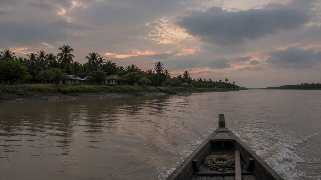
As evening settles over Jharkhali, the outlines of the embankments gradually soften beneath the fading light. Boats return quietly to the jetty, their reflections dissolving into the slow-moving tide. Conversations drift from village courtyards before giving way to the steady chorus of insects and the distant murmur of the river.
Looking back from the departing road or boat, the island does not demand to be remembered through monuments or dramatic spectacle. Instead, it lingers through quieter impressions—the rhythm of the tides against the embankments, the patience of fishermen reading the river, the resilience of communities living beside shifting waters, and the silent presence of the mangrove forests beyond the horizon.
Jharkhali teaches that the Sundarbans cannot be understood through a single journey.
It reveals itself gradually.
- One tide.
- One river.
- One village.
- One story at a time.
Long after the island disappears from view, the lessons remain.
In a world increasingly shaped by change, Jharkhali stands as a reminder that resilience is not simply the ability to endure—it is the wisdom to live in harmony with a landscape that is forever evolving.
Plan your private Sundarban expedition
A private journey shaped around you — your group, your pace, your interests. Book a free consultation.