 Encyclopedia
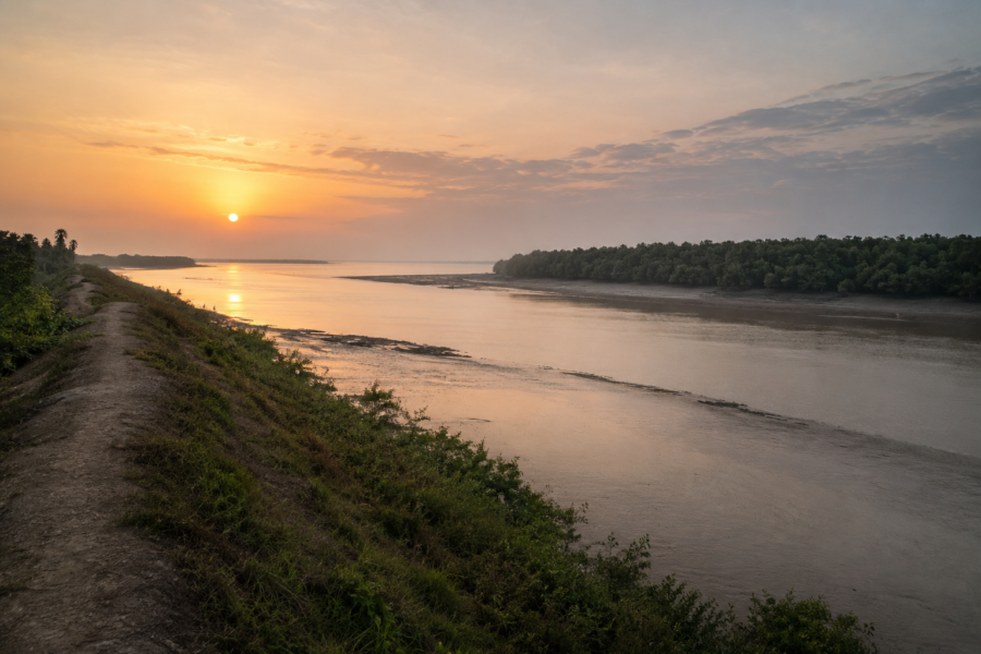
Before sunrise, the river looked unfinished.
The eastern horizon above the lower delta carried only a faint bruise of silver light while the channels of the northern Sundarbans remained black and tidal, breathing invisibly beneath the hull of the wooden boat. Somewhere ahead lay Kumirmari — an inhabited island balanced between river and reserve forest, between cultivation and salinity, between survival and slow erosion.
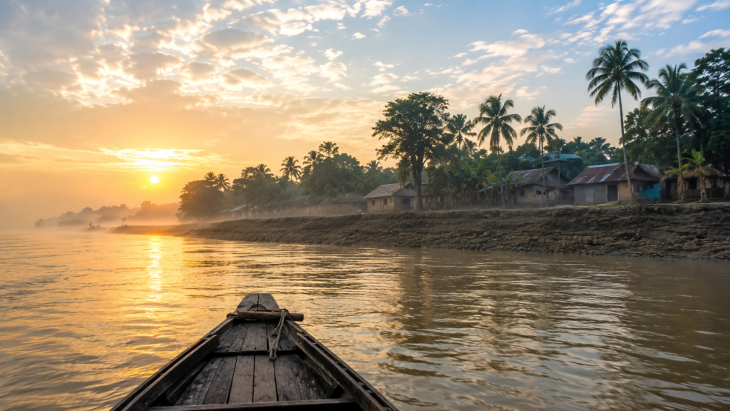
The boatman cut the engine near a bend where the water widened into an estuarine sheet of shifting current. In the half-darkness, mangrove silhouettes stood low against the sky like smoke rising from mudbanks. A flock of egrets lifted suddenly from the exposed charlands. Their wings flashed white for a moment and vanished again into the tide haze.
Nobody aboard spoke much.
In the Sundarbans, morning journeys often begin in silence because the river demands listening first.
- Engines fail.
- Embankments collapse.
- Tides reverse unexpectedly.
- Storms arrive from nowhere visible.
The people who travel these waters inherit caution long before they inherit geography.
As dawn slowly entered the delta, Kumirmari emerged not dramatically but gradually — a horizontal island appearing through embankments, palms, mud ghats, shrimp ponds, and scattered houses raised slightly above flood level.
There were no cliffs, no monumental arrival points, no theatrical shoreline. Like most inhabited islands of the Indian Sundarbans, Kumirmari revealed itself in fragments.
- A bamboo jetty leaned unevenly over the water.
- Smoke rose from cooking fires.
- Children in school uniforms walked along the embankment ridge.
Farther inland, the tops of coconut trees caught the first sunlight.
And beyond them all, somewhere southward across the rivers and creeks, began the darker geography of tiger country.
Kumirmari belongs to the Gosaba region of the Indian Sundarbans in South 24 Parganas district of West Bengal, part of the vast tide-shaped delta where land itself remains temporary. Yet unlike many islands that dissolve into the wider identity of the Sundarbans, Kumirmari possesses a distinct character shaped by isolation, cooperative rural systems, fragile embankments, fisheries, and its long relationship with the bordering forest landscape.
The island does not announce itself loudly. Its identity emerges slowly through water routes, labor rhythms, and the visible negotiations between people and tide.
By the time the sun finally rose over the river, the embankments had already begun filling with movement.
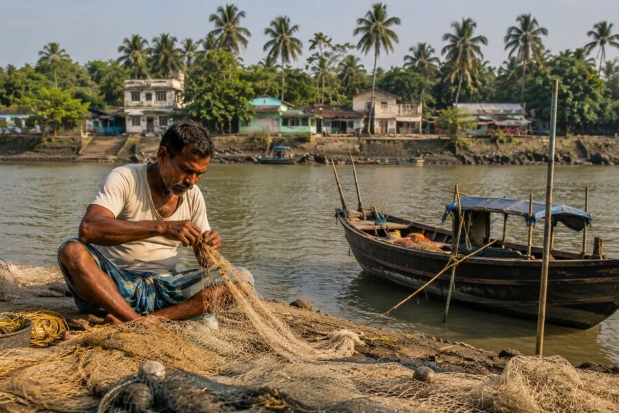
Men walked toward fishing boats carrying rolled nets over their shoulders.
Women washed utensils beside ponds reflecting pale morning light.
A tea stall near the ghat played an old Bengali song through a weak speaker while two ferry passengers argued over tide timings.
The island was awake.
And like every inhabited island of the lower delta, Kumirmari’s day had begun according to the river’s permission.
First Encounter
The first sensation upon stepping onto Kumirmari is not wilderness.
It is edge.
Everything here feels positioned at a threshold — between freshwater and salinity, settlement and forest, permanence and erosion. The embankments form the island’s psychological spine. People walk them constantly because they are roads, flood barriers, observation platforms, and social spaces all at once.
From the arrival ghat, narrow earthen paths branch inward through clustered settlements. The houses change gradually from brick structures with painted walls to mud-plastered homes roofed in tin or thatch. Courtyards hold fishing nets hung for drying beside stacks of firewood protected under plastic sheets during monsoon months. Ducks move through puddled lanes. Goats wander beneath banana trees.
Kumirmari does not possess the compressed density of a mainland settlement. Villages spread themselves according to the logic of embankments, ponds, agricultural plots, canals, and tidal safety. Human habitation follows water carefully here.
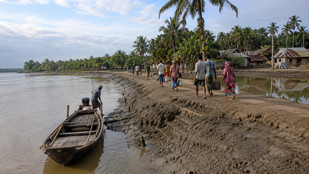
The island’s landscape appears deceptively calm in winter light. Yet almost every visible structure carries some relationship to environmental uncertainty.
- The ponds are rainwater reservoirs.
- The raised pathways anticipate flooding.
- The mangrove fringes attempt to slow erosion.
- The boats remain tied facing the tide.
Even silence on the island often feels temporary.
To the south and southeast, waterways begin threading toward reserve forest zones associated with the larger Sundarbans ecosystem. Fishing routes and crab-collection channels connect inhabited islands with forest-edge livelihoods that have sustained generations despite increasing restrictions and ecological pressures.
At several points along the embankment, erosion scars interrupt the greenery. Fresh mudslides expose roots dangling over tidal water. In some stretches, concrete reinforcement appears beside older earthen sections repaired repeatedly after cyclones.
The island carries visible memory.
Not through monuments.
Through repairs.
Island Identity
Kumirmari’s identity is inseparable from water management and survival at the frontier of the inhabited Sundarbans.
Administratively, the island lies within Gosaba Block of South 24 Parganas district in West Bengal and functions unusually as a single Gram Panchayat associated with one island settlement structure. Researchers and development studies have repeatedly noted this administrative singularity because it reduces internal jurisdictional fragmentation common elsewhere in the delta.
Yet statistics alone explain very little about Kumirmari.
The island is better understood as a river-bound agrarian-fishing settlement shaped by isolation.
Unlike the more frequently traversed tourist-facing islands nearer major transport corridors, Kumirmari still retains the slower tempo of a working delta island. Tide schedules remain more important than clock time in many daily decisions. Boats continue functioning as economic lifelines rather than recreational symbols. Agricultural fields coexist with saline intrusion anxiety. Canals are not scenic features; they are infrastructure.
According to documented local development studies, the island contains thousands of households, many with access to ponds and cultivable plots that support inland fisheries and seasonal agriculture. Numerous excavated canals across the island form part of cooperative and livelihood systems tied closely to local survival economies.
Walking inland during early morning reveals how carefully the settlements are arranged around water bodies. Ponds occupy central positions beside homes because freshwater storage remains essential in a saline landscape. Coconut trees lean over narrow embankment roads. Small shrines appear beneath banyan trees where travelers pause before journeys toward forest-side rivers.
The island’s dominant identity is neither purely agricultural nor purely riverine.
Kumirmari is best understood as a climate frontier settlement — a lived boundary between human persistence and ecological instability.
That identity shapes everything:
- The architecture
- The occupations
- The folklore
- The routes of migration
- The caution in conversation
- The dependence on tides
- The recurring memory of storms
Even the island’s name carries reptilian echoes. “Kumir” in Bengali refers to crocodile — a reminder that the waterways surrounding these islands historically belonged first to estuarine predators long before embankments and settlements altered the delta.
Whether the name emerged from crocodile abundance, older local associations, or oral naming traditions remains uncertain. But the river still preserves the possibility.
The Rivers That Shaped The Island
No island in the Sundarbans can be understood independently of its rivers.
- Land here is secondary.
- Water decides nearly everything.
Kumirmari exists within the tidal architecture of the lower Gangetic delta where rivers continuously redraw boundaries through erosion, siltation, saline intrusion, and seasonal flooding. The surrounding waterways do not merely border the island; they produce it repeatedly.
Throughout the day, the rivers change color with tide and light.
- At dawn they appear metallic gray.
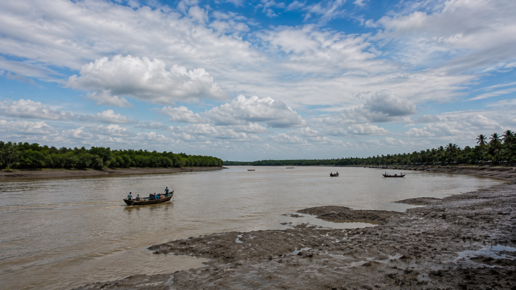
- By noon they become opaque brown-green with suspended silt.
- At sunset they turn copper beneath fishing boats returning inland.
- And during storms they lose all distinction between river and sky.
The channels surrounding Kumirmari connect the island to neighboring settlements, reserve forests, fishing grounds, ferry routes, and eventually the Bay of Bengal itself. These waterways historically enabled migration, trade, forest extraction, fishing movement, and administrative penetration into the delta during colonial reclamation periods.
Yet the rivers also isolate.
- A missed tide can suspend movement for hours.
- Medical emergencies become logistical calculations.
- Cyclones transform transport routes into danger corridors.
In many parts of the Sundarbans, roads end where rivers begin. On Kumirmari, rivers are the roads.
- Small ferry crossings shape everyday geography.
- People discuss routes in relation to ghats rather than highways.
- Distances are measured not only in kilometers but in tidal timing, current strength, and seasonal navigability.
The island’s canals deserve equal attention.
These narrow excavated waterways cut through settlements and agricultural sections like secondary circulatory systems.
Some support inland fisheries through cooperative management arrangements documented in local development studies. Others function primarily for drainage, irrigation support, or seasonal water retention.
Standing beside one of these canals in late afternoon reveals another rhythm of island life.
- Children fish using improvised bamboo rods.
- Women wash vegetables at stepped mud edges.
- Kingfishers wait silently above the waterline.
- Crabs disappear sideways into holes beneath exposed roots.
The canal water rises and falls with distant tidal influence even when the main rivers remain out of sight.
Everything here is connected hydrologically.
And because of that connection, every environmental shift elsewhere in the delta eventually arrives at Kumirmari.
- Salinity travels inward.
- Cyclonic surges push upriver.
- Erosion migrates bank by bank.
Climate change enters quietly through water chemistry before it becomes visible in landscape. The people of Kumirmari understand rivers not romantically but behaviorally.
A river is judged by:
- Its erosion pattern
- Its fish yield
- Its tidal violence
- Its navigability after monsoon
- Its behavior during cyclones
The rivers are not scenery. They are temperament.
Historical Footprints
By midmorning, the winter fog had completely lifted from the embankments, exposing long stretches of cultivated land broken by ponds and clusters of settlement. From a distance, Kumirmari can appear older than it is because delta islands accumulate memory quickly.
- Every embankment repair looks ancient after one monsoon.
- Every cyclone creates a before-and-after history.
Like much of the inhabited Indian Sundarbans, Kumirmari emerged through layered histories of reclamation, migration, forest clearance, and fragile settlement expansion. Earlier versions of these islands were heavily forested tidal landscapes where mangroves dominated riverbanks and wildlife movement extended across territories that later became agricultural zones.
Systematic human settlement intensified during colonial periods when the British administration expanded revenue-oriented reclamation projects across parts of the Sundarbans. Forest tracts were leased, embankments constructed, and laboring communities encouraged or compelled to clear sections of mangrove terrain for cultivation.
But reclamation in the Sundarbans was never straightforward conquest over wilderness.
- The delta resisted continuously.
- Embankments breached.
- Salinity destroyed crops.
- Malaria spread through swamp zones.
- Tigers moved through settlement edges.
- Storm surges erased months of labor overnight.
To settle islands like Kumirmari required not only engineering but endurance.
Generations of settlers transformed unstable mudflats into habitable land through collective labor — excavating ponds, raising homesteads, cutting canals, and building embankments repeatedly after seasonal destruction. The island visible today is therefore not merely geographical land; it is accumulated human effort layered over tidal uncertainty.
Migration shaped this landscape profoundly.
Communities arriving from different parts of Bengal brought agricultural knowledge, fishing techniques, religious practices, river beliefs, and localized survival strategies suited gradually to estuarine life. Over decades, these diverse settlement histories fused into the distinct social ecology now associated with inhabited Sundarban islands.
The memory of Marichjhapi also lingers quietly across this region.
Though geographically distinct, the nearby history of refugee settlement and violent displacement in the Sundarbans during the late twentieth century remains embedded within broader regional consciousness. Nearby river corridors and forest-edge zones around Kumirmari intersect with landscapes historically associated with migration struggles, administrative conflict, and contested belonging in the delta frontier.
Even today, conversations about land often carry undertones of insecurity.
- An embankment breach can erase ownership boundaries.
- River erosion can consume ancestral plots.
- Cyclones can force temporary migration toward mainland districts.
Nothing in the delta feels guaranteed permanently. Yet despite uncertainty, settlement deepened.
- Schools appeared.
- Markets expanded.
- Religious institutions stabilized community life.
- Fishing cooperatives emerged.
Women’s agricultural participation increased through changing livelihood systems.
And slowly, Kumirmari evolved from a vulnerable reclamation settlement into a living inhabited frontier of the Indian Sundarbans — still fragile, still isolated in many ways, but deeply rooted in the tidal geography that once resisted human presence entirely.
By afternoon, the embankments shimmer under winter heat.
- A fishing boat moves downriver toward narrower creeks.
- Somewhere beyond the visible horizon lies reserve forest.
But on Kumirmari itself, history survives not in archives alone.
It survives in repaired mud walls, saline fields, cyclone stories, and the stubborn continuity of people who continue living where the rivers never stop negotiating with land.
Historical Personalities & Transformations
By late afternoon, the island’s pace changes almost imperceptibly.
The harshness of noon light softens over the ponds.
Nets drying beside courtyards cast long angular shadows across earthen lanes.
Schoolchildren return in small groups along the embankments, their uniforms dusted with pale river mud.
Near a tea stall overlooking a narrow canal, older men sit on wooden benches discussing embankment repairs, fish prices, and politics with the slow seriousness common to delta islands where every administrative decision eventually becomes environmental reality.
Kumirmari’s transformations have rarely arrived through dramatic historical events alone. More often, change here has emerged gradually through cooperative effort, local leadership, river management, agricultural adaptation, and the recurring need to survive ecological instability.
The island’s social history is deeply tied to the wider development trajectory of Gosaba and the northern inhabited Sundarbans. During the early twentieth century, the broader region experienced experiments in rural reconstruction, cooperative organization, embankment management, and agricultural settlement associated with Scottish entrepreneur and social reform figure Sir Daniel Hamilton, whose influence across Gosaba shaped local administrative and cooperative structures in lasting ways.
Sir Daniel Hamilton Hamilton’s initiatives encouraged systems of cooperative credit, farming organization, and localized governance that influenced settlement culture across several islands of the region.
Though Kumirmari retained its own distinct identity, the island developed within this wider historical atmosphere of experimentation in delta settlement and cooperative rural life.
Even today, traces of that collective mentality survive in practical forms.
- Fishing activities often depend upon shared labor.
- Canal management requires cooperation.
- Embankment protection becomes impossible without community participation.
Cyclone recovery frequently begins not through distant administration but through neighboring households rebuilding together.
Transformation here is rarely individual.
It is tidal and collective.
Walking farther inland reveals another layer of change visible across many inhabited Sundarban islands: the gradual transition from purely subsistence-based livelihoods toward diversified survival economies.
Small shops selling packaged goods now stand beside traditional rice storage structures.
Solar panels appear above homes where electricity once remained unreliable.
Younger residents increasingly travel toward mainland towns for education or work opportunities while older generations continue maintaining agricultural and fishing practices adapted to delta life.
Migration has become one of Kumirmari’s quieter historical forces.
The island sends labor outward seasonally and permanently — toward Kolkata, Kerala, construction corridors, fisheries, factories, and urban service economies.
Yet departures never entirely sever connection with the island. Families remain tied through remittances, agricultural obligations, ritual visits, and cyclone seasons when returning home becomes both emotional and practical necessity.
Women’s roles have also transformed significantly over time.
Across the Sundarbans, environmental pressure and economic instability have altered household labor structures, increasing women’s participation in fisheries-related work, livestock care, self-help groups, agricultural management, and local market systems. Development studies from the region repeatedly note the importance of women’s collective participation in sustaining rural resilience within fragile island economies.
Yet Kumirmari’s transformations remain uneven.
- Modernization arrives selectively here.
- Mobile phones coexist with kerosene lamps during power interruptions.
- Digital payments appear in markets still governed by tide schedules.
- Government schemes reach some embankments sooner than others.
And beneath every social transition remains the permanent environmental uncertainty of island existence. The rivers continue setting limits.
Folklore & Legends
As evening approaches, conversations on the island become more reflective.
- Stories emerge more easily after sunset in the Sundarbans.
- Partly because darkness here still carries ecological meaning.
- And partly because rivers alter imagination.
In Kumirmari, as across much of the delta, folklore is inseparable from landscape. Religious beliefs, forest traditions, tidal fears, and survival ethics overlap constantly with daily life. The boundaries between spiritual narrative and environmental memory often remain intentionally blurred.
The most enduring presence in the cultural imagination of the Sundarbans is Bonbibi — the forest protector revered across Hindu and Muslim communities throughout the delta. Her stories travel through fishing villages, honey-collecting communities, forest-edge settlements, and river routes linking inhabited islands with reserve forest territories.
Bonbibi is not worshipped here as a distant divine abstraction. She is invoked operationally.
- Before entering dangerous creeks.
- Before fishing journeys.
- Before forest collection expeditions.
- Before navigating uncertain rivers during storm periods.
In many Sundarban communities, Bonbibi represents moral balance between human need and forest power — a reminder that survival in the delta requires restraint, humility, and respect toward forces larger than human ambition.
Her counterpart in many narratives is Dakshin Ray, frequently associated with tiger power, wilderness authority, and the dangerous unpredictability of the forest world.
Even in islands like Kumirmari, where daily life unfolds largely within settled agricultural landscapes, the psychological influence of tiger-country folklore remains strong because the forest never feels entirely distant. River routes connect villages to creeks where encounters with wildlife historically occurred. Stories travel faster than geography in the delta.
An elderly fisherman near the embankment described the forest simply: “The river changes voice near the jungle.”
He did not elaborate further. In the Sundarbans, people often describe ecological danger indirectly.
The stories surrounding river spirits, vanished boats, tidal disappearances, and protective rituals vary from village to village.
- Some accounts speak of unusual lights over creeks during storm seasons.
- Others describe locations where currents behave unpredictably.
- Certain stretches of water acquire reputations over generations, especially near erosion-prone banks or dangerous tidal junctions.
What matters anthropologically is not whether every story can be historically verified. What matters is that folklore functions as ecological memory.
- Warnings become legends.
- Navigation lessons become rituals.
- Environmental fear becomes narrative tradition.
The folklore of the Sundarbans evolved partly because the landscape itself remains difficult to control or fully explain.
- Cyclones arrive suddenly.
- Rivers shift course.
- Animals disappear without trace.
- People vanish during fishing expeditions.
- Storm tides erase familiar landmarks overnight.
Under such conditions, storytelling becomes another survival system.
Near several homes on Kumirmari, small shrines dedicated to Bonbibi stand beside household courtyards or embankment paths. They are often modest structures — painted images protected beneath tin coverings, decorated during ritual occasions with flowers, cloth, incense, and candles. These shrines reveal how intimately spiritual practice remains tied to environmental uncertainty across the delta.
Religion in the Sundarbans is rarely isolated from ecology.
The forest enters prayer constantly.
Life Between The Tides
Long before sunrise the next morning, movement begins again across Kumirmari.
- A rooster calls somewhere behind the embankment.
- Boat engines cough awake in darkness.
- The first tea stalls light kerosene flames beneath aluminum kettles.
And from scattered courtyards comes the sound of metal utensils striking water drawn from ponds before the day’s heat arrives.
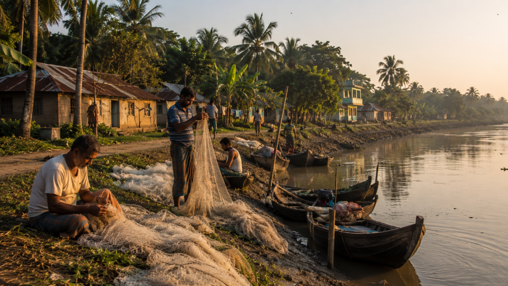
Life on Kumirmari unfolds according to tides, seasons, salinity, and labor cycles more than conventional urban schedules. Time behaves differently on islands where transport depends on rivers and weather can suspend normality without warning.
Fishing remains one of the island’s defining rhythms.
Along the ghats before dawn, fishermen prepare nylon nets carefully under dim battery lights. Some boats head toward wider estuarine channels while others move through smaller creeks connected to inland fisheries and tidal canals. Catch composition changes seasonally and economically. Fish, shrimp fry, crabs, and estuarine species all contribute differently to household survival across the year.
Crab collection has become increasingly significant in many parts of the Sundarbans economy due to export demand, though the work itself remains physically demanding and environmentally precarious. Collectors often navigate muddy creek systems under difficult conditions, balancing income opportunities against ecological risk and uncertain yields.
Agriculture survives here through adaptation rather than abundance.
Rice cultivation remains important where salinity permits, but farming conditions fluctuate constantly depending on rainfall, embankment integrity, and cyclonic intrusion. Saline water breaches can damage fields for extended periods, forcing shifts toward alternative livelihoods or seasonal migration. Across Kumirmari, agricultural plots appear fragmented by canals, ponds, shrimp enclosures, and elevated settlement ridges.
The household economy on the island is therefore rarely dependent upon one occupation alone.
- Fishing supports farming.
- Livestock supplements income.
- Migration supports household repairs.
- Women manage poultry, ponds, and small-scale economic activity.
- Children assist before and after school hours.
Survival becomes diversified because environmental stability cannot be guaranteed.
Near one settlement cluster, women spread fish for drying beside woven bamboo trays while discussing the previous monsoon’s river behavior. A child cycles past carrying schoolbooks tied with rope to the rear carrier. Two elderly men repair a net under the shade of a neem tree while listening to radio news about weather systems forming over the Bay of Bengal.
Even ordinary conversations eventually return to climate.
The Sundarbans trains people to monitor the sky continuously.
School life on Kumirmari reflects another important transformation within the delta. Educational aspirations have expanded significantly over recent decades despite infrastructural limitations. Schools function not only as learning spaces but also as cyclone shelters, social gathering points, and symbols of continuity in uncertain landscapes.
By late morning, school compounds fill with movement.
Children in blue-and-white uniforms gather beneath trees during breaks. Teachers travel from neighboring regions or nearby islands. During monsoon months, attendance patterns may shift depending on flooding or transport disruption.
Education here often carries migration dreams alongside literacy itself.
Many younger island residents grow up balancing emotional attachment to the delta with awareness of limited economic opportunities within it.
Yet departure is never simple.
The island remains inside people long after they leave.
Walking Through The Villages
Walking through Kumirmari requires slowing down.
The island does not reveal itself quickly to hurried movement.
The villages unfold gradually along embankment roads, pond edges, narrow lanes, and shaded courtyards where domestic life remains partially visible from the outside. Unlike urban settlements defined by walls and enclosure, village spaces here often feel porous. Conversations drift outward. Cooking smells travel through lanes. Fishing gear occupies public space.
Homes vary according to income, flood history, and access to resources.
Some houses stand elevated on brick foundations reinforced after cyclone damage. Others remain mud-plastered with carefully maintained earthen floors cool beneath bare feet during summer heat. Tin roofs dominate many stretches of settlement because they withstand seasonal rain more effectively than older thatch structures, though they also amplify monsoon sound dramatically.
- Courtyards are central social units.
- Rice dries there during harvest seasons.
- Children study there beneath evening light.
- Fishing nets are repaired there.
- Guests are received there.
- Religious rituals unfold there.
Nearly every courtyard contains evidence of adaptation: raised storage, covered firewood, water containers, storm preparation materials.
Ponds occupy equally important positions within village geography. In the saline environment of the Sundarbans, freshwater ponds become essential domestic infrastructure supporting washing, cooking, bathing, fish cultivation, and partial drinking-water systems. Their surfaces mirror changing skies across the day while ducks move through floating vegetation at the edges.
Temples and mosques appear throughout the island not as monumental architecture but as integrated components of everyday settlement life.
- Small Kali temples stand beneath banyan trees decorated with marigold garlands.
- Mosque loudspeakers carry evening prayer calls softly across ponds and fields.
Religious coexistence in the Sundarbans historically evolved through shared environmental dependence as much as through abstract ideology.
The tea stalls reveal the island’s social pulse most clearly.
These small roadside structures function simultaneously as cafés, news exchanges, political forums, weather stations, ferry-information centers, and communal observation posts. Fishermen, farmers, students, traders, and travelers gather there repeatedly through the day.
At one stall beside the embankment, a handwritten notice warned about expected high tide conditions later in the week.
Nobody ignored it.
On islands like Kumirmari, environmental information circulates socially before it becomes official.
Markets emerge periodically in open spaces beside transport routes and ferry points. Vegetables arrive from cultivated plots. Fish glisten beneath crushed ice transported from mainland sources. Plastic goods, clothing, batteries, medicine packets, fishing hooks, and mobile recharge cards appear side by side in compressed commercial arrangements reflecting the hybrid economy of the modern delta.
Walking farther outward toward less densely settled stretches, the villages begin thinning gradually into agricultural sections interrupted by ponds and mangrove fringes. Palm trees lean over embankment edges. Egrets move through harvested fields. The smell of drying fish mixes occasionally with woodsmoke and tidal mud.
Nothing on Kumirmari feels entirely separated from the river.
Even inland silence carries traces of tide.
Sounds Of The Island
At dusk, Kumirmari becomes an island of sound.
Not loudness.
Layers.
The first layer belongs to birds returning toward mangrove edges and pond-side trees before darkness settles completely over the delta. Egrets call sharply above the canals. Mynas move noisily between rooftops. Somewhere farther away, a kingfisher breaks the silence with a sudden metallic cry above tidal water.
Then comes the sound of engines.
- Small fishing boats returning before night tide.
- Ferries approaching distant ghats.
- Water slapping repeatedly against wooden hulls.
The rivers never fall entirely silent in the Sundarbans because movement continues according to tides even after sunset.
Closer to the settlements, evening prayer calls drift across the island from mosques while temple bells ring from household shrines and roadside sanctuaries almost simultaneously. The sounds overlap gently above ponds reflecting fading light.
- Children continue playing along embankments until darkness deepens.
- Pressure cookers whistle from kitchens.
- Radio music escapes through open windows.
- Dogs bark intermittently at passing cyclists.
And beneath everything remains the softer environmental soundscape of the delta itself:
- Wind through palms
- Water entering canals
- Insects rising from wetlands
- Distant thunder over unseen rivers
During monsoon months, sound changes dramatically.
- Rain dominates architecture.
- Tin roofs become percussion instruments.
- Storm winds erase conversational distance.
Cyclonic nights replace ordinary village noise with the terrifying acoustics of embankment pressure, flying debris, and tidal water forcing itself inland.
Older residents can often identify approaching weather systems through changes in river sound long before official warnings arrive.
The Sundarbans trains listening as survival instinct.
Late at night, after most household lights disappear, Kumirmari enters another acoustic state entirely. The island quiets but never completely sleeps.
- Boat engines occasionally restart with the tide.
- Crickets intensify along wet embankments.
- Dogs react to movement invisible in darkness.
Somewhere beyond the inhabited landscape, the rivers continue moving toward the forest and sea.
And in that darkness, the island feels once again what it has always been:
a fragile human settlement listening carefully to water.
Wildlife Expedition
Before dawn, the southern edge of Kumirmari feels unfinished again.
Mist settles low over the canals while the tide pushes inward beneath mangrove shadows. The embankment paths remain empty except for a fisherman carrying a rolled net and a boy cycling toward the ghat with a crate of bait balanced behind him. Beyond the inhabited stretches of the island, the wider ecological world of the Sundarbans begins revealing itself gradually through movement rather than spectacle.
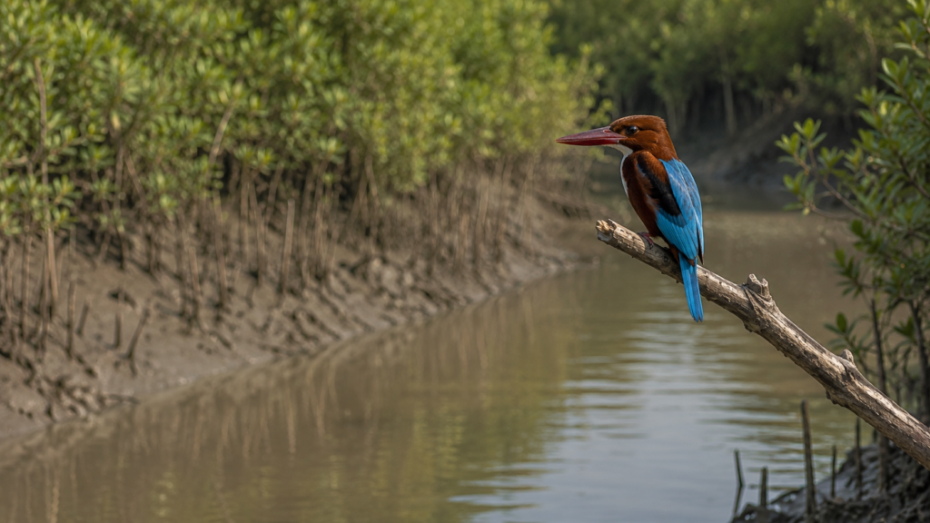
Wildlife here is rarely theatrical.
It appears in fragments:
- A ripple beside mudbanks
- Wingbeats above tidal flats
- Rracks along wet embankments
The sudden disappearance of something unseen into reeds.
Kumirmari exists within one of the most biologically significant estuarine landscapes on Earth — the greater Sundarbans mangrove ecosystem, recognized internationally for its extraordinary ecological complexity and its role as habitat for numerous bird species, estuarine reptiles, aquatic life, and the famous Bengal tiger populations associated with the reserve forests farther south.
Kumirmari itself is not deep forest territory.
It is something more delicate: an ecological interface.
Human settlement and wild estuarine systems overlap constantly here.
Along canals and pond margins, smaller life forms dominate the morning landscape.
- Mudskippers move across exposed banks like amphibious shadows.
- Fiddler crabs emerge from holes in enormous numbers after low tide, raising asymmetrical claws before vanishing again beneath wet sediment.
- Dragonflies hover above stagnant rainwater trapped near paddy fields.
- Weaver birds stitch nests into palms bending over the embankments.
The birdlife of the northern Sundarbans shifts seasonally with water levels, migration cycles, and tidal exposure. Around Kumirmari, common sightings include egrets, pond herons, kingfishers, cormorants, bee-eaters, black drongos, brahminy kites, and various wetland-associated species that use canals, fisheries, mudflats, and mangrove edges as feeding zones.
Winter migratory birds also appear periodically across sections of the delta where water conditions remain favorable.
- The kingfishers seem to dominate the visual rhythm of the island.
- White-throated kingfishers perch along electric wires above ponds.
- Pied kingfishers hover over tidal creeks before plunging vertically into water.
Common kingfishers flash blue through mangrove shade so quickly they seem almost imaginary.
For photographers and field naturalists, Kumirmari rewards patience rather than pursuit. Wildlife observation here depends upon slowing down enough to notice patterns in water movement, bird behavior, tide exposure, and vegetation transitions.
Mammals remain far more elusive.
Fishing cats are known across parts of the Sundarbans landscape, especially in wetland and mangrove-associated territories where fish-rich waterways intersect with human habitation. Otters historically occupied estuarine channels across the delta as well, though sightings have become increasingly uncommon in many regions due to habitat pressure and ecological disturbance.
Local conversations occasionally mention nocturnal movement near ponds or livestock enclosures, but reliable sightings remain rare and difficult to document.
The tiger exists here mostly as psychological geography.
Though Kumirmari itself is an inhabited island, the broader Sundarbans consciousness never entirely separates from tiger territory. Stories travel through boat routes and fishing communities. News of encounters elsewhere spreads quickly across islands. Forest-edge workers continue carrying inherited caution toward creeks and reserve zones where the ecological authority of the tiger remains absolute.
Even absence becomes presence in the Sundarbans.
The rivers remember what the villages avoid discussing casually.
Near one muddy creek branching away from the settlement edge, fresh bird tracks covered nearly every exposed surface after low tide. Tiny feeding marks patterned the sediment beside crab holes and shell fragments. Overhead, a brahminy kite circled slowly in widening loops while the incoming tide erased evidence of movement minute by minute.
By noon, much of the visible wildlife retreats from exposed heat.
But the delta itself remains intensely alive.
- Beneath the water: juvenile fish move through tidal channels.
- Inside the mud: crabs aerate sediment constantly.
- Within the mangroves: roots trap nutrients and stabilize fragile shorelines.
The ecosystem functions continuously even when the surface appears still. That hidden activity is the true pulse of Kumirmari’s surrounding landscape.
Mangrove Chronicles
The mangroves do not begin suddenly.
They gather gradually at the edges of Kumirmari.
First come scattered salt-tolerant shrubs near eroding banks.
Then thicker vegetation appears beside tidal creeks where roots rise from mud like breathing structures.
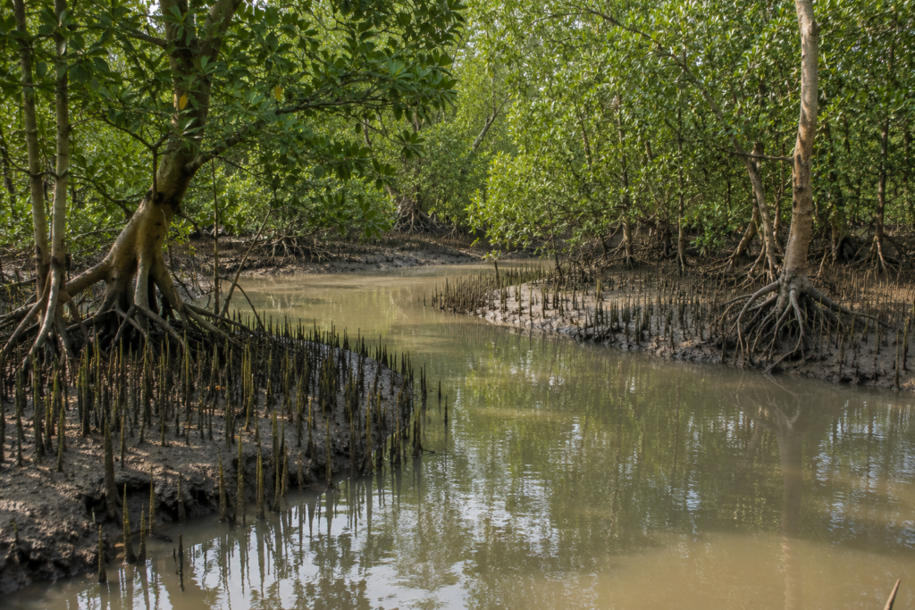
Farther outward, especially toward less inhabited sections and forest-facing waterways, the estuarine vegetation becomes denser, darker, and more recognizably Sundarbans in character.
Mangroves are not merely trees here.
- They are engineering systems.
- Storm barriers.
- Nurseries for aquatic life.
- Sediment stabilizers.
- Carbon reservoirs.
And for generations of island residents, they have also functioned as uneasy allies against the sea.
The Sundarbans contains one of the largest contiguous mangrove ecosystems in the world, with species adapted specifically to saline, tidal, oxygen-poor conditions.
Around Kumirmari, commonly observed mangrove-associated vegetation includes species such as gewa, goran, keora, sundari in broader regional contexts, and various salt-tolerant shrubs and grasses that occupy transitional estuarine terrain. Exact local distribution shifts constantly depending on salinity, erosion, embankment alteration, and human activity.
What defines mangroves visually is their relationship with mud.
Nothing here rises cleanly from solid ground.
Roots twist outward, arch upward, split sideways, anchor themselves repeatedly against unstable sediment.
The trees appear to negotiate survival rather than simply grow.
At low tide, the exposed mangrove floor resembles an anatomical structure more than a forest. Pneumatophores — the breathing roots adapted for oxygen intake in waterlogged soil — protrude upward through mud like thousands of dark spikes. Small crabs move among them in frantic bursts while tidal water retreats temporarily toward deeper channels.
The smell of mangroves is equally distinctive:
- Salt
- Decomposition
- Wet Bark
- Sediment
- Tidal Decay
Life recycling itself continuously.
For island communities like Kumirmari, mangroves have always represented contradiction. They protect shorelines from wave energy and cyclone impact.
Yet historically they also concealed danger:
- Tigers
- Snakes
- Difficult Terrain
- Malaria Zones
- Unpredictable Creeks
People clear them for land. Then replant them for survival.
After major cyclones across the Sundarbans, the importance of mangrove belts in reducing storm impact became increasingly visible through damaged and relatively protected zones.
Conservation groups and local communities have since participated in various mangrove restoration initiatives aimed at reducing erosion and strengthening ecological resilience in vulnerable embankment areas.
Along several stretches near Kumirmari, young mangrove plantations now stand beside repaired embankments — thin green lines attempting to slow future destruction.
Some survive.
Others disappear after the next severe tidal season.
Nothing ecological in the Sundarbans can be considered permanent.
Even the forests migrate.
Late afternoon light transforms the mangroves entirely. Their reflections lengthen across tidal creeks while birds return toward sheltered branches. Water rises quietly around exposed roots. Mudbanks disappear beneath incoming tide almost without sound.
And gradually the forest edge becomes unreadable again.
Explorer’s Field Notes
See it for yourself
A private journey shaped around you — your group, your pace, your interests. Book a free consultation.
Field Note: Winter Morning
Low tide exposes extensive mudflats beside secondary creeks northwest of the settlement edge.
- Bird activity intensifies immediately after tidal retreat.
- White egrets feed aggressively near shallow pools while smaller waders move along exposed sediment ridges.
- Air temperature remains cool until approximately midmorning before humidity rises sharply.
Field Note: Embankment Vegetation
Sections reinforced after cyclone damage show mixed vegetation recovery.
- Salt-tolerant grasses dominate recently repaired slopes.
- Older embankments support coconut, banana, and scattered mangrove-associated shrubs.
- Evidence of erosion visible beneath several tree root systems near outer bends.
Field Note: Human-Wildlife Interface
Domestic ducks frequently forage near tidal canals used by wild waterbirds.
Fish waste discarded near ghats attracts kites and crows rapidly.
Dogs react strongly to nocturnal movement near ponds, though no verified predator presence documented during observation period.
Field Note: Canal Ecology
Small tidal canals continue functioning as active ecological corridors despite proximity to settlement.
- Juvenile fish visible during rising tide phases.
- Mudskipper activity high along exposed sediment margins.
Plastic pollution present intermittently near denser habitation zones.
Field Note: Weather Sensitivity
Local conversation remains strongly weather-oriented even during calm conditions. Fishermen monitor wind direction continuously before departure. Tide discussion integrated into ordinary market and transport conversation throughout the day.
Field Note: Sound Before Rain
Prior to short winter rainfall, bird movement decreased noticeably and embankment wind intensified from the southeast. River surface texture altered visibly before precipitation began.
Nightfall On The Island
Night arrives differently in the Sundarbans.
Darkness does not descend evenly here. It rises from water first.
After sunset, the rivers surrounding Kumirmari begin losing definition while the embankments hold the final traces of fading light. Smoke from cooking fires hangs low above the settlements. Kerosene lamps appear inside courtyards beside intermittent electric bulbs powered through fragile lines vulnerable to storms and outages.
The island contracts inward after dark.
Daytime movement along embankments slows dramatically.
- Boats return earlier during uncertain weather conditions.
- Tea stalls close one by one.
- Conversations lower in volume.
- The rivers beyond visible settlement become psychologically larger at night.
Without urban light pollution, the sky over Kumirmari often opens with startling clarity during winter months. Stars appear above mangrove silhouettes while distant lightning occasionally flashes far beyond the visible horizon over the Bay of Bengal.
The sounds change first.
- Crickets intensify.
- Water becomes louder.
- Dogs bark unpredictably toward unseen movement.
- Boat engines echo farther across tidal channels.
Near the canals, frogs begin calling from flooded vegetation after humid evenings.
- Insects gather around exposed bulbs.
- Geckos emerge onto walls hunting moths drawn toward household lights.
Night fishing continues selectively depending on season and tide. From the embankment, distant lanterns sometimes drift across the river like floating embers moving through darkness. Those lights belong to fishermen navigating channels invisible from shore.
The island never entirely stops listening.
Cyclone memory has altered the psychology of darkness here.
Older residents often describe nights during storms not through visual imagery but through sound:
- Embankments Cracking
- Wind Entering Through Tin Roofs
- Trees Snapping
- Water Striking Walls
- People Shouting Through Rain
Even on calm evenings, that acoustic memory remains embedded in settlement life.
Around midnight, Kumirmari reaches its quietest state. Yet the silence is never complete.
The tide continues turning beneath the island.
The Seasons Of The Island
Kumirmari changes character completely across the seasons.
Winter arrives gently.
From November through February, the air becomes comparatively dry and cool by delta standards. Morning fog drifts over canals and agricultural fields while the sunlight remains softer and clearer than during humid summer months. This is the season when embankment walks feel longest, bird visibility improves, and the rivers carry a deceptive calmness.
Winter also brings relative mobility.
- Roads dry.
- Ferry conditions stabilize.
- Fishing patterns become more predictable.
Community events and repairs often intensify during these months because cyclone anxiety temporarily loosens its grip.
Spring enters briefly and almost unnoticed.
- Mango blossoms appear.
- Palms shift in color.
- Humidity begins returning through the afternoons.
- The island waits.
Summer in the Sundarbans is exhausting.
Heat gathers heavily over the embankments while ponds shrink and salinity pressures intensify in vulnerable zones. Tin-roofed homes trap afternoon temperature fiercely. Thunderstorms build suddenly over the delta, often collapsing just as rapidly after violent bursts of rain and wind.
- The rivers become harsher in summer light.
- White glare replaces winter softness.
- Mudbanks crack under exposed heat during low tide.
Monsoon transforms Kumirmari entirely.
The island becomes waterlogged, green, unstable, beautiful, and dangerous.
Rain enters every structure psychologically even when it does not physically flood them.
Embankments weaken gradually under saturation pressure.
- Transport slows.
- Canals overflow.
- Fish availability changes.
- Agricultural anxiety deepens.
- Children continue walking to school through flooded lanes.
- Boats become more necessary than roads in certain stretches.
And every storm cloud arriving from the south receives careful attention.
Post-monsoon months carry relief mixed with apprehension.
- Agricultural recovery begins where salinity damage remains manageable.
- Repair work intensifies.
- Markets regain rhythm.
Yet this is also cyclone season in the Bay of Bengal — the period when the delta watches weather bulletins most nervously.
On Kumirmari, seasons are never only climatic categories.
They are survival conditions.
Each season rearranges labor, mobility, food systems, water access, wildlife visibility, economic stability, and emotional atmosphere.
The island does not merely experience weather.
It reorganizes itself around it.
Cyclones And Survival
Every embankment on Kumirmari contains storm memory.
Some sections carry newer concrete reinforcement.
Others remain patched repeatedly with mud, sandbags, bamboo, and local labor after years of tidal assault. Walking these embankments means walking through a physical archive of survival.
The Sundarbans exists directly within one of the world’s most cyclone-prone coastal regions. Severe storms moving northward from the Bay of Bengal repeatedly strike the delta with destructive wind, storm surges, saline intrusion, and embankment failure.
For islands like Kumirmari, cyclones are not exceptional events.
They are recurring historical forces.
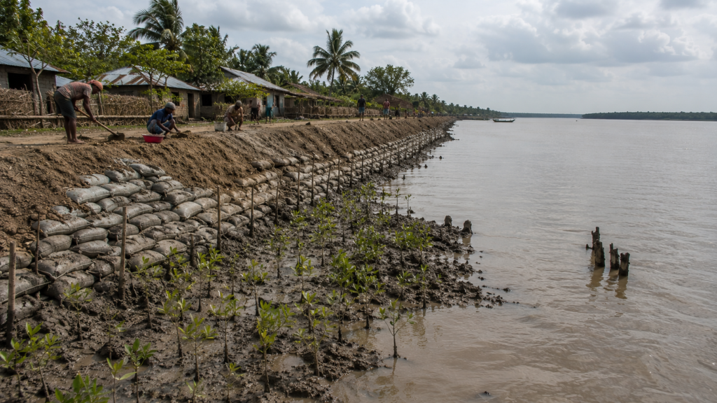
Older residents still distinguish storms by name and impact:
- Which embankments broke
- Which fields turned saline
- Which homes disappeared
- Which year boats were lost
- Which season food became scarce afterward
Cyclone Aila remains one of the defining environmental memories across the Indian Sundarbans. Massive embankment breaches allowed saline water to inundate agricultural land extensively, damaging livelihoods, homes, freshwater systems, and long-term cultivation capacity throughout affected regions.
More recently, Cyclone Amphan and Cyclone Yaas reinforced the vulnerability of the delta once again through destructive winds, flooding, and embankment stress across large sections of the Sundarbans.
The impact of cyclones extends far beyond immediate destruction.
- Salinity remains afterward.
- Agricultural recovery takes years.
- Migration increases.
- Debt deepens.
- Psychological exhaustion accumulates quietly.
Yet Kumirmari continues adapting.
- Cyclone shelters now play crucial roles during severe weather alerts.
- Community preparedness systems have improved compared to earlier decades.
- Mangrove restoration efforts attempt to strengthen ecological buffers.
- Raised housing structures appear more frequently in vulnerable stretches.
- Weather forecasts circulate rapidly through mobile networks and local administration systems.
Still, the fundamental uncertainty remains unresolved.
- Can embankments hold?
- Will the tide rise beyond prediction?
- How long can freshwater survive increasing salinity pressure?
The future of islands like Kumirmari increasingly depends upon questions larger than the island itself: sea-level rise, climate migration, delta erosion, changing cyclone intensity, and the long-term habitability of low-lying estuarine landscapes.
Yet at sunset, life continues normally again along the embankments.
- Children play cricket beside repaired flood barriers.
- Fishing nets dry in orange light.
- Women return from markets carrying vegetables and rice.
- Boatmen discuss tomorrow’s tide.
The island refuses catastrophe as permanent identity.
Kumirmari survives through repetition: repair, adaptation, memory, and return.
Ferry Routes & Hidden Paths
Morning returns to Kumirmari through the ferry ghats first.
Before the inland lanes fully awaken, movement already gathers near the river crossings. Tea sellers boil milk in blackened kettles beside bamboo stalls while passengers wait along muddy approaches carrying sacks of vegetables, fish containers, school bags, plastic drums, and occasionally entire bundles of household supplies tied with rope. Tide determines urgency. Nobody lingers casually when a ferry is preparing to leave.
Reaching Kumirmari has never been only about distance.
It is about sequence.
- Road
- Rail
- Launch
- Ferry
- Embankment
- Tide
The island remains connected to the mainland through the wider transport network of the Gosaba region and the northern Sundarbans. Travelers approaching from Kolkata generally move eastward toward the Canning corridor before continuing by road and river through ferry-linked island routes associated with Gosaba and neighboring settlements. The final approach toward Kumirmari always belongs to water.
The ferry crossings themselves reveal the true geography of the delta better than any map.
- Schoolteachers travel beside fish traders.
- Construction materials move beside livestock.
- Motorcycles balance precariously near baskets of shrimp fry.
- Conversations begin with tide schedules before names.
Thie routes change subtly according to season and river behavior. During monsoon months, crossings become slower and more uncertain as visibility decreases and currents intensify. Cyclone warnings can suspend movement almost entirely. Winter brings comparatively stable navigation, clearer skies, and calmer water surfaces that reflect the embankments like burnished metal during early morning.
Some paths into Kumirmari are barely visible to outsiders.
Narrow embankment tracks branch toward isolated fishing stretches. Small country boats move through tidal creeks connecting interior canals with wider estuarine channels. In several places, footpaths disappear temporarily beneath seasonal flooding before re-emerging along raised ridges between ponds and agricultural plots.
These hidden paths are not designed for exploration.
They exist because island life requires improvisation.
One embankment route curves beside a canal lined with mangrove shrubs before narrowing into a muddy passage where children cycle carefully single-file toward school. Another leads toward quieter stretches of riverbank where fishermen repair nets beneath temporary bamboo shelters while watching the tide reverse direction slowly across exposed mudflats.
The farther one walks from the busier ghats, the more the island reveals its layered relationship with movement.
Nothing here remains fixed permanently.
- A path usable in winter may disappear during monsoon.
- A ferry route may shift after erosion.
- A jetty may require rebuilding after cyclone damage.
Transport in the Sundarbans is always provisional.
And yet the island continues moving.
Photography Expedition Guide
Kumirmari rewards observational photography rather than dramatic spectacle.
The island is best photographed slowly.
Sunrise begins along the eastern embankments and river crossings where mist gathers over canals before lifting into pale gold light.
During winter mornings, the soft atmospheric haze creates long visual depth across ponds, palms, fishing boats, and distant mangrove lines.
The hours immediately after dawn are ideal for documenting working river life — ferries departing, fishermen preparing nets, women collecting water, and children walking along embankments before the day’s heat hardens the landscape.
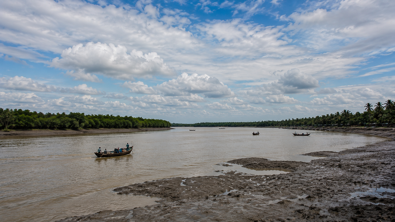
For river photography, low tide and incoming tide produce entirely different visual worlds.
At low tide:
- Mudbanks Emerge
- Bird Activity Intensifies
- Boats Tilt Unevenly Beside Ghats
- Crab Patterns Texture Exposed Sediment
At high tide:
- The Rivers Widen Visually
- Mangrove Reflections Deepen
- Embankments Appear Narrower Against Rising Water
Late afternoon provides the island’s richest human light. Courtyards soften beneath angled sunlight while smoke from cooking fires drifts through village lanes. This is the best time for photographing:
- earthen homes
- fishing-net repair
- local markets
- tea stalls
- ponds reflecting evening skies
- embankment movement
Wildlife photographers require patience more than equipment. Bird activity increases significantly near canals, fisheries, tidal creeks, and quieter mangrove edges during early morning and late afternoon. Kingfishers, egrets, kites, pond herons, and cormorants often appear near working waterways where human and ecological systems overlap continuously.
Monsoon photography transforms Kumirmari completely.
- Cloud structures become immense.
- Reflections dominate the landscape.
- Embankments narrow into thin elevated lines between flooded fields.
But monsoon work also demands caution because roads deteriorate rapidly and storms develop unpredictably over the delta.
Night photography on the island offers another dimension entirely. During clear winter evenings, low light pollution allows unusually visible star fields above silhouetted palms and rivers. Occasional fishing lamps moving across dark waterways create haunting compositions characteristic of the lower delta.
Yet the strongest photographs of Kumirmari rarely emerge from scenery alone.
They emerge from relationship:
- Between people and tide
- Between settlement and erosion
- Between routine and uncertainty
The island photographs best when observed as a living negotiation rather than an isolated landscape.
Expedition Notes
At The Wild Orbit, our every expedition is built around careful observation rather than simply reaching a destination. Before leaving Kumirmari, take a moment to look beyond the obvious.
What Makes Kumirmari Unique
- A climate-frontier island where daily life is shaped by tides, embankments, and changing river systems.
- One of the quieter inhabited islands of the northern Indian Sundarbans with an authentic working-island character.
- A landscape where fishing, farming, ferries, and mangroves coexist within a fragile estuarine ecosystem.
- A community that has repeatedly rebuilt after cyclones, erosion, and saline intrusion.
Observe Closely
Don’t just look—observe.
- Cyclone water marks on older houses.
- Repaired embankments showing layers of mud, bamboo, concrete, and vegetation.
- Freshwater ponds protected within a saline landscape.
- Fishing nets stitched and repaired over many seasons.
- Boats secured beside homes during cyclone-prone months.
- Bonbibi shrines quietly integrated into village life.
- Kingfishers, egrets, and Brahminy Kites using canals and riverbanks throughout the day.
Best Time To Explore
- Sunrise: Ferry ghats, village mornings, bird activity, mist over tidal rivers.
- Morning: Canal life, fishing preparations, embankment walks.
- Late Afternoon: Warm documentary light, returning fishing boats, village life.
- Sunset: River silhouettes, smoke rising from homes, peaceful embankment scenes.
Best Documentary Subjects
- Fishing communities preparing or repairing nets.
- Ferry movement connecting island settlements.
- Mangrove restoration along vulnerable riverbanks.
- Traditional ponds and rainwater storage systems.
- Children walking along embankments.
- Everyday conversations at roadside tea stalls.
- The interaction between people, rivers, and the changing tide.
The Wild Orbit Field Advice
- Walk slowly—the island reveals itself through details rather than landmarks.
- Respect local communities and photograph people only with permission.
- Carry drinking water and sun protection, especially during summer.
- Waterproof cameras and electronics during monsoon travel.
- Always follow local advice regarding tides, ferry schedules, and weather conditions.
- Leave no waste behind and avoid disturbing wildlife or mangrove habitats.
The Wild Orbit Perspective
Kumirmari is not defined by a single attraction.
Its true identity lies in the countless small moments—a repaired embankment, a fisherman reading the tide, a kingfisher waiting beside a canal, or the quiet resilience of a community living between river and forest. Those who slow down and observe carefully will understand the island far more deeply than those who simply pass through.
Connected Landscapes
Kumirmari cannot be understood alone.
Every island in the Sundarbans belongs to a wider hydrological and cultural network where rivers function as connectors rather than separators. Nearby islands, ferry crossings, reserve forest boundaries, fisheries, and embankment systems form an interconnected landscape continuously shaped by tide and human adaptation.
To the south and southeast, waterways gradually transition toward forest-dominated zones associated with the protected Sundarbans ecosystem.
- The psychological geography changes there even when the physical landscape appears similar.
- Human settlement thins.
- Mangrove density increases.
- River routes acquire stronger associations with fishing expeditions, forest permits, and wildlife caution.
Nearby inhabited islands share overlapping histories of reclamation, migration, cyclone recovery, and embankment dependence.
Gosaba remains the wider administrative and historical anchor of the region, associated with cooperative settlement history and transport connections across the northern Sundarbans.
The rivers linking these islands carry far more than passengers.
They transport:
- Stories
- Market goods
- Ritual practices
- Weather warnings
- Political news
- Ecological knowledge
Fishing communities move seasonally across multiple river corridors depending on yield and tidal conditions.
Market relationships tie smaller settlements to larger ferry nodes.
Students travel outward for education.
Migrant labor routes extend from these embankments toward distant Indian cities while emotional attachment continues pulling families back toward the delta during festivals and cyclone seasons.
Ecologically, Kumirmari participates in a larger estuarine corridor connecting mangrove habitats, aquatic breeding zones, migratory bird movement, and sediment systems extending across the Bay of Bengal deltaic network. Changes occurring upstream or downstream eventually influence the island through salinity, erosion, fisheries, and water flow patterns.
Nothing in the Sundarbans is environmentally isolated.
- A breached embankment elsewhere can alter river pressure locally.
- A cyclone crossing another district can still flood Kumirmari through tidal surge.
- A fisheries decline in one channel shifts pressure toward another.
The islands survive collectively even while appearing separate on maps.
At sunset from the embankment, neighboring landforms become silhouettes beyond widening water. Smoke rises faintly from distant settlements while ferries continue threading through channels between islands gradually disappearing into evening haze.
The landscape feels fragmented visually.
But hydrologically and culturally, it remains deeply connected.
Oral Histories
Older residents on Kumirmari often describe time through storms rather than years.
Before Aila.
After Amphan.
- The year the embankment broke near the southern canal.
- The monsoon when saline water entered the ponds.
- Memory follows environmental events.
One fisherman recalled how river routes changed during his lifetime: “Earlier, we knew the channels differently. Some are shallower now. Some banks vanished.”
Another resident described nights during major cyclones when entire families waited awake listening for embankment failure in darkness because once water entered the settlements, escape routes disappeared quickly.
Several elderly islanders still remember periods when transport remained far more limited than today.
- Medical emergencies required hours of boat travel regardless of weather.
- Kerosene lamps dominated village nights.
- Radios served as the only external connection during severe storms.
- Oral memory also preserves ecological change.
Older fishermen frequently speak about altered fish availability, increased salinity, stronger cyclonic patterns, and riverbank erosion accelerating across particular stretches of the delta.
Such observations align with broader environmental studies documenting the vulnerability of the Sundarbans to climate and hydrological change.
Yet nostalgia here remains complicated.
Life in earlier decades was often harsher physically: greater isolation, limited healthcare, lower infrastructure, and intense environmental exposure.
What older residents miss most consistently is not hardship itself but ecological predictability.
The rivers behaved more familiarly then.
At least that is how many remember them.
Oral histories on Kumirmari rarely separate personal memory from landscape memory because survival has always depended upon environmental interpretation.
Families remember:
- Where embankments failed
- Where ponds survived salinity
- Where boats sheltered during storms
- Where fields once produced rice before tidal intrusion altered the soil
The island stores history physically. People simply narrate what the rivers already remember.
Food Of The Island
By lunchtime, the smells moving through Kumirmari become unmistakably deltaic.
- Rice steaming inside kitchens.
- Fish frying in mustard oil.
- Green chilies crushed beside onions.
- Woodsmoke drifting low through humid air.
Food on the island emerges directly from water availability, fishing culture, seasonal agriculture, and economic practicality. Daily meals remain centered around rice accompanied by fish, vegetables, lentils, and locally available greens adapted to the climate and soil conditions of the lower delta.
Fish defines the culinary rhythm of Kumirmari.
Fresh catches vary according to season, river conditions, and fishing success: small estuarine fish, prawns, crabs, and occasionally larger river species sold through local markets.
Dry fish preparation remains important in some households, especially during periods of uncertain weather or fluctuating catch availability. The smell of drying fish near embankments becomes part of the island’s atmospheric identity during certain seasons.
Mustard dominates flavor.
So does salt.
The cuisine reflects both Bengal’s culinary traditions and the realities of estuarine life where preservation, practicality, and intense flavors matter.
Crab preparation has grown economically significant due to commercial demand, though not every household consumes what it collects. Export-oriented fisheries often separate livelihood from diet.
Vegetable cultivation changes seasonally depending on salinity and rainfall conditions. Gourds climb bamboo frames beside homes. Pumpkin, eggplant, spinach, and seasonal greens appear in household plots where soil conditions permit cultivation.
Tea structures the day socially.
- Morning tea before fishing departures.
- Afternoon tea beside ferry ghats.
- Evening tea during storm discussions.
The tea stalls serve heavily sweetened milk tea poured into glass cups or small earthen vessels while conversations drift between politics, weather, migration, and river conditions.
During festivals and ritual occasions, the food landscape changes again: rice sweets, coconut preparations, fried snacks, community cooking, and ceremonial offerings linked to religious observance.
But everyday island food remains rooted in labor.
Meals must sustain physical work under humid conditions where fishing, farming, transport, and embankment repair demand continuous energy.
The cuisine of Kumirmari is therefore not ornamental. It is tidal survival translated into flavor.
Island Economy
Kumirmari’s economy rests upon diversification because no single livelihood remains environmentally secure for long in the Sundarbans.
- Fishing supports households seasonally.
- Agriculture survives where salinity allows.
- Migration supplements local income.
- Small trade circulates through ferry-linked markets.
- Government employment schemes provide intermittent support.
And increasingly, younger generations seek economic futures beyond the island itself.
Fishing remains one of the strongest economic foundations. River fisheries, inland ponds, shrimp-related activities, and crab collection all contribute differently across seasons and household structures. Yet fishing has become more uncertain due to ecological pressure, changing river conditions, fuel costs, and environmental regulation linked to protected forest areas.
Agriculture persists through adaptation rather than stability. Salinity intrusion following cyclones can damage cultivation for extended periods, forcing families toward alternative work or temporary migration. Embankment integrity therefore influences not only safety but the entire agricultural economy.
Migration has become deeply integrated into household survival systems.
Young men — and increasingly broader sections of the working population — travel toward cities and distant states for labor in construction, factories, hospitality, fisheries, and urban service industries.
Remittances support: house repairs, education, medical costs, and cyclone recovery.
Yet migration also alters social structure.
- Elderly parents remain behind.
- Women manage households independently for long periods.
- Village demographics fluctuate seasonally.
Local markets reveal the hybrid nature of the island economy most clearly.
Traditional fishing equipment is sold beside mobile accessories.
Solar products appear near agricultural supplies.
Plastic water containers, packaged snacks, medicines, engine parts, and school materials circulate together through compressed trading spaces tied closely to ferry movement.
Tourism exists only lightly compared to more commercially visible parts of the Sundarbans. Kumirmari still feels primarily like a working island rather than a curated destination. That relative absence of mass tourism preserves much of its lived rhythm but also limits economic diversification opportunities available elsewhere.
The island economy remains fundamentally ecological.
- When the rivers suffer, the markets suffer.
- When embankments fail, migration increases.
- When salinity rises, debt follows.
Everything remains connected through water.
Then & Now
Older photographs of the northern Sundarbans often show wider mudbanks, fewer concrete structures, denser tree cover in some stretches, and thinner embankments vulnerable to even moderate storms.
Kumirmari has changed visibly across decades.
- Electricity expanded gradually.
- Schools improved.
- Roads strengthened in places.
- Mobile communication transformed emergency response and migration networks.
- Cyclone preparedness became more organized.
Yet environmental vulnerability also intensified.
Residents repeatedly describe stronger cyclones, unpredictable rainfall patterns, embankment stress, and increasing salinity pressures affecting both agriculture and freshwater systems. Scientific assessments of the Sundarbans similarly identify the delta among the world’s most climate-vulnerable low-lying coastal regions.
The landscape itself appears more engineered now: concrete embankments, reinforced roads, solar infrastructure, plastic water storage, motorized transport.
But despite these changes, Kumirmari remains deeply tidal at its core.
- The rivers still determine movement.
- Storms still reorganize life.
- Migration still shapes household economies.
And the island continues balancing between resilience and uncertainty. What has changed most may be awareness.
People on Kumirmari increasingly understand that environmental instability is no longer temporary interruption but part of the island’s future trajectory.
Yet daily life continues with remarkable normality.
- Rice dries in courtyards.
- Children walk to school.
- Boats leave before dawn.
- Tea stalls fill at dusk.
The delta survives through continuity even while changing.
The Wild Orbit Quick Facts
- Location: Kumirmari Island, Gosaba Block, South 24 Parganas, West Bengal, India
- Region: Indian Sundarbans
- Landscape Type: Inhabited estuarine delta island
- Dominant Identity: Climate-frontier settlement
- Primary Ecosystem: Mangrove-estuarine tidal landscape
- Primary Livelihoods: Fishing, agriculture, crab collection, and migrant labour
- Key Environmental Challenges: Cyclones, erosion, salinity intrusion, and embankment breaches
- Wildlife Highlights: Wetland birds, kingfishers, estuarine fauna, mangrove biodiversity
- Best Season to Explore: November to February
- Best Time for Wildlife & Birdwatching: Early morning and late afternoon
- Photography Highlights: Embankments, ferry ghats, tidal rivers, mangrove edges, village life, and golden-hour landscapes
- Ideal For: Birdwatchers, wildlife photographers, naturalists, documentary travellers, and slow explorers
The Wild Orbit Expedition Snapshot
Accessibility: Moderate
Reachable by a combination of road and ferry, with travel influenced by tides and seasonal weather.
Wildlife Potential: High
Excellent for observing estuarine ecology, wetland birds, mangrove habitats, and tidal biodiversity.
Photography Potential: Exceptional
Ideal for documentary, landscape, wildlife, and cultural photography throughout the year.
Cultural Experience: Rich
Authentic fishing villages, Bonbibi traditions, ferry culture, and resilient island communities.
Historical Significance: High
Reflects the Sundarbans’ history of settlement, reclamation, cooperative development, and climate adaptation.
Explorer Experience: Peaceful
Away from the ferry ghats, Kumirmari offers a quiet, immersive atmosphere ideal for slow exploration and observation.
The Wild Orbit Explorer Connections
Travelers exploring Kumirmari naturally encounter broader Sundarbans themes:
- Tidal ecology
- Embankment survival
- Mangrove restoration
- Cyclone adaptation
- Ferry-linked culture
- Estuarine livelihoods
- Bonbibi traditions
- River migration histories
Nearby islands and connected waterways reveal how settlement networks survive collectively across the delta despite geographical fragmentation.
The island also connects conceptually to:
- The wider Sundarbans Biosphere Reserve
- Bay of Bengal cyclone systems
- Climate migration discussions
- Mangrove conservation efforts
- Delta anthropology
- Riverine cultures of Bengal
Kumirmari is not an isolated destination. It is part of one of the world’s most fragile living landscapes.
FAQs
What is Kumirmari known for?
Kumirmari is known as an inhabited Sundarbans island shaped by fishing culture, embankment life, mangrove-edge ecology, and climate-frontier survival within the Gosaba region.
Where is Kumirmari located?
The island lies in Gosaba Block of South 24 Parganas district in West Bengal within the Indian Sundarbans delta.
Is Kumirmari inside the Sundarbans forest?
No. Kumirmari is an inhabited island connected ecologically and culturally to the wider Sundarbans landscape but not itself a core reserve forest zone.
What kind of landscape does Kumirmari have?
The island consists of embankments, ponds, tidal canals, agricultural plots, ferry ghats, and mangrove-associated estuarine terrain.
Which rivers surround Kumirmari?
Kumirmari is surrounded by tidal estuarine waterways connected to the larger river systems of the northern Sundarbans delta.
Can tigers be found near Kumirmari?
Tiger presence is associated primarily with reserve forest regions farther south, though tiger consciousness remains deeply embedded in local culture and folklore.
What wildlife can be seen on Kumirmari?
Birdlife, estuarine species, mangrove ecology, crabs, mudskippers, and wetland fauna are commonly observable.
Is Kumirmari good for bird photography?
Yes. Early morning and late afternoon offer strong opportunities for documenting wetland and estuarine birdlife.
What is the best season to visit Kumirmari?
Winter is generally the best season due to clearer skies, calmer rivers, and easier mobility.
How important are embankments on the island?
Embankments are essential for flood protection, transport, and settlement survival.
Does Kumirmari face cyclones?
Yes. The island is highly vulnerable to Bay of Bengal cyclones and associated tidal flooding.
Was Kumirmari affected by Cyclone Aila?
Like much of the Sundarbans region, Kumirmari experienced severe environmental and livelihood impacts associated with Cyclone Aila.
What do people do for a living on Kumirmari?
Fishing, farming, crab collection, migration labor, and small trade dominate the local economy.
Is agriculture difficult on the island?
Yes. Salinity intrusion and embankment breaches create major agricultural challenges.
Are ferries important for daily life?
Absolutely. Ferries remain essential for transport, trade, education, and medical access.
Does Kumirmari have mangroves?
Yes. Mangrove-associated vegetation appears around tidal edges, canals, and erosion-prone zones.
What food is common on the island?
Rice, fish, crab, vegetables, and mustard-based Bengali cooking define the local food culture.
Is Kumirmari isolated?
Compared to mainland settlements, yes. Water transport and environmental conditions strongly shape accessibility.
What makes Kumirmari different from tourist Sundarbans destinations?
The island retains a stronger working-island identity focused on daily survival rather than tourism infrastructure.
What is the atmosphere like at night?
Quiet, river-dominated, and deeply atmospheric with minimal light pollution and strong environmental soundscapes.
Are there schools on Kumirmari?
Yes. Schools play important educational and community roles on the island.
What role does Bonbibi play in local culture?
Bonbibi remains an important protective spiritual figure associated with forest and river survival traditions across the Sundarbans.
Why are ponds important on the island?
Ponds help store freshwater in a saline environment and support domestic and fisheries-related needs.
Does migration affect Kumirmari?
Yes. Many residents travel seasonally or long-term for work outside the island.
Is Kumirmari changing because of climate change?
Yes. Residents increasingly experience stronger cyclones, salinity pressure, erosion, and environmental uncertainty.
How To Reach Kumirmari
Reaching Kumirmari is part of the Sundarbans experience. The journey gradually transitions from city streets to rural roads, ferry crossings, and tidal waterways before the island finally comes into view.
From Kolkata
- Travel from Sealdah Railway Station to Canning by suburban local train (approximately 1.5–2 hours).
- From Canning, continue by shared vehicle, bus, or private car to Godkhali Jetty, one of the principal gateways to the Indian Sundarbans.
- Cross the river by public ferry or motorboat to Gosaba.
- From Gosaba, continue by local ferry, motorboat, or island road transport toward Kumirmari, depending on the prevailing ferry services and local transport available.
By Private Vehicle
Travel by road from Kolkata to Godkhali Jetty (approximately 3–4 hours, depending on traffic). After parking near the jetty, continue by ferry and local transport via Gosaba to reach Kumirmari.
Things To Remember
- Ferry schedules are influenced by tides, weather, and local operating conditions.
- During the monsoon and cyclone season, services may be delayed or temporarily suspended.
- Begin your journey early in the morning to allow sufficient time for ferry connections.
- If travelling independently, confirm local ferry timings before departure, as schedules can change seasonally.
- Private boat transfers may be available through local operators for customised itineraries.
Best Time To Travel
Winter (November to February) offers the most comfortable travel conditions, with calmer rivers, better visibility, and more reliable ferry operations.
Monsoon journeys can be rewarding for experienced explorers but require additional planning due to strong currents, heavy rainfall, and changing weather conditions.
Explorer Tips:
- Begin journeys early in the morning to avoid missed ferry connections.
- Carry drinking water during summer months.
- Respect tide schedules; local advice matters.
- During cyclone season, monitor weather conditions continuously.
- Waterproof protection for equipment is essential during monsoon travel.
- Winter offers the best overall field conditions for photography and exploration.
Things To See Around Kumirmari
- Embankment corridors overlooking tidal rivers
- Ferry ghats during sunrise movement
- Village ponds reflecting winter light
- Mangrove fringes near quieter creeks
- Canal systems linking settlements and fisheries
- Tea stalls functioning as social observation points
- Fishing-net repair zones beside the river
- Seasonal markets near transport crossings
- Bonbibi shrines integrated into village life
- Agricultural sections shaped by salinity adaptation
- Bird-rich wetland stretches during low tide
- River viewpoints facing broader Sundarbans waterways
- Cyclone-repaired embankments revealing environmental history
- Nearby Gosaba-linked transport corridors
- Evening riverbanks during returning fishing traffic
Continue The Journey
Beyond Kumirmari, the Sundarbans continues endlessly through rivers, islands, forests, and stories.
Ferry routes lead toward quieter embankments and larger settlement corridors alike.
Southward waterways move gradually closer to forest-edge geographies where mangroves dominate the horizon and wildlife presence feels more immediate.
Northward routes reconnect the delta to mainland Bengal through markets, rail lines, and urban migration paths.
Every island reveals a different relationship with tide.
- Some depend more heavily on fishing.
- Others on agriculture.
- Some remain deeply forest-facing.
- Others evolve into transport nodes.
Kumirmari belongs among the islands that still feel suspended between ecological vulnerability and human persistence.
To continue exploring the Sundarbans is to continue learning how people survive within landscapes that refuse permanence.
Journey’s End
As the final ferry pulls away from Kumirmari, the island slowly dissolves into the vastness of the delta.
The embankments fade first, followed by rows of coconut palms, scattered village homes, and the narrow ferry ghat where the day’s journeys quietly come to an end. Evening smoke rises above the rooftops before disappearing into the soft haze drifting across the river.
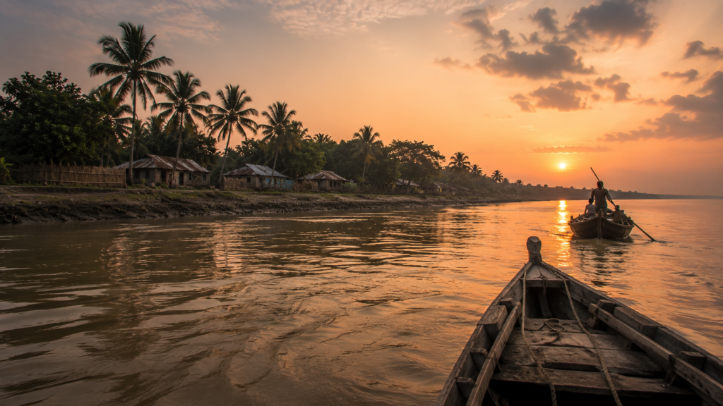
The tide has already begun its next cycle.
- Fishing boats turn toward home.
- Birds settle into the mangroves.
- The river carries the last light of the day toward the forest and, beyond it, the Bay of Bengal.
From the water, Kumirmari appears remarkably small against the immense landscape surrounding it. Yet its story is anything but small.
It is a story of rivers that continually reshape the land, embankments rebuilt after every storm, generations who have learned to read the tides, and communities that continue adapting to one of the world’s most dynamic coastal environments.
Long after the shoreline disappears, the island remains present through memory. Not because of a single monument or landmark, but because of the quiet details:
- The rhythm of the ferries.
- The sound of nets being repaired.
- The evening call of wetland birds.
- The scent of woodsmoke drifting across the embankments.
- The endless conversation between river, mangrove, and people.
Kumirmari is not a place that demands attention. It rewards patience.
The more time you spend observing its rivers, villages, wildlife, and resilient communities, the more the island reveals itself—not as a destination, but as a living chapter in the remarkable story of the Indian Sundarbans.
As the river carries you away, one thought remains unmistakably clear: Some landscapes are remembered for what they show.
The Sundarbans is remembered for what it teaches.
Plan your private Sundarban expedition
A private journey shaped around you — your group, your pace, your interests. Book a free consultation.