 Encyclopedia
Pakhiralay
The Bird Abode at the Gateway to the Indian Sundarbans
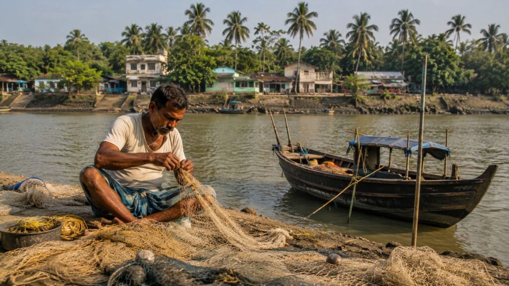
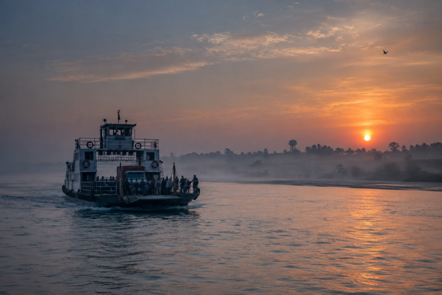
The first ferry toward Pakhiralay leaves long before the Sundarbans has fully awakened.
In the half-light before sunrise, the river carries only silhouettes—wooden boats moored against bamboo poles, fishing nets hanging motionless from narrow decks, and the faint outline of embankments rising above the tide. The engine starts with a deep metallic rhythm that echoes across the water before fading into the immense quiet of the delta.
This is not an arrival into the wilderness.
It is an arrival into one of the Sundarbans' oldest conversations between people and water.
Pakhiralay does not announce itself with dramatic landscapes or towering landmarks. It reveals itself gradually, as every tide reveals another layer of mud, mangrove root, and memory. Approaching by river, the settlement appears almost reluctant to separate itself from the surrounding landscape.
- Coconut palms rise above clusters of homes.
- Narrow embankments stretch like carefully stitched seams across reclaimed land.
- Small passenger boats cross the channels with the familiarity of routine rather than adventure.
For generations, this has been one of the principal gateways into the Indian Sundarbans—a place where journeys pause briefly before continuing deeper into the mangrove forests, and where countless departures and returns have quietly shaped everyday life.
Unlike islands defined solely by isolation, Pakhiralay has always been defined by connection.
- Connection to rivers.
- Connection to neighbouring settlements.
- Connection to forests that begin just beyond the inhabited landscape.
- Connection to the tides that dictate every ordinary day.
The island occupies a unique threshold between habitation and wilderness. To one side lies an intricate network of villages, schools, markets and ferry ghats. Beyond them begins one of the world's largest contiguous mangrove ecosystems—a landscape recognised globally for its ecological importance and for the remarkable relationship between people and nature that continues to evolve here.
This dual identity shapes everything.
Visitors often know Pakhiralay as the starting point for journeys toward Sajnekhali, Sudhanyakhali and Dobanki. Residents know it differently. For them, the island is neither a gateway nor a destination.
It is simply home—a place where the rhythm of the river determines work, where embankments are maintained with quiet persistence, and where every season leaves its own unmistakable mark upon the landscape.
To understand Pakhiralay, one must resist the temptation to hurry onward toward the famous forests beyond.
The real expedition begins here.
Not inside the tiger reserve.
But on the inhabited edge of the delta, where people have learned, over generations, that survival is measured less by conquering nature than by understanding it.
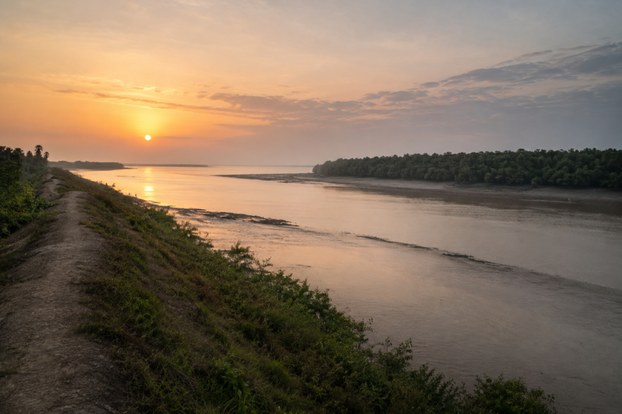
As the eastern sky slowly brightens, the first rays of sunlight spread across the tidal channel.
Egrets move silently through exposed mudflats.
A Brahminy Kite circles above the river before disappearing toward the mangroves beyond the settlement.
Somewhere behind the embankment, the sound of a bicycle bell announces another ordinary morning.
The Sundarbans has begun another day.
So has Pakhiralay.
First Encounter
Stepping ashore at Pakhiralay is less dramatic than many first-time visitors expect.
There is no grand arrival point, no monumental gateway, no obvious transition from river to settlement.
Instead, the landscape unfolds through small observations.
The ferry ghat hums with quiet efficiency. Passengers step onto the landing carrying vegetables, sacks of rice, fishing equipment, school bags and market supplies. Motorised three-wheelers wait patiently beside bicycles and motorcycles, while boatmen prepare for another crossing before the next tide alters the river once again.
Beyond the jetty, the settlement begins almost immediately.
Roads remain modest in scale, bordered by trees that soften the boundary between habitation and nature. Houses appear in clusters rather than continuous rows, each surrounded by courtyards where fishing nets dry beside flowering plants, stored firewood and seasonal agricultural tools.
Unlike inland villages, the horizon here rarely belongs entirely to land.
Water is never far away.
The rivers appear between buildings, beside embankments and beyond cultivated fields, reminding every traveller that this landscape remains part of an active delta rather than a fixed countryside.
Walking further inland, another characteristic becomes evident.
Elevation.
Or rather, the careful absence of it.
The land rises only slightly above the surrounding tidal channels. These modest embankments—built, repaired and strengthened repeatedly across generations—form the invisible architecture upon which settlement depends. Without them, much of daily life would simply not be possible.
Trees provide another clue to the island's character.
- Coconut palms sway above village lanes.
- Betel nut trees stand beside ponds.
- Mango and jackfruit trees occupy family courtyards.
Closer to tidal edges, salt-tolerant vegetation begins to replace domestic planting, signalling the gradual transition toward mangrove habitats beyond inhabited zones.
Pakhiralay does not present itself through spectacle.
Its identity emerges through continuity.
- Every pathway leads toward another embankment.
- Every embankment leads toward another river.
- Every river leads deeper into the Sundarbans.
Island Identity
Pakhiralay forms part of the Gosaba Community Development Block in South 24 Parganas district, West Bengal, occupying a strategically important position within the inhabited landscape of the Indian Sundarbans.
Rather than existing as an isolated island in the conventional sense, Pakhiralay belongs to a closely connected network of delta settlements linked by rivers, embankments and ferry routes. This interconnected geography has shaped its development for generations, allowing movement between neighbouring communities while maintaining a strong dependence on tidal waterways.
Administratively, the settlement falls within the rural governance framework of the Sundarbans, where Gram Panchayat institutions coordinate civic services, infrastructure and community development. Like many delta settlements, administrative boundaries are often less visible on the ground than the rivers and embankments that define everyday movement.
Population patterns reflect the broader character of the inhabited Sundarbans.
Homes tend to cluster along embankments and transport corridors, leaving agricultural fields, ponds and low-lying wetlands between settlement zones. This dispersed arrangement is not accidental. It represents generations of adaptation to flooding, drainage patterns and the practical realities of living within a dynamic estuarine landscape.
Pakhiralay's significance extends beyond its residential character.
Because of its proximity to major tourism embarkation points and protected forest waterways, it serves as one of the principal logistical gateways into the Sundarbans Tiger Reserve and adjoining ecotourism circuits. Visitors often pass through the village on their way to destinations such as Sajnekhali, Sudhanyakhali, and Dobanki, yet the settlement itself possesses a distinct identity that deserves attention independent of the forests beyond.
The island is therefore defined by two overlapping realities.
It is simultaneously a lived rural landscape and a threshold to one of Earth's most extraordinary mangrove ecosystems.
Understanding Pakhiralay requires recognising both.
The Rivers That Shaped The Pakhiralay
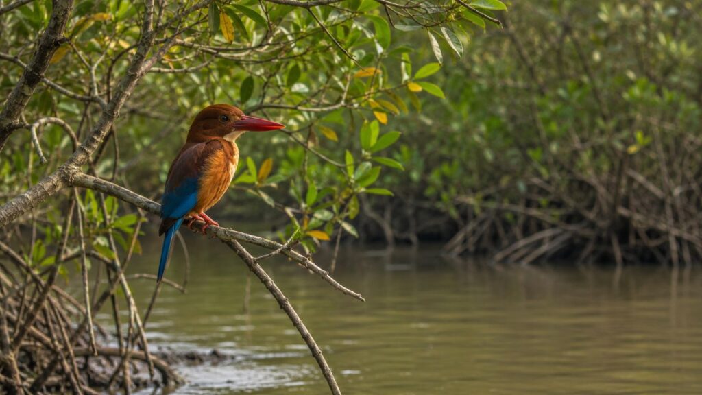
Long before roads connected villages, rivers determined where people could live, cultivate land and establish communities.
Pakhiralay owes its existence to this enduring relationship with water.
The settlement occupies part of the lower delta formed by the intertwined distributaries of the Ganges–Brahmaputra–Meghna system, where freshwater flowing from the Himalayan watershed gradually merges with saline tidal water moving inland from the Bay of Bengal. This constant interaction produces one of the most dynamic estuarine environments anywhere in the world.
Among the waterways shaping the region, the Gomor River has long served as an important transport artery, linking settlements, ferry crossings and market networks across the central Sundarbans. Nearby tidal channels eventually connect with larger river systems including the Matla, creating an intricate web of navigable routes that remain fundamental to local mobility.
These rivers have never been passive geographical features. They have determined where embankments could be constructed.
- Where agriculture could survive.
- Where ferry routes became reliable.
- Where settlements expanded.
And where erosion forced people to retreat. Twice each day, tides transform the appearance of the surrounding landscape.
At low tide, exposed mudbanks reveal the texture of the delta—soft sediments, crab burrows and the remarkable adaptations of estuarine life. High tide reverses the scene entirely, allowing boats to reach channels that hours earlier appeared impassable.
For local communities, these changes are neither unusual nor inconvenient.
They are simply the natural calendar by which work is organised.
Fishing schedules, passenger crossings, movement of goods and even maintenance of embankments are often planned with reference to tidal cycles rather than fixed clock time.
The rivers also serve as ecological corridors.
Fish migrate through these waters between estuarine and freshwater environments.
Birds follow tidal feeding grounds along exposed mudflats.
Sediment carried downstream continually reshapes banks, influencing vegetation patterns and altering the geometry of the landscape over decades.
Standing upon an embankment at Pakhiralay, it becomes evident that the river is not merely something flowing past the village.
It is the force that created the village.
And it continues, with every tide, to shape its future.
Historical Footprints
Every inhabited island in the Sundarbans carries two histories.
One is recorded in official documents—survey maps, settlement records, revenue boundaries, census reports and administrative gazetteers.
The other is written by rivers.
Pakhiralay belongs to both.
Unlike the fortified towns of mainland Bengal or the ancient river ports that preserve monuments to their past, Pakhiralay's history is inseparable from the gradual human occupation of an ever-changing delta. Its story is not defined by palaces, temples, or battlefields, but by embankments built, fields reclaimed, storms endured, and waterways navigated.
For centuries, much of the lower Sundarbans remained an immense tidal wilderness dominated by dense mangrove forests and shifting estuaries. Permanent settlement was limited, not because people ignored the region, but because the environment demanded extraordinary resilience. Early communities settled only where slightly elevated ground, manageable salinity, and dependable freshwater offered the possibility of long-term habitation.
The wider Gosaba region underwent a profound transformation during the late nineteenth and early twentieth centuries. Colonial administration sought to reclaim portions of the delta for agriculture and revenue generation through embankment construction, forest clearance, and organised settlement. These initiatives altered parts of the inhabited landscape while leaving vast areas of mangrove forest under protection or regulated use.
Pakhiralay emerged within this broader historical process.
Its location along navigable waterways made it strategically valuable—not as a commercial port in the conventional sense, but as a practical settlement linked to neighbouring islands through river transport. Boats carried everything that sustained life: rice, vegetables, timber, fishing gear, livestock, school supplies, medical necessities and, perhaps most importantly, people.
Unlike inland villages whose roads gradually expanded outward, Pakhiralay developed from the water inward.
- The river came first.
- The settlement followed.
As embankments strengthened and ferry routes became more reliable, homes clustered along safer stretches of reclaimed land. Ponds were excavated for freshwater storage, agricultural plots slowly expanded where soil permitted cultivation, and village pathways evolved into the transport corridors that still structure movement today.
Yet the landscape never became permanent.
- Cyclones repeatedly reshaped embankments.
- Riverbank erosion altered familiar shorelines.
- Salinity changed agricultural practices.
Storm surges reminded every generation that reclamation in the Sundarbans is never a completed project.
It is a continuous negotiation.
The second half of the twentieth century introduced another important transformation.
Improved ferry services, rural development programmes, schools, healthcare facilities, electrification and communication networks gradually strengthened connections between Pakhiralay and the wider district.
At the same time, the growing recognition of the Sundarbans as a globally significant ecological landscape brought researchers, conservationists, photographers and travellers through the settlement on their way toward protected forest areas.
This emerging role as a gateway to the Sundarbans did not replace the island's traditional identity.
It added another layer to it.
Today, Pakhiralay occupies a unique historical position.
It remains a functioning rural community rooted in agriculture, fishing and river life while also serving as one of the principal embarkation points for those seeking to understand the extraordinary mangrove landscape beyond.
Its history cannot be measured by monuments.
It is measured by continuity.
Generation after generation choosing to remain beside a river that has never stopped changing.
Historical Personalities & Transformations
The history of Pakhiralay is remarkable not because it produced nationally celebrated figures, but because it reflects the quiet work of thousands of ordinary people whose collective effort transformed an unstable delta into a living community.
Historical records specific to individual personalities from Pakhiralay remain limited, and where documentation is absent, it is important not to substitute assumption for evidence.
Instead, the island's story is best understood through the institutions and individuals who shaped the wider Gosaba region.
Among the most influential was Sir Daniel Hamilton, the Scottish entrepreneur and social reformer whose work in Gosaba during the early twentieth century introduced cooperative farming, rural credit systems, education initiatives and experiments in community-based development. Although Hamilton's activities centred primarily around Gosaba rather than Pakhiralay itself, the broader social and economic transformation of the region influenced neighbouring settlements connected through shared waterways and administrative networks.
His legacy remains visible today in the cooperative traditions that continue to characterise parts of the central Sundarbans.
Beyond documented historical figures, the evolution of Pakhiralay has been guided by professions rather than personalities.
Boat builders refined vessels capable of navigating shallow tidal creeks.
Ferry operators sustained connections between isolated communities long before modern roads became practical.
Teachers ensured that education continued despite seasonal flooding and transport difficulties.
Health workers travelled between river settlements where medical access depended as much upon tide tables as professional schedules.
Farmers adapted cultivation techniques to increasing soil salinity.
Fishers' altered methods as river conditions and fish populations changed across decades.
These individuals rarely appear in published histories.
Yet collectively they shaped the settlement far more profoundly than any single administrator could.
Another defining transformation arrived with the recognition of the Sundarbans as an internationally important conservation landscape.
The designation of the Sundarbans Tiger Reserve, Biosphere Reserve and UNESCO World Heritage status for the protected forest area altered regional perception. Pakhiralay increasingly became associated with scientific research, wildlife observation and responsible nature tourism because of its proximity to protected waterways leading toward Sajnekhali and other forest destinations.
This shift created new opportunities alongside new responsibilities.
Local livelihoods gradually diversified.
Boat operators increasingly carried visitors as well as local passengers.
Young residents found employment linked to guiding, hospitality, transport and conservation support services.
Educational awareness regarding wildlife protection became more widespread than in earlier generations.
Yet the transformation remained gradual rather than revolutionary.
- Fishing continued.
- Agriculture persisted.
- Seasonal rhythms still governed everyday life.
Perhaps that is Pakhiralay's defining historical lesson.
Progress here has rarely arrived through dramatic rupture.
It has accumulated quietly, layer upon layer, much like the sediment deposited by the rivers that continue to shape the island itself.
Folklore & Legends
As evening approaches in the Sundarbans, conversations often change.
The practical language of ferry timings, fishing nets and market prices slowly gives way to stories that belong less to geography than to memory.
Pakhiralay shares in this wider cultural landscape, where folklore has long served not merely as entertainment but as a way of understanding an environment whose dangers were once impossible to predict through science alone.
Among the most enduring figures is Bonbibi, the guardian of the forest and one of the most revered cultural symbols across the Sundarbans. Her story transcends religious boundaries, respected by both Hindu and Muslim communities who have historically depended upon the mangrove forest for fishing, honey collection, wood gathering and other livelihoods.
In the traditional narrative, Bonbibi represents restraint, justice and coexistence.
She reminds those entering the forest that survival depends upon humility rather than conquest.
Her counterpart in Sundarbans folklore is Dakshin Ray, frequently depicted as the powerful lord of the forest and often associated with the tiger. Interpretations vary across villages and generations, but the central theme remains remarkably consistent: the forest belongs first to nature, and human beings enter only as temporary visitors.
Alongside Bonbibi stands Shah Jongoli, Bonbibi's brother in regional folklore, whose presence reinforces themes of protection, courage and moral balance within the mangrove landscape.
Although Pakhiralay itself is primarily an inhabited settlement rather than a forest village deep within the reserve, these stories remain part of the region's cultural inheritance. Many boatmen and forest workers continue to acknowledge Bonbibi before journeys into protected waterways—not necessarily as ritual alone, but as an expression of respect for an environment where confidence without caution can quickly become dangerous.
Equally significant are the smaller, less formal traditions that rarely appear in written records.
Older residents sometimes describe rivers as living companions rather than passive channels of water.
Storms are remembered through the names of families who rebuilt together.
Certain bends in tidal creeks become reference points because of events long remembered locally, even if they never entered official documentation.
These are not myths in the supernatural sense.
They are cultural memory.
In Pakhiralay, folklore does not compete with science.
Instead, the two often coexist.
Scientific understanding explains tidal dynamics, salinity gradients and mangrove ecology.
Folklore explains why generations approached those same rivers with caution, respect and patience.
Together, they reveal something essential about the Sundarbans.
The landscape is not simply inhabited.
It is interpreted.
- Every river crossing carries practical knowledge.
- Every journey into the mangroves carries inherited memory.
And every return to the safety of the embankment quietly renews traditions that have shaped life here for centuries.
As darkness settles over Pakhiralay and the final ferry of the evening disappears into the widening river, the stories remain.
Not because anyone insists upon believing them exactly as they were once told.
But because they continue to express a truth the delta has never stopped teaching:
Nature here is neither friend nor enemy.
It is a presence that demands understanding.
Life Between The Tides
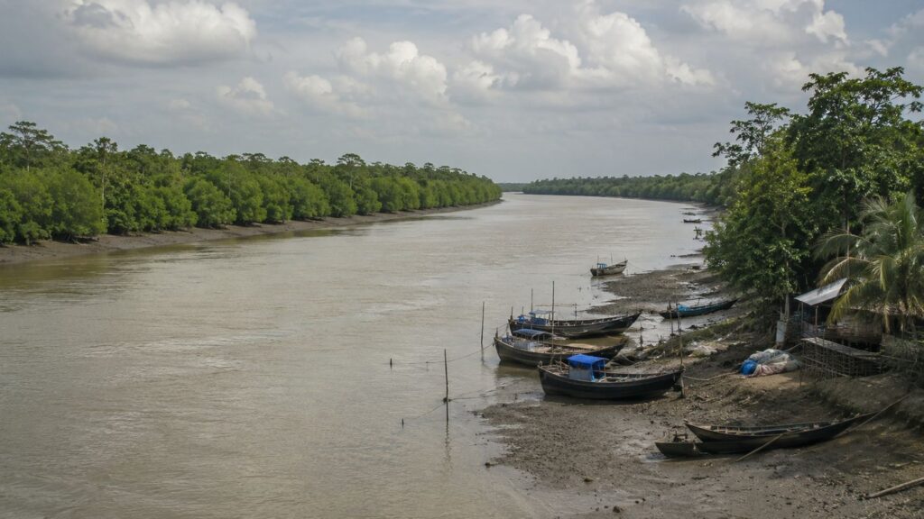
The day in Pakhiralay is not organised by the clock alone.
It begins with water.
Before the first rays of sunlight spread across the tidal channels, fishermen are already studying the river. Their attention is fixed not on the horizon but on the current. The direction of the tide determines whether nets should be cast immediately or whether another hour of waiting will produce a better catch. Here, experience is measured not simply in years but in the ability to read water that appears almost unchanged to an unfamiliar eye.
This dependence on tidal rhythm extends far beyond fishing.
A farmer planning to transport vegetables to a nearby market considers ferry timings as carefully as soil conditions.
Schoolchildren leaving for classes often begin their journey with a short walk along embankments before crossing waterways.
Traders carrying supplies know that a missed ferry may mean waiting for the next favourable movement of the river.
The tide is not merely a natural phenomenon.
It is the island's timetable.
Fishing remains one of Pakhiralay's enduring livelihoods. Families engage in river and estuarine fishing using techniques refined over generations and adapted to changing environmental conditions. Seasonal variations influence target species, while weather, salinity, and water depth affect both effort and success. The work is demanding, requiring patience and a detailed understanding of channels that shift subtly over time.
Agriculture survives through equal resilience.
Cultivation takes place on reclaimed land protected by embankments from tidal intrusion.
Rice continues to dominate agricultural practice where soil conditions allow, while seasonal vegetables and household gardens supplement local food security.
Farmers constantly balance freshwater availability against increasing salinity—a challenge that has intensified in parts of the Sundarbans following repeated cyclones and changing climatic conditions.
Household ponds are another defining feature of island life.
Many serve multiple purposes: storing freshwater where possible, supporting small-scale aquaculture, providing water for domestic needs, and contributing to household resilience during drier periods. These ponds are carefully maintained, reflecting generations of practical adaptation to an environment where freshwater cannot be taken for granted.
Although Pakhiralay itself is not a major centre for licensed honey collection from protected forests, the wider cultural landscape of the central Sundarbans remains closely connected with the annual honey season. Stories of mouals—traditional honey collectors venturing into the mangrove forests under strict regulation—are familiar throughout the region, reminding residents of the enduring relationship between livelihood and wilderness.
Daily life unfolds through countless small routines that rarely appear in official records.
- Women sweep courtyards before sunrise.
- Smoke rises from kitchens preparing the first meal of the day.
- Bicycles begin moving along village roads.
- Tea stalls welcome their earliest customers.
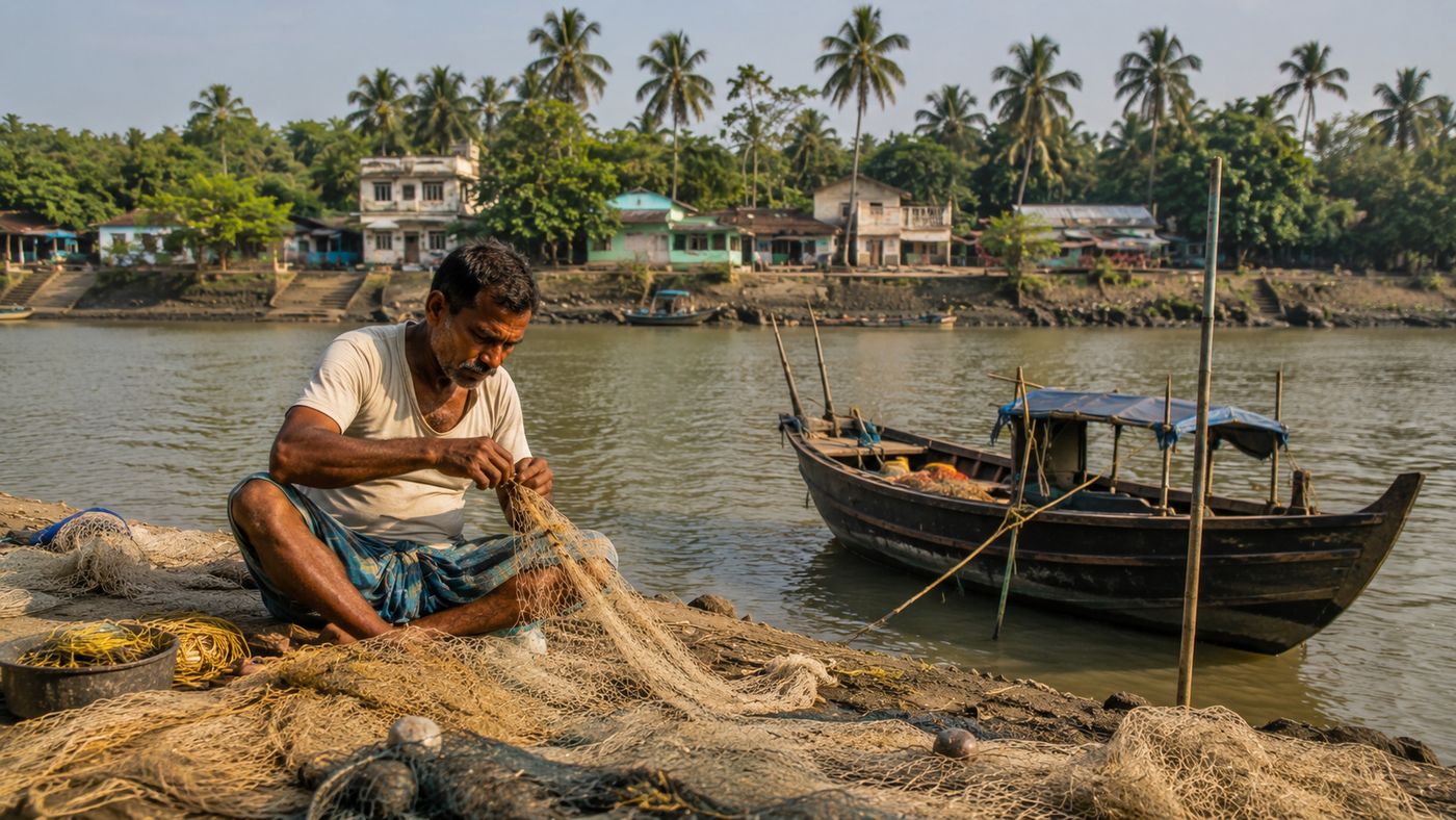
- Repair work on fishing nets continues beneath the shade of verandas.
- Children in neatly pressed school uniforms gather along narrow lanes before setting out together.
Nothing appears hurried.
Yet every activity carries an awareness that the river will continue to change throughout the day. Living in Pakhiralay requires neither constant struggle nor romantic heroism.
It requires attentiveness.
- To weather.
- To water.
- To seasons.
And to the quiet knowledge accumulated by generations who have learned that life in the Sundarbans is sustained not through resistance to nature, but through careful adaptation to it.
Walking Through The Villages
Leaving the ferry ghat behind, the village reveals itself gradually rather than dramatically.
Pakhiralay is not arranged around a central square or broad avenue. Instead, its settlements unfold through a network of modest roads, embankments, footpaths and neighbourhood clusters that reflect decades of practical adaptation rather than formal planning.
Walking here is an exercise in observation.
The first impression is one of intimacy.
Homes stand close enough for neighbours to exchange greetings across courtyards, yet each household maintains its own rhythm and identity.
- Some houses are built in brick with reinforced roofs, reflecting more recent development and improved economic stability.
- Others retain traditional materials adapted to local climate and available resources.
- Verandas serve as workspaces during the day and gathering places in the evening.
Courtyards are active spaces rather than decorative ones.
- Fishing nets dry in the sun beside stacks of firewood.
- Earthen pots collect rainwater during the monsoon.
- Coconut husks, bamboo poles and agricultural tools are stored neatly against boundary walls.
- Fruit trees—mango, guava, banana and jackfruit—provide welcome shade while contributing to household food supplies.
Ponds punctuate the landscape with remarkable regularity.
Some are used for fish culture, others for domestic needs, while many serve several purposes simultaneously. Their calm surfaces mirror passing clouds and swaying palms, offering quiet contrast to the restless movement of the surrounding rivers.
Further along the road, the social fabric of Pakhiralay becomes increasingly visible.
A small tea stall gathers regular customers long before mid-morning. Conversations shift easily between weather forecasts, fishing conditions, crop prices, ferry schedules and local news. Such establishments function not simply as places to drink tea, but as informal centres of information exchange where the island keeps itself connected.
Schools represent another important landmark.
The sound of morning assembly drifts across nearby fields as students in uniform gather before beginning lessons. Education has become an increasingly significant part of life in the Sundarbans, opening opportunities beyond traditional occupations while maintaining strong ties to local communities.
Places of worship appear naturally within the settlement rather than dominating it.
Small temples, village shrines and mosques reflect the shared cultural heritage of the region, where religious traditions have long existed alongside practical cooperation shaped by the realities of delta life. Festivals remain important social occasions, strengthening community identity while preserving customs passed from one generation to the next.
Markets in Pakhiralay are modest compared to urban centres but remarkably efficient.
- Fresh vegetables arrive from surrounding agricultural plots.
- Fish reaches stalls within hours of being landed.
- Essential goods move continuously between river transport and village shops.
Economic activity remains deeply intertwined with the rhythms of surrounding waterways.
Perhaps the most striking feature of walking through Pakhiralay is the absence of separation between human settlement and nature.
- Birdsong accompanies conversation.
- Butterflies move between flowering plants and cultivated gardens.
- Kingfishers perch quietly beside ponds, waiting for movement below the water's surface.
The edge of the village gradually softens into agricultural land, then into tidal channels, and finally toward the mangrove landscapes beyond.
Nothing feels abrupt.
The transition from habitation to wilderness occurs almost imperceptibly, reminding every visitor that Pakhiralay occupies not the end of civilisation nor the beginning of the forest, but the delicate space between the two.
Sounds Of The Island
Every landscape possesses its own language.
In Pakhiralay, that language is spoken through sound long before it is understood through sight.
Just before dawn, silence is never complete.
It is textured.
The distant hum of a ferry engine carries across the river long before the vessel comes into view. Water laps gently against wooden boats secured along the ghat. Somewhere in the darkness, an Indian Pond Heron gives a sharp call before disappearing into the growing light.
As morning unfolds, the island gradually becomes an orchestra of ordinary life.
The metallic ring of bicycle bells announces commuters making their way along narrow roads.
Children laugh on their walk to school.
A rooster calls from behind a courtyard wall.
The rhythmic sweep of brooms against packed earth signals another household beginning its daily routine.
From nearby tea stalls comes the familiar clatter of glass cups, spoons striking steel containers and animated conversations that move effortlessly between politics, fishing, agriculture and the weather.
The rivers contribute their own continuous soundtrack.
- Water striking the hull of a wooden boat.
- The creak of mooring ropes tightening with the tide.
- Engines are slowing as ferries approach the landing.
- The splash of oars where smaller boats still navigate quieter channels.
These sounds are so deeply woven into daily life that residents often cease to notice them consciously.
- Birdlife adds another dimension.
- The sharp whistle of kingfishers echoes beside ponds.
- Black Drongos call from electric wires.
- Brahminy Kites circle overhead with unmistakable cries carried by the wind.
During winter, migratory birds introduce unfamiliar voices to the already rich acoustic landscape, reflecting the seasonal importance of the wider Sundarbans for avian life.
By midday, human activity softens.
- Heat settles across the village.
- Conversations become quieter.
- The breeze moving through coconut fronds grows more noticeable than footsteps on the road.
Evening transforms the soundscape once again.
- Returning ferries bring renewed activity to the jetty.
- Motorcycles arrive carrying families home.
- Temple bells ring softly.
- The call to prayer rises from nearby mosques.
- Children's games gradually give way to conversations on verandas as daylight fades over the river.
After sunset, another world emerges.
- Crickets replace bicycles.
- Tree frogs announce themselves from ponds.
- The steady rhythm of tidal water becomes increasingly audible in the darkness.
Occasionally, a distant boat engine crosses the river before fading once more into the immense quiet of the delta.
Listening carefully, one realises something remarkable.
Pakhiralay is never truly silent.
Its soundtrack simply changes with the tide.
Wildlife Expedition
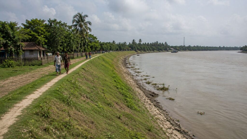
For those expecting dramatic wildlife encounters the moment they step onto Pakhiralay, the island offers an important lesson.
The Sundarbans reward patience rather than expectation.
Pakhiralay is first and foremost a living human settlement. Its significance as a wildlife landscape lies not in constant sightings of iconic animals, but in its position along one of the world's most biologically important estuarine ecosystems. The settlement exists beside ecological corridors through which birds, reptiles, fish and countless smaller organisms move between mangroves, mudflats, rivers and wetlands.
The day often begins with birds.
White-throated Kingfishers perch conspicuously on electric wires overlooking ponds and roadside ditches. Their brilliant plumage flashes against the greenery before they dive with astonishing precision.
Brown-winged Kingfishers—one of the Sundarbans' most celebrated mangrove specialists—are occasionally encountered in suitable forest-edge habitats rather than within the village itself, reminding observers that some species remain closely tied to intact mangrove ecosystems.
Brahminy Kites wheel gracefully above tidal channels.
Little Cormorants dry their wings after feeding.
Egrets and pond herons forage patiently along exposed mudflats as falling tides reveal rich feeding grounds.
During winter, the wider Sundarbans landscape welcomes migratory birds, increasing avian diversity across surrounding waterways and wetlands.
Life closer to the ground is equally compelling.
Mudskippers emerge across exposed tidal flats, moving between water and land with remarkable agility.
Fiddler crabs transform muddy banks into living mosaics of movement, their oversized claws lifted in displays that are as functional as they are visually striking.
These seemingly modest creatures perform vital ecological roles, aerating sediment and supporting the productivity of mangrove ecosystems.
Reptiles remain an integral part of the surrounding landscape.
Water Monitors inhabit suitable wetland habitats across the Sundarbans, while numerous snake species occupy agricultural land, embankments and mangrove forests. Respect rather than fear defines safe coexistence, and local knowledge plays an important role in reducing conflict.
The rivers themselves sustain extraordinary biodiversity.
Numerous fish species underpin both ecological food webs and local livelihoods. In the broader estuarine system, the endangered Ganges River Dolphin has been recorded from suitable stretches of the Sundarbans, although sightings remain unpredictable and should never be expected on routine journeys.
The Royal Bengal Tiger inevitably shapes any discussion of wildlife in this region.
Pakhiralay does not lie within the core tiger habitat.
Direct encounters inside the settlement are extremely uncommon. Nevertheless, the village's proximity to the Sundarbans Tiger Reserve means the presence of tigers continues to influence regional awareness, conservation priorities and cultural identity. Their existence reminds residents and visitors alike that one of the planet's most remarkable predators survives only because the surrounding mangrove ecosystem remains intact.
Wildlife around Pakhiralay is therefore best understood not as spectacle but as a relationship.
- Birds follow the tides.
- Fish nourish communities.
- Mangroves shelter biodiversity.
- Rivers connect habitats.
- People adapt.
- Nature responds.
The expedition here is not about chasing sightings.
It is about recognising the intricate ecological web that allows both wildlife and human life to persist along the fragile edge of the Sundarbans.
CTA: Explore Sundarbans Wildlife
Mangrove Chronicles
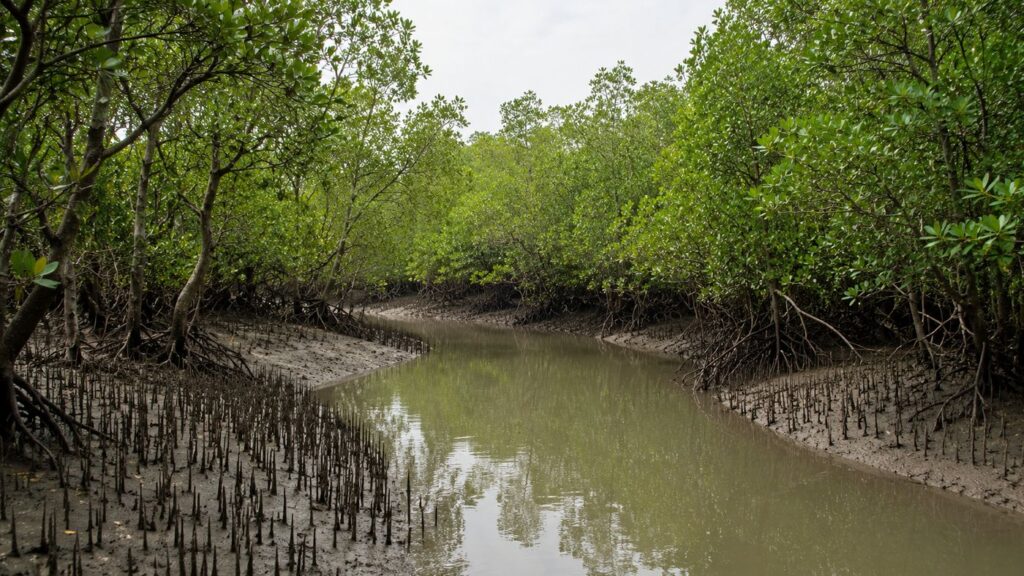
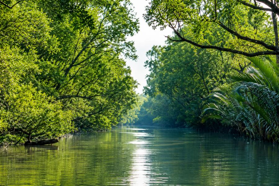
From the embankments of Pakhiralay, the mangrove forest is never far away.
It waits beyond the inhabited landscape like another world—one shaped not by roads or property boundaries, but by salinity, tides and sediment.
Unlike tropical forests rooted in stable soil, mangroves exist in perpetual negotiation with water. Twice each day, much of their root system disappears beneath the tide before re-emerging hours later as the river retreats. Survival here depends not upon resisting change but upon evolving with it.
The forests surrounding the central Sundarbans are composed of a remarkable diversity of salt-tolerant plant species, each adapted to specific combinations of tidal inundation, soil salinity and sediment stability. Avicennia, Sonneratia, Excoecaria, Bruguiera, Ceriops and Rhizophora occur across different habitats, while the iconic Sundari (Heritiera fomes)—from which the Sundarbans derives its name—continues to hold profound ecological and cultural significance, although its distribution has declined in parts of the Indian Sundarbans due to changing environmental conditions.
Closer observation reveals extraordinary engineering.
Pencil-like pneumatophores rise through the mud, allowing roots to breathe in oxygen-poor sediment.
Prop roots anchor trees against relentless tidal movement.
Fallen leaves become nutrients for microscopic organisms that ultimately sustain fish, crustaceans and larger predators throughout the estuary.
Nothing in the mangrove is wasted.
Everything is recycled.
For communities such as Pakhiralay, these forests provide far more than scenic value.
- They reduce wave energy during storms.
- They stabilise vulnerable shorelines.
- They trap sediment that gradually strengthens parts of the delta.
- They serve as breeding grounds for fish and crustaceans upon which local livelihoods depend.
At the same time, conservation challenges remain significant.
Sea-level rise, increasing salinity, cyclonic disturbance, erosion, invasive pressures and human dependence upon natural resources all influence the long-term resilience of the mangrove ecosystem. Protecting these forests, therefore requires more than legal designation; it demands continued cooperation between conservation authorities, researchers and the communities who have lived beside them for generations.
Standing at the edge of the river as evening light touches the mangrove canopy, one realises that these forests are not simply the backdrop to Pakhiralay.
They are the reason the island exists at all.
The rivers built the land.
The mangroves held it together.
And the people learned to live among them.
CTA: Explore Mangrove Ecosystems
Explorer's Field Notes
See it for yourself
A private journey shaped around you — your group, your pace, your interests. Book a free consultation.
Every expedition eventually reaches a point where observation becomes more important than movement.
Pakhiralay invites that transition.
It is not an island that reveals itself through dramatic discoveries, but through details that become visible only after spending time within its landscape.
A single walk along an embankment at dawn differs completely from the same route at midday or during the final light of evening. The island rewards patience more than distance travelled.
One of the first observations concerns elevation.
The difference between land and water is often measured in only a few metres. Yet those few metres determine where homes stand, where crops can be cultivated, where roads remain usable during the monsoon, and where embankments require constant reinforcement. In most landscapes, topography appears permanent. Here, it remains under continuous negotiation with the tide.
Another field observation emerges from the movement of people.
Unlike urban settlements where traffic follows fixed schedules, activity in Pakhiralay fluctuates with ferry arrivals and departures. Moments before a ferry reaches the ghat, roads briefly become busy with bicycles, motorbikes, handcarts and pedestrians. Soon afterwards, the village returns to a quieter rhythm, as though the river itself has exhaled.
The island's vegetation also tells a subtle story.
Domestic gardens contain mango, coconut, banana, betel nut and flowering shrubs carefully maintained by households. Yet only a short distance away, vegetation begins to shift.
Salt-tolerant grasses appear.
Shrubs become lower and more resilient.
Beyond them, mangrove species gradually replace cultivated plants, illustrating the invisible environmental gradient from freshwater influence to tidal salinity.
Bird activity offers another useful indicator of ecological conditions.
- Kingfishers repeatedly return to the same perches overlooking ponds and canals.
- Brahminy Kites use rising morning thermals above open waterways.
- Egrets concentrate where receding tides expose feeding grounds.
Even without seeing the river directly, experienced observers can often estimate the stage of the tide simply by watching bird behaviour.
The mud itself deserves attention.
- Fresh crab burrows appear overnight.
- Sediment deposited during one tidal cycle may disappear during the next.
- Footprints preserved in the morning often vanish before evening.
In Pakhiralay, the landscape records time differently.
It writes its diary in mud rather than stone. Perhaps the most valuable field note concerns pace. Visitors often hurry through Pakhiralay on their way toward famous forest destinations.
The island suggests another approach.
- Slow down.
- Sit beside the ferry ghat.
- Watch how the river changes over several hours.
- Observe how people adapt without drawing attention to their own resilience.
Only then does Pakhiralay begin to reveal its true character—not as a stop on an itinerary, but as a living chapter within the larger story of the Sundarbans.
Nightfall On The Island
Twilight arrives first upon the river.
The broad surface that reflected brilliant morning light gradually deepens into shades of copper, violet and finally charcoal grey. Boats returning from nearby waterways become silhouettes against the fading western sky, their wakes briefly catching the last fragments of sunlight before disappearing into darkness.
Back in the village, evening unfolds gently rather than suddenly.
- Children finish their games and drift home through familiar lanes.
- Tea stalls become busier once more as neighbours gather after the day's work.
- Conversations slow.
- Laughter carries farther in the cooler air.
- News of fishing conditions, crop prospects and ferry schedules passes from one table to another without urgency.
- Lights begin appearing across the settlement.
- A veranda glows beneath a single bulb.
- A kitchen window shines warmly through surrounding trees.
- Motorcycles arrive one after another before village roads gradually fall quiet again.
Religious life gently marks the transition between day and night.
Temple bells sound softly across the settlement.
From nearby mosques, the evening call to prayer drifts across the river, mingling with the persistent murmur of tidal water.
No sound dominates.
Everything belongs.
As darkness deepens, another community awakens.
- Tree frogs begin calling from ponds.
- Crickets establish a steady rhythm beneath roadside vegetation.
- Geckos emerge beneath lights where insects gather.
The river, invisible now, becomes more audible than at any other time of day.
Without daylight to distract the eye, attention shifts naturally toward sound.
- Water brushes against wooden hulls.
- A rope is tightening against a bamboo pole.
- The distant engine of a late ferry.
- Wind moving through coconut palms.
Unlike the illuminated cities of mainland Bengal, Pakhiralay still allows darkness to remain part of the landscape.
The night sky expands above the island with remarkable clarity during dry winter months. Constellations appear brighter, reflected faintly upon calm stretches of tidal water.
The forest beyond the settlement becomes almost entirely invisible.
Its presence is sensed rather than seen. For generations, this transition has shaped local understanding of the Sundarbans.
- The day belongs to movement.
- Night belongs to listening.
Standing quietly upon the embankment after sunset, one realises that Pakhiralay never truly sleeps.
It simply exchanges one rhythm for another.
The Seasons Of The Island
To describe Pakhiralay without describing its seasons would be to describe only half the island.
Everything here changes with the calendar—not because people choose differently, but because the delta demands it.
Winter
Winter is the season that reveals the landscape most clearly.
- Humidity falls.
- Visibility improves.
Morning mist rises slowly from ponds and tidal channels before sunlight uncovers embankments, agricultural fields and distant tree lines. Ferry travel becomes more predictable, wildlife observation improves, and the surrounding rivers often appear calmer than during the rest of the year.
This is also the period when many visitors experience the Sundarbans, drawn by comfortable temperatures and favourable navigation conditions.
Spring
Spring arrives quietly.
- Fruit trees begin flowering.
- Household gardens regain colour after winter.
- Preparations for the coming agricultural cycle increase across cultivated land.
- Bird activity remains high, while warmer afternoons hint at the approaching summer.
Although subtle compared with mainland Bengal, spring represents a period of renewal within village life.
Summer
Summer introduces another rhythm altogether.
Temperatures rise steadily.
Midday activity slows as residents seek shade beneath verandas, trees and market shelters. Water management becomes increasingly important. Household ponds, irrigation practices and freshwater storage receive renewed attention as heat intensifies across the delta.
- Evening offers welcome relief.
- Children return outdoors.
- Tea stalls regain their usual energy.
The river once again becomes the centre of community life.
Monsoon
The arrival of the southwest monsoon transforms every aspect of Pakhiralay.
Rainfall reshapes roads, ponds and agricultural fields.
Water levels fluctuate dramatically.
Travel becomes increasingly dependent upon weather and river conditions rather than fixed schedules.
The surrounding landscape appears greener than at any other time of year, while tidal channels swell beneath persistent cloud cover.
For photographers and naturalists, the monsoon offers an extraordinary atmosphere.
For residents, it demands preparation and adaptability.
Post-Monsoon
As the rains gradually withdraw, the island begins assessing the season's legacy.
- Fields recover.
- Embankments are inspected and repaired where necessary.
- Vegetation flourishes following months of abundant rainfall.
- Fishing patterns adjust once again as river conditions stabilise.
The landscape carries visible evidence of both resilience and renewal.
Cyclone Season
Although tropical cyclones may occur at different times of year, pre- and post-monsoon periods remain especially significant across the Bay of Bengal.
For Pakhiralay, cyclone season is not simply another entry in the calendar.
It is a period of heightened awareness.
- Weather forecasts receive close attention.
- Boats are secured carefully.
- Emergency preparations become part of routine community life.
Generations of experience have taught residents that preparedness is neither fear nor pessimism.
It is wisdom shaped by living beside one of the world's most dynamic coastal landscapes. Each season leaves its own imprint upon the island.
None replaces the others. Instead, together they create the annual cycle through which Pakhiralay continues to evolve.
Cyclones And Survival
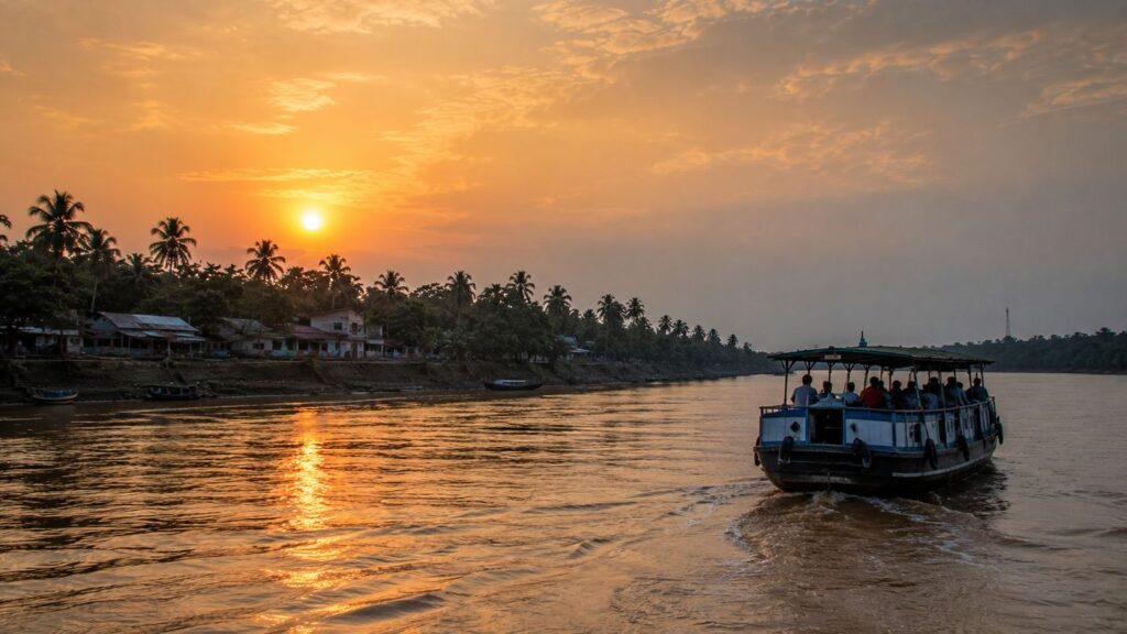
No history of Pakhiralay can ignore the storms that have repeatedly tested both its landscape and its people.
Cyclones are among the most powerful forces shaping the inhabited Sundarbans.
Unlike floods that arrive gradually or erosion that alters shorelines over years, tropical cyclones can transform an island within hours. Wind, rain, tidal surge and saline intrusion combine to challenge infrastructure, agriculture and livelihoods simultaneously.
Residents of Pakhiralay remember these events not through statistics alone but through lived experience.
The names Aila (2009), Amphan (2020) and Yaas (2021) remain deeply embedded in public memory across the central Sundarbans. Each storm affected communities differently, yet all reinforced the same lesson: resilience in the delta depends upon preparation, cooperation and recovery.
Embankments occupy the centre of that story.
To an unfamiliar visitor, they may appear as ordinary raised earthworks beside the river.
To local communities, they represent the fragile boundary between habitation and tidal inundation.
Their maintenance continues throughout the year.
- Small repairs follow ordinary erosion.
- Larger reconstruction efforts often follow severe storms.
- Engineers contribute expertise.
- Government agencies provide support.
But local residents remain indispensable participants in protecting the very structures upon which everyday life depends.
Agriculture often bears the longest-lasting consequences.
Saltwater entering cultivated fields can reduce soil productivity long after floodwaters recede. Farmers respond through careful soil management, changing crop choices and patiently waiting for natural processes to restore fertility where possible.
Cyclones also reshape the psychological landscape. Preparation has become part of daily culture rather than an occasional emergency response.
- Weather bulletins are monitored.
- Boats are secured.
- Essential supplies are organised.
Neighbours assist one another before, during and after severe weather events. The response is collective because survival has always been collective.
Yet despite repeated storms, Pakhiralay continues.
- Children return to school.
- Markets reopen.
- Ferries resume operation.
- Fishing boats once again leave the jetty before dawn.
- Fields are cultivated.
- Homes are repaired.
Life moves forward—not because the river becomes less powerful, but because generations have learned how to live with its uncertainty.
In Pakhiralay, resilience is not a slogan.
It is an ordinary part of everyday life, renewed after every storm and carried quietly into every new season.
Ferry Routes & Hidden Paths
Every journey to Pakhiralay begins with an acceptance that the river remains the principal architect of movement.
Unlike destinations connected by uninterrupted highways, access to the island is a layered experience. Railways, roads and ferries do not compete with one another—they work together, each handing the traveller over to the next until the landscape gradually shifts from mainland Bengal to the tidal world of the Sundarbans.
For most residents, the ferry is not an attraction.
It is public transport.
- Schoolchildren cross rivers to attend classes.
- Farmers carry produce toward nearby markets.
- Shopkeepers receive supplies.
- Health workers travel between settlements.
Government officials, teachers, forest personnel and traders all depend upon the same waterways that have sustained communication here for generations.
The ferry ghat is therefore much more than an embarkation point.
It is where information, commerce and community intersect.
Throughout the day, passengers arrive carrying sacks of vegetables, baskets of fish, construction materials, household goods and bicycles. Conversations begin before boarding and continue across the river, where travel itself becomes an extension of village life.
The routes surrounding Pakhiralay connect it with neighbouring settlements across the Gosaba region and ultimately with the wider transport network leading toward Canning and Kolkata.
From here, waterways also provide access to many of the best-known destinations within the Indian Sundarbans, including Sajnekhali, Sudhanyakhali and Dobanki, making Pakhiralay one of the most familiar starting points for journeys into the protected mangrove landscape.
Yet hidden beyond these established routes lies another network.
Small country boats still navigate narrower tidal creeks inaccessible to larger vessels.
Local fishermen use channels that change subtly with sediment deposition and seasonal water levels.
Footpaths appear along embankments connecting neighbourhoods separated not by distance, but by water.
Some routes become easier after low tide.
Others disappear entirely beneath rising water.
This fluid geography has shaped local knowledge for centuries.
- Maps provide orientation.
- Experience provides navigation.
- Walking these lesser-used embankments reveals another dimension of the island.
- A fisherman pauses to observe the changing current before deciding which creek to enter.
- A cyclist chooses a route not because it is shorter, but because it remains above the highest expected tide.
- Children instinctively avoid softer sections of recently repaired embankment.
Every decision reflects an understanding that movement here is never entirely separate from the river.
To outsiders, these may appear as ordinary pathways.
To residents, they are living infrastructure—constantly adjusted, quietly maintained and deeply understood.
The most rewarding route through Pakhiralay is rarely the fastest one.
It is the one that allows enough time to notice how completely the island has learned to move with water rather than against it.
Photography Expedition Guide
Pakhiralay is not a destination that demands hurried photography.
It rewards observation.
The most compelling images rarely emerge from dramatic wildlife encounters or spectacular viewpoints. Instead, they are found in the subtle relationships between people, rivers, light and landscape that define everyday life in the inhabited Sundarbans.
Sunrise Photography
The first hour after dawn offers the island's most delicate light.
Mist often lingers above ponds and tidal channels during the cooler months, softening the landscape while allowing silhouettes of fishing boats and embankments to emerge gradually from the morning haze.
The ferry ghat becomes particularly active as commuters begin crossing the river, creating opportunities to document movement rather than stillness.
Low-angle sunlight illuminates mudflats exposed by the receding tide, revealing intricate textures, crab burrows and reflections that disappear later in the day.
Sunset Photography
Evening transforms the rivers surrounding Pakhiralay into mirrors of changing colour.
Golden light reflects from tidal water while returning boats cast elongated shadows across the channel.
The final ferry of the day often provides one of the most evocative compositions, carrying silhouettes of passengers against a glowing western horizon.
Unlike mountainous landscapes where sunsets dominate the skyline, here the river becomes the principal canvas upon which light unfolds.
Wildlife Photography
Wildlife photographers should approach Pakhiralay with realistic expectations.
The settlement itself is not a wildlife sanctuary.
Instead, it offers access to an ecological corridor where patient observation may reveal kingfishers, Brahminy Kites, egrets, pond herons, cormorants and other estuarine birdlife.
Long lenses are useful, but patience remains more valuable than equipment.
Avoid disturbing birds during feeding or nesting activities.
Responsible observation always takes precedence over obtaining a photograph.
Landscape Photography
The island's strongest landscapes are shaped by geometry.
- Embankments leading toward the horizon.
- Intersecting tidal channels.
- Reflections in household ponds.
- Lines of coconut palms framing village roads.
Rather than searching for dramatic elevation, photographers should explore the perspective created by water, light and repetition.
Low viewpoints often emphasise the relationship between settlement and river more effectively than elevated ones.
Cultural Photography
Pakhiralay offers numerous opportunities to document daily life respectfully.
- Morning markets.
- Tea stalls.
- Ferry crossings.
- Fishing-net repair.
- Cyclists travelling along embankments.
- Children walking to school.
These scenes should always be photographed with consideration for local privacy and consent where individuals are clearly identifiable.
The objective is documentation rather than intrusion.
Seasonal Opportunities
Winter provides the clearest atmosphere, making it particularly suitable for landscape and bird photography.
Monsoon introduces dramatic cloud formations, reflective surfaces and saturated vegetation, although travel becomes more challenging.
Post-monsoon months combine lush landscapes with improving accessibility.
Every season presents different visual possibilities because every season reshapes the island itself.
Ultimately, Pakhiralay teaches an important lesson about photography.
The most memorable images are seldom captured by chasing extraordinary moments.
They emerge from paying close attention to ordinary ones.
Expedition Notes
Certain characteristics of Pakhiralay become apparent only after prolonged observation.
They are not major attractions. They are the quiet details that define the island's personality.
Notice how many homes are oriented toward roads or embankments rather than directly toward the river.
This arrangement reflects practical concerns such as transport, drainage and protection from seasonal flooding rather than aesthetic preference.
Observe the ponds.
- No two appear identical.
- Some support aquaculture.
- Others store freshwater.
Many fulfil multiple functions simultaneously, illustrating the resourcefulness required in a landscape where every available space contributes to daily life.
Watch the embankments carefully.
Fresh repair work often appears as subtle changes in soil colour or vegetation cover.
Each repaired section represents another chapter in the continuing dialogue between community and river.
Even roadside trees reveal patterns.
Older banyans and mango trees frequently indicate long-established settlement zones, while younger plantations often accompany more recent development or community greening initiatives.
One particularly revealing observation concerns time itself.
In cities, people frequently measure distance by minutes.
In Pakhiralay, conversations often reference the next ferry, the changing tide or tomorrow's weather instead.
The environment remains an active participant in planning everyday life.
Visitors passing quickly through the island may notice only roads leading toward the Sundarbans Tiger Reserve.
Those who remain longer begin recognising another landscape entirely.
One built not around famous landmarks, but around countless small acts of adaptation repeated every single day.
Connected Landscapes
No island in the Sundarbans exists independently.
Each belongs to a wider ecological and cultural network shaped by rivers that connect far more than they separate.
Pakhiralay occupies an especially important position within this network.
Its proximity to Dayapur, Gosaba, Sajnekhali, Satjelia and numerous smaller settlements has fostered centuries of interaction through trade, education, administration and family relationships. Boats travelling these waterways carry not only passengers and goods but also traditions, ideas and shared experiences.
Ecologically, the island stands beside one of the world's most significant mangrove landscapes.
The surrounding waterways connect directly with the protected forests of the Sundarbans Tiger Reserve, where freshwater and marine influences create habitats supporting extraordinary biodiversity.
- Fish spawned within mangrove creeks contribute to fisheries far beyond the immediate region.
- Birds move freely between settlements, wetlands and forest edges.
- Sediment transported by tidal currents shapes coastlines across multiple islands simultaneously.
Hydrologically, Pakhiralay cannot be understood without the wider estuarine system.
The Gomor, Bidya, Matla and interconnected tidal channels function collectively rather than independently. Changes occurring upstream or downstream eventually influence water levels, salinity and sediment dynamics across the entire central Sundarbans.
Culturally, these river connections have encouraged remarkable continuity.
- Festivals bring families together across neighbouring islands.
- Markets depend upon goods arriving by water.
- Educational institutions serve students from multiple settlements.
Healthcare facilities often support communities distributed across several islands rather than a single village.
For explorers, recognising these relationships changes the way the landscape is perceived.
Pakhiralay is not simply one point upon a map.
It is a living node within an intricate network of rivers, forests, settlements and shared histories.
Its story cannot be separated from the wider Sundarbans.
Nor can the Sundarbans be fully understood without places like Pakhiralay, where the everyday realities of delta life continue quietly beside one of Earth's most remarkable natural ecosystems.
CTA: Explore More Islands
Oral Histories
The oldest histories of Pakhiralay are not always preserved in archives.
Many remain in memory.
Across the Sundarbans, oral history has long complemented written documentation, preserving experiences that official records rarely capture. In Pakhiralay, these memories often centre not on political events but on environmental change.
Older residents recall seasons by exceptional floods rather than calendar years.
- They remember riverbanks that once extended farther into the channel.
- They speak of ferry routes altered by erosion or sediment deposition.
Storms become reference points around which personal histories are organised.
- One frequently recurring theme is adaptation.
- Families describe repairing homes after cyclones.
- Farmers remember years when salinity reduced harvests.
- Boatmen recall navigating channels that no longer exist in exactly the same form today.
These accounts should be understood as lived experiences rather than precise historical measurements.
- Memory records significance.
- Science records measurement.
- Together, they provide a richer understanding of change.
Oral traditions also preserve knowledge difficult to quantify.
- Which embankments traditionally flooded first?
- Which ponds retained freshwater longest during dry seasons?
- How bird behaviour sometimes anticipates changing weather.
- Which routes remained safest during particular tidal conditions?
Such observations accumulated through generations remain valuable because they reflect long-term engagement with the landscape.
Importantly, not every story can be verified in documentary sources.
Where historical evidence is unavailable, these narratives should be appreciated as cultural memory rather than factual certainty.
Their value lies not in proving events beyond doubt, but in revealing how communities have understood and interpreted their relationship with the Sundarbans over time.
In Pakhiralay, history survives not only in official documents.
It also survives in conversation, remembrance and the quiet exchange of knowledge from one generation to the next.
Food Of The Island
To understand the food of Pakhiralay is to understand the rhythm of the delta itself.
Meals here are shaped less by recipes than by rivers, seasons, soil and tide. Every ingredient carries the imprint of the surrounding landscape.
Fish arrive from estuarine waters.
Rice grows where embankments have successfully held back saline intrusion.
Vegetables flourish or struggle according to rainfall, freshwater availability and the changing chemistry of the soil.
The kitchen, much like the river, responds to circumstance.
Rice remains the foundation of daily meals, accompanied by seasonal vegetables, lentils and fish prepared according to local tradition. Fresh catches from nearby waterways—depending on season, legal fishing zones and availability—continue to play an important role in household diets. Prawns, small estuarine fish and crabs contribute to the remarkable diversity of food associated with the wider Sundarbans, although the exact composition of meals varies from one household to another.
Cooking methods favour practicality over complexity.
Fresh ingredients are prepared with spices familiar across Bengal—turmeric, mustard, cumin, coriander, green chilli and mustard oil—creating dishes that emphasise freshness rather than elaborate presentation. The cuisine reflects generations of adaptation to an environment where ingredients depend upon weather, river conditions and seasonal harvests.
Household gardens supplement local nutrition.
Bananas, papayas, drumstick trees, gourds, spinach and seasonal leafy vegetables often grow beside homes wherever soil and freshwater conditions permit. Fruit trees provide both shade and food, becoming integral components of the island landscape rather than separate agricultural enterprises.
Tea occupies a special place within daily routine.
Throughout Pakhiralay, tea stalls serve as informal gathering spaces where conversations unfold over countless cups prepared with milk, sugar and strong black tea.
Morning discussions frequently revolve around fishing conditions and ferry timings.
By evening, the same benches host reflections upon the day's work, local events and weather forecasts.
Markets reveal another dimension of the island's food culture.
Early morning brings baskets of vegetables from nearby fields, freshly landed fish from surrounding rivers and household necessities transported by ferry from larger commercial centres. Unlike urban supermarkets, these markets remain closely connected to local production systems, where freshness often depends more upon the timing of boats than refrigerated supply chains.
Festival food introduces another seasonal layer.
During Durga Puja, Kali Puja, Eid and other religious celebrations, families prepare special dishes that reflect both cultural traditions and available local ingredients. Food becomes an expression of community, hospitality and continuity, linking present-day celebrations with generations of shared memory.
Perhaps the defining characteristic of Pakhiralay's food culture is restraint.
Meals are rarely extravagant.
They are honest.
Every plate reflects the realities of living within a tidal landscape—where abundance and limitation coexist, and where appreciation for simple, fresh ingredients has been refined over generations rather than fashionable trends.
Food here nourishes more than the body.
It tells the story of an island that continues to feed itself through careful partnership with land and water.
Island Economy
The economy of Pakhiralay cannot be understood through a single industry.
It is a network of livelihoods woven together by rivers, agriculture, transport and an increasing connection with responsible nature tourism.
Fishing remains one of its enduring economic foundations.
Estuarine waters support livelihoods that have evolved over generations, with fishers adapting continuously to seasonal changes, conservation regulations, weather patterns and river dynamics. Their knowledge extends beyond catching fish; it includes reading currents, understanding salinity and recognising how environmental changes influence aquatic ecosystems.
Agriculture forms the island's second major pillar.
Rice cultivation continues wherever embankments successfully protect reclaimed land from saline intrusion. Seasonal vegetables, fruit trees and small household gardens provide both nutrition and supplementary income. Farming here requires constant adjustment, particularly following cyclones that may temporarily alter soil salinity and freshwater availability.
Transport itself contributes significantly to the local economy.
Ferry operators, boat owners, mechanics, transport workers and traders all depend upon maintaining reliable connections between Pakhiralay and neighbouring settlements. The movement of goods—construction materials, agricultural produce, household supplies and market commodities—supports livelihoods extending far beyond the immediate village.
Over recent decades, tourism associated with the Sundarbans has introduced another economic dimension.
Because Pakhiralay serves as one of the recognised gateways toward protected forest destinations, local enterprises have gradually diversified. Accommodation providers, boat services, local guides, hospitality workers and transport operators increasingly participate in the visitor economy.
Yet tourism has not replaced traditional livelihoods.
It supplements them.
- Fishing continues alongside visitor transport.
- Agriculture remains central to household life.
- Markets still depend primarily upon local communities rather than seasonal visitors.
- Migration has also become an important part of the economic landscape.
Like many rural regions across India, some younger residents pursue employment in Kolkata and other cities while maintaining close ties with their families on the island. Income earned elsewhere contributes to housing improvements, education and community resilience, demonstrating how Pakhiralay's economy now extends well beyond its physical boundaries.
Women's participation deserves equal recognition.
Many contribute through agriculture, small-scale trade, household enterprises, self-help groups and fisheries-related activities. Across the wider Sundarbans, women's cooperatives have increasingly strengthened local resilience through income diversification and community organisation.
Economic success in Pakhiralay is rarely measured by rapid growth alone. It is measured by stability.
- By a successful harvest after a difficult monsoon.
- By repairing embankments before the next cyclone.
- By children continuing their education.
- By families remaining rooted despite environmental uncertainty.
The island's economy reflects the same principle that shapes every aspect of life here.
Adaptation is its greatest resource.
Then & Now
Standing beside the ferry ghat today, it is tempting to imagine that Pakhiralay has always looked much as it does now.
The illusion lasts only until one begins listening to those who have lived here longest.
They describe a landscape that has never remained entirely still. Older embankments have been rebuilt, strengthened or realigned.
Riverbanks have shifted.
Channels have narrowed in some places and widened in others.
Agricultural practices have adapted to changing rainfall patterns and increasing salinity in vulnerable areas.
The island visible today is therefore not identical to the island remembered fifty years ago.
Connectivity has perhaps undergone the most noticeable transformation.
Improved roads, expanded ferry services, better communication networks, electricity, and digital connectivity have reduced the isolation once associated with many Sundarbans settlements. Information now travels almost instantly, while physical movement has become more dependable than in previous generations.
Education has expanded opportunities beyond traditional occupations.
Young people increasingly pursue higher education and professional careers while maintaining strong emotional and familial connections to the island. This gradual diversification has enriched the community without entirely replacing its traditional economic foundations.
Healthcare access has similarly improved through better infrastructure, transport and government programmes, although geographical challenges remain an unavoidable reality within a delta landscape.
Tourism has changed perceptions of Pakhiralay as well.
Where earlier generations viewed the settlement primarily as home and transport hub, many visitors now recognise it as an important gateway to the Sundarbans Tiger Reserve. This growing visibility has created new livelihoods while also increasing awareness of conservation, responsible tourism and environmental stewardship.
Yet beneath these transformations, much remains remarkably familiar.
- The river still determines movement.
- The tide still shapes daily schedules.
- Fishing boats still leave before dawn.
- Tea stalls still become gathering places for conversation.
- Children still walk to school beneath coconut palms.
- The monsoon still commands respect.
- Cyclones still test resilience.
- The mangrove forest still waits beyond the embankment.
The greatest continuity lies not in buildings or roads, but in attitude.
Generation after generation, the people of Pakhiralay have accepted that permanence is an illusion in the Sundarbans.
- The river changes.
- The landscape responds.
- The community adapts.
Looking across the water at sunset, the island appears timeless.
In truth, it has never stopped evolving.
Its greatest achievement is not resisting change.
It is learning how to live with it.
The Wild Orbit Quick Facts
Official Name: Pakhiralay
Settlement Type: Rural village and gateway to the Indian Sundarbans
State: West Bengal
District: South 24 Parganas
Community Development Block: Gosaba
Police Station: Gosaba
Region: Indian Sundarbans Delta
Approximate Coordinates: 22.167° N, 88.804° E (approximate village centre)
Average Elevation: Approximately 3–5 metres above mean sea level
Administrative Status: Village within the Gosaba Community Development Block
Nearest Major Railway Station: Canning Railway Station
Nearest Roadhead: Godkhali
Nearest Major City: Kolkata
Primary Access: Road journey to Godkhali, followed by a ferry or motorboat crossing across the Gomor River
Principal Waterway: Gomor River
Nearby Rivers: Gomor River, Bidya River, Matla River and an intricate network of interconnected tidal creeks
Landscape Type: Human-inhabited tidal delta village bordering the Sundarbans mangrove ecosystem
Dominant Livelihoods: Fishing, agriculture, river transport, hospitality, eco-tourism support services and small-scale local businesses
Nearest Protected Area: Sundarban Tiger Reserve (Buffer Zone)
Nearest Wildlife Attraction: Sajnekhali Watch Tower and Sajnekhali Interpretation Centre
UNESCO Context: Serves as one of the principal gateways to the Sundarbans UNESCO World Heritage landscape
Best Visiting Season: November to February
Best Photography Season: November to March, with the monsoon offering dramatic skies, lush landscapes and atmospheric river scenes
Best Birdwatching Season: November to February
Climate Type: Tropical monsoon climate with a strong estuarine influence
Mangrove Influence: Situated adjacent to the Indian Sundarbans mangrove ecosystem, the world's largest contiguous mangrove forest
Wildlife Highlights: Brown-winged Kingfisher, Black-capped Kingfisher, White-throated Kingfisher, Brahminy Kite, Little Egret, Indian Pond Heron, Little Cormorant, mudskippers, fiddler crabs and the rich estuarine biodiversity of the Sundarbans.
The Wild Orbit Expedition Snapshot
Every expedition leaves a different impression.
Pakhiralay does not overwhelm with dramatic wilderness. Instead, it reveals the living relationship between people and one of the world's greatest mangrove landscapes.
Accessibility ★★★★★ (5/5)
Among the more accessible settlements of the central Indian Sundarbans, Pakhiralay benefits from established road and ferry connectivity through Godkhali and Gosaba. While travel remains dependent on river crossings, reaching the island is comparatively straightforward.
Wildlife Potential ★★★★☆ (4/5)
The settlement itself is not a wildlife viewing destination, yet its proximity to internationally significant mangrove habitats and protected waterways creates excellent opportunities for observing estuarine birds, wetland ecology and the broader biodiversity of the Sundarbans.
Photography Potential ★★★★★ (5/5)
Pakhiralay offers exceptional documentary and landscape photography opportunities. Ferry ghats, tidal rivers, embankments, village life, mangrove edges and changing light create endlessly varied compositions throughout the day.
Cultural Richness ★★★★★ (5/5)
The island remains deeply connected to traditional river life while adapting to contemporary realities. Fishing, farming, ferry transport, local markets and community institutions continue to define its cultural landscape.
Historical Interest ★★★★☆ (4/5)
Although lacking monumental architecture, Pakhiralay reflects the wider historical evolution of the inhabited Sundarbans—colonial reclamation, cooperative development, conservation and community resilience.
Solitude Level ★★★☆☆ (3/5)
Unlike remote forest islands, Pakhiralay remains an active settlement with regular transport, visitors and daily commerce. Moments of solitude are found beside rivers, embankments and quieter village paths rather than through isolation.
The Wild Orbit Verdict
Pakhiralay is best understood as the living threshold between human settlement and mangrove wilderness.
Its greatest value lies not in individual attractions, but in the opportunity to witness how an entire community continues to live alongside one of Earth's most dynamic estuarine ecosystems.
The Wild Orbit Explorer Connections
No expedition through the Sundarbans ends at Pakhiralay.
It begins here.
From this settlement, countless journeys unfold across rivers, forests and neighbouring islands, each revealing another chapter in the story of the delta.
Nearby Settlements
- Dayapur – A neighbouring island closely linked with Pakhiralay through community, transport and tourism.
- Gosaba – The administrative and historical heart of the central Sundarbans.
- Satjelia – A significantly inhabited island reflecting the agricultural and river-based culture of the delta.
- Bali Island – Known for its position within the inhabited river landscape of the Gosaba region.
Nearby Protected Landscapes
- Sundarbans Tiger Reserve
- Sajnekhali Wildlife Sanctuary
- Sundarban Biosphere Reserve
- UNESCO World Heritage-listed Sundarbans mangrove ecosystem
Rivers To Explore
- Gomor River
- Bidya River
- Matla River
- Numerous unnamed tidal creeks connect the central Sundarbans
Wildlife Connections
Exploring beyond Pakhiralay introduces visitors to habitats supporting:
- Estuarine crocodiles
- Fishing Cats
- Smooth-coated Otters
- Gangetic and Irrawaddy Dolphins (recorded in suitable river systems)
- Brown-winged Kingfisher
- Black-capped Kingfisher
- White-bellied Sea Eagle
- Lesser Adjutant
- Numerous migratory wetland birds during winter
Cultural Connections
Pakhiralay also provides access to the wider cultural landscape of the Sundarbans, where Bonbibi traditions, river festivals, fishing communities and delta agriculture continue to shape everyday life across multiple islands.
Rather than standing alone, Pakhiralay functions as one thread within the larger ecological and human tapestry of the Sundarbans.
FAQs
1. Where is Pakhiralay located?
Pakhiralay is a rural settlement in the Gosaba Block of South 24 Parganas district, West Bengal, within the Indian Sundarbans.
2. Is Pakhiralay an island?
Yes. It forms part of the interconnected inhabited islands of the Sundarbans delta, linked by rivers and ferry services.
3. Why is Pakhiralay important?
It serves as one of the principal gateways to the Indian Sundarbans and provides access to several protected forest destinations.
4. What is Pakhiralay best known for?
Its riverfront location, ferry connectivity, proximity to Sajnekhali and its role in Sundarbans ecotourism.
5. Which district does it belong to?
South 24 Parganas, West Bengal.
6. Which administrative block includes Pakhiralay?
Gosaba Community Development Block.
7. What rivers surround Pakhiralay?
The settlement is influenced by the Gomor River and the wider Matla–Bidya estuarine network.
8. Is Pakhiralay inside the Sundarbans Tiger Reserve?
No. It lies outside the core protected forest but serves as an important access point to nearby protected areas.
9. Can Royal Bengal Tigers be seen in Pakhiralay?
Tiger sightings within the settlement are extremely uncommon. Tigers inhabit the protected mangrove forests rather than village areas.
10. Is Pakhiralay good for birdwatching?
Yes. Wetlands, ponds and nearby tidal channels support diverse resident and migratory birds.
11. What mangrove species occur nearby?
Species include Avicennia, Sonneratia, Rhizophora, Bruguiera, Ceriops, Excoecaria and others typical of the Indian Sundarbans.
12. What is the main occupation of local people?
Fishing, farming, transport services, tourism-related work and small businesses.
13. Is agriculture possible despite salinity?
Yes, although farmers continually adapt to changing salinity and seasonal flooding.
14. Which is the nearest railway station?
Canning.
15. Which is the nearest city?
Kolkata.
16. What is the best season to visit?
November to February.
17. Does the island experience cyclones?
Yes. Like much of the Sundarbans, Pakhiralay is vulnerable to tropical cyclones originating in the Bay of Bengal.
18. Are ferries available throughout the day?
Ferry services generally operate regularly, though schedules may vary according to tide, weather and local operations.
19. Is Pakhiralay suitable for wildlife photographers?
Yes, especially for documentary, bird and river landscape photography.
20. Are there schools on the island?
Yes. Educational institutions form an important part of community life.
21. What language is commonly spoken?
Bengali.
22. Can visitors stay overnight?
Yes. Accommodation is available in and around Pakhiralay and nearby Dayapur, though availability varies by season.
23. What food should visitors expect?
Traditional Bengali cuisine with rice, fish, seasonal vegetables and locally prepared dishes.
24. Is the island safe during the monsoon?
Travel remains possible but requires greater caution due to heavy rainfall, changing river conditions and occasional transport disruptions.
25. What makes Pakhiralay unique?
Unlike many settlements that visitors simply pass through, Pakhiralay offers an opportunity to understand how everyday life, conservation and river ecology intersect at the gateway to the Sundarbans.
How To Reach Pakhiralay
Reaching Pakhiralay is not simply a journey across distance.
It is a gradual transition from mainland Bengal into one of the world's largest tidal landscapes.
Every stage of the route reveals another layer of the Sundarbans, where roads slowly give way to rivers and the rhythm of travel begins to follow the movement of water rather than uninterrupted highways.
From Kolkata
Most expeditions begin in Kolkata, approximately 95–105 kilometres from the primary mainland access point at Godkhali.
Travellers usually leave the city before sunrise, allowing enough time to complete the road journey before morning ferry activity reaches its busiest period. As the urban landscape recedes, agricultural fields, ponds and rural settlements gradually replace the dense cityscape, signalling the transition toward the lower delta.
The final approach to Godkhali marks the true beginning of the Sundarbans.
Here, the road ends.
The river takes over.
By Rail
Rail remains one of the most convenient ways to begin the journey.
Frequent suburban trains connect Sealdah Railway Station in Kolkata with Canning Railway Station, the principal rail gateway to the Sundarbans.
The journey generally takes around 1 hour and 30 minutes.
From Canning, travellers continue by road toward Godkhali Jetty using shared vehicles, taxis or private transport. This road journey typically requires another 45–60 minutes, depending on traffic and seasonal road conditions.
For many visitors, this combined rail-and-road route offers both convenience and an early introduction to the changing landscapes of South 24 Parganas.
By Road
Travelling entirely by road provides greater flexibility.
From Kolkata, vehicles usually follow routes through:
- Baruipur
- Canning Road corridor
- Basanti Highway
- Godkhali
The complete drive generally requires between 2.5 and 3.5 hours, depending on traffic conditions.
Private cars, hired taxis and organised tour vehicles regularly use this route.
Road quality has improved significantly over recent decades, making access to the mainland embarkation point considerably easier than in previous generations.
Ferry Routes
From Godkhali Jetty, motorised ferries and passenger boats connect the mainland with the inhabited islands of the central Sundarbans.
Pakhiralay is reached through this established ferry network.
The crossing itself forms one of the most memorable parts of the expedition.
As the mainland gradually disappears behind the boat, the landscape changes character.
- Concrete gives way to water.
- Water gives way to embankments.
Beyond them appear coconut palms, village settlements and the first hints of the mangrove world that extends far beyond the horizon.
Unlike fixed bridge crossings, ferry travel remains closely linked to local river conditions.
The river is not an obstacle.
It is part of the journey.
Nearest Jetty
The principal embarkation point for visitors remains Godkhali Jetty.
Within Pakhiralay itself, local ferry facilities connect surrounding settlements and support movement throughout the Gosaba region.
These ferry ghats remain vital transport infrastructure for residents, students, traders and visitors alike.
Seasonal Travel Notes
Winter (November–February)
The most favourable season for travel.
Cool temperatures, lower humidity and relatively stable river conditions make ferry operations more predictable and photography especially rewarding.
Spring (March)
Pleasant weather continues, although afternoons gradually become warmer.
River travel generally remains comfortable.
Summer (April–June)
Higher temperatures increase heat exposure, particularly during midday travel.
Early morning departures are recommended.
Monsoon (June–September)
Heavy rainfall may influence ferry schedules and road conditions leading toward Godkhali.
Travel remains possible but requires additional flexibility and close attention to local weather updates.
Post-Monsoon (October)
Vegetation is at its most vibrant following seasonal rains.
Water levels remain relatively high, creating particularly attractive river landscapes for photographers.
Travel During Cyclone Season
Cyclonic weather systems occasionally affect the Bay of Bengal before and after the southwest monsoon.
When official weather advisories are issued, travellers should always follow guidance from district authorities, transport operators and the India Meteorological Department.
Safety should always take precedence over the itinerary.
Explorer Tips
- Begin your journey early in the morning to experience the changing landscape in natural light.
- Confirm ferry timings locally, especially during monsoon and adverse weather.
- Carry drinking water, sun protection and lightweight clothing suitable for humid conditions.
- Respect local communities by photographing people only with permission.
- Avoid littering at ferry ghats and riverside locations.
- Remember that tides influence movement throughout the Sundarbans; allow flexibility rather than rigid scheduling.
- Spend time in Pakhiralay itself before continuing deeper into the forest. Understanding the inhabited delta enriches every subsequent exploration of the Sundarbans.
The journey to Pakhiralay is not merely transportation.
It is the first chapter of the expedition.
Things To See Around Pakhiralay
Unlike conventional tourist destinations, Pakhiralay rewards curiosity rather than checklist travel.
Its surrounding landscape offers a mosaic of rivers, villages, mangroves and cultural spaces that together reveal the living character of the central Sundarbans.
Pakhiralay Ferry Ghat
The island's riverfront serves as its social and logistical heart.
Morning departures, evening returns and the continuous rhythm of ferry traffic provide an authentic introduction to delta life.
Sajnekhali Watch Tower
One of the best-known visitor destinations in the Indian Sundarbans.
The area includes interpretation facilities, mangrove habitats and opportunities for observing estuarine birdlife and other wildlife from designated viewing areas.
Sajnekhali Interpretation Centre
An excellent place to understand the ecology, biodiversity and conservation significance of the Sundarbans before entering protected waterways.
Sudhanyakhali Watch Tower
Among the most recognised wildlife observation points within the Sundarbans Tiger Reserve, offering opportunities to observe wetland habitats, birds and, occasionally, larger mammals from authorised viewing structures.
Dobanki Canopy Walk
A unique elevated walkway through the mangrove forest that provides visitors with a different perspective on the structure and ecology of the Sundarbans.
Dayapur Island
Closely linked with Pakhiralay through river transport and community life, Dayapur offers another perspective on inhabited delta landscapes where tourism, agriculture and fishing coexist.
Village Roads & Embankments
Some of the most rewarding explorations require no ticket at all.
Walking slowly along village embankments reveals ponds, gardens, schools, temples, tea stalls and everyday life that rarely appears in conventional travel itineraries.
Local Markets
Morning markets provide opportunities to observe seasonal produce, fresh fish, household commerce and the practical economy of the Sundarbans.
River Viewpoints
Numerous embankments overlooking tidal channels offer exceptional sunrise and sunset photography while illustrating the intimate relationship between settlement and river.
Mangrove Edges
Where permitted and responsibly accessed, the transition between inhabited land and mangrove vegetation provides valuable insight into the ecological foundation of the Sundarbans.
CTA: Discover Nearby Expeditions
Continue The Journey
Pakhiralay is not an ending.
It is an invitation.
Beyond its ferry ghats, the rivers continue to divide and reconnect across one of the world's most intricate delta systems.
Travel northward and the inhabited islands reveal new stories of agriculture, education and river commerce.
Follow the waterways southward and the mangrove forest gradually becomes denser, quieter and increasingly dominated by the ecological processes that define the Sundarbans.
- Each neighbouring settlement contributes another perspective.
- Each river carries another history.
- Each embankment reflects another generation's effort to coexist with an ever-changing landscape.
The expedition naturally continues toward:
- Gosaba
- Dayapur
- Satjelia
- Bali Island
- Sajnekhali
- Dobanki
- Sudhanyakhali
- The wider Sundarbans Tiger Reserve
- The tidal rivers that bind them all together
Understanding one island enriches the experience of the next.
The Sundarbans is not explored through isolated destinations.
It is understood through connection.
As The Ferry Pulls Away
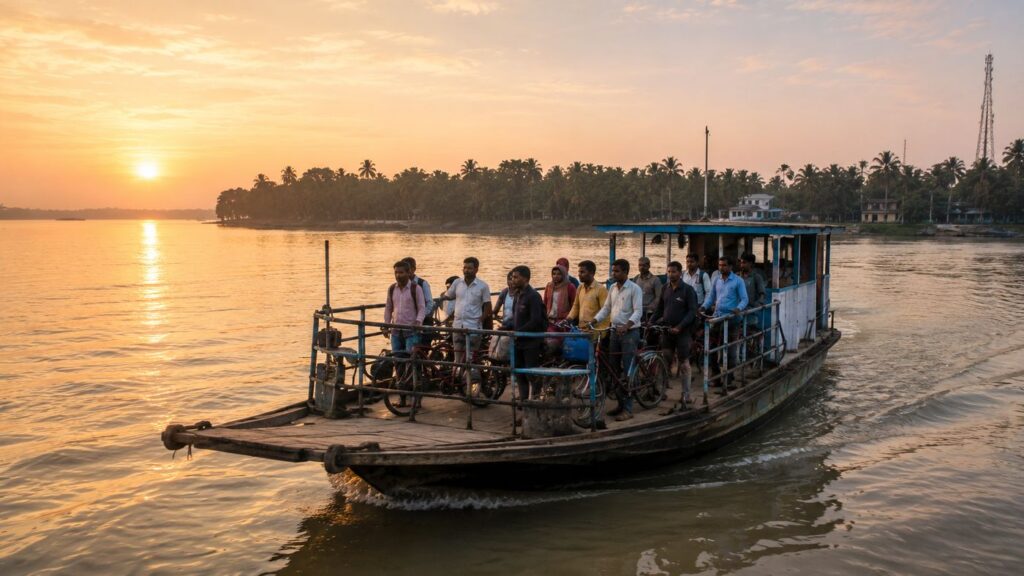
The final ferry leaves Pakhiralay much as the first one arrived—quietly.
- The engine settles into its familiar rhythm, and the jetty slowly begins to recede.
- Conversations on the shore become indistinct.
- The silhouettes of bicycles waiting beside the landing dissolve into the evening light.
- A Brahminy Kite makes one last circuit above the river before disappearing toward the mangroves.
As distance grows, the island refuses to become merely a point on the horizon.
Instead, it reveals its true nature. Pakhiralay was never simply a gateway to somewhere else. It was the lesson that prepared you to understand the Sundarbans.
- Before the tiger reserve.
- Before the watch towers.
- Before the great forests.
There was this island.
- Where children walked to school along embankments built by earlier generations.
- Where ferries carried not tourists, but neighbours.
- Where rivers shaped calendars more faithfully than clocks.
- Where mangroves stood not as scenery, but as protection.
- Where every season rewrote the landscape without erasing its identity.
Looking back across the widening channel, it becomes impossible to separate the settlement from the river that created it.
- The tide continues its patient work.
- Boats continue their crossings.
- The mangroves continue holding the shoreline together.
- And life continues, quietly, as it has for generations.
The ferry rounds the next bend.
Pakhiralay slips gently behind the curtain of trees and water. It does not disappear. It simply returns to the rhythm that has always defined it— waiting for the next tide, the next crossing, and the next traveller willing to slow down long enough to truly see it.
CTA: Continue Exploring with The Wild Orbit
Plan your private Sundarban expedition
A private journey shaped around you — your group, your pace, your interests. Book a free consultation.