 Encyclopedia
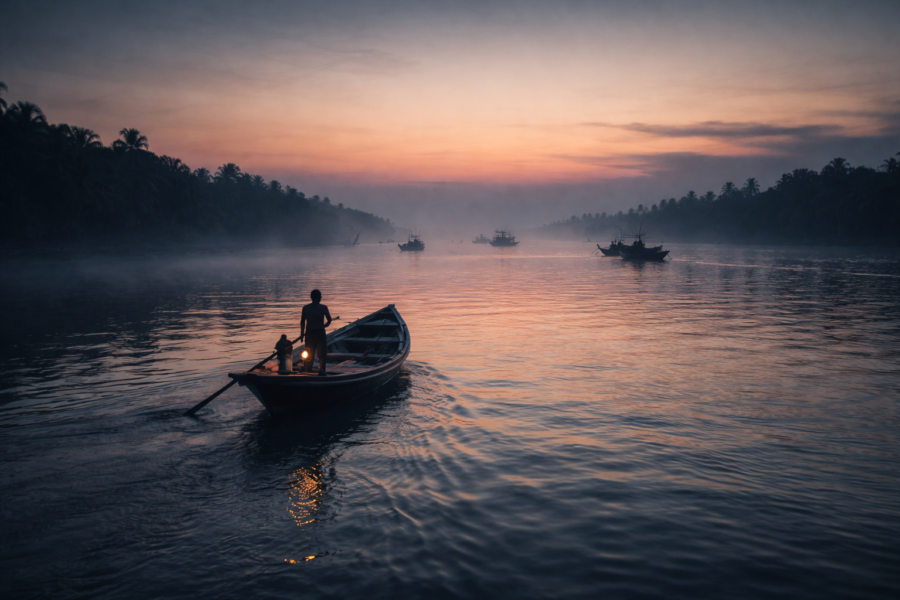
Before sunrise, the border is invisible.
Standing on an embankment above the Raimangal River, there is nothing to suggest that the water flowing silently through the darkness separates two nations.
- No fence cuts across the current.
- No line exists upon the tide.
- No sign announces where one country ends and another begins.
Only the river moves.
The eastern horizon glows faintly.
Fishing boats emerge from the mist one by one, their silhouettes drifting across water that has carried mangrove seeds, monsoon floods, cyclones, fish, birds, and stories for centuries longer than any political boundary has existed.
Somewhere across the broad river lies Bangladesh.
Behind lies the inhabited delta of India.
Between them stretches one of the most remarkable frontier landscapes in South Asia.
This is Hingalganj.
- Not an island.
- Not a town.
- Not merely an administrative block.
Hingalganj is a borderland shaped by rivers.
- A place where embankments stand between fields and tides.
- A place where people live at the edge of both geography and nation.
- A place where the Sundarbans feels different.
Less visited. Less interpreted. Closer to the raw mechanics of the delta. The first sunlight arrives slowly.
- Mudbanks emerge from the retreating tide.
- Egrets appear along the shoreline.
- The mangroves darken from shadow into detail.
- A fisherman adjusts his net.
- A ferry engine starts somewhere downstream.
And with daylight comes the realization that Hingalganj is not defined by what stands here.
It is defined by what flows through it.
- The rivers.
- The tides.
- The border.
- The movement.
- The uncertainty.
- The resilience.
Everything begins there.
First Encounter
The approach to Hingalganj feels unlike entering most parts of the Sundarbans.
- Roads narrow.
- Settlements become more dispersed.
- Water appears more frequently.
The horizon opens.
Eventually, the landscape begins to resemble an unfinished conversation between land and river. Embankments dominate first impressions.
Long earthen ridges stretch across the landscape, carrying roads, bicycles, motorcycles, schoolchildren, market traffic, and daily life above the surrounding floodplain.
- Beyond them lie agricultural fields.
- Beyond the fields, creeks.
- Beyond the creeks, rivers.
- Beyond the rivers, another country.
The villages do not appear suddenly. They reveal themselves gradually.
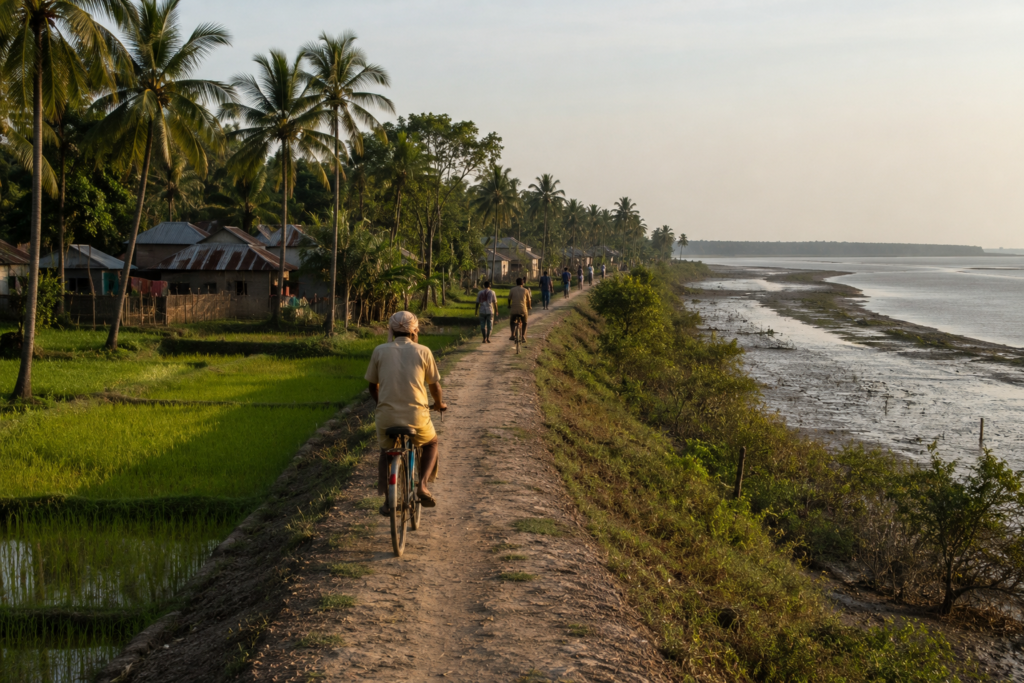
- A cluster of homes beneath coconut palms.
- A tea stall beside an embankment road.
- A mosque minaret is visible above the trees.
- A temple tucked beside a pond.
- A school painted bright blue against the green landscape.
Every settlement seems oriented toward water.
Not because water is scenic. Because water remains essential.
- Transportation.
- Fishing.
- Agriculture.
- Trade.
- Risk.
- Opportunity.
All arrive through the rivers.
Even before learning a single fact about Hingalganj, the landscape communicates its priorities.
This is a place built for adaptation.
Hingalganj’s Identity
Every region of the Sundarbans possesses a dominant character.
- Some are agricultural landscapes.
- Some are fishing islands.
- Some are conservation zones.
Hingalganj’s defining identity is different.
It is a frontier.
Administratively, Hingalganj Block lies within the North 24 Parganas district of West Bengal and forms part of the northeastern Sundarbans region.
Yet maps fail to capture what makes the area distinctive.
The defining reality is proximity.
- To rivers.
- To mangroves.
- To international boundaries.
- To environmental uncertainty.
- To the ecological transition.
The block includes numerous riverine settlements and villages connected by embankments, waterways, and rural roads.
Communities are distributed across a landscape where human habitation and tidal ecosystems coexist in close proximity.
Unlike many inland regions where boundaries feel fixed, Hingalganj remains shaped by forces that continually alter the landscape.
- Rivers migrate.
- Banks erode.
- Sediment accumulates.
- Storms reshape shorelines.
- The environment remains dynamic.
That dynamism influences culture.
People here possess an unusually detailed awareness of weather, tides, river conditions, and embankment stability.
These are not abstract concerns. They influence everyday decisions.
In Hingalganj, geography remains personal.
The Rivers That Define Hingalganj
The rivers arrive long before any official border marker.
They shape everything. Among them, the Raimangal stands apart.
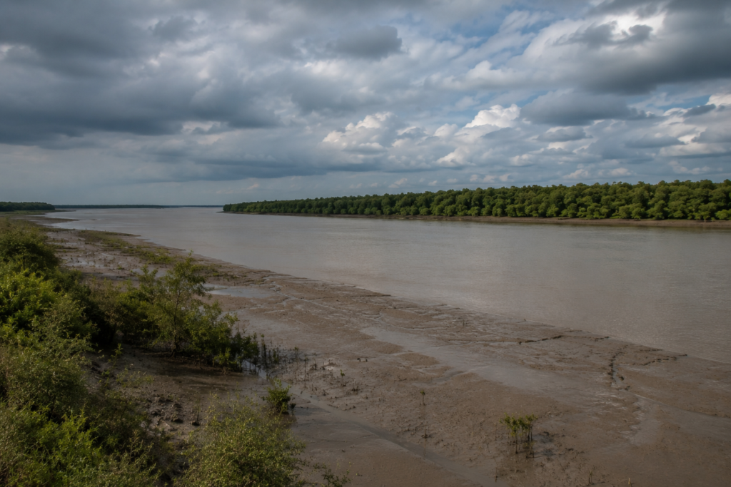
Broad, tidal, and ecologically significant, it forms one of the most important river systems in the eastern Sundarbans. Standing beside it at low tide reveals vast mudflats exposed beneath the sky.
At high tide, much of that landscape disappears beneath moving water.
The river never looks exactly the same twice.
- To the observer, this variability appears beautiful.
- To residents, it represents reality.
The Raimangal influences settlement patterns across the region.
- Villages developed where land could be protected.
- Agriculture expanded where embankments held.
- Transportation routes followed practical geography.
- Fishing adapted to changing conditions.
Other rivers and tidal channels contribute to this network.
- The Kalindi.
- The Ichamati.
Countless creeks connect larger waterways.
Together they create a hydrological system far more complex than most maps suggest. For generations, these rivers have functioned simultaneously as roads, resources, barriers, and threats.
- They carry fish.
- They transport people.
- They shape local economies.
- They erode land.
- They deliver storm surges.
- They connect communities separated by distance.
Every significant story in Hingalganj eventually returns to the rivers.
Because the rivers remain the true architects of the frontier.
Historical Footprints
The landscape appears timeless.
Yet Hingalganj’s history is relatively recent when compared with older settled regions of Bengal.
Much of the northeastern Sundarbans underwent gradual processes of land reclamation and settlement over the nineteenth and twentieth centuries.
Before large-scale habitation expanded, these areas contained extensive tidal forests, wetlands, and river channels.
Colonial administrations viewed the region through practical lenses.
- Land represented potential revenue.
- Forests represented resources.
- Settlements represented economic opportunity.
- Embankments were constructed.
- Land was reclaimed.
- Agricultural expansion followed.
- Communities migrated into newly habitable areas.
The transformation was neither simple nor complete.
- Nature continued negotiating the terms.
- Cyclones challenged embankments.
- Rivers altered channels.
- Salinity influenced agriculture.
- The environment resisted permanence.
The partition in 1947 added another historical layer.
The creation of the India–East Pakistan border—and later Bangladesh—transformed regional geography. Rivers that had once connected communities became international frontiers.
- Trade routes changed.
- Administrative structures shifted.
- New realities emerged.
- Yet many cultural connections persisted.
The rivers continued flowing.
Families remained linked through shared histories. Ecological systems ignored political boundaries.
The frontier became simultaneously divided and connected.
That paradox remains visible today.
Historical Personalities & Transformations
Unlike urban centers associated with famous individuals, Hingalganj’s history is rooted largely in collective effort.
The region’s transformation emerged through generations of settlers, farmers, fishermen, embankment workers, schoolteachers, community leaders, and local administrators.
Their names rarely appear in textbooks.
Their influence remains visible everywhere.
- Every embankment is reinforced after a storm.
- Every field reclaimed from saline conditions.
- Every school is established in a remote settlement.
- Every ferry route is maintained.
The history of Hingalganj is not primarily a story of celebrated figures.
It is a story of persistence.
Community organizations, local governance structures, educators, and development initiatives have all contributed to improving connectivity, education, healthcare, and disaster preparedness across the region.
Progress often arrives incrementally.
- A stronger embankment.
- A better road.
- A new school building.
- Improved communication.
- Small changes accumulate.
Over decades, they reshape lives.
The modern frontier reflects those cumulative transformations.
Folklore & Legends of the Hingalganj
In the early morning, the rivers appear calm.
By afternoon, they may look entirely different.
Such unpredictability has always encouraged stories. Throughout the Sundarbans, folklore serves as a cultural map of uncertainty.
Hingalganj shares many of the wider delta’s narratives while adding its own frontier perspective.
Bonbibi remains one of the most respected figures in regional belief traditions. Among communities connected to forests, rivers, and fishing grounds, her story continues to symbolize protection, balance, and coexistence with powerful landscapes.
Dakshin Ray appears in many narratives as a force associated with the wilderness and the dangers that accompany it. The stories vary between communities.
Details change. Interpretations evolve. Yet their purpose remains remarkably consistent. They remind listeners that survival in the delta depends upon humility.
River legends are equally common. Older residents sometimes speak of stretches of water known for difficult currents, unusual behavior during storms, or historical accidents.
In previous generations, such locations often acquired reputations that blended observation with belief.
- Dangerous channels became inhabited by unseen forces.
- Unexpected survival became divine intervention.
- A fortunate crossing became evidence of protection.
These stories reveal something important about Hingalganj.
The frontier has always demanded respect. Folklore became one way communities expressed that reality. Even today, modern weather forecasts coexist comfortably alongside older narratives.
Not because people reject science.
But stories continue helping communities interpret landscapes larger and more powerful than themselves.
Life Between the Tides
By mid-morning, the frontier no longer feels remote.
It feels lived in.
- A bicycle rattles along an embankment road carrying sacks of rice.
- Schoolchildren in blue-and-white uniforms walk in groups toward classrooms.
- A fisherman repairs a torn net beneath the shade of a mango tree.
- Women sweep courtyards already drying beneath the strengthening sun.
The drama of the rivers exists here.
But so does routine. That routine is what truly defines Hingalganj. For outsiders, the landscape often appears dominated by rivers and borders. For residents, it is defined by work.
The tide may determine when a boat departs.
- But crops still need tending.
- Children still attend school.
- Markets are still open.
- Meals still need cooking.
Life unfolds between environmental uncertainty and daily necessity.
- Agriculture remains central across large parts of the region.
- Paddy fields spread across reclaimed land protected by embankments.
- Vegetable cultivation supplements household incomes.
- Seasonal changes influence both planting and harvesting cycles.
Yet agriculture in Hingalganj has always involved negotiation.
Salinity remains a persistent concern.
- A damaged embankment can alter growing conditions dramatically.
- Cyclonic storm surges may affect soil for months or even years.
- Fishing forms another pillar of local life.
- Small-scale fishing operations continue across rivers, creeks, and estuarine waters.
The day’s catch may include species destined for local consumption or regional markets. Crab collection has become increasingly important in parts of the wider delta economy, linking frontier communities to larger commercial networks.
The rivers provide opportunity.
They also impose limits.
Residents understand both realities intimately.
Walking Through the Villages
The villages of Hingalganj rarely reveal themselves all at once.
They emerge gradually along embankment roads and narrow pathways.
- A bend in the road reveals a cluster of homes.
- A pond reflects coconut palms.
- Children play beneath banyan trees.
- A tea stall appears where two paths intersect.
The settlement pattern reflects geography.
Villages often occupy slightly elevated ground protected by embankments and drainage systems. Homes vary in construction. Some are traditional structures built with local materials. Others are brick houses reflecting economic improvements achieved over decades.
Courtyards remain important social spaces. Many contain vegetable gardens, fruit trees, and areas used for household activities.
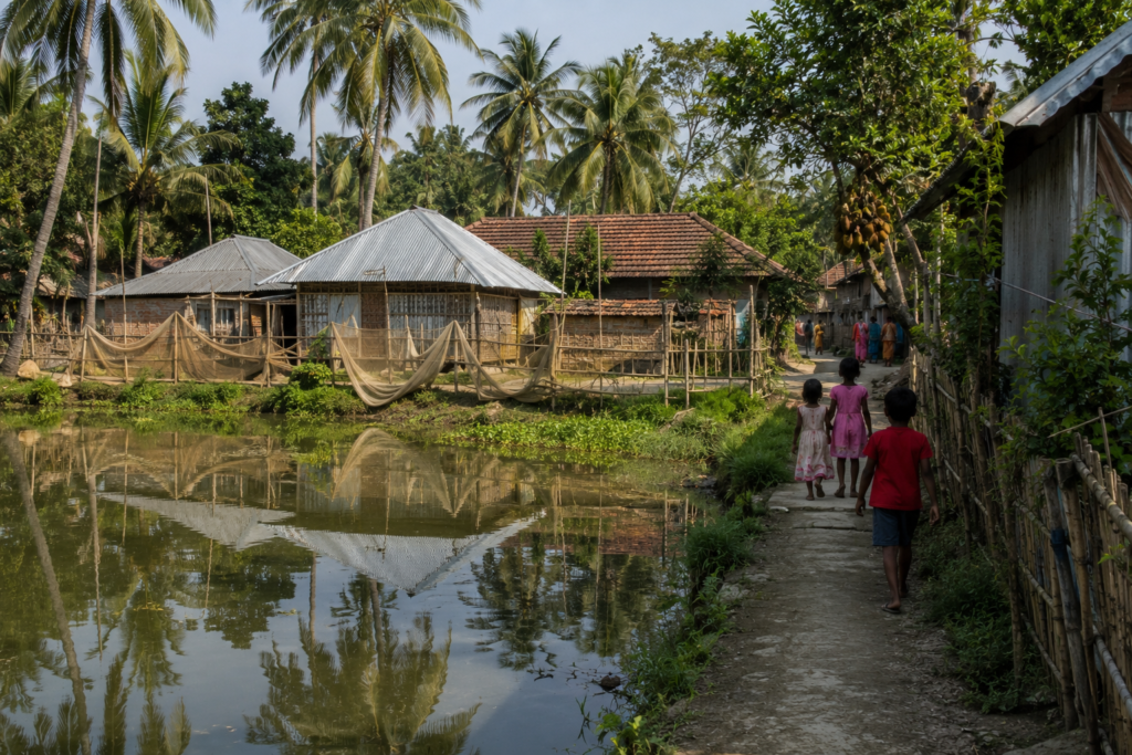
Ponds appear frequently. They support domestic needs, aquaculture, and local biodiversity.
Walking slowly through these settlements reveals a rhythm distinct from urban Bengal.
- The pace is measured.
- Conversations linger.
- People notice arrivals.
- Information travels quickly.
- The community remains visible.
Temples and mosques often stand within short distances of one another, reflecting the cultural fabric of the region. Schools occupy an equally important place within village life. Their presence reflects aspirations extending beyond the immediate landscape.
Education has become one of the most significant transformations across many frontier communities. The classroom represents possibility.
A connection to futures that may extend far beyond the embankments.
Markets of the Border Delta
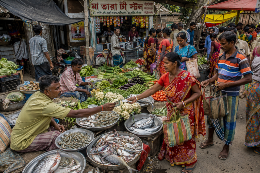
Every frontier has gathering places. In Hingalganj, markets serve that role.
The market is where the rivers become visible through goods rather than geography.
Fish arrive from nearby waters. Vegetables arrive from agricultural fields. Household essentials arrive through transportation networks linking the region with larger towns and cities.
The diversity of products tells a story.
It reveals environmental conditions.
- Economic trends.
- Seasonal cycles.
- Changing livelihoods.
Spend enough time observing a market and the wider delta begins to unfold.
- Fish vendors discuss river conditions.
- Farmers discuss rainfall.
- Traders discuss transportation.
- Customers discuss weather forecasts.
The conversations themselves become a form of environmental monitoring. Markets are also cultural spaces. They are places where news spreads, relationships are maintained, and community life remains visible.
For explorers seeking to understand Hingalganj, few locations offer greater insight.
Sounds of the Frontier
Close your eyes in Hingalganj and the landscape remains recognizable.
The soundscape is distinctive. At dawn, birds dominate.
- Drongos call from exposed branches.
- Egrets move noisily through wetland margins.
- Kingfishers announce their presence before revealing themselves.
As the morning advances, human sounds increase.
- Voices carry across open fields.
- Motorcycles travel along embankment roads.
- School bells mark the progression of the day.
- Boat engines pulse across distant rivers.
Unlike urban environments, sounds here travel far.
Open landscapes allow conversations, machinery, and wildlife to remain audible across surprising distances.
Afternoons bring a quieter atmosphere.
- Heat softens activity.
- The landscape appears to pause.
The evening begins.
- Prayer calls drift across settlements.
- Cooking sounds emerge from households.
- Crickets gradually replace daytime birds.
The rivers contribute their own soundtrack.
- Water moving against embankments.
- Tidal currents are shifting direction.
- Boat engines fading into darkness.
The frontier never becomes silent.
It simply changes voices.
Wildlife Expedition
The ecological story of Hingalganj begins at the edge.
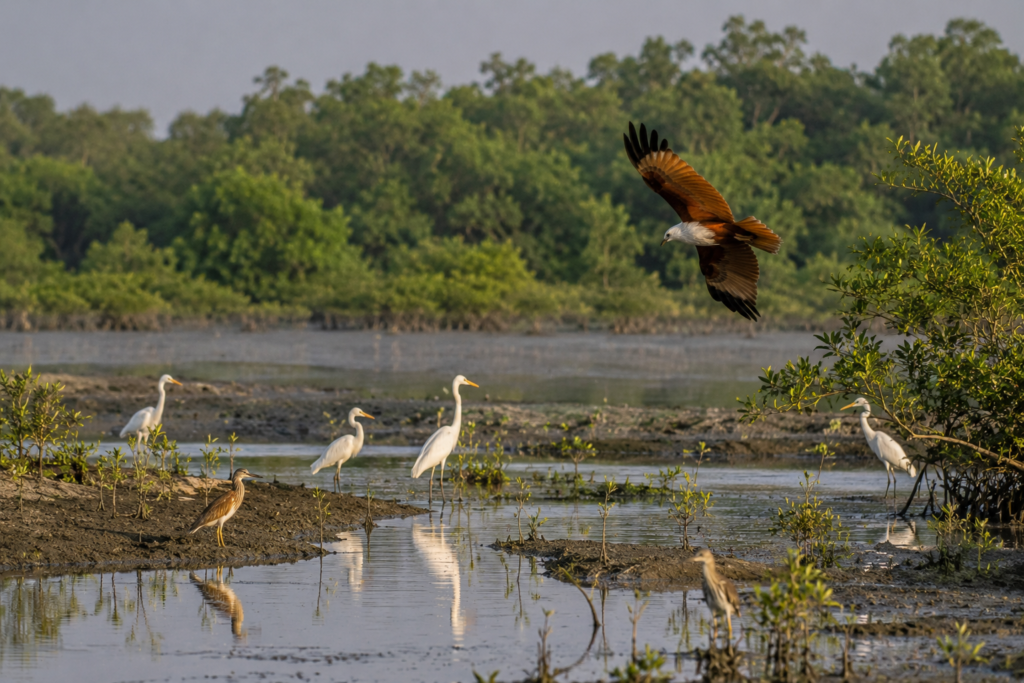
This is a landscape where human settlement meets one of the world’s largest mangrove ecosystems. Wildlife rarely appears dramatically here. Instead, it reveals itself gradually through wetlands, riverbanks, agricultural fields, ponds, embankments, and mangrove fringes.
Commonly Observed Birds
- Egrets
- Herons
- Cormorants
- Kingfishers
- Bee-eaters
- Drongos
- Wagtails
- Lapwings
- Various wetland and waterbirds
During winter, migratory species add seasonal diversity to ponds, mudflats, and river margins.
Raptors of the Frontier
- Brahminy Kite
- Black Kite
- Other seasonal raptors
These birds often patrol above rivers, agricultural fields, and open wetlands.
Mammals
Wild mammals are generally elusive and difficult to observe.
Species known from the wider landscape include:
- Fishing Cat
- Small wetland mammals
- Rodents and other agricultural-edge species
- Historically recorded otters in suitable habitats
Reptiles & Amphibians
- Water snakes
- Monitor lizards
- Frogs and toads
- Wetland-associated reptiles
These species are commonly associated with canals, ponds, riverbanks, and mangrove-edge habitats.
Aquatic Life
The estuarine rivers and tidal creeks support:
- Diverse fish populations
- Crabs
- Prawns
- Other estuarine organisms essential to local livelihoods
Insects
Even the smallest creatures help define the frontier landscape:
- Dragonflies
- Damselflies
- Butterflies
- Wetland insects
- Mosquitoes
Wildlife in Hingalganj rewards patience rather than expectation. The frontier reveals itself slowly—to those willing to watch, wait, and pay attention.
Mangrove Chronicles
See it for yourself
A private journey shaped around you — your group, your pace, your interests. Book a free consultation.
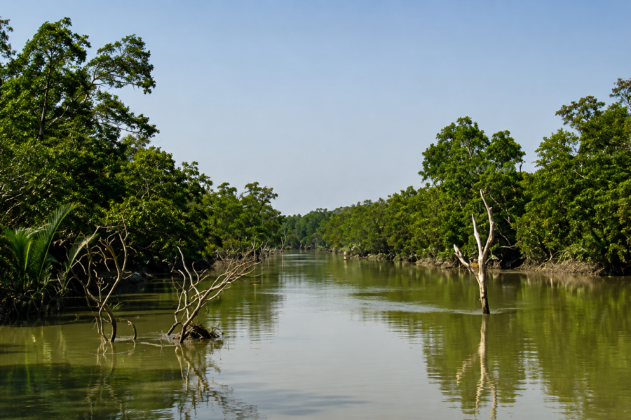
The mangroves appear first as a dark line on the horizon.
- Then, as individual trees.
- Then, as an ecological system of astonishing complexity.
Although much of Hingalganj is inhabited and cultivated, its proximity to mangrove landscapes profoundly influences both ecology and culture.
The Sundarbans mangroves perform essential functions.
- They stabilize sediment.
- Reduce erosion.
- Provide nursery habitats for fish and crustaceans.
- Support biodiversity.
- Buffer storm surges.
- Store significant quantities of carbon.
For frontier communities, these functions are not abstract ecological services.
They are lived realities.
- The health of fisheries depends upon mangrove ecosystems.
- Storm protection depends upon mangrove presence.
- River stability depends partly upon mangrove vegetation.
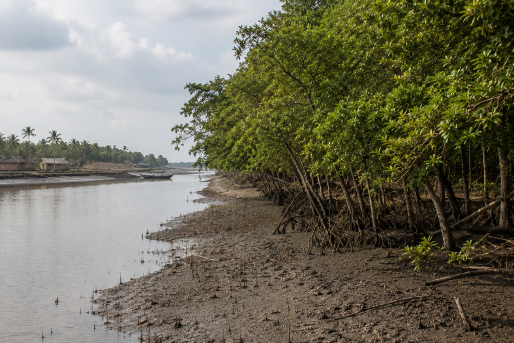
Several characteristic mangrove species occur within the broader region, including sundari, gewa, goran, keora, and other associated plants adapted to saline and tidal environments.
Each species occupies specific ecological niches shaped by salinity, inundation, and sediment conditions.
The relationship between people and mangroves remains complex.
- The forests provide benefits.
- They also impose limits.
- Access is regulated.
- Resources are finite.
Conservation priorities sometimes intersect with livelihood needs.
Yet despite these complexities, there is widespread recognition that the future of the frontier remains connected to the future of the mangroves.
Explorer’s Field Notes
6:00 AM — Dawn on the Raimangal
Morning mist hangs over the river as egrets gather along the exposed mudbanks. The frontier wakes slowly with the turning tide.
8:15 AM — Along the Embankment
Schoolchildren, cyclists, and fishermen share the narrow embankment road, the lifeline connecting villages across the delta.
9:30 AM — Beside a Village Pond
A quiet pond mirrors the surrounding palms while ducks drift across the still water. It is here that daily village life unfolds at an unhurried pace.
10:45 AM — Village Market
Fresh fish, vegetables, and conversations about tides fill the market, reflecting the rhythm of daily life in Hingalganj.
1:30 PM — The Mangrove Edge
The transition from cultivated fields to mangrove vegetation is subtle, where human settlement gradually gives way to tidal wilderness.
3:15 PM — Watching the Tidal Creek
As the tide retreats, the creek exposes muddy banks alive with crabs and wading birds. Every hour reshapes the landscape in subtle ways.
4:45 PM — Watching the River
As the tide recedes, mudflats emerge and wading birds spread across the shoreline in search of food.
5:15 PM — Birds Returning Home
The evening sky fills with egrets, cormorants, and kites returning to their roosts. Their flight marks the gentle transition from day to dusk across the frontier.
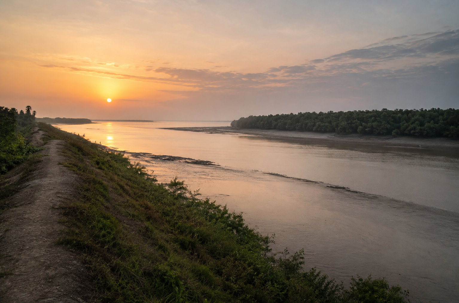
6:20 PM — Sunset on the Frontier
The Raimangal turns golden before fading into shadow, while the opposite bank disappears into the evening haze.
7:45 PM — After Dark
Crickets replace birdsong, distant boat engines echo across the river, and the frontier settles into another tidal night.
Nightfall on the Frontier
The sunset arrives wide.
There are a few tall buildings to interrupt it. The sky expands across rivers, fields, and distant tree lines. For a brief period, the frontier glows.
Mudbanks reflect orange light. Water darkens.
The mangroves become silhouettes. As darkness spreads, the landscape changes character.
The border becomes invisible again. The opposite bank of the Raimangal fades into shadow. Only scattered lights hint at distant settlements.
In villages, evening routines begin.
- Families gather.
- Meals are prepared.
- Children finish homework.
- Television sounds drift through open windows.
Farther from settlements, the ecological day begins anew.
- Nocturnal species emerge.
- Insects dominate the soundscape.
- Crabs become active along muddy margins.
- The rivers continue moving.
- The tide ignores darkness.
Boat engines occasionally echo across open water. Each sound feels amplified. Each light feels isolated.
Standing on an embankment after sunset, one gains a deeper appreciation for the frontier. Not because it feels remote. But because it feels exposed.
The landscape remains open to weather, water, and uncertainty. The people who live here understand that reality better than anyone.
The Seasons of Hingalganj
No season leaves Hingalganj unchanged.
The frontier transforms continuously.
Winter
Cool mornings, migrating birds, clearer skies, and relatively stable travel conditions make winter one of the most comfortable periods in the region.
Fog occasionally settles over rivers and fields before sunrise.
Spring
- Vegetation responds quickly to rising temperatures.
- Agricultural activity intensifies.
- Birdlife remains active.
The landscape appears balanced between winter clarity and summer intensity.
Summer
- Heat dominates daily life.
- Afternoons become demanding.
- Humidity rises.
Communities adapt through long-established routines shaped by generations of experience.
Monsoon
The monsoon fundamentally alters the frontier.
- Water levels rise.
- Canals expand.
- Fields become saturated.
- Transportation becomes more complex.
The landscape feels simultaneously vulnerable and renewed.
Post-Monsoon
Fresh vegetation, clearer skies, and productive agricultural conditions characterize the months following the rains.
Many landscapes appear at their most visually striking during this period.
Cyclone Season
Cyclone season remains deeply embedded in local consciousness.
Preparedness is practical rather than theoretical. Storm memories influence behavior, infrastructure, and planning. Every household understands that resilience begins before the storm arrives.
Cyclones and Survival
Long before a cyclone appears on a weather map, people in Hingalganj begin to pay attention.
The signs are often subtle. An unusually low pressure forecast.
- A discussion at a tea stall.
- A warning shared through mobile phones.
- A fisherman decides not to venture too far.
- A shopkeeper is securing loose materials earlier than usual.
In many parts of India, storms are events. In Hingalganj, they are part of history. The landscape itself tells that story.
Embankments snake across the countryside like defensive walls. Raised roads reveal previous flood levels.
Cyclone shelters stand as reminders of lessons learned through hardship.
Across the wider Sundarbans region, storms such as Aila (2009), Amphan (2020), Yaas (2021), and other severe cyclonic systems left lasting impacts on settlements, livelihoods, agriculture, and embankment infrastructure.
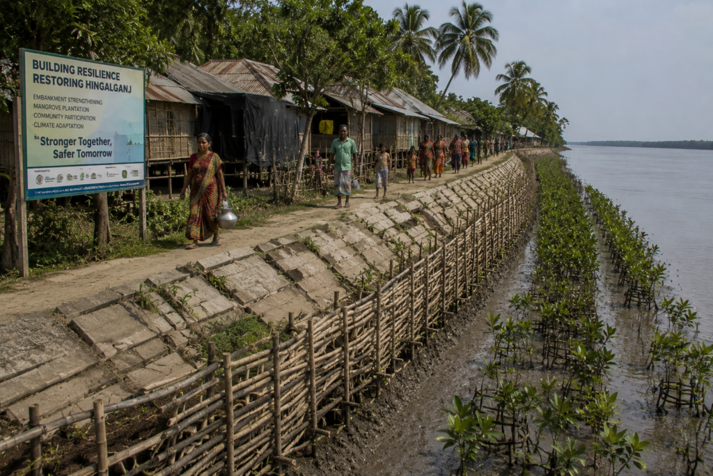
Hingalganj, positioned along a vulnerable frontier of tidal rivers and low-lying reclaimed land, has repeatedly experienced the consequences of storm surges and saline intrusion.
The challenge is rarely the wind alone.
It is the water. When embankments fail, rivers reclaim space.
- Saltwater enters agricultural fields.
- Fish ponds overflow.
- Roads disappear.
- Freshwater sources become contaminated.
Recovery often continues long after headlines fade. Yet resilience here is not defined by dramatic acts. It is visible in rebuilding.
- Repairing embankments.
- Replanting fields.
- Restoring ponds.
- Returning children to school.
- Resuming daily life.
The frontier survives not because storms are absent, but because adaptation has become a cultural skill.
Ferry Routes and Hidden Paths
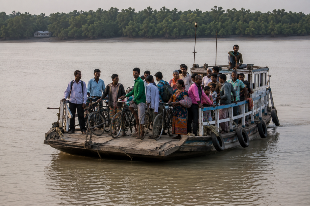
Every explorer eventually learns that maps can be misleading in Hingalganj.
A village may appear close. A river may suggest easy access. Yet distance in the delta is measured differently.
- Water changes everything.
- Roads eventually encounter creeks.
- Paths encounter embankments.
- Rivers require ferries.
- And ferries depend upon conditions.
Many journeys through Hingalganj involve combinations of road travel, embankment routes, local transport, and river crossings.
The landscape rewards patience. Some of the most interesting routes are not major roads at all. They are narrow embankment tracks running beside ponds, fields, and tidal channels.
Walking these paths reveals details invisible from vehicles.
- Birds feeding in drainage canals.
- Fishing nets are drying beside homes.
- Children cycling to school.
- Mangrove saplings colonizing muddy edges.
The hidden geography of Hingalganj exists at a slower pace. To understand the frontier, one must occasionally leave the road and follow the embankment.
Photography Expedition Guide
Hingalganj rewards photographers who appreciate atmosphere rather than spectacle.
The landscape’s power lies in its relationships.
- Water and land.
- Human settlement and wilderness.
- India and Bangladesh.
- Protection and vulnerability.
These contrasts create compelling visual narratives.
Sunrise Along the Raimangal
The broad river often produces extraordinary dawn conditions.
Mist, tidal reflections, distant mangroves, and soft light combine to create some of the region’s most evocative scenes. Photographers should arrive before first light.
The transformation occurs quickly.
Embankment Landscapes
Few locations in the Sundarbans demonstrate the relationship between people and environment as clearly as Hingalganj’s embankments.
These elevated corridors provide excellent perspectives across fields, rivers, settlements, and wetlands.
Village Documentary Photography
The villages offer opportunities for respectful documentary work.
- Daily life unfolds visibly.
- Agriculture.
- Fishing.
- Education.
- Community interactions.
The strongest images often emerge through observation rather than direction.
Monsoon Drama
Storm clouds gathering above tidal rivers create dramatic visual conditions.
Monsoon photography requires patience and caution, but the atmospheric rewards can be exceptional.
Wildlife Opportunities
Wetlands, ponds, riverbanks, and mangrove edges support a diversity of birdlife. Telephoto lenses reward patient observation.
Wildlife photography here is often about subtle moments rather than iconic encounters.
Expedition Notes
The Border Is Ecological Fiction
The political boundary is real.
The ecological boundary is not. Mangrove ecosystems extend across both countries.
- Birds cross freely.
- Fish migrate.
- Sediment moves.
The frontier demonstrates how nature resists administrative simplicity.
Embankments Create Two Landscapes
Stand atop an embankment and look in opposite directions.
One side often reveals agricultural land shaped by human effort. The other reveals rivers, wetlands, and tidal processes.
The contrast is striking.
Water Determines Perspective
The same location may appear entirely different at low tide and high tide. Photographers, researchers, and explorers quickly learn to pay attention to tidal schedules.
Isolation Is Relative
Although Hingalganj may appear remote on a map, communication networks, transportation improvements, and mobile connectivity have altered everyday realities.
The frontier remains connected to the wider world.
Connected Landscapes
No part of the Sundarbans exists independently.
Hingalganj’s significance becomes clearer when viewed within a broader regional context.
- To the east lies Bangladesh and the mangrove forests of the greater Sundarbans ecosystem.
- To the south stretch increasingly wild tidal landscapes.
- To the west lie other inhabited portions of the Indian Sundarbans.
- To the north, the landscape gradually transitions toward mainland Bengal.
The Raimangal River serves as both a connector and a divider.
The Kalindi links ecological systems across the frontier. The Ichamati carries historical and cultural significance extending beyond administrative boundaries.
Nearby settlements maintain economic relationships despite geographical challenges.
- Markets depend upon transportation corridors.
- Families maintain social connections across villages and blocks.
- Environmental processes connect everything.
A cyclone does not respect district boundaries. Neither does a migratory bird. Understanding Hingalganj requires understanding these connections.
The frontier is not an edge.
It is a meeting point.
Oral Histories
The most revealing stories in Hingalganj are often not dramatic.
They are practical. Older residents remember when roads were fewer. When communication depended upon physical travel. When reaching certain settlements required far greater effort.
They describe changing riverbanks. Different agricultural conditions. Storms that altered familiar landscapes. Many memories focus on adaptation.
- A family rebuilding after flooding.
- A community strengthening an embankment.
- A school continues despite difficult conditions.
The stories rarely emphasize heroism. Instead, they emphasize persistence. What emerges is a collective memory shaped by environmental uncertainty and communal response.
The frontier remembers through experience.
Food of the Hingalganj
Food in Hingalganj reflects both the river and the field.
Rice remains central to daily meals. Fish occupy an equally important place. Together they form the foundation of local food culture.
Seasonality remains significant.
- River conditions influence available fish species.
- Agricultural cycles influence vegetables and grains.
- Household gardens contribute additional diversity.
- Freshwater ponds support aquaculture in many areas.
- Market food culture reveals broader connections.
- Products arrive from neighboring regions.
- Local produce moves outward.
- Trade influences what appears on household tables.
Tea remains a social constant. Tea stalls function as informal information networks. Weather forecasts, market prices, local news, and community concerns often circulate alongside cups of tea.
To sit at a tea stall is to participate briefly in the social life of the frontier.
Economy of the Hingalganj
The economy of Hingalganj reflects environmental realities.
Agriculture remains important, though conditions are influenced by salinity, weather, and embankment stability.
Fishing contributes significantly to livelihoods. Aquaculture and crab-related activities support additional income in parts of the wider region.
- Small businesses serve local communities.
- Transportation supports trade.
- Government services provide employment opportunities.
- Education and healthcare institutions contribute to local economic activity.
Migration also plays a role.
Some residents seek opportunities elsewhere in West Bengal or beyond. Remittances influence household economies. Yet despite these connections, the local economy remains closely tied to environmental conditions.
- A strong agricultural season affects spending.
- A severe cyclone affects recovery.
The frontier economy remains adaptive.
Its strength lies in diversification and resilience.
Then and Now
Standing on an embankment overlooking the Raimangal today, it is possible to imagine very different versions of this landscape.
A century ago, larger areas remained dominated by tidal forests and wetlands.
- Settlement patterns were less extensive.
- Transportation infrastructure was more limited.
- Communication was slower.
Over time, embankments expanded.
- Agricultural landscapes developed.
- Villages grew.
- Schools appeared.
- Healthcare access improved.
- Road networks increased.
- Mobile connectivity transformed communication.
Yet some things remain remarkably unchanged.
- The tides still govern the rivers.
- Cyclones still influence planning.
- Mangroves still protect vulnerable shorelines.
The frontier remains a place of negotiation between people and the environment.
- The balance has shifted.
- The conversation continues.
Modern Hingalganj is neither entirely traditional nor fully transformed.
It exists between those states. Just as it exists between river and land. Between nation and ecosystem. Between certainty and change.
That in-between quality may be its defining characteristic.
The Wild Orbit Quick Facts
| Category | Details |
| Location | North 24 Parganas District, West Bengal, India |
| Administrative Unit | Hingalganj Community Development Block |
| Regional Identity | Northeastern Sundarbans Frontier |
| Approximate Coordinates | 22.30° N, 88.95° E |
| International Context | Border region adjoining Bangladesh across the river systems |
| Major Rivers | Raimangal, Kalindi, Ichamati and associated tidal channels |
| Landscape Type | Embankment-protected delta settlements |
| Primary Livelihoods | Agriculture, fishing, aquaculture, trade, services |
| Ecological Zone | Sundarbans Delta Fringe |
| Nearest Major Urban Center | Kolkata |
| Best Season for Exploration | November–February |
| Monsoon Season | June–September |
| Cyclone Exposure | High |
| Wildlife Highlights | Wetland birds, estuarine ecosystems, and mangrove-edge biodiversity |
| Photography Strength | River landscapes, frontier culture, embankments, seasonal atmosphere |
The Wild Orbit Expedition Snapshot
Accessibility
★★★☆☆ (3/5)
Reachable by road from Kolkata and Basirhat, but exploration becomes increasingly dependent on local transport and river geography.
Why it matters
Hingalganj is accessible enough to reach comfortably, yet remote enough to feel genuinely separate from urban Bengal.
Wildlife Potential
★★★☆☆ (3/5)
The frontier supports rich wetland and estuarine biodiversity, though wildlife observation often rewards patience rather than expectation.
Why it matters
This is a landscape of ecological subtlety rather than guaranteed encounters.
Photography Potential
★★★★★ (5/5)
One of the most visually compelling frontier landscapes in the Sundarbans.
Why it matters
Rivers, embankments, weather, villages, and borderland atmospheres create extraordinary documentary opportunities.
Cultural Richness
★★★★☆ (4/5)
The interaction between river life, agriculture, migration, religion, and frontier identity creates a distinctive cultural landscape.
Historical Interest
★★★★☆ (4/5)
Land reclamation, partition-era changes, embankment development, and border formation have shaped the region profoundly.
Solitude Level
★★★★☆ (4/5)
Outside markets and transport corridors, large sections of Hingalganj feel remarkably quiet and spacious.
The Wild Orbit Explorer Connections
Every exploration of Hingalganj naturally connects to the wider Sundarbans landscapes.
Raimangal River
One of the defining rivers of the eastern Sundarbans frontier.
Kalindi River
A historically and ecologically important tidal system shaping the border landscape.
Ichamati River
A river deeply intertwined with regional history, migration, and cultural memory.
Hasnabad
An important transport and administrative gateway for journeys toward the frontier.
Sandeshkhali
Another river-shaped landscape where communities and tidal environments remain closely linked.
Gosaba
The administrative and historical heart of the inhabited Sundarbans.
Sundarbans Mangrove Forests
The ecological foundation underpinning life throughout the region.
India–Bangladesh Border Landscape
One of the most fascinating cultural and geographical dimensions of the northeastern delta.
FAQs
1. Is Hingalganj an island?
No. Hingalganj is a large frontier block comprising multiple settlements, river systems, and embankment landscapes.
2. Where is Hingalganj located?
In the northeastern Sundarbans region of North 24 Parganas district, West Bengal.
3. Why is Hingalganj important?
It represents one of the most significant borderland and climate-frontier landscapes in the Indian Sundarbans.
4. Does Hingalganj border Bangladesh?
Yes. Several river systems form part of the India–Bangladesh frontier.
5. Which river is most associated with Hingalganj?
The Raimangal River.
6. Is Hingalganj part of the Sundarbans?
Yes. It forms part of the greater Sundarbans delta region.
7. Are there mangroves in Hingalganj?
Mangrove ecosystems occur throughout the broader frontier landscape.
8. Can tigers be found in Hingalganj?
Tiger habitat exists within protected Sundarbans forests nearby, but tiger presence should never be assumed in inhabited areas.
9. Is Hingalganj suitable for birdwatching?
Yes. Wetlands, riverbanks, ponds, and mangrove-edge habitats support diverse birdlife.
10. What are the main livelihoods?
Agriculture, fishing, aquaculture, trade, and service-related work.
11. What makes Hingalganj different from Gosaba?
Gosaba functions as a major inhabited island region, while Hingalganj is defined by its frontier and borderland identity.
12. Is Hingalganj vulnerable to cyclones?
Yes. Like much of the lower delta, it faces significant cyclone risks.
13. Why are embankments important?
They protect settlements and agricultural land from tidal flooding and storm surges.
14. Can visitors photograph the border landscape?
Yes, while respecting local regulations and security considerations.
15. What is the best season to visit?
Winter offers the most comfortable conditions.
16. Does Hingalganj have ferry routes?
Yes. Ferries and river crossings remain important components of regional mobility.
17. Is agriculture affected by salinity?
Yes. Salinity remains a significant environmental challenge.
18. What wildlife is easiest to observe?
Birds, reptiles, wetland species, and estuarine ecosystems.
19. Is Hingalganj heavily urbanized?
No. Much of the landscape remains rural and river-oriented.
20. How far is Hingalganj from Kolkata?
The distance varies by route, but it typically requires a substantial road journey through North 24 Parganas.
21. Does the region have historical significance?
Yes. Land reclamation, border formation, and settlement history have all shaped the landscape.
22. Are there local markets?
Yes. Markets remain central to social and economic life.
23. Is monsoon travel difficult?
It can be, particularly during periods of heavy rainfall or flooding.
24. What is the most distinctive feature of Hingalganj?
Its position at the intersection of rivers, borders, mangroves, and human resilience.
25. Why should explorers spend time here?
Because few places reveal the relationship between people and the delta as clearly as Hingalganj.
How To Reach Hingalganj
Hingalganj lies in the northeastern part of the Indian Sundarbans in North 24 Parganas district, close to the India–Bangladesh border. Although it is more remote than western gateways such as Namkhana or Canning, it is well connected by road, rail, and local ferry services.
From Kolkata:
Hingalganj is approximately 115–125 km from Kolkata, depending on the route. The journey by road generally takes 3.5 to 4.5 hours, passing through Barasat, Basirhat, and Hasnabad before reaching the riverine landscape of the Sundarbans.
By Rail:
Travelers can board Eastern Railway suburban trains from Sealdah Station to Hasnabad Railway Station, the nearest major railhead. From Hasnabad, Hingalganj can be reached by road using local buses, shared vehicles, or hired taxis. The train journey takes around 2.5 to 3 hours, followed by approximately 45–60 minutes by road.
By Road:
The most common driving route is via Barasat – Basirhat – Hasnabad – Hingalganj. State highways and district roads provide direct access, with the final stretch passing through embanked roads, agricultural villages, tidal creeks, and mangrove-fringed landscapes that characterize the northern Sundarbans.
By Ferry:
While Hingalganj town itself is accessible by road, local ferry services remain an important part of transportation within the region. Ferries connect villages and islands separated by tidal rivers such as the Goureswar, Kalindi, and Ichamati river systems, enabling movement of residents, goods, and visitors to areas where bridges are unavailable.
During the Monsoon:
From June to September, travelers should allow additional travel time. Heavy rainfall, high tides, and occasional flooding may affect road conditions, ferry operations, and local transport schedules. Checking weather forecasts and ferry timings before departure is advisable, particularly when planning onward travel to remote islands or forest-edge settlements.
Explorer Tip
Begin early. The frontier is at its most atmospheric during the first hours of daylight.
Things To See Around Hingalganj
Raimangal River
The defining river landscape of the frontier.
Kalindi River Corridors
Important ecological and cultural waterways.
Embankment Roads
Among the most revealing routes for understanding the region.
Village Markets
Excellent places to observe everyday life.
Mangrove Edge Landscapes
Where human settlement and tidal ecosystems meet.
Seasonal Wetlands
Important habitats for birds and aquatic life.
Frontier Viewpoints
Locations where river landscapes reveal the proximity of Bangladesh.
Rural Settlement Networks
The living geography of the delta.
Traditional Fishing Areas
Windows into longstanding livelihood systems.
Agricultural Landscapes
Fields reclaimed and maintained through generations of effort.
Continue the Journey
The frontier does not end at Hingalganj.
Follow the Raimangal southward and the mangroves become denser. Follow the Kalindi and new stories emerge.
Travel west toward Sandeshkhali and different relationships between people and water appear. Moving toward Gosaba and the inhabited island heart of the Sundarbans reveals itself.
- Every river leads somewhere.
- Every embankment connects another community.
- Every tide redraws the landscape.
The Sundarbans rewards those willing to continue.
Leaving the Landscape
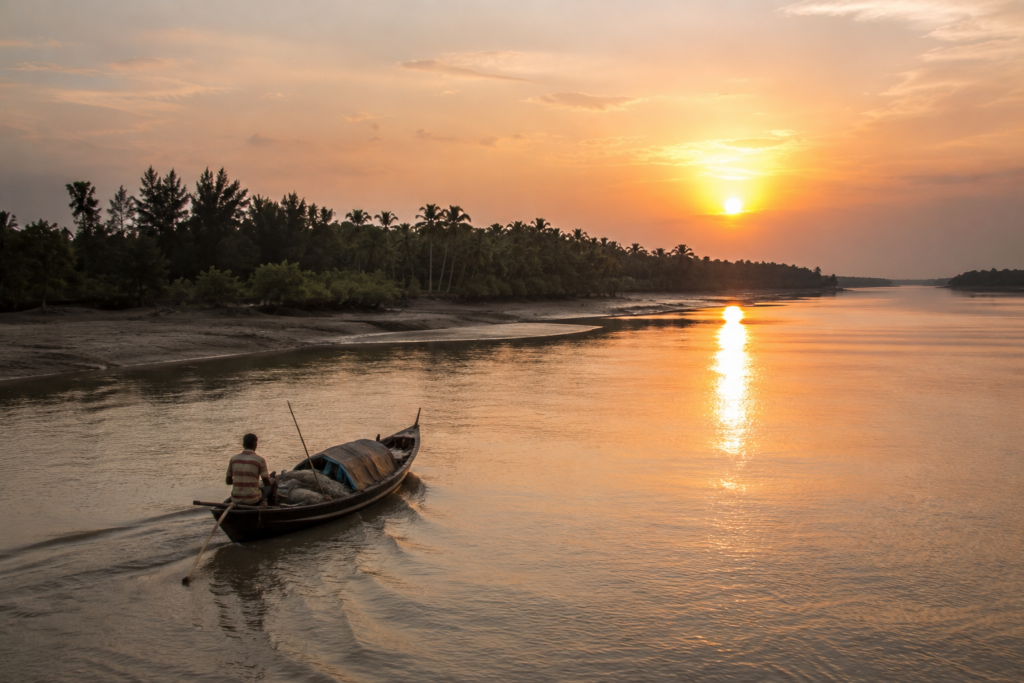
As evening settles over the Raimangal, the border disappears once again.
The river widens into shadow. Mangroves become silhouettes. The opposite bank fades until it exists only as memory and imagination.
A final fishing boat moves downstream with the tide.
Its engine sound lingers long after the vessel itself vanishes into darkness. The embankment beneath your feet remains solid. The river beside it remains restless.
That contrast captures Hingalganj perfectly.
For generations, people here have built stability within movement. They have cultivated fields beside tidal rivers. Raised families within cyclone country. Created communities along a shifting frontier.
And as darkness settles across the delta, one truth becomes impossible to ignore.
- The border may define maps.
- The rivers define life.
- The tides continue.
And Hingalganj endures beside them.
Plan your private Sundarban expedition
A private journey shaped around you — your group, your pace, your interests. Book a free consultation.