 Encyclopedia
The river was awake long before the sun.
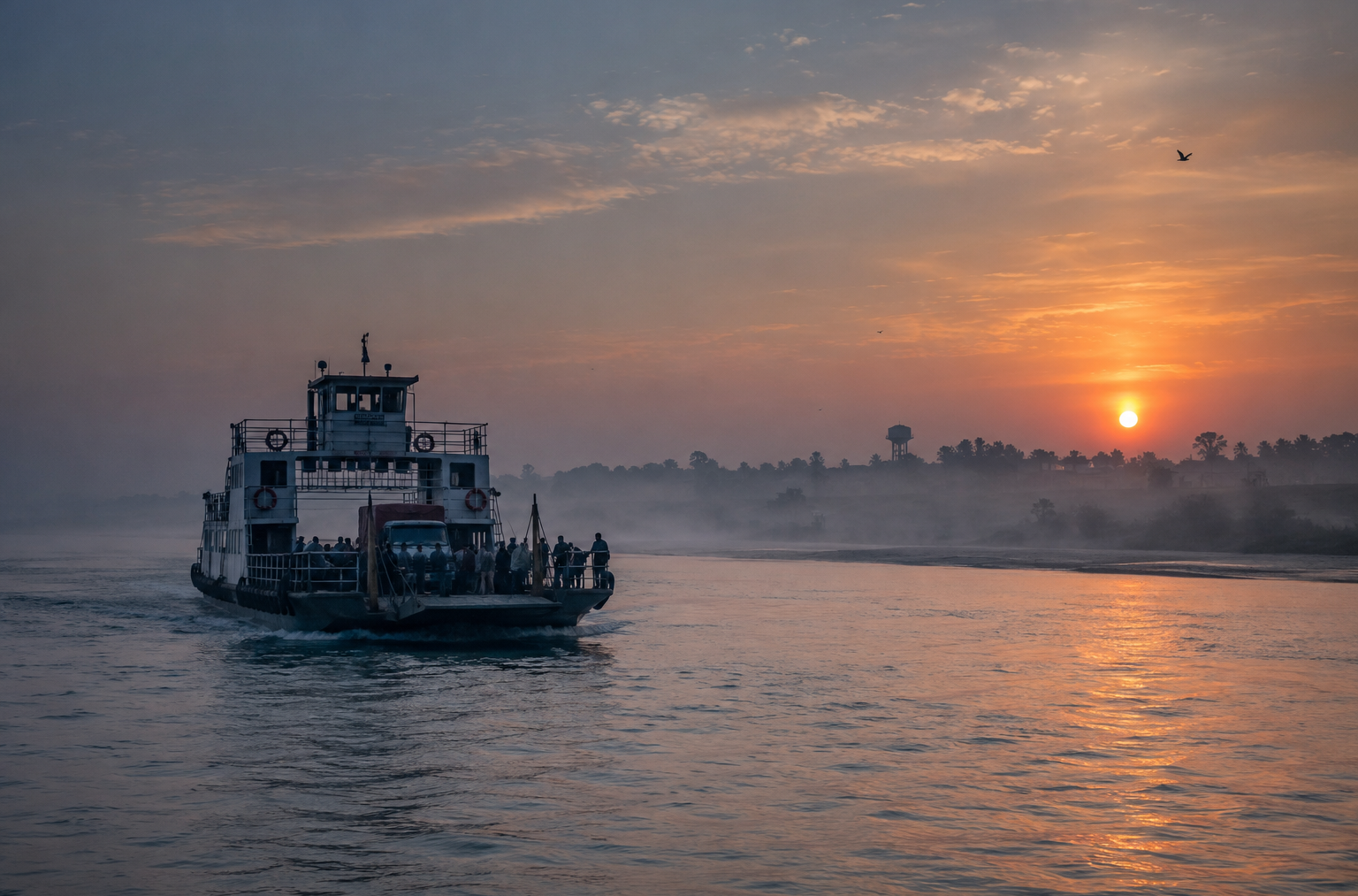
At 4:47 in the morning, the water beneath the ferry moved with a slow metallic shimmer, dark as hammered iron. Somewhere beyond the black horizon lay Sagar Island (Sagardwip), the island where the great river finally surrenders itself to the sea.
The tide was rising. Not dramatically. Not violently. Only enough to remind everyone aboard that here, in the lower delta, the water is always in charge.
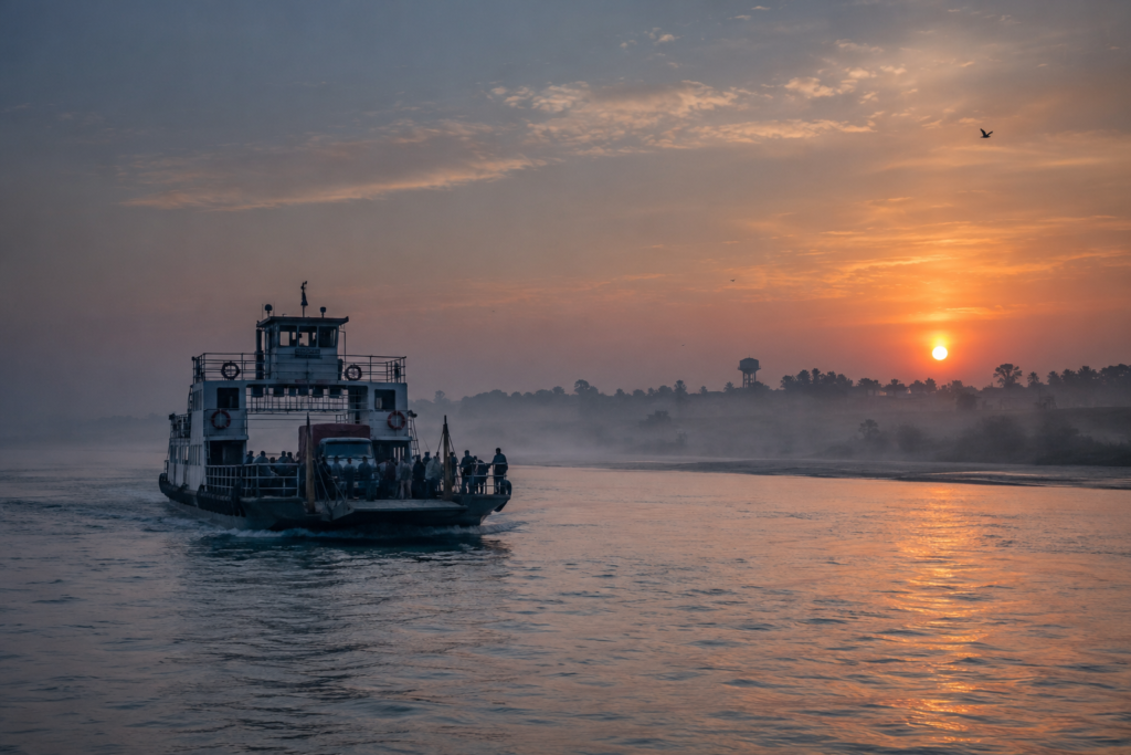
The river was awake long before the sun.
At 4:47 in the morning, the water beneath the ferry moved with a slow metallic shimmer, dark as hammered iron. Somewhere beyond the black horizon lay Sagar Island (Sagardwip), the island where the great river finally surrenders itself to the sea.
The tide was rising. Not dramatically. Not violently. Only enough to remind everyone aboard that here, in the lower delta, the water is always in charge.
The engine muttered to itself as the vessel pushed away from the mainland near Kakdwip. Behind us, scattered lights flickered along the shore. Ahead, nothing existed except darkness and the smell of salt.
Not sea salt. River salt. The peculiar scent that belongs only to estuaries, where fresh water and ocean currents negotiate territory twice every day. A fisherman sitting near the bow pointed into the darkness.
“Not far now.” But there was nothing to see. Only water. Only sky. Only the long anticipation that accompanies every island approach. Then came the birds. A distant whistle. A sharp cry. The first silhouettes of egrets crossing the dawn. Slowly, almost reluctantly, the eastern horizon began to pale. Shapes emerged.
First, the outline of embankments. Then a line of trees. Then the faint geometry of human settlement. Sagar Island appeared exactly as great islands often do not suddenly, but by degrees. A shadow becoming a coastline. A coastline becoming a world. And somewhere beyond those embankments waited one of the most remarkable islands in the entire Sundarbans landscape.
Not because it contains tigers. Not because it remains untouched. But because a few islands in Bengal stand at such a powerful meeting point of geography, mythology, history, faith, and survival.
This is where the river ends and where countless stories begin!
First Encounter
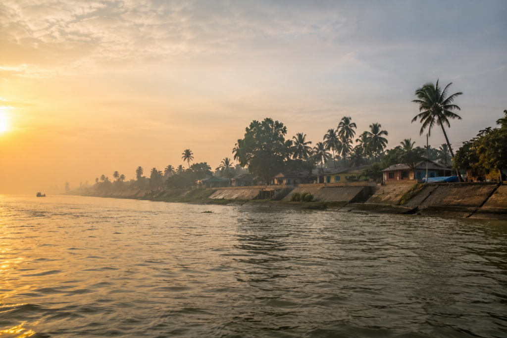
By sunrise, the shoreline had acquired colour. The water around the ferry turned from charcoal grey to a murky green-brown, carrying fine sediments that had travelled hundreds of kilometres through the Ganges system. The first structures visible were embankments. Long, elevated earthworks running beside the river.
Every island in the lower delta possesses a relationship with embankments, but on Sagar, they feel especially significant. They are not simply engineers. There are boundaries between habitation and inundation. Between certainty and uncertainty. Beyond them stretched settlements, ponds, cultivated fields, and clusters of trees bending gently in the coastal wind.
The shoreline lacked the dense wilderness associated with the deeper Sundarbans.
Instead, Sagar announced itself as a human island.
An inhabited landscape.
A place shaped by generations who learned how to negotiate with tides, storms, and shifting land. Boats moved along the river. Motorcycles waited near the landing area. Tea stalls were already active. Schoolchildren appeared on roads lined with coconut palms. The island did not feel remote.
It felt lived-in.
Yet the water surrounding it never allowed anyone to forget where they were.
- Every road.
- Every village.
- Every field.
- Every shrine.
Exists because the river permits it, for now!
Island Identity
To understand Sagar Island, one must first understand scale. Many visitors arrive expecting a small pilgrimage island. Instead, they encounter something much larger.
Sagar is the largest island in West Bengal and among the most significant inhabited islands within the wider Sundarbans delta system. Situated roughly one hundred kilometres south of Kolkata, it occupies a strategic position where the Hooghly branch of the Ganges approaches the Bay of Bengal.
The island forms the core of the Sagar Community Development Block within the South 24 Parganas district. Administrative headquarters are located at Rudranagar, while numerous villages are distributed across the island’s interior. The block contains multiple gram panchayats and dozens of villages connected through roads, embankments, ferries, and local markets.
Modern estimates place the island’s population above two hundred thousand people, making it one of the most densely inhabited islands in the delta.
Yet population figures tell only part of the story. Sagar is not a single settlement. It is a constellation. Forty-plus villages are connected by roads that rise slightly above surrounding fields. Ponds glint beside homes. Temples appear unexpectedly among trees. Mosques stand near markets. Schools open each morning beneath skies watched constantly for signs of changing weather.
- At times, the island feels agricultural.
- At times maritime.
- At times deeply spiritual.
- At times fiercely practical.
This shifting identity mirrors the geography itself.
- To the west flows the mighty Hooghly.
- To the east moves the Muriganga.
- To the south waits the Bay of Bengal.
Three immense forces surround the island. Three boundaries. Three influences are shaping everything from settlement patterns to folklore. The island’s story is impossible to separate from water.
The Rivers That Built The Island
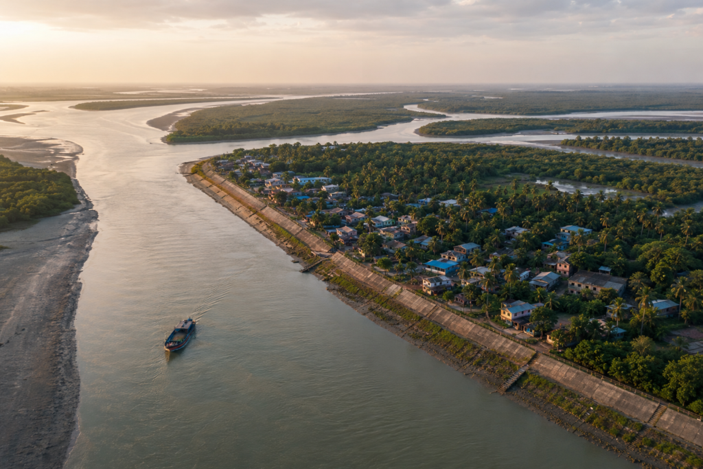
Every island has parents. Sagar’s parents are rivers.
The Hooghly approaches from the north, carrying the accumulated memory of an enormous watershed.
- Snowmelt from the Himalayas.
- Monsoon rainfall.
- Centuries of commerce.
- Countless human journeys.
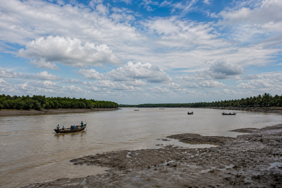
All eventually move through this channel toward the sea. To the east flows the Muriganga. Though smaller than the Hooghly, it has profoundly influenced the island’s development and connectivity. Ferries crossing this waterway have long served as one of the principal gateways to Sagar.
The rivers are not static. They breathe. Twice daily, tides push inland. Twice daily, they retreat. The result is a landscape in constant conversation with moving water. Boatmen speak of currents the way farmers speak of seasons. Older residents remember shorelines that no longer exist. Entire stretches of riverbank have shifted. Channels have widened. Other areas have accumulated sediment and expanded.
Maps tell one story. Memory often tells another. For centuries, these waters functioned as transportation corridors. Pilgrims arrived by boat. Traders moved goods through tidal channels. Fishermen followed seasonal patterns dictated by currents and fish migrations.
Even today, despite expanding infrastructure, the rhythm of the rivers remains fundamental.
- When storms arrive, the rivers become warning systems.
- When tides surge, they become threats.
- When the weather is calm, they become highways.
And when dawn arrives, they become mirrors. Reflecting the island back upon itself.
Historical Footprints
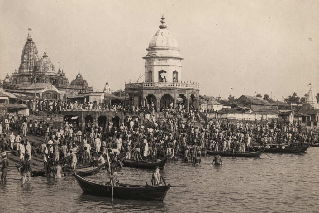
History on Sagar Island is rarely straightforward. Like many delta islands, portions of its past have been erased repeatedly by erosion, storms, shifting channels, and changing settlements.
What survives is a layered narrative.
Ancient mythology places this landscape at the centre of one of India’s most enduring sacred stories. The legend of King Sagar, Kapil Muni, and the descent of the Ganga transformed the island into a place of pilgrimage long before modern roads or ferries existed. For many visitors, Sagar remains inseparable from these sacred associations.
Yet beyond mythology lies another history.
- A history of reclamation.
- A history of settlement.
- A history of human determination.
Colonial records reveal repeated efforts during the nineteenth century to reclaim land, establish settlements, and transform portions of the island into productive territory. These efforts were often complicated by disease, cyclones, flooding, and environmental instability.
The island repeatedly challenged human ambition. Settlements expanded. Storms destroyed them. People returned. Embankments were built. Embankments failed. New ones emerged.
Through the nineteenth and twentieth centuries, migration from other parts of Bengal gradually shaped the island’s demographic character.
- Agriculture expanded.
- Fishing communities grew.
- Local markets developed.
- Religious gatherings attracted increasing numbers of pilgrims.
By the late twentieth century, Sagar had evolved into something unique within the Sundarbans landscape:
A heavily inhabited island balancing pilgrimage, agriculture, fisheries, and delta survival.
Its history was not written by kings. It was written by persistence.
Historical Personalities & Transformations
Some islands are remembered through rulers. Sagar is remembered through influences.
The most enduring figure remains Kapil Muni.
Whether viewed through mythology, faith, or cultural memory, his association with the island has shaped its identity for centuries. The Kapil Muni Temple continues to function as the symbolic heart of Gangasagar’s spiritual landscape.
Yet Sagar’s transformation also owes much to unnamed people.
- Boatmen.
- Settlers.
- Farmers.
- Fishermen.
- Embankment workers.
- School teachers.
- Village organisers.
- The architects of everyday survival.
Colonial administrators attempted to organise and reclaim portions of the island, but long-term habitation depended upon communities willing to endure difficult environmental conditions. In more recent decades, local governance structures, educational institutions, ferry networks, health services, and disaster management systems have gradually altered island life.
The changes are visible everywhere. Concrete roads where mud tracks once existed. Mobile towers rising above coconut trees. Solar panels beside traditional ponds. Students commuting to schools that their grandparents never had access to. Yet transformation remains incomplete.
Because the delta never stops changing. The river still redraws edges. Storms still test resilience. Tides still arrive on schedule. And so Sagar continues to evolve. Not as a finished island. But as a living one. An island perpetually balancing memory and adaptation at the edge of the Bay of Bengal.
Folklore & Legends
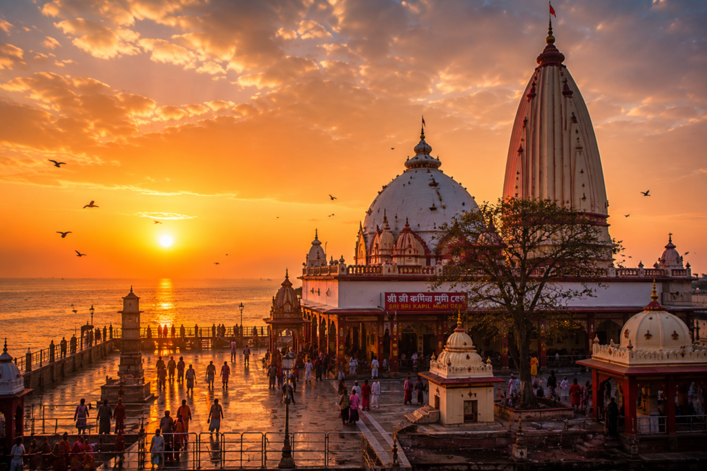
Every island in the tide country possesses stories. Sagar possesses an entire cosmology.
Long before ferries connected the island to the mainland, long before embankments reshaped its edges, people crossed dangerous waters to reach this place, carrying stories older than memory. Those stories still travel with the tide.
Walk through a tea stall near Gangasagar, sit beneath a banyan tree in a village courtyard, or spend enough time with elderly residents, and eventually the conversation drifts toward Kapil Muni.
Not as a distant historical figure. Not as a theological abstraction. But as a presence. A character who still inhabits the island’s cultural imagination.
According to one of India’s most enduring legends, King Sagar’s sixty thousand sons disturbed the meditation of Sage Kapil and were reduced to ashes. Their salvation arrived only when the sacred Ganga descended from heaven and touched the earth, liberating their souls.
For pilgrims arriving at Gangasagar, this is not mythology separated from geography. The landscape itself becomes part of the narrative.
- The river.
- The sea.
- The meeting point of waters.
Everything acquires symbolic meaning. Yet Sagar’s folklore extends beyond sacred texts.
Older fishermen sometimes speak about lights appearing over the river during foggy winter nights. Not everyone agrees on what they are. Some call them reflections.
Others describe them as wandering spirits searching for lost boats. There are stories of sudden voices heard over tidal flats after dark.
Stories of fishermen guided home by sounds they could never identify. Stories of storms that seemed to arrive without warning, despite calm skies only hours before. Most listeners smile when these tales are told.
But nobody interrupts. In the delta, uncertainty commands respect.
Unlike the deeper forest islands, where Bonbibi and Dakshin Ray dominate folklore, Sagar’s narrative universe revolves more strongly around pilgrimage traditions, river spirits, sacred geography, and the unpredictable temperament of water itself.
Here, the river is not merely a channel.
It is a witness. A judge. A storyteller.
Life Between The Tides
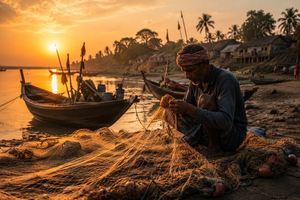
At six o’clock in the morning, the island belongs to workers.
- Not pilgrims.
- Not visitors.
- Not photographers.
Workers.
Cyclists move along embankment roads. Tea stalls fill with conversation. Fishing boats return from night journeys. Women sweep courtyards still damp from dawn dew. The tide influences everything.
Not always dramatically. Sometimes subtly.
A fisherman preparing his nets studies water levels before making decisions. A ferry operator calculates schedules around currents. A farmer watches the sky and the river together.
On Sagar, daily life operates within a tidal calendar that rarely appears on paper.
- Agriculture remains important across large portions of the island.
- Fields change colour with the seasons.
- Green dominates after successful rains.
- Golden tones arrive before harvest.
Elsewhere, ponds shimmer beside homes, serving practical purposes that range from household use to fish cultivation. Fishing remains deeply woven into island life.
The catch varies. The risks vary. The rewards vary. But the relationship remains constant. The river feeds. The river threatens. The river demands respect. Schoolchildren in crisp uniforms travel roads that previous generations could scarcely imagine.
Motorcycles pass bullock carts. Smartphones coexist with traditional fishing techniques. The island lives simultaneously in multiple centuries. That contradiction feels entirely natural here.
Perhaps because change has always arrived in waves.
Walking Through The Villages
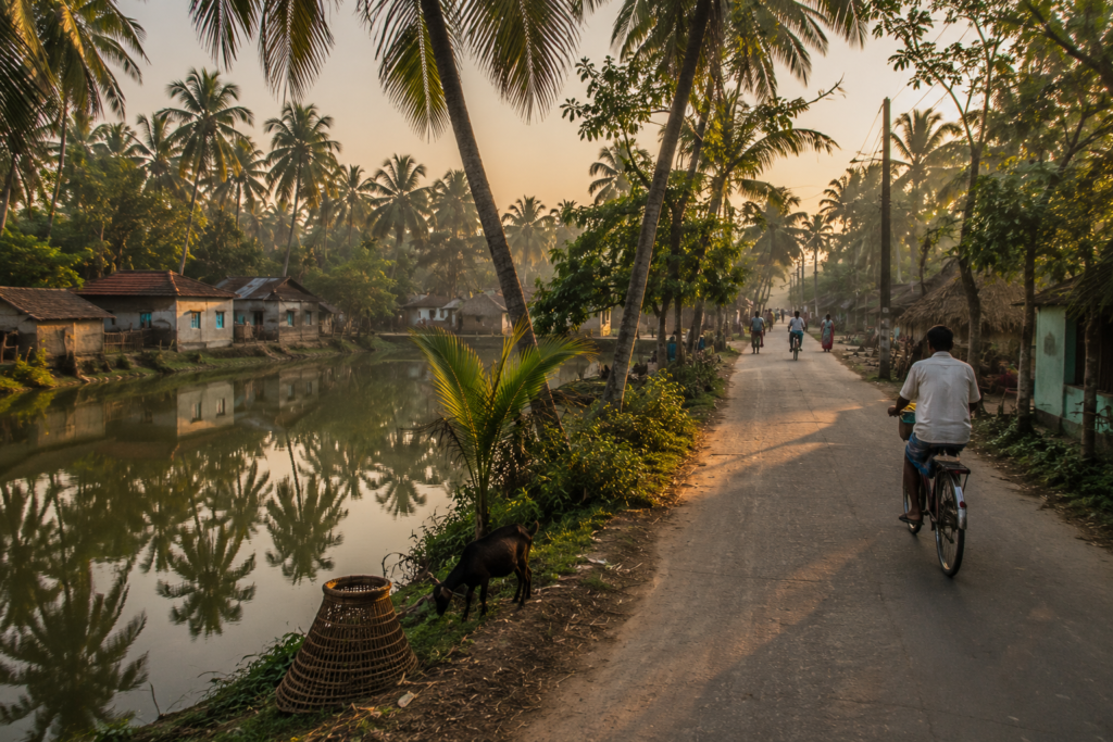
A village in Sagar rarely announces itself. It unfolds.
A narrow road curves around a pond. A cluster of coconut palms appears.
- Then houses.
- Then courtyards.
- Then people.
The first thing one notices is how closely water and settlement coexist. Nearly every village possesses ponds. Some are used for bathing. Others for fish cultivation.
Some simply reflect clouds and passing seasons. Children gather near the tea stalls before school. Elderly men sit on wooden benches discussing politics, weather, and ferry schedules with equal seriousness. Goats wander without urgency. Dogs sleep beneath parked bicycles.
A loudspeaker somewhere broadcasts devotional music. Then fades. Then returns. Temples emerge unexpectedly between houses. Small shrines painted in bright colours stand beside roads. Mosques contribute their own architectural rhythm to the landscape. The coexistence feels ordinary because it is ordinary.
Daily life leaves little room for theatrical divisions.
- Markets provide another window into island society.
- Vegetables arrive from nearby fields.
- Fish arrive from nearby waters.
- News arrives from everywhere.
Markets are information exchanges disguised as commercial spaces. Spend an hour wandering through one and you learn more about the island than any guidebook could ever teach.
- A cyclone warning.
- A school examination.
- A ferry delay.
- A wedding.
- A failed harvest.
Everything circulates. Everything travels. Just like the tides.
Sounds Of The Island
Every island possesses a soundtrack. Sagar’s begins before dawn.
First comes the wind. Soft at first. Moving through coconut fronds.
Then the birds.
- Drongos.
- Mynas.
- Egrets.
- Kingfishers.
Their calls overlap until individual voices become impossible to separate.
As the morning progresses, engines enter the composition.
- Motorcycles.
- Fishing boats.
- Ferries crossing distant channels.
The sound carries remarkably far across flat landscapes. Temple bells punctuate the day. Sometimes near. Sometimes distant. The call to prayer drifts across settlements and mingles with conversations from tea stalls.
A hammer strikes metal in a boat repair yard. A bicycle bell rings. Someone shouts across a field. By afternoon, cicadas dominate warmer months. An electrical buzzing fills the air. Invisible yet impossible to ignore.
Then comes the evening.
The island changes key. Human activity slows. Birds return to roost. Temple bells sound different after sunset. More reflective. More resonant.
And somewhere beyond the embankment, the river continues its endless conversation with the shore. At night, when traffic disappears and village lights diminish, the tide becomes audible again.
- Water moving.
- Water arriving.
- Water leaving.
The oldest sound on the island.
Wildlife Expedition
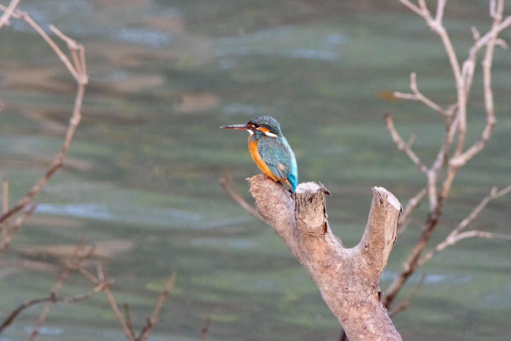
Sagar Island is not a wilderness island.
Understanding that distinction is important. Yet wildlife persists everywhere for those willing to look carefully.
The morning begins with birds. Egrets patrol wetlands. Pond herons stand motionless beside water. Black kites circle overhead. Kingfishers transform ordinary ponds into hunting grounds.
During winter, migratory visitors occasionally join resident species, adding new colours and behaviours to familiar landscapes. Near tidal creeks, mudskippers perform their peculiar amphibious acrobatics. Fiddler crabs wave oversized claws from burrows excavated in soft sediment. The mud itself appears alive. Reptiles remain elusive. Water snakes occasionally appear near ponds and channels. Monitor lizards are sometimes reported from less disturbed habitats. Most encounters occur unexpectedly.
A sudden movement.
A ripple. A disappearing tail. The waters surrounding Sagar occasionally host marine visitors. Dolphins have been observed in estuarine channels of the lower delta, though sightings are never guaranteed.
Ask ten fishermen and you will hear ten different accounts.
Some claim sightings are becoming less frequent. Others insist dolphins still appear regularly if one knows where to look.
Insects deserve attention, too.
- Dragonflies patrol wetlands.
- Butterflies visit flowering plants.
- Fireflies occasionally illuminate humid evenings.
The island rewards patience. Not through dramatic wildlife spectacles. Through accumulation. A kingfisher here. A kite there. A crab emerging from mud. A dolphin rumour carried by fishermen. Nature survives in fragments.
Together, those fragments become an ecosystem.
Mangrove Chronicles
See it for yourself
A private journey shaped around you — your group, your pace, your interests. Book a free consultation.
Sagar occupies an unusual position in the Sundarbans.
It belongs to the delta. Yet much of the original mangrove landscape has long since given way to settlement, agriculture, roads, and human habitation.
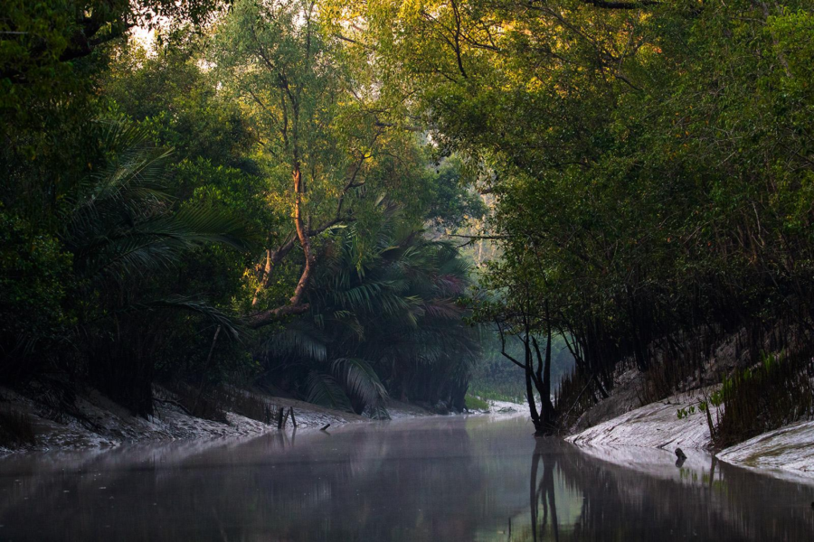
Still, mangroves remain part of the island’s ecological memory. Along creeks, embankments, and less disturbed stretches of shoreline, small pockets persist.
Keora appears where conditions permit. Goran survives in scattered locations. Other salt-tolerant species continue their quiet resistance against development and erosion. These trees perform work that few people notice. They slow currents. Trap sediment. Reduce erosion. Provide habitat. Stabilise fragile edges.
During storms, their importance becomes obvious.
The relationship between Sagar and mangroves is therefore different from that of islands deeper within the reserve forest.
Here, mangroves are not dominant characters. They are survivors. Remnants of older landscapes. Living evidence of what the delta once looked like before human settlement expanded across the island. Stand beside a surviving patch at low tide.
- Observe the roots.
- Observe the mud.
- Observe the countless small creatures moving among them.
And for a moment, the island reveals an earlier version of itself. A memory preserved in wood and salt.
Explorer’s Field Notes
05:11 AM — Ferry departs under fading stars. Tide rising.
05:46 AM — First egrets visible against the eastern horizon.
06:08 AM — Sagar emerges from darkness. Embankments become distinguishable.
06:32 AM — Tea stalls are already active near the landing area.
07:15 AM — Schoolchildren cycling along village roads.
08:02 AM — Fisherman repairing nets beside a pond.
08:47 AM — Kingfisher observed diving repeatedly near a drainage canal.
09:23 AM — Local market begins filling with vegetables and fish.
10:41 AM — Wind strengthens from the south.
11:56 AM — Mudskippers are active near a tidal creek.
01:14 PM — Coconut palms cast sharp shadows across courtyards.
02:39 PM — Boat engines are audible far beyond the visible horizon.
03:27 PM — Incoming tide begins reclaiming exposed mudflats.
04:11 PM — Temple bells drift across the afternoon air.
05:36 PM — Flocks of egrets return toward roosting sites.
06:09 PM — Sunset reflected across pond surfaces throughout the village.
06:42 PM — Evening prayers begin.
07:18 PM — River becomes a dark ribbon beyond the embankment.
08:03 PM — Tide audible in darkness.
08:37 PM — Last ferry lights visible across the water.
09:01 PM — The island settles into the night.
Nightfall On The Island
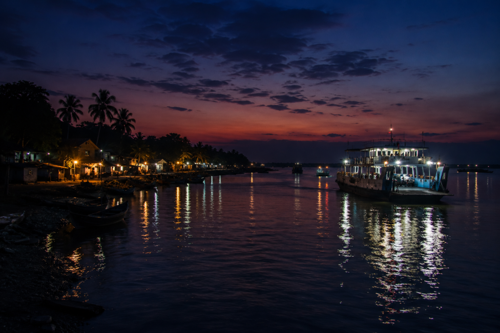
The transformation begins long before darkness arrives.
Around late afternoon, the quality of light changes.
The harsh brightness of midday softens into something gentler. Coconut palms stretch longer shadows across village roads. The ponds that seemed ordinary under the noon sun suddenly become mirrors, holding entire skies within their still surfaces.
By the embankments, people pause. Some sit facing the river. Others simply watch.
There is something compelling about an evening in a tidal landscape. One never quite knows whether the water is arriving or departing without looking carefully.
At Sagar, sunset is not always dramatic. There are no mountain silhouettes.
- No towering cliffs.
- No grand skyline.
Instead, there is openness. Immense openness. The horizon expands in every direction. Clouds become the architects of evening. During winter, the western sky often glows amber and copper.
During monsoon months, massive cloud formations absorb the fading light and return it in shades of violet, crimson, and grey.
- Fishing boats appear as silhouettes.
- Ferry vessels become moving lanterns.
- The river itself turns darker with every passing minute.
As darkness settles, village life contracts inward. Families gather. Cooking fires begin their nightly work. The aroma of fish curry, rice, mustard oil, and wood smoke drifts through settlements. Television sounds leak from open windows. Children complete homework beneath electric bulbs.
Elsewhere, older residents gather for conversations that have no fixed agenda.
- Stories.
- Politics.
- Weather.
- Memories.
Predictions about the coming season. Night reveals another version of Sagar. The pilgrimage crowds vanish. The traffic quiets.
The island returns to itself.
Somewhere beyond the embankments, the tide continues rising. Somewhere farther south, beyond sight, the Bay of Bengal breathes in darkness.
And above everything, stars emerge where clouds permit. Not as many as previous generations remember.
But enough.
Enough to remind the island of its place between river, sea, and sky.
The Seasons Of The Island
An island never remains the same for long. To understand Sagar fully, one must visit repeatedly.
In different months. Under different skies. At different tidal conditions.
Only then does the island reveal its complete personality.
Winter (November – February)
Winter belongs to clarity. The humidity retreats. Skies become expansive. Mornings arrive wrapped in mist. The first sunlight often filters through fog lingering above ponds and fields.
Migratory birds occasionally appear. Pilgrimage activity intensifies as Gangasagar Mela approaches. The island feels alert.
Expectant. Preparing for one of the largest annual gatherings in the region.
Spring (March – April)
The transition is subtle at first. Trees produce fresh growth. Temperatures climb steadily. The landscape begins preparing for heat.
Village ponds shrink slightly. The air grows heavier. Afternoons become quieter. People seek shade. The island slows its pace.
Summer (May – June)
Heat dominates. The roads shimmer. Fields dry.
Cyclone anxiety increases. Conversations frequently drift toward weather forecasts. Cloud formations are watched carefully.
The Bay of Bengal becomes a source of anticipation. Summer on Sagar is not merely a season. It is a period of vigilance.
Monsoon (June – September)
Everything changes.
- Rain arrives.
- The island turns green.
- Ponds fill.
- Canals swell.
- Roads glisten.
- Fields awaken.
- The river becomes larger.
More energetic. More unpredictable.
- Travel becomes slower.
- Life becomes wetter.
- The island feels renewed.
Yet the monsoon always carries uncertainty. Too little rain creates concern. Too much rain creates another.
Post-Monsoon (October – November)
Perhaps the most beautiful period of the year.
The air clears. Vegetation remains vibrant. The worst humidity begins to fade.
Skies become dramatic. Sunsets improve. Travel becomes easier. The island feels refreshed after months of rain.
Cyclone Season
Cyclone season does not fit neatly into a calendar. That uncertainty is precisely what makes it powerful.
- Every year, residents monitor the Bay.
- Every year, weather bulletins attract attention.
- Every year, the possibility exists that a distant tropical depression may evolve into something far more serious.
On Sagar, seasons are not abstract categories. They are lived realities. Each one leaves visible marks upon the landscape.
Cyclones And Survival
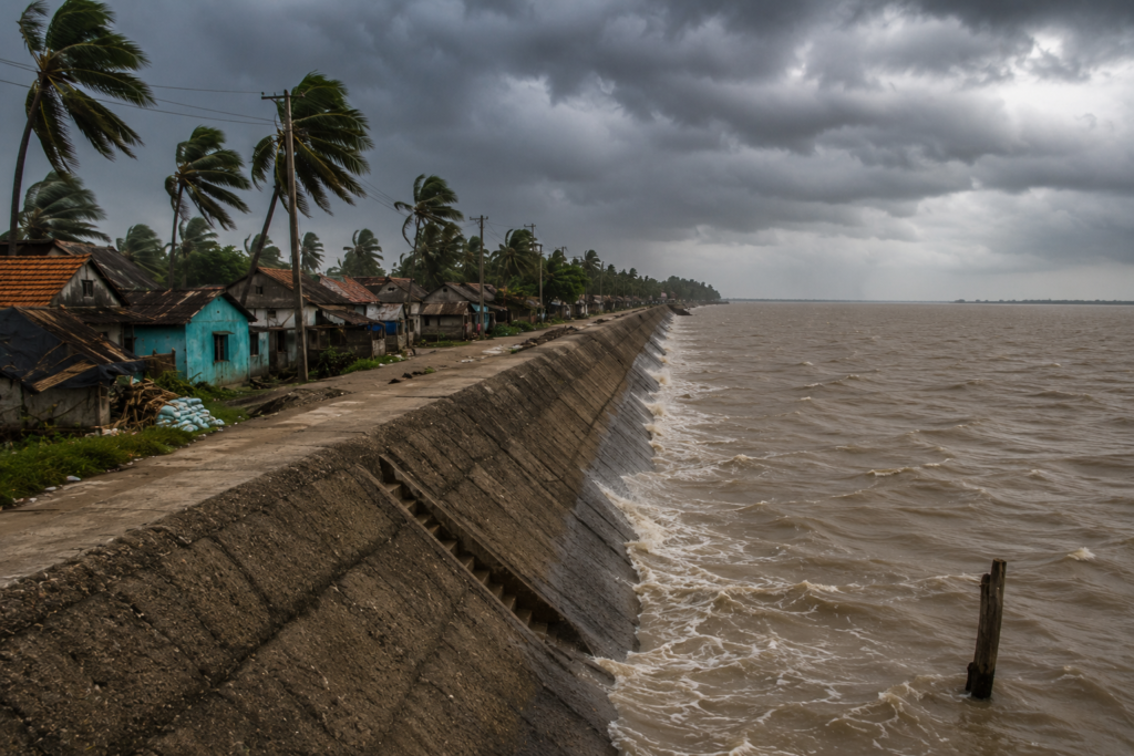
The history of Sagar Island cannot be separated from storms.
The Bay of Bengal has shaped this island as profoundly as any river.
Ask older residents about the past and eventually the conversation reaches cyclones. Not because they enjoy discussing them. Because cyclones become reference points in memory.
Life before a storm. Life after a storm. Entire chapters of personal history are organised around weather events. Generations remember different disasters. Some recall storm surges. Others remember embankment failures.
Many remember nights when families gathered together listening to the wind intensify outside. The modern history of coastal Bengal includes devastating cyclones such as Aila, Bulbul, Amphan, Yaas, and others that affected large portions of the delta in different ways.
Sagar, positioned at the edge of the estuary, remains particularly exposed. When severe weather approaches, geography becomes destiny.
The island faces multiple threats simultaneously:
- Wind.
- Rain.
- Storm surge.
- River flooding.
- Coastal erosion.
- Salinity intrusion.
Yet what emerges repeatedly from these stories is not destruction. It is resilience.
Residents reinforce homes. Communities share information. Cyclone shelters become critical infrastructure. Schools sometimes transform into emergency centres. Government agencies coordinate evacuations. Boat operators assist movement. Volunteers mobilise.
The response is rarely perfect. But it is continuous.
Because adaptation is not a project here. It is a way of life. The embankments visible across the island are physical evidence of this relationship.
They represent decades of effort.
- Repair.
- Failure.
- Improvement.
And renewed effort again. Every embankment tells a story. Every repaired section marks a previous encounter with the sea.
Ferry Routes & Hidden Paths
The approach to Sagar has always been part of the experience.
Even today, despite improved infrastructure, the island retains a sense of arrival. One must cross water. That crossing matters.
For most travellers, the journey begins near Kakdwip.
The route moves toward Harwood Point, often known as Lot No. 8, where vessels cross the Muriganga channel toward Kachuberia on Sagar Island. The crossing itself is brief. Yet it remains one of the most important transitions in the region.
A movement from mainland Bengal into the island world of the lower delta.
From Kachuberia, roads stretch southward through settlements, agricultural landscapes, and village clusters toward Gangasagar and other parts of the island. But the official route tells only part of the story.
Sagar also contains countless smaller paths.
- Embankment roads.
- Footpaths beside ponds.
- Tracks connecting villages.
Routes known primarily by residents. Some lead to quiet stretches of shoreline. Others connect forgotten shrines. A few simply end beside water.
These hidden paths rarely appear on maps. Yet they reveal the island’s character more effectively than any major road. The best explorations often begin by leaving the obvious route behind.
How to reach Sagar Island from Kolkata
Before reaching Sagar Island, one must first understand a simple truth:
The road does not take you all the way. Every journey eventually arrives at water. Unlike many places in modern Bengal, Sagar still preserves an older geography where rivers remain part of the transportation network. The final approach cannot be completed without crossing the Muriganga channel, a tidal waterway that separates the island from the mainland.
This final crossing is more than a logistical necessity. It is a transition. The mainland ends. The island begins.
Stage 1: Kolkata To Kakdwip
Most travellers begin from Kolkata. The route follows the historic southern corridor of Bengal through:
- Joka
- Amtala
- Diamond Harbour
- Kakdwip
By road, the journey generally requires 3 – 4 hours depending on traffic. The changing landscape provides a visible lesson in delta geography.
Urban expansion gradually gives way to ponds, canals, paddy fields, shrimp farms, and low-lying settlements.
By the time Kakdwip appears, the river has already become the dominant force in the landscape.
Stage 2: The Railway Route South
For over a century, railways have carried travellers toward the edge of the delta.
The Sealdah to Kakdwip railway line remains one of the most important transport corridors serving the southern Sundarbans region.
Early morning trains reveal an entirely different Bengal. Office commuters share compartments with fishermen, pilgrims, vegetable traders, school students, and island residents returning home. The train journey itself functions as an anthropological introduction to the region.
Stage 3: Harwood Point
Every road journey eventually reaches Harwood Point.
The name originates from colonial-era port administration and survives as one of the most recognisable transport landmarks in the region.
Here, the mainland effectively ends.
Vehicle parking areas, ticket counters, ferry terminals, vendors, and waiting passengers create an atmosphere somewhere between a river port and a pilgrimage gateway. During Gangasagar Mela, the area transforms into one of India’s largest temporary transport hubs.
Stage 4: Crossing The Muriganga
This is the moment every traveller remembers. The Muriganga is not a small river. It is a tidal estuarine channel shaped by both river discharge and marine influence. Depending on season and tide, the waterway can appear calm, expansive, turbulent, or intimidating.
Crossing times generally range between: 25–40 minutes.
Yet the experience feels much longer. The ferry gradually leaves the mainland behind. Birds circle overhead. Fishing boats move across the channel. The first embankments of Sagar begin appearing in the distance.
For many travellers, this is the precise moment when the expedition begins.
Stage 5: Kachuberia — Gateway To Sagar
Nearly everyone arrives here.
Kachuberia functions as the island’s northern transport gateway. Buses, shared vehicles, private cars, motorcycles, and local transport services radiate outward from the jetty. The road south reveals the true scale of the island.
Many first-time visitors expect a small settlement. Instead, they discover one of the largest inhabited islands in the delta.
The Pilgrim Route
For millions of visitors, the journey culminates at Gangasagar. During the annual Gangasagar Mela, transport systems operate on an entirely different scale.
- Additional ferries.
- Temporary jetties.
- Special trains.
- Dedicated bus services.
- Emergency medical facilities.
- Crowd management infrastructure.
For a brief period each year, the island becomes one of the busiest pilgrimage landscapes in India.
Seasonal Access Notes
Winter
Most reliable conditions.
Monsoon
Weather disruptions become more common.
Cyclone Season
Travel plans may change rapidly.
Dense Fog Events
Ferry delays occasionally occur during winter mornings.
Explorer’s Access Snapshot
Nearest Railway Station: Kakdwip
Nearest Mainland Ferry Terminal: Harwood Point (Lot No. 8)
Primary Island Jetty: Kachuberia
River Crossing: Muriganga Channel
Approximate Travel Time From Kolkata: 4–5 Hours
Best Access Season: November–February
Photography Expedition Guide
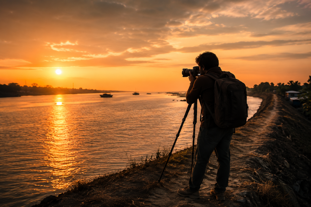
Photographing Sagar requires patience rather than spectacle. The island rewards observation. Not speed.
Sunrise Photography
The hours immediately after dawn offer extraordinary opportunities. Mist often lingers above ponds. Fishermen begin work. Soft light transforms ordinary village scenes into layered compositions. The river crossings near morning can be particularly atmospheric.
Human Landscape Photography
Sagar excels here. Cyclists moving along embankments.
- Tea stalls are opening.
- Net repair.
- Market activity.
- Pilgrims travelling toward sacred sites.
The island offers countless opportunities to document relationships between people and the environment.
Water & Reflection Photography
Ponds become visual assets throughout the day. Reflections frequently create unexpected compositions. Especially during calm weather.
Monsoon Photography
Clouds dominate. Light becomes unpredictable. The landscape becomes intensely green. Photographers willing to embrace rain often discover the island at its most dramatic.
Sunset Photography
Embankments provide elevated viewpoints. River channels catch the final light. Fishing boats create silhouettes. Cloud formations often determine the quality of evening imagery.
Cultural Photography
Gangasagar’s spiritual landscape offers unique visual narratives. However, respectful observation remains essential. Some moments are better experienced than photographed.
Expedition Notes
Every island contains details that rarely appear in brochures. Sagar is no exception.
One notices how frequently ponds appear. Not occasionally. Constantly.
Water storage, aquaculture, household utility, and landscape identity merge into a single feature repeated across the island. One notices the role of motorcycles. The island’s roads have created a mobility revolution over recent decades. One notices the surprising scale of settlement. Visitors expecting a remote island often discover an extensive human landscape instead.
One notices conversations about weather.
They emerge naturally. Without prompting.
- Rainfall.
- Tides.
- Wind direction.
- Forecasts.
- Cyclones.
The environment remains an active participant in daily life. One notices that the sacred and the ordinary coexist seamlessly.
Pilgrimage routes pass agricultural fields. Religious landmarks stand beside tea stalls. Spiritual narratives and practical concerns share the same geography. Perhaps most interestingly, one notices how many residents describe the river as though it were a person.
Not metaphorically. Literally.
- “The river was calm today.”
- “The river has moved closer.”
- “The river took that land.”
Language reveals relationships.
And Sagar’s relationship with water remains deeply personal.
Connected Landscapes
No island exists alone. Sagar certainly does not.
- To understand it properly, one must look beyond its shoreline.
- To the north lie the settlements and transport networks of the South 24 Parganas region.
- To the west flows the Hooghly, one of eastern India’s most historically significant waterways.
For centuries, it connected inland Bengal with maritime worlds far beyond the delta. To the east flows the Muriganga, a channel that remains central to the island’s accessibility and identity. To the south waits the Bay of Bengal. The ultimate destination of river systems originating thousands of kilometres away.
Nearby islands and coastal settlements form a broader network of relationships.
Trade moves between them. Families connect across them. Cultural traditions overlap. Environmental challenges are shared.
The story of Sagar intersects with places such as Kakdwip, Kachuberia, Namkhana, Fraserganj, Bakkhali, and numerous smaller settlements scattered throughout the lower delta. Ecologically, the island occupies a transitional position.
- Not fully urban.
- Not wilderness.
- Not mainland.
- Not open coast.
It exists between categories. A threshold landscape. A place where the river becomes sea. Where pilgrimage meets geography. Where history meets environmental uncertainty.
And where every journey inevitably leads toward another horizon. By the time evening settles across Sagar, one begins to realise that the island is less a destination than a crossroads. Water arrives here from distant mountains. People arrive here from distant cities. Stories arrive from distant centuries.
And all of them briefly share the same shoreline before continuing onward.
Oral Histories
The most revealing stories on Sagar are rarely found in archives.
They are found on verandas. Under banyan trees. Beside the tea stalls. On ferry crossings. In conversations that begin with the weather and end with history. One elderly resident near Rudranagar described how different the island looked during his childhood.
“There were fewer roads then. We walked more. The ferry journey felt longer. When storms came, news travelled slowly.”
Another man, a retired fisherman, pointed toward a distant embankment.
“That land was different once.”
He paused.
“The river keeps changing its mind.”
Such statements appear repeatedly across Sagar. The river is not discussed as a geographical feature. It is discussed as a neighbour.
- Sometimes helpful.
- Sometimes difficult.
- Always present.
Many families remember migration stories. Some arrived generations ago from other parts of Bengal. Others came seeking agricultural opportunities. Some stayed because the island offered possibilities.
Others because they had nowhere else to go. Women often tell different stories.
- Stories about water collection before improved infrastructure.
- Stories about schools expanding.
- Stories about changing household life.
- Stories about raising children in a place where weather forecasts can become deeply personal concerns.
Pilgrimage memories appear frequently as well. Residents recall years when the Gangasagar Mela was smaller. Less organised. More dependent on local support systems. Many speak with pride about the island’s ability to host immense numbers of visitors despite environmental constraints. What emerges from these conversations is not nostalgia.
It is continuity. People recognise change.
But they also recognise enduring patterns.
- The tide still arrives.
- The river still shifts.
- The island still adapts.
Food Of The Island
To understand Sagar, one must eat as the island eats.
Not as visitors eat. As residents do.
Rice remains central. Almost everything begins there.
Fish follows naturally. River fish. Estuarine fish.
Seasonal catches vary according to water conditions, migration patterns, and local availability.
Mustard oil contributes its familiar sharpness. Green chillies appear regularly. Turmeric colours both food and memory.
In village kitchens, recipes are rarely written.
They are inherited. Adjusted. Repeated. Perfected through practice.
Freshly caught fish cooked with vegetables remains a common sight. During certain seasons, dried fish traditions become more visible. Coconut influences local cooking as well, reflecting the trees scattered throughout the island landscape.
Markets reveal another dimension of food culture. Vegetables arrive from nearby agricultural areas. Fish arrive from surrounding waters. Sweets appear beside tea stalls. Seasonal produce changes what people cook and how they cook it.
Pilgrimage seasons create additional culinary layers. Temporary food stalls emerge. Traditional offerings appear. Communal eating becomes part of the cultural landscape.
Food at Sagar is not elaborate.
It does not need to be. It reflects the island itself.
- Practical.
- Seasonal.
- Connected to water.
- Connected to land.
- Connected to the community.
Island Economy
The economy of Sagar resembles a braided river.
- Multiple channels.
- Multiple dependencies.
- Multiple forms of resilience.
Agriculture remains important.
Fields across the island support livelihoods directly and indirectly. Rice cultivation continues to shape much of the rural landscape. Fishing provides another economic foundation.
For some families, it is a primary occupation. For others, it supplements agricultural income. The surrounding waterways create opportunities, but also uncertainty. Catch volumes fluctuate. Weather influences access. Fuel costs matter. Tides matter. Everything matters.
- Trade supports local markets.
- Transport supports trade.
- Ferries support transport.
The entire system remains interconnected.
Pilgrimage contributes significantly as well. Gangasagar attracts enormous numbers of visitors annually, creating temporary but substantial economic activity.
Accommodation providers. Transport operators. Vendors. Food sellers. Service providers. Many benefit from this seasonal influx. Education and government employment have become increasingly important over recent decades.
Young residents often pursue opportunities beyond the island while maintaining strong family connections to it. Migration, therefore, forms another economic layer.
Some people leave temporarily. Some permanently. Many return.
Money, knowledge, and aspirations travel back and forth across the river. The economy of Sagar is therefore neither entirely traditional nor entirely modern. It exists somewhere between the two. Much like the island itself.
Then & Now
Then
- Travel was slower.
- Communication was slower.
- Weather information was limited.
- Many roads remained unpaved.
- Medical access was more difficult.
- Markets were smaller.
- The island felt farther away from Kolkata than the map suggested.
- Pilgrimage required greater effort.
- Storm recovery often required greater patience.
- The river exerted even more control over movement.
Now
- Road networks have improved.
- Mobile phones connect villages instantly.
- Weather forecasts arrive in real time.
- Education opportunities have expanded.
- Transport systems have become more reliable.
- Pilgrimage infrastructure has evolved dramatically.
- Government services reach more people.
- The island feels more connected to the wider world.
- Yet some things remain unchanged.
- The tides still dictate schedules.
- Cyclones still command respect.
- The river still shapes geography.
- Fishing boats still leave before dawn.
- Tea stalls still function as information networks.
- The island remains suspended between continuity and transformation.
- The tools have changed.
- The landscape has changed.
The relationship with nature is still the same.
The Wild Orbit Quick Facts
Island Name
Sagar Island / Sagardwip
District
South 24 Parganas
Administrative Block
Sagar Community Development Block
Administrative Headquarters
Rudranagar
Approximate Area
Approximately 224 square kilometres
Population
More than 200,000 residents
Major Water Bodies
Hooghly River, Muriganga River, Bay of Bengal
Nearest Mainland Gateway
Harwood Point, Kakdwip
Primary Island Entry Point
Kachuberia
Most Famous Landmark
Kapil Muni Temple
Most Significant Annual Event
Gangasagar Mela
Best Exploration Season
November to February
Key Ecological Features
Estuarine landscape, tidal waterways, ponds, coastal habitats, remnant mangrove zones
Wildlife Highlights
Kingfishers, egrets, kites, migratory birds, mudskippers, fiddler crabs, and occasional dolphin sightings in the surrounding waters
The Wild Orbit Expedition Snapshot
Accessibility
9/10
One of the most accessible major islands in the lower delta.
Wildlife Potential
5/10
Wildlife exists throughout the island but not at the density associated with the core Sundarbans forest zones.
Photography Potential
9/10
Excellent opportunities for landscape, culture, pilgrimage, river, and documentary photography.
Cultural Richness
10/10
Among the most culturally significant islands in eastern India.
Historical Interest
9/10
Layers of mythology, pilgrimage history, settlement history, and environmental adaptation.
Solitude Level
4/10
Certain corners remain peaceful, but Sagar is fundamentally a populated island.
Overall The Wild Orbit Expedition Rating
9/10
One of the most important islands for understanding the relationship between river, faith, settlement, and survival in the Bengal delta.
Continue The Journey
Sagar is not the end of the story.
It is the beginning of a larger understanding. To the east lie the intricate waterways that connect the inhabited islands of the delta. Farther into the Sundarbans emerge landscapes where mangroves dominate the horizon.
Elsewhere, forgotten river channels preserve traces of older trade routes. Folklore changes from village to village. Birdlife changes from season to season. The river itself changes from tide to tide.
An explorer leaving Sagar soon discovers that every island in the delta answers one question while raising three more.
- The journey continues through rivers.
- Through stories.
- Through people.
- Through the endless geography of water.
Frequently Asked Questions
1. Where is Sagar Island located?
In the South 24 Parganas district at the southern edge of the Hooghly estuary.
2. Is Sagar Island part of the Sundarbans?
Yes, it forms part of the broader Sundarbans delta region.
3. Why is Sagar Island famous?
Primarily because of Gangasagar and the Kapil Muni pilgrimage tradition.
4. What is Gangasagar?
A major pilgrimage destination associated with the confluence of the Ganga and the Bay of Bengal.
5. Is Sagar Island a forest island?
No. It is predominantly inhabited and agricultural.
6. Are there mangroves on Sagar Island?
Small areas exist, but extensive mangrove forests are limited.
7. Can tigers be found on Sagar Island?
The island is not known as a habitat for resident tigers.
8. What is the main river beside Sagar?
The Hooghly River.
9. What separates Sagar from the mainland?
The Muriganga channel.
10. Which ferry route is most commonly used?
Harwood Point to Kachuberia.
11. What is the administrative centre?
Rudranagar.
12. Is the island heavily populated?
Yes, compared with many other delta islands.
13. What language is commonly spoken?
Bengali.
14. What is the best season to visit?
Winter and post-monsoon months.
15. Does the island experience cyclones?
Yes, like much of coastal Bengal.
16. Are there beaches?
Coastal stretches exist, though the island is more estuarine than beach-focused.
17. What livelihoods dominate the island?
Agriculture, fishing, trade, services, and pilgrimage-related activities.
18. Is photography rewarding here?
Extremely, especially for cultural and documentary work.
19. What wildlife can be seen?
Birdlife, estuarine species, reptiles, and occasional marine life.
20. How important is the tide?
Very important. It influences transport, fishing, and daily life.
21. Are there markets on the island?
Yes, numerous local markets serve residents and visitors.
22. Does migration influence the island?
Yes, many families have migration histories.
23. How does climate change affect Sagar?
Through erosion, sea-level concerns, salinity changes, and cyclone risks.
24. Is Sagar connected by road internally?
Yes, much of the island is linked through an expanding road network.
25. What makes Sagar unique within the Sundarbans?
Its extraordinary combination of sacred geography, dense settlement, tidal ecology, and riverine history.
What Remains
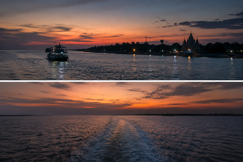
The departure ferry leaves in fading light. Behind it, Sagar slowly begins to dissolve into the distance.
The embankments become lines. The trees become silhouettes. The villages disappear one by one. Only the shape of the island remains.
For a while. Then even that fades. The river widens. Evening deepens. The lights of the island flicker briefly across the water before surrendering to darkness.
What remains is not a memory of monuments.
Not a memory of landmarks. Not even a memory of pilgrimage.
What remains is a feeling.
The feeling of standing at the edge of a continent-sized river as it meets the sea. The feeling of watching generations build lives between tides. The feeling of an island that has spent centuries negotiating with water and has somehow learned not merely to survive, but to endure.
Long after the shoreline vanishes from view, Sagar continues travelling with you. Like the tide. Quietly. Persistently.
Returning when least expected.
Plan your private Sundarban expedition
A private journey shaped around you — your group, your pace, your interests. Book a free consultation.