 Encyclopedia
As the tide rises across the northern reaches of the Indian Sundarbans, narrow creeks gradually widen into broad estuarine channels. Mudbanks disappear beneath opaque, sediment-rich water, and the breathing roots of mangrove trees slowly vanish beneath the incoming tide. The forest appears to transform with the rhythm of the moon, revealing a landscape where land and water are never truly separate. Amid this ever-changing tidal wilderness lies Jhingakhali, one of the most ecologically significant forest destinations in the northern Indian Sundarbans.
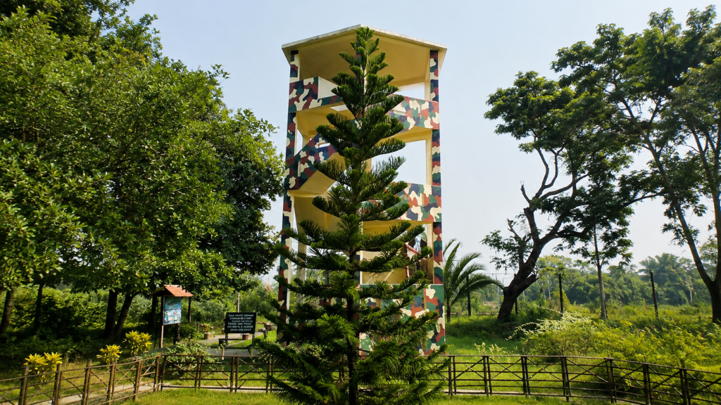
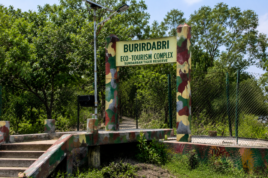
Unlike some of the better-known tourism zones farther south, Jhingakhali occupies an important position along the northern boundary of the protected mangrove landscape. It serves not only as a forest watchtower destination but also as a strategic interface between inhabited delta islands and the protected forests administered by the West Bengal Forest Department. Here, freshwater ponds attract wildlife emerging cautiously from dense mangroves, migratory birds seasonally occupy nearby wetlands, and tidal rivers sustain one of Earth’s most productive estuarine ecosystems.
Jhingakhali represents far more than a sightseeing point. It offers an opportunity to understand how mangrove ecology functions at the northern edge of the Sundarbans Biosphere Reserve. The surrounding waterways illustrate the complex interaction between freshwater discharged from the Ganges–Brahmaputra–Meghna delta and saline tidal water entering from the Bay of Bengal. This dynamic environment supports mangrove forests that stabilize riverbanks, nurture fisheries, store significant quantities of carbon, and provide habitat for an extraordinary diversity of wildlife.
For researchers, wildlife photographers, birdwatchers, and anyone seeking to understand the Indian Sundarbans beyond popular tourism narratives, Jhingakhali provides valuable insight into the ecological processes that define the world’s largest mangrove forest. The experience is shaped less by dramatic encounters and more by careful observation—watching tides reshape the landscape, noting the distribution of mangrove species, listening to the calls of kingfishers and egrets, or observing the subtle signs that reveal the presence of larger animals within the forest.
Although the area is accessible only under the regulations of the West Bengal Forest Department, its importance extends beyond recreation. Jhingakhali contributes to wildlife monitoring, habitat protection, environmental education, and the long-term conservation of one of UNESCO’s most internationally significant wetland ecosystems.
Jhingakhali At a Glance
Location: Northern Indian Sundarbans, North 24 Parganas District, West Bengal
Administrative Authority: West Bengal Forest Department
Protected Area: Sundarban Tiger Reserve landscape within the Sundarbans Biosphere Reserve
Ecosystem: Tidal mangrove forest
Primary Habitat: Mangroves, tidal rivers, mudflats, creeks, freshwater pond near the watchtower
Known For: Forest Watch Tower, birdwatching, estuarine scenery, wildlife observation
Accessibility: By licensed boat through designated tourism routes
Best Season: November to March for comfortable weather and migratory birds; year-round ecological interest
Visitor Activities: Wildlife observation, birdwatching, nature photography, interpretation of mangrove ecology
Conservation Importance: Habitat protection, wildlife monitoring, environmental education, and a buffer between protected forest and inhabited islands
How to Reach Jhingakhali
Jhingakhali is a forest destination reached by boat, not by road. The practical approach is through the Hemnagar–Hingalganj side of the northern Sundarbans, followed by a permitted boat journey into the forest. The Basirhat Police District also identifies Jhingekhali with Hemnagar, while historical travel documentation records boat access from the Hemnagar area to the Jhingekhali range.
- From Kolkata: Travel north toward Hasnabad/Hemnagar by road or rail-based public transport.
- By rail: Hasnabad is the relevant railhead for the Hemnagar approach; from there, continue toward the riverine embarkation points by local transport.
- By boat: From the Hemnagar side, continue by an authorized boat through the tidal waterways to Jhingakhali.
- Forest entry: Jhingakhali is a protected forest destination, so entry requires the applicable Forest Department permission/permit and regulated boat access. The West Bengal Forest Department confirms Jhingakhali as a watchtower with observation lines and a freshwater pond, and states that permits for entry into the Sundarban Tiger Reserve are issued through designated Forest Department offices.
Important: Jhingakhali should not be described as being directly accessible from Godhkhali or Jharkhali without qualification. Those are separate Sundarbans access routes. West Bengal Tourism lists Jhingekhali among the destinations covered by regulated Sundarbans boat tours, but the northern Hemnagar approach is the geographically relevant route for Jhingakhali.
Geographic Setting
Jhingakhali lies within the northern section of the Indian Sundarbans, close to the international boundary between India and Bangladesh. The region forms part of the lower Gangetic delta, where countless distributaries, tidal rivers, and estuarine channels create an intricate mosaic of forest islands, mudflats, and waterways.
Unlike the more open estuarine landscapes found toward the southern coast, the northern Sundarbans exhibit a stronger influence of freshwater during parts of the year while remaining fundamentally tidal. River discharge, seasonal monsoon rainfall, and twice-daily tidal exchange collectively shape the landscape. These processes influence sediment deposition, mangrove distribution, soil salinity, and the availability of habitat for wildlife.
Jhingakhali occupies an important ecological transition zone where protected mangrove forests border inhabited agricultural islands. This proximity highlights one of the defining characteristics of the Indian Sundarbans: the close relationship between human settlements and an internationally important wilderness. Embankments protect nearby villages from tidal flooding, while only a short distance away, dense mangrove forests provide refuge for wildlife, including apex predators such as the Royal Bengal Tiger (Panthera tigris tigris).
Because of its northern position, Jhingakhali is frequently included in educational boat safaris that introduce visitors to the ecological diversity of the Sundarbans without venturing deep into the southern forest blocks. The Forest Department’s watchtower overlooks a freshwater pond and surrounding mangrove habitat, allowing visitors to observe wildlife while minimizing disturbance.
Rivers Flowing Beside Jhingakhali
The hydrology surrounding Jhingakhali is characterized by interconnected tidal rivers rather than a single dominant watercourse. The following rivers and channels influence the surrounding landscape:
- Kalindi River – forms an important international boundary channel between India and Bangladesh in this northern sector.
- Raimangal River – one of the major tidal rivers of the eastern Indian Sundarbans, influencing regional hydrology.
- Numerous unnamed tidal creeks connect these larger rivers to interior mangrove forests, transporting sediment, nutrients, and saline water throughout the ecosystem.
Smaller creeks around Jhingakhali change naturally through erosion and sediment deposition. While major rivers are well documented, the names and configurations of minor channels may vary across official maps and hydrographic surveys.
Nearby Forest Blocks
The surrounding protected landscape includes several forest compartments administered by the West Bengal Forest Department.
Nearby protected mangrove areas include:
- Jhingakhali Forest Range
- Northern sectors of the Sundarban Tiger Reserve
- Mangrove forest compartments adjoining the Kalindi–Raimangal river system
These forest blocks collectively support habitat connectivity for mammals, reptiles, birds, and aquatic fauna across the northern Sundarbans.
Nearby Inhabited Islands & Human Settlements
Several inhabited islands lie west and northwest of the protected forests, illustrating the close relationship between human communities and the mangrove ecosystem.
Nearby settlements include:
- Hemnagar
- Samsernagar
- Parghumti
- Kalitala
- Nazat (regional transport hub farther west)
These villages depend on agriculture, inland fisheries, honey collection, crab harvesting, and river transport. They also represent the frontline communities living alongside one of the world’s most challenging human–wildlife landscapes.
Landscape Character
The landscape surrounding Jhingakhali is defined by subtle transitions rather than dramatic topography. Elevation differences are measured in centimeters rather than meters, yet these small variations determine which mangrove species establish themselves, how long areas remain flooded during high tide, and where wildlife chooses to move.
At low tide, broad expanses of grey-brown mud emerge along the riverbanks. Thousands of pencil-like pneumatophores—the specialized breathing roots of mangrove trees—protrude from the exposed sediment, allowing the trees to obtain oxygen from the air despite growing in waterlogged, oxygen-poor soils. Fiddler crabs become active across the mudflats, while mudskippers move between shallow pools left behind by the retreating tide.
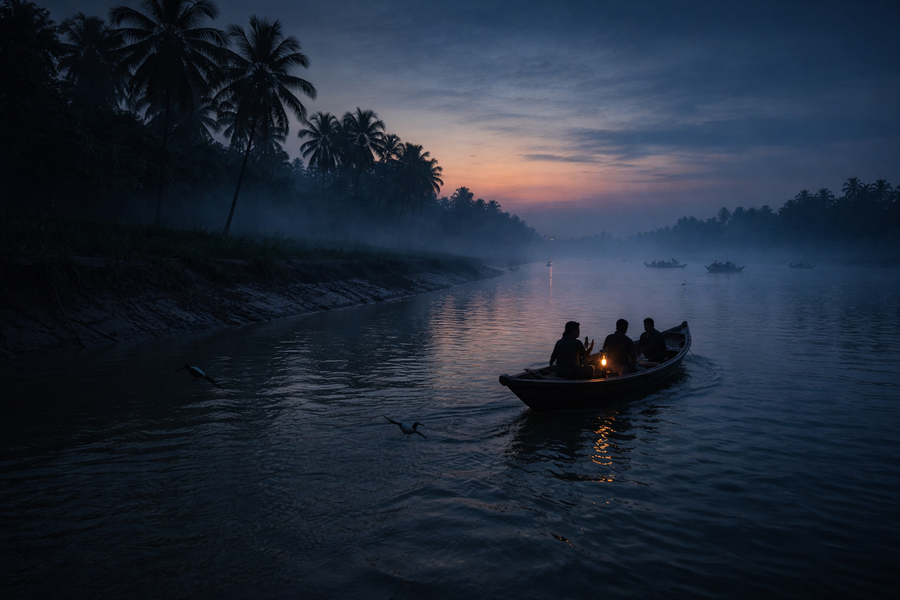
As the tide returns, these exposed surfaces gradually disappear beneath opaque estuarine water carrying fine silt from the Ganges–Brahmaputra–Meghna delta. The forest edge appears to float above the rising water, and navigation shifts entirely to the river channels. This twice-daily transformation is one of the defining visual characteristics of Jhingakhali and the wider Sundarbans.
The vegetation is dominated by mangrove communities adapted to fluctuating salinity, unstable sediments, and periodic inundation. Species composition varies with local environmental conditions, reflecting differences in freshwater influence, soil characteristics, and tidal exposure.
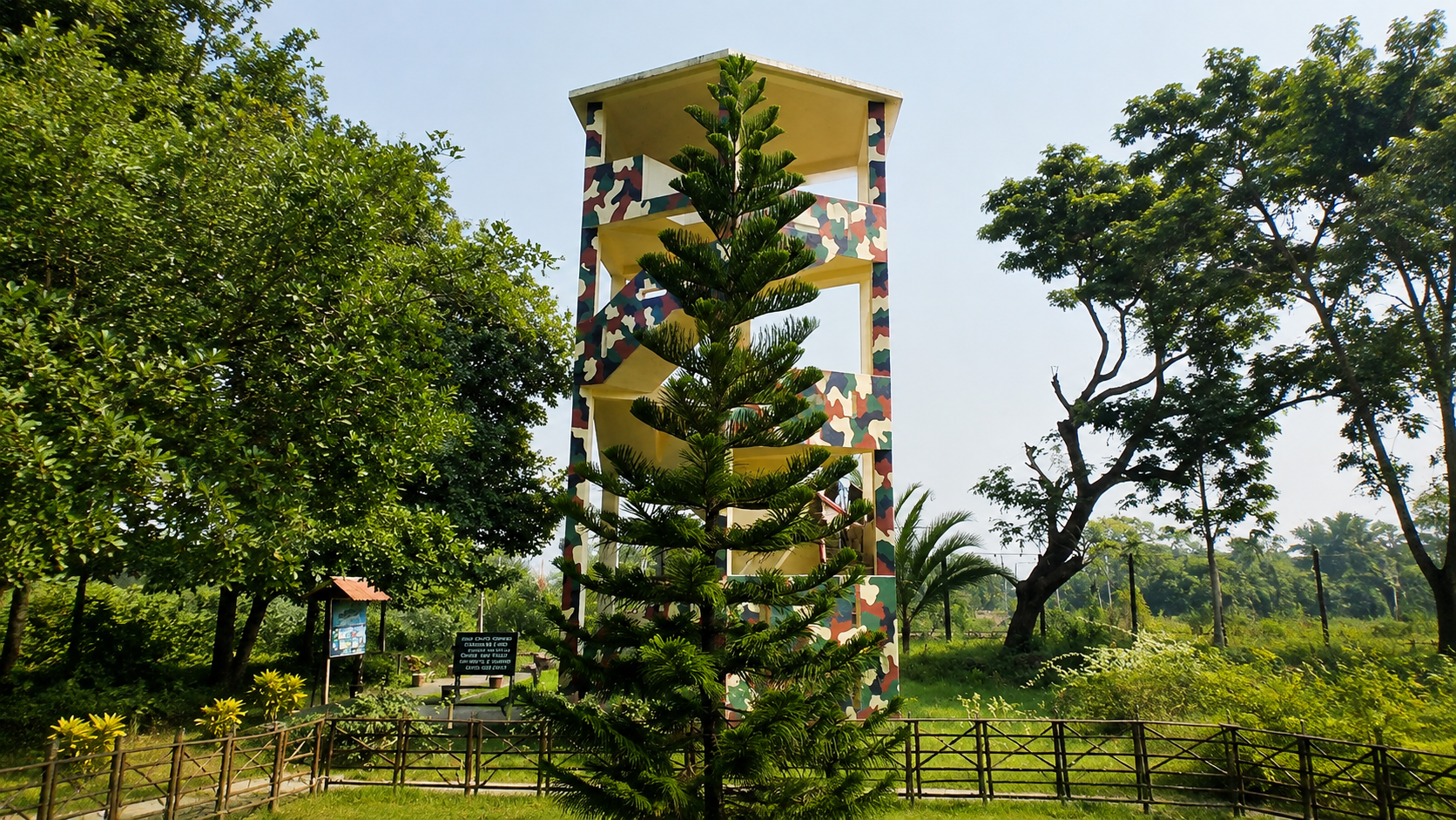
The Forest Department’s watchtower provides one of the few elevated viewpoints in this otherwise flat landscape. From here, observers can appreciate the intricate relationship between rivers, creeks, mangrove canopy, freshwater habitat, and open mudflats—elements that together form the ecological foundation of the northern Sundarbans.
Hydrology and Tidal Systems
Water governs every aspect of life at Jhingakhali. The region experiences semidiurnal tides, meaning that two high tides and two low tides typically occur each lunar day. These tides transport sediment, nutrients, organic matter, and juvenile aquatic organisms throughout the estuarine network.
Seasonal freshwater discharge from upstream rivers interacts continuously with saline water entering from the Bay of Bengal. During the southwest monsoon, increased river flow generally reduces salinity in the northern Sundarbans. In the dry season, reduced freshwater input allows saline conditions to extend farther inland, influencing mangrove distribution and aquatic ecology.
This constant movement of water creates one of the world’s most productive estuarine environments. Organic matter produced by mangrove forests is broken down and exported into adjacent rivers, supporting complex food webs that sustain crustaceans, molluscs, fish, birds, reptiles, and mammals.
Rather than existing as isolated habitats, the rivers, creeks, mudflats, and mangrove forests around Jhingakhali function as an interconnected ecological system in which energy, nutrients, and organisms move continually with the tides.
Mangrove Ecosystem
Jhingakhali lies within one of the most biologically specialized forest ecosystems on Earth. Mangroves here are not simply trees growing near the sea; they are highly adapted plant communities capable of surviving conditions that would be intolerable for most terrestrial vegetation.
Species such as Sundari (Heritiera fomes), Gewa (Excoecaria agallocha), Goran (Ceriops decandra), Keora (Sonneratia apetala), and Avicennia species employ a range of adaptations to cope with saline water, unstable sediments, and tidal inundation. Some species exclude salt at their roots, others excrete excess salt through specialized leaf glands, while many produce aerial roots that facilitate gas exchange in oxygen-poor mud.
These mangrove forests perform critical ecological functions. Their extensive root systems stabilize sediments, reduce shoreline erosion, filter pollutants, and create nursery habitats for numerous estuarine fish and crustaceans. They also store substantial quantities of carbon within both their biomass and the underlying sediments, contributing to climate regulation.
For wildlife, the mangroves surrounding Jhingakhali provide food, shelter, breeding sites, and movement corridors. Birds nest within the canopy, reptiles bask along creek margins, crustaceans burrow into tidal mudflats, and mammals navigate narrow forest paths concealed beneath dense vegetation.
The ecological resilience of Jhingakhali depends on the continued integrity of these mangrove communities. Protecting them safeguards not only biodiversity but also the ecological processes that sustain the northern Indian Sundarbans as a whole.
Wildlife of Jhingakhali
As daylight filters through the mangrove canopy, the forest often appears deceptively still. The only movement may be the ripples created by a mudskipper entering a creek or the sudden flash of a kingfisher crossing the river. Yet beneath this apparent calm exists one of India’s most complex wildlife communities. Jhingakhali supports an intricate web of mammals, birds, reptiles, fishes, crustaceans, and countless invertebrates whose lives are synchronized with tides rather than terrestrial seasons.
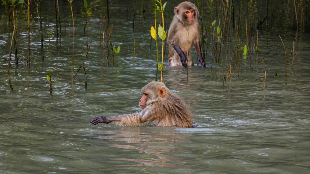
Unlike grassland or rainforest ecosystems where wildlife may be readily visible, the mangrove forests of Jhingakhali demand patience. Dense vegetation, tidal creeks, and limited visibility mean that many animals remain hidden despite being remarkably close. Wildlife observation here is therefore based not only on direct sightings but also on interpreting signs—fresh footprints pressed into tidal mud, claw marks on riverbanks, alarm calls from monkeys, disturbed mangrove leaves, or the sudden silence of birds.
This hidden nature is one reason why Jhingakhali remains valuable for both scientific monitoring and responsible wildlife tourism. Every observation contributes to understanding how species survive within one of the world’s most demanding coastal environments.
Mammals
Royal Bengal Tiger (Panthera tigris tigris)
No species defines the Sundarbans more than the Royal Bengal Tiger. Although direct sightings around Jhingakhali are uncommon—as they are throughout much of the Sundarbans—the surrounding mangrove forests form part of the wider habitat used by this remarkable predator.
Unlike tiger populations elsewhere in Asia, Sundarbans tigers have adapted to a landscape dominated by tidal rivers and saline wetlands. They are capable swimmers, frequently crossing broad estuarine channels to move between forest islands. Their territories shift in response to prey availability, tidal cycles, and habitat conditions rather than fixed terrestrial boundaries.
Around Jhingakhali, evidence of tiger presence is more commonly detected through footprints in exposed mudbanks, scrape marks, scent-marking locations, and observations recorded by Forest Department personnel and camera-trap surveys. These indirect signs reveal the continued ecological importance of the northern mangrove forests as functional tiger habitat.
The tiger also functions as the ecosystem’s apex predator. By regulating populations of herbivores such as spotted deer and wild boar, it helps maintain ecological balance throughout the mangrove landscape.
Fishing Cat (Prionailurus viverrinus)
The Fishing Cat is among the least observed yet most specialized carnivores inhabiting the northern Sundarbans. Unlike larger cats that rely primarily on terrestrial prey, the Fishing Cat exploits tidal wetlands, freshwater ponds, and shallow creek margins where fish, crabs, frogs, and aquatic invertebrates are abundant.
Its partially webbed feet, powerful forelimbs, and patient hunting strategy allow it to capture prey along muddy shorelines. The freshwater pond near the Jhingakhali watchtower offers habitat that may occasionally attract this elusive species, particularly during quieter hours of dawn and dusk.
Because Fishing Cats require healthy wetland ecosystems, their continued presence serves as an indicator of ecological integrity within the northern Sundarbans.
Jungle Cat (Felis chaus)
The Jungle Cat occupies a wider range of habitats than the Fishing Cat and may utilize forest edges, grass-dominated areas, and transitional habitats adjoining mangrove forests. Although encounters are infrequent, it represents another small predator contributing to the region’s ecological diversity.
Smooth-coated Otter (Lutrogale perspicillata)
The tidal rivers surrounding Jhingakhali provide suitable habitat for Smooth-coated Otters. Highly social and intelligent, these mammals forage cooperatively in estuarine channels where fish populations remain abundant.
Otters are often easier to detect through their behaviour than by prolonged observation. Sudden splashes, rolling movements at the water surface, or groups briefly surfacing before disappearing beneath opaque tidal water may reveal their presence.
As top aquatic predators, otters contribute to maintaining balanced fish communities while serving as indicators of healthy river systems.
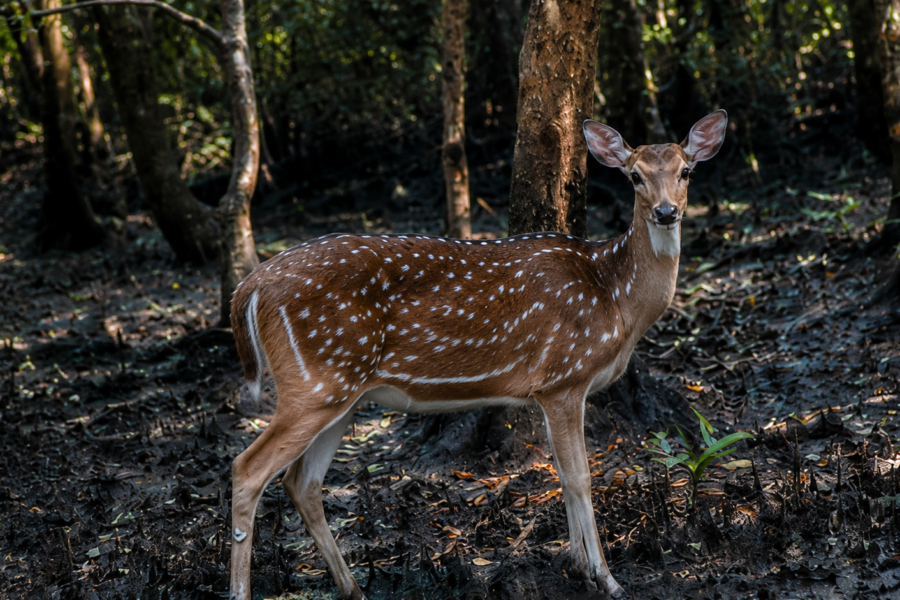
Spotted Deer (Axis axis)
The Spotted Deer is the most frequently observed large herbivore around Jhingakhali and forms the primary prey base for the Royal Bengal Tiger.
Early morning often offers the best opportunity to observe deer approaching freshwater sources or feeding along forest edges where new vegetation emerges following tidal deposition. Their highly developed hearing and constant vigilance reflect the continuous predation risk characteristic of mangrove forests.
Deer also play an important ecological role as grazers and browsers, influencing vegetation dynamics while transferring energy from plant communities to higher trophic levels.
Wild Boar (Sus scrofa)
Wild Boars occupy diverse habitats throughout the Sundarbans and are particularly adept at exploiting tidal mudflats in search of roots, crabs, molluscs, and other invertebrates.
Their rooting behaviour contributes to soil disturbance, seed dispersal, and nutrient cycling. At the same time, they provide another significant prey species for the Royal Bengal Tiger.
Rhesus Macaque (Macaca mulatta)
Groups of Rhesus Macaques are frequently encountered near forest edges and observation areas. These adaptable primates forage on fruits, seeds, leaves, insects, and occasionally aquatic organisms exposed by receding tides.
Their alarm calls often alert other wildlife—and experienced forest guides—to the possible movement of predators within nearby vegetation.
Birds of Jhingakhali
The northern Sundarbans support remarkable avian diversity owing to the convergence of mangrove forests, freshwater wetlands, mudflats, estuarine rivers, and agricultural landscapes. Jhingakhali is therefore recognized as one of the region’s rewarding birdwatching locations, particularly during winter when migratory visitors supplement resident populations.
Bird activity changes dramatically with tidal conditions. Low tide exposes feeding grounds rich in crabs, molluscs, worms, and small fish, attracting waders and shorebirds. High tide concentrates birds along creek margins, elevated roots, and mangrove branches.
Kingfishers
Several kingfisher species regularly occur around Jhingakhali, including:
- Brown-winged Kingfisher (Pelargopsis amauroptera)
- Black-capped Kingfisher (Halcyon pileata)
- White-throated Kingfisher (Halcyon smyrnensis)
- Common Kingfisher (Alcedo atthis)
- Collared Kingfisher (Todiramphus chloris)
The Brown-winged Kingfisher deserves particular attention because it is strongly associated with mangrove forests and has a relatively restricted global distribution. Observing this species is considered one of the highlights for dedicated birdwatchers visiting the Indian Sundarbans.
Herons and Egrets
The tidal creeks surrounding Jhingakhali provide ideal feeding habitat for numerous wading birds.
Common species include:
- Great Egret
- Intermediate Egret
- Little Egret
- Grey Heron
- Purple Heron
- Pond Heron
These birds hunt patiently along exposed mudflats where fish and crustaceans become trapped in shallow pools during falling tides.
Raptors
The estuarine landscape supports several birds of prey, including:
- Brahminy Kite (Haliastur indus)
- White-bellied Sea Eagle (Haliaeetus leucogaster)
- Osprey (Pandion haliaetus) during migration
These aerial predators exploit the productive fisheries sustained by mangrove ecosystems and often patrol broad tidal rivers surrounding Jhingakhali.
Waterbirds and Shorebirds
Seasonal visitors may include:
- Whimbrels
- Sandpipers
- Redshanks
- Greenshanks
- Plovers
Species composition varies annually depending upon migration timing, tidal conditions, and habitat availability.
Reptiles
The warm, humid conditions of the Sundarbans support a diverse reptile community adapted to life in mangrove forests and estuarine rivers.
Saltwater Crocodile (Crocodylus porosus)
The Saltwater Crocodile is the largest living reptile and one of the most formidable predators inhabiting the Sundarbans.
Individuals occasionally utilize riverbanks, creek mouths, and mudflats surrounding Jhingakhali for basking or ambush hunting. Their ability to move between marine and freshwater environments reflects the ecological flexibility required for survival within estuarine ecosystems.
Although sightings remain relatively uncommon, visitors should always remember that crocodiles may be present even when not visible.
Water Monitor (Varanus salvator)
Water Monitors are among the most frequently encountered reptiles around Jhingakhali. These large lizards forage along mudbanks searching for fish, crabs, molluscs, carrion, bird eggs, and small vertebrates.
Excellent swimmers, they move comfortably between aquatic and terrestrial habitats.
Snakes
The mangrove forests support numerous snake species, including both venomous and non-venomous forms.
Confirmed diversity across the Indian Sundarbans includes:
- King Cobra
- Monocled Cobra
- Russell’s Viper
- Checkered Keelback
- Dog-faced Water Snake
Many species remain highly secretive and spend much of their lives concealed beneath vegetation or within burrows.
Aquatic Life
Although much of Jhingakhali’s biodiversity remains hidden beneath opaque tidal water, aquatic organisms form the foundation of the ecosystem.
The estuarine rivers support numerous commercially and ecologically important fish, including mullets, catfish, gobies, anchovies, and juvenile marine species that utilize mangrove habitats as nursery grounds.
Mudskippers occupy exposed mudflats, demonstrating extraordinary adaptations that allow them to breathe through moist skin and spend considerable time outside water.
Crabs—including fiddler crabs and mangrove crabs—play a critical role in recycling organic matter. Their burrowing activity aerates sediments, enhances nutrient cycling, and influences mangrove growth.
Prawns and shrimps likewise depend upon mangrove nursery habitats during juvenile stages before dispersing into larger estuarine systems.
Together, these aquatic communities support the food web that ultimately sustains fish-eating birds, otters, crocodiles, Fishing Cats, and even apex predators.
Ecological Processes
The ecological significance of Jhingakhali cannot be understood by examining individual species alone. Rather, it emerges from the continuous interaction between water, sediment, vegetation, and wildlife.
Twice-daily tides transport nutrients deep into mangrove forests. Mangrove leaves fall into tidal channels, where fungi, bacteria, and small invertebrates begin decomposition. This organic material fuels one of the world’s most productive detritus-based food webs.
Juvenile fish shelter among submerged mangrove roots, where they avoid larger predators while feeding on microscopic organisms. Crabs process decomposing vegetation, birds consume crabs and fish, reptiles prey upon birds and mammals, while tigers ultimately occupy the highest trophic level.
This ecological connectivity means that even seemingly insignificant organisms—such as burrowing crabs or mangrove microbes—contribute indirectly to sustaining iconic species like the Royal Bengal Tiger.
Documentary Field Observation
Shortly after sunrise, the outgoing tide exposes broad mudbanks beneath the watchtower. Hundreds of fiddler crabs emerge almost simultaneously, each defending a tiny territory marked by raised claws and intricate burrows. A Brown-winged Kingfisher waits motionless above a shaded creek before diving into the shallow water. Nearby, Spotted Deer approach cautiously toward the freshwater pond, pausing repeatedly to scan the forest edge. Nothing appears hurried. The landscape functions according to rhythms established by tides rather than clocks, illustrating how every species at Jhingakhali is synchronized with the changing estuary.
Seasonal Ecology
Jhingakhali changes continuously throughout the year as tides interact with rainfall, river discharge, temperature, and salinity.
Winter (November–February)
See it for yourself
A private journey shaped around you — your group, your pace, your interests. Book a free consultation.
Winter offers the clearest skies, lower humidity, and increased bird diversity as migratory species arrive from northern breeding grounds. Wildlife observations are generally more comfortable due to mild temperatures and improved visibility.
Pre-Monsoon (March–May)
Temperatures rise rapidly, increasing evaporation and salinity in many tidal channels. Wildlife activity becomes concentrated around freshwater sources, particularly during the hottest weeks.
Southwest Monsoon (June–September)
Heavy rainfall transforms the landscape. Freshwater input increases, rivers swell, sediment deposition accelerates, and mangrove growth intensifies. Access may be influenced by weather and tidal conditions, while ecological productivity reaches its annual peak.
Post-Monsoon (October)
As floodwaters gradually recede, vegetation appears particularly lush. Fish recruitment remains high following the monsoon, supporting birds and aquatic predators. Cooler temperatures and improving weather make this an important transitional period before the winter migration season.
History of Jhingakhali
Long before Jhingakhali became known as a forest watchtower destination, it formed part of an immense tidal wilderness that evolved over thousands of years as the Ganges, Brahmaputra, and Meghna river systems deposited vast quantities of sediment into the northern Bay of Bengal. Unlike settlements elsewhere in Bengal whose histories are recorded through archaeology or written chronicles, the story of Jhingakhali is primarily one of landscape evolution. Rivers shifted their courses, new islands emerged, older landforms eroded away, and mangrove forests continually expanded and retreated in response to changing tides, sea levels, and sediment deposition.
The northern Sundarbans remained sparsely inhabited for much of recorded history because of its dynamic environment, saline soils, dense mangrove vegetation, disease, and the presence of dangerous wildlife. Permanent settlements gradually expanded only where embankments and agricultural reclamation became feasible along the forest margins.
Jhingakhali itself did not develop as a village or commercial centre. Instead, it remained within protected forest, eventually becoming part of the managed landscape overseen by the West Bengal Forest Department. Its strategic location near the northern boundary of the reserve made it particularly valuable for forest protection, ecological monitoring, and regulated visitor access.
Today, Jhingakhali represents an important example of how conservation priorities have shifted over time—from protecting timber resources during earlier forest administration to safeguarding biodiversity, ecological processes, and globally significant mangrove habitats.
Evolution of Forest Protection
The history of forest management in the Sundarbans reflects changing scientific understanding of coastal ecosystems.
During the nineteenth century, much of the Sundarbans came under systematic forest administration as colonial authorities sought to regulate timber extraction and navigation. Mangrove species such as Sundari (Heritiera fomes) and Gewa (Excoecaria agallocha) were recognized for their economic value, leading to the establishment of forest divisions and management practices.
As ecological science developed during the twentieth century, attention gradually shifted from resource extraction toward habitat conservation. Increasing recognition of the Sundarbans as critical habitat for the Royal Bengal Tiger, estuarine biodiversity, migratory birds, and coastal protection led to progressively stronger conservation measures.
The establishment of the Sundarbans Tiger Reserve, the Sundarbans Biosphere Reserve, UNESCO World Heritage recognition, and Ramsar Wetland designation transformed the conservation landscape. Within this broader framework, Jhingakhali assumed a new role as a carefully managed visitor and interpretation zone where education and conservation could coexist under strict regulation.
Forest Administration and Protection
Jhingakhali is administered by the West Bengal Forest Department, which is responsible for protecting wildlife, regulating tourism, monitoring ecological conditions, and enforcing conservation laws throughout the surrounding protected forests.
Forest personnel stationed within the northern Sundarbans undertake a wide range of responsibilities, including:
- Wildlife monitoring
- Tiger movement surveillance
- Anti-poaching patrols
- Fire prevention
- Mangrove habitat protection
- Visitor management
- Environmental interpretation
- Coordination with scientific researchers
- Monitoring illegal fishing and forest resource extraction
The watchtower at Jhingakhali serves not only visitors but also forest staff who regularly observe wildlife movements around the freshwater pond and adjacent forest.
Modern conservation increasingly relies upon technologies such as camera traps, GPS mapping, satellite imagery, and digital monitoring systems. These tools complement traditional field observations, allowing scientists and forest managers to understand long-term ecological trends without causing unnecessary disturbance to wildlife.
Jhingakhali and the International Border Landscape
One of Jhingakhali’s defining geographical characteristics is its proximity to the India–Bangladesh international boundary.
Unlike many international borders marked by roads, fences, or mountains, parts of the Sundarbans boundary follow tidal rivers that continue to function as ecological corridors. Wildlife does not recognize political boundaries. Tigers, crocodiles, birds, fish, dolphins, and countless other organisms move according to habitat availability, tidal conditions, and ecological requirements rather than national jurisdictions.
This shared landscape makes cooperation between India and Bangladesh particularly important. Conservation initiatives increasingly recognize that protecting only one side of the Sundarbans is insufficient. Long-term ecological resilience depends upon maintaining habitat connectivity across the entire mangrove ecosystem.
Jhingakhali therefore occupies an important position within a transboundary conservation landscape of global significance.
Human Settlements and Livelihoods
Although Jhingakhali itself remains protected forest, nearby villages have developed along embanked islands bordering the reserve. These communities illustrate the close relationship between people and one of the world’s most dynamic coastal ecosystems.
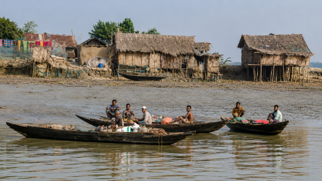
Agriculture remains an important livelihood where soils permit cultivation, although salinity intrusion increasingly affects productivity in some areas. Fishing, crab collection, shrimp seed collection (where permitted), honey collection, small-scale trade, and river transport provide additional sources of income.
Life in these settlements is shaped by environmental uncertainty. Cyclones, embankment breaches, tidal flooding, soil salinity, and changing river channels continually influence agriculture and livelihoods.
Residents have therefore developed generations of practical knowledge regarding tides, seasonal weather, river navigation, and mangrove ecology. This local ecological knowledge complements scientific research and remains an important component of sustainable resource management.
Banbibi and the Cultural Landscape
No understanding of the Sundarbans is complete without acknowledging the cultural traditions that have evolved alongside its forests.
Among the most enduring is the reverence shown toward Banbibi, the guardian figure traditionally respected by many forest-dependent communities regardless of religious background. Before entering the forest to collect honey, fish, crabs, or other resources, many people continue to offer prayers seeking protection.
Within Sundarbans folklore, Banbibi symbolizes harmony between humans and nature rather than domination over the forest. Her stories emphasize restraint, respect, and ethical conduct while reminding forest users that survival depends upon recognizing ecological limits.
Although these traditions belong primarily to surrounding communities rather than Jhingakhali specifically, they form an inseparable part of the broader cultural landscape surrounding the northern Sundarbans.
Conservation Significance
Jhingakhali occupies a strategically important position within the northern Indian Sundarbans because it supports multiple conservation objectives simultaneously.
The surrounding forests provide habitat for globally significant wildlife while also functioning as a natural buffer between protected ecosystems and densely populated islands. Mangroves stabilize riverbanks, reduce coastal erosion, store carbon, filter sediments, and provide nursery habitat for numerous aquatic species.
The freshwater pond near the watchtower creates an additional ecological resource, attracting mammals and birds during periods when freshwater availability becomes limited elsewhere within the surrounding mangrove landscape.
Because visitor access remains carefully regulated, Jhingakhali also serves as an environmental education site where people can observe mangrove ecology without entering highly sensitive wildlife habitats.
Its conservation value therefore extends beyond species protection to include ecosystem resilience, scientific understanding, and public awareness.
Human and Wildlife Interface
The northern Sundarbans represent one of the world’s most complex human–wildlife landscapes.
Protected forests lie immediately adjacent to inhabited islands, meaning that wildlife occasionally approaches areas occupied by people while human activities sometimes occur near forest boundaries. This proximity creates challenges for both conservation and local communities.
Forest authorities employ multiple strategies to reduce risk, including:
- Regulated forest entry
- Controlled tourism routes
- Wildlife monitoring
- Community awareness programmes
- Compensation mechanisms where applicable
- Strengthening embankments and buffer zones
- Rapid response teams for wildlife incidents
Successful conservation depends not only upon protecting wildlife but also upon supporting communities that share the landscape with it.
Climate Change and Future Challenges
Like the wider Sundarbans, Jhingakhali faces environmental pressures that extend far beyond local management.
Among the most significant long-term challenges are:
Rising Sea Levels
Even modest increases in sea level may alter tidal inundation patterns, accelerate erosion, and influence mangrove distribution across low-lying islands.
Increasing Salinity
Reduced upstream freshwater discharge during dry periods, combined with rising sea levels, may increase salinity in northern sectors of the Sundarbans. Changes in salinity can affect mangrove composition, fisheries, and freshwater availability for wildlife.
Cyclones
The Bay of Bengal remains one of the world’s most cyclone-prone regions. Storms such as Aila, Amphan, Yaas, and other severe cyclonic events have demonstrated how rapidly coastal ecosystems and surrounding communities can be transformed.
Mangrove forests provide valuable protection by reducing storm surge energy, yet they themselves may experience damage from extreme weather.
Habitat Fragmentation
Although protected areas remain extensive, maintaining ecological connectivity between forest blocks is essential for wide-ranging species such as tigers, crocodiles, and migratory birds.
Sustainable Tourism
Growing visitor interest creates opportunities for conservation education but also requires careful management to avoid disturbing wildlife or degrading fragile habitats.
Scientific Research and Monitoring
Jhingakhali contributes to ongoing scientific understanding of the northern Sundarbans through ecological monitoring and long-term conservation research.
Researchers working across the wider Sundarbans investigate topics including:
- Tiger population dynamics
- Mangrove regeneration
- Carbon sequestration
- Bird migration
- Fisheries ecology
- Estuarine hydrology
- Climate change impacts
- Sediment transport
- Coastal geomorphology
- Human–wildlife interactions
Camera traps, drone surveys, satellite imagery, vegetation plots, water-quality monitoring, and biodiversity assessments collectively help scientists understand how the ecosystem changes over time.
Importantly, many ecological processes unfold over decades rather than years. Long-term monitoring at locations such as Jhingakhali therefore provides essential evidence for adaptive conservation planning.
Why Jhingakhali Matters
Jhingakhali is often introduced simply as another watchtower within the Sundarbans, but its significance is considerably deeper.
It represents:
- A northern gateway to the Indian Sundarbans.
- An interface between protected mangrove wilderness and human settlements.
- A habitat supporting globally important biodiversity.
- A valuable location for environmental education.
- A site contributing to wildlife monitoring and ecological research.
- A living example of how tides shape every aspect of life within the world’s largest mangrove forest.
Perhaps most importantly, Jhingakhali demonstrates that conservation is not solely about protecting charismatic wildlife. It is about safeguarding the ecological relationships between rivers, tides, mangroves, wildlife, and people that together sustain one of the planet’s most remarkable coastal ecosystems.
Visitor Information
Jhingakhali is one of the designated forest tourism destinations within the northern Indian Sundarbans. Unlike conventional tourist attractions, it is a protected forest area administered by the West Bengal Forest Department. Every visit is governed by conservation regulations designed to minimize disturbance to wildlife while allowing visitors to experience the mangrove ecosystem responsibly.
A journey to Jhingakhali is as much about understanding the landscape as observing wildlife. Visitors spend most of their time navigating tidal rivers before arriving at the Forest Department watchtower overlooking a freshwater pond and surrounding mangrove forest.
Entry Regulations
Visitors should expect the following regulations:
- Entry only through authorized routes.
- Forest permits as required.
- Travel using licensed vessels.
- Compliance with Forest Department instructions.
- No independent exploration inside protected forests.
- Restricted access to designated visitor zones.
Regulations may change over time; therefore, visitors should always verify current requirements before travelling.
What Visitors Can Expect
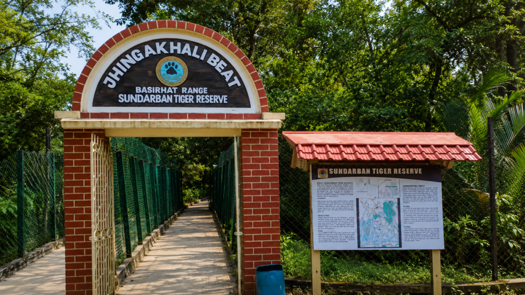
A visit to Jhingakhali emphasizes observation rather than activity.
Experiences commonly include:
- Scenic boat journeys.
- Mangrove interpretation.
- Wildlife observation from the watchtower.
- Birdwatching.
- Photography.
- Understanding tidal ecology.
- Quiet appreciation of the forest landscape.
There are no safari vehicles, walking trails through the forest, or recreational facilities comparable to terrestrial national parks.
Responsible Exploration Guidelines
The Sundarbans is a globally significant ecosystem where every visitor shares responsibility for minimizing ecological impact.
Maintain Silence
Wildlife relies heavily on sound to detect predators and disturbances. Loud conversations, music, and unnecessary noise reduce the likelihood of natural wildlife behaviour.
Remain Inside Designated Areas
Visitors should never attempt to leave approved viewing platforms or boats unless explicitly instructed by Forest Department personnel.
Do Not Feed Wildlife
Feeding alters natural behaviour, increases disease transmission risks, and may create long-term ecological problems.
Avoid Plastic Pollution
Carry reusable water bottles where possible and ensure all waste leaves the protected area.
Respect Wildlife Distance
Photographs should never be prioritized over animal welfare. Telephoto lenses are preferable to approaching wildlife.
Follow Boat Safety Instructions
Tidal rivers experience changing currents throughout the day. Instructions provided by boat operators and Forest Department staff should always be followed.
Photography Opportunities
Jhingakhali offers exceptional opportunities for documentary and nature photography.
Popular subjects include:
Mangrove Landscapes
- Tidal rivers
- Morning mist
- Mangrove silhouettes
- Exposed mudflats
- Reflection photography
Wildlife
Potential photographic subjects include:
- Spotted Deer
- Water Monitor
- Kingfishers
- Brahminy Kite
- Egrets
- Herons
- Crocodiles (occasionally)
- Otters (rare)
Tiger photography remains extremely uncommon due to dense vegetation and the naturally elusive behaviour of the species.
Macro Photography
Excellent opportunities exist for photographing:
- Fiddler crabs
- Mudskippers
- Mangrove roots
- Salt crystals on leaves
- Mangrove flowers
- Insects
Documentary Photography
Some of the strongest visual stories emerge from observing ecological processes rather than individual animals.
Examples include:
- Rising tides surrounding mangrove roots.
- Fishing birds hunting at low tide.
- Changing river colours with tidal flow.
- Crab burrows across exposed mudbanks.
- Boat movement through narrow creeks.
- Light filtering through mangrove canopies.
Best Time to Visit
Each season reveals a different aspect of Jhingakhali.
November–February (Recommended)
Advantages:
- Pleasant weather
- Comfortable temperatures
- Better visibility
- Migratory birds
- Excellent photography conditions
March–May
Advantages:
- Increased chances of observing animals near freshwater.
- Clear skies.
Challenges:
- High temperatures.
- Greater humidity.
June–September
Advantages:
- Lush mangrove growth.
- Peak ecological productivity.
Challenges:
- Heavy rainfall.
- Rough river conditions.
- Limited visibility.
- Weather-related travel disruptions.
October
A transitional month characterized by:
- Fresh post-monsoon vegetation.
- Active birdlife.
- Improving weather.
- Attractive landscape photography.
The Wild Orbit’s Interesting Facts About Jhingakhali
- Jhingakhali is located in the northern sector of the Indian Sundarbans.
- It is accessed entirely by boat.
- The surrounding forest forms part of one of the world’s largest continuous mangrove ecosystems.
- A freshwater pond near the watchtower attracts wildlife.
- Tides reshape the surrounding landscape twice every day.
- Mangrove trees growing around Jhingakhali possess specialized adaptations for surviving saline environments.
- Wildlife often remains hidden despite being only a short distance from observers.
- Several kingfisher species may be observed during a single visit.
- The surrounding rivers function as ecological corridors connecting India and Bangladesh.
- Every visit depends upon tidal timing rather than fixed road schedules.
FAQs
Where is Jhingakhali?
Jhingakhali is located in the northern Indian Sundarbans in the North 24 Parganas district of West Bengal.
Is Jhingakhali inside the Sundarbans Tiger Reserve?
It lies within the protected landscape associated with the Sundarbans and is managed by the West Bengal Forest Department.
Can visitors walk inside the forest?
No. Visitors remain within designated observation areas and approved boats.
Is Jhingakhali famous for tiger sightings?
No. Tiger sightings are possible but uncommon. The area is better appreciated as a complete mangrove ecosystem rather than a guaranteed tiger-viewing destination.
Why is there a freshwater pond?
The freshwater pond provides an important water source for wildlife and increases opportunities for observation from the watchtower.
Which birds can be seen?
Kingfishers, egrets, herons, kites, sea eagles, shorebirds, migratory waterbirds, and many other species.
Are crocodiles present?
Yes. Saltwater Crocodiles inhabit the wider Sundarbans and may occasionally be observed near Jhingakhali.
Is Jhingakhali suitable for birdwatching?
Yes. It is regarded as one of the rewarding northern birdwatching locations within the Indian Sundarbans.
Can families visit?
Yes, provided they follow Forest Department regulations and travel with authorized operators.
What should visitors carry?
Recommended items include:
- Binoculars
- Camera
- Sun protection
- Drinking water
- Insect repellent
- Lightweight clothing
- Rain protection during the monsoon
Is mobile connectivity available?
Connectivity varies considerably and should not be relied upon throughout the journey.
Why are tides important?
Tides determine navigation, wildlife movement, sediment transport, salinity, and virtually every ecological process within the Sundarbans.
Is Jhingakhali good for wildlife photographers?
Yes. It offers excellent opportunities for documentary wildlife and landscape photography, although patience is essential.
Can independent boats enter?
No. Visitors should travel only through authorized operators following Forest Department regulations.
Why is Jhingakhali important?
It combines ecological significance, wildlife habitat, environmental education, and conservation within the northern Sundarbans.
The Ecology Behind the Watchtower
As the final boat leaves Jhingakhali and the watchtower gradually disappears behind a curtain of mangroves, the forest seems to reclaim its silence. The incoming tide softens the outlines of the mudbanks, breathing roots vanish beneath the rising water, and the boundary between land and river fades once again. It is a quiet reminder that the Sundarbans is never static. Every tide redraws the landscape, every season reshapes its habitats, and every organism—from microscopic plankton to the Royal Bengal Tiger—moves in rhythm with this continual transformation.
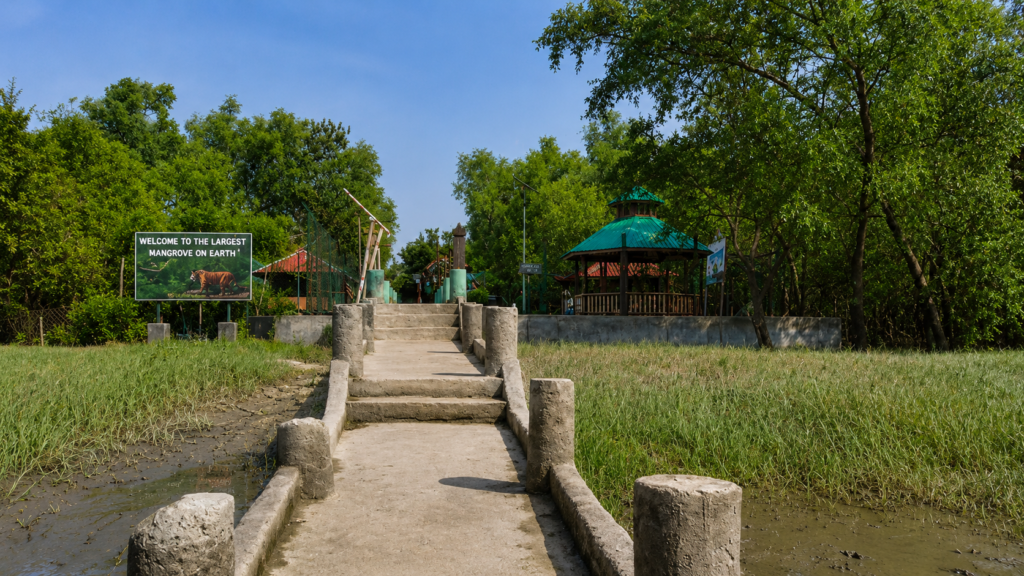
Jhingakhali exemplifies this living dynamism. Its value does not lie solely in the possibility of seeing iconic wildlife but in revealing the intricate ecological relationships that sustain the northern Sundarbans. Mangrove trees stabilize fragile shorelines, tidal currents distribute nutrients, freshwater refuges support animals during dry periods, and local communities continue to adapt their lives to one of the world’s most challenging coastal environments. Together, these interactions form an ecosystem of extraordinary resilience and global importance.
To observe Jhingakhali is to appreciate a landscape where patience is rewarded with understanding rather than spectacle. The calls of kingfishers, the cautious steps of a Spotted Deer, the slow rise of tidal water, and the hidden presence of larger predators all reflect an environment governed by natural rhythms that have endured for centuries.
In protecting places such as Jhingakhali, we preserve far more than a destination. We safeguard an irreplaceable network of rivers, forests, wildlife, and cultural traditions that continues to shape the identity of the Indian Sundarbans. For anyone seeking to understand this remarkable delta, Jhingakhali stands not merely as a watchtower or a stop along a river route, but as a compelling window into one of Earth’s most remarkable mangrove wildernesses.
Plan your private Sundarban expedition
A private journey shaped around you — your group, your pace, your interests. Book a free consultation.