 Encyclopedia
Sajnekhali
The Ecological Gateway to the Indian Sundarbans
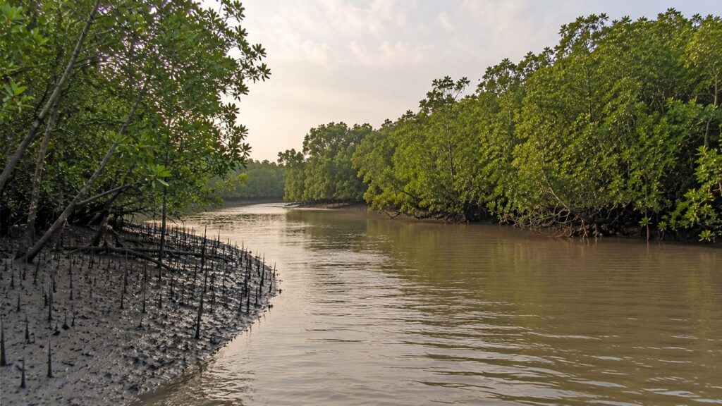
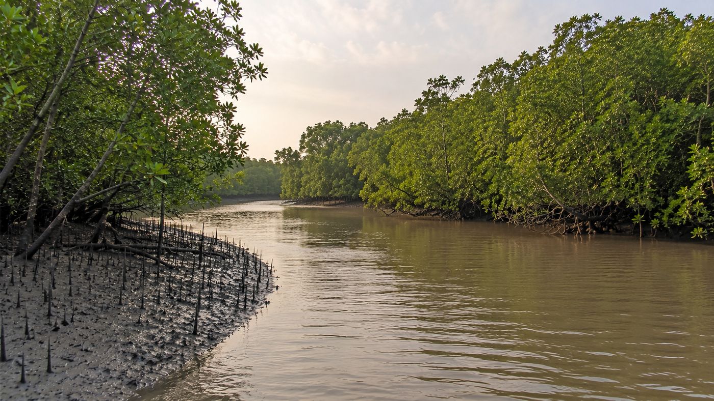
As the tide begins to recede, the muddy banks of a tidal creek slowly emerge from beneath opaque brown estuarine water. Thousands of pencil-like mangrove roots rise from the saturated sediment, breathing through the brief window before the next tide returns. The calls of kingfishers echo across the waterways while an egret glides silently toward an exposed mudflat in search of fish stranded by the retreating water. Overhead, Brahminy Kites circle above the mangrove canopy, and somewhere beyond the dense green wall, a Spotted Deer (Axis axis) steps cautiously between patches of shade. This quiet rhythm of tides, wildlife, and mangroves defines Sajnekhali—one of the most ecologically significant landscapes in the Indian Sundarbans.
Situated within the northern reaches of the Sundarban Tiger Reserve in West Bengal, Sajnekhali occupies a unique position at the interface between human settlements and one of the world's largest mangrove forests. While many visitors recognize Sajnekhali as the location of a popular watchtower and forest interpretation centre, its true significance extends far beyond tourism. It represents an important transition zone where freshwater flowing from the Ganges-Brahmaputra-Meghna delta gradually mixes with saline tidal waters from the Bay of Bengal, creating one of the planet's most productive estuarine ecosystems.
Sajnekhali also serves as one of the principal administrative and conservation centres of the Indian Sundarbans. Forest protection, wildlife monitoring, ecological education, and visitor regulation converge here, making it a critical component of long-term conservation management.
For researchers, photographers, birdwatchers, students, and naturalists, the area provides one of the most accessible opportunities to observe the extraordinary ecological processes that sustain the mangrove delta.
Yet Sajnekhali is far more than a destination. It is a living ecological classroom where every tide reshapes the landscape, every creek supports a network of aquatic life, and every mangrove tree contributes to the stability of an ecosystem that protects millions of people from cyclones while supporting remarkable biodiversity. Understanding Sajnekhali therefore means understanding the broader story of the Indian Sundarbans itself—a landscape governed not by roads or boundaries, but by rivers, tides, sediment, salinity, and the remarkable resilience of life.
CTA: Explore the Sundarbans with The Wild Orbit
Sajnekhali at a Glance
Location: Northern Indian Sundarbans, South 24 Parganas District, West Bengal, India
Administrative Status: Part of the Sundarban Tiger Reserve and Sajnekhali Wildlife Sanctuary
Ecosystem: Tropical tidal mangrove forest
Landscape Type: Estuarine delta with intertidal islands, creeks, mudflats, and mangrove forests
UNESCO Context: Lies within the Sundarbans Biosphere Reserve and the broader Sundarbans World Heritage landscape
Dominant Processes: Tidal inundation, sediment deposition, salinity gradients, and estuarine mixing
Primary Vegetation: Mangrove forests dominated by species adapted to saline and waterlogged environments
Notable Wildlife: Royal Bengal Tiger (Panthera tigris tigris), Fishing Cat (Prionailurus viverrinus), Saltwater Crocodile (Crocodylus porosus), Spotted Deer, and numerous resident and migratory birds
Ecological Role: Biodiversity conservation, nursery habitat for aquatic life, shoreline stabilization, and carbon storage
Conservation Importance: Forest administration, wildlife monitoring, environmental education, and regulated visitor access
Accessibility: Accessible only by licensed boats through designated waterways, subject to Forest Department regulations and prior permission.
Geographic Setting
Sajnekhali lies within the northeastern sector of the Indian Sundarbans, occupying a strategic position inside one of the world's largest contiguous mangrove ecosystems. Located in the South 24 Parganas district of West Bengal, it forms part of the intricate delta created by the Ganges, Brahmaputra, and Meghna river systems before they enter the Bay of Bengal.
Unlike conventional terrestrial landscapes, Sajnekhali cannot be understood through fixed boundaries alone. The geography is dynamic, shaped continuously by tides that rise and fall twice each day, transporting sediment, nutrients, and saline water through an extensive network of rivers and tidal creeks. Land and water constantly redefine one another, producing an ever-changing mosaic of mangrove-covered islands, mudflats, narrow channels, and estuarine waterways.
Its location at the northern edge of the protected forest also makes Sajnekhali an important ecological transition zone.
- To the north lie inhabited islands where agriculture, aquaculture, and village life dominate.
- To the south begins the increasingly remote mangrove wilderness of the core Sundarbans.
This proximity between human settlements and protected forest has shaped both the conservation importance and management responsibilities of the area.
The region experiences a tropical monsoon climate characterized by high humidity throughout the year. Seasonal rainfall replenishes freshwater inputs into the estuary, while dry-season evaporation increases salinity across many parts of the mangrove landscape. These seasonal changes influence vegetation patterns, wildlife distribution, fish migration, and the productivity of the estuarine ecosystem.
Geologically, Sajnekhali belongs to one of Earth's youngest active deltaic landscapes. Fine sediments carried from the Himalayas continue to accumulate across the estuary, while erosion simultaneously removes land elsewhere. This continuous balance between deposition and erosion means that the Sundarbans remain a living, evolving landscape rather than a static geographical feature.
How to Reach Sajnekhali
Sajnekhali is accessible only by water for the final part of the journey. Kolkata is the nearest major city, while Canning is the nearest major railway gateway. Official Sundarban Tiger Reserve guidance identifies Godkhali and Dhamakhali as important boat-boarding points for visitors.
From Kolkata by Road
Travellers can drive or take road transport from Kolkata to Godkhali, one of the principal embarkation points for the Sundarbans. From Godkhali Jetty, the journey to Sajnekhali continues by boat. Private parking is available near Godkhali Jetty for travellers arriving in their own vehicles.
Route: Kolkata → Godkhali Jetty → Sajnekhali by boat
By Train
The nearest major railhead is Canning Railway Station, connected with Sealdah in Kolkata by suburban trains. From Canning, travellers can continue by local road transport toward Godkhali Jetty, from where the journey proceeds by boat. West Bengal Tourism specifically identifies Godkhali as a starting point for boat journeys into the Sundarbans.
Route: Sealdah → Canning → Godkhali Jetty → Sajnekhali by boat
By Air
The nearest airport is Netaji Subhas Chandra Bose International Airport, Kolkata. From the airport, travellers must continue by road toward a Sundarbans embarkation point and then transfer to a boat for Sajnekhali.
Route: Kolkata Airport → Godkhali or another designated embarkation point → Sajnekhali by boat
By Boat
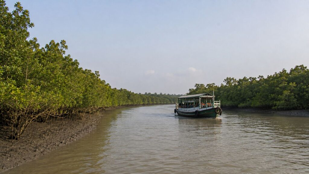
The final journey to Sajnekhali is by boat or launch. The Sundarban Tiger Reserve states that boats and launches are the means of transport within the reserve. Visitors entering the Tiger Reserve must use appropriately registered boats, and boats entering the reserve are required to carry an ecotourism guide.
Alternative approaches to the wider Sajnekhali Wildlife Sanctuary are also possible through Sonakhali, Basanti and other river-access points, depending on the journey being undertaken. The West Bengal Forest Department specifically identifies Canning as the closest railhead for Sajnekhali and describes continuing through Basanti or Sonakhali before taking a boat to the sanctuary.
For most visitors approaching from Kolkata, the simplest route to understand is:
Kolkata → Canning/Godkhali → Boat → Sajnekhali
Rivers Flowing Beside Sajnekhali
The rivers surrounding Sajnekhali function as ecological corridors rather than simple waterways. They transport freshwater, saline tidal water, nutrients, sediments, fish larvae, crustaceans, and organic matter that sustain the mangrove ecosystem.
Major rivers and channels associated with Sajnekhali include:
- Gomor River
- Gumdi River
- Bidya River
- Numerous unnamed tidal creeks connected to the Bidya River system
- Smaller estuarine channels linking adjacent mangrove islands
Together these waterways regulate salinity, influence sediment deposition, determine mangrove distribution, and provide movement corridors for aquatic wildlife including crocodiles, dolphins, fish, and estuarine reptiles.
Nearby Forest Blocks
Sajnekhali forms part of a larger protected forest network rather than existing as an isolated island. Important nearby forest landscapes include:
- Sudhanyakhali
- Pirkhali
- Dobanki
- Chamta
- Netidhopani forest region
- Arbesi forest areas
These interconnected forest blocks collectively support wide-ranging wildlife, particularly the Royal Bengal Tiger, whose movements frequently span multiple islands separated by tidal channels.
Nearby Inhabited Islands and Human Settlements
Several inhabited islands occur immediately north of the protected forest, forming an important socio-ecological boundary between villages and wilderness.
Nearby settlements include:
- Gosaba
- Dayapur
- Bali Island
- Pakhiralay
- Satjelia
- Rangabelia
These communities depend on the delta for fisheries, agriculture, honey collection, tourism-related livelihoods, and transportation. Their close relationship with the surrounding mangrove ecosystem has shaped local culture for generations while also presenting ongoing conservation challenges associated with human-wildlife coexistence.
Landscape Character
As dawn breaks over Sajnekhali, the first rays of sunlight filter through the dense mangrove canopy, illuminating an intricate landscape where water, mud, and vegetation exist in constant interaction. Unlike terrestrial forests that are defined by stable soils and predictable boundaries, Sajnekhali is a landscape governed by tidal rhythms. Every six hours, the advancing and retreating tides transform the appearance of the forest, alternately concealing and revealing mudflats, pneumatophores, creek banks, and shallow estuarine channels.
The terrain is remarkably flat, with elevations often differing by only a few centimeters. Yet these subtle differences determine ecological communities. Slightly elevated areas support mature mangrove stands, while lower depressions remain inundated for longer periods, creating ideal conditions for aquatic organisms and salt-tolerant vegetation. The resulting mosaic of habitats contributes significantly to the exceptional biodiversity of the region.
One of the defining visual features of Sajnekhali is its dense network of tidal creeks. Rather than flowing continuously in one direction like conventional rivers, these waterways reverse their flow with every tidal cycle.
- During flood tide, saline water penetrates deep into the forest.
- During ebb tide, freshwater, sediments, nutrients, and organic matter move seaward, sustaining one of the most productive estuarine ecosystems on Earth.
The forest itself presents an ever-changing composition of textures and colours. Mature mangrove trees form a dense green canopy, beneath which exposed roots weave through soft alluvial mud. Fallen leaves accumulate on the forest floor, gradually decomposing into nutrient-rich organic matter that supports countless microorganisms, crabs, molluscs, and juvenile fish. Seasonal flowering, fruiting, and leaf production continuously alter the appearance of the landscape, ensuring that no two visits are ever exactly alike.
Unlike mountain forests or tropical rainforests, the beauty of Sajnekhali is subtle rather than dramatic. Its ecological richness reveals itself through careful observation—the movement of a mudskipper across exposed sediment, the synchronized feeding of egrets along receding shorelines, or the quiet emergence of fiddler crabs after the tide withdraws. This understated complexity is precisely what makes the landscape one of the most fascinating natural systems within the Indian Sundarbans.
Rivers and Water Systems
Water is the primary architect of Sajnekhali. Every ecological process, from mangrove growth to wildlife distribution, depends on the movement of tidal water through an intricate network of rivers, estuaries, and narrow creeks.
Unlike freshwater forests, Sajnekhali exists within an estuarine environment where freshwater from the Ganges River system mixes continuously with saline water from the Bay of Bengal. This mixing creates highly dynamic salinity gradients that vary across seasons, tidal cycles, and geographical locations.
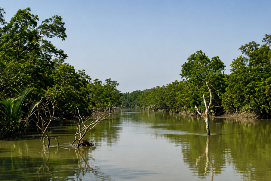
The Bidya River serves as one of the principal waterways associated with Sajnekhali. Its tidal influence extends through numerous interconnected creeks, transporting sediments, dissolved nutrients, plankton, fish larvae, and organic material throughout the forest. Smaller distributaries and unnamed tidal channels branch from larger rivers, creating sheltered aquatic habitats that function as nurseries for many estuarine species.
These waterways also act as ecological corridors. Fish migrate between feeding and breeding grounds, estuarine crocodiles move between river channels and creeks, and mammals such as the Fishing Cat exploit creek margins in search of prey. Even the Royal Bengal Tiger frequently swims across tidal rivers while moving between neighbouring forest islands, demonstrating how rivers connect rather than divide the mangrove landscape.
Sediment transport is equally important. Fine silts carried by river currents settle during periods of reduced water velocity, gradually building new mudbanks and expanding intertidal habitats. In other areas, erosion removes sediment, reshaping creek banks and altering the configuration of islands over time. This continuous balance between deposition and erosion maintains the dynamic character of the delta.
The rivers also influence water quality. Seasonal monsoon rainfall increases freshwater discharge, reducing salinity in many areas and transporting additional nutrients into the estuary. During the dry season, diminished river flow allows saline water to penetrate further inland, affecting mangrove species composition and ecological productivity.
Thus, the rivers surrounding Sajnekhali are not merely geographical features; they are living systems that regulate the ecological health of the entire landscape.
The Mangrove Ecosystem
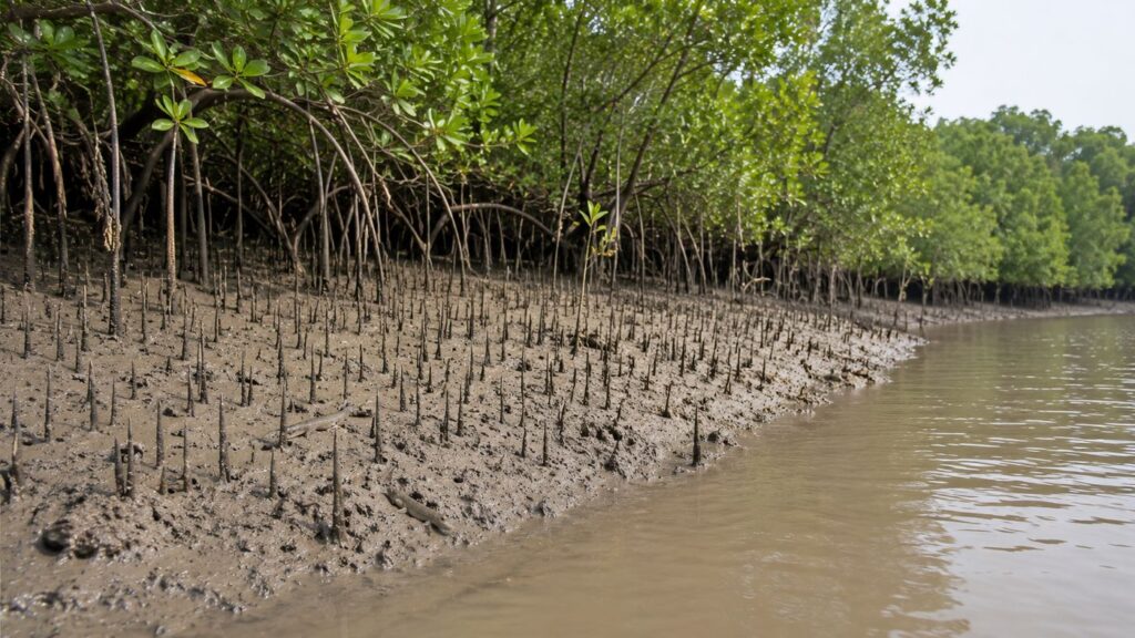
The mangrove forest surrounding Sajnekhali is among the most specialized ecosystems on the planet. It occupies an environment that would be inhospitable to most terrestrial plants—waterlogged soils, fluctuating salinity, unstable sediments, and regular tidal inundation.
Mangroves overcome these challenges through remarkable evolutionary adaptations. Many species possess specialized aerial roots, known as pneumatophores, that project above the mud surface to absorb oxygen when surrounding soils become oxygen-deficient. Others develop stilt roots that provide mechanical stability in soft sediments while helping trap suspended particles carried by tidal currents.
Salt management represents another extraordinary adaptation. Some mangrove species exclude salt at the root level, preventing excessive uptake, while others excrete surplus salt through specialized glands on their leaves. These physiological mechanisms enable mangroves to survive in environments where most plants would quickly perish.
Reproduction is equally distinctive. Many mangrove species exhibit vivipary, in which seeds begin germinating while still attached to the parent tree. Once mature, these elongated propagules detach and drift with tidal currents until they encounter suitable substrates where they can establish new seedlings. This strategy greatly increases the likelihood of successful colonization within dynamic tidal environments.
Beyond their botanical adaptations, mangroves provide essential ecosystem services. Their extensive root systems stabilize shorelines, reduce erosion, trap sediments, improve water quality, and buffer coastal communities against storm surges and cyclones. They also function as globally significant carbon sinks, storing substantial quantities of carbon within both living biomass and deep organic-rich soils.
The forest floor beneath mature mangroves supports a remarkable diversity of life. Crabs recycle organic matter by shredding fallen leaves, molluscs filter suspended particles from tidal water, worms aerate sediments, and microorganisms decompose plant material into nutrients that sustain primary productivity. Together, these processes create one of the world's most efficient natural nutrient recycling systems.
The Foundation of the Forest
The mangrove ecosystem is the foundation upon which almost every ecological relationship in Sajnekhali depends. Trees and shrubs adapted to tidal inundation form the physical structure of the forest, but their influence extends far beyond the vegetation visible above the mud. Their roots stabilize soft sediments, create shelter for aquatic organisms, contribute organic matter to the estuary, and provide feeding, resting, nesting, and hunting environments for wildlife.
This relationship between vegetation and water is fundamental to understanding Sajnekhali. The forest does not occupy dry land beside a river in the conventional sense. It exists within a tidal environment where river channels, creeks, exposed mud, saline water, and vegetation continually interact.
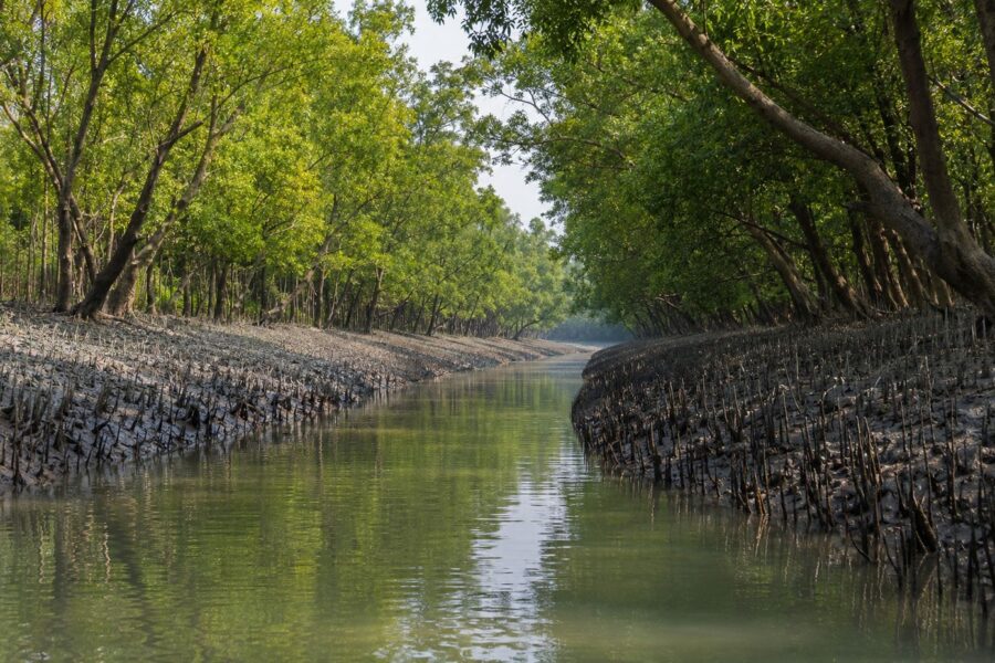
At low tide, the architecture beneath the forest becomes visible. Mudbanks are crowded with breathing roots projecting above the sediment, while narrow drainage channels carry the last of the retreating water toward larger creeks. When the tide returns, much of this structure disappears beneath the surface again.
The alternating exposure and inundation help explain why ordinary terrestrial trees cannot dominate here. Mangrove plants must tolerate soils that are waterlogged, oxygen-poor, unstable, and affected by salt. Survival requires a suite of specialized anatomical and physiological adaptations.
These forests also connect terrestrial and aquatic food systems. Leaves, flowers, fruits, woody material, and other organic matter enter the mud and tidal water. Microorganisms and detritivores process this material, and the resulting nutrients move through food webs involving crabs, molluscs, fish, birds, reptiles, and mammals.
This is one reason the wider Sundarbans is exceptionally productive. UNESCO describes the Sundarbans Biosphere Reserve as a highly productive deltaic ecosystem with exceptional mangrove diversity and a rich assemblage of animal life.
For Sajnekhali, therefore, the mangrove forest is more than habitat. It is the ecological infrastructure of the sanctuary.
Major Mangrove Species
See it for yourself
A private journey shaped around you — your group, your pace, your interests. Book a free consultation.
The vegetation of Sajnekhali belongs to the broader mangrove flora of the Indian Sundarbans, where species distribution is strongly influenced by salinity, tidal inundation, soil conditions, drainage, and the availability of freshwater.
Among the characteristic mangrove plants of the Indian Sundarbans are Sundari (Heritiera fomes), Gewa (Excoecaria agallocha), Goran (Ceriops decandra), Keora (Sonneratia apetala), species of Avicennia, Bruguiera, Rhizophora, and Xylocarpus, together with other mangrove and mangrove-associated vegetation.
Not every species occurs with equal abundance across Sajnekhali. Mangrove communities vary over surprisingly short distances because a small difference in elevation, inundation frequency, sediment character, or salinity can favour one species over another. For that reason, the forest should not be imagined as a uniform stand of identical trees.
Sundari (Heritiera fomes) is the species most closely associated with the name Sundarbans. It is an important component of the regional mangrove flora, although its distribution and condition vary considerably across the salinity gradient of the delta.
Gewa (Excoecaria agallocha) is another characteristic mangrove tree of the Sundarbans. Like other species occupying the intertidal landscape, its occurrence reflects the complex relationship between salinity, tidal flooding, soil conditions, and competition.
Goran (Ceriops decandra) commonly contributes to dense mangrove vegetation in suitable parts of the Indian Sundarbans. Its growth form can help create thick forest structure close to the muddy substrate.
Keora (Sonneratia apetala) is particularly recognizable where its extensive system of vertical breathing roots surrounds the tree. These pneumatophores become conspicuous when the tide retreats.
Species of Avicennia are also important components of the delta's mangrove communities. Their tolerance of saline environments and characteristic breathing roots allow them to occupy intertidal habitats where prolonged waterlogging would exclude most ordinary terrestrial plants.
Other genera, including Bruguiera, Rhizophora and Xylocarpus, add further structural and botanical diversity to the broader Sundarbans mangrove community.
The importance of this diversity extends beyond botany. Different root forms, canopy structures, fruits, flowers, leaf litter, and patterns of tidal tolerance create different ecological opportunities for insects, crabs, molluscs, fish, reptiles, birds, and mammals.
A mangrove forest is therefore not simply a collection of salt-tolerant trees. It is a three-dimensional habitat whose botanical diversity helps generate biological diversity throughout the estuary.
Extraordinary Adaptations
Mangroves survive where most trees cannot.
The mud surrounding their roots is frequently saturated with water. In such soils, oxygen available to conventional underground roots can become extremely limited. At the same time, tidal water exposes plants to varying concentrations of salt, while soft sediment provides a relatively unstable foundation.
Mangrove evolution has produced several solutions to these problems.
One of the most visible is the development of aerial roots.
In species with pneumatophores, narrow root structures project vertically through the mud. During periods of exposure, these structures facilitate gas exchange between the root system and the atmosphere. When the tide rises, many disappear beneath the water; when it retreats, they emerge again.
Other mangroves develop supporting root structures that help anchor the plant in unstable intertidal sediment. Root architecture can also slow water movement and encourage suspended particles to settle, contributing to sediment retention around the forest edge.
Salt presents a different challenge.
Mangrove species do not all manage it in the same way. Some restrict the amount of salt entering through their roots. Others tolerate salt within their tissues or remove excess salt through specialized physiological processes.
Reproduction also reflects the difficulty of establishing a seedling on an unstable tidal surface.
Several mangrove species display vivipary or related forms of precocious germination, in which development begins while the propagule remains attached to the parent plant. Once released, buoyant propagules can be transported by tidal water before becoming lodged in suitable sediment.
These adaptations should not be regarded as botanical curiosities. Together they explain how forests can occupy a geographical zone that alternates repeatedly between exposure and inundation.
They also explain the distinctive appearance of Sajnekhali.
The breathing roots covering exposed mud, seedlings establishing along creek margins, salt-tolerant foliage above tidal water, and dense root systems below the canopy are visible expressions of millions of years of adaptation to the intertidal environment.
Documentary Field Observation
When the tide withdraws from a shaded creek, another landscape appears beneath the forest. The waterline falls away from the mangrove trunks, exposing dark, saturated mud crowded with pencil-like breathing roots. Small crabs emerge from burrows. Mudskippers move across surfaces that only a short time earlier were underwater. Fallen leaves become lodged between roots or are carried slowly toward the creek by the remaining drainage.
A leaf falling from the canopy does not simply disappear into the mud.
Bacteria, fungi, and small detritivores begin breaking down organic material. Crabs may cut and carry fragments into their burrows. Tidal water redistributes smaller particles and dissolved nutrients. Some of that organic material eventually enters aquatic food chains supporting invertebrates and fish.
The next incoming tide changes the scene again.
Water spreads across the exposed sediment, fills depressions and narrow channels, surrounds the pneumatophores, and reconnects shallow feeding areas with the larger creek. Aquatic animals can move into spaces that were inaccessible during low water.
Nothing dramatic needs to happen for the ecological machinery of Sajnekhali to become visible.
The movement of a crab, the decomposition of a leaf, the exposure of a breathing root, and the return of tidal water are ordinary events. Together they demonstrate how the mangrove forest functions.
Where Wildlife and Conservation Meet
Sajnekhali differs from Netidhopani in one important editorial respect: its defining story is not centred on archaeological remains or a surviving historical monument. Its identity is much more closely connected with wildlife, protected-area management, birdlife, conservation, and environmental interpretation.
The Government of West Bengal records Sajnekhali Wildlife Sanctuary as a protected area of approximately 362.4–362.8 square kilometres, formally notified in 1976. The original government notification identified the Penchmukhani and Pirkhali forest blocks and described boundaries involving channels and rivers including Gomdi Khal, Dutta's Gang, the Gosaba River, Netidhopani Khal and the Bidya River.
Its position within the larger protected landscape gives Sajnekhali a dual character.
It is biologically significant in its own right, but it is also part of a much larger conservation system protecting the Indian Sundarbans.
UNESCO notes that the Sajnekhali area is recognized for its importance to birds, particularly waterfowl and migratory species. The wider Sundarbans World Heritage landscape protects extraordinary mangrove biodiversity together with the Royal Bengal Tiger, estuarine crocodile, aquatic fauna, reptiles, and an exceptionally rich bird community.
This makes Sajnekhali an unusually valuable place for understanding how conservation works at the boundary between accessibility and wilderness.
Visitors can observe mangrove ecology and wildlife from regulated areas, while beyond those points extends a landscape where conservation priorities take precedence over unrestricted human movement.
Historical Background
The modern history of Sajnekhali as a protected landscape belongs to the broader twentieth-century evolution of wildlife conservation in the Indian Sundarbans. For generations before formal protection, the Sundarbans were also a working landscape. Fishing, honey collection, wood extraction, navigation, settlement expansion, and other forms of resource dependence shaped relationships between people and the mangrove forest.
As scientific understanding of wildlife conservation developed in India, greater attention was directed toward protecting ecologically important forest landscapes and their fauna.
A decisive legal step for Sajnekhali came in 1976.
A Government of West Bengal notification issued under the Wild Life (Protection) Act, 1972 declared the area a wildlife sanctuary for the purpose of protecting, propagating, and developing wildlife and its environment. The notification described an approximate area of 362.40 square kilometres comprising forest compartments within Penchmukhani and Pirkhali blocks.
This legal history is important because it explains why Sajnekhali should not be understood merely as a watchtower visited during a Sundarbans boat journey.
The watchtower is only one small component of a much larger protected landscape.
Over time, Sajnekhali also became closely associated with forest administration, conservation awareness, regulated nature tourism, wildlife observation, and interpretation of the mangrove ecosystem.
Its history therefore reflects a broader transformation in how society has come to understand the Sundarbans: from a difficult frontier valued largely for extractive resources to an ecosystem increasingly recognized for biodiversity, coastal protection, scientific importance, and global conservation value.
Sajnekhali Wildlife Sanctuary
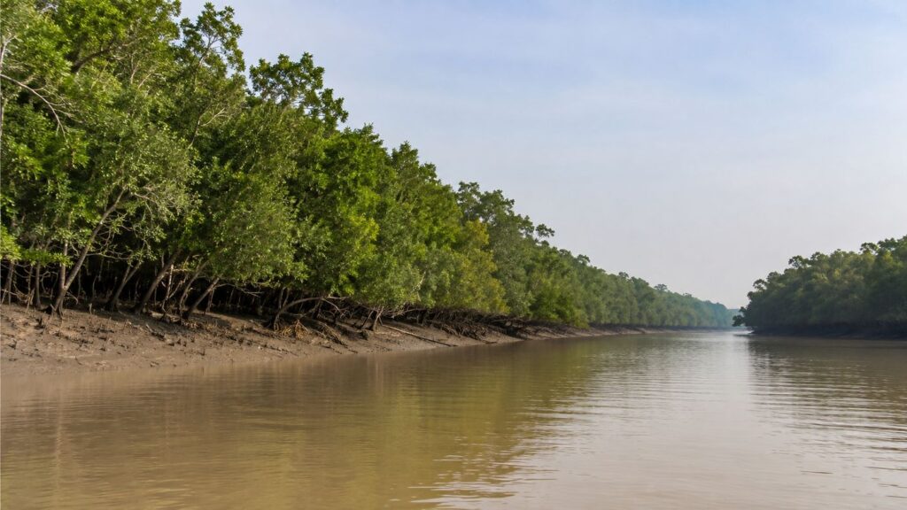
Sajnekhali Wildlife Sanctuary is one of the legally protected areas associated with the Indian Sundarbans.
The Government of West Bengal records an area of approximately 362.80 square kilometres, while the original 1976 notification described approximately 362.40 square kilometres. Rather than conceal this small discrepancy, it is more accurate editorially to recognize that the figures appear differently in official records. The legal notification itself remains the strongest source for the original declaration.
The sanctuary encompasses mangrove forest, tidal waterways, creek systems, mudbanks and other intertidal habitats characteristic of the northern Sundarbans.
Its ecological importance derives from the connectivity of these environments.
A tiger moving through mangrove forest, a crocodile occupying an estuarine channel, a Fishing Cat hunting along a creek edge, and migratory waders feeding on exposed sediment may appear to belong to different habitats. In reality, all depend upon different components of the same tidal system.
Birdlife is particularly significant.
The West Bengal Forest Department identifies Sajnekhali for its rich avian population, listing waterbirds, raptors, kingfishers and migratory waders. UNESCO likewise identifies the Sajnekhali area as important for waterfowl and migratory birds.
This avian significance remains visible today. The 2026 Sundarbans Bird Festival began at the Sajnekhali Beat complex, while the associated survey recorded 168 species across the wider survey landscape, including 57 migratory species. These figures belong to the broader survey area and should not be misrepresented as a Sajnekhali-only species count, but they demonstrate the continuing importance of the region for systematic bird monitoring.
The sanctuary's importance therefore lies not in a single charismatic animal but in the protection of an interconnected mangrove community.
Wildlife of Sajnekhali
The Royal Bengal Tiger (Panthera tigris tigris) remains the most celebrated predator of the Sundarbans, but Sajnekhali's wildlife community is much broader.
Spotted Deer (Axis axis) are among the most important large herbivores of the mangrove landscape and constitute an important prey species. Wild Boar (Sus scrofa) forage through forest floors and intertidal environments, while Rhesus Macaques (Macaca mulatta) occupy the arboreal and terrestrial layers of the forest.
The Fishing Cat (Prionailurus viverrinus), strongly associated with wetlands, represents another important carnivore of the delta. Its ecology connects terrestrial cover with fish-rich creeks, pools, and wetland margins.
Smooth-coated Otters (Lutrogale perspicillata) further illustrate the importance of aquatic-terrestrial connectivity.
Reptiles occupy equally important positions. The Saltwater Crocodile (Crocodylus porosus) inhabits estuarine waters of the Sundarbans, while Water Monitors (Varanus salvator) forage along banks, mudflats, and forest margins.
UNESCO's description of the Sundarbans Biosphere Reserve records more than 40 mammal species, 163 bird species, 56 reptile species, 165 fish species, 23 mollusc species, 15 prawn species and 67 crab species across the wider biosphere reserve. These are regional figures, not Sajnekhali-only counts, but they demonstrate the biological context within which the sanctuary exists.
Birdlife of Sajnekhali
Birds deserve particular attention because Sajnekhali is one of the important bird areas of the Indian Sundarbans.
The habitat provides several ecological opportunities within a relatively compact landscape: open water for fishing birds, mudflats for waders, mangrove branches for kingfishers, shallow margins for herons and egrets, and forest canopy for raptors and other species.
The West Bengal Forest Department lists birds associated with Sajnekhali including Spot-billed Pelican, Cotton Teal, Caspian Tern, Grey Heron, Great Egret, Night Heron, Asian Openbill, kingfishers, Brahminy Kite and Paradise Flycatcher, as well as raptors including Osprey, White-bellied Sea Eagle, Grey-headed Fish Eagle and Peregrine Falcon. The department also highlights the importance of the area for waders.
UNESCO specifically notes the Sajnekhali area's wealth of waterfowl and its importance for migratory birds.
The best way to understand this bird diversity is through habitat rather than through a checklist.
When the tide retreats, mudflats become feeding grounds. Small fish and aquatic invertebrates become accessible in shallow water. Waders probe exposed sediment. Egrets patrol pools. Kingfishers watch creek margins. Raptors survey the open waterways from above.
When the tide rises, those feeding opportunities shift.
Bird distribution therefore changes not only with season but within individual tidal cycles.
This makes birdwatching in Sajnekhali an exercise in understanding the landscape itself.
Role Within the Sundarban Tiger Reserve
Sajnekhali occupies an important position within the wider conservation landscape of the Sundarban Tiger Reserve. The distinction between Sajnekhali Wildlife Sanctuary, the Sundarban Tiger Reserve, the Sundarban National Park, the Sundarban Biosphere Reserve, and the UNESCO World Heritage property is important. These designations overlap geographically in complex ways but are not interchangeable.
Sajnekhali Wildlife Sanctuary is a legally notified sanctuary. The Sundarban Tiger Reserve represents a larger tiger conservation landscape. Sundarban National Park forms the core World Heritage property inscribed by UNESCO in 1987.
The Sundarban Biosphere Reserve encompasses a still broader landscape recognized under UNESCO's Man and the Biosphere Programme.
Understanding these layers prevents one of the most common errors in writing about the Sundarbans: treating every protected-area designation as though it refers to exactly the same boundary.
Within this wider system, Sajnekhali occupies a particularly useful interface between conservation management and controlled public understanding of the forest.
Its accessibility allows forest authorities to regulate visitor movement, communicate conservation principles, and introduce people to the ecology of the tiger reserve without opening sensitive wilderness to unrestricted access.
That role gives Sajnekhali significance beyond its physical area.
It acts as one of the places where the science and practice of Sundarbans conservation become visible to the public.
A Living Network of Forest and Water
Sajnekhali cannot be understood by separating its wildlife into isolated categories.
- The tiger belongs to the forest but crosses rivers.
- The Fishing Cat hunts at the boundary of land and water.
- The crocodile occupies the estuary but may rest on exposed banks.
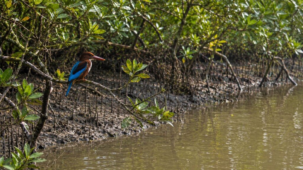
- Kingfishers depend on aquatic prey while nesting or perching above water.
- Crabs live within sediment but process organic material produced by trees.
- Fish use submerged mangrove structure and tidal channels.
Migratory birds arrive from landscapes thousands of kilometres away and depend temporarily on the productivity of these mudflats and waterways.
The ecological identity of Sajnekhali lies precisely in these connections. Mangrove leaves become detritus. Detritus supports invertebrates. Invertebrates and plankton support fish. Fish support birds, reptiles, mammals, and larger aquatic predators. Vegetation supports herbivores, and herbivores support carnivores. Tides continually redistribute nutrients and reorganize feeding opportunities.
This is why protecting a mangrove ecosystem cannot mean protecting only trees or only tigers. The ecological unit is the entire functioning landscape. And at Sajnekhali, that landscape extends from the mangrove canopy to the mud beneath it, from the smallest tidal creek to the larger river, and from microscopic decomposers to the Royal Bengal Tiger.
Ecological Importance
Sajnekhali's ecological importance comes from its position within the interconnected mangrove, estuarine, and tidal landscape of the Indian Sundarbans. Forest, mudflat, creek, river, freshwater habitat, and intertidal zone do not function independently here. Together they form a single ecological system in which changes in water, sediment, vegetation, or wildlife can influence many other components of the landscape.
The wider Sundarbans is recognized by UNESCO as one of the world's most biologically productive natural ecosystems. Its tidal rivers, creeks, canals, estuarine mouths, mangrove forests, and wetlands create habitats for terrestrial, aquatic, and benthic organisms. UNESCO also identifies the mangrove landscape as an important wetland nursery for marine organisms and as a natural climatic buffer against cyclones.
Sajnekhali belongs to this larger ecological network.
A Meeting Place of Land and Water
One of the defining characteristics of Sajnekhali is the absence of a simple ecological boundary between terrestrial and aquatic environments.
At high tide, water enters creeks and inundates low-lying forest margins. At low tide, mudbanks and root systems become exposed. Fish, crustaceans, reptiles, birds, and mammals respond to these changing conditions, exploiting different habitats at different stages of the tidal cycle.
Mangrove roots create structural complexity along the water's edge. Small aquatic organisms can use these areas as feeding grounds and shelter, while exposed mudflats provide feeding opportunities for waders and other birds when the water retreats.
Organic material produced by the forest also moves between land and water.
Leaves and other plant material fall onto the forest floor, where fungi, bacteria, crabs, and other decomposers begin breaking them down. Tidal water then redistributes part of this organic material through creeks and rivers.
This movement of nutrients helps connect mangrove productivity with estuarine food webs.
Nursery Habitat for Aquatic Life
Mangrove ecosystems are particularly important because their shallow waters, creeks, root systems, and organic productivity provide nursery habitat for many aquatic organisms.
Juvenile fish and crustaceans can find food and relative shelter within structurally complex mangrove environments before moving into larger waterways.
This ecological function extends well beyond the forest itself.
Fish and crustaceans support kingfishers, herons, egrets, crocodiles, otters, Fishing Cats, and other predators. The productivity of the mangrove therefore moves upward through the food web.
What begins with sunlight, mangrove vegetation, microorganisms, and detritus ultimately contributes to the survival of animals occupying very different ecological niches.
Shoreline and Sediment Stability
Mangrove vegetation also interacts directly with the physical landscape.
Root systems slow water movement around forest margins and help retain sediments. The forest therefore participates in the continuing relationship between erosion and deposition that shapes the Sundarbans.
This does not mean mangroves can prevent all erosion. The delta remains naturally dynamic, and riverbanks can retreat even where vegetation is present. Cyclones, tidal currents, sediment supply, channel migration, and sea-level conditions all influence shoreline change.
Mangroves nevertheless provide an important stabilizing function within this dynamic system.
UNESCO recognizes the wider Sundarbans for its role as a shore stabilizer, sediment and nutrient trap, wetland nursery, and climatic buffer.
Supporting a Complex Food Web
The ecological importance of Sajnekhali can also be understood through the relationships among its species.
- Mangroves produce organic matter.
- Microorganisms decompose it.
- Crabs and other detritivores process it.
- Fish and aquatic invertebrates use the productivity of creeks and mudflats.
- Birds, reptiles, and mammals consume those organisms.
Spotted Deer browse vegetation and, in turn, form an important component of the prey base available to large carnivores.
Nothing operates entirely in isolation.
Protecting Sajnekhali therefore means protecting ecological processes rather than simply maintaining a list of species.
That distinction is fundamental to mangrove conservation.
Conservation Significance
Sajnekhali's conservation importance extends beyond the boundaries of the wildlife sanctuary itself. Its protected forests form part of the larger conservation landscape of the Indian Sundarbans, where wildlife must be protected across a geography fragmented naturally by rivers and tidal channels.
A tiger does not recognize the administrative boundary between one forest block and another. A crocodile may move through several waterways. Birds can travel between mudflats, creeks, freshwater ponds, and distant islands. Fish move with water conditions and tides. Conservation must therefore operate at landscape scale.
Sajnekhali contributes to that larger system by protecting mangrove habitat while also providing an important location for forest administration, ecological interpretation, wildlife observation, and regulated visitor access.
Protecting the Mangrove Habitat
Conservation begins with habitat.
Without functioning mangrove forests, tidal creeks, mudflats, and estuarine waterways, protecting individual animals would achieve little.
The sanctuary helps maintain habitat used by mammals, reptiles, birds, fish, crustaceans, and other organisms. The preservation of these environments also protects the ecological processes—nutrient cycling, sediment retention, tidal exchange, decomposition, and aquatic productivity—that allow wildlife populations to persist.
This ecosystem-based approach is particularly important in the Sundarbans because the landscape itself is constantly changing.
Protecting Wildlife Beyond the Tiger
The Royal Bengal Tiger understandably dominates public attention, but the ecological value of Sajnekhali cannot be reduced to tiger conservation.
Mangrove protection also benefits Fishing Cats, Spotted Deer, Wild Boar, otters, macaques, Water Monitors, crocodiles, turtles, kingfishers, raptors, herons, egrets, migratory waders, fish, crabs, molluscs, and countless smaller organisms.
Bird conservation is especially relevant because Sajnekhali provides a mixture of mangrove, mudflat, water, and freshwater-associated habitats.
The protection of these communities demonstrates an important conservation principle: safeguarding an ecosystem protects relationships among species, not merely individual charismatic animals.
Conservation and Human Understanding
Sajnekhali has another conservation role that more remote forest areas cannot perform as easily.
It helps people understand what is being protected.
The presence of regulated visitor facilities, a watchtower, freshwater pond, Mangrove Interpretation Centre, and turtle and crocodile facilities gives visitors an opportunity to encounter conservation in an educational setting. The West Bengal Forest Department identifies these among Sajnekhali's principal visitor features.
That educational function matters.
People are more likely to understand the significance of the Sundarbans when they can see how mangroves breathe, how tides expose feeding grounds, why freshwater attracts wildlife, how birds use different habitats, and why unrestricted entry into the forest would be damaging.
Sajnekhali therefore occupies an unusual position: it is simultaneously habitat and a place where the meaning of habitat conservation can be communicated.
Threats to Sajnekhali
Legal protection does not make a mangrove ecosystem immune to environmental change. Some of the greatest pressures affecting Sajnekhali cannot be understood at the scale of the sanctuary alone. They arise from processes operating across the wider Sundarbans and, in some cases, across the entire Ganges-Brahmaputra-Meghna delta. Climate change, cyclones, sea-level rise, salinity, erosion, changing freshwater availability, pollution, and human pressure interact rather than occurring independently.
Cyclones and Storm Surges
Cyclones are part of the natural environmental history of the Bay of Bengal, and mangrove ecosystems have evolved under recurring storm disturbance. Their consequences, however, can be severe. Strong winds can damage forest canopies and uproot trees. Storm surges can carry saline water into areas beyond the normal reach of tides, damage infrastructure, alter sediments, and affect neighbouring human settlements.
Cyclone Amphan demonstrated this vulnerability when it made landfall across the West Bengal-Bangladesh coast on 20 May 2020, affecting the transboundary Sundarbans landscape. UNESCO subsequently reported damage to infrastructure and facilities associated with the World Heritage properties.
The conservation question is therefore not whether cyclones occur—they always have—but how the ecosystem responds when severe storms interact with sea-level rise, human pressure, altered hydrology, and other long-term environmental changes.
Sea-Level Rise
The Sundarbans occupies an exceptionally low-lying delta. That geography makes changes in relative sea level particularly important. Mangroves can respond to changing water levels through sediment accumulation, landward migration, vegetation change, and colonization of newly suitable surfaces. Their ability to adjust, however, depends on sediment supply, rates of environmental change, available space, hydrological connectivity, and human land use.
For Sajnekhali, sea-level rise should therefore be understood as part of a larger set of interacting pressures rather than as a simple prediction that the forest will suddenly disappear beneath the sea. The more scientifically responsible question is whether natural sedimentary and ecological processes can keep pace with changing conditions over the long term.
Changing Salinity
Salinity is one of the most important environmental variables determining mangrove distribution. Different species tolerate different concentrations of salt. Changes in freshwater flow, rainfall, tidal penetration, evaporation, and sea-level conditions can therefore alter vegetation composition even without direct clearing of forest.
UNESCO's assessment of the Indian Sundarbans notes that salinity is influenced by changes in freshwater flow and that the ecological repercussions require careful attention. The significance for Sajnekhali is substantial. A change in salinity can affect mangrove communities, aquatic organisms, soil processes, and the wider food web. Ecological change may therefore begin at levels that are not immediately obvious to a casual observer.
Erosion and Sediment Change
Erosion is not automatically evidence of ecological degradation in the Sundarbans. The delta is naturally dynamic. Some riverbanks retreat while sediment accumulates elsewhere. Channels migrate. Mudflats emerge and disappear. Newly deposited surfaces may eventually be colonized by vegetation. UNESCO describes this continuing interaction between erosion, deposition, tides, sediment, and plant colonization as one of the defining ecological processes of the Sundarbans.
Problems arise when the balance among these processes changes significantly. Altered sediment supply, sea-level conditions, extreme storms, embankments, hydrological modification, and other pressures can influence how quickly land is lost or created. Understanding Sajnekhali therefore requires accepting that conservation does not mean freezing the landscape in its present shape. The objective is to preserve the ecological processes that allow a dynamic delta to continue functioning.
Human Pressure
Millions of people live across the inhabited Indian Sundarbans, often close to protected mangrove forests. Fishing, agriculture, aquaculture, tourism, transport, and other livelihoods are intertwined with the delta's natural resources. Human-wildlife conflict can also occur where villages and tiger habitat exist in close proximity.
UNESCO has documented the vulnerability of communities in the Indian Sundarbans and the importance of measures designed to reduce encounters between people and tigers. The conservation challenge is therefore more complicated than simply separating people from nature. Long-term protection depends on maintaining wildlife habitat while recognizing the economic and social realities of communities living around the forest.
Pollution and Visitor Pressure
Waste entering tidal waterways can travel considerable distances. Plastic and other persistent materials may become trapped along creek margins or within mangrove roots. Oil and chemical contamination can be particularly damaging because tidal water can distribute pollutants through aquatic habitats.
The potential consequences of oil pollution in mangrove environments have been demonstrated elsewhere in the wider Sundarbans, reinforcing the vulnerability of tidal forests to contaminants transported by water. Visitor behaviour also matters at a more local scale.
Noise, littering, wildlife disturbance, irresponsible vessel operation, and disregard for forest regulations can undermine the very experience visitors have come to observe. Responsible tourism in Sajnekhali must therefore remain subordinate to conservation.
The Wild Orbit Perspective
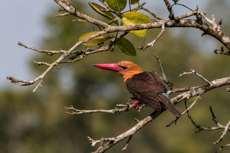
Sajnekhali is often introduced as one of the most accessible places to visit in the Sundarbans. That description is accurate but incomplete. Accessibility is not what makes Sajnekhali important. Its deeper value lies in what the landscape can teach. A visitor arriving only in search of a tiger may leave disappointed after seeing none. A visitor who begins to understand the ecosystem will encounter something almost everywhere. A Brown-winged Kingfisher waiting above a creek is part of the story.
- So is a crab carrying mangrove litter into its burrow.
- So are the breathing roots exposed by falling water.
- So is the sudden alarm call of a Spotted Deer.
- So is a crocodile resting beside an estuarine channel.
- So is the absence of wildlife when the tide, temperature, or disturbance makes animals difficult to detect.
The Sundarbans rewards observation rather than expectation.
At Sajnekhali, this becomes particularly clear because the landscape allows visitors to encounter several layers of the ecosystem within a relatively accessible area: mangrove vegetation, tidal water, freshwater habitat, birdlife, terrestrial wildlife, conservation infrastructure, and forest management. For The Wild Orbit, Sajnekhali should therefore never be presented as simply another stop on a sightseeing itinerary.
It is an introduction to how the Indian Sundarbans works. The purpose of visiting should not be to collect sightings as quickly as possible but to understand relationships—to recognize why a mudflat appears when it does, why birds concentrate along certain waterlines, why mangrove roots have unusual forms, why freshwater matters inside a saline landscape, and why the forest must remain regulated. A tiger sighting would be extraordinary. Understanding the forest should not depend upon one.
Visiting Sajnekhali
Visiting Sajnekhali is fundamentally different from visiting a terrestrial wildlife sanctuary reached by road.
The final approach is by water.
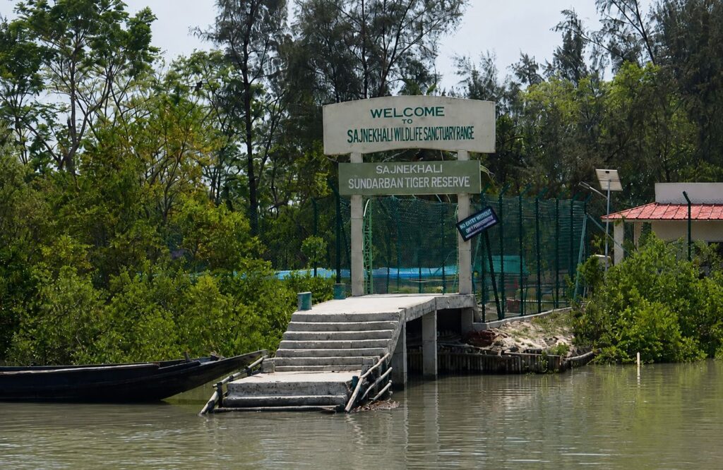
Boats travel through the tidal landscape before reaching the Sajnekhali visitor area, and this journey itself provides an important introduction to the geography of the Sundarbans. Cultivated and inhabited islands gradually give way to protected mangrove banks, while rivers and creeks replace roads as the principal routes through the landscape.
Within the Sundarban Tiger Reserve, visitor movement is regulated.
The West Bengal Forest Department states that permission for entry into the Sundarban Tiger Reserve can be obtained through the Field Director's office at Canning as well as designated locations including Sonakhali, Bagna, and Sajnekhali, subject to applicable entry and other fees.
Because permits, charges, boat regulations, operating arrangements, and access conditions can change, visitors should verify current requirements with the Sundarban Tiger Reserve or West Bengal Forest Department before travelling.
Sajnekhali should also be understood as an orientation point rather than the entirety of a Sundarbans experience.
The visitor facilities provide an opportunity to learn about the mangrove ecosystem before or during exploration of permitted waterways and other designated observation areas.
Mangrove Interpretation Centre
The Mangrove Interpretation Centre is particularly important for visitors encountering the Sundarbans for the first time.
The West Bengal Forest Department identifies the interpretation centre as one of Sajnekhali's principal facilities, together with the watchtower, freshwater pond, and turtle and crocodile pond.
Its value is educational.
Mangrove forests can initially be difficult to interpret. Dense vegetation may appear repetitive, and many of the ecosystem's most important processes occur beneath the water, within mud, or across tidal cycles that are not immediately obvious.
Interpretation can transform what a visitor sees.
Pneumatophores become adaptations to oxygen-poor sediment rather than simply unusual roots.
- Mudflats become feeding grounds rather than empty mud.
- Tidal creeks become ecological corridors.
- Mangrove litter becomes part of a nutrient cycle.
- The river becomes part of the forest rather than a boundary around it.
That change in understanding is one of Sajnekhali's greatest values as a visitor location.
The Sajnekhali Watchtower
The Sajnekhali Watchtower is among the best-known visitor structures in the Indian Sundarbans.
The West Bengal Forest Department lists the watchtower, Mangrove Interpretation Centre, turtle and crocodile pond, and freshwater pond among the principal features at Sajnekhali. The watchtower provides an elevated, controlled observation point from which visitors can watch the surrounding habitat without entering the forest.
Its association with a freshwater pond is particularly significant.
Freshwater is an important resource within a predominantly saline and brackish mangrove environment, and such locations can attract terrestrial wildlife and birds. Observation areas near freshwater therefore provide opportunities to watch animals without following or disturbing them through the forest.
Spotted Deer, Wild Boar, Rhesus Macaques, Water Monitors, kingfishers, herons, egrets, raptors, and other birds may be encountered in the broader Sajnekhali landscape.
The Royal Bengal Tiger is also present within the wider protected forest. But a crucial distinction must be maintained: Sajnekhali is tiger habitat; the Sajnekhali Watchtower is not a guaranteed tiger-sighting location.
Wild tigers move according to territory, prey, tides, disturbance, season, and other ecological factors. They do not appear according to visitor schedules.
A responsible wildlife publication should never suggest otherwise. The best experience at the watchtower comes from patience. Listen before searching.
An alarm call may reveal activity invisible through the vegetation. A movement near the waterline may turn out to be a monitor lizard rather than a deer. Kingfishers may repeatedly use the same fishing perch. Mudflats can become increasingly active as the tide falls.
The watchtower is therefore valuable not because it guarantees spectacular wildlife encounters but because it allows the forest to be observed on its own terms.
Responsible Exploration
The Sundarbans is not a landscape in which visitors should attempt to get as close to wildlife as possible.
Distance is part of responsible observation.
Visitors should remain within authorized areas and vessels, follow instructions from forest personnel and approved guides, and respect all restrictions governing entry into protected forest. Wildlife should never be called, baited, chased, surrounded, or deliberately disturbed for photographs.
- Noise should be kept low.
- Litter should never enter the river or forest.
- Nothing should be removed from the ecosystem.
- Feeding wild animals should never be attempted.
- Photography should document behaviour rather than alter it.
These principles are particularly important in a tidal environment where boats are the primary means of wildlife observation. A vessel can become a source of disturbance if it approaches animals aggressively, blocks movement, repeatedly changes position for photographs, or creates unnecessary noise.
Patience produces better natural-history observation.
If a crocodile is resting on a mudbank, the objective should be to observe from an appropriate distance rather than force it into the water.
If a kingfisher is hunting, the boat should not repeatedly reposition beneath its perch.
If deer appear at the forest edge, their natural behaviour is more valuable than a closer photograph obtained through disturbance.
And if a tiger is encountered, the animal's freedom of movement must take absolute priority over the ambitions of photographers or visitors.
Responsible exploration also means accepting uncertainty.
- There may be mornings with few large-mammal sightings.
- There may be creeks that appear almost empty.
- There may be hours when birds provide most of the observable activity.
None of these represents a failed Sundarbans experience. Wild nature is valuable precisely because it is not staged.
Best Time to Visit with The Wild Orbit
For most wildlife travellers, birdwatchers, photographers, and first-time explorers, November through February generally provides the most comfortable conditions for experiencing Sajnekhali and the wider Indian Sundarbans.
Winter brings comparatively mild temperatures and lower humidity than the hotter months. It is also particularly rewarding for bird observation because resident species are joined by seasonal migrants using the wetlands, waterways, mudflats, and other habitats of the delta. The quality of a Sajnekhali experience, however, depends on more than the month.
November to February — Winter
Winter is generally the most accessible season for extended boat exploration. Cooler mornings make long periods on the waterways more comfortable, while bird activity can be particularly rewarding. Migratory waders and other seasonal visitors add to the resident bird community.
For general wildlife exploration and bird photography, this is usually the strongest all-round period. Early mornings can occasionally be affected by mist or fog, which may reduce visibility but can also reveal a quieter atmospheric character of the delta.
March to May — The Hot Season
As temperatures rise, Sajnekhali takes on a different character.
Heat becomes more demanding for visitors, particularly during the middle of the day. Wildlife behaviour may also shift toward cooler periods of morning and late afternoon. The mangrove landscape remains active, however.
Reptiles, estuarine wildlife, resident birds, and tidal processes continue regardless of visitor comfort. For naturalists interested in seasonal change rather than simply pleasant weather, the hot season reveals another dimension of the ecosystem. Adequate sun protection, drinking water, lightweight clothing, and realistic expectations about heat are important.
June to September — Monsoon
The monsoon transforms the Sundarbans. Heavy rainfall increases freshwater input, skies become more changeable, vegetation responds vigorously, and rivers take on a different seasonal character. But this is also a period when weather can disrupt travel.
Heavy rain, strong winds, rough water, low visibility, and severe weather warnings may affect boat movement and access. The Bay of Bengal is also a cyclone-prone region, making official weather and forest guidance particularly important. For ordinary first-time wildlife travel, winter is generally more practical.
October — The Transition
October marks the transition from the monsoon toward the cooler season. The landscape can appear intensely green after months of rainfall, while changing weather begins to create more comfortable conditions.
However, October remains within the post-monsoon cyclone season of the Bay of Bengal, so weather forecasts and official advisories should always take priority over a fixed itinerary.
The Wild Orbit’s Interesting Facts About Sajnekhali
- Sajnekhali serves as one of the principal administrative centres of the Indian Sundarbans.
- It lies within one of the world's largest continuous mangrove forests.
- The landscape changes visibly with every tidal cycle.
- Mangrove roots help stabilize sediments and reduce coastal erosion.
- The area supports both resident and migratory birds.
- Tigers inhabiting the Sundarbans are accomplished swimmers capable of crossing wide tidal rivers.
- Mangrove forests surrounding Sajnekhali function as globally significant blue-carbon ecosystems.
- Juvenile fish utilize mangrove roots as natural nursery habitats before moving into larger estuarine waters.
- Every tide redistributes nutrients that sustain one of the world's most productive estuarine food webs.
FAQs
Where is Sajnekhali located?
Sajnekhali is located in the northern Indian Sundarbans within South 24 Parganas district, West Bengal, and forms part of the Sundarban Tiger Reserve.
Why is Sajnekhali important?
It serves as an important centre for biodiversity conservation, forest administration, scientific research, environmental education, and regulated visitor access.
Is Sajnekhali inside the Sundarban Tiger Reserve?
Yes. It forms an integral part of the Sundarban Tiger Reserve and the protected mangrove ecosystem of the Indian Sundarbans.
What wildlife can be seen?
Visitors may observe Spotted Deer, Wild Boar, Water Monitor Lizards, numerous kingfishers, herons, egrets, raptors, crocodiles, and occasionally signs of the Royal Bengal Tiger.
Is tiger sighting guaranteed?
No. Tigers inhabit the surrounding forests, but sightings are rare and should never be expected as a certainty.
Why are mangroves important?
Mangroves stabilize coastlines, store carbon, support fisheries, reduce storm impacts, improve water quality, and provide habitat for thousands of species.
When is the best time to visit?
Winter generally offers the most comfortable weather and excellent birdwatching opportunities, although each season reveals different ecological characteristics.
The Living Landscape of Sajnekhali
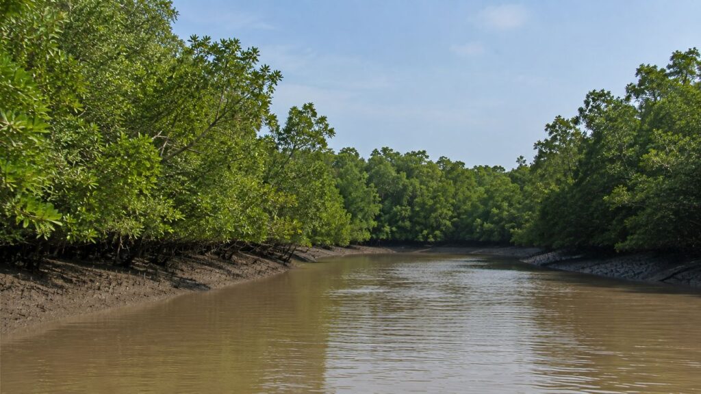
As the final tide of the day begins to rise, yesterday's footprints disappear beneath slowly advancing water. Mudflats vanish, creek banks soften into reflections, and the mangrove forest once again becomes an uninterrupted green horizon stretching toward the Bay of Bengal. By morning, the landscape will appear familiar yet subtly transformed—a reminder that Sajnekhali is never truly the same place twice.
Its significance cannot be measured solely by the presence of a watchtower, a wildlife sanctuary, or even the possibility of encountering a Royal Bengal Tiger. Rather, Sajnekhali represents one of the finest expressions of how geology, tides, rivers, mangroves, wildlife, and human stewardship combine to create an ecosystem of extraordinary resilience.
Every mangrove root anchoring the shoreline, every crab recycling fallen leaves, every migratory bird pausing during its seasonal journey, and every forest ranger navigating tidal creeks contributes to a story far larger than any individual species. Together, they illustrate the delicate balance that has allowed the Indian Sundarbans to endure for millennia despite continual environmental change.
To understand Sajnekhali is to appreciate that the Sundarbans are not simply a forest bordering the sea. They are a living delta, shaped each day by tides and sustained by countless ecological relationships that remain largely invisible to casual observation. In this landscape, patience reveals complexity, observation leads to understanding, and understanding fosters respect.
For scientists, photographers, students, conservationists, and curious readers alike, Sajnekhali offers something far more enduring than a memorable journey. It provides an opportunity to witness one of Earth's most remarkable mangrove ecosystems and to recognize why its continued protection is essential—not only for the wildlife that inhabits it but also for the millions of people whose future remains closely connected to the health of the Sundarbans.
CTA: Start Your Sundarbans Expedition
Plan your private Sundarban expedition
A private journey shaped around you — your group, your pace, your interests. Book a free consultation.