 Encyclopedia
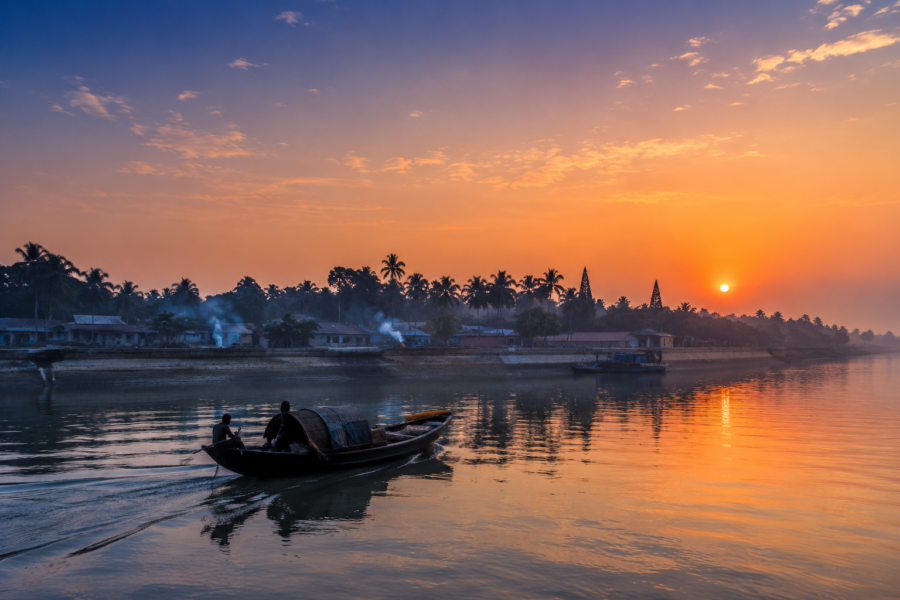
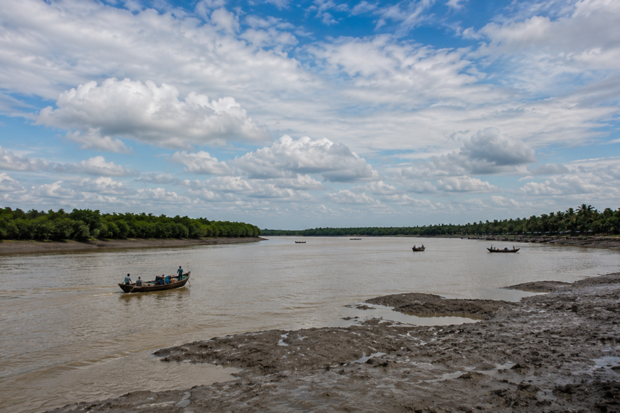
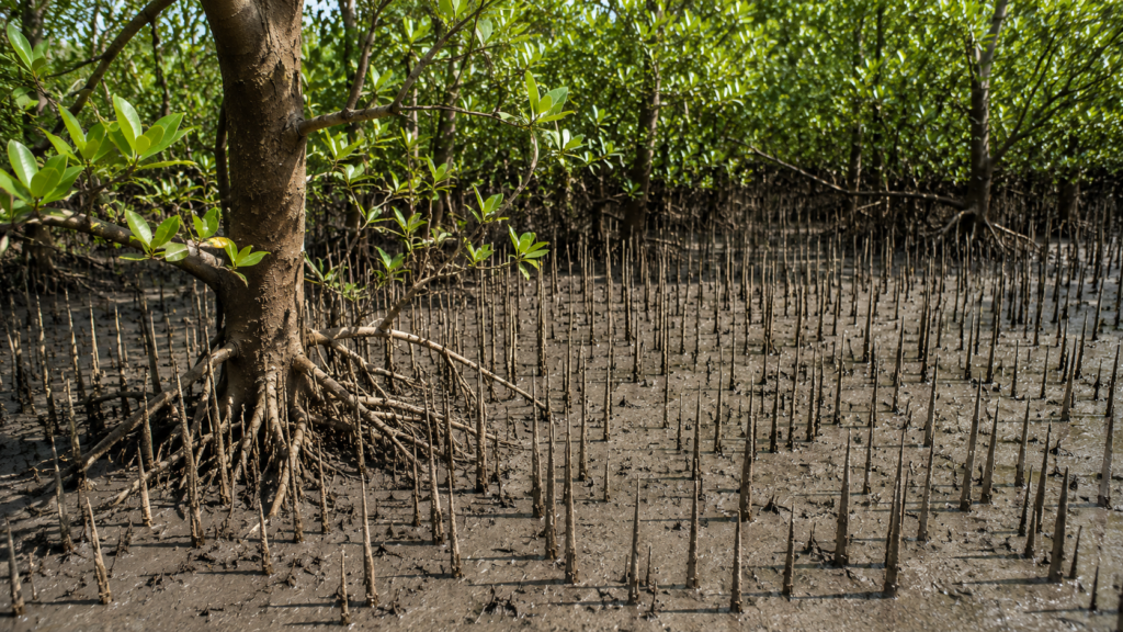
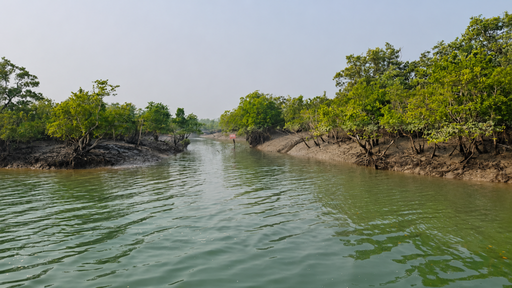
As the tide begins to ebb, the brown waters of the Matla and Thakuran rivers expose broad mudflats fringed with dense mangrove vegetation. Thousands of pencil-like breathing roots emerge from the saturated sediment, while fiddler crabs scatter across the exposed flats before the returning tide submerges the landscape once again. This rhythm of rising and falling water governs every aspect of life in Chulkati, one of the least-known yet ecologically significant forest blocks in the Indian Sundarbans.
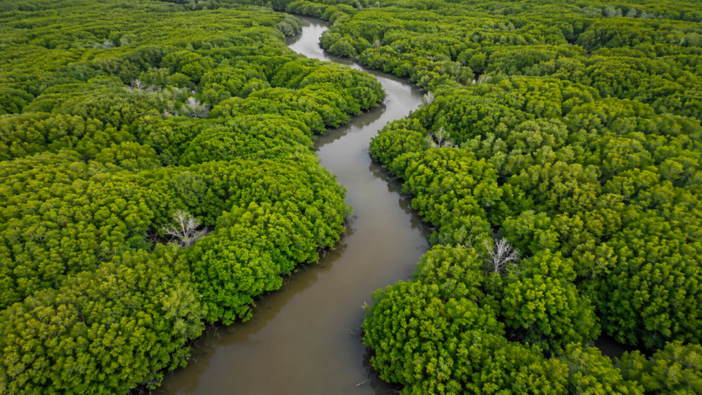
Unlike the inhabited islands of the Sundarbans, Chulkati is not a village or a tourism destination. It is a Reserved Forest block forming the southern portion of the West Sundarban Wildlife Sanctuary, where tidal rivers, mangrove forests, estuarine creeks, and coastal habitats merge into a vast wilderness. Established as part of the sanctuary in 2013, Chulkati contributes nearly half of the sanctuary’s total protected area and plays an essential role in safeguarding one of the world’s largest contiguous mangrove ecosystems.
The forest provides habitat for the Royal Bengal Tiger (Panthera tigris tigris), Saltwater Crocodile (Crocodylus porosus), Spotted Deer (Axis axis), Wild Boar (Sus scrofa), numerous mangrove-dependent birds, estuarine fishes, and countless invertebrates that sustain the productivity of the delta. More importantly, Chulkati functions as part of a much larger ecological network where freshwater, tidal flows, sediment deposition, and mangrove succession continuously reshape the landscape.
Although visitors rarely hear its name, Chulkati is one of the building blocks of the Indian Sundarbans. Understanding this forest block offers insight into how protected mangrove landscapes function, why they remain globally significant, and how individual forest compartments collectively sustain the biodiversity of the Sundarbans.
Chulkati at a Glance
Type: Reserved Forest Block
Protected Area: West Sundarban Wildlife Sanctuary
State: West Bengal, India
District: South 24 Parganas
Area: Approximately 248.96 km²
Administrative Division: Eight Forest Compartments (Chulkati 1–8)
Protected Since: 11 September 2013 (as part of the West Sundarban Wildlife Sanctuary)
Ecosystem: Tidal Mangrove Forest
Major Rivers: Matla River, Thakuran River
Dominant Habitats: Mangrove forests, tidal creeks, estuarine channels, mudflats, and intertidal wetlands
Notable Wildlife: Royal Bengal Tiger, Saltwater Crocodile, Fishing Cat, Spotted Deer, Wild Boar, Brown-winged Kingfisher, and numerous estuarine fish, reptiles, and migratory birds
Conservation Importance: Forms nearly half of the West Sundarban Wildlife Sanctuary and contributes to the protection of one of the world’s largest contiguous mangrove ecosystems.
Accessibility: Accessible only by licensed boats through designated waterways, subject to Forest Department regulations and prior permission.
Geographic Setting
Chulkati lies in the southern reaches of the Indian Sundarbans within the vast Ganges–Brahmaputra–Meghna Delta, the largest deltaic system on Earth. Here, the influence of freshwater from upstream rivers gradually gives way to saline tidal waters moving inland from the Bay of Bengal twice every day. The result is a landscape that is neither entirely terrestrial nor fully marine, but an ever-changing estuarine environment shaped by tides, sediment, and mangrove vegetation.
Administratively, Chulkati forms one of the two principal forest blocks comprising the West Sundarban Wildlife Sanctuary, the other being Dulibhasani. Together they cover approximately 556.45 square kilometres of protected mangrove forest in South 24 Parganas district. The sanctuary was officially notified by the Government of West Bengal on 11 September 2013 under the Wildlife (Protection) Act, 1972.
The sanctuary boundaries are defined by major natural features:
- North: Ajmalmari River junction and Suia Gang
- South: Bay of Bengal
- East: Matla River
- West: Thakuran River
Within this protected landscape, Chulkati occupies the southern forested sector and is divided into eight officially demarcated forest compartments used for administration and ecological management.
Its location places the forest within one of the most dynamic coastal environments in India, where cyclones, tidal currents, salinity fluctuations, and sediment transport continually reshape the shoreline.
Rivers Flowing Beside Chulkati
The following rivers define the hydrological setting of Chulkati:
- Matla River — forms the eastern boundary of the West Sundarban Wildlife Sanctuary and is one of the largest tidal rivers in the Indian Sundarbans.
- Thakuran River — forms the western boundary and separates the sanctuary from inhabited islands to the west.
- Ajmalmari River — contributes to the northern boundary of the sanctuary.
- Suia Gang — associated with the northern limits of the protected landscape.
Numerous unnamed tidal creeks and distributaries connect the larger rivers throughout the Chulkati forest block.
These waterways are not static rivers in the conventional sense. Their water levels, flow direction, and salinity vary with the tides, creating one of the most complex estuarine hydrological systems in South Asia.
Nearby Forest Blocks
Chulkati is connected to several important protected forest landscapes within the Indian Sundarbans.
- Dulibhasani Forest Block
- Ajmalmari Forest
- Sundarban Tiger Reserve (to the east across the Matla River)
- Haliday Island Wildlife Sanctuary (near the northern sector of the broader protected landscape)
These adjoining forests allow wildlife to move across extensive mangrove habitats, supporting ecological connectivity across the delta.
Nearby Inhabited Islands and Human Settlements
Although Chulkati itself is entirely uninhabited, several villages and inhabited islands lie beyond the sanctuary boundaries, particularly west of the Thakuran River.
Nearby settlements include:
- Purba Sripatinagar
- Rakhalpur
- Sridharnagar
- Satyadaspur
- Sitarampur
These settlements rely on the surrounding estuarine environment for fishing and other livelihood activities while remaining physically separated from the protected mangrove forest by tidal rivers.
Geological Formation
The Chulkati forest block occupies land created over thousands of years through the interaction of Himalayan sediments, river discharge, tides, and coastal processes.
Every year, enormous quantities of fine silt are transported downstream by the Ganges river system. As tidal currents slow within the estuary, these sediments settle, gradually building mudbanks that are eventually colonized by salt-tolerant pioneer mangrove species. Over decades and centuries, these young mudflats mature into stable mangrove islands capable of supporting increasingly complex plant communities.
At the same time, erosion continuously removes portions of existing land. The result is a landscape in permanent transition, where new channels form, older creeks disappear, and forest edges advance or retreat depending on tidal energy and storm events.
Rather than existing as a fixed island, Chulkati should be understood as a living geomorphological system whose boundaries evolve over time under the combined influence of rivers, tides, sediment deposition, and coastal processes.
Landscape Character
Walking through Chulkati would reveal a landscape unlike almost any other forest in India.
The forest floor remains waterlogged for much of the year. Instead of firm ground, visitors would encounter sticky estuarine mud, intersecting tidal creeks, dense mangrove stands, and countless aerial roots projecting from the sediment. The terrain is generally flat, with only subtle elevation differences determining how frequently individual areas become inundated during tidal cycles.
Light filters through irregular mangrove canopies, reflecting off shallow tidal channels before disappearing beneath intertwined branches. During low tide, exposed mudflats become active feeding grounds for crabs, mudskippers, wading birds, and numerous invertebrates. High tide transforms these same areas into navigable waterways, allowing fish, crocodiles, and aquatic predators to move deep into the forest.
Unlike inland forests defined by hills, valleys, or permanent streams, Chulkati’s defining landscape feature is movement. Water is constantly arriving, retreating, redistributing sediments, and reshaping habitats. This continual transformation is one of the defining ecological characteristics of the Indian Sundarbans.
Rivers and Water Systems
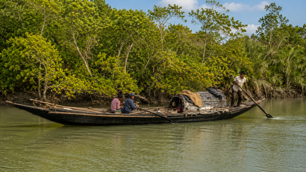
Water determines every ecological process within Chulkati.
The Matla and Thakuran rivers transport saline tidal waters inland twice each day, while an intricate network of tidal creeks distributes these waters throughout the forest. The daily tidal range floods large portions of the mangrove floor, replenishing nutrients, transporting organic matter, and supporting estuarine food webs.
Because tidal influence extends throughout the forest, freshwater and saltwater mix continuously, creating changing salinity conditions that influence mangrove distribution, fish migration, and wildlife habitat use.
The creeks also function as biological corridors.
- Fish enter flooded forests during high tide to feed among submerged roots.
- Juvenile aquatic organisms use sheltered mangrove channels as nursery habitats before returning to larger estuarine waters.
- Predators such as crocodiles and tigers frequently use these waterways as natural travel routes through otherwise dense vegetation.
In Chulkati, rivers are not simply geographical boundaries—they are the ecological engine that sustains the entire forest ecosystem.
Documentary Observation
As the afternoon tide begins to fall, narrow tidal creeks empty slowly into the Matla and Thakuran rivers. Fresh tracks appear across the newly exposed mud, left by crabs, wading birds, and other animals that ventured out with the receding water. Mangrove roots stand exposed for only a few hours before the next incoming tide quietly submerges them once again. In Chulkati, the landscape never truly rests; every tidal cycle rewrites the forest, reminding observers that this protected mangrove wilderness is shaped not by seasons alone, but by the ceaseless rhythm of the estuary.
Mangrove Ecosystem
As the incoming tide advances through Chulkati’s intricate network of creeks, seawater gradually spreads across the forest floor, surrounding tree trunks and submerging thousands of exposed aerial roots. For several hours each day, much of the forest exists beneath shallow tidal water. When the tide retreats, the mud reappears, carrying fresh sediments and organic matter that nourish one of the most productive ecosystems on Earth.
This daily tidal inundation defines the mangrove ecosystem of Chulkati. Unlike terrestrial forests that rely primarily on rainfall, mangrove forests depend on the continuous exchange of tidal water. Every flood transports nutrients, redistributes sediments, and connects rivers with the forest interior. These natural cycles regulate salinity, influence seed dispersal, and sustain countless organisms ranging from microscopic plankton to apex predators.
The mangroves of Chulkati belong to the globally significant Sundarbans mangrove ecosystem, recognized as the largest contiguous mangrove forest on Earth. The forest is characterized by salt-tolerant vegetation capable of surviving in waterlogged, oxygen-poor soils where ordinary terrestrial plants cannot grow. Specialized root systems, salt regulation mechanisms, and remarkable reproductive adaptations enable mangrove species to thrive under conditions that would be inhospitable to most other trees.
Beyond supporting biodiversity, the mangrove ecosystem performs vital ecological services. Dense root networks stabilize newly deposited sediments, reducing shoreline erosion while encouraging further land formation. Fallen leaves decompose into nutrient-rich organic matter that fuels estuarine food webs, supporting fishes, crustaceans, molluscs, and countless microorganisms.
In addition, mangrove forests store substantial amounts of carbon within their biomass and waterlogged soils, making them important natural carbon sinks that contribute to climate change mitigation.
Flora of Chulkati
The vegetation of Chulkati reflects the environmental gradients typical of the Indian Sundarbans, where salinity, tidal frequency, soil conditions, and freshwater availability influence plant distribution. Rather than forming a uniform forest, the landscape consists of distinct plant communities occupying slightly different ecological niches.
Among the dominant mangrove species found within the wider Indian Sundarbans are:
- Sundari (Heritiera fomes) – historically the most iconic mangrove tree, lending its name to the Sundarbans.
- Gewa (Excoecaria agallocha) – a widespread mangrove species tolerant of moderate salinity.
- Goran (Ceriops decandra) – commonly found in relatively saline environments.
- Keora (Sonneratia apetala) – often colonizes newly formed mudflats and creek margins.
- Avicennia species – important pioneer mangroves with dense fields of pencil-like pneumatophores.
- Kankra (Bruguiera gymnorhiza) – characterized by its distinctive knee roots.
- Passur (Xylocarpus mekongensis and related species) – occurring in suitable tidal habitats.
- Dhundul (Xylocarpus granatum) – producing large woody fruits that disperse through tidal waters.
Each species exhibits remarkable adaptations to saline conditions. Some exclude salt through specialized root membranes, while others excrete excess salt through leaf glands or store it within aging leaves that are eventually shed.
One of the most striking features of Chulkati is the diversity of root structures visible during low tide. Pencil-like pneumatophores rise vertically from Avicennia stands, while arching prop roots, knee roots, and buttressed trunks create a complex three-dimensional habitat that shelters juvenile fish, crabs, molluscs, and numerous other organisms.
Mammals
The mammals of Chulkati occupy one of the most challenging environments in Asia. Daily tidal flooding, saline conditions, dense vegetation, and extensive mudflats require exceptional behavioural and physiological adaptations.
Royal Bengal Tiger (Panthera tigris tigris)
The Royal Bengal Tiger is the apex predator of the Sundarbans and one of the defining species of the region. Unlike many tiger populations elsewhere in Asia, Sundarbans tigers regularly navigate tidal creeks, swim between forest blocks, and hunt within mangrove habitats influenced by changing tides.
Although Chulkati forms part of the broader habitat available to tigers, movements of individual animals vary over time depending on prey availability, territorial dynamics, tidal conditions, and connectivity with neighbouring protected forests. Exact population numbers for individual forest blocks are not publicly available, and assigning a fixed tiger population specifically to Chulkati would not be scientifically justified.
Spotted Deer (Axis axis)
Spotted Deer are among the most abundant large herbivores of the Sundarbans. Small herds browse on grasses, leaves, young shoots, and fallen fruits along elevated portions of the mangrove forest. They also serve as an important prey species for tigers.
The distribution of deer within Chulkati changes with tidal conditions. During high tides, animals concentrate on slightly elevated ground before dispersing again as water levels recede.
Wild Boar (Sus scrofa)
Wild Boars forage extensively across mudflats and forest margins in search of roots, crabs, molluscs, fallen fruits, and other food resources. Their omnivorous feeding behaviour contributes to nutrient cycling by disturbing surface sediments and accelerating organic decomposition.
Fishing Cat (Prionailurus viverrinus)
The Fishing Cat is among the most specialized small felids inhabiting wetland ecosystems. Although secretive and rarely observed, it is known to inhabit suitable mangrove habitats across the Indian Sundarbans. Its diet includes fish, crustaceans, amphibians, and small aquatic animals captured within shallow tidal waters.
Small Mammals
Other mammals likely occurring within suitable habitats of Chulkati include:
- Small Indian Civet
- Common Palm Civet
- Jungle Cat
- Smooth-coated Otter (locally in appropriate aquatic habitats)
- Various fruit bats and insectivorous bats
- Numerous rodent species occupying elevated forest areas
Many of these species are nocturnal, making them difficult to observe despite their ecological importance.
Birds
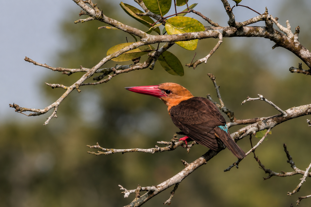
Birdlife provides some of the most visible evidence of Chulkati’s ecological richness. The combination of mudflats, tidal creeks, dense mangroves, open estuarine waters, and coastal habitats supports a remarkable diversity of resident and migratory birds.
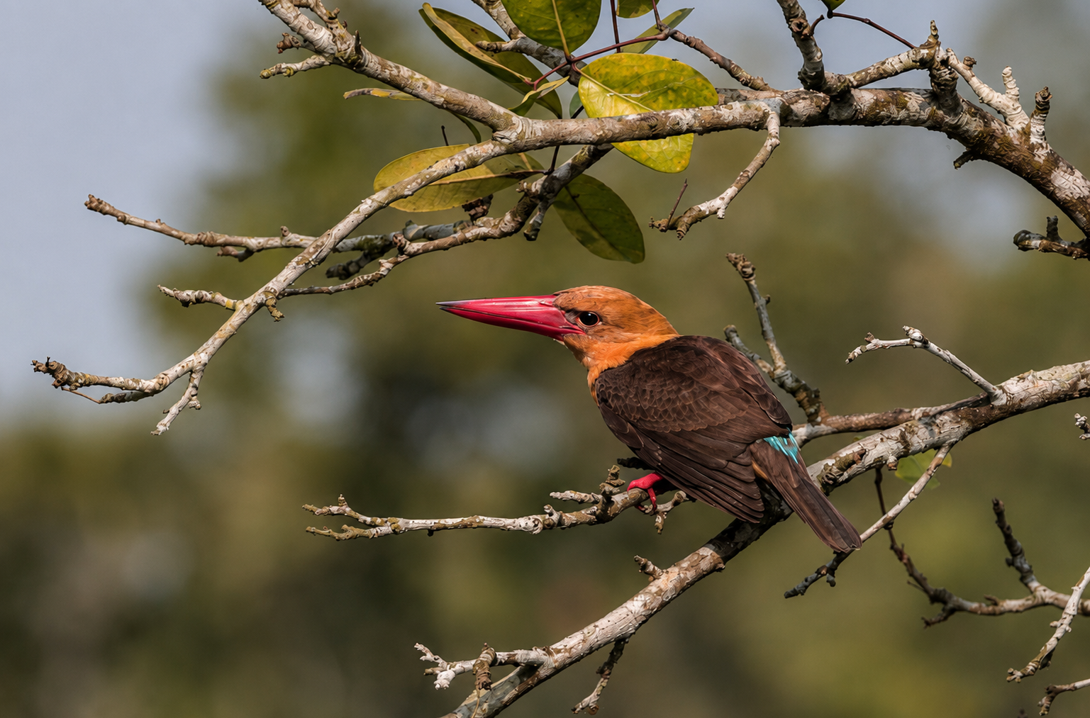
Kingfishers are among the most recognizable inhabitants of the Sundarbans. Several species occur across the region, including the Brown-winged Kingfisher (Pelargopsis amauroptera), a globally near-threatened mangrove specialist closely associated with intact mangrove forests.
Other characteristic birds include:
- White-bellied Sea Eagle
- Brahminy Kite
- Black-capped Kingfisher
- Collared Kingfisher
- Stork-billed Kingfisher
- Lesser Adjutant
- Purple Heron
- Grey Heron
- Intermediate Egret
- Little Egret
- Great Egret
- Black-headed Ibis
- Asian Openbill
- Common Redshank
- Whimbrel
- Sandpipers
- Plovers
- Various migratory shorebirds during winter
The seasonal arrival of migratory birds significantly increases avian diversity, particularly along exposed mudflats and shallow estuarine waters where abundant invertebrates provide important feeding opportunities.
Reptiles
Reptiles occupy nearly every habitat within Chulkati, from tidal rivers and mudflats to dense mangrove interiors.
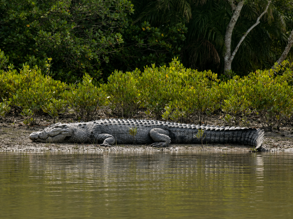
Saltwater Crocodile (Crocodylus porosus)
The Saltwater Crocodile is the largest living reptile and one of the principal aquatic predators of the Sundarbans. Adults inhabit major tidal rivers and creeks, while younger individuals often occupy quieter channels with dense mangrove cover.
These crocodiles are highly adapted to estuarine conditions and regularly move between freshwater, brackish, and marine environments.
Water Monitor (Varanus salvator)
Water Monitors are frequently encountered along creek banks and exposed mudflats, where they forage for fish, crabs, eggs, carrion, and other available food sources. Excellent swimmers, they are well suited to the tidal landscape of Chulkati.
Snakes
The mangrove forests also support numerous snake species, including:
- King Cobra
- Monocled Cobra
- Banded Krait
- Dog-faced Water Snake
- Checkered Keelback
- Rat Snake
- Various sea snakes in adjacent estuarine waters
Because many snakes remain secretive and active during cooler periods or at night, sightings are relatively uncommon despite their presence.
Amphibians
Although saline environments limit amphibian diversity compared with freshwater forests, several frogs and toads inhabit elevated areas where rainfall temporarily reduces soil salinity.
During the southwest monsoon, temporary freshwater pools form on higher ground, providing breeding sites for numerous amphibian species. Their seasonal emergence contributes significantly to food webs by supplying prey for birds, reptiles, fishes, and small mammals.
Fish and Aquatic Biodiversity
The tidal waterways surrounding Chulkati function as highly productive nursery habitats supporting a remarkable diversity of fishes.
Juvenile stages of many commercially important marine and estuarine fish species spend part of their life cycle among mangrove roots before migrating into larger rivers or coastal waters.
Common groups include:
- Mullets
- Catfishes
- Gobies
- Mudskippers
- Sea bass
- Threadfins
- Glassfishes
- Prawns
- Mud crabs
The submerged root systems provide shelter from predators while abundant organic matter supports plankton and other microscopic food resources essential for early fish development.
Invertebrates
The smallest inhabitants of Chulkati collectively perform some of its most important ecological functions.
Fiddler crabs construct extensive burrow systems across exposed mudflats, constantly turning over sediments and improving soil aeration. Mud crabs occupy deeper burrows and play a significant role as predators and scavengers.
Mudskippers, although technically fishes, spend considerable time moving across exposed mud using modified fins, feeding on small invertebrates while demonstrating one of the Sundarbans’ most remarkable evolutionary adaptations.
Mangrove snails, oysters, mussels, barnacles, shrimps, prawns, and countless insects further contribute to nutrient recycling, decomposition, and food web dynamics.
Without these seemingly inconspicuous organisms, the productivity of the mangrove ecosystem would rapidly decline.
Ecological Interactions
The biodiversity of Chulkati functions as an interconnected ecological network rather than a collection of isolated species.
Mangrove trees stabilize sediments and provide habitat for invertebrates. Invertebrates recycle nutrients and support fish populations. Fish attract birds, crocodiles, otters, and Fishing Cats. Herbivores such as Spotted Deer convert plant productivity into biomass that ultimately supports predators including the Royal Bengal Tiger.
Even fallen mangrove leaves contribute to this network. As they decompose, microorganisms break them down into organic particles consumed by crabs, molluscs, worms, and juvenile fishes. This process links terrestrial vegetation directly with aquatic food webs.
Every tidal cycle reinforces these ecological connections, redistributing nutrients, transporting larvae, dispersing seeds, and maintaining the extraordinary biological productivity for which the Sundarbans are globally renowned.
Ecological Importance
At first glance, Chulkati appears to be simply another expanse of mangrove forest within the Indian Sundarbans. Yet its true importance lies not in any single species or landmark but in the ecological processes it supports. Every incoming tide, every layer of deposited sediment, and every mangrove tree contributes to a living system that extends far beyond the boundaries of this individual forest block.
As part of the West Sundarban Wildlife Sanctuary, Chulkati protects an extensive section of tidal mangrove habitat that forms a crucial component of the larger Sundarbans landscape. Rather than functioning as an isolated forest, it is connected through rivers, tidal creeks, and wildlife movement corridors to neighbouring protected forests, allowing ecological processes to operate across the delta.
The mangrove vegetation performs several essential ecosystem functions:
- Stabilizing newly deposited sediments and reducing shoreline erosion.
- Buffering coastal areas against storm surges and cyclonic waves.
- Providing nursery habitats for estuarine fishes, prawns, and crabs.
- Recycling nutrients through decomposition of mangrove litter.
- Supporting one of the world’s richest estuarine food webs.
- Storing substantial quantities of carbon within biomass and waterlogged soils.
These ecological services benefit not only wildlife but also the millions of people living throughout the Sundarbans delta, whose fisheries, coastal protection, and livelihoods depend indirectly upon healthy mangrove ecosystems.
Chulkati within the West Sundarban Wildlife Sanctuary
Chulkati forms the southern and larger forest block of the West Sundarban Wildlife Sanctuary, which was notified by the Government of West Bengal in September 2013 under the Wildlife (Protection) Act, 1972.
The sanctuary comprises two principal Reserved Forest blocks:
- Chulkati Forest Block
- Dulibhasani Forest Block
Together they encompass more than 550 square kilometres of protected mangrove forest, tidal rivers, estuarine creeks, and mudflats.
Unlike the better-known Sundarban Tiger Reserve, which receives greater public attention due to tourism and tiger conservation, the West Sundarban Wildlife Sanctuary serves an equally important role by protecting additional mangrove habitats that strengthen ecological connectivity across the Indian Sundarbans.
For wide-ranging species such as the Royal Bengal Tiger, Saltwater Crocodile, Fishing Cat, and numerous birds, administrative boundaries have little ecological meaning. Rivers and forests remain interconnected, allowing animals to move naturally between different protected areas according to prey availability, breeding opportunities, and seasonal environmental conditions.
Relationship with the Sundarban Tiger Reserve
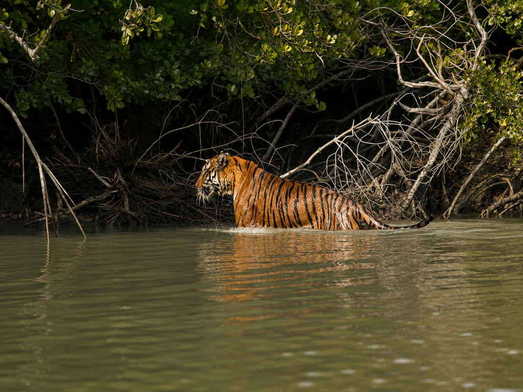
Although Chulkati lies outside the administrative boundary of the Sundarban Tiger Reserve, it remains closely linked to the broader tiger landscape of the Indian Sundarbans.
The Matla River, which forms the eastern boundary of the West Sundarban Wildlife Sanctuary, separates Chulkati from forests associated with the Tiger Reserve. However, this river is not an absolute barrier. Royal Bengal Tigers are exceptional swimmers and have been documented crossing wide tidal rivers throughout the Sundarbans. Such movements help maintain genetic exchange between different forest areas and allow tigers to establish territories across the wider mangrove landscape.
This ecological connectivity is equally important for other species. Saltwater Crocodiles move freely through estuarine waterways, while birds routinely travel between forest blocks in search of feeding and nesting sites. Fish, crustaceans, and mangrove propagules are transported by tides rather than by administrative boundaries.
For this reason, conservation planning increasingly considers the Indian Sundarbans as a connected ecological landscape rather than a collection of separate protected areas.
Climate
Chulkati experiences a tropical monsoon climate strongly influenced by both the Bay of Bengal and the estuarine environment of the Sundarbans.
Three principal seasons characterize the region:
Summer (March–June)
Temperatures frequently exceed 35°C (95°F), accompanied by high humidity. Evaporation increases salinity in many tidal channels, while pre-monsoon thunderstorms occasionally provide temporary relief.
Monsoon (June–September)
Southwest monsoon rains replenish freshwater inputs across the delta. Heavy rainfall reduces salinity in many parts of the estuary, influences mangrove growth, and supports breeding activity among numerous aquatic organisms and amphibians.
Winter (November–February)
Cooler temperatures, generally ranging between 12°C and 25°C (54°F–77°F), create favourable conditions for migratory birds arriving from Central Asia and northern regions. Clear skies and relatively stable weather also characterize this season.
Because Chulkati lies within a low-lying coastal delta, tropical cyclones remain a natural feature of its climate. Events such as Cyclone Aila (2009), Amphan (2020), and Yaas (2021) demonstrated the vulnerability of the Sundarbans to extreme weather while also highlighting the critical role mangrove forests play in reducing storm impacts.
Seasonal Character
Although Chulkati remains green throughout the year, each season produces distinct ecological changes.
Summer
Many tidal channels become increasingly saline as freshwater inflows decline. Wildlife activity often concentrates around creek systems where water remains available. Mangrove trees continue their physiological adaptations to cope with elevated salt concentrations.
Monsoon
The forest becomes more dynamic as freshwater runoff mixes with tidal waters. Sediment transport increases, newly deposited mudbanks develop, and many mangrove species release propagules that drift with tidal currents before establishing themselves in suitable locations.
Fish populations expand into flooded forests, while amphibians and aquatic invertebrates experience increased breeding activity.
Winter
Lower temperatures attract migratory shorebirds and waterbirds to exposed mudflats and estuarine channels. Clear atmospheric conditions improve visibility across the landscape, while many mammals become more active during daylight hours.
Throughout every season, however, the twice-daily rhythm of the tides remains the dominant ecological force governing life within Chulkati.
Conservation Significance
Chulkati contributes to conservation at multiple ecological scales.
Protecting Mangrove Biodiversity
See it for yourself
A private journey shaped around you — your group, your pace, your interests. Book a free consultation.
The forest safeguards representative mangrove communities characteristic of the Indian Sundarbans, preserving both plant diversity and the ecological processes that sustain estuarine ecosystems.
Supporting Threatened Wildlife
The habitat supports several nationally and internationally protected species, including the Royal Bengal Tiger, Fishing Cat, Saltwater Crocodile, Brown-winged Kingfisher, and numerous migratory birds.
Maintaining Landscape Connectivity
Because Chulkati is connected to neighbouring forest blocks through rivers and tidal channels, it enables wildlife movement across extensive sections of the Sundarbans. Such connectivity is increasingly recognized as essential for long-term biodiversity conservation under changing climatic conditions.
Coastal Protection
Dense mangrove vegetation reduces wave energy during cyclones, slows coastal erosion, and stabilizes sediments, helping protect both wildlife habitat and human communities located beyond the protected forest.
Blue Carbon Storage
Mangrove forests rank among the planet’s most effective natural carbon sinks. Much of this carbon remains stored within waterlogged soils for extended periods, making intact mangrove ecosystems increasingly important in global climate mitigation strategies.
Human Interaction
Unlike inhabited islands of the Sundarbans, Chulkati has no permanent villages or agricultural settlements within its boundaries. Human activity is therefore relatively limited and primarily associated with conservation management and legally regulated resource use in surrounding waters.
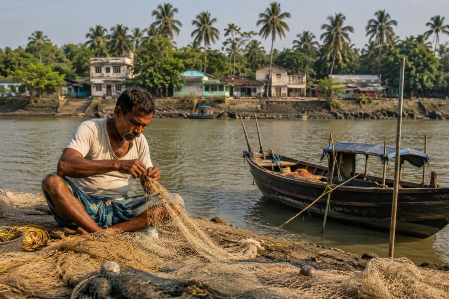
Fishing communities living outside the sanctuary depend heavily on estuarine fisheries that are indirectly supported by the productivity of nearby mangrove habitats. Healthy mangrove ecosystems provide breeding and nursery grounds for many commercially valuable fish and crustacean species before they disperse into larger rivers and coastal waters.
Forest authorities regulate access to protected areas through permits and conservation laws designed to minimize ecological disturbance while ensuring long-term protection of biodiversity.
Because the Sundarbans remain one of India’s most sensitive wildlife landscapes, unauthorized entry into protected forest areas is prohibited.
Scientific and Research Importance
For scientists, Chulkati represents an important natural laboratory where numerous ecological processes can be studied under relatively undisturbed conditions.
Research conducted across the wider Indian Sundarbans has examined topics such as:
- Mangrove succession.
- Coastal geomorphology.
- Carbon sequestration.
- Estuarine fisheries.
- Salinity dynamics.
- Wildlife ecology.
- Tiger movement.
- Climate change impacts.
- Cyclone resilience.
- Coastal erosion.
- Sediment deposition.
- Mangrove restoration.
Because Chulkati remains part of a protected forest with comparatively limited public access, it offers opportunities for long-term ecological monitoring and conservation research that may be more difficult in heavily visited or inhabited landscapes.
Continued scientific investigation is expected to improve understanding of how mangrove ecosystems respond to sea-level rise, changing freshwater availability, increasing temperatures, and extreme weather events.
Current Conservation Challenges
Standing within Chulkati, the mangrove forest appears timeless. The tides continue their ancient rhythm, mangrove roots remain anchored in the mud, and wildlife moves through the estuarine landscape much as it has for centuries. Yet beneath this apparent stability, the forest faces a growing range of environmental pressures that threaten not only Chulkati but the wider Sundarbans ecosystem.
Conservation today is no longer limited to protecting wildlife from direct human disturbance. It increasingly involves safeguarding ecological processes that enable the mangrove forest to survive in a rapidly changing world.
Climate Change and Sea-Level Rise
The Sundarbans is among the world’s most climate-sensitive coastal ecosystems. Rising sea levels increase tidal inundation, alter salinity patterns, and accelerate shoreline erosion. Because much of Chulkati lies only a few metres above mean sea level, even gradual changes can significantly influence mangrove distribution over time.
Although mangrove forests naturally adapt by trapping sediments and building new land, the balance between land formation and erosion may become increasingly uncertain under accelerating sea-level rise. Scientists continue to monitor these long-term changes, recognizing that their impacts may vary across different parts of the delta.
Tropical Cyclones
The northern Bay of Bengal generates some of the world’s most powerful tropical cyclones, and the Sundarbans frequently lies in their path.
Cyclones such as Aila (2009), Amphan (2020), and Yaas (2021) demonstrated both the vulnerability and resilience of mangrove ecosystems. High winds, storm surges, and prolonged saline flooding can damage vegetation, reshape riverbanks, and alter habitat structure.
At the same time, intact mangrove forests significantly reduce wave energy and help protect inland communities by acting as natural coastal buffers. Chulkati therefore plays an important role not only in biodiversity conservation but also in regional disaster resilience.
Salinity Changes
The health of mangrove forests depends upon a delicate balance between freshwater inflow and tidal seawater.
Changes in upstream river discharge, sediment transport, rainfall patterns, and estuarine hydrology can influence salinity across the forest. Some mangrove species tolerate highly saline conditions better than others, meaning long-term changes in salinity may gradually alter vegetation composition.
Understanding these processes remains an active area of scientific research across the Indian Sundarbans.
Habitat Fragmentation
Although Chulkati itself remains protected, the wider Sundarbans landscape includes inhabited islands, embankments, navigation routes, and fishing activities beyond protected areas.
Maintaining ecological connectivity between different forest blocks remains essential for species that require large home ranges or seasonal movement, including the Royal Bengal Tiger, Saltwater Crocodile, Fishing Cat, and numerous bird species.
Landscape-scale conservation therefore focuses not only on protecting individual forests but also on preserving the ecological connections between them.
Human-Wildlife Interface
Most direct interactions between people and wildlife occur near inhabited islands outside Chulkati rather than within the protected forest itself.
Fishing communities operating in adjacent estuarine waters occasionally encounter crocodiles, while tiger movements near human settlements elsewhere in the Sundarbans continue to present management challenges.
Reducing conflict requires a combination of scientific monitoring, community participation, effective forest management, and continued conservation education.
Long-Term Scientific Monitoring
Climate change, changing sediment dynamics, and shifting estuarine conditions make long-term ecological monitoring increasingly important.
Researchers continue studying:
- Mangrove regeneration
- Shoreline change
- Sediment deposition
- Wildlife distribution
- Fish nursery habitats
- Carbon storage
- Salinity dynamics
- Cyclone recovery
Such research provides the scientific foundation needed to guide future conservation planning across the Sundarbans.
Visitor Information
Unlike several well-known destinations in the Indian Sundarbans, Chulkati is not a tourism destination.
The forest lies within the West Sundarban Wildlife Sanctuary, and public access is strictly regulated under the Wildlife (Protection) Act, 1972. The sanctuary is managed primarily for biodiversity conservation rather than recreational tourism.
Visitors exploring the Indian Sundarbans generally travel through designated tourism zones such as Sajnekhali, Sudhanyakhali, Dobanki, Netidhopani (subject to current regulations), and other approved interpretation areas.
Chulkati, by contrast, remains a protected mangrove wilderness where entry is restricted to authorized personnel engaged in conservation, management, scientific research, or other officially permitted activities.
Because regulations may change, anyone seeking access for research or official purposes should consult the West Bengal Forest Department before planning a visit.
The Wild Orbit’s Interesting Facts About Chulkati
- Chulkati is a Reserved Forest block, not an inhabited island.
- It forms one of the two principal forest blocks of the West Sundarban Wildlife Sanctuary.
- The forest covers approximately 248.96 square kilometres, accounting for nearly half of the sanctuary’s protected area.
- Its landscape changes twice each day under the influence of tidal flooding.
- Mangrove roots help stabilize sediments while creating nursery habitats for fish and crustaceans.
- The forest contributes to one of the world’s largest continuous mangrove ecosystems.
- Chulkati supports habitat suitable for the Royal Bengal Tiger, Saltwater Crocodile, Fishing Cat, and numerous mangrove-dependent birds.
- The forest plays an important role in coastal protection by reducing wave energy during tropical cyclones.
- Water, rather than roads or trails, forms the primary transportation network through the mangrove landscape.
- Every new mangrove seedling that establishes on freshly deposited mud contributes to the gradual evolution of the delta.
FAQs
Where is Chulkati located?
Chulkati is a Reserved Forest block within the West Sundarban Wildlife Sanctuary in South 24 Parganas district, West Bengal, India.
Is Chulkati an inhabited island?
No. Chulkati is an uninhabited protected mangrove forest managed primarily for wildlife conservation.
Can tourists visit Chulkati?
No regular tourism operates within Chulkati. Entry is generally restricted and subject to authorization from the West Bengal Forest Department.
Why is Chulkati important?
The forest protects mangrove ecosystems, supports diverse wildlife, strengthens ecological connectivity across the Sundarbans, and contributes to coastal protection and carbon storage.
Which major rivers surround Chulkati?
The forest is associated primarily with the Matla River, Thakuran River, Ajmalmari River, and numerous interconnected tidal creeks.
Are Royal Bengal Tigers found in Chulkati?
Chulkati forms part of the broader Sundarbans mangrove landscape that provides habitat suitable for Royal Bengal Tigers. However, individual tiger movements vary naturally, and population estimates are reported at landscape or reserve level rather than for individual forest blocks.
Why are mangrove roots visible above the ground?
Mangrove soils are waterlogged and contain very little oxygen. Many mangrove species develop specialized aerial roots, known as pneumatophores, which allow them to obtain oxygen directly from the atmosphere during low tide.
How do mangroves help protect the coast?
Dense mangrove roots trap sediments, reduce shoreline erosion, and absorb part of the energy generated by waves and storm surges, helping protect both wildlife habitats and nearby human settlements.
The Bigger Picture of Chulkati
As darkness settles over Chulkati, the distinction between land and water begins to fade once again. The returning tide quietly fills the creeks, submerges exposed mudbanks, and surrounds the trunks of mangrove trees that have endured countless tidal cycles.
Somewhere within the forest, a Spotted Deer moves cautiously through the undergrowth, while a Saltwater Crocodile drifts silently with the incoming water. Above the canopy, the final calls of waterbirds give way to the sounds of an estuary preparing for another night.
Chulkati is not defined by dramatic landmarks or human settlements. Its significance lies in the quiet persistence of natural processes that have shaped the Indian Sundarbans for millennia.
Here, tides redistribute sediments, mangroves stabilize emerging land, rivers connect distant forest blocks, and countless species depend upon one another in a continuously evolving ecological network.
Although it remains largely unknown beyond scientific and conservation circles, Chulkati represents an essential component of one of the world’s greatest mangrove landscapes. Protecting this forest means safeguarding far more than a single protected area.
It means preserving ecological connectivity, supporting biodiversity, strengthening coastal resilience, and ensuring that future generations inherit a living delta where nature continues to follow the rhythms it has maintained for thousands of years.
In understanding Chulkati, we gain a deeper appreciation of the Sundarbans itself—not as a collection of isolated forests, but as an interconnected estuarine ecosystem whose greatest strength lies in the enduring relationship between rivers, tides, mangroves, wildlife, and time.
Plan your private Sundarban expedition
A private journey shaped around you — your group, your pace, your interests. Book a free consultation.