 Encyclopedia
Bali Island
The Island Between Tides
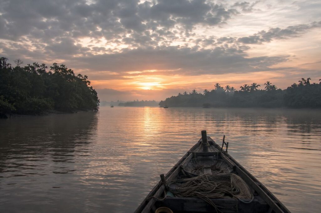
Before dawn, the rivers of the eastern Sundarbans do not look like rivers at all.
They resemble moving darkness.
The boat leaves the mainland jetty while the sky is still iron-grey, its engine coughing into the silence as the tide pulls slowly southward through a labyrinth of channels.
Somewhere beyond the mist lie islands with names that appear only occasionally on government maps and ferry schedules — Dayapur, Satjelia, Gosaba, Pakhiralay.
And farther along the tidal veins of the Bidya River rests a quieter settlement known simply as Bali Island.
Not the famous island of Indonesia.
This Bali belongs to the delta.
A low, mud-banked island shaped not by mountains or volcanoes, but by silt, tidewater, embankments, storms, mangroves, and the patient labor of people who learned to live where land itself is uncertain.
The first signs of the island emerge slowly.
- A broken embankment patched with fresh clay.
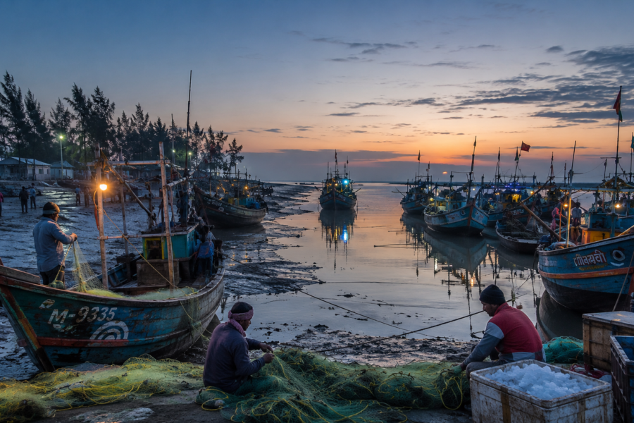
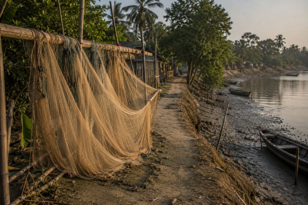
- Fishing nets suspended like ghostly curtains over narrow creeks.
- Palm silhouettes bending inland from years of cyclonic wind.
- A tea stall lantern glows beside a bamboo jetty where two fishermen wait for the morning tide.
Even before stepping ashore, Bali reveals its dominant identity.
This is not merely a settlement island.
It is a frontier island — a human outpost pressed against the ecological edge of the mangrove wilderness.
Here, rivers decide everything.
- The direction of trade.
- The shape of villages.
- The rhythm of sleep.
- The timing of schoolboats.
- The arrival of medicine.
- The loss of farmland.
Sometimes, even the difference between survival and disappearance.
Across much of the Indian Sundarbans, islands blur together in outsider imagination.
But Bali does not feel interchangeable once approached by water. Its character comes from isolation, river dependency, and its uneasy closeness to protected mangrove corridors where forest and habitation still negotiate territory every day.
The deeper the boat moves into the delta, the more Kolkata begins to feel improbable.
- Concrete disappears first.
- Then mobile towers.
- Then traffic noise.
What remains are sounds older than roads.
- Water striking wooden hulls.
- Egrets lifting from mudflats.
- The soft clatter of crab traps stacked along a deck.
- The distant call to prayer crosses a river channel at sunrise.
And gradually, Bali Island comes into view.
First Encounter
Arrival in the Sundarbans is rarely dramatic in the cinematic sense. There are no towering cliffs, no visible horizons, no monumental entrances.
The delta reveals itself through details.
The shoreline of Bali Island appears as a long earthen edge reinforced by embankments built and rebuilt over generations.
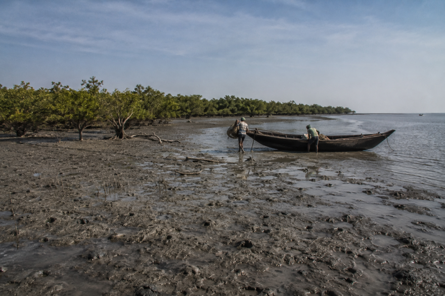
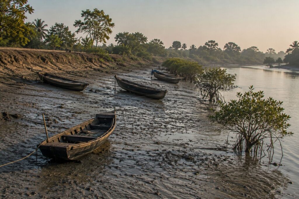
At low tide, the banks expose slick expanses of silver-brown mud where red fiddler crabs vanish into holes within seconds of disturbance.
Mangrove shrubs cling to creek mouths. Small wooden dinghies lean sideways in the receding tide like exhausted animals resting between journeys.
Near the landing area, movement begins before sunrise.
- Women wash utensils at hand pumps.
- Schoolchildren in blue uniforms wait beside narrow pathways raised slightly above flooded ground.
- Fishermen untangle nylon nets while discussing tide timings rather than clock time.
- Bundles of vegetables arrive by country boat from neighboring islands.
The island does not awaken all at once.
It unfolds.
- A kettle whistles from a tea stall roofed with corrugated tin.
- A bicycle bell rings somewhere inside the village lanes.
- Someone repairs a fishing net under a neem tree.
- Smoke rises from kitchens fueled partly by wood, partly by whatever combustible material survived the last monsoon.
The terrain itself immediately explains the nature of life here.
Everything is low.
- The houses sit close to the earth.
- The roads are narrow and vulnerable.
- The ponds collect rainwater because saline intrusion threatens groundwater.
- The embankments stand like defensive walls not against armies, but against rivers.
This is one of the defining realities of Bali Island and much of the inhabited Sundarbans: land is never fully secure.
People speak of erosion the way mountain communities speak of avalanches.
Not as distant a disaster.
As a recurring possibility.
CTA: Explore Sundarbans Expeditions
Island Identity
Bali Island exists within the inhabited island network of the Indian Sundarbans in the South 24 Parganas district of West Bengal, connected administratively through the larger Gosaba region and river transport systems that define daily movement across the delta.
Much of the surrounding landscape belongs to the lower Gangetic delta — a terrain formed over centuries by the immense sediment load of the Ganges-Brahmaputra-Meghna river system.
But statistics alone cannot explain the island.
The Sundarbans are not governed by straight lines on maps.
They are governed by water corridors.
On Bali Island, settlement patterns follow embankments because embankments provide the nearest equivalent to stable ground.
- Homes cluster along elevated stretches.
- Paths curve according to old tidal channels.
- Human geography bends around hydrology.
The rivers surrounding the island are not passive boundaries.
They are active forces.
The Bidya River system and adjoining tidal waterways influence transportation, trade, fishing routes, and even social relationships between islands. In many places across the Gosaba-side delta, boats remain more reliable than roads during monsoon months.
Administrative structures exist here — gram panchayats, schools, health centers, local markets — yet the landscape constantly reminds residents that governance alone cannot overpower geography.
Cyclones redraw priorities overnight.
- A breached embankment matters more than politics.
- A functioning ferry matters more than distance.
- Freshwater ponds matter more than property boundaries.
And perhaps this is what truly defines Bali Island: It is a place where civilization remains negotiable with nature.
The Rivers That Shaped The Island
By mid-morning, the rivers begin changing color.
- At sunrise, they carry soft grey reflections.
- By noon, they become metallic.
- Under storm clouds, they turn nearly black.
No two crossings look the same.
The Sundarbans delta contains hundreds of rivers, creeks, and tidal channels, but around Bali Island, the Bidya River system acts as both a pathway and a pressure point.
Tides move through these waterways with enormous force, carrying silt from distant Himalayan origins before redistributing it through the mangrove maze.
To understand Bali Island, one must first understand tidal time.
The island does not function according to urban schedules.
- Fishing departures depend on the current direction.
- Ferry timings shift with water levels.
- Riverbank markets expand and contract according to navigability.
- Children sometimes wait for tides before crossing channels to schools.
Even language reflects this dependence.
Locals discuss “jowar” and “bhata” — high tide and low tide — with instinctive precision. These are not environmental terms here. They are practical survival vocabulary.
The rivers also determine risk.
A calm-looking channel during winter can become violent during monsoon surges. During cyclonic events, tidal rivers amplify destruction by carrying saline water deep into agricultural land. Embankments collapse not simply from waves, but from prolonged hydraulic pressure exerted by swollen tidal systems.
Yet the rivers also sustain the island.
- Fish move through these channels.
- Crab collectors depend on them.
- Honey gatherers travel along them toward forest zones.
- Trade boats bring rice, kerosene, medicine, and construction materials.
The Sundarbans often appear isolated from the outside. In reality, the rivers are highways.
Ancient ones.
Before roads reached much of the delta, boats connected settlement clusters across waterways that still function as the primary arteries of movement. Even today, many journeys involve combinations of road, ferry, motor launch, and footpath.
On Bali Island, nobody truly escapes the river.
Even those who farm inland speak about water constantly.
- Its salinity.
- Its timing.
- Its erosion.
- Its moods.
Historical Footprints
The history of inhabited Sundarban islands is not the history of ancient kingdoms rising visibly from stone ruins.
It is the history of reclamation.
- Mud is becoming settled.
- Forest becoming embankment.
- Isolation is becoming a fragile habitation.
Much of the Indian Sundarbans, including island regions associated with Gosaba and surrounding settlements, underwent organized reclamation during the colonial period.
Before large-scale habitation, many islands remained heavily forested, tidal, and difficult to occupy permanently because of disease, flooding, salinity, and wildlife presence.
British administrators and private leaseholders gradually encouraged forest clearing and embankment construction to expand cultivation. But reclamation in the Sundarbans was never a complete victory over nature.
The landscape resisted.
- Malaria spreads through stagnant water.
- Cyclones erased embankments.
- Tiger encounters shaped fear and folklore alike.
- Saltwater repeatedly invaded farmland.
The larger Gosaba region became historically important through the efforts of Sir Daniel Hamilton, the Scottish entrepreneur and reformist landlord who attempted cooperative rural development experiments in the early twentieth century. Hamilton introduced schools, credit systems, cooperative structures, and social initiatives intended to stabilize life in the delta settlements.
Although Bali Island itself remains less documented in mainstream historical literature than Gosaba town or nearby tourism gateways, its existence is tied to the same larger transformation of the Sundarbans from dense mangrove frontier into a precarious human landscape.
Migration shaped the island deeply.
Settlers arrived over generations from different parts of Bengal seeking cultivable land, fishing opportunities, or escape from economic hardship elsewhere.
Some came during colonial expansion phases. Others arrived after the partition. Still others moved after river erosion consumed ancestral homes on neighboring islands.
In the Sundarbans, migration is often cyclical.
People lose land to rivers and begin again somewhere else in the delta.
Sometimes more than once.
Historical Personalities & Transformations
In many delta islands, memory survives more strongly through collective recollection than monumental architecture.
Ask older residents about history, and conversations rarely begin with dates.
- They begin with storms.
- Or rivers.
- Or people who changed village life.
Across the Gosaba region, the legacy of Sir Daniel Hamilton remains one of the most significant historical influences. His cooperative experiments in the early twentieth century attempted to create rural self-sufficiency within the isolated island settlements. Schools, local administration systems, and cooperative banking initiatives helped shape the social framework of inhabited Sundarbans communities.
But Bali Island’s transformation was not driven by famous individuals alone.
It was shaped by unnamed labor.
- Men carrying mud baskets to repair breached embankments.
- Women preserving freshwater during saline years.
- Boatmen maintain connectivity between islands.
- Teachers running schools in flood-prone villages.
- Local healers were working where medical access remained uncertain.
The Sundarbans rarely produce singular heroic narratives.
Its history is communal.
Survival itself becomes a shared achievement. And perhaps the most important transformation in islands like Bali has been psychological rather than infrastructural: generations learning how to inhabit instability.
Children here grow up understanding tides before geography textbooks.
- They recognize cyclone warnings through changes in wind pressure.
- They learn early that the river can give and take away within the same season.
Folklore & Legends
By afternoon, conversations begin slowing under the heat.
Tea stalls fill with boatmen waiting for favorable tides. Someone inevitably mentions Bonbibi.
In the Sundarbans, folklore is not decorative mythology.
It remains embedded within ecological consciousness.
Bonbibi — the guardian spirit of the forests — continues to occupy a powerful place in local belief systems across both Indian and Bangladeshi Sundarbans.
Her story represents protection, balance, and survival within dangerous landscapes shared by humans and wildlife.
Alongside Bonbibi appear figures such as Dakshin Ray, often associated with tiger power, and Shah Jongoli, protector and companion in forest lore.
On islands near active forest corridors, these stories are not distant religious relics.
They remain practical narratives of coexistence.
Honey collectors and wood gatherers entering forest zones often invoke Bonbibi before departure. In some settlements, small shrines painted in bright colors stand near ferry points or market edges, quietly acknowledging the uncertainty of journeys into tidal wilderness.
What makes Sundarbans folklore unique is its ecological origin.
These stories emerged from fear of real landscapes.
- Tigers were not symbolic abstractions here.
- Cyclones were not metaphors.
- River disappearances were not fiction.
Folklore became a survival language.
On Bali Island, where forest proximity still shapes imagination, older residents sometimes speak about stretches of river avoided after dark, or creeks believed to hold dangerous presences. Such stories shift over generations, blending spiritual belief with environmental caution.
No one entirely laughs at them.
Because in the Sundarbans, the line between myth and practical warning has always been thin.
Life Between The Tides
Toward late afternoon, the island reveals its working rhythm most clearly.
- Fishing boats begin returning.
- Crates of small fish appear near landing areas.
- Nets dry across bamboo poles.
Children chase each other along embankments while goats wander dangerously close to muddy slopes.
Life on Bali Island unfolds through adaptation to limited certainty.
Fishing remains central to many households. Crab collection, shrimp seed gathering, seasonal agriculture, wage labor, and small-scale trade supplement livelihoods depending on season and river conditions.
Across inhabited Sundarbans islands, economic diversity often reflects environmental vulnerability — when one livelihood fails after storms or saline intrusion, families shift toward another.
Agriculture itself remains fragile.
Rice cultivation depends heavily on embankment protection and freshwater availability. A single severe saline flood can damage soil productivity for years. Rainwater ponds therefore, become precious resources, carefully maintained for household use.
School life carries its own challenges.
Children cross muddy pathways during the monsoon. Ferry interruptions affect attendance. Yet schools remain among the most visible signs of persistence in remote islands. Morning assemblies continue even after storms damage buildings. Education here often represents aspiration beyond ecological uncertainty.
Inside homes, daily routines remain closely tied to tide schedules.
- Meals are adjusted around fishing departures.
- Laundry waits for freshwater availability.
- Travel planning depends on navigable conditions.
Even rest is negotiated with the weather.
The Sundarbans do not allow complete predictability. And still, ordinary life continues with remarkable steadiness.
- A barber opens his roadside chair.
- Someone repairs a bicycle tube.
- Rice dries on woven mats.
- A child practices handwriting beside a hurricane lamp during a power outage.
This is perhaps the most misunderstood aspect of islands like Bali.
Outsiders often see only vulnerability. But daily life here is not defined solely by hardship.
It is also defined by continuity.
Walking Through The Villages
The villages of Bali Island are not arranged according to modern planning.
They follow survival geography.
- Homes rise where embankments hold strongest.
- Paths curve around ponds excavated for rainwater storage.
- Small shrines stand beneath banyan and neem trees where shade survives the dry season.
In some stretches, narrow lanes become barely wider than a bicycle track before dissolving into mud near tidal creeks.
Walking through the island reveals how architecture adapts to uncertainty.
Older homes often use mud walls reinforced with straw and bamboo — cooler during summer and cheaper to rebuild after storms.
Newer structures increasingly incorporate brick and concrete wherever families can afford them, particularly after repeated cyclone damage across the delta.
Roofs remain practical rather than decorative: corrugated tin, asbestos sheets, tarpaulin patches still tied from previous storm seasons.
Nothing here is built with the illusion of permanence.
Courtyards function as workspaces.
- Women clean fish beside hand pumps.
- Rice dries on cloth sheets spread carefully away from roaming chickens.
- Nets hang from bamboo poles like woven curtains.
In one household, an elderly man repairs crab traps while listening to a Bengali news bulletin crackling through a battery-powered radio.
Tea stalls become informal information centers.
Discussions drift between politics, river erosion, ferry timings, fish prices, and weather forecasts. Cyclone names enter conversation the way major historical events do elsewhere.
- Aila.
- Amphan.
- Yaas.
Not merely storms.
Reference points in personal memory.
Children move through this environment with extraordinary familiarity. Barefoot boys balance easily along narrow embankment ridges above flooded channels. Girls in school uniforms walk in small groups carrying books protected inside plastic covers during monsoon months.
The villages do not appear frozen in time, despite outsider assumptions about the Sundarbans.
Solar panels appear on rooftops. Smartphones glow in tea stalls. Government schemes reach some settlements more effectively than others. Yet even modernity arrives here through rivers.
Everything must cross water first.
Sounds Of The Island
Long before Bali Island becomes visually memorable, it becomes audible.
The Sundarbans possesses one of the most distinctive soundscapes in South Asia — a layered mixture of water movement, bird calls, machinery, human labor, insects, and weather.
Morning begins with engines.
Fishing boats start before sunrise, their diesel motors carrying across flat water long before the vessels themselves appear through mist. Soon afterward come softer sounds: sweeping courtyards, utensils striking hand pumps, goats calling from bamboo enclosures.
By midday, heat suppresses movement.
Even sound slows. Only distant river traffic and cicadas continue steadily through the heavy air.
But evening transforms the island acoustically.
- Temple bells ring from one settlement.
- The azaan drifts across tidal channels from another.
- Children play cricket beside embankments while someone shouts fielding instructions into the wind.
- Pressure cookers whistle from kitchens.
- A ferry horn echoes faintly through the fog.
And beneath everything remains the tidal sound itself.
Water.
Always moving somewhere nearby.
At night, when electricity fails or village lights thin into darkness, the natural world reasserts dominance quickly.
- Frogs begin calling from ponds.
- Night insects create dense vibrating walls of sound.
- Wind moves through mangrove leaves with a dry, whispering texture unlike inland forests.
During storm season, even silence becomes meaningful. Experienced residents listen for abnormal wind patterns the way sailors once read oceans.
The island teaches attention through sound.
Wildlife Expedition
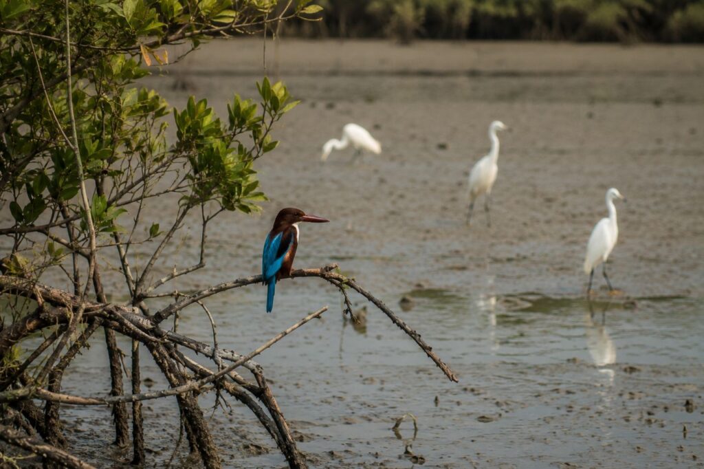
The deeper one travels toward the less-settled edges of the island, the more visible the ecological tension becomes between habitation and wilderness.
The Sundarbans is one of the world’s largest mangrove ecosystems and a globally significant biodiversity zone shared between India and Bangladesh. The Indian sector includes tiger reserve regions, protected forests, mudflats, tidal creeks, estuaries, and countless microhabitats supporting both resident and migratory species.
Bali Island exists close enough to these ecological corridors for wildlife presence to shape everyday consciousness, even when sightings remain uncommon.
Birdlife appears first.
- A white-throated kingfisher flashes electric blue over narrow canals.
- Pond herons freeze beside shallow water before exploding suddenly into flight.
- Brahminy kites circle above fish landing areas waiting for discarded catch.
During winter months, migratory species enter broader Sundarbans wetlands, transforming mudbanks and estuarine zones into temporary avian gathering grounds.
- Egrets follow grazing livestock.
- Drongos perch on fishing poles.
- Bee-eaters skim low above embankments, hunting insects in evening light.
Near mangrove-lined creeks, mudskippers pulse across exposed tidal flats, their amphibious bodies appearing strangely prehistoric against the wet sediment. Fiddler crabs raise oversized claws in a defensive ritual. Mangrove snails cling to roots exposed by the falling tide.
The Sundarbans rewards patient observation rather than dramatic spectacle.
Much remains hidden.
- Fishing cats inhabit parts of the delta, though rarely seen.
- Estuarine crocodiles survive in protected regions.
- Water monitor lizards move silently through muddy margins.
- Irrawaddy dolphins and Gangetic dolphins occasionally appear in broader estuarine systems, surfacing briefly before vanishing again into opaque water.
And then there is the tiger.
The Royal Bengal Tiger remains the psychological center of Sundarbans ecology even in places where sightings are extremely rare. Across inhabited islands, tiger presence exists as awareness more than a daily occurrence. Stories travel quickly through river networks whenever animals stray close to villages or cross embankments during periods of ecological disturbance.
The tiger is not treated casually here.
It represents both fear and respect.
Unlike many forest systems where predators remain distant from human settlement, the Sundarbans historically forced coexistence across overlapping territory. That memory still shapes local caution near isolated creeks and forest edges.
Yet Bali Island’s wildlife story is not only about large animals.
It is about ecological interdependence.
- The insects pollinating flowers near ponds.
- The mangrove roots stabilize the soil.
- The mudflats feed migratory birds.
- The tidal nurseries sustain fish populations.
Every layer supports another. And everywhere, the rivers connect them.
CTA: Join a Wildlife Expedition
Mangrove Chronicles
See it for yourself
A private journey shaped around you — your group, your pace, your interests. Book a free consultation.
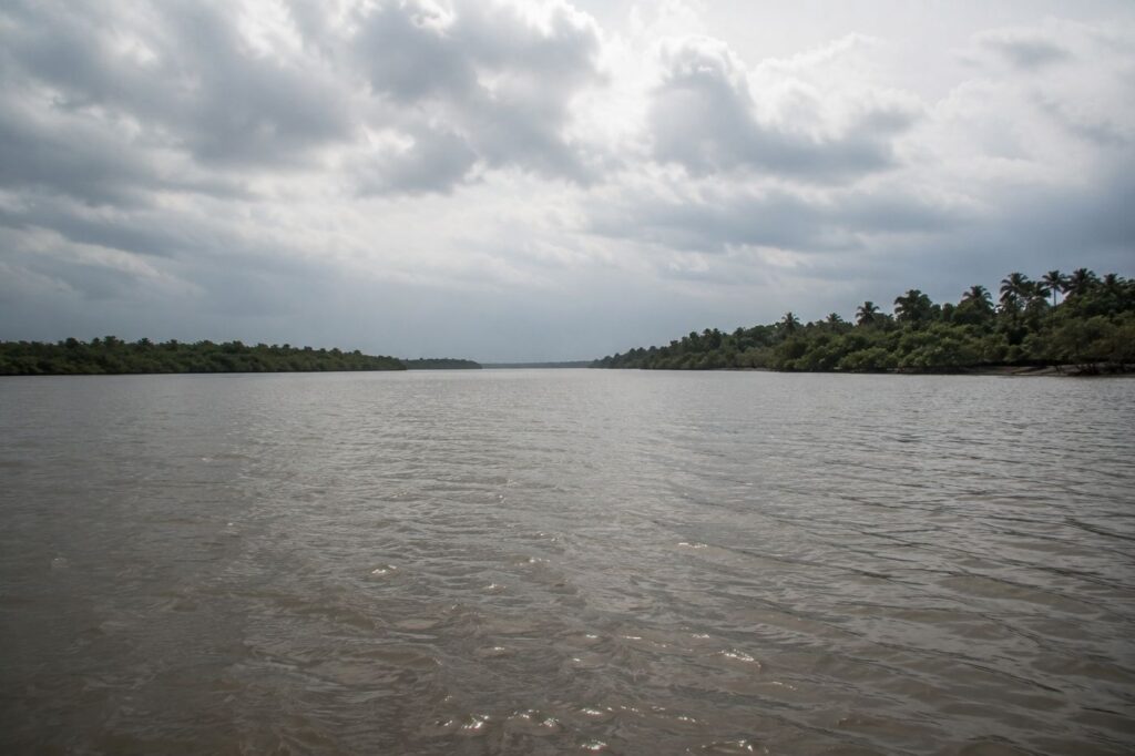
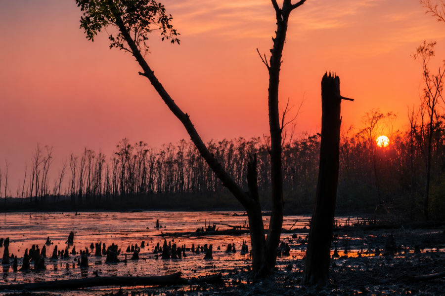
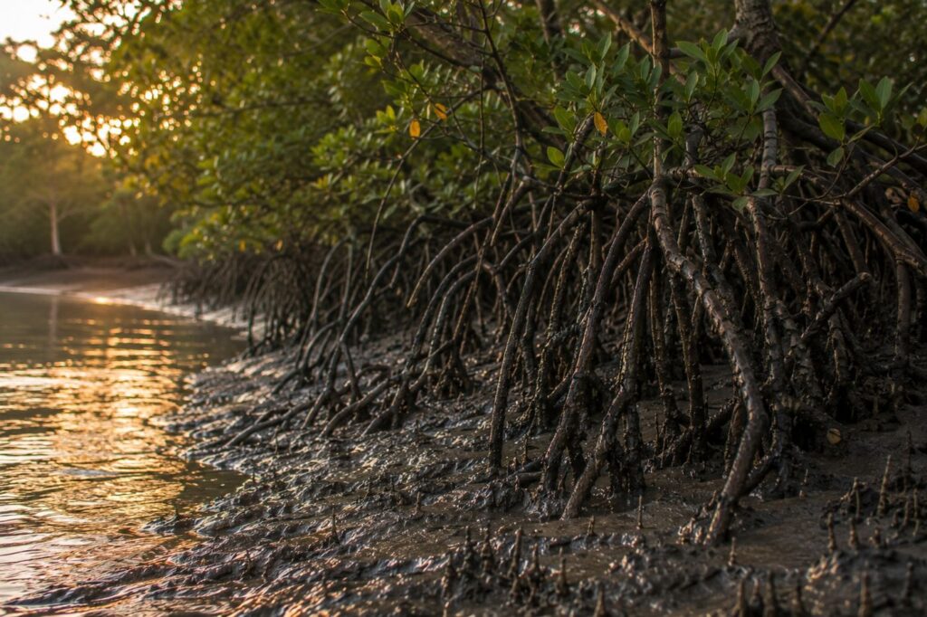
By sunset, the mangroves darken into silhouettes.
Their roots resemble exposed veins rising from mud.
To outsiders, mangrove forests often appear monotonous from a distance. But closer observation reveals extraordinary structural complexity — salt-tolerant species adapted to tidal submersion, unstable sediment, saline water, and oxygen-poor soil.
The Sundarbans derives its very name from the “Sundari” tree, though multiple mangrove species shape the ecosystem, including gewa, goran, keora, and passur in different zones.
These forests function as biological shields against erosion and cyclonic force while also supporting fisheries, birdlife, crustaceans, and estuarine food chains.
Around Bali Island, smaller mangrove stretches survive along creek systems, embankment edges, and less-disturbed tidal margins. Some areas remain degraded from human pressure or storm damage. Others regenerate naturally where salinity and sediment conditions allow recovery.
Mangroves here are not abstract conservation symbols.
They are practical defense systems.
Residents understand this deeply.
After major cyclones, conversations often shift toward where mangrove belts survived and where they were removed. Villagers who may never use ecological terminology still recognize that areas protected by vegetation frequently suffer less erosion than exposed banks.
Yet dependence on the environment also creates pressure upon it.
- Wood collection.
- Fishing expansion.
- Shrimp seed harvesting.
- Embankment construction.
The balance remains fragile.
Conservation in inhabited Sundarbans landscapes cannot operate through exclusion alone because millions depend economically upon the delta ecosystem. This creates one of the region’s most difficult realities: human survival and ecological protection remain inseparable.
Walking beside a tidal creek at dusk, one sees this tension physically.
- A fisherman polishes his boat through water reflecting mangrove shadows.
- Above him, fruit bats leave trees in widening circles.
Beside the creek stands an embankment repaired after the last cyclone.
- Forest.
- River.
- Human settlement.
None is fully separate from the others.
Explorer’s Field Notes
Field Note: Winter Morning
- Dense fog over the river delays boat movement until sunrise strengthens.
- Fishermen navigate using memory more than visibility.
- Bird activity intensifies near exposed mudflats after the tide retreats.
Field Note: Pre-Monsoon Heat
- Afternoon temperatures rise sharply across exposed embankments.
- Livestock gather beneath limited shade.
- River surfaces appear deceptively still before evening tidal reversal accelerates current movement.
Field Note: Post-Cyclone Landscape
- Fresh clay reinforcement visible along damaged embankment sections.
- Fallen palm trunks reused as temporary bridge supports over flooded channels.
- Salinity damage observable in agricultural patches where vegetation growth remains uneven.
Field Note: Evening Creek Edge
- Mudskippers are active along exposed banks during low tide.
- Mosquito density increases rapidly after sunset near stagnant water pockets.
- Mangrove roots hold visible sediment deposits left by the retreating tide.
Field Note: Human Movement
- Boat traffic increases significantly during early morning and late afternoon.
- Midday movement declines sharply during summer months due to heat exposure across open embankments.
Nightfall On The Island
Darkness arrives differently in the Sundarbans.
Cities resist night through electricity.
The delta submits to it.
After sunset, Bali Island gradually contracts inward.
- Tea stalls close their shutters.
- Ferry movement slows except for occasional emergency crossings.
In some stretches, power supply flickers uncertainly before entire sections disappear into blackness, broken only by kerosene lamps and distant solar lights.
- The rivers become invisible first.
- Then the embankments.
- Then even neighboring houses dissolve into shadow.
Only sound remains reliable.
- Frogs pulse from ponds.
- Dogs bark intermittently at unseen movement.
- Wind rattles palm leaves overhead.
- A late fishing boat engine hums somewhere beyond the darkness.
On clear nights, the sky expands enormously over the delta because artificial illumination remains limited compared to urban Bengal. Constellations appear sharp above the tidal plains. During winter, fog sometimes erases even that, enclosing villages inside soft white silence until dawn.
Older residents still recall periods when movement after dark carried greater fear, especially in stretches closer to forest corridors. Even now, people avoid isolated embankments late at night unless necessary.
The Sundarbans after dark belongs increasingly to non-human life.
- Crabs emerge from mudbanks.
- Fishing cats move unseen through vegetation.
- Owls hunt above open fields.
- Tidal water continues entering creeks without warning.
Inside homes, families gather around evening meals — rice, fish curry, lentils, seasonal vegetables. Conversations drift toward weather forecasts, relatives working in Kolkata, school results, and crop conditions.
Ordinary domestic life persists against the immense ecological backdrop surrounding it. And perhaps that is what feels most remarkable on Bali Island after nightfall. Not wilderness alone.
But the fragile persistence of human routine beside it.
The Seasons Of The Island
No season in the Sundarbans arrives gently. Each transforms the delta completely.
Winter
Winter is the most forgiving season on Bali Island.
- The skies clear.
- Humidity drops.
- River crossings become calmer.
- Agricultural activity intensifies where soil conditions remain productive after the monsoon retreat.
- Migratory birds appear in broader wetland zones across the delta.
- Morning fog becomes part of daily life.
- Boats emerge slowly through white river haze while fishermen wrap scarves against the cold wind moving over open water.
This is also the season when outside visitors understand the Sundarbans most comfortably. But winter reveals only one face of the island.
Spring
Spring passes quickly through the delta.
- Mango blossoms appear.
- Palm canopies brighten.
- Temperatures begin rising before the violent humidity of summer arrives.
- Honey collection season historically intensifies in forest zones during this transitional period.
- The rivers remain deceptively calm.
Locals know the harsher months are approaching.
Summer
Summer presses heavily upon Bali Island.
- Heat reflects from embankment mud and exposed tidal flats with exhausting intensity.
- Drinking water management becomes critical in some settlements.
- Afternoon activity declines as temperatures climb.
- Storm systems begin gathering over the Bay of Bengal.
The air changes before they arrive.
- Pressure drops.
- Bird movement shifts.
- Wind direction becomes irregular.
Experienced fishermen notice these signals instinctively.
Monsoon
Then comes the monsoon. The island softens under relentless rain.
- Pathways disappear into mud.
- Ponds overflow.
- River channels swell with tidal force.
- Transportation slows unpredictably.
- Embankments weaken under prolonged saturation.
And yet the monsoon also restores life.
- Rice fields revive.
- Stored dust vanishes.
- Freshwater replenishes ponds strained by salinity.
Children continue walking to school through flooded paths because island life rarely pauses entirely for weather.
Post-Monsoon & Cyclone Season
The most dangerous period often arrives not during steady monsoon rain, but during cyclonic events emerging from the Bay of Bengal.
The Sundarbans sits directly within one of the world’s most cyclone-prone coastal regions. Storm surges, saline flooding, embankment collapse, and prolonged displacement have shaped island memory for generations. Major cyclones, including Aila (2009), Amphan (2020), and Yaas (2021), caused extensive destruction across inhabited Sundarbans islands.
On Bali Island, cyclone season is not treated as abstract climate news.
It is personal history.
Cyclones And Survival
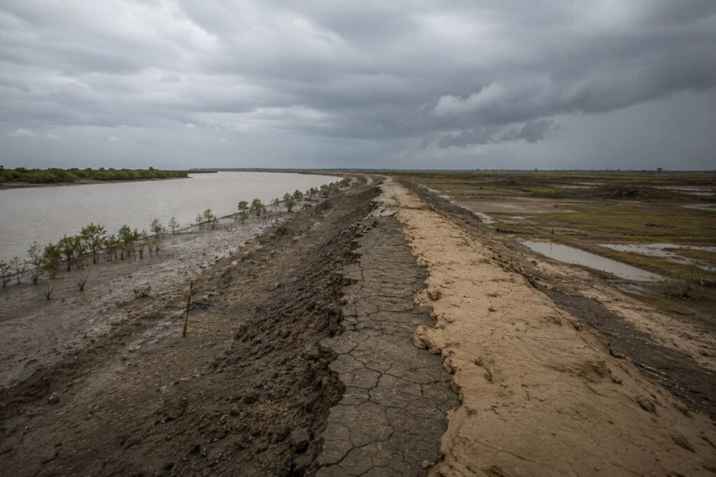
No modern history of Bali Island — or any inhabited Sundarbans island — can be separated from storms.
Cyclones here are not singular disasters that pass into archives after headlines fade. Their effects remain visible for years through damaged soil, altered riverbanks, migration patterns, weakened embankments, and unfinished reconstruction.
When Cyclone Aila struck the Sundarbans in 2009, vast stretches of embankments collapsed across the delta, allowing saline river water to flood settlements and agricultural land.
Entire villages across multiple islands faced prolonged displacement and drinking water crises. Later cyclones such as Amphan and Yaas repeated the cycle of destruction, exposing how vulnerable low-lying islands remain to increasingly intense coastal weather systems.
On Bali Island, cyclone preparation has become woven into ordinary life.
- People store dry food before severe weather.
- Boats are tied inland where possible.
- Livestock are moved toward stronger structures.
- Important documents are wrapped in plastic.
- Mobile phones are charged whenever electricity is available.
But no preparation fully removes uncertainty.
- Storm surges remain the greatest fear.
- Wind destroys roofs.
- Water destroys futures.
When saline tidal water enters agricultural land, recovery can take years.
- Ponds become contaminated.
- Rice fields fail.
- Families dependent upon farming suddenly lose income for entire seasons.
Yet survival in the Sundarbans is rarely dramatic in the heroic cinematic sense.
It is repetitive resilience.
- Rebuilding mud walls.
- Repairing embankments by hand.
- Cleaning ponds after contamination.
- Restarting fishing routes.
- Returning to damaged homes because there is nowhere else to go.
The embankments surrounding islands like Bali therefore, carry emotional weight beyond infrastructure. There are boundaries between habitation and inundation. Every repaired breach becomes part of the collective memory.
Walk along certain stretches today and residents still point toward areas where rivers entered during previous storms.
Memory here follows geography.
Ferry Routes & Hidden Paths
To understand Bali Island, one must arrive by water.
Roads end long before the delta does.
Most journeys toward the inhabited Sundarbans begin from Kolkata through rail and road networks connecting to ferry ghats across the South 24 Parganas district.
From there, travelers continue deeper through combinations of launch services, mechanized boats, local ferries, and narrow embankment roads linking settlement islands.
But maps often fail to communicate the true nature of movement here.
Distance is measured less in kilometers than in crossings.
One ferry after another.
- A muddy path.
- A shared van ride.
- A wooden jetty.
- Another tidal channel.
And slowly the mainland disappears behind rivers.
For residents of Bali Island, transportation remains both routine and fragile.
- Medical emergencies depend on navigable waterways.
- Schoolteachers commute according to tide conditions.
- Market supplies arrive through river transport systems vulnerable to weather disruptions.
Even hidden paths emerge through water logic.
- Narrow creeks become shortcuts during high tide.
- Mudflats become walkable routes during low tide.
- Temporary bamboo bridges appear after storms.
- Boatmen memorize channels invisible to outsiders.
Travel in the Sundarbans requires patience because the landscape itself remains mobile.
- Channels widen.
- Banks collapse.
- Routes shift seasonally.
And perhaps that is why journeys through the delta feel less like transportation and more like gradual entry into another rhythm of existence.
Photography Expedition Guide
Bali Island does not reward hurried photography. The island reveals itself slowly through changing light, tide, weather, and human movement.
Sunrise Photography
The finest sunrise moments occur along eastern embankments and river-facing stretches where fog drifts low over tidal water during winter mornings. Fishermen departing before dawn create silhouettes against soft amber light while egrets gather near exposed mudbanks.
Photographers should begin before first light because the transition from darkness to sunrise happens quickly across open river horizons.
Sunset Photography
Sunset transforms the delta dramatically.
- Palm silhouettes sharpen.
- River surfaces turn copper-colored.
- Smoke from evening kitchens rises through fading light.
Late afternoon along creek mouths and embankment roads offers some of the island’s most atmospheric compositions.
Wildlife Photography
Patience matters more than equipment here.
Bird activity intensifies during early morning and late afternoon, particularly near ponds, mudflats, tidal creeks, and mangrove edges.
Winter provides the best conditions for observing migratory species across the broader Sundarbans wetlands.
Telephoto lenses help, but careful stillness matters more. The Sundarbans reveals wildlife gradually.
Cultural Photography
The island’s human rhythms provide equally powerful visual material:
- Net repair under shade trees.
- Children crossing muddy paths in school uniforms.
- Country boats loaded with vegetables.
- Cyclone-scarred embankments beside newly built homes.
- Tea stalls glow after dusk.
Respect and permission remain essential when photographing people, particularly in smaller settlements unaccustomed to outside visitors.
Monsoon Photography
Monsoon transforms Bali Island into a landscape of reflections and movement.
- Cloud formations become immense.
- Flooded pathways mirror storm light.
- River crossings appear cinematic beneath heavy skies.
But equipment protection becomes critical because moisture dominates everything.
CTA: Explore Photography Expeditions
Expedition Notes
4:45 AM – Before Sunrise
The first sound is not birdsong but the steady cough of a diesel engine. Fishermen leave with the outgoing tide while the village is still wrapped in mist. Lanterns move slowly across the river like floating stars.
6:30 AM – First Light
Women collect water, tea stalls open, and schoolchildren begin appearing along the embankments. The island wakes gradually, not all at once.
9:00 AM – The Working Delta
Markets receive fish landed only minutes earlier. Nets are repaired beneath shade trees. Boats carrying vegetables and supplies move between neighbouring islands before the tide changes again.
12:30 PM – Heat and Silence
The embankments empty. The sun hardens the mud, and even the rivers seem slower. Only the occasional kingfisher breaks the stillness.
3:30 PM – The River Returns
The incoming tide changes everything. Boats that rested on the mud begin floating again. Creeks refill. Life shifts back toward the water.
6:15 PM – Evening Along the Embankment
Children play cricket beside the river while fishermen prepare for another departure. Smoke rises from kitchens as the setting sun turns the Bidya River bronze.
9:00 PM – After Darkness Falls
Electric lights become scattered islands in the night. Beyond them lies only the sound of moving water, frogs, insects, and the unseen mangrove forest.
Connected Landscapes
Bali Island is only one piece of a much larger living delta. Every river crossing, tidal creek, and neighbouring settlement extends its story far beyond its own shoreline.
Northward
The waterways lead toward Gosaba, the administrative heart of the inhabited Sundarbans, where schools, markets, healthcare, and government services connect dozens of surrounding islands.
Eastward
The Bidya River widens into mangrove wilderness. Here, human settlements gradually give way to protected forests, tidal creeks, and wildlife corridors that form part of the Sundarbans Tiger Reserve.
Southward
The delta becomes increasingly untamed. Rivers broaden, islands become smaller and more exposed, and the landscape is shaped almost entirely by tides, salinity, and mangrove ecosystems before eventually merging with the Bay of Bengal.
Westward
A chain of inhabited islands links Bali to the mainland through ferries, embankments, roads, and railway connections that eventually reach Kolkata. Every day, this route carries people, fish, agricultural produce, medicine, building materials, and essential supplies.
Oral Histories
Older residents of the Sundarbans often describe time through environmental change rather than calendar decades.
Before the embankment broke.
After Aila.
When the river was narrower.
Before saline water entered the fields.
On Bali Island, oral memory preserves transformations not always documented formally.
People recall stretches of cultivable land now lost to erosion. Older fishermen describe periods when fish abundance seemed greater in nearby channels. Some remember journeys that once required different ferry routes before riverbanks shifted.
Cyclones occupy a particularly vivid space in collective recollection.
- The sound of wind before embankment failure.
- Boats tied to trees during storm surge.
- Entire nights spent awake listening for rising water.
Yet oral histories here are not only narratives of loss.
They also contain extraordinary accounts of adaptation.
- Communities rebuilding together after disasters.
- Families relocating within the delta after erosion.
- Shared labor reinforcing embankments before the monsoon.
The Sundarbans teaches cooperation because isolation during a crisis becomes dangerous quickly.
Food Of The Island
The food culture of Bali Island emerges directly from rivers, weather, and availability.
Rice remains central.
Fish shapes everything else.
Daily meals often include freshwater or estuarine fish prepared with mustard, turmeric, green chili, or seasonal vegetables, depending on catch and affordability. Smaller fish varieties dried or preserved during abundant periods help households manage uncertain fishing seasons.
Crab and shrimp economies influence local markets, though much commercially valuable catch leaves the islands for larger trade centers.
Seasonality matters deeply.
- Monsoon alters fish availability.
- Cyclones disrupt supply chains.
- Salinity affects agriculture.
Kitchen gardens therefore, remain important where soil permits cultivation.
Tea stalls function as social spaces as much as food spaces. Sweet tea, biscuits, muri, fried snacks, and seasonal gossip circulate together beside ferry points and market roads.
Festival food introduces another layer.
Religious celebrations across Hindu and Muslim communities bring shared culinary traditions involving rice dishes, sweets, fish preparations, and community gatherings reflecting the mixed cultural fabric of the delta.
Food here is practical before performative.
It reflects survival geography more than culinary spectacle.
Island Economy
The economy of Bali Island remains inseparable from environmental uncertainty.
Fishing supports many households directly or indirectly. Crab collection, shrimp-related activities, agriculture, small trade, transport work, wage labor, and seasonal migration supplement incomes across the island.
But livelihood patterns continue changing.
Climate vulnerability increasingly influences economic decisions.
Younger generations often seek employment outside the delta in Kolkata or other urban centers because agricultural instability and storm damage reduce long-term security.
Tourism affects some parts of the broader Sundarbans economy, especially around more established gateways such as Gosaba and Pakhiralay. However, islands like Bali remain less commercially exposed compared to major tourism circuits.
This relative isolation preserves certain cultural rhythms while also limiting infrastructure development.
Economic life therefore, exists in constant negotiation between opportunity and vulnerability.
A good fishing season may compensate for poor agriculture.
A cyclone may erase both.
Then & Now
Older residents describe a Sundarbans that once felt wilder.
- Denser mangroves.
- Less mechanized fishing.
- Fewer embankments.
- Longer journeys between settlements.
But nostalgia in the delta is complicated because earlier decades also meant greater isolation, weaker healthcare access, severe disease burden, and more limited communication.
Today, Bali Island exists between continuity and transformation.
- Solar lighting appears beside traditional mud homes.
- Smartphones connect fishermen to weather forecasts.
- Students access educational opportunities unavailable to previous generations.
Yet environmental pressures intensify simultaneously.
Sea-level rise, stronger cyclones, embankment stress, salinity intrusion, and erosion increasingly shape discussions about the future of inhabited Sundarbans islands. Scientists and environmental researchers continue studying how climate change may reshape these low-lying delta systems over the coming decades.
The island therefore, occupies an uncertain threshold.
- Still inhabited.
- Still resilient.
- Still adapting.
But always negotiating with water.
The Wild Orbit Quick Facts
- Location: Indian Sundarbans, South 24 Parganas district, West Bengal, India
- Regional Association: Gosaba-side delta settlement network
- Landscape Type: Inhabited tidal island within the lower Gangetic delta
- Dominant Identity: Frontier island between human settlement and mangrove ecology
- Major River Influence: Bidya River system and adjoining tidal channels
- Primary Livelihoods: Fishing, crab collection, agriculture, small trade, transport labor
- Ecological Character: Mangrove-fringe settlement landscape with estuarine biodiversity
- Nearest Major Access Region: Gosaba and connected ferry corridors
- Best Visiting Season: Winter (November–February) for calmer weather and clearer river conditions
- Major Environmental Threats: Cyclones, saline flooding, erosion, embankment breaches
- Wildlife Highlights: Estuarine birds, mudskippers, mangrove fauna, occasional dolphin presence in broader river systems
- Landscape Experience: Embankments, tidal rivers, village settlements, mangrove creeks, cyclone-scarred terrain
The Wild Orbit Expedition Snapshot
Accessibility
Moderate to difficult. Multi-stage travel involving rail, road, and ferry systems.
Wildlife Potential
Strong for birdlife, estuarine ecology, mangrove observation, and environmental photography, rather than guaranteed large-animal sightings.
Photography Potential
Exceptional during winter fog, monsoon skies, river sunrise conditions, and post-storm atmospheric landscapes.
Cultural Richness
High. River-based livelihoods, cyclone memory, folklore traditions, and frontier settlement culture shape everyday life.
Historical Interest
Strong regional significance tied to Sundarbans reclamation history and delta settlement evolution.
Solitude Level
High compared to mainstream Sundarbans tourism corridors.
The Wild Orbit Explorer Connections
Readers exploring Bali Island naturally connect to:
- The broader Gosaba settlement network
- Bidya River ecological corridors
- Mangrove conservation landscapes of the Indian Sundarbans
- Bonbibi folklore traditions across the delta communities
- Cyclone adaptation studies in coastal Bengal
- Estuarine bird habitats and tidal ecology
- Ferry systems linking inhabited islands
- The cultural geography of river-dependent settlements
FAQs
1. Where is Bali Island located?
Bali Island is located within the Indian Sundarbans region of the South 24 Parganas district in West Bengal, India.
2. Is Bali Island part of the protected forest?
The inhabited island areas are separate from core protected forest zones, though they remain ecologically connected to the larger Sundarbans mangrove ecosystem.
3. What is Bali Island known for?
Its tidal landscape, river-dependent settlements, ecological frontier character, and everyday life are shaped by cyclones and mangrove geography.
4. Can tourists easily visit Bali Island?
Travel is possible but requires multiple transport stages involving rail, road, and ferry systems.
5. Which river influences the island most?
The Bidya River system strongly shapes the surrounding hydrology and transportation.
6. Is the island vulnerable to cyclones?
Yes. Like much of the Sundarbans, Bali Island remains highly vulnerable to cyclones and saline flooding.
7. What livelihoods dominate the island?
Fishing, crab collection, agriculture, and small-scale trade.
8. Are there mangroves near the island?
Yes, mangrove vegetation survives along creek systems and nearby ecological corridors.
9. Is tiger presence common?
Tiger sightings are rare in inhabited stretches but awareness of tiger territory remains culturally significant across the Sundarbans.
10. Which season is best for visiting?
Winter offers the most comfortable weather and calmer river conditions.
11. How do residents travel?
Mostly through ferries, mechanized boats, embankment roads, and local transport systems.
12. Is freshwater available easily?
Freshwater management is a major challenge because salinity affects groundwater quality.
13. What kind of houses are common?
Mud houses, bamboo structures, tin-roof homes, and increasingly brick buildings.
14. Are schools available on the island?
Yes, though access can become difficult during severe monsoon or flooding conditions.
15. Does erosion affect the island?
Yes. River erosion remains a constant concern across the delta.
16. Are there markets nearby?
Yes, local markets operate through interconnected island trade systems.
17. Is fishing seasonal?
Fishing activity changes according to tides, weather, and ecological conditions.
18. What birds can be seen here?
Kingfishers, egrets, kites, herons, bee-eaters, and seasonal migratory birds.
19. Does tourism impact the island heavily?
Not to the same extent as major Sundarbans tourism gateways.
20. What makes the island unique?
Its balance between fragile habitation and tidal wilderness.
21. Are embankments important?
Absolutely. They protect settlements from saline tidal flooding.
22. Is electricity reliable?
Supply varies and interruptions remain common in some stretches.
23. What language do residents speak?
Primarily Bengali.
24. What food is most common?
Rice and fish-based meals dominate daily cuisine.
25. Why is the Sundarbans ecologically important?
It is one of the world’s largest mangrove ecosystems and a critical biodiversity zone.
How To Reach Bali Island
Bali Island is a riverine island in the Gosaba block of South 24 Parganas, within the inhabited landscape of the Indian Sundarbans. Reaching the island involves a combination of rail or road travel from Kolkata, followed by a ferry or mechanized boat across the tidal river network.
From Kolkata:
Bali Island is approximately 95–110 km from Kolkata, depending on the route and ferry crossing. The journey typically takes 4 to 5 hours, including road or rail travel and the final river crossing.
By Rail:
The most common route is via Eastern Railway suburban trains from Sealdah Station to Canning Railway Station, a journey of about 1 hour 45 minutes to 2 hours. Canning is one of the principal gateways to the Indian Sundarbans. From the station, travelers continue by road to nearby ferry ghats, where boats connect to Gosaba and the surrounding islands, including Bali Island.
By Road:
Travelers can also drive from Kolkata to Canning via Baruipur and the Basanti Highway. The drive generally takes 2.5 to 3 hours, depending on traffic. From Canning, local transport is available to the ferry terminals serving the Gosaba region.
By Ferry and Boat:
After reaching the mainland ferry ghat, travelers cross the tidal rivers by government ferry, mechanized boat, or local launch to Gosaba. From Gosaba, additional local boat services connect Bali Island with neighbouring inhabited islands. River transport remains the primary means of movement between islands, as no bridges connect most settlements within this part of the Sundarbans.
Travel During the Monsoon:
Between June and September, high tides, heavy rainfall, and occasional cyclonic weather may affect ferry schedules and river navigation. Travelers should confirm ferry timings before departure and allow extra travel time. The period from November to February generally offers the most comfortable weather and the most reliable conditions for river travel.
Explorer Tips
- Start journeys early in the morning
- Carry waterproof protection for electronics and documents
- Respect local tide timings
- Avoid unnecessary night travel in unfamiliar river corridors
- Remain aware of weather bulletins during cyclone season
CTA: Plan Your Sundarbans Journey
Things To See Around Bali Island
- Tidal embankment landscapes
- Village fishing activity at sunrise
- Creek-side mangrove stretches
- Local tea stalls and ferry points
- River crossings during changing tide
- Traditional fishing net repair scenes
- Storm-repaired embankments
- Seasonal bird activity near mudflats
- Nearby Gosaba-side settlement corridors
- Estuarine river panoramas during sunset
Continue The Journey
Beyond Bali Island, the Sundarbans continues endlessly through water and memory.
- Toward Gosaba, larger settlement systems emerge beside historic administrative routes.
- Toward protected forest corridors, mangroves thicken into tiger country.
- Toward smaller, unnamed islands, embankments narrow until habitation itself feels temporary.
Every river crossing reveals another version of delta life. And everywhere, the tides continue shaping land faster than maps can fully record it.
The Last Crossing
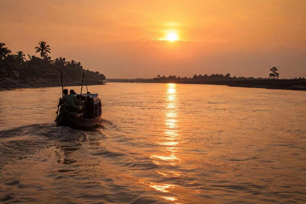
Every journey through the Sundarbans ends the same way—not with a destination, but with another river.
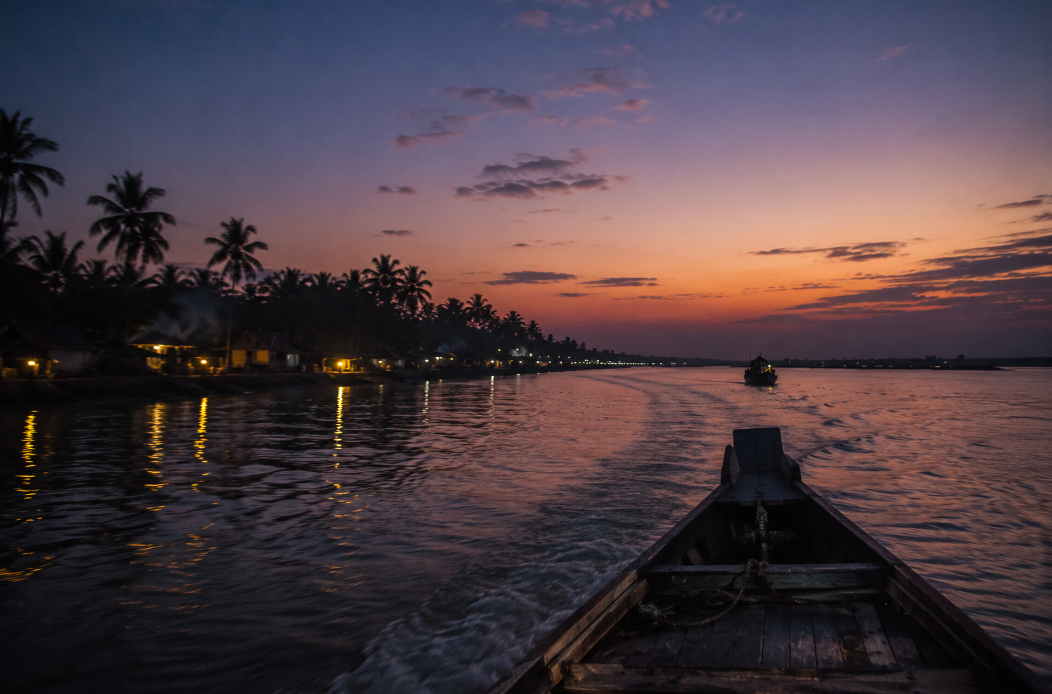
As the boat eases away from Bali Island, the shoreline begins to dissolve into the evening tide.
- The voices from the jetty fade first.
- Then the fishing boats become silhouettes.
- Palm trees merge with the darkening sky until the embankment itself becomes little more than a thin line between water and horizon.
For a few quiet minutes, it is impossible to tell where the island ends and the river begins.
Perhaps that is the greatest lesson Bali Island offers. Here, nothing exists in isolation.
- The rivers shape the land.
- The mangroves protect the rivers.
- The tides feed the forests.
- The forests shelter wildlife.
And the people have learned to build their lives within that endless cycle, never attempting to conquer the delta, only to understand it.
Long after the island disappears from view, its rhythms remain.
- The habit of measuring time by the tide rather than the clock.
- The embankments were built not once, but generation after generation.
- The quiet confidence of boatmen reading currents invisible to unfamiliar eyes.
- The resilience of communities that have accepted change as part of everyday life.
Maps will always show Bali Island as a fixed piece of land.
The delta knows otherwise.
- Every tide redraws its edges.
- Every monsoon reshapes its future.
- Every cyclone tests its resolve.
Yet every sunrise begins another chapter. That is why Bali Island is more than an island.
It is one expression of a living delta—where rivers are roads, mangroves are guardians, and survival has always been measured not by permanence, but by the ability to adapt.
As darkness settles across the Bidya River and the last outline of the island fades into the horizon, the journey does not feel complete.
It feels like an invitation.
Because in the Sundarbans, there is always another river to follow, another island beyond the tide, and another story waiting to be discovered.
CTA: Start Your Sundarbans Expedition
Plan your private Sundarban expedition
A private journey shaped around you — your group, your pace, your interests. Book a free consultation.