 Encyclopedia
Before sunrise, the fishing harbor at Frazergunj wakes not with noise, but with friction.
Ropes grind against wet timber.
Diesel engines cough awake in the dark.
Men move through mist carrying crates of ice on their shoulders while the Bay of Bengal breathes somewhere beyond the embankments — unseen, but always audible. The tide is withdrawing. Mudbanks emerge like ancient skin from beneath the water.
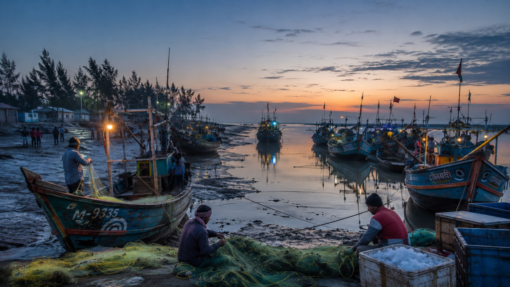
At this hour, the island does not resemble a beach destination. It resembles a working frontier.
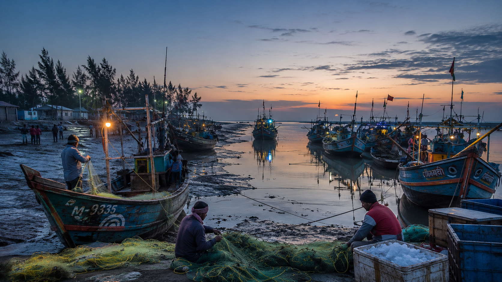
A lantern swings from the side of a trawler painted in fading turquoise and saffron. Beside it, a fisherman untangles nylon nets with fingers roughened by saltwater and years of river abrasion.
Another boat prepares for a journey that may last six days. Some crews will head toward deeper coastal waters beyond Jambudwip. Others will remain closer to the estuarine channels where the rivers dissolve into the sea.
Frazergunj belongs to that unstable edge of Bengal where geography never fully settles.
It is not entirely an island.
- Not entirely mainland.
- Not entirely forest.
- Not entirely coast.
It exists in transition.
And that is its identity.
Unlike the tiger-haunted forest interiors farther east in the Sundarbans, Frazergunj is a maritime threshold — a fishing settlement, storm frontier, wind corridor, migratory bird landscape, and historical coastal outpost shaped less by dense mangroves than by tides, fisheries, embankments, and the restless pull of the sea.
By dawn, the eastern sky over Bakkhali Creek begins turning silver.
Egrets drift low over the mudflats.
The smell of fish, salt, engine oil, drying nets, and tidal silt mixes into the unmistakable scent of Bengal’s southern edge.
The day on the island has begun.
First Encounter
The approach to Frazergunj is deceptive.
The road from Kolkata travels south through Diamond Harbour, Kakdwip, and Namkhana before crossing the Hatania-Doania River — one of the tidal gateways into the lower delta.
Beyond that crossing, the landscape changes almost imperceptibly.
- The trees become shorter.
- Salt begins appearing in the soil.
- Fish ponds replace agricultural plots.
- Wind bends the casuarina lines inland.
Then comes Bakkhali.
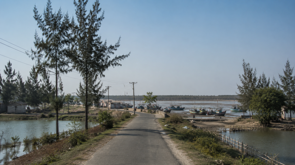
And just beyond it, quieter and more exposed to the sea, lies Frazergunj.
The shoreline here does not rise dramatically from the water. It spreads outward in mudflats, tidal stretches, fishing jetties, and low embankments. Boats dominate the horizon more than buildings do. Even the settlement seems temporary in spirit, as if aware that the Bay has erased older versions of this coastline many times before.
The first thing most visitors notice is the harbor.
Hundreds of fishing trawlers cluster together in narrow tidal channels, painted in startling colors that resist the grayness of the estuary. Their names — often invoking deities, mothers, rivers, or luck — are written in Bengali script across weathered hulls.
Here, movement depends entirely on tide schedules.
- Boats lean sideways in low tide mud.
- Children walk barefoot across exposed creek beds.
- Dogs sleep beneath drying nets.
- Women sort fish beneath tarpaulin roofs while gulls circle overhead.
Frazergunj announces itself not through monuments, but through labor.
Island Identity
Administratively, Frazergunj lies in the Namkhana Block of the South 24 Parganas district in southern West Bengal. It forms part of the wider Bakkhali–Frazergunj coastal zone at the western edge of the Indian Sundarbans.
Historically, the area was once known as Narayanitala before becoming associated with Andrew Fraser, the Lieutenant Governor of Bengal during the early twentieth century. Over time, “Fraser’s Ganj” evolved linguistically into Frazergunj.
But administrative descriptions alone fail to explain the place.
Frazergunj behaves more like a coastal organism than a conventional settlement.
- The sea determines routines.
- The tide determines the economy.
- Cyclones determine architecture.
- Migration determines demographics.
Unlike the densely inhabited agricultural islands deeper within the Sundarbans, Frazergunj developed around fisheries, transport routes, and coastal access. It sits close to the interface between riverine Bengal and the open Bay of Bengal, making it both vulnerable and strategically important.
The settlement pattern reflects this uncertainty.
- Homes cluster behind embankments.
- Fishing infrastructure occupies the waterfront.
- Tourism overlaps uneasily with working maritime life.
- Wind turbines rise unexpectedly above palm groves and fish markets.
The island is surrounded not by silence, but by movement — tidal creeks, estuarine currents, fishing vessels, migratory birds, and seasonal human departures toward deeper waters.
The Rivers That Shaped The Island
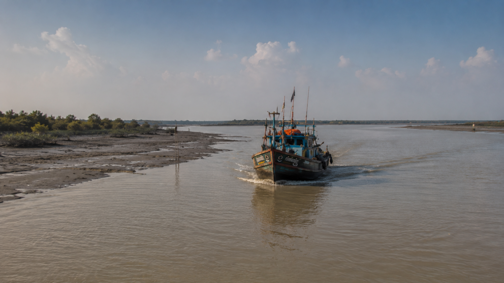
In the Sundarbans, rivers are never merely rivers.
They are borders, roads, economies, disasters, memory systems, and living maps.
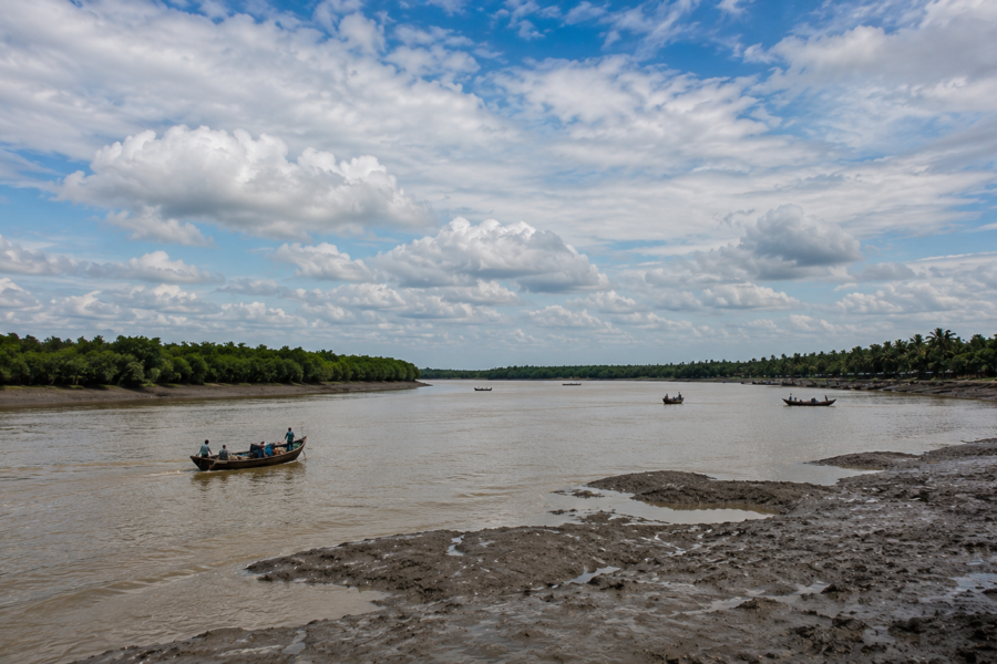
The Hatania-Doania River — crossed before reaching the southern coast — functions as one of the principal tidal arteries linking mainland Bengal with the lower delta settlements. Beyond it, numerous creeks and channels lace through the landscape toward the Bay.
At Frazergunj, freshwater has already begun surrendering to salinity.
The rivers here widen and flatten.
Their banks dissolve easily.
Tidal rhythms overpower linear flow.
Water moves inland and outward in cycles that dictate fishing schedules, ferry timing, and embankment anxiety.
Older residents still remember when sections of shoreline stood farther outward than they do today.
The sea advances quietly here.
Not dramatically every day.
But persistently.
Fishing boats departing from Frazergunj often navigate through a maze of estuarine channels before reaching deeper marine waters. These waterways historically connected fishing communities from Namkhana, Kakdwip, Sagar Island, and farther coastal regions.
The rivers also brought migration.
After Partition, fishing communities from East Bengal — particularly from coastal districts skilled in marine fishing — established camps and settlements across coastal Sundarban zones, including Frazergunj.
Their knowledge transformed the maritime economy of the region.
Even today, listening to fishermen discuss tides, currents, storm behavior, or fish movement feels less like conversation and more like oral navigation science refined across generations.
Historical Footprints
The history of Frazergunj is deeply tied to ambition — specifically colonial ambition confronted by tidal reality.
In the early 1900s, Sir Andrew Fraser visited this stretch of coast and reportedly became captivated by its windswept beaches and isolation. He envisioned developing the area into a coastal retreat or sanatorium.
But the coast refused permanence.
- Storms repeatedly damaged structures.
- The sea reclaimed land.
- Construction remained fragile.
Fragments associated with Fraser survived for decades near the coast until severe cyclonic activity and erosion erased much of the remaining historical structure. Cyclone Yaas in 2021 reportedly destroyed the remnants of Fort Fraser, removing another visible layer of the region’s colonial memory.
Yet history here exists less in architecture and more in adaptation.
Fishing transformed the region more profoundly than colonial administration ever did.
Through the mid-twentieth century, the coastal fisheries economy expanded rapidly. Harbors developed. Ice storage facilities appeared. Boat repair yards emerged. Families settled permanently around marine trade networks.
Frazergunj evolved into one of Bengal’s important coastal fishing zones.
The harbor became its true monument.
Historical Personalities & Transformations
Frazergunj does not possess the monumental biographies associated with royal capitals or nationalist strongholds. Its transformations emerged collectively through fishermen, boat-makers, migrant laborers, traders, embankment workers, and storm survivors.
Yet one historical figure remains inseparable from the island’s identity: Sir Andrew Fraser.
His attempt to establish a colonial coastal retreat altered the geographical imagination of the region. Even though much of that dream dissolved into storms and erosion, the name survived — lingering longer than the buildings themselves.
But the deeper architects of Frazergunj were anonymous.
- Boat carpenters who adapted hulls to shallow estuarine channels.
- Women who sustained fish-processing economies.
- Migrant fishing communities who introduced marine techniques from eastern Bengal.
- Engine mechanics who modernized trawler fleets.
- Local traders who linked the harbor to Kolkata’s fish markets.
Transformation here came through labor rather than proclamation.
The island changed gradually:
- From the forest-edge coast
- To the fishing camp
- To the marine settlement
- To cyclone frontier
- To a hybrid tourism-fishing landscape.
And through every transformation, the tide remained the only permanent authority.
Life Between The Tides
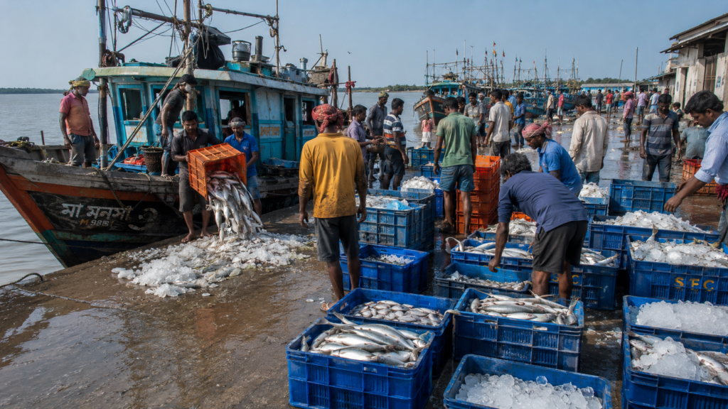
By late morning, the harbor reaches full intensity.
Fish arrive in waves.
- Hilsa during the right season.
- Pomfret.
- Bombay duck.
- Ribbonfish.
- Prawns.
- Mud crab.
- Silver shoals are packed tightly in crushed ice.
Auction voices rise above engine noise while workers move quickly across slippery concrete platforms washed repeatedly with brackish water. The harbor smells intensely alive — salt, diesel, fish blood, wet rope, smoke, seaweed, and sun-heated timber combining into a scent inseparable from coastal Bengal.
The fishing economy governs the island’s rhythm.
- Boats leave according to tide windows.
- Crews track lunar cycles carefully.
- Storm forecasts alter entire schedules.
- Families measure time not by calendars, but by return journeys.
A successful voyage changes household fortunes for weeks.
A failed voyage deepens debt.
Many fishing expeditions last several days in offshore waters. Crews sleep on narrow wooden platforms inside trawlers while waves hammer against aging hulls. Cyclonic depressions form quickly in the Bay. Every fisherman here knows someone who never returned.
And yet departure continues.
At midday, away from the harbor, quieter routines emerge.
- Women clean courtyards shaded by coconut and betel nut palms.
- Schoolchildren cycle along embankment roads.
- Tea stalls fill with arguments about diesel prices, fish auctions, weather bulletins, and politics.
- Elderly men sit facing tidal creeks as though reading water.
Life in Frazergunj is inseparable from uncertainty.
That uncertainty shapes temperament itself.
Walking Through The Villages
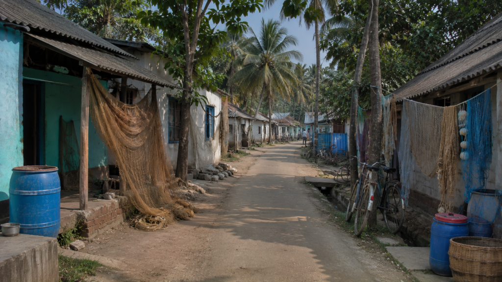
The villages around Frazergunj are low and wind-shaped.
Homes rarely attempt grandeur. Most structures prioritize survival over permanence.
- Concrete houses stand beside tin-roofed dwellings patched repeatedly after storms.
- Verandas hold fishing nets instead of ornamental plants.
- Bamboo fencing leans unevenly under salt-heavy air.
The courtyards reveal more about the island than the roads do.
- Nets drying in loops.
- Plastic drums storing rainwater.
- Boats under repair.
- Children repairing bicycle tires.
- Women sorting shrimp fry.
- Cats sleeping beneath upside-down fishing baskets.
Temples appear modest but deeply active. Small shrines dedicated to Kali, Manasa, Bonbibi, or local deities stand near embankments and crossroads. In fishing communities, ritual protection remains woven into everyday life.
Mosques too form part of the island’s rhythm, especially among fishing families with roots tracing across the delta’s fluid historical migrations.
In tea stalls, conversation drifts constantly toward water.
- Someone mentions embankment breaches from earlier cyclones.
- Another discusses declining fish availability.
- Someone else recalls when the beach extended farther seaward decades ago.
The island stores memory through comparison.
Everything is measured against what the sea has taken.
Sounds Of The Island
Frazergunj can almost be understood through sound alone.
Before dawn: engines coughing awake.
Morning: fish auctions and gull calls.
Afternoon:
- hammering from boatyards,
- wind through casuarina groves,
- bicycle bells on embankment roads.
Evening:
- mosquitoes rising from tidal flats,
- distant temple bells,
- generators humming through power fluctuations.
And always beneath everything: water.
Not crashing dramatically like ocean surf alone, but shifting constantly through channels, creeks, mudbanks, sluice gates, and harbor edges.
- At high tide, the island sounds fuller.
- At low tide, it sounds exposed.
The mud itself changes acoustics.
- Footsteps squelch differently.
- Bird calls carry farther.
- Boats scrape creek beds with hollow wooden groans.
Even silence in Frazergunj feels tidal.
Wildlife Expedition
Frazergunj belongs to an ecological transition zone where marine waters, tidal mudflats, mangrove systems, and human settlements overlap uneasily.
Wildlife here reveals itself patiently. The most visible residents are birds.
- Egrets stalk exposed mud during low tide.
- Lesser sand plovers move rapidly across tidal flats.
- Kingfishers flash electric blue along creeks.
- Brahminy kites circle above fishing harbors waiting for discarded catch.
- Cormorants dry their wings atop abandoned poles.
During migratory seasons, the wider coastal region around Bakkhali and nearby Jambudwip attracts numerous winter visitors. Sandbanks and mudflats become temporary resting grounds for migratory shorebirds traveling enormous distances along the Central Asian Flyway.
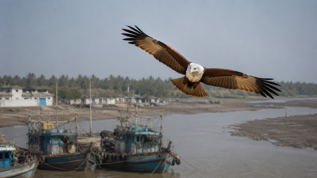
The tidal ecology supports crustaceans, mollusks, juvenile fish populations, and mud-dwelling organisms essential to the broader coastal food chain.
Dolphins occasionally appear in estuarine waters farther from the harbor, though sightings remain unpredictable and seasonal.
Reptiles survive quietly along embankments and wetlands:
- water snakes
- monitor lizards
- occasional turtles in nearby coastal zones
Unlike deeper Sundarban interiors, Frazergunj is not known primarily for tiger encounters. Yet the psychological presence of the mangrove wilderness still lingers culturally. The forest remains near enough to shape imagination, ritual, and caution.
Nature here does not dominate visibly.
It persists in fragments between human systems.
Mangrove Chronicles
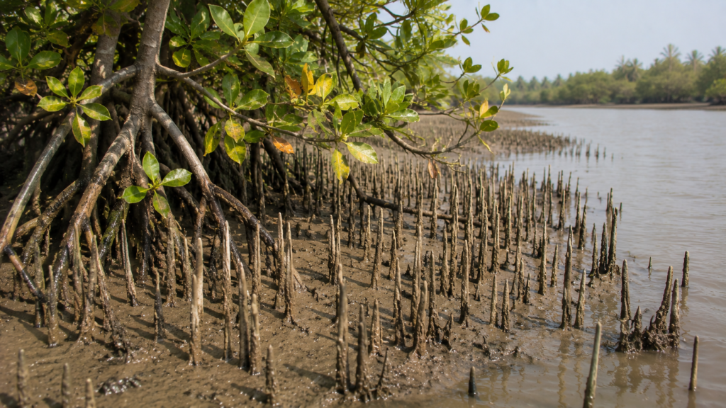
The mangroves near Frazergunj are thinner and more fragmented than the dense forest belts farther east in the Sundarbans Biosphere Reserve, yet they remain ecologically critical.
They function as living barriers.
- Roots trap sediment.
- Vegetation reduces erosion.
- Mangrove belts soften storm surges.
- Creeks nurture juvenile marine life.
Species found across nearby coastal zones include gewa, goran, keora, and patches of sundari in suitable salinity conditions elsewhere in the broader delta ecosystem.
But mangroves here exist under pressure.
- Aquaculture expansion
- coastal erosion
- cyclones
- tourism infrastructure
- salinity shifts
Also, embankment modifications have altered older ecological balances. Some residents speak nostalgically about the thicker coastal vegetation decades ago.
Others view mangroves pragmatically: as storm defense.
After devastating cyclones, communities across coastal Bengal increasingly recognized that embankments alone cannot resist the Bay indefinitely. Mangrove restoration initiatives in several coastal belts emerged partly from lived catastrophe rather than abstract conservation theory.
In Frazergunj, ecology is rarely philosophical. It is practical survival.
Folklore & Legends
Stories in Frazergunj travel through harbors more than forests.
The classic Sundarban legends of Bonbibi, Dakshin Ray, and Shah Jongoli remain culturally present, especially among fishing communities familiar with forest-edge traditions. Though Frazergunj itself sits closer to marine fishing zones than tiger-dense mangrove interiors, spiritual protection remains deeply embedded in occupational life.
Some trawlers carry painted images of Bonbibi near the cabin entrance.
Others display Islamic verses, Hindu symbols, or combinations of both.
Before dangerous journeys, prayers are still offered quietly. Older fishermen speak less about mythical tigers and more about the sea itself becoming unpredictable.
Storms gain personalities in oral memory.
Cyclones are remembered by names, dates, water heights, breached embankments, lost boats, and vanished homes.
One recurring coastal belief persists across many delta communities: The sea always gives a warning.
- Bird movement changes.
- Wind direction alters strangely.
- Tides behave unevenly.
- The air becomes unnaturally heavy.
Whether scientifically measurable or not, such observations form part of the island’s inherited environmental intelligence.
And in places where survival depends on reading nature correctly, folklore and experience often merge.
Explorer’s Field Notes
See it for yourself
A private journey shaped around you — your group, your pace, your interests. Book a free consultation.
06:10 AM — The first trawlers begin preparing for departure before sunrise, taking advantage of favourable tidal conditions.
07:25 AM — The fish landing centre is busiest during the morning, when freshly landed catches are unloaded, sorted, and auctioned.
09:40 AM — Brahminy kites and house crows gather above the harbour, attracted by fish offal left after sorting.
11:15 AM — Exposed mudflats reveal hundreds of small crab burrows until the returning tide gradually covers them again.
12:45 PM — The smell of diesel, saltwater, and drying fishing nets becomes strongest around the working harbour.
02:10 PM — Casuarina trees along the embankment lean inland, shaped by years of persistent coastal winds.
03:35 PM — Salt leaves visible marks on boat hulls, metal fittings, and concrete surfaces exposed to sea spray.
04:50 PM — As the tide rises, grounded trawlers slowly become afloat, allowing repairs and loading work to resume.
05:40 PM — The late afternoon light reflects from rows of colourful fishing boats, creating one of the harbour’s most photogenic moments.
06:20 PM — Even after sunset, engine maintenance and net repairs continue for boats preparing for their next fishing voyage.
Nightfall On The Island
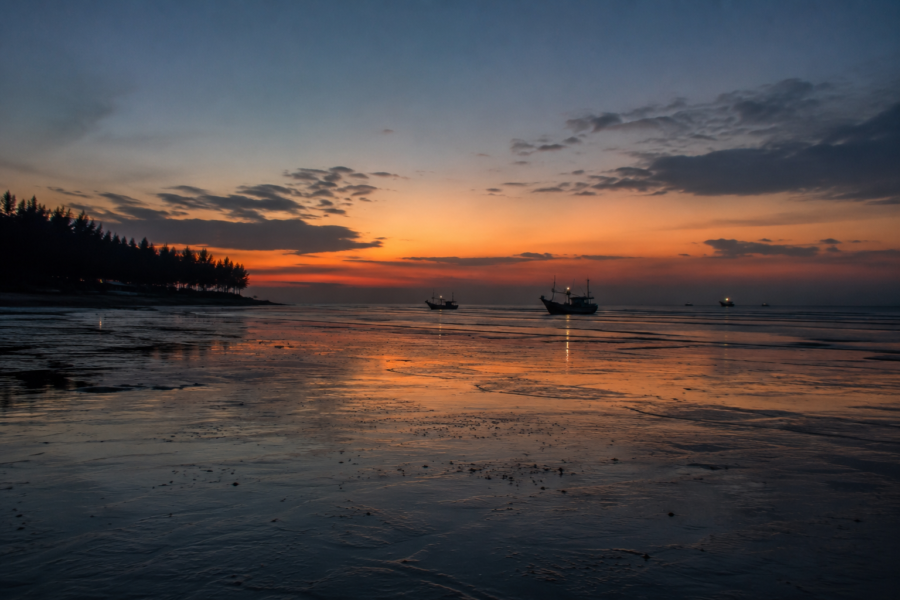
Sunset arrives slowly over Frazergunj.
The harbor darkens first.
- Fishing boats return through orange water carrying silhouettes instead of detail.
- Nets hang like exhausted wings from bamboo poles.
- Smoke rises from roadside kitchens preparing rice, fried fish, lentils, and green chilies for returning crews.
The sky widens dramatically after dusk.
Without major urban light pollution, the coastal horizon remains unusually open. Wind turbines blink red in the distance. Tidal creeks reflect scattered moonlight between mangrove shadows and moored boats.
Night changes the island’s emotional texture.
Daytime labor softens into caution.
- Cyclone stories emerge more easily after dark.
- Missing fishermen are remembered.
- Weather bulletins become serious conversation.
Generators hum through temporary power cuts while dogs bark toward unseen movement near embankments.
The sea grows louder at night. Not necessarily rougher. Only more audible.
And sometime after midnight, when most houses have gone quiet, trawlers preparing for dawn departure begin restarting their engines.
Frazergunj never fully sleeps.
The Seasons Of The Island
Winter
Winter transforms Frazergunj into its most navigable season.
The air becomes dry and comparatively gentle. Migratory birds appear along mudflats and coastal stretches. The sky sharpens into clear blue horizons, making this the best period for photography, long embankment walks, and marine observation.
Fishing activity remains intense during this season, and mornings often begin wrapped in silver fog drifting over tidal channels.
Spring
Spring is brief and transitional.
The wind shifts gradually warmer. Salt accumulates visibly along exposed surfaces. Casuarina groves whisper continuously under strengthening coastal airflow. Fish markets grow busier before pre-monsoon weather instability begins affecting marine schedules.
Summer
Summer in Frazergunj is harsh.
- Humidity thickens.
- Metal burns under sunlight.
- The tidal mud releases a dense saline odor during low tide.
Afternoon heat empties roads quickly. Work continues in the harbor because it must, not because conditions permit comfort.
Thunderstorms occasionally erupt suddenly from the Bay, offering temporary relief.
Monsoon
Monsoon redraws the island.
- Creeks swell.
- Roads flood.
- Fishing schedules collapse unpredictably.
- Cloud formations dominate the horizon.
Rainwater becomes precious despite the flooding because freshwater storage remains essential in saline environments.
During heavy monsoon weeks, the island feels less anchored and more afloat.
Post-Monsoon
Post-monsoon months bring restoration and damage assessment simultaneously.
Repair work intensifies:
- boats
- roads
- embankments
- homes
- electrical lines
Vegetation appears greener after rain, but erosion scars become more visible too.
Cyclone Season
Cyclone season is not merely meteorological here.
It is psychological.
Every depression forming over the Bay is monitored carefully. Every warning triggers memory.
Supplies are checked.
Boats are secured.
Families remain alert through sleepless nights, listening to the wind intensify against embankments.
In Frazergunj, the weather is never background.
It is an authority.
Cyclones And Survival
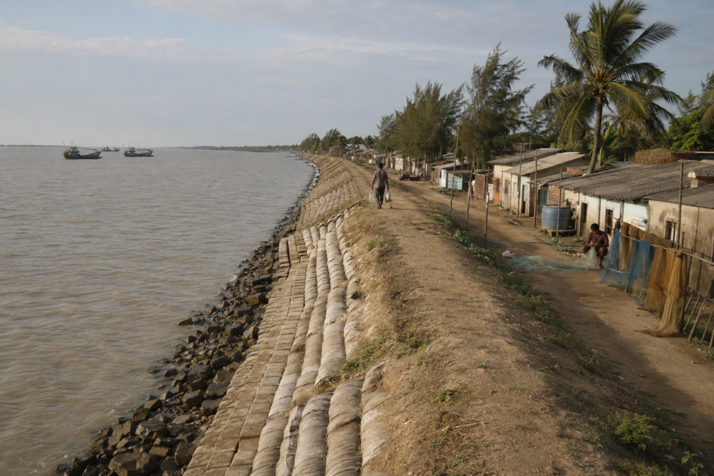
To understand Frazergunj fully, one must understand cyclones.
- They are not isolated disasters here.
- They are recurring chapters.
Cyclones such as Aila, Amphan, Bulbul, Yaas, and others left deep physical and emotional marks across coastal South Bengal.
- Embankments breached.
- Saline water entered homes and ponds.
- Fisheries suffered enormous losses.
- Transportation collapsed.
- Shorelines shifted.
Residents still describe cyclones spatially.
How high the water rose.
- Which embankment failed first?
- Which road disappeared?
- Which trees survived?
Cyclone Aila in 2009 remains especially significant in collective memory across the Sundarbans. Many coastal communities experienced catastrophic flooding and long-term salinity intrusion after embankment failures.
Then came Amphan in 2020.
- Wind ripped through casuarina belts.
- Electric poles collapsed.
- Fishing infrastructure suffered severe damage.
Even historical remnants linked to Fraser reportedly vanished permanently after subsequent erosion and cyclonic activity.
Yet recovery begins quickly in Frazergunj because waiting is economically impossible.
- Boats must return.
- Nets must be repaired.
- Markets must reopen.
Resilience here is rarely romanticized by residents themselves.
It is exhausting work.
Ferry Routes & Hidden Paths
Reaching Frazergunj is itself an expedition through changing geographies.
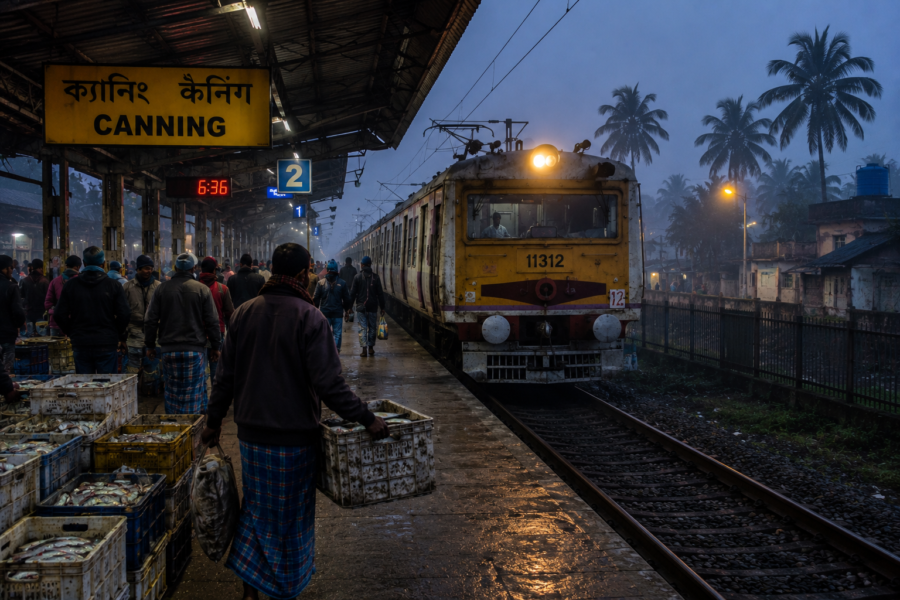
From Kolkata, the journey moves southward by rail or road toward Namkhana. Travelers typically pass through Diamond Harbour, Kakdwip, and the Hatania-Doania crossing before continuing toward Bakkhali and Frazergunj.
Older travelers still remember when ferry crossings formed a more unpredictable part of the route before bridge infrastructure improved regional connectivity.
Yet water remains central to movement.
- Small boats continue operating across local channels.
- Fishing routes extend deep into estuarine networks.
- Tidal timing still affects accessibility in subtler ways.
Some of the most revealing paths around Frazergunj are not official routes at all:
- embankment walks at dawn
- mudflat crossings during low tide
- narrow harbor lanes lined with repair workshops
- creekside stretches where migratory birds gather quietly
Exploration here rewards slowness. The island rarely reveals itself to hurried visitors.
Photography Expedition Guide
Frazergunj offers unusual photographic contrasts rarely found together in a single coastal landscape.
Sunrise Photography
The best sunrise moments occur near the harbor edges and tidal mudflats where fishing boats depart under low mist and silver dawn light. Winter mornings are especially atmospheric.
Sunset Photography
Sunset over the wider Bakkhali–Frazergunj coastline produces long reflections across tidal water and wet sand. Returning trawlers create striking silhouettes.
Wildlife Photography
Bird photography opportunities increase during migratory seasons, especially around mudflats, creeks, and nearby coastal stretches, including Jambudwip-facing waters.
Telephoto lenses are useful because wildlife observation here often happens across large open tidal distances.
Cultural Photography
The fishing harbor itself forms the island’s most powerful documentary subject:
- boat repair,
- fish auctions
- net mending
- ice loading
- departure rituals
- storm preparation
Monsoon Photography
Storm clouds over tidal estuaries create dramatic atmospheric conditions, though equipment protection becomes essential due to rain, wind, and saline moisture.
Expedition Notes
Before setting out to explore Frazergunj, keep these observations in mind:
- Fishing Harbour First: Frazergunj is a working fishing settlement. Harbour activity is most active during the morning fish landing and auction.
- The Tide Changes Everything: Large areas of mudflat appear during low tide and disappear again within a few hours. The landscape can look completely different between successive tides.
- Carry Sun Protection: Much of the embankment and harbour offers little natural shade, particularly during late morning and afternoon.
- Expect Strong Coastal Winds: Sea breezes are common throughout the day, especially along the embankments and open shoreline.
- Look Beyond the Beach: Some of Frazergunj’s most distinctive landscapes are found around the fishing harbour, tidal creeks, and boat repair yards rather than along the coast itself.
- Watch the Sky: Weather conditions over the Bay of Bengal can change quickly, making the horizon an important part of the island’s daily rhythm.
- A Photographer’s Detail: Early morning and late afternoon provide the softest light for documenting fishing boats, harbour life, and tidal landscapes.
- Observe Quietly: Fishing boats, repair yards, and landing centres are active workplaces. A respectful distance allows both better observation and uninterrupted local activity.
Connected Landscapes
Frazergunj cannot be understood in isolation.
It belongs to a wider tidal geography linking Bakkhali, Namkhana, Sagar Island, Jambudwip, Henry’s Island, and the broader estuarine corridors of the western Sundarbans.
These landscapes remain ecologically connected even when administratively separate.
- Fish populations move through shared waters.
- Migratory birds travel across coastal mudflats.
- Storm systems strike entire coastlines without respecting boundaries.
- Fishing crews migrate seasonally between harbors.
Jambudwip, visible offshore under favorable conditions, carries its own layered history as a seasonal fishing island and ecologically sensitive zone. Henry’s Island, with its mangrove stretches and quieter wetlands, forms another connected coastal habitat nearby.
The Hatania-Doania River links inland Bengal to these coastal worlds like a tidal bloodstream.
Cultural connections run equally deep.
- Fishing techniques
- boat designs
- food traditions
- storm rituals
- migration histories
All circulate across islands and estuarine settlements. Frazergunj exists not as an isolated endpoint, but as one node within a vast amphibious civilization shaped by water.
Oral Histories
Many older residents describe earlier decades through absence.
- Fewer tourists.
- More shoreline.
- Thicker vegetation.
- Different fish patterns.
Some recall when fishing boats depended less on mechanized engines and more on tidal timing and inherited navigation knowledge. Others remember devastating storms before modern warning systems improved.
One recurring memory concerns erosion.
Elders point toward open water and describe locations where land once existed. Entire sections of coastline, they say, shifted gradually over the years until memory became the only remaining map.
Some oral accounts describe tiger sightings from earlier decades in more isolated coastal stretches closer to mangrove zones, though such encounters are not associated with modern central Frazergunj settlement life.
Stories about storms remain especially vivid.
People remember:
- Which tree survived
- Which embankment failed
- Who sheltered where
- How long has saline water remained trapped inside fields and ponds?
Disaster becomes chronology in coastal Bengal. Years are often recalled through cyclones rather than calendars.
Food Of The Island
Food in Frazergunj emerges directly from the tide, season, and labor.
Fish dominate daily life, but not in ceremonial excess. Here, seafood is practical, immediate, and deeply tied to livelihood.
Morning markets carry fresh catches unloaded only hours earlier:
- Pomfret
- prawns
- bhetki
- bombay duck
- Crab
Small estuarine fish cooked whole with mustard or salt-heavy spice blends. Dry fish processing appears seasonally in nearby coastal zones, especially where sunlight and open wind aid preservation.
Meals tend to remain functional for working households:
- rice
- lentils
- fried fish
- green chilies
- onions
- salt-preserved accompaniments.
Tea stalls form another essential part of the island’s food culture.
Sweet tea arrives in thick glasses beside fried snacks, biscuits, or muri mixed with mustard oil and chopped onions. Conversations around fishing conditions and weather forecasts accompany nearly every serving.
During storms and difficult seasons, food patterns shift noticeably.
- Fish availability changes.
- Freshwater becomes limited.
- Stored staples gain importance.
The island’s cuisine reflects adaptation more than indulgence.
Island Economy
Fishing remains the economic spine of Frazergunj.
Marine fisheries support not only boat crews, but ice suppliers, repair workshops, auction systems, transport workers, traders, mechanics, and countless secondary occupations.
The harbor connects local livelihoods directly to urban markets in Kolkata and beyond.
Yet the economy is increasingly layered.
Tourism linked to nearby Bakkhali brings seasonal income through lodges, transport services, eateries, and small commerce. Renewable energy infrastructure — particularly wind power installations — introduced another unusual dimension to the coastal economy.
Still, economic vulnerability remains constant.
- Fuel prices affect fishing viability.
- Cyclones destroy infrastructure.
- Fish populations fluctuate.
- Erosion threatens settlement stability.
- Migration pulls younger generations toward cities.
Some households maintain mixed survival strategies: fishing plus tourism work, small trade plus migration income, seasonal labor plus aquaculture.
The island survives economically through diversification because dependence on any single system has become too risky.
Then & Now
Old photographs of coastal Bengal often reveal landscapes that appear wider, quieter, and less defended.
Frazergunj today feels more engineered than it once did.
- Embankments are stronger in some stretches.
- Concrete structures replaced older materials.
- Road connectivity improved dramatically.
- Electricity and communication networks expanded.
But environmental pressure intensified simultaneously.
- Sea-level concerns
- erosion
- salinity intrusion
- cyclonic intensity
- changing fisheries
- tourism pressure
All altered the relationship between people and landscape. The psychological distance between the mainland and coast has also narrowed. What once felt remote now lies within weekend reach from Kolkata. Yet despite improved access, the essential uncertainty of the place remains unchanged.
- The tide still rewrites edges.
- Storms still redraw priorities.
- The Bay still determines final authority.
The Wild Orbit Quick Facts
- Location: Frazergunj, South 24 Parganas, West Bengal, India
- Region: Western coastal fringe of the Indian Sundarbans
- Administrative Block: Namkhana Block
- Nearest Town: Bakkhali
- District: South 24 Parganas
- Landscape Type: Coastal fishing settlement with tidal mudflats and estuarine shoreline
- Dominant Ecosystem: Estuarine and coastal ecosystem
- Nearby Habitats: Mudflats, tidal creeks, coastal vegetation, mangrove patches, Bay of Bengal shoreline
- Tidal Influence: Semi-diurnal tides shape daily harbour activity and shoreline appearance
- Common Birds: Brahminy Kite, Little Egret, Pond Heron, House Crow, White-throated Kingfisher
- Seasonal Visitors: Migratory shorebirds during winter
- Marine Life: Estuarine fish, mud crabs, prawns and other coastal fisheries
- Primary Identity: Working fishing harbour and coastal frontier settlement
- Nearest Railway Station: Namkhana
- Nearest Major River Crossing: Hatania–Doania River
- Best Season for Exploration: November to February
- Main Livelihoods: Marine fishing, fish trading, tourism and local commerce
- Major Environmental Challenges: Cyclones, coastal erosion, salinity intrusion and sea-level rise
The Wild Orbit Expedition Snapshot
Accessibility: 8/10
One of the more accessible coastal Sundarban landscapes from Kolkata, though weather and tidal conditions still influence movement.
Wildlife Potential: 6.5/10
More rewarding for birdlife and estuarine ecology than large mammal sightings.
Photography Potential: 9/10
Exceptional harbor scenes, tidal landscapes, migratory birds, storms, and documentary coastal life.
Cultural Richness: 8/10
Fishing traditions, migration histories, storm resilience, and tidal livelihoods create deep anthropological interest.
Historical Interest: 7/10
Colonial-era associations, fisheries development, and coastal transformation offer layered historical narratives.
Solitude Level: 5/10
Less isolated than the deeper Sundarban islands, especially during the tourism season, though quiet pockets still exist beyond the main beach corridor.
The Wild Orbit Explorer Connections
Explorers drawn to Frazergunj often continue toward:
- Bakkhali’s long coastal stretches
- Henry’s Island wetlands and mangrove edges
- Namkhana’s tidal crossings
- Sagar Island’s pilgrimage and estuarine landscapes
- Jambudwip’s contested ecological territory
- Interior Sundarban river systems, farther east
- Fishing settlements along the lower delta coast
Together, these landscapes reveal different faces of the Sundarbans: forest, harbor, pilgrimage route, erosion frontier, bird habitat, storm corridor, human survival zone.
FAQs
1. Where is Frazergunj located?
Frazergunj is located in the Namkhana Block of South 24 Parganas district in southern West Bengal near Bakkhali on the western edge of the Sundarbans coastal region.
2. Is Frazergunj an island?
It functions as part of the tidal island-coastal landscape of the lower delta, though improved road connectivity has reduced the sense of isolation once associated with the region.
3. What is Frazergunj most known for?
Primarily for its fishing harbor, coastal landscape, proximity to Bakkhali, and maritime economy.
4. Why is it called Frazergunj?
The settlement became associated with Sir Andrew Fraser, a colonial administrator who envisioned developing the coast during the early twentieth century.
5. Is Frazergunj part of the Sundarbans?
Yes, it lies within the broader Sundarbans coastal ecosystem, though its ecology differs from the dense mangrove interiors farther east.
6. Are there mangroves in Frazergunj?
Yes, nearby coastal and estuarine zones contain mangrove vegetation, though not in the dense formations found deeper inside protected forest regions.
7. Is Frazergunj good for birdwatching?
Yes. Migratory shorebirds and coastal birdlife make winter particularly rewarding for bird observation.
8. Can tigers be seen in Frazergunj?
Tiger sightings are not associated with the central settlement area. The island is more closely linked to fisheries and coastal ecology.
9. What is the best season to visit?
Winter and early post-monsoon months offer the clearest weather and most stable exploration conditions.
10. How important is fishing to the island?
Fishing forms the core economic activity supporting much of the local population.
11. Are cyclones common?
Yes. The region remains highly vulnerable to Bay of Bengal cyclones.
12. What kind of boats operate from the harbor?
Mechanized marine fishing trawlers dominate the harbor landscape.
13. Is Frazergunj different from Bakkhali?
Yes. Bakkhali functions more as a beach settlement, while Frazergunj retains a stronger working-harbor identity.
14. What wildlife can be seen nearby?
Birdlife, estuarine species, crabs, reptiles, and occasional dolphin sightings in wider coastal waters.
15. What are the roads like?
Road connectivity has improved significantly, though monsoon conditions may affect travel.
16. Are there ferries nearby?
Yes. Ferry and river-crossing systems remain central to regional connectivity.
17. What is the landscape like?
Tidal mudflats, embankments, fishing infrastructure, coastal vegetation, and estuarine waterways dominate the terrain.
18. Is the sea eroding the coast?
Yes. Erosion remains a serious long-term concern in many coastal stretches.
19. What languages are spoken?
Bengali is the dominant language.
20. Is freshwater scarce?
Freshwater management remains a significant challenge due to salinity.
21. Are there wind turbines in the area?
Yes. Frazergunj is known for coastal wind-energy infrastructure.
22. What food is most associated with the island?
Fresh seafood and fish-based daily meals dominate local cuisine.
23. Is the harbor active year-round?
Mostly yes, though weather conditions strongly affect fishing schedules.
24. Does tourism affect the island?
Yes. Tourism linked to nearby Bakkhali influences the local economy and landscape.
25. What makes Frazergunj unique within the Sundarbans?
It’s identity as a tidal fishing frontier where harbor life, storm survival, coastal ecology, and estuarine geography intersect.
How To Reach Frazergunj
Reaching Frazergunj is less about arriving at a destination and more about watching the landscape gradually transform from mainland Bengal into the tidal frontier of the western Sundarbans. Paddy fields give way to aquaculture ponds, freshwater gradually yields to salinity, and fishing boats begin replacing buses as the most familiar sight.
From Kolkata by Road
Frazergunj is located approximately 130 km south of Kolkata and can usually be reached in 4–5 hours, depending on traffic and road conditions.
The most common route follows:
Kolkata → Diamond Harbour → Kakdwip → Hatania–Doania Bridge → Namkhana → Bakkhali → Frazergunj
Since the completion of the Hatania–Doania Bridge, travellers no longer need the traditional ferry crossing that once formed an essential part of the journey. The final stretch passes through coastal villages, fish ponds, casuarina plantations, and the tidal landscapes of the lower delta.
By Rail
The nearest railway station is Namkhana, connected to Sealdah via the Sealdah South Section suburban railway network.
From Namkhana Station, Frazergunj is about 25 km away and can be reached by local buses, shared vehicles, or reserved taxis via Bakkhali.
By Bus
Regular government and private buses operate between Kolkata (Esplanade) and Bakkhali. Since Frazergunj lies immediately before Bakkhali, visitors can disembark there or continue a short distance by local transport.
Bus frequency generally increases during weekends and the winter season.
Local Transport
Shared auto-rickshaws, local buses, cycle vans (for short distances), and reserved vehicles are commonly available between Namkhana, Bakkhali, and Frazergunj. Walking is often the best way to explore the harbour area and embankments once on the island.
During the Monsoon
Travel usually remains possible throughout the monsoon, but heavy rainfall, strong coastal winds, or cyclone warnings can temporarily disrupt road conditions and fishing activities. Always check weather forecasts before planning a journey during the cyclone season.
Tide Considerations
The appearance of Frazergunj changes dramatically with the tide. During low tide, extensive mudflats emerge around the fishing harbour, leaving many boats resting on the exposed estuary floor. As the tide returns, the same harbour becomes fully navigable within a few hours.
If time allows, explore the harbour during both low tide and high tide to appreciate how completely the landscape transforms.
Explorer’s Tips
- Arrive early in the morning to experience the fishing harbour at its busiest.
- Wear comfortable footwear suitable for walking on uneven embankments and harbour paths.
- Carry drinking water and sun protection, particularly during summer.
- Protect cameras and binoculars from salt spray and coastal humidity.
- Respect working fishing areas and avoid obstructing landing, repair, or auction activities.
- During winter, allow extra time to explore the nearby tidal mudflats, where coastal birds are often easier to observe.
Things To See Around Frazergunj
Fishing Harbor
The island’s defining landscape and best location for documentary observation.
Bakkhali Beach
Long coastal stretches shaped by tidal retreat and changing sediment patterns.
Henry’s Island
Wetlands, quieter mangrove edges, and bird habitats.
Jambudwip Viewpoints
Distant views toward the ecologically sensitive offshore island zone.
Embankment Roads
Ideal for slow exploration, photography, and observing daily life.
Fish Markets
Most active during morning unloading periods.
Wind Turbine Zone
One of coastal Bengal’s unusual visual landmarks.
Coastal Casuarina Belts
Important wind-shaped ecological buffers.
Tidal Mudflats
Best observed during low tide for birdlife and estuarine patterns.
Local Tea Stalls
Perhaps the best places to hear the island thinking aloud.
Continue The Journey
Beyond Frazergunj, the Sundarbans continues unfolding in radically different forms.
- Travel eastward and the mangroves deepen.
- Travel inland and river settlements dominate.
- Travel offshore and fishing routes dissolve into the Bay.
Every island in the delta develops its own negotiation with water.
- Some survive through embankments
- Some go through forests.
- Some go on pilgrimage.
- Some through migration.
Frazergunj survives through movement.
- Through boats leaving before dawn.
- Through tides return twice daily.
- Through labor repeated despite storms.
- Through memory carried across estuarine generations.
The harbor remains its heartbeat.
Leaving the Harbour Behind
The journey away from Frazergunj begins almost unnoticed.
As the road turns back towards Namkhana, the fishing harbour slowly slips behind the embankments. The colourful trawlers that had filled the day’s horizon become small silhouettes against the fading light, while the wind continues to carry the familiar scent of salt, diesel, and the sea through the open landscape. Behind them, the Bay of Bengal stretches beyond sight, where many boats are only beginning voyages that may last several days.
What remains is not a postcard view, but a deeper appreciation of a place shaped by work, weather, and water.
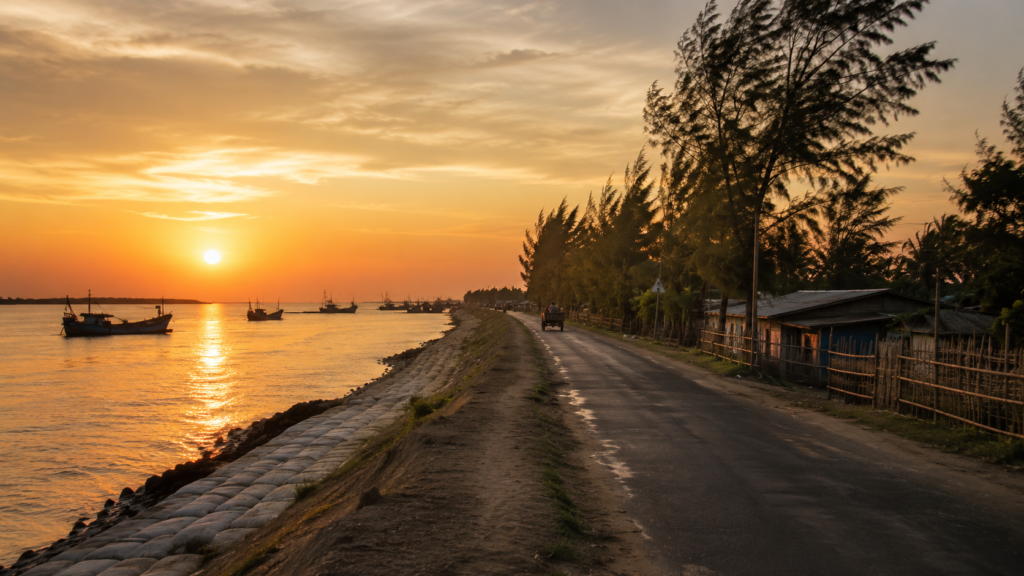
Frazergunj is a settlement that lives by the tide. Every rising tide lifts its boats. Every falling tide exposes the mud on which the harbour rests. Each fishing season brings hope, each cyclone demands resilience, and every returning vessel becomes part of a rhythm that has defined this coast for generations.
Long after the shoreline disappears from view, one image continues to linger—the quiet transformation of the harbour between low tide and high tide. In that daily exchange between land and sea lies the true character of Frazergunj: not a place that resists nature, but one that has learned to live with it, one tide at a time.
Plan your private Sundarban expedition
A private journey shaped around you — your group, your pace, your interests. Book a free consultation.