 Encyclopedia
The river was already awake long before the sun.
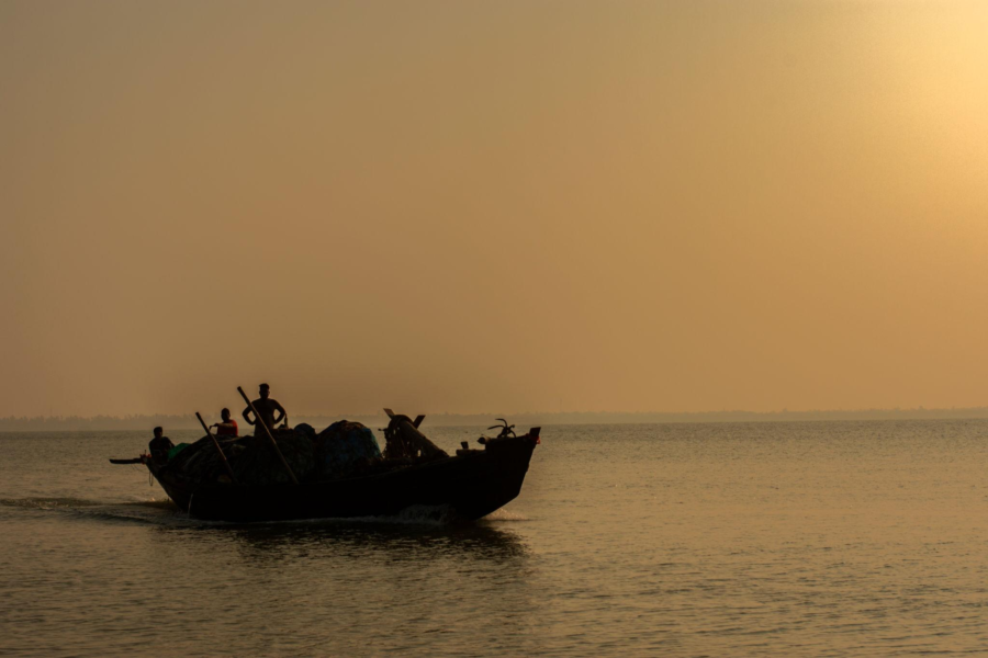
At 4:47 in the morning, the eastern horizon was still hidden behind a curtain of charcoal-grey cloud when the engine of our small wooden boat coughed into life at the jetty. Somewhere in the darkness, water slapped rhythmically against bamboo poles. The tide was rising.
The Sundarbans never truly sleeps. Even in darkness, it moves.
- The rivers breathe.
- The mudbanks shift.
- The mangroves whisper.
- The tides arrive and retreat with a patience older than memory.
The boat pushed away from shore, leaving behind a cluster of dim lights that shimmered across the water. Ahead lay Basanti Island—one of the great inhabited islands of the Indian Sundarbans, a place shaped by rivers, embankments, cyclones, migrations, and the daily negotiations between people and nature.
The Matla River stretched across the darkness like an inland sea. A faint breeze carried the smell of brine, wet mud, and mangrove leaves. Somewhere overhead, a night heron called. A second answered. Then silence returned.
The boatman sat quietly at the stern, guiding the vessel through channels he knew not from maps but from years of observation. He watched currents the way city dwellers watch traffic lights.
The river widened. Then widened again. Far away, a thin line appeared against the horizon. Not land exactly.
- A shadow.
- A suggestion.
- An interruption in darkness.
Basanti.
At first, it looked like a floating forest. Then individual trees emerged.
- Palm silhouettes.
- Bamboo clusters.
- The crowns of mango trees.
Beyond them rose the faint outline of embankments. The first signs of human determination.
- A kingfisher flashed across the bow.
- The first bird of the morning.
- The sky slowly shifted from black to indigo.
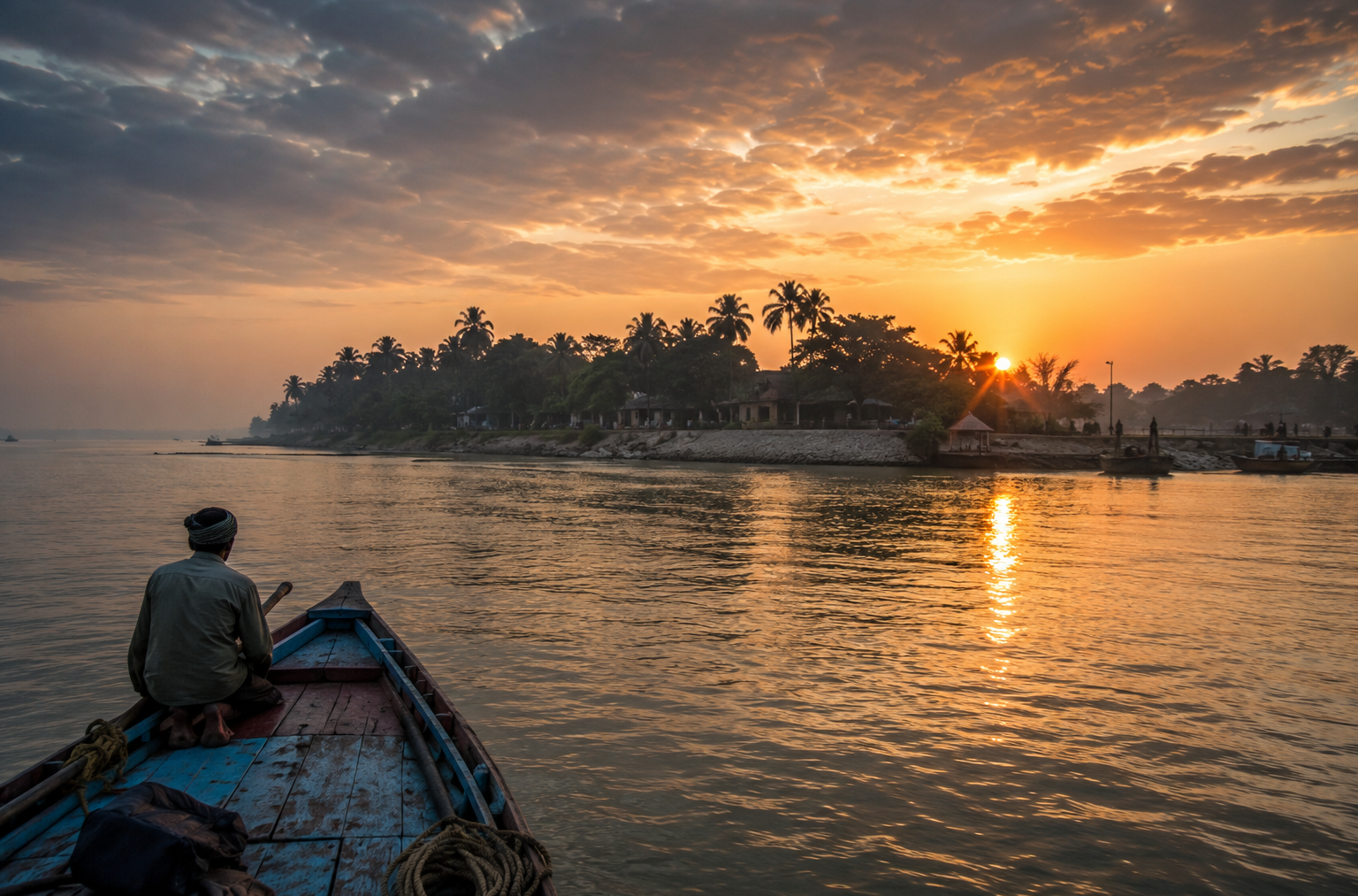
Then violet. Then silver. And Basanti Island stepped out of the night. Not dramatically. Not suddenly.
But gradually, like a story being remembered.
First Encounter
The shoreline of Basanti does not announce itself.
Unlike rocky coasts or sandy beaches, it emerges through layers.
- Water first.
- Mud second.
- Vegetation third.
- Human settlement last.
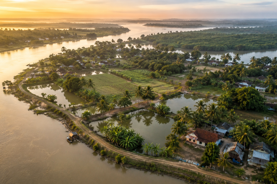
As the boat approached, the embankment became visible—a long earthen wall running beside the river. To outsiders, it might appear ordinary. To residents, it represents survival. Behind that embankment lay fields, villages, schools, temples, markets, ponds, homes, memories, and generations of effort.
Without it, much of Basanti would belong once again to the tide. Morning activity had already begun. A fisherman stood knee-deep in water, checking nets. Two women walked along the embankment carrying metal containers. A boy cycled past a line of coconut trees. Smoke rose from a kitchen somewhere inland. The scent of burning wood drifted across the river.
The island was waking. Not with urgency.
But with routine. The kind of routine that develops when life has been shaped by rivers for centuries. A narrow jetty extended into the water. Several boats were tied there. Some carried vegetables. Others fish.
One was loaded with sacks of rice. Transportation here remains deeply connected to waterways. Roads exist. Motorcycles exist. Even buses connect many parts of the block. Yet the river remains present in every aspect of movement.
The river arrived first. Everything else came later.
Stepping ashore, the ground felt unexpectedly firm. The Sundarbans often evokes images of mud and mangrove forests, but Basanti is largely a settled island. This is not wilderness. This is a frontier landscape shaped by continuous human occupation.
- Fields stretched inland.
- Trees shaded homes.
- Children walked toward school.
The island’s identity revealed itself immediately: This was not a place isolated from the world. It was a place negotiating with every day.
Island Identity
Understanding Basanti requires understanding scale.
The Sundarbans is often imagined as an endless forest. Basanti tells a different story. It is one of the major inhabited landscapes within the Indian delta. As the morning brightened, a local schoolteacher pointed toward the horizon. “People think Sundarbans means only forest,” he said.
Then he smiled. “But millions live here.”
Basanti forms a major part of the Basanti administrative block in the South 24 Parganas district of West Bengal. The island exists within a vast network of reclaimed deltaic land surrounded by tidal rivers and intersected by channels that continuously reshape the landscape. Villages spread across the island in clusters.
Some follow embankments. Others stretch along roads.
Many grew around older settlement cores established during phases of land reclamation. Unlike compact settlements found elsewhere in India, villages here often blend into one another.
- A pond.
- A grove of trees.
- A temple.
- A school.
- A stretch of paddy field.
Then another village begins. Administrative boundaries exist on paper. The landscape itself flows organically. Gram Panchayats such as Basanti, Jharkhali, Bharatgarh, Jyotishpur, Chunakhali, Masjidbati, Nafarganj, and Ramchandrakhali contribute to the wider social geography of the island and the surrounding block.
Each possesses its own identity. Its own stories. Its own relationship with nearby rivers. Population density here can feel surprising. The Sundarbans may be famous for tigers, but Basanti is fundamentally a human landscape.
People are everywhere.
- Children heading to school.
- Farmers cycling toward fields.
- Fishermen returning with catches.
- Women tending vegetable gardens.
- Shopkeepers are opening shutters.
The island’s character emerges through these daily interactions. Basanti is not simply land within a delta.
It is a living social ecosystem.
The Rivers That Built The Island
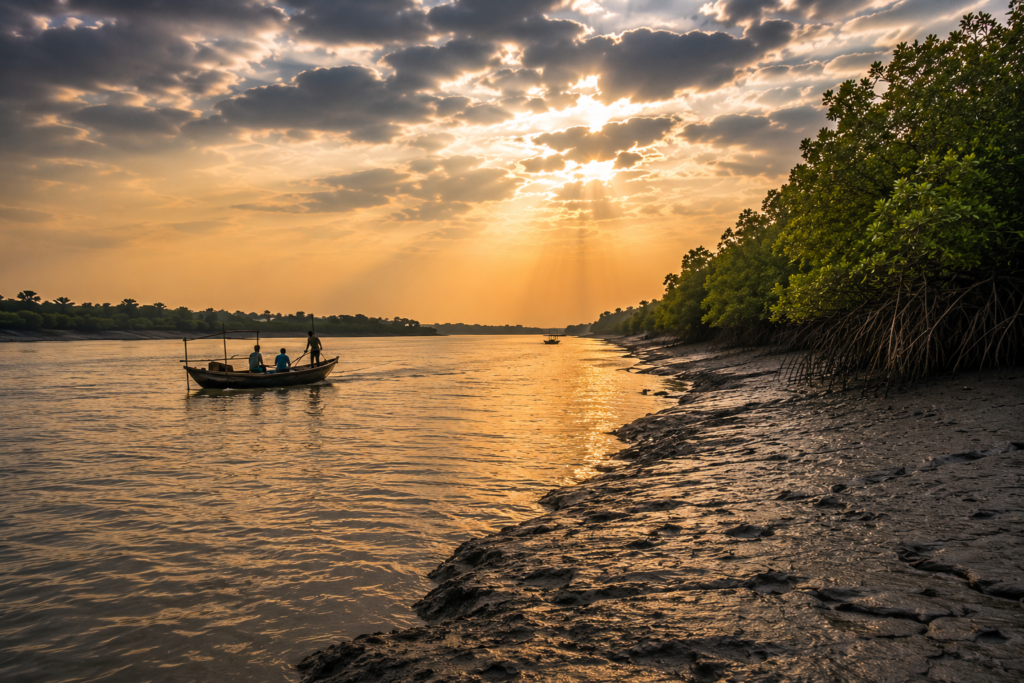
No map can explain Basanti as effectively as its rivers.
The island exists because rivers allowed it. And it survives because rivers permit it. The mighty Matla dominates much of the region. Its waters carry the memory of the Himalayas, monsoon rains, tidal forces from the Bay of Bengal, and centuries of sediment deposition. Standing beside the river at sunrise, it is difficult to think of it as merely water.
The Matla behaves more like a living force.
At low tide, vast mudflats appear. At high tide, the river swells dramatically. Its moods change within hours. Its influence shapes entire communities. Older residents remember periods when navigation routes differed.
- Channels shifted.
- Banks eroded.
- New land appeared.
- Old land disappeared.
The river never stops editing the landscape.
Nearby rivers such as the Bidya, Gomor, and countless smaller channels form an intricate hydrological network connecting Basanti to neighbouring islands. For generations, these waterways served as highways. Before modern roads, movement depended almost entirely upon boats.
- Rice travelled by river.
- Fish travelled by the river.
- People travelled by river.
- News travelled by river.
- Ideas travelled by river.
The rivers connected isolated settlements into a larger cultural world. Even today, ferry crossings remain essential.
- A school student commuting to class.
- A trader transporting vegetables.
- A patient seeking medical care.
- A family attending a wedding.
All remain dependent upon water routes. The tide determines schedules as much as clocks do. That relationship continues. Because here the river still has a vote.
Historical Footprints
Few landscapes in India tell a story of transformation as dramatic as Basanti.
Several centuries ago, much of this region would have appeared radically different. Dense mangrove forests dominated large areas. Wildlife moved freely across landscapes now occupied by villages and agricultural fields. Human settlement existed, but in smaller and more scattered forms.
Then came reclamation. The nineteenth century changed everything. Colonial administrators, landlords, and entrepreneurs viewed the delta not simply as forest but as potential agricultural land. Large-scale efforts began to clear mangroves and construct embankments.
Land was surveyed. Boundaries drawn. Settlers encouraged to arrive. The process was neither simple nor immediate. It required extraordinary labour. Workers cut forests.
Built embankments.
- Dug canals.
- Created drainage systems.
- Faced disease.
- Faced storms.
- Faced isolation.
Many failed. Others persisted. Gradually, the frontier expanded. Communities emerged where forests once stood. Basanti became part of one of the largest land reclamation efforts in South Asian history.
Yet traces of that older world remain visible. Many embankments follow historical reclamation lines. Certain water channels preserve older geographical patterns. Local folklore still remembers landscapes that existed before settlement expanded.
History survives not only in records. It survives in memory. A farmer near Jyotishpur described it simply: “Our grandfathers fought the forest.” Then, after a pause, he added: “Now we fight the water.”
In that single sentence lies much of Basanti’s history.
Historical Personalities & Transformations
Basanti’s story is often told through collective effort rather than by famous individuals.
The island’s greatest architects were thousands of unnamed settlers whose labour transformed difficult terrain into habitable land. Yet certain figures left an enduring influence. Local educators established some of the earliest schools in remote settlements. Religious leaders helped create social cohesion among dispersed communities. Community organisers mobilised people after cyclones and floods.
Agricultural innovators introduced new cultivation methods suited to saline environments. Freedom movement participants from the wider South 24 Parganas region carried nationalist ideas into these riverine settlements during the colonial period. Their influence extended beyond politics. They contributed to the creation of local institutions that continued shaping community life after independence.
Perhaps the most influential historical force, however, was not a person. It was infrastructure. Embankments.
- Roads.
- Schools.
- Ferry ghats.
- Health centres.
- Markets.
- Each transformed how people interacted with the island.
- Each reduced isolation.
- Each expanded opportunity.
Walking through Basanti today, these layers remain visible. An old embankment beside a modern road. A traditional village pond beside a mobile phone tower. A wooden fishing boat is anchored near a concrete jetty.
History and modernity coexist here not as opposites but as companions. The island continues to evolve. Just as it always has. Yet every transformation remains connected to the same fundamental challenge:
How do people build permanent lives within a landscape that never stops changing? Basanti’s answer has never been certain. It has been adapted.
And adaptation remains the island’s greatest legacy.
Between Belief, Water, and Wilderness
By mid-morning, the light had changed.
The silver glow that accompanied our arrival was gone. The sky had opened into a pale blue canopy streaked with drifting clouds. Across Basanti Island, the day had settled into its working rhythm. Bicycles moved along embankment roads. Fishing nets dried beside ponds. Schoolchildren disappeared into classrooms. Tea stalls became gathering places.
Yet beyond the visible routines lay another Basanti. A world of stories. A world of belief.
A world where rivers possess personalities, forests possess memory, and survival itself has created a culture unlike any other in Bengal. To understand Basanti, one must leave the roads occasionally and listen. Not simply to what people do.
But to what they remember.
Folklore & Legends
Every Sundarbans island possesses geography.
Not every island possesses mythology as deeply rooted as the land itself. Basanti belongs to that second category. Here, folklore is not preserved inside books. It travels through conversations.
- Tea stalls.
- Fishing boats.
- Temple courtyards.
- Mosque verandas.
- Family gatherings during monsoon evenings.
The stories change slightly depending on who tells them. But their purpose remains remarkably consistent. They explain uncertainty. And life in the Sundarbans contains plenty of uncertainty.
The Presence of Bonbibi
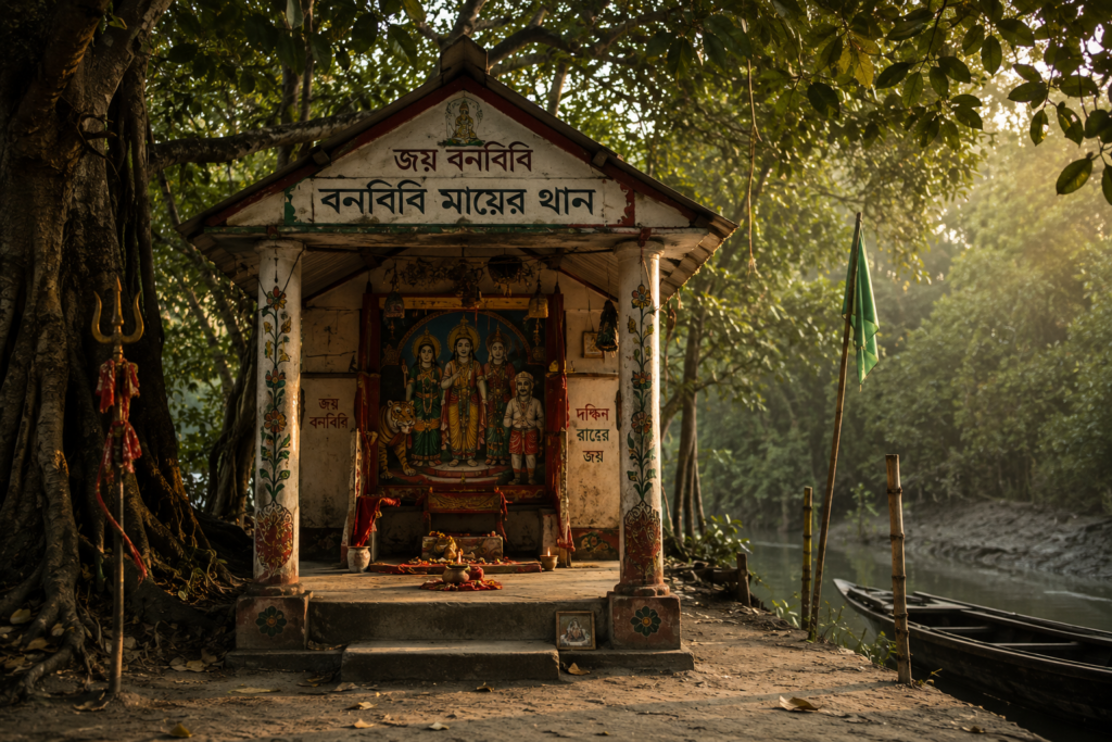
In a village near the forest-facing stretches of the region, I noticed a small shrine beneath a tree.
It was simple. A painted structure no taller than a person. Fresh flowers rested at its base. The image belonged to Bonbibi. Across the Sundarbans, Bonbibi is revered as the protector of those who enter dangerous landscapes—particularly forests and rivers.
Her significance extends beyond religion. She represents a moral order. A reminder that human beings are guests within nature rather than masters of it. Among fishermen, honey collectors, crab collectors, and boatmen, respect for Bonbibi remains deeply woven into daily life.
Many journeys begin with a prayer. Not always elaborate. Sometimes only a whispered request.
“Keep us safe.”
The request itself matters more than ritual.
Dakshin Ray: Lord of the Wild
No discussion of Sundarbans folklore is complete without Dakshin Ray.
Traditionally associated with the tiger and the wilderness, Dakshin Ray occupies a unique place within local imagination. To outsiders, he appears as a mythical figure. To many residents, he functions as something more nuanced.
A symbol of nature’s power. A reminder that the forest remains beyond complete human control.
In Basanti, where many families maintain direct or indirect relationships with rivers, creeks, and forest-edge occupations, stories of Dakshin Ray continue to circulate. Some are ancient. Some are surprisingly modern.
A fisherman laughed while recounting one story. “If someone ignores warnings and goes where they should not go,” he said, “people still say Dakshin Ray called them.” Whether believed literally or metaphorically, the story persists because it reflects an enduring truth:
Arrogance rarely survives long in the Sundarbans.
The River Spirits
Older boatmen often speak about rivers differently from younger generations. Not scientifically. Personally.
The Matla is frequently described as unpredictable.
- The Bidya is quieter.
- Certain channels are deceptive.
- Others are trustworthy.
These descriptions sound almost human. Perhaps because generations spent so much time reading currents that rivers became characters. One elderly ferryman described a dangerous bend where tides collide.
“My grandfather said a spirit lived there.”
Did he believe it?
He shrugged.
Then smiled.
“Maybe not. But everyone slowed down when passing.”
Folklore often serves practical purposes. Dangerous waters become haunted waters. Warnings become stories. Stories become tradition. And tradition helps people survive.
The Tiger That Was Never Seen
Many villages across the wider Basanti region possess stories about tigers. Curiously, some of the most memorable involve animals nobody actually saw.
- A cow disappears.
- Footprints appear near a creek.
- Dogs bark through the night.
The next morning, an entire village is convinced a tiger visited. Perhaps it did. Perhaps it didn’t. The uncertainty itself becomes the story. The Sundarbans has always been a landscape where absence can feel as powerful as presence. A tiger does not need to appear to influence behaviour.
The possibility is enough.
Life Between The Tides
By late morning, Basanti reveals its true character.
Not through monuments. Not through landmarks. But through routines. Everything here revolves around timing. And timing revolves around water.
The Fishermen
Near a creek connected to the Matla system, several fishermen were repairing nets. The work appeared repetitive. But watching closely revealed extraordinary skill.
Every knot mattered. Every repair mattered. A damaged section could mean a reduced catch. Or worse. The rivers provide livelihoods. But they rarely provide guarantees.
Fishing remains one of Basanti’s most important occupations. Different seasons bring different opportunities. Different tides produce different catches. Experience often matters more than equipment. The river rewards observation.
The Crab Collectors
In recent decades, crab collection has become increasingly important throughout parts of the Sundarbans. The demand for mud crabs has created new economic opportunities. Yet the work remains physically demanding. Collectors often operate in difficult terrain.
- Tides dictate schedules.
- Weather influences safety.
- Income fluctuates.
What appears lucrative from the outside often involves significant uncertainty on the ground.
Agriculture Against Odds
Further inland, green fields interrupted the riverine landscape.
- Rice remains central to local agriculture.
- Vegetables occupy smaller plots.
- Fruit trees appear around homesteads.
Yet farming in Basanti differs from farming in many inland regions.
- Salinity remains a constant concern.
- Cyclones remain a constant concern.
- Flooding remains a constant concern.
Agriculture here often feels less like domination of land and more like negotiation with it.
A farmer explained: “We grow crops when the land allows us.”
The phrase lingered. Because it captured the reality of delta agriculture perfectly.
The Household Economy
Walk through any village and another truth becomes visible. Island life depends upon multiple income streams.
- Fishing alone may not be enough.
- Agriculture alone may not be enough.
Families combine occupations. One member fishes. Another farm.
- Someone operates a small shop.
- Someone works in a nearby town.
- Someone has migrated temporarily for employment.
Economic resilience often comes through diversification. Not specialisation.
School Bells and River Roads
Near noon, children poured out of a school courtyard. Their laughter briefly overwhelmed every other sound. Many had travelled significant distances.
- Some by bicycle.
- Some on foot.
- Some after crossing waterways.
Education has transformed Basanti over recent decades. Schools now form important social anchors across the island. They represent something larger than learning. They represent aspiration. Evidence that even within a constantly changing delta, people continue investing in long-term futures.
Walking Through The Villages
See it for yourself
A private journey shaped around you — your group, your pace, your interests. Book a free consultation.
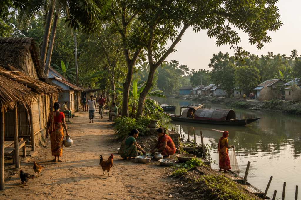
The best way to understand Basanti is to walk.
Slowly. Without a destination. Without an agenda. The villages reveal themselves through details.
Courtyards
Almost every home possesses a small open space. A courtyard. These spaces function as kitchens, workshops, meeting places, drying grounds, play areas, and social hubs simultaneously.
- Fish dry in the sun.
- Rice dries beside it.
- Children play nearby.
- A chicken wanders through.
Life unfolds in plain view.
Ponds
Freshwater ponds appear everywhere.
- Some large.
- Some small.
- Many are older than the surrounding structures.
They provide water storage, fish cultivation, and environmental balance. Viewed from above, they form one of the defining visual features of inhabited Sundarbans landscapes.
Temples and Mosques
Basanti’s cultural landscape reflects coexistence. Temples appear beneath banyan trees. Mosques rise beside roads. Religious life remains integrated into daily routines rather than separated from them.
- Morning prayers.
- Festival preparations.
- Community gatherings.
These institutions provide social stability alongside spiritual meaning.
Tea Stalls: The Island Parliament
Every village possesses one. Sometimes several. A tea stall.
- Small.
- Crowded.
- Essential.
- Politics.
- Weather.
- Fish prices.
- Cricket.
- Cyclones.
Everything is discussed here. For an explorer, few places provide richer insight into local life. The tea arrives quickly. Conversations arrive even faster.
Markets
The markets of Basanti are not merely commercial spaces. They are social ecosystems.
- Fish glisten on wooden tables.
- Vegetables arrive from nearby fields.
- Boats unload goods.
- Bicycles crowd entrances.
- Voices overlap.
- Negotiations unfold.
The market reveals the island’s connections to the wider world. Every item possesses a journey. Every trader possesses a story.
Sounds Of The Island
Every landscape has a soundtrack. Basanti’s is remarkably layered. Close your eyes and listen.
Morning
- Kingfishers calling.
- Crows arguing.
- Boat engines are starting.
- School bells are ringing.
- Water striking embankments.
- Distant bicycle bells.
Afternoon
- Wind through coconut leaves.
- Conversations drifting from courtyards.
- Vendors announcing goods.
- Goats bleating.
- Children playing.
- A radio somewhere is broadcasting Bengali songs.
Evening
- Temple bells.
- The call to prayer.
- Returning fishing boats.
- Market activity is slowing.
- Crickets emerging.
- The river changes with the tide.
Night
- Generators humming.
- Dogs barking occasionally.
- Owls calling.
- Water moves invisibly through creeks.
- Silence returns between sounds.
The remarkable thing about Basanti is that the river remains audible almost constantly. Even when unseen. The island never completely escapes its water.
Wildlife Expedition
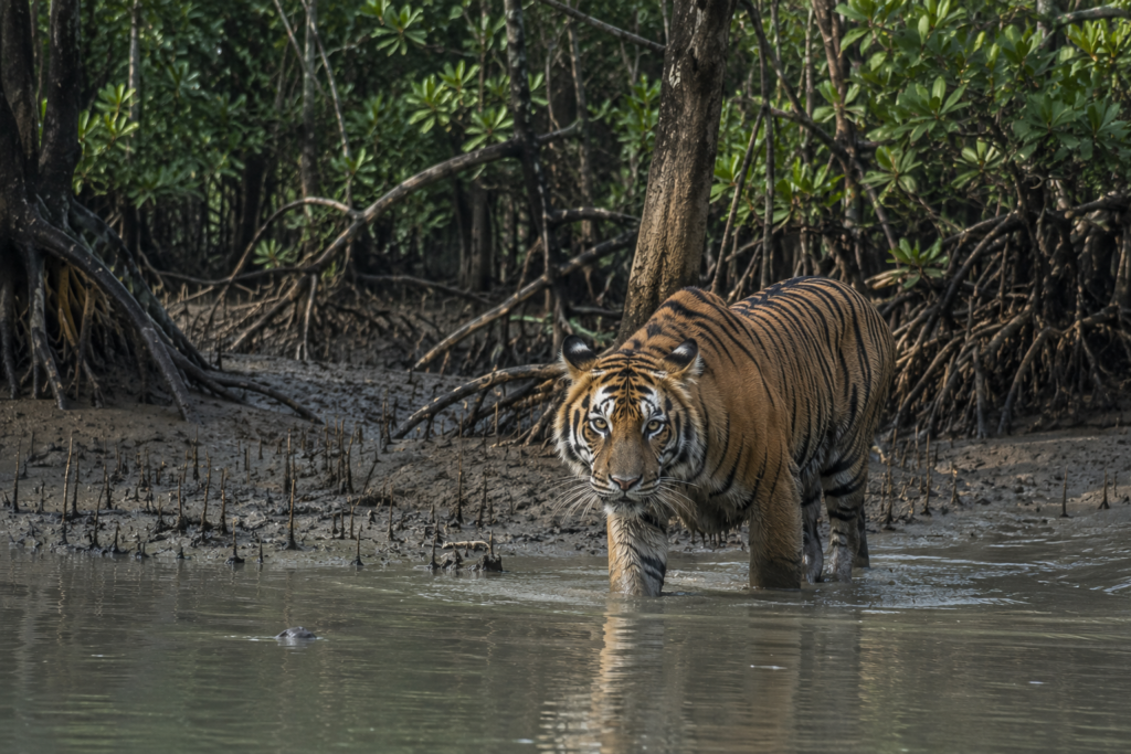
To search for wildlife around Basanti requires adjusting expectations. This is not a safari landscape. It is a frontier landscape where people and wildlife exist in complex proximity. Observation rewards patience.
Birds
Birdlife appears almost immediately.
- Kingfishers dominate visual encounters.
- White-throated kingfishers flash electric blue.
- Pied kingfishers hover above water.
- Black-capped kingfishers occasionally appear near mangrove habitats.
- Egrets patrol wetlands.
- Herons stalk shallows.
- Cormorants dive repeatedly.
- Brahminy kites circle overhead.
Each species occupies a distinct ecological niche. Together they animate the island’s skies.
Reptiles
Water monitors occasionally appear near creeks. Snakes inhabit wetlands and agricultural landscapes alike. Most remain unseen. Their presence forms part of the ecosystem’s hidden layer.
Amphibians
After rainfall, frogs become impossible to ignore. Their calls transform entire evenings. During monsoon months, they become one of Basanti’s dominant soundscapes.
Dolphins in the Rivers
The broader Matla River system occasionally supports sightings of dolphins. Encounters remain unpredictable. Yet the possibility adds another layer of ecological richness to these waterways. The rivers contain more life than their muddy surfaces reveal.
Fishing Cats and Otters
Direct sightings are rare. Evidence is more common.
- Tracks.
- Stories.
- Observations from fishermen.
Fishing cats continue inhabiting suitable wetland habitats across parts of the Sundarbans landscape. Otters occasionally appear within river systems where habitat conditions remain favourable. Their existence reminds visitors that even heavily inhabited islands remain connected to wider ecological networks.
Tigers: The Invisible Presence
Basanti is not a core tiger-viewing destination.
Yet the broader region exists within the gravitational influence of the Sundarbans tiger landscape. Occasional incidents, stories, and sightings from surrounding areas ensure the tiger remains part of local consciousness.
Here, the tiger often exists more as a possibility than an encounter. But possibilities shape behaviour. And few possibilities shape human imagination as powerfully as the tiger.
Mangrove Chronicles
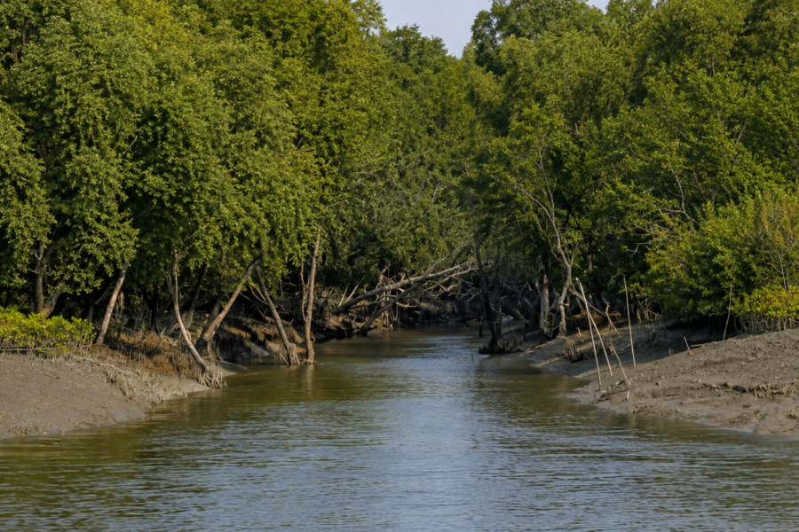
By late afternoon, the expedition moved toward mangrove-fringed stretches near the island’s watery margins. The transition felt immediate.
- Villages faded.
- Roads disappeared.
- The landscape softened into roots, mud, water, and silence.
Mangroves emerged. Not as a forest wall. But as a living architecture.
- Their roots rose from mud like sculptures.
- Their trunks twisted toward light.
- Their leaves shimmered in the tidal wind.
Mangroves are often described as barriers. That description is incomplete. They are also engineers.
- Nurseries.
- Water filters.
- Sediment traps.
- Storm shields.
Life-support systems for countless species. For Basanti, mangroves represent both neighbour and protector. Yet they also reveal a tension. Human settlement requires space. Mangrove ecosystems require space.
The frontier between those needs remains one of the defining challenges of the Sundarbans. Standing beside a tidal creek as evening approached, that relationship became visible.
The forest waited on one side.
The village waited for the other.
Between them flowed water.
- Constantly moving.
- Constantly negotiating.
Much like Basanti itself.
Storm Memory, Seasonal Rhythms, and Paths Across Water
By late afternoon, the light over Basanti had begun to soften.
The harsh brightness of midday slowly surrendered to a golden haze drifting across ponds, rice fields, embankments, and tidal creeks. Fishermen prepared for evening tides. Schoolyards emptied. Tea stalls are filled.
The island entered its second life of the day. In river landscapes, evening is not an ending. It is another beginning. And nowhere is that more apparent than in Basanti.
Explorer’s Field Notes
The following observations were recorded throughout a full day of exploration across Basanti’s embankments, riverbanks, ferry ghats, villages, wetlands, and mangrove margins.
These moments are not dramatic.
That is precisely why they matter.
They reveal the island as it truly exists.
05:03 AM — River Before Sunrise
The Matla is almost invisible. Only the sound of moving water confirms its presence. A distant fishing boat displays a single yellow light.
The tide is rising.
05:28 AM — First Kingfisher
A flash of blue crosses the bow. Gone before binoculars can be raised. The first bird sighting of the day.
05:46 AM — Basanti Appears
The island emerges as a silhouette. Palm trees become visible before houses. The embankment appears next. Human geography announces itself gradually.
06:14 AM — Fishermen at Work
Three men stand ankle-deep beside a creek. Nets are being checked. Nobody speaks much. The work appears routine. Years of experience are visible in every movement.
07:03 AM — School Uniforms
The first groups of children appear along village roads.
- White shirts.
- Blue uniforms.
- Bicycles.
- Backpacks.
Morning has officially begun.
07:41 AM — Tea Stall Discussions
Weather dominates conversation.
- Not politics.
- Not cricket.
Weather. In Basanti, the weather is not background information. It is economic information.
08:56 AM — Market Activity Intensifies
Vegetable sellers arrive. Fish traders begin sorting catches. Motorcycles and bicycles compete for limited space. The market becomes the island’s temporary centre of gravity.
10:17 AM — Embankment Inspection
Several residents pause to examine a section of the riverbank. A small crack has appeared. Nothing serious. Yet everyone notices. People here learn early that ignoring embankments can become expensive.
12:43 PM — Heat
The island slows. Roads empty. Dogs sleep beneath trees. Even birds appear less active. Only the wind remains energetic.
02:11 PM — Incoming Tide
Water begins reclaiming exposed mudflats. The transformation is surprisingly fast. Within an hour, the landscape changes completely.
04:37 PM — Brahminy Kite
A single kite circles above a creek. For several minutes, it appears suspended rather than flying. Then disappears toward the river.
05:54 PM — Return of Fishing Boats
Engines become audible before vessels are visible. One by one, they return. The river begins delivering people home.
06:31 PM — Sunset Reflection
The final sunlight catches the surface of a pond. For a moment, the water appears molten. Then darkness arrives.
08:47 PM — Evening Gathering
Several families sit outdoors. Electric lights glow from nearby homes. Conversations continue. The island remains awake.
10:16 PM — River at Night
The Matla is once again invisible. Only sound remains. The cycle is complete.
Nightfall On The Island
Night arrives differently in the Sundarbans. In cities, darkness is defeated. In Basanti, darkness is negotiated. The last sunlight disappears behind the trees. Bird calls fade. Human sounds briefly increase. Then gradually diminish. The island changes character.
The Blue Hour
For a short period after sunset, Basanti enters a world of muted colours.
- The ponds darken first.
- Then fields.
- Then roads.
The sky remains illuminated long after the land has disappeared into shadow. This is perhaps the most beautiful moment of the day. Not sunrise. Not sunset. But the transition between them.
Evening Rituals
Across villages, evening routines unfold with remarkable consistency.
- People return from work.
- Livestock are secured.
- Dinner preparations begin.
- Prayer calls drift through humid air.
- Temple bells answer from another direction.
The sounds overlap naturally. Neither competing nor dominating. Simply existing together.
The River After Dark
Night transforms rivers more dramatically than it transforms land. Distances become impossible to judge.
- Channels disappear.
- Banks vanish.
- Water and sky merge into a single dark expanse.
Only experience allows navigation. For generations, boatmen learned to read subtle clues invisible to outsiders.
- Wind direction.
- Current speed.
- Reflections.
- Sound.
The river remains active long after visibility ends.
The Night Sky
On clear nights, Basanti offers something increasingly rare.
Darkness. Not absolute darkness. But enough to reveal stars hidden from most urban landscapes. The sky feels larger here. The absence of city lights restores perspective. One begins to understand why generations of boatmen learned navigation by observing the heavens.
The Seasons Of The Island
Basanti never remains the same for long.
Every season redraws the island. Every season creates a new version of the landscape. To understand Basanti fully requires seeing it repeatedly. The island visited in January is not the same island encountered in July.
Winter (December–February)
Winter is the most forgiving season. Mornings arrive wrapped in mist. Temperatures remain comfortable. Visibility often becomes magical. The rivers seem suspended between water and cloud.
- Agricultural activity remains high.
- Birdlife becomes easier to observe.
- Many residents consider winter the most pleasant time of year.
- The landscape appears calmer.
More predictable. Though never completely predictable.
Spring (March–April)
Spring arrives quietly.
- Trees produce fresh growth.
- The air begins warming.
- Days lengthen.
- Agricultural cycles shift.
- The island feels transitional.
Preparing for more demanding months ahead.
Summer (May–June)
Summer tests patience.
- Heat dominates afternoons.
- Humidity intensifies.
- Water levels become a constant topic of discussion.
- Thunderstorms occasionally provide dramatic relief.
- The horizon darkens.
- Wind arrives suddenly.
- Rain follows.
Then sunshine returns as if nothing happened.
Monsoon (June–September)
Monsoon transforms Basanti. The island becomes greener.
- Ponds overflow.
- Creeks expand.
- Fields absorb enormous quantities of water.
- The landscape appears rejuvenated.
Yet monsoon also introduces risk. Heavy rainfall increases pressure on embankments. Transportation becomes more challenging. Agricultural decisions become increasingly dependent upon weather patterns.
The beauty of the monsoon is inseparable from its uncertainty.
Post-Monsoon (October–November)
This is the season of recovery.
- The sky clears.
- Visibility improves.
- Fields respond to months of rainfall.
- Rivers stabilise.
- The island exhales.
For photographers and naturalists, the post-monsoon often provides exceptional conditions.
Cyclone Season
Technically part of broader seasonal cycles.
Emotionally distinct. Cyclone season deserves its own category. Because cyclones influence Basanti far beyond the days on which they occur.
Preparation begins long before landfall.
Recovery continues long after departure.
Every resident understands this reality.
Cyclones And Survival
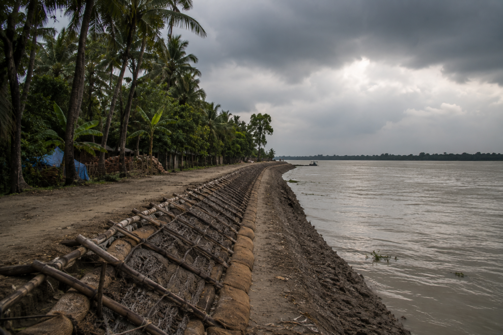
To speak about Basanti without discussing cyclones would be dishonest.
Cyclones are not occasional events here.
- They are historical forces.
- They shape memory.
- They shape infrastructure.
- They shape behaviour.
- They shape entire generations.
The Geography of Vulnerability
Basanti occupies a low-lying tidal landscape. That geography creates opportunity.
- Fertile soils.
- River access.
- Fisheries.
- Wetlands.
But it also creates exposure. Storm surges can travel enormous distances. High winds can damage homes, crops, and infrastructure. Saline water intrusion can affect agriculture long after the storm itself has passed.
Aila
Residents still speak about Cyclone Aila.
Not as history. As memory. Many conversations eventually return to it. People remember breached embankments.
- Flooded villages.
- Destroyed livelihoods.
The cyclone became a reference point.
Life before Aila.
Life after Aila.
Amphan
More recently, Cyclone Amphan reinforced old lessons.
- Again, embankments faced pressure.
- Again, communities mobilised.
- Again, recovery demanded enormous effort.
The names of cyclones become chapters in local history.
The Embankment
No structure symbolises Basanti more powerfully than the embankment.
Visitors see Earth. Residents see protection.
- Every repair matters.
- Every reinforcement matters.
- Every breach carries consequences.
The embankment is not merely infrastructure. It is the frontier line between settlement and tide.
Human Adaptation
What stands out most is not vulnerability. It is resilience.
- Residents adjust cropping patterns.
- Strengthen homes.
- Develop community response systems.
- Monitor weather forecasts.
- Share information quickly.
Adaptation is not theoretical here. It is a daily practice.
Ferry Routes & Hidden Paths
A map of Basanti rarely tells the whole story. The true transportation network includes rivers.
- Creeks.
- Footpaths.
- Embankments.
- And ferry crossings.
Arrival Through Water
Many journeys into Basanti still begin with water. Approaching by boat reveals relationships impossible to understand from roads alone. One sees how villages align themselves along embankments.
How fields follow reclaimed land. How rivers continue organising movement.
Ferry Culture
Ferries remain social spaces.
- Passengers rarely sit silently.
- Conversations emerge naturally.
- Weather forecasts circulate.
- Local news spreads.
- Market prices travel.
The ferry functions as transportation and communication simultaneously.
Embankment Roads
Some of the island’s most rewarding routes follow embankments. These paths provide continuous views of rivers, wetlands, villages, and agricultural landscapes. Walking them reveals Basanti’s geography more effectively than any map.
The Unnamed Paths
The most interesting routes often lack names.
- Narrow footpaths connecting ponds.
- Trails through agricultural plots.
- Shortcuts known primarily to residents.
- Exploration rewards curiosity.
Basanti reveals itself gradually. Never all at once.
Photography Expedition Guide
Basanti rewards photographers who value atmosphere over spectacle. This is not a destination of monumental landmarks. It is a destination of moments.
Sunrise Photography
The most compelling sunrise images often come from river-facing embankments.
- Mist.
- Boats.
- Birds.
- Silhouettes.
The elements combine naturally. Patience matters more than equipment.
Village Photography
The strongest images usually emerge from observation rather than direction.
- Courtyards.
- Bicycles.
- Fishing nets.
- Tea stalls.
- Morning routines.
Authenticity creates better photographs than staging.
Wildlife Photography
Birdlife provides the most consistent opportunities.
- Kingfishers.
- Egrets.
- Herons.
- Kites.
- Cormorants.
The challenge lies not in finding subjects. But in anticipating movement.
Landscape Photography
Basanti’s landscapes are subtle. Their power comes from layers.
- River.
- Mudflat.
- Embankment.
- Field.
- Tree line.
- Sky.
Successful compositions embrace that complexity.
Monsoon Photography
- Rain changes everything.
- Reflections multiply.
- Cloud formations become dramatic.
- Colours intensify.
The island appears simultaneously beautiful and vulnerable.
Human Stories
Perhaps Basanti’s greatest photographic subject is resilience itself.
- The fisherman is repairing a net.
- The farmer is inspecting a field.
- The student is cycling along an embankment.
- The ferryman is reading a tide.
These images tell the island’s deepest story. Because Basanti is not defined by its scenery alone. It is defined by the people who continue choosing to build lives within it.
The Departure
The day was ending where it had begun. On the river. The light that had once revealed Basanti from darkness was now preparing to hide it again. But before departure, every expedition requires a final set of notes.
- A summary of the landscape.
- A record of observations.
- A guide for future explorers.
And perhaps most importantly, a recognition that no island can ever be fully captured.
Only experienced.
The Wild Orbit Quick Facts
Island Name
Basanti Island
Administrative District
South 24 Parganas
Administrative Block
Basanti Community Development Block
State
West Bengal
Region
Indian Sundarbans Delta
Approximate Coordinates
Around 22.18°N, 88.68°E
Landscape Type
Inhabited tidal delta island with agricultural land, settlements, wetlands, ponds, embankments, and mangrove-fringed waterways
Major Rivers
- Matla River
- Bidya River
- Gomor River
Major Gram Panchayat Areas Within the Wider Basanti Region
Basanti, Bharatgarh, Jyotishpur, Chunakhali, Nafarganj, Masjidbati, Ramchandrakhali, Jharkhali
Nearest Major Rail Access
Canning Railway Station
Nearest Major Urban Gateway
Kolkata
Dominant Livelihoods
- Agriculture
- Fishing
- Crab Collection
- Aquaculture
- Small Trade
- Migration-Based Income
Ecological Highlights
- Tidal Rivers
- Wetlands
- Mangrove Edges
- Estuarine Birdlife
- Seasonal Dolphin Sightings
Best Exploration Season
November–February
Cyclone Exposure
High
Sundarbans Identity
Human Frontier Landscape
The Wild Orbit Expedition Snapshot
Accessibility
★★★★☆
Basanti is significantly easier to access than many remote Sundarbans islands, yet still retains a strong river-island identity.
Wildlife Potential
★★★☆☆
Wildlife exists throughout the landscape, particularly birdlife and wetland species, though Basanti is primarily a human-inhabited island rather than a wilderness destination.
Photography Potential
★★★★★
- Exceptional.
- Morning mist.
- River crossings.
- Embankments.
- Markets.
- Fishing activity.
- Monsoon skies.
- Human stories.
The island rewards patient observation.
Cultural Richness
★★★★★
Basanti provides one of the strongest opportunities to understand how people actually live within the Sundarbans.
Historical Interest
★★★★☆
The story of reclamation, settlement, embankments, and adaptation is deeply embedded in the landscape.
Solitude Level
★★☆☆☆
This is not an isolated island. Life is everywhere. That is part of its appeal.
The Wild Orbit Verdict
Basanti is one of the most important islands for understanding the inhabited Sundarbans. Not because it is the wildest. But it reveals the relationship between people and the delta more clearly than almost anywhere else.
Frequently Asked Questions
1. Where is Basanti Island located?
Within the Indian Sundarbans region of the South 24 Parganas district in West Bengal.
2. Is Basanti part of the Sundarbans?
Yes. It forms part of the inhabited Sundarbans delta landscape.
3. Is Basanti inside the core tiger reserve?
No. It is an inhabited island, though connected ecologically to the wider Sundarbans ecosystem.
4. What river is most associated with Basanti?
The Matla River is among the most influential waterways shaping the region.
5. Is Basanti a forest island?
No. It is primarily an inhabited and agricultural island.
6. What is the main occupation?
Agriculture and fisheries remain dominant livelihoods.
7. Are there mangroves on Basanti?
Mangrove habitats occur along river margins and nearby tidal zones.
8. Can tigers be found on Basanti?
Tiger presence is not a defining feature of the island itself, though the broader Sundarbans tiger landscape influences local culture.
9. Is Basanti affected by cyclones?
Yes, significantly.
10. What is the best season to visit?
Winter and post-monsoon months.
11. Does Basanti have ferry services?
Yes.
12. Is agriculture still important?
Extremely important.
13. Are there traditional markets?
Yes, several local markets support daily trade.
14. Is birdwatching worthwhile?
Very much so.
15. What makes Basanti unique?
It’s role as a living human frontier within the Sundarbans.
16. Are there schools on the island?
Yes, numerous educational institutions serve local communities.
17. What language is spoken?
Primarily Bengali.
18. Is migration common?
Yes.
19. What food is most typical?
Rice and fish.
20. Are there historic settlement stories?
Yes, many are tied to reclamation and embankment building.
21. Is the island densely populated?
Compared to forest islands, yes.
22. What is the biggest environmental challenge?
Cyclones, salinity, erosion, and climate-related vulnerability.
23. Are ponds important?
Essential.
24. Does tourism dominate the economy?
No.
25. Why should researchers study Basanti?
Because it offers one of the clearest examples of human adaptation within a dynamic delta ecosystem.
How To Reach Basanti Island
Reaching Basanti is less about distance and more about transition. The journey gradually removes layers of urban Bengal and replaces them with rivers.
From Kolkata
Begin in Kolkata. The city expands outward through suburbs, industrial belts, and commuter settlements. Gradually, the landscape begins to flatten.
- Ponds appear.
- Canals appear.
- Rice fields appear.
- The delta announces itself.
By Rail
Most journeys begin with a train from Sealdah Railway Station to Canning Railway Station. This route serves as one of the principal gateways into the inhabited Sundarbans. The train journey itself provides an introduction to changing geography.
By Road
From Canning, roads connect toward Basanti through increasingly rural landscapes. Bridges, embankments, and waterways accompany much of the route.
By Ferry
Depending on the exact destination within the Basanti region, ferry crossings remain important. The river continues to participate in every journey. Even modern infrastructure cannot completely bypass geography.
During Monsoon
Travel becomes slower. Road conditions can change. Ferry schedules may be influenced by weather and river conditions. Flexibility becomes valuable.
Explorer’s Advice
- Leave early.
- Watch the landscape change.
- Do not rush the journey.
The approach to Basanti is part of the experience.
Things To See Around Basanti Island
The most rewarding places around Basanti are not always the most famous. They are the places where landscape and life intersect.
Jharkhali
Jharkhali
One of the most significant gateways into the wider Sundarbans. Watch river traffic. Observe changing tides. Study the relationship between settlements and forest-edge landscapes.
Matla River Embankments
Perhaps Basanti’s greatest open-air observation deck. Morning and evening light transform these riverbanks. The river never appears the same twice.
Village Markets
Markets reveal more about Basanti than monuments ever could.
- Arrive early.
- Observe movement.
- Listen to conversations.
- Watch commerce unfold.
River Ghats
The ghats function as transportation hubs, social spaces, and observation points simultaneously. Every arrival and departure tells a story.
Agricultural Landscapes
The fields of Basanti are not empty spaces. They represent generations of adaptation.
- Walk slowly.
- Observe irrigation patterns.
- Notice pond networks.
- Read the landscape.
Mangrove-Fringed Creeks
The transition zone between settlement and mangrove habitat offers some of the island’s most atmospheric scenery.
Local Temples and Mosques
Small community religious sites often reveal the strongest sense of local identity.
Seasonal Birding Areas
Wetlands, ponds, creeks, and river margins provide opportunities for observing resident and migratory birds.
Embankment Roads
Perhaps the finest walking routes on the island. Every bend reveals another layer of Basanti.
The River at Dawn
No landmark surpasses it. No monument competes with it. The river remains Basanti’s greatest spectacle.
Continue The Journey
Basanti is not an ending.
It is a doorway.
- Follow the Matla and you reach other islands.
- Follow the creeks and you encounter other communities.
- Follow the folklore and you discover Bonbibi’s world.
- Follow the wildlife and you move closer to the mangrove forests.
- Follow history and you uncover the story of reclamation that transformed the Sundarbans.
The wider delta waits beyond every horizon. Basanti simply teaches you how to read it.
From here, future expeditions with The Wild Orbit might continue toward:
- Gosaba
- Jharkhali
- Sagar Island
- Pakhiralay
- The Matla estuary
- The Bidya river system
- The forested margins of the Sundarbans
As The Last Lights Fade Across The Matla
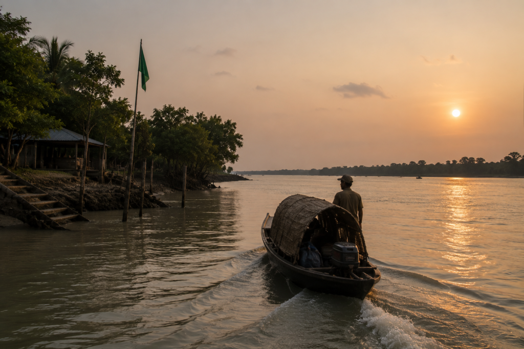
The boat left just after sunset.
Behind us, Basanti’s lights appeared one by one along the embankment like scattered constellations resting on the edge of the river. The tide had turned. Water moved quietly beneath the hull. The Matla no longer reflected daylight. It reflected darkness, carrying fragments of starlight across its surface.
As distance increased, individual houses disappeared. Then trees disappeared. Then the embankment dissolved into shadow. Only a thin silhouette remained between water and sky. For a moment, Basanti looked exactly as it had that morning when it first emerged from darkness.
A shape. A suggestion. An island suspended between river and memory. Yet it no longer felt unknown. Its stories remained aboard the boat.
- The fishermen are repairing nets beside tidal creeks.
- The schoolchildren are cycling along embankment roads.
- The tea stalls are debating weather forecasts.
- The farmers are watching the river levels.
- The shrines of Bonbibi.
- The ponds reflect clouds.
- The mangroves wait beyond the last village.
- The endless negotiation between people and water.
- The engine continued its steady rhythm.
- The island drifted farther away.
But the lesson lingered. Basanti is not defined by wilderness alone. Nor by settlement alone. It exists in the narrow space between the two. A frontier that has never truly closed. A landscape still being shaped by tides, storms, migration, memory, and resilience. Long after the final lights vanished from the horizon, the river continued flowing beside the boat. And somewhere in the darkness behind us, Basanti continued its ancient conversation with the tide.
Plan your private Sundarban expedition
A private journey shaped around you — your group, your pace, your interests. Book a free consultation.