 Encyclopedia
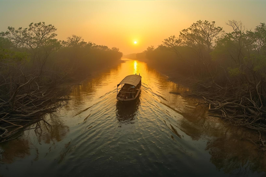
Before dawn, the river is almost invisible.
Not because it is calm, but because it is too large to comprehend in darkness.
The boat leaves the jetty while the estern horizon is still a thin band of charcoal-grey. The tide is rising. Somewhere beneath the hull, millions of tonnes of water are moving northward through channels that have been sculpting this landscape for centuries. The air smells faintly of salt and silt.
Not the deep saline breath of the open Bay of Bengal, but something more complicated—the scent of a delta forever negotiating between river and sea.
From the western darkness comes the low throb of an engine boat. A few seconds later, another answer echoes from somewhere downstream.
Then silence again above the water
- The first birds begin to wake.
- An egret calls from an unseen mudbank.
- A pond heron flutters across the channel.
Far overhead, a black kite traces invisible circles against the fading stars.
The river here is the Hooghly Estuary, one of the great tidal highways of eastern India. Every day, tides travel inland through this immense corridor, carrying sediment, fish, boats, stories, and livelihoods.
Somewhere ahead lies Kakdwip.
- Not an isolated island in the conventional sense.
- Not a wilderness.
- Not a tourist enclave.
Kakdwip is something far more fascinating.
It is a threshold. A place where mainland Bengal gradually transforms into the island world of the Sundarbans. A frontier between river civilization and tidal civilization.
As dawn slowly brightens the water, shapes emerge. A line of embankments. Clusters of trees. The silhouettes of fishing boats. The faint outline of settlements stretches along the riverbank. Kakdwip rises from the darkness not as a dramatic island but as a lived landscape—a place shaped less by spectacle and more by centuries of adaptation.
The river has brought us here.
The river explains everything.
And before the day is over, it will explain Kakdwip itself.
First Encounter
By sunrise, the shoreline is fully visible.
Unlike the deep forest islands farther south, Kakdwip announces itself through human activity.
- Boats move constantly.
- Ferries cross channels.
- Fish traders are already awake.
- Tea stalls release their first curls of smoke.
The embankments are the island’s defining visual feature.
Long earthen barriers run beside tidal water, separating homes and fields from a landscape that would otherwise flood twice daily. These embankments are not merely infrastructure.
They are historical documents.
- Each repaired section tells a story of storms survived.
- Each elevated stretch marks a battle against tides.
- Each crack reveals the persistent pressure of water.
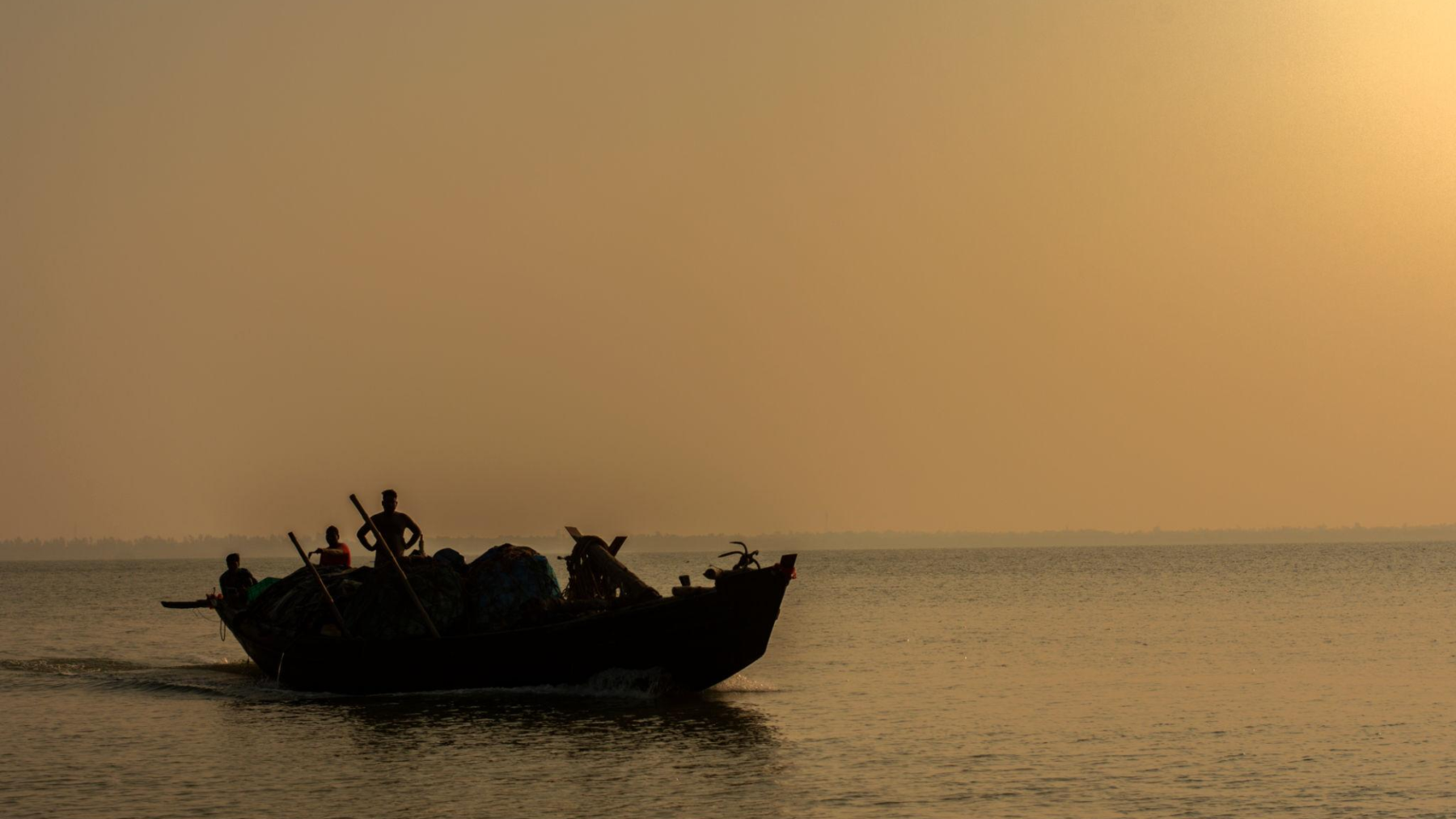
As the boat approaches the bank, fishermen unload nets.
- Women carry baskets toward local markets.
- Schoolchildren in uniforms walk along narrow roads.
- Motorcycles weave between bicycles and handcarts.
At first glance, Kakdwip feels more connected to mainland Bengal than many Sundarban islands.
Yet a closer look reveals something different.
- Water remains everywhere.
- Creeks branch from larger rivers.
- Tidal channels appear unexpectedly behind villages.
- Boats remain as important as roads.
The island’s rhythms continue to follow the moon and tide as much as the clock. This dual identity defines Kakdwip.
It is simultaneously a gateway and an island. A transport hub and a river settlement. A growing town and a tidal landscape.
The closer one looks, the more fascinating that contradiction becomes.
Island Identity
To understand Kakdwip, one must first abandon the idea that islands are always remote.
Kakdwip occupies a strategic position within the southern reaches of the South 24 Parganas district, serving as one of the principal gateways into the wider Sundarban region. It is the administrative heart of the Kakdwip subdivision and one of the most important transport nodes linking Kolkata with islands farther south.
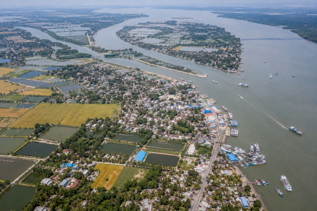
The broader Kakdwip Community Development Block supports a population of roughly 282,000 people spread across dozens of villages and settlement clusters. Census records identify nearly forty major villages within the block, including Akshyanagar, Ganespur, Bamanagar, Chandipur, Harendranagar, and Gobindarampur.
The block contains numerous gram panchayats that administer an intricate network of settlements woven together by roads, embankments, canals, and waterways.
Unlike islands deeper inside the mangrove zone, Kakdwip is heavily shaped by its role as a regional connector.
People come through Kakdwip to reach:
- Sagar Island
- Namkhana
- Patharpratima
- Fraserganj
- Bakkhali
- The lower Sundarban settlements
Yet Kakdwip itself is often overlooked.
Most travelers pass through.
Few stop to examine the landscape.
That is a mistake.
Because Kakdwip contains within its boundaries many of the defining characteristics of the Sundarbans:
- Tidal rivers
- Embankment agriculture
- Fisheries
- Cyclone vulnerability
- River trade
- Migration histories
- Delta ecology
It is not merely a gateway.
It is a living chapter of the delta.
The Rivers That Built Kakdwip
Every island in the Sundarbans has a river story.
Kakdwip has several.
The most influential is the mighty Hooghly.
To the west, this vast tidal artery has shaped settlement patterns, trade networks, fisheries, transportation routes, and agricultural possibilities for generations.
The Hooghly is not simply a river. It is a moving geography. Twice daily, tides push enormous volumes of water inland.
- Mudbanks appear and disappear.
- Channels deepen.
- Banks erode.
- New land forms while old land vanishes.
For centuries, people learned to read these changes.
- Fishermen learned where currents carried hilsa.
- Boatmen learned which channels remained navigable.
- Farmers learned where embankments required reinforcement.
The river rewarded observation. It punished complacency. Smaller tidal channels extend this influence throughout the landscape. Even villages seemingly distant from major waterways remain connected to the tidal system.
- Water enters through creeks.
- Water exits through drainage canals.
- Water influences soil chemistry.
- Water determines agricultural timing.
In Kakdwip, geography is not fixed.
It arrives and departs every six hours.
Historical Footprints
Long before roads connected southern Bengal, rivers did.
The story of Kakdwip begins with waterborne movement.
The lower delta remained sparsely settled for centuries because of flooding, shifting channels, dense vegetation, and disease.
- Permanent habitation required engineering.
- People had to build embankments.
- Drain wetlands.
- Stabilize riverbanks.
- Reclaim land from tidal influence.
Many of the inhabited landscapes seen today emerged through generations of reclamation efforts.
The process was gradual.
- Families settled on slightly elevated ground.
- Agricultural fields expanded.
- Markets appeared.
- Religious institutions followed.
- Villages matured.
Colonial administrators later viewed these southern lands through an economic lens. Revenue collection depended upon expanding cultivation.
As a result, embankment construction accelerated across parts of the delta.
Land became measurable.
- Taxable.
- Governable.
Yet rivers remained the ultimate authority. Even the most ambitious plans could be undone by a single cyclone season. The history of Kakdwip is therefore not merely one of development.
It is a history of negotiation between people and the landscape.
A negotiation that continues today.
Historical Personalities & Transformations
Kakdwip occupies an important place in one of Bengal’s most significant agrarian movements.
When the historic Tebhaga Movement emerged during the 1940s, demanding a greater share of crops for sharecroppers, Kakdwip and neighboring Namkhana became major centers of peasant mobilization. The movement transformed political consciousness across the region and remains deeply embedded in local memory.
The legacy of those struggles extends beyond politics.
- Land reforms later altered ownership patterns.
- Agricultural rights became more secure for many rural households.
- The social geography of the region changed.
Equally important were the unnamed builders.
- The embankment workers.
- The fishermen.
- The settlers who transformed unstable tidal terrain into habitable land.
Most left no written records. Yet their influence survives everywhere.
- Every cultivated field.
- Every market.
- Every village road.
- Every ferry ghat.
Kakdwip is built upon countless acts of persistence.
Folklore & Legends
As daylight strengthens and conversations lengthen, stories emerge.
Not all belong specifically to Kakdwip. Many drift across the wider Sundarbans. Like rivers, folklore rarely respects administrative boundaries.
Older fishermen still invoke the protective presence of Bonbibi when discussing journeys into dangerous waters. Some speak of Dakshin Ray with the cautious respect reserved for ancient powers.
Others describe stretches of river where unusual lights appear during monsoon nights.
No one agrees on what causes them. Some attribute them to spirits. Others are gases rising from wetlands. A few simply shrug and smile. The mystery matters more than the explanation.
In tea stalls, folklore often arrives disguised as memory. Someone recalls a storm that seemed impossible. Someone else remembers hearing tigers swim across channels decades ago. Another describes a vanished creek that existed during childhood but has since disappeared beneath sediment.
Whether entirely factual or partly embellished, such stories reveal something important.
In tidal landscapes, certainty is rare. Memory becomes a form of navigation. And folklore becomes a way of understanding forces larger than oneself.
As the morning advances and the markets grow louder, the expedition moves deeper into Kakdwip.
The real life of the island is beginning to unfold.
Life Between the Tides
By mid-morning, Kakdwip reveals what dawn conceals. The river may dominate first impressions, but it is the tide that truly governs life here.
- Not visibly.
- Not dramatically.
- Quietly.
- Persistently.
A clock hanging inside a tea stall might indicate nine in the morning, but for many residents, another schedule matters more.
- The water schedule.
- The incoming tide.
- The outgoing tide.
- The period between them.
- A fisherman preparing his boat near a creek does not consult a wristwatch first. He studies the river.
- A crab collector planning a journey into muddy channels calculates movement according to water depth.
- A ferry operator watches the current.
- A fish trader knows when the boats are expected to return.
The tide determines opportunity. And occasionally danger. This relationship between people and water is one of Kakdwip’s defining characteristics. Unlike inland settlements, where roads dictate movement, movement here remains partially aquatic.
Even where roads have expanded and transport infrastructure has improved, river logic survives.
A farmer walking along an embankment may discuss crop yields and market prices, but sooner or later the conversation turns toward water.
- Too much.
- Too little.
- Too salty.
- Too powerful.
Water is not merely part of life. It is an active participant in every decision.
The agricultural landscape surrounding Kakdwip reflects centuries of adaptation. Rice remains the dominant crop. During monsoon months, the fields transform into vast green expanses stretching toward distant settlements.
- The air carries the scent of wet earth.
- Egrets patrol newly flooded plots.
- Dragonflies hover above irrigation channels.
By winter, harvested fields reveal a different character.
- Golden stubble catches morning light.
- Women gather fodder.
- Children cross open ground on their way to school.
- Seasonal vegetables appear in carefully managed plots.
Every field exists because someone successfully negotiated with the delta. Behind each harvest lies a history of embankment maintenance, drainage management, rainfall uncertainty, and tidal risk. Agriculture here is never entirely predictable.
The land remembers the sea.
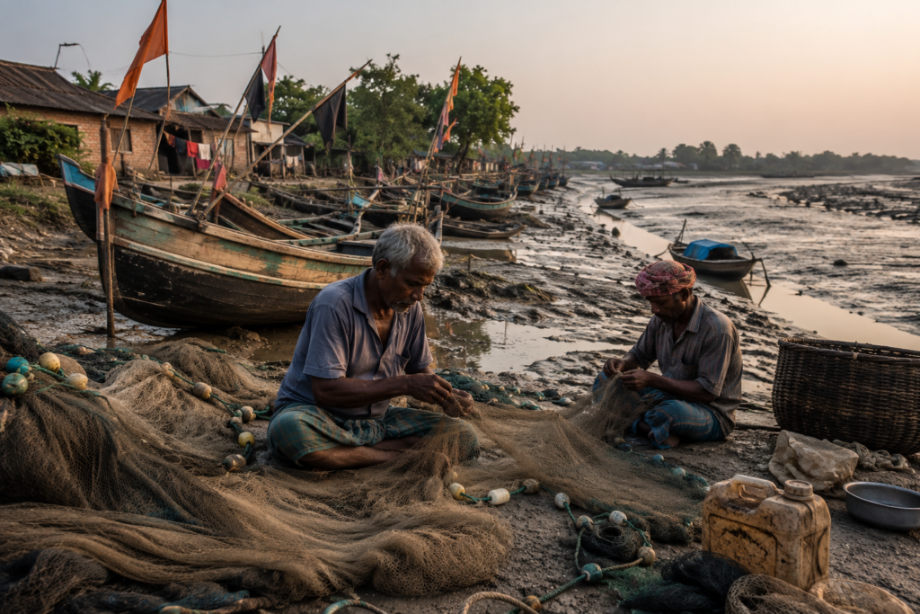
Fishing remains equally important. Along canals and riverbanks, nets dry beneath the sun. Some are repaired beneath bamboo shelters. Others lie spread across open ground like giant woven maps.
The fishing economy of Kakdwip is remarkably diverse.
Small-scale fishers work creeks and tidal channels. Larger boats venture farther into estuarine waters. Fish markets become temporary theaters where river abundance meets economic necessity.
- Hilsa, when available, commands attention.
- Prawns generate livelihoods.
- Crabs support households.
Countless smaller species contribute to daily food security. The river’s productivity sustains entire communities. Yet the relationship remains uncertain.
- Changes in salinity.
- Shifting channels.
- Cyclones.
- Overfishing pressures.
All influence outcomes. Every successful catch carries an element of unpredictability.
For younger generations, life unfolds between traditional rhythms and modern aspirations.
- School buildings stand beside ponds.
- Mobile towers rise above rice fields.
- Motorcycles share roads with handcarts.
Students commute daily to educational institutions while maintaining close ties to river-based livelihoods. The future is arriving. The tide remains.
Both coexist.
Walking Through the Villages
Leaving the main roads behind reveals another Kakdwip.
A quieter Kakdwip. A more intimate one.
The villages do not announce themselves. They unfold gradually.
- A narrow lane diverges from an embankment.
- A cluster of coconut palms appears.
- A pond reflects clouds.
- A courtyard emerges behind a bamboo fence.
Then another.
And another.
Soon, an entire settlement reveals itself.
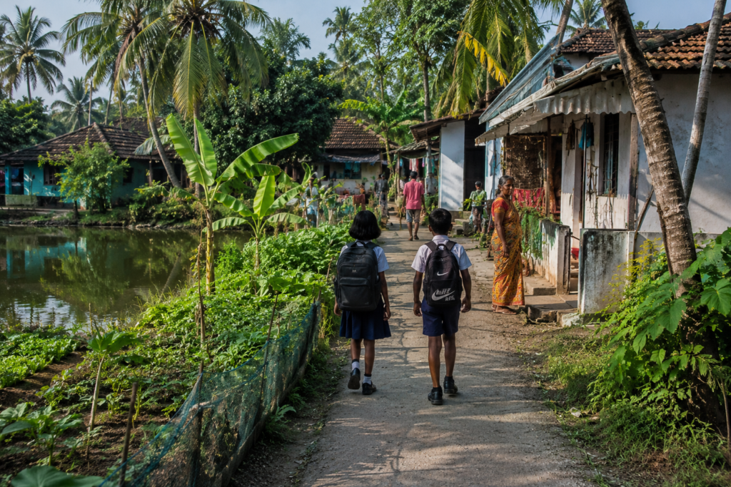
The architecture speaks the language of adaptation. Older houses often combine mud walls with thatched or corrugated roofs. Many newer homes incorporate brick and concrete. Some structures display signs of recent reconstruction, reminders of storms endured and recovered from.
Every home appears connected to the landscape.
- Vegetable gardens occupy available space.
- Banana plants grow beside entrances.
- Mango trees provide shade.
- Ponds serve practical purposes while supporting local biodiversity.
Nothing feels ornamental. Everything has a function.
Courtyards function as social centers.
- Women sort vegetables.
- Children play cricket using improvised equipment.
- Elderly residents sit beneath trees discussing politics, weather, and river conditions.
- A bicycle leans against a wall.
- Laundry dries in sunlight.
- A goat wanders through the scene.
Life unfolds outdoors.
Religious structures emerge unexpectedly.
- A small temple beneath an ancient tree.
- A village shrine decorated with flowers.
- A mosque whose call to prayer travels across ponds and fields.
The diversity feels integrated rather than displayed. Faith here exists within daily life.
Not separate from it.
Schools occupy a special place in village landscapes. Their walls often bear educational murals. Playgrounds double as gathering spaces. Children in uniforms move through settlements carrying books while passing fishermen carrying nets.
Two worlds intersect.
Neither diminishes the other.
Tea stalls serve as information exchanges. A visitor learns more in thirty minutes at a village tea stall than from hours of official reports.
- News travels quickly.
- River conditions.
- Crop prices.
- Political developments.
- Cyclone forecasts.
- Fishing prospects.
- Everyone contributes.
- Everyone listens.
The tea stall remains one of Kakdwip’s most important institutions.
Sounds of the Island
Every island possesses a soundscape.
Kakdwip’s is layered. Complex.
Continuously evolving throughout the day.
Morning begins with birds. Not a single species. An orchestra.
- Mynas argue from rooftops.
- Crows patrol village edges.
- Kingfishers announce themselves with sharp calls near ponds.
- Egrets move silently but contribute to the atmosphere through wingbeats and sudden eruptions from wetlands.
Above them all, kites circle patiently.
Then comes a human sound.
- Bicycle bells.
- Conversations.
- The metallic rhythm of shutters opening.
- Boat engines are starting.
- Fish crates are being unloaded.
- Market negotiations.
- Temple bells.
- School assemblies.
The island awakens not with a single sound but with hundreds.
Near ferry ghats, the soundtrack changes again.
- Engines dominate.
- Announcements echo.
- Passengers arrive carrying sacks, baskets, bicycles, and expectations.
- The ferry terminal environment possesses its own acoustic identity.
Movement creates noise.
Noise signals connectivity.
By afternoon, the wind becomes more noticeable. It moves through coconut palms. Across harvested fields. Along embankments. Through fishing nets suspended for drying. The sound is subtle. Almost invisible.
Yet constant.
Evening transforms everything.
- The call to prayer drifts across water.
- Temple bells answer elsewhere.
- Bird activity intensifies before nightfall.
- Boats return.
- Market conversations grow louder.
Then it gradually became quieter. Darkness approaches. The island begins changing shape.
Not visually. Acoustically.
Wildlife Expedition
Kakdwip is often viewed through the lens of settlement and transport.
That perspective overlooks an important truth. Wildlife persists here. Not despite people. Alongside them.
The delta remains alive.
The birdlife is particularly impressive. Even a casual observer encounters remarkable diversity. Kingfishers appear frequently. Their electric colors seem almost exaggerated against muddy water.
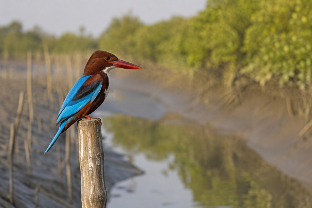
White-throated kingfishers occupy wires and branches overlooking ponds. Pied kingfishers hover above channels before plunging into water. Common kingfishers flash through vegetation like living gemstones.
Waders dominate wetlands.
- Egrets.
- Herons.
- Pond herons.
- Sandpipers.
- Plovers.
Each occupies a distinct ecological niche. Watching them forage reveals the complexity hidden within apparently simple mudflats.
Raptors patrol overhead. Black kites are ubiquitous. Brahminy kites occasionally appear above river channels, their striking chestnut-and-white plumage catching sunlight.
These birds embody the estuarine landscape. Their presence feels entirely appropriate.
The waterways support rich aquatic life. Fish diversity underpins local economies. Estuarine ecosystems provide nursery habitats for countless species. Although rarely visible from shore, river dolphins occasionally occur within larger river systems connected to the lower delta. Sightings remain unpredictable and should never be assumed, but the possibility itself speaks to ecological richness.
Reptiles inhabit the margins. Water snakes navigate creeks. Monitor lizards occasionally appear near wetlands and embankments. Numerous amphibians emerge during monsoon months, transforming night-time soundscapes into remarkable choruses.
Insects deserve equal attention.
- Butterflies move through gardens.
- Dragonflies patrol ponds.
- Bees visit flowering plants.
- Fireflies sometimes illuminate humid evenings.
Much of the island’s ecological activity occurs at scales easily overlooked. The absence of dramatic wildlife encounters does not diminish ecological value.
Kakdwip rewards patience. Observation. Attention.
Its wildlife is woven into everyday landscapes rather than isolated from them.
Mangrove Chronicles
Travel farther from dense settlements and traces of the original delta begin to appear.
Not vast forests.
- Fragments.
- Remnants.
- Living memories.
Mangroves survive along creek margins, mudbanks, and tidal zones. These ecosystems represent the biological foundation upon which the entire Sundarbans exists. Without mangroves, the delta would be unimaginably vulnerable.
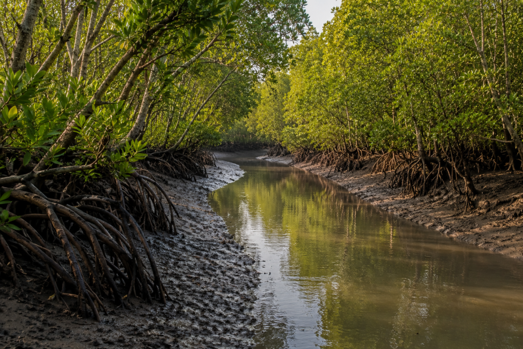
Mangroves perform countless tasks simultaneously.
- They stabilize sediment.
- Reduce erosion.
- Provide fish nurseries.
- Support birdlife.
- Filter water.
- Absorb storm energy.
- Create habitat.
They are engineers disguised as trees.
Species composition varies according to salinity and tidal conditions. Patches of mangrove vegetation often contain familiar Sundarban associates such as gewa, goran, and other salt-tolerant species adapted to estuarine environments.
These plants survive where many others cannot.
Their roots appear almost architectural.
Their growth patterns reflect centuries of evolutionary adaptation.
Standing beside a tidal creek lined with mangroves reveals something important. The boundary between land and water is not fixed. Mangroves understand this. They thrive in uncertainty.
Humans build embankments to resist change. Mangroves succeed by accommodating it.
Yet these ecosystems face pressure.
- Settlement expansion.
- Pollution.
- Hydrological changes.
- Cyclone damage.
- Climate-related challenges.
Conservation, therefore, becomes both an ecological necessity and a human one. Protecting mangroves ultimately protects people. The relationship is inseparable.
Explorer’s Field Notes
See it for yourself
A private journey shaped around you — your group, your pace, your interests. Book a free consultation.
05:11 AM
First light appears above the eastern horizon. The river remains dark silver. A solitary fishing boat moves downstream against the incoming tide.
05:37 AM
White-throated kingfisher observed near a creek junction. First significant bird activity of the morning.
06:12 AM
The fish market begins receiving catches. Bamboo baskets arrive faster than expected.
06:48 AM
Schoolchildren appear along embankment roads. Morning routines accelerate throughout nearby settlements.
07:21 AM
The incoming tide is noticeably higher. Water reaches the lower mudbank vegetation.
08:06 AM
Tea stall discussion dominated by weather forecasts and river conditions.
09:03 AM
Market activity intensifies. Fish, vegetables, household goods, and agricultural supplies all changing hands simultaneously.
10:17 AM
Monitor lizard sighted near wetland edge before disappearing into vegetation.
11:44 AM
Strong sunlight. Bird activity has reduced. Human activity dominates the soundscape.
01:08 PM
Wind strengthens across open fields. Coconut palms become noticeably animated.
02:31 PM
Several fishing nets are undergoing repair beneath temporary shelters.
03:57 PM
Afternoon ferry traffic increases. Passenger movement is visibly heavier than in the morning.
04:42 PM
Brahminy kite observed circling above a tidal channel.
05:29 PM
Return of fishing vessels begins. Market preparations resume.
06:11 PM
Sunset light transforms embankments into long silhouettes.
06:43 PM
Temple bells are audible across the water.
07:02 PM
Evening prayer echoes through the settlement landscape.
07:48 PM
Insects dominate the soundscape. Human activity gradually recedes.
08:26 PM
Night is fully established. River visible only through reflected lights.
Nightfall on the Island
By the time darkness settles over Kakdwip, the river has become something entirely different.
The broad tidal channels that seemed expansive and knowable during daylight now dissolve into shadow.
Only fragments remain visible.
- A scattering of lights from distant boats.
- The glow of ferry terminals.
- Reflections trembling on moving water.
- The outline of embankments against the sky.
Everything else becomes imagination.
And memory.
The evening transition begins slowly.
- First, the markets begin to thin.
- Fish traders complete their final transactions.
- Vegetable sellers gather unsold produce.
- Tea stalls remain active, but conversations change.
- The urgency of commerce gives way to storytelling.
- People linger longer.
- News is exchanged.
- Rumours travel.
- Memories surface.
Near the riverfront, fishermen continue working. Some prepare for departures timed to the tide. Others repair equipment beneath dim electric bulbs. Their shadows move across wooden hulls. The river remains active long after daylight disappears.
In a tidal landscape, darkness rarely means inactivity.
The sounds change.
Daytime Kakdwip is mechanical.
Night-time Kakdwip is atmospheric.
- The drone of engines fades.
- Insects take control.
- Frogs emerge from ponds and wetlands.
- A distant dog barks.
Somewhere, a temple bell rings. Elsewhere, the evening prayer drifts across water. The wind carries sounds farther after sunset. Distances become deceptive. A voice heard across a creek may seem surprisingly close.
The night sky itself feels larger. Away from concentrated lighting, stars emerge above the delta. The constellations reflect in ponds. Clouds move across the estuary.
During the winter months, visibility can be remarkable. During monsoon months, the sky becomes an ever-changing theatre of moisture and light. Standing on an embankment after dark offers one of Kakdwip’s most revealing experiences.
The landscape becomes simplified.
- River.
- Sky.
- Wind.
- Water.
The elements that built the island reveal themselves. Everything else recedes. For a few moments, one can imagine the delta before roads, electricity, and settlements. A world ruled almost entirely by tides.
The Seasons of Kakdwip
Kakdwip is never the same island twice.
Every season reconstructs it.
The geography remains.
The experience changes.
Winter (December – February)
Winter is the gentlest season.
- Morning mist often hangs above ponds and canals.
- The air becomes crisp by Delta standards.
- Migratory birds appear in wetlands and agricultural landscapes.
- The fields glow with post-harvest colors.
Visibility improves.
The horizon seems wider.
Boat journeys become calmer.
For many residents, winter represents a brief period of environmental stability. Cyclones are absent. Humidity retreats. The landscape breathes.
Spring (March – April)
Spring arrives subtly.
- Mango trees flower.
- Temperatures begin rising.
- Agricultural activities intensify.
- Birdsong becomes more noticeable during early mornings.
The transition from winter’s clarity toward summer’s intensity begins. The river remains relatively calm, but anticipation grows.
Everyone knows what follows.
Summer (April – June)
Summer transforms Kakdwip into a landscape of heat and waiting.
- Afternoons shimmer.
- Roads radiate warmth.
- Ponds shrink slightly.
- The sky becomes immense.
- Cloud formations grow increasingly dramatic.
Every distant thunderhead attracts attention. The pre-monsoon season often produces spectacular storms.
Sudden winds. Intense lightning. Brief but powerful rainfall. Nature rehearsing for monsoon.
Monsoon (June – September)
Then the rains arrive.
The first sustained monsoon showers alter everything.
- Dust disappears.
- Vegetation explodes into life.
- Canals fill.
- Fields become brilliant green.
- Rivers swell.
- Creeks reconnect.
- The island appears renewed.
Yet monsoon also introduces uncertainty. Heavy rainfall can strain drainage systems. Embankments require constant monitoring. Transportation becomes less predictable.
The same water that sustains life can also threaten it.
Post-Monsoon (October – November)
Many observers consider this the most beautiful season.
- The air clears.
- The landscape remains green.
- The rivers retain monsoon fullness.
- Sunrises become particularly striking.
- Agricultural activity intensifies.
- Festivals animate villages and markets.
The delta appears balanced. Neither dry nor flooded. Neither exhausted nor dormant.
Cyclone Season
Technically overlapping multiple seasons, the cyclone season deserves separate recognition. Cyclones are not weather events here.
They are historical forces. Entire generations remember life according to storms.
- Before a cyclone.
- After a cyclone.
- Recovery from a cyclone.
- Preparation for the next one.
The geography of memory often follows the geography of disaster.
Cyclones and Survival
To understand Kakdwip, one must understand resilience.
And resilience here is inseparable from cyclones. The Bay of Bengal is among the world’s most cyclone-prone regions. For centuries, storms have shaped settlement patterns throughout the lower delta.
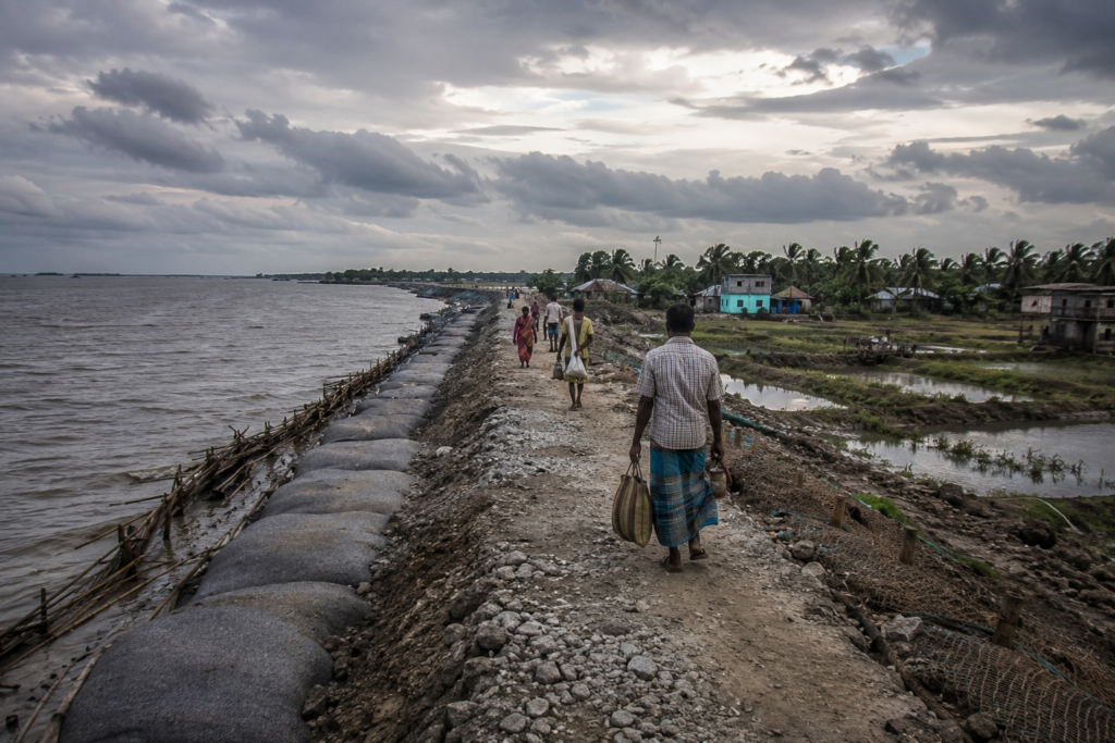
Kakdwip has repeatedly experienced its consequences.
Older residents rarely describe cyclones in purely meteorological terms.
They describe experiences.
- The sound of the wind.
- The sudden rise of water.
- The darkness.
- The waiting.
- The uncertainty.
Among recent disasters, Cyclones Aila (2009), Amphan (2020), and Yaas (2021) remain deeply embedded in local memory.
- Each storm tested embankments, infrastructure, livelihoods, and human endurance.
- Each left visible scars across parts of the wider delta.
- Each also revealed extraordinary community resilience.
Embankments are central to this story.
Visitors often see them simply as raised earthworks. Residents understand them differently. They are defensive lines. Agricultural protection systems. Transportation corridors. Community assets. Symbols of survival.
When embankments fail, consequences spread rapidly. Saltwater intrusion can affect agricultural land for months or years. Homes may require rebuilding. Livelihoods become disrupted. Recovery extends far beyond the storm itself.
Yet Kakdwip has never been defined solely by vulnerability.
The island’s history is also a history of adaptation.
- Raised housing.
- Improved forecasting.
- Cyclone shelters.
- Community preparedness.
- Infrastructure improvements.
Knowledge is passed between generations. Resilience is not a slogan here. It is a necessity.
Ferry Routes & Hidden Paths
Every explorer eventually discovers that Kakdwip is best understood through movement.
Not static observation. Movement. The island exists within a network. Roads connect settlements. But waterways connect worlds. Throughout the day, ferries create invisible threads across the landscape.
- Passengers travel for work.
- Students commute to educational institutions.
- Farmers transport produce.
- Traders move goods.
- Families visit relatives.
The ferry system functions as social infrastructure as much as transportation.
The major ghats reveal only part of the story. More interesting are the smaller landing points. The informal jetties. The embankment paths. The narrow roads lead unexpectedly toward creeks. These routes reveal everyday geography.
Not official geography.
Some of the most rewarding walks begin without a destination.
- Follow an embankment.
- Continue past a market.
- Cross a narrow bridge.
- Observe where people naturally move.
Soon, the landscape begins explaining itself. The hidden paths of Kakdwip are not secret. They are simply overlooked.
Photography Expedition Guide
For photographers, Kakdwip rewards patience more than equipment. The most powerful images emerge from observation.
Not speed.
Sunrise Photography
The riverfront before dawn offers extraordinary possibilities.
- Mist above water.
- Fishing boats departing.
- Bird silhouettes against early light.
Reflections on tidal channels. The first hour after sunrise often produces the most atmospheric conditions.
River Photography
The Hooghly estuary provides constantly changing compositions.
- Tides alter foregrounds.
- Boats create movement.
- Clouds transform the mood.
No two days are identical.
Village Photography
- Courtyards.
- Markets.
- Fishing-net repairs.
- Agricultural activity.
- Tea stalls.
These subjects reveal Kakdwip’s human geography. Respect and permission remain essential. The strongest photographs emerge from interaction rather than observation alone.
Wildlife Photography
- Kingfishers provide excellent opportunities.
- Egrets and herons are abundant.
- Raptors frequently patrol river corridors.
- Wetlands reward slow movement and patience.
The best wildlife encounters often occur when searching for something else.
Monsoon Photography
Storm clouds over tidal rivers create some of the most dramatic visual conditions in the delta.
- Light changes rapidly.
- Reflections multiply.
- Atmosphere intensifies.
Weather becomes part of the subject.
Night Photography
- River lights.
- Ferry terminals.
- Star-filled skies during clear winter nights.
- Reflections across still ponds.
Night reveals a quieter visual language.
Expedition Notes
Certain details refuse to fit neatly into categories. They belong instead to the explorer’s notebook. Observations that linger. Questions without complete answers.
Small curiosities.
- A weathered boat resting far from the water.
Was the river once closer?
- An abandoned embankment section partly reclaimed by vegetation.
Evidence of an older landscape?
A pond filled with lotus flowers is hidden behind a busy settlement. Invisible from the road. Essentially unknown to outsiders. A tea stall owner capable of recounting fifty years of local change with remarkable precision. More valuable than many official records.
The way river mud changes color throughout the day.
- Grey at dawn.
- Brown at noon.
- Silver after rain.
- Almost black at night.
The remarkable number of people capable of reading tides instinctively. Knowledge rarely documented. Yet indispensable.
Connected Landscapes
No island exists alone.
Kakdwip certainly does not. Its significance emerges partly through its relationships. To the south lies the route toward Sagar Island, one of the most culturally significant islands in eastern India.
Pilgrims, traders, fishermen, and explorers have moved along this corridor for generations.
To the east, connections extend toward Namkhana and beyond toward the more fragmented island landscapes of the lower delta. These routes reveal increasingly tidal geographies.
Farther southeast, landscapes connect with Patharpratima, where waterways dominate movement and human settlement becomes increasingly intertwined with estuarine ecology.
Northward connections lead back toward mainland Bengal.
- Toward Kolkata.
- Toward urban systems.
- Toward markets and administrative centers.
Yet even there, the influence of the delta persists.
Ecologically, Kakdwip forms part of a much larger network.
- Fish migrate through connected waterways.
- Birds move between wetlands.
- Sediment travels across channels.
- Storm systems ignore administrative boundaries.
The island cannot be understood in isolation.
Historically, the same pattern appears.
- Migration.
- Trade.
- Religious movements.
- Agricultural expansion.
- Political struggles.
Everything connects.
As midnight approaches, the river continues its work.
- The tide turns once more.
- Water begins moving in a different direction.
- Tomorrow the process will repeat.
- The island will wake again.
- Boats will depart.
- Markets will fill.
- Birds will call.
And Kakdwip will continue its long conversation with the river that created it.
Oral Histories
Every island possesses two histories.
The first is written. The second is remembered.
The written history of Kakdwip can be found in government records, land surveys, census reports, administrative documents, and political archives.
The remembered history exists elsewhere.
- In courtyards.
- Tea stalls.
- Fishing boats.
- Market sheds.
- Temple verandas.
- Ferry queues.
And beneath old trees where conversations unfold without urgency. The remembered history is often more revealing.
One elderly fisherman at a riverside settlement recalls a time when river travel dominated every aspect of life.
“There were roads,” he says, “but the river was faster.”
He points toward a channel now crowded with mechanized vessels. When he was young, journeys that now take an hour often required an entire day. The river was both highway and uncertainty.
- Weather mattered more.
- Tides mattered more.
- Patience mattered more.
Another resident remembers the arrival of electricity.
Not the date. The feeling.
- The first evening, when darkness did not arrive completely.
- The first radio.
- The first television.
- The first electric bulb was visible from across a pond.
Infrastructure changed more than convenience. It changed perception. The world suddenly felt closer.
In a village courtyard, an elderly woman recalls cyclones not by their official names but by their effects.
- “The storm that took the mango tree.”
- “The storm that broke the embankment.”
- “The storm after which we rebuilt the house.”
Memory here is geographical. Events become attached to places.
A retired schoolteacher speaks about education. When he began teaching, many children travelled significant distances on foot or by boat.
Attendance depended partly on the weather. Examinations depended partly on river conditions. Today, the challenges differ. The landscape changes. The aspirations change.
Yet education remains one of the most powerful forces shaping the future of Kakdwip. Perhaps the most striking oral histories concern environmental change.
Many residents can identify creeks that no longer exist.
- Fields that were once wetlands.
- Wetlands that became settlements.
- Riverbanks that shifted.
- Channels that narrowed.
- Shorelines that moved.
To outsiders, these transformations may seem gradual. To residents, they are deeply personal.
The landscape is remembered not as scenery but as lived experience.
Food of the Island
To understand Kakdwip’s food culture is to understand its relationship with water.
The river appears at nearly every table.
- Not directly.
- But through fish.
- Crustaceans.
- Salt.
- Trade.
- Seasonality.
- And tradition.
Fish remains the foundation of everyday cuisine. Markets begin early because freshness matters.
The day’s catch determines meals.
- Rohu.
- Catla.
- Tilapia.
- Parshe.
- Bhetki.
- Prawns.
Numerous estuarine species. Each occupies a distinct place within local cooking traditions.
A morning visit to a fish market reveals remarkable biodiversity. Species unfamiliar to urban consumers appear routinely. Names vary from village to village. Knowledge passes between generations.
A buyer may evaluate freshness through observation alone.
- A glance.
- A touch.
- A question.
Experience replaces technology.
Rice remains the essential companion. The agricultural landscape surrounding Kakdwip ensures its centrality.
Fish and rice. The classic delta pairing.
- Simple.
- Effective.
- Deeply rooted.
Seasonality influences everything.
- Monsoon months bring particular species.
- Winter introduces others.
- Festival periods alter menus.
- Agricultural cycles affect availability.
Food here follows ecological rhythms rather than purely commercial ones.
Markets also reveal wider culinary connections.
- Vegetables arrive from nearby agricultural zones.
- Spices move through regional trade networks.
- Sweets connect Kakdwip to broader Bengali traditions.
- Tea stalls function as informal dining institutions.
A cup of tea and conversation often prove as culturally significant as any elaborate meal.
Religious festivals contribute additional culinary layers.
- Offerings.
- Community meals.
- Seasonal specialties.
- Shared cooking.
Food becomes social memory. A recipe often preserves history more effectively than a document.
Perhaps most importantly, Kakdwip’s food culture remains practical. This is not cuisine designed for visitors. It evolved to nourish communities living within a demanding environment.
The result is that authenticity is difficult to manufacture.
Island Economy
If the rivers are Kakdwip’s arteries, the economy is its circulation system.
Everything moves.
- Fish.
- People.
- Agricultural produce.
- Goods.
- Services.
- Ideas.
- Money.
The island survives through motion.
- Fishing remains one of the most visible economic activities.
- The river sustains livelihoods directly and indirectly.
- Fishermen work estuaries, tidal creeks, and offshore waters.
- Fish traders connect catches with regional markets.
- Transport operators move products.
- Ice suppliers support preservation.
An entire ecosystem of economic activity surrounds every successful landing.
Agriculture remains equally important.
- Rice cultivation dominates much of the landscape.
- Seasonal vegetables contribute to income and food security.
- Small-scale farming continues to support thousands of households.
Yet agriculture here differs from inland agriculture. The delta imposes conditions.
- Salinity.
- Flood risk.
- Cyclone exposure.
- Drainage challenges.
Success requires adaptation. Trade has always been central to Kakdwip’s identity. Its location transformed it into a regional commercial hub. People moving toward Sagar Island, Namkhana, Patharpratima, and other delta destinations often pass through Kakdwip.
Goods do the same.
The result is an economy shaped partly by geography and partly by connectivity. Markets demonstrate this vividly.
- Fish arrive from waterways.
- Vegetables arrive from fields.
- Manufactured products arrive from urban centers.
- Everything converges.
- Then disperses again.
The market functions as a living map of regional relationships.
Government employment, education, healthcare, transportation services, retail businesses, and small enterprises contribute additional economic layers. Kakdwip is no longer solely dependent upon traditional livelihoods.
Diversification continues.
Migration also influences the economy. Many families maintain connections with Kolkata and other urban centers. Income may originate elsewhere while remaining deeply connected to the island. Money travels. Relationships persist. The result is an increasingly interconnected economic landscape.
Tourism exists, but often indirectly.
Many travellers pass through Kakdwip en route to destinations farther south. Ferries, accommodations, restaurants, transport operators, and local businesses all benefit from this movement. Yet Kakdwip remains more a transit landscape than a tourism landscape. Its identity is rooted in function rather than performance.
Then & Now
Perhaps the most revealing way to understand Kakdwip is through comparison.
Not nostalgia.
Observation.
- The island has changed.
- The river has changed.
- The people have changed.
Yet certain patterns remain remarkably consistent.
Then: A Landscape of Water
Older generations describe a world where waterways dominated movement.
- Boats were not alternatives. They were necessities.
- Travel schedules followed tides.
- Communication depended upon physical movement.
- Distance felt greater.
- Isolation was more common.
Now: A Landscape of Connectivity
- Roads have improved.
- Rail connections strengthened.
- Mobile communication transformed information exchange.
Travel that once consumed entire days may now require only hours. Kakdwip feels more connected than at any point in its history.
Then: Agricultural Expansion
Much of the historical story involved land reclamation.
- Embankments enabled cultivation.
- Settlements expanded.
- Agricultural frontiers advanced.
The challenge was creating habitable land.
Now: Environmental Management
Today, the challenge is increasingly protective.
- Maintaining embankments.
- Managing salinity.
- Preparing for cyclones.
- Adapting to environmental uncertainty.
The conversation has shifted from expansion toward resilience.
Then: Oral Information Networks
Knowledge travelled person to person.
- Village to village.
- Boat to boat.
Information moved at human speed.
Now: Instant Communication
- Weather forecasts arrive digitally.
- Market prices spread rapidly.
- Emergency warnings reach communities faster.
- Technology changed information.
Not the importance of information.
Then: Smaller Settlements
Many villages were less densely populated. Economic opportunities remained limited. Educational access was more restricted.
Now: Expanding Aspirations
- Education levels have risen.
- Mobility increased.
- Career possibilities diversified.
Young residents increasingly navigate multiple worlds simultaneously—local, regional, national, and global.
Yet despite all these transformations, one constant remains.
- The tide still arrives.
- The tide still departs.
And every major decision continues to acknowledge that reality. The river remains the island’s oldest authority.
The Wild Orbit Quick Facts
Island / Region
Kakdwip
Coordinates
Approximately 21.88° N, 88.19° E
Administrative District
South 24 Parganas
Administrative Block
Kakdwip
Subdivision
Kakdwip
State
West Bengal
Population (Block)
Approximately 280,000+
Settlement Pattern
Dense rural settlements mixed with urbanizing growth centers
Major Water Systems
- Hooghly Estuary
- Tidal creeks and distributary channels of the lower delta
Landscape Type
Tidal deltaic island and estuarine settlement zone
Dominant Livelihoods
- Fishing
- Agriculture
- Trade
- Transport services
- Small businesses
- Government employment
Nearest Major Rail Link
Kakdwip Railway Station
Nearest Major Ferry Connections
Routes toward:
- Sagar Island
- Kachuberia
- Namkhana region
- Other lower delta settlements
Ecosystem Type
Human-modified estuarine delta landscape
Wildlife Highlights
- White-throated kingfisher
- Pied kingfisher
- Brahminy kite
- Egrets
- Herons
- Wetland birds
- Monitor lizards
- Estuarine fish diversity
Best Exploration Season
November to February
Cyclone Exposure
High
Landscape Character
Gateway between mainland Bengal and the island world of the Sundarbans
The Wild Orbit Expedition Snapshot
Accessibility
9/10
One of the most accessible entry points into the lower delta. Strong road, rail, and ferry connectivity.
Wildlife Potential
6.5/10
Not a wilderness island, yet rich in wetland birdlife, estuarine ecology, and everyday biodiversity.
Photography Potential
8.5/10
Exceptional opportunities for river landscapes, fishing culture, markets, seasonal agriculture, weather systems, and human-environment interactions.
Cultural Richness
9/10
A living archive of delta life where trade, migration, religion, fisheries, agriculture, and oral traditions intersect.
Historical Interest
8.5/10
Land reclamation history, agrarian movements, transportation heritage, and the evolution of a major Sundarban gateway.
Solitude Level
4/10
Kakdwip is active, connected, and inhabited. Solitude exists in hidden creeks and quiet embankments rather than across the landscape as a whole.
Expedition Difficulty
3/10
Easy to explore physically.
Difficult to fully understand.
The complexity lies not in reaching Kakdwip, but in appreciating how deeply the island is connected to river systems, historical transformations, and the wider Sundarban world.
As the night deepens and the tide turns again, Kakdwip reveals itself as more than a transit point. It is a place where mainland and island blur.
- Where rivers remain architects.
- Where memory survives in stories.
- Where embankments record history.
And where every journey into the Sundarbans begins by crossing a landscape that deserves exploration in its own right.
FAQs
1. Is Kakdwip part of the Sundarbans?
Yes. Kakdwip occupies the northern gateway zone of the Indian Sundarbans and serves as one of the most important access points to the wider deltaic island network.
2. Is Kakdwip an island or a town?
It is both a settlement and a tidal island landscape shaped by estuarine waterways, embankments, and river systems.
3. Which district is Kakdwip located in?
Kakdwip is located in the South 24 Parganas district of West Bengal.
4. Which river is most important to Kakdwip?
The Hooghly Estuary is the dominant water system influencing the region.
5. Why is Kakdwip important in the Sundarbans?
Because it functions as a major transportation, commercial, and administrative gateway linking Kolkata with southern islands.
6. Is Kakdwip covered by mangroves?
Not extensively like the protected forest islands farther south, but mangrove patches survive along creeks, mudflats, and estuarine margins.
7. Are tigers found in Kakdwip?
Kakdwip is not considered a tiger habitat. Tiger presence belongs primarily to the protected forest regions deeper within the Sundarbans.
8. What birds can be seen around Kakdwip?
Kingfishers, egrets, herons, kites, cormorants, sandpipers, and numerous wetland species.
9. What is the main occupation of local people?
Fishing, agriculture, trade, transportation services, and small businesses.
10. Is Kakdwip vulnerable to cyclones?
Yes. Like much of the lower delta, Kakdwip faces significant cyclone and storm-surge risks.
11. What crops are commonly cultivated?
Rice remains dominant, along with seasonal vegetables and horticultural crops.
12. What makes Kakdwip different from remote Sundarban islands?
Its role as a transportation hub and regional center creates a unique blend of urban activity and tidal-island life.
13. Are ferry services important?
Absolutely. Ferries remain essential links between islands, settlements, and transportation corridors.
14. What is the best season to explore Kakdwip?
Winter and post-monsoon months generally provide the most comfortable conditions.
15. Does Kakdwip have historical significance?
Yes. It played a role in agrarian movements, land reclamation history, and the development of the southern Bengal delta.
16. Can migratory birds be seen here?
Seasonally, yes. Winter often brings additional bird activity to wetlands and agricultural landscapes.
17. Why are embankments so important?
They protect settlements and agricultural land from tidal flooding and saline intrusion.
18. Is Kakdwip culturally diverse?
Yes. The island reflects a blend of Hindu, Muslim, fishing, agricultural, and riverine traditions.
19. What kind of markets exist in Kakdwip?
Fish markets, agricultural markets, transport-linked trading centers, and everyday rural commerce hubs.
20. How has climate change affected the region?
Increased concern about cyclones, salinity, erosion, and long-term environmental uncertainty is evident across the delta.
21. Are there old river channels that disappeared?
Many residents recall creeks and waterways that have changed shape, narrowed, or vanished over time.
22. Is Kakdwip a good place for photographers?
Yes. Especially for documentary, river, market, cultural, weather, and landscape photography.
23. Does the tide affect daily life?
Profoundly. Transportation, fishing, drainage, agriculture, and river movement all remain influenced by tides.
24. Is Kakdwip growing?
Yes. Improved connectivity and infrastructure continue to transform the region.
25. What is the most defining feature of Kakdwip?
Its position between mainland Bengal and the island world of the Sundarbans.
26. Why do explorers often overlook Kakdwip?
Because many pass through on their way to other destinations without realizing how much of the delta’s story is concentrated here.
27. What can Kakdwip teach about the Sundarbans?
The Sundarbans are not only forests and wildlife. They are also settlements, livelihoods, rivers, histories, and human adaptation.
How to Reach Kakdwip
The journey to Kakdwip is itself an introduction to the delta.
As Kolkata gradually recedes behind you, the landscape begins changing.
- Urban density softens.
- Water appears more frequently.
- Canals accompany roads.
- Fish ponds reflect the sky.
The delta slowly announces itself.
By Rail from Kolkata
The most characteristic approach is by train.
Local trains depart regularly from Sealdah Railway Station toward Kakdwip Railway Station along the Sealdah South section.
The journey moves through suburban Bengal before entering increasingly rural and tidal landscapes.
For many explorers, the train ride is the first chapter of the expedition.
By Road
Road access follows the historic Diamond Harbour corridor southward.
The route passes through changing ecological zones where urban Bengal gradually transitions into estuarine Bengal.
Road travel allows greater flexibility for stopping at river viewpoints, markets, and settlements along the way.
By Ferry Connections
Kakdwip serves as a crucial ferry node for movements toward:
- Sagar Island
- Namkhana region
- Lower delta settlements
- Numerous river-connected communities
The ferry experience remains one of the most authentic ways to understand the region.
Water explains the landscape better than roads.
During Monsoon
Travel remains possible but requires flexibility.
- Rainfall.
- River conditions.
- Waterlogging.
- Ferry schedules.
All can influence movement. The landscape becomes dramatically beautiful, but less predictable.
Explorer’s Note
Arrive early.
- Before the markets fully awaken.
- Before the ferries become crowded.
- Before the day’s heat develops.
Kakdwip is best understood beginning at dawn beside the river.
Things to See Around Kakdwip
The surroundings of Kakdwip reveal why the region functions as a gateway rather than a destination in isolation.
Every road and waterway leads toward another story.
The Ferry Corridors Toward Sagar
Southward movement toward Sagar Island offers one of Bengal’s most significant cultural and geographical journeys.
The route itself is often as compelling as the destination.
- Watch the changing river.
- Observe the movement of boats.
- Study the shifting relationship between land and water.
Harwood Point (Lot No. 8)
One of the most important river-crossing landscapes in southern Bengal. Pilgrims, traders, fishermen, transport workers, and explorers converge here. The scale of movement reveals the importance of waterways in contemporary Bengal.
River Embankments
Some of Kakdwip’s most rewarding explorations require no famous landmark.
Simply walk an embankment.
Observe:
- Fishing activity
- Tidal fluctuations
- Agricultural fields
- Birdlife
- Settlement patterns
The island explains itself gradually.
Fish Markets
Early morning fish markets provide an extraordinary insight into delta economies.
- Species diversity.
- Trade networks.
- Human interactions.
- River livelihoods.
Everything converges in a few intense hours.
Village Roads
Leave the main roads whenever possible.
The smaller lanes reveal ponds, shrines, schools, gardens, and everyday landscapes invisible from transportation corridors.
Seasonal Wetlands
Winter mornings often transform wetlands into important bird habitats. Photographers and naturalists should pay close attention to these overlooked ecosystems.
Local Temples and Shrines
Many are modest in scale but significant in community life. Their value lies less in architecture and more in cultural continuity.
Sunset River Viewpoints
Evening light across the Hooghly Estuary can be spectacular. Particularly during post-monsoon months, when visibility improves and cloud formations become dramatic.
Delta Edge Landscapes
Travel toward the southern margins of the region and the transition toward the deeper Sundarbans becomes increasingly visible.
- The river widens.
- The land fragments.
- The tidal influence intensifies.
Continue the Journey
Kakdwip is rarely the end of a journey.
Historically, it has been a beginning. From here, the delta unfolds outward.
- Follow the river south toward Sagar Island and discover one of the most significant pilgrimage landscapes in India.
- Move eastward toward Namkhana and encounter another gateway where rivers shape daily life.
- Continue toward Patharpratima and witness a world where waterways become roads.
- Explore Gosaba and step deeper into the ecological heart of the Sundarbans.
- Study the channels of the Muriganga River, the Hooghly Estuary, and the countless tidal creeks that bind these islands together.
Listen for stories of Bonbibi.
- Observe the mangroves.
- Follow the birds.
- Watch the tides.
The Sundarbans is not a single place.
It is a network of landscapes connected by water and memory. Kakdwip is one of its most important thresholds.
The Island in the Wake
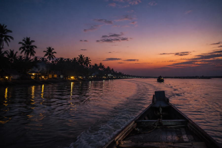
The last ferry leaves as the western sky fades from gold to indigo.
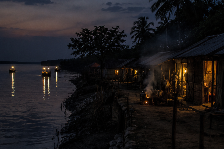
The river is calmer now. Not because the tide has stopped moving, but because the day has finished arguing with it. Along the shoreline, lights begin appearing one by one.
- A tea stall.
- A riverside home.
- A fishing boat preparing for another departure.
- A distant jetty.
The island slowly transforms into a constellation. The outlines of embankments dissolve into darkness. The markets fall silent. Only the river remains clearly present.
As the boat moves away, Kakdwip begins shrinking behind the wake. Yet it never truly disappears. Because Kakdwip is not defined by a skyline, a monument, or a single landmark.
It is defined by relationships.
- Between river and settlement.
- Between tide and livelihood.
- Between memory and landscape.
- Between resilience and uncertainty.
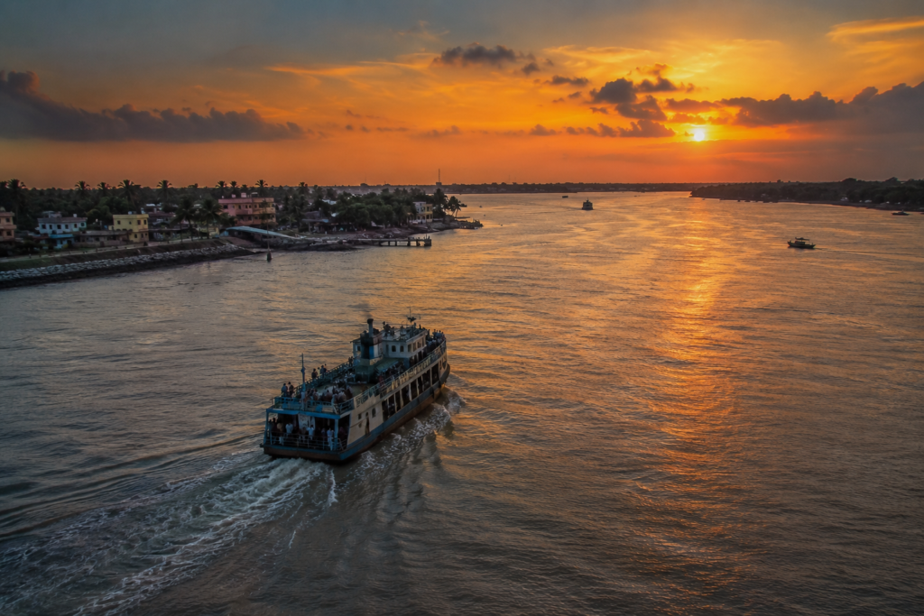
For centuries, people have arrived here carrying hopes, goods, stories, and ambitions before continuing deeper into the delta. Many still do. Most remember only the journey onward. But those who pause long enough to observe discover something unexpected.
Kakdwip is not merely the gateway to the Sundarbans. It is one of the clearest expressions of the Sundarbans itself.
- Where water continues to shape history.
- Where embankments record human determination.
- Where every tide rewrites the edges of the world.
And as darkness finally absorbs the shoreline, the island lingers not as a destination visited, but as a living landscape understood—if only briefly—through the movement of a river that never stops flowing.
Plan your private Sundarban expedition
A private journey shaped around you — your group, your pace, your interests. Book a free consultation.