 Encyclopedia
Before sunrise, the river around Satjelia does not look like water at all. It looks like movement itself — black, tidal, breathing.
The launch leaves Gosaba while the eastern sky is still the color of wet ash. Somewhere beyond the dark riverbanks lies Satjelia, one of the southernmost inhabited islands of the Indian Sundarbans, an island suspended between embankment and estuary, between cultivation and forest, between survival and erosion.
- The boatman barely speaks.
- The engine coughs awake.
- Nets lie heaped near his feet, smelling faintly of shrimp scales and diesel.
Then the tide begins to turn.
In the Sundarbans, geography is never fixed.
- Rivers rearrange memory.
- Mudbanks appear and disappear.
- Channels widen after cyclones.
- Villages shift inland.
- Embankments collapse.
An island here is not simply land surrounded by water; it is a negotiation with water every single day.
Satjelia carries this reality more heavily than many others.
Far to the south and east, beyond the inhabited stretches, the mangrove forests thicken toward the tiger reserve. The forest is never fully absent from Satjelia.
Even when invisible, it exists in conversation, caution, economy, ritual, and fear.
- Crab collectors speak of tides the way mountaineers speak of avalanches.
- Honey gatherers still invoke Bonbibi before entering forest creeks.
- Children grow up hearing stories not only about cyclones, but about men who did not return from the rivers.
As dawn slowly opens over the delta, the island begins to emerge.
Not dramatically.
The Sundarbans never reveal themselves all at once.
- First comes the silhouette of embankments.
- Then the faint outline of palms bent permanently inland by salt winds.
- Then the geometry of fishing nets suspended on bamboo poles.
- Smoke rises from unseen kitchens.
- Egrets lift from mudflats in white bursts.
Somewhere behind the riverbank, a loudspeaker recites morning prayers through static.
Satjelia appears less like an island being discovered and more like one being remembered by the tide.
Its dominant identity reveals itself almost immediately: Satjelia is a frontier island — a human settlement standing at the edge of mangrove wilderness and climatic uncertainty.
Unlike islands shaped primarily by tourism or river commerce, Satjelia carries the tension of proximity: proximity to tiger territory, to tidal vulnerability, to salinity, to erosion, to ecological richness, and to the fragile boundary between habitation and forest.
The closer the boat approaches, the clearer that tension becomes.
- The river widens beside exposed mudbanks where red fiddler crabs scatter into holes.
- Mangrove roots emerge like dark fingers from the tidal edge.
- A kingfisher flashes electric blue above the water and disappears into the haze.
The smell changes too — less urban, more estuarine: wet clay, drying fish, wood smoke, saline wind.
By the time sunlight finally reaches the embankments, Satjelia is awake.
First Encounter
Arrival in Satjelia is rarely cinematic in the conventional sense. There are no dramatic harbors or monumental entrances. The island announces itself through ordinary labor.
- Women carrying metal water vessels walk along narrow embankment paths before the heat intensifies.
- Fishermen untangle nylon nets beside moored wooden boats stained dark by river water.
- Schoolchildren in blue uniforms wait near tea stalls while bicycles rattle across uneven brick roads.
- A goat tied beside a grocery kiosk chews quietly at a length of jute rope.
The first visible structure from the river is often the embankment itself — the island’s most important architecture.
Everything behind it depends on whether it holds.
The mud embankments of the Sundarbans are not passive boundaries.
They are living structures continuously repaired by hand, patched after storms, reinforced with bamboo, weakened by tides, and reshaped by monsoon water. In Satjelia, the embankment is a road, a shield, a viewpoint, a gathering place, and a memory line all at once.
From the river, the island appears low and vulnerable. Much of the inhabited Sundarbans sits only slightly above sea level. During high tide, the water presses close against the embankment walls, reminding residents how thin the separation really is between settlement and estuary.
Coconut palms lean above clusters of homes roofed with tin, tile, and occasionally thatch. Ponds glimmer behind courtyards. Narrow canals snake inland through fields and settlements before disappearing into mangrove-lined creeks.
Nothing here feels disconnected from water.
Even silence carries tidal rhythm.
The boats arriving at Satjelia rarely carry tourists alone. They carry sacks of rice, school supplies, medicines, fuel drums, fish baskets, mobile recharge cards, construction material, and news from Kolkata.
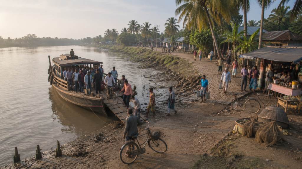
The island’s relationship with the mainland is maintained through these daily crossings over rivers that can appear deceptively calm in winter and violently unpredictable during monsoon storms.
Near the landing areas, tea stalls begin their first business of the morning.
- Sweet tea boils in blackened kettles.
- Someone discusses the previous night’s tide height.
- Someone else talks about crab prices in the Canning market.
- A radio crackles with Bengali songs interrupted by weather bulletins.
Every conversation eventually returns to water.
Island Identity
Satjelia belongs administratively to the Gosaba Community Development Block in the South 24 Parganas district of West Bengal. The island lies within the inhabited belt of the Indian Sundarbans — the immense tidal delta formed by the Ganges, Brahmaputra, and Meghna river systems before they dissolve into the Bay of Bengal.
But statistics alone cannot explain Satjelia.
To understand the island, one must first understand isolation.
The journey from Kolkata to the more deeply inhabited Sundarbans is gradual and layered.
- Roads narrow.
- Railway lines end.
- Concrete thins into mud embankments and ferry crossings.
- Eventually, the river becomes the only reliable connector between settlements.
Satjelia exists within this final geography — a landscape where movement depends on tides, weather, engines, and memory.
The island is associated with two gram panchayat regions:
Satjelia and Lahiripur.
Settlements spread across embankment roads, reclaimed agricultural land, ponds, creeks, and village clusters connected by narrow paths. Research studies and census references identify Satjelia as one of the major inhabited islands of the Gosaba region.
Unlike more commercially visible parts of the Sundarbans, Satjelia retains a quieter, working-island character. Its identity is tied less to tourism infrastructure and more to subsistence economies, river dependency, and forest-edge existence.
The island is surrounded and shaped by a network of tidal rivers and creeks connected to larger estuarine systems of the delta. These waterways determine everything from transport schedules to soil salinity. During low tide, exposed mudflats reveal how temporary solid ground truly is. During monsoon tides, the rivers reclaim psychological authority over the landscape.
Settlement patterns on Satjelia reflect adaptation rather than design.
Homes are often built on slightly raised ground. Ponds serve multiple purposes — bathing, fish cultivation, and rainwater storage. Fruit trees cluster around courtyards not only for food but as protection against wind and erosion. Paths follow embankments because embankments remain the safest elevated routes during flooding.
Even village spacing reflects environmental negotiation.
In many places, open fields abruptly end near creeks lined with mangroves. Beyond those creeks begins another world — the protected forest landscape where human presence becomes conditional.
Satjelia does not feel like an island at the center of something.
It feels like an island at the edge of something enormous.
The Rivers That Shaped The Island
No map of Satjelia is complete without its rivers.
They are the island’s roads, walls, markets, memory keepers, and destroyers.
The rivers surrounding the Gosaba region separate inhabited islands from each other and from the protected mangrove forests beyond. Across this watery geography, ferries replace buses, jetties replace stations, and tides determine timing more reliably than clocks.
On Satjelia, rivers are not scenery. They are infrastructure.
The Gomor River system and connected tidal channels influence the island’s settlement and mobility patterns, while countless smaller khals — tidal creeks threading through mudflats and mangrove belts — regulate salinity, fishing access, and drainage.
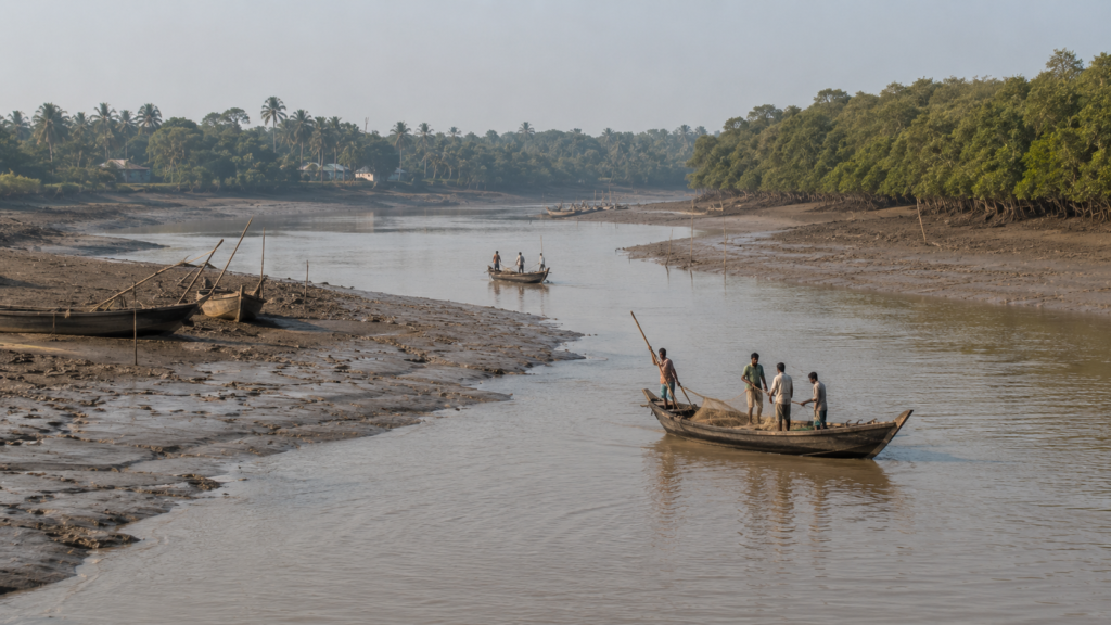
From the embankment, the rivers often appear deceptively calm in winter mornings.
Fishing boats drift across silver water while children play near moored launches. Yet these same rivers become violent during cyclonic weather. Tidal surges can rise rapidly through estuarine channels, pushing saline water deep into cultivated land.
The people of Satjelia read rivers almost instinctively.
They notice subtle changes outsiders rarely perceive: the color of water before storms, unusual current speed, floating debris after upstream erosion, shifts in fish movement, sudden silence among birds before heavy weather.
River knowledge here is inherited through repetition.
An elderly fisherman repairing a net beside the embankment can often identify tide behavior by moon phase alone.
Crab collectors discuss creek depths from memory.
Boatmen calculate routes according to tidal pull rather than straight-line distance.
The island’s economy emerged directly from these waters.
Fish, prawns, mud crabs, fuel transport, market connectivity, forest access, and inter-island trade all depend upon navigable tidal channels. Even agriculture is indirectly shaped by rivers because embankment breaches allow saline water intrusion into cropland.
Throughout the day, the riverfront changes character.
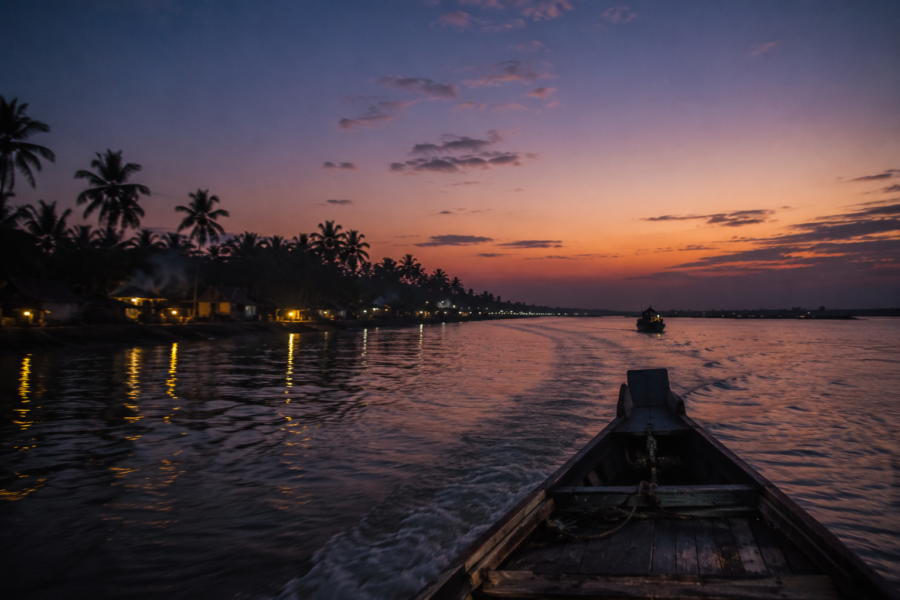
Morning belongs to transport and fishing activities. Afternoon brings slower rhythms — boats tied along muddy edges while nets dry in sunlight. At dusk, the rivers darken quickly, reflecting only scattered lanterns and distant engine lights.
And always there is movement.
Not dramatic waves, but tidal breathing.
- Water advancing.
- Water retreating.
- Water remembers the sea.
Historical Footprints
Satjelia is not an ancient settlement in the traditional sense. Much of the inhabited Sundarbans emerged through reclamation, colonial experimentation, migration, and dangerous environmental transformation during the late nineteenth and early twentieth centuries.
Before embankments and organized settlement, large parts of this region belonged primarily to mangrove wilderness.
- Tigers moved through areas where rice fields now exist.
- Saltwater crocodiles occupied channels later crossed daily by ferries.
- Dense forests covered the land that would eventually become villages.
The transformation accelerated under colonial land reclamation projects. Among the most influential figures associated with the inhabited Sundarbans was Sir Daniel Mackinnon Hamilton, the Scottish entrepreneur who acquired large tracts of deltaic land in the early twentieth century, including islands such as Gosaba, Rangabelia, and Satjelia.
Hamilton’s vision was unusual for its time.
He imagined cooperative rural settlements in the tidal delta — organized agricultural communities built through reclamation and embankment construction. Settlers were encouraged to migrate into difficult terrain where forest, predators, disease, and flooding made habitation extremely dangerous.
Satjelia became part of this frontier experiment.
Historical accounts and research references indicate that sections of the island were reclaimed and gradually cultivated during the Hamilton-era expansion into the Sundarbans. Migrants arrived from different regions, including areas that later became part of Bangladesh.
The process was brutal.
- Mangroves were cleared manually.
- Embankments were built through exhausting labor.
- Malaria spread widely.
- Tiger attacks were not uncommon in newly reclaimed zones bordering forests.
- Settlers fought not only environmental uncertainty but also isolation from urban centers.
Even today, older settlement patterns on Satjelia retain traces of reclamation-era geography.
Long embankment alignments follow former tidal boundaries. Some village names preserve histories of migration and settlement clustering. Agricultural fields appear carved from terrain that still feels partially claimed from water rather than permanently secured from it.
The partition in 1947 altered the demographic fabric further.
Refugee migration from East Pakistan — later Bangladesh — reshaped many Sundarban settlements. Families displaced by political upheaval arrived in islands where survival already depended on ecological resilience. Oral histories across the delta frequently blend memories of migration with memories of storms, failed harvests, and forest labor.
Satjelia absorbed these histories quietly.
Unlike cities that archive transformation through monuments, the island stores memory through land itself — embankments repaired after breaches, ponds dug by settlers, shrines built beside dangerous creeks, and pathways established through reclaimed terrain.
History here survives not in grand architecture but in persistence.
Historical Personalities & Transformations
The most significant historical figure connected to Satjelia’s broader transformation remains Sir Daniel Hamilton, whose cooperative settlement experiments influenced large sections of the Gosaba region during the early twentieth century.
Hamilton’s influence extended beyond land acquisition.
He promoted cooperative credit systems, agricultural experimentation, and local self-organization in areas where formal infrastructure barely existed. Though shaped by colonial structures and limitations, his initiatives left a lasting imprint on how many inhabited Sundarban islands developed.
Yet Satjelia’s deeper transformation belongs less to administrators and more to unnamed settlers.
- Men who cut mangrove roots by hand.
- Women who carried mud to reinforce embankments.
- Boatmen who connected isolated settlements long before regular transport systems existed.
Fishing communities that learned tidal rhythms through loss.
Agricultural laborers who adapted to saline intrusion season after season.
The island’s social structure also reflects layers of caste, migration, tribal communities, fishing occupations, and forest-linked livelihoods. Research in parts of Satjelia and neighboring regions has documented economically vulnerable communities living close to forest-dependent occupations, particularly fishing, crab collection, and seasonal forest labor.
Transformation on Satjelia has never been linear.
- Electricity arrived gradually.
- Mobile networks altered communication patterns.
- Concrete structures replaced some mud homes.
- Solar panels appeared in remote stretches.
- Motorized boats reduced travel time between islands.
- Schools expanded educational access across settlements once reachable only by difficult tidal routes.
Yet environmental vulnerability remains constant beneath these changes.
- A cyclone can still erase years of savings in a single night.
- An embankment breach can turn cropland saline for months.
- A failed fishing season can push families toward migration.
This tension defines modern Satjelia.
The island is changing, but never fully escaping its elemental realities.
Even now, standing on an embankment at midday, one can see both histories at once: schoolchildren carrying smartphones past fishermen repairing traditional nets beneath coconut trees while tidal water presses silently against the mud walls protecting the village.
In Satjelia, progress never fully replaces struggle.
It simply learns to coexist with the tide.
Folklore & Legends
By late afternoon, the conversation on Satjelia changes.
The practical rhythms of the day — fishing, ferry timings, market errands, embankment repairs — slowly soften into stories.
- Men gather near the tea stalls facing the river.
- Elderly women clean vegetables beneath shaded verandas.
- Children drift between courtyards while the tide rises almost invisibly beyond the embankments.
This is usually when the forest enters the conversation.
Not as geography.
As presence.
In the Sundarbans, folklore is not decorative mythology separated from ordinary life. It survives because the landscape itself remains unpredictable. The mangrove forest surrounding inhabited islands like Satjelia has historically been associated with danger: tigers, storms, drowning tides, disappearing creeks, and people who never returned from fishing expeditions.
Across this region, the most enduring spiritual figure remains Bonbibi — the guardian of the forest, revered across both Hindu and Muslim communities of the Sundarbans. Her story travels through oral performance, shrine rituals, folk theatre, and inherited memory.
On Satjelia, Bonbibi is less a distant deity and more a moral geography.
Her shrines are often modest: painted clay figures, green flags, faded garlands, simple altars beside river crossings or forest-bound routes. Before entering deeper creeks for fishing, honey collection, or crab gathering, many workers still offer prayers seeking protection from Dakshin Ray — the tiger-associated power of the forest — and invoke Bonbibi as mediator between humans and wilderness.
The stories vary from village to village.
Some elders speak of tiger encounters avoided through prayer.
Others remember hearing forest chants carried across water at night.
A few dismiss such stories publicly while quietly participating in rituals before dangerous journeys.
The boundary between belief and precaution is intentionally blurred here.
Because in the Sundarbans, rationality alone has never guaranteed survival.
Boatmen crossing forest channels sometimes avoid mentioning tiger names directly.
Honey collectors speak carefully about certain creeks believed to be “unlucky.” Older fishermen recall stretches of river where unusual silence among birds was once considered a warning before storms.
Many of these beliefs cannot be historically verified.
But neither can they be dismissed merely as superstition.
They emerged from generations of environmental uncertainty.
The folklore of Satjelia reflects a landscape where humans never achieved complete dominance over nature. Even today, residents living near forest-facing river systems often describe the mangroves almost as a living intelligence — watchful, unpredictable, impossible to fully know.
At dusk, when river fog begins forming above the tidal channels, those stories suddenly feel less symbolic.
Life Between The Tides
Morning on Satjelia begins before light.
Not because people prefer dawn, but because tide schedules demand it.
- Fishing boats depart according to current and depth.
- Crab collectors calculate journeys through tidal creeks with precision inherited through experience.
- Farmers check salinity conditions in ponds and fields.
- Women prepare rice before the day’s heat settles across the embankments.
Everything here bends around water movement.
The phrase “between the tides” is not metaphorical on Satjelia. It is logistical reality.
Fishing remains among the island’s most significant livelihoods.
- Nets dry beside houses.
- Boats line muddy riverbanks.
- Young boys learn knotting techniques almost unconsciously while sitting beside older relatives repairing torn mesh under shade trees.
The catch changes seasonally.
Small estuarine fish, prawns, mud crabs, and shrimp seed collection have long shaped local economies across parts of the Sundarbans, though environmental regulations and ecological concerns increasingly complicate these activities. Research across the delta has documented how fishing and crab-based livelihoods remain deeply tied to vulnerable household economies.
On Satjelia, livelihood diversification is often a necessity rather than a choice.
One household may cultivate paddy, maintain ponds, collect crabs seasonally, and depend partly on migrant labor income from cities. Another may operate a small tea stall while relatives work on fishing boats or construction sites outside the island.
Agriculture survives under difficult conditions.
Salinity intrusion from embankment breaches can damage cropland for years. Farmers adapt by altering crop cycles, experimenting with salt-resistant varieties, and depending heavily on monsoon rainfall to dilute soil salinity.
- Ponds are everywhere.
- Behind homes.
- Besides pathways.
- Near schools.
Some are used for bathing and household water. Others support fish cultivation. During dry months, rain-fed freshwater ponds become critically important because saline groundwater limits drinking-water access in many areas of the Sundarbans.
Children move easily through this landscape.
They walk narrow embankments without hesitation.
They know which ponds are safe for swimming and which river stretches become dangerous during strong tides. School boats and ferry crossings become part of ordinary childhood memories.
In the afternoons, the island slows.
- Heat settles heavily across the fields.
- Dogs sleep beneath fishing nets hung for repair.
- Small grocery shops remain half-open while radios murmur cricket commentary through static.
Then the tide changes again.
And movement resumes.
Walking Through The Villages
The villages of Satjelia do not unfold through grand streets or planned symmetry. They emerge gradually through embankment roads, narrow brick paths, ponds edged with banana trees, and clusters of homes shaped more by adaptation than architecture.
Walking here means walking through layers of negotiation with the climate.
Many houses stand on raised earthen platforms to reduce flood impact.
Courtyards are carefully maintained because mud turns treacherous during monsoon months. Bamboo fencing separates small vegetable patches from pathways where ducks wander freely between ponds.
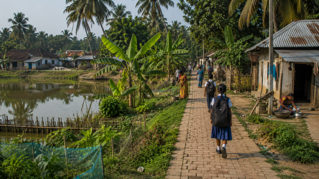
The villages feel simultaneously exposed and intimate.
One can hear conversations through open windows.
- The smell of cooking rice drifts across shared spaces.
- Radios broadcast devotional songs beside bicycle repair shops.
- A hand pump squeaks somewhere behind coconut palms.
The visual texture changes constantly.
A small temple painted bright blue appears beside a grocery stall selling biscuits and kerosene. Further ahead stands a mosque with green trim facing an open field where children play cricket using driftwood as wickets. School walls display hand-painted environmental slogans warning about cyclones, sanitation, and tiger awareness.
- Tea stalls function almost like informal public squares.
- Fishermen discuss market prices.
- Farmers debate rainfall patterns.
- Boat operators exchange river information.
Students check mobile phones for exam results while elderly men comment on politics and embankment conditions with equal seriousness.
On Satjelia, information travels socially long before it becomes official.
The villages also reveal the island’s economic fragility.
Many homes remain modest despite decades of settlement.
Tin roofs are often weighted with bricks to resist storm winds.
Boats undergoing repair lie overturned beside courtyards because replacing them entirely would be financially devastating.
Yet there is visible resilience too.
Kitchen gardens flourish in limited space. Fruit trees — mango, guava, coconut, papaya — surround homes wherever soil permits. Women dry fish, spices, and rice products beneath woven mats while children cycle past carrying schoolbags larger than their shoulders.
Religious spaces on the island are rarely monumental.
Their significance comes from continuity.
- Small Bonbibi shrines stand near routes historically connected to forest work.
- Local temples host seasonal festivals tied to agricultural rhythms and river cycles.
- Mosques become especially active during evening prayers when the sound of recitation drifts softly across the settlement.
As evening approaches, village paths fill again.
- Cows return from grazing.
- Fishing nets are folded.
- Smoke rises from clay ovens.
And beyond the houses, always visible somewhere between trees or embankments, lies the river.
Sounds Of The Island
Satjelia is heard long before it is fully understood.
The island possesses no single dominant sound. Instead, it shifts acoustically with tide, weather, season, and hour.
At dawn, the loudest noise is often the engine of the first ferry or fishing launch breaking the silence of tidal water. Then come birds — egrets, mynas, kingfishers, drongos — layered above human activity beginning across the villages.
Metal utensils striking hand pumps.
- Cycle bells.
- Roosters.
- Distant prayer calls distorted through loudspeakers.
- Women sweeping courtyards with stiff grass brooms.
The island never becomes truly silent, yet it rarely becomes loud in an urban sense either.
Even conversation here seems shaped by open landscapes and river distance.
- By midmorning, work sounds dominate.
- Axes splitting wood.
- Boat engines revving beside muddy landings.
- Children reciting lessons inside schools with open windows.
- Fishing nets dragged across the embankment grass.
In markets and tea stalls, radios compete gently with conversation. Bengali folk songs, political debates, weather warnings, devotional music, and cricket commentary drift through the humid air.
The river adds its own constant undertone.
Not waves exactly. Movement.
- Soft collision between tide and embankment.
- Wooden boats knocking together.
- Water drains through creeks during ebb tide.
During the monsoon, the soundscape changes dramatically.
Rain overwhelms everything.
- Tin roofs become percussion instruments.
- Wind moves through palms with unsettling force.
- Embankment water slaps harder against mud walls.
- Distant thunder rolls across flat estuarine horizons without obstruction.
And then there are the night sounds.
- Dogs barking suddenly at unseen movement.
- Insects pulsing through mangrove humidity.
- The low mechanical hum of diesel generators.
- Occasional ferry engines crossing dark water long after sunset.
Sometimes, in winter fog, sound travels strangely across the rivers.
Voices from unseen boats drift through the mist.
A single hammer strike from another embankment echoes farther than expected.
Somewhere across the water, a fisherman calls out to another boat invisible in the darkness.
On Satjelia, hearing becomes another way of navigating the landscape.
Wildlife Expedition
The wildlife around Satjelia rarely reveals itself dramatically.
The Sundarbans reward patience rather than pursuit.
A naturalist walking the embankments near dawn notices movement first in fragments: ripples near muddy banks, shadows lifting from mangrove roots, sudden flashes of color crossing tidal channels.
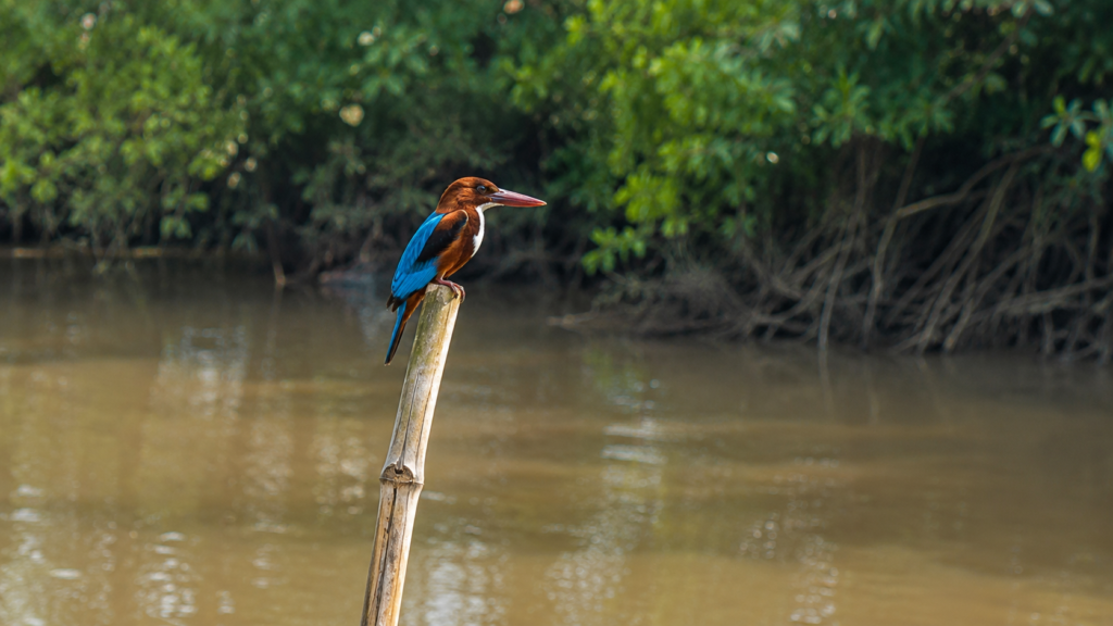
Birdlife appears everywhere once the eye adjusts.
- Pied kingfishers hover above creeks before diving sharply into water.
- Brahminy kites circle high over fishing zones.
- Egrets stalk exposed mudflats during low tide.
- Pond herons vanish almost completely against muddy embankments until startled into flight.
During winter months, migratory species increase activity across wetlands and open water systems connected to the delta.
Mangrove ecosystems surrounding Satjelia support rich avian diversity, estuarine reptiles, amphibians, crustaceans, and aquatic life adapted to saline tidal environments. Scientific surveys across the Indian Sundarbans have repeatedly documented the ecological importance of these interconnected habitats.
The waterways around the island occasionally host sightings of estuarine dolphins, though encounters remain unpredictable. Mudbanks support populations of fiddler crabs whose synchronized movement transforms exposed tidal flats into living patterns of red and rust-colored motion.
Reptiles remain part of the island ecology too.
Water monitor lizards move silently through creek edges and pond embankments.
Snakes inhabit agricultural fields, mangrove margins, and wetland vegetation, particularly during monsoon months when flooding alters habitat boundaries.
Tiger presence around Satjelia exists more as an ecological reality than a visible spectacle.
The island lies within a wider landscape historically shaped by proximity to tiger habitat in the Sundarbans reserve region. Human-tiger conflict studies conducted in nearby areas of the delta highlight how forest-edge communities continue to negotiate coexistence with one of the world’s most difficult large predators.
Most residents will never casually describe the tiger as wildlife alone.
They speak of it with layered respect — fear, caution, inevitability. For forest workers, tiger awareness becomes procedural knowledge.
- Avoid isolated creeks.
- Watch tide timing.
- Travel in groups.
- Observe bird alarm calls.
- Do not ignore silence.
Even where tigers are absent physically, their possibility shapes behavior.
As evening descends near the mangrove-facing river stretches, the ecological atmosphere shifts subtly.
- Birds retreat deeper into vegetation.
- Mudskippers emerge across exposed flats.
- Insects intensify.
The edges between inhabited land and wild terrain feel less fixed. The Sundarbans after dark belongs increasingly to non-human movement.
And Satjelia knows this.
Mangrove Chronicles
To outsiders, mangroves often appear chaotic.
Dense.
Impenetrable.
But standing near the tidal creeks beyond Satjelia, the order inside the mangrove system gradually becomes visible.
- Roots arch upward to breathe above oxygen-poor mud.
- Salt-tolerant leaves filter brackish water through specialized adaptations.
- Sediment gathers around root systems, slowly stabilizing fragile coastlines against erosion and tidal force.
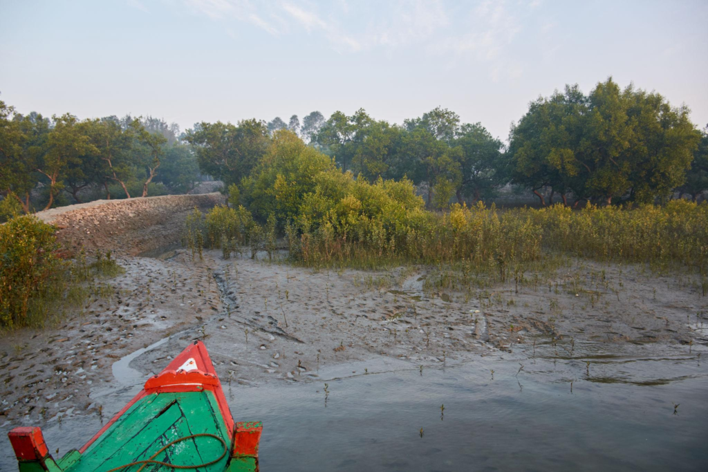
The mangroves here are not simply forests.
They are engineering systems built by evolution.
Species found across the Sundarbans include gewa, goran, sundari, keora, and gewa-associated vegetation adapted to fluctuating salinity and tidal inundation. Ecological studies have shown how these forests function as storm barriers, nursery grounds for fish populations, carbon sinks, and sediment stabilizers.
For Satjelia, mangroves are both protection and limitation.
- They reduce wave impact during storms.
- They stabilize creek edges.
- They support fisheries by sustaining aquatic ecosystems.
But they also mark the threshold of dangerous territory where forest regulations, wildlife risks, and difficult livelihoods intersect.
People here maintain a practical relationship with mangroves.
- Children collect fallen wood along safer edges.
- Fishermen navigate narrow creeks lined with pneumatophores rising like spikes from mud.
- Boatmen read tidal depth partly through vegetation patterns.
Conservation conversations in the Sundarbans are rarely abstract because survival and ecology remain tightly linked.
- When mangrove belts weaken, embankments become more vulnerable.
- When salinity patterns shift, fisheries suffer.
- When cyclones intensify, exposed settlements face greater devastation.
The relationship between Satjelia and the surrounding mangrove systems is therefore reciprocal rather than symbolic.
One protects the other imperfectly. At low tide, the mangrove margins reveal astonishing detail.
- Tiny crabs wave oversized claws from burrows.
- Mudskippers drag themselves across glistening flats.
- Herons stand motionless near tidal pools reflecting late afternoon light.
- The forest smells of salt, decomposition, algae, and wet earth all at once.
Nothing here feels static.
The mangroves are continuously growing, drowning, adapting, retreating, and reclaiming.
Like the island itself.
Explorer’s Field Notes
Near the southern embankment, sections of mud reveal fresh crab burrows after the tide retreats. Fiddler crabs emerge cautiously before scattering simultaneously at the vibration of approaching footsteps.
Morning ferry crossings between Gosaba-linked routes and Satjelia carry far more than passengers. Schoolchildren, sacks of vegetables, medicine cartons, fishing equipment, and fuel containers share limited deck space with remarkable efficiency.
Several ponds near settlement clusters appear rain-fed rather than groundwater-dependent, reflecting freshwater storage strategies common across saline-prone regions of the Sundarbans.
Bird activity intensifies noticeably during the first hour after sunrise. Kingfishers remain especially active along narrower creeks where small fish concentrate during changing tides.
Embankment vegetation often includes coconut palms, banana plants, and smaller shrubs whose root systems help reduce localized erosion near settlement edges.
Conversations in tea stalls repeatedly return to weather unpredictability, embankment maintenance, fish prices, and migration of younger workers toward Kolkata and other cities.
The transition between inhabited village space and mangrove-facing creeks can occur abruptly. In several stretches, cultivated land ends almost directly against tidal vegetation.
Even in relatively calm weather, river currents remain visibly strong near narrower channels during tidal change.
Nightfall On The Island
Sunset arrives horizontally in Satjelia.
There are no hills to interrupt it, no skyline to soften it. Evening moves across the island through open sky and tidal reflection. The last light lingers on the rivers longer than on the villages themselves, turning muddy water briefly copper-colored before darkness spreads outward from the mangrove edges.
By dusk, the embankments change character completely.
- Children disappear indoors.
- Tea stalls become brighter against the darkening landscape.
- Ferry movement slows.
- The last boats return carrying fishermen, market traders, schoolteachers, sacks of rice, bundles of nets, and occasionally live crabs tied carefully inside woven baskets.
Smoke rises from cooking fires across the villages.
Rice boils.
Fish fries in mustard oil.
The smell of wood smoke drifts slowly across damp air already cooling after the day’s heat.
Satjelia at night feels smaller than during daylight.
The rivers that seemed expansive under the sun become invisible boundaries. Beyond them lies darkness thick enough to erase distance entirely. Only scattered lanterns, solar lights, and the occasional beam from a passing launch suggest that other islands exist somewhere across the water.
Electricity has reached much of the inhabited Sundarbans over time, but outages remain common in storm-prone conditions. In some stretches of Satjelia, backup lighting still depends on kerosene lamps, rechargeable batteries, or solar systems installed after years of unreliable power access.
Night reorganizes sound.
Insects dominate first.
Then frogs begin calling from ponds and wet ditches. Dogs bark intermittently at unseen movement along embankment paths. Somewhere far away, a diesel engine crosses the river long after visibility has vanished.
The forest feels psychologically closer after dark.
Even residents who no longer work directly inside mangrove zones often speak differently about the rivers at night.
- Tidal creeks become harder to read.
- Fog forms quickly during the winter months.
- Currents strengthen silently beneath black water.
The absence of visibility restores older anxieties embedded deep within Sundarban life.
Some tea stalls remain open late, particularly near ferry points.
Men discuss weather forecasts, embankment conditions, political news, and market prices beneath dim lights, attracting clouds of insects. Mobile phones glow across wooden benches while older conversations continue beside them, almost unchanged from decades earlier.
Further inland, the villages settle gradually.
One by one, lights disappear.
The island does not sleep all at once.
It recedes.
The Seasons Of The Island
Satjelia does not experience seasons gently.
Each season alters the island’s rhythm, economy, ecology, and emotional atmosphere in visible ways.
Winter is the most forgiving.
From November through February, the humidity weakens slightly and the skies often remain clear for days. Morning fog drifts low over rivers and ponds while migratory birds appear across wetland stretches connected to the delta. Embankment walks become easier under softer sunlight, and fishing activity increases in calmer river conditions.
Winter also changes sound.
- Boat engines travel farther through cold air.
- Conversations linger longer outdoors.
- Markets remain active later into the evening.
This is the season when the Sundarbans appears deceptively peaceful.
Spring arrives subtly.
- Mango blossoms emerge near village courtyards.
- Dryness begins creeping into exposed mudbanks.
- The air grows heavier.
- Agricultural activity intensifies before the pre-monsoon heat reaches its peak.
Then comes summer.
By April and May, Satjelia begins to feel suspended beneath heat itself.
- Tin roofs radiate warmth long after sunset.
- River water reflects harsh white sunlight.
Afternoon work slows wherever possible because temperatures combined with humidity become physically exhausting.
It is also cyclone season.
Across the Bay of Bengal, atmospheric pressure systems gather strength over warming water. Every resident of the Sundarbans understands what this means long before official alerts arrive.
- People watch the sky more carefully.
- Boat movement becomes cautious.
- Embankment inspections increase.
The monsoon transforms the island again.
- Rainwater reshapes pathways into mud channels.
- Ponds overflow.
- Rivers swell against embankments.
- Tidal currents become faster, murkier, and more dangerous.
- Boat journeys that seemed routine in winter suddenly become uncertain under storm-heavy skies.
Yet monsoon is not only destruction. It replenishes freshwater ponds.
- Dilutes soil salinity.
- Revives vegetation.
- Restores agricultural possibilities after harsh, dry months.
Post-monsoon months often carry the most complicated emotional atmosphere. The landscape becomes intensely green again, but this is also the period when cyclone damage, embankment breaches, crop loss, and recovery efforts remain visible across the islands.
Seasonality in Satjelia is therefore not aesthetic alone. It determines survival strategies.
- Fishing patterns.
- Migration cycles.
- Crop decisions.
- School attendance.
- Ferry reliability.
Even marriage ceremonies and religious festivals often align with environmental timing because the climate here affects nearly every aspect of movement and livelihood.
The island measures time not only by calendars, but by tides, storms, and recovery.
Cyclones And Survival
Every embankment on Satjelia contains memory.
Not written memory.
Impact memory.
The Sundarbans has endured repeated cyclonic disasters for generations, but recent decades have intensified awareness of vulnerability across islands like Satjelia. Cyclones such as Aila in 2009, Amphan in 2020, and Yaas in 2021 left deep marks on embankments, agriculture, freshwater systems, housing, and livelihoods across the delta.
Residents still speak about Aila with particular gravity.
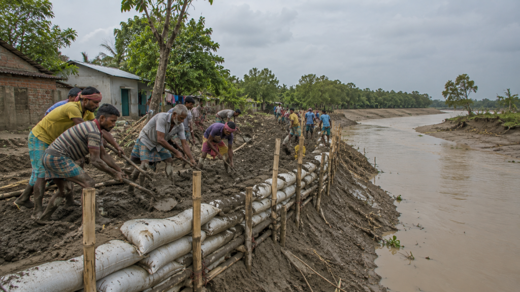
Not because cyclones were new, but because the scale of saline flooding and embankment collapse reshaped entire stretches of the inhabited Sundarbans. Saline water entered agricultural land and ponds, damaging livelihoods long after floodwaters receded.
On Satjelia, survival during cyclones depends first on preparation and then on collective response.
- Fishing boats are secured inland wherever possible.
- Livestock is moved to elevated ground.
- Food and drinking water are stored.
- Families monitor radio updates, mobile alerts, and local announcements continuously as storms approach.
But there are limits to preparation in a low-lying tidal delta.
When powerful cyclones strike during high tide, embankments can fail catastrophically. Water enters with immense force, carrying mud, debris, fish, uprooted vegetation, and occasionally entire sections of broken infrastructure.
After storms, the island changes temporarily.
- Fields turn saline.
- Roads disappear beneath mud.
- Dead fish accumulate near breached embankments.
Drinking-water scarcity becomes immediate because freshwater ponds are contaminated by saline intrusion.
Recovery is rarely fast.
Research across the Sundarbans repeatedly documents how economically vulnerable households experience prolonged impacts after cyclonic disasters, including debt, migration pressure, food insecurity, and livelihood disruption.
Yet resilience on Satjelia is deeply collective.
Villagers rebuild embankments manually before outside assistance fully arrives.
Community kitchens emerge during severe crises.
Boats transport medicine and food between isolated settlements when roads become unusable.
- Children return to school quickly even after storms.
- Fishing resumes rapidly despite damaged infrastructure.
Not because recovery is easy. Because delay itself becomes dangerous in subsistence economies. Cyclones have also altered how younger generations imagine the future.
Some families increasingly encourage migration toward Kolkata or other cities because environmental instability makes long-term livelihood planning uncertain. Others remain committed to island life despite recurring losses.
The future of islands like Satjelia is therefore inseparable from climate discussions now unfolding globally.
Sea-level rise, salinity intrusion, embankment sustainability, and intensified cyclonic systems are no longer theoretical concerns here.
They are visible realities already shaping everyday decisions.
Ferry Routes & Hidden Paths
Movement in Satjelia depends on water before roads.
Every journey begins with a crossing.
The route from Kolkata into the deeper Sundarbans usually unfolds through layered transitions: suburban rail lines toward Canning, road journeys through Basanti or Godkhali corridors, and finally ferry or launch crossings into the inhabited islands.
By the time travelers reach Satjelia, mainland assumptions about distance have already collapsed.
Ten kilometers may require multiple river crossings.
Weather may alter schedules entirely.
A tide can delay movement more effectively than traffic.
Local ferries remain essential arteries connecting Satjelia with Gosaba and neighboring islands. Wooden boats, mechanized launches, and passenger ferries transport workers, students, traders, schoolteachers, medical patients, vegetables, fuel drums, and fishing supplies daily across shifting tidal routes.
- The ferry ghats possess their own rhythm.
- Early morning crossings are busiest.
- Bicycles crowd narrow boarding planks.
- Fish baskets leak river water onto wooden decks.
- Schoolchildren stand balancing effortlessly while boats rock against muddy jetties.
During monsoon months, these crossings become more uncertain.
- Visibility drops suddenly in heavy rain.
- Strong currents complicate docking.
- Smaller boats navigate cautiously through wind-disturbed channels.
Yet transport rarely stops completely.
The islands survive through continuity of movement. Away from the main ferry points, narrower paths reveal another geography entirely.
- Brick roads end abruptly near ponds.
- Footpaths continue along embankments lined with wild grass and coconut palms.
- Small bamboo bridges cross drainage canals where children fish using improvised nets.
Some hidden paths lead toward quieter riverbanks rarely visited by outsiders. Others disappear into settlement clusters where homes stand close together beneath mango and betel nut trees.
Walking these interior routes reveals how intimately the island’s infrastructure depends upon adaptation rather than formal planning.
- Roads bend around ponds.
- Shops emerge near ferry traffic.
- Schools occupy slightly elevated terrain, safer from seasonal flooding.
Nothing here feels accidental.
Even apparent disorder reflects environmental negotiation accumulated across decades.
At low tide, hidden creek routes appear temporarily across exposed mudbanks. Experienced boatmen sometimes navigate channels that outsiders would barely recognize as navigable water. During high tide, the same landscape transforms again, swallowing exposed edges beneath tidal flow.
Satjelia’s geography is therefore not fixed.
It pulses.
Photography Expedition Guide
Satjelia rewards patience more than spectacle.
Photographing the island successfully requires attention to atmosphere, tide, and changing light rather than the pursuit of singular landmarks.
Sunrise is best experienced from embankment stretches facing open tidal channels. Before dawn, mist often forms above the rivers, softening boats, mangrove silhouettes, and distant tree lines into layered monochrome landscapes. Fishermen departing early create some of the island’s strongest documentary scenes — not staged moments, but ordinary labor unfolding against tidal light.
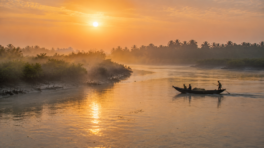
Winter mornings are especially favorable for photography.
Fog lingers longer.
Bird activity intensifies near mudflats and ponds.
Low-angle sunlight reveals textures across embankments, fishing nets, cracked mud, and mangrove roots.
For wildlife photography, quieter creek systems near mangrove-facing zones offer the greatest possibilities, though sightings remain unpredictable. Kingfishers, egrets, brahminy kites, pond herons, and estuarine activity provide more reliable subjects than dramatic mammal encounters.
The best photographs on Satjelia often emerge from human-environment interaction rather than isolated scenery.
- A fisherman repairing nets beneath a cyclone-damaged embankment.
- Children cycling along raised mud paths after monsoon rain.
- Women washing utensils beside freshwater ponds reflecting storm clouds.
- Crab baskets drying beside boats stained with saltwater residue.
Afternoon light works well for village photography because shadows deepen gradually across courtyards, tea stalls, and embankment roads. The humid atmosphere diffuses harshness, especially during post-monsoon months when vegetation appears intensely green.
Sunset locations depend heavily on season and tide.
Open embankments facing wider river stretches provide the clearest horizons.
- During ebb tide, exposed mudbanks add dramatic foreground texture.
- During high tide, reflections intensify across calmer water surfaces.
Night photography presents challenges due to low lighting and humidity, but winter fog conditions can create striking atmospheric scenes around ferry ghats and riverside settlements.
The island should not be photographed hurriedly.
Satjelia reveals itself slowly.
Its strongest visual language lies in transitions: tide changing around mangrove roots, evening smoke rising through palms, ferries vanishing into fog, storm clouds building above embankments.
This is a landscape of mood rather than monument.
Expedition Notes
The embankments of Satjelia function simultaneously as roads, flood barriers, social spaces, and observation points. At different hours of the day, the same stretch may host grazing goats, schoolchildren, fishermen repairing nets, and emergency cyclone monitoring.
Several ferry crossings remain strongly dependent on tidal depth despite increasing mechanization of local transport systems.
After heavy monsoon rain, some interior village paths become navigable only by foot or bicycle due to mud accumulation and localized flooding.
Freshwater ponds often appear greener during post-monsoon months because of algae growth stimulated by runoff and nutrient accumulation.
Conversations regarding migration recur frequently across the island, particularly concerning younger workers leaving for Kolkata, Kerala, or other urban labor markets.
During winter mornings, fog over wider tidal channels can reduce visibility dramatically even when nearby villages remain clearly visible.
Older residents often distinguish between “forest rivers” and “village rivers,” reflecting differing levels of perceived danger associated with specific waterways.
Sections of mangrove-facing creek edges display visible erosion patterns where tidal pressure has gradually undercut softer mud banks.
Connected Landscapes
Satjelia does not exist in isolation.
Like every inhabited island of the Sundarbans, it belongs to a wider ecological and cultural network shaped by rivers rather than highways.
To the north and west lie other settled islands connected through ferry routes, shared markets, schools, healthcare movement, and migration histories. Gosaba functions as one of the major administrative and transport nodes of the region, linking smaller island settlements through daily river traffic.
Nearby islands such as Rangabelia, Bali, Dayapur, and Gosaba itself share intertwined histories of reclamation, embankment construction, cooperative settlement, and environmental vulnerability. The rivers between them separate communities physically while simultaneously binding them economically.
A market on one island serves several others.
- A schoolteacher may travel daily by ferry.
- Medical emergencies depend upon inter-island boat movement.
- Marriage networks often connect families across river channels.
To the south, the relationship changes dramatically.
There, the inhabited landscape gradually yields to protected mangrove wilderness associated with the Sundarbans Tiger Reserve and adjacent forest systems. Human presence becomes increasingly regulated, seasonal, and risky.
This proximity to protected forest landscapes shapes Satjelia psychologically as much as geographically.
The island exists near one of the world’s largest mangrove ecosystems — a UNESCO-recognized ecological region supporting extraordinary biodiversity and critical climate-buffer functions.
- River systems connect these landscapes continuously.
- Sediment flows between inhabited and protected zones.
- Fish populations migrate through shared estuarine waters.
- Cyclones impact both forest and settlement simultaneously.
Even folklore travels along the same waterways.
Bonbibi stories told on Satjelia echo across dozens of Sundarban islands because the environmental realities producing those narratives remain shared throughout the delta.
Historically too, the islands evolved collectively rather than independently. Reclamation projects, migration waves, cooperative experiments, refugee settlements, and embankment systems transformed entire clusters of islands over decades.
Today, climate vulnerability reinforces these interconnections further.
An embankment failure on one island may disrupt transport routes elsewhere. Market fluctuations ripple across ferry networks. Migration patterns alter labor systems throughout the region.
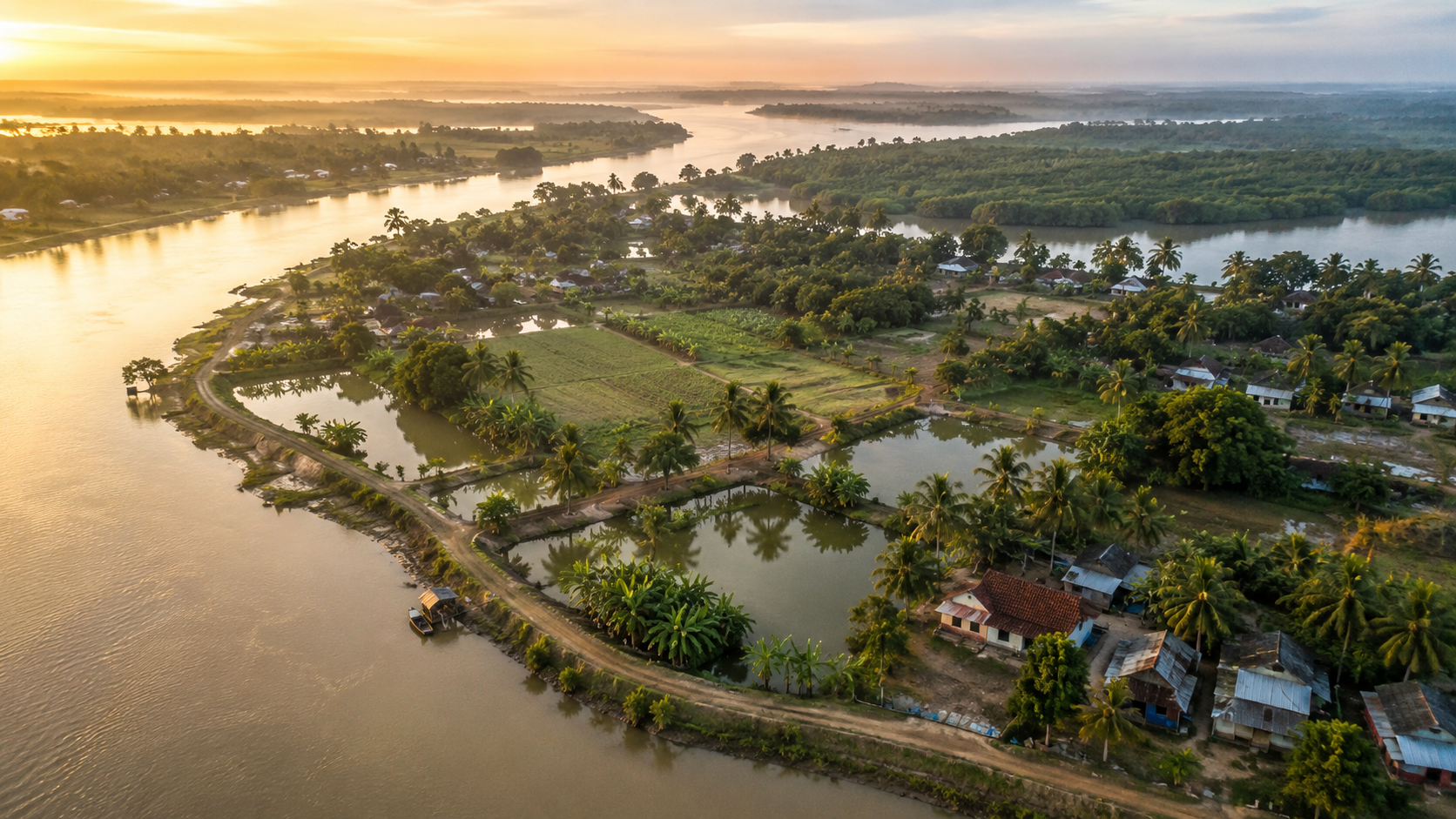
Seen from above, Satjelia is only one fragment within a vast amphibious world of mud, tide, forest, and human persistence.
But from within, it feels complete unto itself.
Oral Histories
Older residents of Satjelia often describe the past through storms rather than dates.
One remembers the year embankments failed near a particular creek.
Another recalls when saline water destroyed several seasons of crops after a cyclone.
Someone else remembers traveling by country boat before mechanized ferries became common.
Oral memory on the island remains deeply environmental.
Families speak about migration histories too.
Across the inhabited Sundarbans, many settlements absorbed people displaced by poverty, land scarcity, political upheaval, and Partition-era movement from regions that later became Bangladesh. These histories survive not through official archives alone, but through family stories repeated across generations.
An elderly fisherman sitting near a tea stall may remember tiger warnings issued before certain fishing expeditions decades earlier.
A grandmother recalls carrying drinking water long distances after cyclone flooding contaminated ponds.
Former students describe journeys to school before improved embankment routes connected village clusters more reliably.
Many oral accounts focus less on extraordinary events than on endurance.
- Repairing homes after storms.
- Reclaiming fields from salinity.
- Crossing rivers during medical emergencies.
- Learning tide behavior from parents and grandparents.
These memories rarely sound dramatic when narrated locally.
They sound practical. Matter-of-fact. Perhaps because environmental uncertainty has remained so continuous that survival itself became ordinary.
Some residents also speak about visible environmental change across their lifetimes.
- Wider rivers.
- More erratic weather.
- Increased salinity.
- Changing fish populations.
- Hotter summers.
- Erosion along familiar creek edges.
Scientific climate studies increasingly support many of these lived observations across the Sundarbans delta. Yet on Satjelia, such changes are discussed less through scientific terminology and more through comparison with remembered landscapes.
The oral histories of the island therefore, function as ecological records as much as human memory.
Not written in documents.
Written in recollection of tides.
Food Of The Island
The first smell most visitors notice in Satjelia is not the river.
It is cooking rice.
By midday, smoke from wood-fired kitchens drifts across embankment roads and settles lightly over ponds, courtyards, and fishing nets hung out to dry. Food on the island is deeply seasonal, intensely practical, and inseparable from tide, salinity, and livelihood.
Rice remains the center of nearly every meal.
Fish follows naturally.
In Satjelia, food is rarely ornamental. It reflects what the rivers permit, what ponds sustain, what markets receive by ferry, and what families can preserve through uncertain seasons. Kitchens here evolved through adaptation to isolation, cyclones, changing fisheries, and fluctuating agricultural conditions.
Small estuarine fish are common in daily cooking.
Prawns appear frequently where economically possible.
Mud crabs, though commercially valuable, are often sold rather than eaten locally because market prices offer critical income for fishing households. During favorable seasons, freshwater pond fish supplement diets in settlements where aquaculture remains viable despite salinity challenges.
Mustard oil dominates flavor.
So does heat.
- Green chilies dry beside courtyards under winter sunlight.
- Turmeric stains cooking vessels.
- Fish curries simmer in blackened pots while children wait nearby holding metal plates already washed at pond edges.
Vegetable cultivation survives carefully around homesteads.
- Pumpkin vines spread across bamboo frames.
- Eggplants grow beside ponds.
- Banana trees serve culinary and practical functions alike.
- Seasonal leafy greens appear during cooler months when soil conditions become more manageable.
The island’s food culture also reflects scarcity management.
Dried fish remains important during difficult weather periods and fishing interruptions. Stored rice becomes essential after cyclones when transport systems fail temporarily. Families often maintain small reserves of lentils, puffed rice, molasses, and preserved ingredients precisely because river isolation can intensify suddenly during storms.
Tea stalls form another layer of Satjelia’s food landscape.
- Sweet tea.
- Biscuits stored in glass jars.
Occasionally, fried snacks are cooked quickly beside ferry points where passengers gather between crossings.
These stalls operate as social infrastructure as much as businesses.
- Morning conversations begin there.
- Weather speculation circulates there.
- Political arguments unfold there.
And during long monsoon rain, entire afternoons can disappear there.
Festivals alter food rhythms too.
Religious ceremonies bring communal cooking, sweets, rice preparations, fish feasts, and seasonal offerings tied to both Hindu and Muslim traditions across the island’s mixed social fabric. Bonbibi-related observances in the wider Sundarbans also historically involved ritual offerings associated with forest protection and safe return.
Perhaps the most revealing aspect of food on Satjelia is restraint.
Nothing feels excessively distant from labor.
A plate of rice and river fish contains the memory of tides, ferry transport, market uncertainty, embankment survival, and seasonal risk. Even ordinary meals carry geography within them.
Island Economy
Money moves through Satjelia unevenly.
- Some arrive by fish baskets.
- Some are migrant labor transfers from Kolkata, Kerala, or distant construction sites.
- Some through government programs, local trade, ferry movement, agriculture, small shops, and seasonal tourism connected to nearby parts of the Sundarbans.
But the island’s economy still rests fundamentally on ecology.
Fishing remains one of the most important livelihood systems. River fish, shrimp, and mud crabs support both household consumption and commercial trade networks extending far beyond the island itself. Crab collection in particular has become economically significant across many Sundarban communities because export demand has increased market value dramatically over recent decades.
Yet a higher value often brings greater vulnerability.
Crab collectors and fishermen frequently work in environmentally risky conditions near tidal creeks and forest-edge waterways. Income fluctuates according to weather, river conditions, regulations, fuel prices, and ecological shifts.
Agriculture survives under constant pressure from salinity and cyclonic damage.
Rice cultivation continues where embankments remain stable enough to protect fields from tidal intrusion.
Farmers increasingly adapt cropping strategies in response to changing rainfall patterns and saline soil conditions documented across the delta.
Research repeatedly identifies climate vulnerability as one of the greatest long-term economic challenges facing the inhabited Sundarbans.
Small-scale aquaculture supplements household economies in some areas.
Poultry rearing, vegetable cultivation, local transport work, grocery shops, tea stalls, tailoring, and repair services form additional layers of economic survival across the island.
Migration now shapes Satjelia profoundly.
Younger residents increasingly leave temporarily or permanently for urban labor markets because local livelihoods remain uncertain and climate-sensitive. Construction work, factory labor, domestic work, driving, hotel employment, and service-sector jobs outside the island provide income streams that many families now depend upon.
This migration changes village life subtly.
- Houses are repaired with remittance money.
- Mobile phones connect distant workers to riverbank homes.
- School aspirations shift because education increasingly represents mobility beyond the island economy itself.
Tourism exists nearby in the broader Sundarbans region, particularly around Gosaba-linked circuits and forest tourism zones, but Satjelia retains a quieter economic identity compared to more tourism-facing locations. Visitors pass through, ferries stop, researchers arrive, photographers wander embankments, but the island still functions primarily as a lived settlement rather than a curated destination.
Markets on Satjelia reveal the scale of the local economy clearly.
- Fish beside vegetables.
- Plastic buckets beside fishing hooks.
- Mobile recharge counters beside rice sacks.
- Cyclone tarpaulins beside school notebooks.
Everything necessary for continuity is compressed into modest commercial spaces dependent on river transport.
The island economy is therefore neither isolated nor fully integrated.
It survives in between.
Like the tides.
Then & Now
Older residents remember when Satjelia felt farther away from the world.
Not geographically.
Psychologically.
- There were fewer mechanized boats then.
- Communication traveled slowly across rivers.
- Medical emergencies often depended upon uncertain nighttime crossings.
- Electricity remained limited or absent in many stretches of the inhabited Sundarbans.
The island moved according to older rhythms.
- Lantern light.
- Hand-rowed boats.
- Forest caution.
- Longer silences.
Today, satellite dishes rise above embankment villages.
Smartphones glow inside homes roofed with corrugated tin.
Schoolchildren watch videos online while sitting beside ponds where previous generations learned tide behavior before they learned to read.
- Transformation arrived gradually rather than dramatically.
- Road surfaces improved in sections.
- Solar infrastructure expanded.
- Ferry systems became more regular.
- Educational access widened.
- Government cyclone shelters appeared across vulnerable regions of the delta.
Yet the deeper environmental realities remain strikingly consistent.
- The rivers still dominate movement.
- Cyclones still reshape livelihoods.
- Salinity still threatens agriculture.
- Embankments still require continuous repair.
Perhaps the most significant change is awareness.
Climate discussions, once framed as distant scientific concerns, are now woven into ordinary conversation on Satjelia. Residents compare the present summer with remembered heat patterns. Fishermen discuss shifting river behavior. Farmers describe altered rainfall timing and saline intrusion with increasing concern.
Research across the Sundarbans supports many of these observations, identifying sea-level rise, erosion, extreme weather events, and ecosystem stress as critical regional challenges.
Social transformation is equally visible.
Education now carries a different meaning for younger generations. Earlier settlement generations often prioritized survival first. Today, many families view schooling as an escape route from ecological uncertainty and physically dangerous livelihoods.
Women’s roles have shifted too in subtle but important ways across parts of the delta through self-help groups, educational participation, local enterprise, and disaster-response involvement.
Yet continuity persists everywhere.
- Bonbibi shrines still stand beside river routes.
- Fishing nets are still dry across embankments.
- Children still learn to read tides instinctively.
- Winter fog still erases rivers at dawn exactly as it did decades earlier.
Satjelia today exists between persistence and transition.
Modernity reaches the island unevenly, carried by ferries, mobile towers, migration income, and administrative expansion. But the delta reshapes every change according to its own rules.
Nothing here becomes fully detached from mud, tide, and weather.
The Wild Orbit Quick Facts
- Location: Indian Sundarbans, South 24 Parganas district, West Bengal, India
- Administrative Block: Gosaba Community Development Block
- Gram Panchayat Associations: Satjelia and the surrounding administrative clusters connected to the Gosaba region
- Geographical Identity: Inhabited a frontier island near mangrove forest systems of the Sundarbans delta
- Dominant Landscape: Embankments, tidal rivers, agricultural fields, ponds, mangrove-linked creeks
- Nearest Major Access Hub: Gosaba via ferry-linked transport routes
- Nearest Rail Connectivity: Canning railway station through mainland approach routes
- Primary Livelihoods: Fishing, crab collection, agriculture, aquaculture, local trade, migrant labor
- Major Ecological Features: Mangrove ecosystems, tidal estuaries, mudflats, wetland bird habitats
- Wildlife Highlights: Kingfishers, brahminy kites, egrets, estuarine biodiversity, and nearby tiger landscape influence
- Best Visiting Season: Winter and post-monsoon months for clearer skies, ferry reliability, and wildlife observation
- Major Environmental Risks: Cyclones, embankment breaches, salinity intrusion, erosion
- Cultural Identity: Forest-edge settlement culture shaped by Bonbibi traditions, river livelihoods, and climate resilience
The Wild Orbit Expedition Snapshot
Accessibility — Moderate To Challenging
Satjelia requires layered travel involving rail, road, and ferry systems. Weather and tide conditions directly affect movement. Accessibility is part of the island’s identity rather than an inconvenience separate from it.
Wildlife Potential — Strong
The island’s proximity to mangrove ecosystems and estuarine habitats supports rich birdlife and wider Sundarbans ecological interaction. Wildlife observation rewards patience rather than the expectation of spectacle.
Photography Potential — Exceptional For Documentary & Landscape Work
Foggy river mornings, embankment life, tidal reflections, fishing culture, mangrove textures, and storm-shaped landscapes create powerful visual opportunities throughout the year.
Cultural Richness — Deeply Layered
Satjelia preserves a lived Sundarban identity rooted in migration history, river dependence, Bonbibi folklore, and collective climate resilience rather than staged cultural presentation.
Historical Interest — Significant
The island’s relationship to colonial reclamation projects, settlement expansion, refugee migration, and environmental adaptation provides important insight into the broader history of the inhabited Sundarbans.
Solitude Level — High Beyond Main Ferry Corridors
Away from active transport points, large stretches of Satjelia retain remarkable quietness, shaped more by tide and weather than by tourism.
The Wild Orbit Explorer Connections
Travelers exploring Satjelia naturally encounter wider Sundarban networks connected through ecology, history, and river movement.
Nearby inhabited islands such as Gosaba, Rangabelia, Dayapur, and Bali reveal different dimensions of delta life — from administrative centers and market activity to quieter agricultural settlements shaped by similar embankment struggles and mangrove proximity.
The island also connects directly to larger estuarine systems feeding into protected forest landscapes of the Sundarbans Tiger Reserve. Rivers flowing beside Satjelia eventually merge into broader ecological corridors supporting fish migration, mangrove regeneration, bird habitats, and predator movement across the delta.
Bonbibi traditions link Satjelia culturally to dozens of other forest-edge communities throughout the Sundarbans. The stories, rituals, and moral geography associated with the forest transcend administrative boundaries because the environmental realities remain shared across islands.
Historically, Satjelia’s development is tied to wider reclamation and cooperative settlement initiatives associated with the Gosaba-region transformation during the colonial period. Migration histories, cyclone memory, embankment engineering, and agricultural adaptation all connect the island to broader narratives of human survival in tidal landscapes.
Even ferry routes function as cultural connectors.
A boat crossing from one island to another often carries not only passengers, but shared weather knowledge, market information, fishing conditions, political discussion, ritual participation, and family relationships maintained across water.
In the Sundarbans, rivers separate land physically while binding communities emotionally.
FAQs
1. Where is Satjelia located?
Satjelia is an inhabited island in the Indian Sundarbans within the Gosaba Block of South 24 Parganas district, West Bengal.
2. What is Satjelia known for?
The island is known for its frontier relationship with the mangrove ecosystem, river-based livelihoods, embankment settlements, and proximity to the wider Sundarbans forest landscape.
3. Is Satjelia inside the Sundarbans Tiger Reserve?
The inhabited island itself is not a core tiger reserve forest, but it exists within the broader Sundarbans landscape, influenced by nearby protected mangrove ecosystems.
4. How do people reach Satjelia?
Travel typically involves rail or road access from Kolkata toward Canning/Godkhali corridors, followed by ferry or launch crossings into the islands.
5. Are ferries available throughout the day?
Ferry frequency depends on route, demand, weather, and tidal conditions. Early morning and daytime crossings are generally most reliable.
6. What are the major livelihoods on Satjelia?
Fishing, crab collection, agriculture, aquaculture, local trade, and migrant labor are among the primary livelihood systems.
7. Is Satjelia vulnerable to cyclones?
Yes. Like much of the Sundarbans, the island faces significant cyclone and tidal flooding risk.
8. Which cyclones affected the island region severely?
Cyclones such as Aila, Amphan, and Yaas caused major impacts across the inhabited Sundarbans, including embankment damage and saline flooding.
9. What kind of wildlife can be seen around Satjelia?
Birdlife is especially rich, including kingfishers, egrets, kites, and wetland species. Estuarine reptiles and aquatic biodiversity are also important.
10. Are tiger sightings common on the island?
Tiger sightings are not common within inhabited settlements, though tiger presence influences the wider regional landscape and forest-edge culture.
11. What is the best season to visit Satjelia?
Winter and post-monsoon months generally provide more comfortable weather and clearer river conditions.
12. Does Satjelia have mangrove forests?
Mangrove systems exist along nearby creeks and connected estuarine zones associated with the broader Sundarbans ecology.
13. What language do people speak on the island?
Bengali is the primary language spoken across the region.
14. Is agriculture difficult on Satjelia?
Yes. Salinity intrusion, cyclones, and flooding make farming highly challenging.
15. Why are embankments so important here?
Embankments protect settlements and agricultural land from tidal flooding and saline river water.
16. Are there schools on Satjelia?
Yes. Educational institutions operate across the island and in connected settlements.
17. Is drinking water a challenge?
Freshwater access can become difficult after cyclones or during saline intrusion events.
18. What role do rivers play in daily life?
Rivers function as transport routes, livelihood systems, ecological boundaries, and cultural connectors.
19. Are Bonbibi traditions still important?
Yes. Bonbibi remains culturally significant across many Sundarban communities connected to forest-related livelihoods.
20. Is Satjelia heavily commercialized for tourism?
No. Compared to some better-known Sundarban locations, Satjelia retains a quieter working-island character.
21. Can visitors photograph village life freely?
Photography should always be respectful and sensitive to local privacy and livelihood activities.
22. What makes Satjelia different from mainland Bengal?
Its tidal geography, ferry dependence, mangrove proximity, cyclone vulnerability, and river-centered culture create a distinct island identity.
23. Are roads available across the island?
There are embankment roads and village paths, though movement still depends heavily on ferry connectivity.
24. How does climate change affect Satjelia?
Sea-level rise, stronger cyclones, salinity intrusion, erosion, and changing weather patterns increasingly affect livelihoods and settlement stability.
25. What defines everyday life on Satjelia most strongly?
The tides.
How To Reach Satjelia
Satjelia is an inhabited island in the Gosaba block of South 24 Parganas, located in the eastern Indian Sundarbans. The island is accessible by a combination of rail or road travel from Kolkata, followed by ferry and boat services through the delta’s interconnected tidal rivers.
From Kolkata:
Satjelia is approximately 110–125 km from Kolkata, depending on the route and ferry crossing. The journey generally takes 4.5 to 5.5 hours.
By Rail:
The most common route begins with an Eastern Railway suburban train from Sealdah Station to Canning Railway Station, a journey of about 1 hour 45 minutes to 2 hours. From Canning, travelers continue by road for approximately 30 km to Godkhali (Gadkhali) Jetty, the principal gateway to the inhabited Sundarbans.
By Road:
Travelers may also drive directly from Kolkata to Godkhali Jetty via Baruipur, Canning, and the Basanti Highway. The drive typically takes 2.5 to 3.5 hours, depending on traffic and road conditions.
By Ferry and Boat:
From Godkhali Jetty, regular government ferries and mechanized boats cross the Gomor River to Gosaba. From Gosaba, local ferries, country boats, and motorized launches provide onward connections to Satjelia Island. Water transport is the primary means of reaching the island, and boat schedules may vary with tidal conditions.
Travel During the Monsoon:
Between June and September, heavy rainfall, strong tidal currents, and occasional cyclonic weather can affect ferry operations and increase travel times. Travelers should check ferry schedules and weather forecasts before departure and allow extra time for the journey. The months from November to February generally provide the safest and most reliable conditions for river travel and exploration.
Explorer tips for Satjelia often remain simple:
- Travel early.
- Respect tide timing.
- Carry drinking water.
- Avoid rigid schedules.
- And watch the rivers carefully.
They determine everything here.
Things To See Around Satjelia
Satjelia reveals itself through atmosphere and lived geography rather than monumental attractions.
The embankments themselves are among the island’s defining experiences. Walking them during early morning or late afternoon reveals fishing activity, bird movement, ferry crossings, pond reflections, and expansive tidal horizons shaped by changing light.
- Village interiors offer quieter observations.
- Tea stalls beside ferry routes.
- Children cycling narrow brick paths.
- Small temples painted in fading blues and reds.
- Mosques standing beside open agricultural fields.
- Courtyards shaded by coconut and banana trees.
The ferry ghats remain essential viewing points because they compress the movement of the entire island into a visible daily rhythm — labor, trade, schooling, migration, conversation, and weather awareness all intersect there.
Mangrove-facing creek zones near the island edges provide some of the strongest ecological landscapes, particularly during low tide when exposed mudflats reveal crab activity, estuarine textures, and bird concentration.
Winter mornings are especially rewarding for photography around wider river channels where fog forms layered atmospheric scenes across boats and embankments.
Nearby islands connected through ferry systems also expand the experience naturally. Gosaba offers administrative and market activity, while quieter settlements around the region reveal different textures of Sundarban life shaped by varying degrees of forest proximity and transport access.
Perhaps the most important thing to “see” around Satjelia is not a landmark at all.
It is the relationship between human settlement and tidal wilderness.
Few places in India reveal that tension so continuously.
Continue The Journey
Leaving Satjelia rarely feels complete.
The rivers encourage continuation.
A ferry northward leads toward Gosaba’s markets and administrative history.
Another crossing reveals quieter agricultural islands where embankment life unfolds differently under the same tidal pressures.
Southward, beyond the inhabited margins, the mangrove wilderness thickens toward protected forest landscapes where rivers become narrower, darker, and more uncertain.
The Sundarbans resists singular understanding.
Each island reveals only part of the delta’s identity. One settlement explains migration.
- Another reveals erosion.
- Another preserves stronger fishing traditions.
- Another lives closer to tiger territory.
Satjelia occupies a distinctive place within this network because it stands so visibly between habitation and ecological frontier. Its embankments, folklore, ferry systems, cyclone memory, and mangrove proximity embody many of the central tensions shaping the inhabited Sundarbans today.
To continue exploring the region is to continue following water itself — through estuaries, creeks, reclaimed land, shifting mudbanks, and human settlements balanced carefully against uncertainty.
In the Sundarbans, every river eventually leads to another story.
The Island That Stays With You
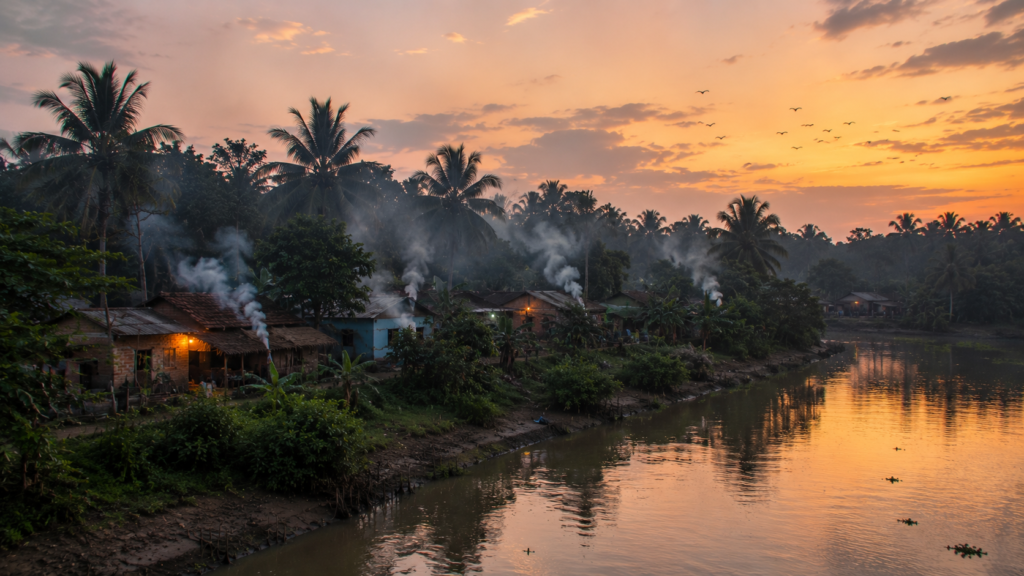
The departure from Satjelia happens quietly.
No dramatic farewell announces it.
The ferry pulls away from the muddy landing as evening settles once more across the embankments. A few figures remain visible near the riverbank — someone folding fishing nets, someone waiting beside a bicycle, someone standing still long after the boat has begun moving.
- Then, the distance slowly rearranges the island.
- The tea stalls disappear first.
- Then the palms.
- Then the embankments flatten into shadow against the horizon.
Only the river remains clearly visible, carrying reflections of fading light across water that has shaped every part of Satjelia’s existence — its hunger, its livelihoods, its folklore, its storms, its departures, its resilience.
Far behind the retreating boat, the island becomes less a place than a silhouette suspended between tide and memory.
And somewhere beyond the darkening channels, beyond the mangrove edges and shifting estuaries, the Sundarbans continues breathing with the same ancient rhythm that made Satjelia possible at all.
Not conquered.
Not settled completely.
Only inhabited for a while.
Plan your private Sundarban expedition
A private journey shaped around you — your group, your pace, your interests. Book a free consultation.