 Encyclopedia
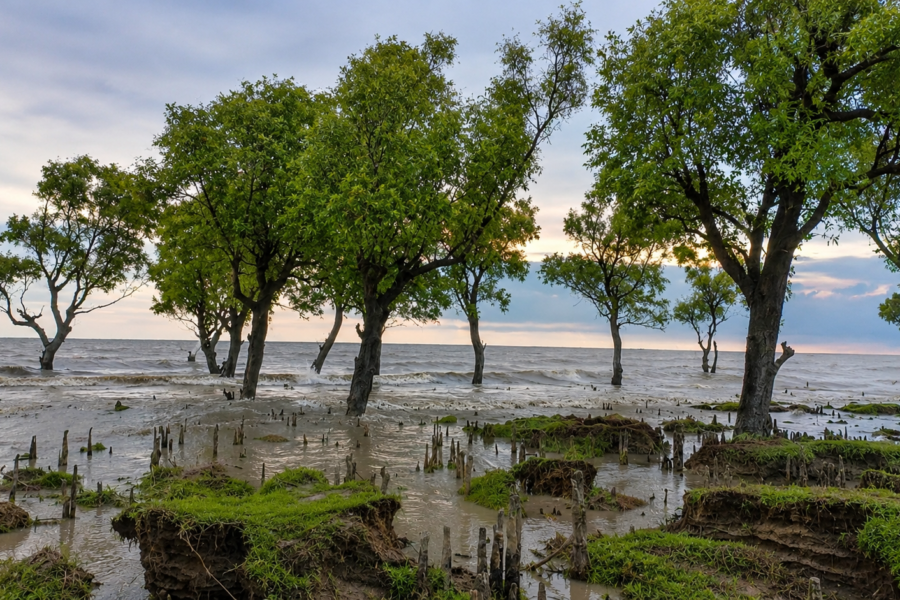
As the incoming tide pushes silently through narrow creeks, the mangrove roots disappear beneath opaque brown estuarine water. A few hours later, the same forest floor re-emerges, exposing thousands of breathing roots, mud crabs, molluscs and fresh animal tracks pressed into the soft sediment. At Burirdabri, the landscape is never static. Every tide redraws the forest.
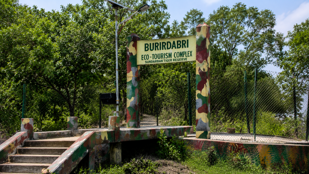
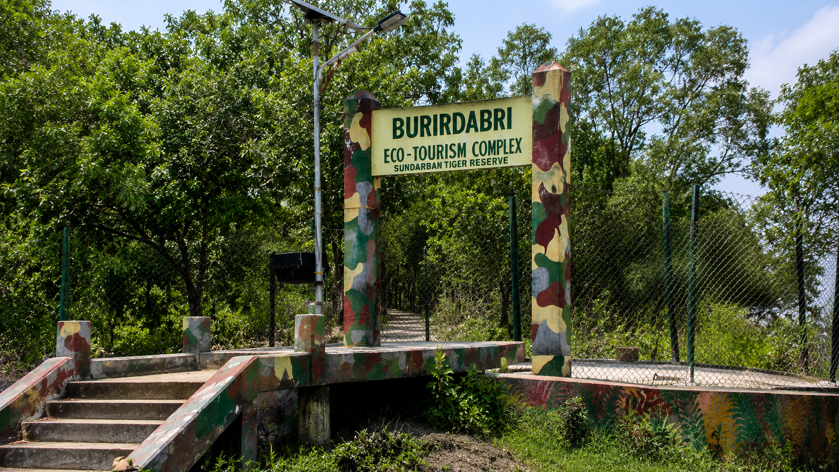
Situated at the extreme eastern edge of the Indian Sundarbans, Burirdabri is one of the most distinctive forest destinations within the Sundarbans Tiger Reserve. Unlike locations known primarily for wildlife observation, Burirdabri is celebrated for allowing visitors to experience the mangrove ecosystem at ground level through its protected mangrove cage trail, elevated wooden boardwalks, mud walk, and watchtower overlooking the Raimangal River—the international boundary separating India from Bangladesh.
Yet Burirdabri is far more than a tourism viewpoint. It represents an ecological frontier where tidal hydrology, mangrove succession, estuarine biodiversity, and geopolitical geography converge within one of the world’s largest contiguous mangrove forests. Every creek, mudflat, pneumatophore, and tidal channel illustrates the ecological processes that sustain the Sundarbans Biosphere Reserve.
For researchers, photographers, birdwatchers, naturalists, and readers seeking to understand the Indian Sundarbans beyond its famous tiger, Burirdabri provides an exceptional opportunity to observe how tides shape landscapes, how mangrove vegetation adapts to saline conditions, and how an international river functions simultaneously as a political boundary and a living ecological corridor.
Burirdabri at a Glance
Type: Forest camp, watchtower, and mangrove interpretation site.
Protected Area: Sundarbans Tiger Reserve.
Administrative Jurisdiction: Basirhat Range, Sundarbans Tiger Reserve.
Location: Extreme eastern Indian Sundarbans, near the India–Bangladesh border.
UNESCO Status: Located within the wider Sundarbans Biosphere landscape associated with the UNESCO-listed Sundarbans ecosystem.
Best Known For: Mangrove cage trail, mud walk, Raimangal View Point, and border watchtower.
Habitat Type: Intertidal mangrove forest.
Primary Access: Boat.
Dominant Ecological Influence: Semi-diurnal tides and estuarine salinity.
Ecological Importance: Mangrove habitat, tidal wetlands, estuarine biodiversity, and ecological connectivity with the wider transboundary Sundarbans ecosystem.
Accessibility: Accessible by boat through regulated forest-entry routes; access is subject to Forest Department permissions, prevailing tides, weather, and local navigation conditions.
Geographic Setting
Burirdabri occupies one of the easternmost accessible forest locations within the Indian Sundarbans. Unlike many interior watchtowers situated deeper within the protected forest, Burirdabri lies adjacent to the Raimangal River, one of the principal tidal rivers that marks a substantial portion of the international boundary between India and Bangladesh. From its watchtower, visitors can look directly across the river toward the forests of the Bangladesh Sundarbans, making Burirdabri unique among India’s accessible forest destinations.
The surrounding landscape belongs to the lower Ganges–Brahmaputra–Meghna Delta, the world’s largest active deltaic system. Here, freshwater delivered from the Himalayan river network mixes with saline tidal water from the Bay of Bengal, creating a dynamic estuarine environment where landforms are continually reshaped by erosion, sediment deposition, and twice-daily tidal flooding.
Unlike conventional terrestrial forests defined by fixed boundaries, Burirdabri exists within an ever-changing mosaic of tidal creeks, mudflats, marshes, mangrove islands, and distributary channels. Elevation differences are measured in centimeters rather than meters, yet these subtle variations strongly influence which mangrove species establish themselves, how sediments accumulate, and where wildlife can forage.
From a conservation perspective, Burirdabri occupies an important transition zone between India’s protected mangrove forests and the larger transboundary Sundarbans ecosystem shared with Bangladesh. Wildlife, tidal waters, sediments, nutrients, and migratory birds move across political borders without recognizing them, underscoring the ecological unity of the Sundarbans landscape despite international boundaries.
How to Reach Burirdabri
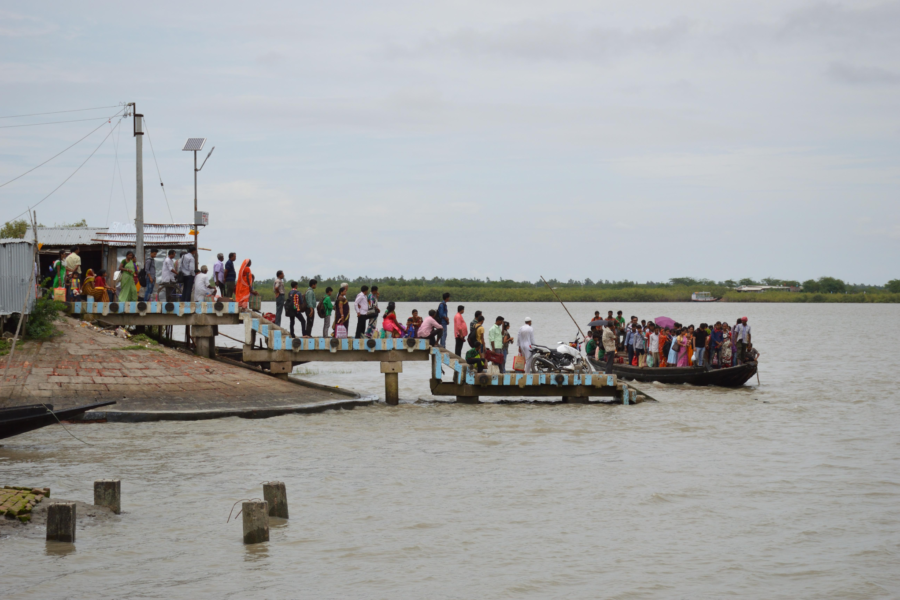
Burirdabri is inside the protected Sundarbans forest and is reached by boat. There is no road access to the forest site itself.
- From Kolkata: Travel by road or train toward the Sundarbans gateway. West Bengal Tourism identifies Canning, Sonakhali, Raidighi, Namkhana, and Najat among the principal approaches to the Sundarbans.
- By Train: Take a local train from Sealdah South to Canning. From Canning, shared road transport is available to Godhkhali Jetty, a recognised starting point for boat journeys into the Sundarbans.
- By Road: Godhkhali and other recognised river-access points can be reached by road from Kolkata.
- By Air: Fly to Netaji Subhas Chandra Bose International Airport, then continue by road to a Sundarbans river-access point and by boat.
- Final Access to Burirdabri: Continue by tourist motorboat through the Sundarbans waterways. West Bengal Tourism specifically lists Burirdabri among the forest locations visited on multi-day Sundarbans boat tours.
Important for Visitors
Burirdabri is not an independently accessible roadside attraction. Forest entry and the boat itinerary must be arranged through the applicable Sundarbans tourism and forest-entry system. The actual route to Burirdabri can vary according to the authorised itinerary, tides, weather, and navigation conditions.
For a first-time visitor, the practical route is therefore: Kolkata → Canning/Godhkhali → Boat into the Sundarbans → Burirdabri
Rivers Flowing Beside Burirdabri
The Editorial Production Bible requires that every island or forest dossier include concise geographic reference sections immediately after the geographic setting.
Major River
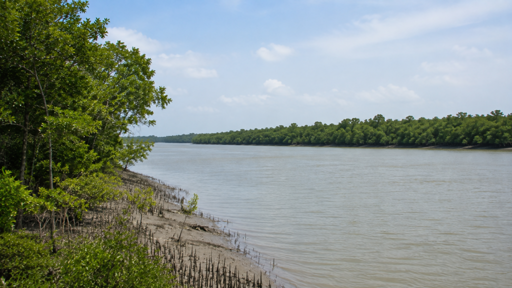
- Raimangal River — forms the eastern boundary of this section of the Indian Sundarbans and serves as an international boundary between India and Bangladesh. It is one of the largest tidal rivers in the eastern Sundarbans and directly influences Burirdabri’s hydrology, salinity, sediment transport, and estuarine ecology.
Associated Tidal Creeks
Numerous unnamed tidal creeks and distributary channels connect Burirdabri with the wider estuarine network of the eastern Sundarbans. Their precise morphology changes gradually through natural erosion and sediment deposition, making smaller channels dynamic landscape features rather than permanently fixed waterways.
Nearby Forest Blocks
The immediate surroundings of Burirdabri comprise protected mangrove forest administered under the Basirhat Range of the Sundarbans Tiger Reserve. Available public sources consistently identify Burirdabri within this administrative range.
Forest areas commonly associated with the approach toward Burirdabri include:
- Arbesi Beat
- Jhila Beat
- Burirdabri Beat
- Adjacent protected mangrove compartments within the Basirhat Range
Nearby Inhabited Islands and Human Settlements
Although Burirdabri itself lies within protected forest, several inhabited islands and gateway settlements provide logistical access to the eastern Sundarbans.
Nearby inhabited areas include:
- Sandeshkhali
- Dhamakhali
- Bagna
- Jamespur (used in longer itineraries)
- Pakhiralay (farther west but commonly used as a tourism gateway)
Most visitors reach Burirdabri by boat after entering the Sundarbans through one of these mainland or island access points. Travel times vary considerably depending on tides, weather, and the chosen navigation route.
Landscape Character
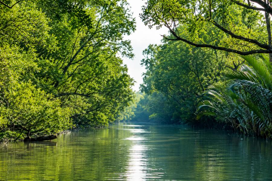
Burirdabri possesses a landscape distinctly different from many inland forests. Here, water dominates every aspect of the environment. Rivers widen into broad estuarine channels before narrowing again into intricate tidal creeks lined with dense mangrove vegetation. During high tide, the forest appears to rise directly from the water. As the tide retreats, extensive mudflats emerge, revealing a textured landscape of mangrove roots, crab burrows, shell fragments, and sediment ridges shaped by tidal currents.
One of Burirdabri’s defining visual characteristics is its extensive field of pneumatophores—the specialized breathing roots produced by mangrove species such as Avicennia. These upright roots project from oxygen-poor mud, allowing trees to exchange gases even when the surrounding soil remains waterlogged for much of the day.
Unlike sandy coastlines shaped primarily by waves, Burirdabri is governed by sediment. Fine silts carried downstream by the Ganges–Brahmaputra river system settle within sheltered creeks, gradually building mudbanks that support successive generations of mangrove vegetation. This continual interaction between tides, sediment, and vegetation makes the landscape dynamic rather than permanent.
A walk through the protected mangrove cage trail provides an unusually intimate view of this environment. Visitors move above and alongside the forest floor rather than observing it solely from a boat, allowing close examination of tidal sediments, root systems, and the small invertebrates that form the ecological foundation of the mangrove ecosystem.
Hydrology and Tidal System
The hydrology of Burirdabri is governed by the semi-diurnal tidal regime of the northern Bay of Bengal. Approximately twice each day, tidal waters flow inland through the Raimangal River and its interconnected creeks before reversing direction during ebb tide. This regular flooding and drainage cycle controls virtually every ecological process within the surrounding forest.
Tides influence salinity, oxygen availability in sediments, nutrient exchange, seed dispersal, fish movement, and the daily behaviour of numerous organisms. Even the distribution of mangrove species reflects subtle differences in inundation frequency and soil salinity across the landscape.
Because Burirdabri lies near the seaward portion of the delta, saline influence is generally stronger than in northern sections of the Sundarbans where greater freshwater inputs moderate estuarine conditions. Seasonal monsoon rainfall temporarily reduces salinity, while the dry season typically increases marine influence.
The Raimangal River also functions as an important ecological corridor. Fish larvae, crustaceans, plankton, sediments, and organic matter move continuously through this tidal network, linking Burirdabri with the wider estuarine ecosystem of both India and Bangladesh. In this sense, the river is not simply a geographic boundary but a living system that maintains ecological connectivity across the transboundary Sundarbans.
Mangrove Ecosystem
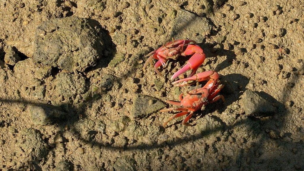
As the tide begins to recede, the forest floor slowly emerges from beneath the opaque brown water. Thousands of pencil-like roots pierce the soft mud, fiddler crabs retreat into their burrows, and the first mudskippers appear on the exposed sediment. What appears at first glance to be a quiet coastal woodland is, in reality, one of the most productive intertidal ecosystems on Earth.
Burirdabri lies within the Indian Sundarbans mangrove ecosystem, the western portion of the world’s largest contiguous mangrove forest. Unlike terrestrial forests that grow on relatively stable ground, mangroves exist in an environment defined by continual tidal inundation, fluctuating salinity, oxygen-poor soils, and constant sediment deposition. Every plant and animal living here has evolved remarkable adaptations to survive these conditions.
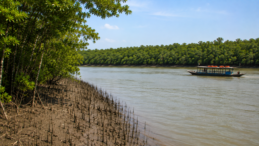
The mangrove vegetation surrounding Burirdabri performs several essential ecological functions simultaneously. The dense network of roots traps sediment transported by the Raimangal River and adjoining tidal creeks, helping stabilize newly formed mudbanks while reducing shoreline erosion. This natural process gradually builds land even as other parts of the delta are lost to tidal erosion.
Equally important is the forest’s role in nutrient cycling. Falling leaves, twigs, flowers, and fruits decompose within the intertidal mud, producing organic matter that supports microorganisms, worms, crustaceans, molluscs, and juvenile fish. These organisms, in turn, become food for larger predators, creating one of the most productive food webs in any coastal ecosystem.
Burirdabri also serves as an ecological transition zone between freshwater influence from the Ganges-Brahmaputra-Meghna Delta and saline water entering from the Bay of Bengal. Seasonal fluctuations in rainfall, river discharge, and tidal salinity continually influence mangrove distribution, seedling establishment, and species composition. Rather than remaining static, the forest is constantly responding to changing environmental conditions.
Beyond supporting biodiversity, the mangroves surrounding Burirdabri provide ecosystem services of global significance. They store substantial quantities of carbon within their soils and biomass, reduce the energy of cyclonic storm surges, improve water quality by trapping sediments, and create nursery habitats that sustain fisheries throughout the northern Bay of Bengal. Numerous scientific studies have identified mangrove forests as among the planet’s most effective natural carbon sinks, highlighting their importance in climate regulation as well as biodiversity conservation.
Dominant Mangrove Flora
The vegetation around Burirdabri reflects the salinity, tidal flooding, and sediment characteristics typical of the eastern Indian Sundarbans. Species composition varies across microhabitats, with slight differences in elevation and tidal exposure influencing which mangrove trees dominate particular locations.
Common mangrove species found within this landscape include:
Sundari (Heritiera fomes)
Historically the signature tree of the Sundarbans, the Sundari gives the region its name. It prefers areas with relatively lower salinity and well-drained alluvial soils. Although still present across the Sundarbans landscape, its distribution has declined in some regions due to changing salinity, disease, and environmental stress.
Gewa (Excoecaria agallocha)
One of the most widespread mangrove trees in the Sundarbans, Gewa tolerates saline conditions and often occupies middle intertidal zones. Its latex can irritate skin and eyes, earning it the common name “blind-your-eye mangrove” in some parts of the world.
Avicennia Species (Avicennia marina, Avicennia officinalis, Avicennia alba)
Avicennia trees are among the most recognizable plants around Burirdabri because of their dense fields of vertical breathing roots, known as pneumatophores. These specialized structures enable gas exchange in waterlogged, oxygen-deficient soils where conventional underground roots would suffocate.
Keora (Sonneratia apetala)
Frequently growing along creek margins, Keora is among the first mangrove species to colonize newly deposited sediments. Its rapid growth makes it particularly important during the early stages of mangrove succession.
Goran (Ceriops decandra)
This smaller mangrove shrub or tree commonly occupies slightly elevated areas that experience regular tidal flooding but are not continuously submerged. Dense stands of Goran often create thick undergrowth that provides shelter for numerous birds and small mammals.
Dhundul (Xylocarpus granatum)
Recognizable by its large spherical fruits, Dhundul contributes to structural diversity within mature mangrove forests and supports numerous invertebrate species.
Together, these and many other mangrove plants create a layered ecosystem in which each species occupies a specific ecological niche determined by salinity, tidal frequency, soil characteristics, and competition.
Remarkable Mangrove Adaptations
Life in Burirdabri demands extraordinary resilience. Unlike most terrestrial plants, mangroves must survive prolonged inundation by saline water while anchoring themselves in unstable mud.
Some of their most remarkable adaptations include:
- Pneumatophores that extend above the mud to absorb oxygen during low tide.
- Salt regulation mechanisms, allowing different species either to exclude salt at the root surface or excrete excess salt through specialized leaf glands.
- Vivipary, in which seeds begin germinating while still attached to the parent tree, producing elongated propagules that can float with the tides before establishing themselves in suitable sediment.
- Extensive lateral root systems that stabilize soft mud while trapping suspended sediments.
These adaptations explain why mangrove forests flourish in environments where few other tree species could survive.
Wildlife of Burirdabri
The forests surrounding Burirdabri support an impressive diversity of mammals, reptiles, birds, fishes, crustaceans, and invertebrates characteristic of the eastern Sundarbans. Wildlife observations vary considerably depending on season, tide, weather, and simple chance. The dense vegetation and complex tidal landscape often conceal animals that remain active beyond human sight.
Royal Bengal Tiger (Panthera tigris tigris)
Although Burirdabri is not regarded as one of the most reliable tiger-viewing locations, it lies within the home range of the Royal Bengal Tiger, the apex predator of the Sundarbans. Tigers here have adapted uniquely to an estuarine environment, regularly swimming across tidal rivers, navigating mudflats, and moving through mangrove vegetation in search of prey.
Because the forest is exceptionally dense and wildlife disturbance is minimized, direct sightings are uncommon. Most evidence of tiger presence comes from tracks, scent marks, camera traps, or observations made by Forest Department personnel.
Spotted Deer (Axis axis)
The Spotted Deer is among the most frequently observed mammals in the Sundarbans and forms the principal prey base for the tiger. Herds often forage along creek margins during lower tides when fresh vegetation becomes accessible.
Wild Boar (Sus scrofa)
Wild Boar forage extensively across exposed mudflats and forest edges, rooting through sediments for roots, tubers, crabs, and other invertebrates.
Fishing Cat (Prionailurus viverrinus)
See it for yourself
A private journey shaped around you — your group, your pace, your interests. Book a free consultation.
The Fishing Cat is one of the Sundarbans’ most specialized carnivores. Adapted to hunting fish, crustaceans, amphibians, and aquatic prey, it occupies tidal creeks, marshes, and densely vegetated mangrove habitats. Like many nocturnal species, it is seldom encountered during ordinary boat excursions.
Rhesus Macaque (Macaca mulatta)
Groups of Rhesus Macaques are occasionally observed near forest edges, feeding on fruits, leaves, insects, and crabs. Their omnivorous diet allows them to exploit a wide variety of mangrove food resources.
Small Mammals
The forest also supports otters, civets, mongooses, bats, rodents, and several lesser-known mammals, many of which remain difficult to observe because of their nocturnal or secretive behavior.
Birdlife
At sunrise, the first sounds across Burirdabri are often those of kingfishers, egrets, herons, and drongos calling above the rising tide. As light reaches the upper canopy, raptors begin circling over tidal channels while waders forage along newly exposed mudbanks.
The eastern Sundarbans support a rich assemblage of resident and migratory birds. Species regularly associated with habitats around Burirdabri include:
Kingfishers
The Sundarbans is one of India’s finest locations for observing multiple kingfisher species, including:
- Brown-winged Kingfisher
- Black-capped Kingfisher
- White-throated Kingfisher
- Collared Kingfisher
- Common Kingfisher
Wading Birds
Commonly recorded species include:
- Little Egret
- Great Egret
- Intermediate Egret
- Grey Heron
- Purple Heron
- Pond Heron
Raptors
Predatory birds frequently observed over tidal channels include:
- Brahminy Kite
- White-bellied Sea Eagle
- Crested Serpent Eagle
Other Notable Birds
Depending on season and habitat conditions, observers may also encounter:
- Lesser Adjutant
- Asian Openbill
- Black-headed Ibis
- Oriental Darter
- Cormorants
- Bee-eaters
- Drongos
- Sunbirds
Migratory shorebirds use exposed tidal mudflats as feeding grounds during the winter months, although species composition varies annually according to water levels and migration patterns.
Reptiles and Aquatic Fauna
The tidal waters surrounding Burirdabri support a diverse community of reptiles and aquatic organisms.
Saltwater Crocodile (Crocodylus porosus)
The Saltwater Crocodile is the largest living reptile and one of the Sundarbans’ apex aquatic predators. Individuals may be encountered basking along muddy banks or floating almost invisibly near creek edges. Their distribution depends on prey availability, suitable basking sites, and minimal disturbance.
Water Monitor (Varanus salvator)
This large lizard is frequently seen swimming across tidal creeks or searching mudbanks for crabs, fish, eggs, and carrion.
Snakes
Several snake species inhabit the mangrove ecosystem, including marine, estuarine, and terrestrial forms. Exact species occurrence at Burirdabri is not comprehensively documented in publicly available scientific inventories, and therefore individual species should be interpreted cautiously without localized survey data.
Fish, Crustaceans, and Estuarine Life
The waters surrounding Burirdabri function as nurseries for countless aquatic organisms.
Common ecological groups include:
- Mudskippers
- Fiddler crabs
- Sesarmid mangrove crabs
- Mud crabs
- Prawns
- Shrimps
- Molluscs
- Juvenile estuarine fishes
- Plankton communities
Many commercially important marine fish spend their juvenile stages within mangrove creeks before migrating into larger estuaries or the Bay of Bengal. This nursery function is one of the principal reasons mangrove conservation has importance extending far beyond the Sundarbans itself.
Ecological Interactions: A Forest Built on the Tide
Every organism in Burirdabri is linked by the rhythm of the tides. As seawater floods the forest, nutrients are redistributed, fish enter flooded creeks, and mangrove roots become submerged. When the tide retreats, oxygen returns to the exposed sediments, crabs emerge to feed, birds concentrate along mudflats, and mammals move across newly accessible ground.
Rather than existing as separate habitats, the forest, river, mudflat, and estuary form a single interconnected ecological system. Remove any one component—whether mangroves, tidal flow, sediment supply, or wildlife—and the balance of the entire landscape begins to change.
Burirdabri is therefore best understood not as an isolated destination but as a living expression of the ecological processes that define the Indian Sundarbans: a landscape shaped by water, sustained by mangroves, and animated by an extraordinary diversity of life.
History of Burirdabri
As boats travel eastward through the tidal channels toward Burirdabri, the landscape appears timeless. Dense mangrove forests stretch uninterrupted to the horizon, rivers continue their daily rhythm of flood and ebb, and the muddy banks reveal little indication of human history. Yet the story of Burirdabri is inseparable from the broader history of the Sundarbans—a landscape shaped over centuries by rivers, tides, colonial administration, conservation, and changing relationships between people and nature.
Unlike inhabited islands of the Sundarbans, Burirdabri has never developed as a permanent human settlement. Its saline soils, regular tidal inundation, dense mangrove vegetation, and persistent presence of large wildlife made long-term habitation impractical. Instead, it remained part of the vast tidal wilderness that historically extended almost continuously across what are now India and Bangladesh.
For centuries, the mangrove forests surrounding Burirdabri were known primarily to local fishing communities, honey collectors (Mouals), woodcutters (Bawalis), and boatmen navigating the eastern reaches of the delta. These communities developed remarkable ecological knowledge, learning to interpret tides, weather, river channels, and wildlife behaviour in one of the most challenging landscapes of South Asia.
During the eighteenth and nineteenth centuries, the British administration began systematic surveys of the Sundarbans. Forest boundaries were gradually mapped, timber extraction was regulated, and reserved forest areas were established to protect commercially valuable mangrove species while controlling resource use. Although Burirdabri itself remained largely inaccessible, it became part of the administrative framework that would eventually evolve into today’s protected forest system.
A significant transformation occurred during the latter half of the twentieth century as conservation priorities replaced commercial exploitation. The creation of the Sundarbans Tiger Reserve in 1973 under Project Tiger, followed by the declaration of the Sundarbans National Park in 1984, recognition as a UNESCO World Heritage Site in 1987, and designation of the Sundarbans Biosphere Reserve in 1989, established Burirdabri within one of the world’s most important protected mangrove landscapes. Today, the area is managed primarily for biodiversity conservation, ecological research, habitat protection, and regulated nature tourism.
Forest Administration
Burirdabri forms part of the Sundarbans Tiger Reserve, administered by the West Bengal Forest Department under the framework of India’s protected area network. Publicly available administrative information places Burirdabri within the Basirhat Range, one of the management divisions responsible for the eastern sector of the reserve.
Forest management at Burirdabri focuses on several interconnected objectives:
- Protection of critical mangrove habitats.
- Conservation of the Royal Bengal Tiger and associated wildlife.
- Monitoring of estuarine biodiversity.
- Regulation of tourism through controlled boat access.
- Maintenance of interpretation infrastructure such as the watchtower and mangrove trail.
- Prevention of illegal resource extraction, poaching, and unauthorized entry.
Because Burirdabri lies adjacent to the India–Bangladesh international boundary, management also involves coordination with border security agencies while ensuring that ecological processes remain undisturbed. Rivers, tides, fish, migratory birds, and wildlife move freely across the international border, making transboundary conservation an essential aspect of long-term ecosystem management.
Burirdabri Watch Tower
Long before the watchtower becomes visible, the surrounding forest begins to change. The river widens, mangrove canopies open toward the water, and the broad expanse of the Raimangal River dominates the eastern horizon. Rising above the forest edge, the Burirdabri Watch Tower offers one of the most distinctive perspectives available anywhere in the Indian Sundarbans.
Unlike many observation towers designed primarily for terrestrial wildlife viewing, Burirdabri’s watchtower emphasizes the relationship between river, forest, and international geography. From its elevated platform, visitors overlook the Raimangal River while facing the mangrove forests of Bangladesh directly across the water.
The watchtower serves several important purposes:
- Observation of estuarine landscapes.
- Interpretation of mangrove ecology.
- Birdwatching.
- Wildlife observation along creek margins.
- Educational understanding of the India–Bangladesh border landscape.
Wildlife sightings from the tower vary considerably depending on season, tide, and luck. Visitors may observe Spotted Deer grazing near forest edges, raptors soaring above tidal channels, kingfishers hunting from exposed branches, or Saltwater Crocodiles basking along muddy banks. Direct tiger sightings remain rare, although the surrounding forest forms part of tiger habitat.
Rather than guaranteeing wildlife encounters, the watchtower provides an opportunity to appreciate the broader ecological setting of the eastern Sundarbans—a landscape where rivers, forests, and tides dominate every aspect of the environment.
The Mangrove Cage Trail
One of Burirdabri’s defining features is its mangrove cage trail, often described as one of the most distinctive visitor experiences in the Indian Sundarbans.
Unlike conventional boardwalks found in many protected areas, the Burirdabri trail passes through a protective steel-mesh enclosure designed to allow visitors to experience the mangrove forest at ground level while minimizing risks associated with large wildlife, including the Royal Bengal Tiger. The enclosure enables safe interpretation of the intertidal environment without significantly altering the natural landscape.
Walking through the trail reveals details that are difficult to appreciate from a boat:
- Dense fields of pneumatophores rising from tidal mud.
- Natural regeneration of mangrove seedlings.
- Crab burrows and feeding activity.
- Fallen propagules awaiting establishment.
- Sediment layers deposited by successive tides.
- Variations in vegetation corresponding to subtle changes in elevation and salinity.
The experience shifts attention away from searching for charismatic wildlife and toward understanding the ecological foundations of the mangrove ecosystem itself.
The Mud Walk
Beyond the cage trail lies another feature rarely associated with forest tourism—the mud walk.
Here, visitors encounter the soft alluvial sediments that define the Sundarbans. During low tide, exposed mudflats reveal the remarkable physical structure of the estuary, shaped by centuries of sediment deposition from the Ganges–Brahmaputra–Meghna river system.
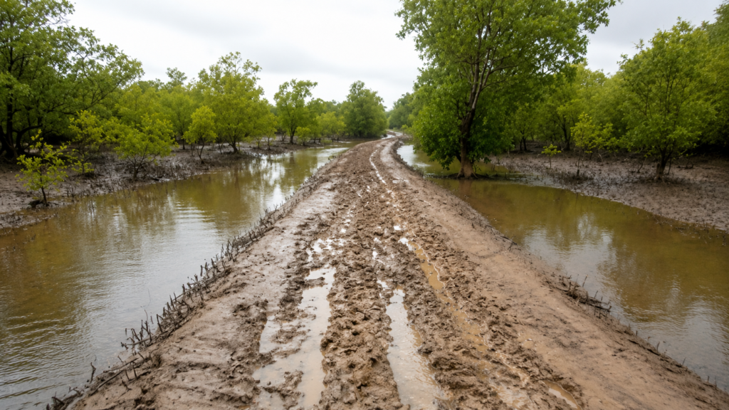
The mud supports an astonishing diversity of life despite appearing barren from a distance. Careful observation reveals:
- Fiddler crab colonies.
- Mudskippers moving between shallow pools.
- Mollusc shells embedded in sediment.
- Worm casts.
- Fresh animal tracks.
- Tidal drainage channels.
- Emerging mangrove propagules.
These mudflats are far from empty. They function as feeding grounds for shorebirds, nurseries for juvenile fish, and the foundation upon which future mangrove forests establish themselves.
Raimangal View Point: Where Two Nations Share One Ecosystem
Perhaps no location in the Indian Sundarbans illustrates the ecological unity of the region more clearly than the Raimangal View Point.
Standing beside the broad Raimangal River, visitors can look directly across the water toward the forests of Bangladesh. Although the river serves as an international boundary, the landscape itself appears uninterrupted. Mangrove forests continue seamlessly from one bank to the other, tides rise and fall across both countries simultaneously, and wildlife crosses the river without regard for political borders.
This perspective highlights one of the central realities of the Sundarbans: ecological systems do not conform to administrative boundaries. Fish migrate through shared estuarine waters, migratory birds use habitats on both sides of the border, sediments move with tidal currents, and tigers have historically crossed major tidal channels when ecological conditions permit.
The Raimangal viewpoint therefore offers more than a scenic panorama—it provides a powerful reminder that conservation in the Sundarbans is inherently transboundary. The long-term health of the ecosystem depends on coordinated management across the entire mangrove landscape.
Human Presence and Traditional Livelihoods
Although Burirdabri itself has no permanent settlement, nearby communities have depended on the surrounding rivers and forests for generations.
Traditional occupations in the eastern Sundarbans include:
- Small-scale fishing.
- Crab collection.
- Honey gathering.
- Collection of non-timber forest products under regulated permits.
- Boat transport.
- Eco-tourism services.
Access to forest resources is carefully regulated by the Forest Department to balance local livelihoods with biodiversity conservation. Honey collectors and fishermen entering designated forest areas require permits and must follow strict seasonal and operational guidelines intended to reduce risks to both people and wildlife.
The cultural relationship between these communities and the forest is deeply rooted. Local traditions emphasize respect for the mangrove ecosystem, acknowledging both its life-supporting resources and its inherent dangers.
Bonbibi: The Guardian Spirit of the Forest
Throughout the Sundarbans, including communities near Burirdabri, the forest is associated with the enduring tradition of Bonbibi, revered as the protector of those who enter the mangroves for their livelihoods.
Before entering the forest, many fishermen, honey collectors, and woodcutters traditionally offer prayers seeking safe passage and protection. Bonbibi represents harmony between humans and nature rather than domination over the forest.
Central to this tradition is the belief that people should take only what they genuinely need while respecting the ecological balance of the mangrove landscape. Although rooted in folklore rather than formal conservation science, this philosophy reflects principles remarkably consistent with sustainable resource use.
Conservation Significance
Burirdabri occupies a strategically important position within the eastern Indian Sundarbans. Its significance extends well beyond recreation or wildlife observation.
The area contributes to conservation by:
- Protecting intact mangrove habitat.
- Supporting populations of threatened wildlife.
- Maintaining estuarine ecological connectivity.
- Conserving nursery habitats for fish and crustaceans.
- Preserving one of the world’s largest continuous mangrove ecosystems.
- Facilitating environmental education and scientific interpretation.
- Demonstrating the importance of transboundary conservation between India and Bangladesh.
Because Burirdabri experiences relatively limited infrastructure development compared with many coastal landscapes elsewhere, it continues to function as an important reference site for understanding natural mangrove ecological processes.
Present-Day Environmental Challenges
Like the wider Sundarbans, Burirdabri faces a range of environmental pressures that require ongoing scientific monitoring and adaptive management.
These include:
Climate Change
Rising sea levels, changing rainfall patterns, increasing temperatures, and more intense tropical cyclones have the potential to alter salinity, sediment dynamics, and mangrove distribution.
Coastal Erosion
Natural erosion continuously reshapes tidal banks and islands. While erosion is an inherent process within deltaic systems, accelerating sea-level rise may influence its long-term balance.
Salinity Changes
Variations in freshwater discharge from upstream river systems can alter estuarine salinity, affecting mangrove composition and ecological processes.
Extreme Weather Events
Cyclones remain among the most significant natural disturbances affecting the Sundarbans. Healthy mangrove forests provide substantial protection against storm surges, yet they are also vulnerable to severe cyclone damage.
Human Pressure
Although Burirdabri itself is protected, broader regional pressures—including unsustainable resource use, pollution, and climate-related impacts—continue to influence the resilience of the Sundarbans ecosystem.
The future of Burirdabri depends not only on effective local management but also on the long-term conservation of the entire transboundary Sundarbans, where rivers, tides, wildlife, and mangrove forests remain ecologically connected despite political boundaries.
Seasonal Character
Burirdabri is a landscape in constant transition. Unlike forests where seasonal change is driven primarily by temperature, the character of this mangrove ecosystem is shaped by the combined influence of tides, rainfall, river discharge, salinity, and tropical weather systems. Every season presents a different ecological rhythm, influencing wildlife activity, vegetation, river conditions, and the visitor experience.
Winter (November to February)
Winter is generally regarded as the most comfortable season for exploring Burirdabri. Lower humidity, clear skies, and pleasant daytime temperatures improve visibility across the tidal landscape.
Morning boat journeys often begin beneath drifting mist that gradually lifts as sunlight illuminates the mangrove canopy. The exposed mudflats become active feeding grounds for egrets, herons, kingfishers, and migratory shorebirds. Raptors frequently soar above the Raimangal River, taking advantage of rising air currents.
The relatively calm weather also makes this one of the best seasons for photography and extended wildlife observation.
Ecological Highlights
- Comfortable temperatures
- Increased bird activity
- Arrival of migratory species
- Improved visibility
- Stable navigation conditions
Summer (March to June)
Summer transforms Burirdabri into a harsher environment. Air temperatures rise considerably while evaporation increases surface salinity in many parts of the estuary.
During midday, wildlife activity often decreases as many animals seek shade within dense mangrove vegetation. Early morning and late afternoon become the most productive periods for observation.
Many mangrove trees begin flowering or fruiting during this period, supporting insects, nectar-feeding birds, and numerous other organisms.
Pre-monsoon thunderstorms occasionally develop rapidly, bringing brief but intense rainfall and strong winds that temporarily alter river conditions.
Ecological Highlights
- High temperatures
- Increased salinity
- Mangrove flowering in several species
- Greater reptile activity
- Frequent pre-monsoon storms
Monsoon (June to September)
With the arrival of the southwest monsoon, Burirdabri changes dramatically. Heavy rainfall reduces surface salinity while rivers swell with freshwater entering from the vast Ganges–Brahmaputra basin.
The forest appears greener, tidal channels expand, and suspended sediments give the rivers their characteristic muddy brown colour.
Navigation becomes more challenging as rainfall, reduced visibility, strong currents, and occasional cyclonic weather influence boat movement. Many wildlife observations become more difficult because dense vegetation offers increased cover.
At the same time, this is an important period of ecological renewal. Mangrove seedlings establish themselves on freshly deposited sediments, fish breeding intensifies, and nutrient exchange throughout the estuary reaches its seasonal peak.
Ecological Highlights
- Heavy rainfall
- Reduced salinity
- Increased sediment transport
- Vigorous mangrove regeneration
- Peak aquatic productivity
Post-Monsoon (October)
October represents a transition between the wet and dry seasons.
The rivers gradually stabilize, vegetation remains lush after the monsoon, and many migratory birds begin returning to the Sundarbans. Clearer skies improve visibility while temperatures become increasingly comfortable.
For many naturalists, this season offers one of the most balanced combinations of favourable weather and ecological activity.
Why Burirdabri Matters Ecologically
Burirdabri is significant not because it guarantees spectacular wildlife sightings but because it reveals how the Sundarbans actually functions.
Its importance lies in several interconnected ecological processes:
- It protects mature intertidal mangrove forest.
- It demonstrates the interaction between tides and vegetation.
- It supports nursery habitats essential for coastal fisheries.
- It contributes to long-term carbon storage.
- It provides habitat for threatened wildlife.
- It illustrates ecological continuity across the India–Bangladesh border.
- It serves as an outdoor classroom for understanding mangrove ecology.
In many ways, Burirdabri represents the ecological heart of the eastern Sundarbans, where every visible feature—from a single pneumatophore to the vast Raimangal River—contributes to the functioning of the entire delta.
The Wild Orbit’s Interesting Facts About Burirdabri
- Burirdabri lies near the eastern edge of the Indian Sundarbans, facing Bangladesh across the Raimangal River.
- The Raimangal River serves both as an international boundary and as an active ecological corridor.
- The mangrove cage trail is one of the few places in the Sundarbans where visitors can safely experience the forest at ground level.
- Twice-daily tides completely transform the surrounding landscape.
- Mangrove trees growing around Burirdabri possess specialized breathing roots known as pneumatophores.
- Many mangrove species reproduce through vivipary, allowing seedlings to germinate before falling from the parent tree.
- The surrounding estuary functions as a nursery for numerous commercially important fish and crustacean species.
- Burirdabri forms part of the Sundarbans Tiger Reserve, one of the most important tiger conservation landscapes in the world.
- Wildlife crosses tidal rivers naturally, regardless of international political boundaries.
- Healthy mangrove forests surrounding Burirdabri help reduce coastal erosion and buffer cyclone impacts.
FAQs
Where is Burirdabri located?
Burirdabri is situated in the eastern sector of the Indian Sundarbans within the Sundarbans Tiger Reserve, close to the India–Bangladesh border along the Raimangal River.
Why is Burirdabri famous?
It is best known for its mangrove cage trail, watchtower, Raimangal viewpoint, and opportunities to understand mangrove ecology within a protected tidal forest.
Can visitors see Bangladesh from Burirdabri?
Yes. The opposite bank of the Raimangal River belongs to the Bangladesh Sundarbans, making Burirdabri one of the few places in the Indian Sundarbans where visitors can directly view the neighbouring country’s mangrove forest.
Is Burirdabri inside the Sundarbans Tiger Reserve?
Yes. It lies within the protected area managed by the West Bengal Forest Department.
Are Royal Bengal Tigers found near Burirdabri?
Yes. Burirdabri forms part of tiger habitat, although sightings are uncommon because of the dense vegetation and naturally elusive behaviour of the species.
What is the mangrove cage trail?
It is a protected steel-mesh walkway that allows visitors to observe the mangrove ecosystem safely at ground level while minimizing risks associated with wildlife.
What wildlife can be seen?
Depending on season and luck, visitors may observe Spotted Deer, Wild Boar, Saltwater Crocodiles, Water Monitors, numerous kingfishers, herons, egrets, raptors, mudskippers, crabs, and many other estuarine species.
What makes the Raimangal River important?
Besides marking part of the international boundary between India and Bangladesh, the Raimangal River is a vital tidal channel supporting sediment transport, fisheries, mangrove ecology, and wildlife movement.
When is the best time to visit?
Winter (November to February) generally provides the most comfortable weather, clearer visibility, and excellent birdwatching opportunities.
Why are mangroves important at Burirdabri?
Mangroves stabilize shorelines, support biodiversity, protect coastal communities from storms, store carbon, and provide nursery habitats for countless aquatic species.
Can Burirdabri be reached by road?
No. Like most protected forest destinations within the Sundarbans, Burirdabri is accessible only by boat.
Is Burirdabri suitable for birdwatching?
Yes. The combination of tidal rivers, mudflats, and mangrove forest supports a rich diversity of resident and migratory birds throughout the year.
Burirdabri and the Living Sundarbans
As the final light fades across the Raimangal River, the outlines of the mangrove forest soften into silhouette. The tide begins another quiet cycle, flowing through creeks that have carried water, sediment, fish, and wildlife across this landscape for thousands of years. Human borders are visible only on maps; the estuary itself continues uninterrupted.
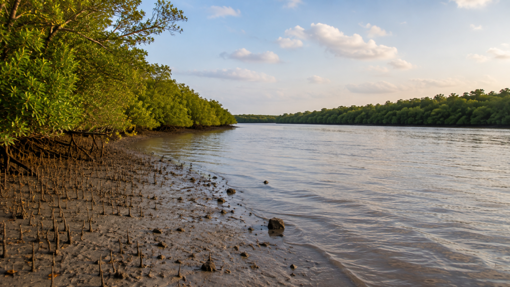
Burirdabri is not defined by a single watchtower, a boardwalk, or the possibility of encountering a tiger. Its true significance lies in revealing how the Sundarbans works as a living system. Here, mangroves anchor shifting sediments, tides sustain intricate food webs, rivers connect two nations through one ecosystem, and every organism—from microscopic plankton to the Royal Bengal Tiger—depends on the same rhythmic pulse of the estuary.
Understanding Burirdabri means understanding that the Sundarbans is far more than a collection of islands or a destination for wildlife tourism. It is one of Earth’s great ecological landscapes, where geography, hydrology, biodiversity, and human history converge in extraordinary balance.
For those willing to look beyond the obvious, Burirdabri offers something far more enduring than a memorable journey. It offers insight into the resilience of mangrove ecosystems, the interconnectedness of nature, and the importance of conserving one of the world’s last great tidal forests for generations to come.
Plan your private Sundarban expedition
A private journey shaped around you — your group, your pace, your interests. Book a free consultation.