 Encyclopedia
As the tide begins to ebb, broad expanses of grey-brown mud emerge along the mangrove shoreline. Thousands of pencil-like breathing roots protrude from the soft sediment, while fiddler crabs scatter across freshly exposed flats. The only sounds are the calls of distant kingfishers, the rustling of mangrove leaves, and the slow movement of tidal water through narrow creeks. At first glance, Chhota Harikhali appears quiet and unchanging. In reality, it is one of countless living islands continuously shaped by tides, sediment, salinity, and ecological succession within the Indian Sundarbans.
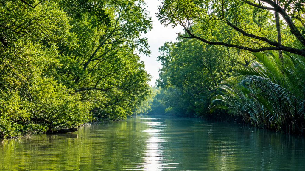
Situated inside the protected mangrove wilderness of the Indian Sundarbans, Chhota Harikhali represents the type of forest island that defines the world’s largest contiguous mangrove ecosystem. Although it receives little public attention compared with well-known destinations such as Sajnekhali, Dobanki or Netidhopani, islands like Chhota Harikhali perform ecological functions that are equally significant. They provide habitat for mangrove vegetation, support complex estuarine food webs, stabilize riverbanks, store carbon, and contribute to the functioning of one of Earth’s most productive coastal landscapes.
Unlike inhabited islands protected by embankments and agriculture, Chhota Harikhali remains part of the dynamic tidal forest. Every day, rising and falling tides alter its shoreline. Fresh sediment is deposited in some locations while erosion reshapes others. The island exists not as a permanent landmass but as a continuously evolving feature of the Ganges-Brahmaputra-Meghna Delta.
From a conservation perspective, Chhota Harikhali lies within one of the most important protected landscapes in India. The surrounding forests support populations such as:
- Royal Bengal Tiger (Panthera tigris tigris)
- Fishing Cat (Prionailurus viverrinus)
- Saltwater Crocodile (Crocodylus porosus)
- Spotted Deer (Axis axis)
- Wild Boar (Sus scrofa)
- Smooth-coated Otter (Lutrogale perspicillata)
Apart from that, numerous reptiles, hundreds of bird species, and an extraordinary diversity of estuarine fishes and invertebrates. The island therefore forms part of an interconnected ecological network rather than functioning as an isolated patch of vegetation.
Understanding Chhota Harikhali also provides insight into how the Sundarbans itself functions. The island illustrates the interaction between delta-building rivers, mangrove ecology, tidal hydrology, climate, wildlife, and conservation management. Its significance lies not in human settlement or tourism, but in demonstrating how seemingly modest forest islands collectively sustain one of the world’s most remarkable coastal ecosystems.
Chhota Harikhali At a Glance
- Island Type: Protected forest island
- Region: Indian Sundarbans, West Bengal
- Delta System: Ganges–Brahmaputra–Meghna Delta
- Ecosystem: Tidal mangrove forest
- Administrative Status: Protected forest under the Sundarbans Reserve Forest and associated protected-area management. Specific administrative compartment designations should be verified against the latest West Bengal Forest Department records.
- UNESCO Status: Forms part of the wider Sundarbans UNESCO World Heritage landscape (Indian component)
- Biosphere Reserve: Sundarbans Biosphere Reserve
- Tiger Landscape: Sundarbans Tiger Reserve landscape
- Habitat Type: Estuarine mangrove ecosystem
- Human Settlement: None
- Primary Ecological Functions: Mangrove habitat, shoreline stabilization, biodiversity support, carbon storage, and estuarine productivity
- Accessibility: Accessible only by boat through tidal waterways; access depends on forest regulations and permitted navigation routes.
How to Reach Chhota Harikhali
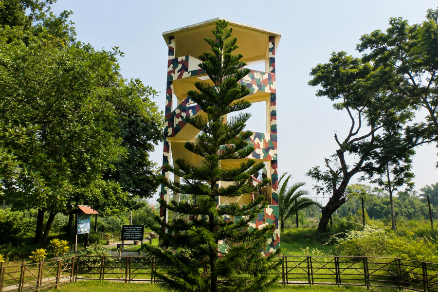
The official Sundarban Tiger Reserve does, however, document Harikhali as a forest tourism point on the bank of the Harinbhanga River, with a forest camp and watchtower.
Getting to the Sundarbans
- By air: Fly to Netaji Subhas Chandra Bose International Airport in Kolkata. From Kolkata, continue by road and then by boat.
- By train: Take a suburban train from Sealdah South to Canning. From Canning, shared road transport is available towards Godkhali Jetty, a major boarding point for Sundarbans boat journeys.
- By road: Travel from Kolkata towards Godkhali by car or other road transport. Godkhali is a recognised starting point for boat journeys into the Sundarbans.
From Godkhali to the Forest
The forest portion of the journey is by boat. Visitors cannot reach the protected forest islands by road.
For the officially recognised Harikhali tourism point, the Sundarbans Tiger Reserve publishes a dedicated boat circuit:
Bagna → Jhingekhali → Raimongal → Burirdabri → Gabbani Khal → Khatuajhuri Khal → Harikhali → Bolkhali → Jhilla
The published circuit is approximately 50 km and is designed as a one-day route, with a tentative schedule of approximately 7:00 AM to 5:00 PM.
A separate published route approaches Harikhali from the Sajnekhali side:
Sajnekhali → Sadakkhali → Dutter → Jhilla → Harikhali/Balkhali → Khatuajhuri → Burirdabri → Raimongal
This is also described as an approximately one-day circuit.
Important: Chhota Harikhali vs. Harikhali
The official sources reviewed identify Harikhali, not a separate tourist destination named Chhota Harikhali. Therefore, visitors should not book a trip simply by asking for “Chhota Harikhali” without first confirming the exact location and access permission with the Forest Department or their registered boat operator.
If the intended destination is the officially recognised Harikhali forest camp and watch-tower, it can be incorporated into an authorised Sundarban Tiger Reserve boat route.
Before You Travel
Confirm these details before departure:
- Exact location intended by the name Chhota Harikhali.
- Whether tourist access is currently permitted.
- Approved boat route.
- Boarding point.
- Forest entry requirements.
- Boat and guide arrangements.
- Weather and tidal conditions.
Geographic Setting
Chhota Harikhali lies within the protected forested sector of the Indian Sundarbans in southern West Bengal. The island forms part of the immense delta created by the Ganges, Brahmaputra, and Meghna river systems before they enter the Bay of Bengal. Rather than existing as a fixed landmass, it occupies a continually evolving position within a network of tidal rivers, estuaries, creeks, and mudflats.
The Indian Sundarbans comprise hundreds of islands, broadly divided into inhabited islands protected by embankments and uninhabited forest islands managed primarily for conservation. Chhota Harikhali belongs to the latter category. Its landscape is governed almost entirely by natural tidal processes rather than human land use.
Unlike inland forests, the boundaries of mangrove islands are fluid. Seasonal sediment deposition, channel migration, bank erosion, storm surges, and changing tidal currents continually modify their shape. Satellite imagery collected over successive decades demonstrates that many Sundarbans islands undergo measurable changes in shoreline configuration, illustrating the dynamic nature of the delta rather than instability unique to any single island.
From a broader geographical perspective, Chhota Harikhali contributes to a vast mosaic of mangrove forests extending across the lower delta. Collectively, these islands regulate sediment transport, dissipate wave energy, reduce coastal erosion, and create habitat for thousands of plant and animal species.
Landscape Character
The landscape of Chhota Harikhali reflects the defining characteristics of the Indian Sundarbans: low elevation, intertidal mudbanks, dense mangrove vegetation, tidal creeks, and soft alluvial sediments. There are no hills, rocky outcrops, or permanent freshwater streams. Instead, the terrain exists only a few metres above mean sea level, making it highly responsive to daily tidal fluctuations.
At high tide, large portions of the shoreline become inundated as estuarine water penetrates deep into the mangrove forest through countless creeks and channels. During low tide, newly exposed mudflats reveal intricate patterns of crab burrows, mollusc shells, and pneumatophores—the specialised aerial roots that enable mangrove trees to obtain oxygen from waterlogged soils.
Vegetation forms a complex vertical structure. Taller mangrove trees occupy relatively stable ground, while shrubs and pioneer species colonize newly deposited sediments. This gradual ecological succession reflects the continuous interaction between hydrology and plant adaptation rather than abrupt changes in vegetation.
One of the most striking aspects of the island is its apparent stillness. Yet almost every visible feature is in motion over ecological timescales. Riverbanks erode centimetre by centimetre. New sediment accumulates elsewhere. Mangrove seedlings establish themselves on fresh mudbanks, while older trees may eventually be lost to tidal erosion. The landscape is therefore best understood as a living geomorphic process rather than a static forest.
Geological Formation
Chhota Harikhali owes its existence to one of the largest sedimentary systems on Earth. Over thousands of years, enormous quantities of silt, clay, and fine sand transported by the Ganges, Brahmaputra, and Meghna rivers accumulated near the Bay of Bengal. These sediments gradually built an extensive delta characterised by branching distributaries, tidal channels, and countless islands.
Unlike volcanic or tectonic islands, mangrove islands such as Chhota Harikhali are depositional landforms. Their foundation consists primarily of unconsolidated alluvial sediments deposited by river flow and subsequently reworked by tidal action. This geological origin explains why their boundaries remain inherently dynamic.
The interaction between freshwater discharge during the monsoon and saline tidal waters throughout the year creates an environment where sediment deposition and erosion occur simultaneously. Some shorelines advance as new sediment accumulates, while others retreat under the influence of strong tidal currents or cyclonic storm surges.
Because the underlying sediments remain relatively soft, mangrove root systems play a crucial role in stabilising the shoreline. Dense root networks trap suspended particles, reduce erosion, and promote further sediment accumulation, illustrating the close relationship between biological and geological processes in the Sundarbans.
Rivers and Water Systems
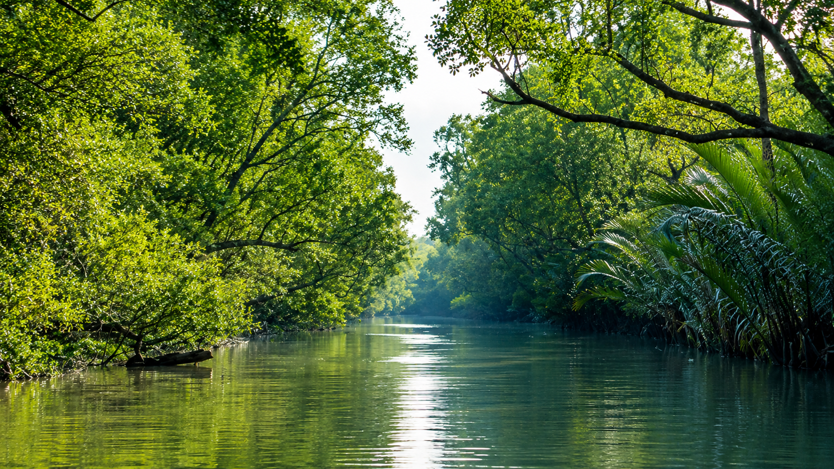
Water defines every aspect of Chhota Harikhali’s existence. The island functions within an intricate network of estuarine rivers, distributaries, creeks, and tidal channels that connect the interior forest with the Bay of Bengal. Rather than flowing consistently in a single direction, many waterways experience bidirectional movement as tides alternately flood and drain the landscape approximately every six hours.
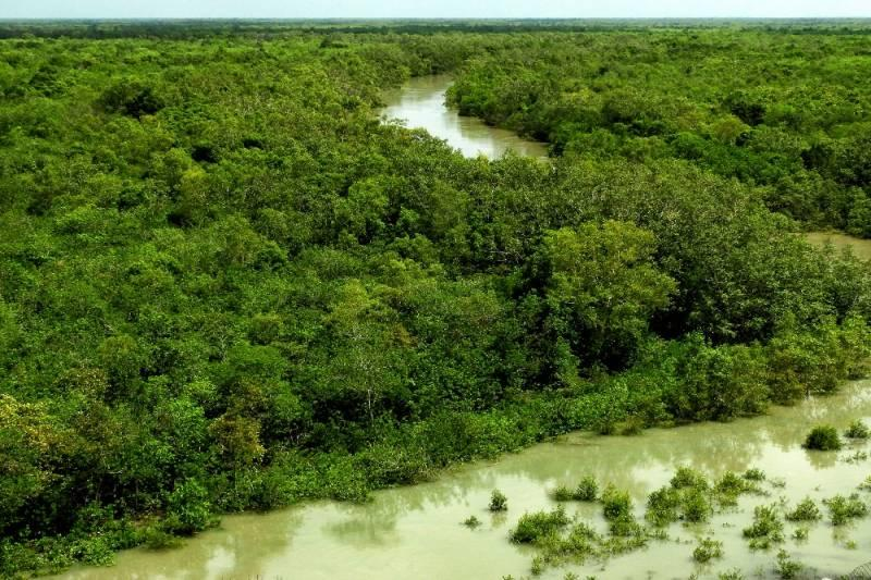
The hydrology of the island is therefore dominated by tidal exchange rather than rainfall alone. Salinity levels vary seasonally, influenced by freshwater discharge during the southwest monsoon and marine intrusion during the dry season. These fluctuations shape the distribution of mangrove species, influence fish breeding cycles, and affect nutrient availability throughout the ecosystem.
The surrounding waterways also act as ecological corridors. Fish migrate between rivers and tidal creeks during different stages of their life cycles. Juvenile crustaceans use sheltered mangrove channels as nursery habitats, while larger predators—including estuarine crocodiles and occasionally Royal Bengal Tigers—move through these waterways as part of their natural behaviour.
Suspended sediment transported by tidal currents gradually settles in calmer areas, building new mudflats and supporting mangrove colonisation. In contrast, stronger currents can remove sediment from exposed banks, demonstrating the continual balance between erosion and deposition that governs the island’s evolution.
For Chhota Harikhali, water is not simply a surrounding feature—it is the primary force that determines the island’s origin, ecology, landscape, and long-term survival.
The Mangrove Ecosystem
As the incoming tide quietly advances across the mudflats, seawater begins filling countless shallow depressions beneath the forest canopy. Within minutes, the exposed breathing roots disappear beneath opaque brown estuarine water. Small fishes move into flooded channels, mudskippers retreat into submerged burrows, and fiddler crabs climb onto higher ground before the tide reaches its peak. By the time the water recedes several hours later, the entire landscape has been transformed once again.
This rhythmic alternation between land and sea defines the ecological character of Chhota Harikhali. Unlike terrestrial forests, mangrove ecosystems exist within the intertidal zone—a unique environment periodically flooded by saline or brackish water. Every plant and animal living here has evolved to cope with fluctuating salinity, unstable sediments, oxygen-poor soils, and daily tidal inundation.
The mangrove forests surrounding Chhota Harikhali belong to one of the most biologically productive ecosystems on Earth. Rather than relying solely on terrestrial nutrient cycles, they receive continuous inputs of mineral-rich sediments transported by tidal rivers. Fallen leaves, twigs, flowers, and fruits decompose rapidly within the warm, waterlogged environment, producing organic matter that fuels an extensive estuarine food web.
The forest also functions as a natural interface between river and sea. It filters sediments, traps nutrients, stabilizes shorelines, and creates sheltered nursery habitats for fish, crustaceans, molluscs, reptiles, birds, and mammals. The ecological value of the island therefore extends well beyond its physical boundaries.
Mangrove Flora
The vegetation of Chhota Harikhali is expected to reflect the diverse mangrove communities characteristic of the Indian Sundarbans. Species composition varies according to salinity, tidal frequency, soil characteristics, and elevation above mean tidal level. Even within a relatively small area, subtle changes in these environmental factors produce noticeable differences in plant communities.
Mangrove trees possess remarkable adaptations that enable them to survive conditions that would be lethal to most terrestrial plants. Their roots anchor them in soft, shifting sediments while simultaneously allowing oxygen exchange in waterlogged soils. Many species also regulate salt concentrations by excluding, storing, or excreting excess salt through specialized physiological mechanisms.
Among the characteristic mangrove species of the Indian Sundarbans are:
- Sundari (Heritiera fomes)
- Gewa (Excoecaria agallocha)
- Goran (Ceriops decandra)
- Keora (Sonneratia apetala)
- Avicennia species (Avicennia marina, A. officinalis, A. alba)
- Dhundul (Xylocarpus granatum)
- Passur (Xylocarpus mekongensis)
- Kankra (Bruguiera gymnorhiza)
- Hental Palm (Phoenix paludosa)
- Ora (Aegiceras corniculatum)
Not every species occurs uniformly across every forest island. Their distribution depends upon local environmental conditions, and site-specific botanical surveys are necessary to document the precise floral composition of Chhota Harikhali. In keeping with The Wild Orbit’s editorial standards, individual species records should be confirmed through field surveys or authoritative botanical inventories before publication.
Adaptations to a Challenging Environment
Few ecosystems demand as many biological adaptations as mangrove forests.
Breathing Roots
Many mangrove trees produce vertical aerial roots known as pneumatophores. These structures project above the mud during low tide, allowing oxygen to enter underground root systems where the surrounding sediment contains very little free oxygen.
Salt Regulation
Mangrove species employ several different strategies to survive saline conditions. Some exclude salt at the root surface, others accumulate it within older leaves before shedding them, while certain species actively excrete salt through specialized leaf glands.
Vivipary
Unlike most trees, several mangrove species produce seeds that begin germinating while still attached to the parent tree. These elongated propagules eventually fall into tidal water, where they either lodge directly in soft sediment or drift until suitable habitat becomes available.
Flexible Root Systems
Complex root networks help stabilize loose alluvial sediments while reducing erosion caused by tidal currents. These roots also trap suspended particles, gradually encouraging further sediment deposition.
Together, these adaptations enable mangrove forests to occupy ecological niches unavailable to almost any other group of flowering plants.
Wildlife
At first glance, the forest may appear quiet. Yet every layer of Chhota Harikhali supports wildlife specially adapted to life in a tidal landscape. From microscopic plankton to apex predators, biodiversity is distributed throughout the water, mud, vegetation, and canopy.
The island should be viewed not as an isolated wildlife habitat but as one component of a much larger ecological network extending across the protected forests of the Indian Sundarbans.
Mammals
Among the mammals associated with the surrounding protected forests are the Royal Bengal Tiger (Panthera tigris tigris), the dominant terrestrial predator of the Sundarbans. Unlike tiger populations elsewhere in India, Sundarbans tigers routinely negotiate tidal creeks, swim between islands, and move through saline mangrove habitats.
Other important mammals recorded from the Indian Sundarbans include:
- Fishing Cat (Prionailurus viverrinus)
- Jungle Cat (Felis chaus)
- Leopard Cat (Prionailurus bengalensis)
- Smooth-coated Otter (Lutrogale perspicillata)
- Small Indian Civet (Viverricula indica)
- Large Indian Civet (Viverra zibetha)
- Wild Boar (Sus scrofa)
- Spotted Deer (Axis axis)
- Rhesus Macaque (Macaca mulatta)
Whether each of these species regularly occupies Chhota Harikhali specifically depends on habitat quality, prey availability, tidal connectivity, and current distribution patterns. Site-level occurrence should therefore be verified through camera-trap surveys or official wildlife monitoring records before making definitive species claims.
Birds
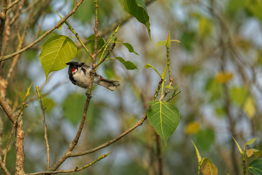
As dawn breaks over the estuary, bird activity increases dramatically. White-bellied Sea Eagles patrol above tidal rivers while kingfishers scan muddy creek edges for fish. Egrets and herons forage on exposed mudflats, and drongos, sunbirds, bee-eaters, and woodpeckers occupy different levels of the forest canopy.
The Indian Sundarbans support more than 300 recorded bird species across resident and migratory populations, making the region one of eastern India’s most significant coastal bird habitats.
Bird groups likely associated with habitats similar to Chhota Harikhali include:
- Kingfishers
- Herons
- Egrets
- Bitterns
- Storks
- White-bellied Sea Eagle
- Brahminy Kite
- Osprey (seasonal)
- Waders and sandpipers
- Plovers
- Bee-eaters
- Drongos
- Orioles
- Sunbirds
The exact avifauna of Chhota Harikhali remains dependent upon seasonal surveys, migration periods, and habitat conditions.
Reptiles
Reptiles occupy nearly every ecological niche within the Sundarbans.
The Saltwater Crocodile (Crocodylus porosus) represents the largest reptilian predator in the ecosystem, inhabiting tidal rivers, estuaries, and larger creeks. Water Monitor Lizards (Varanus salvator) patrol mudflats and mangrove margins in search of fish, crabs, eggs, and carrion.
The surrounding forests also support numerous snake species, including venomous and non-venomous taxa adapted to wetland environments. Species occurrence varies considerably among islands, and individual records require verification through herpetological surveys.
Aquatic Life
Much of the island’s biodiversity remains hidden beneath tidal waters.
Numerous estuarine fishes use mangrove creeks as nursery habitats during juvenile life stages. Crustaceans, including mud crabs, prawns, and shrimps, depend heavily upon mangrove habitats for shelter and feeding.
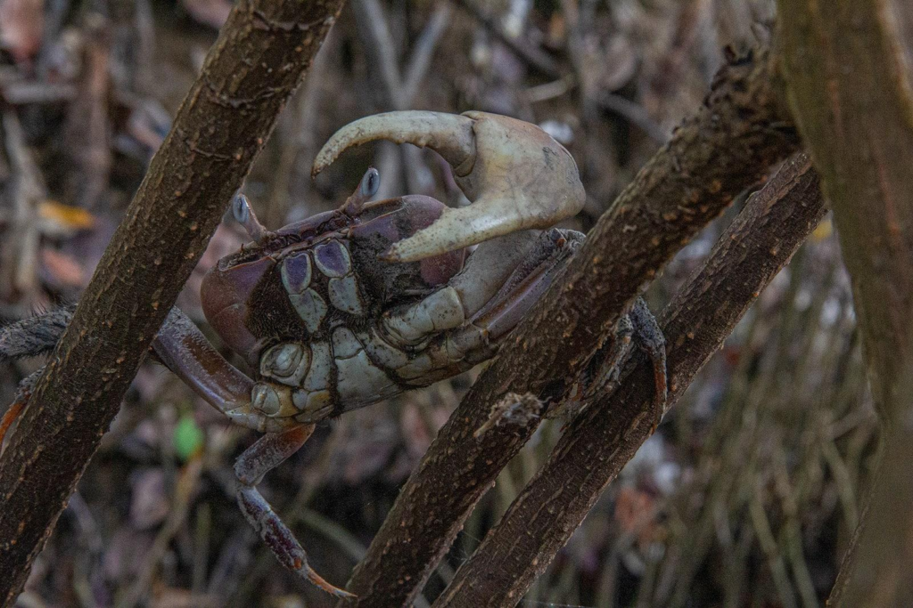
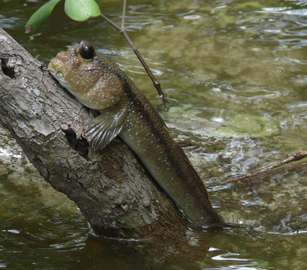
Mudskippers illustrate one of the most unusual adaptations within the ecosystem. These amphibious fishes spend considerable time out of water, moving across exposed mud using modified fins while obtaining oxygen through moist skin and specialized gill chambers.
The benthic community beneath the sediment contains worms, molluscs, burrowing crustaceans, and microorganisms that recycle nutrients essential for the productivity of the entire ecosystem.
Ecological Interactions
Every organism on Chhota Harikhali participates in an interconnected ecological network.
Mangrove leaves fall into tidal waters, where fungi and bacteria begin decomposition. Small invertebrates consume this organic material, becoming food for juvenile fish and crabs. Larger fishes prey upon smaller species, while birds, otters, crocodiles, and mammals occupy progressively higher trophic levels.
The Royal Bengal Tiger ultimately occupies the apex of this terrestrial food web, regulating herbivore populations and influencing ecosystem dynamics across the forest landscape.
This continuous recycling of energy and nutrients explains why mangrove forests maintain exceptionally high biological productivity despite relatively nutrient-poor terrestrial soils.
Ecological Importance
Chhota Harikhali performs ecological functions that extend far beyond its geographical footprint.
Biodiversity Conservation
The island contributes to maintaining habitat connectivity across the protected forests of the Indian Sundarbans. Continuous mangrove cover allows wildlife to move between islands while supporting genetically connected populations.
Nursery Grounds
Sheltered tidal creeks associated with mangrove forests provide essential nursery habitats for numerous commercially and ecologically important fish and crustacean species.
Shoreline Stabilization
Dense mangrove root systems reduce erosion by binding soft sediments and trapping suspended particles transported by tidal currents.
Carbon Storage
Mangrove ecosystems store exceptionally large quantities of carbon both within living biomass and waterlogged soils. Because decomposition proceeds slowly under oxygen-poor conditions, significant amounts of organic carbon remain locked within sediments for centuries.
Coastal Protection
Although no natural barrier completely eliminates cyclone impacts, intact mangrove forests reduce wave energy, slow storm surges, and lessen coastal erosion. Their protective role has been documented repeatedly following major cyclonic events affecting the Bay of Bengal.
Supporting Human Communities
Even though Chhota Harikhali itself remains uninhabited, healthy mangrove ecosystems sustain fisheries, improve water quality, protect nearby inhabited islands, and contribute to the ecological resilience upon which millions of people living throughout the lower delta ultimately depend.
Documentary Reflection
Standing quietly along a tidal creek at low tide, it becomes clear that the apparent stillness of Chhota Harikhali conceals extraordinary ecological activity.
- Every exposed root is exchanging gases with the atmosphere.
- Every fallen leaf is beginning its journey through the estuarine food web.
- Every incoming tide delivers new nutrients while simultaneously reshaping the shoreline.
The forest does not simply survive these daily changes—it depends upon them. Chhota Harikhali is therefore best understood not as a static island, but as a living ecosystem whose plants, animals, sediments, and tides remain inseparably connected.
Environmental History
Long before human settlements became established on the embanked islands of the lower delta, landscapes like Chhota Harikhali were already evolving through the interaction of rivers, tides, sediment, and vegetation. The history of this island is therefore primarily an environmental history rather than a record of permanent human occupation.
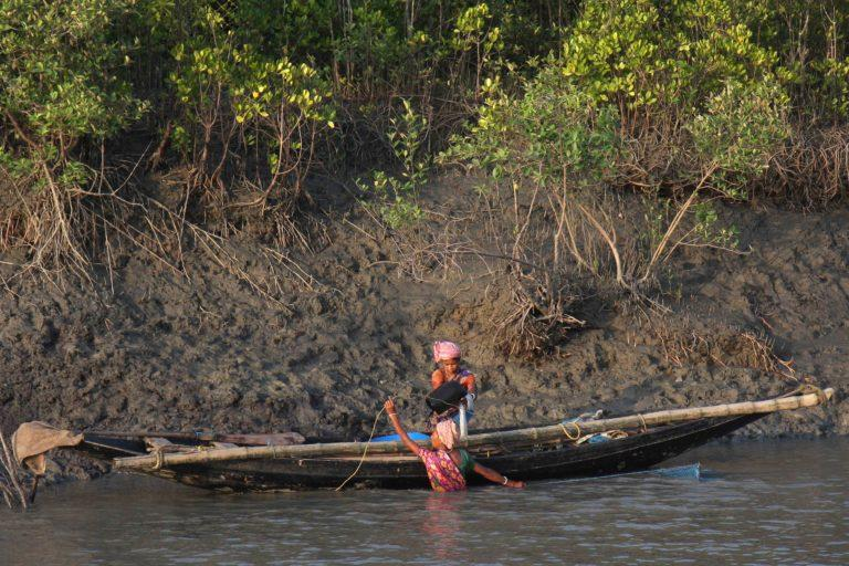
The Ganges–Brahmaputra–Meghna Delta has been constructed over thousands of years through the continuous deposition of sediments transported from the Himalayas and the Indian subcontinent. As these sediments accumulated near the Bay of Bengal, tidal currents redistributed them into an intricate network of channels, mudbanks, sandbars, and emerging islands. Mangrove vegetation gradually colonised these newly formed surfaces, stabilising the sediments and allowing increasingly complex ecological communities to develop.
Unlike rocky islands that may remain relatively unchanged for millennia, forest islands in the Sundarbans are inherently dynamic. Chhota Harikhali has almost certainly experienced repeated episodes of shoreline expansion, erosion, creek migration, and vegetation succession throughout its existence. Such changes are natural expressions of deltaic evolution rather than signs of ecological decline.
Although no widely published historical records specifically document the environmental history of Chhota Harikhali, its development is consistent with the broader geomorphological evolution of the Indian Sundarbans, where land formation and land loss occur simultaneously across different parts of the delta. Site-specific historical reconstruction would require analysis of archival maps, historical hydrographic surveys, satellite imagery, and sediment studies.
Human History
Unlike many inhabited islands of the Indian Sundarbans, Chhota Harikhali has no known permanent settlement history. There is no evidence in publicly available authoritative literature that the island supported long-term villages, agriculture, or extensive human habitation.
This absence of permanent settlement reflects the island’s environmental conditions. Daily tidal inundation, saline soils, unstable sediments, and exposure to cyclones make such forest islands unsuitable for conventional agriculture or sustained habitation. Instead, they have remained part of the protected mangrove wilderness managed primarily for ecological conservation.
Historically, the surrounding waterways would have been navigated by local fishing communities, honey collectors, crab harvesters, and forest-dependent livelihoods operating under regulated access. However, attributing such activities specifically to Chhota Harikhali would require documentary evidence and should not be assumed without verification. In accordance with The Wild Orbit Editorial Production Bible, unsupported historical claims are intentionally avoided.
Conservation Significance
From a conservation perspective, Chhota Harikhali is valuable not because of its size or public recognition, but because it contributes to the integrity of the Indian Sundarbans as a functioning ecological landscape.
The island forms part of an interconnected system of protected mangrove forests that collectively support one of the world’s largest remaining populations of mangrove-dependent wildlife. Ecological processes, including nutrient cycling, sediment deposition, tidal exchange, wildlife movement, and mangrove regeneration, operate across the landscape rather than within isolated islands.
Habitat Connectivity
Large mammals such as the Royal Bengal Tiger do not recognise administrative boundaries or individual island names. Their movements depend upon continuous habitat connected by tidal waterways and forest cover. Even relatively small islands therefore contribute to maintaining landscape-scale connectivity.
Mangrove Regeneration
Natural regeneration occurring on islands like Chhota Harikhali supports long-term forest resilience. Young mangrove stands replace older vegetation lost to erosion, storms, or natural succession, ensuring the continued functioning of the ecosystem.
Estuarine Productivity
The island contributes organic matter, shelter, and breeding habitat that sustain numerous estuarine organisms. Fish populations supporting regional fisheries often depend upon healthy mangrove ecosystems during juvenile life stages.
Climate Regulation
Healthy mangrove forests store substantial quantities of carbon within living biomass and waterlogged soils. Protecting intact mangrove landscapes therefore contributes to climate-change mitigation while simultaneously supporting biodiversity conservation.
Protected Area Context
Chhota Harikhali exists within one of India’s most rigorously protected coastal landscapes.
The broader Indian Sundarbans include multiple overlapping conservation designations that collectively safeguard biodiversity, ecological processes, and internationally significant habitats. These include the Sundarbans Tiger Reserve, Sundarbans National Park, Sundarbans Biosphere Reserve, and the UNESCO World Heritage Site.
The precise legal status of Chhota Harikhali within these overlapping management zones should be confirmed using the latest official maps published by the West Bengal Forest Department before publication. Forest compartment boundaries and administrative designations may change over time and should never be inferred.
Regardless of its specific compartment designation, the island forms part of the larger protected mangrove landscape managed under national and state conservation frameworks.
Climate
The climate influencing Chhota Harikhali is tropical, humid, and strongly seasonal. Unlike inland regions where temperature alone dominates environmental conditions, the Sundarbans climate is shaped equally by monsoon rainfall, tidal inundation, salinity, humidity, and proximity to the Bay of Bengal.
Average annual rainfall is delivered primarily during the southwest monsoon, typically between June and September. During this period, freshwater input increases throughout the delta, temporarily reducing salinity in many estuarine channels and influencing mangrove growth, fish breeding, and sediment transport.
The post-monsoon months generally provide relatively stable environmental conditions, while the dry season is characterised by declining freshwater discharge, increased salinity, and greater evaporation.
Humidity remains high throughout the year, often exceeding levels typical of inland regions. Combined with low elevation and extensive water surfaces, this creates a distinctive microclimate supporting mangrove vegetation and associated wildlife.
Seasonal Character
Summer (March–May)
Before the arrival of the southwest monsoon, temperatures rise steadily across the delta. Water levels remain largely governed by tidal cycles, while increasing evaporation contributes to higher surface salinity in many estuarine channels.
Wildlife activity often concentrates near permanent tidal creeks where water remains available throughout the tidal cycle.
Southwest Monsoon (June–September)
Heavy rainfall transforms the landscape.
Freshwater discharge from upstream river systems increases, suspended sediments become more abundant, and tidal rivers transport enormous quantities of nutrient-rich material through the mangrove forests.
Young mangrove seedlings often establish themselves during this season on newly deposited mudbanks, while aquatic productivity increases substantially.
Post-Monsoon (October–November)
As rainfall declines, the forest becomes particularly vibrant.
Clearer skies improve visibility across tidal rivers, vegetation remains lush following the monsoon, and many bird species become increasingly active. This period also coincides with favourable environmental conditions for ecological fieldwork, subject to forest regulations.
Winter (December–February)
Winter brings comparatively cooler temperatures and lower humidity.
Morning mist frequently settles over tidal waterways before gradually lifting after sunrise. Migratory birds supplement resident avifauna, while reduced rainfall allows tidal processes to dominate the hydrological regime once again.
Natural Disturbance Regime
Disturbance is not exceptional within the Sundarbans; it is fundamental to ecosystem function.
Cyclones, tidal surges, bank erosion, channel migration, sediment deposition, and occasional tree fall continually reshape islands like Chhota Harikhali. Rather than representing ecological failure, these events often initiate natural regeneration processes.
Following severe storms, newly deposited sediments may become colonised by pioneer mangrove species, gradually leading to the establishment of mature forest communities over time.
Understanding this natural cycle is essential for interpreting landscape change within the delta.
Contemporary Threats
Although protected, Chhota Harikhali remains influenced by regional environmental pressures affecting the wider Sundarbans.
Sea-Level Rise
Projected sea-level rise increases the vulnerability of low-lying mangrove islands to prolonged inundation, shoreline retreat, and changes in salinity regimes.
Cyclones
See it for yourself
A private journey shaped around you — your group, your pace, your interests. Book a free consultation.
The Bay of Bengal experiences some of the world’s most powerful tropical cyclones. Strong winds, storm surges, and wave action can cause extensive damage to mangrove forests, alter river channels, and accelerate erosion.
Salinity Changes
Changes in freshwater availability upstream influence estuarine salinity throughout the Sundarbans. These shifts may affect mangrove species composition and ecological productivity over long timescales.
Riverbank Erosion
Natural erosion continuously modifies island boundaries. While erosion forms part of normal delta dynamics, changing hydrological conditions may influence its rate and spatial distribution.
Climate Change
Climate change introduces multiple interacting pressures, including altered rainfall patterns, increasing temperatures, changing cyclone characteristics, and sea-level rise. Together, these factors may influence both biodiversity and geomorphological processes across the delta.
Conservation Management
Protecting Chhota Harikhali requires managing ecological processes rather than individual species alone.
Conservation within the Indian Sundarbans combines habitat protection, wildlife monitoring, scientific research, regulated navigation, anti-poaching measures, and ecosystem restoration where necessary.
Management priorities include:
- Maintaining landscape connectivity across protected forests.
- Conserving natural tidal hydrology.
- Monitoring tiger and prey populations.
- Protecting nesting and breeding habitats.
- Preventing illegal extraction of forest resources.
- Supporting long-term ecological research.
- Strengthening climate resilience through mangrove conservation.
Because mangrove ecosystems operate as integrated landscapes, effective conservation depends upon preserving the ecological relationships among rivers, islands, vegetation, wildlife, and sediment dynamics rather than focusing exclusively on individual locations.
Scientific Research Opportunities
Despite decades of research within the Sundarbans, islands such as Chhota Harikhali remain comparatively under-documented at the site level.
Future research could improve understanding of:
- Mangrove species composition.
- Sediment accumulation rates.
- Shoreline dynamics.
- Blue carbon storage.
- Bird diversity.
- Camera-trap monitoring of mammals.
- Estuarine fish assemblages.
- Reptile distribution.
- Pollination ecology.
- Long-term responses to climate change.
Such studies would contribute not only to knowledge of Chhota Harikhali itself but also to broader understanding of mangrove ecosystem resilience across the Indian Sundarbans.
Visitor Information
Chhota Harikhali is not a conventional visitor destination. Unlike popular interpretation centres or tourism zones within the Indian Sundarbans, its importance lies primarily in ecological conservation rather than recreational access.
Because the island forms part of the protected mangrove landscape, public access is governed by regulations established by the West Bengal Forest Department. Navigation routes, permissible waterways, and entry permissions are subject to conservation objectives, seasonal restrictions, weather conditions, and wildlife management considerations.
Visitors exploring the surrounding waterways should regard Chhota Harikhali as part of a living protected ecosystem rather than an attraction.
Accessibility
- Accessible only by boat.
- Navigation depends on tidal conditions.
- Forest permissions may be required depending on the route and protected-area regulations.
- Landing on protected forest islands is generally restricted unless specifically authorised for research, conservation, or management purposes.
Best Season for Observational Navigation
From an environmental perspective, the period between November and February generally offers clearer visibility, lower humidity, and comparatively comfortable weather for observing the surrounding mangrove landscape. However, navigational decisions should always prioritise weather forecasts, tidal conditions, and official guidance rather than seasonal preference alone.
Responsible Observation Guidelines
Visitors travelling through the surrounding waterways should follow established responsible nature practices:
- Maintain a safe distance from wildlife.
- Never attempt to feed animals.
- Avoid loud noises or amplified music.
- Do not dispose of waste into rivers or creeks.
- Respect all forest department regulations.
- Avoid disturbing nesting birds or basking reptiles.
- Follow designated navigation channels where required.
- Remember that wildlife has priority over human activity within protected habitats.
The objective is not merely to see the forest but to ensure that observation leaves no ecological footprint.
Documentary Field Notes
Although individual field observations vary according to season, tide, and weather, the following characteristics are representative of mangrove islands such as Chhota Harikhali.
Dawn
Soft mist frequently hangs above tidal channels before sunrise. The first sounds often come from kingfishers, drongos, and distant egrets leaving their roosts. Low-angle sunlight gradually illuminates mangrove canopies while exposed mudbanks remain cool from the night.
Midday
High humidity dominates the forest. During high tide, many mudflats disappear beneath opaque brown estuarine water, reducing visible terrestrial activity while increasing aquatic movement beneath the surface.
Late Afternoon
As the tide begins to recede, mudskippers emerge onto exposed sediments. Fiddler crabs become increasingly active, and wading birds concentrate along newly exposed creek margins where prey becomes accessible.
Evening
Light softens across the estuary. Bird activity gradually declines while nocturnal species begin replacing diurnal communities. The forest transitions quietly rather than dramatically, reflecting the subtle rhythms that characterise mangrove ecosystems.
Chhota Harikhali by the Numbers
Because detailed site-specific measurements for Chhota Harikhali are not publicly available in authoritative sources, quantitative values should not be fabricated. Instead, the island can be understood within the broader context of the Indian Sundarbans.
- Biome: Tropical mangrove forest.
- Elevation: Low-lying intertidal deltaic island.
- Hydrology: Dominated by semidiurnal tides.
- Primary Geomorphic Process: Sediment deposition and tidal erosion.
- Human Settlement: None.
- Principal Ecological Function: Protected mangrove habitat.
Future field surveys may provide more precise measurements for area, shoreline length, vegetation composition, and biodiversity.
The Wild Orbit’s Interesting Facts About Chhota Harikhali
1. Every Tide Rewrites the Landscape
Unlike inland forests, Chhota Harikhali experiences major environmental changes approximately every six hours as tides alternately flood and expose the forest floor.
2. The Island Exists Because Rivers Never Stop Moving
Its existence depends upon the continuous interaction between Himalayan sediments, tidal currents, mangrove roots, and coastal processes.
3. Mangroves Help Build Land
Rather than simply growing on existing land, mangrove roots trap suspended sediments, gradually encouraging further land formation.
4. The Forest Stores Carbon Beneath the Mud
A substantial proportion of mangrove carbon remains stored within waterlogged sediments, making these ecosystems globally significant for long-term carbon storage.
5. Wildlife Often Remains Invisible
Many visitors assume the forest is empty because they see few animals. In reality, much wildlife remains concealed within dense vegetation, tidal creeks, or beneath the water surface.
6. Every Island Is Ecologically Connected
Even isolated-looking forest islands function as components of a much larger ecological network supporting wildlife movement, nutrient exchange, and tidal processes.
7. Stability Is an Illusion
Although the island appears permanent, its shoreline is continually modified by erosion, sediment deposition, creek migration, and vegetation succession.
8. Mangrove Forests Are Engineers
By slowing water flow, trapping sediments, and stabilising riverbanks, mangrove trees actively shape the physical landscape around them.
FAQs
Where is Chhota Harikhali located?
Chhota Harikhali is an uninhabited protected forest island within the Indian Sundarbans of West Bengal. It forms part of the lower Ganges–Brahmaputra–Meghna Delta.
Is Chhota Harikhali inhabited?
No verified evidence indicates permanent human settlement on the island. It functions primarily as protected mangrove forest.
Can tourists visit Chhota Harikhali?
Navigation through nearby waterways may be possible depending on forest regulations and authorised routes. Direct access to protected forest islands is generally restricted and subject to official permission.
Why is Chhota Harikhali important?
The island contributes to biodiversity conservation, mangrove regeneration, shoreline stabilisation, carbon storage, estuarine productivity, and habitat connectivity within the Indian Sundarbans.
Which animals may occur there?
The surrounding protected forests support species such as the Royal Bengal Tiger, Fishing Cat, Spotted Deer, Wild Boar, Saltwater Crocodile, Water Monitor, numerous birds, fishes, crustaceans, and mangrove-associated invertebrates. Site-specific species occurrence should be verified through official wildlife records.
Why are mangrove roots visible above the mud?
Many mangrove trees produce specialised aerial roots called pneumatophores that obtain oxygen from the atmosphere because waterlogged sediments contain very little free oxygen.
Does the island change over time?
Yes. Shorelines, tidal creeks, mudbanks, and vegetation communities gradually change through natural erosion, sediment deposition, tidal action, and ecological succession.
Is Chhota Harikhali affected by climate change?
Like the wider Sundarbans, the island may be influenced by sea-level rise, changing salinity, cyclone activity, and shifts in rainfall patterns. The precise long-term effects continue to be studied.
What Chhota Harikhali Reveals About the Sundarbans
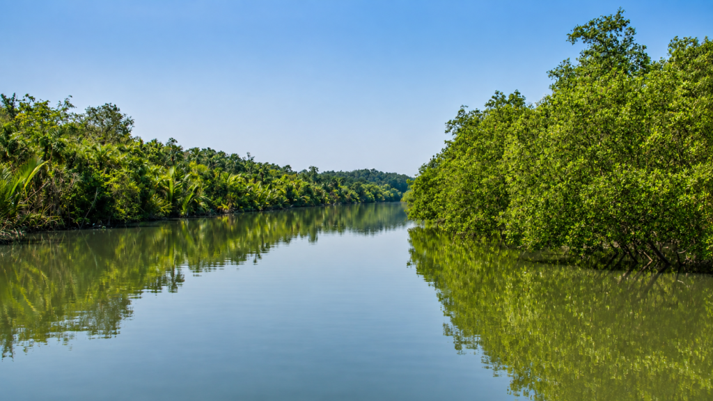
As daylight fades across the estuary, the silhouette of Chhota Harikhali gradually merges with the surrounding mangrove horizon. The rising tide once again covers the exposed mud, concealing crab burrows, pneumatophores, and the intricate traces of countless organisms that briefly occupied the surface. To an observer, the island seems unchanged. Yet beneath the water, sediment is settling, roots continue exchanging gases, microorganisms are recycling nutrients, and the ecological processes that sustain the Sundarbans carry on without interruption.
This quiet transformation captures the true significance of Chhota Harikhali. Its value is not measured by visitor numbers, historical monuments, or human settlement. Instead, it lies in the essential role it plays within one of the planet’s most dynamic coastal ecosystems. Every tide reshapes its margins, every mangrove root strengthens its foundation, and every season contributes to the ongoing story of a landscape defined by change.
Studying islands like Chhota Harikhali reminds us that the Sundarbans is not a collection of isolated forests but a single, interconnected living delta. Each uninhabited island supports the resilience of the whole—providing habitat for wildlife, stabilising sediments, storing carbon, and sustaining ecological processes that extend far beyond its own shoreline.
Plan your private Sundarban expedition
A private journey shaped around you — your group, your pace, your interests. Book a free consultation.