 Encyclopedia
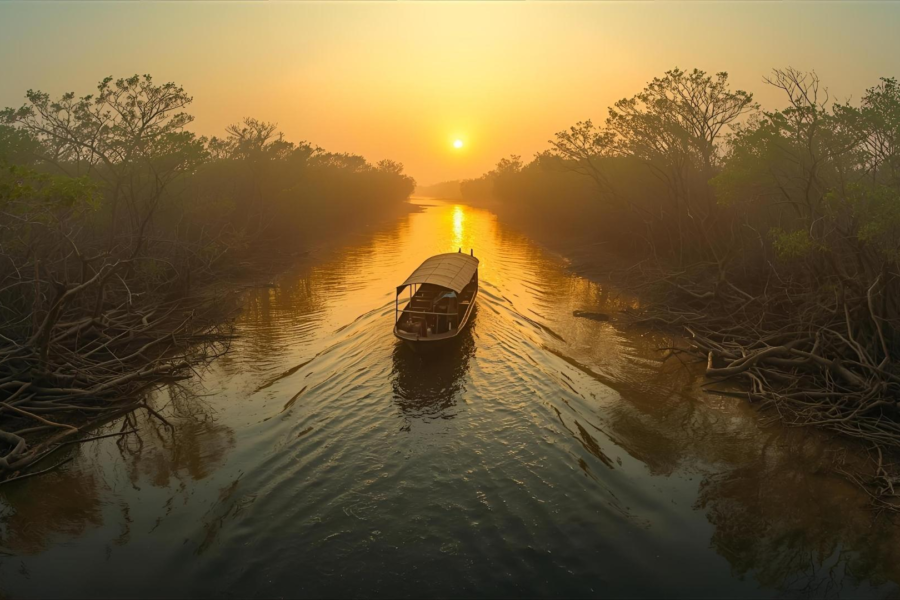
At low tide, the northern Bay of Bengal is a landscape in constant transition. Rivers carrying immense volumes of sediment from the Himalayas spread across one of the world’s largest deltas before meeting the sea. Sandbars emerge, tidal channels migrate, mudflats expand and disappear, and coastlines shift over years—or even within a single monsoon season. Few places on Earth illustrate the dynamic nature of coastal geography as dramatically as the Sundarbans and the adjoining Ganges–Brahmaputra–Meghna Delta.
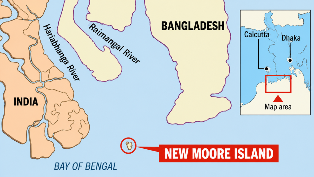
Among these ever-changing landforms, one small island became unexpectedly significant. Known as New Moore Island in India and South Talpatti Island in Bangladesh, it measured only a few square kilometres at its largest, lacked permanent human settlement, and supported little vegetation during much of its existence. Yet for nearly four decades, this uninhabited sand island became the subject of diplomatic exchanges, hydrographic surveys, media attention, and competing territorial claims between two neighbouring nations.
Its story was never simply about ownership of a tiny island. Instead, it reflected the intersection of delta geology, international maritime law, coastal geomorphology, and the broader environmental forces shaping the northern Bay of Bengal. The island’s appearance demonstrated how rivers can build new land through sediment deposition, while its eventual disappearance illustrated how erosion, tidal currents, subsidence, storms, and rising sea levels can erase that land almost as quickly as it formed.
Today, New Moore / South Talpatti Island no longer rises above the tides. It survives only in historical maps, scientific literature, diplomatic archives, and satellite imagery documenting one of the most remarkable examples of a disputed island disappearing before its political status was ever fully resolved.
Understanding this vanished island requires far more than tracing a geopolitical dispute. It begins with understanding the Bengal Delta itself—a living landscape where rivers, tides, and sediment continuously redraw the boundary between land and sea.
New Moore / South Talpatti Island At a Glance
At a Glance
Common names: New Moore Island (India), South Talpatti Island (Bangladesh)
Other names: New Island, Purbasha (proposed in India)
Geographic region: Northern Bay of Bengal
Delta system: Ganges–Brahmaputra–Meghna Delta
Location: Near the mouth of the Hariabhanga River along the India–Bangladesh maritime frontier
Political status: Formerly disputed between India and Bangladesh
First recorded emergence: Early 1970s, following major sediment deposition after the 1970 Bhola Cyclone
Maximum elevation: Only a few metres above mean sea level
Permanent population: None
Vegetation: Sparse pioneer coastal vegetation with limited mangrove colonisation
Current status: Submerged beneath sea level
Primary scientific importance: Delta geomorphology, coastal evolution, maritime boundary studies, and climate adaptation
Documentary significance: One of the world’s best-known examples of a disputed island that disappeared naturally.
Accessibility: Accessible only by licensed boats through designated waterways, subject to Forest Department regulations and prior permission.
How to Reach New Moore / South Talpatti Island
Step 1: Reach Kolkata
Kolkata is the nearest major gateway to the Indian Sundarbans.
- By Air: Netaji Subhas Chandra Bose International Airport is the nearest airport.
- By Rail: Sealdah Railway Station and Howrah Junction connect Kolkata with the rest of India.
Step 2: Travel to the Sundarbans Entry Point
The most practical entry point is Godkhali Jetty, from where registered boats enter the Indian Sundarbans.
- By Road: Approximately 100 km from Kolkata (around 3 hours).
- Alternative: Take a local train from Sealdah to Canning, then continue by road to Godkhali or Sonakhali.
Step 3: Continue by Registered Boat
From Godkhali, visitors must board a registered motorboat authorised by the Sundarbans Tiger Reserve. Boats typically travel through Sajnekhali, Sudhanyakhali, Dobanki, and other permitted routes. Independent travel beyond authorised zones is not permitted.
Can You Visit New Moore Island?
No. The island has been permanently submerged for years and cannot be landed upon. Its former location lies approximately 2–3.5 km south of the Hariabhanga River estuary in the northern Bay of Bengal, close to the India–Bangladesh maritime boundary. The surrounding waters remain environmentally sensitive and are subject to forest, maritime, and border security regulations.
Nearest Viewpoint
While the island itself cannot be seen, the Hariabhanga River represents the closest accessible geographical reference from the Indian Sundarbans. Specialised research vessels and authorised government patrols operate in parts of this outer estuarine region, but these areas are generally not included in regular tourist itineraries because of border-security restrictions.
Geographic Setting
Before understanding the island itself, it is necessary to understand the landscape that created it.
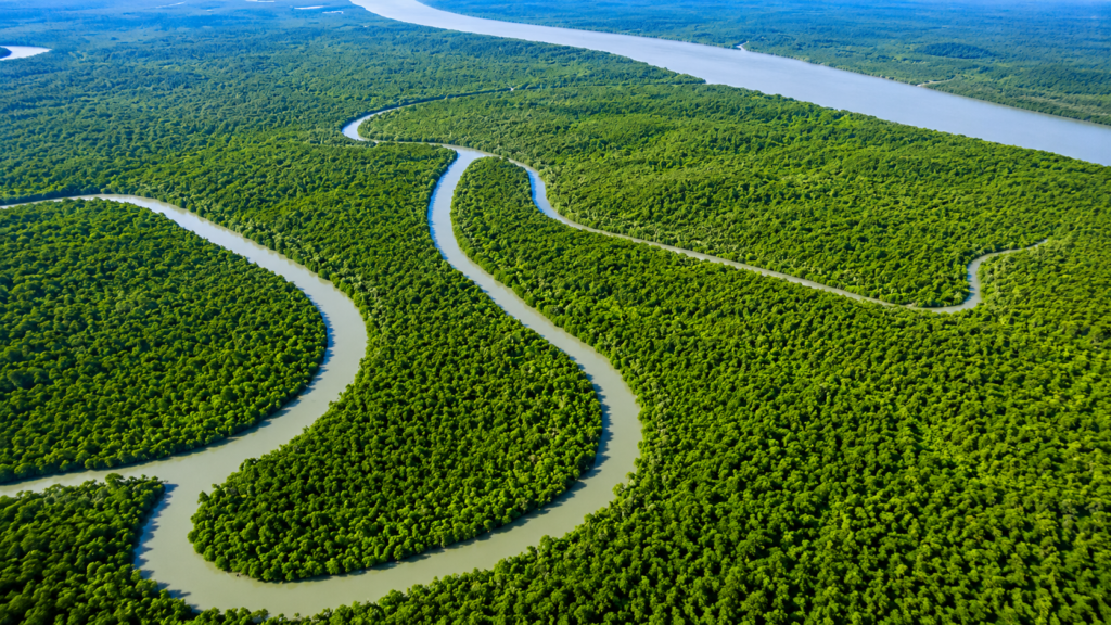
The northern Bay of Bengal forms the seaward edge of the Ganges–Brahmaputra–Meghna (GBM) Delta, the largest active delta on Earth. Covering much of Bangladesh and eastern India, this immense depositional system has been built over thousands of years by sediments transported from the Himalayas, the Tibetan Plateau, and the Indian subcontinent. Every year, the interconnected river network delivers enormous quantities of sand, silt, and clay to the coast, continually reshaping tidal flats, estuaries, and offshore shoals.
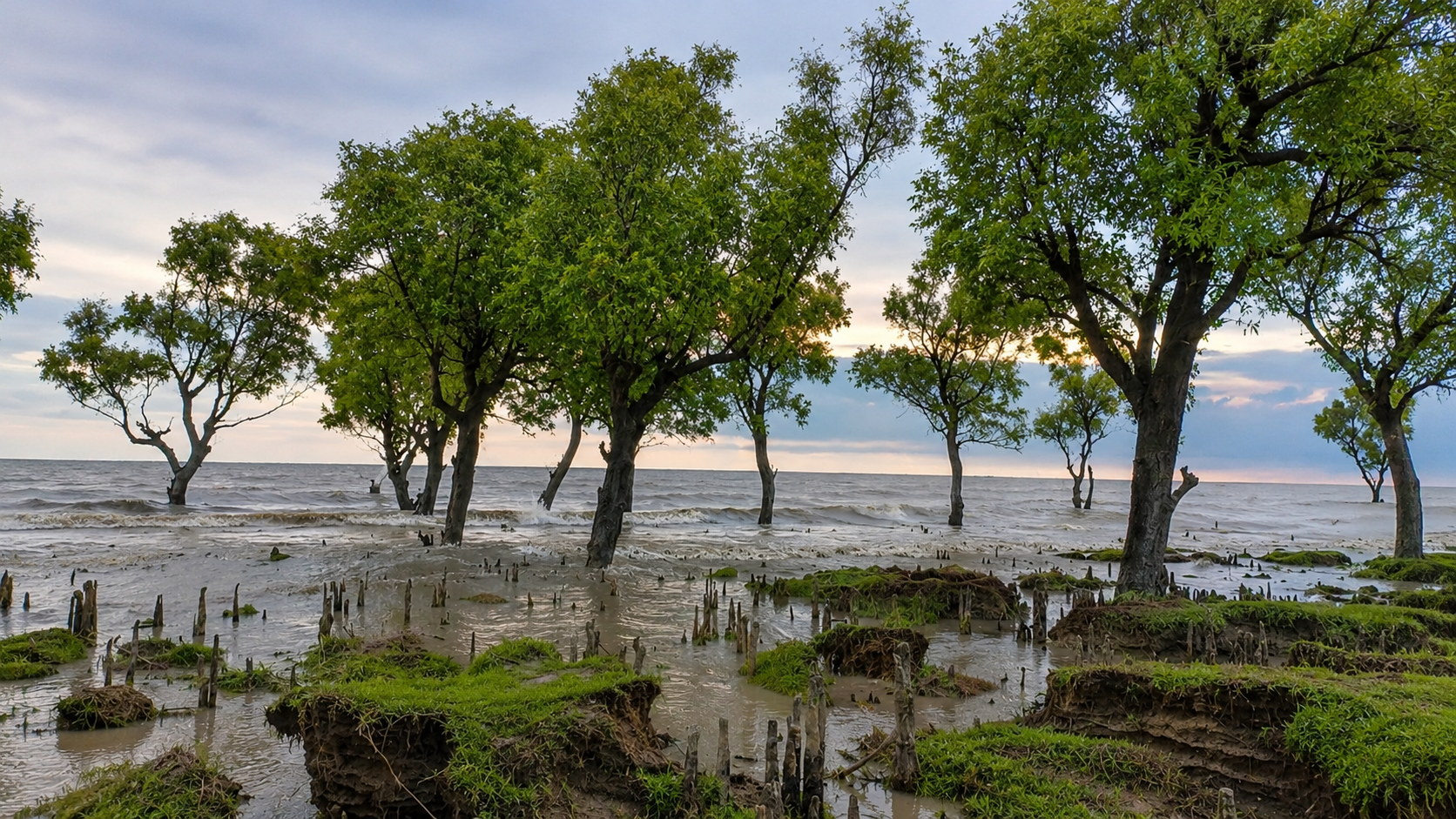
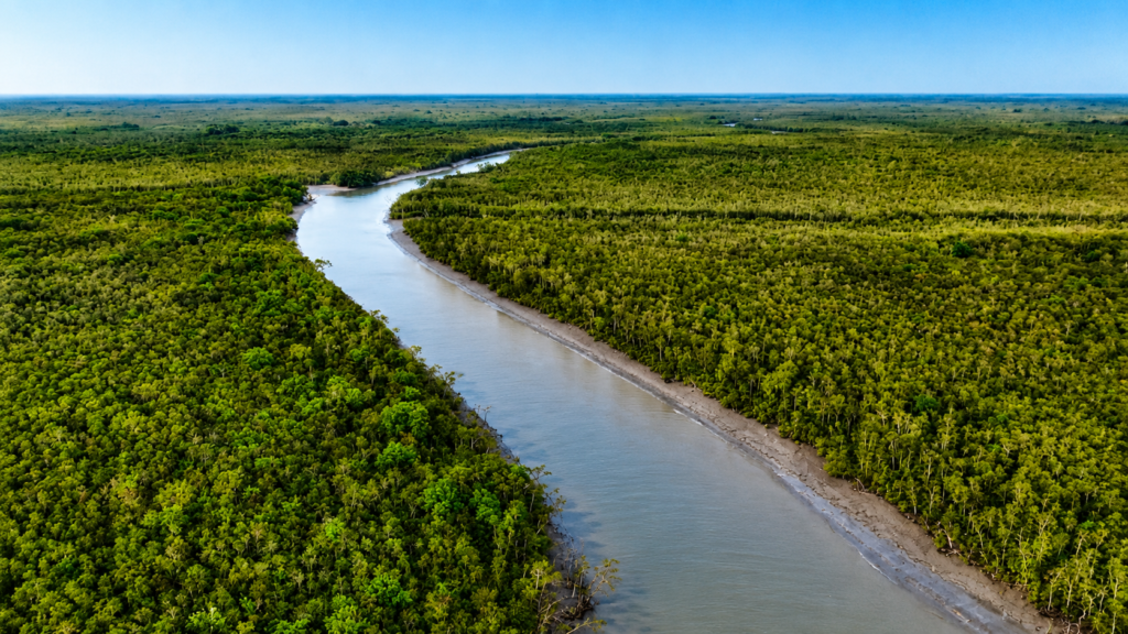
Within this vast delta lies the Sundarbans, the world’s largest contiguous mangrove forest. Here, hundreds of tidal channels, estuarine rivers, mudflats, creeks, and mangrove islands form a landscape that rarely remains static. Land is constantly created through sediment deposition while neighbouring areas are simultaneously eroded by tidal currents and storm surges.
New Moore / South Talpatti Island emerged beyond the southern fringe of the mangrove forest, close to the mouth of the Hariabhanga River, one of the tidal boundary rivers separating India and Bangladesh before entering the Bay of Bengal.
Unlike established mangrove islands farther inland, this island occupied a highly exposed marine environment where waves, tides, river discharge, and seasonal cyclones interacted directly. Such locations are among the least stable landscapes anywhere in the delta.
Its position near an international boundary transformed what would otherwise have been an ordinary offshore sandbar into an internationally recognised geographical feature.
Geographic Reference
Rivers Associated with the Island
- Hariabhanga River
- Raimangal River (regional estuarine influence)
- Bay of Bengal tidal estuary
Nearby Indian Regions
- Southern Sundarbans Biosphere Reserve
- Coastal waters south of the Sundarbans Tiger Reserve
- Offshore deltaic shoals
Nearby Bangladeshi Regions
- Southwestern coastal delta
- Satkhira coastal zone
- Sundarbans Reserved Forest (Bangladesh)
Documentary Observation
On a calm winter morning, the northern Bay of Bengal often appears deceptively tranquil. Fine brown sediment suspended in the water gives the sea a muted, earthy colour rather than the deep blue associated with open oceans. Tidal currents move almost imperceptibly across the surface, yet beneath them millions of sediment particles are continually settling, being lifted again, and redistributed by the next tidal cycle. In such an environment, land itself is temporary. What seems like a permanent shoreline may simply be the latest expression of an ever-changing delta.
The Bengal Delta: A Landscape Built by Rivers
New Moore Island was not formed by volcanic activity, tectonic uplift, or coral growth. It was created by one of nature’s most powerful geomorphological processes: sediment deposition.
The Ganges, Brahmaputra, and Meghna river systems collectively drain an enormous catchment extending from the Himalayas to the Bay of Bengal. Along their journey, these rivers erode mountains, transport rock fragments, clay, silt, and sand, and ultimately deposit these materials where river velocity decreases near the sea.
This process has continued for thousands of years, gradually constructing the Bengal Delta layer by layer.
Unlike rocky coastlines, deltas are inherently unstable. Every flood season introduces new sediment while tides and waves simultaneously redistribute older deposits. Channels migrate, islands split, mudbanks merge, and shorelines advance or retreat depending on seasonal river discharge and marine conditions.
Geologists often describe active deltas as “living landscapes” because their geography is never fixed. New Moore Island was one such product of this continual cycle of construction and destruction.
How New Moore Island Emerged
The emergence of New Moore Island is closely linked to one of the deadliest natural disasters in recorded history—the 1970 Bhola Cyclone.
Striking the northern Bay of Bengal in November 1970, the cyclone generated catastrophic storm surges that reshaped large sections of the delta coastline. Beyond its devastating human impact, the event also altered sediment transport patterns across several estuaries.
In the years immediately following the cyclone, hydrographic surveys and satellite observations began identifying a newly emerged offshore landform near the mouth of the Hariabhanga River. Although sediment had likely been accumulating before 1970, the cyclone appears to have accelerated the redistribution of sediments that eventually allowed the island to remain above mean sea level.
Rather than rising suddenly in a single event, the island probably evolved through successive phases of deposition, compaction, and tidal reworking over several years.
This distinction is important. Scientific studies generally describe New Moore as the outcome of ongoing deltaic sedimentation rather than the direct creation of a cyclone itself. The cyclone likely acted as a catalyst within a much longer geomorphological process rather than as the sole cause of the island’s formation.
The Science of Sediment Deposition
To understand why the island appeared where it did, imagine the Hariabhanga River carrying enormous quantities of suspended sediment toward the Bay of Bengal.
As river water enters the open estuary, its flow slows dramatically. Reduced current velocity means that heavier particles begin settling first, followed by progressively finer sediments. Over time, repeated tidal cycles accumulate these deposits into submerged shoals.
Once enough sediment accumulates above the average tidal level, small sandbars begin emerging during low tide.
If additional deposition continues faster than erosion removes material, these sandbars gradually stabilize and remain exposed for longer periods.
Only after repeated cycles of deposition can vegetation begin colonising the new surface, helping trap additional sediment and increasing stability.
New Moore Island represented one stage within this natural progression—a stage that ultimately proved temporary.
Discovery and Early Mapping
The precise date of the island’s first appearance remains uncertain because deltaic landforms often emerge gradually rather than suddenly.
Most authoritative accounts indicate that the island became widely recognised during the early 1970s after hydrographic observations detected a newly exposed landmass near the maritime boundary.
Its emergence coincided with increasing availability of aerial photography, satellite imagery, and systematic hydrographic surveying in the Bay of Bengal. These technologies enabled both India and Bangladesh to monitor changes in the evolving coastline with far greater precision than had previously been possible.
As awareness of the island grew, each country adopted its own official name.
India referred to it primarily as New Moore Island, although Purbasha was also proposed in some contexts.
Bangladesh called the same landform South Talpatti Island, reflecting local geographical naming traditions.
Despite differing names, both referred to the same naturally formed offshore island located near the mouth of the Hariabhanga River.
Why the Island Drew Immediate Attention
Under ordinary circumstances, the appearance of a small offshore sand island would have interested only geologists and hydrographers.
New Moore became internationally significant because of where it appeared.
The island emerged in waters where the maritime boundary between India and the newly independent Bangladesh required careful interpretation under international law. Even a small island can influence territorial sea measurements, maritime claims, and the delimitation of offshore rights depending on applicable legal principles.
Consequently, what began as a geological event soon evolved into a matter of diplomacy, hydrographic surveying, and international maritime policy.
The island’s political importance, however, rested entirely upon its continued existence above sea level—a condition that nature would ultimately overturn.
Historical Timeline (1947–1971)
1947 – Partition of British India establishes a new international boundary in the Bengal Delta.
1947–1970 – The Hariabhanga estuary remains a dynamic tidal boundary influenced by continual sediment deposition and erosion.
November 1970 – The Bhola Cyclone dramatically reshapes portions of the northern Bay of Bengal through extreme storm surge and coastal sediment redistribution.
1971 – Bangladesh gains independence, creating a new sovereign state sharing extensive maritime boundaries with India.
Early 1970s – Hydrographic surveys identify a newly emerged offshore island near the mouth of the Hariabhanga River.
From Geological Curiosity to Geopolitical Issue
When New Moore Island emerged during the early 1970s, neither India nor the newly independent Bangladesh disputed that the island was a natural formation. The disagreement centred instead on where the maritime boundary passed in relation to the island.
Unlike disputes involving long-inhabited territories, New Moore had no villages, no historical settlements, no indigenous communities, and no permanent economic activity. Its importance derived almost entirely from its geographic position near the mouth of the Hariabhanga River, one of the principal boundary rivers flowing into the Bay of Bengal.
Because maritime boundaries determine sovereignty over territorial seas, exclusive economic zones (EEZs), and continental shelf rights, even a small island situated near an international frontier can carry legal significance far beyond its physical dimensions.
For both countries, the island represented more than a patch of emerging land. It raised broader questions about how a changing delta should be interpreted under international maritime law.
Why the Hariabhanga River Was So Important
The Hariabhanga River occupies a unique place in the geography of the India–Bangladesh frontier. Flowing southward through the Sundarbans before entering the Bay of Bengal, it forms part of the international boundary established after the Partition of British India in 1947 and inherited by Bangladesh following its independence in 1971.
Unlike rivers flowing through mountainous terrain, the Hariabhanga is an estuarine tidal river. Its width, channels, banks, and sediment bars change over time under the combined influence of river discharge, tidal currents, and coastal processes.
This dynamic character complicates the interpretation of maritime boundaries because river mouths may migrate while offshore sediment deposits continuously alter local geography.
The emergence of New Moore occurred precisely where these natural processes intersected with international law.
Competing Interpretations of Sovereignty
India and Bangladesh adopted different legal and geographical interpretations regarding the island’s position relative to the maritime boundary.
India maintained that the island lay on its side of the principal navigational channel associated with the Hariabhanga River and therefore formed part of Indian territory. Indian hydrographic surveys, naval observations, and official mapping supported this interpretation. During the early 1980s, Indian authorities also conducted symbolic visits and installed temporary markers to reinforce their administrative claim.
Bangladesh, meanwhile, argued that the island lay within its maritime jurisdiction based on its interpretation of the river boundary and applicable maritime delimitation principles. Bangladeshi officials referred to the island as South Talpatti, reflecting their own geographical nomenclature and sovereign claim.
Importantly, both governments based their positions on differing interpretations of geography and law rather than on competing claims of historical settlement or occupation.
A Dispute Without Residents
One of the most unusual aspects of the New Moore dispute was the complete absence of a resident population.
Throughout its existence:
- No permanent settlements developed.
- No agricultural activity occurred.
- No freshwater sources were available.
- No civil administration functioned on the island.
- No lasting infrastructure was established.
The island’s extremely low elevation made permanent habitation impractical. Much of its surface remained vulnerable to inundation during high tides and storm surges, while the unstable sandy substrate offered little foundation for long-term construction.
As a result, the dispute remained almost entirely diplomatic and cartographic rather than humanitarian.
Understanding Maritime Boundaries
To appreciate why such a small island attracted international attention, it is necessary to understand the basic framework of maritime boundaries.
Modern international law allows coastal states to exercise different levels of jurisdiction over adjacent marine areas.
These generally include:
- Internal Waters – Waters landward of the coastal baseline under full national sovereignty.
- Territorial Sea – Extending up to 12 nautical miles from the baseline, where the coastal state exercises sovereignty subject to limited rights of innocent passage.
- Contiguous Zone – Extending beyond the territorial sea for limited enforcement purposes.
- Exclusive Economic Zone (EEZ) – Extending up to 200 nautical miles, granting sovereign rights over marine resources rather than complete territorial sovereignty.
- Continental Shelf – Relating to rights over seabed resources beyond the territorial sea under specific geological and legal conditions.
Where neighbouring countries lie close together—as in the northern Bay of Bengal—these maritime zones overlap. Delimiting them requires negotiated agreements or international legal decisions based on accepted principles of maritime law.
The Challenge of Applying Law to a Living Delta
Most maritime boundary cases involve relatively stable coastlines.
The Bengal Delta presents a far more complicated situation.
Here:
- River mouths migrate.
- Sandbars emerge and disappear.
- Shorelines advance or retreat.
- Tidal channels shift position.
- Cyclones reshape coastal landscapes.
- Sediment deposition continually creates new landforms.
These processes raise important legal questions.
- Should a newly formed island immediately influence maritime boundaries?
- If an island later disappears beneath the sea, should previous legal claims remain relevant?
- How should international law respond when geography changes faster than diplomatic negotiations?
The New Moore dispute became one of the clearest real-world examples of these challenges.
Hydrographic Surveys and Scientific Monitoring
Both India and Bangladesh undertook repeated hydrographic surveys to document the evolving condition of the island.
Hydrographic surveys differ from ordinary mapping.
They measure:
- Water depth (bathymetry)
- Coastal topography
- Tidal channels
- Navigation hazards
- Shoreline position
- Sediment accumulation
- Coastal erosion
Throughout the 1970s, 1980s, and 1990s, successive surveys revealed that New Moore remained an exceptionally unstable landform.
Although its exact dimensions varied between observations, scientists consistently described it as:
- extremely low-lying,
- composed primarily of unconsolidated sediments,
- highly vulnerable to erosion,
- exposed to severe tidal action,
- lacking long-term geomorphological stability.
These findings increasingly suggested that the island’s future depended less on diplomacy than on coastal processes beyond human control.
Could the Island Have Supported Permanent Settlement?
From time to time, speculative media reports suggested that the island might eventually become economically valuable or permanently inhabited.
Scientific evidence offered a much more cautious assessment.
Several environmental constraints limited long-term habitation:
Low Elevation
Most of the island stood only a few metres above mean sea level, leaving it highly susceptible to tidal flooding.
Storm Surge Exposure
The northern Bay of Bengal experiences some of the world’s most destructive tropical cyclones. Even moderate storm surges could inundate large portions of the island.
Coastal Instability
Because the island consisted largely of recently deposited sediments, its shoreline changed continually under wave and tidal action.
Freshwater Limitations
No reliable freshwater source existed for sustained human settlement.
Vegetation
Although sparse pioneer vegetation gradually appeared in some areas, extensive mangrove development capable of stabilising the shoreline remained limited.
Collectively, these factors made permanent occupation extremely unlikely.
Strategic Importance Beyond the Island
Although New Moore itself possessed little intrinsic economic value, its location near the maritime frontier carried broader strategic implications.
Control of offshore territory can influence:
- Maritime jurisdiction.
- Fisheries management.
- Navigation rights.
- Offshore scientific research.
- Future seabed resource exploration.
- Surveillance of coastal waters.
It is important, however, to distinguish documented facts from speculation.
During the height of the dispute, media reports occasionally suggested that offshore petroleum or natural gas reserves substantially increased the island’s importance. While the broader Bay of Bengal has long been considered prospective for hydrocarbon exploration, no conclusive evidence demonstrated that proven commercial reserves beneath New Moore itself drove the competing territorial claims.
Most academic analyses instead identify maritime jurisdiction and legal boundary interpretation as the principal issues.
International Law Evolves
As the dispute continued through the late twentieth century, both India and Bangladesh increasingly relied upon the legal framework established under the United Nations Convention on the Law of the Sea (UNCLOS).
UNCLOS does not resolve every boundary dispute automatically. Instead, it provides principles and procedures through which neighbouring states can negotiate or seek international adjudication.
For the Bay of Bengal, these legal mechanisms became increasingly important as both countries pursued broader maritime delimitation beyond the immediate question of New Moore Island.
By the beginning of the twenty-first century, the focus of the dispute had gradually shifted away from the island itself toward the larger issue of defining an equitable maritime boundary across the northern Bay of Bengal.
Nature, however, was already changing the problem.
Timeline: 1971–2000
1971 – Bangladesh becomes independent, inheriting maritime interests in the northern Bay of Bengal.
Early 1970s – New Moore / South Talpatti is identified through hydrographic observations.
Mid-1970s – India and Bangladesh formally adopt differing territorial interpretations regarding the island.
1981 – Indian authorities conduct visits to the island and reinforce their administrative claim through symbolic presence.
1980s–1990s – Hydrographic surveys by both countries continue documenting shoreline change, erosion, and shifting coastal morphology.
Late 1990s – Increasing scientific evidence indicates that the island is undergoing progressive erosion and declining elevation.
A Landscape That Never Stopped Changing
Unlike the mature mangrove islands of the Sundarbans, New Moore / South Talpatti never developed into a stable landmass.
Its existence depended on a delicate balance between two opposing natural forces:
- Deposition, where rivers delivered fresh sediment that gradually built new land.
- Erosion, where tides, waves, currents, and storms continually removed that same material.
For several years after its emergence, deposition appears to have exceeded erosion, allowing the island to remain above sea level. Over time, however, this balance shifted. Coastal erosion increasingly outpaced sediment accumulation, initiating a gradual decline that would ultimately erase the island.
This transformation was not sudden. It unfolded over decades, illustrating the dynamic nature of one of the world’s most active delta systems.
Landscape Character
Even during its largest recorded extent, New Moore differed markedly from the forested islands farther north within the Sundarbans.
Scientific observations consistently describe it as:
- A low-lying sandy and silty island.
- Largely composed of recently deposited sediments.
- Flat with minimal topographic variation.
- Subject to frequent tidal inundation.
- Exposed directly to wave action from the Bay of Bengal.
- Highly susceptible to shoreline migration.
Unlike older delta islands that possess consolidated soils and established mangrove forests, New Moore represented an early stage of coastal land formation.
Its unstable geological foundation made long-term persistence uncertain from the outset.
Could Mangroves Have Established Themselves?
Mangrove forests are among the defining features of the Sundarbans. Their intricate root systems stabilise sediments, reduce shoreline erosion, trap suspended particles, and create habitat for numerous species.
Whether New Moore might eventually have supported a mature mangrove ecosystem has long interested coastal scientists.
Evidence suggests that only limited pioneer vegetation developed before the island disappeared.
Several factors restricted widespread mangrove colonisation:
Constant Shoreline Instability
Young mangrove seedlings require relatively stable sediments during their establishment phase.
On New Moore, continual erosion frequently removed newly deposited substrates before vegetation could become firmly rooted.
High Wave Energy
Unlike sheltered tidal creeks inside the Sundarbans, the island faced direct marine exposure.
Strong wave action reduced opportunities for successful seedling establishment.
Salinity
The outer estuary experiences considerable seasonal variation in salinity depending on freshwater discharge and tidal exchange.
Such conditions can influence the survival of newly establishing mangrove species.
Frequent Inundation
The island’s extremely low elevation meant that much of its surface remained submerged during high tides, limiting the availability of suitable ground for sustained vegetation growth.
Consequently, New Moore never developed the dense mangrove cover characteristic of older delta islands.
Wildlife Potential
Because the island remained isolated, uninhabited, and ecologically immature, relatively little biological research was conducted there.
Nevertheless, its position within the northern Bay of Bengal suggests that it likely provided temporary habitat for various coastal and marine species.
Seabirds
Open sandbars frequently attract birds adapted to exposed coastal environments.
Potential visitors may have included:
- Gulls
- Terns
- Sandpipers
- Plovers
- Egrets
- Herons during low tide
These species often use transient islands as resting or feeding areas during migration or daily tidal movements.
However, published scientific inventories specific to New Moore remain extremely limited. It would therefore be inappropriate to claim confirmed breeding populations without supporting evidence.
Marine Life
The surrounding shallow waters formed part of a productive estuarine ecosystem influenced by freshwater and marine mixing.
Likely marine fauna included:
- Estuarine fish species.
- Prawns and shrimp.
- Mud crabs.
- Molluscs.
- Polychaete worms.
- Plankton communities supporting higher trophic levels.
Such organisms play essential roles within the food web of the northern Bay of Bengal.
Larger Wildlife
Occasionally, speculative reports suggested that larger Sundarbans wildlife might have reached the island.
Scientific evidence does not support regular occupation by species such as the Royal Bengal Tiger (Panthera tigris tigris), Spotted Deer (Axis axis), or Wild Boar (Sus scrofa cristatus).
Given the island’s isolation, lack of freshwater, minimal vegetation, and absence of extensive habitat, sustained populations of terrestrial mammals would have been highly unlikely.
Acknowledging this uncertainty reflects the principles of responsible documentary writing.
An Island Without Ecological Maturity
Many delta islands gradually progress through identifiable ecological stages.
- Sediment deposition.
- Pioneer vegetation.
- Increasing soil development.
- Mangrove establishment.
- Expansion of biodiversity.
- Formation of relatively stable ecosystems.
New Moore appears never to have advanced beyond the earliest stages of this sequence.
Before ecological succession could fully develop, coastal erosion began removing the very sediments upon which future ecosystems depended.
Its ecological story therefore remained incomplete.
Why the Island Began to Disappear
The disappearance of New Moore did not result from a single catastrophic event.
Instead, multiple natural processes operated simultaneously over many years.
Scientists generally recognise several interacting factors.
1. Coastal Erosion
Wave action continuously attacks exposed shorelines.
Each tidal cycle removes small quantities of sand and silt from vulnerable coasts.
- On consolidated rocky shorelines, erosion may occur slowly.
- On recently deposited delta sediments, however, erosion can proceed rapidly because unconsolidated material is easily transported by currents.
Over successive years, shoreline retreat gradually reduced the island’s surface area.
2. Tidal Currents
The northern Bay of Bengal experiences powerful semidiurnal tides.
Every day, flood tides carry marine water inland while ebb tides transport sediment seaward.
Around isolated shoals, these reversing currents can erode shorelines from multiple directions simultaneously.
Rather than allowing sediment to accumulate permanently, tidal circulation often redistributes it elsewhere within the delta.
3. River Channel Migration
River mouths within active deltas rarely remain fixed.
Small changes in channel position alter where sediment is deposited and where erosion becomes dominant.
If the principal sediment supply shifts away from an emerging island, natural replenishment declines.
Without continuous new deposition, erosion gradually becomes the dominant process.
This appears to have contributed to New Moore’s long-term instability.
4. Cyclones and Storm Surges
The Bay of Bengal is one of the world’s most cyclone-prone regions.
Powerful tropical cyclones generate:
- Storm surges.
- Large waves.
- Intense coastal currents.
- Rapid shoreline erosion.
Although no single cyclone can be identified as solely responsible for New Moore’s disappearance, repeated storm impacts almost certainly accelerated the erosion of its already fragile coastline.
Each major storm redistributed sediments across surrounding estuaries, altering the island’s morphology.
5. Relative Sea-Level Rise
One of the most widely discussed aspects of New Moore’s disappearance concerns sea-level rise.
Scientific evidence indicates that the northern Bay of Bengal has experienced relative sea-level rise, but this phrase requires careful explanation.
Relative sea level reflects two combined processes:
- The ocean surface rises.
- The land surface itself may slowly sink (subsidence).
Therefore, an observer standing on the coast experiences rising water levels resulting from both processes together.
This distinction is important because it demonstrates that the island’s disappearance cannot be attributed solely to global sea-level rise.
Land Subsidence: The Hidden Process
The Bengal Delta consists largely of thick layers of unconsolidated sediments.
Over time, these sediments naturally compact under their own weight.
This gradual compaction causes the land surface to sink slightly relative to sea level.
Additional contributors may include:
- Sediment loading.
- Natural geological processes.
- Local tectonic adjustments.
Subsidence is therefore a normal characteristic of many large deltas worldwide.
When combined with rising oceans, even low rates of subsidence significantly increase flood vulnerability.
Sea-Level Rise and Scientific Interpretation
Following reports that New Moore had submerged, media coverage often presented the island as the first nation-state territory lost entirely to climate change.
While this narrative attracted considerable international attention, scientists have generally adopted a more nuanced interpretation.
Current evidence suggests that the island disappeared because of the combined influence of:
- Coastal erosion.
- Sediment redistribution.
- Relative sea-level rise.
- Natural subsidence.
- Storm activity.
- Deltaic geomorphology.
Climate change almost certainly contributed by increasing relative sea level, but isolating it as the sole cause would oversimplify a far more complex geological process.
Responsible scientific communication therefore recognises multiple interacting drivers rather than a single explanation.
When Did New Moore Finally Disappear?
The exact timing of the island’s complete submergence varies slightly between different scientific assessments because definitions differ.
Some studies define disappearance as the loss of permanently exposed land.
Others consider whether portions remained visible during exceptionally low tides.
By the late 2000s, satellite imagery increasingly showed that the island no longer remained consistently above sea level.
Subsequent observations confirmed that the landform had effectively disappeared as a permanent island.
This illustrates an important principle in coastal geomorphology: the transition from island to submerged shoal is often gradual rather than occurring on a single date.
Scientific Lessons from New Moore
Despite its short existence, New Moore became an important natural laboratory.
Its history has helped scientists better understand:
- Delta formation.
- Coastal erosion.
- Sediment transport.
- Relative sea-level rise.
- Subsidence.
- Cyclone impacts.
- Maritime boundary challenges in dynamic environments.
Few islands have been observed from emergence through complete disappearance using modern hydrographic surveys, aerial photography, satellite imagery, and international scientific research.
For this reason, New Moore occupies an important place in the study of coastal geomorphology despite its modest size.
Timeline: Decline and Disappearance
1980s – Progressive coastal erosion becomes increasingly evident in hydrographic surveys.
1990s – Continued shoreline retreat reduces the island’s surface area.
Early 2000s – Satellite imagery indicates significant tidal inundation and declining land elevation.
Late 2000s – Scientific observations conclude that the island is no longer a permanently exposed landmass.
Subsequent Years – The former island survives only as a submerged shoal within the dynamic deltaic environment of the northern Bay of Bengal.
The Maritime Boundary Was Ultimately About More Than One Island
Although New Moore / South Talpatti attracted considerable public attention during the late twentieth century, the broader maritime relationship between India and Bangladesh extended far beyond a single disappearing island.
Both countries needed to establish internationally recognised maritime boundaries covering:
- Territorial seas.
- Exclusive Economic Zones (EEZs).
- Continental shelf rights.
- Fisheries management.
- Navigation.
- Offshore resource jurisdiction.
The complexity of the northern Bay of Bengal meant that bilateral negotiations alone were unable to resolve every issue.
Consequently, the maritime dispute gradually evolved into a comprehensive legal process concerning the delimitation of the entire maritime boundary rather than solely determining ownership of New Moore Island.
International Adjudication and UNCLOS
The legal framework governing the dispute was provided by the United Nations Convention on the Law of the Sea (UNCLOS).
After years of negotiations, Bangladesh initiated international arbitration regarding maritime delimitation.
The case was heard under the dispute-resolution mechanisms established by UNCLOS rather than as a separate sovereignty case concerning New Moore Island itself.
In 2014, the Permanent Court of Arbitration (PCA) delivered its award on the maritime boundary between India and Bangladesh.
The tribunal established a comprehensive maritime boundary across the Bay of Bengal using internationally recognised principles of equitable delimitation.
By the time the award was issued, however, New Moore Island had already disappeared beneath the sea.
As a result, the island no longer functioned as a permanently emergent geographic feature influencing the final maritime boundary in the manner once anticipated during earlier decades of the dispute.
The legal resolution therefore reflected the broader maritime geography rather than the continued existence of the island itself.
Did the Disappearance End the Dispute?
In practical terms, yes.
Because the island no longer remained permanently above sea level, the political importance that had once surrounded it diminished considerably.
The 2014 maritime boundary award provided legal certainty for the broader offshore boundary between India and Bangladesh.
Rather than continuing to debate a submerged sandbar, both countries obtained an internationally recognised maritime framework governing their respective rights in the northern Bay of Bengal.
The episode illustrates an unusual intersection of law and nature.
Diplomatic negotiations unfolded over decades, yet geological processes transformed the physical landscape more rapidly than the political process itself.
Scientific Significance
Although New Moore existed only briefly in geological terms, it became one of the world’s most intensively discussed examples of transient deltaic land formation.
Its history has contributed to research in multiple scientific disciplines.
Delta Geomorphology
The island demonstrated how active deltas continuously create and destroy land through sediment deposition and erosion.
Coastal Engineering
Engineers studying shoreline stability frequently reference dynamic delta environments like the Bengal Delta when evaluating coastal protection strategies.
Climate Science
See it for yourself
A private journey shaped around you — your group, your pace, your interests. Book a free consultation.
New Moore became widely cited in discussions concerning sea-level rise and the vulnerability of low-lying coasts.
Its disappearance highlighted the importance of distinguishing between:
- Global sea-level rise.
- Local subsidence.
- Natural coastal erosion.
- Sediment dynamics.
Modern climate research increasingly recognises that these processes interact rather than operate independently.
Remote Sensing
The island’s complete life cycle—from emergence to disappearance—was documented using successive generations of aerial photography and satellite imagery.
Few transient coastal landforms have been observed so comprehensively through modern remote sensing technologies.
Lessons for the Sundarbans
The disappearance of New Moore does not imply that the Sundarbans itself will inevitably disappear.
The Sundarbans is a vast and highly diverse mangrove ecosystem extending across thousands of square kilometres.
However, New Moore provides valuable insight into the processes already affecting many parts of the delta.
Dynamic Coastlines
Coastal boundaries within active deltas should never be assumed to be permanent.
Importance of Sediment Supply
Healthy river systems continue delivering sediments that naturally rebuild portions of the delta.
Interruptions to sediment transport can reduce the capacity of coastlines to recover from erosion.
Mangroves as Natural Defences
Established mangrove forests trap sediments, reduce wave energy, and help stabilise shorelines.
Protecting mangrove ecosystems therefore supports both biodiversity and long-term coastal resilience.
Climate Adaptation
Sea-level rise will increasingly interact with subsidence, cyclones, and changing sediment dynamics.
Future adaptation strategies must consider all of these processes together rather than focusing on any single factor.
Climate Change: A Symbol, Not a Simple Explanation
News reports frequently described New Moore as the first island lost to climate change.
This statement contains an important element of truth but requires scientific context.
Climate change contributes to rising global sea levels, increasing the vulnerability of low-lying coastal environments.
However, New Moore formed within an exceptionally dynamic delta where:
- Sediment deposition continually reshapes land.
- River channels migrate naturally.
- Storms periodically redistribute coastlines.
- Subsidence causes gradual lowering of the land surface.
- Marine erosion constantly modifies exposed shorelines.
Most coastal geomorphologists therefore regard the island’s disappearance as the result of multiple interacting natural and climatic processes, rather than attributing it solely to anthropogenic climate change.
This distinction strengthens scientific understanding rather than diminishing the significance of climate change itself.
Myths vs Facts
Myth: New Moore was a large inhabited island.
Fact: It remained an uninhabited, low-lying offshore sand island with no permanent settlements.
Myth: The island disappeared overnight.
Fact: Scientific observations indicate that the island gradually eroded over several decades before becoming permanently submerged.
Myth: Climate change alone destroyed the island.
Fact: Relative sea-level rise contributed to its disappearance, but erosion, subsidence, sediment dynamics, tidal currents, and storm activity also played essential roles.
Myth: The island contained confirmed major oil reserves.
Fact: Although offshore hydrocarbon potential has long been discussed within the Bay of Bengal, no conclusive evidence demonstrates that proven commercial reserves beneath New Moore itself drove the territorial dispute.
Myth: The disappearance of New Moore means the entire Sundarbans will soon vanish.
Fact: The Sundarbans is a vast, complex ecosystem. While many areas face serious environmental challenges, the future of individual islands depends upon local sediment supply, mangrove health, hydrology, subsidence, sea-level rise, and coastal management.
The Wild Orbit’s Interesting Facts About New Moore / South Talpatti Island
- New Moore existed for only a few decades before disappearing beneath the sea.
- The island emerged naturally through sediment deposition rather than volcanic or tectonic activity.
- It became internationally known despite never supporting permanent human settlement.
- Two neighbouring countries officially recognised the same island under different names.
- Modern satellite imagery documented nearly its entire observable life cycle.
- The island became an important case study in coastal geomorphology and maritime law.
- Its disappearance highlighted the importance of distinguishing between natural coastal dynamics and long-term climate change.
- Today, its former location remains part of one of the world’s most dynamic estuarine environments.
FAQs
Where was New Moore Island located?
It lay near the mouth of the Hariabhanga River in the northern Bay of Bengal, close to the maritime boundary between India and Bangladesh.
Why did it have two different names?
India referred to it as New Moore Island, while Bangladesh officially called it South Talpatti Island. Both names described the same naturally formed island.
Was anyone living there?
No. The island never developed permanent settlements because of its low elevation, unstable sediments, and lack of freshwater.
Why was it disputed?
Its location near the maritime boundary meant that sovereignty could potentially influence territorial waters and maritime jurisdiction.
What caused the island to disappear?
Current scientific evidence points to a combination of coastal erosion, tidal dynamics, sediment redistribution, subsidence, storm impacts, and relative sea-level rise.
Is any part of the island still visible?
No permanently emergent land remains. The former location now exists as part of the dynamic coastal waters of the northern Bay of Bengal.
Does the maritime dispute still continue?
No. The broader India–Bangladesh maritime boundary was resolved through international arbitration under UNCLOS in 2014.
Why is New Moore still important today?
It remains an internationally recognised example of how geology, climate, international law, and coastal science can intersect within a rapidly changing delta.
Lessons from a Vanished Coast
The story of New Moore / South Talpatti Island is remarkable not because the island was large, inhabited, or ecologically unique, but because it revealed how temporary land can be within one of Earth’s most dynamic coastal landscapes.
Born from Himalayan sediments carried hundreds of kilometres by the Ganges, Brahmaputra, and Meghna rivers, the island briefly emerged where river, tide, and sea met. It became the subject of competing national claims, scientific investigation, hydrographic surveys, and international attention before the same natural forces that created it gradually reclaimed it beneath the Bay of Bengal.
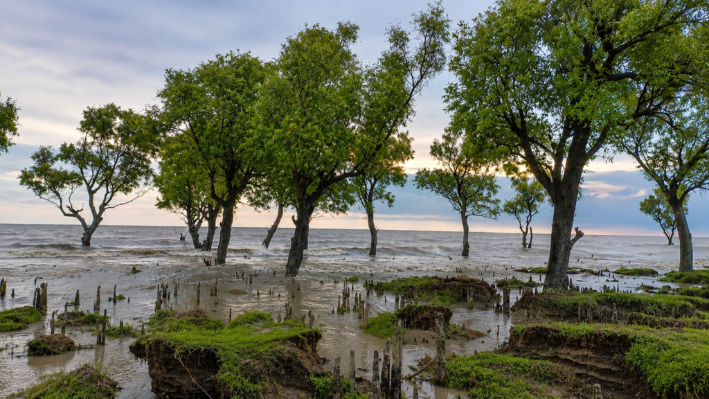
Its disappearance reminds us that coastlines are not static boundaries etched permanently onto maps. They are living systems shaped by water, sediment, vegetation, storms, and time. In the Bengal Delta, political frontiers may be carefully negotiated, but the landscape itself continues to evolve according to the rhythms of nature.
- For researchers, New Moore remains an invaluable case study in delta geomorphology, maritime law, and climate adaptation.
- For conservationists, it reinforces the importance of protecting the mangrove ecosystems that stabilise much of the Sundarbans coastline.
- For anyone seeking to understand the northern Bay of Bengal, it serves as a powerful reminder that even an island can have a life story—one written not by human history alone, but by rivers flowing from the Himalayas, tides rising from the sea, and the ever-changing geography of the world’s largest delta.