 Encyclopedia
Every expedition into the Indian Sundarbans begins with water.
There are no mountain passes to cross, no highways that lead uninterrupted to the destination, and no skyline that announces arrival from a distance. Here, the rivers are the first roads, the tides are the first navigators, and every island must be approached with patience.
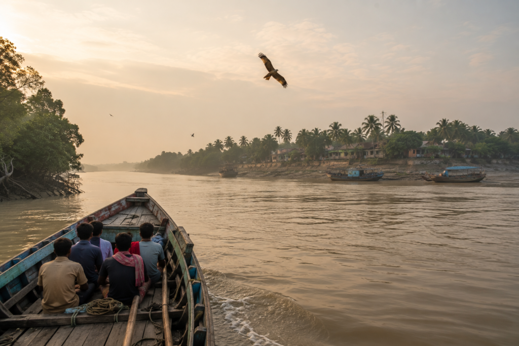
Chotomollakhali and Boro Mollakhali are no exception. Their story does not begin on land—it begins on the river that has shaped their existence for generations.
As the boat leaves the mainland behind, the landscape gradually abandons the familiar rhythms of towns and roads.
Concrete gives way to mud embankments.
The air grows heavier with moisture and carries the unmistakable scent of estuarine water—a mixture of silt, salt, vegetation, and life that defines the world’s largest mangrove delta.
The wide tidal channel stretches across the horizon, its opaque brown water constantly moving with invisible lunar rhythms. Every ripple is part of a cycle that has repeated itself for centuries, long before maps, boundaries, or settlements existed here.
The journey is never hurried.
Fishing boats glide silently across the channel, their reflections broken by the tide.
Wooden country boats remain tied to bamboo poles along the banks, waiting for the next favourable current.
White egrets stand motionless on exposed mudflats, while Brahminy Kites circle patiently overhead, scanning the water below.
The mangrove-lined edges of distant islands appear almost suspended above the river, softened by humidity and morning light.
Gradually, the shoreline begins to reveal itself.
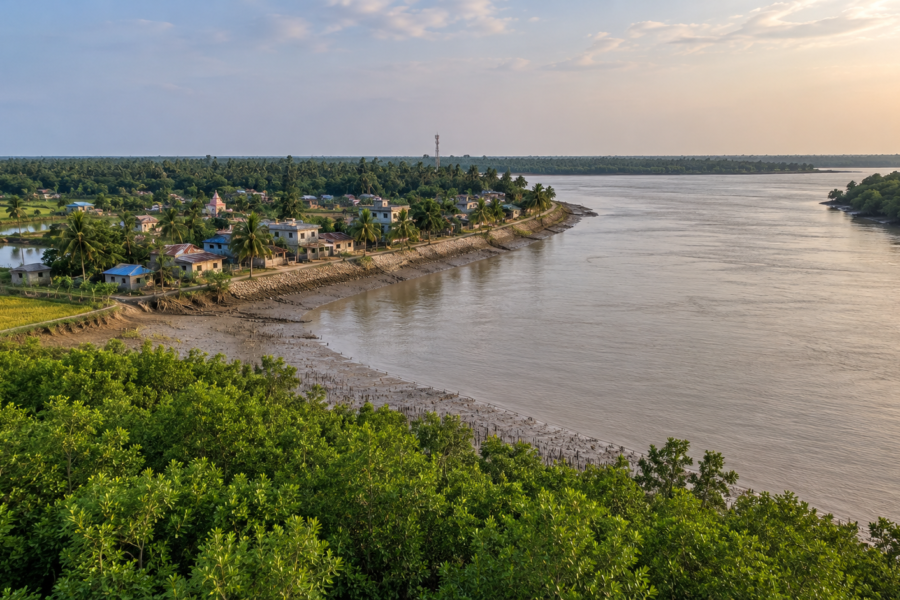
At first, it is only a faint green silhouette against the eastern sky. Then individual coconut palms emerge above the embankment, followed by clusters of betel nut trees and scattered village homes hidden behind orchards. The rising sun slowly illuminates the riverbank, revealing narrow jetties, anchored fishing boats, and the quiet movement of people beginning another day shaped by the tides.
Unlike destinations that introduce themselves with monuments or dramatic skylines, Chotomollakhali and Boro Mollakhali make no attempt to impress at first glance.
Their character unfolds quietly.
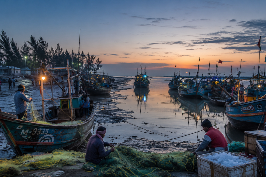
- A fisherman untangles his nets before the morning market begins.
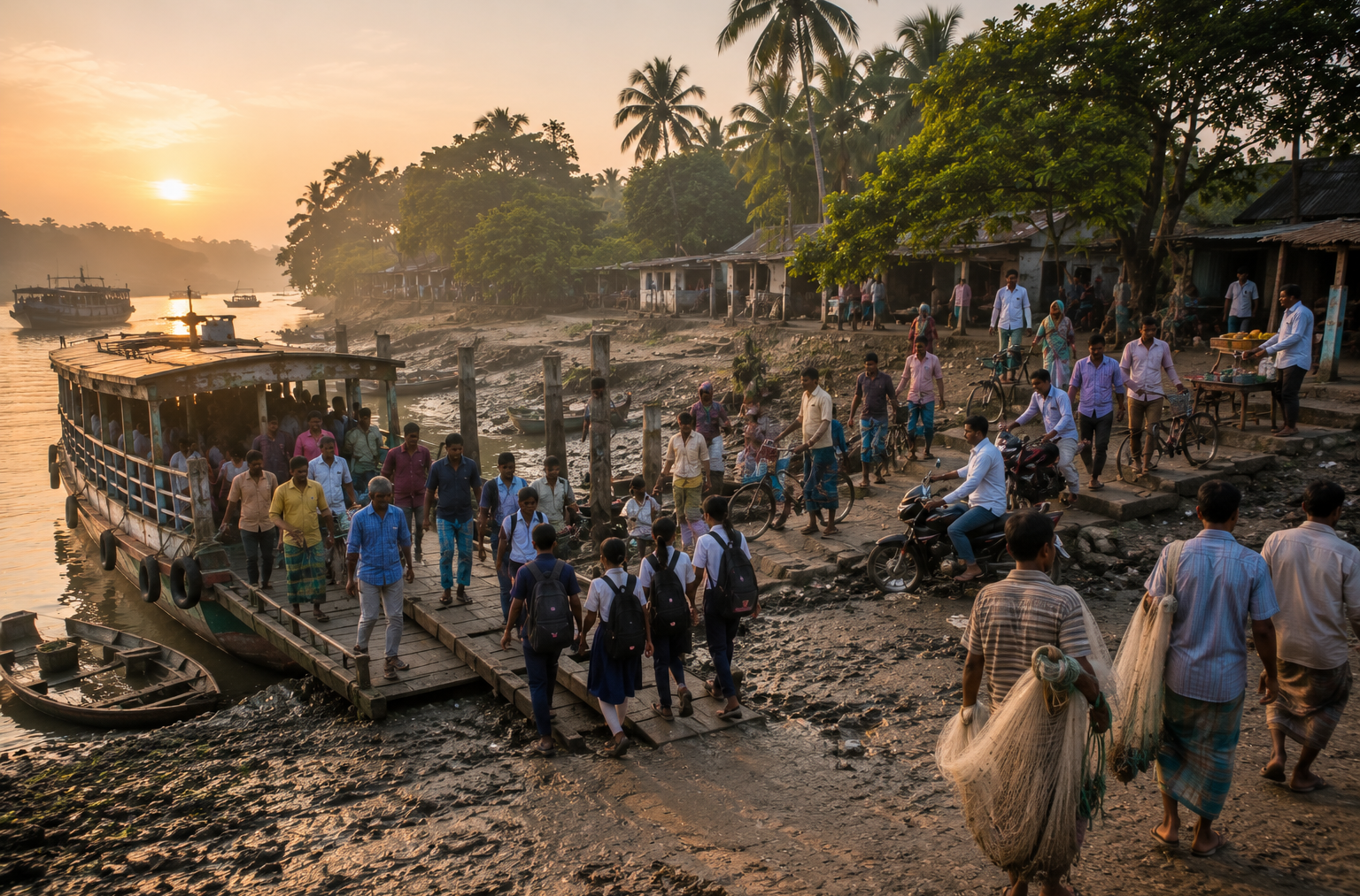
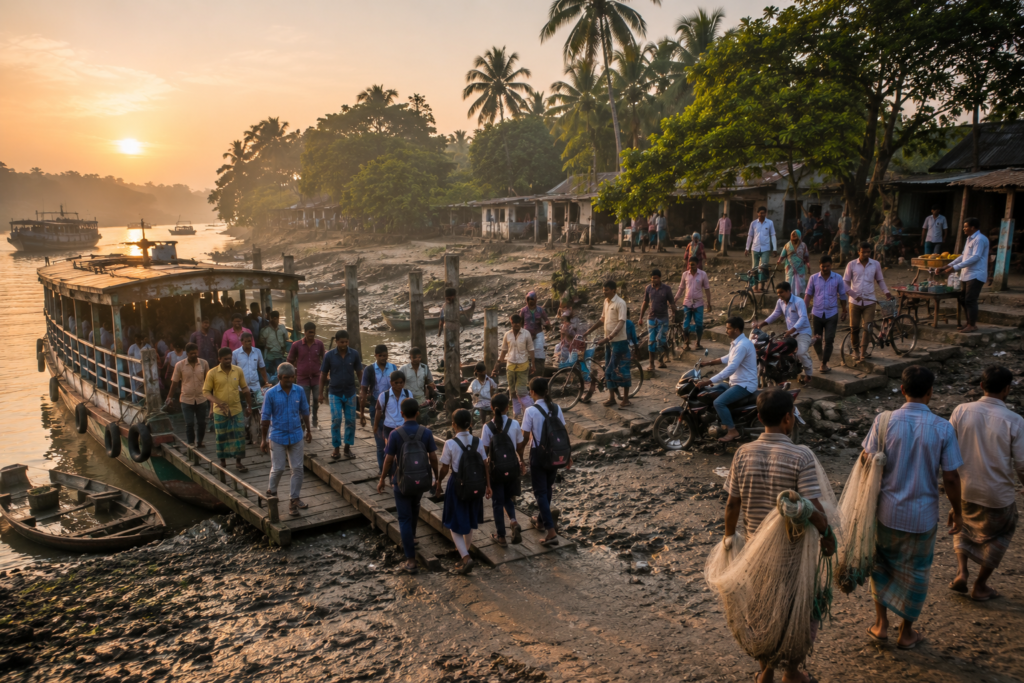
- A ferry prepares for its first crossing of the day, carrying students, workers, traders, and families between neighbouring islands.
- Smoke curls gently above village kitchens as breakfast is prepared.
- Children in school uniforms walk along embankments that serve not only as protection from tidal waters but also as the island’s most important pathways.
Somewhere beyond the trees, the rhythmic sound of a wooden hammer echoes from a small boatyard where another fishing vessel is being repaired before the next season.
These are not performances arranged for visitors.
They are fragments of everyday life.
Every movement reflects an intimate relationship between people and the tidal landscape. The river determines work, transport, trade, fishing schedules, agriculture, and even the pace of daily routines. Time here is measured not only by clocks but also by high tide, low tide, monsoon winds, and seasonal river currents.
Standing on the deck as the boat approaches the landing, one truth becomes immediately apparent.
This is not merely another inhabited island of the Sundarbans.
It is part of a living delta where human resilience has evolved alongside one of the most dynamic natural environments on Earth.
- Every embankment tells a story of adaptation.
- Every ferry route represents connection.
- Every village reflects generations of people who have learned to coexist with rivers that nourish, reshape, and occasionally challenge their world.
The expedition begins long before setting foot on land.
It begins with understanding that in the Sundarbans, the river is never simply a route to the destination.
It is the destination’s first storyteller.
First Encounter
The boat eases gently against the landing, its wooden hull brushing the tide as ropes are secured to weathered posts that have witnessed thousands of similar arrivals. There is no ceremonial welcome, no tourist gateway, and no carefully designed entrance announcing that one has arrived somewhere extraordinary.
The island introduces itself through authenticity rather than spectacle.
Stepping onto solid ground, the first sensation is the firmness of the embankment beneath your feet. Built to protect villages from the daily advance of tidal water, these earthen structures are far more than flood barriers. They are roads, gathering places, cycling routes, walking paths, and lifelines connecting one settlement to another. Throughout the day, they become living corridors where schoolchildren, fishermen, farmers, shopkeepers, health workers, and travellers naturally intersect.
The rhythm of the island becomes clearer with every step.
Small tea stalls welcome early customers discussing weather forecasts and river conditions before beginning work.
Grocery shops slowly open their shutters.
Fish traders prepare baskets for the day’s catch.
Motorbikes weave carefully around pedestrians while bicycles remain one of the most practical ways to navigate the villages.
Elderly residents exchange greetings beneath the shade of roadside trees, carrying with them stories accumulated across decades of living beside these rivers.
The architecture reflects practicality rather than uniformity.
Traditional homes stand alongside more modern brick houses, each adapted to local conditions and family needs.
Courtyards often contain fruit trees, flowering plants, hand pumps, and carefully maintained kitchen gardens.
Coconut palms sway above rooftops, while mango, jackfruit, banana, and betel nut trees provide both shade and seasonal harvests.
Domestic ducks wander confidently through narrow lanes, goats graze beside embankments, and cattle rest beneath trees during the warmer hours of the day.
Beyond the villages, the wider landscape remains ever-present.
Open stretches of agricultural land alternate with ponds, canals, orchards, and tidal creeks. The horizon is never completely separated from water. Even when the river itself is hidden from view, its influence is visible everywhere—in the soil, the vegetation, the embankments, the livelihoods, and the conversations of the people who call this island home.
Visitors quickly realise that exploration here is not about rushing between attractions.
It is about slowing down.
- Every lane reveals another detail.
- Every conversation offers another perspective.
- Every ferry crossing connects another community.
The island gradually rewards those willing to observe rather than simply look.
This first encounter reshapes expectations.
Instead of discovering a destination built around tourism, one discovers a community built around continuity—where generations have developed knowledge, traditions, and resilience that remain inseparable from the tidal landscape surrounding them.
Island Identity
To understand Chotomollakhali and Boro Mollakhali, it is necessary to look beyond conventional definitions of an island.
Its identity cannot be reduced to geography alone.
Nor can it be understood solely through wildlife, agriculture, fisheries, or transport. Each of these elements contributes to its character, yet none fully defines it on its own. What truly distinguishes Chotomollakhali and Boro Mollakhali is the enduring relationship between people and the tidal delta—a relationship shaped every day by rivers, embankments, seasonal rhythms, and collective resilience.
Unlike the protected forest islands that remain largely untouched by permanent settlement, Chotomollakhali and Boro Mollakhali belong to the inhabited heart of the Indian Sundarbans.
Here, villages, schools, local markets, places of worship, agricultural fields, fishing activities, ferry routes, healthcare facilities, and community institutions coexist within one of the world’s most environmentally dynamic landscapes.
The river is not simply a geographical boundary.
- It is infrastructure.
- It is transportation.
- It is livelihood.
- It is memory.
Every journey to school, every visit to a neighbouring village, every basket of produce reaching a market, every fishing expedition, and every emergency response remains connected, directly or indirectly, to the waterways that surround the island.
Equally significant are the embankments.
These engineered landscapes represent generations of determination to live with the delta rather than abandon it. They protect homes from tidal inundation, support daily movement across villages, and symbolise the ongoing relationship between human settlement and the powerful estuarine environment that constantly reshapes the region.
Life here is therefore defined not by isolation but by connection.
- Connection between islands.
- Connection between rivers.
- Connection between people.
- Connection between nature and livelihood.
- Connection between tradition and adaptation.
For explorers, Chotomollakhali and Boro Mollakhali offer something increasingly rare: the opportunity to witness a living cultural landscape where everyday life continues to evolve in harmony with one of the planet’s most remarkable mangrove ecosystems. The experience is not centred on a single monument or attraction but on understanding how an entire community functions within the rhythms of the tide.
This is the island’s defining identity.
Not merely an island within the Sundarbans.
But a living chapter of the Sundarbans itself—where every river crossing, every embankment, every village path, and every sunrise over the estuary reminds visitors that the true story of the delta is written not only in its forests, but also in the lives of the people who have learned to thrive beside them.
The Rivers That Shaped Chotomollakhali & Boro Mollakhali
To understand Chotomollakhali and Boro Mollakhali, one must first understand the rivers.
Long before villages appeared, before embankments were raised, and before ferry routes connected neighbouring communities, it was the ceaseless movement of tidal water that sculpted this landscape. These islands are not ancient pieces of land standing unchanged through time. They are living creations of the Ganga–Brahmaputra–Meghna Delta, continually formed, reshaped, and influenced by one of the most dynamic estuarine systems on Earth.
Unlike rivers that simply flow toward the sea, the waterways surrounding the inhabited Sundarbans breathe with the tides. Every day, the Bay of Bengal sends enormous volumes of water inland before gravity slowly draws them back toward the coast. This twice-daily rhythm carries fertile sediments, redistributes nutrients, alters shorelines, and influences almost every aspect of life on the island.
The rivers are therefore not passive geographical features. They are active architects.
- Every embankment follows their contours.
- Every ferry route depends upon their currents.
- Every fishing ground changes with their tides.
- Every agricultural field reflects the sediments they have deposited over generations.
For centuries, these waterways have connected Chotomollakhali and Boro Mollakhali with neighbouring islands, local markets, administrative centres, and the wider delta. What appears to visitors as a network of rivers is, to local communities, an intricate transport system that has long functioned as the island’s natural highway.
The rivers also define the island’s seasonal character.
During the dry months, calmer waters facilitate easier crossings and more predictable fishing conditions. With the arrival of the southwest monsoon, rainfall upstream and stronger tidal movements transform the rivers into wider, faster-moving channels. During cyclonic weather, these same waterways become powerful reminders of nature’s immense force, carrying storm surges deep into the delta and testing both embankments and communities.
Yet the relationship is never one of conflict alone.
The rivers nourish as much as they challenge.
They replenish ponds, sustain fisheries, enrich agricultural soils, support local transportation, and create habitats for countless aquatic and estuarine species. Without them, permanent human settlement here would never have been possible.
Standing along the riverbank at sunrise, one begins to realise that these waters are not simply flowing past the island.
They are continuously shaping its future.
Historical Footprints
The history of Chotomollakhali and Boro Mollakhali cannot be separated from the wider history of the inhabited Indian Sundarbans.
For much of recorded history, large parts of this delta remained dominated by dense mangrove forests, tidal creeks, shifting mudflats, and abundant wildlife. Permanent human settlement was limited, not because the land lacked potential, but because survival demanded extraordinary resilience. The tides, saline environment, seasonal flooding, disease, and isolation made life here exceptionally challenging.
Over time, organised settlement gradually expanded across suitable islands.
Communities cleared selected areas of mangrove vegetation, constructed earthen embankments, reclaimed land for cultivation, and established villages that would eventually become the social and economic foundations of today’s inhabited Sundarbans.
- Every reclaimed field represented years of labour.
- Every embankment symbolised determination against an environment that constantly sought to reclaim the land.
The colonial period accelerated many of these reclamation efforts throughout the Sundarbans. Administrative planning, land settlement policies, and expanding agricultural activity gradually transformed several islands into productive landscapes capable of supporting permanent communities. Chotomollakhali and Boro Mollakhali evolved within this broader historical transformation, becoming part of a network of inhabited islands connected by rivers rather than roads.
History here is not written only in official records.
It survives within the landscape itself.
- The alignment of embankments reflects decades of engineering and community effort.
- Old ferry routes reveal patterns of movement that have existed for generations.
- Mature fruit trees often mark the locations of some of the earliest homesteads.
- Traditional village layouts continue to preserve practical knowledge developed through centuries of adapting to tidal conditions.
Unlike cities where history is often preserved in monuments, the heritage of these islands remains embedded within everyday life.
- A road follows an old embankment.
- A marketplace grows where river traffic naturally converged.
- A village expands around land first reclaimed by earlier generations.
Everyday geography quietly preserves historical memory.
Historical Personalities & Transformations
The story of Chotomollakhali and Boro Mollakhali has never depended upon a single famous individual.
Instead, it has been shaped by thousands of ordinary people whose collective efforts transformed tidal wilderness into thriving communities.
The first settlers were not merely establishing homes.
They were creating possibilities.
They learned where the soil remained fertile, how high embankments needed to be, which crops tolerated changing salinity, when fishing grounds became most productive, and how to navigate rivers whose channels shifted with time. Their accumulated knowledge became the foundation upon which later generations continued to build.
- Teachers carried education into remote communities.
- Boatmen connected isolated settlements long before reliable road networks existed elsewhere.
- Fishermen refined techniques suited to estuarine waters.
- Farmers continuously adapted cultivation practices to changing environmental conditions.
Healthcare workers, local administrators, traders, artisans, religious leaders, and community volunteers each contributed to strengthening the social fabric of the island.
Transformation has therefore never been a single historical event.
It has been a continuous process.
- Homes gradually evolved from traditional materials to stronger brick structures.
- Educational institutions expanded opportunities for younger generations.
- Communication improved.
- Electricity reached more households.
- Healthcare became increasingly accessible.
- Transport networks strengthened.
Yet despite these changes, many defining characteristics remain remarkably constant.
- The river continues to dictate movement.
- The embankment remains essential infrastructure.
- The tide still influences daily routines.
- The relationship between community and landscape continues to define life here.
Perhaps the greatest historical achievement of Chotomollakhali and Boro Mollakhali is not any one construction project or administrative milestone.
It is the enduring ability of successive generations to adapt without losing their connection to the environment that sustains them.
Folklore & Legends
Every inhabited island carries two histories.
One is documented through maps, administrative records, and historical accounts.
The other survives through stories.
Across the Sundarbans, oral traditions have long helped communities interpret an environment that often feels larger than human understanding.
- Rivers change their course without warning.
- Storms arrive with astonishing force.
- Dense mangrove forests conceal wildlife rarely seen yet constantly respected.
In such a landscape, folklore becomes more than entertainment—it becomes a way of understanding uncertainty, expressing hope, and preserving collective memory.
Like many islands of the inhabited Sundarbans, Chotomollakhali and Boro Mollakhali exist within this rich cultural landscape of storytelling.
Conversations among elders frequently weave together memories of extraordinary floods, powerful cyclones, remarkable fishing seasons, unusual wildlife encounters, and acts of courage shown during times of crisis. These narratives are passed from one generation to the next, not always as literal history, but as reminders of resilience, caution, and respect for nature.
Faith also occupies an important place in the cultural imagination of the Sundarbans.
Across the wider delta, traditions associated with Bonbibi—the revered guardian of the forest—continue to reflect the deep relationship between people and the natural world. Although forest-dependent communities maintain the strongest association with these beliefs, the cultural influence of Bonbibi remains woven into the broader identity of the region, symbolising harmony, humility, and coexistence with an unpredictable landscape.
Many local stories are deeply personal rather than widely recorded.
They speak of families rebuilding after devastating storms, neighbours protecting one another during floods, boatmen navigating rivers through darkness, and communities coming together whenever nature tested their resilience. Such stories rarely appear in textbooks, yet they become an essential part of the island’s living heritage.
For explorers, these narratives offer something valuable.
They reveal that the identity of Chotomollakhali and Boro Mollakhali is shaped not only by geography, but also by memory.
- Every river carries stories.
- Every embankment recalls perseverance.
Every generation adds another chapter to an island whose history continues to be written through the lives of the people who call it home.
Life Between the Tides
On Chotomollakhali and Boro Mollakhali, no two days are entirely the same.
The sunrise may arrive at a familiar hour, but the island awakens according to something far older than the clock—the tide.
For generations, the people here have organised their lives around the predictable yet ever-changing pulse of the estuary. The movement of water determines when boats leave, when fishermen cast their nets, when passengers cross rivers, when goods reach markets, and when certain stretches of land become accessible. Time is not measured solely in hours but also in high tide and low tide, spring tide and neap tide, monsoon currents and winter calm.
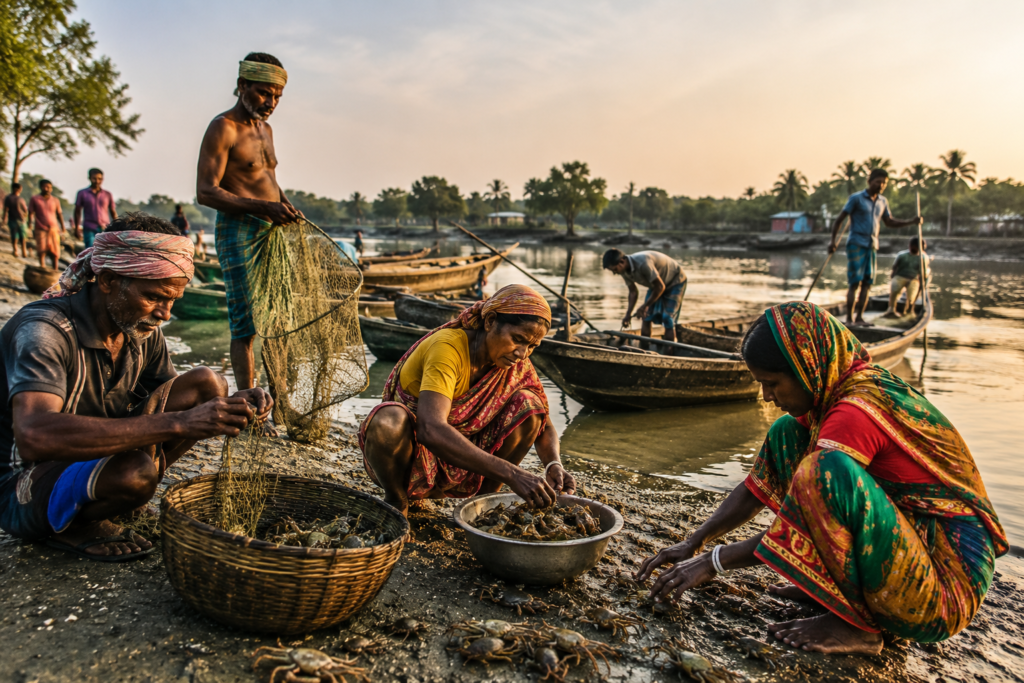
The first activity begins long before daylight fully spreads across the horizon.
- Fishing boats quietly depart while much of the island is still asleep.
- Farmers inspect their fields before the tropical heat intensifies.
- Tea stalls prepare their first kettles as boatmen, traders, teachers, and daily commuters gather for conversations that range from weather forecasts to river conditions.
- Ferry ghats gradually become busier, carrying students to schools, workers to neighbouring islands, traders to local markets, and families visiting relatives across the waterways.
By mid-morning, village life settles into its natural rhythm.
- Children fill classrooms.
- Farmers tend seasonal crops.
- Small grocery shops welcome customers throughout the day.
- Carpenters repair fishing boats and household furniture.
- Local markets exchange vegetables, fish, fruits, household necessities, and agricultural supplies.
- Women manage households while also contributing significantly to agriculture, livestock care, fisheries, and small-scale enterprises that support family livelihoods.
The afternoon brings another transformation.
As the tropical sun reaches its peak, activity slows. Shade beneath trees becomes a welcome refuge for conversations among neighbours. Domestic animals rest beside ponds and orchards. Elderly residents gather outside their homes, exchanging stories that effortlessly blend family memories with observations about the changing seasons and the behaviour of the rivers.
Evening introduces another rhythm.
- Returning fishing boats approach the jetties.
- Ferry services complete their final crossings before darkness settles over the waterways.
- Smoke rises once again from household kitchens as families prepare evening meals.
- Children play along village paths while elders stroll atop the embankments, watching the fading colours reflected upon the tidal river.
Throughout these daily routines, one constant remains.
The tide never stops influencing life.
Even when it is out of sight, its presence shapes decisions, movements, occupations, and expectations. Living here means understanding that the river is not merely part of the landscape.
It is an active participant in everyday life.
Walking Through the Villages
The most rewarding way to understand Chotomollakhali and Boro Mollakhali is neither from a boat nor from a vehicle.
It is on foot.
Walking through the villages allows the island to reveal itself gradually, one detail at a time. There are no hurried tourist circuits here. Instead, exploration unfolds naturally through quiet observation, respectful curiosity, and the willingness to appreciate ordinary moments that together create an extraordinary sense of place.
The embankment often becomes the first pathway.
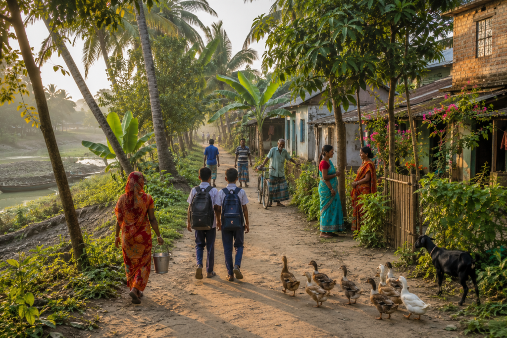
Stretching beside tidal rivers, these raised earthen structures connect settlements while protecting them from seasonal flooding and tidal surges. Throughout the day, they serve as roads, walking tracks, cycling routes, and informal gathering places where daily life unfolds without interruption.
Branching away from the embankment are narrow village lanes lined with homes surrounded by fruit trees, flowering plants, vegetable gardens, and small ponds. Coconut palms sway above rooftops while mango, jackfruit, banana, guava, and betel nut trees contribute both shade and sustenance. Seasonal flowers brighten courtyards, and carefully maintained kitchen gardens reflect generations of practical self-reliance.
The villages possess a remarkable sense of openness.
Children greet visitors with curiosity rather than hesitation.
Shopkeepers pause briefly to exchange greetings while continuing their work.
Elderly residents often sit beneath trees or on shaded verandas, quietly observing the steady movement of village life.
Conversations begin easily, frequently leading to stories about local history, agriculture, fishing traditions, education, or the changing nature of the rivers.
Religious and community spaces appear naturally within the settlement pattern.
Small temples, mosques, community halls, schools, health centres, and local markets together form the social infrastructure of the island. These institutions are not isolated landmarks but integral parts of everyday life, reflecting the close relationships that define rural communities throughout the inhabited Sundarbans.
Walking further reveals the diversity of the landscape.
Agricultural fields extend toward the horizon before giving way to orchards, ponds, canals, and tidal creeks. Water remains visible—or at least perceptible—from almost every part of the island. The geography constantly reminds visitors that life here exists within a dynamic estuarine environment where land and water remain inseparably connected.
Exploring these villages requires no checklist. The reward lies in observation itself.
- Every pathway tells a story.
- Every courtyard reflects a family.
- Every embankment reveals another perspective on the remarkable relationship between people and the delta they call home.
Sounds of the Island
Every landscape has its own soundtrack.
On Chotomollakhali and Boro Mollakhali, the island is heard long before it is fully understood.
The day begins softly.
Before sunrise, the distant calls of roosters drift across the villages while the gentle murmur of tidal water brushes against muddy riverbanks. Wooden boats creak against their moorings as the first fishermen prepare for departure. Somewhere nearby, an oar enters the water with measured rhythm, breaking the stillness without disturbing it.
As dawn brightens, the island gradually finds its voice.
Birdsong fills the orchards and roadside trees. Mynas, bulbuls, drongos, kingfishers, egrets, and numerous other resident birds contribute to an ever-changing chorus that accompanies the beginning of each day. Domestic ducks chatter near ponds while cattle bells occasionally echo through agricultural fields.
Human activity soon joins the natural orchestra.
- Bicycles pass quietly along embankments.
- Conversations emerge from tea stalls.
- Vendors greet early customers at village markets.
- School bells announce the beginning of classes.
- The engines of passenger ferries rise and fade as boats travel between neighbouring islands.
The afternoon becomes noticeably quieter.
- The tropical heat slows movement.
- Wind rustles through coconut fronds and bamboo groves.
- Insects replace many of the daytime birds, while occasional fishing boats continue navigating the tidal channels beyond the villages.
Evening introduces perhaps the island’s most memorable atmosphere.
Returning ferries announce their arrival with the steady rhythm of diesel engines.
- Families gather outside their homes.
- Children laugh along village lanes.
- Temple bells, evening prayers, and everyday conversations blend into a peaceful soundscape that gradually yields to the chorus of crickets and frogs after sunset.
Unlike cities dominated by mechanical noise, the sounds here remain closely connected to nature and community.
The river, the wind, the birds, the boats, and the people each contribute their own rhythm.
Together they create an acoustic identity that belongs unmistakably to the inhabited heart of the Sundarbans.
Food of the Island
The cuisine of Chotomollakhali and Boro Mollakhali reflects the same principles that shape every aspect of island life—seasonality, simplicity, and a close relationship with the surrounding landscape.
Freshwater ponds, tidal rivers, agricultural fields, orchards, and household gardens collectively provide much of the food that appears on family tables throughout the year.
Fish naturally occupy a central place in the local diet.
Depending upon the season and availability, households prepare a wide variety of locally caught fish using recipes passed through generations. Fresh vegetables, leafy greens, pumpkins, gourds, eggplants, okra, and seasonal produce accompany everyday meals, while rice remains the staple around which most traditional cuisine is built.
Household gardens contribute significantly to food security.
Many families cultivate vegetables, herbs, chillies, turmeric, and fruits within their own compounds. Coconut is widely used in both savoury and sweet preparations, while mangoes, bananas, guavas, papayas, and jackfruit enrich the seasonal diet.
Food here is deeply connected to hospitality.
Visitors are often welcomed not with elaborate ceremonies but with a simple cup of tea, homemade snacks, and genuine conversation. Meals emphasise freshness over complexity, allowing the natural flavours of locally grown ingredients to define the dining experience.
Rather than representing a commercial culinary destination, the island offers something more meaningful.
It preserves a food culture rooted in self-reliance, community, and seasonal abundance.
Island Economy
The economy of Chotomollakhali and Boro Mollakhali reflects the remarkable adaptability that has long characterised life throughout the inhabited Sundarbans.
Instead of depending upon a single occupation, most households combine multiple sources of income, creating a resilient economic system capable of responding to changing environmental and seasonal conditions.
Agriculture remains one of the principal foundations of village life.
Seasonal cultivation supports household consumption while contributing to local markets. Alongside farming, inland fisheries and river-based fishing continue to provide livelihoods for many families, supplying fresh fish to surrounding communities and regional trading networks.
Small businesses play an equally important role.
Village grocery shops, pharmacies, tea stalls, repair workshops, tailoring services, transportation providers, educational institutions, healthcare facilities, and local markets together sustain the daily functioning of the island. Boat operators, carpenters, electricians, masons, mechanics, and skilled artisans contribute specialised services that strengthen the local economy.
Livestock rearing also supports household income.
Cattle, goats, ducks, and poultry supplement agriculture while providing food, financial security, and additional livelihood opportunities.
The river remains central to economic activity.
It enables transportation, connects markets, supports fisheries, and facilitates the movement of people and goods throughout the delta. Without reliable river transport, much of the island’s economic life would simply not function.
Although modern infrastructure has improved opportunities across many sectors, the island’s greatest economic strength continues to be its people.
Their ability to adapt, diversify livelihoods, cooperate within communities, and respond to an ever-changing environment has allowed Chotomollakhali and Boro Mollakhali to thrive within one of the world’s most challenging yet rewarding landscapes.
Wildlife Expedition
While Chotomollakhali and Boro Mollakhali are known as inhabited islands, they exist within one of the most extraordinary ecological landscapes on Earth. Every river, creek, mudflat, pond, orchard, and mangrove edge forms part of a much larger ecosystem that supports an astonishing diversity of life.
Exploring the island through the eyes of a naturalist reveals a world that often goes unnoticed by hurried travellers.
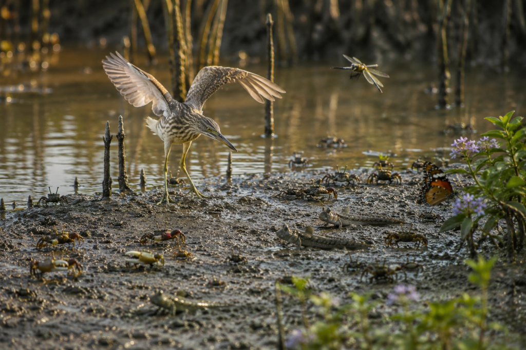
The morning offers the richest opportunities for wildlife observation. As the first light reaches the riverbanks, egrets forage along exposed mudflats while pond herons patiently stalk shallow waters. Kingfishers flash brilliant shades of blue and chestnut between branches before diving with remarkable precision into tidal creeks. Brahminy Kites soar effortlessly above the river, scanning the water below for fish carried by the current.
The agricultural landscape attracts another community of species.
Mynas, drongos, bulbuls, wagtails, tailorbirds, sunbirds and doves move between orchards, gardens and cultivated fields. Butterflies drift among flowering plants, dragonflies patrol ponds, while honeybees quietly pollinate fruit trees that support both biodiversity and local livelihoods.
As the expedition moves towards mangrove-lined creeks, the ecological character begins to change.
Fiddler crabs emerge from thousands of tiny burrows scattered across the mud, waving their oversized claws in silent territorial displays. Mudskippers propel themselves across the exposed tidal flats, equally comfortable in water and on land. Mangrove snails climb roots during rising tides, while oysters and barnacles cling to submerged surfaces that disappear beneath estuarine water twice each day.
Although rarely seen, signs of larger wildlife are never entirely absent from the wider Sundarbans landscape.
The waterways surrounding the inhabited islands remain connected to protected mangrove forests where species such as the Royal Bengal Tiger, Fishing Cat, Smooth-coated Otter, Estuarine Crocodile, Water Monitor Lizard, Spotted Deer and numerous reptiles continue to survive. Their presence serves as a reminder that the boundary between human settlement and wilderness remains remarkably close throughout the delta.
Wildlife observation here rewards patience rather than expectation.
The Sundarbans never performs for its visitors.
Instead, it quietly reveals itself to those willing to slow down, observe carefully, and appreciate the countless small interactions that together sustain one of the world’s most remarkable estuarine ecosystems.
Mangrove Chronicles
The story of Chotomollakhali and Boro Mollakhali cannot be separated from the mangroves.
Although the villages themselves occupy reclaimed land, the surrounding landscape continues to be shaped by mangrove ecology. These forests are far more than collections of salt-tolerant trees. They are living infrastructure that protects coastlines, supports fisheries, stabilises sediments, stores enormous quantities of carbon, and provides habitat for countless species.
Mangroves survive where few other forests could exist.
Twice each day, tidal water floods the muddy ground before gradually retreating. Salinity fluctuates with rainfall, river discharge and seasonal change. Oxygen remains scarce beneath waterlogged soil. Yet mangrove species have evolved remarkable adaptations that allow them to flourish under these challenging conditions.
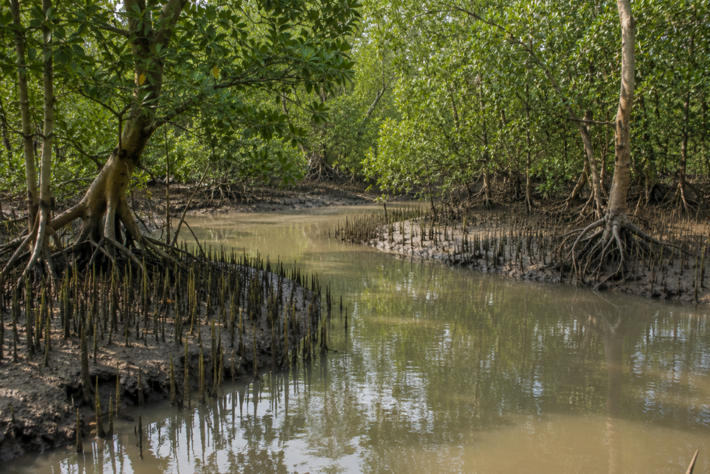
Among the most recognisable are Avicennia species, whose pencil-like pneumatophores rise vertically from the mud like thousands of natural breathing tubes. Sonneratia species display broader respiratory roots while developing fruits dispersed by tidal currents. Together with other characteristic mangrove trees, these species create a dense, interconnected ecosystem capable of surviving constant environmental change.
The forest performs countless ecological services.
Its roots trap sediment carried by tidal rivers, gradually helping stabilise shorelines. Fallen leaves become the foundation of an intricate food web, nourishing microorganisms, crustaceans, molluscs and juvenile fish that later support larger predators throughout the estuary.
Mangroves also act as natural buffers.
During cyclones and storm surges, dense vegetation helps reduce wave energy before it reaches vulnerable settlements. Although no natural barrier can eliminate the impact of extreme weather, healthy mangrove forests significantly strengthen the resilience of coastal landscapes throughout the Sundarbans.
Perhaps the greatest lesson offered by the mangroves is one of coexistence.
Rather than resisting the tide, these forests have evolved by adapting to it.
Their survival reflects flexibility rather than rigidity—a principle that has shaped both the ecology of the Sundarbans and the communities living beside it for generations.
Explorer’s Field Notes
Every expedition benefits from careful observation.
Rather than rushing between locations, experienced explorers allow the landscape to reveal itself gradually. Chotomollakhali and Boro Mollakhali reward curiosity, patience and respect far more than speed.
The best time to begin exploring is shortly after sunrise.
Morning light enhances the colours of the river while bird activity reaches its daily peak. Village life is already underway, yet the atmosphere remains calm enough for meaningful observation and photography.
Walk slowly along the embankments.
Notice how they function simultaneously as flood protection, roads, meeting places and viewing platforms overlooking the tidal landscape. Observe the relationship between settlements, agricultural fields, ponds and waterways. Every feature exists because it serves a practical purpose within the island’s unique environment.
Spend time near the ferry ghats.
Few places better illustrate the island’s daily rhythm. Ferries transport far more than passengers. They carry education, healthcare, commerce, family connections and community life across the delta.
Listen as much as you look.
The changing soundscape often reveals wildlife before it becomes visible. Bird calls, flowing tides, fishing boats, temple bells, children’s laughter and evening conversations together form an acoustic map of the island.
Observe respectfully.
Always remember that these villages are homes rather than attractions. Everyday life should never be interrupted for the sake of photography or curiosity. Genuine exploration values understanding above documentation.
Finally, remain patient.
The Sundarbans rarely reveals its greatest moments immediately.
Some of the most memorable discoveries occur only after quietly sitting beside a river, watching a changing tide, or simply allowing the island to unfold at its own pace.
Photography Expedition Guide
For photographers, Chotomollakhali and Boro Mollakhali offer an exceptional opportunity to document the lived reality of the inhabited Sundarbans rather than only its famous wildlife.
The most rewarding images are rarely staged.
Instead, they emerge naturally from ordinary moments shaped by extraordinary surroundings.
Best Subjects
- Morning ferry crossings against golden river light.
- Fishermen preparing nets before sunrise.
- Earthen embankments stretching beside tidal rivers.
- Village lanes framed by coconut and betel nut palms.
- Traditional wooden boats anchored along muddy banks.
- Agricultural landscapes meeting estuarine waterways.
- Local markets during morning trading hours.
- Mangrove-lined creeks during high tide.
- Fiddler crabs and mudskippers on exposed mudflats.
- Evening reflections across calm tidal channels.
Best Lighting
Golden Hour (Sunrise):
Soft light, calm rivers, active birdlife and atmospheric mist create ideal documentary conditions.
Late Afternoon:
Warm side-light enhances textures of embankments, boats, orchards and village architecture.
Documentary Approach
- Avoid directing people or staging scenes.
- Allow life to unfold naturally.
- Photograph interactions rather than poses.
- Capture relationships between people and landscape instead of isolated subjects.
Wide compositions help establish the island’s geography, while environmental portraits communicate the connection between residents and the estuarine environment.
Ethical Photography
- Always seek permission before photographing individuals at close range.
- Respect religious spaces, schools, and private homes.
- Do not disturb wildlife for a better photograph.
- Leave no trace.
The strongest photographs from Chotomollakhali and Boro Mollakhali are those that communicate authenticity.
Rather than dramatic spectacle, they reveal quiet resilience, everyday beauty and the remarkable relationship between people, rivers and the living delta.
Nightfall on the Island
As daylight gradually fades across Chotomollakhali and Boro Mollakhali, the island enters one of its most peaceful transformations.
The afternoon warmth softens into a gentle evening breeze that travels across the tidal rivers before weaving through coconut palms and village lanes. The golden light settles upon embankments that only hours earlier carried bicycles, schoolchildren, farmers, and traders. Shadows lengthen across agricultural fields while the river begins reflecting the colours of the western sky.
Fishing boats slowly return from the day’s work.
Passengers gather for the final ferry crossings before darkness makes navigation more challenging. Small markets complete their daily business, while shopkeepers lower shutters after exchanging the day’s final conversations with familiar customers. The steady rhythm of engines gradually fades as boats secure themselves along the riverbank until the following morning.
Within the villages, another rhythm begins.
Smoke rises from household kitchens where evening meals are prepared using fresh ingredients gathered from fields, ponds, rivers, and local markets.
Families assemble after spending the day in different occupations.
Children finish their studies before joining neighbours for games in open spaces near their homes.
Elders sit along verandas or embankments, quietly watching the river while sharing stories that effortlessly blend memory with observation.
As darkness deepens, artificial light remains modest.
Streetlights illuminate only selected areas while countless household lights glow gently through trees and courtyards. Without the overwhelming brightness of urban centres, the evening sky regains its natural prominence. On clear nights, stars emerge above the delta, their reflections occasionally shimmering upon calm stretches of tidal water.
The sounds of the island also change.
Birdsong gradually yields to the calls of crickets, frogs, and nocturnal insects.
Wind moves gently through palm leaves while the river continues its timeless conversation with the shore.
Somewhere in the distance, the low hum of a late-returning boat briefly interrupts the silence before disappearing once again into the darkness.
Nightfall here is never dramatic.
It is quiet.
- Measured.
- Natural.
- It reminds every visitor that the Sundarbans never truly sleeps.
- It simply changes its rhythm.
The Seasons of the Island
Life on Chotomollakhali and Boro Mollakhali is shaped as much by the calendar of nature as by the calendar of people.
Each season introduces subtle yet significant transformations that influence agriculture, fisheries, transportation, wildlife, vegetation, and everyday routines. Rather than existing as four sharply divided periods, the seasons flow into one another through gradual environmental change.
Winter (December – February)
Winter brings some of the most pleasant weather to the island.
Cool mornings, comfortable afternoons, and relatively low humidity make this an excellent period for exploration. Visibility across the rivers often improves, migratory birds increase the diversity of avian life, and agricultural activity continues across cultivated fields. Calm river conditions also make ferry travel more predictable.
Summer (March – May)
As temperatures rise, the island prepares for another seasonal transition.
Afternoons become noticeably warmer, while village life naturally adjusts to avoid the peak heat of the day. Fruit trees begin producing seasonal harvests including mangoes and jackfruits. Fishing patterns adapt to changing water temperatures, and preparations begin for the approaching monsoon.
Monsoon (June – September)
The arrival of the southwest monsoon transforms the landscape.
Frequent rainfall refreshes vegetation while ponds, canals, and rivers swell with renewed energy. Agricultural fields flourish under increased moisture, yet transportation becomes more challenging as river conditions change. Heavy rainfall occasionally tests embankments and local infrastructure, reminding communities of the delicate balance between water and settlement.
Post-Monsoon & Autumn (October – November)
As rainfall gradually decreases, the island enters one of its most visually striking periods.
- Clear skies return.
- The rivers regain calmer conditions.
- Agricultural landscapes mature.
Festive celebrations bring communities together while cooler evenings signal the approach of winter once again.
Through every season, one element remains constant.
The tide continues its ancient rhythm.
Whether beneath winter sunlight or monsoon clouds, it remains the island’s most faithful companion.
Cyclones and Survival
To understand the true character of Chotomollakhali and Boro Mollakhali, one must also understand resilience.
The islands occupy a region where tropical cyclones have shaped both landscapes and human experience for generations. Their names become part of community memory, marking moments when nature demonstrated its extraordinary power across the northern Bay of Bengal.
- Strong winds.
- Storm surges.
- Heavy rainfall.
- Rising tidal waters.
These forces have repeatedly tested settlements throughout the Sundarbans.
For island communities, preparation is therefore not exceptional—it is essential.
- Embankments represent the first line of protection.
- Cyclone shelters provide security during emergencies.
Local administrations, volunteers, disaster response teams, healthcare workers, and residents work together whenever severe weather approaches. Families secure homes, protect livestock, store essential supplies, and monitor official weather advisories with remarkable discipline born from experience.
Yet resilience extends beyond infrastructure. It lives within the people themselves.
- Communities rebuild damaged homes.
- Neighbours assist one another.
- Farmers restore fields affected by saline water.
- Fishermen repair boats.
- Schools reopen.
- Markets resume.
Life gradually returns—not because recovery is easy, but because determination remains stronger than adversity.
The Sundarbans has taught generations an important lesson.
Nature cannot always be controlled.
But it can be respected, understood, and prepared for.
This philosophy continues to guide life across Chotomollakhali and Boro Mollakhali today.
Then & Now
Every island tells two stories.
- One belongs to memory.
- The other belongs to change.
For older generations, Chotomollakhali and Boro Mollakhali recall a time when transportation depended almost entirely upon wooden country boats, communication was slower, and many services now considered essential required long journeys across rivers. Education, healthcare, electricity, and market access were far more limited than they are today.
Over the decades, the island has evolved steadily.
- Road connectivity within settlements has improved.
- Educational institutions have expanded.
- Healthcare services have become more accessible.
- Electricity has reached more households.
- Mobile communication and digital connectivity have strengthened links with the wider world.
Transportation has become more reliable through improved ferry operations and local infrastructure.
Economic opportunities have diversified beyond traditional occupations, allowing younger generations to pursue education, skilled employment, entrepreneurship, and professional careers while maintaining strong family ties to the island.
Despite these transformations, the island has not lost its identity.
- The river still determines movement.
- The embankment remains central to daily life.
- Agriculture continues to shape the landscape.
- Fishing remains an important livelihood.
Communities still gather in local markets, schools, places of worship, and tea stalls where conversations flow as naturally as the rivers surrounding them.
Perhaps this balance between continuity and progress defines Chotomollakhali and Boro Mollakhali more than anything else.
Modern life has arrived.
Yet it has arrived without erasing the island’s relationship with the delta.
The result is a landscape where tradition and development exist not as opposing forces, but as partners shaping the future together.
Ferry Routes & Hidden Paths
The journey to Chotomollakhali and Boro Mollakhali is unlike travelling to most destinations in India. Roads eventually give way to rivers, and the river itself becomes the final approach. Every visitor quickly realises that in the Sundarbans, ferries are not merely transportation—they are an essential part of everyday life, linking villages, markets, schools, healthcare facilities, administrative centres, and neighbouring islands across an intricate estuarine network.
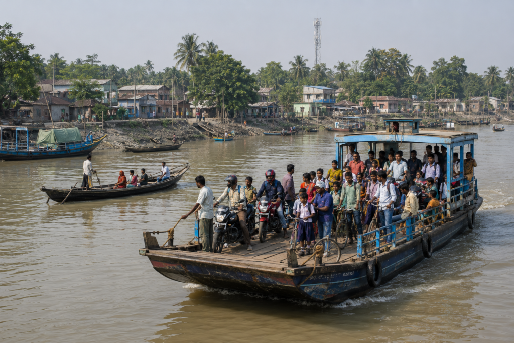
Unlike urban transport systems that operate independently of nature, ferry movement in the Sundarbans remains closely connected to tidal conditions, weather, and river dynamics. For residents, these crossings are routine. For explorers, they provide the first authentic experience of understanding how an island community functions within a landscape where water is the primary connector.
Approaching the island by boat also offers perspectives impossible to appreciate from land. The gradual emergence of embankments, orchards, fishing boats, village skylines, and tidal mudflats tells the story of the island long before stepping ashore.
Suggested Exploration Route
Rather than rushing through the island, allow the landscape to reveal itself gradually.
Morning
- Arrive on the first available ferry.
- Spend time observing activity at the ferry ghat.
- Walk along the primary embankment while village life begins.
- Visit local tea stalls and small marketplaces.
Late Morning
- Explore residential villages.
- Observe orchards, ponds, agricultural fields, and community institutions.
- Interact respectfully with local residents where appropriate.
Afternoon
- Continue towards quieter embankments overlooking tidal rivers.
- Observe birdlife around ponds and creeks.
- Spend time documenting everyday life through photography or field notes.
Evening
- Return to the ferry ghat before sunset.
- Watch fishing boats returning with the day’s catch.
- Experience the transition from busy daytime activity to the peaceful rhythm of evening before departing.
Hidden Experiences Worth Discovering
The most memorable moments on Chotomollakhali and Boro Mollakhali rarely appear on maps.
Instead, they are found in simple observations:
- Sunrise illuminating tidal rivers.
- Elderly residents gathering beneath roadside trees.
- Schoolchildren cycling along embankments.
- Fishermen repairing nets beside village ponds.
- Small wooden boats moving silently through morning mist.
- Kingfishers hunting along tidal creeks.
- Coconut palms reflected in calm estuarine water after high tide.
- Evening conversations at roadside tea stalls.
- Quiet village paths shaded by fruit trees.
- The sound of ferry engines gradually disappearing across the river at dusk.
These are not attractions.
They are the living details that define the island’s identity.
The Wild Orbit Quick Facts
Official Identity
- Region: Indian Sundarbans
- State: West Bengal
- Country: India
- Landscape Type: Inhabited Delta Island
- Ecosystem: Tidal Estuarine Mangrove Landscape
Landscape Profile
- Human settlement integrated within the world’s largest mangrove delta.
- Extensive embankment network protecting villages from tidal flooding.
- Agricultural fields interwoven with ponds, canals, orchards, and tidal rivers.
- Landscape continuously influenced by tidal movement and seasonal change.
Ecological Significance
- Part of the greater Sundarbans Biosphere landscape.
- Connected to globally important mangrove ecosystems.
- Supports diverse estuarine biodiversity.
- Important ecological buffer between human settlements and mangrove forests.
Community Profile
- Predominantly rural settlements.
- Strong dependence on agriculture, fisheries, transport, and small businesses.
- Deep cultural relationship with rivers and seasonal cycles.
- Community life centred around villages, ferry ghats, schools, markets, and places of worship.
Natural Features
- Tidal rivers.
- Mudflats.
- Mangrove-influenced waterways.
- Freshwater ponds.
- Agricultural landscapes.
- Fruit orchards.
- Embankments.
- Village wetlands.
Wildlife Highlights
Visitors may encounter:
- Kingfishers.
- Egrets.
- Pond Herons.
- Brahminy Kites.
- Drongos.
- Bulbuls.
- Mynas.
- Fiddler Crabs.
- Mudskippers.
- Butterflies.
- Dragonflies.
Nearby protected landscapes support iconic Sundarbans wildlife including Royal Bengal Tigers, Fishing Cats, Saltwater Crocodiles, Spotted Deer, Water Monitor Lizards, and numerous migratory birds.
Best Time to Visit
October to February
Pleasant weather, clearer skies, active village life, excellent photography conditions, comfortable walking, and productive birdwatching.
Ideal For
- Explorers.
- Naturalists.
- Photographers.
- Birdwatchers.
- Researchers.
- Students.
- Cultural travellers.
- Responsible ecotourists.
The Wild Orbit Expedition Snapshot
Cultural Experience: ★★★★★
An authentic opportunity to experience the everyday life, traditions, and resilience of one of the inhabited islands of the Indian Sundarbans.
Landscape Diversity: ★★★★★
A captivating blend of tidal rivers, embankments, villages, agricultural fields, orchards, ponds, mudflats, and mangrove-influenced landscapes.
Photography Potential: ★★★★★
Exceptional for documentary, cultural, landscape, river, village, and nature photography throughout the day.
Birdwatching: ★★★★☆
A rewarding destination for observing resident and seasonal bird species across ponds, creeks, orchards, fields, and riverbanks.
Wildlife Observation: ★★★☆☆
Excellent for estuarine biodiversity and smaller wildlife, while iconic Sundarbans wildlife can be experienced in nearby protected forest landscapes.
Educational Value: ★★★★★
An outstanding destination for understanding delta geography, mangrove ecosystems, rural livelihoods, climate resilience, and the relationship between people and nature.
Research Interest: ★★★★★
Highly valuable for researchers studying estuarine ecology, anthropology, sociology, geography, climate adaptation, rural development, and sustainable livelihoods.
Walking Difficulty: Easy
The island is best explored through relaxed walks along embankments, village lanes, and riverside pathways.
Boat Dependency: High
Ferry services and local boats remain the primary means of reaching and connecting with the island.
Family Friendly: Yes
Suitable for families seeking educational, cultural, and nature-based experiences.
Suitable for Students: Excellent
An ideal outdoor classroom for learning about the Sundarbans, environmental science, biodiversity, and community life.
Suitable for Documentary Filmmakers: Excellent
Offers rich visual storytelling opportunities featuring authentic village life, river culture, traditional livelihoods, and the evolving relationship between people and the tidal landscape.
Responsible Tourism Value: Outstanding
An ideal destination for travellers who value slow exploration, cultural understanding, environmental awareness, and meaningful engagement with the living heritage of the Indian Sundarbans.
The Wild Orbit Explorer Connections
Every island within the Sundarbans contributes a unique chapter to the story of the delta. Chotomollakhali and Boro Mollakhali reveal the rhythm of everyday life in an inhabited estuarine landscape, but the journey becomes richer when explored alongside neighbouring destinations.
Gosaba
Discover one of the administrative and historical centres of the Indian Sundarbans, where heritage, governance, and river connectivity converge.
Dayapur
Experience the interface between rural settlements and some of the region’s best-known wildlife tourism corridors.
Satjelia
Explore another island where village life unfolds in close proximity to mangrove ecosystems and tidal waterways.
Bali Island
Understand a quieter side of the inhabited Sundarbans, where agriculture and traditional livelihoods continue to shape everyday life.
Sajnekhali
Journey into one of the most recognised gateways to the protected mangrove forests, offering interpretation centres, birdlife, and wildlife awareness.
Dobanki
Walk above the mangroves on the celebrated canopy trail and gain a new perspective on the forest ecosystem.
Sudhanyakhali
One of the premier wildlife observation areas of the Indian Sundarbans, renowned for its watchtower and opportunities to observe the mangrove landscape.
Bonnie Camp
Experience one of the highest watchtowers in the Sundarbans and appreciate the vast scale of the mangrove wilderness.
Together, these destinations demonstrate that the Sundarbans is not a single attraction but a connected world of rivers, forests, villages, wildlife, and human resilience.
FAQs
1. Where are Chotomollakhali and Boro Mollakhali located?
They are inhabited islands within the Indian Sundarbans of West Bengal, forming part of the world’s largest mangrove delta.
2. Are these tourist islands?
They are primarily living communities rather than purpose-built tourist destinations, offering visitors an authentic glimpse into life within the inhabited Sundarbans.
3. Why are these islands important?
They demonstrate how human settlements have successfully adapted to a dynamic tidal environment while remaining closely connected to the surrounding mangrove ecosystem.
4. What is the best way to explore the island?
On foot, combined with ferry travel, allowing sufficient time to observe village life, river landscapes, and everyday community interactions.
5. How much time should I spend here?
One full day provides a meaningful introduction, while two days allow for deeper cultural observation and slower exploration.
6. Is the island suitable for photography?
Yes. Documentary, cultural, landscape, river, and bird photography are particularly rewarding.
7. Is birdwatching worthwhile?
Yes. The combination of ponds, orchards, agricultural land, tidal creeks, and nearby mangrove habitats supports a diverse range of resident and seasonal bird species.
8. Is the island family-friendly?
Yes, provided visitors respect local customs, ferry safety, and weather conditions.
9. Do I need a guide?
A guide is not essential for village exploration, but local interpretation significantly enriches the experience by providing historical, cultural, and ecological context.
10. What makes this island different from the protected forest?
Unlike the protected mangrove wilderness, Chotomollakhali and Boro Mollakhali showcase the human dimension of the Sundarbans, where communities have adapted to life alongside the delta for generations.
11. What is the best season to visit Chotomollakhali & Boro Mollakhali?
The most comfortable period is from October to February, when the weather is cooler, humidity is lower, skies are generally clearer, and walking through the villages and embankments is more enjoyable.
12. Can the island be visited throughout the year?
Yes. Every season presents a different character. Winter offers pleasant exploration, the monsoon transforms the landscape into lush greenery, while summer highlights agricultural activity and changing tidal conditions.
13. Are ferry services available every day?
Local ferry services generally operate daily, connecting the island with neighbouring settlements. Timings may vary depending on weather, river conditions, and local schedules, so visitors should always confirm services before travelling.
14. Is it safe for independent travellers?
Yes. The island is a peaceful rural community. Visitors should respect local customs, remain aware of ferry timings, avoid isolated areas after dark, and always behave responsibly.
15. Is this island suitable for birdwatchers?
Absolutely. Agricultural fields, ponds, tidal creeks, orchards, and nearby mangrove habitats attract numerous resident and seasonal bird species throughout the year.
16. Can wildlife such as Royal Bengal Tigers be seen here?
The inhabited villages are separate from the protected mangrove forests where tigers naturally occur. While the wider Sundarbans ecosystem supports iconic wildlife, visitors should not expect tiger sightings within the village landscape.
17. What photography equipment is recommended?
A standard zoom lens is ideal for documentary photography, while a telephoto lens is useful for birds and distant wildlife. A wide-angle lens helps capture river landscapes, embankments, and village scenes.
18. Are drones permitted?
Visitors should always comply with applicable government regulations and obtain any required permissions before operating drones in the Sundarbans region. Responsible flying is essential to protect both communities and wildlife.
19. Is mobile network coverage available?
Coverage is available in many inhabited parts of the island, although signal strength may vary depending on location and network provider.
20. Can researchers visit the island?
Yes. Chotomollakhali and Boro Mollakhali provide valuable opportunities for research in rural development, estuarine ecology, geography, climate resilience, agriculture, anthropology, sociology, and community adaptation.
21. What makes the island different from popular Sundarbans tourist destinations?
Rather than focusing on wildlife safaris, the island offers an authentic understanding of how people live within the world’s largest mangrove delta.
22. Is local food available?
Yes. Small eateries and tea stalls serve simple local meals and refreshments, while nearby markets provide fresh seasonal produce and fish.
23. What should visitors wear?
Lightweight cotton clothing, comfortable walking footwear, sun protection, and rain protection during the monsoon are recommended.
24. Is this destination suitable for children?
Yes. Families interested in nature, geography, and rural culture can enjoy meaningful educational experiences while exploring responsibly.
25. Why should explorers include Chotomollakhali & Boro Mollakhali in a Sundarbans expedition?
Because it reveals a dimension of the Sundarbans that many visitors never experience—the remarkable relationship between people, rivers, embankments, agriculture, and mangrove ecology that has shaped everyday life for generations.
How to Reach Chotomollakhali & Boro Mollakhali
Chotomollakhali and Boro Mollakhali are neighbouring inhabited islands in the Gosaba block of South 24 Parganas, located within the eastern Indian Sundarbans. Reaching the islands requires a combination of rail or road travel from Kolkata, followed by a ferry or mechanized boat through the delta’s tidal river network.
From Kolkata:
The islands are approximately 110–125 km from Kolkata, depending on the route and ferry crossing. The journey typically takes 4.5 to 5.5 hours.
By Rail:
The most convenient route is by Eastern Railway suburban train from Sealdah Station to Canning Railway Station, a journey of about 1 hour 45 minutes to 2 hours. From Canning, travelers continue by road for approximately 30 km to Godkhali (Gadkhali) Jetty, the principal mainland gateway to the Gosaba region.
By Road:
Travelers can also drive directly from Kolkata to Godkhali Jetty via Baruipur, Canning, and the Basanti Highway. The drive generally takes 2.5 to 3.5 hours, depending on traffic and road conditions.
By Ferry and Boat:
From Godkhali Jetty, regular ferries and mechanized boats cross the Gomor River to Gosaba. From Gosaba, local ferries, country boats, and motorized launches provide onward connections to Chotomollakhali and Boro Mollakhali. As with most inhabited islands in the Sundarbans, waterways remain the primary mode of transport, and travel schedules are influenced by tidal conditions.
Local Transport:
Within both islands, movement is primarily on foot, by bicycle, motorcycle, cycle van, electric rickshaw (where available), or locally operated vehicles. Walking along the embankments offers the best opportunity to experience the villages, agricultural fields, fish ponds, and mangrove-lined waterways that define everyday life in this part of the Sundarbans.
Travel During the Monsoon:
From June to September, heavy rainfall, high tides, and occasional cyclonic weather may affect ferry operations and increase travel times. Visitors should confirm ferry schedules before departure and allow additional time for the journey. The period from November to February generally offers the most reliable weather and river conditions for travel.
Travel Tips
- Begin early to maximise daylight.
- Confirm ferry timings in advance.
- Avoid planning the return journey close to the final ferry.
- Carry drinking water during warmer months.
- Respect local communities and avoid unnecessary disturbance.
Things to See Around Chotomollakhali & Boro Mollakhali
Exploring neighbouring destinations enriches the understanding of the wider Sundarbans landscape.
Gosaba
The administrative and historical heart of the Indian Sundarbans, offering insight into the region’s governance, settlement history, and river connectivity.
Dayapur
An important gateway connecting inhabited villages with internationally recognised wildlife tourism areas.
Satjelia
A fascinating island illustrating the close relationship between agriculture, settlements, and tidal rivers.
Sajnekhali
One of the principal interpretation centres of the Sundarbans, known for birdlife and environmental education.
Dobanki
Home to the celebrated canopy walk that offers a unique perspective above the mangrove forest.
Sudhanyakhali
Among the best-known wildlife observation areas within the Sundarbans Tiger Reserve.
Bonnie Camp
Famous for its elevated watchtower overlooking vast stretches of mangrove forest.
Jharkhali
A growing eco-tourism hub providing additional opportunities to understand the ecology and conservation of the Sundarbans.
Together, these destinations reveal that every island contributes a unique chapter to the larger story of the delta.
Continue the Journey
No expedition through the Sundarbans truly ends with a single island.
- Each river crossing leads to another landscape.
- Each village introduces another community.
- Each creek reveals another ecological relationship.
The more one explores, the clearer it becomes that the Sundarbans is not a destination to be completed—it is a living landscape to be understood.
Chotomollakhali and Boro Mollakhali represent one chapter in that extraordinary story.
Beyond them lie countless rivers, forests, islands, watchtowers, villages, fishing communities, migratory birds, mangrove forests, folklore, and generations of human resilience waiting to be discovered.
Every expedition begins with curiosity.
The next one begins here.
The Spirit of Chotomollakhali & Boro Mollakhali
As the return ferry gradually pulls away from the embankment, the island slowly recedes into the horizon.
The coconut palms become silhouettes.
The sounds of village life fade beneath the steady rhythm of the river.
Fishing boats continue their daily routines, schoolchildren follow familiar paths home, evening conversations drift through village courtyards, and the tide quietly resumes its timeless cycle.
For the people of Chotomollakhali and Boro Mollakhali, this is simply another day.
For the explorer, however, something has changed.
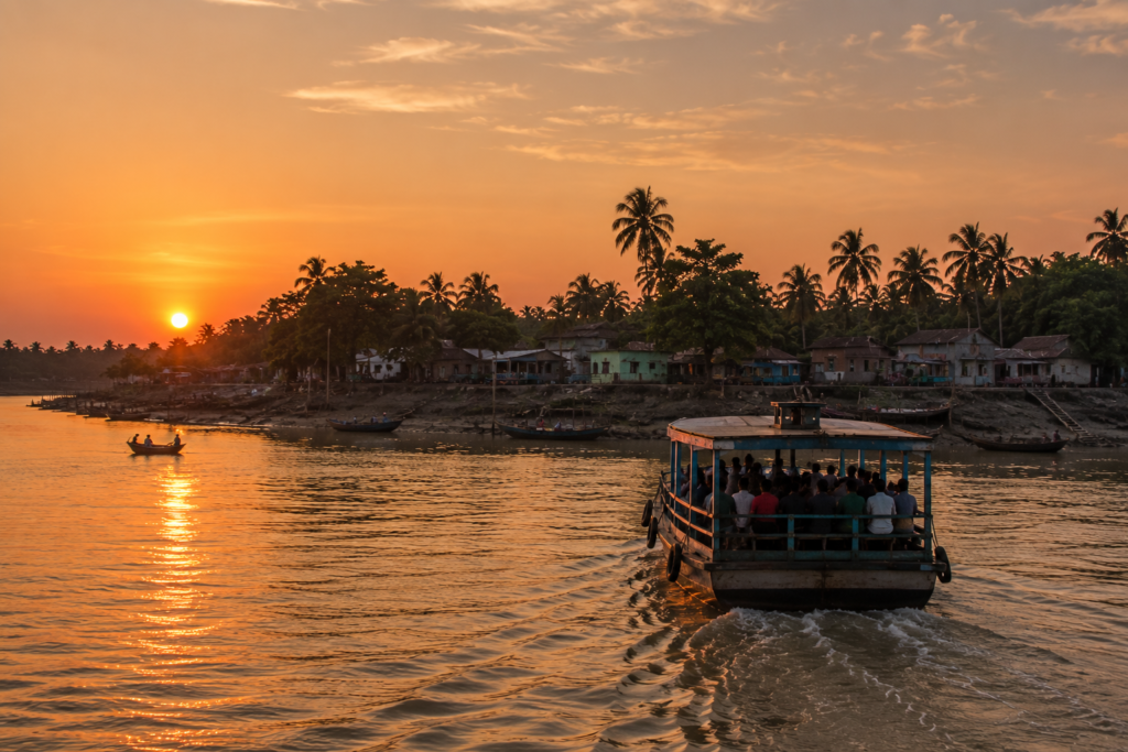
The island is no longer remembered as a point on a map.
It becomes a place understood through experience.
- Through the scent of tidal water carried on the morning breeze.
- Through the quiet determination embodied in every embankment.
- Through the patience of fishermen reading the river.
- Through orchards that shelter generations of family life.
- Through ferries that connect communities instead of merely transporting passengers.
- Through stories shared beneath the shade of old trees.
- Through the remarkable ability of people to adapt, rebuild, and flourish within one of the world’s most dynamic estuarine environments.
Perhaps that is the greatest lesson Chotomollakhali and Boro Mollakhali offer.
The Sundarbans is not defined solely by its famous wildlife or its vast mangrove forests.
Its true strength also lies in its people.
They have transformed a challenging tidal landscape into a place of belonging without losing their respect for the rivers that continue shaping every aspect of life.
- Every tide reminds the island that change is inevitable.
- Every sunrise reminds its people that resilience is a choice.
And every visitor leaves carrying a deeper understanding that the real story of the Sundarbans is written not only in the forest, but also in the lives of those who call this extraordinary delta home.
Plan your private Sundarban expedition
A private journey shaped around you — your group, your pace, your interests. Book a free consultation.