 Encyclopedia
Before dawn, the river looked almost metallic.
The launch leaving Gosaba moved without urgency, its wooden hull groaning softly against the tide as the Matla River carried the last darkness downstream toward the Bay of Bengal. A kerosene lamp trembled near the bow. Beyond it, the Sundarbans remained mostly invisible — only fragments emerging from shadow: a broken embankment, a line of mangrove silhouettes, the distant bark of a dog from somewhere across the water.
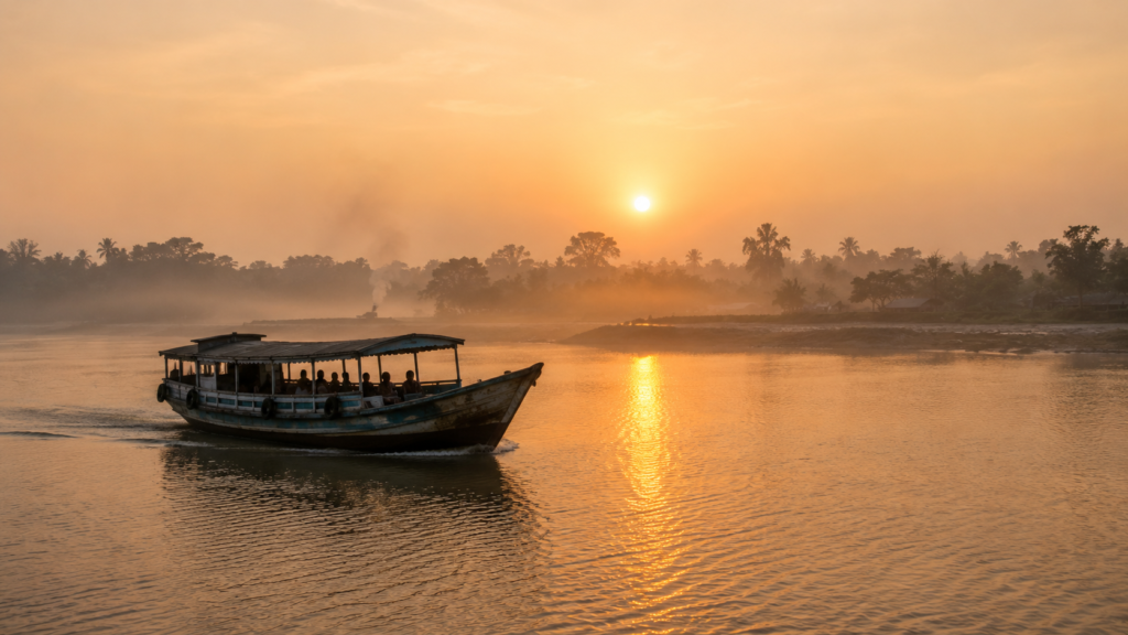
Then the eastern horizon began to pale.
Not dramatically. The Sundarbans rarely reveals itself all at once. It arrives in layers.
First came the smell — wet silt, saline wind, smoke from wood-fired kitchens hidden behind embankments. Then the soundscape gathered itself slowly: oars striking against narrow fishing boats, the metallic clank of a ferry chain, the sharp cry of egrets lifting from exposed mudbanks as the tide withdrew into the creeks.
And finally, beyond a bend in the waterways of Satjelia Island, Rajat Jubilee emerged.
Not as a singular village, but as a fragile human edge drawn against water and mangrove wilderness.
The island did not rise from the river like mainland Bengal settlements. It appeared stitched together from mud embankments, ponds reflecting pale light, scattered palms, fishing nets, paddy fragments, and low houses built with the quiet understanding that rivers here are temporary allies. In the Sundarbans, permanence is always conditional.
Rajat Jubilee exists within that uncertainty.
By sunrise, the settlement had fully awakened.
- Women swept courtyards hardened with river clay.
- Ducks moved noisily through puddles left by the previous night’s rain.
- Schoolchildren in blue uniforms negotiated narrow embankment paths beside ponds covered in water hyacinth.
- Near a tea stall shaded beneath blue tarpaulin, fishermen discussed tidal timings over small glasses of sweet tea clouded from repeated use.
Nothing about the morning felt theatrical.
That was precisely what made it powerful.
Unlike some better-known Sundarbans gateways that now appear regularly in tourism itineraries, Rajat Jubilee still carries the rhythm of a working river settlement rather than a curated destination. Life here unfolds according to embankment repairs, crab prices, diesel availability, monsoon forecasts, and rumours of tiger movement from nearby forest-facing islands.
Its identity reveals itself slowly.
Rajat Jubilee is a climate-fragile forest-fringe settlement — a place shaped by tides, migration, reclamation history, mangrove ecology, and the constant negotiation between human survival and the unpredictable geography of the delta.
The rivers define everything here.
- They decide when boats move.
- They determine whether fields can survive another season of salinity.
- They shape migration, markets, fear, folklore, and memory.
Even direction is explained through water.
A fisherman points west, not by compass but by the route toward Gosaba.
A crab collector measures distance in tidal windows rather than kilometres.
Boatmen speak of rivers as though describing temperaments — some calm during winter, others dangerous after monsoon winds shift through the estuary.
As the launch drifted closer to the embankment, the first sunlight spread across the mudflats.
Tiny crabs disappeared into holes carved into the exposed banks.
A brahminy kite circled silently above the river channel.
Somewhere inland, a conch shell sounded from a household shrine.
The Sundarbans were awake.
And Rajat Jubilee, balanced between river and forest, was beginning another day of negotiation with land, tide, and uncertainty.
First Encounter
Approaching Rajat Jubilee by water reveals one of the central truths of the Sundarbans: land here is never entirely secure.
The shoreline appears provisional.
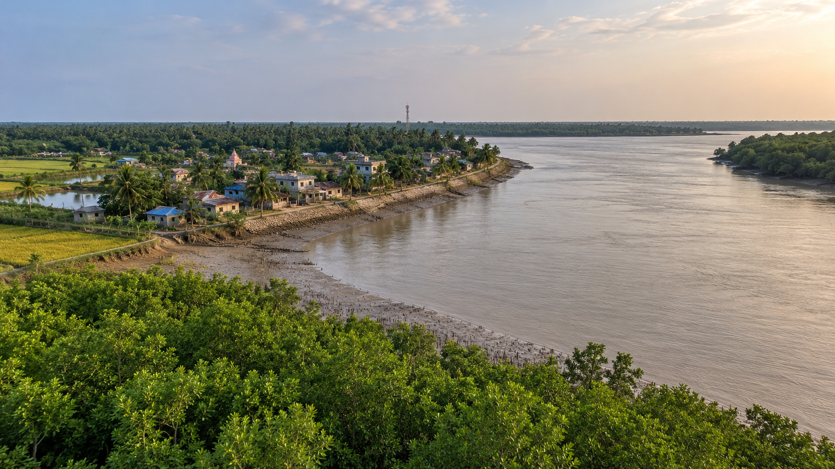
Sections of embankment carry visible layers of repair — hardened mud walls reinforced with bamboo, newer stretches lined with sandbags, and occasional concrete interventions where erosion proved too aggressive.
Coconut palms lean toward the river as if slowly surrendering to it. At low tide, the muddy banks widen dramatically, exposing slick expanses where children descend carefully to untangle fishing nets caught among roots and debris.
The settlement itself stretches inward from the river in irregular clusters.
There is no grand entrance.
No defined boundary announces arrival.
Instead, Rajat Jubilee unfolds gradually through details: a narrow jetty crowded with bicycles, fishing nets drying beside ponds, small grocery stalls selling biscuits and kerosene, goats tied beneath banana trees, solar panels glinting unexpectedly between palm fronds.
Even in daylight, the island carries a sense of environmental vigilance.
People here observe rivers instinctively.
- They monitor cracks in embankments after heavy rain.
- They notice subtle changes in salinity after cyclones.
- They calculate monsoon intensity not through forecasts alone, but through wind direction, tidal behaviour, and the colour of river water.
Survival in Rajat Jubilee depends upon environmental literacy accumulated across generations.
Many homes reflect that adaptation.
- Mud-walled houses remain common beside newer brick structures, roofed with corrugated tin.
- Raised plinths protect interiors during flooding.
- Courtyards are compact and functional, often shared with ducks, fishing equipment, stored firewood, and hand pumps.
Some houses display cyclone scars that never fully disappear — repaired walls, mismatched roofing sheets, rebuilt verandas.
And everywhere, water remains present.
Not merely the rivers themselves, but ponds, canals, creeks, flooded depressions, shrimp enclosures, and narrow channels winding behind settlements toward mangrove edges. The geography creates a constant sense of fluidity. Villages do not feel separated from rivers. They feel suspended within them.
Morning movement intensifies as the sun rises higher.
- Women walk toward ponds carrying metal utensils for washing.
- Small boats loaded with vegetables move toward local markets.
- Elderly men gather beneath shaded tea stalls discussing weather, politics, and fish prices.
- Schoolchildren navigate embankments with an ease learned from childhood, balancing effortlessly above muddy slopes that would challenge unfamiliar visitors.
Rajat Jubilee does not present itself dramatically. Its power lies elsewhere.
- In the quiet evidence of endurance.
- In the embankments rebuilt after storms.
- In the fishing boats returning before the tides shift.
- In the ordinary routines continuing beneath the long shadow of ecological uncertainty.
The settlement exists at the edge of one of the world’s largest mangrove ecosystems, yet daily life here remains grounded in practical negotiations: water levels, crop survival, ferry timings, medical access, fuel costs, and the condition of embankments before the next monsoon arrives.
Standing near the riverbank after sunrise, it becomes impossible to separate geography from human existence.
The island and its people have shaped each other continuously.
And the rivers are still rewriting both.
Island Identity
By mid-morning, the pathways of Rajat Jubilee begin to fill with movement.
Cyclists carrying sacks of rice wobble carefully along narrow embankment roads.
Women return from local markets balancing vegetables and fish inside metal bowls covered with cloth.
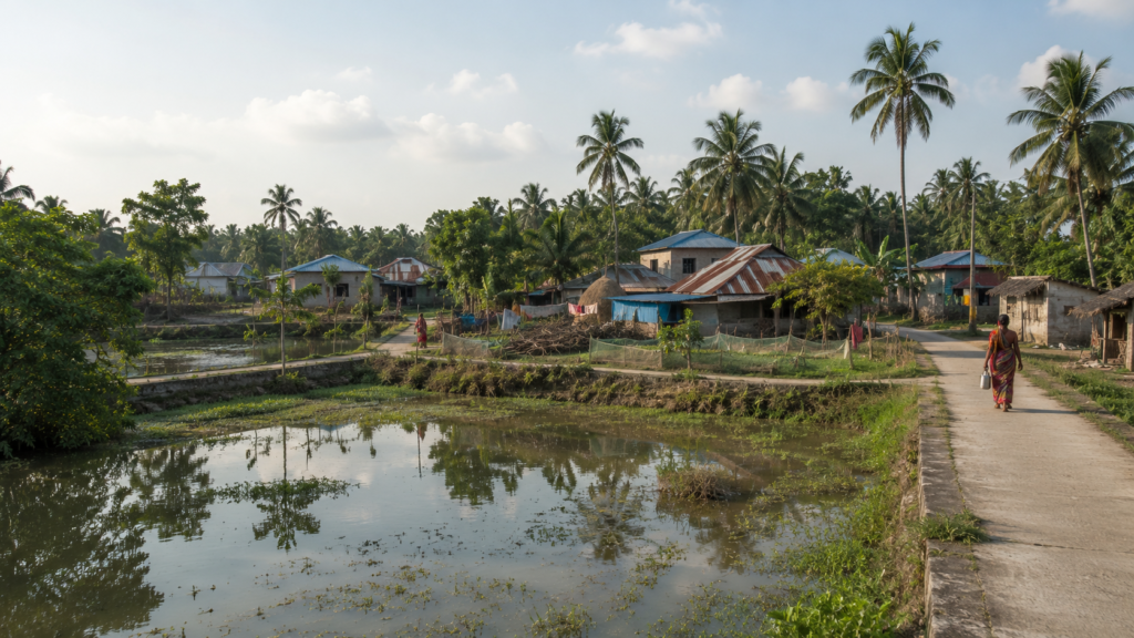
A mechanic repairs a diesel engine beneath the shade of a neem tree while nearby, schoolchildren recite lessons loudly enough for their voices to drift across ponds shimmering beneath the sun.
Only gradually does the geography of the settlement begin to reveal itself.
Rajat Jubilee is not an isolated island in the conventional sense. It exists as a settlement zone within Satjelia Island — one of the inhabited islands of the Indian Sundarbans located in the Gosaba administrative block of South 24 Parganas district in West Bengal. The settlement falls under Lahiripur Gram Panchayat, part of a larger network of riverine communities spread across the delta’s constantly shifting landscape.
Yet administrative definitions alone fail to explain the island’s character.
To understand Rajat Jubilee, one must first understand how settlement in the Sundarbans evolved. Unlike ancient agrarian villages of mainland Bengal, much of the inhabited Sundarbans emerged through reclamation. Dense mangrove forests were gradually cleared during the colonial period to create cultivable land and revenue-generating settlements. Embankments were raised against tidal flooding. Forest edges retreated. Human habitation expanded cautiously into terrain once dominated almost entirely by tidal wilderness.
Satjelia became part of that transformation.
Even today, Rajat Jubilee retains the feeling of a frontier settlement balanced between cultivation and ecological instability. The villages do not spread outward in dense urban formations. Instead, they appear fragmented by ponds, creeks, low agricultural plots, and embankments tracing the geometry of rivers.
Population density fluctuates across the island landscape. Some settlement clusters feel compact and busy near market zones or ferry points, while others dissolve quietly into stretches of paddy fields, shrimp enclosures, and tree cover. The rhythm of habitation remains deeply connected to water access.
Roads exist, but rivers remain the true architecture of mobility.
Boats continue to carry vegetables, fish, fuel, construction material, livestock, school supplies, and people between islands. Ferries link Satjelia with Gosaba and other settlements across the delta. During monsoon months, river conditions can transform ordinary journeys into unpredictable crossings shaped by wind, tide, and visibility.
The island’s identity is therefore inseparable from movement.
Everything arrives by negotiation with water.
Electricity infrastructure improved gradually over the years, aided partly by renewable energy initiatives introduced across remote Sundarbans settlements where grid connectivity remained unreliable. Yet even today, the sense of remoteness persists. Medical emergencies, storm evacuations, and supply shortages are all shaped by distance measured not merely in kilometres, but in river crossings and tidal timing.
This geographical isolation has also preserved something increasingly rare.
Rajat Jubilee still feels governed by ecological rhythm rather than urban speed.
Afternoons slow noticeably during peak summer heat.
- Fishing schedules change with lunar cycles.
- Agricultural decisions depend on salinity patterns left behind after cyclones.
- Families discuss embankments with the seriousness city residents reserve for highways or electricity systems.
The island’s dominant identity becomes impossible to ignore:
Rajat Jubilee is a human settlement built in permanent conversation with environmental uncertainty.
That uncertainty shapes architecture, economy, migration, religion, folklore, and memory itself.
And beyond the embankments, the mangrove frontier waits silently at the edge of everyday life.
The Rivers That Shaped The Island
Near noon, the rivers begin to change colour.
Morning silver turns into a deeper brown-green as tidal currents strengthen beneath the rising sun.
The water appears heavier now, carrying suspended silt through channels that have shaped the Sundarbans for centuries.
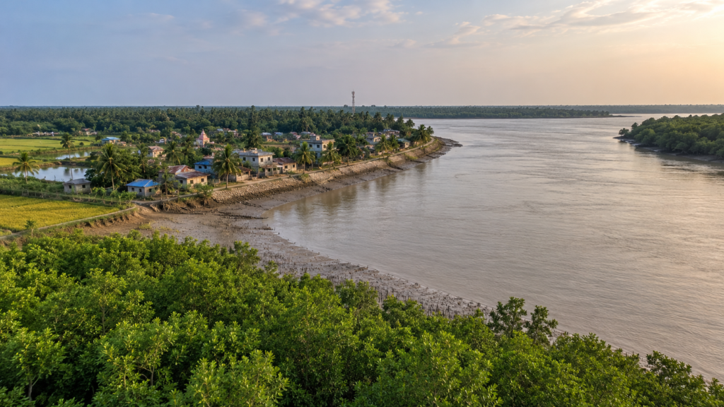
Fishing boats returning from smaller creeks angle carefully against the current while egrets stalk exposed mudflats left behind by the retreating tide.
From the embankments of Rajat Jubilee, rivers are never background scenery.
They are infrastructure, geography, livelihood, danger, and inheritance.
Satjelia Island exists within one of the most hydrologically complex landscapes in the world — a living delta formed through the combined influence of the Ganges, Brahmaputra, and Meghna river systems before they disperse into countless estuarine channels approaching the Bay of Bengal.
Around Rajat Jubilee, rivers dictate the logic of existence.
The Matla River remains one of the most influential waterways shaping the broader Gosaba region. Known for its powerful tidal fluctuations and unpredictable currents, the Matla has long acted both as a connector and a destroyer.
Historically, it enabled trade, transport, migration, and settlement expansion deeper into the delta. Yet the same river system also accelerated erosion, flooding, and salinity intrusion during storms.
Smaller tidal creeks and distributaries surrounding Satjelia create a constantly shifting aquatic network linking villages, mangrove zones, fishing areas, and ferry routes. Many channels appear calm during winter mornings, only to become turbulent during monsoon tides or cyclonic weather.
The rivers determine where settlements can survive.
Villages tend to cluster behind embankments raised against tidal flooding.
Agricultural plots occupy comparatively protected interiors where salinity levels remain manageable for cultivation.
Areas closer to exposed riverbanks often show signs of erosion — collapsed edges, uprooted trees, abandoned structures swallowed gradually by water.
Even daily timekeeping bends around tides.
Fishermen leave before dawn not only for better catch conditions, but to align their journeys with navigable currents.
Ferries operate according to river behaviour as much as official schedules.
Crab collectors moving toward creeks near mangrove zones calculate return timings carefully; a missed tidal window can leave boats stranded in exposed mud channels for hours.
Children growing up in Rajat Jubilee learn to read rivers early.
- They understand which embankment paths become dangerous after rain.
- They know how currents shift near ferry crossings.
- They recognise the difference between ordinary tidal rise and the heavier, more ominous swell associated with distant cyclonic systems moving through the Bay of Bengal.
The rivers also shape emotional geography.
For mainland visitors, rivers often represent beauty or escape. In the Sundarbans, they carry memory with far greater weight.
- Families remember storms through river behaviour.
- Elders recall years when embankments failed under tidal pressure.
- Migration stories often begin with a boat journey across widening channels toward Kolkata or other cities in search of work after crop failures or cyclone damage.
Yet despite their dangers, the rivers sustain life continuously.
Fishing remains deeply tied to tidal ecology.
Small boats move through creeks searching for prawns, crabs, and estuarine fish species that support local markets and household economies.
River water feeds aquaculture enclosures.
Transportation networks rely almost entirely on navigable waterways connecting islands otherwise separated by vast stretches of mangrove terrain and unstable mudflats.
At certain hours of afternoon light, the rivers around Rajat Jubilee appear deceptively peaceful.
- Water hyacinths drift lazily near the banks.
- Kingfishers dive into narrow creeks.
- Children swim beside anchored boats while older men repair nets beneath shaded trees.
But the Sundarbans never allows complete forgetfulness.
- Every embankment carries the memory of storms.
- Every river channel contains the possibility of transformation.
And every settlement along these tidal edges survives through an ongoing negotiation with water powerful enough to reshape entire landscapes within a single season.
Historical Footprints
The deeper one travels into the inhabited Sundarbans, the more history begins to feel layered beneath mud, river silt, and mangrove roots.
Rajat Jubilee carries that layered history quietly.
There are no monumental ruins here. No dramatic archaeological remains rise above the embankments. The history of this landscape survives differently — through settlement patterns, reclaimed fields, river routes, oral memory, colonial land records, and the persistent struggle between cultivation and wilderness.
Before large-scale human settlement expanded across this region, Satjelia and its surrounding islands formed part of an immense mangrove frontier stretching across the lower Bengal delta. Dense forests, tidal creeks, saline marshes, and wildlife-dominated terrain that mainland populations often regarded with caution. Tigers moved through these islands long before embankments divided the river from the village.
Permanent settlement intensified gradually during the nineteenth century under colonial reclamation projects.
The British administration viewed the Sundarbans not merely as a forest, but as potential revenue land. Large sections of mangrove terrain were leased for clearing and agricultural expansion. Embankments were constructed to protect reclaimed land from tidal flooding. Labourers, settlers, cultivators, and fishing communities migrated into newly opened areas despite the environmental risks.
The broader Gosaba region became especially associated with the experiments of Sir Daniel Hamilton, the Scottish entrepreneur and zamindar who attempted cooperative rural development projects in the Sundarbans during the early twentieth century. Hamilton’s initiatives in nearby Gosaba introduced cooperative banking, agricultural reforms, and attempts at organised settlement infrastructure intended to stabilise life in the difficult delta environment.
Though Rajat Jubilee itself remained a smaller settlement zone within Satjelia Island, the influence of these wider regional transformations shaped its emergence.
Land reclamation altered the ecology permanently.
- Mangrove forests retreated from inhabited zones.
- Agricultural plots expanded behind embankments.
- Fishing communities established more permanent settlements along riverbanks once considered too unstable or dangerous for long-term habitation.
Yet reclamation never fully subdued the delta.
- Cyclones repeatedly breached embankments.
- Salinity destroyed crops.
- River erosion consumed sections of cultivated land.
- Disease, isolation, and economic hardship remained constant features of life across the Sundarbans frontier throughout the colonial and postcolonial periods.
Migration patterns transformed the island repeatedly.
Some families trace their ancestry to settlers who arrived generations ago seeking cultivable land.
Others came later through economic displacement, partition-era movement, or post-cyclone resettlement. The resulting social fabric reflects multiple histories layered into one fragile landscape.
Even today, remnants of older settlement logic remain visible.
Village clusters often follow embankment alignments first established decades earlier.
Older ponds dug for freshwater storage continue serving households during dry seasons.
Narrow pathways connecting settlements sometimes trace routes created long before paved roads reached the island.
History in Rajat Jubilee does not feel distant.
It survives in practical memory.
An elderly fisherman discussing how river channels shifted after a cyclone is also preserving environmental history.
A farmer describing how salinity changed crop patterns over decades is documenting ecological transformation.
A family rebuilding a damaged house using techniques learned from earlier storms participates in a cycle of adaptation repeated across generations.
The island’s history is therefore not simply about human settlement.
It is about endurance within instability.
Rajat Jubilee emerged through reclamation, survived through adaptation, and continues to exist because its residents learned to negotiate continuously with one of the most volatile delta environments on Earth.
Historical Personalities & Transformations
By early afternoon, the heat settles heavily across Rajat Jubilee.
The embankment paths grow quieter. Fishing nets dry motionless beneath the sun. Even the dogs retreat into strips of shade beside tea stalls and grocery shops. Only the rivers continue moving with visible energy, their tidal currents sliding past the island as they have for centuries — indifferent to administrations, settlements, and human ambition.
Yet human ambition altered this landscape profoundly.
Much of the inhabited Sundarbans visible today emerged through a long and difficult process shaped by administrators, reformers, landholders, engineers, labourers, and settlers who attempted to transform tidal wilderness into habitable land. Rajat Jubilee carries traces of that transformation even if its history survives more through inherited systems than through monuments.
Among the most influential figures connected to the wider Gosaba region was Sir Daniel Mackinnon Hamilton, whose experiments in cooperative rural development during the early twentieth century became deeply associated with the inhabited Sundarbans. Hamilton acquired large tracts of land in the Gosaba area and attempted to establish what he viewed as a self-sufficient rural society based on cooperative banking, collective agriculture, and local self-governance.
His influence extended beyond economics.
Hamilton’s initiatives helped shape patterns of settlement, embankment construction, agricultural experimentation, and institutional organisation across nearby islands. Cooperative credit systems attempted to reduce dependence on exploitative moneylending networks that trapped many settlers in debt. Schools and local institutions slowly emerged within a region previously defined more by isolation than by structured development.
Though Rajat Jubilee remained one of the smaller settlements within the larger Satjelia landscape, the wider regional transformation initiated during that period influenced the island’s evolution.
But the Sundarbans have always resisted easy control.
Even as settlements expanded, rivers shifted unpredictably.
- Embankments collapsed under cyclonic pressure.
- Salinity transformed agricultural land.
- Disease and isolation complicated every attempt at permanent stability.
The real historical architects of Rajat Jubilee were therefore not only administrators or reformers.
They were ordinary settlers.
- Fishing families who learned tidal behaviour creek by creek.
- Women who preserved freshwater during dry months by maintaining household ponds.
- Farmers who experimented constantly with crop survival in saline soil.
- Boatmen who mapped navigable channels through memory rather than formal charts.
Across the Sundarbans, transformation rarely occurred dramatically. It emerged through slow adaptation repeated over generations.
After Indian independence and later political changes in West Bengal, development gradually expanded deeper into the delta. Electrification, schools, health centres, road connections, and ferry systems improved incrementally, though unevenly. Rajat Jubilee, like many forest-fringe settlements, remained shaped by remoteness despite these changes.
Then came the era of climate anxiety.
Cyclones such as Aila in 2009 altered not only infrastructure but psychological geography.
- Embankments failed across large sections of the Sundarbans.
- Saline water flooded agricultural land.
- Thousands lost homes, livelihoods, livestock, and stored grain.
- Migration toward Kolkata and other cities intensified as families struggled to rebuild.
In Rajat Jubilee, memories of storms became generational markers.
People often recall events not through calendar years alone, but through cyclones:
“before Aila,”
“after Bulbul,”
“during Amphan.”
Transformation here is measured through survival.
The introduction of solar energy initiatives in parts of the Sundarbans also altered daily life significantly. In remote areas where conventional electricity networks struggled to reach consistently, solar systems brought lighting, mobile charging, refrigeration, and new forms of communication. Evening landscapes changed. So did education, commerce, and access to information.
Yet despite technological shifts, Rajat Jubilee still feels governed more by ecology than infrastructure.
The island remains part of a living frontier where development is constantly tested against erosion, flooding, salinity, and storm exposure.
Transformation continues.
But so does uncertainty.
Folklore & Legends
As afternoon light softens over Satjelia, stories begin returning to conversation.
In the Sundarbans, folklore does not survive as entertainment alone. It functions as environmental memory — a cultural system shaped by fear, reverence, uncertainty, and coexistence with landscapes humans never fully controlled.
Even in settlements like Rajat Jubilee, where schools, mobile phones, solar panels, and political debates connect daily life to the modern world, older beliefs still move quietly beneath ordinary routines.
The forest remains spiritually inhabited.
Among the most enduring figures across the Sundarbans is Bonbibi — the guardian spirit of the forest revered by both Hindu and Muslim communities throughout the delta. Her presence emerges especially in stories connected to honey collectors, woodcutters, fishermen, and crab collectors who venture into mangrove territories where danger remains immediate and real.
Bonbibi is not worshipped in the distant ceremonial manner of urban deities.
She is invoked for protection.
Near forest-entry zones elsewhere in the Sundarbans, small shrines dedicated to Bonbibi often stand beside river channels where boats depart toward tiger territory. Offerings are simple: incense, flowers, and prayers for safe return.
Though Rajat Jubilee itself is not a deep forest settlement, the psychological influence of nearby mangrove wilderness remains strong enough that these beliefs continue shaping local imagination.
And where Bonbibi exists, Dakshin Ray is never far away.
Often represented as a tiger-associated force or supernatural lord of the forest, Dakshin Ray occupies an ambiguous place within Sundarbans folklore — feared, respected, sometimes negotiated with through ritual and storytelling. The tiger itself becomes more than an animal in these narratives. It represents the unpredictable authority of the forest over human ambition.
Stories travel easily through river settlements.
Boatmen speak of creeks avoided after dark.
Fishermen discuss strange sounds heard near mangrove edges during winter fog.
Older residents recall periods when tiger incursions into inhabited islands were more frequent, especially after storms disrupted forest ecosystems or damaged prey availability.
Not every story can be verified.
And in the Sundarbans, certainty is rarely the point.
Folklore here emerges from lived vulnerability.
When people inhabit landscapes shaped by tidal isolation, cyclones, crocodiles, snakes, and tiger territory, belief systems become intertwined with survival psychology. Rituals provide structure against uncertainty. Stories transform environmental danger into something culturally understandable.
Some oral traditions also preserve ecological wisdom indirectly.
Warnings against entering certain creeks alone.
- Respect for tidal timing.
- Ritual preparation before forest journeys.
- Community cooperation during emergencies.
These practices often blur the line between spirituality and practical adaptation.
Even the rivers possess personalities in local imagination.
Certain waterways are described as deceptive during monsoon currents. Others are considered unusually dangerous after cyclonic disturbances. Storms themselves are remembered almost as living forces crossing the delta with intention and fury.
As evening approaches, these stories feel easier to understand.
The Sundarbans changes after sunset.
- Distances expand.
- River sounds sharpen.
- Darkness becomes absolute beyond settlement lights.
And somewhere beyond the embankments and inhabited fields, the mangrove wilderness still begins where human certainty ends.
Life Between The Tides
The working day in Rajat Jubilee unfolds according to tides long before clocks become relevant.
Before sunrise, fishermen move toward creeks carrying nets coiled carefully inside narrow boats.
By morning, women wash utensils beside ponds while monitoring rice left drying in courtyards. Children leave for school, balancing along embankment paths slick with overnight moisture.
Afternoon heat slows movement briefly before evening activity returns with the falling tide.
Life here is tidal in structure.
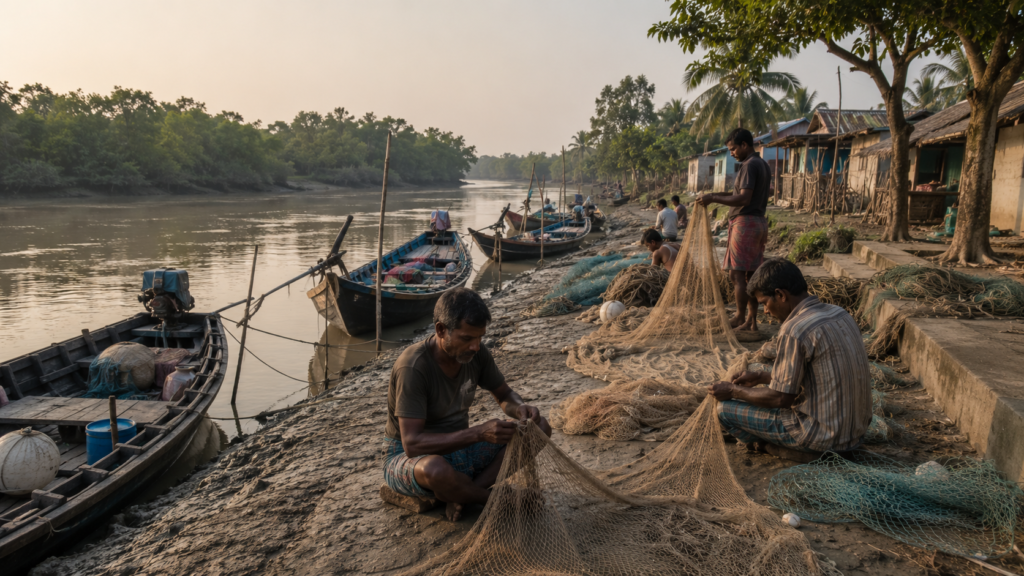
The rhythms of labour rise and recede with water.
Fishing remains one of the most visible occupations shaping daily existence.
Small estuarine fish, prawns, and crabs support both household consumption and local trade networks linking remote settlements with larger markets deeper inside the delta and eventually Kolkata. Boats leaving Rajat Jubilee often navigate through complex creek systems where river knowledge matters more than formal navigation.
Crab collection has become increasingly important economically across many parts of the Sundarbans.
Collectors enter muddy tidal zones searching for mud crabs valued in export markets.
- The work is physically exhausting and frequently dangerous.
- Sharp mangrove roots cut exposed skin.
- Tidal timing leaves little room for error.
In forest-adjacent areas, wildlife risks remain constant.
Agriculture survives through adaptation rather than predictability.
Rice cultivation dominates where salinity permits, though cyclones and embankment breaches repeatedly disrupt farming cycles.
After severe storms, saline water can linger in fields long enough to destroy multiple harvest seasons. Farmers respond by experimenting with salt-tolerant crop varieties, adjusting planting schedules, or combining agriculture with aquaculture where possible.
Household economies rarely depend on one occupation alone.
A family may combine fishing, seasonal agricultural labour, crab collection, small livestock rearing, and temporary migration work to survive financially. Younger residents often leave seasonally for urban employment in Kolkata, Kerala, Chennai, or other regions where construction and labour opportunities provide income unavailable within the island economy.
Migration has become part of the island’s social rhythm.
- Some departures are temporary.
- Others become permanent.
Yet even families who relocate often maintain emotional and economic ties to Rajat Jubilee through remittances, land ownership, festivals, or seasonal returns during major religious occasions.
Women carry a particularly complex burden within this fragile ecology.
They manage water storage, household food systems, livestock care, child-rearing, fuel collection, and often agricultural labour simultaneously. During cyclones or embankment failures, women frequently become central to household recovery efforts despite limited economic visibility in formal systems.
School life unfolds within this environmental reality.
Children grow up understanding cyclones before geography textbooks explain them. They learn to navigate muddy embankments instinctively. Many assist with fishing, agriculture, or household responsibilities outside of classroom hours.
And always, the tides continue shaping ordinary decisions.
- When to travel.
- When to fish.
- When to repair embankments.
- When to avoid certain creeks.
- When to prepare for storms moving inland from the Bay.
Life in Rajat Jubilee is not defined by dramatic wilderness encounters every day. Its deeper story lies in repetition.
- The repeated labour of adaptation.
- The repeated rebuilding after floods.
- The repeated departures and returns.
The repeated negotiation between survival and uncertainty in one of the world’s most fragile inhabited delta landscapes.
Walking Through The Villages
Late afternoon brings movement back to the pathways of Rajat Jubilee.
Tea stalls fill again.
Schoolchildren return home carrying dusty bags.
Elderly men sit beneath banyan shade discussing weather patterns and politics while bicycles rattle along narrow roads raised slightly above surrounding fields and ponds.
Walking through the villages of Rajat Jubilee reveals a settlement shaped less by planning than by gradual accommodation to terrain.
The roads curve unpredictably around ponds, embankments, trees, and older household clusters.
Some sections are paved with concrete while others dissolve into compacted mud pathways vulnerable during monsoon months. Narrow canals appear unexpectedly between homes, carrying tidal water slowly toward larger channels beyond the settlement.
The architecture reflects environmental negotiation.
Older mud houses still survive beside newer brick structures built after cyclones destroyed earlier homes. Corrugated tin roofing dominates many neighbourhoods, often held down with ropes, bamboo supports, or weighted materials in preparation for storm seasons. Elevated foundations remain common where flooding risk persists.
Courtyards function as extensions of household life.
- Fish dry on woven mats.
- Rice is spread beneath the sun.
- Children play beside ducks and goats.
Women clean vegetables while exchanging local news across adjoining compounds separated only by low fences or narrow pathways.
Religious structures appear modest but are deeply integrated into daily routine.
Small temples painted in fading colours stand near ponds shaded by coconut trees.
Mosques emerge quietly between settlement clusters, their loudspeakers carrying evening prayer calls across fields and waterways.
The coexistence feels practical rather than performative — shaped by generations of shared environmental vulnerability.
Markets are small but socially vital.
Tiny grocery shops sell biscuits, kerosene, batteries, soap, mobile recharge coupons, fishing hooks, and packets of spices hanging from strings near the entrance. Tea stalls operate as information exchanges where discussions range from crop conditions and fish prices to ferry disruptions and cyclone rumours moving through the delta.
The sounds of village life remain inseparable from ecology.
- Bird calls drift constantly from ponds and tree cover.
- Wind rattles palm leaves above embankments.
- Distant boat engines pulse across waterways.
Somewhere nearby, someone repairs fishing nets by hand while a radio broadcasts old Bengali songs distorted by static.
Nothing in Rajat Jubilee feels isolated from environmental reality.
Even ordinary conversation returns repeatedly to rivers, storms, fish availability, rainfall, embankment conditions, and salinity.
The villages exist within the delta not as permanent victories over nature, but as ongoing negotiations with it.
And by evening, when sunlight turns copper against the ponds and smoke begins rising from cooking fires across the settlement, Rajat Jubilee feels less like a fixed island and more like a living adaptation suspended between river, memory, and tide.
Sounds Of The Island
Toward evening, Rajat Jubilee becomes an island of sound.
Not loudness — rhythm.
The Sundarbans rarely feel silent, even when human movement slows. Sound travels unusually far across tidal landscapes.
Water reflects it.
Open fields carry it.
Mangrove edges absorb and release it in strange ways, especially during the transitional hours between daylight and darkness.
Standing near the embankments at dusk, the island reveals itself acoustically long before it disappears visually.
Boat engines pulse from distant creeks like slow mechanical heartbeats moving through fog. Metal utensils strike against hand pumps beside household ponds. Somewhere beyond the fields, a bicycle bell rings repeatedly along a narrow path barely visible in the fading light.
Then comes the evening azaan from a village mosque.
Its amplified call drifts over waterlogged fields, crossing ponds and embankments before dissolving into the wind moving upriver. Moments later, a conch shell sounds from a household shrine nearby. Neither interrupts the other. In the Sundarbans, shared vulnerability has long shaped coexistence more strongly than ideological separation.
As darkness gathers, insects take control of the soundscape.
- Crickets pulse from grassland edges.
- Frogs call from ponds swollen by monsoon residue.
- Mosquitoes gather in dense, invisible clouds near stagnant water.
The sounds rise gradually until they form a continuous living texture beneath everything else.
And always, the rivers remain audible.
- Tidal water striking embankment walls.
- Oars cutting through creeks.
- Fishing boats returning late against the current.
- The slap of loosened ropes against wooden hulls tied near small jetties.
People who grow up here learn to interpret these sounds instinctively.
An approaching storm often announces itself first through altered wind movement in palm trees. Unusual river turbulence becomes audible before visible. Even silence can carry meaning.
Older residents sometimes describe the strange stillness that occasionally settles across the delta before cyclones — birds disappearing, wind collapsing, dogs becoming restless, river surfaces flattening unnaturally beneath heavy air moving inland from the Bay.
Night deepens quickly in Rajat Jubilee.
Beyond the limited glow of homes, shops, and solar-powered lights, darkness expands almost completely across the surrounding landscape. The absence of urban illumination transforms perception itself.
Distances become uncertain.
Rivers vanish visually but remain present through sound alone.
And somewhere beyond the settlement boundaries, the mangrove wilderness continues breathing invisibly through tide and wind.
Wildlife Expedition
At first glance, Rajat Jubilee appears dominated by human survival — embankments, ponds, fishing boats, rice fields, and settlement clusters shaped by labour and environmental adaptation.
But look carefully enough, and the island begins revealing another world layered quietly within the human one.
The Sundarbans is never ecologically empty.
Even inhabited islands remain threaded into one of the largest mangrove ecosystems on Earth, and wildlife moves constantly through these connected tidal landscapes whether noticed or not.
Early mornings offer the richest signs.
- Egrets gather along muddy creek edges exposed during low tide.
- Pond herons wait motionless beside shallow water before striking suddenly at fish or frogs.
- Brahminy kites circle above embankments scanning for movement in fields and canals.
- Kingfishers flash electric blue across ponds where small fish gather beneath floating vegetation.
Birdlife here follows water.
Seasonal wetlands attract migratory visitors during winter months while resident species adapt continuously to the shifting mosaic of ponds, paddy fields, creeks, mangrove edges, and tidal flats. Even narrow village canals support surprising ecological activity.
- Drongos perch on bamboo fencing, watching for insects disturbed by livestock.
- Bee-eaters skim low over open fields during warmer afternoons.
- Cattle egrets follow grazing animals through muddy agricultural plots.
At dusk, fruit bats emerge from trees and move across the darkening sky toward feeding grounds deeper within the delta.
Reptiles remain less visible but deeply present.
Water snakes move silently through ponds and flooded embankment depressions.
Monitor lizards occasionally appear near canal edges or abandoned stretches of vegetation.
During hotter months, snakes become part of ordinary environmental awareness for residents navigating tall grass, ponds, and embankment paths after sunset.
The Sundarbans crocodile habitat lies more strongly associated with protected forest waterways than densely inhabited areas like Rajat Jubilee, yet the broader estuarine ecology connects everything through rivers and tidal movement.
Fishing cats — elusive and rarely seen — continue surviving across sections of the delta where wetland conditions remain suitable. Most residents encounter them through tracks, livestock theft, or brief nighttime sightings rather than direct observation. Their presence reflects the ecological complexity that still persists despite expanding human pressure.
Otters, too, historically formed part of the Sundarbans ecosystem, though sightings remain uncommon and increasingly localised.
And then there is the tiger.
In Rajat Jubilee, the tiger exists less as visible wildlife and more as psychological geography.
Satjelia Island lies within the wider human-inhabited landscape bordering protected mangrove territories where Royal Bengal Tigers continue surviving. Direct tiger encounters inside settlements remain rare, but the possibility shapes behaviour, folklore, memory, and environmental consciousness across the region.
Stories travel quickly whenever a tiger is sighted near embankments or enters inhabited zones elsewhere in the Sundarbans.
People discuss pugmarks found near creeks.
- Fishermen exchange rumours about movement through mangrove channels.
- Forest-entry workers invoke Bonbibi before journeys into deeper wilderness.
- The tiger’s presence therefore extends beyond biology.
It becomes part of the emotional ecology of the island.
Insects dominate much of the actual biodiversity visible around Rajat Jubilee, especially during monsoon months.
- Dragonflies hover above ponds.
- Mosquitoes emerge aggressively after rain.
- Butterflies gather near flowering vegetation along embankments.
- Mangrove mud itself teems with microscopic life sustaining the broader estuarine food chain.
Even the mudbanks move.
Tiny crabs vanish into holes as footsteps approach. Mudskippers leap awkwardly across exposed tidal flats between water and land, embodying the amphibious logic of the delta itself.
Wildlife in Rajat Jubilee rarely presents itself dramatically.
There are no safari moments here.
No guaranteed encounters.
Instead, the island teaches a slower form of ecological observation — one based on traces, sounds, patterns, and coexistence between human settlement and tidal wilderness.
The deeper truth of the Sundarbans lies precisely there.
Life survives everywhere it can.
CTA: View Our Wildlife Expeditions
Mangrove Chronicles
Beyond the embankments, the mangroves begin almost quietly.
Not as towering forests in the conventional sense, but as dense tidal vegetation adapted to salinity, unstable soil, and daily submergence beneath shifting estuarine water.
- Their roots rise from mud like breathing structures.
- Their branches twist low against cyclonic wind.
- Their survival strategies appear almost alien to inland ecosystems.
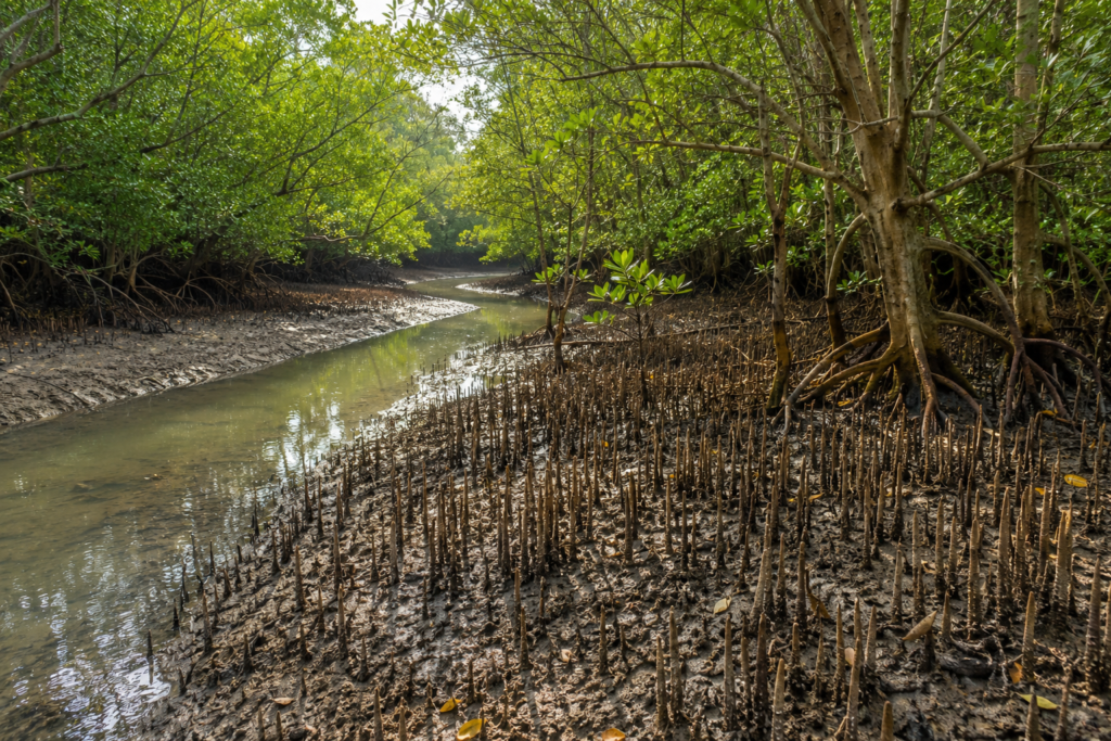
The mangroves are the reason the Sundarbans exist at all.
Without them, much of this delta would erode far more rapidly beneath tidal pressure and storm surge. They stabilise mudbanks, trap sediment, reduce wave energy, support fisheries, shelter biodiversity, and act as one of the most important ecological buffers between the Bay of Bengal and human settlement.
For islands like Satjelia, mangroves are both protection and reminder.
Protection because they soften cyclonic impact in areas where forest cover remains healthy.
Reminder, because they mark the boundary where human habitation meets untamed tidal wilderness.
Several mangrove species characteristic of the Indian Sundarbans grow across nearby forested zones and tidal creek systems. Sundari trees — from which the Sundarbans likely derives its name — historically dominated parts of the delta, though salinity changes and ecological stress have affected their distribution over time. Goran, gewa, keora, and other salt-tolerant species now shape much of the surviving mangrove landscape around inhabited islands.
Each species reflects adaptation.
Pneumatophores rise vertically from mud to absorb oxygen where waterlogged soil limits normal respiration. Salt-filtering mechanisms allow survival in brackish conditions that would kill most terrestrial vegetation. Seed dispersal occurs through tidal movement rather than stable ground.
Nothing about mangrove ecology is static.
The forest moves with water.
For residents of Rajat Jubilee, mangroves remain economically and culturally significant even when direct dependence has reduced compared to earlier generations. Fish breeding cycles rely heavily on mangrove-supported estuarine ecosystems. Honey collectors, woodcutters, and crab collectors continue interacting more directly with forest zones elsewhere in the Sundarbans.
But conservation tensions have intensified.
Population growth, embankment expansion, aquaculture pressures, erosion, cyclones, and salinity shifts continue to reshape ecological balance throughout the delta. Climate change has added new layers of uncertainty through rising sea levels, increasingly severe storms, and altered rainfall patterns, affecting both forest health and agriculture.
Many older residents describe environmental changes with remarkable specificity.
- Creeks are becoming wider.
- Fish species are declining.
- Salinity increases after major cyclones.
- Mangrove edges are shifting over decades.
In the Sundarbans, ecological observation is rarely an abstract science. It emerges from lived dependence on environmental stability.
The mangroves also influence imagination.
- Their silhouettes dominate river horizons at dusk.
- Their creeks generate stories of disappearance and survival.
- Their dense interiors remain associated with danger, mystery, and reverence across generations raised near forest boundaries.
And yet, despite their ecological importance, mangroves are often understood most clearly during storms.
When cyclones move inland from the Bay and tidal surges rise against embankments, villages protected by healthier forest buffers sometimes experience reduced damage compared to more exposed zones.
The forest absorbs violence silently.
That quiet protection may be one of the Sundarbans’ greatest ecological gifts.
Explorer’s Field Notes
Field Note: Early morning movement near Rajat Jubilee follows the tide before traffic. Boats begin operating while large sections of the settlement still remain half-asleep.
Field Note: Embankment conditions vary noticeably. Older repaired sections reveal repeated layers of reinforcement rather than permanent engineering stability.
Field Note: Solar panels appear frequently across household rooftops, reflecting the gradual adaptation of remote delta settlements to unreliable grid infrastructure.
Field Note: Bird activity intensifies dramatically during tidal transitions when exposed mudflats attract feeding species.
Field Note: Conversations about the weather here carry unusual seriousness. Forecasts are not casual information but survival intelligence.
Field Note: Ponds remain central to household geography — for washing, fish culture, water storage, and micro-ecosystems supporting daily life.
Field Note: Even younger residents discuss cyclones through lived memory rather than historical abstraction.
Field Note: Village pathways often function simultaneously as roads, embankments, social gathering spaces, and flood barriers.
Field Note: The psychological presence of the forest extends far beyond visible mangrove boundaries.
Nightfall On The Island
Darkness arrives quickly in Rajat Jubilee.
One moment, the ponds still reflect traces of orange evening light. Next, the settlement begins dissolving into scattered points of illumination separated by enormous stretches of shadow.
Cooking fires appear first.
Smoke rises slowly through palm silhouettes while the smell of rice, fried fish, onions, and mustard oil drifts between homes.
Radios play faintly behind open windows.
Children complete homework beneath electric bulbs powered by fragile grids or solar systems charged during the day.
The rivers disappear visually after sunset.
But they never vanish completely. One still hears them moving against embankments beyond the darkness.
Boat engines continue somewhere far away.
Occasional voices carry across water, impossible to see.
Night reshapes distance in the Sundarbans. A light visible across a river may belong to another village only minutes away by boat, or much farther than it appears in darkness distorted by an open tidal landscape.
Tea stalls remain active longer than expected.
Men gather discussing politics, fishing conditions, crop prices, and rumours of weather systems moving northward through the Bay of Bengal. Storm anxiety never disappears entirely from conversation here. Cyclones have rewritten too many lives across the delta for complacency to survive.
Then, gradually, even the settlement quiets.
The later hours belong increasingly to insects, frogs, wind, and water.
Above Rajat Jubilee, the night sky expands with unusual clarity when clouds permit. In the absence of urban light pollution, stars scatter sharply across the darkness while the humid air carries the smell of mudflats exposed by the retreating tide.
Somewhere beyond the embankments, beyond ponds and rice fields and sleeping households, the mangrove wilderness continues unseen.
The forest breathes with the tide.
And the island waits for another dawn beside the rivers that made it possible.
The Seasons Of The Island
No season arrives gently in the Sundarbans.
In Rajat Jubilee, the year is not experienced through calendar pages so much as through changing water, changing wind, changing soil, and changing anxiety.
Each season reshapes the island physically.
- The rivers alter colour and temperament.
- Fish migration changes.
- Crops respond differently to salinity.
- Embankments strengthen or weaken.
- Human routines reorganise themselves around environmental pressure.
The island lives seasonally because survival depends upon noticing the transition early.
Winter
Winter arrives quietly sometime after the retreat of the monsoon, usually through the first cold winds moving across the delta at dawn.
Morning fog settles low above ponds and river channels. Fishermen leaving before sunrise become silhouettes drifting through white mist while dew gathers heavily on paddy edges and embankment grass. The oppressive humidity of summer weakens temporarily. Afternoons grow softer, calmer, easier to work through.
This is often the most physically comfortable season in Rajat Jubilee.
- River travel becomes more predictable.
- Skies remain clearer for longer stretches.
- Agricultural activity intensifies where salinity conditions permit successful cultivation.
- Local markets carry winter vegetables brought through interconnected river settlements.
- Migratory birds appear more frequently along wetlands and mudflats.
Winter evenings possess a particular atmosphere in the Sundarbans.
- Cooking fires begin earlier.
- Tea stalls remain crowded longer.
- Conversations stretch into the night beneath sweaters and shawls rarely needed during the rest of the year.
- Weddings and social gatherings become more common once cyclone anxiety subsides temporarily.
Yet even winter never fully erases environmental uncertainty.
- The rivers remain tidal.
- The embankments remain fragile.
- The forest remains closed.
Spring
Spring in Rajat Jubilee is brief and transitional.
The air grows warmer almost imperceptibly at first.
- Mango trees begin flowering near homesteads.
- Dryness increases gradually along embankments where winter moisture disappears beneath strengthening sunlight.
- The rivers lose some of winter’s softness and begin preparing for harsher months ahead.
This season often carries a deceptive calm.
- Fishing activity remains steady.
- Schools continue normally.
- Markets function with relative ease.
Yet experienced residents begin quietly preparing for the difficult cycle approaching with summer and monsoon.
Repairs begin early.
- Households reinforce roofing sheets.
- Fishing equipment is checked carefully.
- Stored grain and household materials are reorganised.
In the Sundarbans, preparedness is rarely dramatic. It is embedded into seasonal routine.
Summer
By late spring and early summer, the heat becomes physical pressure.
Afternoons in Rajat Jubilee slow beneath temperatures intensified by humidity rising from ponds, mudflats, and tidal waterways. Embankment roads shimmer beneath harsh sunlight. Livestock gather beneath the smallest available patches of shade. Even the wind feels heated.
- Water management becomes critical.
- Pond levels fluctuate.
- Salinity concerns intensify in some agricultural areas.
- Drinking water storage grows more important as heat deepens across the island.
- Electricity disruptions become more difficult during hot nights when air movement weakens.
Summer is also storm season.
Dark clouds gather rapidly across the delta during pre-monsoon disturbances. Sudden squalls move through river systems with startling speed, overturning small boats and damaging fragile structures before disappearing almost as quickly as they arrived.
Boatmen watch the horizon constantly during these months.
Experience matters.
So does caution.
Monsoon
When the monsoon finally arrives, Rajat Jubilee changes completely.
The first heavy rains strike embankments with explosive force after months of accumulated heat.
- Dust vanishes instantly from roads and vegetation.
- Ponds overflow.
- Canals refill.
- Water begins reclaiming the landscape.
The monsoon is both a relief and a threat.
Agriculture depends upon it.
So does freshwater replenishment.
But excessive rainfall combined with high tide can place enormous pressure on already vulnerable embankments protecting settlements from tidal flooding.
Roads become slippery and unstable.
Travel slows.
River crossings grow dangerous during periods of strong wind and reduced visibility.
Entire sections of the island begin functioning according to weather windows rather than schedules.
The monsoon soundscape dominates everything.
- Rain is hammering tin roofs.
- Wind moving through palms.
- Water overflowing drainage channels.
- Distant thunder rolling continuously across the flat delta sky.
Children continue walking to school through flooded pathways. Fishermen continue working whenever river conditions permit. Life does not stop during the monsoon in the Sundarbans. It adapts.
It always adapts.
Post-Monsoon
After the heaviest rains retreat, the island enters a season of recovery and reassessment.
- Fields reveal which crops survived.
- Embankments are inspected for hidden damage.
- Fishing conditions stabilise gradually.
- Vegetation appears intensely green beneath clearer skies.
This season often determines how difficult the coming year may become economically for many families. A successful agricultural cycle can temporarily ease financial pressure. A damaged harvest may intensify migration toward mainland labour markets.
The landscape carries visible evidence of what the monsoon has altered.
- Collapsed riverbanks.
- Flooded depressions.
- New sediment deposits.
- Broken roads.
- Repaired rooftops.
The Sundarbans remembers every season physically.
Cyclone Season
Cyclone season exists beyond ordinary weather.
In Rajat Jubilee, cyclones are not distant meteorological events discussed through television graphics. They are lived historical ruptures capable of reorganising memory, economy, migration, and geography within hours.
Storm preparation begins long before landfall.
- Mobile phones circulate warning messages rapidly across villages.
- Boats are secured inland where possible.
- Livestock are moved toward safer ground.
- Families gather dry food, drinking water, medicines, documents, and emergency supplies.
Then comes waiting. The waiting may be the hardest part.
- Wind intensifies first.
- River behaviour changes.
- The air pressure shifts strangely.
And everyone remembers earlier storms.
Cyclones And Survival
No conversation about Rajat Jubilee can avoid cyclones for long.
Their memory exists everywhere across the island — in rebuilt embankments, altered riverbanks, repaired homes, abandoned agricultural land damaged by salinity, migration stories, and the cautious way residents monitor weather systems forming over the Bay of Bengal.
Cyclones are not interruptions in Sundarbans history.
They are part of it.
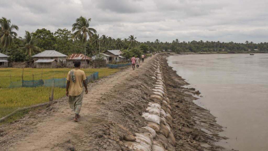
Among the most devastating storms in recent memory was Cyclone Aila in 2009, which transformed large sections of the delta with catastrophic force. Embankments collapsed across wide areas of the Sundarbans, allowing saline tidal water to flood villages, ponds, and agricultural fields for prolonged periods.
The consequences lasted years beyond the storm itself.
In places like Satjelia, families lost crops, livestock, stored grain, fishing infrastructure, and homes simultaneously. Drinking water sources became contaminated with salinity. Agricultural recovery slowed dramatically because flooded soil remained unsuitable for cultivation long after floodwaters receded.
People remember Aila not simply as a cyclone, but as a dividing line.
Before Aila.
After Aila.
The distinction still shapes conversation.
Later cyclones, including Bulbul, Amphan, and Yaas, reinforced the growing awareness that climate vulnerability in the Sundarbans is intensifying. Each storm tested embankments already weakened by erosion, tidal pressure, and inadequate maintenance.
Yet survival here has produced remarkable forms of adaptation.
- Communities rebuild repeatedly despite limited resources.
- Local knowledge circulates quickly during emergencies.
- Families share shelter space during severe weather.
- Raised platforms protect livestock where possible.
- Fishing schedules change according to storm forecasts.
- Embankment repair becomes a collective priority because everyone understands what failure means.
Resilience in Rajat Jubilee is practical rather than romantic.
- It means rebuilding homes multiple times.
- It means restoring fields poisoned by saltwater.
- It means continuing daily life despite knowing another cyclone will eventually come.
Children grow up recognising storm warnings instinctively. Elderly residents compare cyclone behaviour across decades, discussing how river surges now seem stronger and less predictable than before.
Climate change is not theoretical here.
It arrives through water.
- Rising salinity affects agriculture.
- Sea-level rise intensifies erosion pressure.
- Warmer oceans strengthen cyclonic systems moving inland from the Bay of Bengal.
And still, the island remains inhabited.
Because, despite everything — storms, erosion, isolation, uncertainty — Rajat Jubilee is home.
Ferry Routes & Hidden Paths
In the Sundarbans, movement is never simple.
Even short journeys require negotiation with rivers, tides, weather, and timing. Rajat Jubilee remains connected to the wider delta through a network of ferries, embankment roads, narrow paths, and boat routes shaped more by geography than infrastructure planning.
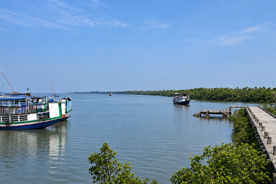
Most journeys toward the island begin through Gosaba, one of the major inhabited gateways into the Indian Sundarbans. From there, ferries and local boats connect settlements across the river network depending on tide and operational conditions.
Travel here still feels transitional.
- The mainland recedes gradually.
- Road systems weaken.
- Water begins taking control of direction.
Local ferries remain essential not only for passengers but also for vegetables, construction materials, fuel, motorcycles, school supplies, livestock, and everyday commerce moving between islands.
The jetties themselves become social landscapes.
People wait carrying sacks of rice, bicycles, fishing nets, poultry cages, medicines, and market goods. Conversations begin easily between strangers because everyone shares the same uncertainty regarding weather and river timing.
During monsoon months, even familiar routes can become difficult.
- Strong currents delay crossings.
- Visibility collapses during heavy rain.
- Wind conditions force smaller boats to wait near embankments before attempting open channels.
Yet movement never entirely stops.
The Sundarbans survives through circulation.
Beyond formal ferry points, Rajat Jubilee also contains hidden pathways understood primarily by residents: narrow embankment shortcuts between settlement clusters, raised foot trails beside ponds, unofficial creek crossings used during low tide, and old routes connecting agricultural zones to river edges.
Walking these paths reveals another scale of the island invisible from larger roads.
- Small shrines hidden beneath banyan trees.
- Abandoned embankment sections swallowed by vegetation.
- Children fishing in rain-fed canals.
- Ponds glowing orange at sunset behind coconut groves.
The geography encourages slow travel.
One cannot move carelessly here.
Mud, tide, waterlogging, and unstable ground constantly demand attention. And perhaps that is why Rajat Jubilee feels so different from mainland landscapes.
The island resists speed. Its pathways insist on observation.
Photography Expedition Guide
Rajat Jubilee is not an island that reveals itself quickly to cameras.
The landscape resists spectacle in the conventional sense. There are no dramatic mountain ridges, monumental architecture, or instantly recognisable tourist landmarks. Its visual power emerges slowly through atmosphere, texture, weather, human movement, and the uneasy coexistence between settlement and tidal wilderness.
Photographing the island requires more patience than equipment.
Sunrise Photography
The most powerful light often arrives before the sun itself becomes visible.
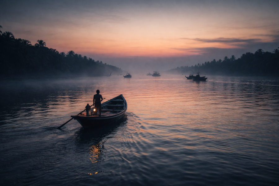
Pre-dawn along the embankments near river channels offers layered atmospheric conditions unique to the Sundarbans: drifting fog above tidal water, silhouettes of fishing boats, smoke rising from early cooking fires, and pale reflections spreading across exposed mudflats.
Winter mornings are especially rewarding.
Fog softens the landscape while birds gather along creek edges exposed by the retreating tide. Human activity begins gradually — fishermen preparing nets, women collecting water, ferry passengers waiting quietly near jetties.
The island wakes slowly enough to observe.
Sunset Photography
Sunset transforms Rajat Jubilee completely.
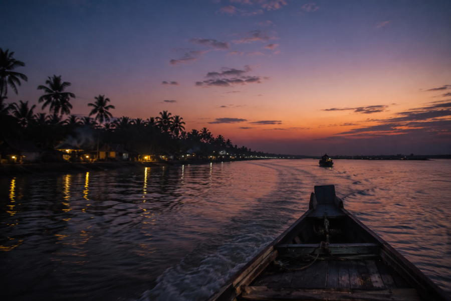
As the light lowers across ponds and embankments, the settlement begins reflecting copper and amber tones intensified by suspended moisture in the delta air. Palm silhouettes sharpen against open sky while tidal rivers darken into reflective bands moving through the landscape.
The best sunset images often emerge not from wide scenic views alone, but from transitional moments:
- A fisherman returning against the evening light.
- Children walking home along elevated embankments.
- Smoke drifting above cooking fires.
- Boats anchored beside mudbanks during the falling tide.
Monsoon clouds can create particularly dramatic skies after storms, though rapidly changing weather also increases logistical difficulty for photographers moving through river-dependent terrain.
Wildlife Photography
Wildlife photography around Rajat Jubilee rewards observation of smaller ecological interactions rather than expectations of dramatic predator encounters.
Birdlife offers the richest opportunities.
Early morning wetlands attract egrets, pond herons, kingfishers, brahminy kites, bee-eaters, drongos, and migratory species during the winter months. Tidal mudflats expose feeding zones where patient observation becomes essential.
The challenge lies in movement.
- Boats drift.
- Light changes rapidly.
- Tides reshape habitat visibility within hours.
Long periods of waiting often produce the most meaningful images.
The Sundarbans teaches stillness to photographers.
Landscape Photography
The island’s landscapes function through layering.
- Foreground embankments.
- Midground ponds or settlements.
- Background river channels and distant mangrove silhouettes.
Weather plays an enormous role in the visual atmosphere. Monsoon skies create dramatic contrasts between water and cloud, while winter fog produces softer, more muted compositions.
Photographing Rajat Jubilee successfully often means embracing ambiguity rather than clarity.
The delta is a place of dissolving edges.
Cultural Photography
Daily life provides some of the island’s most compelling visual narratives.
- Net repair beneath shaded courtyards.
- Children balancing along embankments after school.
- Tea stalls function as social centres.
- Boat crossings during changing tide.
- Market movement before storms.
These moments require sensitivity rather than intrusion.
The island is not a staged ethnographic exhibit. It is a working settlement shaped by labour, uncertainty, and environmental pressure. Respectful observation matters more than aggressive image-making.
Seasonal Opportunities
Every season alters photographic conditions dramatically.
Winter offers fog, migratory birds, softer light, and easier movement.
Summer intensifies atmospheric haze and heat distortion.
Monsoon transforms the island into a saturated water landscape filled with reflections, storms, and unstable skies.
Post-cyclone periods can reveal harsh environmental realities — damaged embankments, altered riverbanks, reconstruction efforts, and ecological vulnerability visible across the terrain.
Rajat Jubilee rewards photographers willing to document the process rather than postcard imagery.
The island is most visually powerful when photographed honestly.
Expedition Notes
Expedition Note: Embankments function simultaneously as transportation corridors, flood defence systems, and social spaces. Their condition reveals recent environmental history.
Expedition Note: Tidal timing changes the visual geography of the island dramatically within hours. Mudflats exposed during low tide vanish completely at high tide.
Expedition Note: Local tea stalls operate as informal information networks where weather updates, fishing conditions, ferry delays, and political discussions circulate continuously.
Expedition Note: Solar lighting has subtly transformed nighttime settlement patterns in parts of the Sundarbans, extending evening activity beyond what older generations experienced.
Expedition Note: The psychological relationship between residents and rivers feels fundamentally different from mainland Bengal. Rivers here are treated with caution rather than romantic distance.
Expedition Note: Many households maintain layered livelihood systems combining fishing, agriculture, wage labour, livestock, and seasonal migration income.
Expedition Note: The most environmentally revealing conversations often emerge casually — while discussing crop failure, fish scarcity, or embankment repairs rather than formal “climate change.”
Expedition Note: Even seemingly stable roads may function as flood barriers during extreme weather events.
Expedition Note: The island’s atmosphere changes completely after dark. Distances become uncertain and sound replaces visibility as the primary environmental sense.
Connected Landscapes
Rajat Jubilee cannot be understood in isolation.
Like all Sundarbans settlements, it exists within an interconnected tidal geography where rivers, embankments, forests, markets, ferry routes, and migration networks bind islands together into one continuously shifting delta system.
Satjelia Island itself forms part of the broader Gosaba region — among the most historically significant inhabited sectors of the Indian Sundarbans. Nearby islands and settlements maintain economic, cultural, and ecological relationships shaped through generations of river movement and shared environmental vulnerability.
To travel through the region is to move through connected landscapes rather than separate destinations.
Gosaba functions as one of the principal administrative and transportation centres linking many surrounding islands. Markets there influence trade patterns extending toward settlements like Rajat Jubilee. Medical access, education, government services, and transport connections often depend upon journeys routed through Gosaba’s ferry infrastructure.
Lahiripur, associated with tourism-oriented access toward forest zones such as Sajnekhali, occupies another important position within the regional landscape. Yet beyond tourist routes, local river movement continues following older patterns tied to fishing grounds, agricultural exchange, and kinship networks across islands.
Further outward, the protected mangrove territories of the Sundarbans Tiger Reserve shape ecological reality across inhabited areas, even where the forest itself is not directly visible. Fish breeding cycles, crab populations, river salinity, storm protection, and wildlife movement all remain connected to the health of these mangrove ecosystems.
The boundaries between “human settlement” and “wild landscape” are therefore less rigid than maps suggest.
Cyclones demonstrate this interconnectedness brutally.
A storm surge damaging embankments in one sector can alter migration, labour patterns, fish supply, agricultural pressure, and ferry movement across multiple islands simultaneously. Environmental disruption travels through the delta socially as well as physically.
Migration routes connect Rajat Jubilee far beyond the Sundarbans.
Young labourers leave seasonally for Kolkata, Kerala, Chennai, Gujarat, and other regions where construction, factory, transport, or service-sector work provides income unavailable locally. Remittances return through banking systems, mobile transfers, or physical transport back into island economies.
Yet despite outward migration, emotional geography remains rooted in the delta.
People return during festivals.
They rebuild ancestral homes after cyclones.
They continue identifying themselves through island belonging even after years away.
The Sundarbans creates attachment through hardship as much as through beauty.
And every river crossing reinforces the awareness that these islands survive together within one fragile ecological system.
Oral Histories
In Rajat Jubilee, memory often begins with water.
Older residents describe rivers differently from younger generations. They speak of channels that once flowed wider, embankments that stood elsewhere, fish species more abundant than today, storms that altered entire sections of the landscape within hours.
History here survives orally because environmental change happens visibly within living memory.
One elderly fisherman recalls periods when journeys between islands depended entirely on manually rowed boats before diesel engines became common across local transport. Another remembers how nights once appeared far darker before solar systems and expanded electrification introduced scattered light deeper into remote settlements.
Cyclones dominate many oral narratives.
- People remember where the water entered first during Aila.
- Which embankment failed?
- How long has saline water remained trapped inside fields?
- Who migrated afterward.
- Who rebuilt.
Storm memory functions almost as a communal chronology.
Children born after major cyclones still inherit these stories through repeated retelling during monsoon seasons and storm warnings.
Women often preserve different forms of memory.
They speak about freshwater scarcity after embankment breaches, preserving food during prolonged flooding, protecting children during evacuations, rebuilding kitchens from salvaged materials, or maintaining household life through periods when male family members migrated for work after agricultural collapse.
Oral history in the Sundarbans rarely separates environmental events from social consequences.
- A failed embankment becomes a migration story.
- A cyclone becomes a marriage delay.
- Salinity becomes an educational interruption.
- River erosion becomes inheritance loss.
Some residents also describe changing relationships with the forest itself.
Older generations often carried a stronger direct dependence on forest resources through fishing, wood collection, honey gathering, and creek navigation. Younger residents increasingly pursue education or wage labour outside traditional forest-linked occupations, though economic necessity still draws many toward dangerous ecological work.
And always, there is comparison.
- The island then.
- The island now.
- More storms.
- More salinity.
- More migration.
But also more roads, schools, communication systems, and access to the outside world.
Oral histories in Rajat Jubilee therefore resist nostalgia.
People do not romanticise hardship.
They document adaptation.
Food Of The Island
Evening meals in Rajat Jubilee emerge directly from geography.
Rice dominates the table as it does across Bengal, but here the surrounding estuarine ecosystem shapes food culture profoundly. Fish remains central not merely as cuisine, but as livelihood, identity, and nutritional necessity within an environment where rivers influence everyday survival.
The smell of frying fish moves through the villages after sunset.
Hilsa occasionally appears seasonally where river conditions permit access through broader trade networks, though smaller estuarine species dominate ordinary household meals more consistently. Prawns, crabs, and locally caught fish varieties support both local consumption and market exchange.
Mustard oil, green chilli, onion, turmeric, and salt form the foundation of many daily preparations.
Food here is practical before performative.
Meals are designed around labour.
Fishing families often eat early before dawn departures. Agricultural workers carry simple food into fields during cultivation periods. Tea stalls provide biscuits, sweet tea, fried snacks, and quick conversation rather than an elaborate dining culture.
Cyclones and salinity have altered food security patterns significantly across the Sundarbans.
After major storms, crop destruction and contaminated freshwater systems can disrupt ordinary food availability for extended periods. Relief food, stored rice, dried fish, and improvised cooking systems become temporarily essential during recovery periods.
Seasonality matters deeply.
- Winter vegetables appear more abundantly in local markets during cooler months.
- Monsoon conditions alter fish movement and accessibility.
- Household ponds supporting fish culture contribute additional dietary flexibility where resources permit.
Religious festivals introduce ritual foods shaped by both Hindu and Muslim traditions, present across the island landscape. Yet daily food culture remains grounded less in ceremonial cuisine than in adaptation to environmental uncertainty and labour-intensive livelihoods.
Freshwater itself remains precious.
Many households depend upon ponds, rainwater storage, or managed water systems because salinity intrusion threatens usable drinking water across large sections of the delta after severe storms or embankment failures.
To eat in Rajat Jubilee is therefore to consume the geography of the Sundarbans directly.
- River.
- Tide.
- Soil.
- Salinity.
- Season.
Everything reaches the plate eventually.
Island Economy
The economy of Rajat Jubilee operates through diversification because no single livelihood remains reliable for long in the Sundarbans.
Fishing continues to form one of the island’s most important economic foundations. Small-scale fishermen navigate tidal creeks and river systems searching for estuarine fish, prawns, and crabs that sustain both household income and local trade networks. Catch sizes fluctuate seasonally and environmentally, making economic stability uncertain.
Crab collection has become increasingly significant because export demand raised market value for mud crabs harvested across parts of the delta. Yet the work remains dangerous and physically demanding, especially for those operating closer to mangrove zones.
Agriculture survives through adaptation.
Rice cultivation remains widespread where salinity levels allow productive farming, though repeated cyclone damage and embankment breaches have made cultivation increasingly difficult in some areas. Farmers continuously experiment with salt-tolerant crop varieties and altered agricultural timing in response to environmental stress.
Aquaculture expanded across parts of the Sundarbans as traditional farming became more unstable. Shrimp cultivation offers income opportunities but also generates ecological debate because saline aquaculture can alter soil conditions and long-term agricultural viability.
Migration now forms a major economic reality.
Many younger residents leave seasonally or permanently for work outside the island. Construction labour, factory employment, transport work, hotel jobs, and urban informal-sector employment support families through remittances sent back into village economies.
The result is an economy stretched across geography.
Income may originate in Kerala construction sites, Kolkata workshops, or distant industrial zones while still financing embankment repairs, school fees, household rebuilding, and agricultural recovery in Rajat Jubilee.
Women contribute enormously to the local economy despite limited formal recognition.
They manage livestock, household food systems, pond resources, agricultural labour, and small-scale economic activities that sustain family survival during difficult periods.
Tourism exists nearby within the broader Sundarbans circuits but remains unevenly distributed. Rajat Jubilee itself still feels more connected to working river life than to large-scale tourism infrastructure. This relative absence of commercialisation preserves authenticity while simultaneously limiting certain economic opportunities available elsewhere.
Ultimately, the island economy remains shaped by uncertainty.
- Fish stocks shift.
- Storms destroy crops.
- Embankments fail.
- Migration patterns change.
And still, economic life continues through flexibility, labour, cooperation, and constant environmental negotiation.
That adaptability may be Rajat Jubilee’s most valuable resource.
Then & Now
At certain hours of evening light, Rajat Jubilee still resembles the older Sundarbans remembered in oral histories.
- Fishing boats drift homeward against copper-coloured rivers.
- Smoke rises from cooking fires behind embankments.
- Palm silhouettes bend toward tidal wind exactly as they did generations earlier.
The island can appear timeless for a moment.
Then the modern world re-enters the frame.
- A mobile phone rings beside a fishing net.
- Solar panels glint above mud-walled houses.
- Young men discuss construction jobs in Kerala while waiting for ferries.
- Schoolchildren scroll through videos beneath LED lighting powered by batteries charged during the day.
Rajat Jubilee exists between continuity and transformation.
Older residents remember periods when transportation depended almost entirely on manually rowed boats and tidal familiarity passed through generations without technological assistance. Storm warnings travelled slowly. Medical emergencies carried greater danger because evacuation itself could become impossible during rough weather.
Today communication moves faster.
Cyclone alerts arrive through mobile networks.
- Government relief coordination improved after repeated disasters exposed infrastructural weaknesses across the delta.
- Solar electrification projects expanded access to lighting and communication.
- Educational aspirations widened beyond traditional livelihood systems tied exclusively to fishing and agriculture.
Yet environmental vulnerability intensified simultaneously.
Many residents speak about increased salinity after major cyclones.
- Agricultural uncertainty grew.
- River erosion altered familiar landscapes.
- Migration accelerated as younger generations searched for economic stability unavailable within increasingly fragile local systems.
The island therefore changed in contradictory ways.
- There is greater connectivity.
- And greater insecurity.
- More technology.
- And deeper climate anxiety.
Some traditional occupations weakened while others adapted. Crab collection became economically important in ways older generations did not experience at the same scale. Aquaculture expanded. Seasonal migration evolved from a supplementary strategy into an economic necessity for many households.
Even architecture changed.
Concrete structures appear more frequently beside older mud houses rebuilt repeatedly after storms. Embankments carry newer engineering interventions layered over older community-built defences. Solar lighting altered nighttime rhythms once governed almost entirely by darkness and kerosene.
But certain things remain remarkably constant.
- The rivers still control movement.
- Cyclones still dominate fear.
- Tides still structure work.
And the mangrove horizon still marks the uncertain edge between settlement and wilderness.
Rajat Jubilee has modernised without escaping geography.
Perhaps it never can.
The Wild Orbit Quick Facts
Location
Rajat Jubilee is a settlement area on Satjelia Island within the Indian Sundarbans region of South 24 Parganas district, West Bengal.
Administrative Division
- Block: Gosaba
- Gram Panchayat: Lahiripur Gram Panchayat
- District: South 24 Parganas
- State: West Bengal, India
Geographic Identity
A forest-fringe tidal settlement shaped by embankments, estuarine rivers, fishing livelihoods, and climate vulnerability.
Approximate Coordinates
Satjelia Island lies within the lower deltaic region of the Indian Sundarbans near the Matla riverine system.
Surrounding River Systems
- Matla River
- Multiple tidal creeks and estuarine channels are connected to the broader Sundarbans delta network
Landscape Type
- Embanked settlement zones
- Tidal riverbanks
- Ponds and canals
- Agricultural plots
- Mangrove-influenced estuarine ecology
Primary Livelihoods
- Fishing
- Crab collection
- Agriculture
- Aquaculture
- Seasonal migrant labour
Ecological Significance
Part of the broader Sundarbans biosphere landscape is influenced by mangrove ecosystems and tidal estuarine ecology.
Wildlife Highlights
- Kingfishers
- Brahminy kites
- Pond herons
- Egrets
- Fishing cat habitat within the broader region
- Estuarine biodiversity
- Tiger-influenced cultural landscape
Nearest Major Sundarbans Gateway
Gosaba
Best Visiting Season
Winter to early spring offers the most stable weather and accessible river conditions.
Cyclone Exposure
High. The island remains vulnerable to tidal surges, embankment breaches, salinity intrusion, and severe cyclonic storms originating from the Bay of Bengal.
The Wild Orbit Expedition Snapshot
Accessibility
Moderate to Difficult
Reaching Rajat Jubilee requires coordinated rail, road, and ferry movement through the Sundarbans transport network. Weather and tides significantly influence accessibility.
Wildlife Potential
See it for yourself
A private journey shaped around you — your group, your pace, your interests. Book a free consultation.
Moderate
The island offers strong estuarine birdlife, tidal ecology, and a broader Sundarbans biodiversity context rather than guaranteed large wildlife encounters.
Photography Potential
Excellent
Atmospheric river landscapes, embankments, fishing culture, monsoon skies, tidal transitions, and human-environment interaction create powerful documentary opportunities.
Cultural Richness
High
The settlement preserves a layered Sundarbans river culture shaped by migration, folklore, fishing traditions, embankment life, and climate adaptation.
Historical Interest
High
Connected to the broader reclamation and cooperative settlement history of the Gosaba-Satjelia region.
Solitude Level
High
Large sections of the landscape remain quiet outside market areas and ferry routes, especially during early mornings and evenings.
Expedition Character
Slow, observational, river-dependent, environmentally immersive.
The Wild Orbit Explorer Connections
Travellers exploring Rajat Jubilee naturally encounter a wider network of connected Sundarbans landscapes.
Nearby Gosaba remains historically significant because of Sir Daniel Hamilton’s cooperative settlement experiments and its role as a major inhabited gateway into the delta.
Lahiripur connects many journeys toward forest-facing river routes and tourism-linked access zones deeper within the Sundarbans.
The Matla River continues shaping transportation, erosion, fishing patterns, and ecological identity across the region.
Further south and east, protected mangrove territories associated with the Sundarbans Tiger Reserve influence the ecological balance of inhabited islands through fisheries, tidal exchange, and storm-buffering forest systems.
Connected themes across neighbouring islands include:
- embankment survival
- migration
- cyclone recovery
- mangrove conservation
- estuarine fishing culture
- Bonbibi folklore
- salinity adaptation
- disappearing land
Rajat Jubilee therefore, works best not as an isolated destination, but as part of a broader exploration of human survival within the world’s largest mangrove delta.
FAQs
1. Where is Rajat Jubilee located?
Rajat Jubilee is located on Satjelia Island in the Gosaba Block of South 24 Parganas district within the Indian Sundarbans region of West Bengal.
2. Is Rajat Jubilee a separate island?
It functions as a settlement area within the larger Satjelia Island landscape rather than as a completely isolated independent island.
3. What is Rajat Jubilee known for?
The area is known for its forest-fringe river culture, fishing livelihoods, embankment settlements, tidal ecology, and climate vulnerability within the Sundarbans delta.
4. Which rivers influence Rajat Jubilee?
The broader Matla River system and interconnected tidal creeks strongly shape the settlement’s geography and daily life.
5. Is Rajat Jubilee inside the Sundarbans forest?
No. It is an inhabited settlement within the Sundarbans landscape, though closely connected ecologically and culturally to nearby mangrove forest regions.
6. Are tigers found near Rajat Jubilee?
Direct tiger encounters inside the settlement are uncommon, but the wider region remains culturally and ecologically influenced by the Sundarbans tiger landscape.
7. What are the main occupations here?
Fishing, crab collection, agriculture, aquaculture, and migrant labour are among the primary livelihoods.
8. How important are embankments?
Embankments are essential for protecting settlements and agricultural land from tidal flooding and cyclonic storm surges.
9. Which cyclone affected the island most severely?
Cyclone Aila in 2009 remains one of the most devastating storms remembered across the region.
10. Does salinity affect agriculture?
Yes. Salinity intrusion after storms and embankment breaches can severely damage farmland and freshwater systems.
11. Is Rajat Jubilee accessible year-round?
Yes, but monsoon and cyclone seasons can make transportation difficult and unpredictable.
12. What is the best season to visit?
Winter and early spring generally provide more stable weather and easier river conditions.
13. Are ferries important here?
Ferries are essential. River transport remains central to movement throughout the Sundarbans.
14. What wildlife can be seen around the island?
Birdlife is especially visible, including kingfishers, egrets, brahminy kites, herons, and wetland species.
15. Are mangroves visible near Rajat Jubilee?
Yes, mangrove ecology strongly influences the surrounding landscape and river systems.
16. Is tourism common here?
The settlement remains less commercialised than some better-known Sundarbans tourism gateways.
17. How do people prepare for cyclones?
Residents secure boats, reinforce homes, store essentials, monitor forecasts, and often move toward safer shelter zones.
18. Do people migrate for work?
Yes. Seasonal and long-term migration for labour is common among younger residents.
19. Is fishing still economically important?
Very much so, though catches and income fluctuate seasonally and environmentally.
20. What role do ponds play in village life?
Ponds support washing, fish culture, household water systems, and ecological balance.
21. Is Rajat Jubilee culturally diverse?
Yes. Hindu and Muslim communities coexist across the wider Sundarbans settlement network.
22. What makes the island different from mainland Bengal?
Its tidal geography, embankment life, river dependence, climate vulnerability, and proximity to mangrove wilderness create a distinct social and ecological identity.
23. Does climate change affect daily life?
Yes. Rising salinity, stronger cyclones, erosion, and changing river behaviour increasingly shape livelihoods and settlement stability.
24. Are roads well developed?
Road infrastructure exists but remains limited and environmentally vulnerable compared to mainland regions.
25. Why is Rajat Jubilee important within the Sundarbans?
It represents the lived reality of inhabited delta settlements balancing ecology, survival, migration, and climate resilience at the edge of the mangrove frontier.
How To Reach Rajat Jubilee
Reaching Rajat Jubilee requires accepting the geography of the Sundarbans on its own terms.
This is not a place reached through uninterrupted highways.
The journey gradually transitions from rail to road, from road to ferry, and finally from mainland certainty into tidal movement.
From Kolkata
Most journeys begin from Kolkata toward Canning, one of the principal rail gateways into the Sundarbans.
Rail Route
Local trains from Sealdah station connect Kolkata to Canning regularly. The journey moves steadily away from the city into lower delta landscapes where ponds, wetlands, and river channels begin dominating the horizon.
Road Route
From Canning, road transport continues toward Godkhali Jetty, among the major river departure points for Gosaba and the surrounding Sundarbans islands.
Shared vehicles, buses, and private transport operate along this route, though travel conditions can slow considerably during monsoon periods.
Ferry Route
From Godkhali, ferries and motorised boats cross toward Gosaba and the interconnected island networks.
River transport timings depend heavily upon:
- tide
- weather
- operational conditions
- seasonal water movement
From Gosaba, local ferries and smaller transport routes connect onward toward Satjelia and Rajat Jubilee.
Seasonal Travel Notes
Winter
The most stable season for travel. Visibility improves and river conditions are usually calmer.
Monsoon
Travel becomes unpredictable due to heavy rain, reduced visibility, slippery embankments, and rougher river crossings.
Cyclone Season
Travel disruption becomes possible during severe weather alerts. Visitors should monitor regional forecasts carefully.
Explorer Tips
- Start journeys early in the day.
- Keep buffer time for ferry delays.
- Carry drinking water and basic supplies.
- Respect local weather warnings seriously.
- Avoid unnecessary river movement during storm conditions.
- Waterproof equipment during monsoon travel.
- Observe tidal timing whenever moving through smaller creek networks.
The journey itself forms part of the Sundarbans experience.
The farther one travels toward Rajat Jubilee, the more the mainland begins to loosen its hold.
Things To See Around Rajat Jubilee
Exploring around Rajat Jubilee requires abandoning the idea of sightseeing as a checklist.
The surrounding landscape reveals itself through movement — ferry crossings, embankment walks, changing tides, tea stalls beside river jetties, conversations with fishermen, and long stretches of riverbank where the Sundarbans feels suspended between habitation and wilderness.
Satjelia Embankments
The embankments themselves are among the most revealing landscapes around Rajat Jubilee.
Walking them at dawn or late afternoon offers an uninterrupted understanding of how people survive within tidal geography. On one side lie ponds, rice fields, courtyards, and settlement life. On the other hand, rivers move endlessly against mudbanks shaped by erosion and storm pressure.
These raised paths are not merely roads.
They are flood defences, social spaces, transport corridors, and environmental frontlines simultaneously.
Local Ferry Ghats
The ferry ghats around Satjelia and Gosaba function as living theatres of delta life.
Before sunrise, fishermen prepare nets while market traders organise vegetables, fish baskets, and household goods for transport across islands. Schoolchildren wait beside labourers carrying construction materials toward distant settlements.
Watching ferry movement reveals how deeply river transport still structures Sundarbans society.
Tides decide schedules more reliably than clocks.
Gosaba
Gosaba remains one of the most historically important inhabited settlements in the Indian Sundarbans.
Its significance extends beyond administration. The region carries the legacy of Sir Daniel Hamilton’s cooperative experiments, early settlement expansion, and evolving river commerce across the delta.
Markets here provide insight into the broader economy, linking islands like Rajat Jubilee with mainland Bengal through fish trade, agriculture, transport, and migration networks.
Mangrove River Corridors
Boat journeys through nearby tidal creeks and mangrove corridors reveal the ecological heart of the Sundarbans.
The experience changes dramatically depending on the tide and season.
At low tide, exposed mudflats fill with bird activity and crab movement. At high tide, water rises silently through mangrove roots while the forest appears to float above the estuary itself.
These journeys are less about guaranteed wildlife sightings and more about understanding the ecological atmosphere.
- The silence.
- The shifting water.
The uneasy awareness of how close wilderness remains.
Village Markets
Small rural markets around the region offer some of the clearest insight into daily life.
- Fish lay over wet wooden tables.
- Piles of crabs tied with rope.
- Seasonal vegetables transported through multiple ferry crossings.
- Tea stalls carry on conversations about storms, migration, politics, and river conditions.
These are working landscapes, not staged cultural displays.
River Viewpoints At Dusk
Some of the most memorable experiences around Rajat Jubilee involve simply standing beside the rivers near sunset.
The Sundarbans changes emotionally during evening light.
- Boats return homeward.
- Bird calls intensify briefly before darkness.
- Smoke rises across the settlements.
- The rivers darken.
And the entire delta begins dissolving slowly into shadow.
Hidden Paths Through Settlement Clusters
Away from the larger embankments, narrow pathways move between ponds, courtyards, shrines, and agricultural plots.
Walking these smaller routes reveals textures often missed during faster travel:
- children fishing in canals
- ducks moving through flooded fields
- women drying fish beside ponds
- repaired cyclone damage hidden behind vegetation
- small shrines beneath banyan trees
- hand-painted boats pulled onto muddy banks
The Sundarbans often reveals itself most clearly through these quiet details.
Continue The Journey
Leaving Rajat Jubilee rarely feels complete.
The island creates the sense that every river bend leads toward another unfinished story deeper inside the delta.
From Satjelia, journeys naturally continue outward through the wider Sundarbans landscape.
- Toward Gosaba and its layered settlement history.
- Toward mangrove corridors where tidal creeks narrow beneath dense forest.
- Toward villages rebuilding after cyclones while negotiating salinity, erosion, and migration.
- Toward bird-filled wetlands visible only during falling tide.
- Toward embankments where climate change is measured not academically, but physically.
The Sundarbans reward continuity of exploration.
- Each island explains another.
- Each river alters perspective.
- Each ferry crossing reveals a different relationship between people and water.
Travellers following these connected landscapes begin noticing recurring themes:
- adaptation
- vulnerability
- resilience
- migration
- coexistence with uncertainty
- ecological dependence
- reverence for rivers and forests
Yet every island expresses those themes differently.
Rajat Jubilee’s story belongs especially to the fragile frontier between settlement and tidal wilderness — a place where embankments, ponds, ferries, folklore, fishing culture, and storm memory combine into one continuous environmental narrative.
And beyond the visible settlements, the mangrove horizon always remains waiting.
One Last Look at Rajat Jubilee
The departure from Rajat Jubilee happens slowly.
There is no dramatic boundary separating island from river, civilisation from wilderness, permanence from erosion. The transition unfolds gradually as the ferry pulls away from the embankment and the settlement begins receding into the tidal distance.
- Children still move along the pathways beside ponds.
- Fishing nets continue drying in courtyards.
- Smoke rises from evening kitchens beneath palms bending toward the river wind.
And behind everything — beyond the homes, beyond the embankments, beyond the visible edge of settlement — the Sundarbans continues breathing through mangrove, tide, and mud.
From the boat, Rajat Jubilee appears increasingly fragile against the immensity surrounding it.
A narrow human foothold suspended between river currents and storm memory.
Yet that fragility is not weakness alone.
It is also endurance.
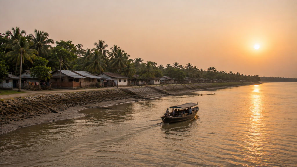
Generation after generation has remained here despite cyclones, salinity, erosion, isolation, and uncertainty. The island survives because its people learned to adapt to movement rather than resist it entirely.
The rivers change.
- The embankments fail and are rebuilt.
- Young residents leave and sometimes return.
- Mangroves advance and retreat with the tide.
And still, life continues along the edges of water.
As darkness settles across the delta, the lights of Rajat Jubilee fade gradually into scattered reflections trembling against the river surface. Soon, even those disappear, absorbed into the vast tidal night of the Sundarbans.
Only the sound of water remains.
And the awareness that somewhere behind the darkness, the island is still there — waiting for another dawn beside the rivers that shaped it.