 Encyclopedia
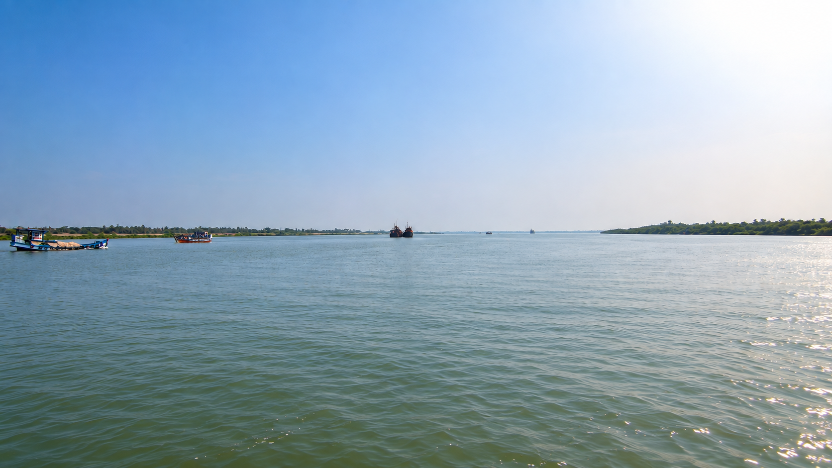
Deep inside the protected forests of the Indian Sundarbans lies Panchamukhani, literally meaning “the place of five mouths” or “five-way confluence.” Unlike a conventional river junction where two waterways merge, Panchamukhani represents a broad tidal meeting point where multiple estuarine channels converge before continuing southward toward the Bay of Bengal. It is one of the most recognizable hydrological landmarks within the Sundarban Tiger Reserve and is widely known among forest guides, researchers, wildlife photographers, and experienced boat operators for its powerful tidal currents, expansive water vistas, and frequent wildlife sightings.
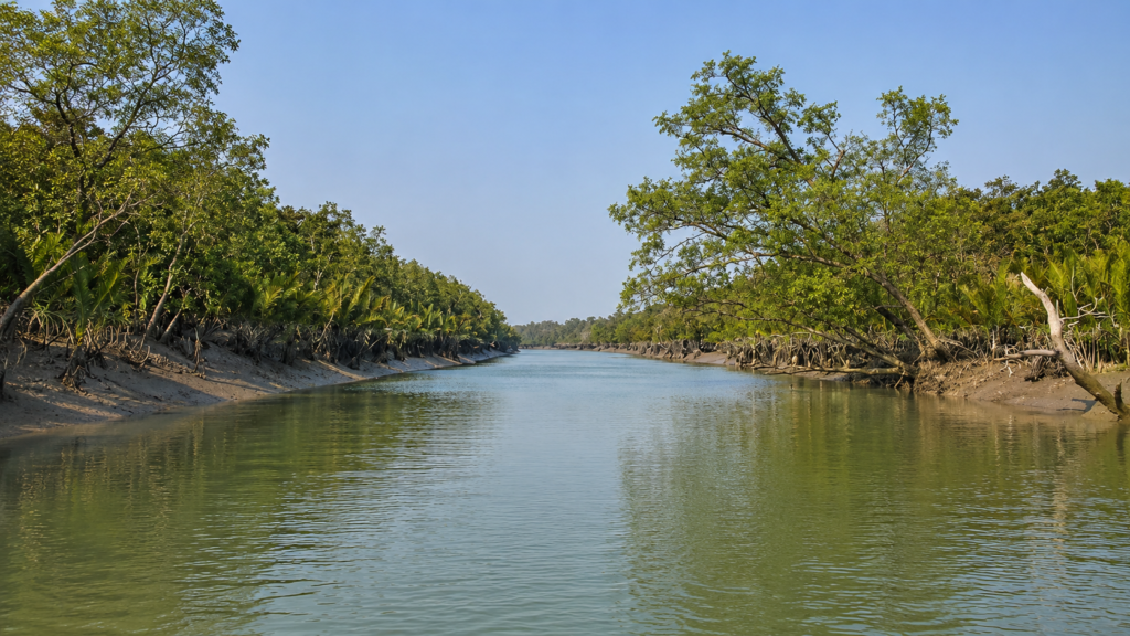
Panchamukhani is not merely a scenic location. It is a living demonstration of how the world’s largest mangrove delta functions.
- Every incoming tide redistributes sediment, nutrients, organic matter, and aquatic organisms through this natural crossroads.
- Every outgoing tide reverses the direction of flow, illustrating that rivers in the Sundarbans are governed as much by the sea as by freshwater arriving from upstream.
For wildlife, Panchamukhani forms an ecological intersection. Fish schools move through its channels with changing tides, attracting predators such as river dolphins, estuarine crocodiles, piscivorous birds, and occasionally the Royal Bengal Tiger (Panthera tigris tigris) along nearby mudbanks. The surrounding mangrove forests provide breeding habitat, feeding grounds, and shelter for countless organisms that depend upon tidal exchange for survival.
Although Panchamukhani is included in many wildlife boat routes, its scientific importance extends far beyond tourism. It offers a remarkable opportunity to observe estuarine hydrology, sediment transport, mangrove ecology, and the interconnectedness that defines the Indian Sundarbans.
Panchamukhani at a Glance
Meaning: “Five mouths” or five-river confluence
Location: Core protected region of the Indian Sundarbans within the Sundarbans Tiger Reserve
Landscape: Broad tidal estuarine junction surrounded by mangrove forest
Ecosystem: Intertidal mangrove delta
Water Type: Brackish estuarine water with continuously changing salinity
Governing Process: Semi-diurnal tides from the Bay of Bengal
Known For: Five-river confluence, dolphin sightings, expansive river landscape, and powerful tidal dynamics
Ecological Role: Movement corridor for fish, aquatic mammals, reptiles, and migratory waterbirds
Accessibility: Accessible only by authorised forest-approved boats operating within the Sundarban Tiger Reserve. Independent access is not permitted, and travel depends on forest permissions, tidal conditions, and designated navigation routes.
How to Reach Panchamukhani
Reaching Panchamukhani requires travelling through the river network of the Sundarban Tiger Reserve, as there is no road access to the confluence itself. Like all destinations inside the reserve’s core protected zone, Panchamukhani can only be visited by registered boats operating under the regulations of the West Bengal Forest Department.
From Kolkata to Panchamukhani
Most visitors begin their journey from Kolkata, the nearest major city with international and domestic air, rail, and road connections.
By Air
The nearest airport is Netaji Subhas Chandra Bose International Airport. From the airport, travellers continue by road to one of the authorised embarkation points for the Sundarbans, most commonly Godkhali, though Dhamakhali, Sonakhali, and Jharkhali are also used depending on the operator and itinerary.
By Train
The most convenient railway route is from Sealdah Station in Kolkata to Canning Railway Station, with frequent EMU local trains operating throughout the day. From Canning, visitors typically travel by shared vehicle, auto-rickshaw, or pre-arranged transport to Godkhali Jetty, the principal boarding point for many Sundarbans expeditions.
By Road
Private cars, taxis, and buses connect Kolkata with several official embarkation points, including:
- Godkhali–the most common departure point for tours entering the Sundarbans Tiger Reserve.
- Dhamakhali–an alternative northern entry point.
- Sonakhali–another recognised access route used by tour operators.
- Jharkhali–often used for itineraries exploring the western side of the Sundarbans.
Government and private buses regularly operate from Esplanade, Sealdah, Babughat, and other major transport hubs in Kolkata to these boarding locations.
By Boat to Panchamukhani
From the embarkation point, the journey continues entirely by water through the reserve’s intricate network of tidal rivers and creeks. Registered boats carrying authorised ecotourism guides navigate towards protected forest areas such as Sajnekhali, Sudhanyakhali, Dobanki, and Netidhopani, with Panchamukhani included on longer wildlife-cruise routes that venture deeper into the reserve. Travel time varies according to the chosen route, tidal conditions, and the expedition itinerary.
Entry and Access Regulations
- Independent boat entry into the Sundarbans Tiger Reserve is not permitted.
- Visitors must travel on registered boats operating with Forest Department authorisation.
- Ecotourism guides are mandatory on boats entering the reserve.
- The confluence is viewed from the boat, as landing is not permitted within the protected core area.
- Navigation schedules are planned around semi-diurnal tides, making departure and arrival times dependent on water levels and current conditions.
Why Panchamukhani Matters
Many locations in the Sundarbans are celebrated for watchtowers or historical ruins. Panchamukhani is different because its defining feature is a natural process rather than a built structure.
Here, geography itself becomes the attraction.
The meeting of several tidal channels concentrates water movement into a broad confluence where the dynamics of the delta become unusually visible. Floating vegetation rotates in slow eddies, sediment plumes form temporary patterns, and changing tidal currents constantly reshape the river surface. Rather than presenting a fixed landscape, Panchamukhani reveals an ecosystem in perpetual motion.
From an ecological perspective, such junctions are important because they connect multiple habitats. Organisms moving through one river system can disperse into several others, increasing biological connectivity across the mangrove landscape. Nutrients, suspended sediments, plankton, fish larvae, and organic debris are redistributed by each tidal cycle, helping sustain productivity throughout the surrounding estuary.
For scientists, Panchamukhani represents a natural laboratory for understanding estuarine circulation, tidal hydrodynamics, and mangrove ecosystem processes. For wildlife observers, it offers one of the best opportunities to appreciate how the physical environment shapes animal behaviour.
Geographic Setting
Panchamukhani lies within the protected forests of the Indian Sundarbans, a vast tidal mangrove landscape occupying the lower reaches of the Ganges–Brahmaputra–Meghna Delta. This delta, shared between India and Bangladesh, is recognised as the largest contiguous mangrove ecosystem on Earth and has been designated a UNESCO World Heritage Site for its exceptional ecological significance.
Unlike inland rivers, waterways in the Sundarbans cannot be understood simply by following downstream flow. The influence of the Bay of Bengal extends deep into the delta through powerful tides that reverse current directions approximately every six hours. Consequently, channels such as those meeting at Panchamukhani experience alternating phases of inflow and outflow, producing a highly dynamic estuarine environment.
The surrounding landscape consists almost entirely of protected mangrove forest. There are no permanent human settlements at the confluence itself, and access is restricted to authorised boats operating under regulations of the Sundarban Tiger Reserve.
The exact hydrological composition of the five converging channels is described inconsistently across public sources. Popular tourism literature often lists different river names, while official management documents consistently recognise Panchamukhani as a protected compartment and field location within the reserve but do not provide a definitive public list of the five waterways. For this reason, it is more accurate to describe Panchamukhani as a five-channel tidal confluence rather than assigning an unverified list of river names.
Landscape Character
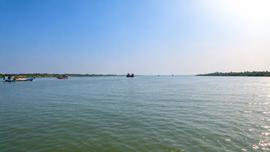
Seen from a boat, Panchamukhani feels markedly different from the narrower creeks that define much of the Sundarbans.
The horizon suddenly opens.
Instead of enclosed waterways bordered closely by mangroves, visitors encounter an expansive junction where broad channels spread in multiple directions. During calm weather, the water reflects the changing sky, while windy conditions can produce surprisingly large standing waves as tidal currents interact.
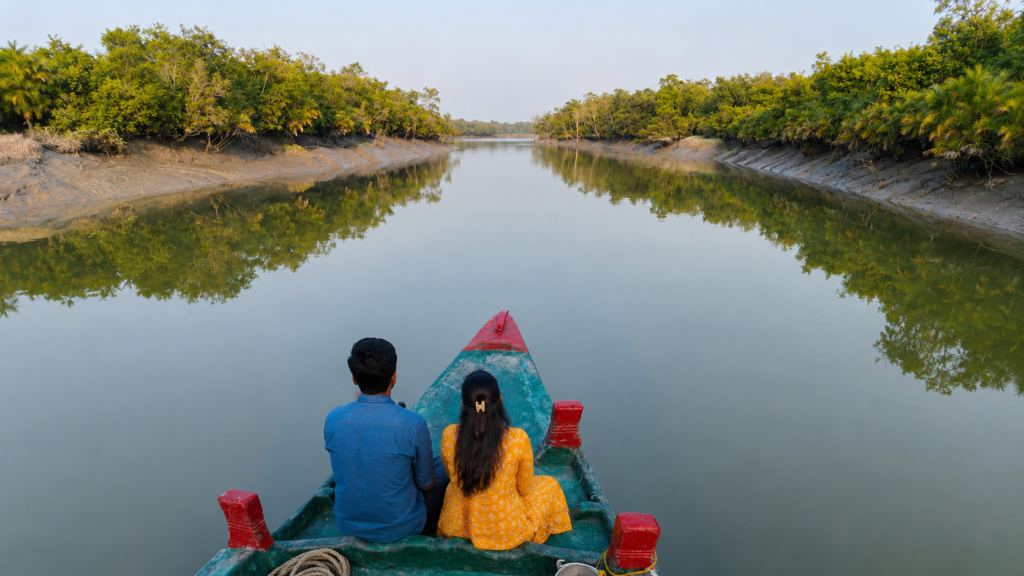
The surrounding forests remain relatively low in elevation. Dense stands of mangroves occupy the banks, their aerial roots anchoring unstable sediments against constant erosion. The muddy shoreline changes subtly with each tide, alternately exposing and submerging broad intertidal flats.
Light also behaves differently here. With fewer obstructions, sunrise and sunset illuminate the river surface across a wide panorama, producing dramatic contrasts between the reflective water and the dark green mangrove canopy.
Understanding the Five-River Confluence
The name Panchamukhani derives from the Sanskrit words pancha (five) and mukha (mouth or opening), referring to the meeting of five tidal channels.
It is important, however, to distinguish this from the classical concept of a river confluence in mountainous regions.
In Himalayan river systems, rivers usually unite into a single downstream channel. In the Sundarbans, channels frequently divide, reconnect, widen, narrow, and exchange water under tidal influence. Panchamukhani therefore functions as an estuarine hydrological node rather than a simple upstream-to-downstream confluence.
Every tidal cycle produces two opposing phases:
- During flood tide, seawater moves inland through multiple distributaries.
- During ebb tide, freshwater mixed with saline water flows seaward again.
Because these movements occur simultaneously across interconnected channels, water circulation becomes remarkably complex. Sediments remain suspended for long periods, salinity fluctuates seasonally, and nutrients are continuously redistributed throughout the surrounding mangrove ecosystem.
The result is one of the most dynamic aquatic environments anywhere in the Indian Sundarbans.
The Power of Tides
Unlike most river landscapes, the defining force at Panchamukhani is not rainfall alone.
The Bay of Bengal exerts a profound influence on every aspect of the local environment. The Sundarbans experience semi-diurnal tides, meaning two high tides and two low tides typically occur each lunar day. These tidal oscillations drive water deep into the mangrove forest before carrying it back toward the sea, transporting sediment, organic matter, plankton, fish larvae, and dissolved nutrients with each cycle.
At Panchamukhani, where several channels interact simultaneously, these forces become particularly visible. Boat operators often adjust navigation according to tidal timing because current strength, wave formation, and water depth can change significantly within a few hours.
This rhythmic exchange is fundamental to the survival of the surrounding mangrove ecosystem. Without regular tidal inundation, the transport of nutrients, sediment deposition, and maintenance of brackish-water habitats would be severely disrupted.
Looking Ahead
The geography of Panchamukhani provides the physical foundation upon which every ecological process in this part of the Sundarbans depends. The tides that shape its channels also determine the distribution of mangroves, influence fish migrations, create feeding opportunities for birds, and sustain predators ranging from crocodiles to dolphins and tigers.
The Mangrove Ecosystem
Panchamukhani lies within one of the world’s largest continuous mangrove forests, where vegetation has evolved to survive conditions that would be hostile to most terrestrial plants. Saltwater inundation, oxygen-poor soils, unstable sediments, and twice-daily flooding create an environment requiring remarkable biological adaptations.
Mangrove species growing around Panchamukhani are not randomly distributed. Each occupies a specific ecological niche influenced by salinity, tidal duration, soil composition, and elevation.
Dominant species found within the surrounding forests include:
- Sundari (Heritiera fomes)
- Gewa (Excoecaria agallocha)
- Goran (Ceriops decandra)
- Keora (Sonneratia apetala)
- Avicennia species (Avicennia marina, A. alba, A. officinalis)
- Dhundul (Xylocarpus granatum)
- Passur (Xylocarpus mekongensis)
- Kankra (Bruguiera gymnorhiza)
- Hental (Phoenix paludosa)
Together, these species create multiple vegetation layers that stabilise shorelines, trap sediment, reduce erosion, and provide habitat for thousands of organisms.
Living Between Land and Sea
Panchamukhani represents a classic ecotone—a transition zone where freshwater, seawater, terrestrial forest, and open estuary interact.
Such environments are naturally among the most productive ecosystems on Earth.
Leaves falling from mangrove trees do not simply decompose on the forest floor. Instead, tides transport organic material into creeks where bacteria, fungi, worms, molluscs and crustaceans gradually break it down into nutrient-rich detritus.
This detritus forms the foundation of an enormous food web.
Rather than relying solely on photosynthesis, much of the Sundarbans ecosystem depends upon this continuous recycling of organic matter.
Adaptations of Mangroves
Survival in the Sundarbans demands extraordinary adaptations. Around Panchamukhani, mangroves employ several specialised strategies:
Pneumatophores
Many species produce vertical aerial roots that protrude above the mud, allowing oxygen to reach underground tissues submerged in oxygen-deficient sediment.
Salt Management
Different species deal with salinity differently.
- Some exclude salt at their roots.
- Others excrete excess salt through specialised leaf glands.
- Certain species accumulate salt in older leaves before shedding them.
Vivipary
Unlike most trees, many mangroves begin germinating while seeds remain attached to the parent tree.
The elongated propagules eventually fall into tidal water, drifting until suitable mudbanks allow them to establish new forests.
Flexible Root Systems
Prop roots, buttress roots, and stilt roots anchor trees against erosion while trapping suspended sediment transported through Panchamukhani’s tidal currents.
The Tidal Food Web
Every tide delivers food.
- Microscopic phytoplankton bloom within nutrient-rich waters.
- Zooplankton consume phytoplankton.
- Small fish feed upon plankton.
- Larger fish prey upon smaller species.
Birds, crocodiles, dolphins, otters, and occasionally tigers exploit these concentrated food resources.
The energy supporting apex predators ultimately begins with sunlight captured by mangroves and microscopic algae.
Panchamukhani therefore functions not merely as a meeting of rivers but as an engine of biological productivity.
Fish Diversity
Although visibility beneath the water remains extremely limited due to suspended sediments, Panchamukhani supports a remarkable diversity of estuarine fishes.
Common groups include:
- Mullets
- Catfish
- Gobies
- Barramundi
- Threadfins
- Croakers
- Glass perchlets
- Anchovies
- Halfbeaks
- Eels
- Pufferfish
Many species use tidal currents for migration between nursery habitats and feeding grounds.
Juvenile fish often shelter among submerged mangrove roots where predators find hunting more difficult.
Because Panchamukhani connects several major waterways, fish movement through this confluence contributes significantly to ecological connectivity across the surrounding estuary.
Crustaceans: Engineers of the Mud
The muddy banks around Panchamukhani support astonishing densities of crustaceans.
Among the most conspicuous are:
- Fiddler crabs
- Mud crabs
- Sesarmid crabs
- Swimming crabs
- Prawns
- Shrimps
These animals perform essential ecological functions.
- Their burrowing aerates compact sediment.
- Their feeding recycles organic material.
- Their movement redistributes nutrients.
They also provide food for fish, birds, reptiles and mammals.
Without these seemingly insignificant creatures, much of the Sundarbans’ productivity would collapse.
Molluscs and Hidden Filter Feeders
Mudflats surrounding Panchamukhani also contain numerous molluscs, including oysters, clams, gastropods and snails.
Many function as natural filters.
By feeding on suspended particles, they improve water quality while recycling nutrients back into the ecosystem.
Certain snail species graze algae growing upon mangrove roots, helping regulate microbial communities that develop on submerged surfaces.
Birds of Panchamukhani
See it for yourself
A private journey shaped around you — your group, your pace, your interests. Book a free consultation.
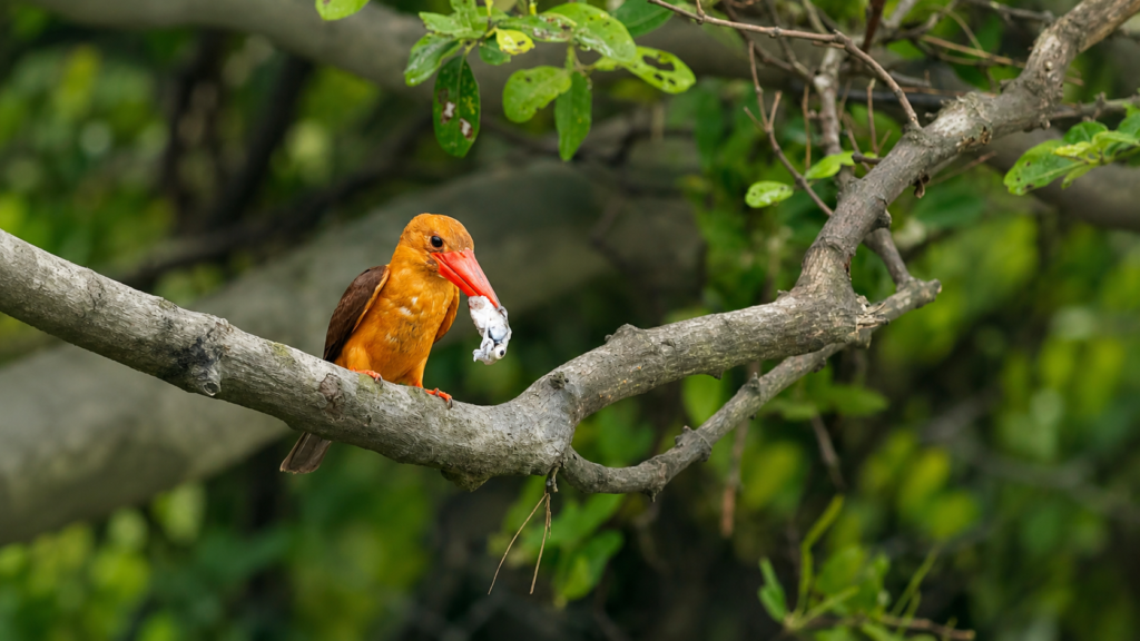
The open waters and adjoining forests create diverse habitats supporting resident and migratory birds.
Species frequently associated with this landscape include:
- White-bellied Sea Eagle
- Brahminy Kite
- Lesser Adjutant
- Grey Heron
- Purple Heron
- Great Egret
- Intermediate Egret
- Little Egret
- Black-capped Kingfisher
- Brown-winged Kingfisher
- Collared Kingfisher
- Stork-billed Kingfisher
- Pied Kingfisher
- Whimbrel
- Common Sandpiper
- Curlew Sandpiper
- Asian Openbill
The changing tide determines feeding opportunities.
- Low tide exposes mudflats rich in invertebrates.
- High tide concentrates fish into deeper channels.
Consequently, bird activity changes dramatically throughout the day.
Reptiles of the Confluence
The tidal waterways surrounding Panchamukhani support several important reptile species.
Most notable is the Saltwater Crocodile (Crocodylus porosus), the world’s largest living reptile.
Individuals frequently utilise deeper estuarine channels where fish are abundant and broad mudbanks provide basking opportunities during suitable tidal conditions.
Other reptiles inhabiting surrounding forests include:
- Water Monitor
- King Cobra
- Indian Rock Python
- Various sea snakes
- Freshwater and estuarine turtles
Most remain elusive due to dense vegetation and muddy waters.
Mammals
Among mammals, Panchamukhani forms part of the home range of numerous iconic species.
These include:
Royal Bengal Tiger (Panthera tigris tigris)
The surrounding mangrove forests support one of the world’s only tiger populations adapted to tidal mangrove ecosystems.
Although tiger sightings remain rare, individuals regularly cross tidal creeks by swimming between islands.
Fishing Cat (Prionailurus viverrinus)
This elusive predator specialises in hunting fish and crustaceans within tidal wetlands.
Smooth-coated Otter (Lutrogale perspicillata)
Family groups occasionally forage through tidal channels searching for fish.
Wild Boar
Often observed foraging along muddy margins during low tide.
Spotted Deer (Axis axis)
Common prey for tigers, frequently feeding on vegetation within nearby forest compartments.
Dolphins of Panchamukhani
One of Panchamukhani’s most celebrated wildlife experiences is the possibility of observing river dolphins.
The deeper tidal channels may be used by:
- Ganges River Dolphin (Platanista gangetica)
- Irrawaddy Dolphin (Orcaella brevirostris)
Their occurrence varies according to tidal conditions, prey availability and seasonal movements. Publicly available scientific evidence indicates dolphin use of suitable estuarine habitats within the Indian Sundarbans, although predicting sightings at Panchamukhani on any given day is impossible.
Observers typically notice only a brief surfacing before the animals disappear beneath the sediment-rich water.
Ecological Connectivity
Perhaps the greatest ecological importance of Panchamukhani lies in connectivity.
The five-channel junction enables:
- movement of fish populations
- dispersal of mangrove propagules
- exchange of nutrients
- seasonal redistribution of plankton
- movement of dolphins
- migration of estuarine birds
- transport of sediments
- maintenance of salinity gradients
Rather than functioning as isolated rivers, the waterways operate as one interconnected estuarine network.
Disrupting one component would influence ecological processes far beyond Panchamukhani itself.
Seasonal Ecological Changes
The appearance of Panchamukhani changes throughout the year.
Winter
Cooler temperatures attract numerous migratory waterbirds.
Visibility often improves during calm mornings.
Pre-Monsoon
Increasing temperatures elevate evaporation, influencing salinity patterns.
Southwest Monsoon
Heavy rainfall introduces greater freshwater input, temporarily reducing salinity while increasing sediment transport.
Post-Monsoon
Fresh nutrients stimulate productivity, supporting fish populations and the predators that depend upon them.
Every season reshapes ecological interactions without altering the underlying rhythm imposed by the tides.
The Geological Story of Panchamukhani
Long before the Sundarbans became a tiger reserve or a UNESCO-recognised landscape, the region was being shaped by immense geological forces.
The Ganges, Brahmaputra, and Meghna river systems have transported enormous quantities of sediment from the Himalayas for thousands of years. These sediments settled gradually across the northern Bay of Bengal, creating an immense delta characterised by branching distributaries, tidal estuaries, mudflats, and mangrove forests.
Panchamukhani is a product of this continuing geological evolution.
Its channels were not carved into rock but formed through the constant interaction of river discharge, tidal currents, sediment deposition, and erosion. Even today, the exact shape of its banks changes gradually as tides redistribute fine alluvial sediments.
Unlike mountain rivers that often follow relatively stable valleys, estuarine channels in the Sundarbans migrate over time. Some widen, others narrow, while entirely new channels may develop as older ones become partially silted.
Panchamukhani therefore represents an evolving landscape rather than a permanent geographical feature frozen in time.
Human Understanding of the Delta
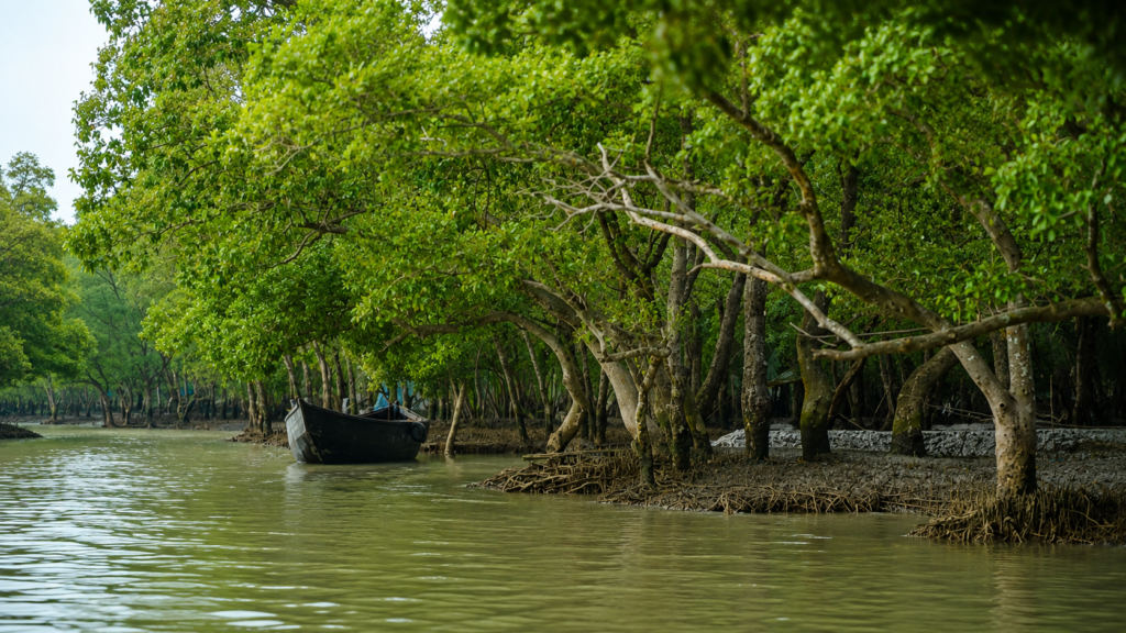
For centuries, people living around the northern fringes of the Sundarbans have understood that waterways such as Panchamukhani cannot be treated like ordinary rivers.
Traditional fishermen, honey collectors (Mouals), wood collectors, and boatmen learned to navigate according to tides rather than fixed currents.
Knowledge passed through generations included:
- timing departures according to tidal cycles
- recognising dangerous eddies
- reading changing water colour
- interpreting bird behaviour
- identifying submerged mudbanks
- understanding seasonal salinity changes
Long before satellite navigation became available, these observations formed the practical science of surviving within the tidal delta.
Although Panchamukhani lies within today’s protected core forest, its surrounding waterways have long been part of the broader navigational network used by experienced forest-dependent communities.
Panchamukhani and Traditional Navigation
The Sundarbans have always been a landscape where rivers function as roads.
Before modern transportation, waterways connected nearly every inhabited island, fishing ground, forest compartment, and trading settlement throughout the delta.
Broad confluences such as Panchamukhani naturally became important reference points.
Boatmen recognised these locations because they offered:
- multiple route choices
- wider turning areas
- changing tidal conditions
- access to different forest sectors
Unlike landmarks built by people, these natural junctions became embedded within the navigational vocabulary of the Sundarbans.
Today, Panchamukhani continues to serve as a recognised waypoint for authorised forest patrols, research vessels, and regulated wildlife tourism boats operating within the Sundarbans Tiger Reserve.
Forest Administration and Protected Area Management
The twentieth century marked a significant change in the relationship between people and the Sundarbans.
As scientific understanding of mangrove ecosystems increased and wildlife populations faced growing pressure, much of the Indian Sundarbans came under formal protection.
Panchamukhani now lies within a network of internationally recognised protected landscapes that include:
- Sundarban Tiger Reserve
- Sundarban National Park
- Sundarban Biosphere Reserve
- UNESCO World Heritage Site
This layered system of protection reflects the area’s global ecological importance rather than its scenic value alone.
Forest officers regularly patrol these waterways to monitor wildlife, prevent illegal activities, and support scientific research. Boat movement within the core protected area is regulated through permits and designated routes to minimise disturbance to wildlife.
Scientific Importance
Although visitors often admire Panchamukhani for its sweeping river views, scientists value it for very different reasons.
The confluence provides opportunities to study:
- estuarine hydrology
- sediment transport
- tidal circulation
- salinity gradients
- mangrove succession
- aquatic biodiversity
- fish migration
- dolphin habitat use
- shoreline erosion
- climate change impacts
Because multiple channels converge here, Panchamukhani offers insight into ecological processes operating across much larger portions of the Sundarbans.
Researchers studying water quality, nutrient cycling, and estuarine productivity often view such confluences as key indicators of ecosystem health.
Panchamukhani Within the Tiger Landscape
Although the open waters dominate the landscape, Panchamukhani should not be considered separate from the surrounding tiger habitat.
The adjoining mangrove forests form part of the home range of the Royal Bengal Tiger.
Unlike tigers inhabiting grasslands or tropical forests elsewhere in Asia, Sundarbans tigers have evolved to survive within a tidal mangrove ecosystem.
Their behaviour reflects this unique environment.
They frequently:
- swim between islands
- cross tidal creeks
- navigate muddy shorelines
- hunt along estuarine margins
- utilise mangrove cover for concealment
The waterways surrounding Panchamukhani therefore act not as barriers but as integral components of the tiger’s landscape.
Climate Change and a Changing Delta
No discussion of Panchamukhani is complete without considering climate change. The Sundarbans rank among the world’s most climate-sensitive coastal ecosystems.
Several long-term processes influence its future:
Rising Sea Levels
Gradual sea-level rise alters tidal inundation patterns, increases shoreline erosion, and changes salinity across mangrove habitats.
Increased Cyclone Intensity
Recent decades have witnessed several severe cyclones affecting the region.
High storm surges damage mangrove forests, reshape riverbanks, and deposit large volumes of sediment.
Changing Rainfall
Variations in monsoon intensity influence freshwater availability, affecting estuarine salinity and ecological productivity.
Sediment Dynamics
Climate-driven changes in river discharge may alter the balance between erosion and deposition, influencing channel stability around Panchamukhani.
These processes operate simultaneously, making long-term ecological monitoring increasingly important.
Cyclones and Natural Disturbance
Cyclones are not new to the Sundarbans.
They have influenced this delta for thousands of years.
What concerns scientists today is the possibility that climate change may increase the intensity of some storms while rising sea levels amplify storm surge impacts.
For Panchamukhani, cyclones may cause:
- temporary changes in channel depth
- uprooting of mangrove trees
- erosion of mudbanks
- redistribution of sediments
- altered salinity
- habitat modification
Despite these disturbances, mangrove ecosystems possess remarkable resilience.
Natural regeneration often begins surprisingly quickly, provided that hydrological conditions remain suitable.
Human Pressures Beyond the Core Forest
Panchamukhani itself experiences relatively limited direct human disturbance because it lies within a protected area.
However, the wider Sundarbans continues to face pressures including:
- illegal fishing in restricted zones
- unsustainable resource extraction
- plastic pollution
- vessel traffic
- upstream alterations to freshwater flow
- climate-driven environmental change
Many of these pressures originate far beyond the boundaries of the protected forest, illustrating how interconnected the delta has become.
Effective conservation therefore depends upon both local management and broader regional environmental policies.
Conservation Initiatives
Conservation within the Sundarbans increasingly combines scientific research, law enforcement, habitat management, and community participation.
Key priorities include:
- protecting tiger habitat
- conserving mangrove forests
- monitoring dolphin populations
- maintaining water quality
- preventing illegal exploitation
- strengthening climate resilience
- promoting responsible ecotourism
- supporting local livelihoods compatible with conservation
The success of these efforts depends not only upon government agencies but also upon researchers, conservation organisations, local communities, and responsible visitors.
Why Panchamukhani Matters to Conservation Science
Large river confluences often receive less public attention than charismatic wildlife species.
Yet Panchamukhani illustrates why protecting ecological processes is just as important as protecting individual animals.
The confluence sustains:
- nutrient transport
- fish recruitment
- mangrove regeneration
- sediment redistribution
- aquatic food webs
- habitat connectivity
If these processes become disrupted, the consequences extend far beyond a single location.
Protecting Panchamukhani therefore means protecting one of the hydrological engines that helps sustain the broader Sundarbans ecosystem.
Visiting Panchamukhani
Unlike conventional tourist destinations, Panchamukhani is not a place that can be explored independently. It lies within the protected core area of the Sundarbans Tiger Reserve, where access is governed by strict conservation regulations enforced by the West Bengal Forest Department.
Visitors experience Panchamukhani exclusively as part of authorised wildlife expeditions or forest-approved boat safaris. The emphasis is not on reaching a destination but on observing a living estuarine ecosystem with minimal disturbance.
The journey itself forms an integral part of the experience. Boats navigate through narrow tidal creeks before emerging into the expansive waters of the confluence, revealing the remarkable scale of the mangrove landscape.
Best Time to Visit
Panchamukhani offers a different ecological experience in every season.
Winter (November–February)
Often considered the most comfortable season for exploration.
Characteristics include:
- pleasant temperatures
- improved visibility
- active birdlife
- migratory waterbirds
- calmer navigation on many days
Spring (March–April)
The forest gradually becomes warmer.
Visitors may observe:
- flowering mangrove species
- increased reptile activity
- changing tidal colours
- active fishing birds
Pre-Monsoon (May–June)
Higher temperatures create dramatic atmospheric conditions.
Afternoon thunderstorms become more frequent, while humidity increases significantly.
Southwest Monsoon (June–September)
Heavy rainfall transforms the delta.
- Water levels rise.
- Freshwater input increases.
- Sediment transport intensifies.
- Boat operations may be influenced by weather and forest advisories.
Post-Monsoon (October)
The forest appears freshly renewed.
Mangroves recover from seasonal flooding, while improved weather gradually supports wildlife observation once again.
Wildlife Watching
Panchamukhani rewards patience rather than expectation.
Wildlife encounters are unpredictable because animals remain entirely free-ranging.
Possible observations include:
Mammals
- Royal Bengal Tiger
- Fishing Cat
- Smooth-coated Otter
- Spotted Deer
- Wild Boar
Reptiles
- Saltwater Crocodile
- Water Monitor
- Various snakes
- Freshwater turtles
Birds
Depending upon the season:
- Brahminy Kite
- White-bellied Sea Eagle
- Lesser Adjutant
- Black-capped Kingfisher
- Brown-winged Kingfisher
- Stork-billed Kingfisher
- Great Egret
- Purple Heron
- Grey Heron
- Asian Openbill
- Sandpipers
- Whimbrels
Aquatic Wildlife
Occasional sightings may include:
- Ganges River Dolphin
- Irrawaddy Dolphin
- Numerous estuarine fishes
- Mudskippers
- Fiddler Crabs
Wildlife sightings should always be regarded as privileges rather than guarantees.
Photography Opportunities
Panchamukhani offers some of the most expansive photographic compositions within the Indian Sundarbans.
Ideal subjects include:
- panoramic river landscapes
- mangrove shorelines
- dramatic cloud formations
- tidal reflections
- birds in flight
- crocodiles basking on mudbanks
- dolphins (with patience)
- changing light during sunrise and sunset
Because animals remain wild, ethical wildlife photography requires maintaining appropriate distance and avoiding disturbance.
Responsible Exploration
Every visitor shares responsibility for protecting Panchamukhani.
Good field practices include:
- Maintain silence near wildlife.
- Never request the boat crew to approach animals too closely.
- Avoid littering entirely.
- Do not feed wildlife.
- Respect forest regulations.
- Remain inside authorised vessels.
- Wear life jackets where instructed.
- Follow guidance provided by forest personnel.
- Appreciate the ecosystem without attempting to alter it.
Responsible tourism contributes directly to long-term conservation.
Why Panchamukhani Is Ecologically Unique
Several characteristics distinguish Panchamukhani within the Sundarbans.
It represents:
- a major tidal confluence rather than a simple river junction
- continuous interaction between multiple estuarine channels
- one of the best locations for observing tidal hydrology
- an important corridor for aquatic biodiversity
- a key landscape within the tiger reserve
- a demonstration of how geomorphology, tides, and mangroves function together
Its importance lies not in a single species but in the ecological relationships connecting the entire estuary.
The Wild Orbit’s Interesting Facts About Panchamukhani
- The name “Panchamukhani” literally translates as “five mouths,” referring to a five-channel confluence.
- Water currents here reverse direction with the tides rather than flowing continuously in one direction.
- The surrounding forests belong to the world’s largest continuous mangrove ecosystem.
- Suspended sediments give the water its characteristic brown appearance.
- Mangrove roots stabilise banks that are constantly reshaped by tidal action.
- Fish, crustaceans, dolphins, birds, crocodiles, and tigers all depend indirectly upon the productivity generated by these tidal waters.
- The confluence changes subtly every year through natural erosion and sediment deposition.
- Panchamukhani forms part of an internationally recognised protected landscape encompassing the Sundarban National Park, Tiger Reserve, Biosphere Reserve, and UNESCO World Heritage Site.
FAQs
What does Panchamukhani mean?
The name derives from Sanskrit, meaning “five mouths” or “five-way confluence,” referring to the meeting of five tidal channels.
Where is Panchamukhani located?
It lies within the protected forests of the Indian Sundarbans inside the Sundarbans Tiger Reserve.
Can tourists visit Panchamukhani independently?
No. Access is only permitted through authorised forest-approved boats operating under the regulations of the West Bengal Forest Department.
Why is Panchamukhani famous?
It is known for its spectacular tidal confluence, expansive river landscape, ecological importance, and opportunities to observe wildlife within the Sundarbans.
Are tiger sightings common?
No. Tigers are present within the surrounding forests, but sightings are rare and cannot be predicted.
Can dolphins be seen here?
Occasionally, yes. Dolphin sightings depend upon tidal conditions, seasonal movements, and chance.
Why is the water brown?
The rivers carry enormous quantities of fine alluvial sediment suspended within the estuarine water.
Is Panchamukhani a river?
No. It is a broad confluence where several tidal channels meet.
Why are tides so important?
The tides transport nutrients, sediments, fish larvae, organic matter, and saline water throughout the mangrove ecosystem, sustaining ecological productivity.
Is Panchamukhani suitable for birdwatching?
Yes. It supports numerous resident and migratory bird species, particularly during winter.
Are crocodiles present?
Yes. Saltwater Crocodiles inhabit suitable waterways within the Sundarbans, including broad estuarine channels.
Why is Panchamukhani important for conservation?
Because it functions as an ecological junction connecting multiple waterways, supporting biodiversity, nutrient exchange, sediment transport, and hydrological processes essential to the wider Sundarbans.
The Story the Rivers Continue to Tell
Few places in the Indian Sundarbans illustrate the living nature of a tidal delta as clearly as Panchamukhani. Here, geography is never fixed, currents never remain constant, and every tide reshapes the relationship between land and water. What appears to be a simple meeting of rivers is, in reality, one of the ecological engines that sustain the world’s largest mangrove forest.
The productivity of its waters nourishes fish, crustaceans, dolphins, crocodiles, birds, and the elusive Royal Bengal Tiger. Mangrove roots stabilise fragile shorelines while filtering sediments carried from distant Himalayan rivers. Every flood tide brings nutrients inland; every ebb tide carries organic matter back towards the sea, linking countless habitats across the delta. These cycles have operated for millennia, creating a landscape defined by movement rather than permanence.
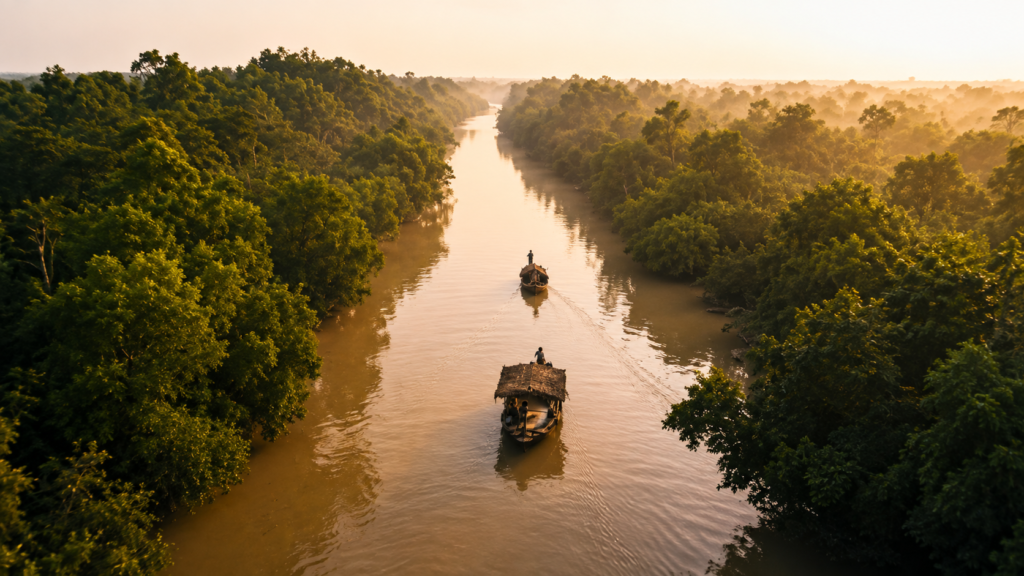
Panchamukhani also reminds us that the Sundarbans is best understood as an interconnected ecosystem. Its importance does not arise from a single landmark or species but from the intricate relationships between tides, rivers, forests, wildlife, and climate. Protecting such places means safeguarding the natural processes that support biodiversity across the entire estuary.
To witness Panchamukhani is to observe the Sundarbans in its purest form—a landscape where science and documentary storytelling converge, where every tide reveals a new perspective, and where the enduring rhythms of nature continue to shape one of the planet’s most extraordinary coastal wildernesses. This aligns with The Wild Orbit’s editorial commitment to evidence-based, documentary-style storytelling that deepens understanding of the Indian Sundarbans.
Plan your private Sundarban expedition
A private journey shaped around you — your group, your pace, your interests. Book a free consultation.