 Encyclopedia
There are places that announce themselves loudly.
Canning is not one of them.
Its story begins not with a monument, a temple, or a dramatic landscape, but with a train.
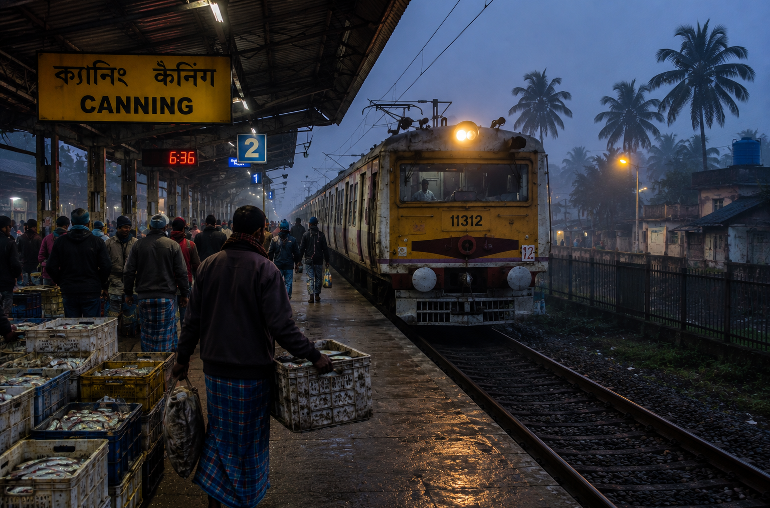
Long before dawn, the platforms at Sealdah begin filling with fishermen carrying empty crates, vegetable traders balancing sacks, commuters clutching steel tiffin boxes, and travelers heading toward a destination that remains invisible to most of the city.
The train leaves Kolkata and heads southeast.
- The city slowly unravels.
- Concrete gives way to ponds.
- Apartment blocks surrender to rice fields.
- The skyline flattens.
- Palm trees begin appearing against the horizon.
- The air changes.
Somewhere beyond the windows, the tide is already moving.
And at the end of the line lies Canning.
Not the Sundarbans.
Not yet.
But the place where Bengal begins negotiating with the Sundarbans.
The place where railway tracks stop, and rivers take over. The place where thousands of journeys into the mangrove wilderness have begun for generations. Even before stepping onto the platform, one senses movement.
Not the movement of a city. A different movement.
- The movement of fish arriving from distant creeks.
- The movement of boats heading toward Gosaba.
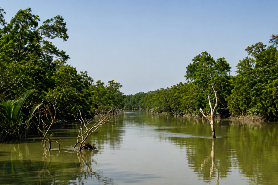
- The movement of tides advancing through the Matla River.
The movement of people living between two worlds—urban Bengal to the north and the tidal frontier to the south.
This is not merely a town.
It is a threshold.
And thresholds possess their own geography.
First Encounter
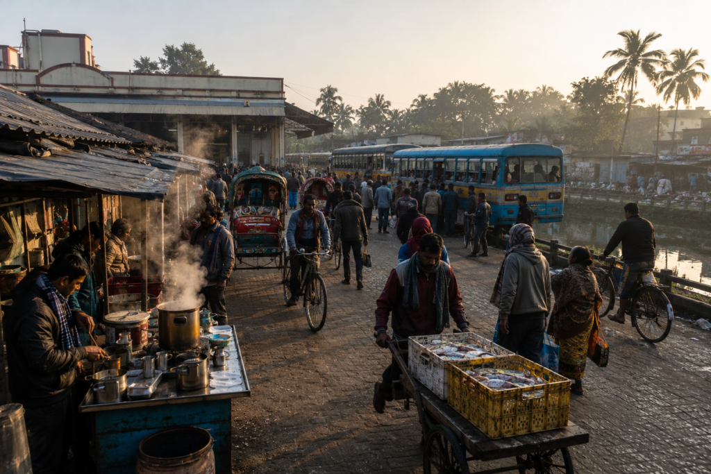
Outside Canning Railway Station, the day is already underway.
- Tea stalls release columns of steam into the humid air.
- Rickshaw bells ring.
- Fish traders move quickly through crowded lanes.
- Buses depart toward villages scattered across the lower delta.
- Motorcycles weave between carts loaded with vegetables.
Everything appears temporary. Everything appears in motion. Following the roads southward, the landscape begins to open.
The town gradually loosens its grip.
- The horizon widens.
- Ponds appear beside houses.
- Canals cut through settlements.
- Date palms and coconut trees punctuate the skyline.
- The smell of mud becomes more noticeable.
Not unpleasant.
Simply present.
A reminder that this is still a delta. The closer one moves toward the Matla River, the more the landscape changes character. The river does not emerge gently.
It appears suddenly.
- Wide.
- Brown.
- Restless.
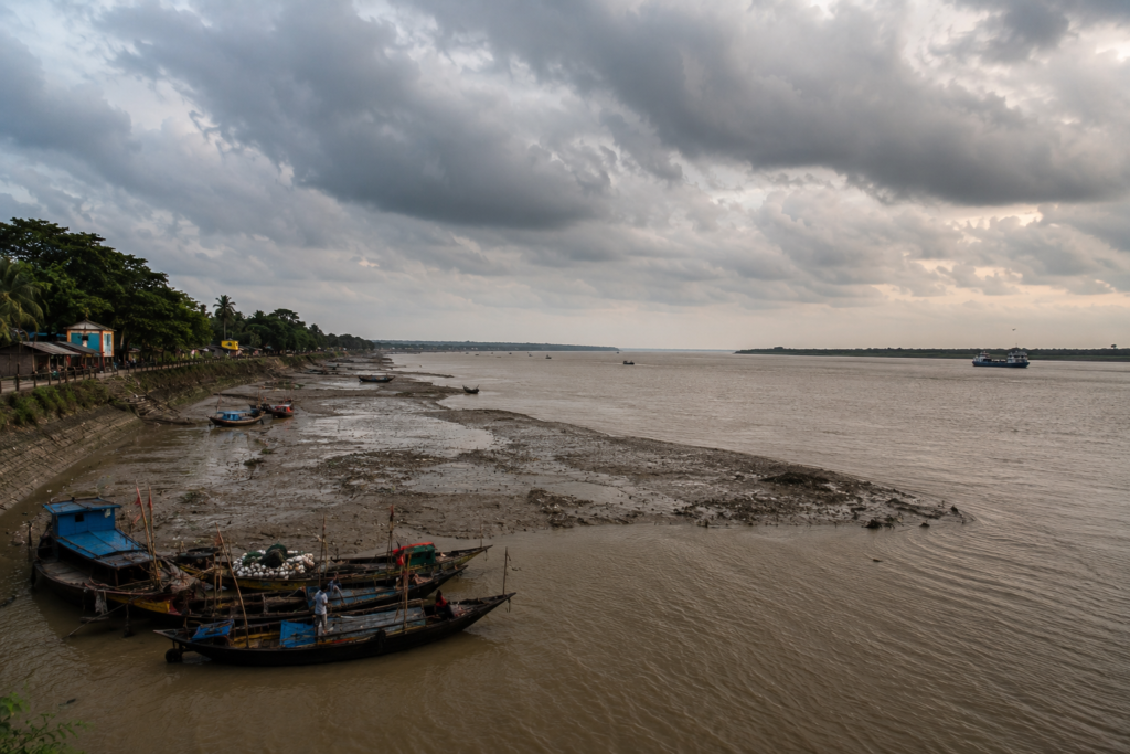
Even on calm days, the Matla seems incapable of stillness.
- Its banks carry scars of erosion.
- Its channels shift with tides.
- Its waters reflect a history of both prosperity and destruction.
Standing along the embankment, one immediately understands why Canning exists where it does. The town was built around a river. And the river continues shaping everything around it.
Canning’s Identity
Strictly speaking, Canning is not an island in the way Gosaba or Patharpratima are islands.
Its identity is more complex.
Administratively, Canning lies within the South 24 Parganas district of West Bengal and serves as one of the most important gateway settlements linking Kolkata with the Sundarbans region.
The area is divided between Canning I and Canning II Community Development Blocks, encompassing numerous villages, Gram Panchayats, wetlands, agricultural landscapes, and riverfront settlements.
Population figures shift with each census and administrative revision, but the broader Canning region supports hundreds of thousands of residents whose lives remain deeply connected to rivers, fisheries, agriculture, trade, transportation, and increasingly, tourism.
Yet statistics reveal little.
To understand Canning, one must observe patterns.
- Morning trains arriving from Kolkata.
- Boats departing from river ghats.
- Fish markets receive catches from distant creeks.
- Students traveling to schools.
- Workers commuting in both directions.
The settlement pattern itself reveals the town’s purpose. Unlike isolated island communities built around a single riverbank, Canning evolved as a connector.
- A hinge between regions.
- A meeting point between transportation systems.
- A place where roads, railways, rivers, and tidal routes intersect.
Its dominant identity remains unmistakable: The River Gateway to the Sundarbans.
The Rivers That Shaped Canning
No story about Canning can begin anywhere except the Matla.
The river arrives before history.
- Before railways.
- Before colonial plans.
- Before markets.
- Before maps.
The Matla River is among the most influential waterways of the Indian Sundarbans.
Broad and tidal, it carries immense volumes of water through the lower delta before dispersing into a labyrinth of channels farther south. Standing beside it during high tide, the river appears almost oceanic. Standing beside it during low tide, vast mudbanks emerge like hidden landscapes temporarily revealed.
Everything about Canning reflects this river.
- Settlement locations.
- Trade routes.
- Livelihoods.
- Transportation systems.
- Even local imagination.
Historically, the Matla offered both opportunity and danger.
- Its navigability encouraged trade.
- Its tidal energy complicated navigation.
- Its shifting banks created uncertainty.
- Its floods periodically transformed the surrounding landscape.
Other waterways also contribute to Canning’s geography.
Canals, distributaries, and smaller tidal channels thread through the region, connecting villages and wetlands to larger river systems.
Many of these channels once served as vital transportation routes before roads became widespread.
Older residents still recall journeys conducted almost entirely by boat. Today, although rail and road dominate, water remains essential.
The river is never merely scenery. It remains infrastructure.
- Ecology.
- Economy.
- Memory.
- Identity.
Historical Footprints
The afternoon sun illuminates old records differently.
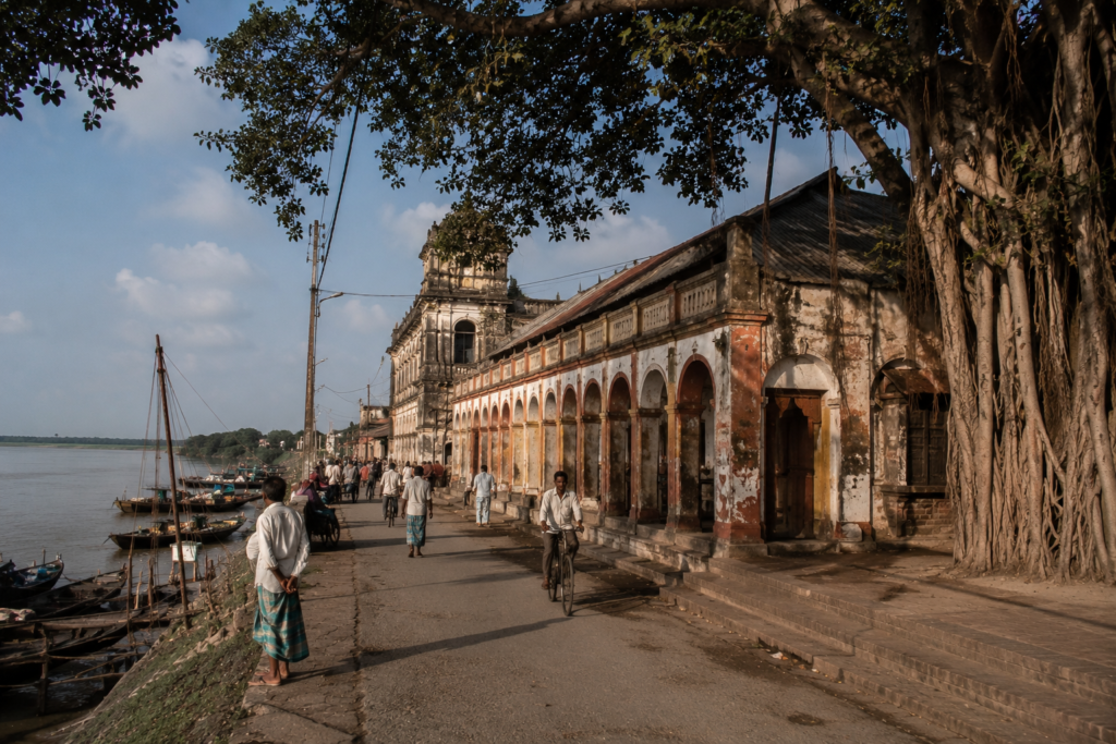
Standing beside the Matla today, it is difficult to imagine that nineteenth-century colonial administrators once believed this location could become one of the most important ports in eastern India.
Yet that ambition shaped Canning’s history.
The town owes much of its existence to British colonial planning.
During the mid-nineteenth century, concerns emerged regarding the future viability of Kolkata’s port facilities. The British sought alternative locations that might accommodate growing maritime trade.
The Matla River attracted attention. Its width impressed engineers. Its proximity to Kolkata appeared advantageous. And so an ambitious project began.
A new port town was planned.
The settlement was named after Lord Canning, the Governor-General and later the first Viceroy of India.
- Infrastructure followed.
- Embankments.
- Administrative buildings.
- Transportation links.
- Commercial facilities.
- Expectations soared.
Nature responded differently. The Matla proved difficult to control.
- Cyclones damaged infrastructure.
- Sedimentation complicated navigation.
- Tidal dynamics challenged engineering assumptions.
- The grand vision gradually faded.
The port never achieved the prominence its planners imagined. Yet failure created something unexpected.
- The infrastructure remained.
- The railway connection survived.
- The settlement endured.
And over time, Canning reinvented itself.
Rather than becoming a rival to Kolkata, it became the principal gateway into the Sundarbans. Sometimes history’s most influential places are not those that fulfilled their original purpose. They are the places that adapted when plans collapsed.
Canning belongs firmly within that category.
Historical Personalities &Transformations
The most influential figure associated with Canning’s origin is undoubtedly Lord Canning himself, though his connection remains largely administrative rather than personal.
More interesting are the local transformations that followed.
Throughout the late nineteenth and early twentieth centuries, waves of settlers expanded agricultural activity across parts of the surrounding delta.
Land reclamation projects altered landscapes.
- New villages emerged.
- Markets developed.
- Transportation networks strengthened.
- Railway expansion connected communities previously dependent on waterways.
- Educational institutions gradually appeared.
- Political movements associated with Bengal’s broader history reached the region.
The freedom movement touched Canning as it touched much of rural Bengal.
The partition in 1947 introduced new demographic changes. Refugees arrived from East Bengal, reshaping social and economic patterns throughout South 24 Parganas. Subsequent decades brought additional transformations.
- Electricity.
- Road networks.
- Mechanized fishing.
- Improved communications.
- Educational expansion.
- Migration toward Kolkata.
Each generation inherited a different Canning. Yet the river remained constant. Or as constant as a tidal river can ever be.
Folklore and Legends
As evening approaches, conversations along the riverfront occasionally drift toward older stories.
Not all belong to documented history.
Many belong to the realm where geography and imagination meet.
Unlike deeper Sundarban settlements where Bonbibi traditions remain closely intertwined with forest-dependent livelihoods, Canning occupies a slightly different cultural position.
Here, folklore often arrives through travelers.
- Fishermen returning from remote creeks.
- Honey collectors moving through markets.
- Boatmen navigating tidal channels.
The town becomes a crossroads for stories.
In tea stalls and riverfront gatherings, one still hears references to Bonbibi, Dakshin Ray, and Shah Jongoli.
These figures travel northward from the mangrove frontier through the people who depend upon it.
For many families, the forest begins not where the mangroves appear, but where stories arrive. Boatmen once spoke of mysterious lights appearing above distant mudflats. Fishermen described channels that seemed familiar by daylight yet disorienting after dark. Older narratives occasionally mention stretches of river considered unlucky during certain tides.
Such stories are difficult to verify.
And perhaps verification misses the point. Folklore often reveals how communities understand uncertainty. The Sundarbans have always contained uncertainty. Canning, positioned at the edge of that world, became a place where those stories accumulated.
A receiving station for the imagination of the delta.
As darkness begins gathering over the Matla, the railway station remains active.
- Trains arrive.
- Trains depart.
- Passengers move in both directions.
- Some are returning home.
Others are heading south toward rivers, islands, mangroves, and forests. And that may be the most revealing thing about Canning. Few people come here seeking an ending. Most come here seeking a beginning.
The journey continues.
Life Between the Tides
Before sunrise, fish traders are already awake.
Long before most of the town stirs, activity begins along the river and in the markets that depend upon it.
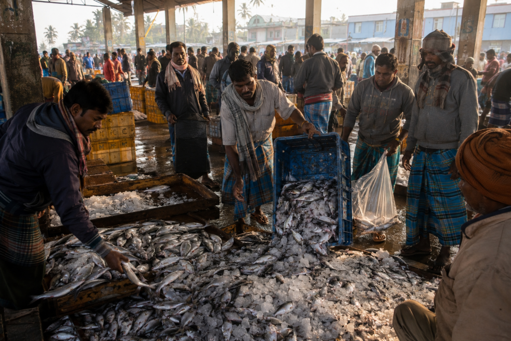
Fish arriving from the lower delta often travel through a chain of waterways before reaching Canning. Some catches originate in creeks that lie many hours south, beyond Gosaba and deeper into the estuarine maze of the Sundarbans.
By dawn, those catches become part of Canning’s daily rhythm. The town’s economy still carries the imprint of the river.
Fishing remains central.
So does agriculture.
In surrounding villages, rice cultivation continues across low-lying fields shaped by seasonal flooding and water availability.
- Ponds support aquaculture.
- Canals provide irrigation.
- Wetlands sustain both biodiversity and livelihoods.
The distinction between land and water is rarely absolute. A field may become a shallow wetland during one season and return to cultivation during another.
A pond may function simultaneously as a fishery, water reserve, and ecological refuge. This fluidity defines the landscape. It also defines the people who inhabit it.
Adaptation is not a special skill here. It is a daily requirement.
The Fishermen’s Geography
Maps rarely capture how fishermen understand the region.
Their geography is built differently. Not through administrative boundaries.
- Through channels.
- Creeks.
- Tidal timings.
- Fishing grounds.
- Safe anchorages.
- Dangerous bends.
The names they use often reveal relationships invisible on official maps. A particular creek may be remembered for its abundant fish. Another for difficult currents. Another for crocodile sightings farther south.
These practical geographies continue connecting Canning to the wider Sundarbans. The town functions as one node within a much larger network of water-dependent communities.
School Days and River Days
By mid-morning, another rhythm emerges.
- Children in uniforms cycle along roads bordered by ponds and fields.
- Schools become temporary centers of activity.
- Education has altered the social landscape profoundly over recent decades.
Many families now balance traditional occupations with aspirations extending far beyond the delta.
Yet environmental realities remain present. A student’s journey to school may still depend upon ferry schedules.
- Flooded roads.
- Weather conditions.
- Or river crossings.
The modern and the traditional coexist continuously. Neither has fully replaced the other.
Walking Through the Villages
Leaving the town center behind reveals a quieter Canning.
- The roads narrow.
- Traffic diminishes.
- The landscape begins speaking more softly.
- Villages emerge gradually.
Not as isolated settlements, but as extensions of ponds, fields, canals, and trees.
Most homes appear designed through generations of environmental experience.
- Raised foundations.
- Shaded courtyards.
- Fruit trees are planted strategically around houses.
- Ponds positioned nearby.
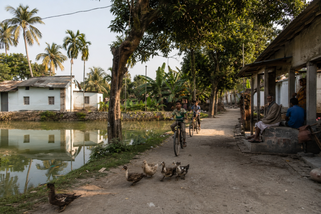
These are practical decisions shaped by climate, water management, and livelihood needs. Walking through such villages reveals an astonishing density of life.
- Mango trees.
- Jackfruit trees.
- Banana groves.
- Coconut palms.
- Betel nut palms.
- Domestic ducks are moving between ponds.
- Goats resting beneath the shade.
- Children playing beside courtyards.
- Elders observing the world from verandas.
The landscape feels inhabited at every scale.
Temples and mosques appear throughout the villages, often standing within walking distance of one another. Many are modest structures. Yet they serve as important social anchors. Religious life here often appears intertwined with everyday practical concerns.
- Harvests.
- Weather.
- Health.
- Safe journeys.
- Community gatherings.
Life in the delta encourages humility. The environment itself demands it.
Tea Stalls as Information Networks
Every village seems to possess at least one tea stall.
And every tea stall functions as something more than a place to drink tea.
- News travels through these spaces.
- Fishing conditions.
- Crop prices.
- Railway updates.
- Cyclone forecasts.
- Political debates.
- Family events.
In many ways, tea stalls remain among the most important communication networks in rural Bengal. The conversations change. The function remains.
Sounds of Canning
Every landscape has its own acoustic identity.
Canning’s begins with trains. Before one sees the railway, one often hears it. A distant horn. The metallic rhythm of wheels on tracks. The sound is woven deeply into the character of the town.
Elsewhere in the Sundarbans, rivers dominate the soundscape.
In Canning, trains and rivers coexist.
- Morning introduces birdsong.
- House crows gather near markets.
- Asian pied starlings patrol rooftops.
- Common mynas move through village lanes.
- Kingfishers call from canal edges.
As the day progresses, human sounds become more prominent.
- Market negotiations.
- Motorcycles.
- Boat engines.
- School bells.
- Conversations drifting from tea stalls.
- The call to prayer.
- Temple bells.
The sounds overlap rather than compete. Together, they create the auditory texture of the region.
By evening, another transition occurs.
- Traffic diminishes.
- River sounds become more noticeable.
- Wind moves across open water.
- Insects emerge from wetlands.
- Frogs begin calling.
And occasionally, from far across the landscape, the horn of a train echoes through the darkness. A reminder that Canning remains permanently connected to movement.
Wildlife Expedition
At first glance, Canning appears too busy to support significant wildlife.
The impression is misleading. The surrounding landscape contains an extraordinary diversity of habitats.
- Wetlands.
- Ponds.
- Canals.
- Agricultural fields.
- Mudflats.
- Mangrove edges.
- Riverbanks.
Each supports different communities of species.
Birds of the Gateway
Birds are often the most visible wildlife.
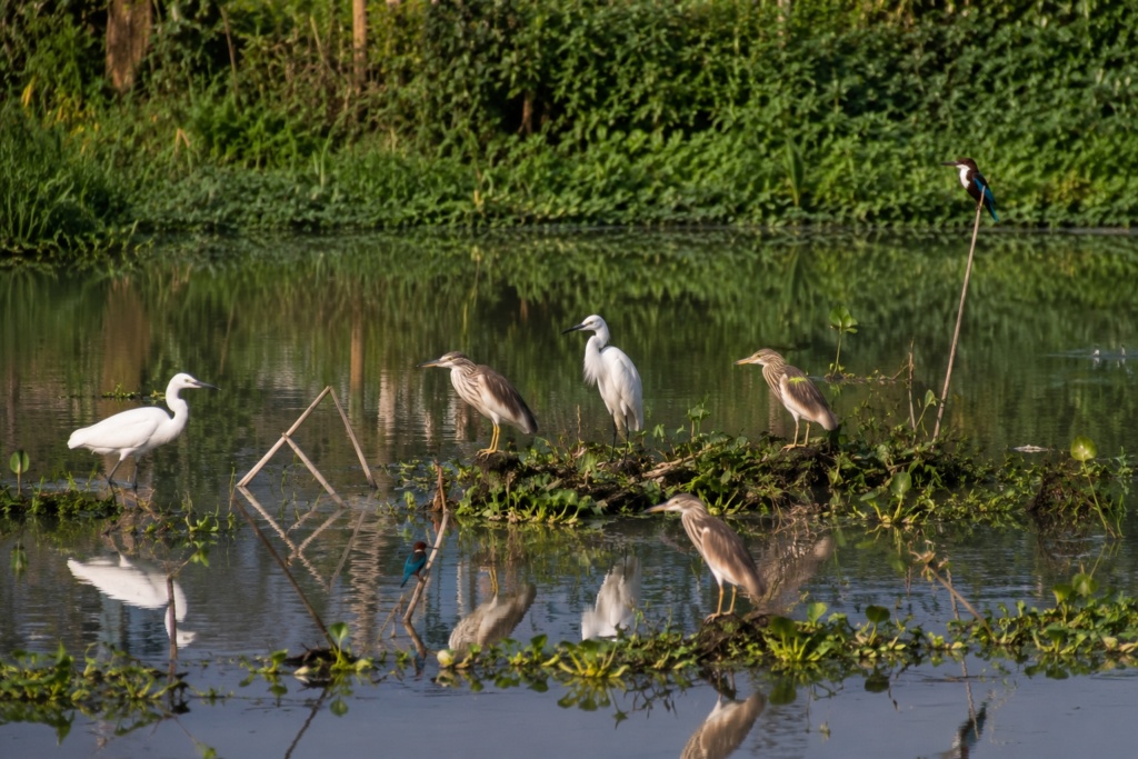
- Egrets patrol wetlands.
- Indian pond herons stand motionless beside ponds.
- Black drongos hunt insects above fields.
- White-throated kingfishers flash electric blue along canal edges.
- Brahminy kites circle above riverbanks.
During winter, migratory birds increase the region’s diversity. Seasonal wetlands become feeding grounds for numerous species moving through the delta.
Some remain only briefly. Others stay throughout the season.
For birdwatchers, the transitional habitats around Canning often prove surprisingly rewarding.
Reptiles and Amphibians
The abundance of water creates ideal conditions for reptiles and amphibians.
- Water snakes inhabit ponds and canals.
- Garden lizards occupy homesteads.
- Monitor lizards occasionally appear near wetlands.
- Frogs become especially abundant during the monsoon.
Their calls dominate many evenings. Though often overlooked, amphibians play vital ecological roles within the delta ecosystem.
Mammals of the Transition Zone
Most large wildlife associated with the Sundarbans remains farther south.
Yet smaller mammals persist around Canning. Mongooses are occasionally encountered. Fruit bats emerge after sunset. Rodents occupy agricultural landscapes.
Fishing cats have been recorded from various wetland-rich parts of South 24 Parganas, though sightings remain uncommon and should never be assumed. The region functions less as wilderness than as an ecological transition zone.
Wildlife exists here, not despite people. But alongside them.
Mangrove Chronicles
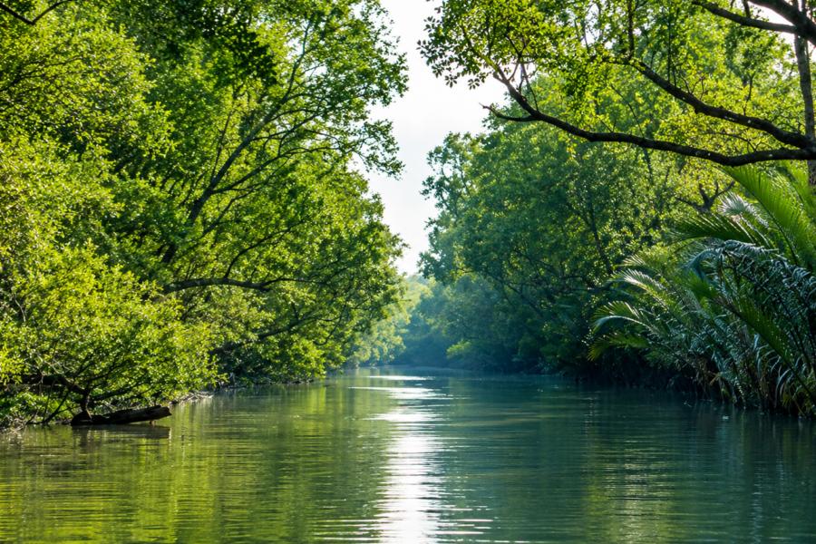
The mangroves begin south of Canning.
Yet their influence begins much earlier. This distinction matters. Many first-time visitors imagine a clear boundary separating the mangrove forest from human settlement.
Reality is more complicated. Canning occupies the northern approach to one of the world’s largest mangrove ecosystems. The ecological effects extend well beyond the visible forest.
- Tides influence rivers.
- Sediments influence agriculture.
- Storms influence infrastructure.
Wildlife moves through connected habitats. The mangrove system reaches outward through these processes. Even where dense forests are absent, their influence remains present.
Traveling south from Canning toward Gosaba or Basanti, the transformation becomes increasingly visible.
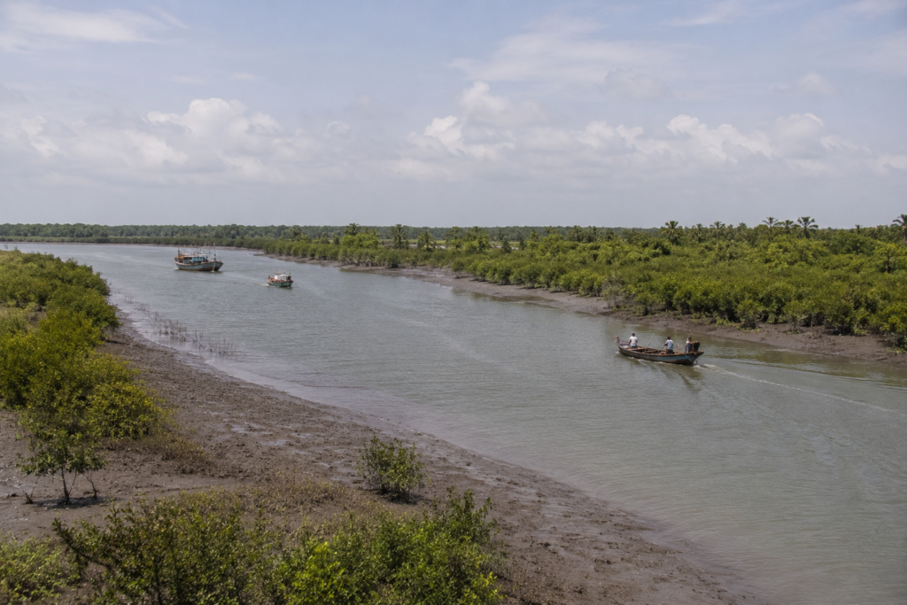
Mangrove species begin appearing along creek edges.
- The landscape grows more tidal.
- Water becomes more dominant.
- Human settlements adapt accordingly.
Canning therefore, occupies a fascinating ecological position. It stands at the edge of a transition.
- One foot in mainland Bengal.
- One foot in the mangrove world.
Why the Mangroves Matter Here
Even communities outside the core forest depend indirectly upon mangrove health.
- Mangroves reduce storm impacts.
- Support fisheries.
- Stabilize sediments.
- Provide habitat for species that move through the broader ecosystem.
Their decline would affect regions far beyond the forest itself. Including places like Canning.
The relationship is ecological. Economic. Cultural.
And increasingly, climatic.
Explorer’s Field Notes
See it for yourself
A private journey shaped around you — your group, your pace, your interests. Book a free consultation.
Field Note 01 — The River Never Disappears
Even when the Matla is out of sight, it remains present.
- In market activity.
- In transportation.
- In conversation.
The river shapes the town whether visible or not.
Field Note 02 — Trains Define Time
Few places in the lower delta are as strongly influenced by rail connectivity. Train schedules shape daily movement in ways comparable to tides.
Field Note 03 — A Landscape of Interfaces
Canning exists between systems.
- Urban and rural.
- Freshwater and tidal water.
- Roads and rivers.
- Agriculture and wetlands.
The landscape gains much of its identity from these intersections.
Field Note 04 — Fish as Geography
Following fish markets reveals the geography of the Sundarbans more effectively than many maps. Trade routes often mirror ecological connections.
Field Note 05 — Gateway Does Not Mean Temporary
Many travelers pass through Canning quickly. Yet the town possesses its own cultural and environmental depth independent of the journeys that continue beyond it.
Nightfall on the Gateway
Darkness arrives differently beside a tidal river.
The last light lingers over the Matla. The water reflects fragments of sky long after the sun has disappeared.
- Fishing boats return.
- Market activity slows.
- Tea stalls remain active.
- Conversations lengthen.
- The railway station brightens.
Evening trains carry workers home from Kolkata. Others arrive from the city, intending to continue southward the following morning.
The flow never fully stops. Night in Canning feels transitional. As though the town remains awake on behalf of the journeys still to come.
Beyond the river, somewhere in the darkness, lie Gosaba, Basanti, Dayapur, Pakhiralay, and the vast mangrove wilderness beyond them.
The tide continues moving toward those landscapes.
So do stories.
So do people.
And so, for more than a century, has Canning.
Explore Related Landscapes
The story of Canning extends beyond the railway terminus and the Matla River.
Continue exploring:
→ The Matla River
→ Gosaba Island
→ Basanti Island
→ Wetlands of South 24 Parganas
→ The Mangrove Ecosystem of the Sundarbans
The Seasons of Canning
Winter — The Season of Clarity
A pale mist hangs over ponds before sunrise. Date palms emerge slowly from the haze. The Matla River appears softer, calmer.
For many observers, winter reveals Canning at its most photogenic.
- Temperatures become comfortable.
- Visibility improves.
- Birdlife becomes more noticeable.
- Markets overflow with seasonal produce.
Travel conditions remain relatively predictable.
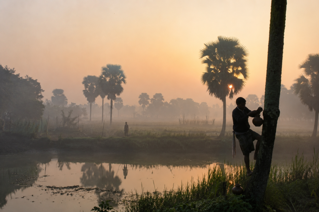
Morning train journeys from Kolkata often pass through landscapes wrapped in silver fog. By mid-morning, sunlight illuminates wetlands, ponds, and fields with remarkable clarity. This is also the season when many visitors begin their journeys into the Sundarbans.
The gateway becomes particularly active.
Spring — The Transition
Winter gradually retreats.
- The air warms.
- Trees produce new growth.
- Bird activity increases.
- Agricultural cycles shift.
The landscape begins preparing for the more demanding months ahead. Spring in Canning often feels brief.
A pause between comfort and intensity.
Summer — Heat and Waiting
By April and May, heat dominates.
- The earth dries.
- Water levels fluctuate.
- The horizon shimmers.
- Afternoons become quieter.
- Human activity adapts accordingly.
- Work shifts toward cooler hours.
Shade becomes valuable.
The river appears broader beneath the intense sunlight. Storm clouds occasionally gather during late afternoons. Many dissipate. Some do not. The season carries anticipation.
Everyone knows the monsoon is approaching.
Monsoon — The Return of Water
The first major rains transform everything.
- Dust disappears.
- Canals fill.
- Wetlands expand.
- Fields regain their vibrant green character.
- Cloud formations become dramatic.
- Water returns to every depression in the landscape.
The monsoon reveals an important truth about Canning.
This region is not merely shaped by water. It is renewed by water. Yet renewal comes with challenges.
- Flooding.
- Transportation disruptions.
- Embankment stress.
- Agricultural uncertainty.
The monsoon is both benefactor and test.
Post-Monsoon — The Delta Reassembled
As the rains decrease, the landscape settles.
- Fresh vegetation dominates the countryside.
- Rivers remain full.
- Wetlands support abundant birdlife.
- Fishing activity intensifies.
Many consider this one of the most visually rewarding periods in the delta. The atmosphere feels cleansed. The land appears rejuvenated.
Cyclone Season — The Time of Vigilance
Cyclone season occupies a special category.
It is not merely the weather. It is memory. Every family possesses stories. Every village remembers names.
- Aila.
- Amphan.
- Yaas.
The names remain part of local conversation long after the storms themselves have passed. In Canning, cyclone season is never viewed casually. Experience discourages complacency.
Cyclones and Survival
Standing beside the Matla River, one quickly understands why cyclones matter here.
The river is powerful under normal conditions. During major storms, that power multiplies dramatically. Storm surges move inland. Water levels rise. Embankments face immense pressure. Transportation networks become vulnerable.
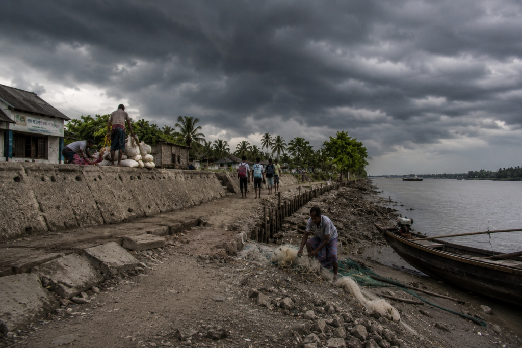
Communities throughout South 24 Parganas have experienced repeated encounters with extreme weather. The effects vary by location.
Yet few places in the region remain untouched.
The Memory of Aila
Among recent cyclones, Cyclone Aila (2009) remains particularly significant in local memory.
Although some of the most severe impacts occurred farther south in the Sundarbans, Canning became deeply involved in the wider humanitarian response.
- Transportation routes.
- Relief movements.
- Administrative coordination.
The town’s position as a gateway suddenly gained additional importance. Aila demonstrated how interconnected the delta truly is. Damage occurring dozens of kilometers away quickly affects settlements throughout the region.
Amphan and a New Generation
When Cyclone Amphan struck in 2020, another generation experienced firsthand the vulnerability of the delta.
- Power failures.
- Infrastructure damage.
- Disrupted livelihoods.
- Fallen trees.
- Flooding.
Recovery once again became a collective effort. The storm reminded residents that adaptation remains an ongoing process rather than a completed achievement.
Living With Risk
Perhaps the most remarkable aspect of Canning is not its exposure to cyclones.
It is the persistence of everyday life despite that exposure. Communities continue building.
- Farming.
- Fishing.
- Studying.
- Trading.
- Planning.
The future remains uncertain.
Yet life continues. That resilience forms one of the defining characteristics of the lower delta.
Ferry Routes and Hidden Paths
Every gateway develops formal routes.
Canning also possesses informal geographies. The official maps show roads, railways, and river channels. Local knowledge reveals much more.
The Railway Route
The railway remains the most famous approach.
For generations, trains have carried passengers from Kolkata into the lower delta. This route shaped modern Canning more than any other transportation corridor. The railway transformed accessibility.
- Trade.
- Migration.
- Education.
- Communication.
It remains central to the town’s identity.
The River Route
Long before railways, rivers served as highways.
Many older transportation patterns still survive. Boats continue connecting settlements throughout the region. Certain routes remain essential for communities located beyond direct road access.
The river remains a living transportation network. Not a historical relic.
Paths Between Villages
Away from major roads, narrow pathways connect settlements through agricultural landscapes and wetlands.
Some follow embankments. Others trace canal edges. These routes often reveal details invisible from vehicles.
- Birdlife.
- Traditional architecture.
- Small shrines.
- Ponds.
- Seasonal agricultural activity.
For explorers, such paths often provide deeper insight than primary roads.
Photography Expedition Guide
Canning rewards patient observation.
Its photographic value emerges less through singular landmarks and more through atmosphere, activity, and transition.
Sunrise Photography
Best Subjects
- Mist-covered wetlands
- Morning train movements
- Rural landscapes
- River embankments
- Village activity begins at dawn
Winter mornings are especially productive.
River Photography
Best Locations
- Matla River embankments
- Ferry ghats
- Riverfront markets
- Boat landing areas
Tidal changes dramatically alter compositions throughout the day.
Cultural Photography
The strongest cultural images often emerge from:
- Fish markets
- Railway stations
- Tea stalls
- Agricultural activity
- Local transportation scenes
Authenticity matters more than spectacle.
Wildlife Photography
Target habitats include:
- Wetlands
- Canal systems
- Pond networks
- Agricultural edges
Birdlife offers the greatest opportunities.
Winter generally provides the most diversity.
Monsoon Photography
For photographers comfortable with challenging conditions, the monsoon creates:
- Dramatic cloudscapes
- Reflections
- Flooded landscapes
- Dynamic river scenes
The atmosphere becomes cinematic.
Expedition Notes
Curiosity 01 — The Port That Never Became a Port
Many visitors remain unaware that Canning was once envisioned as a major colonial port capable of rivaling Kolkata.
The failed ambition remains one of the most fascinating chapters in the region’s history.
Curiosity 02 — The End of One Journey and the Beginning of Another
For many travelers, Canning is simultaneously a destination and a departure point.
Few places occupy both roles so naturally.
Curiosity 03 — The Invisible Influence of the Mangroves
Even where mangroves are absent, their ecological influence remains visible through rivers, fisheries, sediment movement, and weather resilience.
Curiosity 04 — Markets as Ecological Indicators
The composition of local fish markets often reflects seasonal ecological conditions across the wider delta.
Markets become informal environmental records.
Curiosity 05 — Canning’s Dual Identity
Ask different people what Canning represents.
- A commuter town.
- A river settlement.
- A market center.
- A railway terminus.
- A Sundarbans gateway.
All are correct.
Connected Landscapes
No place in the lower delta exists alone. Canning’s significance emerges through its connections.
To the North
The railway links Canning directly with Kolkata and the urban heart of Bengal. This connection shapes commerce, education, migration, and opportunity.
To the South
The landscape gradually transitions toward:
- Basanti
- Gosaba
- Dayapur
- Pakhiralay
- Sajnekhali
The ecological character becomes increasingly tidal and mangrove-dominated.
To the East
A network of wetlands, villages, and agricultural landscapes extends across the broader delta.
To the West
Road networks connect additional settlements within South 24 Parganas, reinforcing Canning’s role as a regional hub.
The Matla Corridor
Perhaps the most important connection of all is the Matla River itself.
The river functions as an ecological corridor linking multiple landscapes across the lower delta. Water, sediment, wildlife, and human activity move through this corridor continuously.
The river connects places that roads cannot fully explain.
Oral Histories
The most common memory shared by older residents is not a single event.
It is a change.
People remember:
- The arrival of electricity.
- The expansion of roads.
- The transformation of markets.
- The increasing frequency of severe storms.
- The evolution of transportation.
- The growth of educational opportunities.
- The changing relationship between river and settlement.
Many recall periods when river transport dominated daily life. Others remember when railway access became transformative. Some speak of storms. Others of migration.
Together, these memories form a living archive. Not preserved in museums. Preserved in conversation.
Deepen Your Understanding
Canning is best understood through its connections to rivers, storms, migration, and the wider Sundarbans landscape.
Explore next:
→ The Matla River
→ Cyclones of the Sundarbans
→ Gosaba Island
→ Life Along the Delta Rivers
→ The Mangrove Ecosystem of the Sundarbans
Food of Canning
The food of Canning begins with water.
- Not recipes.
- Not restaurants.
- Water.
The rivers, ponds, wetlands, and tidal channels surrounding the town have shaped local diets for generations.
Fish remains central.
Markets display species arriving from freshwater ponds, estuarine channels, tidal rivers, and aquaculture systems scattered across the lower delta.
- Rohu.
- Catla.
- Prawn.
- Tilapia.
Various small indigenous fish.
The selection changes with season and availability. Local households often build meals around what the landscape provides.
- Rice remains the foundation.
- Fish supplies the character.
- Vegetables add seasonal variation.
Food here reflects geography rather than fashion.
Morning Fish Markets
The most revealing food experience in Canning is not found at a dining table.
It is found at dawn.
- Fish markets become temporary theaters of the delta.
- Traders arrive.
- Auctioneers negotiate.
- Ice melts.
- Crates move rapidly.
Species from distant creeks and rivers appear briefly before dispersing across the region. Watching the market is like observing an ecological map in motion.
The fish reveal where water remains productive. The catches reveal seasonal changes. The market becomes a record of the wider Sundarbans landscape.
Seasonal Foods
- Winter introduces fresh date palm jaggery.
- Summer brings mangoes.
- Monsoon encourages recipes centered around seasonal vegetables and freshwater fish.
- Festivals contribute their own culinary traditions.
Food remains strongly connected to environmental rhythms. The landscape still influences what reaches the plate.
The Economy of Canning
To understand Canning’s economy, one must think in terms of movement.
- Goods moving.
- People moving.
- Water moving.
- Information moving.
The town functions as a logistical bridge between Kolkata and the lower delta. That position shapes everything.
Fisheries
Fishing and fish trade remain among the most important economic activities.
The fish markets serve not only local consumers but also wider distribution networks. Catches originating deep within the delta often pass through Canning before continuing toward urban markets.
The town therefore, occupies a critical position within the fisheries economy of South 24 Parganas.
Agriculture
The surrounding countryside continues to support agriculture.
- Rice dominates.
- Vegetables contribute to additional income.
- Pond-based aquaculture supplements traditional farming.
- Many households maintain diversified livelihood strategies.
Agriculture alone rarely tells the full economic story. Families often combine farming, fishing, trade, transportation, and wage employment.
Transportation
Few settlements in the region possess transportation significance comparable to Canning.
- The railway remains central.
- Road networks reinforce connectivity.
- River routes continue supporting movement.
- The economy benefits directly from this strategic position.
Transportation itself becomes an economic activity.
Tourism and Exploration
Canning increasingly serves as an entry point for travelers heading toward the Sundarbans.
While many visitors pass through quickly, the growing interest in the region contributes additional economic opportunities.
- Hotels.
- Transport services.
- Boat operators.
- Guides.
- Food vendors.
The gateway role continues evolving.
Migration
Migration has become an increasingly important component of household economies.
Some residents commute daily to Kolkata. Others work elsewhere in India. Remittances contribute significantly to family income.
The railway connection enables these patterns. Once again, transportation shapes livelihoods.
Then and Now
Standing beside the Matla after sunset invites comparison.
- What has changed?
- What remains?
The answer depends on where one looks.
Then
A century ago, colonial planners imagined a major port city.
The Matla River occupied the center of that vision.
- Steamships.
- Trade.
- Commercial expansion.
- Administrative infrastructure.
The future appeared clear.
- Reality proved more complicated.
- Nature reshaped the plan.
- Cyclones disrupted ambitions.
- Navigation challenges persisted.
- The dream faded.
Now
Modern Canning serves a different purpose.
- The railway has become more important than the port.
- The Sundarbans gateway identity has replaced colonial aspirations.
- The town remains dynamic.
- Connected.
- Relevant.
- The original vision disappeared.
- A more resilient identity emerged.
Environmental Change
The landscape itself continues evolving.
- Storm intensity.
- Changing rainfall patterns.
- Erosion.
- Urban expansion.
- Wetland transformation.
- Climate uncertainty.
These forces influence daily life in ways both visible and subtle. The future of Canning will depend largely on how successfully it adapts to these changes. Adaptation has always been part of the town’s story.
That story continues.
The Wild Orbit Quick Facts
Dominant Identity
River Gateway to the Sundarbans
Administrative District
South 24 Parganas
Community Development Blocks
Canning I and Canning II
Approximate Coordinates
22.31° N 88.67° E
Major River
Matla River
Ecological Region
Lower Bengal Delta
Nearest Major City
Kolkata
Transportation Significance
Railway Terminus and Sundarbans Gateway
Best Exploration Season
November to February
Wildlife Highlights
Wetland birds, kingfishers, egrets, pond herons, reptiles, and migratory species
Landscape Character
Riverfront settlements, wetlands, ponds, agricultural land, transportation hub
The Wild Orbit Expedition Snapshot
Accessibility
9.5/10
One of the most accessible locations in the lower delta.
Wildlife Potential
7/10
Strong birdlife and wetland habitats, though not a wilderness destination.
Photography Potential
9/10
Exceptional opportunities for documenting river culture, transportation, markets, wetlands, and human stories.
Cultural Richness
9/10
A fascinating blend of railway history, river trade, migration, and delta livelihoods.
Historical Interest
9.5/10
One of the most historically significant settlements connected to the Sundarbans region.
Solitude Level
4/10
Busy, active, and connected.
The appeal lies in observing movement rather than escaping it.
The Wild Orbit Explorer Connections
Continue exploring:
Rivers
- Matla River
- Bidyadhari River
- Gomor River
Settlements
- Gosaba
- Basanti
- Dayapur
- Pakhiralay
Ecosystems
- Sundarbans Mangrove Forest
- Lower Delta Wetlands
- Estuarine River Systems
Themes
- Cyclones of the Sundarbans
- Railway History of the Delta
- Fisheries of South 24 Parganas
- Mangrove Conservation
Frequently Asked Questions About Canning
1. Where is Canning located?
In South 24 Parganas district of West Bengal.
2. Is Canning part of the Sundarbans?
It is a gateway settlement connected to the wider Sundarbans region.
3. Is Canning an island?
No. It is a riverfront settlement and transportation hub.
4. Why is Canning famous?
For its connection to the Sundarbans and the Matla River.
5. What river flows beside Canning?
The Matla River.
6. How far is Canning from Kolkata?
Approximately 50 kilometers depending on route.
7. Can you reach Canning by train?
Yes. Direct trains operate from Sealdah.
8. Why was Canning developed during colonial times?
As a planned river port.
9. Did the port succeed?
No. The original vision was never fully realized.
10. What wildlife can be seen around Canning?
Wetland birds, reptiles, amphibians, and various aquatic species.
11. Is Canning good for birdwatching?
Yes, particularly in winter.
12. What is the best season to visit?
November to February.
13. Is the Matla River tidal?
Yes.
14. Does Canning experience cyclones?
Yes.
15. Is fishing important locally?
Very important.
16. Are there wetlands around Canning?
Yes, extensive wetland habitats exist.
17. What role does the railway play?
It defines much of Canning’s economic and social importance.
18. Is Canning a good photography destination?
Yes.
19. What makes Canning different from Gosaba?
Canning is a gateway town, while Gosaba is an island settlement.
20. Can you explore the Sundarbans from Canning?
Yes. Many routes begin here.
21. Does Canning have historical significance?
Very much so.
22. Are there ferry routes nearby?
Yes.
23. Is agriculture important?
Yes, especially in surrounding villages.
24. Does climate change affect Canning?
Increasingly so.
25. Why should explorers study Canning?
Because it explains how people, rivers, transportation, and the Sundarbans interact.
How to Reach Canning
Reaching Canning is more than a journey between two places. It is a gradual transition between metropolitan Kolkata and the tidal landscapes that define the northern edge of the Sundarbans.
For more than a century, traders, fishermen, forest workers, administrators, researchers, and explorers have followed this route southward. Today, the same corridors continue to connect the city with the delta.
By Train from Kolkata
The railway remains the most historic and atmospheric route into Canning.
Regular suburban trains operate between Sealdah South Section Railway Station and Canning Railway Station, with journey times typically ranging between 1 hour 30 minutes and 2 hours, depending on the service.
The route passes through Sonarpur, Baruipur, Mallikpur, Champahati, and several smaller settlements before entering the lower delta region.
For explorers, the earliest morning trains offer the most revealing experience. As Kolkata gradually recedes, apartment blocks give way to ponds, rice fields, wetlands, fish farms, coconut groves, and village settlements. During winter, mist often hangs above the landscape, creating one of the most atmospheric approaches to the Sundarbans gateway.
Upon arrival, Canning Railway Station places visitors within walking or short-rickshaw distance of markets, transport hubs, and the Matla River waterfront.
By Road from Kolkata
Canning can also be reached by road via the southern corridor of the Kolkata Metropolitan Region.
Most journeys follow:
Kolkata → Garia → Baruipur → Canning
Travel time generally ranges between 2 and 3 hours, depending on traffic conditions, road works, and seasonal weather.
Road travel offers greater flexibility for photographers, researchers, and travellers carrying equipment, as vehicles can stop at wetlands, village roads, and agricultural landscapes along the route.
During monsoon months, however, travel times may increase significantly due to heavy rainfall and localized waterlogging.
By Water and Delta Routes
Historically, rivers were the primary highways of the region long before railways arrived.
Although most visitors now reach Canning by train or road, waterways continue to connect the settlement with numerous locations throughout the lower delta.
Local boat services and ferry routes link communities across parts of South 24 Parganas, while further south, the river network extends toward Basanti, Gosaba, Dayapur, Pakhiralay, and the wider Sundarbans archipelago.
For those interested in understanding the historical geography of the delta, arriving by water offers valuable insight into why Canning emerged as such an important gateway settlement.
Reaching the Matla River Waterfront
From Canning Railway Station, the Matla River can be reached within a short distance by auto-rickshaw, cycle-rickshaw, or local transport.
The riverfront provides one of the clearest introductions to the tidal character of the region.
Here, visitors can observe:
- Tidal fluctuations of the Matla River
- Fishing boats and transport vessels
- Riverbank markets
- Embankments protecting surrounding settlements
- Daily movement between the river and the town
For many first-time visitors, the Matla serves as the moment when the geography of the Sundarbans begins to feel real.
Seasonal Travel Notes
Winter (November–February)
The most comfortable season for exploration.
Clear skies, lower humidity, active markets, and excellent visibility make this the preferred period for photography, birdwatching, and field observation.
Summer (March–May)
Expect high temperatures and humidity. Early morning and late afternoon travel are generally more comfortable than midday exploration.
Monsoon (June–September)
Heavy rainfall can affect road conditions, ferry schedules, and local transportation. Wetlands become particularly dramatic during this season, though flexibility is essential.
Post-Monsoon (October–November)
Fresh vegetation, full waterways, and improved weather conditions create one of the most visually rewarding periods to visit the region.
Explorer’s Arrival Tip
Do not rush through Canning.
Most travelers arrive, transfer to another vehicle, and continue south. Instead, arrive before sunrise.
- Walk through the station precinct as the first trains arrive from Kolkata.
- Watch fish traders unload crates.
- Follow the movement of cyclists toward the markets.
- Stand beside the Matla embankment as the tide changes.
Only then, continue toward the deeper Sundarbans. Canning is often described as a gateway. But gateways have stories of their own.
Things to See Around Canning
Matla River Embankment
The defining landscape of the town.
Canning Fish Market
One of the best places to observe the economic heartbeat of the region.
Railway Station Precinct
Historically significant and culturally revealing.
River Ghats
Observe transportation, trade, and daily life.
Wetland Landscapes
Excellent for birdwatching and photography.
Village Roads Beyond the Town
Reveal the quieter side of the lower delta.
Continue the Journey
Canning is not the destination.
It is the threshold.
Continue exploring:
→ Gosaba Island
→ Basanti Island
→ Dayapur
→ Pakhiralay
→ The Matla River
→ Sundarbans Mangrove Ecosystem
Final Reflection
The final train of the evening waits beneath station lights.
Passengers gather. Conversations fade into the background. Beyond the tracks, the Matla continues moving through darkness.
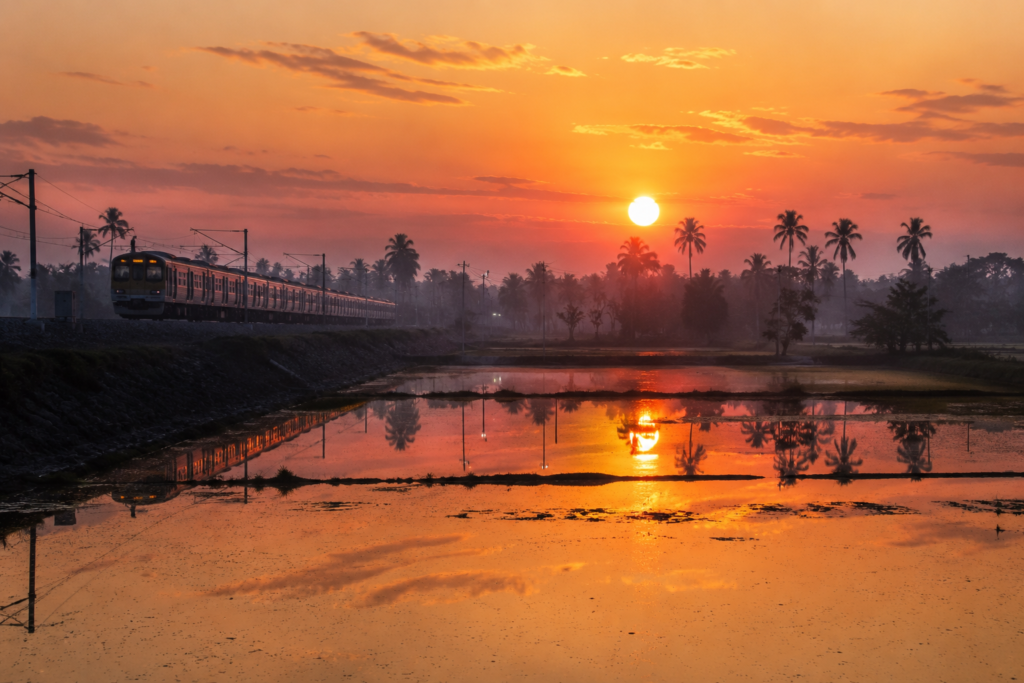
Its tide does not pause. Neither does the delta. As the train pulls away from Canning, lights recede slowly into the distance.
- The river disappears first.
- Then the embankments.
- Then the markets.
- Then the silhouettes of palms against the night sky.
Yet something remains.
- Not a monument.
- Not a landmark.
- A feeling.
The feeling of standing at the edge of a vast living landscape.
- A place where railways end, and rivers continue.
- A place where the city gives way to the tide.
- A place where countless journeys into the Sundarbans begin.
And for anyone seeking to understand the delta, there are few better places to start than Canning.
Plan your private Sundarban expedition
A private journey shaped around you — your group, your pace, your interests. Book a free consultation.