 Encyclopedia
There are islands that announce themselves long before you arrive.
Henry’s Island is not one of them.
Its presence is almost deliberately understated.
- The road narrows after Bakkhali.
- The bustle of the beach town slowly disappears behind rows of casuarina trees.
- Small fisheries, tidal ponds, and patches of mangroves begin replacing roadside shops.
The landscape becomes quieter with every kilometre, as though the coast itself is asking visitors to leave behind unnecessary haste.
The final stretch feels less like entering a destination and more like crossing into a working coastal landscape where people and tides have learned to live together.
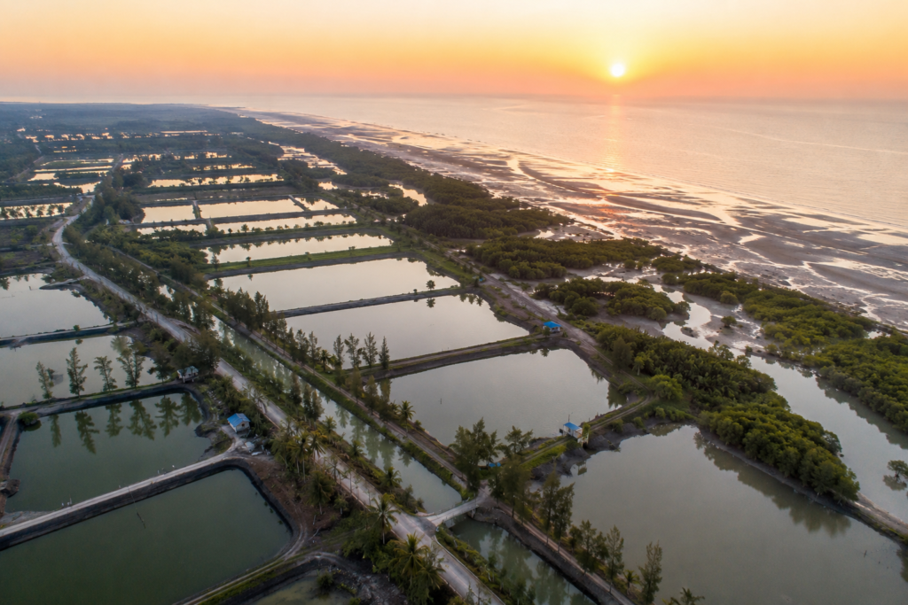
Nothing appears designed for spectacle.
The silence becomes the first landmark.
Before sunrise, the air carries the unmistakable scent of salt mixed with damp earth.
A faint mist hangs above the fisheries that surround the island. Somewhere beyond the tree line, the Bay of Bengal breathes in slow, rhythmic waves that cannot yet be seen, only heard.
This is not the dramatic roar of an open ocean. It is quieter. More patient.
As daylight slowly spreads across the eastern horizon, thousands of tiny movements begin revealing themselves.
- Egrets leave their overnight roosts.
- Pond herons search the edges of shallow water.
- Mudskippers emerge from freshly exposed mud.
- Small crabs disappear into burrows almost as quickly as they appear.
Every tide has rewritten the landscape during the night, leaving behind a fresh page for another day of life.
Few places along the Bengal coast demonstrate the relationship between land and sea as clearly as Henry’s Island.
Unlike neighbouring beaches that attract attention for their shoreline alone, Henry’s Island exists because of an intricate partnership between mangroves, tidal creeks, fisheries, mudflats, coastal forests, and human stewardship. The island represents one of the western gateways to the larger Sundarbans landscape, where conservation, livelihoods, and coastal ecology meet long before dense mangrove forests begin farther east.
Walking here feels different.
- Every embankment serves a purpose.
- Every canal carries the tide.
- Every pond reflects decades of careful adaptation.
The landscape is constantly working.
The history of Henry’s Island is also unusual.
Much of its modern identity has been shaped through coastal afforestation, fisheries development, and ecological management rather than centuries of dense human settlement. The island gradually evolved into a carefully managed coastal landscape where fish ponds, protective plantations, wetlands, and mangroves coexist with scattered communities and visitors seeking a quieter understanding of Bengal’s coastline.
Perhaps that is why Henry’s Island never feels crowded with stories waiting to be told.
Instead, it quietly allows them to reveal themselves.
- A fisherman is repairing his net beside a tidal creek.
- A watchtower rising above mangrove canopies.
- Red ghost crabs scatter across wet sand.
- A brahminy kite is circling overhead.
- Children cycling along embankment roads between fisheries.
Each scene appears ordinary on its own. Together, they explain the island far better than any introduction ever could.
Henry’s Island is often associated with beaches.
But the beach is only the final chapter.
The real expedition begins much earlier—among the wetlands, mangroves, tidal channels, and fisheries that prepare the coast long before the Bay of Bengal comes into view.
To understand Henry’s Island is to slow your pace.
To watch the tide instead of the clock.
To recognise that this landscape is shaped not by monuments or cities, but by water moving patiently between mud, roots, birds, and people.
The journey begins there.
First Encounter
The first impression of Henry’s Island rarely comes from the sea.
It comes from water that appears almost everywhere else.
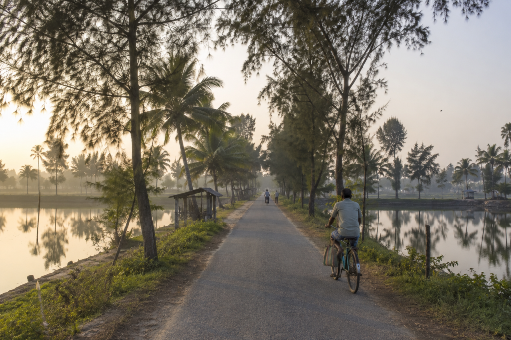
Long before reaching the beach, narrow tidal creeks wind through the landscape. Large brackish-water fisheries stretch across the horizon like mirrors, reflecting drifting clouds and passing birds. Earthen embankments divide one pond from another, while rows of casuarina, coconut, and native coastal vegetation soften the boundary between human settlement and the estuary.
The island feels open.
Nothing rises very high.
The sky dominates almost every view.
As the road reaches the entrance managed by the Fisheries Department, the atmosphere changes again.
Vehicles become fewer.
The sounds of commerce fade.
The landscape begins speaking through wind moving across casuarina needles, distant bird calls, and the steady rustle of tidal grasses.
Walking deeper into Henry’s Island reveals a place where people have learned to work with the coast rather than against it.
- Fish ponds support local livelihoods.
- Mangroves protect vulnerable shorelines.
- Raised embankments guard against tidal flooding.
Small settlements remain closely connected to the rhythms of the surrounding wetlands.
Eventually, a wooden walkway leads toward the watchtower overlooking the mangroves. From above, the island’s true character becomes visible.
The beach lies beyond.
Between the observer and the sea stretches a remarkable transition of mangrove forest, tidal mudflats, fisheries, creeks, and coastal woodland—a living buffer that protects both wildlife and people.
Only after crossing this ecological mosaic does the shoreline finally appear.
The beach itself feels unexpectedly wide.
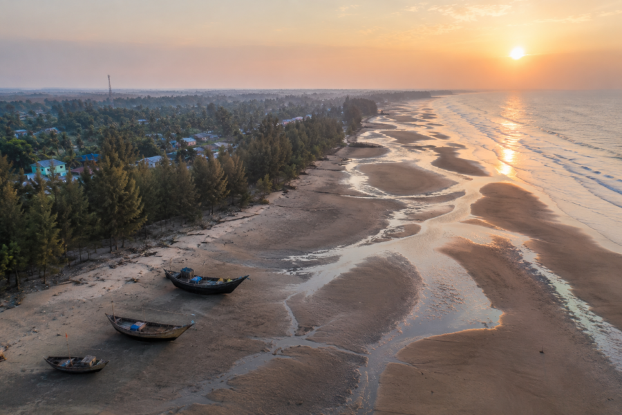
At low tide, vast stretches of firm wet sand extend toward the Bay of Bengal, broken by shallow tidal channels and dotted with the delicate tracks of crabs and shorebirds. The receding water leaves behind countless reflections, turning the beach into a changing mirror beneath the sky.
Unlike many popular coastal destinations, Henry’s Island rarely demands attention through crowds or activity.
Its character is quieter.
More observant.
More ecological.
The first encounter is not with a tourist attraction.
It is with a functioning coastal ecosystem where mangroves, wetlands, fisheries, birds, tides, and people continue shaping one another every single day.
And that quiet introduction defines everything that follows.
Island Identity
The map identifies Henry’s Island as a small island along the southern coast of South 24 Parganas, West Bengal.
The landscape tells a far richer story.
Unlike many inhabited islands of the Sundarbans, where villages gradually expanded through agriculture and river-based trade, Henry’s Island developed with a different relationship to the delta. Here, wetlands, fisheries, mangrove restoration, coastal plantations, and tidal ecosystems define the landscape as much as human settlement.
It is an island where conservation and livelihoods share the same geography.
Administratively, Henry’s Island falls within the Namkhana Community Development Block of the South 24 Parganas district and is closely associated with Bakkhali and Fraserganj, two neighbouring coastal settlements that serve as its primary gateways. Much of the island’s infrastructure, including accommodation and fisheries, has been developed under the supervision of the Department of Fisheries, Government of West Bengal, giving Henry’s Island a distinctive identity unlike the privately developed coastal destinations found elsewhere.
This administrative history continues to influence the island today.
- Roads remain relatively limited.
- Construction is modest.
- Large sections of wetlands and coastal vegetation remain intact.
- Human activity is concentrated rather than widespread.
That restraint has allowed the landscape to retain much of its ecological character.
Unlike densely populated islands elsewhere in the Sundarbans, Henry’s Island has no large market town dominating its centre. Instead, the island is defined by scattered fisheries, service facilities, small settlements, and protected natural spaces connected by narrow roads and embankments.
- The settlement pattern follows the water.
- Fish ponds occupy broad sections of the interior.
- Mangroves fringe tidal channels.
Casuarina plantations protect exposed coastal areas from wind and salt spray.
The beach itself remains separated from inland activity by belts of vegetation and wetlands that function as natural buffers against storms and coastal erosion.
Standing atop the watchtower reveals this pattern with remarkable clarity.
- From one direction stretch rows of fisheries reflecting the changing sky.
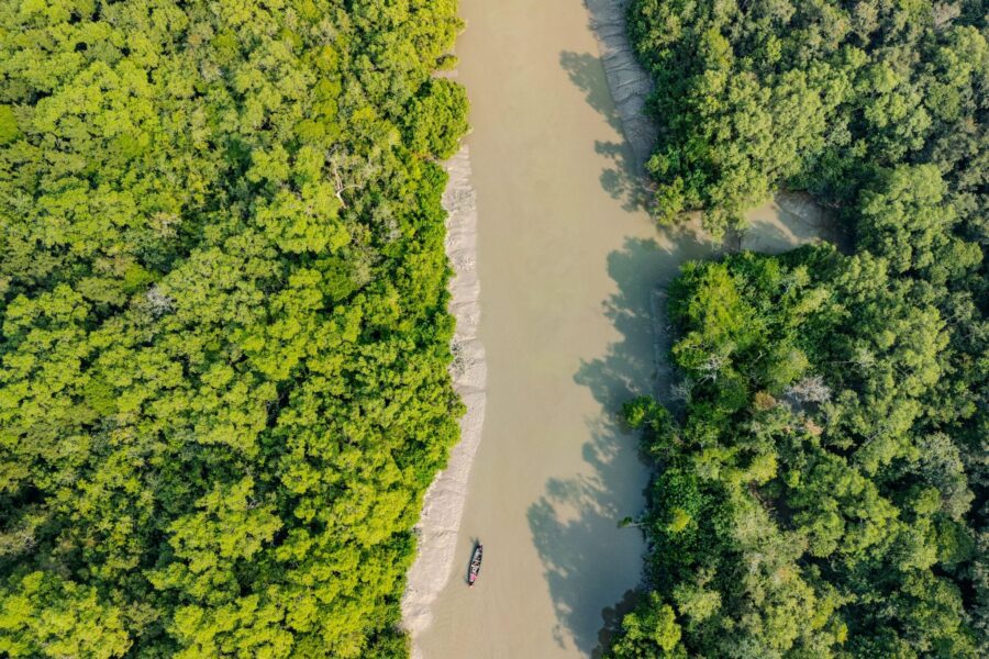
- Another reveals dense mangrove vegetation intersected by winding creeks.
- Beyond lies the broad sandy shoreline opening toward the Bay of Bengal.
Very few places along the Bengal coast display such a complete sequence of coastal ecosystems within such a compact landscape.
Henry’s Island is not simply a beach.
It is a functioning coastal system. Every element depends upon another.
- The fisheries rely on tidal water.
- The mangroves stabilise vulnerable shores.
- The wetlands support birds and aquatic life.
- The plantations reduce wind erosion.
- The embankments protect livelihoods.
- The beach absorbs the daily energy of the sea.
Each landscape performs its own quiet task. Together, they create the island.
The Waters That Shaped Henry’s Island
No island in the Bengal delta exists independently of water.
Henry’s Island is shaped by it from every direction.
The Bay of Bengal defines its southern edge, but the island’s true character emerges through the countless tidal channels, estuarine waters, creeks, and brackish wetlands that surround and penetrate its interior. Unlike rivers that carve dramatic valleys elsewhere in the world, the waters here work patiently, advancing and retreating with every tide.
The result is a landscape that is never completely still.
Twice each day, tidal water moves through creeks and fisheries, refreshing habitats that support fish, crustaceans, molluscs, and countless aquatic organisms. These movements also transport nutrients across the wetlands, helping sustain the productivity that has supported local livelihoods for decades.
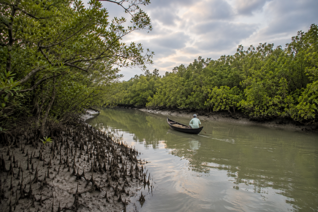
The influence of the sea reaches much farther inland than it first appears.
Brackish water fisheries across Henry’s Island depend on carefully managed exchanges between freshwater and saline tidal water. Earthen embankments, sluice gates, and canals regulate these movements, creating one of the defining features of the island’s landscape.
These engineered waters exist alongside natural ones.
Together, they form an intricate network where ecology and livelihoods remain closely connected.
The nearby Hatania–Doania River, flowing north of the island, has long served as the principal waterway linking this coastal region with the mainland. For generations, it carried fishing boats, supplies, and travellers moving between Namkhana and the outer coast. Even after the construction of the Hatania–Doania Bridge improved road connectivity, the river continues to influence commerce, fisheries, and the wider estuarine environment surrounding Henry’s Island.
Closer to the coast, smaller tidal creeks weave through mangrove vegetation before emptying into the Bay of Bengal.
At low tide, these channels expose muddy banks alive with fiddler crabs, mudskippers, and feeding shorebirds.
As the tide returns, the same channels become quiet waterways once again, carrying fish and nutrients back into the wetlands.
This constant transformation explains why the island supports such remarkable biodiversity despite its relatively modest size.
The waters also dictate where people build.
- Roads follow higher ground.
- Buildings stand on raised foundations.
- Protective embankments separate fisheries from tidal channels.
Casuarina plantations occupy exposed coastal zones vulnerable to strong winds.
Even the famous beach owes its form to these tidal processes.
At low tide, the shoreline expands dramatically as water retreats across an exceptionally gentle coastal gradient, exposing wide stretches of reflective sand and shallow channels.
A few hours later, much of that landscape disappears beneath the returning sea.
Nothing here remains exactly the same for long. Perhaps that is the greatest lesson Henry’s Island offers.
- Land is never entirely land.
- Water is never entirely absent.
Each continually reshapes the other, creating a coastline that remains alive with movement, adaptation, and quiet resilience.
Long before people arrived, these waters were already writing the story of Henry’s Island.
They continue writing it today.
Historical Footprints
The first impression of Henry’s Island is one of timelessness.
- Mangroves stand quietly beside tidal creeks.
- The sea follows its ancient rhythm.
- Birds continue arriving with the changing seasons.
It is easy to believe the landscape has always looked this way.
It has not.
Much of what visitors experience today is the result of decades of careful environmental planning, fisheries development, and coastal protection rather than centuries of uninterrupted human settlement.
Compared with many islands of the Indian Sundarbans, Henry’s Island has a relatively recent history of organised development.
Unlike Gosaba, Basanti, or Patharpratima—where settlement expanded through agriculture and land reclamation during the colonial period—Henry’s Island remained a sparsely inhabited coastal landscape for much of its history. Its low elevation, saline soils, tidal influence, and exposure to cyclones made large-scale permanent settlement difficult.
Nature dominated.
People adapted cautiously.
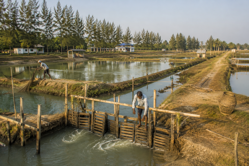
The transformation began as the Government of West Bengal recognised the ecological and economic potential of the area. Through the Department of Fisheries, extensive brackish-water fish farms, locally known as bheris, were established and managed across sections of the island. These fisheries provided livelihoods while making productive use of the island’s saline environment.
Unlike conventional farming, which struggled under coastal salinity, fisheries worked with the landscape rather than against it.
That philosophy continues to define Henry’s Island today.
Around the same period, large-scale coastal plantations of casuarina and other protective vegetation were developed to stabilise sandy soils, reduce wind erosion, and provide a natural barrier against storms. These plantations gradually became one of the island’s defining visual features, creating shaded corridors between the fisheries and the beach.
Mangrove restoration also became increasingly important.
Rather than viewing mangroves as obstacles to development, conservation initiatives recognised their role in protecting embankments, supporting fisheries, reducing erosion, and sustaining biodiversity. The surviving mangrove belts that visitors walk through today represent both natural resilience and deliberate ecological stewardship.
This approach distinguished Henry’s Island from many other coastal destinations.
Development here was never centred solely on recreation.
The landscape continued functioning as a productive ecological system.
The watchtower overlooking the mangroves reflects that philosophy perfectly.
It was not built simply to provide scenic views.
It encourages visitors to observe the relationship between wetlands, tidal creeks, mangrove forests, fisheries, and the Bay of Bengal from a single vantage point. From above, the island reveals itself not as isolated attractions but as one interconnected landscape.
Modern tourism arrived gradually.
As nearby Bakkhali became increasingly popular, travellers began discovering Henry’s Island through word of mouth. Its quieter atmosphere, natural setting, and relatively limited development appealed to photographers, birdwatchers, researchers, and visitors seeking a less crowded experience of the Bengal coast.
Even today, Henry’s Island has resisted rapid commercialisation.
- Accommodation remains limited.
- The road network is modest.
- Large-scale construction has been relatively restrained.
This slower pace has helped preserve much of the island’s ecological integrity while allowing visitors to experience one of the most complete coastal wetland systems along the western edge of the Sundarbans.
Its history is therefore not a story of conquest or urban expansion.
It is a story of coexistence.
One where fisheries, conservation, and coastal resilience gradually shaped a distinctive island identity.
Historical Personalities &Transformations
Henry’s Island is unusual among the islands of southern Bengal because its history is not strongly associated with kings, zamindars, freedom fighters, or famous reformers.
Its transformation has instead been guided largely by institutions, scientists, engineers, fisheries experts, forest officials, and local communities whose work often remained unnoticed beyond the region.
The most influential force behind the island’s modern identity has been the Department of Fisheries, Government of West Bengal.
Recognising the economic potential of saline coastal waters, the department developed and managed extensive brackish-water aquaculture across the island. These fisheries not only created employment but also demonstrated how livelihoods could be sustained without fundamentally altering the island’s ecological character.
This model became one of Henry’s Island’s defining achievements.
Equally significant were the coastal afforestation efforts undertaken over several decades.
Casuarina plantations were established across exposed stretches of coastline to reduce wind erosion, stabilise sandy soils, and protect inland fisheries from coastal storms. While these plantations are often admired for their scenic beauty today, they originated as practical environmental interventions.
Mangrove conservation became another quiet transformation.
As scientific understanding of coastal ecosystems improved, mangrove vegetation was increasingly recognised as essential infrastructure rather than wasteland. Their complex root systems reduce wave energy, trap sediment, provide nursery habitats for aquatic life, and strengthen the resilience of the coastline against cyclones.
Local fishing communities also played a crucial role.
Generations of fishers, aquaculture workers, and coastal residents developed detailed knowledge of tides, salinity, fish breeding cycles, weather patterns, and seasonal changes. Much of this understanding exists not in formal records but in daily practice, passed between families through observation and experience.
The island’s evolution therefore, reflects collective knowledge more than individual fame.
Its modern landscape emerged through cooperation between ecological science, government management, and local livelihoods.
Perhaps that explains why Henry’s Island feels so balanced.
- Nothing dominates.
- Nature remains visible.
- Human intervention remains purposeful.
The result is neither untouched wilderness nor heavily urbanised coastline.
It is something increasingly rare—a working coastal landscape where conservation and community continue shaping one another.
Folklore and Legends
As evening approaches, conversations along Bengal’s coast often drift toward stories.
Some belong to history.
Others belong to belief.
Henry’s Island does not possess a rich body of island-specific folklore recorded in historical literature. Unlike the deep forest villages farther inside the Sundarbans, where tales of Bonbibi, Dakshin Ray, and Shah Jongoli remain closely woven into everyday life, Henry’s Island’s cultural landscape is shaped more by its coastal setting than by dense forest traditions.
Even so, the wider beliefs of the Sundarbans are never entirely absent.
Many fishing families working along this coast continue to hold deep respect for Bonbibi, the revered guardian of the forest and protector of those whose livelihoods depend upon the delta.
Although Henry’s Island itself is not a tiger landscape, nearby fishing communities often carry these traditions with them whenever they venture into the larger estuarine waters connected with the Sundarbans.
The sea has its own stories.
Older fishermen sometimes speak less about mythical beings and more about reading the behaviour of birds, clouds, currents, and tides. A sudden silence among seabirds, an unusual wind direction, or unexpected changes in tidal flow have long been regarded as warnings demanding attention.
Whether understood as folklore or practical wisdom, these observations continue influencing decisions made on the water.
Cyclones have also shaped local memory.
Families remember storms not only by official names such as Aila, Amphan, or Yaas, but by the damage they caused to fisheries, embankments, boats, and plantations. These shared memories have become part of the island’s living oral tradition, passed between generations as lessons in preparedness and resilience.
Henry’s Island therefore, reminds us that folklore is not always ancient.
Sometimes it is created quietly through lived experience.
- Every returning tide.
- Every approaching storm.
- Every successful fishing season.
- Every restored mangrove.
Together, they form the stories that future generations will inherit.
Life Between the Tides
Morning begins before sunrise.
Not because visitors are awake.
Because the island already is.
- Lights appear across the fisheries long before daylight reaches the coast.
- Workers inspect sluice gates controlling tidal water entering the ponds.
- Fishermen prepare nets while watching the changing current.
- Birds gather wherever the retreating tide exposes fresh feeding grounds.
The day begins with water.
It always has.
Brackish-water aquaculture remains one of the island’s principal livelihoods.
Fish and shrimp farming shape much of the surrounding landscape, with carefully managed ponds occupying large sections of the interior. Water levels, salinity, and seasonal conditions require constant attention, making aquaculture a profession built upon observation rather than routine.
Nearby, small fishing boats continue working the estuarine channels and coastal waters beyond the beach.
The catch changes with the season.
So do the tides.
Daily life adjusts accordingly.
Unlike agricultural villages where work often follows the sun, Henry’s Island frequently follows the sea.
- Low tide creates opportunities.
- High tide changes them.
Every schedule remains flexible enough to accommodate water that never keeps the same timetable for long.
Away from the fisheries, village life unfolds at a quieter pace.
- Children travel to nearby schools.
- Small tea stalls welcome workers beginning their day.
- Cyclists move along embankment roads between settlements.
Households prepare the morning meal while the first visitors make their way toward the watchtower.
By afternoon, the beach begins attracting more people.
- Some come to walk.
- Some come to photograph birds.
- Others simply stand silently watching the tide return.
Yet despite these visitors, the island never feels overwhelmed.
Its working rhythm continues uninterrupted. That perhaps is Henry’s Island’s greatest lesson. People do not merely live beside the tides. They organise entire lives around them.
Walking Through the Villages
The road narrows again.
Not because it ends, but because the landscape begins taking over.
Henry’s Island has no dense town centre where traffic, shops, and concrete dominate the view. Instead, its settlements appear quietly between fisheries, wetlands, and coastal vegetation. Every village seems to have grown around the realities of the landscape rather than replacing it.
Walking here rarely feels hurried.
The roads are modest.
Many are bordered by ponds on one side and coconut palms on the other. Narrow earthen paths branch away from the main road, leading toward family homes hidden behind flowering shrubs, banana plants, and carefully maintained kitchen gardens.
The houses themselves reflect the changing history of the island.
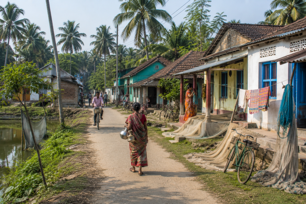
Older homes retain traditional rural Bengal architecture, with brick walls, sloping tiled roofs, shaded verandas, and open courtyards where fishing nets dry beneath the morning sun.
Newer houses, built with reinforced concrete, stand on raised plinths to better withstand flooding and seasonal waterlogging. Yet even these modern structures remain modest in scale, rarely disturbing the open character of the landscape.
Life unfolds outdoors.
- Women clean freshly harvested fish beneath shaded verandas.
- Children cycle slowly along embankment roads on their way to school.
- Elderly residents gather beneath large trees, discussing weather, fishing conditions, and local news while sipping tea served in small glass cups.
In one courtyard, fishing nets lie stretched across bamboo poles for repair.
In another, shrimp seed containers wait beside bicycles before being carried toward nearby fisheries.
These are ordinary scenes.
Yet together they reveal the quiet economy of the island far more clearly than statistics ever could.
Religious life is equally understated.
- Small temples appear beside village roads, often sheltered beneath old banyan or peepal trees.
- Simple shrines decorated with marigolds stand outside family homes.
- Mosques serving nearby communities remain woven naturally into the daily rhythm of village life.
There are no monumental religious structures dominating the skyline.
- Faith here feels local.
- Personal.
- Integrated into everyday existence.
Small grocery shops stock household essentials alongside biscuits, tea, batteries, and fishing supplies.
Tea stalls become gathering places where fishermen, aquaculture workers, government employees, and occasional visitors briefly share the same wooden benches before returning to their respective routines.
Conversation rarely remains fixed on one subject.
- Weather.
- The tides.
- Fish prices.
- Road conditions.
- The latest cyclone forecast.
Life along the coast encourages practical discussions.
As the afternoon approaches, the villages grow quieter.
Many residents are already working elsewhere—at fisheries, on fishing boats, or maintaining embankments and ponds. Unlike destinations built around tourism, Henry’s Island never performs for its visitors.
It simply continues living.
The privilege belongs to the observer.
Sounds of the Island
Henry’s Island announces itself through sound long before it reveals itself through landmarks.
Before sunrise, the island belongs almost entirely to birds.
- The clear whistles of kingfishers echo across quiet fisheries.
- Egrets call from mangrove edges.
- The distant cry of a Brahminy Kite drifts above the wetlands as it circles on rising coastal air.
- Somewhere deeper within the casuarina plantations, bulbuls and drongos begin their morning chorus.
The sea remains almost hidden.
Yet it is always present.
Even when invisible behind dunes and trees, the slow pulse of waves rolling across the Bay of Bengal becomes part of the island’s constant background.
It never dominates.
It simply remains.
As daylight strengthens, other sounds gradually emerge.
- Bicycle bells along village roads.
- The soft hum of motorcycles transporting supplies.
- Wooden fishing boats are knocking gently against their moorings.
- The splash of water is released through sluice gates feeding the fisheries.
- Workers calling to one another across ponds.
None of these sounds is particularly loud.
Together, they create the unmistakable rhythm of a working coastal landscape.
Near the watchtower, the atmosphere changes again.
The wind moving through casuarina needles produces a dry whisper unlike the broad rustle of mangrove leaves. Standing quietly here, individual sounds become easier to distinguish.
- Tiny fiddler crabs click across exposed mud.
- Mudskippers disturb shallow pools with sudden movements.
- Waders probe wet sand with rapid, repetitive taps.
Even silence feels active.
The beach offers another transformation. At low tide, footsteps across wet sand become almost soundless. Only the occasional wave, distant gulls, and the steady coastal breeze interrupt the stillness.
As evening approaches, fishing boats return.
- Engines replace birdsong.
- Voices carry across the water.
- Nets are unloaded.
- The working day slowly comes to an end.
Then darkness arrives.
Artificial light remains limited across much of Henry’s Island. Without constant urban noise, the night belongs once again to nature.
- Crickets begin their steady chorus.
- Frogs answer from freshwater ponds.
- The wind strengthens through the coastal plantations.
Beyond everything else, the Bay of Bengal continues breathing against the shore.
The sounds never stop. Only the performers change. And that may be the island’s greatest gift.
It teaches visitors that silence is rarely the absence of sound.
It is simply the presence of nature speaking without interruption.
Wildlife Expedition
The first wildlife encounter on Henry’s Island is easy to miss.
It rarely begins with something large. Instead, it starts with movement.
- A ripple across a tidal creek.
- A sudden flash of blue as a kingfisher dives.
- Tiny footprints crossing freshly exposed mud.
- A flock of shorebirds lifts together before settling only a few metres away.
Henry’s Island rewards patience more than distance.
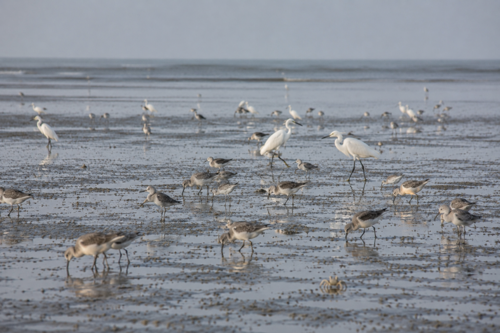
Unlike the protected forests of the Sundarbans, where visitors often hope for dramatic encounters with large mammals, this island reveals its biodiversity through smaller, quieter interactions. Here, life is spread across mudflats, wetlands, mangroves, fisheries, ponds, and the intertidal zone.
Every habitat supports its own community.
The broad mudflats exposed during low tide quickly become feeding grounds for migratory shorebirds. Sandpipers move rapidly across the wet sand, probing for worms and tiny crustaceans buried beneath the surface. Plovers pause briefly before sprinting ahead. Little Egrets patrol the edges of shallow pools with deliberate precision, while larger Great Egrets stand almost motionless until an unsuspecting fish passes within striking distance.
During winter, these tidal flats become even more important.
Migratory birds travelling along the Central Asian Flyway use the Bengal coast as a seasonal feeding ground. Henry’s Island, with its combination of mudflats, estuarine creeks, and quiet wetlands, provides valuable habitat for many of these visitors before they continue their journeys.
The skies remain equally active.
Brahminy Kites circle above the coast throughout the day, using rising air currents to search for fish and carrion. White-throated Kingfishers occupy electric wires, bamboo poles, and mangrove branches overlooking ponds and creeks. Their brilliant turquoise wings appear almost impossibly bright against the muted colours of mud and water.
- Black Drongos patrol open fields.
- Pond Herons disappear into the landscape until disturbed.
- Cormorants dry their wings beside fisheries after successful dives.
Each species occupies its own ecological niche.
The island’s fisheries create another unexpected wildlife habitat.
Although designed primarily for aquaculture, these ponds attract birds seeking fish, amphibians, insects, and aquatic invertebrates. The boundaries between managed landscapes and natural ecosystems remain remarkably fluid.
- Nature adapts.
- Wildlife follows opportunity.
- Closer to the beach, another community becomes visible.
Ghost crabs emerge across the sand, their pale bodies almost matching the shoreline itself. At the slightest vibration, they vanish into perfectly round burrows scattered across the upper beach.
Farther inland, exposed tidal mud hosts armies of fiddler crabs.
The males raise their oversized claws in displays that resemble tiny semaphore signals performed across the mangrove floor.
It is easy to overlook these creatures.
Yet they perform essential ecological work.
By constantly turning over the sediment, they improve oxygen circulation, recycle nutrients, and help maintain healthy mudflat ecosystems.
Reptiles are present too.
Garden Lizards bask along sunny embankments.
Water Monitor Lizards occasionally inhabit suitable wetland habitats within the wider coastal region, although sightings on Henry’s Island itself remain infrequent and unpredictable.
Snakes also occur within the island’s wetlands and vegetation, as they do throughout coastal Bengal, though they generally avoid human activity.
Henry’s Island is not a place where wildlife performs on demand.
Its greatest reward comes to observers willing to slow down.
- Sit quietly beside a tidal creek for twenty minutes.
- Watch a mudflat as the tide retreats.
- Stand silently at the watchtower during sunrise.
Gradually, the landscape begins revealing lives that hurried visitors never notice.
Wildlife here is measured not by rarity alone. It is measured by relationships.
- Every bird depends upon the tide.
- Every crab depends upon the mud.
- Every mangrove depends upon the water.
- Every observer depends upon patience.
That is the true expedition Henry’s Island offers.
Mangrove Chronicles
The path to the beach does not begin with sand.
It begins with roots.
Before the Bay of Bengal finally comes into view, visitors pass through one of Henry’s Island’s most important landscapes—a belt of mangroves quietly protecting the coast from forces far greater than themselves.
From a distance, the trees appear ordinary.
Up close, they reveal extraordinary adaptations.
Their roots emerge from the mud like thousands of slender breathing tubes.
Known as pneumatophores, these specialised structures allow mangroves to survive in oxygen-poor tidal soils where most trees would perish.
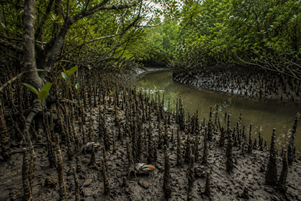
Walking along the elevated boardwalk toward the watchtower, these roots form intricate natural patterns beneath the forest canopy.
- Every incoming tide submerges them.
- Every retreating tide exposes them once more.
- Life here is written twice each day.
Henry’s Island supports a mix of mangrove vegetation typical of the western fringe of the Indian Sundarbans. Species such as Avicennia and Sonneratia are commonly associated with these tidal environments, where fluctuating salinity and constant sediment movement determine which plants can survive.
The mangroves perform many roles simultaneously.
- They slow coastal erosion.
- Trap sediment carried by tides.
- Provide nursery grounds for juvenile fish and crustaceans.
- Offer nesting and roosting sites for birds.
- Buffer inland areas against storm surges.
Few ecosystems accomplish so much while demanding so little.
Beneath the trees, the mud appears almost alive.
- Fiddler crabs move continuously between burrows.
- Small gastropods leave delicate trails across wet sediment.
- Mudskippers rest beside shallow pools before suddenly launching themselves forward with surprising agility.
Nothing remains still for long.
Even decomposition becomes creation.
Fallen leaves gradually break down, feeding microscopic organisms that support larger food webs extending into nearby fisheries, estuaries, and the Bay of Bengal itself.
- The mangroves nourish far more than the forest.
- They nourish the coast.
- Their importance becomes most visible during cyclones.
Dense root systems reduce wave energy before storm surges reach inland embankments. Sediment trapped by the roots gradually strengthens sections of shoreline that might otherwise disappear beneath repeated erosion.
These natural defences have become increasingly valuable as climate change intensifies coastal hazards across the Bengal delta.
Henry’s Island demonstrates an important lesson.
Conservation is not separate from human wellbeing.
- Healthy mangroves support healthy fisheries.
- Healthy fisheries support local livelihoods.
- Healthy coastlines support communities.
The connections are impossible to separate.
Standing atop the watchtower, the relationship becomes unmistakable. Below stretches a continuous sequence of mangrove forest, tidal creek, mudflat, coastal vegetation, and beach.
There are a few abrupt boundaries. Only gradual transitions. Perhaps that is why Henry’s Island feels so complete.
- It does not present isolated attractions.
- It presents an entire ecosystem functioning exactly as nature intended.
And the mangroves remain at its heart.
Explorer’s Field Notes
See it for yourself
A private journey shaped around you — your group, your pace, your interests. Book a free consultation.
Field Observation 01
The best wildlife activity often begins within the first two hours after sunrise, particularly around tidal creeks, fisheries, and exposed mudflats.
Field Observation 02
Low tide transforms Henry’s Island more dramatically than any other time of day, exposing extensive mudflats that attract feeding shorebirds and reveal the ecological richness of the intertidal zone.
Field Observation 03
The watchtower offers one of the clearest perspectives of how fisheries, mangroves, wetlands, coastal plantations, and the Bay of Bengal function as one interconnected landscape.
Field Observation 04
Casuarina plantations provide shelter from strong coastal winds, but the island’s true ecological value lies within its mangrove belts and tidal wetlands.
Field Observation 05
Winter remains the most rewarding season for birdwatchers, while the monsoon reveals the remarkable resilience of the island’s wetlands and coastal vegetation.
Nightfall on the Island
Sunset arrives slowly on Henry’s Island.
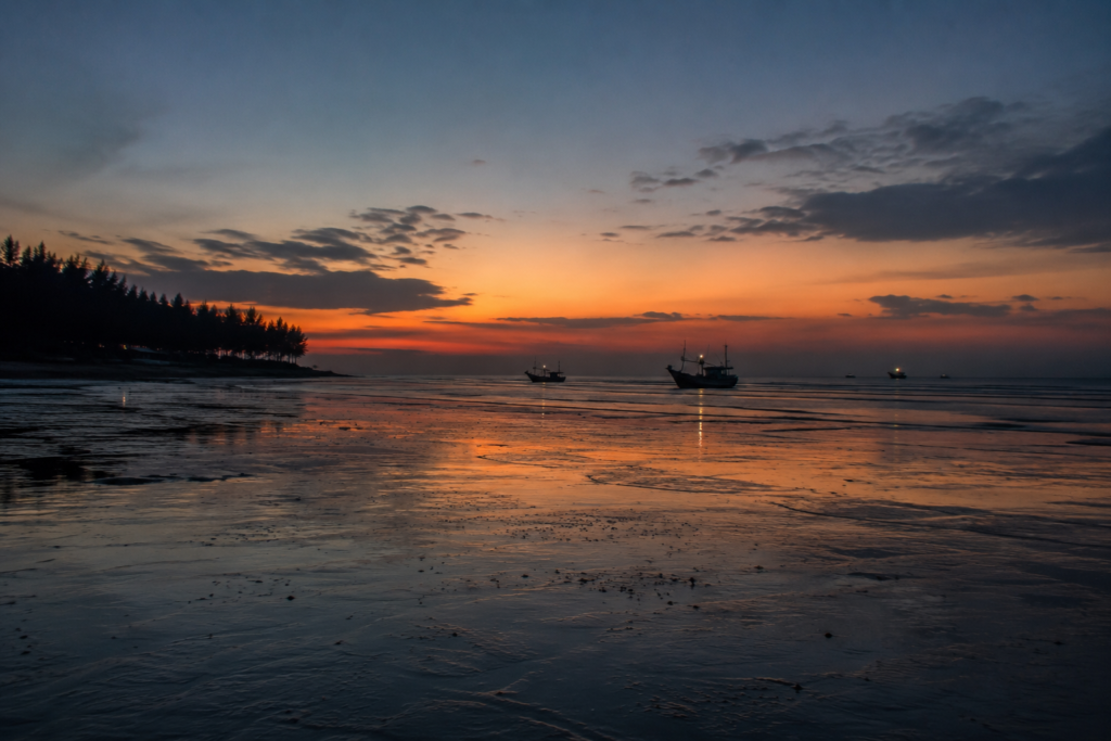
The last visitors drift away from the beach. The watchtower grows quiet. The tide begins reclaiming the broad expanse of sand that only hours earlier seemed almost endless.
Golden light softens into deep amber.
Then violet.
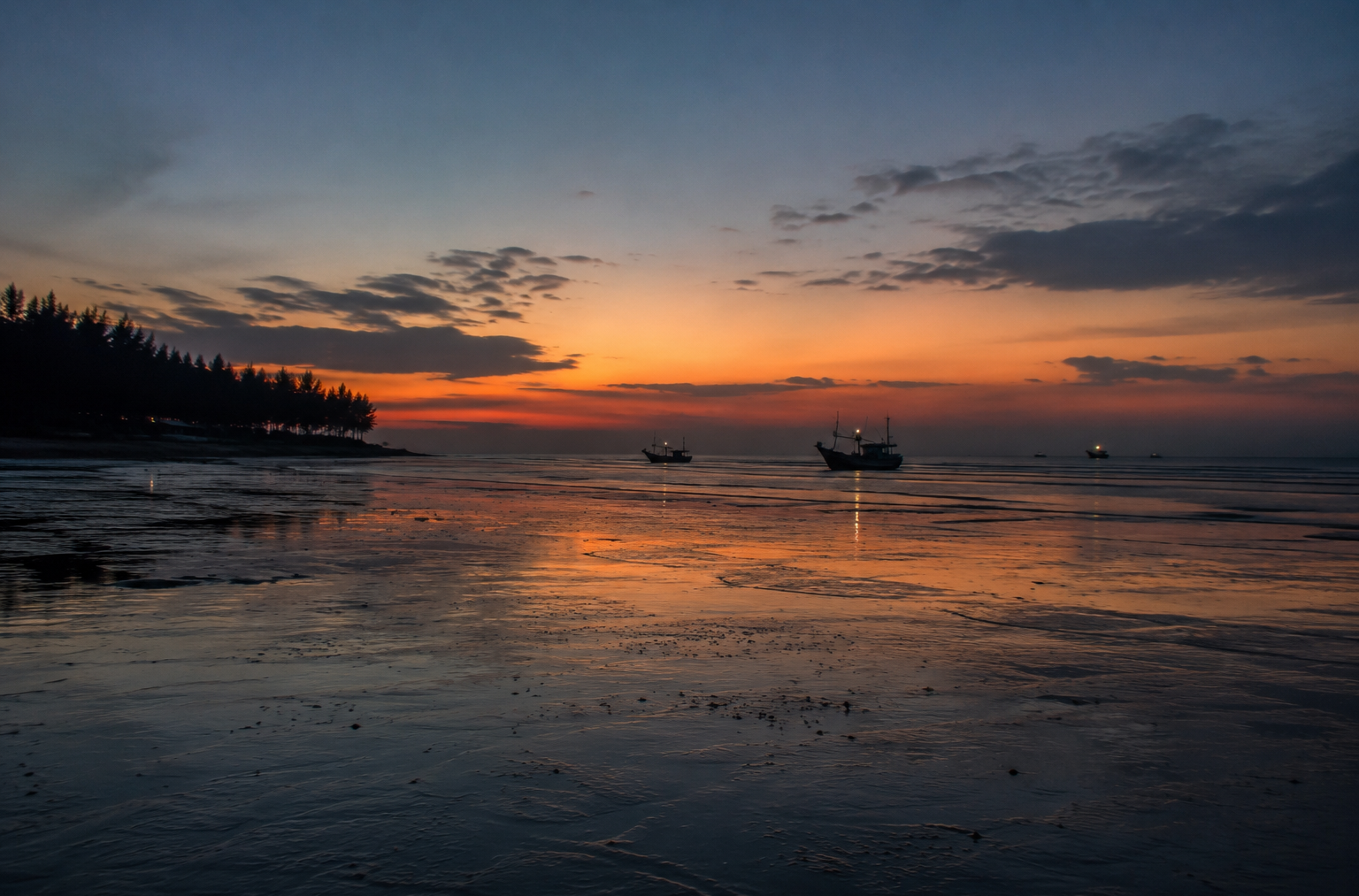
Fishing boats become dark silhouettes against the fading horizon as they return toward nearby landing points.
The day’s final bird calls echo briefly across the wetlands before silence settles over the mangroves.
Yet the island does not become inactive.
It simply changes shifts.
- Crickets begin calling from the vegetation.
- Frogs answer from freshwater ponds hidden among the fisheries.
- Small nocturnal insects emerge beneath the casuarina canopy.
- The wind carries the scent of salt across the darkening coast.
Looking upward, the sky becomes another landscape altogether.
On clear nights, away from the brighter lights of nearby settlements, stars appear surprisingly vivid above the Bay of Bengal.
The sea itself almost disappears into darkness. Only its steady rhythm remains. There is no dramatic ending to the day here.
Only a gentle transition.
Henry’s Island falls asleep much as it wakes—quietly, patiently, and always in conversation with the tide.
The Seasons of Henry’s Island
There is no single version of Henry’s Island.
Return in a different season, and the landscape introduces itself all over again.
- The birds change.
- The colours shift.
- The wind carries a different scent.
Even the beach appears transformed by the changing rhythm of the tides and weather.
Few coastal landscapes in southern Bengal demonstrate seasonal change as gracefully as Henry’s Island.
Winter — The Season of Clear Horizons
Winter, from November to February, is perhaps the island’s most celebrated season.
- Humidity falls.
- The skies become remarkably clear.
- Morning mist hangs lightly over the fisheries before dissolving beneath the rising sun.
- The watchtower offers uninterrupted views across mangroves, wetlands, and the Bay of Bengal.
- Birdlife reaches its peak.
Migratory shorebirds join resident egrets, kingfishers, cormorants, and Brahminy Kites, turning mudflats and tidal creeks into productive feeding grounds.
Walking along the beach during low tide often reveals countless bird tracks crossing the wet sand before disappearing beneath the returning sea.
For photographers and naturalists, winter provides the island at its most accessible.
Spring — Quiet Transition
Spring arrives gently.
There is no dramatic transformation.
- The mornings remain pleasant while afternoons gradually become warmer.
- New growth appears across mangrove vegetation.
- Casuarina plantations regain fresh colour after the cooler months.
- Fishing activity continues uninterrupted as aquaculture ponds prepare for changing seasonal conditions.
- The beaches become quieter once the winter crowds begin disappearing.
Henry’s Island returns to its natural rhythm.
Summer — Living with Heat
By April and May, the island enters its warmest period.
Afternoons become intensely humid.
- Heat shimmers above the tidal flats.
- Many birds remain active only during the cooler hours of morning and evening.
- Human activity also adjusts.
- Fishing crews leave early.
Maintenance work around fisheries is often completed before midday.
Visitors seeking wildlife quickly learn to follow the same schedule. Even during summer, however, the sea breeze offers occasional relief along the coast.
The Bay of Bengal continues to moderate temperatures more effectively than inland Bengal.
Monsoon — When Water Reclaims the Landscape
The arrival of the southwest monsoon changes everything.
- Rain fills freshwater ponds.
- Tidal creeks overflow their banks.
- Mangroves appear greener than at any other time of year.
- Clouds dominate the sky for days.
The distinction between land and water becomes increasingly subtle.
This is perhaps the season when Henry’s Island most resembles the larger Sundarbans. Every surface appears alive with moisture.
- The wetlands expand.
- Small channels reconnect.
- Frogs become more active.
- Insects multiply.
Life responds immediately to the abundance of water.
The sea also becomes more unpredictable.
Rougher waves and stronger winds demand greater caution from fishing communities and visitors alike.
Post-Monsoon — Renewal
After the rains begin retreating, the island enters a period of remarkable renewal.
- Fresh vegetation covers embankments.
- The fisheries recover from the monsoon cycle.
- Migratory birds gradually begin returning.
- The atmosphere feels newly washed.
Visibility improves.
The coastline regains its quiet balance between water, vegetation, and sky. This transition often passes unnoticed by casual visitors. For regular observers, it signals the beginning of another ecological cycle.
Cyclone Season — Nature’s Greatest Test
No discussion of Henry’s Island is complete without acknowledging cyclones.
Situated along the Bay of Bengal, the island remains exposed to some of the most powerful tropical storms affecting eastern India.
Every cyclone leaves its own signature.
Some remove sections of the beach. Others damage fisheries.
- Strong winds topple trees.
- Storm surges test embankments.
Yet the landscape also demonstrates remarkable resilience.
- Mangroves recover.
- Communities rebuild.
- The tides continue their ancient rhythm.
Resilience has become as much a seasonal pattern as the weather itself.
Cyclones and Survival
The warning often arrives before the storm.
- Weather bulletins become more frequent.
- Fishing boats return earlier than usual.
- Nets are secured.
- Loose equipment disappears from courtyards.
The island begins preparing long before the first heavy clouds appear above the Bay of Bengal. For coastal communities, cyclones are not unexpected events.
They are recurring realities.
Henry’s Island has experienced the effects of several major cyclones that have impacted the Bengal coast over recent decades, including Aila (2009), Bulbul (2019), Amphan (2020), and Yaas (2021).
Each storm tested the resilience of both people and landscape. The greatest threat rarely comes from wind alone.
- Storm surges push seawater inland.
- Embankments weaken.
- Brackish water enters freshwater areas.
- Fisheries suffer damage.
- Casuarina plantations lose branches or entire trees.
- Roads become temporarily inaccessible.
Recovery begins almost immediately after conditions improve.
- Damaged embankments are repaired.
- Fishing boats return to the water.
- Aquaculture ponds are restored.
- Communities rebuild using experience gained through previous storms.
This cycle of preparation, damage, and recovery has become part of life along the coast.
Nature also plays its part.
Mangrove belts absorb wave energy before it reaches inland areas. Their dense root systems trap sediment and reduce erosion. Although they cannot stop every cyclone, they remain among the coast’s most effective natural defences.
Henry’s Island demonstrates an increasingly important lesson for the future of the Bengal delta.
Concrete alone cannot protect vulnerable coastlines. Healthy ecosystems matter just as much.
- Mangroves.
- Wetlands.
- Protective plantations.
- Strong embankments.
- Prepared communities.

Each contributes to the island’s resilience. Together, they create a system far stronger than any individual structure. Perhaps that is the island’s quiet achievement.
It has learned not to fight nature. It has learned to endure alongside it.
Ferry Routes and Hidden Paths
Reaching Henry’s Island has become easier than it once was.
Yet the final approach still carries the feeling of entering somewhere slightly removed from the ordinary.
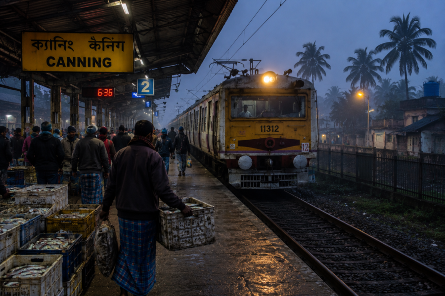
Most journeys begin from Kolkata, travelling south through Baruipur, Diamond Harbour, Kakdwip, and Namkhana before continuing toward Bakkhali.
The Hatania–Doania Bridge has largely replaced the older ferry crossing, making road access far more convenient than in previous decades.
From Bakkhali, a short drive leads to the entrance of Henry’s Island.
- The transition is subtle.
- Traffic becomes lighter.
- Casuarina plantations become denser.
- Fisheries begin appearing on either side of the road.
The island announces itself gradually.
- Walking remains the best way to understand it.
- Small embankment roads connect fisheries with mangrove belts.
- Raised pathways lead toward the watchtower.
Wooden boardwalks cross sensitive wetland areas, allowing visitors to observe the landscape without disturbing fragile habitats.
There are no complicated routes. Only quiet ones. Some of the island’s finest experiences lie away from the beach itself.
- A narrow embankment overlooking fisheries at sunrise.
- A mangrove creek during falling tide.
- The watchtower before the first visitors arrive.
- A shaded casuarina path carrying only the sound of the wind.
These are the hidden paths that rarely appear on maps. Yet they often become the moments visitors remember most.
Photography Expedition Guide
Henry’s Island does not reward hurried photography.
It rewards observation.
The landscape changes with every tide, every shift in light, and every passing season. The same location photographed at sunrise, high tide, and sunset can appear like three entirely different places.
Rather than chasing landmarks, photographers are rewarded for following the island’s natural rhythms.
Sunrise Photography
The first light arrives over the fisheries before reaching the beach.
Soft mist often hangs above the brackish-water ponds, while the rising sun paints warm reflections across calm water. This is the best time to photograph the island’s wetlands before the wind disturbs the surface.
The beach also becomes exceptional during low tide, when shallow tidal channels mirror the changing colours of the morning sky.
Watchtower Photography
The Fisheries Department watchtower provides Henry’s Island’s most complete landscape perspective.
From here, photographers can capture the remarkable transition between mangroves, tidal creeks, fisheries, coastal woodland, and the Bay of Bengal.
Morning offers softer light.
Late afternoon creates a greater contrast across the wetlands.
Wildlife Photography
Henry’s Island rewards patient observation rather than long-distance travel.
The best opportunities usually occur around:
- Tidal mudflats during low tide
- Mangrove edges
- Fisheries
- Estuarine creeks
- Quiet beach sections during winter
Telephoto lenses are recommended for bird photography to minimise disturbance.
Landscape Photography
Some of the island’s strongest compositions combine several ecosystems within a single frame.
Look for:
- Mangroves leading toward the sea
- Reflections across fisheries
- Casuarina-lined pathways
- Tidal channels crossing wet sand
- Fishing boats returning at sunset
The island’s greatest photographic strength lies in its transitions rather than individual landmarks.
Monsoon Photography
The monsoon transforms Henry’s Island into a landscape dominated by water.
- Dark skies.
- Fresh green vegetation.
- Overflowing wetlands.
- Rain is moving across the Bay of Bengal.
Although weather conditions become challenging, the season produces some of the island’s most dramatic documentary photographs.
Documentary Photography
Beyond scenic landscapes, Henry’s Island offers opportunities to document everyday coastal life.
- Fishermen preparing nets.
- Aquaculture workers maintain fisheries.
- Birds feeding across mudflats.
- Mangrove restoration.
- Cyclone recovery.
These quiet moments often tell the island’s story better than panoramic views.
Expedition Notes
Henry’s Island reveals itself slowly.
The following observations often become the most memorable parts of an expedition.
Observe the Tide Before Choosing a Route
Many of the island’s most interesting landscapes appear only during low tide.
Checking tide timings before exploring greatly improves both photography and wildlife observation.
Walk Beyond the Beach
Most visitors stop at the shoreline.
The island begins much earlier.
Mangroves, fisheries, wetlands, and embankments explain Henry’s Island far better than the beach alone.
Spend Time at the Watchtower
Do not simply climb the tower and leave.
- Remain there.
- Watch the changing light.
- Observe bird movements.
- Notice how wetlands connect to mangroves before meeting the sea.
The landscape gradually reveals its structure.
Listen More Than You Photograph
- Wind through casuarina plantations.
- Kingfishers are calling across the fisheries.
- Water enters tidal creeks.
The island communicates through sound as much as scenery.
Respect Wildlife
Birds feeding on mudflats conserve valuable energy.
- Avoid walking directly toward feeding flocks.
- Observe quietly from a distance.
The best wildlife encounters happen when people become less noticeable.
Connected Landscapes
Henry’s Island cannot be understood in isolation.
It belongs to a wider coastal system where rivers, estuaries, islands, beaches, fisheries, and mangroves remain closely connected.
Bakkhali
Immediately west of Henry’s Island lies Bakkhali.
Together, the two destinations present complementary landscapes.
Bakkhali introduces visitors to the Bay of Bengal.
Henry’s Island explains the wetlands and mangroves supporting that coastline.
Fraserganj
To the north lies Fraserganj, whose fishing harbour reflects the commercial heartbeat of the region.
Much of the seafood landed here eventually travels across West Bengal and beyond.
Hatania–Doania River
The Hatania–Doania River remains one of the region’s defining waterways, linking Namkhana with the southern coast and supporting transportation, fisheries, and estuarine ecology.
Bay of Bengal
Everything on Henry’s Island ultimately responds to the Bay of Bengal.
- The tides.
- The fisheries.
- The beach.
- The mangroves.
Even the local economy. The sea remains the island’s greatest architect.
Jambu Dwip
Offshore lies Jambu Dwip, an ecologically important protected island known for its coastal habitats and seasonal birdlife.
Its protected status reflects the wider conservation importance of this coastline.
Namkhana
Namkhana serves as the mainland gateway connecting visitors with Henry’s Island, Bakkhali, and the surrounding coastal settlements.
The Western Sundarbans
Although Henry’s Island lies outside the core tiger habitat, it shares ecological connections with the western edge of the Indian Sundarbans through tidal waters, estuaries, mangrove vegetation, and migratory wildlife.
Oral Histories
Henry’s Island’s strongest oral traditions are rooted in memory rather than mythology.
Many residents recall when the island felt even quieter than it does today.
- The road to Bakkhali was longer.
- Visitors were fewer.
- The watchtower overlooked an even more secluded coastline.
- Fishing and aquaculture occupied a larger share of daily conversation than tourism.
- Cyclones form another shared memory.
- Older residents often remember coastal history through storms rather than dates.
- People speak of rebuilding embankments after Aila.
- Repairing fisheries after Amphan.
- Preparing boats before Bulbul.
These recollections remain part of the island’s living memory, passed from one generation to the next.
Equally memorable are the gradual environmental changes witnessed over decades.
Residents have observed shifting shorelines, changing tidal behaviour, improvements in road connectivity, and increasing awareness of mangrove conservation.
Rather than dramatic historical events, Henry’s Island remembers steady change.
Its history has unfolded gradually.
One tide at a time.
Food of Henry’s Island
The cuisine of Henry’s Island reflects its surroundings.
Fresh fish remains central to almost every meal.
Prawns, seasonal crabs, estuarine fish, rice, lentils, and locally grown vegetables form the foundation of traditional coastal cooking.
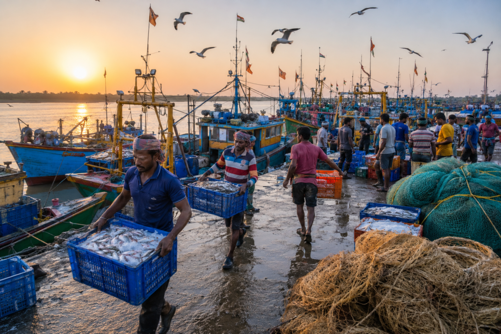
Meals are uncomplicated. Freshness matters more than elaborate preparation.
Fish often arrives directly from nearby fisheries or coastal landings before reaching local kitchens.
Simple mustard-based curries, lightly spiced fried fish, and prawn preparations remain common across the region.
Small roadside eateries also serve traditional Bengali breakfasts, tea, and seasonal snacks prepared for residents as much as visitors.
Like the island itself, the food values authenticity over presentation.
Island Economy
Henry’s Island’s economy is closely linked to its coastal geography.
Brackish-water aquaculture remains one of its most significant economic activities.
Managed fisheries support employment, food production, and local trade while making productive use of saline coastal waters.
Fishing also continues to support many nearby households, particularly those connected with the Bay of Bengal and surrounding estuarine waters.
Tourism contributes to the local economy, although on a smaller scale than neighbouring Bakkhali.
Government accommodation, small guesthouses, local transport operators, food stalls, and handicraft vendors all benefit from seasonal visitors.
Importantly, tourism has developed alongside fisheries rather than replacing them.
The island remains a working landscape first.
A visitor destination second.
Then and Now
Henry’s Island has changed considerably over recent decades.
Improved roads and the Hatania–Doania Bridge have made access easier than ever before.
Visitors who once regarded the island as a remote coastal outpost can now reach it comfortably from Kolkata.
Yet much remains unchanged.
- The mangroves continue protecting the shore.
- The fisheries still shape the landscape.
- The watchtower overlooks the same remarkable transition from wetland to sea.
- Birds continue following the tides as they always have.
Development has certainly arrived. Fortunately, it has not overwhelmed the island. Henry’s Island still feels defined more by ecology than infrastructure.
That balance remains one of its greatest strengths.
The Wild Orbit Quick Facts
Location:
Henry’s Island, South 24 Parganas, West Bengal
Administrative Block:
Namkhana Community Development Block
District:
South 24 Parganas
Nearest Town:
Bakkhali
Nearest Railway Station:
Namkhana
Nearest Major Water Body:
Bay of Bengal
Nearest River:
Hatania–Doania River
Landscape Type:
Coastal wetland, mangroves, fisheries, beach
Best Visiting Season:
November to February
Wildlife Highlights:
Shorebirds, kingfishers, Brahminy Kite, egrets, fiddler crabs, ghost crabs, mudskippers
The Wild Orbit Expedition Snapshot
Accessibility: ☆☆☆☆
Easily accessible from Kolkata via Namkhana and Bakkhali.
Wildlife Potential: ☆☆☆☆
Excellent for coastal birds, mangrove wildlife, and estuarine biodiversity.
Photography Potential: ☆☆☆☆☆
Outstanding for wetlands, mangroves, watchtower views, beaches, and documentary photography.
Cultural Richness: ☆☆☆☆
Fishing traditions, fisheries, and coastal village life define the island’s character.
Historical Interest: ☆☆☆
Shaped by fisheries development, coastal conservation, and environmental management.
Solitude Level: ☆☆☆☆
Generally quieter than nearby Bakkhali, especially on weekdays.
Family Friendly: ☆☆☆☆☆
Suitable for families interested in nature, beaches, and peaceful coastal exploration.
Explorer Value: ☆☆☆☆☆
One of the finest places to understand the relationship between mangroves, wetlands, fisheries, and the Bay of Bengal on the western edge of the Sundarbans.
The Wild Orbit Explorer Connections
Henry’s Island is best explored as part of a larger coastal expedition.
- Continue west to Bakkhali Beach to experience the open shoreline of the Bay of Bengal.
- Travel north to Fraserganj Fishing Harbour to witness one of West Bengal’s busiest marine fishing centres.
- Cross toward Namkhana to understand the importance of the Hatania–Doania River in connecting the mainland with the southern coast.
- Look offshore toward Jambu Dwip, a protected island supporting important coastal habitats and migratory birds.
Beyond these landscapes lies the wider Indian Sundarbans, where estuaries, mangroves, tidal rivers, and protected forests continue the ecological story that begins quietly on Henry’s Island.
FAQs
1. Where is Henry’s Island located?
Henry’s Island is located near Bakkhali in the Namkhana Block of South 24 Parganas, West Bengal.
2. Why is Henry’s Island famous?
It is known for its peaceful beach, mangroves, wetlands, watchtower, fisheries, and rich coastal biodiversity.
3. Is Henry’s Island part of the Sundarbans?
It lies on the western fringe of the Sundarbans landscape but outside the core tiger reserve.
4. How far is Henry’s Island from Kolkata?
It is approximately 130–140 km from Kolkata by road.
5. How far is Henry’s Island from Bakkhali?
Henry’s Island is about 5 km from Bakkhali.
6. Can you visit Henry’s Island in one day?
Yes, but an overnight stay allows more time for sunrise, sunset, birdwatching, and photography.
7. What is the best time to visit Henry’s Island?
November to February offers pleasant weather and the best birdwatching opportunities.
8. Is Henry’s Island good for birdwatching?
Yes. The wetlands, mudflats, and tidal creeks attract resident and migratory birds.
9. Can you swim at Henry’s Island?
Swimming is not generally recommended because tides and coastal conditions can change quickly.
10. Is Henry’s Island suitable for families?
Yes. It is a peaceful destination suitable for families interested in nature and quiet beaches.
11. Is there a watchtower on Henry’s Island?
Yes. The watchtower offers panoramic views of mangroves, wetlands, fisheries, and the Bay of Bengal.
12. Who manages Henry’s Island?
The area is associated with the Department of Fisheries, Government of West Bengal.
13. What wildlife can be seen on Henry’s Island?
Kingfishers, egrets, Brahminy Kites, shorebirds, fiddler crabs, ghost crabs, and mudskippers are commonly observed.
14. Are mangroves found on Henry’s Island?
Yes. Mangrove belts protect the coastline and support the island’s wetland ecosystem.
15. Is Henry’s Island crowded?
It is generally quieter than nearby Bakkhali, especially on weekdays.
16. What is the nearest railway station?
Namkhana Railway Station is the nearest railhead.
17. Is parking available?
Yes, parking facilities are available near the entrance area.
18. Are food options available?
Yes. Small restaurants and eateries serve fresh Bengali coastal cuisine.
19. Can photographers visit throughout the year?
Yes, although winter offers the most favourable lighting and wildlife activity.
20. Is Henry’s Island good for sunrise photography?
Yes. Sunrise over the wetlands and beach is one of the island’s highlights.
21. Are there accommodation options?
Yes. Government-managed and private accommodations are available nearby.
22. Can migratory birds be seen in winter?
Yes. Winter attracts several migratory shorebirds to the mudflats and wetlands.
23. Is Henry’s Island close to Fraserganj?
Yes. Fraserganj is only a short drive away.
24. Can you visit both Henry’s Island and Bakkhali on the same trip?
Yes. They are neighbouring destinations and are commonly explored together.
25. Why is Henry’s Island important ecologically?
Its mangroves, wetlands, mudflats, and fisheries support coastal biodiversity and help protect the shoreline.
26. Is Henry’s Island suitable for nature lovers?
Yes. It is one of the finest coastal landscapes in southern West Bengal for observing wetlands and estuarine ecology.
27. Can children enjoy Henry’s Island?
Yes. Families can enjoy the beach, watchtower, and natural surroundings responsibly.
28. What makes Henry’s Island different from Bakkhali?
Henry’s Island focuses more on mangroves, wetlands, fisheries, and conservation, while Bakkhali is better known for its beach.
How to Reach Henry’s Island
Reaching Henry’s Island is relatively straightforward, but the journey is also an introduction to Bengal’s changing coastal landscape.
From Kolkata by Road
The most convenient route is via:
- EM Bypass
- Baruipur
- Diamond Harbour
- Kakdwip
- Namkhana
- Bakkhali
Now this is Henry’s Island.
The Hatania–Doania Bridge has eliminated the need for the former ferry crossing, making road travel much easier.
The journey generally takes 4 to 5 hours, depending on traffic and road conditions.
By Train and Road
Take a local train from Sealdah to Namkhana Railway Station.
From Namkhana, hire a local vehicle or take public transport to Bakkhali and continue to Henry’s Island.
Local Transport
Auto-rickshaws, Toto (electric rickshaws), and reserved vehicles are available from Bakkhali to Henry’s Island.
Walking is the best way to explore once you arrive.
Explorer Tips
- Visit early in the morning for bird activity.
- Check tide timings before exploring the beach.
- Carry drinking water during the summer.
- Respect mangrove habitats and avoid disturbing wildlife.
Things to See Around Henry’s Island
- Henry’s Island Watchtower
- Henry’s Island Beach
- Mangrove Boardwalk
- Coastal Wetlands
- Brackish Water Fisheries
- Bakkhali Beach
- Fraserganj Fishing Harbour
- Jambu Dwip (viewpoint from the coast)
- Hatania–Doania River
- Namkhana
Continue the Expedition
Henry’s Island is only one chapter of the western Sundarbans. Continue exploring nearby landscapes where rivers, islands, fisheries, mangroves, and coastal communities reveal different perspectives of the Bengal delta.
Every destination adds another layer to the story.
The Coast Stays With You
Leaving Henry’s Island rarely feels like leaving a destination.
It feels like leaving a rhythm.
As the road winds back toward Bakkhali and the wetlands slowly disappear behind rows of casuarina trees, the island offers no dramatic farewell. The mangroves remain where the tide last touched them. The fisheries continue reflecting the changing sky. Birds circle above the creeks exactly as they did when the day began.
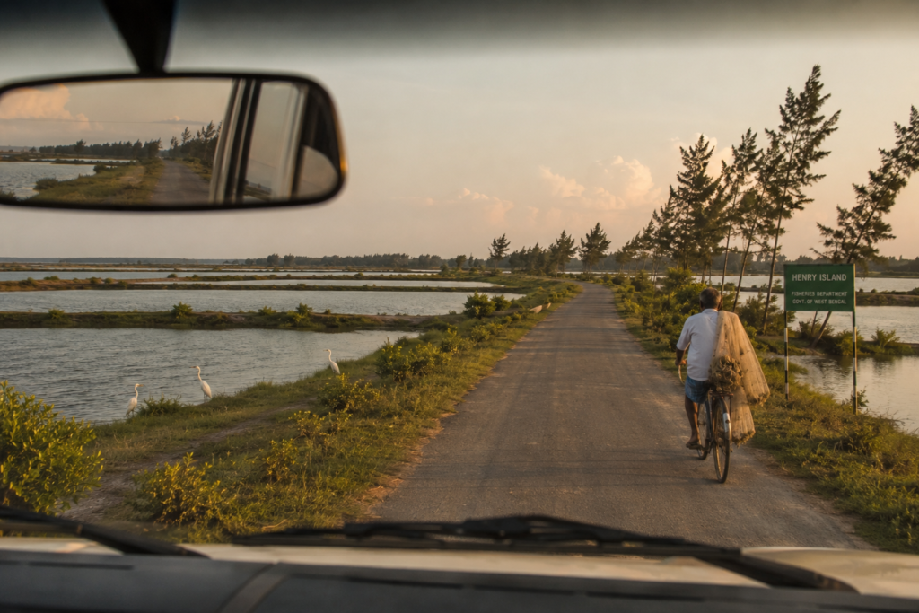
Nothing pauses because a visitor departs. That quiet continuity is perhaps Henry’s Island’s greatest lesson.
Here, nature is not presented as a spectacle.
It is simply allowed to continue. The memories that travel home are rarely of a single beach or viewpoint. They are of wind moving through coastal trees.
- Of birds feeding across tidal mud.
- Of mangrove roots rising from the earth.
- Of fishermen reading the sea before sunrise.
Henry’s Island reminds us that the coast is more than the place where land meets water. It is where people, wildlife, and tides have learned to endure together. Long after the shoreline disappears in the rear-view mirror, the island remains.
Not on the horizon.
But in the quiet understanding that some landscapes are best remembered not for what they show us—
But for what they teach us.
Plan your private Sundarban expedition
A private journey shaped around you — your group, your pace, your interests. Book a free consultation.