 Encyclopedia
Before dawn, the river is almost indistinguishable from the sky.
A pale mist hangs over the water, softening every edge. Somewhere beyond the darkness, an unseen current slides silently toward the Bay of Bengal. The tide is turning.
The boat drifts away from the jetty with little more than the murmur of an engine and the rhythmic slap of water against its wooden hull.
Ahead lies Hasnabad.
- Not deep within the mangrove wilderness.
- Not among the famous tiger forests.
- But in a landscape equally important to understanding the Sundarbans.
- A landscape where borders, rivers, migration, trade, memory, and ecology intersect.
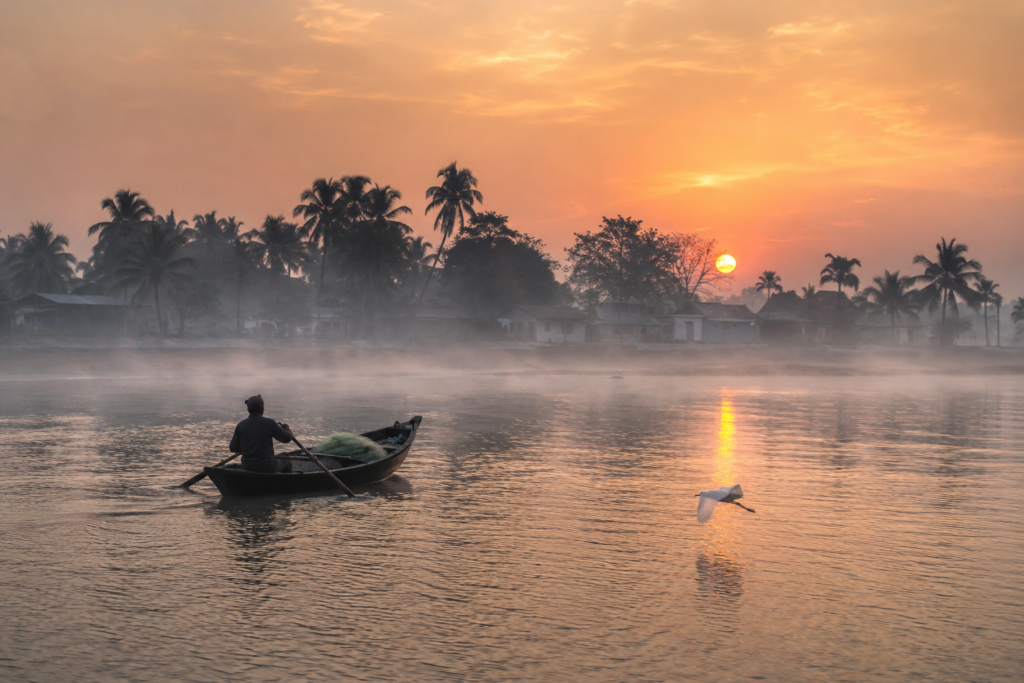
The eastern horizon begins to glow.
- A kingfisher calls from somewhere along the bank.
- A flock of egrets lifts suddenly from a mudflat hidden by fog.
- The smell of wet earth rises from exposed riverbanks.
As daylight slowly expands across the water, silhouettes emerge.
- Palm trees.
- Fishing boats.
- Embankments.
- The outlines of settlements.
And beyond them, a river that has shaped the destinies of nations.
The Ichamati.
Here, in Hasnabad, rivers are never merely waterways. They are boundaries.
- Connections.
- Histories.
- Witnesses.
The first sunlight catches the river’s surface. The island begins to reveal itself.
First Encounter
Arrival in Hasnabad feels different from arrival in many Sundarban islands.
The first impression is movement. Not wilderness. Movement.
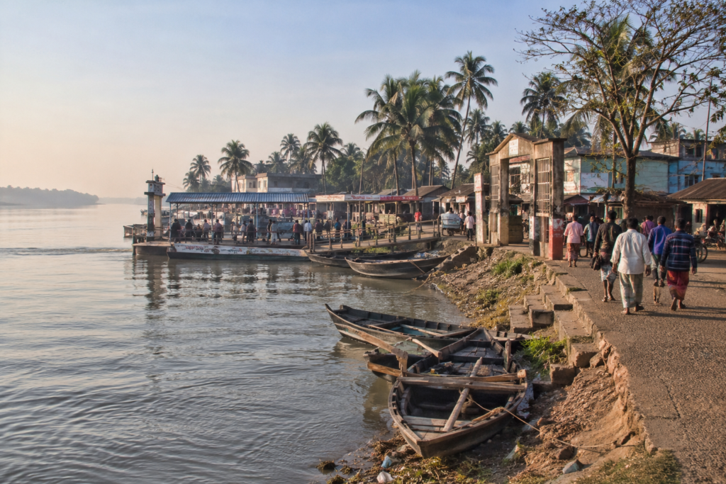
- Ferries crossing channels.
- People commuting.
- Fish traders unloading baskets.
- Cyclists navigating embankment roads.
- Vendors are preparing market stalls.
The riverbank is alive before most households have finished breakfast.
The shoreline itself tells a story.
Unlike the heavily forested edges found farther south, Hasnabad’s banks are shaped by centuries of human occupation.
- Embankments trace the water’s edge.
- Small ghats descend toward the river.
- Fishing boats rest in muddy shallows waiting for the next tide.
- Rows of trees provide shade above narrow paths.
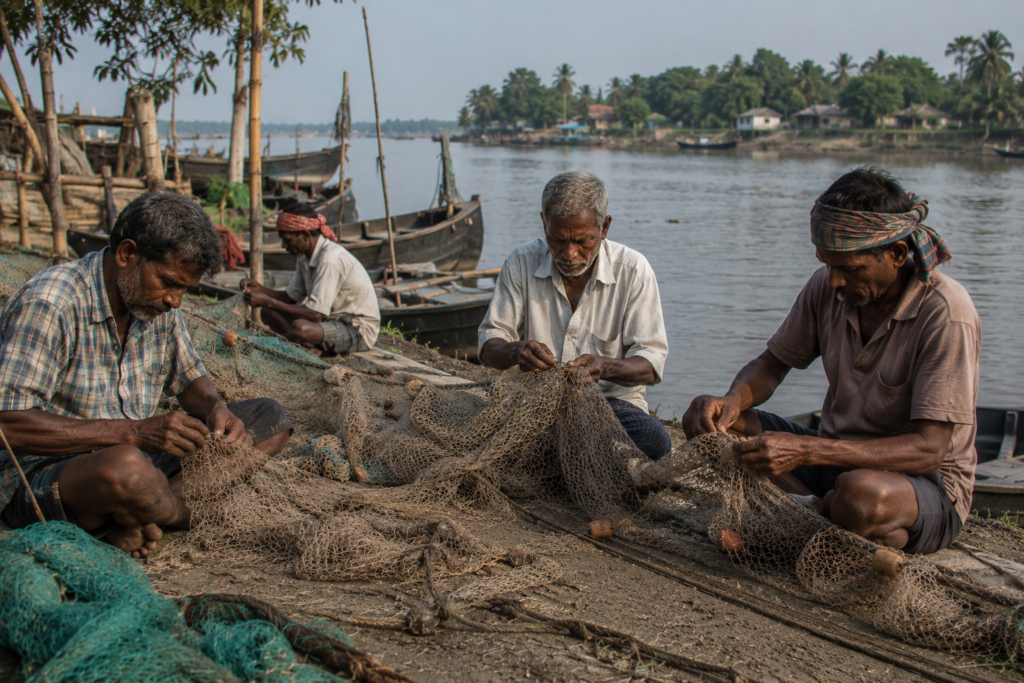
- Children in school uniforms walk past fishermen repairing nets.
Life here appears ordinary until one notices the river.
The Ichamati flows quietly beside everything. Yet it changes the meaning of every scene.
Because on the far bank lies another country.
Hasnabad’s Identity
Hasnabad occupies a unique position within the northeastern reaches of the Sundarbans delta.
Located within the Hasnabad Community Development Block of South 24 Parganas district, it functions as one of the most important riverine settlements along the India–Bangladesh frontier.
Unlike many islands that derive their identity primarily from remoteness, Hasnabad derives its identity from connection.
- Connection through rivers.
- Connection through trade.
- Connection through migration.
- Connection through history.
The broader block contains numerous villages distributed across a landscape shaped by tidal channels, embankments, agricultural fields, wetlands, and transport corridors.
Settlements rarely appear isolated.
Instead, they form a continuous relationship with roads, waterways, markets, schools, religious institutions, and ferry crossings.
The most influential geographic feature remains the Ichamati River.
- Its presence defines the island’s eastern horizon.
- Its tides influence agriculture.
- Its channels support fisheries.
- Its banks preserve memories of partition, migration, and changing borders.
To understand Hasnabad, one must understand the river first.
Everything else follows.
The Rivers That Built Hasnabad
The Ichamati is not a simple river.
It behaves like a conversation.
- At times gentle.
- At times forceful.
Always moving between places.
Originating farther north before entering the delta, the river gradually transforms as it approaches Hasnabad.
Freshwater influences weaken. Tidal influence strengthens. The landscape becomes increasingly estuarine. Increasingly maritime. Increasingly Sundarbans.
For centuries, the Ichamati functioned as a trade corridor. Boats transported rice, timber, salt, fish, and agricultural goods.
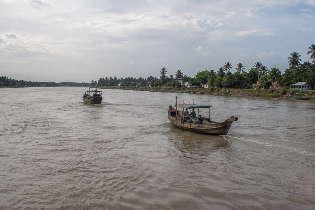
Communities emerged along its banks because movement was possible. Markets developed because exchange was possible. Cultures mixed because rivers ignore political boundaries.
Even today, the river remains central to daily life.
- Ferries cross it.
- Fishers depend upon it.
- Farmers monitor its behavior.
- Children grow up learning to read their moods.
The river’s seasonal changes remain deeply influential.
During monsoon months, it expands dramatically.
- Currents strengthen.
- Banks erode.
- Flood risks increase.
During winter, exposed mudflats emerge.
- Birdlife becomes more visible.
- Fishing patterns shift.
- The river changes.
- The people adapt.
That cycle has repeated for generations.
Historical Footprints
The history of Hasnabad cannot be separated from the history of Bengal itself.
Long before modern administrative boundaries existed, these riverbanks formed part of an extensive network linking villages, markets, agricultural zones, and waterways throughout the lower delta.
- Settlement expanded gradually.
- Embankments transformed wetlands into cultivable land.
- Agriculture intensified.
- Markets developed.
- Religious institutions appeared.
- Communities matured.
Then history accelerated.
The colonial period introduced new administrative systems, revenue structures, transportation networks, and economic priorities.
The landscape changed. Yet the river remained central. Perhaps no event shaped Hasnabad more profoundly than the Partition of 1947.
Few places in the Sundarbans carry such immediate proximity to the border.
The creation of India and East Pakistan transformed familiar landscapes into international frontiers.
- Communities were divided.
- Migration increased.
- New identities emerged.
- Old connections persisted.
The river became both bridge and boundary. Even today, memories of that transformation survive in local narratives.
Not as distant history.
As lived experience passed between generations.
Historical Personalities & Transformations
Unlike some islands associated with a single celebrated figure, Hasnabad’s historical significance emerges through collective transformation.
- Teachers.
- Local administrators.
- Religious leaders.
- Community organizers.
- Agricultural pioneers.
- Refugee settlers.
Each contributed to shaping modern Hasnabad.
The decades following Partition witnessed substantial demographic change. Refugee populations arriving from present-day Bangladesh influenced settlement patterns, agriculture, commerce, and cultural life.
Their impact remains visible in village names, family histories, food traditions, and local memory.
- Educational institutions expanded.
- Healthcare services improved.
- Transportation networks developed.
The arrival of rail connectivity strengthened Hasnabad’s relationship with Kolkata and other regional centers.
The result was not merely growth.
It was integration.
Hasnabad evolved from a frontier settlement into a vital regional node connecting riverine Bengal with the wider state.
Folklore & Legends
Every evening, eventually reach a tea stall.
And every tea stall eventually reaches folklore.
In Hasnabad, stories travel as easily as rivers. Some belong specifically to local communities. Others drift through the wider Sundarbans cultural world.
Bonbibi remains present in conversations concerning forests, rivers, and uncertainty.
Though Hasnabad lies outside the deep tiger forests, the cultural influence of Bonbibi extends far beyond protected mangrove zones.
Older fishermen occasionally invoke her name before difficult journeys.
Not out of ritual obligation.
- Out of habit.
- Out of respect.
- Out of inheritance.
Dakshin Ray appears in stories less frequently than in southern forest islands, yet his presence survives within the broader folklore of the delta.
More common are stories about the river itself.
- Unusual lights seen during foggy nights.
- Boats that lost their way in sudden storms.
- Channels that vanished.
- Banks that moved.
- Villages altered by erosion.
The most compelling stories often blur the boundary between memory and myth.
A fisherman describing a storm experienced fifty years ago may sound indistinguishable from a storyteller describing a legend. In tidal landscapes, both serve the same purpose.
They help explain uncertainty. And uncertainty remains one of the defining characteristics of life beside the Ichamati.
As the morning advances, the mist finally lifts from the river.
- The markets grow louder.
- Schoolyards fill.
- Fishing boats return.
And Hasnabad begins revealing the deeper rhythms that shape everyday life along one of the Sundarbans’ most historically significant waterways.
Life Between the Tides
By late morning, Hasnabad begins revealing its true rhythm.
Not the rhythm of roads. Not even the rhythm of markets.
The rhythm of water.
The tide may not always be visible from the center of a village, but its influence reaches everywhere.
A fisherman preparing nets beside a canal understands this instinctively. A farmer monitoring water levels in agricultural fields understands it too. So does the ferry operator watching the riverbank disappear beneath an incoming tide.
And the shopkeeper who knows exactly when commuters will arrive from the morning crossings.
The tide quietly organizes life.
Unlike the forest-fringed islands deeper inside the Sundarbans, Hasnabad exists within a densely inhabited river landscape.
- Agriculture remains important.
- Fishing remains important.
- Transportation remains important.
Yet none of these activities functions independently of water. The delta refuses such separation.
In cultivated areas, fields stretch beyond embankments toward distant tree lines.
- Rice dominates much of the agricultural landscape.
- Seasonal vegetables appear wherever conditions allow.
- Farmers continuously negotiate with rainfall, soil conditions, drainage systems, and salinity.
The farther south one travels in the delta, the stronger the influence of saltwater becomes. Hasnabad occupies a transitional zone where freshwater and tidal influences remain locked in constant negotiation.
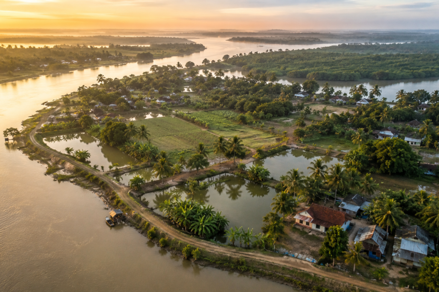
Ponds are everywhere.
- Some serve aquaculture.
- Some provide household water.
- Others support fish production.
Nearly every settlement contains water bodies woven into daily life.
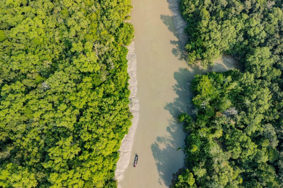
Viewed from above, the landscape appears less like solid land and more like a mosaic of fields, settlements, canals, ponds, and waterways.
The distinction matters.
Hasnabad is not built beside water.
It is built within water.
Fishing remains one of the most visible livelihoods. The day’s catch arrives through a network of rivers, creeks, and canals that connect villages to larger water systems. Early morning markets reveal species diversity that many urban visitors never encounter.
- Small estuarine fish.
- Freshwater species.
- Prawns.
- Crabs.
Seasonal catches that fluctuate according to river conditions. Every basket reflects ecological relationships occurring far beyond the marketplace itself.
Education occupies an increasingly important role in local life.
Schools stand beside ponds. Libraries sit near markets. Students travel daily along roads and embankments that previous generations crossed by boat.
Modern aspirations coexist with traditional livelihoods. A child carrying textbooks may return home to a family deeply connected to agriculture or fisheries. Neither reality excludes the other.
Both belong to contemporary Hasnabad.
Walking Through the Villages
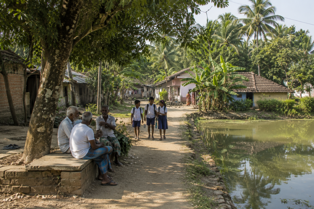
The best way to understand Hasnabad is to leave the main road.
Not immediately. Gradually.
Allow the settlements to unfold.
- A narrow lane branches away from a busier route.
- A pond appears.
- Then another.
- Palm trees lean over still water.
- Ducks move through aquatic vegetation.
- A bicycle rests against a courtyard wall.
The village emerges through details rather than landmarks.
- Homes reflect generations of adaptation.
- Older structures often reveal traditional building methods.
- Mud walls.
- Bamboo frameworks.
- Corrugated roofing.
Newer houses increasingly incorporate brick and concrete.
Many display evidence of incremental growth.
- A room was added here.
- A reinforced wall there.
- An elevated foundation responding to flood concerns.
Architecture becomes a record of environmental experience.
- Courtyards remain among the most revealing spaces.
- Women sort the vegetables harvested that morning.
- Children complete school assignments beneath shaded verandas.
Elderly residents sit beneath mango trees discussing politics, weather, agriculture, and cricket with equal seriousness.
Domestic life remains remarkably visible.
The boundary between public and private feels more permeable than in urban settings.
Religious life appears woven naturally into the landscape.
- Small temples emerge beside ponds.
- Mosques stand within village centers.
- Shrines occupy road intersections.
The structures themselves vary greatly in scale. Their social significance does not. Religious spaces function not only as places of worship but also as community landmarks and gathering points.
- Schools provide another focal point.
- The sound of lessons drifts through open windows.
- Students gather beneath trees during breaks.
- Educational murals decorate walls.
The future of Hasnabad often feels most visible near its schools.
Tea stalls remain essential. Not because of tea. Because of the conversation.
Every tea stall functions simultaneously as a café, newsroom, weather station, community center, and oral archive.
Sit long enough, and the entire region begins explaining itself.
Sounds of the Hasnabad
Every landscape possesses a soundtrack.
Hasnabad’s begins before sunrise and continues long after darkness falls.
The morning belongs to birds.
- Common mynas dominate village soundscapes.
- Crows patrol rooftops and market areas.
- Kingfishers call from canals and ponds.
- Egrets occasionally erupt from wetlands in noisy white flocks.
Above everything, black kites circle patiently in widening spirals.
Human sounds arrive gradually.
- The first bicycle bell.
- The first ferry horn.
- The first market conversation.
The settlement awakens layer by layer.
- Metal shutters opening.
- Motorcycles passing.
- School bells are ringing.
Near ferry crossings, movement becomes audible long before it becomes visible.
- Engines echo across water.
- Passengers gather.
- Voices carry unexpectedly far over tidal channels.
- Announcements mix with boat horns.
The river communicates through sound as much as sight.
Markets generate their own acoustic environment.
- Negotiation.
- Laughter.
- Arguments.
Fish being unloaded. Vegetables arranged. Customers calling across crowded pathways. The noise is rarely chaotic.
It possesses structure. Everyone seems to understand it.
Afternoon introduces wind.
- Palm fronds begin moving.
- Bamboo groves respond.
The sound shifts according to season.
- Winter wind whispers.
- Monsoon wind announces itself.
- Cyclone-season wind commands attention.
Residents learn these differences early. Evening brings transformation.
- The call to prayer drifts across ponds.
- Temple bells answer elsewhere.
- Birds become briefly more active before nightfall.
- Then insects inherit the landscape.
- Crickets.
- Frogs.
Night-time life begins speaking.
Wildlife Expedition
At first glance, Hasnabad appears dominated by people.
A closer examination reveals something more complex. Wildlife persists throughout the landscape.
Not in isolation.
In coexistence.
Birdlife provides the most immediate evidence. Even heavily settled areas support surprising diversity.
- Ponds function as miniature ecosystems.
- Canals connect habitats.
- Agricultural fields attract feeding birds.
- Wetlands support seasonal visitors.
The result is a constantly changing avian community.
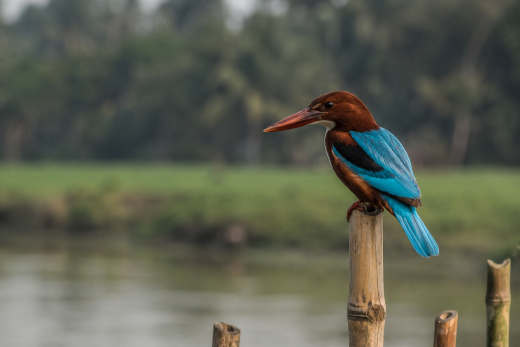
- Kingfishers are among the most frequently encountered species.
- White-throated kingfishers occupy electric wires overlooking ponds.
- Their bright turquoise wings seem almost unreal against muddy delta water.
- Pied kingfishers hover above channels before diving.
Common kingfishers appear as brief flashes of blue and orange along shaded banks.
- Herons and egrets dominate wetter areas.
- Pond herons stalk quietly through vegetation.
- Little egrets patrol shallow water.
- Intermediate egrets appear in agricultural landscapes.
Their movements seem deliberate.
Measured.
Efficient.
Raptors remain surprisingly common. Black kites are nearly ubiquitous. Brahminy kites occasionally appear above larger waterways, their distinctive coloration making them immediately recognizable.
These birds occupy the upper levels of the delta’s food web. Their presence reflects ecological productivity below.
- Mammals are less visible but certainly present.
- Indian palm squirrels move through village trees.
- Fruit bats emerge at dusk.
Various small mammals inhabit agricultural and wetland environments. Many remain unseen by casual observers.
- Reptiles survive wherever suitable habitat persists.
- Water snakes occur near canals and ponds.
- Monitor lizards are occasionally reported from wetland margins.
- Various gecko species occupy homes and outbuildings.
During monsoon months, amphibian diversity becomes impossible to ignore.
The evening chorus of frogs transforms entire landscapes. What appears silent during daylight becomes acoustically alive after rain.
The most important wildlife lesson Hasnabad offers is this:
- Biodiversity does not always require wilderness.
- Sometimes it survives within working landscapes.
- Sometimes it adapts.
- Sometimes it persists in places people overlook.
Mangrove Chronicles
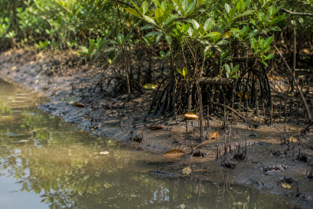
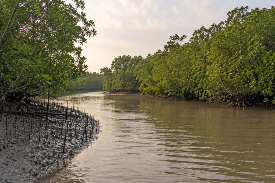
Hasnabad is not a mangrove island in the classical Sundarbans sense.
Visitors expecting vast forests will be disappointed. Naturalists will not. Because fragments matter.
Travel along tidal channels and remnants of mangrove vegetation begin appearing.
- A cluster beside a creek.
- A narrow strip protecting a bank.
- A patch surviving where development pressures remain limited.
These fragments reveal the ecological foundation upon which the wider delta exists.
Mangroves here function less as forests and more as ecological memories. They remind observers what much larger portions of the delta once looked like.
And what continues farther south.
Species vary according to local salinity and hydrological conditions. Where mangroves survive, they perform the same critical functions they perform elsewhere in the Sundarbans.
- They stabilize sediment.
- Reduce erosion.
- Provide nursery habitat.
- Support fish populations.
- Protect shorelines.
- Create ecological complexity.
Standing beside a surviving mangrove patch offers a lesson in resilience.
These plants evolved specifically to inhabit uncertainty.
- Changing water levels.
- Variable salinity.
- Unstable substrates.
They thrive where predictability disappears.
Human relationships with mangroves remain complicated.
- Communities value their protective role.
- Yet development pressures continue.
- Land remains valuable.
- Space remains limited.
Balancing ecological preservation with human needs remains an ongoing challenge.
The future of mangroves around Hasnabad may depend less on large-scale conservation projects and more on recognizing the importance of small surviving patches.
Ecological corridors begin with fragments.
Explorer’s Field Notes
See it for yourself
A private journey shaped around you — your group, your pace, your interests. Book a free consultation.
05:07 AM
Dense river mist limits visibility along the Ichamati. Bird activity begins before sunrise.
05:34 AM
First kingfisher sighting near a canal entering the main river.
06:02 AM
Fishing boats return toward local landing points. Market preparations visible from the embankment.
06:49 AM
Schoolchildren begin appearing along village roads.
07:18 AM
The incoming tide noticeably raises water levels along smaller channels.
08:11 AM
The fish market is operating at peak intensity. Species diversity greater than expected.
09:06 AM
The tea stall discussion focused on river conditions and crop prospects.
10:23 AM
Little egret observed feeding beside an agricultural drainage canal.
11:47 AM
Heat increases rapidly. Human activity concentrates beneath shaded areas.
01:14 PM
Wind strengthens across open fields.
02:39 PM
Village pond supports multiple kingfisher species within a remarkably small area.
03:58 PM
Afternoon ferry traffic increases significantly.
04:37 PM
Brahminy kite observed above the Ichamati.
05:16 PM
Golden light transforms embankments and riverside vegetation.
06:04 PM
Evening prayer audible across several settlements simultaneously.
06:43 PM
Temple bells and bird calls overlap briefly.
07:21 PM
Frog chorus begins after sunset.
08:03 PM
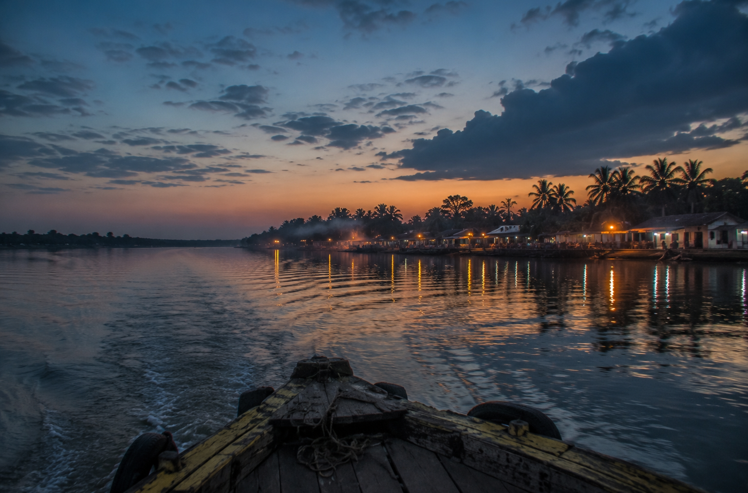
River visible primarily through reflected settlement lights.
As darkness settles over Hasnabad, the Ichamati becomes a ribbon of moving shadow.
- The ferries continue.
- The tide continues.
- The border remains invisible.
And the island prepares to reveal a completely different character after sunset.
Nightfall on the Hasnabad
Darkness arrives gradually in Hasnabad.
The river resists it.
For a while.
The final traces of sunlight linger on the Ichamati long after shadows have filled the villages. The water continues reflecting fragments of the sky, holding onto daylight longer than the land.
Then, slowly, even the river surrenders.
- The transformation is immediate.
- The landscape becomes quieter.
- Not silent.
- Never silent.
- Just different.
The markets that seemed energetic and crowded during daylight begin to empty.
- Vendors count earnings.
- Fish stalls wash away the day’s traces.
- Bicycles disappear toward villages.
- Children are called indoors.
The movement that defined the afternoon gradually dissolves.
Near ferry points, activity continues. Hasnabad’s relationship with water does not end at sunset.
- Late passengers cross channels.
- Boatmen monitor currents.
- Fishermen prepare for journeys timed to the night tide.
The river remains active while much of the settlement sleeps.
Standing beside the Ichamati after dark creates a curious sensation.
The opposite bank becomes difficult to distinguish. The international border that dominates maps becomes invisible. Only scattered lights remain.
One bank.
Then another.
- Reflections.
- Darkness.
- Water.
- Political geography disappears.
River geography remains.
The sounds become more pronounced.
- Frogs emerge from wetlands.
- Crickets establish a steady rhythm.
- A dog barks somewhere beyond a pond.
- A distant engine passes through the darkness.
The occasional ferry horn travels surprisingly far across calm water.
Night amplifies distance.
During winter, the sky often reveals remarkable clarity.
Stars emerge above the delta. Constellations reflect in ponds and canals. On moonlit nights, embankments glow faintly beneath silver light.
The river becomes visible once again.
Not through sunlight. Through reflection.
By midnight, Hasnabad feels older.
- Closer to its riverine origins.
- The roads matter less.
- The water matters more.
The island returns temporarily to the elemental landscape that existed long before modern boundaries arrived.
The Seasons of Hasnabad
To spend a year in Hasnabad is to witness several different landscapes occupying the same geography.
- The villages remain.
- The rivers remain.
- The experience changes entirely.
Winter (December – February)
Winter is perhaps the most revealing season.
- Morning fog drifts across the Ichamati.
- Wetlands attract migratory birds.
- Agricultural fields display post-harvest textures and colors.
- Visibility improves once the mist lifts.
- The horizon expands.
- The river appears wider.
Human activity becomes more comfortable under cooler conditions. Winter mornings belong to birdwatchers, fishermen, and farmers.
Everyone seems to rise early.
Spring (March – April)
Spring arrives quietly.
- Mango trees flower.
- Temperatures begin climbing.
- The landscape still retains traces of winter calm.
- Bird activity remains high.
- Agricultural work intensifies.
- The atmosphere feels transitional.
The island is preparing for heat.
Summer (April – June)
By late April, heat dominates daily life.
Afternoons become intense.
- Roads shimmer.
- Ponds shrink slightly.
- Shade becomes valuable.
People adapt their schedules accordingly.
- Work begins earlier.
- Breaks become longer.
- The sky grows increasingly dramatic.
- Towering clouds appear along distant horizons.
The pre-monsoon atmosphere carries anticipation.
Everyone watches the weather.
Monsoon (June – September)
Then the rains arrive.
The first sustained rainfall transforms Hasnabad.
- Dust disappears.
- Canals refill.
- Fields become intensely green.
- The river swells.
Water reasserts its dominance over the landscape.
The monsoon reveals connections normally hidden.
- Ponds link to canals.
- Canals connect to rivers.
- Wetlands expand.
Drainage systems become visible through function rather than structure. The entire landscape begins behaving as a single hydrological system.
Yet beauty arrives alongside risk.
- Flooding becomes possible.
- Riverbank erosion intensifies.
- Transportation becomes less predictable.
- Communities monitor embankments closely.
The monsoon demands attention.
Post-Monsoon (October – November)
This season often produces some of the year’s most beautiful conditions.
- The rains retreat.
- Vegetation remains lush.
- Humidity decreases.
- Visibility improves.
- Agricultural activity accelerates.
- The rivers remain full.
The landscape feels refreshed rather than exhausted. Photographers often consider this the most rewarding period.
Cyclone Season
Cyclone season deserves separate consideration because it reshapes perception itself.
During cyclone warnings, ordinary routines change.
- Markets close earlier.
- Boats return sooner.
- Families monitor forecasts.
- Communities prepare.
The atmosphere becomes cautious. Everyone understands what is possible. Because everyone remembers.
Cyclones and Survival
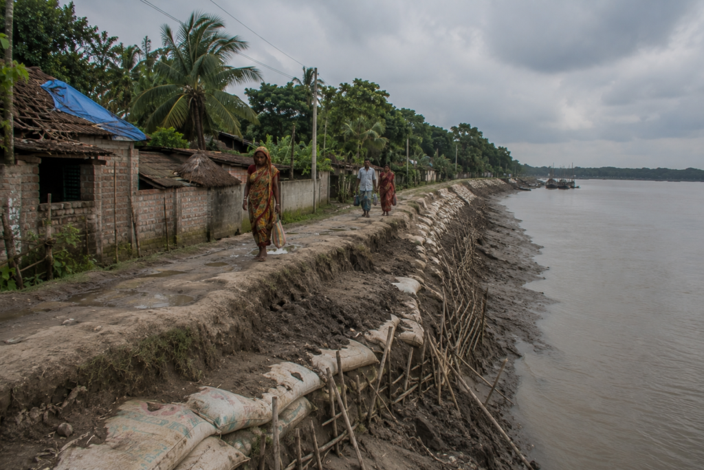
No conversation about Hasnabad can ignore cyclones.
The Bay of Bengal’s storms may originate far away, but their consequences reach deeply into the delta.
Hasnabad has experienced generations of these encounters.
Older residents often describe cyclones through memory rather than meteorology.
Not wind speeds.
Experiences.
- The sound of rising water.
- The movement of roofs.
- The darkness when electricity failed.
- The hours spent waiting.
- The uncertainty afterward.
Cyclones such as Aila (2009), Amphan (2020), and Yaas (2021) remain firmly embedded in local memory across southern Bengal.
Although impacts varied from location to location, each storm reinforced the same lesson:
The delta remains vulnerable.
Embankments therefore, occupy a special place within local consciousness.
- Visitors may see the infrastructure.
- Residents see protection.
- Agriculture depends upon them.
- Settlements depend upon them.
- Livelihoods depend upon them.
- Every repaired section tells a story.
- Every reinforcement reflects experience.
Adaptation has become part of daily life.
- Cyclone shelters.
- Improved forecasts.
- Mobile communication.
- Community preparedness.
- Raised housing foundations.
- Emergency planning.
These measures cannot eliminate risk. They can reduce vulnerability. And in the delta, that distinction matters enormously.
Perhaps the most remarkable aspect of Hasnabad’s cyclone history is not destruction.
It is recovery.
The speed with which communities rebuild.
- Replant.
- Repair.
- Return.
Resilience here is practical.
Not symbolic.
Ferry Routes & Hidden Paths
To understand Hasnabad, follow the movement.
Movement explains the island.
- The railway station brings people toward the river.
- The river distributes them onward.
- This relationship has shaped Hasnabad for decades.
The settlement functions as a gateway linking inland Bengal with riverine landscapes farther south and east.
Ferry crossings remain central to daily life.
- Students commute.
- Workers travel.
- Families visit relatives.
- Goods move continuously.
The ferries do not feel like tourist experiences. They feel necessary. Because they are.
Some of the most revealing routes are not marked on maps.
- A narrow embankment path beside a canal.
- A shortcut through agricultural land.
- A small landing point used primarily by local residents.
These places reveal everyday geography.
Walk long enough beside the Ichamati and patterns emerge.
- Where fishermen gather.
- Where birds concentrate.
- Where erosion is strongest.
- Where children play.
- Where people pause simply to watch the river.
The hidden routes are not secret. They are simply lived rather than advertised.
Photography Expedition Guide
Hasnabad rewards photographers interested in stories rather than spectacles.
The strongest images emerge from observation. Patience matters more than equipment.
Sunrise Along the Ichamati
Before dawn, mist often drifts across the river.
- Fishing boats appear as silhouettes.
- Birds cross pale horizons.
- The atmosphere feels cinematic without effort.
This is arguably the most rewarding photographic window of the day.
River and Border Landscapes
The Ichamati offers a unique subject.
A river that functions simultaneously as an ecosystem, a transportation corridor, a cultural connection, and an international boundary.
Photographs here often carry layers of meaning beyond the visible frame.
Village Photography
- Courtyards.
- Tea stalls.
- School entrances.
- Fishing-net repairs.
- Agricultural work.
These scenes reveal Hasnabad’s human geography. Respect and conversation remain essential.
The best photographs emerge from relationships, not distance.
Wetland and Bird Photography
Winter mornings provide excellent opportunities.
- Kingfishers.
- Herons.
- Egrets.
- Kites.
Wetland habitats reward slow observation. Many encounters occur unexpectedly.
Monsoon Photography
Storm clouds gathering above the Ichamati create extraordinary visual conditions.
- Light changes rapidly.
- Reflections multiply.
- The weather itself becomes a subject.
Night Photography
- River reflections.
- Ferry lights.
- Moonlit embankments.
- Mist above water during winter.
Night reveals a quieter, more contemplative Hasnabad.
Expedition Notes
Certain observations refuse categorization. They belong instead to the explorer’s notebook.
A section of riverbank where older residents insist the channel once flowed differently. The river remembers changes that maps rarely capture.
A tea stall owner capable of recounting fifty years of local history with greater precision than many written sources.
Children identify bird species with surprising confidence. Knowledge is inherited through everyday observation.
A pond hidden behind dense vegetation supports remarkable bird activity despite its proximity to a busy road.
The way fog transforms the Ichamati during winter mornings. The river seems less like a boundary and more like a memory.
The subtle difference between people looking at the river and people reading the river.
Residents notice details that outsiders rarely see.
- Current strength.
- Watercolor.
- Floating vegetation.
- Signs of change.
Connected Landscapes
Hasnabad cannot be understood in isolation.
Its importance emerges through connection.
- To the east lies Bangladesh.
- The relationship is geographical, historical, cultural, and emotional.
- The river separates.
- The river connects.
Both realities exist simultaneously.
Southward, the landscape gradually transitions toward the more fragmented waterways of the lower Sundarbans.
- Creeks multiply.
- Tidal influence intensifies.
- Mangrove ecosystems are becoming increasingly prominent.
The delta deepens.
Northward, connections extend toward Basirhat and the broader plains of Bengal.
- Agricultural systems strengthen.
- Urban influence increases.
- Yet the river remains present.
Nearby settlements such as Hingalganj share ecological and cultural relationships with Hasnabad.
- The rivers that shape one landscape inevitably influence the other.
- Migratory birds ignore administrative boundaries.
- Fish move through connected waterways.
- Sediment travels continuously.
Historically, these connections were even stronger.
Before modern borders, rivers linked communities throughout the lower delta.
- Trade networks.
- Family relationships.
- Cultural exchanges.
The waterways served as corridors rather than boundaries. Traces of that history remain visible today.
Ecologically, Hasnabad forms part of a much larger system.
- The Ichamati connects wetlands.
- Wetlands support fisheries.
- Fisheries support livelihoods.
- Livelihoods influence settlement patterns.
Everything connects. Nothing exists independently.
As the tide begins turning once again, the river resumes its endless work.
- Water moves.
- Sediment shifts.
- Boats travel.
- Stories continue.
And Hasnabad remains exactly where it has always been—at the meeting point of river, border, memory, and change.
Oral Histories
The written history of Hasnabad can be found in records.
The lived history survives in conversations. And in Hasnabad, conversations rarely stay small for long.
- A discussion about fish prices becomes a discussion about river changes.
- A discussion about weather becomes a discussion about cyclones.
- A discussion about transportation becomes a discussion about Partition.
Everything connects. Because history here remains close to the surface.
Near a riverside tea stall, an elderly resident gestures toward the Ichamati.
- To a visitor, it appears unchanged.
- To him, it is a different river.
“The channel was wider,” he says.
- Others disagree.
- The conversation continues.
- No maps emerge.
- No documents appear.
Only memory.
Yet these disagreements themselves reveal something important. The river is not merely observed.
It is remembered.
One retired schoolteacher recalls a time when river crossings dominated daily life.
- Travel required patience.
- Schedules followed tides.
- Communication moved more slowly.
- The world beyond the district felt distant.
Today, mobile phones connect villages instantly.
- Roads have improved.
- Rail services remain important.
Yet he insists something has remained constant. “The river still decides.”
Partition memories remain especially powerful. In many households, family histories extend across the border.
The political boundary is relatively recent compared to the cultural geography that preceded it. Some families arrived from areas now within Bangladesh. Others maintained relationships across the river for decades.
The stories vary.
The emotional tone does not. The border altered lives in ways still remembered generations later.
An elderly fisherman remembers fishing grounds that no longer exist. Not because fish disappeared.
- Because the river changed.
- Channels shifted.
- Mudbanks emerged.
- Waterways narrowed.
- Others deepened.
His memory functions like an unwritten hydrographic survey.
Perhaps the most revealing oral histories concern weather. Residents often describe storms by consequence rather than date.
- “The storm that broke the embankment.”
- “The storm after which we rebuilt.”
- “The storm when the river entered the fields.”
Such descriptions reveal how communities experience environmental events. Not as meteorological statistics.
As personal geography.
Food of the Hasnabad
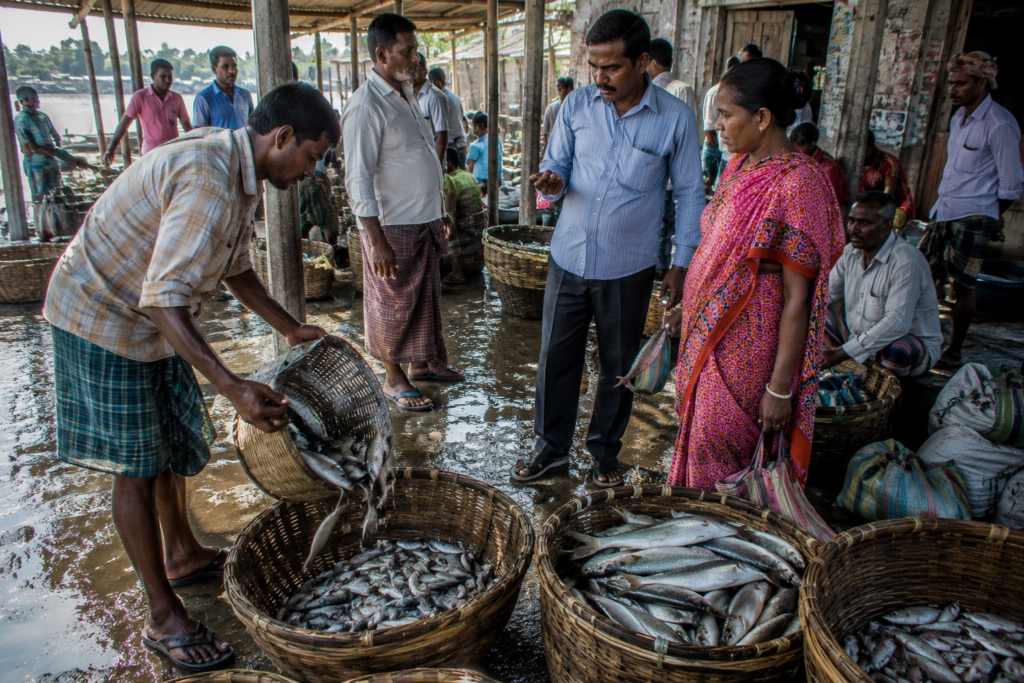
Food in Hasnabad begins with water.
Not because every meal contains fish. Though many do. But because the river shapes availability, tradition, trade, and taste.
Morning markets reveal this immediately. Fish occupies a central position. Species vary according to season, river conditions, fishing effort, and ecological cycles.
Some arrive from freshwater environments. Others from estuarine waters. Still others through broader regional trade networks. The diversity reflects the complexity of the delta itself.
Rice remains foundational.
Like much of Bengal, daily meals frequently revolve around rice accompanied by fish, vegetables, lentils, and seasonal ingredients.
The simplicity is deceptive.
Behind every meal lies a landscape.
- Fields.
- Ponds.
- Rivers.
- Markets.
- Transportation systems.
- Human labor.
Seasonality remains important.
- Winter brings different vegetables.
- Monsoon influences fish availability.
- Festivals alter menus.
Agricultural cycles shape market offerings. Food follows environmental rhythms rather than fixed expectations.
Tea stalls deserve special attention.
They are culinary institutions disguised as conversation spaces. Tea arrives quickly. Discussions linger.
Travelers often learn more about Hasnabad over several cups of tea than through hours of formal research.
Sweets connect Hasnabad to wider Bengali traditions.
Local markets offer familiar regional favorites while reflecting the broader culinary culture of southern Bengal.
Food becomes another form of cultural continuity.
Religious observances add additional layers.
- Festival foods.
- Community meals.
- Offerings.
- Seasonal preparations.
Many recipes survive because they remain tied to collective memory.
Perhaps most importantly, Hasnabad’s food culture feels functional. Authentic. Unperformed.
These are meals shaped by environment rather than presentation. That authenticity remains one of the island’s defining characteristics.
Hasnabad’s Economy
To understand Hasnabad’s economy, begin at the river.
Most economic stories here eventually return to water.
Fishing remains fundamental. The Ichamati and connected waterways support livelihoods directly and indirectly. Fishermen work rivers, canals, wetlands, and nearby estuarine environments. Fish traders connect catches to markets.
Transport operators move products. Ice suppliers, vendors, and laborers contribute to a broader economic network. A single basket of fish represents multiple livelihoods.
- Agriculture forms the second major pillar.
- Rice cultivation dominates much of the landscape.
- Vegetables provide supplementary income.
- Household-scale agriculture remains common.
- Ponds contribute to additional food security.
The economy often operates through diversification rather than specialization.
Trade has historically been central to Hasnabad.
Its position along important river corridors encouraged exchange long before modern infrastructure arrived.
Today, markets continue serving as regional gathering points where agricultural products, fish, household goods, and services circulate continuously.
Transportation itself generates economic activity.
- Railways.
- Roads.
- Ferries.
- Small vehicles.
Goods movement supports employment across multiple sectors. Connectivity has value. Hasnabad understands this deeply.
Education and government services contribute to growing economic significance. Schools, healthcare facilities, administrative offices, and associated services create employment opportunities beyond traditional occupations.
The local economy continues evolving.
Migration also influences economic life. Many families maintain connections with Kolkata and other urban centers. Income generated elsewhere often supports households within Hasnabad.
Money travels.
Relationships remain.
The island participates in larger economic systems while retaining strong local character.
Tourism exists only marginally compared to more recognized destinations. Most visitors pass through rather than stop. Ironically, this contributes to Hasnabad’s authenticity.
The landscape continues functioning primarily for residents rather than visitors.
Then & Now
The most revealing way to understand Hasnabad may be through comparison.
Not a comparison with other places. Comparison with itself.
Then: River Dependency
For earlier generations, rivers dominated transportation.
- Boats connected communities.
- Tides influenced schedules.
- Weather determined possibilities.
- Movement required patience.
The river was infrastructure.
Now: Multiple Networks
Roads, railways, mobile communication, and improved transport options have diversified connectivity.
The river remains important. It is no longer the only option.
Then: Slower Information
News traveled through people.
- Markets.
- Boatmen.
- Teachers.
- Traders.
Information moved physically.
Now: Instant Communication
- Weather forecasts arrive on phones.
- Market prices spread rapidly.
- Cyclone warnings reach villages faster than ever before.
- Knowledge travels differently.
Its importance remains unchanged.
Then: Expansion
Earlier generations focused heavily on settlement, cultivation, embankment construction, and agricultural development.
The challenge involved creating stability.
Now: Protection
Today, environmental resilience increasingly dominates discussions.
- Embankment maintenance.
- Flood management.
- Salinity concerns.
- Climate uncertainty.
The challenge shifted from expansion toward adaptation.
Then: Local Horizons
- Travel opportunities were fewer.
- Educational access more limited.
- Economic mobility constrained.
Many lives remained geographically concentrated.
Now: Expanding Aspirations
- Students pursue higher education.
- Families maintain connections across cities and states.
- Career opportunities have diversified.
Hasnabad participates more actively in wider regional and national networks.
Yet despite these changes, some realities remain remarkably consistent.
- The Ichamati still rises and falls.
- Fishing boats still depart before sunrise.
- Markets still depend upon timing.
- The river still influences decisions.
Modernity arrived.
The tide stayed.
The Wild Orbit Quick Facts
Region
Hasnabad
Approximate Coordinates
22.57° N, 88.88° E
Administrative District
South 24 Parganas district historically defines much of the Sundarbans region, though Hasnabad itself lies within North 24 Parganas district.
Administrative Block
Hasnabad Community Development Block
State
West Bengal
Landscape Type
Tidal riverine settlement landscape at the northern gateway of the Sundarbans delta
Major River
Ichamati River
International Significance
Located along the India–Bangladesh border zone
Dominant Livelihoods
- Fishing
- Agriculture
- Trade
- Transportation
- Government services
- Small businesses
Ecosystem Character
Riverine wetlands, agricultural landscapes, ponds, canals, estuarine transition zones
Railway Connectivity
Hasnabad Railway Station serves as a major transport link to Kolkata
Nearest Major Waterway
Ichamati River
Best Exploration Season
November to February
Cyclone Exposure
Moderate to high due to deltaic location
Wildlife Highlights
- Kingfishers
- Egrets
- Herons
- Brahminy kites
- Wetland birds
- Amphibians
- Riverine biodiversity
Defining Characteristic
A borderland river settlement where history, migration, rivers, and delta ecology intersect
The Wild Orbit Expedition Snapshot
Accessibility
9.5/10
One of the easiest riverine landscapes of the greater Sundarbans region to access via rail and road. Connectivity is a defining strength.
Wildlife Potential
6/10
Not a wilderness destination, but wetlands, ponds, river corridors, and agricultural habitats support notable birdlife and biodiversity.
Photography Potential
8.5/10
Outstanding opportunities for river photography, border landscapes, documentary storytelling, village life, fisheries, markets, and seasonal weather.
Cultural Richness
9.5/10
Few places in the Sundarbans combine migration history, border narratives, river culture, religious diversity, and everyday delta life so effectively.
Historical Interest
9/10
Partition memories, river trade heritage, settlement history, and the evolution of a borderland community create substantial historical depth.
Solitude Level
5/10
Hasnabad is active and inhabited. Solitude exists beside rivers, wetlands, and quiet embankments rather than throughout the landscape.
Expedition Difficulty
2/10
Physically easy to explore. Intellectually rewarding. The challenge lies in understanding the layers of geography, memory, ecology, and history embedded within an apparently ordinary settlement.
As night deepens over the Ichamati, the river becomes almost invisible once again.
- The ferries slow.
- The markets sleep.
- The tide continues moving through darkness.
And Hasnabad waits for another dawn beside one of the most consequential rivers in the Sundarbans frontier.
FAQs
1. Where is Hasnabad located?
Hasnabad is located in the northeastern deltaic region of West Bengal within the Hasnabad Community Development Block of North 24 Parganas district, along the Ichamati River near the India–Bangladesh border.
2. Is Hasnabad part of the Sundarbans?
Yes. Hasnabad occupies the northern gateway zone of the greater Sundarbans delta and forms part of the broader tidal river system that shapes the region.
3. Is Hasnabad an island?
Hasnabad is better understood as a riverine delta settlement landscape shaped by tidal rivers, canals, wetlands, and embanked habitation zones rather than an isolated island in the traditional sense.
4. Which river defines Hasnabad?
The Ichamati River is the most important river associated with Hasnabad.
5. Why is Hasnabad important?
Hasnabad is significant because of its location along the India–Bangladesh border, its historical migration stories, river trade heritage, and its role as a gateway to the northeastern Sundarbans.
6. Does Hasnabad have mangrove forests?
Not extensive forests like the protected Sundarbans Reserve Forest, but scattered mangrove patches survive along certain tidal waterways and wetland margins
7. Can tigers be found in Hasnabad?
No established tiger habitat exists in Hasnabad. Tigers are associated with the protected mangrove forests farther south.
8. What birds are commonly seen in Hasnabad?
Kingfishers, egrets, herons, cormorants, black kites, Brahminy kites, pond herons, and numerous wetland birds.
9. Is the Ichamati River tidal?
Yes. Tidal influence extends into the Ichamati, affecting water levels, fisheries, navigation, and daily life.
10. What is the main livelihood in Hasnabad?
Fishing, agriculture, trade, transportation, government services, and small businesses dominate the local economy.
11. Why are embankments important?
They protect settlements and agricultural land from flooding, tidal influence, and erosion.
12. Is Hasnabad affected by cyclones?
Yes. Like much of the Bengal delta, Hasnabad experiences impacts from cyclonic systems originating in the Bay of Bengal.
13. Does Hasnabad have railway connectivity?
Yes. Hasnabad Railway Station provides direct connections to Kolkata through the suburban rail network.
14. What makes Hasnabad different from the southern Sundarban islands?
Its borderland location, river-based history, migration narratives, and strong transport connectivity distinguish it from more isolated islands.
15. Is the Bangladesh border visible from Hasnabad?
In many locations along the Ichamati, the opposite riverbank belongs to Bangladesh and can be seen across the river.
16. Are ferries important in Hasnabad?
Yes. Ferries continue to support local movement across waterways and remain part of daily life.
17. What is the best season to explore Hasnabad?
Winter and post-monsoon months generally offer the most comfortable conditions and the clearest visibility.
18. Does Hasnabad have wetlands?
Yes. Wetlands, ponds, canals, and floodplain habitats form an important part of the landscape.
19. Can migratory birds be seen here?
Seasonally, yes. Winter often brings increased bird activity to wetlands and riverbanks.
20. How important is fishing to local culture?
Fishing remains one of the foundational economic and cultural activities of the region.
21. Does Hasnabad have historical links to Partition?
Yes. The creation of the India–East Pakistan border profoundly influenced local demographics and settlement history.
22. Are there old river channels around Hasnabad?
Many residents describe historical river changes, abandoned channels, and altered waterways remembered across generations.
23. Is Hasnabad suitable for documentary photography?
Exceptionally so. The combination of river life, border landscapes, fisheries, markets, and village culture creates rich documentary opportunities.
24. How does climate change affect Hasnabad?
Concerns include erosion, flooding, salinity changes, cyclones, and long-term environmental uncertainty.
25. What defines Hasnabad more than anything else?
It’s relationship with the Ichamati River.
26. Is Hasnabad more historical or ecological?
It is both. The region combines ecological significance with deep historical and cultural layers.
27. What can Hasnabad teach about the Sundarbans?
The Sundarbans are not only forests and wildlife. They are also river settlements, migration landscapes, border communities, and living cultural systems.
How To Reach Hasnabad
Hasnabad is one of the principal northern gateways to the Indian Sundarbans, located in North 24 Parganas district along the banks of the Ichamati River. Well connected by rail and road from Kolkata, it serves as an important transit point for travelers, local communities, and those heading toward the riverine islands and border villages of the delta.
By Rail from Kolkata:
The most convenient way to reach Hasnabad is by Eastern Railway suburban trains operating from Sealdah Station to Hasnabad Railway Station. The journey covers approximately 75 km and takes 2 to 2.5 hours, passing through Barasat, Basirhat, and a succession of rural settlements before entering the wetlands and riverine landscapes of the northern Sundarbans.
As the train moves beyond the suburbs, the scenery gradually transforms. Agricultural fields give way to fish ponds, irrigation canals, and extensive wetlands, offering a glimpse into the water-dependent landscape that defines the delta. Hasnabad Railway Station is the final station on the line and acts as a key transport hub for the surrounding region.
By Road:
Hasnabad is approximately 80–90 km from Kolkata, depending on the route. The drive generally takes 2.5 to 3.5 hours via Barasat and Basirhat. State highways and district roads provide direct access, with the final stretch passing through agricultural villages, embanked roads, freshwater ponds, and tidal waterways that characterize the lower Gangetic delta.
By River:
Although road and rail are the primary means of reaching Hasnabad, river transport continues to play a vital role in local connectivity. Ferry services and country boats operate across the Ichamati River, linking Hasnabad with nearby villages and riverine communities where bridges are unavailable. These waterways remain essential for daily commuting, trade, and access to remote settlements throughout the northern Sundarbans.
During Monsoon
Monsoon travel requires patience.
- Rainfall can alter conditions rapidly.
- Water levels fluctuate.
- Transportation schedules may change.
Yet the season also reveals the delta in its most dynamic state.
The rivers expand. Wetlands reconnect. The landscape becomes visibly alive with water.
Explorer’s Note
- Arrive before sunrise.
- Stand beside the Ichamati as the first light appears.
- Watch the river emerge from darkness.
Everything that makes Hasnabad important becomes easier to understand.
Things To See Around Hasnabad
Hasnabad rewards curiosity more than itinerary planning.
Many of its most interesting places are ordinary at first glance. Only observation reveals their significance.
The Ichamati River
Everything begins here.
The river functions simultaneously as a border, ecosystem, transportation corridor, historical archive, and a cultural landscape.
Spend enough time beside it, and the region begins explaining itself.
Riverside Embankments
- Walk slowly.
- Observe erosion patterns.
- Fishing activity.
- Birdlife.
- Agricultural fields.
- Daily life unfolding beside tidal water.
The embankments offer some of the most revealing perspectives in the district.
Local Fish Markets
Arrive early.
The markets provide insight into fisheries, biodiversity, trade networks, and local food culture. The activity lasts only a few hours.
The stories remain much longer.
Village Settlements
Leave the main roads.
Explore smaller lanes.
Ponds, courtyards, shrines, schools, tea stalls, and gardens reveal a more intimate Hasnabad.
Wetland Landscapes
Particularly during winter, wetlands support rich birdlife and provide valuable opportunities for ecological observation.
Many remain largely overlooked.
Railway Terminus Landscape
The railway station area offers a fascinating perspective on how transportation reshapes river settlements.
- People arrive.
- People depart.
The region remains connected.
Border River Viewpoints
Few places in Bengal offer such direct visual engagement with a river that simultaneously serves ecological and geopolitical functions.
The experience remains quietly powerful.
Seasonal Agricultural Landscapes
Fields change dramatically throughout the year.
Winter, monsoon, and post-monsoon conditions create entirely different visual experiences.
Continue The Journey
Hasnabad is not the end of the delta.
It is one chapter within a much larger story.
Follow the Ichamati southward and the landscape becomes increasingly tidal.
Explore Hingalganj and discover another frontier shaped by rivers and wetlands.
Continue toward Sandeshkhali and encounter one of the most fascinating human landscapes of the northern Sundarbans.
Travel deeper into Gosaba, where settlement and mangrove wilderness meet.
Study the channels that connect with the Raimangal, Kalindi, and other great rivers of the eastern delta.
- Follow stories of migration.
- Observe the wetlands.
- Listen to local memories.
- Watch how rivers influence identity.
The Sundarbans cannot be understood through a single island.
It must be explored as a network.
Hasnabad is one of its most revealing entry points.
Looking Back on the Expedition
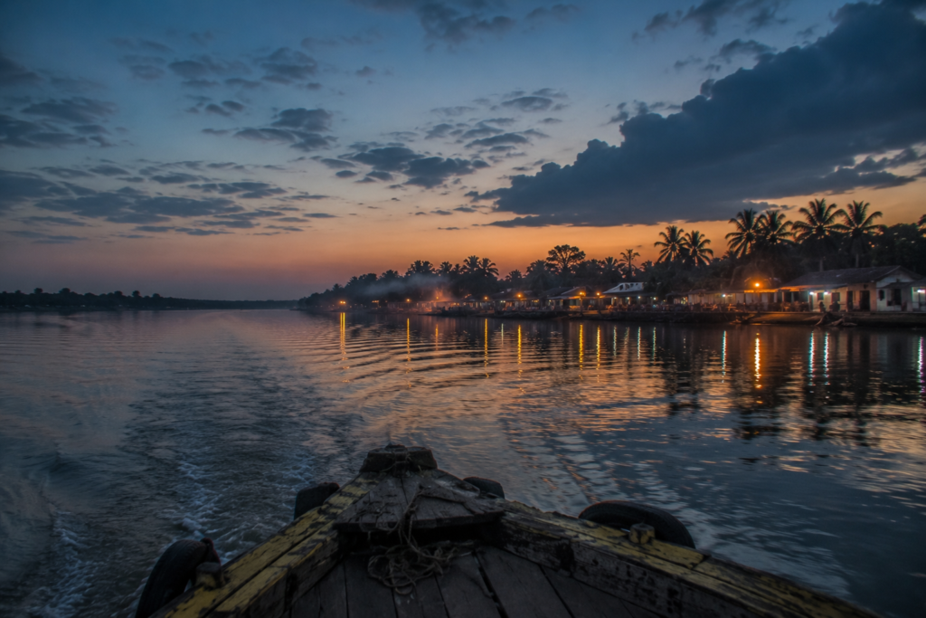
The final ferry leaves just before darkness fully settles across the Ichamati.
- The river is smooth now.
- The wind has weakened.
- The shoreline glows softly beneath scattered lights.
From the boat, Hasnabad appears less like a settlement and more like a sequence of reflections.
- A temple light.
- A riverside home.
- A ferry terminal.
- A fishing boat.
Each flickers briefly across the moving water.
Then fades.
As the distance increases, details disappear.
- The markets vanish first.
- Then the roads.
- Then the embankments.
Only the river remains visible.
And even that gradually merges with the night.
- What lingers is not a landmark.
- Not a monument.
- Not a dramatic landscape.
What lingers is a feeling.
A sense of standing at the edge of multiple worlds at once.
- River and border.
- Past and present.
- Migration and belonging.
- Settlement and wilderness.
- Memory and geography.
Hasnabad rarely appears on lists of famous places.
Perhaps that is why it remains so revealing. It asks visitors to pay attention.
- To rivers rather than attractions.
- To conversations rather than monuments.
- To ordinary life rather than spectacle.
And in doing so, it reveals something essential about the Sundarbans.
Because the Sundarbans are not only mangrove forests.
- They are also ferry crossings.
- Fishing markets.
- Border rivers.
- Schoolyards.
- Tea stalls.
- Migration stories.
- Cyclone memories.
And communities that have learned to live with water for generations.
- The boat continues downstream.
- The lights of Hasnabad become smaller.
- The river grows wider.
And somewhere behind the darkness, the tide continues its ancient journey toward the sea—carrying with it the stories of an island where history, water, and memory still move together.
Plan your private Sundarban expedition
A private journey shaped around you — your group, your pace, your interests. Book a free consultation.