 Encyclopedia
The first light does not arrive quietly on Mousuni Island.
It arrives with the tide.
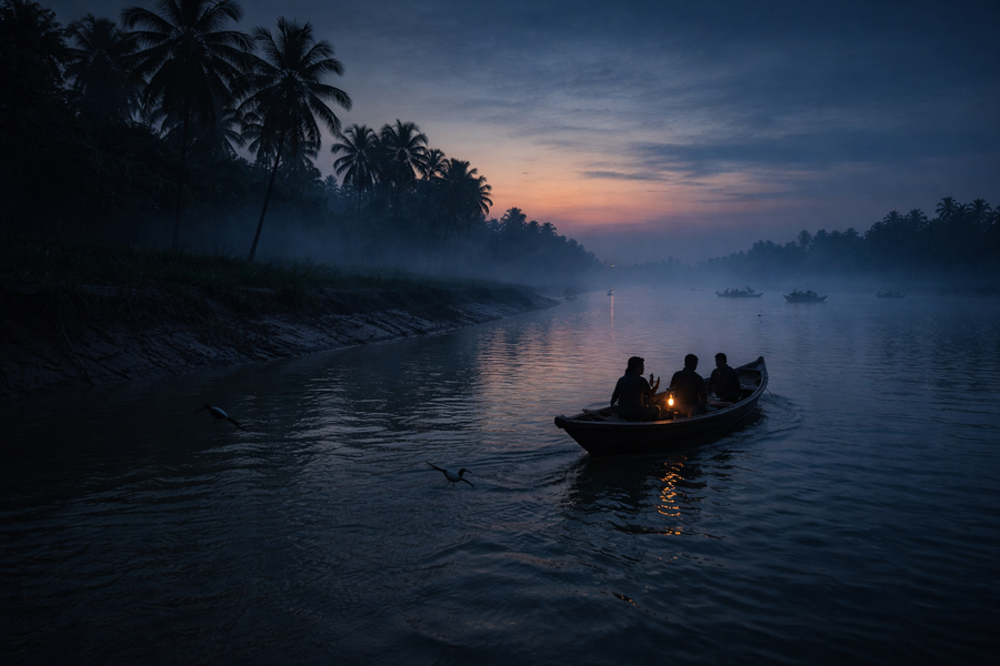
Long before the sun appears above the Bay of Bengal, the island is already awake. Somewhere beyond the darkness, an engine-powered wooden boat pushes slowly across the Chenai River.
Along the muddy embankments, fishermen untangle their nets beneath dim lanterns. The smell of salt hangs in the cool morning air, carried inland by a breeze that has crossed open water before touching the island’s fields.
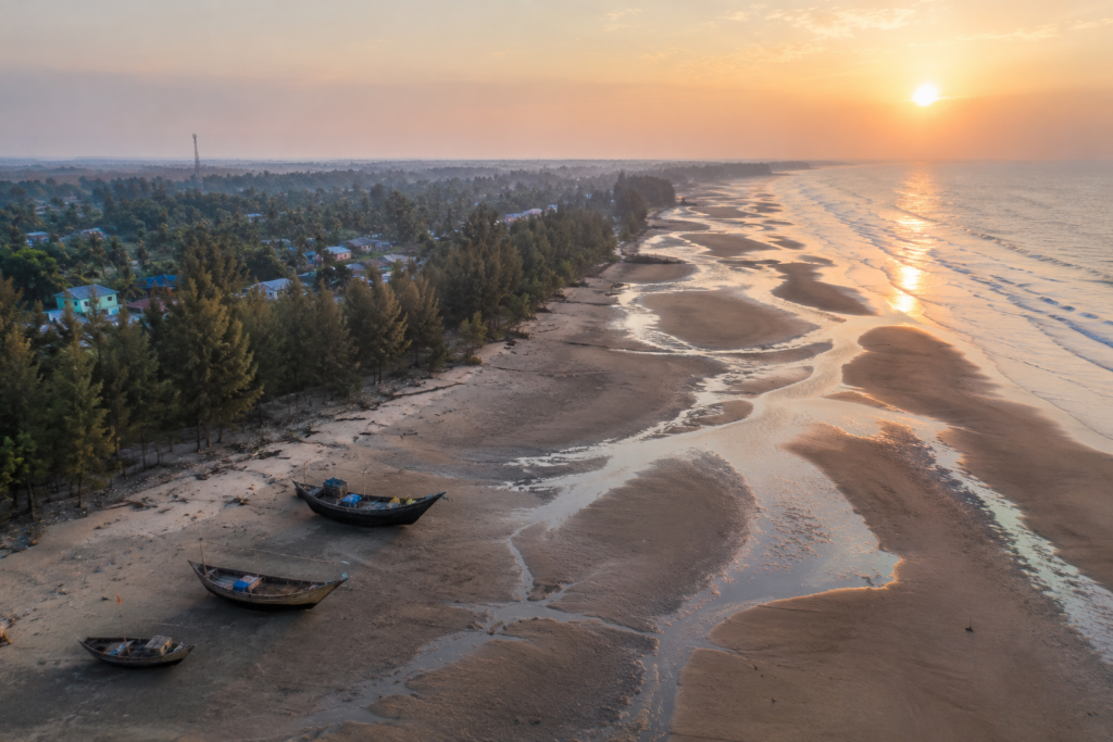
Standing at Bagdanga Ghat before dawn, it is impossible to tell where the river ends and the sea begins.
The water is restless.
- Every current carries silt from distant Himalayan rivers.
- Every tide pushes salt inland before retreating again.
Nothing here is truly permanent—not the shoreline, not the sandbanks, not even the villages that have learned to move with the changing coast.
That uncertainty defines Mousuni Island.
Unlike many islands scattered across the western Sundarbans, Mousuni does not hide behind dense mangrove forests or protected reserve boundaries. It faces the Bay of Bengal directly.
The sea arrives without interruption, carrying both livelihood and danger. For generations, the island has existed at the meeting point of two powerful forces—the tidal rivers of the Bengal delta and the open ocean beyond.
As the ferry leaves the mainland, the landscape unfolds gradually rather than dramatically.
- Mudflats emerge with the falling tide.
- White egrets patrol the exposed banks.
- Fishing boats drift with the current, waiting for deeper water.
Rows of coconut palms and casuarina trees begin appearing above the embankments, announcing human settlement long before individual houses become visible.
The island seems calm.
Yet every resident understands that calm is only one season of its story.
- Cyclones have repeatedly rewritten this coastline.
- Storm surges have crossed fields where children now play.
- Embankments have failed and been rebuilt.
- Entire stretches of shore have shifted within a single generation.
For many places, history is written in monuments.
On Mousuni Island, history is written by the tides. The island’s greatest landmark is not a building. It is resilience.
First Encounter
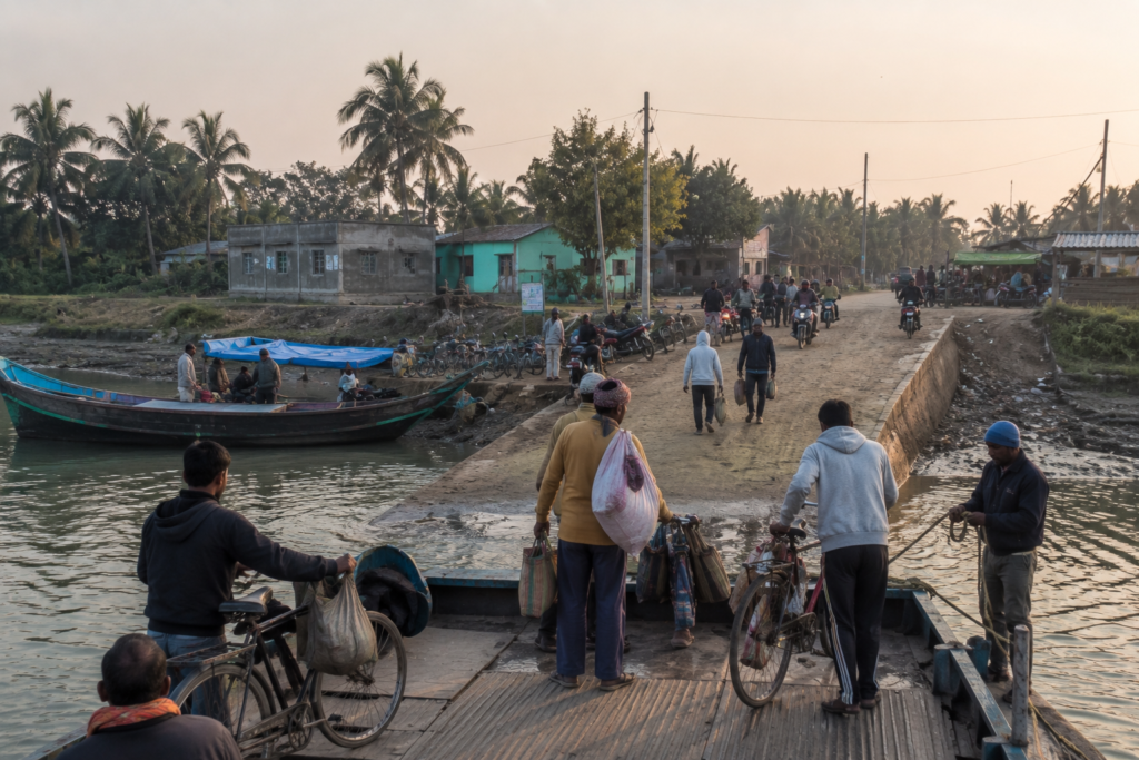
Arrival on Mousuni Island is not marked by a dramatic gateway or a famous monument.
It begins with an embankment.
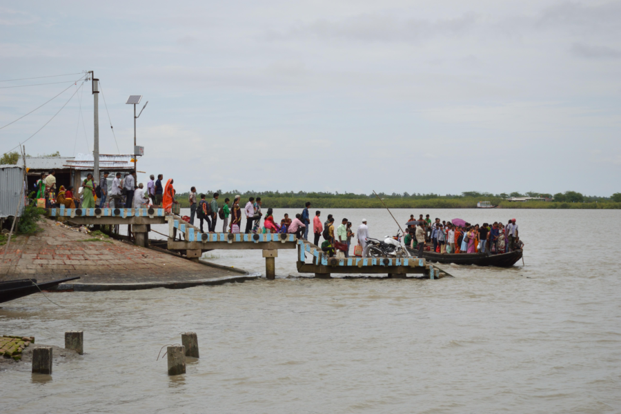
Stepping off the boat at Bagdanga Ghat, the first impression is one of movement.
- Motorcycles wait beside narrow roads.
- Small goods carriers unload vegetables, fish, and construction materials.
- Schoolchildren weave through the morning activity while fishermen prepare for another day on the river.
Life begins immediately at the water’s edge.
The embankment serves as the island’s main artery, protecting settlements from high tides while connecting villages that stretch across the low-lying landscape. On one side lies the tidal river. On the other hand, ponds, paddy fields, shrimp farms, and clusters of homes gradually spread inland.
There is no sharp divide between nature and settlement.
The two have grown together.
As the journey continues deeper into the island, the roads become quieter.
- Brick houses alternate with traditional village homes.
- Courtyards hold fishing nets drying beneath coconut palms.
- Small temples stand beside ponds where ducks drift across still water.
Tea stalls become gathering places where conversations move easily from fishing conditions to crop yields, ferry timings, and the latest weather forecast.
Everything eventually returns to the sea. Even the roads seem to acknowledge its presence. They rise gently along embankments before descending toward villages shaped by decades of living beside tidal water.
Walking westward, the soundscape changes.
- Engines fade.
- Bird calls become clearer.
- Wind begins moving through long rows of casuarina trees planted to slow coastal erosion.
Beyond them lies the beach.
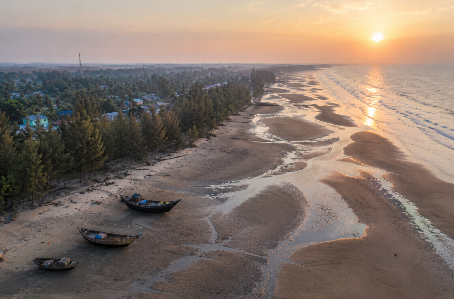
Unlike the wide tourist beaches found elsewhere along the Bengal coast, Mousuni’s shoreline feels unfinished.
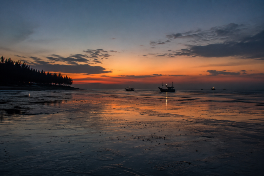
- The tide leaves behind winding channels across wet sand.
- Driftwood rests where the previous high tide reached.
- Fishing boats stand tilted against the mud, waiting for the water to return.
Nothing appears arranged for visitors.
Everything exists because the island needs it.
That authenticity is Mousuni’s first introduction.
It does not invite admiration.
It invites understanding.
Island Identity
Mousuni Island occupies the southern edge of the Namkhana Community Development Block in South 24 Parganas district, West Bengal, where the Bengal delta gradually gives way to the Bay of Bengal.
Administratively, the island falls under the Mousuni Gram Panchayat, whose villages are spread across a low-lying landscape shaped by tidal rivers, agriculture, fisheries, and an increasingly dynamic coastline.
Although relatively close to Kolkata in terms of distance, Mousuni belongs to an entirely different rhythm.
- Roads eventually end.
- Ferry crossings become essential.
- The tide determines daily schedules as much as the clock.
The island is bounded by tidal waterways that connect it with neighbouring settlements while separating it from the mainland.
- To the south lies the open Bay of Bengal, whose waves and storm surges have influenced every generation that has lived here.
- To the north and east, tidal rivers continue carrying freshwater, sediment, and saline tides through one of the world’s largest delta systems.
Settlement across Mousuni remains predominantly rural.
Villages are connected by embankment roads, narrow concrete lanes, and earthen paths that weave between ponds, cultivated fields, shrimp farms, and homesteads shaded by coconut, betel nut, and mango trees.
Agriculture continues to support many households, particularly rice cultivation during suitable seasons.
Fishing and brackish-water aquaculture provide additional livelihoods, while seasonal tourism has introduced new opportunities through locally managed homestays and small businesses.
Yet tourism has not replaced the island’s original identity.
Mousuni remains, above all else, a working island.
Its economy still depends on tides, weather, and the resilience of its people. That is perhaps the island’s defining characteristic.
Mousuni tells the story of coexistence.
It is a climate frontier where rivers, sea, and human determination continue shaping one another every single day.
The Rivers That Shaped Mousuni Island
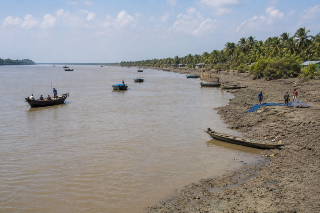
The first maps of Mousuni Island never stayed accurate for long.
Not because the surveyors lacked skill. Because the rivers refused to remain still.
Unlike islands anchored by rocky coastlines or stable riverbanks, Mousuni exists within one of the youngest and most dynamic landscapes on Earth.
- Every tide carries sediment.
- Every monsoon redraws channels.
- Every cyclone reminds the island that the delta is still being created.
Here, water is not simply a feature of the landscape.
It is the landscape.
The island is closely associated with the Chenai River, which separates it from the mainland and serves as the principal waterway connecting Mousuni with Bagdanga Ghat.
For generations, this tidal river has functioned as the island’s lifeline, carrying people, agricultural produce, fish, construction materials, and daily necessities between the mainland and the villages beyond.
Even after improved road connectivity reached neighbouring parts of Namkhana Block, the river remained essential.
Every crossing reinforces a simple truth.
On Mousuni, the journey always begins with water.
Yet the Chenai River is only one part of a much larger estuarine system.
Its tides are ultimately governed by the Bay of Bengal, whose saline waters travel inland twice each day. During high tide, seawater advances through the river channels before slowly retreating again, influencing agriculture, aquaculture, groundwater, and even the condition of embankments protecting nearby villages.
The sea is never far away.
Even when unseen, its presence shapes daily life. This tidal exchange has determined where people could settle.
- Villages developed upon slightly higher ground behind protective embankments.
- Freshwater ponds became essential for drinking and household use.
- Agricultural fields were carefully managed to minimise saltwater intrusion.
- Shrimp farms appeared in areas where salinity made conventional farming increasingly difficult.
Every occupation reflects the influence of the tide.
- Fishermen study the current before launching their boats.
- Farmers monitor rainfall to reduce soil salinity.
- Boat operators schedule crossings according to water depth.
- Even schoolchildren often learn to read the river long before they fully understand maps.
The rivers have also shaped the island’s ecology.
Exposed mudflats provide feeding grounds for wading birds. Narrow tidal creeks support juvenile fish and crustaceans before they move into larger estuarine waters.
Mangrove patches surviving along sections of the coastline help stabilise sediment while reducing erosion during storms.
Nothing exists independently.
Water connects every part of the island. Unlike many inland rivers, however, these waterways can also become destructive.
During severe cyclones, tidal rivers carry storm surges deep into the landscape, placing enormous pressure on embankments that protect villages and agricultural land. Some sections have been strengthened repeatedly over the years, while others continue requiring constant maintenance as changing currents gradually undermine their foundations.
Residents understand this reality better than anyone.
They rarely describe the rivers as either friend or enemy. Instead, they speak of them with respect.
- The rivers provide fish.
- They transport people.
- They nourish wetlands.
- They reshape fields.
- They also demand adaptation.
Perhaps no other force has influenced Mousuni Island more profoundly. Its geography, economy, settlement pattern, and identity all continue flowing with the tide.
Historical Footprints
History arrives quietly on Mousuni Island.
There are no ruined forts overlooking the sea. No colonial mansions rising above the villages. No ancient temples dominate the skyline.
Instead, the island’s history is preserved in embankments rebuilt after storms, fields reclaimed from saline marshes, and communities that have repeatedly adapted to an unpredictable coast.
Like much of the lower Bengal delta, Mousuni’s earliest permanent settlements emerged gradually as people learned to cultivate land shaped by tides. Families cleared vegetation, raised homesteads above flood level, dug freshwater ponds, and constructed earthen embankments that made agriculture possible in an otherwise unstable coastal environment.
Life depended upon collective effort.
- Maintaining embankments required cooperation.
- Repairing breaches became a community responsibility.
- The landscape itself encouraged shared resilience.
During the nineteenth century, British colonial administration expanded revenue settlements across parts of South 24 Parganas, encouraging agricultural production wherever land could be reclaimed from tidal influence. Although Mousuni remained geographically isolated, wider administrative changes affected land ownership, taxation, and patterns of cultivation throughout the region.
Rice gradually became the principal crop where salinity permitted cultivation.
- Fishing continued alongside farming rather than replacing it.
- The sea offered opportunity.
- The soil demanded patience.
Following India’s independence, improvements in transport, education, healthcare, and local administration slowly reached the island.
- Schools expanded.
- Roads improved.
- Electricity eventually connected villages that had relied on kerosene lamps for generations.
Yet the island never experienced rapid urbanisation.
Its geography imposed natural limits. Every improvement still had to negotiate the realities of tides and storms.
In recent decades, Mousuni has become increasingly recognised beyond the region. Not because it transformed into a conventional tourist destination.
But it came to symbolise one of the most visible frontlines of climate change in coastal West Bengal.
Researchers, environmentalists, photographers, and journalists began documenting coastal erosion, embankment failures, saline intrusion, and the remarkable resilience of local communities.
The island entered public conversation for reasons its residents had known for generations.
Living beside the sea requires constant adaptation. Its history therefore, cannot be separated from its geography.
Every generation has inherited a slightly different shoreline. Every generation has learned to begin again.
Historical Personalities & Transformations
Unlike some islands of the Sundarbans associated with famous reformers or influential zamindars, Mousuni Island’s story has largely been shaped by ordinary people.
Its transformation belongs to fishing families.
- Farmers.
- Boatmen.
- Teachers.
- Village leaders.
- Engineers strengthening embankments.
- Health workers serving remote communities.
Countless individuals whose contributions rarely appear in history books. Perhaps the most significant transformation has been infrastructural rather than personal.
Over several decades, improved ferry services, better roads, rural electrification, expanded schools, healthcare facilities, and communication networks gradually reduced the island’s isolation.
Each improvement altered daily life without changing the island’s essential character.
Equally important has been the continued strengthening of coastal embankments.
Following repeated cyclone damage, government agencies and local communities have worked together to reinforce vulnerable sections using earth, geotextiles, concrete blocks, and vegetation where appropriate.
These projects rarely attract attention outside the region.
Yet they represent some of the most important public works on the island.
Without them, many villages would face significantly greater exposure to tidal flooding.
Another transformation has emerged through community-based tourism.
Rather than large commercial developments, Mousuni has witnessed the gradual growth of locally operated homestays, small eateries, and guiding services that provide supplementary income while allowing visitors to experience village life more directly.
Although tourism remains seasonal, it has diversified the island’s economy without fundamentally replacing its traditional occupations.
This balance remains fragile.
Residents continue navigating difficult questions. How can livelihoods improve without sacrificing ecological stability? How should development proceed in one of India’s most climate-sensitive coastal regions?
There are no simple answers.
Mousuni continues searching for them.
One tide at a time.
Folklore & Legends
As darkness settles over Mousuni Island, conversations often return to the sea.
Not because people romanticise it. Because they have lived beside it for generations.
Unlike the deep forest settlements of the central Sundarbans, Mousuni does not possess a large body of island-specific folklore preserved in written records. Its cultural traditions are instead closely connected to the wider beliefs of the lower Bengal delta.
Among many fishing and farming families, reverence for Bonbibi continues as part of the broader spiritual landscape of the Sundarbans.
Although Mousuni lies outside the core tiger forests, the values associated with Bonbibi—humility, balance with nature, and respect for forces beyond human control—remain familiar to many coastal communities.
The sea itself has created newer traditions.
Older residents often recall major cyclones not by calendar years but by the changes they left behind.
- One storm is remembered for destroying fields.
- Another for breaching embankments.
- Another reason for forcing families to relocate houses farther inland is
These shared memories have become part of Mousuni’s living oral history.
Fishermen also inherit practical knowledge that borders on folklore.
- The colour of clouds.
- The behaviour of birds.
- The direction of the wind.
- The unusual silence before rough weather.
Such observations are passed between generations not as superstition, but as accumulated experience.
On an island where the weather can change rapidly, careful observation has always been a form of survival.
Mousuni therefore, reminds us that stories need not involve mythical creatures to become meaningful.
Sometimes the greatest legends are created by people who continue returning to the sea despite knowing exactly how powerful it can be.
Life Between the Tides
Morning on Mousuni begins long before sunrise.
The first movement comes from the river.
Boats leave with the tide while lanterns still glow along the embankments. Fishermen organise nets with practised efficiency, timing their departure according to water levels rather than daylight.
The tide decides first.
Everything else follows.
Fishing remains one of the island’s defining livelihoods.
Small boats work the tidal rivers and nearby coastal waters, bringing back fish, prawns, and crabs that support both household incomes and local markets.
The catch changes with the seasons.
So do the currents. No two days are exactly alike.
Farther inland, agriculture follows its own rhythm.
Where soil conditions allow, paddy fields spread across sections of the island during the growing season. Farmers work carefully around the challenge of salinity, relying on rainfall, freshwater ponds, and embankments to protect cultivation from tidal intrusion.
Shrimp farming has also expanded in suitable areas, reflecting changing environmental and economic realities.
By mid-morning, village life is fully underway.
- Children walk to school.
- Tea stalls fill with conversation.
- Motorcycles carry supplies between settlements.
Women tend kitchen gardens and household ponds while older residents gather beneath shaded verandas, watching the road slowly come alive.
Nothing here feels disconnected from nature.
- The weather influences work.
- The tide influences transport.
- The sea influences planning.
Even celebrations often adjust around seasonal conditions. Life on Mousuni is rarely described in terms of convenience.
It is described in terms of adaptation.
The island does not ask its people to conquer nature. It asks them to understand it.
And that understanding shapes every ordinary day.
Walking Through the Villages
The road narrows once again.
Concrete slowly gives way to brick lanes and compacted earth, weaving through villages that seem to have grown naturally with the contours of the island rather than against them. There is no formal town centre on Mousuni. Instead, life is distributed across small settlements connected by embankments, ponds, fields, and narrow roads that eventually disappear into the horizon.
Walking through these villages is less about reaching a destination and more about observing a way of life shaped by water.
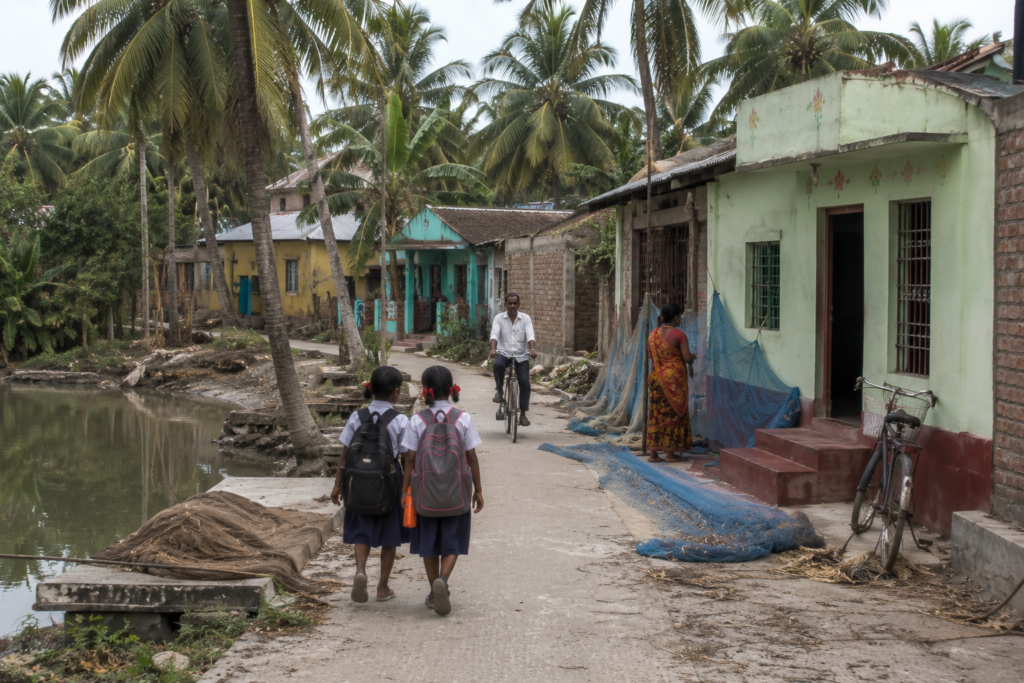
Homes stand on slightly raised plinths, a practical response to seasonal flooding rather than an architectural choice. Older houses built from brick, mud plaster, and corrugated roofs stand beside newer concrete homes, reflecting both continuity and gradual change. Almost every courtyard serves several purposes at once.
- Fishing nets dry beneath the morning sun.
- Paddy is spread across woven mats.
- Boats are repaired beside ponds.
Children leave for school carrying backpacks while elders sweep courtyards already warmed by the first sunlight.
- Kitchen gardens occupy whatever space remains.
- Pumpkins climb bamboo frames.
- Banana plants shade small vegetable patches.
Coconut and betel nut palms rise above rooftops, their leaves moving constantly in the coastal breeze.
Freshwater ponds appear everywhere.
- Some provide household water for washing.
- Others support fish culture.
- Many simply reflect the sky, becoming quiet centres around which daily life unfolds.
Religious life is woven naturally into the villages.
Small temples dedicated to local deities stand beside narrow roads, often beneath banyan or peepal trees.
Mosques serving neighbouring communities blend quietly into the landscape without dominating it.
Festivals remain important, but they are celebrated within the rhythms of agricultural and fishing life rather than apart from them.
Tea stalls become informal community squares.
- A few wooden benches.
- An aluminium kettle is constantly boiling.
- Morning newspapers are shared among several readers.
Discussions move easily from fish prices to weather forecasts, school examinations, embankment repairs, ferry schedules, and rumours of the next cyclone.
The conversations rarely stay still.
Neither does the island.
Unlike destinations where villages appear arranged for visitors, Mousuni’s settlements continue their everyday routines with little regard for observation.
Visitors simply become temporary witnesses.
By late afternoon, bicycles replace motorcycles as children return from school and fishermen prepare for the evening tide. Smoke begins rising from household kitchens. The smell of wood fires mixes with salt carried inland by the wind.
Nothing feels staged.
Everything feels lived.
That quiet authenticity remains one of Mousuni’s greatest strengths.
Sounds of the Island
Before the first rays of sunlight reach the embankments, the island can already be heard.
- An engine-powered fishing boat starts somewhere beyond the river.
- Wooden hulls knock softly against bamboo moorings.
- A rooster answers another across the village.
- The sound travels easily over flat land.
Then comes the tide.
Not loudly.
But steadily.
- Water pushing against muddy banks.
- Small waves touch wooden boats.
- The distant splash of a cast net landing somewhere in the half-light.
- Morning birds gradually replace mechanical sounds.
- White-throated Kingfishers announce the day from electric wires overlooking ponds.
- Black Drongos chase insects above agricultural fields.
- Little Egrets call softly while crossing wetlands toward feeding grounds.
Occasionally, a Brahminy Kite circles overhead, its distinctive whistle drifting across the open sky.
As villages awaken, new sounds emerge.
- The bell of a bicycle.
- Children laughing on their way to school.
- The rhythmic strike of a dao splitting firewood.
- Women drawing water from ponds.
The quiet conversation of neighbours begins another ordinary day.
Near the ferry ghat, engines dominate once again.
Motorcycles wait for crossings.
Boats arrive carrying vegetables, fish, construction materials, and passengers beginning or ending their journey across the Chenai River.
By midday, the island grows quieter.
Heat settles over the fields.
Bird activity slows.
Only the wind continues moving through coconut palms and casuarina plantations, producing a constant whisper that follows visitors almost everywhere.
Evening brings another transformation.
- Fishing boats return.
- Engines echo briefly across the river before fading into conversation along the embankment.
- Children play until darkness gathers.
- The first frogs begin calling from ponds.
- Crickets answer from roadside vegetation.
The sea remains unseen for much of the island.
Yet it is always audible. Its distant rhythm never disappears completely.
On Mousuni, silence is never empty.
It is filled with water.
Wildlife Expedition
The wildlife of Mousuni Island rarely reveals itself through dramatic encounters.
Instead, it appears gradually.
- One species at a time.
- One habitat after another.
The island’s greatest ecological richness lies in its remarkable diversity of coastal environments. Mudflats, tidal rivers, wetlands, paddy fields, shrimp farms, village ponds, sandy beaches, and scattered mangrove patches together create a mosaic capable of supporting an impressive variety of birds and smaller wildlife.
Low tide transforms the shoreline into an enormous feeding ground.
Thousands of tiny invertebrates become accessible beneath the wet sand and exposed mud, attracting flocks of shorebirds that move continuously across the intertidal zone.
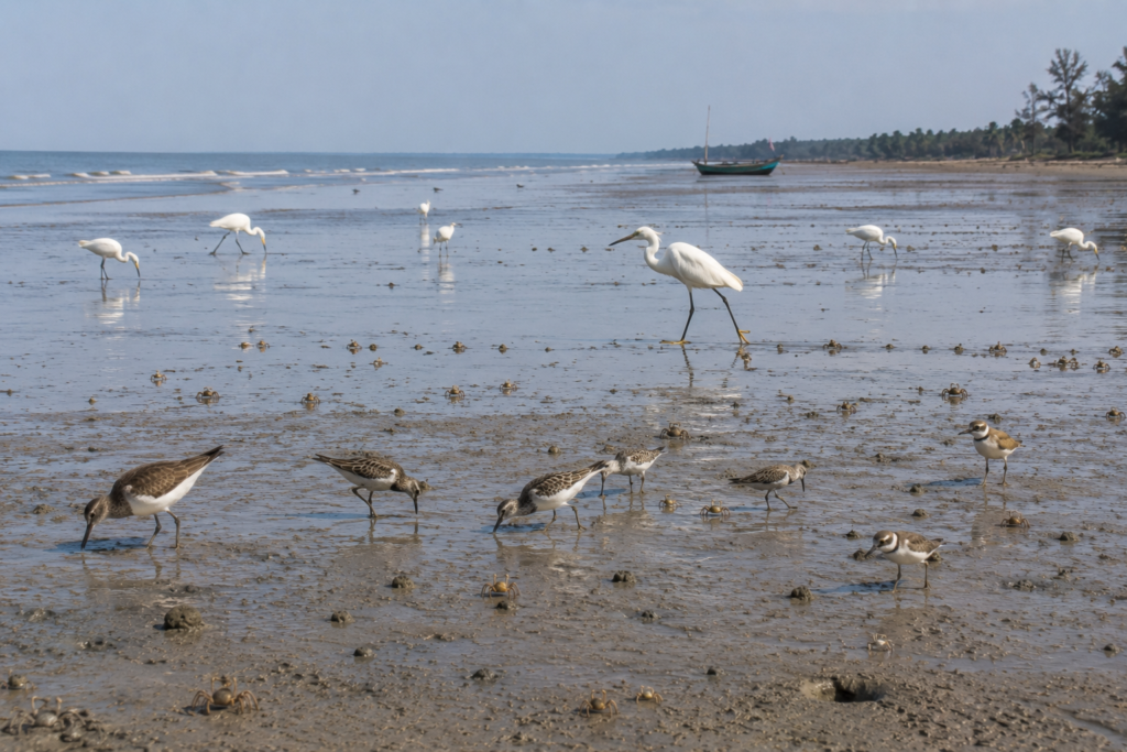
- Sandpipers probe the sediment with remarkable speed.
- Kentish Plovers pause briefly before darting ahead.
- Little Stints, when present during migration, blend almost perfectly into the shoreline.
- Little Egrets patrol shallow pools with measured precision, while Intermediate and Great Egrets search the edges of tidal creeks for fish disturbed by the retreating water.
Winter brings another dimension to the island.
Migratory birds travelling along the Central Asian Flyway regularly use coastal habitats across southern West Bengal as seasonal feeding grounds. Mousuni’s beaches, mudflats, and wetlands become important resting and foraging areas during these journeys.
The skies remain equally active.
- Brahminy Kites circle above fishing boats searching for discarded catch.
- Black Kites appear near villages.
- White-throated Kingfishers occupy bamboo poles overlooking ponds and canals.
- Pied Kingfishers occasionally hover above shallow water before diving with remarkable accuracy.
The island’s ponds and freshwater wetlands support another community altogether.
- Indian Pond Herons remain almost invisible until startled into flight.
- Little Cormorants dry their wings after successful dives.
- Purple Swamphens and White-breasted Waterhens may be encountered in suitable marshy vegetation where disturbance remains low.
The beach itself hosts quieter inhabitants.
Ghost crabs emerge during cooler hours, leaving intricate patterns across the sand before retreating rapidly into deep burrows.
Along muddy estuarine edges, fiddler crabs wave their oversized claws while mudskippers move between shallow pools using adaptations that seem almost amphibious.
These small creatures perform essential ecological functions. They aerate sediment.
- Recycle nutrients.
- Support larger food webs.
Without them, the coastal ecosystem would quickly weaken.
Reptiles also inhabit the island, though they are usually secretive.
Garden Lizards are commonly seen around villages and vegetation.
Various non-venomous and venomous snakes occur within suitable habitats, as they do throughout coastal Bengal, though encounters remain infrequent and should always be treated with caution and respect.
Mousuni is not a wildlife sanctuary. It does not promise spectacular sightings. Instead, it offers something equally valuable.
A chance to observe how biodiversity survives within a working coastal landscape shared by people, agriculture, fisheries, and the sea.
For patient observers, the island rewards attention rather than expectation.
Mangrove Chronicles
Unlike the dense mangrove forests of the Sundarbans Tiger Reserve, Mousuni Island presents a more fragmented story.
Here, mangroves appear not as endless forests but as resilient survivors.
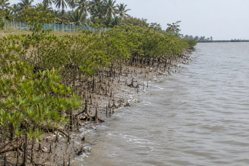
Scattered belts persist along tidal creeks, embankments, and vulnerable stretches of coastline where they continue performing ecological work far greater than their size might suggest.
Walking toward these patches reveals remarkable adaptations.
The muddy ground is punctuated by hundreds of slender breathing roots rising vertically from beneath the sediment.
These pneumatophores allow species such as Avicennia to survive in waterlogged soils where oxygen remains scarce for much of the day.
Twice daily, the tide transforms the landscape.
Roots disappear beneath brackish water before emerging once more as the sea retreats.
The forest breathes with the tide.
- Life beneath the canopy is equally active.
- Fiddler crabs emerge from tiny burrows to forage across exposed mud.
- Mudskippers rest beside shallow pools before darting unexpectedly across the surface.
- Small molluscs cling to roots awaiting the returning water.
Every organism depends upon the rhythm of inundation and exposure.
For local communities, mangroves represent far more than biodiversity.
- They help reduce shoreline erosion.
- Trap sediment.
- Slow storm surges.
- Provide nursery habitat for juvenile fish and crustaceans.
- Strengthen embankments naturally.
After repeated cyclones, their importance has become increasingly evident.
Many restoration efforts along vulnerable coastlines now recognise that engineering alone cannot protect islands like Mousuni.
Healthy ecosystems remain equally important.
Standing beside a surviving mangrove belt after high tide, it becomes clear why these trees are often described as the island’s first line of defence.
They ask for little.
Yet they protect so much.
Explorer’s Field Notes
Field Observation 01
The most productive birdwatching begins shortly after sunrise, particularly along tidal mudflats exposed by the falling tide.
Field Observation 02
The ferry crossing itself often provides the first opportunity to observe estuarine birds and fishing activity.
Field Observation 03
Mousuni’s embankments offer some of the island’s finest walking routes, connecting villages, fields, wetlands, and coastal habitats.
Field Observation 04
Cyclone embankments reveal the continuing relationship between engineering and ecology. Observe how vegetation is increasingly being incorporated into shoreline protection.
Field Observation 05
The island changes dramatically between high and low tide. Planning walks around tidal conditions reveals entirely different landscapes within a single day.
Nightfall on the Island
As daylight begins withdrawing toward the Bay of Bengal, Mousuni grows quieter.
- The last ferry returns across the Chenai River.
- Fishing boats head home with the evening tide.
- Smoke rises gently from village kitchens where dinner preparations begin.
- The beach, busy only hours earlier, slowly empties.
- Ghost crabs emerge once more.
- Shorebirds settle along distant mudflats.
The sea becomes a darker presence rather than a visible horizon.
Beyond the villages, embankments fall almost silent. Only the wind continues moving through the casuarina trees.
- Crickets begin their chorus.
- Frogs answer from freshwater ponds.
Occasionally, the distant sound of a fishing boat engine drifts inland before disappearing into the night.
Looking upward, the stars appear remarkably bright on clear evenings, unobstructed by the glow of large towns or cities.
The island seems suspended between sky and sea.
Nothing dramatic announces the end of the day. Mousuni simply returns to the rhythms that have sustained it for generations.
Tomorrow’s tide has already begun its journey.
And with it, another day on the island quietly waits to begin.
The Seasons of the Island
The landscape of Mousuni Island is never truly the same twice.
Each season reshapes the coastline, alters the rivers, changes the rhythm of village life, and transforms the opportunities for wildlife. Rather than existing as four fixed chapters, the seasons overlap with the movement of tides, rainfall, and the Bay of Bengal.
To understand Mousuni is to understand its changing calendar.
Winter (November–February)
The first cool mornings arrive with remarkable clarity.
Humidity falls. The sky becomes deeper blue. Visibility improves across the coastline, allowing distant fishing boats and tidal channels to appear unusually sharp against the horizon.
For many islanders, winter is the most comfortable working season.
Fishing remains active. Agricultural fields recover after the monsoon.
Migratory birds begin arriving across mudflats, ponds, and coastal wetlands, adding new movement to an already dynamic landscape.
Early mornings often reveal thin layers of mist floating above freshwater ponds before gradually dissolving into sunlight.
For photographers and naturalists, winter offers the island at its most accessible.
Spring (March–April)
Spring is subtle on Mousuni.
The island does not burst into dramatic flowering landscapes. Instead, temperatures slowly rise while vegetation remains green from the retreating winter.
- Village orchards become more active.
- Mango and other fruit trees begin producing new growth.
- Fishing continues while farmers prepare for the approaching heat.
- Bird activity remains high during the early mornings before increasing temperatures quieten the landscape by midday.
The sea remains comparatively calm. Yet experienced fishermen already begin watching weather patterns more carefully.
Cyclone season is approaching.
Summer (May–June)
Summer arrives with intensity.
The afternoon sun reflects sharply from embankments, fisheries, and tidal flats.
- Heat builds quickly after sunrise.
- Work begins earlier.
- Rest comes sooner.
Freshwater becomes increasingly valuable as evaporation accelerates and soil salinity becomes more noticeable in exposed fields.
Fishing schedules adjust to avoid the harshest afternoon conditions. The beaches often appear almost deserted during midday. Only shorebirds continue feeding across exposed mudflats while Brahminy Kites circle high above the coast.
Clouds gradually begin gathering over the Bay of Bengal. Everyone notices. Because these clouds sometimes bring relief.
Sometimes they bring something much larger.
Monsoon (June–September)
The first heavy rains transform Mousuni almost overnight.
- Dry fields become green.
- Freshwater ponds refill.
- Roads glisten beneath continuous rainfall.
- The rivers swell.
Everywhere, water returns.
- The island appears softer.
- The boundary between wetlands, ponds, rivers, and flooded fields becomes less distinct.
- Mangrove vegetation responds quickly to the renewed moisture.
- Birdlife shifts with changing water levels.
- Fishing continues whenever conditions allow, although rough seas often limit activity.
Travel also becomes less predictable.
Strong winds, heavy rainfall, and high tides occasionally disrupt ferry services and local transportation.
Life slows.
But it never stops.
Post-Monsoon (October)
See it for yourself
A private journey shaped around you — your group, your pace, your interests. Book a free consultation.
October brings recovery.
- Floodwaters gradually recede.
- Fields begin drying.
- Communities repair roads, embankments, homes, and fisheries affected by the monsoon.
- The atmosphere feels noticeably clearer.
- The first migratory birds begin reappearing.
Village life becomes increasingly active as festivals approach and agricultural work resumes its familiar rhythm.
For many residents, post-monsoon is less about celebration than restoration.
The island quietly prepares for another cycle.
Cyclone Season
Cyclones cannot be assigned to a single month.
The Bay of Bengal remains one of the world’s most active cyclone basins, with severe storms historically occurring before and after the monsoon. Residents, therefore monitor weather forecasts throughout much of the year.
Cyclone preparedness has become an ordinary part of island life.
- Fishing boats return early when warnings are issued.
- Families secure roofs.
- Livestock are moved to safer ground.
- Emergency shelters are prepared.
The island has learned not to underestimate the sea. Preparation begins long before the wind arrives.
Cyclones and Survival
Standing beside Mousuni’s embankments, it becomes difficult to ignore their significance.
They are not simply raised walls of earth. They are the island’s frontline. For decades, Mousuni has faced some of the Bay of Bengal’s most destructive tropical cyclones.
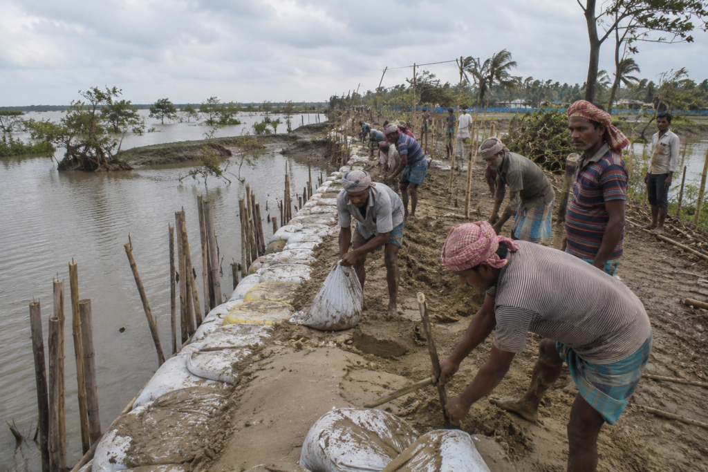
Storms such as Cyclone Aila (2009), Cyclone Bulbul (2019), Cyclone Amphan (2020), Cyclone Yaas (2021), and more recent severe weather events have left lasting marks on both the landscape and the memories of its residents.
Each cyclone arrived differently.
Yet each carried the same questions.
- Would the embankments hold?
- Would the fields survive?
- How quickly could life begin again?
Storm surges remain among the island’s greatest challenges.
Unlike ordinary tidal flooding, cyclone-driven water can overtop or breach embankments, allowing saline water to spread across agricultural land, ponds, fisheries, and settlements.
The effects often continue long after floodwaters disappear.
- Salt remains in the soil.
- Freshwater ponds require restoration.
- Fields need time before cultivation can resume.
Recovery therefore, becomes measured not in days, but sometimes in months.
Yet Mousuni has repeatedly demonstrated remarkable resilience.
- Communities rebuild damaged embankments.
- Local volunteers assist vulnerable households.
- Government agencies strengthen coastal protection.
Mangrove plantation programmes increasingly complement engineering solutions, recognising that natural barriers help reduce wave energy during storms. The island has gradually shifted from reacting to disasters to preparing for them.
Early warning systems have improved.
Cyclone shelters have become more accessible. Communication networks now allow warnings to reach villages much faster than in previous decades.
No system can eliminate risk. But preparedness saves lives. Walking along the embankment today, visitors may notice newly strengthened sections beside older repairs.
These are not simply construction projects. They are physical reminders of every storm the island has survived.
The landscape itself remembers.
And so do its people.
Ferry Routes & Hidden Paths
Every journey to Mousuni begins with water.
Unlike many coastal destinations connected entirely by road, the island still retains the experience of crossing a tidal river before entering its villages.
The most commonly used approach begins from Bagdanga Ghat, where passenger ferries cross the Chenai River throughout the day, connecting the mainland with Mousuni Island.
The crossing is brief.
Yet it immediately changes the pace of travel.
Motor traffic disappears.
The sounds of the river replace the road.
The island gradually approaches rather than arriving all at once.
Once ashore, narrow roads connect villages through embankments, fisheries, agricultural fields, and ponds before eventually reaching the western coastline.
Many of the island’s most rewarding routes are not marked on tourist maps.
Walking along embankments reveals everyday life unfolding between freshwater ponds, shrimp farms, coconut groves, and tidal wetlands.
Small village lanes often lead unexpectedly to quiet stretches of shoreline where fishing boats rest between tides.
- Cyclists move slowly between settlements.
- Children return from school.
- Birds occupy irrigation channels and village ponds.
Nothing here feels designed.
Everything simply functions.
Exploring on foot offers a perspective impossible to experience from a vehicle.
- Distances seem shorter.
- Conversations become easier.
- The island gradually reveals itself one village at a time.
For explorers, these quiet paths often become the most memorable part of the journey. They explain Mousuni far better than any destination marker ever could.
Photography Expedition Guide
Mousuni Island rewards photographers who pay attention to change rather than permanence.
The island has no single iconic landmark.
Its beauty lies in shifting light, receding tides, working landscapes, and the quiet relationship between people and the sea. Every visit produces different photographs because the coastline itself is constantly evolving.
For documentary photographers, patience matters more than equipment.
Sunrise Photography
Before sunrise, the island belongs to fishermen and birds.
The best morning photographs are made along the Chenai River crossing, village embankments, and the eastern side of the island, where fishing boats begin leaving with the rising tide.
Soft mist often settles above ponds and agricultural fields, while the first golden light catches coconut palms and village rooftops.
Low tide mornings also reveal reflective mudflats, shallow tidal channels, and feeding shorebirds along the coast.
Coastal Landscape Photography
The western shoreline offers Mousuni’s most distinctive landscapes.
Rather than dramatic cliffs or elevated viewpoints, photographers encounter wide beaches, tidal creeks, exposed mudflats, driftwood, fishing boats, and expansive skies.
The island’s simplicity becomes its greatest strength.
Long focal lengths help compress distant boats against the horizon, while wide-angle lenses capture the immense openness of the Bay of Bengal.
Village Documentary Photography
Some of the strongest photographs are found away from the beach.
- Village lanes reveal everyday coastal life unfolding naturally.
- Fishing nets are drying beside homes.
- Cyclists travelling along embankments.
- Women tending kitchen gardens.
- Children returning from school.
These quiet moments communicate the character of Mousuni more effectively than posed portraits.
Always photograph respectfully and seek permission before taking close images of people.
Wildlife Photography
The most productive wildlife photography begins around low tide.
- Mudflats attract shorebirds, including sandpipers, plovers, and egrets searching for food exposed by retreating water.
- Kingfishers remain active around ponds and tidal canals throughout the morning.
- Winter offers the greatest diversity of migratory birds, particularly during calm weather.
A telephoto lens allows natural behaviour to be documented without disturbing wildlife.
Monsoon Photography
The monsoon changes the island completely.
- Dark storm clouds gather over the Bay of Bengal.
- Freshwater ponds overflow.
- Fields become intensely green.
- Embankments glisten after rain.
Although travel becomes more difficult, the season produces powerful documentary images illustrating the relationship between people and an ever-changing coastal environment.
Cyclone Documentary Photography
Cyclones should never be photographed during dangerous conditions. Instead, documentary value lies in recording recovery.
- Repaired embankments.
- Communities rebuilding homes.
- Restored fisheries.
- New mangrove plantations.
These images tell the long-term story of resilience rather than disaster.
Expedition Notes
Mousuni rarely reveals itself through famous landmarks.
Its story is discovered by slowing down. The following observations consistently reward patient exploration.
Observe the Tide Before Walking
The coastline changes dramatically within a few hours.
Low tide exposes mudflats, tidal channels, and bird feeding areas that disappear beneath the returning sea.
Walk the Embankments
The embankments explain the island.
They connect villages, protect agricultural land, reveal changing shorelines, and offer uninterrupted views across rivers and wetlands.
Spend Time at the Ferry Ghat
The ferry crossing is more than transportation.
It is where agriculture, fishing, education, trade, and daily life intersect. Watching arrivals and departures reveals the island’s dependence on the river.
Explore the Villages Slowly
The most memorable experiences often occur away from the beach.
- Tea stalls.
- Village ponds.
- Roadside shrines.
- Children cycling home.
- Fishing nets are drying beside homes.
These ordinary scenes become the island’s strongest stories.
Watch the Weather
Clouds over the Bay of Bengal often change quickly.
Experienced fishermen observe wind direction, wave conditions, and sky colour long before rain begins.
Visitors soon learn why.
Connected Landscapes
Mousuni Island forms part of a much larger coastal landscape where rivers, islands, estuaries, beaches, and villages remain closely connected.
Understanding these neighbouring places helps explain Mousuni itself.
Bagdanga
Bagdanga serves as the principal mainland gateway to Mousuni. The ferry crossing across the Chenai River remains the island’s traditional point of arrival.
Namkhana
To the west, Namkhana connects the island with the wider road and railway network of South 24 Parganas. It remains one of the region’s most important transport hubs.
Bakkhali
Across the wider coastal region lies Bakkhali.
While Bakkhali is recognised for its established seaside destination, Mousuni offers a quieter experience focused on fishing communities, changing coastlines, and climate resilience.
Together, they present two contrasting faces of the Bengal coast.
Henry Island
Nearby Henry Island demonstrates another dimension of the western Sundarbans, where fisheries, mangroves, and coastal wetlands dominate the landscape.
Viewed together, Henry Island and Mousuni reveal how similar coastal environments can evolve in remarkably different ways.
Bay of Bengal
Everything on Mousuni ultimately responds to the Bay of Bengal.
- The tides.
- The weather.
- The fisheries.
- The beaches.
- The cyclones.
The sea remains the island’s greatest influence.
The Sundarbans Delta
Although Mousuni lies outside the protected tiger forests, it belongs to the broader Ganges–Brahmaputra–Meghna Delta, sharing ecological processes with the western Sundarbans through tides, sediment transport, estuarine rivers, and coastal wetlands.
Oral Histories
On Mousuni, memory is often measured by storms.
Many older residents remember periods of island life not by official dates but by the cyclones that reshaped fields, rivers, and coastlines.
People speak of embankments before they broke.
- Fields before saltwater entered them.
- Villages before sections of shoreline disappeared.
These recollections are remarkably consistent across different communities. They are not dramatic stories told for effect. They are practical memories that explain how families adapted to changing conditions.
Many residents also recall when ferry crossings relied on fewer services, roads remained unpaved, and electricity had not yet reached every household.
Improved transport, education, communication, and locally managed tourism have gradually changed everyday life without altering the island’s essential dependence on the sea.
The strongest oral tradition, however, concerns resilience.
Almost every family has experienced rebuilding.
- Repairing homes.
- Restoring ponds.
- Replanting fields.
- Strengthening embankments.
These experiences have become part of Mousuni’s collective identity.
Food of Mousuni Island
The food of Mousuni reflects what the tide provides.
Fresh fish remains central to daily meals, changing with the seasons and the day’s catch.
Parshe, bhetki, mullet, prawns, and seasonal estuarine fish commonly appear in household kitchens, prepared using recipes that emphasise freshness over complexity.
Rice remains the staple food, accompanied by lentils, seasonal vegetables, leafy greens, and homemade pickles.
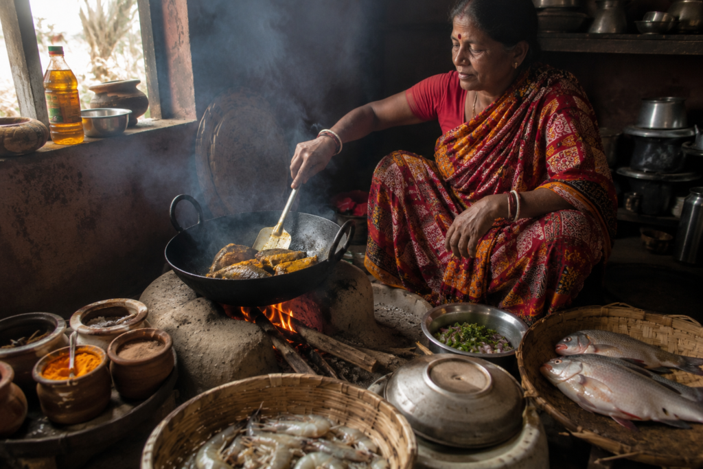
Mustard oil, green chillies, turmeric, and locally ground spices define the island’s cooking far more than elaborate restaurant presentation.
Many families continue preparing meals over traditional clay stoves, particularly in older homes where wood or agricultural residue remains available as fuel.
Morning tea stalls serve simple breakfasts of muri, ghugni, singara, and tea, becoming gathering places before fishermen leave with the tide or farmers head toward the fields.
Food on Mousuni is rarely separated from livelihood.
The sea appears on the dining table every day.
Island Economy
Mousuni’s economy remains deeply connected to its geography.
Fishing continues providing employment for many households through riverine and coastal fisheries.
Brackish-water aquaculture has expanded where salinity makes conventional agriculture increasingly difficult.
Rice cultivation remains important wherever freshwater conditions permit successful farming.
Kitchen gardens, livestock, and pond fisheries contribute additional household income and food security.
During recent years, community-based tourism has created new opportunities.
Small homestays, local guides, transport providers, eateries, and handicraft sellers now benefit from seasonal visitors.
Unlike large commercial resorts, this tourism model remains closely integrated with village life.
Migration also forms part of the island’s economy.
Many younger residents seek employment in Kolkata and other cities while maintaining strong family connections with Mousuni.
Income earned elsewhere often supports home construction, education, and agricultural investment.
The island therefore continues balancing traditional occupations with changing economic realities.
Its future remains tied to both resilience and adaptation.
Then & Now
Mousuni has never been a static island.
Older residents recall wider beaches in some places.
- Narrower rivers in others.
- Fields that later became saline.
- Embankments that have since been rebuilt several times.
- Road connectivity has improved considerably.
- Education and healthcare are more accessible than previous generations experienced.
- Communication has transformed daily life.
- Mobile phones now connect villages that once relied almost entirely on ferry passengers for news.
- Tourism has introduced new livelihoods while increasing awareness of the island beyond South 24 Parganas.
Yet much remains unchanged.
- Fishing boats still leave before dawn.
- Children still walk along embankments to school.
- Freshwater ponds remain essential.
- The tide still determines daily life.
Mousuni has changed.
But it has never stopped being itself.
The Wild Orbit Quick Facts
Location: Mousuni Island, South 24 Parganas, West Bengal
Administrative Block: Namkhana Community Development Block
Gram Panchayat: Mousuni Gram Panchayat
District: South 24 Parganas
Nearest Mainland Jetty: Bagdanga Ghat
Nearest Railway Station: Namkhana
Major Waterway: Chenai River
Southern Boundary: Bay of Bengal
Landscape Type: Coastal island, beaches, tidal rivers, agriculture, fisheries, wetlands
Best Visiting Season: November to February
Wildlife Highlights: Shorebirds, kingfishers, Brahminy Kites, egrets, ghost crabs, fiddler crabs, mudskippers
The Wild Orbit Expedition Snapshot
Accessibility: ☆☆☆☆
Easy to reach via road and ferry, though travel depends on tidal crossings.
Wildlife Potential: ☆☆☆☆
Excellent coastal birdlife and productive estuarine habitats.
Photography Potential: ☆☆☆☆☆
Outstanding for documentary photography, coastlines, village life, tidal landscapes, and dramatic skies.
Cultural Richness: ☆☆☆
Strong fishing traditions, rural communities, and resilient coastal culture.
Historical Interest: ☆☆☆
Closely linked with delta settlement, land reclamation, and climate adaptation.
Solitude Level: ☆☆☆☆
Large stretches of the island remain peaceful outside peak holiday periods.
Family Friendly: ☆☆☆☆
Suitable for families seeking nature and village experiences rather than conventional beach tourism.
Explorer Value: ☆☆☆☆
One of the finest islands in coastal West Bengal for understanding how people, rivers, and the Bay of Bengal continue shaping one another.
The Wild Orbit Explorer Connections
Mousuni Island is best understood as part of a wider coastal expedition.
Continue west toward Bakkhali to explore another face of the Bay of Bengal.
Visit Henry Island to experience coastal wetlands, fisheries, and mangrove landscapes.
Travel through Namkhana to understand how tidal rivers continue linking mainland Bengal with its southern islands.
Observe the Chenai River, whose ferry crossings remain central to Mousuni’s daily life.
Beyond these landscapes lies the wider Indian Sundarbans, where estuaries, mangroves, rivers, islands, and coastal communities continue telling one interconnected story.
FAQs
1. Where is Mousuni Island located?
Mousuni Island is located in the Namkhana Community Development Block of South 24 Parganas, West Bengal.
2. Why is Mousuni Island famous?
It is known for its untouched coastline, fishing villages, tidal rivers, and climate-resilient coastal communities.
3. Is Mousuni Island part of the Sundarbans?
It lies on the western fringe of the Sundarbans delta but outside the core Sundarbans Tiger Reserve.
4. How far is Mousuni Island from Kolkata?
It is approximately 120–130 km from Kolkata, followed by a short ferry crossing.
5. Which river separates Mousuni Island from the mainland?
The Chenai River separates Mousuni Island from the mainland.
6. What is the best time to visit Mousuni Island?
November to February offers pleasant weather and excellent opportunities for birdwatching and photography.
7. How do you reach Mousuni Island?
Travel by road or train to Namkhana, continue to Bagdanga Ghat, and cross the Chenai River by ferry.
8. Is the ferry available throughout the day?
Passenger ferries generally operate throughout the day, though timings depend on tidal conditions and local operations.
9. Is Mousuni Island suitable for birdwatching?
Yes. Its beaches, mudflats, wetlands, and tidal creeks attract resident and migratory birds.
10. Can you swim at Mousuni Beach?
Swimming is not recommended because of unpredictable tides, strong currents, and changing coastal conditions.
11. Is Mousuni Island good for photography?
Yes. It is one of the best coastal destinations in West Bengal for documentary, landscape, and village photography.
12. What wildlife can be seen on Mousuni Island?
Shorebirds, kingfishers, Brahminy Kites, egrets, ghost crabs, fiddler crabs, and mudskippers are commonly observed.
13. Are mangroves found on Mousuni Island?
Yes. Scattered mangrove patches occur along tidal creeks and parts of the coastline.
14. Is Mousuni Island crowded?
Most of the island remains peaceful, especially on weekdays and outside holiday periods.
15. Does Mousuni Island have villages?
Yes. Several rural villages are spread across the island, connected by embankments and narrow roads.
16. Is Mousuni Island family friendly?
Yes. Families interested in nature, village life, and quiet coastal landscapes can enjoy the island responsibly.
17. What makes Mousuni different from Bakkhali?
Mousuni focuses more on fishing communities, climate resilience, and rural coastal life, while Bakkhali is a more established seaside destination.
18. Can you visit Mousuni Island in one day?
Yes, but an overnight stay provides a better understanding of sunrise, village life, and changing tides.
19. Is Mousuni Island affected by cyclones?
Yes. Like many islands along the Bay of Bengal, it has experienced several major cyclones and continues adapting to coastal change.
20. What are the main livelihoods on Mousuni Island?
Fishing, agriculture, aquaculture, and community-based tourism support the local economy.
21. Are homestays available on Mousuni Island?
Yes. Several locally operated homestays offer accommodation across the island.
22. What is the nearest railway station?
Namkhana Railway Station is the nearest railhead.
23. Is Mousuni Island suitable for cycling?
Yes. Many visitors explore the island by bicycle along embankments and village roads.
24. Which season is best for bird photography?
Winter is the most productive season because migratory birds visit the island’s wetlands and mudflats.
25. Why is Mousuni Island important?
It demonstrates how coastal communities adapt to tides, erosion, cyclones, and changing environmental conditions.
26. Is Mousuni Island good for documentary photography?
Yes. Every day, village life, fishing traditions, and dynamic coastal landscapes provide outstanding documentary subjects.
27. Are there markets on Mousuni Island?
Yes. Small village markets supply daily essentials, fresh fish, vegetables, and household goods.
28. Can you combine Mousuni with nearby destinations?
Yes. Many explorers also visit Bakkhali, Henry Island, Fraserganj, and Namkhana during the same coastal journey.
How to Reach Mousuni Island
Reaching Mousuni Island is part of the experience.
Unlike many coastal destinations connected entirely by road, the final approach still involves crossing a tidal river, reminding visitors that they are entering an island shaped by water.
From Kolkata by Road
Travel via EM Bypass – Baruipur – Diamond Harbour – Kakdwip – Namkhana – Bagdanga Ghat.
From Bagdanga Ghat, take a passenger ferry across the Chenai River to Mousuni Island. The total journey generally takes 4 to 5 hours, depending on traffic and ferry timings.
By Train
Take a suburban train from Sealdah to Namkhana Railway Station. From the station, hire a local vehicle or Toto to Bagdanga Ghat, then cross the Chenai River by ferry.
Ferry Crossing
The ferry ride is short but memorable.
Fishing boats, tidal currents, and estuarine birds often accompany the crossing, providing the first glimpse of the island’s coastal landscape.
Schedules may vary according to local conditions and tidal cycles.
Explorer Tips
- Start early to maximise daylight.
- Check ferry timings before travelling.
- Carry cash for local transport.
- Wear comfortable footwear for embankment walks.
- Respect village communities and wildlife habitats.
- Avoid walking on exposed mudflats during rising tides.
Things to See Around Mousuni Island
- Mousuni Beach
- Bagdanga Ferry Ghat
- Chenai River
- Village Embankments
- Coastal Casuarina Plantations
- Tidal Mudflats
- Mangrove Patches
- Fishing Villages
- Community Homestays
- Coastal Birdwatching Areas
- Bakkhali Beach
- Henry Island
- Fraserganj Fishing Harbour
- Namkhana
Continue the Journey
Every island tells a different chapter of the Bengal delta.
From Mousuni’s climate-shaped coastline, continue toward Henry Island’s wetlands, Bakkhali’s beaches, Fraserganj’s fishing harbour, or the tidal rivers surrounding Namkhana.
Together, these landscapes reveal a Sundarbans that is larger than any single destination—a living delta where rivers, tides, wildlife, and communities remain inseparable.
As Mousuni Slips Beyond the Horizon
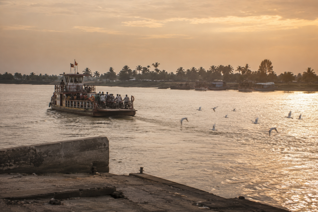
The return journey begins the same way the expedition began.
By water.
As the ferry slowly leaves Bagdanga Ghat, Mousuni Island retreats almost unnoticed.
- The embankments grow smaller.
- The coconut palms merge into the horizon.
- Fishing boats continue working exactly as they did when the morning began.
Nothing pauses because a visitor is leaving.
- The tide continues its patient work.
- Birds still follow the exposed mudflats.
- Smoke rises from evening kitchens.
- Children cycle home along the embankments.
The island simply continues being itself.
Perhaps that is Mousuni’s greatest lesson. It is not a place that asks to be admired. It asks to be understood.
Its story is written not in monuments but in repaired embankments, changing shorelines, working boats, freshwater ponds, and communities that continue adapting to one of the most dynamic coastlines in India.
Long after the ferry reaches the mainland, the island refuses to disappear completely.
Because some journeys are remembered through photographs.
Others through landscapes.
Mousuni is remembered through its resilience.
And once you have watched the tide shape an island—and the people who live beside it—you begin to understand that the coast is never simply where land meets the sea.
It is where endurance becomes a way of life.
Plan your private Sundarban expedition
A private journey shaped around you — your group, your pace, your interests. Book a free consultation.