 Encyclopedia
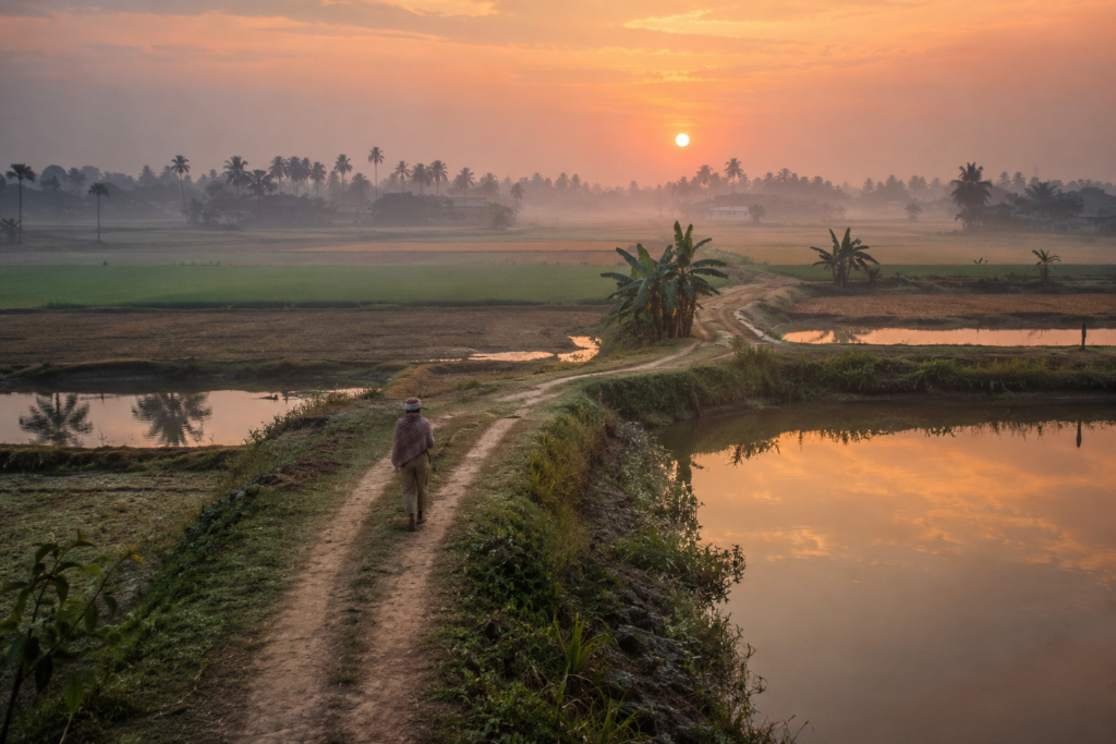
The first light arrives quietly in Jaynagar.
Not as a dramatic sunrise breaking over an open river, but as a gradual awakening across fields, ponds, railway tracks, temple courtyards, and market lanes that have known centuries of movement between land and water.
Before dawn, the air still carries the cool dampness of the night. Mist hangs low above stretches of paddy fields beyond the town. Somewhere in the distance, a train whistles along the southern line from Kolkata. Closer by, a bicycle bell rings. A tea stall owner lifts the shutter of a small roadside shop. Water boils in an aluminum kettle blackened by years of coal and wood smoke.
The smell arrives before the sun does.
- Wet earth.
- Rice husk.
- Wood smoke.
- Fresh milk.
And faintly, the sweet aroma of date palm jaggery—the ingredient that transformed this delta town into a name recognized across Bengal.
Jaynagar is often introduced through its most famous creation: the Moa.
Yet standing here at daybreak, that feels like only a small chapter in a much larger story. Because Jaynagar is not merely a town.
It is a threshold. A place where metropolitan Bengal slowly dissolves into the watery world of the lower delta. A place where rail lines meet rivers. Where markets meet wetlands. Where centuries of migration, reclamation, agriculture, trade, and survival have created one of the most fascinating cultural landscapes in southern Bengal.
The Sundarbans begin far before the first mangrove appears.
They begin in places like Jaynagar.
And understanding the delta requires beginning here.
First Encounter
The approach to Jaynagar is different from arriving at many parts of the Sundarbans.
There is no dramatic ferry crossing. No immediate sight of dense mangrove forests. No sudden encounter with wilderness. Instead, the landscape changes gradually.
Traveling south from Kolkata, the urban density begins to loosen.
- Apartment blocks become scattered settlements.
- Industrial zones fade into agricultural land.
- Concrete gives way to ponds.
- Roadside markets appear beneath banyan trees.
- The sky becomes larger.
- The horizon stretches wider.
- The land flattens.
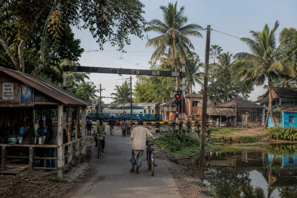
The closer one comes to Jaynagar, the more obvious it becomes that rivers have shaped everything—even where water is not immediately visible.
- Drainage canals run beside roads.
- Ponds appear beside homes.
- Fields follow patterns established by centuries of managing monsoon water.
- Villages sit on slightly elevated ground.
The landscape feels engineered not by machines but by generations of adaptation.
Jaynagar-Majilpur today functions as an important urban center within the South 24 Parganas district, yet it remains deeply connected to the rhythms of the delta. Its streets carry both the energy of a growing municipality and the memory of an agricultural frontier.
- Morning commuters board trains toward Kolkata.
- Farmers head toward fields.
- Vendors arrange vegetables in local markets.
- Students walk toward schools.
- Fishermen transport catches from nearby wetlands.
And every river ultimately flows toward the Bay of Bengal.
- Every road seems connected to another village.
- Every village seems connected to another waterbody.
- Every waterbody seems connected to a river.
Jaynagar’s Identity
To understand Jaynagar, one must stop thinking in terms of a single settlement.
Jaynagar exists as part of a broader delta landscape that includes towns, villages, agricultural tracts, wetlands, canals, and transport corridors connecting the interior of Bengal to the lower Sundarbans region.
Administratively, Jaynagar is located within the South 24 Parganas district of West Bengal and forms part of the Jaynagar subdivision.
The urban core consists primarily of Jaynagar-Majilpur Municipality, while the surrounding region includes extensive rural settlements governed through gram panchayats under the Jaynagar I and Jaynagar II Community Development Blocks.
Yet statistics alone reveal little. What matters is how the settlement sits within the landscape. Unlike many river islands farther south, Jaynagar occupies a transitional zone.
- To the north lie increasingly urbanized parts of Bengal.
- To the south stretch the tidal landscapes that eventually merge into the Sundarbans Biosphere.
- To the east and west flow rivers that have directed settlement, agriculture, and trade for centuries.
This position has made Jaynagar more than a town. It has become a meeting point.
Agricultural producers bring crops here.
- Students travel through it.
- Traders use it.
- Pilgrims pass through it.
Travelers heading toward the Sundarbans often cross its landscape without realizing how deeply the history of the delta is embedded beneath their feet.
Jaynagar’s true identity is neither urban nor rural. Neither inland nor coastal. It belongs to the frontier where these worlds overlap.
The Rivers That Shaped Jaynagar
Long before roads and railways arrived, rivers determined everything.
The story of Jaynagar cannot be told without understanding water. The lower Bengal delta is among the youngest and most dynamic landscapes on Earth. For thousands of years, sediment carried from the Himalayas traveled south through immense river systems before being deposited across the Bay of Bengal’s northern edge.
These deposits slowly created new land.
- Channels shifted.
- Wetlands emerged.
- Settlements followed.
The region surrounding Jaynagar developed within this constantly changing environment.
Among the most influential waterways in the broader landscape are the Matla River and numerous interconnected distributaries, canals, and tidal channels that shape movement across the lower delta.
Historically, waterways served as roads. They transported rice, timber, fish, salt, jaggery, and people. Before railway connectivity transformed regional mobility, boats connected villages more efficiently than roads.
- Markets rose where navigable channels met settlements.
- Agricultural expansion followed water availability.
- Trade followed river routes.
Even today, traces of these relationships remain visible.
Older settlements often align with historic waterways. Traditional occupations remain concentrated near wetlands and canals. Many local roads follow routes first established as embankment paths beside water channels.
The rivers provided opportunity.
They also delivered danger. Flooding remains part of the delta’s reality. Excess rainfall, tidal surges, and embankment failures have repeatedly reshaped livelihoods across the region.
- Families learned to build ponds for freshwater storage.
- Communities elevated homesteads.
- Agricultural calendars evolved around monsoon rhythms.
The river was never simply a resource. It was a force that demanded negotiation. And Jaynagar emerged from that negotiation.
Historical Footprints
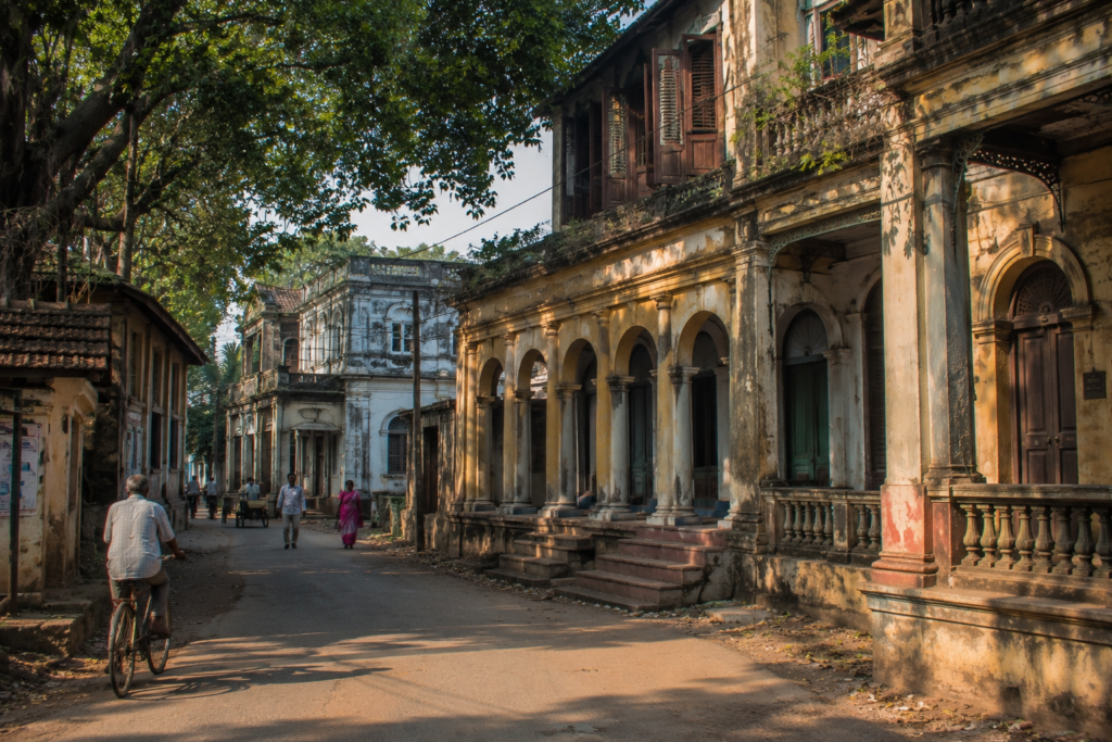
By mid-morning, as the markets fill with activity and sunlight settles across the town, history begins to reveal itself in subtle ways.
Not through grand monuments.
Not through imposing fortresses.
But through patterns of settlement.
- Street layouts.
- Religious institutions.
- Land records.
- Family histories.
And memories carried across generations.
The history of Jaynagar belongs to the larger story of South 24 Parganas—a region transformed repeatedly by rivers, empires, landlords, migrants, and agricultural expansion. Before large-scale reclamation efforts, much of southern Bengal consisted of forests, marshes, tidal creeks, and sparsely inhabited landscapes.
Settlement expanded gradually as communities cleared land for cultivation.
During the Mughal period, administrative structures increasingly incorporated the region into broader networks of taxation and governance.
- Agriculture expanded.
- Trade routes developed.
- River-based commerce flourished.
- The colonial period accelerated change dramatically.
British administrators viewed the delta not merely as a landscape but as an economic resource.
Extensive efforts were undertaken to reclaim land, expand cultivation, construct embankments, and increase revenue generation.
- Large tracts of forest were cleared.
- New settlements emerged.
- Agricultural production increased.
- The consequences were profound.
On one hand, reclamation created livelihoods and expanded cultivation. On the other hand, it altered ecological systems that had evolved over centuries.
The landscape visible around Jaynagar today is, in many ways, the result of these transformations. Much of what appears natural is actually a product of generations of human intervention.
- Fields exist because wetlands were managed.
- Villages exist because embankments were built.
- Roads exist because reclaimed land allowed them to exist.
The delta became inhabited through effort and often through hardship.
Historical Personalities &Transformations
The story of Jaynagar is inseparable from the social and intellectual currents that shaped Bengal.
Throughout the nineteenth and twentieth centuries, the region participated in broader movements involving education, reform, nationalism, and local governance. Jaynagar-Majilpur developed a reputation for learning and cultural activity that distinguished it from many surrounding settlements.
- Schools emerged.
- Literary traditions developed.
- Religious institutions became centers of community life.
- The spread of education transformed opportunities for local families.
Students who once would have remained confined to agricultural livelihoods increasingly entered professions, government service, and academic fields. The railway played a crucial role in this transformation. Connectivity linked Jaynagar to Kolkata, enabling the circulation of ideas as well as people.
The result was a unique blend of identities.
A resident could maintain deep roots in the delta while participating in the intellectual and economic life of the metropolis. This duality remains visible today. Many families maintain agricultural connections while simultaneously pursuing education and employment in urban centers.
Jaynagar became a place where traditional rural culture and modern aspirations learned to coexist.
Folklore and the Landscape of Belief
By afternoon, when conversations lengthen beneath shaded tea stalls and village elders begin recounting stories of earlier decades, another layer of Jaynagar emerges.
The landscape is full of belief.
Not necessarily formal religion.
But lived belief.
The kind carried through stories, rituals, warnings, and inherited memory. Unlike deeper parts of the Sundarbans, where Bonbibi and tiger lore dominate local imagination, Jaynagar occupies a transitional cultural zone.
Here, stories often blend agricultural traditions, river beliefs, local deities, folk practices, and broader Bengali religious customs.
- Water remains central.
- Rivers are respected.
- Storms are remembered.
- Old ponds acquire reputations.
- Certain trees become associated with local legends.
- Temples and shrines preserve stories whose origins are often difficult to trace.
Some narratives describe miraculous events. Others explain floods. Others recount unusual natural occurrences interpreted through spiritual frameworks.
What matters is not whether these stories can be historically verified. What matters is the role they play within community memory.
Folklore serves as a cultural map.
- It teaches caution.
- Preserves history.
- Strengthens identity.
- Connects generations.
In a landscape where rivers continually alter geography, stories often become more durable than physical landmarks.
- A channel may shift.
- A road may disappear.
- A settlement may expand.
Yet the stories remain. And through them, the past continues speaking to the present.
Life Between the Tides
Although Jaynagar is not surrounded by mangrove creeks like many southern Sundarban islands, life here is still governed by water.
The influence is less dramatic but equally profound.
- Water determines crops.
- Water determines fish production.
- Water determines transportation.
- Water determines prosperity.
And sometimes, water determines survival.
Throughout the Jaynagar region, daily life revolves around an intricate network of ponds, canals, wetlands, and seasonal water bodies. Many households maintain ponds that serve multiple purposes.
- Fish cultivation.
- Household water storage.
- Irrigation support.
- Duck rearing.
During the monsoon, these ponds become miniature ecosystems, attracting birds, amphibians, insects, and aquatic plants.
For farmers, the agricultural calendar remains deeply tied to seasonal water cycles. Rice cultivation dominates much of the surrounding landscape. Fields transform dramatically across the year.
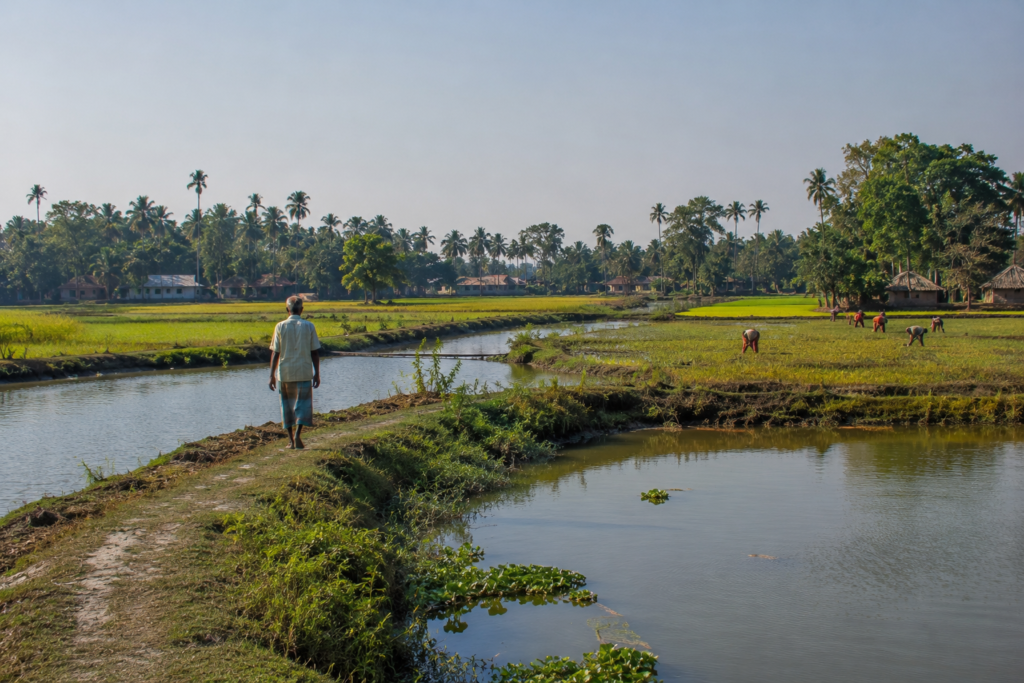
In one season, they shimmer emerald green. Months later, they glow golden beneath the winter sun. Then, after harvest, vast stretches of land appear almost empty, waiting patiently for another cycle to begin.
Agriculture here is not merely an occupation.
It is a relationship with the delta.
Every crop reflects an understanding accumulated over generations.
Families know which fields flood first.
- Which soils retain moisture longest.
- Which canals overflow during heavy rainfall.
- Which embankments require constant monitoring.
Knowledge is passed down quietly. Not through books.
- Through observation.
- Through experience.
- Through repetition.
The landscape itself becomes a teacher.
Walking Through the Villages
Leaving the municipal center behind, smaller roads begin threading through villages where the pace of life changes noticeably.
The houses tell stories. Older homes often feature traditional courtyards surrounded by fruit trees.
- Mango.
- Jackfruit.
- Banana.
- Coconut.
- Betel nut.
Trees are rarely ornamental. Most serve practical purposes.
- Providing food.
- Shade.
- Building materials.
- Or supplementary income.
The courtyards themselves function as social spaces.
- Women dry rice.
- Children play.
- Elders sit beneath verandas.
The boundaries between private and communal life feel more fluid than in urban environments. A visitor walking through these settlements notices another defining feature.
Ponds.
They appear everywhere.
- Some large.
- Some small.
- Some are meticulously maintained.
Others partially covered with floating vegetation. Each pond serves a purpose. And collectively they form one of the most important elements of the delta’s human ecology. Village temples emerge unexpectedly along narrow roads.
- A painted shrine beneath an ancient banyan tree.
- A modest temple dedicated to Kali.
- A local Shiva shrine beside a pond.
Mosques rise nearby as well, reflecting the diverse religious fabric that has characterized South 24 Parganas for centuries. Calls to prayer and temple bells coexist naturally within the same soundscape. Schools occupy prominent positions in many settlements.
Brightly painted buildings stand as symbols of one of the region’s most important transformations: the expansion of education.
Children in uniforms cycle along village roads carrying backpacks nearly as large as themselves.
Education has become one of the strongest forces reshaping Jaynagar’s future.
Yet the villages remain deeply connected to the landscape that shaped them.
Modernity has arrived.
But it has not erased the delta.
Markets: The Living Heart of Jaynagar
By late afternoon, activity intensifies in local markets.
If rivers are the arteries of the delta, markets are its beating heart. Here, the agricultural identity of Jaynagar becomes immediately visible.
Vegetable vendors arrange produce harvested only hours earlier. Fish sellers display catches from ponds, wetlands, rivers, and aquaculture farms.
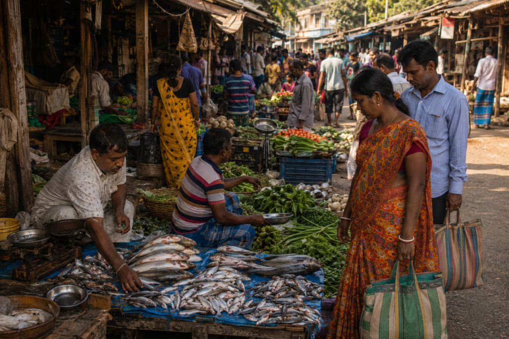
The air becomes a mixture of aromas.
- Fresh coriander.
- Mustard greens.
- Wet fish.
- Spices.
- Tea.
- Jaggery.
- Wood smoke.
And, during winter, something else.
The unmistakable fragrance of freshly prepared Jaynagar Moa. No discussion of Jaynagar can avoid this iconic sweet.
Made primarily from aromatic Kanakchur rice and date palm jaggery, the sweet has become inseparable from the town’s identity.
Yet observing its production reveals something deeper.
Moa is not simply a confection.
It is the product of an entire landscape.
- Rice cultivation.
- Date palm tapping.
- Seasonal weather.
- Agricultural traditions.
- Local craftsmanship.
Every ingredient reflects a relationship between people and place. The market preserves these relationships. Even as supermarkets expand elsewhere, traditional marketplaces continue functioning as social institutions.
People come not only to buy.
- They come to exchange information.
- Discuss weather forecasts.
- Share news.
- Debate politics.
- Arrange marriages.
- Seek employment opportunities.
Markets remain among the most important cultural spaces in the region.
Sounds of Jaynagar
Every landscape possesses a soundtrack.
Jaynagar’s changes with the hour. Morning begins with birds.
- House crows dominate the settlements.
- Common mynas patrol rooftops.
- Asian pied starlings gather near fields.
The distant whistle of trains soon joins the chorus. As the day progresses, human sounds become more prominent.
- Bicycle bells.
- Motorcycles.
- School announcements.
- Market negotiations.
- Tea stall conversations.
- Temple bells.
- The call to prayer drifted across the afternoon air.
In rural sections, another sound persists.
Wind moving through rice fields. It is subtle. Easy to overlook. Yet unmistakable once noticed.
During the monsoon, the soundtrack transforms again.
- Rain striking tin roofs.
- Overflowing drains.
- Frogs calling from ponds.
- Thunder rolling across the open landscape.
Then night arrives. And a different orchestra takes over.
- Crickets.
- Tree frogs.
- Occasional barking dogs.
- The distant rumble of trains heading toward Kolkata.
The sounds remind the listener that, despite urban expansion, Jaynagar remains connected to a larger ecological world.
Wildlife Expedition
To the casual observer, Jaynagar may appear dominated by human activity.
A closer look reveals something else. Wildlife persists everywhere. Not as dramatic spectacles. But as constant companions.
The wetlands, ponds, agricultural fields, and remnant natural habitats support a surprising diversity of species.
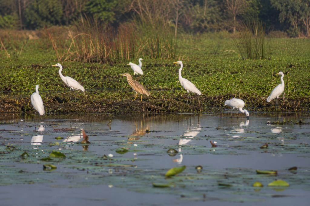
For birdwatchers, the region offers rewarding opportunities.
- Egrets patrol flooded fields.
- Pond herons stand motionless beside water bodies.
- Kingfishers flash brilliant blue across canals.
- Black drongos perch on electrical wires, scanning for insects.
During winter, migratory species arrive in varying numbers depending on wetland conditions.
Open agricultural landscapes attract raptors. Kites circle overhead. Harriers occasionally hunt across grasslands and harvested fields. Wetland edges host jacanas, moorhens, and various wading birds.
The region’s biodiversity often goes unnoticed because it lacks the dramatic reputation of the mangrove forests farther south.
Yet ecologically, these transitional habitats play important roles.
They serve as feeding grounds.
- Breeding areas.
- Migration stopovers.
- And ecological corridors connecting different parts of the delta.
Reptiles remain common.
- Water snakes inhabit ponds and canals.
- Garden lizards occupy homesteads.
- Various frog species flourish during the monsoon.
- Insects dominate the warmer months.
- Dragonflies patrol water bodies.
- Butterflies move between flowering plants.
- Fireflies occasionally illuminate village edges during humid evenings.
Wildlife here is not separate from human life. It exists alongside it. Sharing the same landscape.
Wetland and Mangrove Connections
See it for yourself
A private journey shaped around you — your group, your pace, your interests. Book a free consultation.
A common misconception suggests that the Sundarbans begin only where dense mangrove forests become visible.
The reality is more complex.
Ecologically, Jaynagar exists within a broader delta system connected to the Sundarbans through hydrology, climate, sediment processes, and historical land use.
The region’s wetlands act as transitional habitats between inland Bengal and the tidal ecosystems farther south.
These wetlands perform crucial functions.
- They store monsoon water.
- Reduce flooding.
- Recharge groundwater.
- Support fisheries.
- Provide habitat for birds and amphibians.
- Filter pollutants.
- Moderate local temperatures.
Historically, much of southern Bengal contained extensive marshes and seasonally inundated landscapes.
Many have been converted into agricultural land or settlements. Yet remnants survive. These surviving wetlands continue to support biodiversity and livelihoods.
Mangrove influence may not be immediately visible in central Jaynagar, but the ecological connection remains undeniable.
Water flowing through local channels ultimately joins larger river systems linked to the Sundarbans.
- Birds move between habitats.
- Fish migrate through connected waterways.
- Cyclones affect both regions.
Climate change influences both landscapes simultaneously. Jaynagar occupies a vital position within this larger ecological mosaic. Understanding the Sundarbans requires understanding these transitional zones as well.
Explorer’s Field Notes
Field Note 01: The Pond Economy
One of the most striking observations across Jaynagar is the density of ponds.
From above, the landscape resembles a mosaic of water and land. Each pond represents an investment in resilience.
- Food production.
- Water storage.
- Microclimate regulation.
- Biodiversity.
The pond is perhaps the most underestimated feature of the Bengal delta.
Field Note 02: Trains and Agriculture
Unlike many deeper delta settlements dependent primarily on waterways, Jaynagar’s railway connection has profoundly shaped local development.
The coexistence of trains, agriculture, and wetlands creates a unique landscape rarely found elsewhere in the Sundarban region.
Field Note 03: Trees Around Homes
Settlement vegetation follows clear patterns.
- Coconut palms.
- Mango trees.
- Jackfruit.
- Banana.
- Betel nut.
These species form living infrastructure around households, providing food, shade, income, and protection from the weather.
Field Note 04: Winter Sweetness
The cultural significance of date palm jaggery becomes especially evident during winter.
Seasonal food traditions remain deeply embedded within local identity, connecting agriculture, climate, and community memory.
Field Note 05: The Delta Horizon
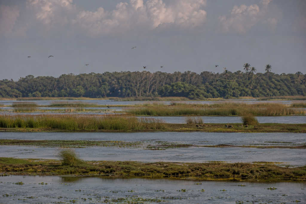
One recurring visual characteristic of Jaynagar is openness.
- Fields stretch toward distant tree lines.
- Cloud formations appear enormous.
- The sky often feels larger than the settlements beneath it.
This sense of scale contributes significantly to the region’s character.
Nightfall on Jaynagar
The transformation begins gradually.
- Shadows lengthen across fields.
- Market crowds thin.
- School buildings empty.
- Farmers return home.
- Smoke rises from evening cooking fires.
- A golden light settles over ponds and canals.
The railway station becomes active again as commuters return from Kolkata. Passengers step onto platforms carrying bags, newspapers, and stories from the city.
For a brief moment, two worlds meet.
- The metropolis and the delta.
- Modernity and tradition.
- Movement and rootedness.
As darkness deepens, village roads grow quieter.
- Tea stalls remain illuminated.
- Conversations continue beneath hanging bulbs.
- Mosquitoes emerge from wetland edges.
- Frogs begin calling from ponds.
The air cools. Stars appear where city lights allow them. And somewhere beyond the horizon, farther south, the rivers continue their journey toward the great mangrove forests of the Sundarbans.
Jaynagar settles into the night.
- Not silent.
- Never truly silent.
- But resting.
Preparing for another dawn in the landscape where Bengal’s great delta gradually becomes a civilization.
The Seasons of Jaynagar
The people of Jaynagar do not merely experience the seasons.
They live through them. Each season arrives with its own colors, sounds, occupations, foods, opportunities, and challenges. The calendar is not measured only in months. It is measured in harvests, rains, fish migrations, flowering trees, and river moods.
Winter: The Season of Clarity
The most beloved season arrives quietly.
Between late November and February, the oppressive humidity of summer retreats.
- Mornings become cool.
- Mist settles across fields and ponds.
- The sky often appears brilliantly clear.
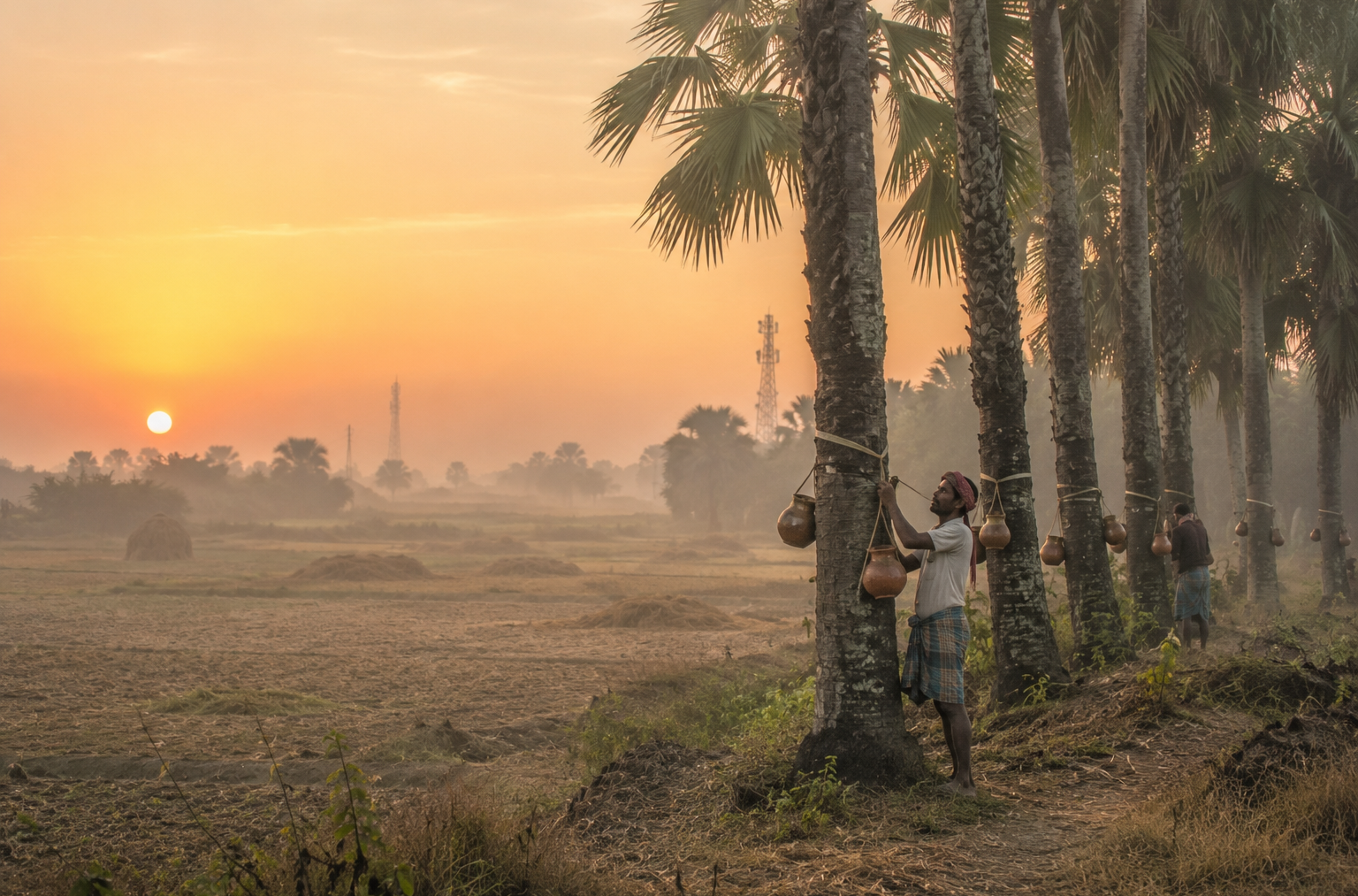
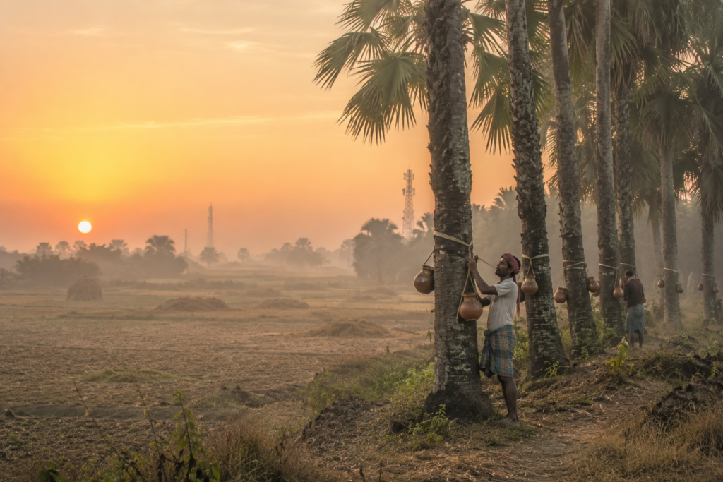
This is the season when Jaynagar reveals one of its most celebrated identities. Date palm trees begin yielding sap. Collectors climb before dawn to gather the sweet liquid that will eventually become nolen gur—the fresh date palm jaggery treasured throughout Bengal.
The famous Jaynagar Moa reaches its finest expression during these months.
Winter also transforms the landscape visually.
- Harvested fields stretch toward the horizon.
- Migratory birds appear in wetlands.
- Local markets overflow with seasonal vegetables.
Travel becomes easier.
The air carries a sense of openness rarely found during the humid months. For photographers and naturalists, winter often provides the most rewarding conditions.
Spring: The Brief Transition
Spring in Jaynagar is subtle.
It does not arrive dramatically. Instead, it slips quietly between winter and summer.
- Mango trees begin flowering.
- New leaves emerge across village landscapes.
- The agricultural cycle shifts once again.
- Temperatures gradually rise.
- Bird activity increases.
The countryside briefly appears refreshed before the intensity of summer arrives. The season may be short, but it serves as an important ecological bridge between cooler and hotter months.
Summer: Heat and Anticipation
By April and May, the delta begins to simmer.
- Afternoons become intense.
- Roads radiate heat.
- Ponds shrink.
- Fields dry.
People adjust their routines.
- Work often begins earlier in the day.
- Shaded tea stalls become essential social spaces.
- The atmosphere feels suspended between exhaustion and expectation.
Because everyone knows what is coming next.
- The monsoon.
- The anticipation becomes almost tangible.
- Farmers watch the sky.
- Conversations frequently turn toward rainfall forecasts.
The first storm clouds become events in themselves. The entire landscape waits.
Monsoon: The Great Transformation
Then the rains arrive.
Sometimes gradually. Sometimes with astonishing force. Within weeks, Jaynagar becomes a different world.
- Fields flood.
- Canals fill.
- Ponds overflow.
Roadside vegetation explodes into shades of green. The delta appears rejuvenated.
- Life returns to wetlands.
- Fish populations expand.
- Amphibians emerge.
- Bird activity increases.
The monsoon is both provider and disruptor. It nourishes agriculture. Replenishes water resources. Supports fisheries.
Yet it can also overwhelm infrastructure.
- Flood low-lying areas.
- Damage crops.
- Challenge transportation.
For generations, local communities have learned to embrace both realities simultaneously. The monsoon remains one of the defining forces shaping life in the region.
Post-Monsoon: Renewal and Recovery
After the rains retreat, the landscape enters a period of remarkable productivity.
- Agricultural activity intensifies.
- Fields regain structure.
- Wetlands remain rich with life.
- The sky becomes clearer.
- The countryside often appears at its most vibrant.
For many families, this season represents opportunity. The months of preparation begin yielding results. Harvest expectations grow. The landscape seems temporarily balanced between abundance and uncertainty.
Cyclones and Survival
Every delta possesses a memory.
In Jaynagar, many of those memories arrive with the wind. Conversations with older residents often return to storms. Not specific dates at first.
But experiences.
- A night when the wind sounded like a train.
- A morning when embankments failed.
- A season when floodwater remained for weeks.
- A year when crops vanished.
Cyclones are woven into the history of southern Bengal.
Though Jaynagar lies north of the most exposed coastal islands, it remains vulnerable to the consequences of major storms.
The region has experienced the impacts of numerous cyclonic events over the decades, including powerful storms that affected much of the lower delta.
Names such as Aila, Bulbul, Amphan, and Yaas remain embedded within public memory.
Each storm revealed both vulnerability and resilience.
- Electricity networks failed.
- Trees fell.
- Agricultural losses accumulated.
- Transportation was disrupted.
Yet communities adapted.
Again and again.
- Cyclone shelters expanded.
- Early-warning systems improved.
- Local disaster preparedness strengthened.
- Infrastructure evolved.
The relationship between people and storms remains ongoing.
No one imagines complete victory. The goal is endurance.
- Adaptation.
- Survival.
The delta has always demanded resilience. Jaynagar continues that tradition.
Ferry Routes and Hidden Paths
Although railways dominate modern transportation, water remains present in the geography of movement.
Historically, waterways connected much of the lower delta. Many routes that appear ordinary today originated as pathways linking rivers, canals, and markets. To travel through the broader Jaynagar region is to discover a layered transportation landscape.
- Rail lines connect the area to Kolkata.
- Roads link villages to market centers.
- Canals trace forgotten commercial routes.
- Embankments double as walking paths.
Beyond the town itself, movement toward the deeper Sundarbans increasingly shifts toward ferry networks. Many travelers pass through Jaynagar on journeys toward settlements farther south.
Yet those who slow down often discover another landscape.
- Small roads leading to ponds hidden behind bamboo groves.
- Village paths crossing agricultural fields.
- Markets that operate according to rhythms unchanged for decades.
The most interesting routes are often the least obvious. Exploration here rewards patience rather than speed.
Photography Expedition Guide
For photographers, Jaynagar offers something different from the iconic imagery usually associated with the Sundarbans.
There may be no tiger tracks on muddy banks. No dramatic mangrove labyrinths. Instead, the appeal lies in documenting the relationship between people and landscape.
Sunrise Photography
The finest sunrise opportunities often emerge across agricultural fields and wetlands surrounding the town.
Winter mornings are particularly rewarding.
- Mist creates layers.
- Palm trees become silhouettes.
- Farmers appear as dark figures moving through pale light.
The atmosphere feels almost cinematic.
Village Life Photography
Jaynagar’s villages provide opportunities to document everyday delta culture.
- Courtyards.
- Fishing ponds.
- Traditional architecture.
- Agricultural activities.
- Religious spaces.
- Morning markets.
The strongest images often come from ordinary moments rather than staged scenes.
Wetland Photography
Seasonal wetlands attract birds, reflections, and changing light conditions.
Monsoon and post-monsoon months are especially productive. Patience is essential. Many of the region’s most compelling photographs emerge from waiting rather than searching.
Cultural Photography
Festivals, local markets, seasonal food production, and religious events reveal the social character of the region.
Particularly during winter, the preparation and sale of Jaynagar Moa becomes a visual story in itself. The process links agriculture, tradition, commerce, and identity.
Sunset Photography
Evening light transforms ponds and fields into reflective landscapes.
The open horizon creates opportunities for wide compositions. The final light often lingers longer than expected across the flat delta terrain.
Expedition Notes
Observation 01: The Delta’s Architecture
Many houses appear designed not by architects but by environmental experience.
- Elevated foundations.
- Shaded courtyards.
- Ponds nearby.
- Trees positioned strategically.
The architecture reflects adaptation rather than aesthetics alone.
Observation 02: Water is Everywhere
Even when rivers are absent from view, water remains present.
- Ponds.
- Canals.
- Drainage channels.
- Wetlands.
- Agricultural fields.
The entire landscape functions as a water-management system.
Observation 03: Urban and Rural Boundaries Blur
Jaynagar challenges simple classification.
It is neither fully urban nor fully rural.
- Railway stations coexist with rice fields.
- Municipal roads lead directly into agricultural landscapes.
- Modernity and tradition overlap continuously.
Observation 04: Memory Lives in Conversation
Some of the region’s most valuable historical records exist not in archives but in personal recollections.
- Storm stories.
- Migration histories.
- Agricultural changes.
- Market traditions.
The oral archive remains remarkably strong.
Observation 05: The Sky is a Character
Few elements shape the visual identity of Jaynagar more than the sky.
The flatness of the landscape amplifies cloud formations, weather systems, and changing light conditions. The sky becomes part of the narrative.
Connected Landscapes
No place in the delta exists in isolation.
Jaynagar’s story extends beyond its municipal boundaries. To the south lie the increasingly tidal landscapes leading toward the Sundarbans. To the north stretch the urban corridors connecting the region with Kolkata.
Nearby settlements contribute to a shared cultural and ecological identity.
- The routes toward Canning reveal one dimension of the delta.
- The pathways toward Baruipur reveal another.
- The roads leading south toward the island regions reveal yet another.
Agricultural goods move across these networks.
- Students travel through them.
- Workers commute along them.
- Cultural traditions spread through them.
Ecological processes ignore administrative boundaries altogether.
- Birds move between wetlands.
- Floodwaters cross jurisdictions.
- Cyclones affect entire regions simultaneously.
Jaynagar occupies a strategic position within this larger interconnected landscape. It functions as a bridge. A transition zone. A meeting point between different worlds of the delta.
Oral Histories: Voices of the Lower Delta
As darkness settles and conversations lengthen, memories emerge.
Older residents often describe a Jaynagar that younger generations would scarcely recognize. They remember fewer roads.
- More wetlands.
- Larger agricultural holdings.
- Different transportation patterns.
- Seasonal flooding that shaped entire communities.
Many recall journeys that once required boats, where roads now exist. Others speak about changing agricultural practices.
- The arrival of electricity.
- Expansion of schools.
- Growth of railway connectivity.
Increasing migration toward Kolkata and beyond. Yet certain themes appear repeatedly.
- Water.
- Community.
- Adaptation.
The uncertainty of the weather.
- The importance of markets.
- The value of education.
- The significance of land.
These recurring themes reveal something important. The history of Jaynagar is not merely a story of infrastructure or administration. It is a story of people learning how to live within one of the most dynamic landscapes on Earth.
And that story continues.
- Every season adds another chapter.
- Every generation contributes another layer.
The delta never stops evolving. Neither does Jaynagar.
Food of Jaynagar
Food is often the quickest route into understanding a place.
- Not restaurant food.
- Not curated food.
- But everyday food.
The food people eat is because it belongs to the landscape around them. In Jaynagar, food begins with rice.
It is impossible to separate the culture of the lower delta from rice cultivation. Fields surrounding the town produce the grain that remains central to daily life. A traditional meal still revolves around rice accompanied by fish, vegetables, lentils, and seasonal ingredients.
Fish occupy a special place.
The abundance of ponds, wetlands, canals, and nearby rivers has shaped food culture for generations.
- Rohu.
- Catla.
- Mrigal.
- Tilapia.
- Prawn.
Various small indigenous fish. Each appears in different forms depending on season and availability.
For many households, fish is not simply a preferred food. It is part of cultural identity.
Vegetables also reflect the agricultural richness of the region.
- Pumpkin.
- Bottle gourd.
- Brinjal.
- Okra.
- Spinach.
- Radish.
- Cauliflower.
- Cabbage.
- Seasonal greens.
Many families still cultivate small kitchen gardens alongside larger agricultural activities.
The Story of Jaynagar Moa
No culinary discussion can ignore the food that transformed Jaynagar into a household name throughout Bengal.
Jaynagar Moa is more than a sweet.
It is a cultural artifact. Its reputation rests on a specific combination of ingredients and geography. The traditional preparation relies upon aromatic Kanakchur rice and fresh date palm jaggery.
Neither ingredient exists independently of the delta environment.
- The rice reflects agricultural heritage.
- The jaggery reflects winter.
- The final product reflects craftsmanship.
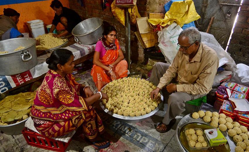
For generations, families have perfected techniques passed through experience rather than formal instruction.
During winter, local markets become filled with the fragrance of freshly prepared moa. Visitors often encounter it first through smell rather than sight.
- Sweet.
- Warm.
- Distinctly seasonal.
The popularity of Jaynagar Moa has created an identity that extends far beyond the town itself. Across Bengal, the name Jaynagar often evokes this sweet before anything else. Yet the moa’s true significance lies in what it represents.
- A landscape.
- A season.
- A tradition.
- A community.
- A connection between agriculture and culture.
Seasonal Foods
The food calendar changes throughout the year.
- Winter introduces fresh date palm products.
- Monsoon encourages dishes built around seasonal vegetables and fish.
- Summer brings mangoes and cooling preparations suited to the heat.
- Religious festivals add their own culinary traditions.
Food in Jaynagar remains closely linked to environmental rhythms. The seasons still dictate menus. A reminder that despite modernization, the landscape continues to influence daily life.
The Economy of Jaynagar
At first glance, Jaynagar may appear to function primarily as a residential and commercial town.
A closer examination reveals a more complex economy.
- Agriculture remains fundamental.
- Trade remains vital.
- Transportation remains essential.
- Education increasingly shapes economic opportunity.
- Migration contributes significantly to household income.
These systems operate simultaneously.
Agriculture
Agriculture continues serving as one of the region’s most important economic foundations.
Rice cultivation dominates much of the surrounding countryside.
Fields visible from roads and railway lines represent generations of adaptation to delta conditions.
Farmers must constantly respond to changing rainfall patterns, soil conditions, water availability, and market fluctuations.
Agriculture here is both traditional and evolving.
Modern techniques coexist alongside inherited knowledge. The result is a landscape where centuries-old practices continue adapting to contemporary realities.
Fisheries and Aquaculture
The abundance of ponds and water bodies supports extensive fish production.
Aquaculture contributes significantly to local livelihoods.
Many families maintain fish ponds either as primary income sources or supplementary enterprises. Fish produced in the region often move through local markets before reaching larger urban centers.
This connection between rural production and urban demand remains a defining feature of the local economy.
Trade and Commerce
Jaynagar functions as an important commercial center for the surrounding settlements.
Markets draw producers and buyers from nearby villages.
- Agricultural products.
- Fish.
- Household goods.
- Construction materials.
- Seasonal products.
Everything flows through local trading networks.
Historically, waterways facilitated much of this movement. Today, roads and railways dominate. Yet the fundamental role of Jaynagar as a regional marketplace remains unchanged.
Migration and Commuting
One of the most significant economic transformations has been the expansion of mobility.
The railway connection allows many residents to work outside the immediate region.
Some commute regularly to Kolkata. Others seek opportunities elsewhere in India. Income generated through migration increasingly supports local households.
This has produced a distinctive social pattern. Families remain rooted in the delta while participating in broader economic networks. The result is a landscape simultaneously local and global.
Then and Now
Standing beside an old pond at dusk, it becomes impossible not to wonder how much Jaynagar has changed.
The answer depends on where one looks. Some transformations are dramatic. Others are subtle.
The Historical Landscape
Older generations often describe a landscape with more wetlands and fewer roads.
Transportation depended more heavily on waterways.
- Agriculture occupied a larger proportion of daily life.
- Communication was slower.
- Distances felt greater.
- Storm recovery took longer.
The region remained more isolated from metropolitan influence. Many aspects of life moved according to environmental rhythms rather than technological schedules.
The Contemporary Landscape
Today’s Jaynagar is more connected than ever.
- Railways link the region directly to Kolkata.
- Mobile networks connect villages to global information systems.
- Educational opportunities have expanded.
- Healthcare access has improved.
- Commercial activity has diversified.
- Infrastructure has increased.
Yet continuity remains visible.
- The ponds remain.
- The fields remain.
- Seasonal food traditions remain.
- The markets remain.
- The relationship with water remains.
Perhaps the most remarkable aspect of Jaynagar is not how much it has changed. But how much it has retained while changing.
The Wild Orbit Quick Facts
Location
South 24 Parganas District, West Bengal, India
Administrative Region
Jaynagar Subdivision
Urban Core
Jaynagar-Majilpur Municipality
Community Development Blocks
Jaynagar I and Jaynagar II
Approximate Coordinates
22.17° N, 88.42° E
Elevation
Low-lying deltaic plain
Nearest Major City
Kolkata
Railway Connectivity
Direct suburban railway connection with Kolkata via the Sealdah South Section
Dominant Landscape
Agricultural plains, wetlands, ponds, canals, and settlements
Ecological Identity
Transitional delta landscape connected to the broader Sundarban ecosystem
Famous Cultural Product
Jaynagar Moa
Best Exploration Season
November to February
Key Environmental Challenges
Cyclones, flooding, wetland loss, and climate change impacts
The Orbit Expedition Snapshot
Accessibility
9/10
Among the most accessible gateways to the lower delta region, supported by strong rail and road connectivity.
Wildlife Potential
6.5/10
Not a wilderness destination, but wetlands, agricultural habitats, ponds, and seasonal birdlife offer rewarding observations.
Photography Potential
8.5/10
Exceptional opportunities for documenting rural Bengal, seasonal agriculture, wetlands, food culture, and everyday delta life.
Cultural Richness
9.5/10
Deeply layered traditions involving agriculture, food heritage, markets, religion, education, and regional identity.
Historical Interest
8/10
Strong connections to land reclamation, delta settlement history, transportation development, and social transformation.
Solitude Level
5/10
A lived-in landscape rather than a remote wilderness. Exploration focuses on immersion rather than isolation.
The Wild Orbit Explorer Connections
Readers interested in Jaynagar may naturally continue exploring:
Delta Gateways
- Canning
- Baruipur
- Kakdwip
Lower Delta Landscapes
- Namkhana
- Patharpratima
- Sagar Island
River Systems
- Matla River
- Bidyadhari River
Ecosystems
- Sundarbans Biosphere Reserve
- Indian Sundarbans
FAQs
1. Where is Jaynagar located?
Jaynagar is located in the South 24 Parganas district of West Bengal within the lower Bengal delta region.
2. Is Jaynagar part of the Sundarbans?
It is not within the core mangrove forest area but forms an important gateway and transitional landscape connected to the wider Sundarbans region.
3. Is Jaynagar an island?
No. Jaynagar is a town and regional settlement landscape rather than a river island.
4. What is Jaynagar most famous for?
Jaynagar is internationally known for Jaynagar Moa.
5. What is Jaynagar Moa made from?
Traditionally, from Kanakchur rice and fresh date palm jaggery.
6. When is the best season to visit Jaynagar?
Winter, particularly from November to February.
7. Does Jaynagar have wetlands?
Yes. Wetlands, ponds, canals, and agricultural water bodies are integral to the landscape.
8. Are there mangrove forests in Jaynagar?
Not extensive mangrove forests like those farther south in the Sundarbans.
9. How important is agriculture?
Agriculture remains one of the most significant local economic activities.
10. Is fish farming common?
Yes, aquaculture is widespread throughout the region.
11. Does Jaynagar experience cyclones?
Yes. Major cyclonic systems affecting southern Bengal can impact the region.
12. What crops are commonly grown?
Rice remains the dominant crop.
13. Are there birdwatching opportunities?
Yes. Wetlands and agricultural landscapes attract many bird species.
14. Is Jaynagar connected to Kolkata by train?
Yes. Regular suburban railway services operate daily.
15. Why are ponds so common?
They support fisheries, water storage, biodiversity, and household needs.
16. What type of landscape surrounds Jaynagar?
Low-lying agricultural delta plains.
17. Is the area prone to flooding?
Seasonal flooding can occur during heavy rainfall and severe weather events.
18. What role do markets play locally?
Markets function as economic, cultural, and social hubs.
19. Does Jaynagar have historical importance?
Yes. It reflects centuries of delta settlement and regional development.
20. What wildlife can be seen?
Birds, reptiles, amphibians, fish, insects, and wetland species.
21. Is Jaynagar suitable for photography?
Very much so, particularly for cultural and landscape photography.
22. How does climate change affect Jaynagar?
Through changing rainfall patterns, flooding risks, and cyclone impacts.
23. Is Jaynagar urban or rural?
It is a blend of both.
24. What makes Jaynagar unique in the delta?
Its role as a cultural, agricultural, and transportation gateway.
25. What defines the identity of Jaynagar?
The meeting of agriculture, wetlands, trade, mobility, and delta culture.
26. Why is Jaynagar important for understanding the Sundarbans?
Because it reveals how people and landscapes interact before the mangrove frontier begins.
27. Can Jaynagar be explored in a day?
Yes, though deeper exploration rewards additional time.
28. What is the most overlooked aspect of Jaynagar?
Its ecological significance as a transitional delta landscape.
How to Reach Jaynagar
From Kolkata by Train
The railway remains the most practical and historically significant route into Jaynagar.
The suburban rail network has connected the region to Kolkata for generations, transforming trade, education, migration, and daily life.
Most travelers begin their journey from Sealdah Station in Kolkata.
Regular trains operate on the Sealdah South Section toward Jaynagar Railway Station.
The journey generally takes between 1.5 and 2.5 hours, depending on the service selected and operational conditions.
What makes this route remarkable is not merely convenience. The train itself becomes part of the expedition. Urban neighborhoods gradually give way to ponds, agricultural fields, wetlands, and village settlements. The changing landscape provides a visual introduction to the lower Bengal delta.
Explorer’s Note
Choose a window seat during winter mornings.
Mist-covered fields, palm silhouettes, village ponds, and waking settlements often create some of the most atmospheric scenes in southern Bengal.
From Kolkata by Road
Jaynagar can also be reached via road through the southern transport corridors of South 24 Parganas.
The route passes through a sequence of expanding suburban and rural landscapes.
Travel times vary depending on traffic conditions, weather, and season.
Road travel offers flexibility for photographers and explorers who wish to stop at villages, wetlands, roadside markets, and agricultural areas along the way.
During monsoon months, road conditions may change due to localized flooding and heavy rainfall. Checking local conditions before departure is advisable.
Ferry Connections and Water Routes
Unlike the deeper island regions of the Sundarbans, Jaynagar itself does not require a ferry crossing for access.
However, waterways remain important throughout the broader region.
Many travelers continue southward from Jaynagar toward ferry-connected landscapes where rivers once again become the primary transportation corridors.
Historically, river transport played a much greater role in local mobility.
Although railways and roads dominate today, traces of older water-based networks remain visible in canals, embankments, and settlement patterns.
Monsoon Travel Considerations
The monsoon transforms the landscape dramatically.
- Fields flood.
- Wetlands expand.
- Vegetation becomes lush and vibrant.
- Photography opportunities improve significantly.
However, transportation can occasionally become less predictable.
Heavy rainfall may affect local roads and increase travel times. For explorers, this season offers extraordinary visual rewards but requires additional flexibility.
Best Season for Exploration
November to February
This period offers:
- Comfortable temperatures
- Clear skies
- Migratory bird activity
- Peak Jaynagar Moa season
- Excellent photography conditions
- Easier rural exploration
July to September
Ideal for:
- Wetland observation
- Monsoon landscapes
- Dramatic skies
- Agricultural photography
April to June
Best suited for those interested in experiencing the climatic realities of the delta before the arrival of the monsoon.
Things to See Around Jaynagar
The greatest mistake many travelers make is assuming Jaynagar can be understood through a single attraction.
The region rewards observation rather than sightseeing.
Its most memorable experiences are often landscapes, activities, and encounters rather than monuments.
Jaynagar Moa Production Areas
Winter provides opportunities to observe the traditions associated with the production of the sweet that made Jaynagar famous.
Markets and workshops reveal the connection between agriculture, seasonal ingredients, and cultural identity.
The process itself tells a story about the landscape.
Traditional Markets
Local markets remain among the best places to understand everyday life.
- Agricultural products.
- Fresh fish.
- Seasonal vegetables.
- Local conversations.
The market functions as a living archive of the region’s economy and culture. Early morning visits are particularly rewarding.
Village Landscapes
The villages surrounding Jaynagar reveal the architecture of adaptation.
- Ponds.
- Fruit trees.
- Courtyards.
- Agricultural fields.
- Religious spaces.
Traditional settlement patterns remain visible despite modern changes. Walking slowly through these landscapes often reveals more than any guidebook can offer.
Wetlands and Water Bodies
Scattered throughout the region, wetlands support birdlife, fisheries, and seasonal ecological activity.
These habitats demonstrate the intricate relationship between human communities and water management in the delta.
Winter mornings and post-monsoon periods are especially productive for observation and photography.
Railway Landscape Photography
Few places in Bengal offer such an interesting combination of rail infrastructure and delta ecology.
Trains moving through agricultural landscapes provide compelling opportunities for visual storytelling.
Local Temples and Shrines
Many small temples preserve local traditions, community histories, and folk practices.
Rather than monumental architecture, these sites offer insight into lived spirituality and cultural continuity.
Seasonal Agricultural Landscapes
Different seasons reveal entirely different visual worlds.
Rice cultivation, harvest periods, flooded fields, and post-monsoon vegetation create changing photographic opportunities throughout the year.
Continue the Journey
Jaynagar rarely feels like an ending.
It feels like a beginning. From here, explorers can continue deeper into the landscapes that define the lower Bengal delta.
Possible next journeys include:
Toward the Mangrove Frontier
- Kakdwip
- Namkhana
- Patharpratima
- Sagar Island
These landscapes reveal increasingly tidal environments and stronger ecological connections to the Sundarbans.
Toward the River Gateways
- Canning
- Gosaba
- Basanti
These regions illustrate the transition between settled delta landscapes and mangrove ecosystems.
Toward Historical Delta Settlements
- Baruipur
- Sonarpur
- Diamond Harbour
These locations provide additional perspectives on the evolution of settlement, trade, and river culture across southern Bengal.
Toward the Great Mangrove Forest
Eventually, every route seems to point toward one destination.
The Sundarbans. Yet after exploring Jaynagar, the mangrove forest appears differently. One begins to understand that the forest does not stand apart from the delta. It emerges from it.
The story begins long before the first mangrove tree appears.
Departure Across the Evening Delta
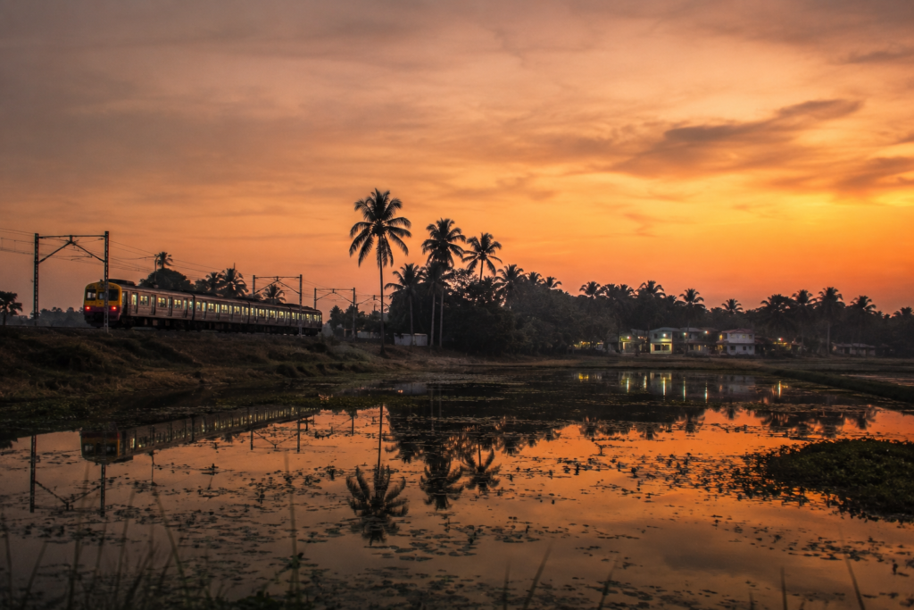
The final train leaves beneath a sky slowly surrendering to darkness.
- The platform lights glow against the evening haze.
- Vendors pour their last cups of tea.
- Passengers settle beside windows.
The whistle sounds.
And gradually, Jaynagar begins to slip away.
- Fields appear briefly between clusters of lights.
- Ponds catch fragments of moonlight.
- Palm trees become silhouettes.
- Villages dissolve into darkness.
Yet something remains.
- Not a monument.
- Not a single landmark.
But an understanding.
An understanding that the delta is more than rivers and forests. It is also markets and memories.
- Railway stations and rice fields.
- Ponds and stories.
- Storms and survival.
Sweetness gathered from date palms during winter dawns. Lives shaped by water even when the river is out of sight. As the train moves northward toward Kolkata, the landscape slowly disappears beyond the window.
But the feeling lingers.
Because Jaynagar is not merely a place one visits.
It is a place that explains the delta.
And once the delta begins explaining itself, every future journey into the Sundarbans feels richer, deeper, and infinitely more alive.
Plan your private Sundarban expedition
A private journey shaped around you — your group, your pace, your interests. Book a free consultation.