 Encyclopedia
There are places in the Sundarbans that disappear from the landscape long before they disappear from memory.
Kabasgadi Island is one of them.
Kabasgadi is identified in recent literature as one of the islands of the Indian Sundarbans that has disappeared from the present map. A 2023 assessment of changing Sundarbans islands places Kabasgadi alongside Lohachara, Bedford and Suparibhanga in the category of islands that had disappeared from the contemporary map.
Earlier coastal research provides a more precise description of what happened. It records that Kabasgadi shifted from its original position and became attached to the Indian mainland, rather than simply disappearing in one sudden event.
A later assessment also describes Kabasgadi among the islands inundated in the Sundarbans, while Government of West Bengal material has associated the loss of Kabasgadi with the wider history of erosion, sea-level change and island disappearance in the region.
Yet Kabasgadi’s story contains an important geographical complication.
The present Government of India’s National Centre for Sustainable Coastal Management (NCSCM) DWIEP database still maintains a Kabasgadi Island record, identifying it as an uninhabited, protected Reserve Forest of 1.727 square kilometres between Kakdwip and Sagar Island.
A more recent geomorphological study likewise investigates a present Kabasgadi landform as a compound tidal bar, showing that sediment and mangrove vegetation continue to occupy part of the geomorphological system historically associated with Kabasgadi.
This apparent contradiction is central to understanding the island.
Kabasgadi was lost as the historical island that once existed in the landscape, but the physical landform associated with its name has continued to change.
That distinction matters.
Kabasgadi is therefore not simply a story of a piece of land sinking beneath the sea. It is a story of island migration, sedimentation, erosion, tidal-channel change, mangrove colonisation and human intervention.
Its history shows that in the Sundarbans, an island is not always a permanent geographical object.
- It can be created by sediment.
- It can be consolidated by vegetation.
- It can be cut apart by channels.
- It can be eroded from its margins.
- It can become attached to another landmass.
And eventually, its identity as an island can disappear.
Kabasgadi Island At a Glance
- Name: Kabasgadi Island
- Region: Indian Sundarbans, West Bengal, India
- Historical status: Island subsequently lost/transformed
- Current database status: Kabasgadi Island is still listed as a present landform by India’s NCSCM DWIEP database
- Island code in DWIEP: INWB003
- Current recorded area: 1.727 km²
- Current recorded population: Uninhabited
- Forest status: Reserve Forest
- Ecological designation: Mangrove Ecologically Sensitive Area
- Location: Between Kakdwip and Sagar Island
- Coordinates recorded by DWIEP: 21°52′00.47″N, 88°11′05.62″E
- Principal river: Muriganga
- Associated eastern water system: Kakdwip River
- Associated tidal channel: Kalnagini Khal
- Dominant documented mangrove: Baen (Avicennia officinalis)
- Major environmental processes: erosion, sedimentation, tidal action, flooding and mangrove succession
- Current tourism status in DWIEP: No tourism activity recorded
- Historical significance: Listed in recent literature among Indian Sundarbans islands that disappeared from the present map.
- Accessibility: Approachable by boat from Kakdwip; however, Kabasgadi is a protected Reserve Forest and uninhabited landscape, so access or landing should not be assumed to be freely permitted and remains subject to applicable forest, environmental and navigation regulations.
Geographic Setting
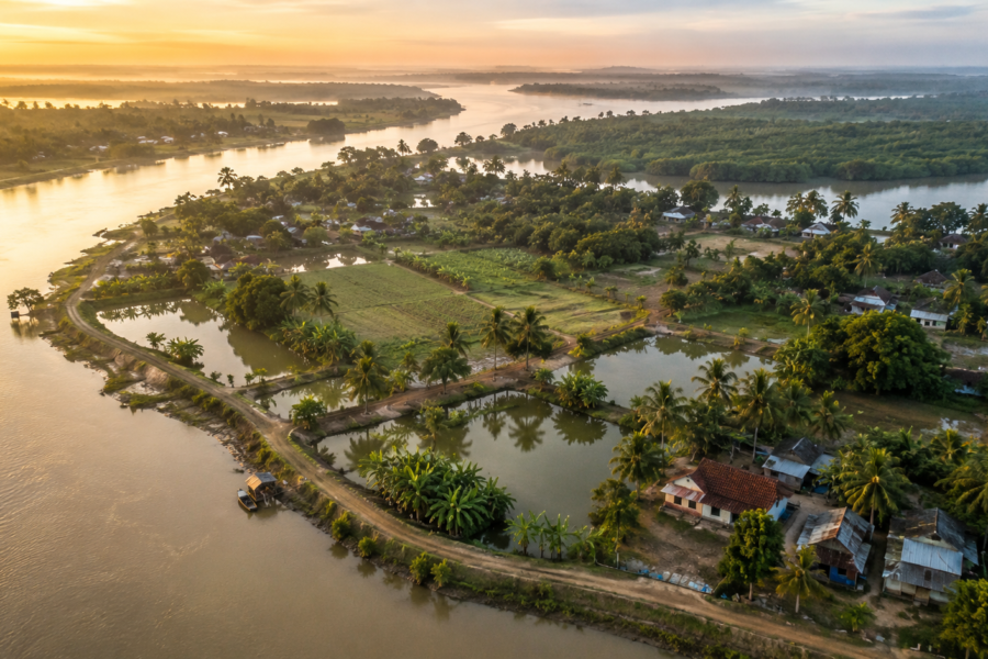
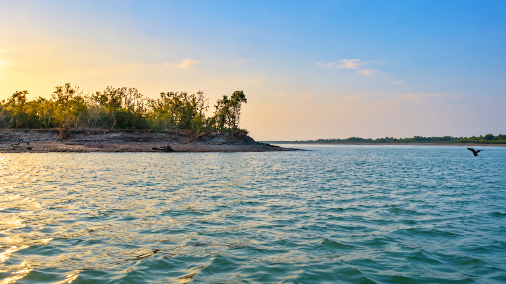
Kabasgadi belongs to the western part of the Indian Sundarbans, close to Kakdwip and Sagar Island.
Its historical geography is tied closely to the Muriganga River, one of the distributary channels of the Hooghly system.
Recent research describes Kabasgadi as a tidal-bar landform associated with the Muriganga and the Kakdwip River. The landform lies in an area where tidal flows, sediment transport and river-channel behaviour interact continuously.
The geographical setting is important because Kabasgadi could never be understood independently of the waterways surrounding it.
The island was born from those waters.
And ultimately, those same waters helped transform it.
Rivers Flowing Beside Kabasgadi
- Muriganga River — the principal western river associated with Kabasgadi.
- Kakdwip River — associated with the eastern side of the landform.
- Kalnagini Khal — a tidal channel associated with the Saptamukhi system and the local tidal network around Kabasgadi.
Nearby Forest Landscape
- Kabasgadi Reserve Forest — the present NCSCM database identifies the landform as protected Reserve Forest.
- The wider landscape belongs to the western Indian Sundarbans’ mangrove and estuarine environment.
A separate adjacent forest-block designation should not be assigned without specific documentary evidence.
Nearby Inhabited Areas
- Kakdwip — the principal nearby mainland settlement and river-port environment.
- Sagar Island — the major inhabited island in the surrounding estuarine landscape.
- Settlements and river infrastructure around Kakdwip form the principal human landscape adjacent to the Kabasgadi system.
A Lost Island in a Moving Delta
To understand why Kabasgadi disappeared, it is first necessary to understand what an island means in the Sundarbans.
In many parts of the world, an island is a relatively permanent piece of land surrounded by water.
The Sundarbans is different.
It is a delta still being reshaped by tides.
- Sediment moves through channels.
- Banks retreat.
- Mudflats emerge.
- New bars form.
- Existing islands expand or contract.
- Channels migrate.
- Mangroves colonise newly stabilised surfaces.
The boundary between land and water is therefore constantly negotiated.
The wider Sundarbans has experienced measurable long-term island-area reduction, particularly in its western Indian sector. A large-scale study of island-area change across the Sundarban region found continuing erosional trends and identified post-2001 erosion as dominant on a substantial proportion of individual islands.
Kabasgadi belongs to this larger geomorphological story.
The Island Before It Was Lost
Historical mapping is essential to Kabasgadi’s story.
Recent research reconstructing the landform through historical Survey of India maps and satellite imagery traces its development through successive stages of sediment accumulation, merging bars, vegetation establishment and later erosion.
The landform did not appear suddenly as a mature mangrove island.
It developed through sediment.
An early mapped feature in the area was identified as the Kakdwip Sand Bar. Later mapping showed changes in the relationship between the Kakdwip and Minx sandbars, eventually producing a larger consolidated landform.
This is a crucial part of Kabasgadi’s identity.
Before there was an island with a stable geographic name, there was sediment.
Before there was mangrove forest, there was mud.
Before there was a recognisable island boundary, there were tidal currents deciding where the river would deposit and remove material.
When Kabasgadi Took Shape
The later development of the Kabasgadi landform demonstrates one of the most characteristic processes of the Sundarbans.
Sedimentation came first.
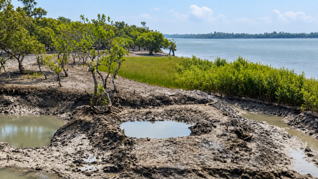
As tidal flows interacted, sediment accumulated in areas where water movement lost enough energy for suspended material to settle. Over time, these deposits became sufficiently stable and elevated for vegetation to establish.
The process can be visualised simply: moving sediment → tidal deposition → rising surface → vegetation colonisation → mangrove establishment
But that sequence does not lead automatically to permanent land.
The same tidal system remains capable of reversing the process.
A Field Observation
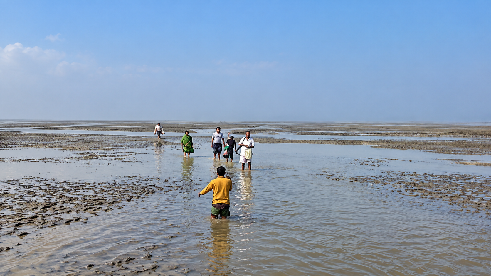
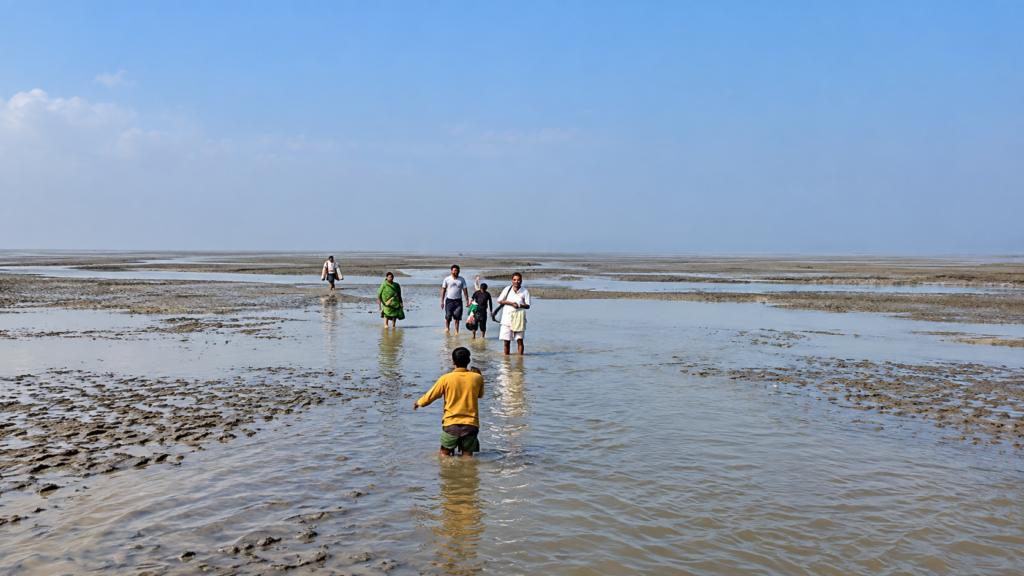
At low tide, the mudflats of the western Sundarbans can look deceptively solid.
- The water withdraws from the smaller channels.
- Fine sediment glistens in the open air.
- Mangrove roots emerge from the mud.
- Tiny tracks cross the surface.
- Then the tide turns.
Water returns through channels that may have looked insignificant only an hour earlier. The landscape begins to disappear beneath the returning tide. Kabasgadi’s history unfolded inside this rhythm.
When Mangroves Took Root
As the sediment surface became suitable for vegetation, mangroves began to colonise the developing landform.
Recent research identifies Baen (Avicennia officinalis) as the dominant documented mangrove species associated with Kabasgadi.
This vegetation was not merely a passive covering.
Mangrove roots interact with sediment.
- They slow water around the plant.
- They create complex surfaces.
- They provide habitat.
- They contribute organic material.
- They can encourage local sediment retention.
Yet Kabasgadi demonstrates an important limit to the idea that mangroves can simply “hold an island together”.
The research concludes that mangrove growth was strongly dependent upon land accretion and that the trees were unable to withstand significant bank erosion when the underlying land itself was being removed.
The mangrove could occupy the island.
It could modify the surface.
But it could not command the river.
The Changing Shape of Kabasgadi
The landform continued changing after mangrove establishment.
Research based on historical maps and Landsat imagery identifies substantial fluctuations in Kabasgadi’s area and vegetation through the twentieth century and into the twenty-first century.
The important turning point came around 1988.
According to the recent study, sediment accretion that had characterised the earlier history of Kabasgadi stalled around that period. Thereafter, land loss became increasingly important.
Another study examining the erosional processes of Kabasgadi reports approximately 1.39 km² of land loss between 1988 and 2021 in its study assessment. It links erosion to hydraulic action along the Muriganga as well as human intervention around the eastern side of the landform.
This was not simply the disappearance of vegetation.
It was the erosion of the physical land beneath it.
The Forces That Erased the Island
Kabasgadi’s disappearance should not be attributed to a single cause.
The evidence points toward an interacting system of natural and human processes.
Riverbank Erosion
The Muriganga’s hydraulic action has been identified as an important driver of erosion. Water moving along a riverbank exerts force on the sediment. In a soft deltaic environment, repeated hydraulic action can progressively undercut the edge.
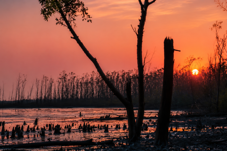
Once the bank retreats, mangrove roots may become exposed. Eventually, trees can collapse with the soil that once supported them.
Tidal Action
Kabasgadi lies within a tide-dominated environment. Flood and ebb tides continually redistribute sediment. Where sediment is deposited, land can grow. Where it is removed, land can retreat. The island existed within that balance.
Cyclones
Cyclonic disturbances can dramatically alter shoreline conditions. Storm-driven water, waves, currents and flooding can remove sediment and damage vegetation.
The wider Sundarbans is highly exposed to tropical cyclones, and recent Kabasgadi research also identifies cyclones among the natural factors contributing to disturbance.
Salinity and Hydrological Change
Salinity is another environmental pressure affecting mangrove growth and estuarine ecology. Changes in freshwater and saline-water balance can influence which vegetation survives and where.
Human Intervention
Kabasgadi’s location close to Kakdwip places it within a heavily used riverine environment.
Recent research identifies activities including trawler movement, embankment construction, earth mining and dredging as factors affecting the landform’s erosion and sedimentation dynamics.
This is an important distinction.
Kabasgadi was not erased by one event.
It was transformed through a long interaction between river dynamics, tides, sediment availability, extreme weather, vegetation and human intervention.
The Moment an Island Stops Being an Island
There is an important difference between land loss and island disappearance.
An island disappears geographically when its former boundaries cease to exist as an identifiable island.
That can happen in several ways.
It can be:
- submerged
- fragmented
- eroded
- merged with another landmass
- connected to the mainland
- or reduced to tidal remnants
Kabasgadi’s historical record is particularly interesting because earlier research specifically states that it shifted from its original position and became attached to mainland India.
That means “disappeared” should not necessarily be interpreted as “the entire sediment body sank vertically beneath the sea”.
Instead, Kabasgadi lost its identity as the island mapped in its earlier configuration.
- Its geography changed.
- Its boundaries changed.
- Its relationship with neighbouring land changed.
The island, as an island, was lost.
Kabasgadi Among the Lost Islands of the Sundarbans
Kabasgadi belongs to a small but significant group of Indian Sundarbans islands repeatedly discussed in the literature on disappearing landforms.
These include:
- Lohachara
- Bedford
- Kabasgadi
- Suparibhanga
A 2023 assessment explicitly places all four in the category of islands that had disappeared from the present map.
Government-linked material similarly records Kabasgadi alongside Lohachara, Bedford and Suparibhanga in discussions of island loss associated with sea-level change and erosion.
But the four islands should not be treated as identical cases.
Each had its own history of settlement, geomorphology, erosion, sedimentation and human intervention.
Kabasgadi is particularly valuable because its disappearance illustrates landform transformation, not merely inundation.
A Field Observation: What Remains
The most haunting aspect of a lost island is that disappearance does not always leave an empty space.
The river does not erase the sediment from memory.
- Old channels may remain.
- Mudflats can preserve the outline of former banks.
- Vegetation may occupy remnant surfaces.
- Historical maps preserve boundaries that no longer exist.
- Satellite images reveal patterns invisible from the water.
And the name survives.
This is why Kabasgadi continues to appear in modern geographical and scientific research. The physical landscape associated with Kabasgadi has not ceased to exist entirely.
What disappeared was the historical island configuration.
The Modern Kabasgadi Problem
This is where the article must depart from a simple “lost island” narrative.
The Government of India’s current DWIEP database still identifies Kabasgadi Island (INWB003) as an existing island between Kakdwip and Sagar Island. It records an area of 1.727 km², describes it as uninhabited, and identifies it as a protected Reserve Forest.
Recent research also describes Kabasgadi as a compound tidal bar, rather than treating the site as entirely absent.
Therefore, the most accurate editorial formulation is: Kabasgadi is a historically lost island whose associated landform remains identifiable in modern geographic and scientific datasets.
This wording respects both bodies of evidence.
It does not falsely claim that there is currently no land where Kabasgadi once stood.
And it does not erase the substantial historical literature identifying Kabasgadi as a vanished island.
Why This Matters
At first this may seem like a technical distinction.
It is not.
It changes how we understand disappearing islands.
- A map gives an island a boundary.
- A river does not recognise that boundary.
- A satellite image taken decades later may show something different.
- A forest officer may use one boundary.
- A historical cartographer may use another.
- A geomorphologist may identify a tidal bar where an older map showed an island.
All of these observations can be true at different moments. Kabasgadi demonstrates that island disappearance is often a process rather than an event.
The Mangroves of the Lost Island
Kabasgadi’s mangroves are central to its story.
Research indicates that vegetation expanded substantially during earlier stages of the landform’s development, particularly after the sediment bars became stable enough to support colonisation.
Baen became a dominant mangrove component.
Other vegetation associated with mangrove succession has also been documented in research on the site.
But the relationship between vegetation and land was never one-directional.
- Sediment allowed mangroves to grow.
- Mangroves influenced the sedimentary environment.
- Then erosion began removing the sediment.
- The vegetation responded.
- Some areas remained vegetated.
- Other areas lost their mangroves.
Still other areas experienced regeneration.
This is why Kabasgadi should not be described simply as a forest that was destroyed.
It was a mangrove ecosystem occupying an unstable tidal surface.
Wildlife of Kabasgadi
There is no sufficiently comprehensive island-specific wildlife inventory to justify publishing a long list of species as confirmed residents of Kabasgadi.
That restraint is important.
The current national coastal-island database records mangrove-associated crustaceans, molluscs, fishes and seabirds.
These groups reflect the habitat created by:
- tidal mud,
- mangrove roots,
- shallow channels,
- exposed intertidal surfaces,
- and estuarine water.
Crustaceans
Crabs are particularly characteristic of mangrove sediment. Their burrowing activities also contribute to the physical reworking of the mud.
Research at Kabasgadi observed crab activity in association with soil-piping and erosion processes.
Fish
The tidal waterways surrounding Kabasgadi provide estuarine habitat for fish. The current island database confirms fish fauna but does not provide a sufficiently detailed Kabasgadi-specific inventory to support species-by-species claims.
Molluscs
Molluscs form another part of the mangrove-associated community. They contribute to grazing, decomposition and aquatic food webs.
Birds
Intertidal mud and shallow water provide feeding environments for seabirds and other water-associated birds.
Again, individual species should only be attributed to Kabasgadi where supported by island-specific records.
What About the Royal Bengal Tiger?
Kabasgadi should not be marketed or described as a Royal Bengal Tiger island.
The Royal Bengal Tiger (Panthera tigris tigris) is one of the defining animals of the wider Sundarbans, but the presence of the species in the wider ecosystem does not establish Kabasgadi as a tiger habitat.
No reliable evidence reviewed for this article establishes Kabasgadi as a regular tiger-sighting location.
The Wild Orbit’s editorial standard specifically requires species records to be supported rather than inferred. The_Wild_Orbit_Editorial_Produc…
The Ecological Importance of a Lost Island
A lost island can still have ecological importance.
Its disappearance can itself become evidence.
Kabasgadi provides a record of how the delta responds to changing sediment conditions.
It shows:
- how tidal bars develop
- how mangroves colonise newly formed land
- how vegetation responds to erosion
- how river channels influence island morphology
- how human activity can alter sediment dynamics
- and how an island can lose its geographic identity
The wider Sundarbans is recognised internationally for precisely these interactions between water, sediment, mangrove vegetation and biodiversity. UNESCO identifies the region’s tidal processes and mangrove ecosystems as fundamental to its Outstanding Universal Value.
Kabasgadi is a smaller-scale expression of that much larger system.
Erosion and the Western Sundarbans
Kabasgadi’s disappearance cannot be separated from the wider erosion history of the western Indian Sundarbans.
A major study of island-area changes across the Sundarban region found a long-term reduction in total island area, with the western Indian sector experiencing stronger area reduction than the eastern Bangladeshi sector.
The same research shows that individual islands do not all behave identically.
- Some erode continuously.
- Some accrete.
- Some experience alternating erosion and deposition.
- Some fragment.
Others expand along selected margins. This is precisely why the story of Kabasgadi is important.
It is not proof that every Sundarbans island is destined to disappear. It is proof that the geography of the Sundarbans is dynamic.
Climate Change and Kabasgadi
It would be tempting to reduce Kabasgadi’s disappearance to climate change alone.
The evidence does not justify that simplification.
Relative sea-level rise, land subsidence, cyclones, sediment availability and changing hydrodynamics all influence the Sundarbans.
At the same time, human activity can alter the movement of sediment and water.
The latest regional research on Indian Sundarbans morphodynamics identifies relative sea-level rise, wave action and human-caused sediment deprivation among major drivers of contemporary coastal change.
Kabasgadi’s individual history is more complicated still.
Research focused specifically on the site identifies hydraulic erosion and human interventions as major components of the later landform change.
The responsible conclusion is therefore: Kabasgadi’s disappearance belongs to a coupled natural-human geomorphological system, rather than having a single proven cause.
Human Activity Around the Lost Island
Kabasgadi’s proximity to Kakdwip is important.
Kakdwip is a working river landscape.
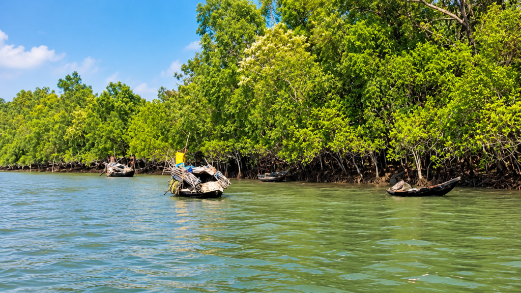
- Boats move through the channels.
- Fishing activity takes place.
- Harbour infrastructure operates nearby.
- Sediment is disturbed.
The river is used not simply as an ecological system but as a transport and economic corridor.
Research on Kabasgadi identifies earth mining, dredging and trawler movement among human activities affecting the sedimentary environment.
This is one of the most important lessons from the island.
The fate of a tidal island can be influenced by what happens beyond its shoreline.
- An intervention on one bank can alter currents elsewhere.
- A change in a channel can alter sediment deposition.
- A harbour can modify local hydrodynamics.
- A dredged channel can change the balance between erosion and accretion.
In a connected delta, there is rarely a truly isolated intervention.
Culture and Memory
Unlike some inhabited Sundarbans islands, Kabasgadi does not have a documented resident cultural tradition that can be confidently reconstructed as an island-specific heritage narrative.
It was not a large settled island whose disappearance produced the same well-documented displacement history associated with Lohachara.
That distinction should be preserved.
Kabasgadi’s cultural importance lies more in memory and landscape history.
Its name survives because maps, scientific studies, government records and regional histories continue to refer to the island.
In that sense, Kabasgadi is part of the cultural memory of a changing Sundarbans.
The lost islands of the delta are not only geographical stories.
They are reminders that maps can preserve places that the landscape itself has already changed.
Kabasgadi and the Other Lost Islands
Kabasgadi should be understood alongside, but not equated with, other vanished Sundarbans islands.
Lohachara
Lohachara became one of the best-known examples of island disappearance in the Indian Sundarbans and had a resident population before its eventual abandonment and inundation.
Bedford
Bedford was uninhabited and subsequently disappeared from the landscape.
Suparibhanga
See it for yourself
A private journey shaped around you — your group, your pace, your interests. Book a free consultation.
Suparibhanga also appears in historical accounts of islands lost from the Sundarbans.
Kabasgadi
Kabasgadi’s story is different in detail.
Historical research describes it as shifting and becoming attached to the mainland, while later literature has classified it as a disappeared island.
That makes Kabasgadi particularly useful for understanding transformation rather than simple drowning.
Can Kabasgadi Still Be Found?
This is one of the most interesting questions.
The answer is: Yes but with an important qualification.
The historical Kabasgadi Island described in literature as a lost island is no longer present in exactly the form represented by earlier maps.
At the same time, the Government of India’s current DWIEP database still records a Kabasgadi Island and gives it a present geographic location and area.
Recent research likewise maps the contemporary Kabasgadi landform.
Therefore, the most accurate interpretation is that the historical island has been lost as a distinct geographic configuration, while a remnant or transformed Kabasgadi landform persists within the same tidal system.
That is more scientifically useful than saying simply: “Kabasgadi no longer exists.”
Is Kabasgadi Still an Island?
The answer depends on what is meant by “Kabasgadi Island”.
Historically
No.
The island described in earlier records and historical literature has disappeared as an identifiable island configuration.
In current government geographic records
Yes.
The NCSCM’s current DWIEP database still records Kabasgadi Island as INWB003.
Geomorphologically
The situation is more nuanced.
Recent research treats Kabasgadi as a compound/side-channel tidal bar, demonstrating that the physical landform associated with the name remains part of the active estuarine system.
This distinction should remain explicit in any authoritative Wild Orbit publication.
Conservation Significance
The loss of Kabasgadi demonstrates why conservation in the Sundarbans cannot be limited to planting trees.
The current NCSCM database identifies Kabasgadi as Protected — Reserve Forest and as a mangrove Ecologically Sensitive Area. It is currently recorded as uninhabited.
The conservation priorities for the Kabasgadi landscape are therefore broader than forest cover.
They include:
- monitoring shoreline change
- tracking sedimentation and erosion
- protecting regenerating mangroves
- monitoring tidal channels
- limiting destructive sediment extraction
- assessing dredging impacts
- understanding harbour-related hydrodynamic changes
- monitoring cyclonic disturbance
- maintaining long-term satellite records
- and preserving historical maps for future comparison
The most important lesson is simple: A mangrove restoration programme cannot be evaluated without understanding whether the land beneath the mangroves is gaining or losing sediment.
What Kabasgadi Teaches Us About Mangroves
Kabasgadi challenges one of the most common simplified narratives about mangroves.
Mangroves are often described as natural coastal barriers.
That is true in many contexts.
But they are not immovable walls.
They depend on the geomorphology of their habitat.
The Kabasgadi research concludes that mangroves were able to establish where vertical accretion created suitable surfaces, but bank erosion could subsequently remove the vegetation.
This means that mangrove resilience is closely connected to sediment supply.
- Where sediment can accumulate: mangroves may expand.
- Where erosion removes the substrate: mangroves may retreat.
The forest and the land are therefore linked.
Seasonal Character
Kabasgadi’s historical disappearance was not a seasonal phenomenon. It was the result of long-term geomorphological change. But seasonal conditions continue to influence the landscape.
Pre-Monsoon
- Temperatures rise.
- Thunderstorms become frequent.
- The local atmosphere becomes increasingly unstable.
Monsoon
- Rainfall and river discharge increase.
- Flooding becomes more likely.
- Sediment transport intensifies.
Post-Monsoon
- Cyclonic disturbances remain a major possibility.
- Shoreline conditions can change rapidly after extreme weather.
Winter
The generally drier season provides clearer conditions for observing the landscape and comparing satellite imagery.
Recent Kabasgadi research relied heavily on imagery from relatively dry months to analyse land and vegetation changes.
The Wild Orbit’s Interesting Facts About Kabasgadi Island
1. Kabasgadi is listed among the disappeared islands of the Indian Sundarbans.
A 2023 assessment explicitly places Kabasgadi in the category of islands that disappeared from the present map.
2. It did not simply vanish overnight.
Historical research describes Kabasgadi as shifting from its original position and becoming attached to mainland India.
3. The name survives in modern government records.
The Government of India’s NCSCM database currently maintains Kabasgadi Island as INWB003.
4. The modern landform is described as a tidal bar.
Recent research investigates Kabasgadi as a compound/side-channel tidal bar shaped by sedimentation and erosion.
5. Baen is the dominant documented mangrove.
Recent field research identifies Baen (Avicennia officinalis) as the principal mangrove species.
6. Kabasgadi developed through sediment accumulation.
The landform grew where tidal and river processes deposited sediment.
7. The major geomorphological turning point came around 1988.
Research identifies the period after 1988 as one of increasing land loss and erosion.
8. Human activity contributed to later changes.
Research identifies activities including dredging, earth mining, trawler movement and embankment-related changes as influences on the sedimentary environment.
9. The island is currently recorded as uninhabited.
The NCSCM database records no permanent population.
10. The island’s disappearance does not mean all associated land disappeared.
Modern geographic and research datasets still identify a Kabasgadi landform.
11. Kabasgadi is part of a much larger pattern.
The western Indian Sundarbans has experienced significant long-term island-area loss.
12. Its story demonstrates that island disappearance is often a process.
Kabasgadi moved through stages of sedimentation, vegetation establishment, erosion and transformation rather than experiencing one simple moment of disappearance.
FAQs
Was Kabasgadi Island really lost?
Yes, in the sense used by historical and regional literature. Kabasgadi is listed among Indian Sundarbans islands that disappeared from the present map. Historical research also records that it shifted and became attached to mainland India.
Does Kabasgadi still exist?
There is an important qualification. The historical island configuration has been lost, but the Government of India’s current NCSCM database still records a Kabasgadi Island, and recent research identifies a contemporary Kabasgadi tidal-bar landform.
Why do some sources say Kabasgadi disappeared while government records still show it?
Because they are describing different stages and definitions of the landform. Historical sources refer to the disappearance or transformation of the former island, while modern geographic datasets can identify a remaining or reconfigured landform under the same name.
Where was Kabasgadi Island?
Kabasgadi was located in the western Indian Sundarbans between the Kakdwip and Sagar Island areas, in association with the Muriganga and Kakdwip river systems.
Which river shaped Kabasgadi?
The Muriganga River is particularly important. The Kakdwip River also forms part of the surrounding tidal system.
What caused Kabasgadi Island to disappear?
The evidence indicates a combination of riverbank erosion, tidal dynamics, sediment redistribution, cyclonic disturbance, salinity and human interventions. No single factor adequately explains the entire history.
Did sea-level rise cause Kabasgadi’s disappearance?
Sea-level rise is part of the broader environmental context of Sundarbans island loss, and government and scientific literature associates relative sea-level change with regional inundation and erosion. However, Kabasgadi-specific research identifies a more complex combination of hydraulic erosion, sediment dynamics and human intervention.
Did mangroves fail to protect Kabasgadi?
Mangroves could help stabilise suitable sediment surfaces, but they could not prevent all bank erosion. Research shows that mangrove growth was strongly dependent on land accretion and that vegetation could be removed when the underlying bank eroded.
Which mangrove species dominated Kabasgadi?
Baen (Avicennia officinalis) is the dominant documented mangrove species in recent research on the Kabasgadi landform.
Were people living on Kabasgadi?
The current NCSCM database records Kabasgadi as uninhabited. Claims about mass displacement from the island should therefore be treated cautiously and should not be confused with well-documented displacement histories from other Sundarbans islands.
Is Kabasgadi a tiger island?
There is no adequate evidence to establish Kabasgadi as a regular Royal Bengal Tiger habitat or tiger-sighting location.
Can Kabasgadi be visited?
The current NCSCM database does not record tourism activity on the island and identifies it as protected Reserve Forest. Access should therefore be governed by applicable forest and environmental regulations rather than treated as ordinary tourism.
Why is Kabasgadi important if the island has disappeared?
Because its disappearance records the physical processes by which the Sundarbans changes. Kabasgadi provides evidence of sediment accumulation, mangrove colonisation, erosion, tidal-channel dynamics and human influence on a deltaic landscape.
Remembering Kabasgadi
Kabasgadi did not disappear in a single moment.
The river worked more slowly than that.
Sediment accumulated.
A bar rose.
Vegetation found the mud.
Mangroves spread across the new surface.
For a time, the landform consolidated into an island.
Then the balance changed.
- Sediment accumulation weakened.
- Erosion became more important.
- The river attacked its margins.
- Tides redistributed its sediment.
- Human activity altered the surrounding waterways.
- Vegetation retreated in places where the ground beneath it disappeared.
- The island changed shape.
- Its boundaries moved.
- Its relationship with the mainland changed.
And eventually, the Kabasgadi represented in historical geography was no longer the same island.
It had become a lost island.
Yet the story does not end there.
- Modern mapping still identifies a Kabasgadi landform.
- Recent research still studies its tidal bar, its mangroves and its sediment.
- The Government of India still maintains a Kabasgadi Island record.
This apparent contradiction is perhaps the most revealing part of the story.
Kabasgadi was lost, but the landscape did not stop moving.
- The delta continued.
- Water continued to carry sediment.
- Mangroves continued to colonise suitable surfaces.
- Banks continued to erode.
- Channels continued to shift.
What disappeared was not simply a piece of land.
It was a particular geographical configuration—an island with a recognisable boundary and identity.
And that is the deeper lesson of Kabasgadi.
In the Sundarbans, the map is never the final authority.
The river has the last word.
- A map can draw an island.
- A forest can occupy it.
- A community can name it.
- But the tide can redraw it.
And when the island is gone, its story remains in the sediment, in the maps, in the satellite images and in the changing geography of the delta.
Kabasgadi is therefore not merely a lost island.
It is a record of the Sundarbans in motion.
Plan your private Sundarban expedition
A private journey shaped around you — your group, your pace, your interests. Book a free consultation.