 Encyclopedia
Long before Lahiripur comes into view, the rivers announce their presence.
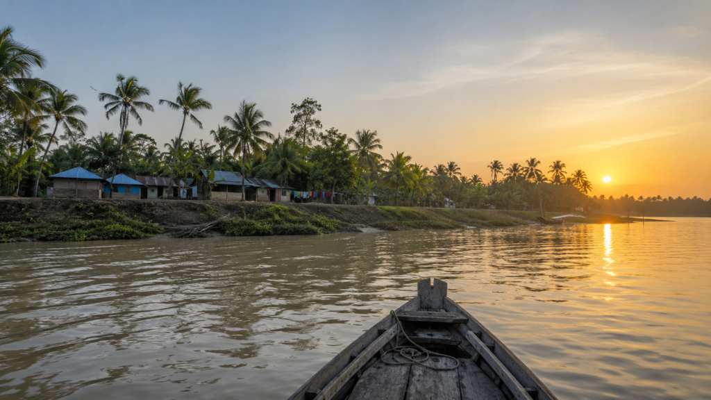
The first light of dawn stretches across the eastern sky as our wooden country boat leaves the busy ferry ghat at Gosaba behind. The tide has just begun to turn, and the broad estuarine channel mirrors soft shades of amber and pale blue. The rhythmic pulse of the engine blends with the distant call of an egret while the morning breeze carries the unmistakable scent of salt, wet earth, and mangrove leaves.Folklore & Legends
The Sundarbans never introduces itself in a hurry.
It reveals itself patiently.
- One river.
- One tide.
- One island at a time.
As the mist begins to lift, the horizon slowly comes alive.
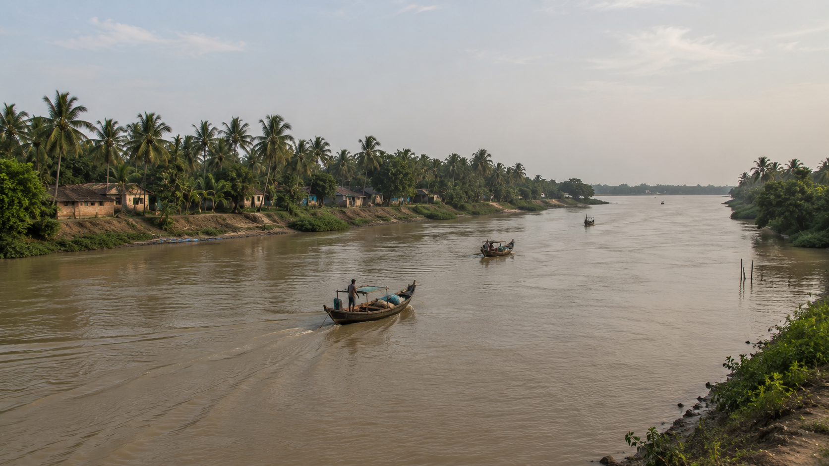
Fishing boats head towards deeper channels before the current strengthens.
A lone kingfisher waits silently above the water.
Along the riverbanks, mangrove silhouettes become sharper with every passing minute, their roots disappearing into the tide that has shaped this landscape for thousands of years.
Nothing here feels accidental.
Everything follows the rhythm of water.
Unlike most places, there is no highway leading into Lahiripur.
There is no railway station welcoming visitors. The river remains the oldest road.
Even today, ferries, country boats, and motorised launches continue to connect people, goods, stories, and livelihoods across this intricate network of tidal waterways.
Every arrival begins with a crossing.
Slowly, the island begins to emerge.
An earthen embankment stretches along the shoreline, protecting farmland and settlements from the twice-daily rise of the tide. Coconut palms sway gently above village rooftops. Narrow concrete and brick-paved roads disappear beyond the riverbank, hinting at communities hidden within the island’s interior.
- Smoke curls upward from kitchen fires.
- A fisherman untangles yesterday’s net.
- Schoolchildren begin their morning walk.
The day has quietly begun.
At first glance, Lahiripur appears peaceful.
Perhaps even ordinary.
But the Sundarbans has a habit of hiding extraordinary stories behind ordinary landscapes.
This island is one of them.
Situated within the inhabited heart of the Indian Sundarbans, Lahiripur occupies a remarkable position between thriving human settlements and one of the world’s largest remaining mangrove ecosystems. Life here is influenced not by the ticking of clocks but by tides, seasons, rivers, and weather—forces that continue to shape everyday decisions in ways unfamiliar to most of the modern world.
Every season transforms the island.
Summer hardens the soil beneath an unforgiving sun.
The southwest monsoon fills rivers beyond their usual limits, testing embankments built through generations of resilience.
Winter brings calmer waterways, clearer skies, and migratory birds that briefly share this landscape with its permanent residents.
Then there are the cyclones.
Powerful reminders that nature still writes the final chapter in the Sundarbans.
Lahiripur is not simply another island on a map.
It is part of a living delta where rivers shape geography, mangroves protect coastlines, wildlife thrives beyond village boundaries, and communities continue adapting to one of Earth’s most dynamic estuarine environments.
Our expedition begins here.
Not in search of famous landmarks.
But in search of understanding.
Because every island in the Sundarbans has its own story.
And Lahiripur deserves to be heard on its own terms.
First Encounter
The boat slows as it approaches the ghat.
For a few quiet moments, there is nothing but the gentle sound of water brushing against the wooden hull.
Then the island comes alive.
Passengers prepare to disembark.
A cyclist waits near the landing.
A tea seller arranges freshly brewed cups beside a small roadside stall while two fishermen discuss the morning’s tide before heading towards the river once again.
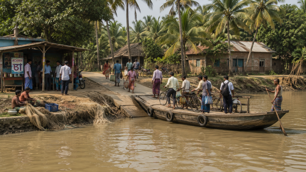
- The pace is calm.
- Unforced.
- Entirely natural.
Stepping ashore, the first impression is not of wilderness, but of a community that has learned to exist alongside it.
- The roads are modest.
- The houses are practical.
- Life unfolds without spectacle.
Brick homes stand beside traditional dwellings that continue to reflect the island’s architectural heritage. Courtyards are shaded by mango, banana, coconut, guava, and areca palms. Freshwater ponds, carefully maintained by generations of families, remain an essential part of everyday life, supporting domestic needs in a landscape surrounded by saline water.
Walking a little further inland, familiar scenes begin to emerge.
- Children make their way to school.
- Shopkeepers lift shutters for the day’s business.
- Women sweep courtyards before the heat of the morning arrives.
Motorcycles pass occasionally, but bicycles still remain a common companion for short journeys across the island.
Nothing feels hurried.
Life here has developed its own rhythm—one shaped less by deadlines and more by daylight, tides, and seasons.
Yet the forest is never truly absent.
Even when hidden beyond the rivers, its influence is everywhere.
Conversations often begin with questions about water levels, weather forecasts, fishing conditions, or reports from nearby forest areas. Boatmen speak of tidal currents with remarkable precision. Farmers watch the salinity of the soil as carefully as the changing sky. Every occupation, in one way or another, remains connected to the larger ecosystem surrounding the island.
The wilderness may seem distant.
Its presence is not.
Spend enough time in Lahiripur, and one realisation becomes impossible to ignore.
This is not a place that has conquered nature.
Nor is it a place untouched by human hands.
Instead, it represents something far rarer.
A landscape where people and the delta continue learning, adapting, and evolving together—day after day, tide after tide.
That relationship defines everything else waiting to be discovered.
Island Identity
Every island in the Sundarbans has a distinct personality.
Lahiripur is no exception.
While many visitors recognise its name as an important gateway to nearby forest attractions, reducing the island to a stopover would overlook its far deeper significance. Lahiripur is a living settlement with its own history, communities, agricultural landscape, river connections, and cultural identity that have evolved over generations within the lower Ganges-Brahmaputra-Meghna Delta.
Administratively, Lahiripur is located within the Gosaba region of the South 24 Parganas district in West Bengal, forming part of the inhabited eastern Sundarbans. Its location places it within one of India’s most environmentally significant landscapes, where densely populated islands exist alongside protected mangrove forests recognised for their exceptional biodiversity and ecological importance.
Yet statistics reveal only part of the story.
The true identity of Lahiripur is found in the relationship between its people and the land they inhabit.
Here, rivers are not obstacles.
They are connections.
Embankments are not merely engineering structures.
They are symbols of resilience.
Freshwater ponds are not decorative features.
They are essential lifelines.
Every element of the landscape serves a purpose shaped by generations of experience living within a tidal delta.
Agriculture, fishing, small-scale commerce, education, transport, and community life come together to form the island’s everyday character. The surrounding waterways connect Lahiripur with neighbouring settlements, while nearby mangrove forests continually remind residents that the natural world remains an active presence rather than a distant backdrop.
This balance between settlement and wilderness gives the island its unique identity.
Neither fully urban.
Nor completely remote.
It exists in the space between.
Understanding Lahiripur requires looking beyond maps.
- Its geography explains where it is.
- Its rivers explain how it survives.
But to truly understand the island, we must now follow the waterways that have shaped its past, defined its boundaries, and continue to influence every aspect of life today.
The Rivers That Shaped The Island
- Before there were villages.
- Before embankments held back the tide.
- Before fields of paddy stretched across reclaimed land.
There were rivers.
The story of Lahiripur begins with water.
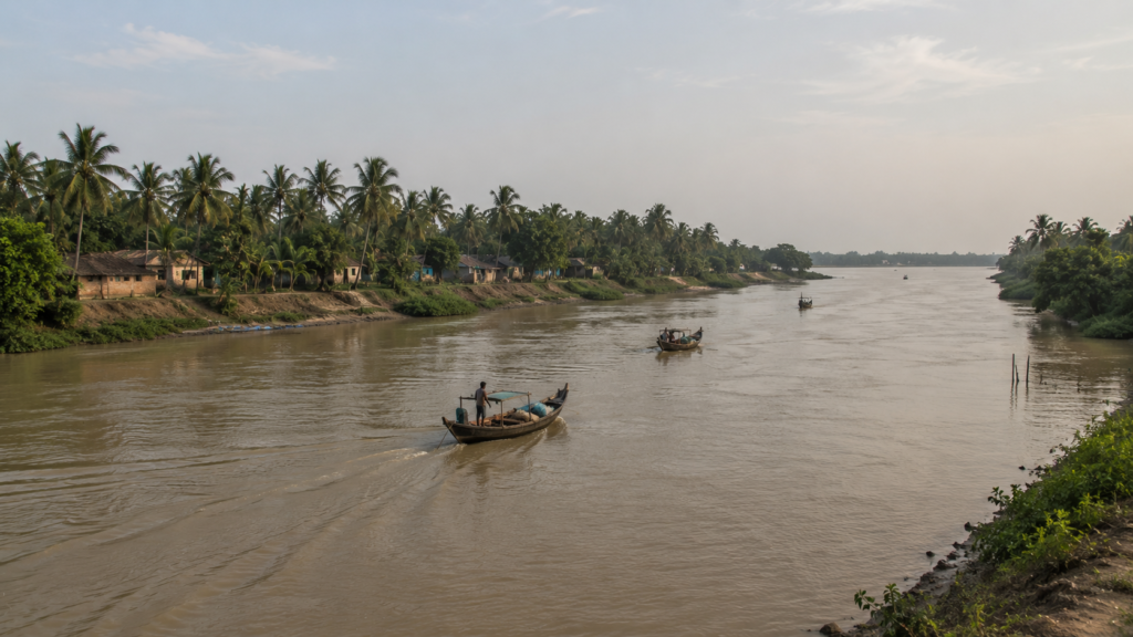
Unlike most settlements in mainland India, Lahiripur was never shaped by roads or mountain passes. Its geography emerged through an endless conversation between the Ganges, the Brahmaputra, and the Bay of Bengal. Over thousands of years, these mighty river systems deposited enormous quantities of silt, gradually building the islands that today form the Indian Sundarbans.
Lahiripur is one of those living landscapes.
It continues to evolve with every tide.
The island exists within an intricate network of tidal rivers and creeks that define both its boundaries and its identity. These waterways are far more than geographical features. They influence agriculture, transport, fishing, trade, freshwater availability, and even the daily routines of the people who live here.
In many ways, the rivers remain the island’s true architects.
Unlike rivers in the upper plains that flow steadily in a single direction, the rivers surrounding Lahiripur breathe with the sea.
- Twice each day, the tide advances inland.
- Twice each day, it retreats.
This constant exchange carries nutrients, sediment, and saline water deep into the delta, creating one of the world’s most productive estuarine ecosystems.
It also demands constant adaptation from the communities living beside it.
Boatmen understand these waters instinctively.
A journey that takes thirty minutes during one stage of the tide may require considerably longer, only a few hours later. Fishing schedules, ferry timings, agricultural work, and even the movement of supplies often depend upon reading the river rather than watching a clock.
Time here is measured differently.
The tide decides.
These waterways also connect Lahiripur with neighbouring islands, including Gosaba, Dayapur, Pakhiralay, Satjelia, and the wider inhabited landscape of the eastern Sundarbans. For generations, they have carried fishermen, farmers, traders, students, teachers, forest workers, researchers, and travellers through a delta where boats remain an indispensable part of everyday life.
Long before modern infrastructure arrived, the rivers had already built an interconnected world.
Yet the rivers are not always gentle.
During the southwest monsoon, heavy rainfall across the Ganges basin increases freshwater discharge into the delta. Combined with tidal surges and cyclonic weather systems, these rivers can swell dramatically, placing enormous pressure on embankments that protect settlements like Lahiripur.
The same waters that sustain life can also threaten it.
That duality defines the Sundarbans.
Stand quietly along the riverbank during sunrise or sunset.
- Watch the changing colour of the water.
- Observe how every boat adjusts its movement to the current.
- Listen to conversations among local fishermen.
Before long, one truth becomes unmistakable.
Lahiripur has never controlled its rivers. It has learned to live with them.
Historical Footprints
Every inhabited island carries memories beneath its soil.
Some survive in written records. Others endure through family stories passed from one generation to the next.
Lahiripur is no different.
The history of the island is closely linked to the broader transformation of the Sundarbans—a landscape that remained dominated by dense mangrove forests, shifting rivers, and abundant wildlife for centuries before large-scale human settlement gradually expanded into the delta.
Unlike ancient cities with monumental architecture, the history here is written more quietly.
- It lives in reclaimed land.
- In ageing embankments.
- In old ferry routes.
And in the resilience of the communities that chose to stay.
During the nineteenth century, British colonial administration accelerated efforts to reclaim sections of the Sundarbans for agriculture and revenue generation. Forests in selected areas were gradually cleared, embankments were constructed, and settlements expanded onto land that had previously remained under tidal influence.
This transformation permanently altered the relationship between people and the delta.
Lahiripur developed within this wider historical landscape.
Life, however, remained far from easy.
Early settlers faced isolation, saline soils, tidal flooding, malaria, limited transport, and frequent encounters with wildlife.
- Every cultivated field represented years of labour.
- Every embankment required constant maintenance against erosion and storm damage.
Building a permanent community demanded extraordinary determination.
The twentieth century brought gradual changes.
- Schools appeared.
- Healthcare slowly improved.
- Ferry services became more organised.
- Road connectivity expanded within the island.
Government programmes supported rural development while communication with neighbouring settlements became increasingly reliable.
Even so, the rivers continued to dictate the rhythm of everyday life.
History in Lahiripur is not preserved only through official records.
It survives in memory.
Older residents still recall devastating cyclones, embankment breaches, years of poor harvest, changing river channels, and the remarkable resilience shown by families rebuilding homes after every major storm.
These experiences form an unwritten archive of the island.
One that continues to grow with each generation.
To walk through Lahiripur today is to move across a landscape shaped by countless acts of persistence.
- Every road.
- Every field.
- Every settlement.
Carries the imprint of people who learned not to defeat nature—but to negotiate with it.
Historical Personalities & Transformations
Unlike many historic towns, Lahiripur is not defined by a single ruler, freedom fighter, or celebrated monument.
Its greatest legacy belongs to ordinary people.
Generations of farmers transformed reclaimed land into productive fields despite saline conditions.
Fishermen mastered tidal rivers whose currents changed with remarkable speed.
Boatmen connected isolated communities long before permanent road networks existed.
Teachers established schools that gradually expanded educational opportunities across the island.
Healthcare workers, local administrators, artisans, and small business owners all contributed to shaping the community that exists today.
Collectively, they became the architects of modern Lahiripur.
Transformation also came through infrastructure.
- Brick roads replaced muddy tracks in many areas.
- Electricity reached homes that had once depended entirely upon kerosene lamps.
- Improved ferry services strengthened links with neighbouring islands.
- Mobile communication connected villages that had previously relied almost exclusively on physical travel.
Yet despite these changes, much of the island continues to preserve its rural character.
Nature has also shaped history.
Major cyclones, including events that affected large parts of the Sundarbans in recent decades, left lasting marks upon the island. Homes were damaged, embankments failed, agricultural land was inundated by saline water, and livelihoods were disrupted.
Recovery required not only government assistance but also remarkable community cooperation.
- Neighbours rebuilt together.
- Families shared resources.
- Villages adapted once again.
Perhaps that is Lahiripur’s greatest historical transformation.
- Not the arrival of roads.
- Not the expansion of markets.
- Not even technological progress.
Its greatest achievement has been the ability to evolve while remaining rooted in the ecological realities of the Sundarbans.
The island has changed.
Its relationship with the rivers has not.
Folklore & Legends
Not every story in Lahiripur can be found in government archives.
- Some belong to the rivers.
- Others belong to the forest.
- Many belong to the people who have lived beside both.
Across the inhabited Sundarbans, folklore has long served as a way of understanding a landscape where human knowledge often met the unpredictability of nature. Stories travelled from one generation to the next—not merely as entertainment, but as lessons about survival, respect, and coexistence.
Lahiripur shares this wider cultural inheritance.
Among the most enduring traditions is the reverence for Bonbibi, the guardian of the Sundarbans in local belief. For generations, forest-dependent communities have invoked Bonbibi’s protection before entering mangrove forests to collect honey, fish, or crabs. Her story reflects an enduring cultural message—that survival in the Sundarbans depends upon humility rather than domination.
Whether expressed through ritual, oral storytelling, or seasonal observances, this belief continues to hold cultural significance across many communities connected to the delta.
Alongside Bonbibi are stories of Dakshin Rai, often associated with the tiger in regional folklore, and Gazi Pir, another respected figure in the shared spiritual traditions of the Sundarbans. Together, these narratives illustrate a remarkable cultural landscape where Hindu and Muslim traditions have coexisted and intertwined for centuries.
Their stories remind people that the forest demands respect from everyone.
Lahiripur’s elders also preserve memories that never reached printed pages.
- They speak of rivers changing course.
- Cyclones that altered familiar landscapes overnight.
- Exceptional floods.
- Remarkable fishing seasons.
- Unusual wildlife sightings.
And moments when entire communities came together to rebuild after a disaster.
These accounts may not always be formally documented. Yet they remain an important part of the island’s living heritage.
Perhaps that is the true folklore of Lahiripur.
Not tales of mystery alone—but the enduring belief that survival in the Sundarbans has always depended upon cooperation, resilience, and respect for the forces of nature.
That wisdom continues to flow through the island as quietly as the tides themselves.
Life Between The Tides
Life in Lahiripur does not begin with the sunrise.
It begins with the tide.
Long before the first shop opens or the first classroom fills with students, many islanders have already looked towards the river.
- Fishermen study the current.
- Boat operators judge the water level at the ghat.
- Farmers quietly assess the condition of their fields after the night’s changing tide.
For generations, this has been the island’s daily rhythm.
In most towns, time is measured by clocks.
In Lahiripur, nature still has a voice.
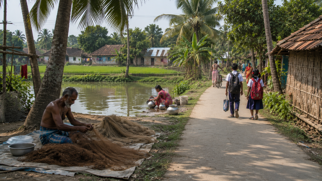
The arrival of high tide determines when boats can travel efficiently. Low tide exposes muddy banks, alters navigation routes, and changes fishing opportunities. Even routine journeys between neighbouring islands are often planned with an awareness of the river’s movement.
Here, the tide is not simply observed.
It is respected.
Agriculture continues to shape much of the island’s landscape.
Paddy fields spread across reclaimed land protected by earthen embankments, while household gardens produce seasonal vegetables and fruits that supplement family livelihoods. Coconut, banana, mango, guava, papaya and areca palms are common features of village courtyards, creating green pockets throughout the settlements.
Every harvest reflects months of careful adaptation to changing soil and water conditions.
Fishing remains equally important.
The surrounding rivers provide livelihoods for many families, though catches vary with season, tidal movement, weather conditions and environmental change. Boats leave before sunrise or return at dusk, carrying not only fish but stories of river currents, changing channels and the day’s observations from the water.
The river continues to feed the island.
Just as it has for generations.
Freshwater, however, is one of the island’s most valuable resources.
Although surrounded by water, much of it is saline.
Carefully maintained ponds continue to play an essential role in domestic life, while rainwater harvesting and improved water infrastructure have become increasingly important across many parts of the inhabited Sundarbans.
Water here is never taken for granted.
Daily life also reflects a strong sense of community.
- Neighbours help repair embankments after storms.
- Families gather during festivals.
- Children play along quiet village lanes after school.
Tea stalls become places where conversations drift from farming and fishing to weather forecasts, politics, education and the latest news from nearby islands.
Life moves steadily.
Together.
Living beside one of the world’s largest mangrove forests has also nurtured a deep awareness of nature.
Residents understand seasonal changes with remarkable accuracy. They recognise the warning signs of approaching storms, notice subtle shifts in river behaviour and appreciate that the landscape around them is constantly changing.
Experience has become its own form of knowledge.
And nowhere is that knowledge more visible than in everyday life.
Walking Through The Villages
Leave the riverbank behind.
Walk slowly.
Lahiripur reveals itself best on foot.
The villages are connected by narrow roads that weave between homes, ponds, cultivated fields and community spaces. Some stretches are lined with mature trees that provide welcome shade during the warmer months, while others open towards broad agricultural landscapes stretching beyond the embankments.
There is no single centre.
Instead, the island unfolds as a series of connected neighbourhoods, each contributing to the wider identity of Lahiripur.
Homes vary in age and design.
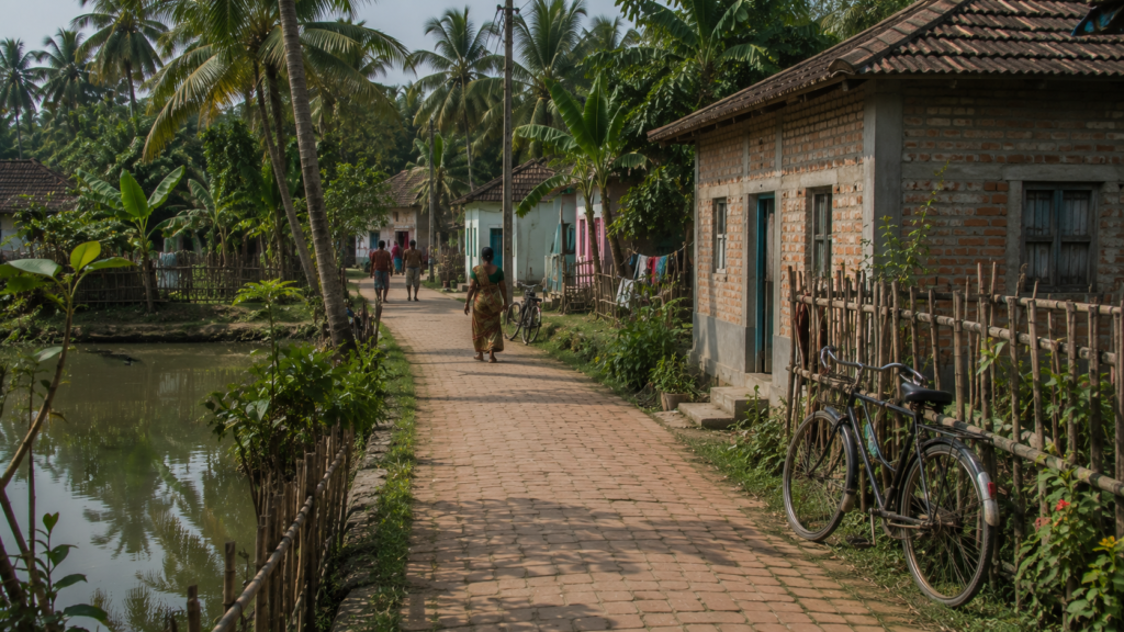
Traditional mud houses continue to stand beside brick-built residences, reflecting both the island’s heritage and its gradual development over recent decades. Tin roofs, tiled verandas, colourful courtyards and carefully maintained gardens create a landscape that feels lived in rather than constructed for visitors.
Practicality shapes architecture here.
Not fashion.
Schools are among the busiest places each morning.
Children arrive in neatly pressed uniforms, often walking or cycling from neighbouring villages. Education has become an increasingly important part of community life, opening opportunities that earlier generations could scarcely imagine while allowing many families to remain deeply connected to the island they call home.
- The future begins in these classrooms.
- Small shops line sections of the village roads.
- Tea stalls welcome regular customers before the day’s work begins.
- Grocery stores supply daily necessities.
- Local markets bring together farmers, fishermen and traders who continue traditions of exchange that have sustained island communities for decades.
- Business here rarely feels hurried.
- Relationships remain just as important as transactions.
Religious and community spaces quietly anchor village life.
Temples, mosques and local gathering places serve not only spiritual purposes but also strengthen social bonds during festivals, celebrations and times of hardship. Across the island, community participation remains an important part of everyday life.
Shared experiences have always been one of Lahiripur’s greatest strengths.
Walking through the villages also reveals something less obvious. There is remarkably little separation between human life and the surrounding environment.
- Birds’ nests beside homes.
- Fruit bats emerge after sunset.
- Kingfishers hunt from electric wires overlooking ponds.
- Dragonflies patrol the fields.
Nature is never confined to the forest alone. It lives beside the villages as well.
- Spend an afternoon simply observing.
- Watch people greet one another.
- Listen to conversations outside tea stalls.
- Notice bicycles leaning against courtyard walls.
- Observe the patience with which daily routines unfold.
Only then does Lahiripur begin to reveal its true character. It is not defined by a single attraction. Its greatest attraction is everyday life itself.
Sounds Of The Island
Close your eyes for a moment. Lahiripur can be understood through sound as much as sight.
The day begins gently.
- Birdsong echoes across ponds before sunrise.
- The distant engine of a fishing boat carries across the river.
- Roosters announce the morning while leaves rustle softly beneath the first breeze moving through coconut and areca palms.
The island wakes gradually.
Never abruptly.
As the morning grows busier, new sounds take over.
- Bicycles roll along village roads.
- School bells ring across the settlements.
- Children laugh on their way to class.
- Shopkeepers greet familiar customers.
Somewhere, a radio broadcasts the day’s news while tea is poured into waiting cups. These ordinary sounds create the soundtrack of everyday island life.
Near the river, another rhythm emerges.
- Boat engines rise and fade with the tide.
- Wooden hulls knock gently against bamboo moorings.
- Fishermen call to one another across the water.
- The occasional ferry horn signals another crossing between neighbouring islands.
The river is never truly silent. It speaks throughout the day.
During the afternoon, the pace slows. The heat settles over the fields.
Only the wind, distant bird calls and the steady chorus of insects disturb the quiet.
Egrets glide across ponds.
Kingfishers announce their presence with sharp, unmistakable calls before disappearing into the greenery.
Even silence feels alive.
After sunset, Lahiripur changes once again.
- Crickets begin their evening chorus.
- Tree frogs emerge after rain.
- The occasional barking of village dogs drifts through the darkness.
Across the river, a passing boat leaves behind the fading sound of its engine before the night returns to stillness.
Above it all, the tide continues its timeless journey.
- Unseen.
- Unhurried.
- Unstoppable.
Every landscape has its own voice.
Lahiripur’s is neither loud nor dramatic.
It is composed of water, wind, wildlife and people living in quiet harmony with the rhythms of the Sundarbans.
Listen carefully.
The island tells its own story.
Wildlife Expedition
The villages slowly disappear behind us.
- The chatter at the ferry ghat fades into the distance.
- Brick roads give way to open river channels.
- The familiar signs of settlement are gradually replaced by mudbanks, tidal creeks and dense walls of mangroves stretching towards the horizon.
The expedition is entering another world. Lahiripur occupies a unique position within the Indian Sundarbans.
It is an inhabited island, yet only a short boat journey separates its villages from one of the largest and most biologically important mangrove forests on Earth. For naturalists, photographers and wildlife enthusiasts, that proximity makes Lahiripur far more than a settlement—it is a gateway into a landscape where nature still dictates the rules.
The transition happens almost unnoticed.
One moment, fishermen are repairing nets along the riverbank. Next, the forest has closed in around the boat.
The river narrows. The light softens beneath the mangrove canopy. Every bend carries a quiet sense of anticipation.
Wildlife in the Sundarbans rarely offers dramatic entrances.
- It rewards patience instead.
- A sudden splash near the shoreline.
- Fresh hoofprints pressed into wet mud.
- A kingfisher is diving with astonishing precision.
- The alarm call of a spotted deer echoes from deep within the forest.
Each observation becomes another clue in a landscape where every creature has learned the value of remaining unseen.
The Royal Bengal Tiger is undoubtedly the forest’s most famous resident.
Its reputation has travelled far beyond the Sundarbans.
Yet the reality is very different from popular imagination.
Dense vegetation, winding creeks and countless square kilometres of mangrove habitat allow these elusive predators to move almost invisibly. Even experienced forest guides can spend years navigating these waterways without witnessing a direct encounter.
In the Sundarbans, seeing signs of a tiger is often as meaningful as seeing the animal itself.
- Fresh pugmarks along a muddy creek.
- Scratches on soft earth.
- Alarm calls from deer or monkeys.
These quiet indicators remind everyone aboard that the forest is never empty. It is simply watching from places we cannot see.
Spotted deer are among the most frequently observed mammals during river safaris.
Small groups emerge cautiously onto exposed mudflats during low tide, feeding on grasses and tender vegetation while remaining constantly alert. Their behaviour reflects the delicate balance of life in the Sundarbans, where every movement is influenced by both predators and tides.
Even moments of grazing carry an awareness of danger.
Wild boars occasionally appear along creek banks, rooting through soft sediment in search of food.
Rhesus macaques move confidently between mangrove branches, using the elevated canopy to remain vigilant.
Their calls often travel surprisingly far across the quiet waterways.
Every species has developed its own strategy for surviving within this constantly changing environment.
The rivers support equally remarkable wildlife.
Saltwater crocodiles bask on sunlit mudbanks during low tide, their heavily armoured bodies almost indistinguishable from the surrounding earth until they begin to move. With extraordinary patience, they wait for favourable conditions before slipping silently beneath the opaque brown water.
Few predators demonstrate stillness quite like the crocodile.
Along exposed tidal flats, another world comes alive.
Mudskippers launch themselves across wet sediment using muscular fins that allow them to move both in water and on land.
Nearby, thousands of fiddler crabs emerge from tiny burrows, transforming otherwise quiet mudflats into landscapes filled with colour and movement. Their oversized claws rise and fall in a remarkable display that serves both communication and territorial defence.
Even the smallest creatures help define the character of the delta.
Birdlife accompanies almost every stage of the journey.
White-bellied Sea Eagles patrol the larger rivers from high above.
Brahminy Kites drift effortlessly on warm air currents.
Black-capped Kingfishers flash electric blue across narrow creeks before disappearing into dense foliage.
Little Egrets, Pond Herons, Cormorants and various waders carefully follow the retreating tide, searching freshly exposed mud for fish, crustaceans and other prey.
Every change in water level creates new feeding opportunities.
One of the greatest lessons visitors learn here is patience.
The Sundarbans does not operate on a schedule.
- Wildlife appears when conditions favour the animal—not the observer.
- Some expeditions return with remarkable sightings.
- Others return with only footprints, distant calls and fleeting movements among the trees.
Neither experience is disappointing. Both are authentic.
Perhaps that is what makes wildlife watching from Lahiripur so rewarding.
- Nothing is staged.
- Nothing is guaranteed.
- Every sighting feels earned.
And every journey reminds us that we are visitors in a wilderness that has followed its own rhythms long before humans ever arrived.
Mangrove Chronicles
The wildlife of the Sundarbans exists because of one extraordinary ecosystem.
The mangroves.
Without them, neither the forest nor islands like Lahiripur could exist in their present form.
Mangroves are often described simply as salt-tolerant trees. In reality, they are among the planet’s most remarkable ecological engineers.
They survive where land meets sea—an environment flooded twice each day, shaped by shifting sediments and challenged by constantly changing salinity.
Few forests anywhere in the world endure such demanding conditions.
The forests surrounding Lahiripur are part of a complex mangrove ecosystem composed of multiple plant species, each occupying slightly different ecological niches depending upon tidal influence, soil composition and salinity.
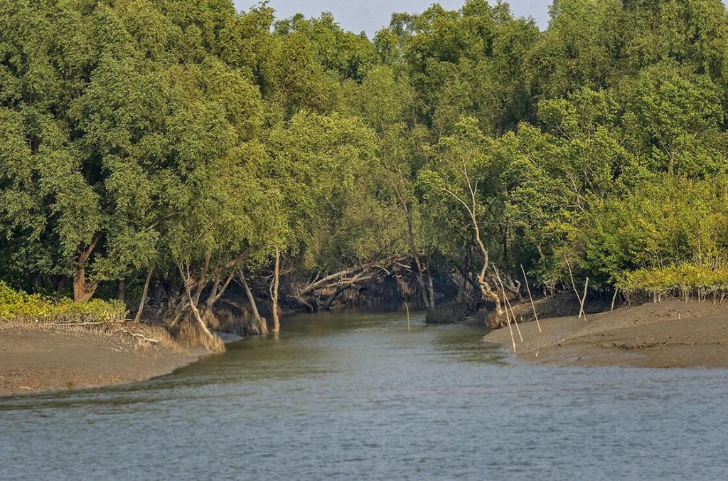
Species such as Sundari, Avicennia, Gewa, Goran, Keora, and Dhundul contribute to the structural diversity that makes the Sundarbans globally significant.
Together, they create one of the richest estuarine habitats on Earth.
At low tide, the forest floor reveals one of its most fascinating adaptations.
Thousands of slender breathing roots rise vertically from the mud.
These structures, known as pneumatophores, allow mangrove trees to absorb oxygen despite growing in waterlogged soils where ordinary roots would suffocate.
The forest literally breathes through the ground.
- The root systems perform another equally important role.
- They slow tidal currents.
- Trap sediment.
- Stabilise riverbanks.
- Reduce erosion.
Over time, they help build and maintain the very land upon which islands such as Lahiripur continue to exist.
The forest is constantly constructing the landscape.
Even while the rivers reshape it.
Look beneath the water’s surface and an entirely different ecosystem begins to appear.
- Young fish shelter among submerged roots where larger predators struggle to reach them.
- Juvenile prawns begin their early life cycles within these protected creeks.
- Crabs excavate burrows that aerate the mud and recycle nutrients.
- Countless microscopic organisms quietly sustain food chains that extend far beyond the mangroves themselves.
The forest is a nursery before it becomes a wilderness.
For birds, mangroves provide nesting sites, hunting perches and seasonal feeding grounds.
- For mammals, they offer cover from predators and access to freshwater pockets formed during the monsoon.
- For reptiles, they create ideal basking locations beside tidal channels.
Every level of the ecosystem supports another.
Nothing exists in isolation.
The people of Lahiripur also depend upon the health of these forests, even if they rarely enter the protected areas.
Mangroves reduce the force of storm surges before they reach inhabited islands. They help protect embankments from erosion.
They sustain fisheries that support local livelihoods.
They capture significant amounts of atmospheric carbon, contributing to climate regulation far beyond the Sundarbans.
Protecting mangroves ultimately means protecting communities.
Yet these forests remain vulnerable.
- Rising sea levels.
- Changing salinity.
- Increasing cyclone intensity.
- Riverbank erosion.
- Human pressures.
Each challenge tests the resilience of an ecosystem that has already endured centuries of natural change.
Conservation today is not simply about preserving trees.
It is about safeguarding the intricate web of life that connects rivers, forests, wildlife and people across the delta.
Stand quietly beside a mangrove creek for a few minutes.
- Watch the tide weave between the roots.
- Listen to the soft crackle of crabs moving through the mud.
- Observe the reflections dancing beneath the canopy.
Only then does the true character of the Sundarbans become clear.
- It is not merely a forest.
- It is a living system in constant conversation with water.
The Seasons Of The Lahiripur
No two visits to Lahiripur are ever quite the same.
The island changes with every season.
- Sometimes gradually.
- Sometimes overnight.
Unlike landscapes governed only by temperature, the Sundarbans responds to a remarkable combination of rainfall, tides, river discharge, salinity and wind.
Each season transforms not only the scenery but also the lives of the people and wildlife that depend upon it.
Summer arrives with long hours of intense sunshine.
By late morning, the embankments radiate heat while exposed mudflats begin to harden beneath the relentless sun. Water levels fluctuate with the tides, and many birds concentrate around shrinking pools where food becomes easier to find.
For residents, the day often begins early.
- Before the heat takes control.
- Then, almost inevitably.
- The sky begins to change.
- Dark clouds gather over the Bay of Bengal.
The first monsoon winds arrive.
Rain transforms Lahiripur completely.
Parched fields regain their colour.
Freshwater ponds begin to refill.
The rivers swell with rainwater flowing from far upstream, while the tides continue their relentless movement through the delta.
The island feels renewed.
Yet the monsoon is both a blessing and a challenge.
- Farmers welcome the rainfall that sustains agriculture.
- Fishermen watch the rivers with greater caution.
- Boat operators navigate stronger currents.
- Families keep a close eye on weather forecasts, knowing that a depression over the Bay can intensify with remarkable speed.
Life becomes increasingly dependent on reading the sky.
The monsoon also reshapes the surrounding wilderness.
- Mangrove forests appear greener than at any other time of year.
- Tidal creeks fill to their edges.
- Fish move deeper into flooded channels, attracting birds, reptiles and mammals that follow the changing abundance of food.
Every species adjusts.
Every tide brings new opportunities.
As the rains gradually withdraw, another transformation begins.
- The air becomes cooler.
- Humidity decreases.
- The skies turn brilliantly clear.
Winter has arrived.
For many travellers, this is the most comfortable season to experience Lahiripur.
- The rivers remain calm.
- Visibility improves dramatically.
- Morning mist drifts across the waterways before giving way to bright blue skies.
- Migratory birds begin appearing across the wetlands and mudflats, adding another layer of life to an already vibrant landscape.
- Nature seems unhurried.
The island breathes more gently.
Spring brings another subtle transition.
- Wildflowers appear along embankments.
- Fruit trees begin another growing cycle.
- Many birds enter their breeding season, filling the mornings with calls that echo across ponds and village roads.
It is perhaps the quietest season.
But never an empty one.
There is no single “best” time to visit Lahiripur.
Each season reveals a different chapter of the island.
- The summer demonstrates resilience.
- The monsoon showcases renewal.
- Winter celebrates biodiversity.
Spring reminds visitors that even the smallest seasonal changes influence the rhythm of life across the Sundarbans.
Understanding the island means appreciating every season—not comparing them.
Ferry Routes & Hidden Paths
The rivers of the Sundarbans are more than waterways.
They are roads.
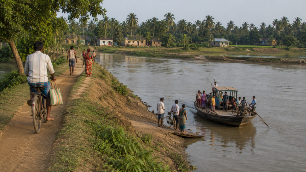
For generations, ferries and wooden boats have connected Lahiripur with neighbouring islands, carrying people, produce, schoolchildren, fishermen, traders, and visitors across the ever-changing tidal landscape.
Every crossing is part of daily life.
Every landing ghat is a meeting point between communities.
Unlike mainland towns where highways define movement, Lahiripur remains connected through an intricate network of ferry services, village roads, narrow embankments, and tidal channels.
The route you take often depends on the river.
On the tide.
And sometimes, on the weather itself.
Travel here is shaped by nature rather than fixed schedules.
Ferry Connections
Regular ferries and motorised boats connect Lahiripur with nearby settlements, making them the island’s lifeline.
Common routes link the island with:
- Gosaba
- Dayapur
- Pakhiralay
- Rangabelia
- Satjelia
Other neighbouring inhabited islands, depending on local demand and seasonal conditions
These services support far more than tourism.
They carry students to school, workers to markets, patients to healthcare facilities, and families visiting relatives across the delta.
For island communities, ferries are public transport in its most essential form.
Walking The Embankments
Some of Lahiripur’s most rewarding journeys begin after leaving the boat behind.
Raised earthen embankments weave across the island, connecting villages, ponds, agricultural fields, temples, schools, and ferry ghats.
Walking these paths offers an intimate understanding of everyday life.
- Cyclists pass quietly.
- Children walk to school.
- Farmers return from their fields.
- Fishing nets dry beneath the afternoon sun.
The landscape unfolds at a human pace.
Village Lanes
Beyond the main roads lie narrow village lanes bordered by bamboo fences, flowering plants, coconut palms, betel nut trees, and traditional homes.
These quiet paths reveal the rhythm of island life more clearly than any viewpoint.
- Neighbours exchange greetings.
- Tea stalls become gathering places.
- Domestic animals wander freely.
- Life continues without performance.
- Visitors become observers rather than spectators.
Hidden Waterways
Some of the most fascinating routes cannot be found on ordinary tourist maps.
Narrow tidal creeks branch away from the main rivers, winding through dense mangrove vegetation before disappearing around quiet bends.
These waterways are used by fishermen, forest workers, researchers, and authorised expedition boats that navigate the delta’s intricate maze.
Every creek feels different.
Some remain wide enough for larger boats. Others become so narrow that mangrove branches almost meet overhead.
The deeper you travel, the quieter the world becomes.
Cyclones & Survival
Living in the Sundarbans means accepting one undeniable reality. Nature always has the final word.
For generations, islands like Lahiripur have stood in the path of cyclones forming over the Bay of Bengal.
Some storms pass with little consequence.
Others leave memories that remain etched into the landscape for decades.
Cyclones are not isolated disasters here.
They are part of the island’s history.
Their impact can be seen in repaired embankments, rebuilt homes, newly planted trees and strengthened community infrastructure. Every generation carries stories of storms that tested both the landscape and the people who call it home.
Those memories are never far away.
When powerful winds combine with high tides, the greatest danger often comes from storm surges.
Saline water overtops or breaches embankments, flooding agricultural land, damaging homes and contaminating freshwater ponds that communities depend upon throughout the year.
Recovery does not end when the storm passes.
It continues for months.
Sometimes years.
Yet resilience has become one of Lahiripur’s defining characteristics.
Neighbours help rebuild damaged houses.
Local volunteers assist vulnerable families.
Government agencies, disaster response teams and community organisations work together to restore essential services.
The recovery is collective.
No one rebuilds alone.
The mangrove forests surrounding the inhabited islands also play a vital role.
Although they cannot eliminate the force of a cyclone, healthy mangrove belts help reduce wave energy, stabilise shorelines and provide an important natural buffer against storm surges.
The forest protects quietly.
Long before anyone notices.
Modern forecasting has transformed preparedness.
Weather bulletins, mobile communication and improved evacuation systems now provide communities with valuable time to prepare before severe weather arrives.
Experience and technology now work together.
Both save lives.
For visitors, cyclones may appear as extraordinary events.
For the people of Lahiripur, they are reminders of an enduring truth.
Living beside nature requires respect.
Not resistance.
That philosophy has allowed island communities to endure challenges that would overwhelm many other landscapes.
Photography Expedition Guide
Every photographer arrives in Lahiripur hoping to capture something memorable. Many leave having photographed something they never expected.
The island rewards observation rather than speed.
No dramatic viewpoints are demanding immediate attention.
Instead, the most compelling images often emerge quietly—from changing light, patient waiting and careful composition.
Photography here is an exercise in slowing down.
Sunrise transforms the rivers into mirrors.
Soft golden light spreads across calm water while fishing boats begin their daily journeys. Layers of morning mist create depth that changes almost minute by minute, offering opportunities for atmospheric landscape photography rarely found elsewhere.
Early mornings belong to the patient.
- The villages tell equally powerful stories.
- Children walking to school.
- Cyclists crossing narrow embankments.
- Tea stalls are welcoming their first customers.
- Fishermen repairing nets.
- Farmers working beneath open skies.
These moments reveal the authentic rhythm of island life without needing elaborate staging. The ordinary often becomes extraordinary through careful observation.
The surrounding waterways offer endless possibilities.
- Mangrove reflections.
- Weathered wooden boats.
- Tidal creeks are disappearing into dense forests.
- Birds perched against the morning light.
Every bend presents a different composition depending on the tide, season and weather. No two journeys are ever identical.
Wildlife photography demands even greater patience.
The Sundarbans does not reward hurried expectations.
Long periods of quiet observation are often interrupted by only a few fleeting seconds of opportunity—a kingfisher diving, a crocodile sliding into the river, a herd of spotted deer emerging briefly from the forest edge.
- Preparation matters.
- Patience matters even more.
Light changes constantly throughout the day.
The warm tones of sunrise gradually give way to bright midday conditions before returning to rich golden hues during the late afternoon.
Experienced photographers rarely chase subjects.
They wait for light.
Then allow the landscape to come to them.
Perhaps the most rewarding photographs are not always of wildlife.
- Sometimes they are simply moments.
- A weathered jetty disappearing into the river.
- Ripples left behind by a passing boat.
- Rain clouds gathering beyond distant mangroves.
- The reflection of coconut palms in a village pond.
These quiet scenes often capture the true spirit of Lahiripur better than any dramatic encounter.
Expedition Notes
Every expedition leaves behind observations that maps cannot record. Lahiripur is no exception.
This is not an island measured by famous monuments or crowded attractions.
Its character emerges gradually through conversations, changing tides, village life and the quiet relationship between people and the surrounding landscape.
The longer you stay, the more the island reveals.
Move slowly.
Allow extra time between destinations.
The most memorable discoveries rarely appear on an itinerary.
They happen while watching a ferry arrive, listening to a fisherman explain the river, or waiting patiently as morning mist lifts from the mangroves.
Observation is the greatest companion of exploration.
- Respect the rhythm of the island.
- The tide influences movement.
- The weather shapes daily plans.
- Nature does not follow human schedules.
Trying to rush through the Sundarbans often means missing what makes it extraordinary.
Carry curiosity rather than expectation.
- Some days, the forest remains silent.
- Some days, birds appear in remarkable numbers.
- Some journeys reveal extraordinary wildlife.
Others reveal extraordinary people. Both experiences are equally valuable.
Leave nothing behind except gratitude.
The Sundarbans remains one of Earth’s most fragile landscapes.
Responsible exploration means minimising disturbance, respecting local communities, supporting conservation and recognising that every visitor becomes part of the island’s ongoing story.
As the boat begins its return journey, Lahiripur slowly fades into the distance.
- The villages become smaller.
- The rivers grow wider.
- The mangroves merge once again with the horizon.
Yet something has changed.
Not the island. The way we understand it. Because Lahiripur is not remembered for a single sight.
It is remembered for a feeling.
A place where rivers guide every journey, tides shape every season, and people continue to live in quiet partnership with one of the world’s most remarkable natural landscapes.
The expedition may be ending.
But the story of Lahiripur continues with every rising tide.
Connected Landscapes
No island in the Sundarbans exists in isolation.
Lahiripur is no exception.
Look at a map and you’ll see boundaries drawn by rivers. Spend a few days here, however, and those boundaries begin to disappear.
- Boats move constantly between neighbouring islands.
- Families have relatives across different settlements.
- Students travel for education, traders for business, and fishermen wherever the tide promises a better catch.
The rivers divide the land.
They unite the people.
Lahiripur shares a close relationship with Gosaba, the administrative and commercial heart of this part of the Sundarbans. For many residents, Gosaba serves as the primary destination for government services, healthcare, education, banking, and larger marketplaces.
It is the island’s everyday connection to the wider region.
A short journey away lies Dayapur, another important settlement known for its proximity to the protected forests. Together, Lahiripur and Dayapur form part of an interconnected landscape where villages, rivers, and tourism-related activities coexist alongside traditional livelihoods.
Visitors often pass through both islands during their exploration of the eastern Sundarbans.
Yet each possesses its own identity.
Across the surrounding waterways are settlements such as Pakhiralay, Satjelia, and numerous smaller inhabited islands, each contributing to the social and economic network that sustains life throughout the delta.
For local residents, these are not distant destinations.
They are neighbours connected by water.
The surrounding rivers also link Lahiripur to some of the Sundarbans’ best-known forest zones.
Protected watchtowers, mangrove creeks, and wildlife habitats become accessible only because these waterways continue to function as the region’s primary transport corridors.
Every expedition begins where the villages end.
This interconnected geography has shaped culture as much as commerce.
- Festivals bring families together across islands.
- Markets attract traders from multiple settlements.
- Boatmen know dozens of landing points by memory.
- Students cross rivers to attend school.
- Healthcare often begins with a boat ride.
Life flows continuously between islands.
The landscape also connects ecosystems.
- Freshwater ponds.
- Agricultural fields.
- Village groves.
- Tidal mudflats.
- Mangrove forests.
Each supports different forms of life while remaining closely linked to the others. Nothing functions independently. Everything belongs to the same ecological mosaic.
Perhaps that is the greatest lesson these connected landscapes offer.
Lahiripur cannot be understood alone.
Its story becomes complete only when viewed alongside the rivers, forests, neighbouring islands, and communities that have evolved together across the Sundarbans for generations.
Food Of The Island
The cuisine of Lahiripur reflects the landscape that surrounds it.
- Simple.
- Seasonal.
- Resourceful.
Every meal tells a story of rivers, fields, ponds, and home gardens.
Rice remains the foundation of daily life.
Almost every household meal begins with freshly cooked rice accompanied by vegetables, lentils, or fish, depending on the season and availability.
The ingredients may appear modest.
The flavours are deeply rooted in tradition.
Fish occupies a special place on the dining table.

The surrounding rivers and nearby markets provide a variety of freshwater and estuarine species that have shaped local food culture for generations. Prepared with mustard, turmeric, green chillies, or light gravies, fish dishes remain central to everyday meals rather than reserved for special occasions.
For many families, the river feeds both livelihood and kitchen.
Seasonal vegetables grown in household gardens or nearby fields contribute significantly to local diets.
- Pumpkin.
- Brinjal.
- Bottle gourd.
- Okra.
- Spinach.
- Beans.
- Leafy greens.
Their availability changes throughout the year, ensuring that the island’s cuisine evolves naturally with the seasons.
Fresh fruits also form an important part of village life.
- Mangoes during summer.
- Guavas in season.
- Bananas throughout much of the year.
- Jackfruit is shared among neighbours.
- Coconuts are harvested from trees growing beside family homes.
The landscape itself supplies much of what the community needs.
- Tea remains the island’s universal companion.
- Morning conversations begin over steaming cups at roadside stalls.
- Travellers pause before continuing their journey.
- Neighbours exchange local news.
- Fishermen discuss river conditions.
Sometimes, the smallest tea stall offers the richest stories.
Food in Lahiripur is not defined by elaborate recipes.
- It is defined by freshness.
- By seasonality.
- By ingredients gathered close to home.
It reflects a way of life that remains deeply connected to the rhythms of the surrounding landscape.
Lahiripur’s Economy
Life on Lahiripur has always depended upon adaptability.
No single occupation defines the island. Instead, the local economy is built upon multiple livelihoods working together.
Agriculture continues to provide an important source of income for many households.
Paddy cultivation remains widespread wherever soil conditions permit, while seasonal vegetables and fruit trees supplement both household consumption and local markets.
Every successful harvest reflects careful management of water, soil, and salinity.
Fishing is equally significant.
Rivers surrounding the island support numerous families whose livelihoods depend upon understanding tides, seasonal fish movement, and changing environmental conditions.
Some fish close to home.
Others travel greater distances across the delta.
Every journey begins with reading the river.
Small businesses contribute steadily to the local economy.
- Grocery stores.
- Tea stalls.
- Repair workshops.
- Boat services.
- Local markets.
- Transport providers.
These enterprises may appear modest individually, yet together they form the commercial foundation of everyday life.
Education and government employment have gradually expanded economic opportunities over recent decades.
Teachers, healthcare workers, administrative staff, and other public service professionals now form an important part of the island’s social and economic fabric.
The economy has diversified without losing its rural identity.
Tourism has also created new opportunities.
Lahiripur’s proximity to the protected forests has encouraged the development of eco-tourism services including boat operations, accommodation, guiding, hospitality, and transport.
For many families, tourism provides supplementary income alongside traditional occupations rather than replacing them entirely.
Balance remains essential.
Yet economic life in Lahiripur continues to face challenges.
- Cyclones.
- Riverbank erosion.
- Salinity.
- Changing fish populations.
- Climate variability.
Each has the potential to influence livelihoods in profound ways. Resilience therefore remains as important economically as it is socially.
The strength of Lahiripur’s economy lies not in rapid growth.
It lies in diversity.
- Agriculture supports fishing.
- Fishing supports trade.
- Trade supports education.
- Education creates new opportunities.
Together, they form an economy capable of adapting to one of the world’s most dynamic environments.
Then & Now
Every island changes.
Lahiripur has changed too. But its transformation has been gradual rather than dramatic.
Older residents remember a time when journeys were longer, communication was slower, and many roads remained little more than earthen paths. Boat travel dominated almost every aspect of life, connecting villages that otherwise remained isolated for much of the year.
The river was everything.
It still is.
Over time, infrastructure improved.
- Brick roads replaced many traditional tracks.
- Electricity reached homes across the island.
- Schools expanded.
- Healthcare became more accessible.
Mobile communication transformed how families, businesses, and emergency services remained connected. Modern conveniences gradually arrived.
Tourism also introduced new possibilities.
Visitors from across India and abroad began exploring this part of the Sundarbans, creating opportunities for local entrepreneurship while increasing awareness of the region’s ecological significance.
The challenge has been maintaining balance.
Development should support the island.
Do not redefine it.
Despite these changes, much remains reassuringly familiar.
- Morning ferries continue their crossings.
- Children still walk to school.
- Farmers still watch the weather before planting.
- Fishermen still judge the river before leaving the ghat.
- The tides still determine the pace of life.
Some rhythms refuse to change.
Perhaps that is Lahiripur’s greatest achievement.
It has embraced progress without losing its identity.
- Modern infrastructure now exists alongside traditional knowledge.
- New opportunities coexist with long-established livelihoods.
- Community life remains rooted in cooperation, resilience, and respect for the landscape.
The Lahiripur of today is not the same island that earlier generations knew.
Nor should it be. Every generation leaves its own imprint. Yet beneath those changes, the island continues to be shaped by the same enduring forces—
- The rivers.
- The tides.
- The mangroves.
And the people who have learned to call this remarkable corner of the Sundarbans home.
The Wild Orbit Quick Facts
Every island has a story.
Sometimes, however, understanding begins with the facts.
These quick facts provide an overview of Lahiripur before you explore its rivers, villages, forests, and people in greater depth.
Official Name
Lahiripur Island
A permanently inhabited river island situated within the Indian Sundarbans of West Bengal.
Location
Lahiripur is located in the Gosaba Community Development Block of South 24 Parganas district, West Bengal, India. It forms part of the inhabited eastern Sundarbans and lies within the lower reaches of the vast Ganges–Brahmaputra–Meghna Delta.
Geographic Region
- Indian Sundarbans
- Lower Ganges Delta
- World’s Largest Mangrove Delta
- UNESCO-recognised Biosphere Landscape
Administrative Division
- Country: India
- State: West Bengal
- District: South 24 Parganas
- Block: Gosaba
Island Type
An inhabited tidal river island protected by embankments and surrounded by estuarine waterways connected to the Sundarbans mangrove ecosystem.
Landscape
Lahiripur presents a distinctive delta landscape comprising:
- Traditional villages
- Agricultural fields
- Freshwater ponds
- Earthen embankments
- Coconut and betel nut groves
- Narrow village roads
- Ferry ghats
- Tidal rivers
- Mangrove-lined waterways
Nearest Town
Gosaba
The principal commercial and administrative centre serving Lahiripur and several neighbouring islands.
Gateway Significance
Lahiripur serves as one of the important inhabited gateways to the eastern Indian Sundarbans, offering access to numerous river routes leading towards protected mangrove forests and wildlife habitats.
Primary Livelihoods
The local economy is supported through multiple occupations, including:
- Agriculture
- Inland and estuarine fishing
- Small businesses
- Boat transport
- Tourism and hospitality
- Government services
- Skilled trades
Main Crops
Agriculture depends upon seasonal conditions and generally includes:
- Paddy
- Seasonal vegetables
- Pumpkin
- Bottle gourd
- Brinjal
- Chillies
- Various leafy vegetables
Household gardens contribute significantly to local food security.
Climate
Lahiripur experiences a tropical monsoon climate characterised by:
- Hot summers
- Heavy monsoon rainfall
- Pleasant winters
- High humidity
- Strong tidal influence throughout the year
Nearest Forest
The protected mangrove forests of the Indian Sundarbans begin across the surrounding tidal rivers, making Lahiripur an important starting point for authorised forest exploration.
Famous For
Lahiripur is widely recognised for:
- Traditional island life
- Proximity to the Sundarbans forests
- River-based transport
- Wildlife expeditions
- Birdwatching
- Mangrove ecosystem
- Sustainable rural communities
- Scenic river landscapes
Best Time To Visit
Although every season offers a different perspective, the most comfortable period for exploration is generally from November to February, when temperatures are pleasant and visibility across the rivers is excellent.
Photography Opportunities
Lahiripur offers outstanding opportunities for:
- Documentary photography
- Landscape photography
- Village life
- River scenes
- Sunrise photography
- Bird photography
- Mangrove ecosystems
- Boat photography
- Cultural storytelling
Ideal For
Lahiripur appeals especially to travellers interested in:
- Nature exploration
- Wildlife observation
- Birdwatching
- Slow travel
- Photography
- Conservation
- Rural Bengal
- Mangrove ecology
- Responsible tourism
Expedition Character
Unlike destinations built around monuments or commercial attractions, Lahiripur offers an immersive experience shaped by rivers, seasons, wildlife, village life, and the quiet rhythm of the Sundarbans.
It is a destination best explored slowly.
The Wild Orbit Expedition Snapshot
Every expedition begins with a destination.
The most memorable ones leave behind an understanding. Lahiripur is one of those places.
Most journey begins long before the island comes into view.
- Roads gradually give way to rivers.
- Concrete slowly disappears behind stretches of open water.
- The sounds of cities fade beneath the steady rhythm of boat engines and tidal currents.
Without realising it, you have already entered another world.
The first impression is not dramatic.
- There are no towering mountains.
- No monumental architecture.
- No crowded promenades.
Instead, the landscape introduces itself quietly.
- Fishing boats resting beside muddy banks.
- Children cycling along embankments.
- Coconut palms swaying above village homes.
- A kingfisher is darting across the river.
The Sundarbans never rush an introduction.
As you explore deeper, the island begins revealing its many identities. It is a farming community.
- A fishing village.
- A transport hub.
- A wildlife gateway.
- A place shaped equally by rivers and resilience.
Every path eventually leads back to the water.
Soon, the inhabited landscape begins to merge with wilderness.
- The villages are becoming fewer.
- Mangroves appear along the riverbanks.
- Bird calls replace everyday conversation.
- The river grows wider.
- The horizon becomes greener.
- The expedition quietly transitions from human stories to ecological ones.
Time itself feels different here.
- The clock becomes less important than the tide.
- Morning departures depend upon water levels.
- Fishing follows seasonal cycles.
- Agriculture responds to rainfall.
- Boat schedules adjust to the river.
- Nature remains the island’s oldest calendar.
Some visitors arrive hoping to see a tiger.
Others come searching for birds. Many simply wish to experience the famous mangrove forests. Yet those who spend enough time on Lahiripur often discover something unexpected.
The greatest attraction is not a single wildlife sighting.
It is the remarkable relationship between people and one of Earth’s most dynamic natural landscapes.
By the time the return journey begins, Lahiripur no longer feels like another stop on a map.
It feels like an introduction.
Not simply to the Sundarbans—but to a way of living where rivers, forests, wildlife, weather, and human resilience remain inseparable.
That understanding becomes the expedition’s greatest souvenir.
The Wild Orbit Explorer Connections
Every explorer remembers certain places long after returning home.
Not because they were spectacular. But because they quietly changed the way the world was understood.
Lahiripur is one of those places.
Here, exploration is not measured by the number of attractions visited.
It is measured by attention.
- The attention to notice the changing light across a tidal river.
- The patience to wait for a kingfisher to return to the same branch.
- The curiosity to listen as a fisherman explains how tides determine his working day.
- The willingness to slow down.
Lahiripur asks visitors to abandon familiar expectations.
There are no carefully choreographed experiences.
- No artificial performances.
- No landscape is designed for entertainment.
Everything here continues exactly as it has for generations.
You are not the centre of the story. You are simply invited to witness it.
- Spend an hour beside the river.
- Watch ferries arrive and depart.
- Observe schoolchildren crossing the ghat.
- Notice how neighbours greet one another.
- Listen to conversations carried across the water.
Slowly, the island begins revealing details that hurried travel never discovers.
Walk through the villages respectfully.
- Every narrow road has a destination.
- Every pond supports a household.
- Every embankment protects a community.
- Every fishing net represents experience passed from one generation to the next.
The ordinary becomes extraordinary once you understand its purpose.
Then venture towards the surrounding waterways.
- The villages gradually disappear behind curtains of mangroves.
- The sounds become softer.
- The landscape becomes wilder.
You begin to appreciate why the Sundarbans cannot simply be visited. It must be experienced.
Perhaps that is Lahiripur’s greatest lesson.
Exploration is not always about travelling farther. Sometimes it is about observing more carefully.
- Looking more patiently.
- Listening more closely.
- Understanding more deeply.
When you leave, you carry more than photographs.
You carry a different perspective. One shaped by rivers rather than roads.
- By tides rather than timetables.
- By coexistence rather than control.
And long after the island disappears beyond the horizon, that perspective remains.
FAQs
1. Where is Lahiripur Island located?
Lahiripur Island is located in the Gosaba Block of the South 24 Parganas district in West Bengal, India. It is one of the inhabited islands of the eastern Indian Sundarbans and forms part of the world’s largest mangrove delta.
2. Why is Lahiripur important in the Sundarbans?
See it for yourself
A private journey shaped around you — your group, your pace, your interests. Book a free consultation.
Lahiripur serves as an important inhabited gateway to the Sundarbans, connecting local communities with nearby mangrove forests, river routes, wildlife habitats, and neighbouring islands while preserving a traditional river-based way of life.
3. Is Lahiripur inside the Sundarbans Tiger Reserve?
No. Lahiripur is an inhabited island located outside the protected core forest. However, it lies very close to authorised entry routes leading into the Sundarbans Tiger Reserve and surrounding protected mangrove forests.
4. Which district does Lahiripur belong to?
Lahiripur is part of the South 24 Parganas district in the Indian state of West Bengal.
5. How can visitors reach Lahiripur?
Visitors generally travel from Kolkata to Canning or Godkhali before continuing by road and ferry or motorised boat through the Sundarbans river network to reach Lahiripur.
6. What is Lahiripur best known for?
The island is known for its authentic village life, proximity to the Sundarbans mangrove forests, scenic river landscapes, birdlife, and its role as a gateway for wildlife expeditions.
7. What is the best time to visit Lahiripur?
The most comfortable period is generally between November and February, when temperatures are pleasant, humidity is lower, and river journeys are particularly enjoyable.
8. Can Royal Bengal Tigers be seen near Lahiripur?
Royal Bengal Tigers inhabit the protected mangrove forests surrounding the region. Sightings are possible only during authorised forest expeditions and can never be guaranteed due to the tiger’s elusive nature.
9. Is Lahiripur suitable for birdwatching?
Yes. The island and its surrounding rivers attract kingfishers, egrets, herons, Brahminy Kites, sea eagles, waders, cormorants, and many other resident and migratory bird species.
10. Is Lahiripur a good destination for wildlife photography?
Yes. Its rivers, mangroves, village life, birds, changing light, and nearby protected forests make it an excellent destination for documentary, landscape, and wildlife photography.
11. How do people travel around Lahiripur?
Residents use village roads for local movement, while ferries and motorised boats remain essential for travelling between neighbouring islands and across the Sundarbans.
12. What are the main occupations of people living in Lahiripur?
Agriculture, fishing, small businesses, tourism, transport services, government employment, and skilled trades collectively support the island’s economy.
13. What type of landscape does Lahiripur have?
The island features agricultural fields, freshwater ponds, village settlements, earthen embankments, tidal rivers, coconut groves, and nearby mangrove forests.
14. Are there mangrove forests on Lahiripur?
Most of the dense mangrove forests lie across the surrounding tidal rivers in protected areas, although mangrove vegetation is present along sections of nearby waterways.
15. Why are tides important on Lahiripur?
Tides influence transport, fishing, agriculture, river navigation, and daily routines, making them one of the most important natural forces shaping life on the island.
16. Does Lahiripur experience cyclones?
Yes. Like many islands in the Sundarbans, Lahiripur is periodically affected by tropical cyclones originating over the Bay of Bengal, making disaster preparedness an essential part of community life.
17. Is Lahiripur suitable for family travel?
Yes. Visitors interested in nature, culture, birdwatching, photography, and responsible tourism often find Lahiripur an enriching destination for families as well as individual travellers.
18. What wildlife can be seen around Lahiripur?
Common wildlife includes numerous birds, estuarine fish, mudskippers, fiddler crabs, rhesus macaques, saltwater crocodiles in surrounding waterways, and other species associated with the Sundarbans ecosystem.
19. Which nearby destinations can be explored from Lahiripur?
Nearby attractions include Gosaba, Dayapur, Pakhiralay, Sudhanyakhali Watch Tower, Dobanki Canopy Walk, and several river routes leading into the protected mangrove forests.
20. How many days should visitors spend exploring Lahiripur?
A stay of two to three days allows visitors to experience village life, river journeys, nearby forest excursions, birdwatching, and the island’s distinctive rhythm at a relaxed pace.
21. What makes Lahiripur different from other Sundarbans islands?
Its close relationship with both traditional village life and nearby protected mangrove ecosystems creates a unique balance between human settlement and wilderness.
22. Is Lahiripur suitable for responsible tourism?
Yes. Visitors who respect local communities, minimise environmental impact, and appreciate the ecological importance of the Sundarbans contribute positively to responsible tourism.
23. What should visitors carry during their visit?
Light clothing, sun protection, drinking water, binoculars, a camera, insect repellent, comfortable footwear, and weather-appropriate gear are generally recommended.
24. Is Lahiripur worth visiting even without seeing a tiger?
Absolutely. The island’s rivers, mangroves, birdlife, village culture, scenic landscapes, and peaceful atmosphere provide a rewarding experience regardless of wildlife sightings.
25. Why should Lahiripur be part of a Sundarbans expedition?
Because it offers something increasingly rare—a genuine opportunity to understand how communities and nature continue to coexist within one of the world’s most extraordinary tidal landscapes. Rather than simply visiting the Sundarbans, Lahiripur helps visitors understand it.
How To Reach Lahiripur Island
Every journey to Lahiripur follows a path shaped by rivers.
Unlike many destinations connected entirely by highways, reaching this island is part of the Sundarbans experience itself. The transition from city roads to tidal waterways gradually introduces visitors to one of the world’s most distinctive delta landscapes.
By the time your boat reaches Lahiripur, the journey has already become part of the story.
From Kolkata
Most visitors begin their expedition from Kolkata.
The city is approximately 95–105 kilometres from the main gateway points leading into the Indian Sundarbans, depending on the chosen route.
Travellers generally leave early in the morning to make the most of daylight and favourable ferry schedules.
As the urban skyline disappears, highways gradually give way to rural Bengal, passing villages, wetlands, agricultural fields, and small market towns before reaching the river.
The transformation is gradual.
But unmistakable.
Via Canning
Canning remains one of the traditional rail gateways to the Sundarbans.
Regular suburban trains connect Kolkata with Canning throughout the day, making it one of the most convenient options for independent travellers.
From Canning, visitors continue by road towards the ferry points serving the inhabited islands before completing the final stage of the journey by boat.
For generations, this route has introduced travellers to the river world of the Sundarbans.
Via Godkhali
Many organised expeditions prefer travelling through Godkhali.
Located on the edge of the delta, Godkhali functions as one of the principal embarkation points for boats heading towards Gosaba, Dayapur, Lahiripur, and neighbouring islands.
Here, the landscape changes dramatically.
Roads end.
The river begins.
Motorboats and ferries replace vehicles, and every onward journey depends upon tides, weather, and navigation through the interconnected waterways.
Reaching Gosaba
Most visitors travelling towards Lahiripur pass through Gosaba.
As the largest administrative and commercial centre in this part of the Sundarbans, Gosaba serves as an important transport hub where passengers, supplies, local residents, and visitors converge before continuing towards the surrounding islands.
The crossing itself offers the first close encounter with the delta’s remarkable scenery.
- Fishing boats drift across broad rivers.
- Kingfishers flash above the water.
- Mangroves begin appearing along distant banks.
The expedition has truly begun.
Final Journey To Lahiripur
From Gosaba, the journey continues through local roads, ferries, or motorised boats, depending upon the chosen route and prevailing river conditions.
Unlike conventional travel, this final stage is influenced by natural rhythms.
- High tide.
- Low tide.
- Weather.
- River traffic.
- Season.
Every journey is slightly different. Yet every arrival shares the same feeling— Stepping onto an island where life continues to move in harmony with the river.
Travel Tips
A little preparation makes the journey more enjoyable.
- Begin your journey early to maximise daylight.
- Confirm ferry or boat timings in advance, especially during the monsoon.
- Carry drinking water and light refreshments.
- Protect cameras and electronics from moisture.
- Wear comfortable clothing suitable for tropical weather.
- Allow flexibility in your itinerary, as river transport may occasionally be influenced by tides or weather conditions.
The Sundarbans rewards travellers who travel with patience rather than urgency.
Things To See Near Lahiripur
Exploring Lahiripur naturally leads to exploring the wider Sundarbans.
Each neighbouring destination reveals another layer of this extraordinary delta, where every river bend tells a different story.
Gosaba
Often regarded as the administrative heart of the Indian Sundarbans, Gosaba combines history, commerce, and community life.
Its bustling markets, educational institutions, government offices, ferry terminals, and historic associations make it one of the region’s most important inhabited islands.
For many visitors, Gosaba provides their first introduction to everyday life in the Sundarbans before venturing deeper into the delta.
Dayapur
Located close to Lahiripur, Dayapur has become one of the best-known gateways to the surrounding mangrove forests.
Its strategic location allows visitors to begin river safaris, birdwatching excursions, and wildlife expeditions into nearby protected areas.
Despite its growing tourism profile, Dayapur continues to retain the character of a traditional island community.
Pakhiralay
Pakhiralay is closely associated with birdwatching and nature exploration.
Seasonal migratory birds, scenic riverbanks, and peaceful village surroundings attract photographers, bird enthusiasts, and travellers seeking quieter experiences away from urban environments.
Its name itself reflects a long-standing connection with birds.
Sudhanyakhali Watch Tower
Among the most recognised wildlife observation points in the Sundarbans, Sudhanyakhali Watch Tower overlooks freshwater ponds, open grassland, and dense mangrove forest.
These habitats frequently attract spotted deer, wild boar, crocodiles, numerous bird species, and occasionally the elusive Royal Bengal Tiger.
Every visit offers different possibilities.
Nothing is guaranteed.
Everything feels authentic.
Dobanki Canopy Walk
The Dobanki Canopy Walk provides a unique opportunity to experience the mangrove forest from an elevated perspective.
The enclosed walkway passes above sections of the forest, allowing visitors to appreciate the remarkable structure of the mangrove ecosystem while observing wildlife with minimal disturbance.
It is one of the most distinctive experiences available within the Indian Sundarbans.
Sajnekhali
Sajnekhali serves as one of the principal entry points into the protected forests.
The interpretation centre, mangrove awareness displays, birdlife, watchtower, and surrounding waterways provide visitors with valuable insight into the ecology and conservation significance of the Sundarbans before continuing deeper into the reserve.
Rivers And Creeks
Not every attraction has a name.
Some of the Sundarbans’ greatest experiences are found while drifting through unnamed tidal creeks bordered by dense mangrove forests.
Every bend offers something different.
- A kingfisher waits silently above the water.
- A crocodile resting on a muddy bank.
- Fresh tiger pugmarks preserved in soft sediment.
- A sea eagle is circling overhead.
Sometimes the river itself becomes the destination.
Continue Your Journey
No single island can fully explain the Sundarbans.
Each contributes another chapter to a much larger story.
Lahiripur introduces visitors to the relationship between rivers, villages, mangroves, and human resilience.
Neighbouring islands reveal different traditions, different landscapes, and different ecological perspectives.
Together, they create one interconnected living delta.
For those wishing to understand the Sundarbans more deeply, the journey naturally continues towards places such as Gosaba, Dayapur, Pakhiralay, Satjelia, Bali Island, Chhoto Mollakhali, Jamespur, Basanti, Rangabelia, and many other inhabited islands—each with its own history, culture, and connection to the mangrove wilderness.
Beyond the villages lie the protected forests.
Beyond the forests lie countless tidal rivers and hidden creeks where nature continues much as it has for centuries.
The more islands you explore, the more complete your understanding becomes.
The Sundarbans is not a collection of destinations.
It is one living landscape.
Every island helps tell its story.
The Enduring Legacy of Lahiripur
As the evening slowly settles across Lahiripur, the day’s final boat begins its journey home.
The river reflects the fading colours of the western sky.
Fishing nets are folded. Children return from school. The sounds of village life gradually soften beneath the steady movement of the incoming tide.
- Nothing feels hurried.
- Nothing feels staged.
- Life simply continues.
Standing beside the river, it becomes clear why Lahiripur leaves such a lasting impression.
It is not because the island seeks attention. It is because authenticity still defines everyday life here.
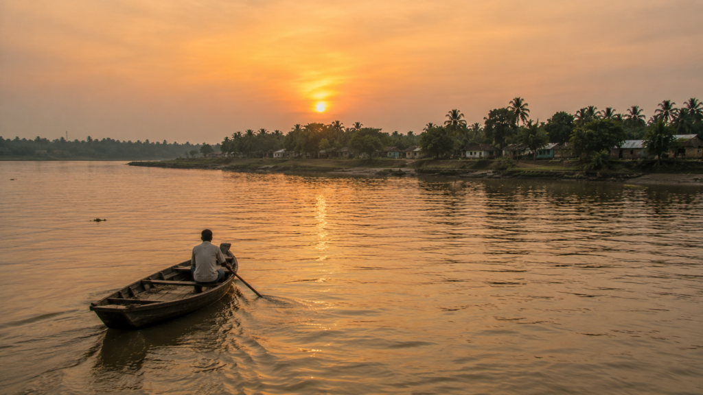
- The rivers continue to shape transport.
- The tides continue to influence livelihoods.
- The mangroves continue protecting the fragile coastline.
- Communities continue adapting, just as generations before them have done.
The landscape has never stopped teaching.
Many visitors arrive expecting only wildlife.
Some hope to photograph a tiger. Others dream of exploring the world’s largest mangrove forest. They often leave having discovered something equally remarkable—
A deeper appreciation for the people who have learned to live alongside one of Earth’s most dynamic natural environments.
The human story becomes inseparable from the ecological one.
Lahiripur reminds us that conservation is not only about protecting forests.
It is also about understanding the communities that exist beside them.
It is about recognising that rivers sustain villages, mangroves protect coastlines, biodiversity supports livelihoods, and traditional knowledge continues to play an essential role in one of the planet’s most fragile ecosystems.
Every element depends upon the others.
Perhaps that is the island’s greatest lesson.
Nature is not something separate from human life.
Here, it is woven into every journey across the river, every fishing expedition, every cultivated field, every monsoon, every season, and every sunrise reflected upon the tidal waters.
The Sundarbans is not merely observed.
It is lived.
Long after the boat disappears around the final bend, memories of Lahiripur remain.
Not as a checklist of attractions. Not as a collection of photographs. But as an experience that quietly changes the way rivers, forests, resilience, and coexistence are understood.
Some destinations entertain.
Some educate.
Lahiripur does something rarer.
It invites reflection.
The expedition may end at the jetty.
The understanding continues long after the journey home.
Because Lahiripur is more than an island within the Sundarbans.
It is a reminder that some of the world’s greatest landscapes reveal themselves not through spectacle, but through patience, humility, and a willingness to slow down.
And in that quiet rhythm of rivers and tides, the true spirit of the Sundarbans continues to endure—one island, one community, and one rising tide at a time.