 Encyclopedia
Mathurapur is not an island in the strict geographical sense that many of the deeper Sundarban settlements are. It sits at a threshold—a frontier between mainland Bengal and the tidal world that slowly dissolves into mangrove wilderness. Here, the Sundarbans do not arrive abruptly. They emerge gradually, almost secretly, through rivers, creeks, embankments, saline fields, and villages that have learned to live with the pull of the tide.
Unlike Gosaba or Patharpratima, Mathurapur belongs to the northern gateway of the delta. It is a place where railway tracks still arrive, where markets remain busy throughout the year, and where the rhythms of rural Bengal merge with the tidal pulse of the lower Gangetic landscape.
To understand Mathurapur is to understand transition.
- Between river and land.
- Between the mainland and the delta.
- Between certainty and tide.
And that journey begins before dawn.
First Encounter
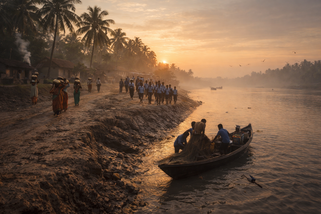
By sunrise, the shoreline is fully visible.
Unlike the forest-fringed region farther south, Mathurapur presents a more inhabited face to arriving visitors.
- The embankments are broad.
- Villages stand close to one another.
- Agricultural fields stretch inland.
Roads connect settlements that would have seemed isolated only a generation ago. Yet beneath this apparent stability lies the unmistakable character of the Sundarbans.
- The soil remains young.
- The rivers remain restless.
- The tides still arrive twice every day.
The first people visible along the embankment are fishermen returning from overnight work. Their boats are loaded with nets darkened by river water.
Nearby:
- Women walk toward ponds carrying brass water vessels.
- Children in school uniforms appear along narrow village lanes.
- Tea stalls begin opening.
- Kettles whistle.
- The smell of wood smoke drifts across the morning air.
Mathurapur does not wake suddenly. It unfolds.
Like the tide itself.
Mathurapur Identity
Mathurapur occupies a strategically important position within the southern portion of the South 24 Parganas district.
Administratively, the region is divided between the blocks of Mathurapur I and Mathurapur II, forming part of the larger Sundarban development zone. The area serves as one of the important transitional landscapes connecting inland Bengal with the more remote places of the delta.
Mathurapur’s landscape differs from the isolated region farther south.
Here, settlements are more continuous.
Transportation networks are stronger.
Railways connect the region directly with Kolkata through the Sealdah–Namkhana line, while roads and waterways link villages to surrounding blocks and river systems.
The broader Mathurapur region covers extensive low-lying deltaic terrain shaped by centuries of river deposition and human reclamation. Much of the land sits only a few meters above sea level, making embankments as important as roads.
The people who live here often describe themselves as residents of the “upper Sundarban.”
It is a revealing phrase. Because Mathurapur belongs simultaneously to two worlds.
- One foot remains in mainland Bengal.
- The other stands firmly in the tidal delta.
The Rivers That Built Mathurapur
No map truly explains Mathurapur.
Only rivers do.
Across centuries, countless channels of the Ganges delta have shifted, merged, disappeared, and returned. The land itself exists because rivers allowed it and rivers continue reshaping it.
The waterways surrounding the Mathurapur region are part of the immense tidal network feeding the Sundarbans. Unlike mountain rivers that carve through rock, these rivers build landscapes.
- Every flood deposits sediment.
- Every tide rearranges mudbanks.
- Every monsoon redraws boundaries.
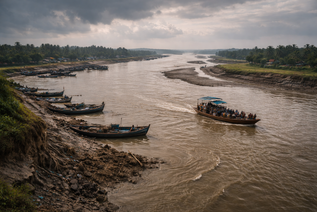
The result is a landscape that remains permanently unfinished. Fishermen understand this instinctively. Ask them for directions and they rarely describe roads first.
They describe rivers.
- The river is the map.
- The river is the memory.
- The river is the road.
Even today, many settlements maintain stronger historical relationships with waterways than with highways. Before roads expanded across South 24 Parganas, boats connected villages, markets, temples, schools, and agricultural communities.
Many older residents still remember journeys measured not in kilometers but in tides.
- “Leave with the ebb.”
- “Return with the flood.”
Such instructions remain meaningful here.
Historical Footprints
Long before modern Mathurapur emerged, much of this landscape belonged to a fluctuating frontier between settlement and wilderness. Historical records from southern Bengal repeatedly describe extensive wetlands, forests, marshes, and riverine landscapes occupying large portions of the delta.
Human settlement arrived gradually.
The earliest communities were often fishermen, woodcutters, boatmen, and cultivators seeking fertile alluvial soil.
But over generations,
- Forests were cleared.
- Embankments were constructed.
- Fields emerged.
- Villages expanded.
The colonial era accelerated these transformations dramatically.
British land revenue policies encouraged large-scale reclamation across southern Bengal. Areas once considered too unstable for permanent settlement became valuable agricultural land. Entire communities migrated into newly reclaimed territories.
This process permanently altered the landscape.
- The forests retreated.
- Agriculture expanded.
- Markets emerged.
- Transportation routes developed.
Yet nature never entirely surrendered.
- The rivers continued flooding.
- Cyclones continued arriving.
- Salinity continued shaping agricultural possibilities.
Mathurapur, therefore, became a place defined not by the conquest of nature but by negotiation with it.
A negotiation that continues today.
Historical Personalities &Transformations
Mathurapur lacks the grand monuments that dominate historical narratives elsewhere. Its history survives differently.
- In schools established by local educators.
- In embankments strengthened by collective labor.
- In agricultural reforms that altered village life.
- In community leaders who helped transform reclaimed lands into stable settlements.
The wider South 24 Parganas region played a significant role in agrarian movements, including land reform efforts and tenancy struggles that reshaped rural Bengal during the twentieth century. These transformations influenced communities throughout the Mathurapur blocks, altering land ownership patterns and agricultural livelihoods.
Many of the region’s most important historical figures remain largely absent from textbooks. They are remembered locally.
- Teachers.
- Boat operators.
- Village organizers.
- Religious leaders.
- Midwives.
- Farmers.
The people who built continuity in a landscape where continuity is never guaranteed.
Folklore & River Memory
In Mathurapur, folklore often arrives through conversation.
- A tea stall.
- A ferry crossing.
- A fishing boat anchored beside an embankment.
The deeper one travels toward the tidal south, the stronger the presence of Sundarban mythology becomes.
Stories of Bonbibi drift northward through generations. Tales of Dakshin Ray survive in fragments. Older fishermen occasionally speak of places where rivers behave strangely. Places where currents seem alive. Places best crossed before dark.
Unlike formal myths, these stories rarely have fixed versions. Every storyteller,
- Adds something.
- Removes something.
- Changes something.
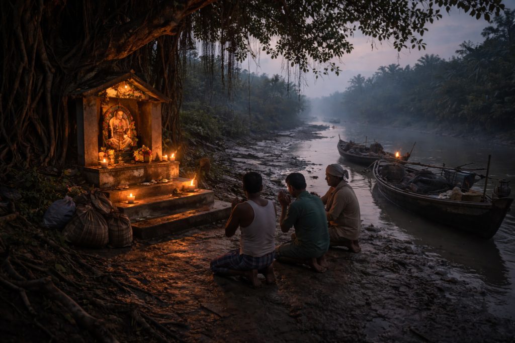
The river itself becomes part of the narrative. A living participant rather than a backdrop. And perhaps that is the most authentic folklore of Mathurapur. The belief that water remembers.
Life Between The Tides
By mid-morning, the villages are fully awake.
- Agricultural fields shimmer beneath growing heat.
- Fish markets begin filling.
- Motorcycles move along embankment roads.
- Schoolyards echo with children’s voices.
Yet beneath every activity lies an invisible timetable.
The tide.
Even in relatively developed parts of the Sundarban region, tidal cycles continue influencing daily decisions.
- Fishing schedules.
- Boat departures.
- Market arrivals.
- Pond management.
- Agricultural practices.
The tide is rarely discussed because everyone already knows it.
- Like breathing.
- Like the weather.
- Like daylight.
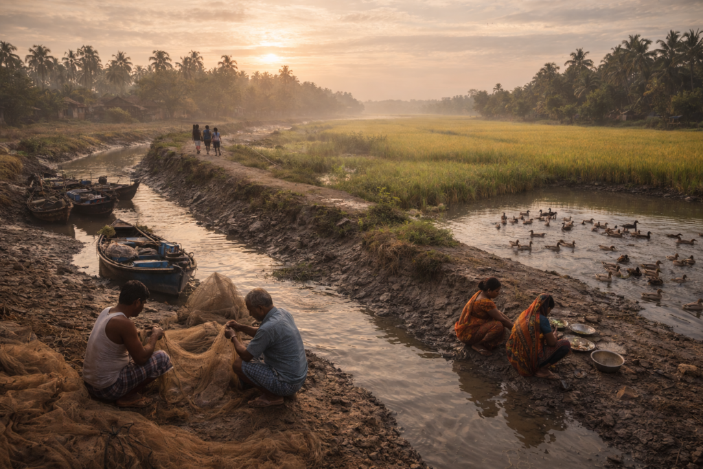
In Mathurapur, life is not controlled by tides. But it remains synchronized with them. And that subtle distinction explains much about the region’s character.
Walking Through The Villages
The village paths of Mathurapur do not follow neat geometric plans.
- They curve around ponds.
- They bend beside mango orchards.
- They follow embankments built decades ago and repaired countless times since.
Walking here feels less like navigating a settlement and more like following the logic of water.
- Every village appears connected to a pond.
- Every pond appears connected to a household.
- Every household appears connected to the river.
The homes vary.
Older mud-walled structures still survive in some areas, their earthen surfaces carefully maintained despite monsoon rains.
Beside them stand brick houses painted in shades of blue, green, and pink. Satellite dishes rise above roofs that still shelter ducks, chickens, and goats below. In courtyards, women sort vegetables harvested from kitchen gardens.
- Pumpkins hang from bamboo frames.
- Bottle gourds trail across roofs.
- Bundles of fishing nets dry in the sun.
Children chase each other between coconut trees. The village landscape feels intensely lived-in. Nothing appears decorative. Everything has a purpose.
- A pond stores water.
- A tree provides shade.
- A courtyard serves as a kitchen, workshop, gathering place, and playground.
The economy of space reflects generations of adaptation.
Temples, Mosques & Shared Landscapes
Religion in Mathurapur exists not as a spectacle but as part of daily geography.
- A small Shiva temple stands beside a pond.
- A mosque rises beyond a rice field.
- A roadside shrine shelters beneath a banyan tree.
Their scale reflects the character of the region. They belong to communities rather than monuments. The morning call to prayer travels across fields. Temple bells answer from another direction.
Neither seems out of place.
Both have become part of the soundscape. Throughout South 24 Parganas, communities have shared rivers, markets, embankments, and challenges for generations.
Cyclones do not distinguish between faiths. Floods do not respect boundaries. This reality has historically encouraged forms of practical coexistence deeply embedded in delta life.
In Mathurapur, survival has often been a collective project.
Markets As Social Rivers
If rivers move people physically, markets move stories.
By midday, local bazaars become the most animated spaces in Mathurapur. Fish vendors occupy the busiest sections. Fresh catches glisten on wooden tables.
- Small prawns.
- Tilapia.
- Catfish.
- Seasonal river fish.
Crabs tied carefully with strips of coconut fiber. The smell is unmistakable.
- Fresh river water.
- Wet bamboo baskets.
- Fish scales.
- Mud.
- Salt.
Nearby, vegetable sellers arrange produce grown in surrounding villages.
- Brinjals.
- Green chilies.
- Pumpkins.
- Bananas.
- Okra.
- Bundles of leafy greens.
Conversations flow continuously.
- News travels faster than vehicles.
- Someone discusses crop prices.
- Another talks about an approaching storm.
- A fisherman reports unusual river conditions.
- A teacher discusses examination results.
Markets in Mathurapur function as social observatories. To stand here for an hour is to understand the concerns of the region.
The Sounds Of Mathurapur
Every landscape possesses its own soundtrack.
Mathurapur’s soundtrack is surprisingly layered. At first, the listener notices obvious sounds.
- Motorcycles.
- Voices.
- Boat engines.
- Market activity.
But spend enough time here and subtler sounds emerge.
- The rustling of coconut leaves.
- The rhythmic knocking of bamboo against a fishing boat.
- The distant whistle of a train crossing the countryside.
- Kingfishers calling from ponds.
- The repetitive creaking of rope against wooden moorings.
- Wind moving through paddy fields.
The delta never becomes completely silent. Even at its quietest moments, there is movement somewhere.
- Water is entering a creek.
- Birds changing perches.
- Leaves shifting in the breeze.
The landscape seems perpetually engaged in conversation with itself.
Afternoon Soundscape
Around three o’clock, the character of sound changes again.
- Schoolchildren return home.
- Tea stalls become crowded.
- Cricket matches appear in open fields.
Laughter carries across villages.
A train horn echoes faintly from the direction of Mathurapur Road station. The sound feels oddly symbolic.
A reminder that despite its deltaic identity, Mathurapur remains connected to Kolkata and the wider world.
Unlike more isolated Sundarban islands, Mathurapur lives simultaneously in two realities:
The rural delta and modern Bengal.
Wildlife Expedition
See it for yourself
A private journey shaped around you — your group, your pace, your interests. Book a free consultation.
Wildlife in Mathurapur does not announce itself dramatically.
Unlike the forested islands deeper within the Sundarbans, encounters here often require patience. The observer must slow down.
- Look carefully.
- Listen.
Because the most remarkable creatures are often hiding in plain sight.
Birds Of The Wetlands
Birdlife provides the first clues.
The ponds, canals, fields, and riverbanks support a remarkable diversity of species.
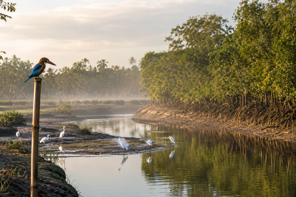
- White-throated kingfishers perch on electrical wires.
- Small blue kingfishers flash across canals like flying gemstones.
- Pond herons stand motionless along muddy edges.
- Little egrets patrol shallow waters.
- Cormorants dry their wings on exposed branches.
During winter, migratory visitors arrive from far beyond Bengal.
Wetlands become temporary homes for ducks, waders, and other seasonal travelers following ancient flyways across Asia. For birdwatchers, Mathurapur offers an advantage often overlooked.
The landscape combines agricultural fields, freshwater wetlands, tidal channels, and village ponds within a relatively small area.
Such ecological diversity attracts birds year-round.
Raptors Above The Delta
Around midday, the sky itself becomes part of the expedition.
Black kites circle high above settlements. Brahminy kites patrol rivers. Their chestnut wings glow in sunlight. Occasionally, an osprey appears during migration seasons, scanning waterways for fish.
The presence of these birds reveals something important. Healthy predator populations indicate functioning ecosystems. Even landscapes heavily influenced by humans can sustain surprising ecological richness.
Reptiles And Amphibians
The ponds and canals of Mathurapur support a quieter community.
- Water snakes.
- Garden lizards.
- Skinks.
- Tree frogs.
Toads emerging after rain. Most remain unseen. Yet their presence is essential. They control insect populations. Support food chains. Maintain ecological balance.
After monsoon showers, village roads often resonate with amphibian calls. The sound can become almost orchestral. An entire unseen chorus announcing the return of water.
Mammals Of The Delta Fringe
Large mammals are less frequently encountered in Mathurapur than in core mangrove zones.
Yet the wider landscape supports species adapted to life alongside people.
- Jackals occasionally appear near agricultural edges.
- Mongooses hunt along embankments.
- Indian palm squirrels remain common around settlements.
Fishing cats, though elusive, inhabit suitable wetland habitats throughout parts of the greater Sundarban landscape. Most residents never see them. But evidence occasionally appears.
- Tracks beside ponds.
- Stories shared by fishermen.
- Brief nighttime sightings.
The fishing cat remains one of Bengal’s most mysterious predators. A ghost of the wetlands.
Mangrove Chronicles
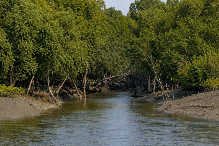
Mathurapur is not dominated by dense mangrove forests in the way Gosaba or Jharkhali are. Yet mangroves remain deeply woven into its ecological story.
- They survive along creeks.
- Riverbanks.
- Protected wetlands.
- Fragments of older landscapes.
These mangroves function as living reminders of what once covered much larger portions of the delta.
The Guardians Of The Shoreline
Mangroves perform tasks that no human engineering project can fully replace.
- Their roots stabilize sediment.
- Their branches weaken storm surges.
- Their presence reduces erosion.
- Their ecosystems nurture juvenile fish and crustaceans.
Species associated with the wider Sundarbans ecosystem include:
- Gewa
- Goran
- Keora
- Bain
- Dhundul
- Sundari
Not every species occurs equally across Mathurapur’s immediate landscape, but the ecological influence of mangroves extends throughout the region.
The rivers carry their influence far beyond forest boundaries.
Human Relationships With Mangroves
Ask older residents about mangroves and the conversation quickly shifts from ecology to memory.
Many remember periods when forests stood closer. When creeks remained wider. When fish populations seemed more abundant. Such memories may not always align perfectly with scientific data.
Yet they contain valuable observations. People who spend lifetimes beside rivers notice changes.
- The disappearance of a creek.
- The arrival of salinity.
- The decline of certain fish.
- The spread of invasive vegetation.
These local observations form an important environmental archive. One written not in reports but in experience.
Explorer’s Field Notes
05:12 AM
- First light appears above eastern fields.
- Mist drifts across ponds.
- A kingfisher calls repeatedly from a bamboo pole.
06:03 AM
- Fishermen return along a narrow canal.
- Their nets glisten with river water.
- The tide continues rising.
07:41 AM
- Temple bells begin sounding from a nearby village.
- Moments later, the call to prayer carries across the fields.
- The sounds overlap briefly.
- Then fade.
09:15 AM
- Market activity intensifies.
- Fresh fish arrives.
- Bicycle traffic increases.
- Tea stalls become crowded.
11:37 AM
- Black kites circle above agricultural fields.
- A pond heron stalks along a canal.
- The morning coolness has disappeared.
01:18 PM
- Heat dominates the landscape.
- Most movement slows.
- Dogs sleep beneath trees.
- Even birds appear less active.
03:42 PM
- Schoolchildren fill village paths.
- Cricket matches begin in open grounds.
- The atmosphere becomes lively again.
05:27 PM
- Golden light spreads across the embankment.
- Fishing boats prepare for evening departures.
- The river changes color.
06:41 PM
- First stars emerge.
- The tide reverses.
- Water begins flowing in the opposite direction.
- The river starts another chapter.
Nightfall On The Mathurapur
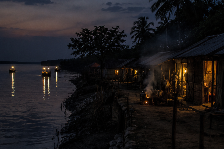
Sunset arrives slowly across the delta.
- The sky turns amber.
- Then copper.
- Then violet.
Palm trees become silhouettes. Smoke rises from cooking fires. The markets empty. The roads quieten. Yet Mathurapur does not sleep immediately.
Night reveals another version of the landscape. The sounds become sharper.
- Dogs bark in the distance.
- Frogs begin calling from ponds.
- Crickets emerge from vegetation.
- Boats continue moving along rivers invisible in the darkness.
Only their engines reveal their existence. The darkness feels different from urban darkness. It possesses depth.
- Space.
- Mystery.
The river becomes unseen again. Exactly as it was before dawn. Completing the cycle.
The Seasons Of Mathurapur
No season leaves Mathurapur unchanged. The landscape transforms continuously. Understanding these changes is essential to understanding the place itself.
Winter (November–February)
- Clear skies dominate.
- Migratory birds arrive.
- Fields become green and productive.
- River journeys are easiest.
- Visibility improves dramatically.
This is when the delta appears most tranquil.
Spring (March–April)
- Flowering trees brighten villages.
- Temperatures begin rising.
- Agricultural activity intensifies.
- Birdlife remains abundant.
The first signs of approaching summer appear.
Summer (May–June)
- Heat becomes relentless.
- Ponds shrink.
- Humidity rises.
- Storm clouds gather unexpectedly.
- The atmosphere feels charged.
Waiting.
Watching.
Monsoon (June–September)
Rain transforms everything.
- Canals overflow.
- Fields flood.
- Vegetation explodes into growth.
- The landscape becomes intensely green.
- Travel becomes less predictable.
- The rivers gain power.
Post-Monsoon (October)
Perhaps the most dramatic season.
- The air clears.
- Water levels remain high.
- Sunsets become spectacular.
- The landscape appears freshly renewed.
Cyclones And Survival
No story about Mathurapur can ignore cyclones.
The region exists within one of the world’s most cyclone-prone coastal zones. Storms arriving from the Bay of Bengal have shaped generations of memory.
Names like Aila, Bulbul, Amphan, Yaas, and Remal are remembered not as weather events but as historical markers.
People recall where they stood. What they lost. How they rebuilt.
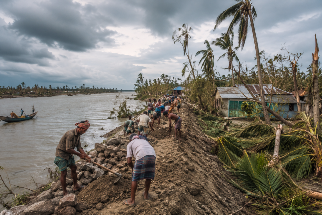
Cyclones expose the fundamental vulnerability of the delta. But they also reveal its resilience. After every storm:
- Embankments are repaired.
- Homes are rebuilt.
- Fields are reclaimed.
- Communities reorganize.
Life continues.
Not because the risks disappear. But because the people of Mathurapur have learned that adaptation itself is a way of life. And in the Sundarbans, resilience may be the most important inheritance of all.
Connected Landscapes
No island—or island-like deltaic landscape—exists alone in the Sundarbans.
Every settlement is connected to another through water, trade, kinship, migration, and memory. Mathurapur’s importance comes partly from its position as a gateway. To the north lie the agricultural heartlands of South 24 Parganas.
To the south, the landscape gradually transitions toward the more remote tidal place of the Sundarbans. Many families in Mathurapur maintain relationships stretching across the delta.
- A daughter married in Kultali.
- A fisherman working seasonally near Patharpratima.
- Relatives living in Gosaba.
- A trader visiting Namkhana markets.
These connections create invisible networks stronger than roads. The rivers themselves encourage these relationships. Water rarely respects administrative boundaries.
- A boat leaving one village may pass through several ecological worlds before sunset.
- A fish caught in one river may be sold in another settlement.
- A story told in one tea stall may travel across multiple islands within days.
Mathurapur therefore functions as more than a location. It is a junction. A meeting point within the greater Sundarban system.
Rivers As Ecological Corridors
The waterways surrounding Mathurapur connect freshwater systems, tidal creeks, wetlands, agricultural lands, and mangrove habitats.
For wildlife, these rivers act as migration routes.
- Fish move with changing salinity.
- Birds follow seasonal feeding opportunities.
- Aquatic life travels through channels invisible to most observers.
For people, the same rivers continue serving as transportation corridors. Even where roads have replaced many traditional routes, waterways remain economically and culturally significant.
The delta’s ecology cannot be understood in fragments. Everything remains connected. A change upstream eventually affects the coast. A cyclone on the coast eventually affects inland villages.
Mathurapur exists within this web of relationships.
Oral Histories
Official histories often focus on governments, administrators, and institutions.
The history remembered in villages is different. It survives through conversation. During an evening tea break, an elderly resident points toward an open field.
“There used to be a canal there.” Today, it is farmland.
The water disappeared decades ago. But older residents still navigate the landscape using vanished waterways as reference points. Another villager remembers a cyclone from childhood.
- The exact year is forgotten.
- The details are not.
- The wind.
- The flood.
- The livestock was carried away.
- The weeks spent rebuilding.
Memory preserves emotion long after dates disappear. Throughout Mathurapur, oral histories reveal recurring themes.
- Migration.
- Adaptation.
- Loss.
- Persistence.
The stories rarely celebrate dramatic achievements. Instead, they celebrate endurance.
- Families surviving difficult years.
- Communities rebuilding after storms.
- Farmers reclaiming land damaged by salinity.
These are the victories most remembered here.
The River That Changed Course
Many older residents speak about rivers changing shape within a single lifetime.
- A creek becomes narrower.
- A channel silts up.
- An embankment alters water flow.
- A fishing ground disappears.
Such observations are common throughout the delta. For people whose lives remain closely tied to waterways, landscape change is not an abstract concept.
It is something witnessed directly. One generation remembers a river.
The next generation inherits a field. The transformation becomes family history.
Food Of Mathurapur
Food in Mathurapur tells the story of the landscape.
- The rivers contribute.
- The fields contribute.
- The ponds contribute.
Together, they create a cuisine shaped by availability, seasonality, and practicality. Breakfast often remains simple.
- Puffed rice.
- Rice cakes.
- Fresh vegetables.
- Tea is prepared strong and sweet.
By midday, the influence of the delta becomes more visible.
Fish dominates many meals. Not because it is considered special. Because it is part of everyday life.
- Small river fish cooked with vegetables.
- Fish curries flavored with mustard.
- Dried fish preserved for difficult seasons.
- Prawn dishes during favorable catches.
- Crab when available.
The recipes vary between households, but the river remains a constant ingredient.
The Agriculture Of The Plate
Rice remains central.
Fields surrounding Mathurapur continue producing the grain that defines rural Bengal. Seasonal vegetables supplement daily diets.
- Pumpkins.
- Brinjals.
- Bottle gourds.
- Beans.
- Leafy greens.
Many households maintain kitchen gardens that function as miniature ecosystems. The garden reduces dependence on markets. It also reflects generations of agricultural knowledge. A visitor looking only at the rivers misses half the story.
The fields are equally important.
Festivals And Food
Food becomes particularly significant during religious festivals and community gatherings.
- Special rice preparations.
- Traditional sweets.
- Seasonal ingredients.
Recipes passed through generations.
The meals served during celebrations often reveal deeper cultural histories than formal ceremonies. A recipe may survive longer than a building. A cooking technique may outlast political changes.
Food therefore becomes a form of cultural memory.
Mathurapur Economy
Mathurapur’s economy reflects the dual identity of the region.
- Part agricultural.
- Part riverine.
- Part connected to urban Bengal.
- Part dependent on local resources.
Few livelihoods depend on a single source of income. Diversification is a survival strategy.
Agriculture
Agriculture remains one of the region’s most important economic activities.
Rice cultivation dominates many areas. Seasonal crops provide additional income. Farmers must constantly balance productivity against environmental challenges.
- Salinity.
- Flooding.
- Unpredictable rainfall.
- Cyclone damage.
Every harvest represents both effort and uncertainty. Yet agriculture continues because generations have learned how to adapt.
Fishing And Aquatic Resources
The rivers continue supporting livelihoods throughout the region.
- Fishing remains important both economically and culturally.
- Small-scale fishers work tidal channels, ponds, rivers, and wetlands.
- Aquaculture has expanded in some areas.
Prawn cultivation and fish farming contribute to local income, though these activities also introduce environmental challenges. The relationship between the economy and ecology remains delicate.
A healthy river supports communities. A declining river affects everyone.
Markets, Trade & Mobility
Mathurapur benefits from stronger transportation connections than many deeper Sundarban islands.
- Rail links.
- Road networks.
- River transport.
These connections facilitate trade and mobility. Local produce reaches larger markets.
- Workers commute.
- Students pursue education elsewhere.
- Goods move in and out continuously.
This accessibility has significantly influenced the region’s development trajectory.
Migration And Remittances
Like many parts of coastal Bengal, migration plays an important role in household economies.
Some residents work seasonally in Kolkata. Others seek employment in different states. Money earned elsewhere often supports families remaining in the village.
This creates an interesting dynamic. The economy of Mathurapur is partly local. Partly regional. And increasingly national. Yet many migrants eventually return.
The connection to the delta remains strong.
Then And Now
The Mathurapur known today differs significantly from the Mathurapur remembered by older generations.
The differences appear everywhere.
- Roads where there were once footpaths.
- Bridges replacing boat crossings.
- Mobile towers rising above fields.
- Concrete homes replacing vulnerable structures.
- Electricity is reaching areas once dependent on kerosene lamps.
- Education opportunities are expanding.
- Healthcare improving.
- Connectivity increasing.
These changes have transformed daily life. Yet not everything has changed. The tide still arrives twice each day.
- Cyclones still threaten.
- Rivers still shift.
- Agriculture still depends on the weather.
- Nature continues to exert influence.
The delta remains a place where modernity negotiates constantly with geography.
Environmental Change
The landscape itself is evolving.
- Residents frequently discuss changing rainfall patterns.
- Increased salinity in some areas.
- More intense weather events.
- Altered river behavior.
Scientific research across the Sundarbans supports concerns regarding climate vulnerability, sea-level rise, and changing environmental conditions. Mathurapur stands at the front line of these broader transformations.
The future of the region may depend largely on how effectively communities adapt. As they have adapted for centuries.
Ferry Routes & Hidden Paths
Official maps often emphasize roads.
Explorers quickly learn that rivers tell a more interesting story. Even today, many journeys around Mathurapur remain closely linked to waterways.
- Small ferries continue connecting communities.
- Boat crossings shorten routes that roads lengthen.
- River travel offers perspectives unavailable from land.
The embankments reveal themselves differently. The settlements appear differently. The scale of the delta becomes easier to understand.
Forgotten Routes
Older residents occasionally describe routes no longer commonly used.
- Canals that once carried traders.
- Creeks that connected markets.
- Waterways abandoned after siltation.
- Paths erased by changing river dynamics.
These forgotten routes form an invisible geography beneath the modern landscape. The explorer who listens carefully discovers that every village contains traces of older maps.
Photography Expedition Guide
Mathurapur rewards patience more than spectacle. Photographers expecting dramatic wilderness may overlook its subtler beauty. The strongest images often emerge from ordinary moments.
Sunrise Photography
Before dawn:
- Ponds become mirrors.
- Mist softens the landscape.
- Fishing boats move through golden light.
- Palm silhouettes create striking compositions.
The transition from darkness to daylight can be extraordinary during the winter months.
Village Photography
The villages offer rich opportunities for documenting rural life.
- Courtyards.
- Fishing nets.
- Agricultural work.
- Tea stalls.
- Schoolchildren walking along embankments.
The most compelling photographs often focus on interactions rather than landmarks.
Wildlife Photography
Birdlife provides the greatest opportunities.
- Kingfishers.
- Herons.
- Egrets.
- Kites.
Migratory visitors during winter. Success depends on observation and patience rather than equipment alone.
River Landscapes
Late afternoon transforms the waterways.
- Low-angle sunlight highlights textures in mudbanks.
- Reflections intensify.
- Boats become silhouettes.
- The rivers appear almost cinematic.
The best images often arrive during the final hour before sunset.
Expedition Notes
An expedition through Mathurapur reveals countless small observations that rarely appear in formal descriptions.
The names of ponds often survive longer than the families who originally dug them. Certain trees serve as unofficial landmarks known by entire villages. Older tea stalls function as community archives where decades of local history remain available to anyone willing to listen.
Railway stations connect the delta to Kolkata, yet many conversations still measure distance in river crossings.
Some embankments follow the paths of much older boundaries. Many village paths trace routes established long before modern roads existed. The landscape contains layers.
- Every generation adds another.
- Every storm rewrites part of the story.
- Every tide edits the edges.
And yet Mathurapur endures. Not unchanged. But continuously becoming.
The Wild Orbit Quick Facts
| Category | Details |
| Location | Southern part of South 24 Parganas District, West Bengal |
| Administrative Region | Mathurapur I & Mathurapur II Blocks |
| Division | Presidency Division |
| Ecological Zone | Northern Sundarban Transition Belt |
| Landscape Type | Deltaic agricultural and tidal river landscape |
| Major Water Systems | Sundarban tidal river network and associated creeks |
| Elevation | Low-lying coastal delta plain |
| Primary Livelihoods | Agriculture, fishing, aquaculture, trade, services |
| Transportation | Rail, road, ferry and local boat networks |
| Nearest Major Urban Center | Kolkata |
| Nearest Important Railway Access | Mathurapur Road Railway Station |
| Climate | Tropical monsoon |
| Cyclone Vulnerability | High |
| Wildlife Highlights | Kingfishers, egrets, herons, kites, wetland fauna |
| Best Exploration Period | November to February |
| Photography Highlights | Rivers, wetlands, village life, winter birdlife, sunrise landscapes |
The Wild Orbit Expedition Snapshot
Accessibility
★★★★★★★★☆☆ (8/10)
One of the more accessible gateway regions connected directly by rail and road.
Wildlife Potential
★★★★★★☆☆☆☆ (6/10)
Less dramatic than core mangrove zones but rewarding for birdlife and wetland ecology.
Photography Potential
★★★★★★★★☆☆ (8/10)
Excellent opportunities for documentary, cultural, river, and rural landscape photography.
Cultural Richness
★★★★★★★★⭐☆ (9/10)
A deep blend of delta traditions, migration histories, agriculture, fishing culture, and river life.
Historical Interest
★★★★★★★☆☆☆ (7/10)
Strong historical value as a reclamation frontier and gateway into the Sundarbans.
Solitude Level
★★★★★☆☆☆☆☆ (5/10)
More populated and connected than the remote Sundarban islands, though hidden corners remain wonderfully quiet.
FAQs
1. Is Mathurapur part of the Sundarbans?
Yes. Mathurapur forms part of the northern Sundarban transition region and serves as an important gateway into the broader delta ecosystem.
2. Is Mathurapur an island?
Not in the strict geographical sense of many southern Sundarban islands. It is a deltaic landscape strongly influenced by rivers, wetlands, and tidal systems.
3. Which district is Mathurapur located in?
Mathurapur is located in the South 24 Parganas district of West Bengal.
4. Which blocks comprise Mathurapur?
The region includes Mathurapur I and Mathurapur II administrative blocks.
5. What is Mathurapur known for?
Its riverine landscape, agriculture, fisheries, transport connectivity, and a role as a gateway to the Sundarbans.
6. Does Mathurapur have mangroves?
Yes, though not as extensively as the core Sundarban islands.
7. Is wildlife present in Mathurapur?
Yes. Wetland birds, reptiles, amphibians, and aquatic species are common.
8. Can migratory birds be seen here?
Winter is the best season for observing migratory birds in the surrounding wetlands.
9. Are there fishing communities in Mathurapur?
Yes. Fishing remains an important livelihood.
10. Is agriculture important?
Very much so. Rice cultivation remains central to the local economy.
11. What rivers influence Mathurapur?
The area is influenced by the larger Sundarban tidal river system and interconnected waterways.
12. Does the region experience tidal influence?
Yes. Tidal cycles remain an important environmental factor.
13. Is Mathurapur vulnerable to cyclones?
Yes. Like much of coastal Bengal, it is highly exposed to cyclonic storms.
14. Which major cyclones affected the region?
Aila, Bulbul, Amphan, Yaas, and Remal all left significant impacts.
15. What is the best season to visit?
November through February offers the most comfortable conditions.
16. Is Mathurapur connected by railway?
Yes. The Sealdah–Namkhana railway corridor serves the region.
17. What is the nearest railway station?
Mathurapur Road Station is the primary access point.
18. Can photographers explore the area?
Absolutely. Rural landscapes, rivers, birds, and village life provide excellent opportunities.
19. Are ferry services available?
Yes. Local ferry crossings continue to connect riverbank communities.
20. Is the area densely populated?
Compared with remote Sundarban islands, yes.
21. Does tourism dominate the economy?
No. Agriculture, fisheries, trade, and services remain more important.
22. Are there traditional markets?
Yes. Local bazaars continue to play an important economic and social role.
23. Is climate change affecting Mathurapur?
Like the wider Sundarbans, the region faces increasing environmental challenges.
24. What makes Mathurapur unique?
Its role of a transition zone between mainland Bengal and the deeper Sundarbans.
25. Why should explorers study Mathurapur?
Because it reveals how people adapt to life in a constantly changing delta landscape.
26. Is Mathurapur suitable for cultural documentation?
Very much so. It offers rich opportunities for studying rural Bengal and Sundarban culture.
27. What defines life in Mathurapur?
The continual negotiation between land, water, weather, and human resilience.
How To Reach Mathurapur
Reaching Mathurapur is itself part of the expedition.
Unlike remote Sundarban islands requiring multiple river crossings, Mathurapur remains one of the most accessible entry points into the lower delta.
From Kolkata By Rail
The classic route begins at the bustling rail terminals of Kolkata.
Board a local train on the Sealdah South section heading toward Namkhana. As the train moves southward, urban landscapes slowly dissolve into wetlands, ponds, agricultural fields, and riverine country.
- Stations become smaller.
- The horizon becomes wider.
- Palm trees begin replacing apartment blocks.
Eventually, the train reaches Mathurapur Road. The transition feels gradual but unmistakable. You have entered the delta.
From Kolkata By Road
Road travelers can follow routes through Baruipur, Jaynagar, and adjoining southern corridors.
The journey offers a fascinating visual lesson in the changing geography of Bengal.
- Concrete gradually gives way to waterways.
- Bridges cross tidal channels.
- Fields spread across reclaimed land.
The closer one approaches Mathurapur, the more dominant the influence of water becomes.
Using Ferry Connections
Though road infrastructure has expanded dramatically, ferries remain essential for understanding the region. Local crossings connect communities separated by tidal channels.
For explorers, ferries offer something roads cannot: Perspective. From the river, the embankments reveal their scale. Villages emerge differently.
The delta begins to make sense.
During Monsoon
Travel becomes less predictable.
Heavy rainfall can affect roads and river conditions. Yet monsoon journeys also reveal the landscape at its most dynamic.
- The rivers swell.
- Fields flood.
- Vegetation explodes into life.
For experienced explorers, it is one of the most dramatic seasons.
Explorer’s Travel Notes
- Begin early.
- Watch the tides.
- Carry rain protection year-round.
- Spend time in local markets.
- Travel some distance by river whenever possible.
- Observe the landscape rather than rushing through it.
Mathurapur rewards patience.
Things To See Around Mathurapur
Exploring Beyond The Main Route
The most rewarding experiences are often found away from obvious landmarks.
River Embankments
The embankments reveal the true relationship between people and water. Walk them at sunrise or sunset.
They are observation platforms, historical records, and engineering structures all at once.
Local Wetlands
Seasonal wetlands attract birdlife and reveal the ecological foundations of the region.
Winter mornings are particularly rewarding.
Village Markets
Markets provide unmatched insight into daily life.
- Arrive early.
- Observe quietly.
- Listen more than you speak.
The market will explain Mathurapur better than any signboard.
Agricultural Landscapes
Rice fields, ponds, irrigation channels, and kitchen gardens reveal how communities have adapted to delta conditions.
Historic Rail Corridor
The railway itself is part of the story. It transformed mobility, trade, education, and opportunity throughout southern Bengal.
Tidal Creeks
Many smaller waterways remain overlooked. These creeks often provide the most atmospheric views of the delta.
River Viewpoints
Almost every embankment eventually leads to a remarkable river vista. Some require no destination. The journey itself becomes the experience.
Nearby Sundarban Gateways
Mathurapur connects naturally to further explorations toward:
- Jaynagar
- Raidighi
- Kultali
- Patharpratima
- Gosaba
- Namkhana
- Sagar Island
Each represents a different chapter of the delta story.
Continue The Journey
Mathurapur is rarely the end of an expedition.
It is often the beginning.
- Follow the rivers south and the landscape becomes wilder.
- Continue toward Kultali and the influence of the mangroves strengthens.
- Travel onward to Gosaba and the forest frontier emerges.
- Move toward Patharpratima and tidal isolation becomes more pronounced.
- Journey to Sagar Island and the Bay of Bengal dominates the horizon.
Every direction offers another story.
- Another river.
- Another island.
- Another layer of the Sundarbans.
Mathurapur stands at the crossroads of them all.
Leaving Mathurapur At Dusk
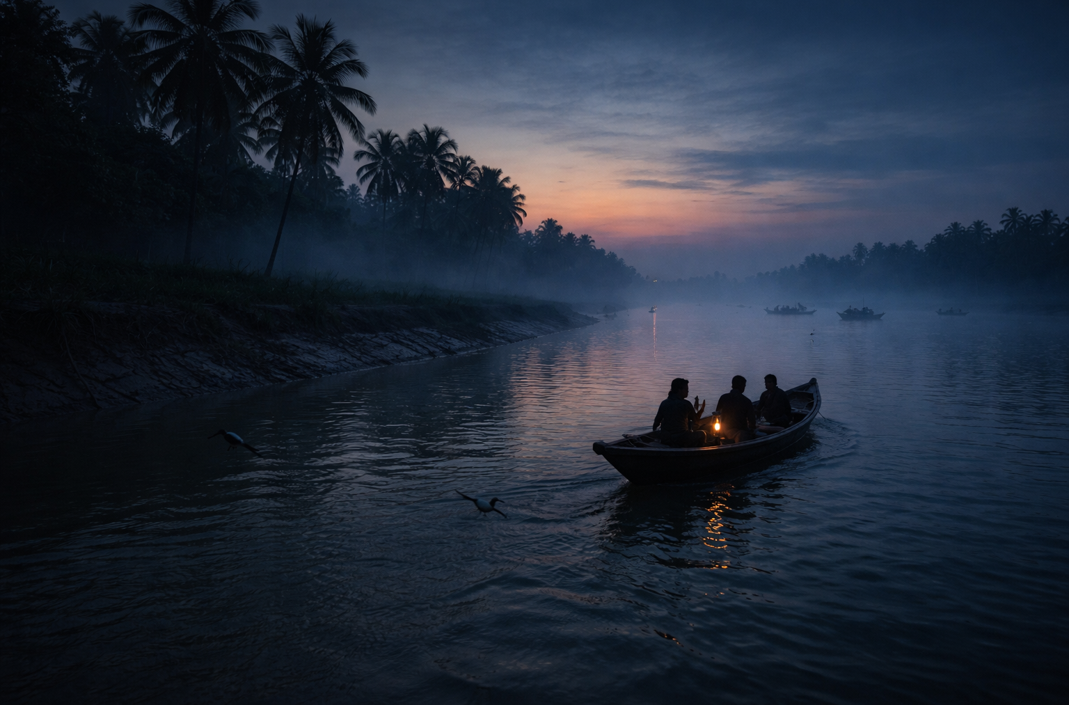
The boat departs just after sunset.
The tide is turning once again. Behind the stern, the shoreline of Mathurapur begins slowly dissolving into the distance.
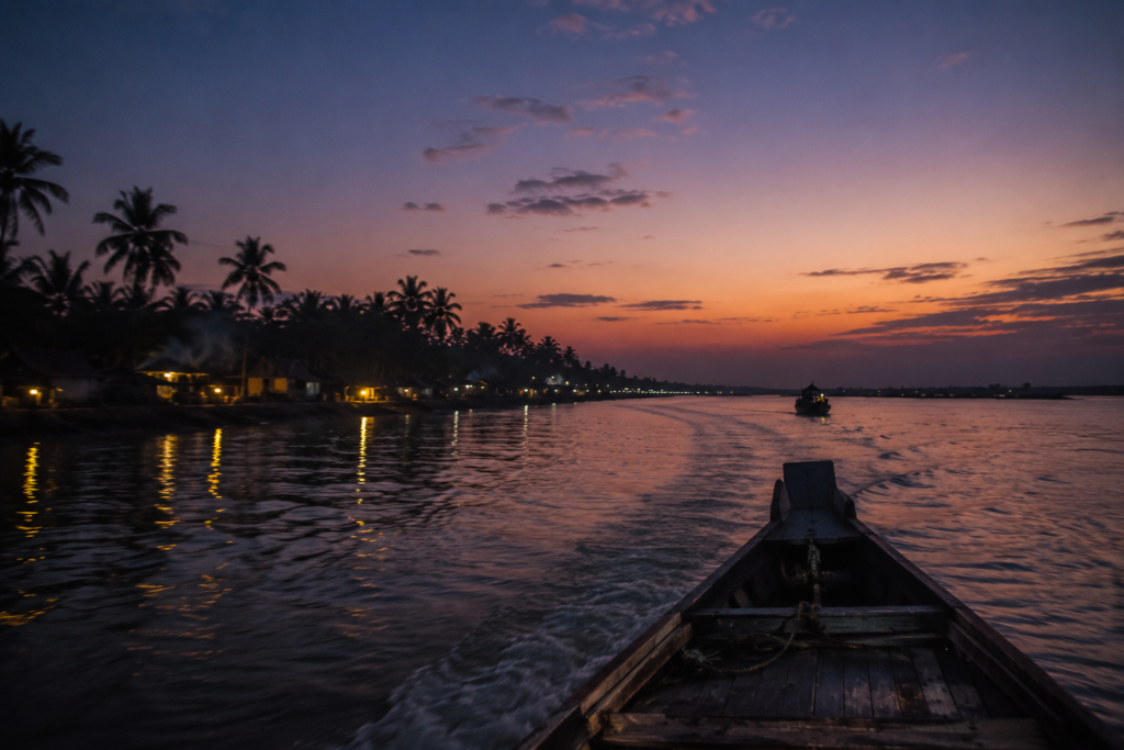
- Palm trees become silhouettes.
- Village lights appear one by one.
- A temple bell rings faintly somewhere beyond the embankment.
Then fades.
The river widens.
Darkness gathers across the water. The villages that seemed so vivid during the day retreat into shadow. Yet something remains.
- Not a landmark.
- Not a monument.
- Not a single memory.
But a feeling.
The feeling of a landscape forever negotiating with water.
A place where rivers write history, tides shape routine, storms test endurance, and generations continue adapting to a world that never stands still. Far behind, the last lights of Mathurapur flicker along the horizon. Ahead, only darkness and the river remain.
The engine hums steadily.
The tide carries the boat onward.
And slowly, almost imperceptibly, Mathurapur disappears into the great living delta from which it emerged.
Plan your private Sundarban expedition
A private journey shaped around you — your group, your pace, your interests. Book a free consultation.