 Encyclopedia
Before dawn, the river looked older than memory.
The boat pushed away from the jetty in darkness, its wooden hull nudging against water that seemed neither river nor sea. Somewhere ahead lay Namkhana—a name familiar to ferry operators, fishermen, railway commuters, cyclone survivors, and those who know the southern edge of Bengal not as a map but as a living frontier.
The tide was turning. Not dramatically. Not with waves. Only through subtle signs. The current shifted direction. Loose hyacinths began drifting differently.
The boatman glanced at the water more often than at the sky.
Across the eastern horizon, a thin silver band appeared behind layers of cloud. A night heron crossed silently overhead. Somewhere in the distance came the mechanical pulse of a fishing trawler heading toward deeper waters. The Sundarbans often reveal themselves through forests.
Namkhana reveals itself through rivers.
Before you see the island, you feel the waterways tightening around it. The delta becomes more intricate.
- Channels divide.
- Mudbanks emerge.
- Fishing stakes appear like skeletal markers in the half-light.
Then slowly, the shoreline arrives.
Not dramatically. Not as a wilderness. But as a long, inhabited conversation between land and water.
- A silhouette of embankments.
- Clusters of coconut palms.
- Fishing boats pulled onto muddy slopes.
The faint outline of houses standing behind earthen walls built against tides that have spent centuries trying to reclaim this land.
As dawn breaks fully, Namkhana emerges not as a single island but as a gateway landscape—a place where rivers gather before meeting the Bay of Bengal, where ferries, fishing boats, railway tracks, embankments, markets, and memories all intersect.
And the day-long expedition begins.
First Encounter
The first thing one notices is movement.
Nothing in Namkhana stands still for long. Even the land appears temporary.
- Water moves.
- Boats move.
- People move.
- Tides move.
The island exists within a rhythm dictated by lunar cycles and river currents. Approaching from the north, the settlement appears stretched along waterways rather than organized around roads.
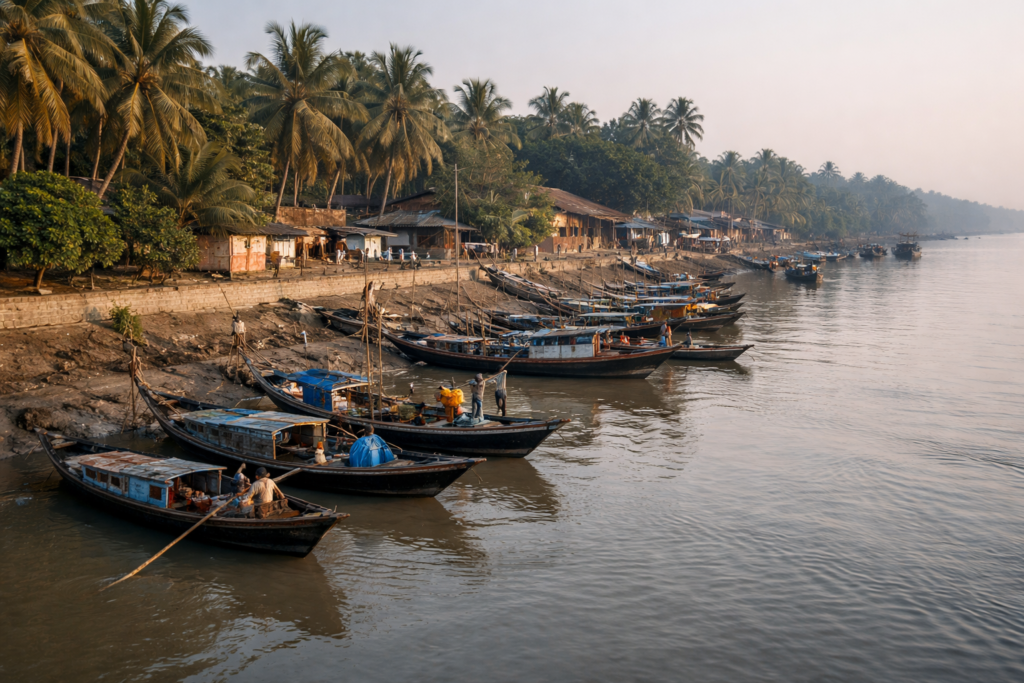
The famous Hatania–Doania River cuts through the landscape like a living artery. For generations, it served as both a connection and an obstacle. Before the bridge arrived in 2019, ferries carried people, vegetables, fish, livestock, bicycles, and entire daily routines across its shifting waters. Today, the bridge stands above the river, but boats still move beneath it, reminding visitors that rivers here remain the original highways.
At the ghats, fishermen unload crates before sunrise.
- Women walk toward local markets carrying baskets balanced effortlessly on their heads.
- Schoolchildren begin appearing in uniforms.
- Tea stalls awaken.
- The smell of wood smoke mixes with tidal mud.
Namkhana does not feel like a place waiting to be explored. It feels like a place already busy with its own life. You are merely entering the flow.
Island Identity
Understanding Namkhana requires abandoning the idea of a single island.
Administratively, Namkhana is a Community Development Block in the Kakdwip subdivision of the South 24 Parganas district. The block covers roughly 370 square kilometres and supports a population exceeding 180,000 according to the 2011 Census, spread across dozens of villages and seven gram panchayats.
The villages are not arranged around a central town.
Instead, they are scattered across reclaimed delta lands shaped by rivers, creeks, embankments, and tidal channels.
Names emerge repeatedly in conversations:
- Narayanpur.
- Budhakhali.
- Mousani.
- Haripur.
- Shibrampur.
- Fraserganj.
- Dwariknagar.
Namkhana itself.
Each settlement carries its own relationship with water.
- Some face rivers.
- Others face tidal creeks.
- Some look toward fishing grounds.
- Others depend more heavily on agriculture.
Together they form a landscape that feels less like an administrative block and more like an archipelago of human adaptations. The entire region sits low above sea level. The horizon remains broad. The sky dominates.
And everywhere, rivers define identity more strongly than roads.
The Rivers That Built Namkhana
Every island in the Sundarbans has parent rivers.
Namkhana has several.
The most influential are the Hatania–Doania, Muriganga, and Saptamukhi river systems that surround and shape the region. Spend a day here and you quickly realize these rivers are not geographical features. They are active participants.
The Hatania–Doania River behaves almost like a gatekeeper. Historically, crossing it determined access to the southern islands and coastal settlements.
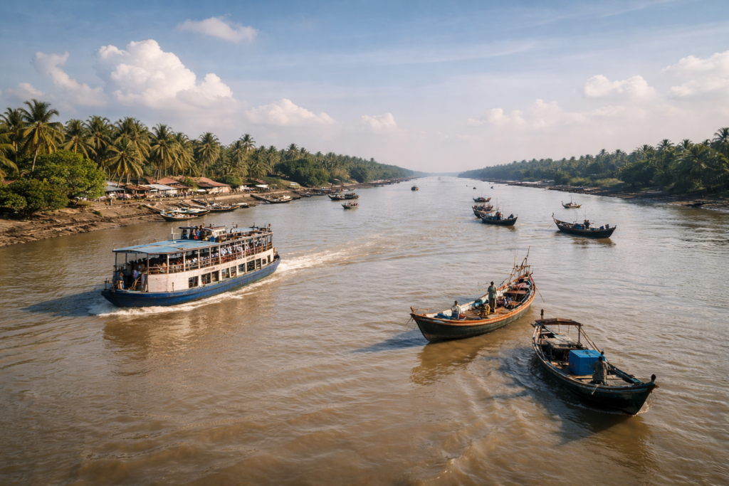
For generations, people planned journeys around ferry schedules and tidal conditions. The Muriganga carries influences from upstream Bengal while also feeling the pull of the sea. The Saptamukhi spreads outward through a network of tidal channels, connecting villages, mangrove edges, and fishing routes.
Their waters are neither fully fresh nor fully saline. The balance changes constantly. During monsoon months, freshwater pushes south. During dry seasons, saltwater advances inland. This invisible struggle affects agriculture, fisheries, drinking water, and even the vegetation growing beside village paths.
To understand Namkhana, one must stop thinking of rivers as boundaries.
Here, rivers are architects.
- They built the island.
- They continue redesigning it.
Historical Footprints in Mud and Tide
The history of Namkhana is difficult to separate from the broader history of the lower delta.
For much of recorded history, large portions of this region remained sparsely settled.
- Dense mangroves dominated.
- Wildlife outnumbered humans.
- Settlement expanded gradually through reclamation.
- Embankments were built.
- Forests were cleared.
- Agricultural plots appeared.
- Villages emerged.
The British colonial administration accelerated many of these transformations through land-revenue systems and reclamation schemes across the Sundarbans. Land that was once tidal wilderness became productive farmland through enormous human effort.
But every reclaimed acre carried risk.
- Cyclones.
- Floods.
- Salinity.
- River erosion.
These forces never disappeared. They merely retreated temporarily. Namkhana became part of a larger experiment repeated throughout the Sundarbans: Could humans permanently occupy land that nature repeatedly attempted to reclaim?
The answer remains unfinished.
Even today.
Tebhaga Memories & Political Landscapes
History here is not confined to colonial archives.
It survives in family stories. One historical chapter still remembered across South 24 Parganas is the Tebhaga Movement of the 1940s. Namkhana and neighboring regions became important centers of peasant mobilization during this period. Sharecroppers demanded a larger share of agricultural produce and challenged existing agrarian structures.
Older residents still speak of land struggles, agricultural rights, and changing village power structures. Though decades have passed, those movements helped shape social relationships that remain visible today.
The history of Namkhana is therefore not only environmental.
It is also agricultural.
Political.
Human.
A history written not only in documents but in harvested fields.
Historical Personalities & Transformations
Unlike some islands associated with famous rulers or religious figures, Namkhana’s history is shaped more by collective transformations than individual personalities.
- The builders of embankments.
- The boatmen who maintained communication routes.
- The farmers who reclaimed saline land.
- The teachers who established schools in isolated villages.
- The local organizers who helped communities recover after cyclones.
Their names may not appear in textbooks. Yet their influence remains visible everywhere.
- Every embankment carries human history.
- Every village school reflects decades of persistence.
- Every ferry route tells a story of people refusing isolation.
In many ways, Namkhana’s greatest historical figures are anonymous. Their legacy is the landscape itself.
Folklore Between River and Forest
- Ask fishermen about the river after dark.
- Ask honey collectors about mangrove creeks.
- Ask elderly villagers about storms.
Sooner or later, folklore enters the conversation. Like much of the Sundarbans, Namkhana exists within the cultural universe of Bonbibi and Dakshin Ray.
- These stories are not merely legends.
- They function as moral geography.
- They explain relationships between humans, forests, animals, and unseen forces.
Bonbibi appears as a protector.
Dakshin Ray often emerges as a figure associated with power, wilderness, and danger.
In villages closer to forest-influenced waterways, stories survive of mysterious lights over creeks, boats losing direction in fog, and inexplicable sounds carried across tidal channels. The details vary. The interpretations differ.
But the underlying theme remains constant: Nature here is never entirely predictable. And people have long relied on stories to make sense of uncertainty.
Life Between the Tides
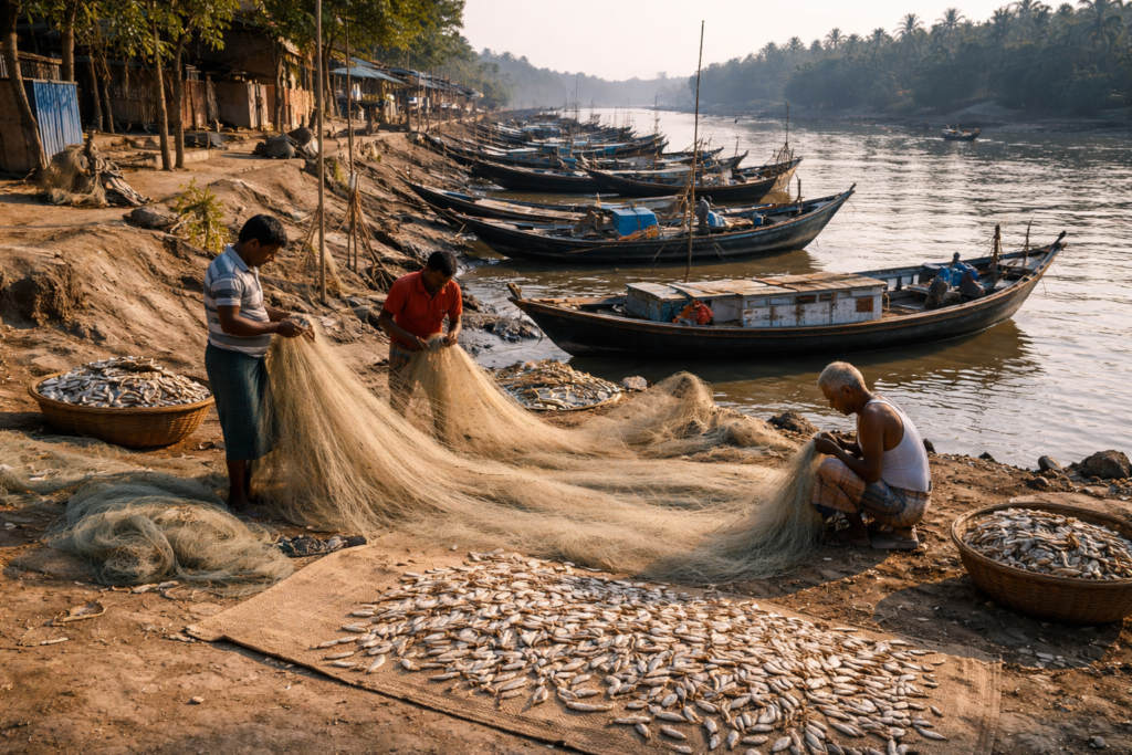
By mid-morning, Namkhana reveals its true rhythm. The tide chart becomes more important than the clock.
- Fishing boats leave according to the water levels.
- Farmers monitor salinity.
- Crab collectors watch channels.
- Market vendors calculate arrival times based on ferry movements.
- Life operates within tidal schedules.
Not despite them. But because of them.
In agricultural areas, paddy fields stretch behind embankments.
- Vegetable cultivation occupies carefully protected land.
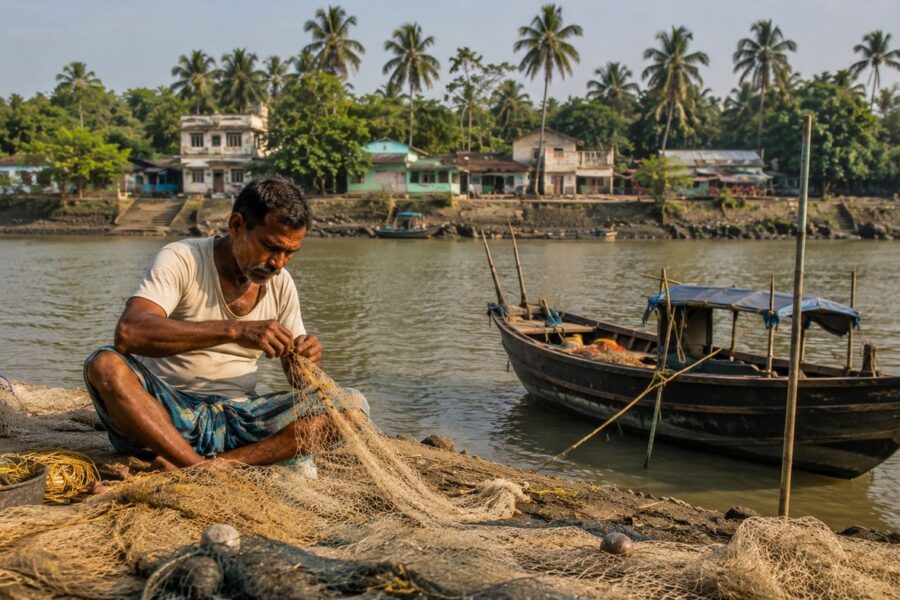
- In fishing communities, nets dry beside homes.
- Boats line the creek banks.
- Fish auctions begin before many towns elsewhere have fully awakened.
The relationship between land and water is never fixed.
Every occupation reflects that reality.
Walking Through the Villages
The villages of Namkhana do not announce themselves dramatically.
There are no monumental gateways. No obvious landmarks visible from afar. Instead, settlements emerge gradually.
- A cluster of houses behind mango trees.
- A tea stall beneath a banyan tree.
- A pond covered with lotus leaves.
- A temple bell ringing somewhere beyond sight.
- A call to prayer drifting across the fields.
The villages feel woven into the landscape rather than imposed upon it. Many homes are still organized around courtyards. The courtyard remains the true center of domestic life.
- Women clean fish beneath shaded verandas.
- Children complete homework on woven mats.
- Rice dries in the sun.
- Nets hang from bamboo poles.
Elderly residents sit beneath trees discussing politics, weather, and tides with equal seriousness. The architecture reflects decades of adaptation. Older mud houses still survive in places, though many have gradually been replaced by brick structures.
Cyclones have influenced building choices.
Repeated exposure to storms has taught lessons that become visible in construction styles. Walls stand thicker. Roofs are reinforced. Important belongings are often stored with future flooding in mind. Nothing here feels accidental.
Every design decision carries memory.
Schools at the Edge of the Delta
Around midday, the school grounds become unexpectedly lively.
- Uniformed students spill into courtyards.
- Bicycles crowd entrances.
- The noise of recitation gives way to laughter.
Education in the Sundarbans has always involved overcoming geography.
For generations, rivers, ferries, monsoon flooding, and long travel distances complicated access to schools. In Namkhana, educational institutions represent something larger than classrooms. They are symbols of continuity.
Parents who spend their mornings fishing tidal creeks or working agricultural fields often speak about education as a pathway beyond uncertainty.
Teachers become respected figures not because they possess authority but because they provide possibilities.
One notices how frequently schools occupy elevated ground.
Experience has taught the delta which places survive floods best.
Tea Stalls: The Island’s Information Network
Every village possesses a tea stall.
Some are little more than bamboo structures with corrugated roofs. Others have evolved into permanent gathering places. By noon, these stalls become unofficial information centers.
- Fishing reports.
- Weather forecasts.
- Political discussions.
- Market prices.
- Ferry schedules.
- Cyclone rumors.
Everything passes through the tea stall.
A visitor seeking to understand Namkhana quickly discovers that local knowledge travels faster than mobile networks.
A fisherman returning from a distant creek can inform an entire village about changing conditions before formal reports arrive.
The tea stall functions as a newsroom, a parliament, a weather station, and a social club simultaneously.
Sounds of the Island
Every landscape has a soundtrack.
Namkhana’s is written by water. Stand quietly beside a riverbank and the sounds begin to separate themselves.
- The slap of waves against boat hulls.
- The rattling of loose bamboo poles.
- The distant drone of fishing engines.
- Wind moving through coconut fronds.
- Bird calls from hidden wetlands.
- Children playing near ponds.
- Temple bells carried by the breeze.
- The call to prayer rises from village mosques.
Unlike urban environments, where sounds compete aggressively, island sounds arrive in layers. One sound fades. Another emerges. The landscape seems to breathe acoustically. At low tide, mudflats produce their own subtle noises.
- Tiny crabs are moving.
- Water drains through channels.
- Wading birds probing soft sediment.
By afternoon, market sounds dominate.
By evening, rivers reclaim the soundscape once more.
The Wildlife Expedition
Namkhana is often overshadowed by more famous wildlife zones deeper within the Sundarbans. Yet spending time here reveals remarkable biodiversity. One simply needs patience. The wildlife does not advertise itself.
It reveals itself slowly.
Like the island.
Birds of River and Field
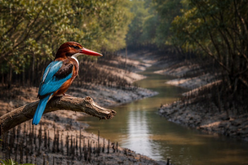
The first birds appear before sunrise.
- Black-crowned night herons returning from nocturnal hunting.
- Egrets standing motionless along creek edges.
- Pond herons vanish into vegetation through camouflage rather than flight.
As daylight strengthens, kingfishers begin their patrols.
- White-throated kingfishers dominate electric wires and bamboo poles.
- Their bright blue wings flash unexpectedly against green landscapes.
- Smaller kingfisher species often remain closer to creeks and ponds.
Brahminy kites circle overhead.
Their chestnut bodies and white heads have become one of the defining images of coastal Bengal.
Further from settlements, mudflats attract sandpipers, plovers, and migratory shorebirds depending on the season. Winter transforms parts of the Namkhana landscape into a temporary habitat for visitors arriving from distant regions of Asia.
The birds connect the island to ecological networks stretching far beyond Bengal.
Reptiles in the Heat
By early afternoon, reptiles become more visible.
Water monitors occasionally appear near creeks. Their prehistoric appearance often surprises first-time observers.
Snakes remain present but largely unseen. Most avoid human contact whenever possible.
The Sundarbans region supports a variety of snake species, though sightings depend heavily on season, habitat, and luck.
Near wetlands, turtles occasionally surface briefly before disappearing again. The riverbanks themselves often reveal tracks rather than animals.
A reminder that wildlife is frequently nearby even when invisible.
Mammals of the Delta
The larger mammals of the region remain elusive.
Jackals occasionally appear near agricultural edges.
Fishing cats inhabit suitable wetland habitats across parts of the Sundarbans landscape, though sightings are rare and often limited to those who spend extensive time near marshes and creeks.
Small Indian mongooses move quickly through vegetation. Fruit bats emerge after sunset. Their silhouettes become common features of evening skies. Many residents speak more often about signs than sightings.
- Tracks.
- Sounds.
- Evidence.
Wildlife frequently exists here at the edge of perception.
Dolphins in the Tidal Rivers
The rivers surrounding Namkhana occasionally host one of the delta’s most charismatic inhabitants.
Dolphins.
Both the endangered Gangetic dolphin and the Irrawaddy dolphin have been recorded in parts of the Sundarbans estuarine system. Sightings near Namkhana are never guaranteed. Yet boat operators often speak of sudden appearances.
A curved back.
A brief exhalation.
Then the disappearance.
The encounter lasts seconds.
The memory lasts for years.
And What About Tigers?
Namkhana itself is not known as a core tiger habitat in the way protected forest islands of the Sundarbans are.
The dense mangrove forests supporting resident tiger populations lie further within protected forest landscapes.
Yet tiger stories still circulate.
Every Sundarban island exists within the cultural gravity of the tiger. Its presence influences folklore, memory, and identity even where direct encounters are uncommon. In conversations, the tiger often appears not as an animal but as a symbol.
A reminder that wilderness still exists nearby.
Mangrove Chronicles
See it for yourself
A private journey shaped around you — your group, your pace, your interests. Book a free consultation.
To understand Namkhana, one must eventually leave the villages and approach the mangroves.
Not the famous postcard mangroves.
- The quieter fragments.
- The creekside stands.
- The tidal vegetation survives at the margins of human settlement.
From a distance, mangroves appear static.
Up close, they reveal constant activity.
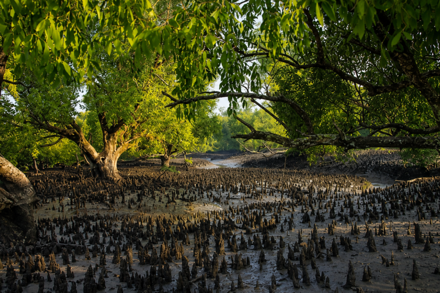
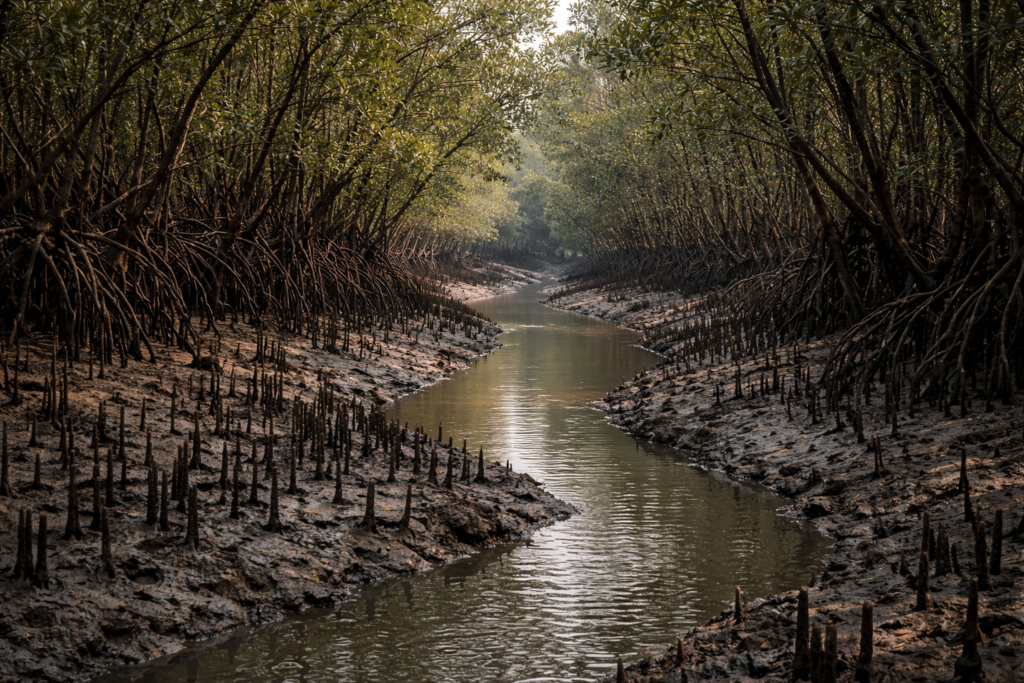
- Roots arch upward like breathing structures.
- Mud shifts around them.
- Crabs excavate tunnels.
- Fish move through submerged channels.
- Salt accumulates and disperses.
The forest never truly rests.
The Trees That Hold the Delta Together
Mangroves perform tasks impossible for most other forests.
- They survive salt.
- They tolerate flooding.
- They withstand tidal submersion.
Species found within the broader Namkhana region may include gewa, goran, keora, and other characteristic mangrove vegetation associated with the Sundarbans ecosystem.
- Each species occupies a slightly different ecological niche.
- Each responds differently to salinity and tidal conditions.
Together, they create one of Earth’s most specialized forest systems.
Human Relationships With Mangroves
The relationship between local communities and mangroves remains complex.
The forest protects villages from storm surges.
- It stabilizes shorelines.
- It supports fisheries.
- It nurtures biodiversity.
Yet people also depend upon its resources. Historically, timber, fuelwood, honey, fish, and other materials connected communities directly to mangrove ecosystems. Modern conservation efforts increasingly seek balance.
The challenge is immense.
The needs of people and the needs of ecosystems often overlap. Sometimes they conflict. The future of Namkhana may depend largely upon how successfully that balance is maintained.
Explorer’s Field Notes
05:11 AM
Departure from the jetty. Incoming tide. Thin fog over the river.
05:47 AM
First Brahminy kite visible above the eastern shoreline.
06:23 AM
Fishing boats are returning earlier than expected. Local fishermen discuss changing currents.
07:06 AM
Tea stalls begin serving morning customers.
08:14 AM
Schoolchildren are visible along embankment roads.
09:51 AM
Market activity intensifies. Fresh fish arrivals increase dramatically.
11:37 AM
White-throated kingfisher observed hunting beside an irrigation canal.
01:12 PM
Heat becomes oppressive. Human activity slows temporarily.
02:43 PM
The incoming tide begins filling secondary channels.
04:08 PM
A large flock of egrets gathers on an exposed mudflat.
05:19 PM
Evening prayers drift across the river simultaneously with temple bells.
06:02 PM
Fruit bats emerge.
06:31 PM
The river changes colour from silver to bronze.
Oral Histories Along the Embankment
In the late afternoon, conversations lengthen.
The heat softens. People become less hurried. This is often when memories emerge. An elderly resident points toward a distant embankment. “It was not there when I was young.”
Another recalls a cyclone decades earlier.
Someone remembers ferry crossings before the bridge. Someone else remembers when electricity first arrived. These stories rarely follow chronological order. They move through memory the same way rivers move through the delta.
- Bending.
- Returning.
- Changing direction.
The landscape becomes an archive.
- Every generation remembers a slightly different island.
- Every generation inherits a slightly different version of Namkhana.
- And perhaps that is the defining characteristic of delta life.
Nothing remains the same.
- Not the river.
- Not the shoreline.
- Not even memory.
Nightfall on the Island
Sunset arrives horizontally.
Unlike mountainous landscapes where darkness descends from above, darkness in the delta approaches from the horizon.
The sky becomes layered.
- Orange.
- Copper.
- Purple.
- Then grey.
The rivers mirror every change.
- The Hatania–Doania appears almost motionless.
- Fishing boats become silhouettes.
- A distant ferry crosses slowly beneath the evening sky.
For a few moments, the island feels suspended between worlds.
Day has not entirely departed. Night has not entirely arrived. This twilight period reveals one of Namkhana’s greatest qualities.
Its openness.
Nothing obstructs the horizon.
- The sky dominates everything.
- Cloud formations become events.
- Light becomes geography.
- Weather becomes architecture.
Evening Rituals
As darkness gathers, household routines begin.
Kerosene lamps have largely disappeared, replaced by electricity, yet many evening traditions remain unchanged.
- Families gather in courtyards.
- Fishing nets are repaired.
- Children complete school assignments.
- Tea stalls host their final conversations of the day.
- Temple bells ring.
- Mosques call the faithful to prayer.
Across different faiths and communities, evening carries a shared rhythm.
The day’s work ends.
The night watch begins.
The River After Dark
The river changes character completely after sunset.
Its visual presence diminishes. Its acoustic presence grows. One begins hearing rather than seeing.
- The distant engine of a fishing trawler.
- The splash of fish near the bank.
- The creaking of moored boats.
- The whisper of wind moving across water.
For fishermen preparing overnight journeys, darkness is not an obstacle. It is part of the working environment. Many know channels not through sight but through memory.
- Every bend.
- Every sandbar.
- Every dangerous current.
Generations of navigation have transformed rivers into inherited knowledge.
The Seasons of Namkhana
No island can be understood through a single day.
Namkhana changes dramatically throughout the year.
- The island seen in January is not the same island seen in August.
- The landscape transforms continuously.
- Water levels shift.
- Bird populations change.
- Agricultural cycles evolve.
- Human routines adapt.
Every season creates a different version of Namkhana.
Winter: The Season of Clarity
From November through February, the island experiences its gentlest period.
- The air becomes drier.
- Visibility improves.
- The sky often appears extraordinarily clear.
- Migratory birds begin arriving.
- Fishing activity remains high.
- Agricultural fields become productive.
Walking along embankments during winter mornings reveals a landscape filled with detail.
- Distant villages appear sharper.
- River channels become more visible.
- Even sounds seem to travel farther.
Many residents describe winter as the most comfortable season for work and travel. The climate becomes temporarily forgiving.
Spring: The Brief Transition
Spring in Namkhana arrives subtly.
- Flowering trees appear.
- Temperatures begin rising.
- The atmosphere becomes increasingly humid.
- Agricultural activities intensify.
- The landscape prepares for another cycle.
This season often passes quickly. It serves mainly as a bridge between winter comfort and summer intensity.
Summer: Heat and Waiting
Summer transforms the island.
- The air grows heavy.
- Humidity rises.
- Afternoons become exhausting.
- Metal surfaces become untouchable.
- Roads shimmer beneath the sun.
- The rivers appear slower, though their currents remain unchanged.
Life adjusts.
- Work begins earlier.
- Midday activity decreases.
- People seek shade whenever possible.
- Conversations increasingly focus on the weather.
Everyone watches the sky and waits for rain.
Monsoon: The Season of Water
When the monsoon arrives, Namkhana becomes a different world.
The distinction between river and sky often disappears.
- Rain falls in sheets.
- Creeks overflow.
- Ponds refill.
- Fields become saturated.
- Roads struggle.
Transportation becomes uncertain.
The rivers swell. Tidal influence combines with enormous freshwater input from upstream systems. Everything becomes wetter. Greener. More dynamic.
The monsoon is both a blessing and a challenge. Agriculture depends upon it. Infrastructure suffers because of it.
Life adapts accordingly.
Post-Monsoon: Renewal and Assessment
After the rains retreat, the island enters a period of evaluation.
- Fields recover.
- Embankments are inspected.
- Damages are repaired.
- Fishing patterns normalize.
- Communities assess what the monsoon has changed.
In the Sundarbans, every season leaves evidence behind. Post-monsoon is when people read those signs.
Cyclone Season: Living with Possibility
Unlike many places where disasters are rare interruptions, cyclones occupy a permanent place in local consciousness.
- Even during calm weather, people think about storms.
- Not constantly.
- But realistically.
The possibility never disappears. The Bay of Bengal remains one of the world’s most active cyclone-generating regions. And Namkhana sits directly in the path of that reality.
Cyclones and Survival
To walk through Namkhana without discussing cyclones would be to ignore one of the defining forces that shaped the island.
The history of the region can be read partly through storms. Not simply because of destruction. But because of adaptation.
The Memory of Aila
Even years later, people still speak about Cyclone Aila. The storm struck the Sundarbans in 2009 and became one of the defining environmental events of recent decades. Across southern Bengal, embankments failed.
- Saltwater entered agricultural lands.
- Homes disappeared.
- Livelihoods collapsed.
- Recovery took years.
Some impacts lasted much longer.
In Namkhana, conversations about Aila often sound less like disaster stories and more like historical markers.
- People remember where they were.
- What failed.
- What survived.
- How communities responded.
Aila became a reference point. A dividing line between before and after.
Amphan and a New Generation of Storms
Cyclone Amphan in 2020 reinforced difficult lessons.
- Infrastructure had improved.
- Warning systems were better.
- Preparedness was stronger.
Yet the scale of the storm demonstrated that vulnerability remains. The delta continues facing powerful environmental pressures.
- Sea-level rise.
- Increasing salinity.
- Changing weather patterns.
- Coastal erosion.
- Storm intensity.
These are no longer abstract concerns. They are lived realities.
Embankments: The Island’s Defensive Walls
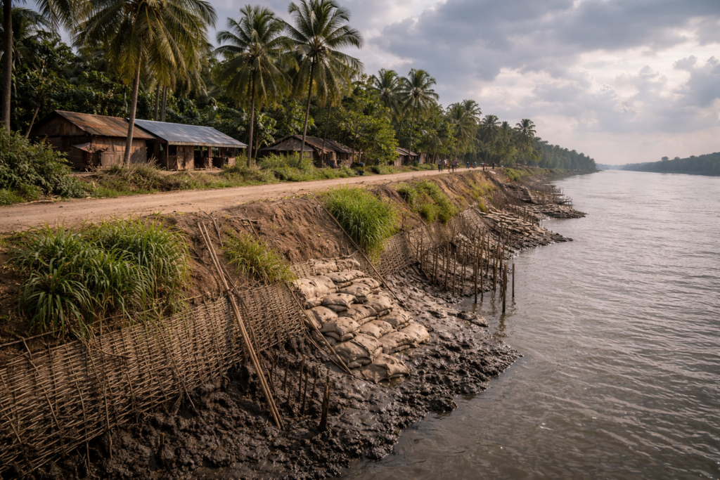
Every visitor eventually notices the embankments. Long earthen structures follow rivers and creeks.
At first glance, they seem ordinary. But locally, they are treated almost like critical infrastructure. Because they are. The embankments separate habitation from inundation.
- Fields from saltwater.
- Security from uncertainty.
- People monitor them constantly.
- Weak points are discussed.
- Repairs are organized.
Their condition influences community confidence. In many ways, embankments are the island’s most important architecture.
Resilience as Culture
What outsiders often call resilience is simply daily life here.
- People rebuild.
- Adapt.
- Repair.
- Adjust.
Storms are remembered. But they are not allowed to become the entire story. Perhaps that is Namkhana’s most remarkable characteristic. Its people acknowledge vulnerability without surrendering to it.
Ferry Routes and Hidden Paths
Despite bridges and roads, Namkhana remains fundamentally connected by water. Travel here still feels different from mainland Bengal. Movement follows both infrastructure and geography. The river retains authority.
The Traditional Ferry Landscape
Before the Hatania–Doania bridge transformed connectivity, ferries were essential.
- Crossing rivers was part of ordinary life.
- Markets depended upon them.
- Students depended upon them.
- Workers depended upon them.
Entire daily schedules revolved around crossings. Though the bridge altered transportation patterns, ferries remain important throughout the wider region. They continue linking islands, riverbanks, and settlements beyond the reach of roads.
Hidden Water Routes
Local fishermen often know routes invisible on conventional maps.
- Small creeks.
- Seasonal channels.
- Tidal shortcuts.
- Historic navigation paths.
Many are practical rather than scenic. Yet they reveal how deeply local knowledge remains connected to waterways. The delta contains layers of geography.
Some official.
Some inherited.
Food of the Island
By evening, food begins telling its own story. Namkhana’s cuisine reflects its environment.
- What grows here.
- What swims here.
- What survives here.
Food is geography made edible.
Fish as Daily Culture
Fish is not merely an ingredient. It is part of identity. Markets display astonishing variety depending on season and catch.
- Hilsa occasionally dominates conversations.
- Prawns remain economically significant.
- Numerous estuarine species appear in local cooking traditions.
- Recipes emphasize freshness.
The distance between the river and the kitchen is often remarkably short.
Rice and the Delta Table
Rice remains central.
Meals often combine rice with fish, vegetables, lentils, and seasonal ingredients. Agriculture and fisheries meet directly on the plate. The food reflects practicality rather than extravagance. Yet within that simplicity lies remarkable diversity.
Seasonal Foods
Monsoon brings particular ingredients.
- Winter introduces others.
- Festivals add ceremonial dishes.
- Families maintain recipes linked to memory and place.
Food becomes another form of oral history. One generation teaches the next.
The Island Economy
A day spent in Namkhana reveals an economy built upon multiple foundations. No single occupation dominates completely. People diversify because uncertainty demands flexibility.
Fisheries
Fishing remains among the most visible economic activities.
From small creek fisheries to larger marine operations, the river continues to support livelihoods.
- Fish auctions create daily economic rhythms.
- Boats create employment.
- Processing and transport generate additional income streams.
The river remains employer, provider, and partner.
Agriculture
Despite salinity challenges, agriculture remains essential.
- Paddy cultivation continues across suitable areas.
- Vegetables contribute to household income.
- Agricultural success depends heavily upon water management.
The balance between fresh and saline water influences outcomes significantly.
Migration and Remittances
Many households maintain connections beyond the island.
Young residents increasingly seek opportunities in Kolkata and other cities. Some travel further. Income earned elsewhere often supports families remaining on the island. Migration has become part of the modern delta economy.
Emerging Tourism
Namkhana’s role as a gateway to nearby coastal destinations and sections of the Sundarbans has introduced tourism-related activity.
Yet compared with more prominent destinations, tourism remains only one thread within a much broader economic fabric.
Fishing, agriculture, transportation, trade, and migration continue to exert greater influence over daily life.
Then and Now
Ask older residents to describe Namkhana fifty years ago.
The answers vary. Yet certain themes repeat.
- The rivers were different.
- The embankments were different.
- Transportation was different.
- Communication was different.
The island itself felt farther away from the world.
- Today, mobile phones connect villages instantly.
- Roads have improved.
- The bridge changed movement patterns.
- Schools expanded.
- Healthcare access improved.
Yet environmental challenges have intensified.
- Climate uncertainty has grown.
- Salinity pressures remain.
- Cyclones continue arriving.
The story of modern Namkhana is therefore not a simple story of progress. It is a story of simultaneous gains and challenges. Development and vulnerability advance together. Tradition and change exist side by side.
And through it all, the rivers continue flowing exactly as they always have.
Connected Landscapes
Standing atop an embankment near sunset, one realizes that Namkhana is less an isolated island and more a crossroads.
To the south lies the pull of the Bay of Bengal.
To the east and southeast stretch the tidal landscapes associated with the greater Sundarban ecosystem.
To the west sits the culturally significant island of Sagar Island, connected through waterways, ferry movements, pilgrim routes, and centuries of maritime interaction.
Further inland lie settlements that maintain economic ties with Kolkata while remaining rooted in delta realities.
- The rivers create ecological corridors.
- Fish move through them.
- Birds migrate along them.
- Sediments travel through them.
- Human stories flow through them.
A fisherman from Namkhana may know waterways extending toward Fraserganj better than roads leading north.
A trader may cross multiple channels before reaching a market.
A migratory bird arriving from Central Asia may treat Namkhana merely as one stop within a journey spanning continents.
The island is connected to everything around it and everything around it influences the island.
Photography Expedition Guide
Namkhana rewards patience more than equipment. The best photographs emerge from observation rather than pursuit. The landscape rarely performs on command. It reveals itself gradually.
Dawn Photography
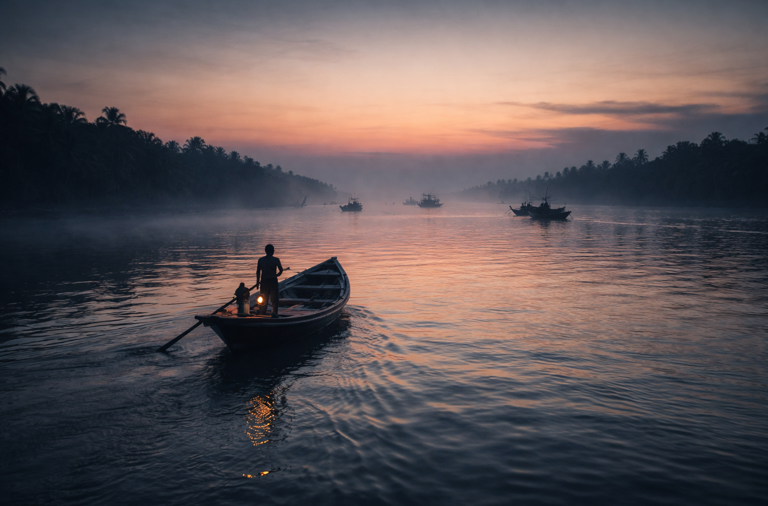
- The finest light often arrives before sunrise.
- The river becomes a reflective surface.
- Fishing boats appear as silhouettes.
- Mist occasionally hangs above tidal channels.
- Bird activity increases dramatically.
Photographers seeking atmosphere should arrive before first light rather than after sunrise. The transition itself is often the most powerful moment.
Embankment Landscapes
The embankments provide natural observation points.
From here, one can photograph:
- River geometry
- Fishing activity
- Village life
- Agricultural fields
- Seasonal weather patterns
- Monsoon skies
- Cyclone clouds
The elevated perspective reveals how closely human settlements and water coexist.
Wildlife Photography
Patience is essential.
- Kingfishers often provide opportunities.
- Brahminy kites regularly patrol rivers.
- Egrets gather near wetlands.
- Winter migration periods increase diversity.
The best wildlife photographs frequently emerge during quiet observation near creeks and mudflats.
Cultural Photography
Namkhana’s most compelling images are often human.
- Boat repair.
- Net weaving.
- Fish markets.
- School journeys.
- Tea stall conversations.
- Religious gatherings.
- Agricultural labor.
The island’s character lives within these moments. Always photograph respectfully and seek permission when appropriate.
Monsoon Photography
The monsoon transforms everything.
- Dark skies.
- Reflective roads.
- Flooded fields.
- Towering clouds.
The landscape becomes more dramatic and unpredictable. Some of the most striking images of Namkhana are created during weather transitions.
Expedition Notes
Every island possesses details that rarely appear in official descriptions. Namkhana is no exception.
Observation 1
Many visitors focus on rivers. Few notice the ponds.
Yet village ponds often reveal remarkable biodiversity and act as critical freshwater resources. They are among the most important landscapes on the island.
Observation 2
The smell of Namkhana changes throughout the day.
- Morning smells of fish markets and river mud.
- Afternoon smells of heated earth and vegetation.
- Evening smells of cooking fires and tidal air.
Observation 3
Conversations about the weather occur constantly. Not because people enjoy discussing weather. But because weather directly influences livelihoods.
Observation 4
The island appears flat. Yet local residents can identify subtle elevation differences invisible to outsiders. These differences often determine flooding patterns.
Observation 5
- The most experienced navigators rarely look at maps.
- They read currents, tides, winds, landmarks, and water color.
- The river itself becomes the chart.
The Wild Orbit Quick Facts
| Category | Information |
| Location | Southern South 24 Parganas District, West Bengal |
| Administrative Unit | Namkhana Community Development Block |
| Subdivision | Kakdwip |
| Approximate Coordinates | 21.84° N, 88.23° E |
| Area | Approximately 370 sq km (block area) |
| Population | Over 180,000 (2011 Census) |
| Major Rivers | Hatania–Doania, Muriganga, Saptamukhi system |
| Nearest Major City | Kolkata |
| Gateway Function | Access point toward the coastal Sundarbans and the Bay of Bengal |
| Key Livelihoods | Fishing, agriculture, trade, transport |
| Ecosystem Type | Deltaic coastal landscape |
| Wildlife Highlights | Kingfishers, Brahminy kites, migratory birds, and estuarine biodiversity |
| Cyclone Exposure | High |
| Best Exploration Season | November–February |
The Wild Orbit Expedition Snapshot
Accessibility
8/10
Rail and road connectivity have improved significantly, especially after the Hatania–Doania Bridge.
Wildlife Potential
7/10
Not a core tiger landscape, but excellent for birds, estuarine ecology, and delta biodiversity.
Photography Potential
9/10
Exceptional skies, river landscapes, fishing culture, and seasonal weather.
Cultural Richness
9/10
Deeply connected to river life, fisheries, agriculture, folklore, and coastal adaptation.
Historical Interest
8/10
Land reclamation history, Tebhaga memories, transport evolution, and cyclone narratives.
Solitude Level
6/10
Namkhana is active and inhabited rather than remote, yet quiet corners remain abundant.
FAQs
1. Is Namkhana part of the Sundarbans?
Yes. It forms part of the broader Sundarban delta landscape.
2. Which district is Namkhana in?
South 24 Parganas, West Bengal.
3. What river is most associated with Namkhana?
The Hatania–Doania River.
4. Is Namkhana an island?
It functions as part of an island-rich deltaic landscape interconnected by rivers and tidal channels.
5. Does Namkhana have mangroves?
Yes, mangrove vegetation occurs in parts of the surrounding ecosystem.
6. Is the tiger habitat located within the Namkhana settlements?
No. Core tiger habitats occur deeper within protected forest regions.
7. What is the main occupation?
Fishing and agriculture remain major livelihoods.
8. Are ferries still important?
Yes, despite improved road infrastructure.
9. What makes Namkhana unique?
Its role as a river gateway between inhabited delta islands and the sea.
10. Is it cyclone-prone?
Very much so.
11. What language is spoken?
Primarily Bengali.
12. Does the island have markets?
Yes, several active local markets serve surrounding villages.
13. Is fishing economically important?
Extremely important.
14. Are migratory birds seen here?
Yes, particularly during winter.
15. What is the landscape like?
Low-lying, riverine, agricultural, and coastal.
16. Does salinity affect agriculture?
Yes, significantly.
17. Are there embankments?
Extensive embankment networks protect settlements.
18. What is the nearest rail connection?
Namkhana Railway Station.
19. Is the Bay of Bengal nearby?
Yes, the sea strongly influences the landscape.
20. Are there traditional fishing communities?
Yes, many villages maintain deep fishing traditions.
21. How important are tides?
Tides influence nearly every aspect of life.
22. Are there wetlands?
Yes, numerous wetlands and ponds occur throughout the area.
23. Is climate change a concern?
Very much so.
24. Can one observe delta ecology here?
Exceptionally well.
25. Why is Namkhana important?
Because it reveals how people live at the dynamic edge of river and sea.
How to Reach Namkhana
Reaching Namkhana is straightforward from Kolkata and serves as the primary gateway to the western Sundarbans. The town is well connected by both rail and road, making it one of the most accessible entry points for travelers heading toward destinations such as Bakkhali, Henry’s Island, Sagar Island, Fraserganj, Jambudwip, and the surrounding estuarine landscape.
By Train:
Regular local trains operated by Eastern Railway run from Sealdah Station (South Section) to Namkhana Railway Station via Baruipur and Kakdwip. The journey typically takes 3 to 3.5 hours, offering a gradual transition from the urban landscape of Kolkata to the rural plains and tidal environment of South 24 Parganas.
By Road:
Namkhana is approximately 105–115 km from central Kolkata, depending on the starting point. Travelers can drive via NH-12 (formerly NH-117) through Baruipur, Joynagar, Kakdwip, and onward to Namkhana. The drive generally takes 3 to 4 hours, although travel times may increase during weekends, holidays, or the monsoon season.
A major improvement in regional connectivity came with the opening of the Hatania–Doania Bridge, which replaced the former ferry crossing over the Hatania Doania River. The bridge now provides uninterrupted road access to Namkhana and onward to Bakkhali, making travel considerably faster and more reliable throughout the year.
By Bus:
Government and private buses operate regularly from Kolkata, including services from Esplanade (Dharmatala) and nearby transport hubs. These buses connect directly to Namkhana and continue toward Bakkhali, offering an economical option for travelers.
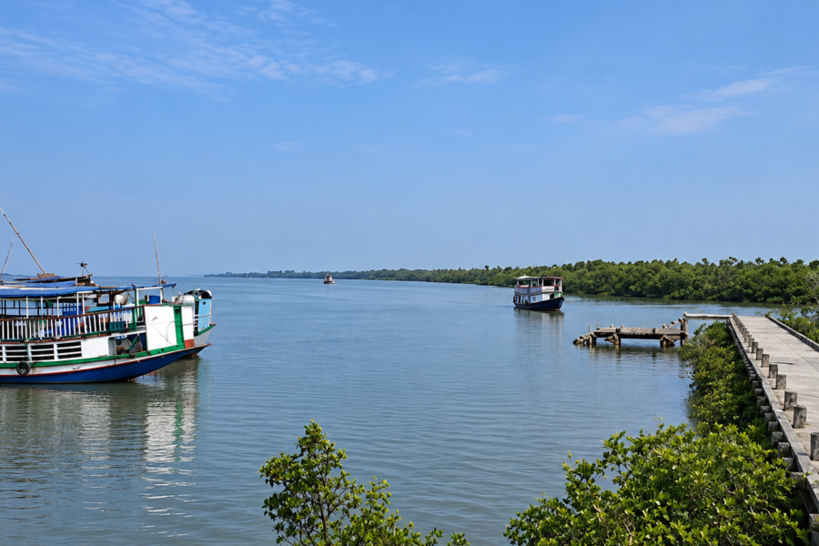
Although Namkhana itself is accessible entirely by road and rail, boat transport remains essential for reaching many nearby islands, fishing villages, and forested sections of the Sundarbans. From local jetties, mechanized boats and ferries connect communities across the tidal rivers, reflecting the delta’s enduring dependence on waterways.
Travelers visiting during the monsoon season (June to September) should allow extra travel time, as heavy rainfall, high tides, and occasional waterlogging can affect road conditions and boat schedules. Winter (November to February) generally offers the most comfortable weather for exploring the region.
Things to See Around Namkhana
Namkhana rewards exploration beyond its immediate settlements. The surrounding landscape unfolds through rivers and tidal roads rather than conventional attractions.
Fraserganj
A coastal settlement where the river and the sea begin merging.
Fishing activity dominates the landscape.
The atmosphere feels distinctly maritime.
Bakkhali
One of Bengal’s best-known coastal stretches.
Yet viewed through an explorer’s lens, it is less a beach and more a meeting place between human settlement, dunes, coastal vegetation, and tidal influence.
Henry’s Island
A fascinating coastal ecosystem combining wetlands, mangroves, mudflats, and bird habitat.
Particularly rewarding for naturalists and photographers.
Mousuni Island
Mousuni Island offers a different expression of delta life, shaped by coastal exposure and changing shorelines.
Sagar Island
Sagar Island provides historical, religious, and ecological perspectives that complement the understanding of Namkhana.
Estuarine Riverbanks
Often, the most rewarding destinations are not famous places at all.
- A quiet embankment.
- A fishing jetty.
- A mangrove-lined creek.
- A village market.
The delta reveals itself through small moments.
Continue the Journey
Namkhana is not an endpoint. It is an introduction. From here, an explorer begins noticing patterns repeated across the Sundarbans.
- The relationship between rivers and settlements.
- The role of embankments.
- The persistence of folklore.
- The influence of tides.
- The fragility of landscapes.
- The resilience of communities.
Beyond Namkhana lie islands such as Gosaba, Basanti, Kultali, Patharpratima, Mousuni, and Sagar. Beyond those islands lie forests. Beyond the forests lies the Bay of Bengal.
And beyond the sea lies another horizon. The journey never truly ends.
Leaving Namkhana
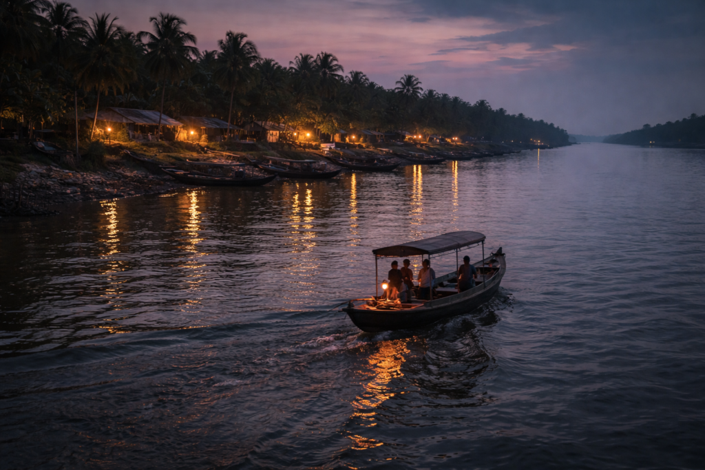
The last ferry departs beneath a fading sky.
- The river is calm now.
- Not silent.
- Never silent.
- But calm.
The engine starts.
- The shoreline begins drifting backward.
- Fishing boats become silhouettes.
- Palm trees dissolve into shadow.
- Lights appear one by one across the embankments.
- A temple bell rings somewhere beyond sight.
- A dog barks near the jetty.
The tide continues its ancient work beneath the boat. Slowly, Namkhana recedes. Not dramatically. Not all at once.
The island withdraws the way it first appeared—gradually, patiently, through layers of river and distance. Soon, only scattered lights remain. Then even those begin to disappear.
Yet something stays.
Perhaps it is the memory of tides dictating daily life. Perhaps it is the sight of fishermen reading currents like language. Perhaps it is the realization that islands such as Namkhana are never fixed pieces of land, but ongoing negotiations between water, weather, history, and human determination.
- The boat continues north.
- Darkness deepens.
- The river widens.
And somewhere behind, hidden beyond the night and tide, Namkhana remains exactly what it has always been:
A living frontier at the edge of the delta, where every day begins with water, and every story eventually returns to the river.
Plan your private Sundarban expedition
A private journey shaped around you — your group, your pace, your interests. Book a free consultation.