 Encyclopedia
Netidhopani
Home to the historic Netidhopani Temple ruins
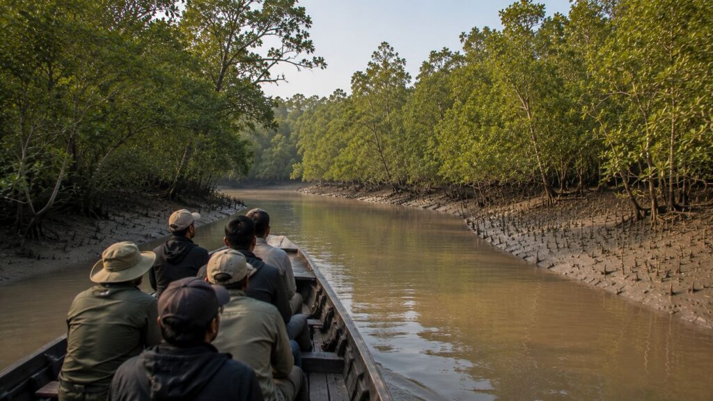
As the tide begins to recede, broad mudflats emerge from the brown estuarine waters and thousands of breathing roots rise silently from the sediment. The mangrove canopy appears motionless from a distance, yet the landscape is constantly changing. Every incoming tide redraws creek channels, transports nutrient-rich silt, and reshapes the fragile boundary between land and water. Hidden within this dynamic wilderness lies Netidhopani Island, one of the most historically intriguing and ecologically significant forest islands of the Indian Sundarbans.
Unlike the inhabited islands protected behind embankments, Netidhopani belongs almost entirely to the protected mangrove wilderness of the Sundarbans Tiger Reserve. It represents a remarkable intersection of natural and cultural history. Dense mangrove forests provide habitat for the Royal Bengal Tiger (Panthera tigris tigris), Estuarine Crocodile (Crocodylus porosus), Fishing Cat (Prionailurus viverrinus), Spotted Deer (Axis axis), numerous bird species, mud-dwelling invertebrates, and countless fish that depend upon the tidal estuary. At the same time, the island preserves one of the Sundarbans' most enigmatic archaeological sites—the centuries-old ruins commonly known as the Netidhopani Temple.
- For ecologists, Netidhopani demonstrates how mangrove ecosystems function within one of the world's largest deltaic landscapes.
- For historians, it offers rare evidence that people occupied or used parts of today's protected forest long before the modern reserve was established.
- For conservationists, the island illustrates the delicate balance between safeguarding biodiversity, preserving cultural heritage, and managing carefully regulated ecotourism.
Understanding Netidhopani therefore requires more than simply locating it on a map. Its significance emerges only when its geography, tidal processes, ecological relationships, historical remains, and conservation role are viewed together as parts of a single living landscape.
CTA: Explore Netidhopani with The Wild Orbit
Netidhopani Island at a Glance
Location: Eastern sector of the Indian Sundarbans, South 24 Parganas, West Bengal
Administrative Status: Protected forest within the Sundarbans Tiger Reserve
Protected Area: Sundarban National Park core landscape
UNESCO Status: Part of the Sundarban National Park, a UNESCO World Heritage Site
Ecosystem: Tidal mangrove forest
Habitat Type: Intertidal estuarine island
Known For: Ancient temple ruins, tiger habitat, mangrove ecosystem and watchtower
Dominant Vegetation: Mixed mangrove forests including Sundari, Gewa, Goran and Avicennia species
Major Wildlife: Royal Bengal Tiger, Fishing Cat, Saltwater Crocodile, Spotted Deer, Wild Boar and numerous bird species
Human Settlement: None within the protected island
Visitor Access: Regulated boat-based access through designated tourism routes with Forest Department permission.
Geographic Setting
Netidhopani Island occupies a strategically important position within the eastern portion of the Indian Sundarbans, where tidal rivers, mangrove forests, and protected wildlife habitats merge into an uninterrupted natural landscape. The island lies inside one of the most strictly protected sections of the Sundarbans Tiger Reserve and forms part of the vast network of forest islands that collectively support the largest continuous mangrove ecosystem on Earth.
The island belongs to the active lower delta of the Ganges-Brahmaputra-Meghna river system. Unlike continental landscapes that remain relatively stable over centuries, deltaic islands continually evolve under the influence of tides, sediment deposition, erosion, and sea-level fluctuations. Netidhopani itself is therefore not a static landmass but part of an ever-changing estuarine environment shaped by powerful natural processes.
Its location within the protected forest gives it exceptional ecological value. Unlike inhabited islands where agriculture, roads, and settlements alter natural habitats, Netidhopani retains much of its original mangrove vegetation. The absence of permanent human habitation allows ecological processes such as tidal inundation, nutrient cycling, mangrove regeneration, and wildlife movement to continue with relatively little direct disturbance.
From a landscape perspective, Netidhopani also serves as an important ecological link between surrounding forest blocks and tidal waterways. Tigers, deer, crocodiles, reptiles, birds, and aquatic organisms do not recognise administrative boundaries. Instead, they move through an interconnected mosaic of creeks, mudflats, mangrove stands, and estuarine channels that collectively sustain biodiversity across the wider Sundarbans.
How to Reach Netidhopani
Netidhopani is situated within the protected core area of the Sundarban Tiger Reserve in West Bengal. Unlike many tourist destinations, it cannot be reached directly by road or by independent boat. Access is regulated by the West Bengal Forest Department and is available only through authorised vessels operating within the reserve.
From Kolkata to the Sundarbans
Most visitors begin their journey in Kolkata, travelling approximately 100–110 kilometres by road to Godkhali Jetty, the principal gateway to the Indian Sundarbans. Travellers may also reach Canning Railway Station from Kolkata and continue by road to Godkhali before boarding an authorised boat.
Boat Journey
From Godkhali, visitors continue by Forest Department-approved safari boat through the tidal rivers and mangrove waterways of the Sundarbans. Netidhopani is visited as part of authorised boat itineraries, and the exact navigation route depends on tidal conditions, weather, and daily operational permissions issued for the protected area.
Important Information
- Independent entry to Netidhopani is not permitted.
- Access is available only through authorised boats operating within the Sundarban Tiger Reserve.
- Navigation schedules depend on tides, weather, and Forest Department regulations.
- Visitors should follow all instructions issued by forest authorities during their journey.
Rivers Flowing Beside Netidhopani Island
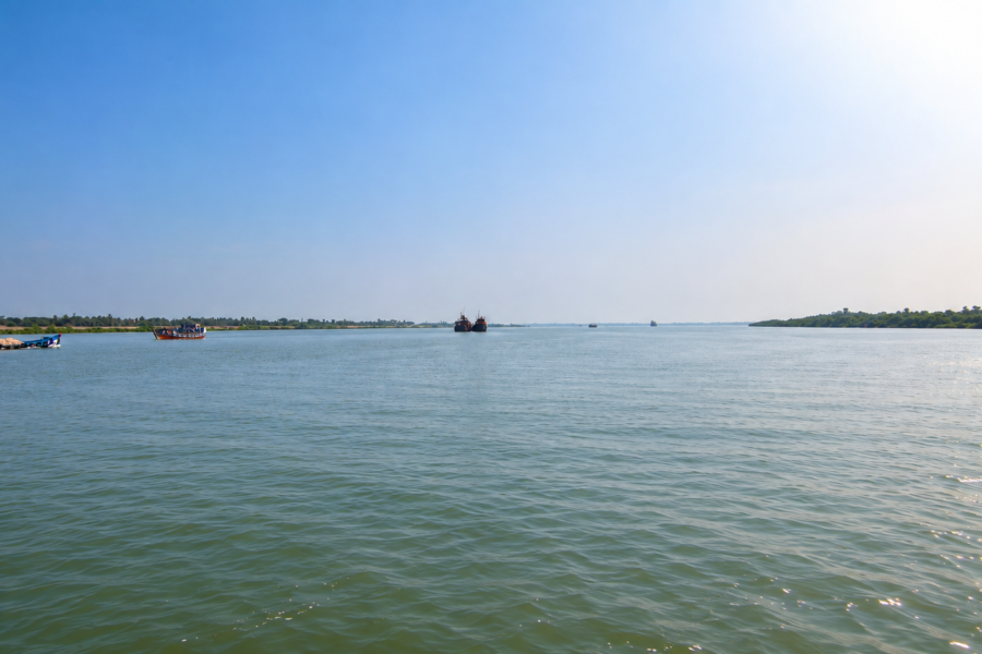
The island is surrounded by an intricate network of tidal rivers and creeks that regulate virtually every ecological process occurring within its forests.
Major surrounding waterways include:
- Gomor River
- Bidya River
- Netidhopani Creek and associated tidal channels
- Numerous unnamed tidal creeks connecting neighbouring forest compartments
These waterways are not merely geographical boundaries. They transport sediments from upstream river systems, carry saline water inland during high tide, flush nutrients across the mangrove forest floor, and provide migration corridors for fish, crustaceans, reptiles, and aquatic mammals.
Nearby Forest Blocks
Netidhopani forms part of a larger protected forest landscape that includes several important forest compartments within the Sundarbans Tiger Reserve.
Nearby protected forest areas include:
- Pirkhali Forest
- Chora Gazi Forest
- Haliday Island sector
- Dobanki forest landscape
- Matla–Bidya mangrove complexes
Together these forests create continuous habitat for wide-ranging wildlife, particularly the Royal Bengal Tiger, whose territories often span multiple forest blocks connected by tidal channels.
Nearby Inhabited Islands & Human Settlements
Although Netidhopani itself remains uninhabited, several populated islands occur around the protected forest landscape and serve as important gateways for forest administration, research, and regulated tourism.
Nearby inhabited areas include:
- Gosaba
- Dayapur
- Bali Island
- Satjelia
- Jamespur
- Pakhiralay
These settlements represent the interface between people and the protected mangrove wilderness. They support livelihoods based on fishing, agriculture, honey collection, tourism, and forest-dependent occupations while also facing ongoing challenges from cyclones, erosion, saline intrusion, and human–wildlife interactions.
Landscape Character
Approaching Netidhopani by boat offers one of the clearest demonstrations of how the Sundarbans differs from almost every other forest in India. There are no mountains on the horizon, no permanent freshwater streams cutting through valleys, and no clearly defined forest edge. Instead, land and water merge into one another through a constantly shifting network of creeks, mudbanks, tidal flats, and mangrove vegetation.
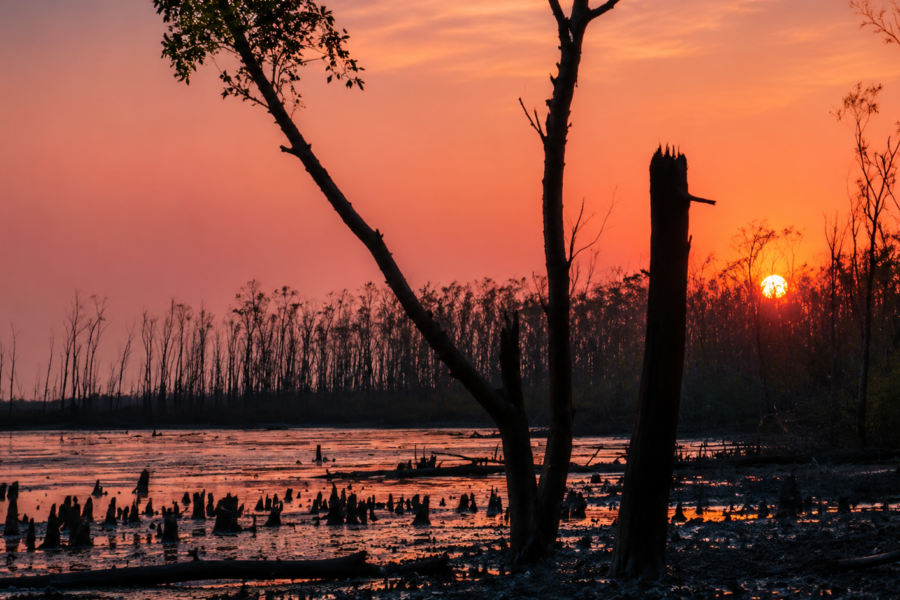
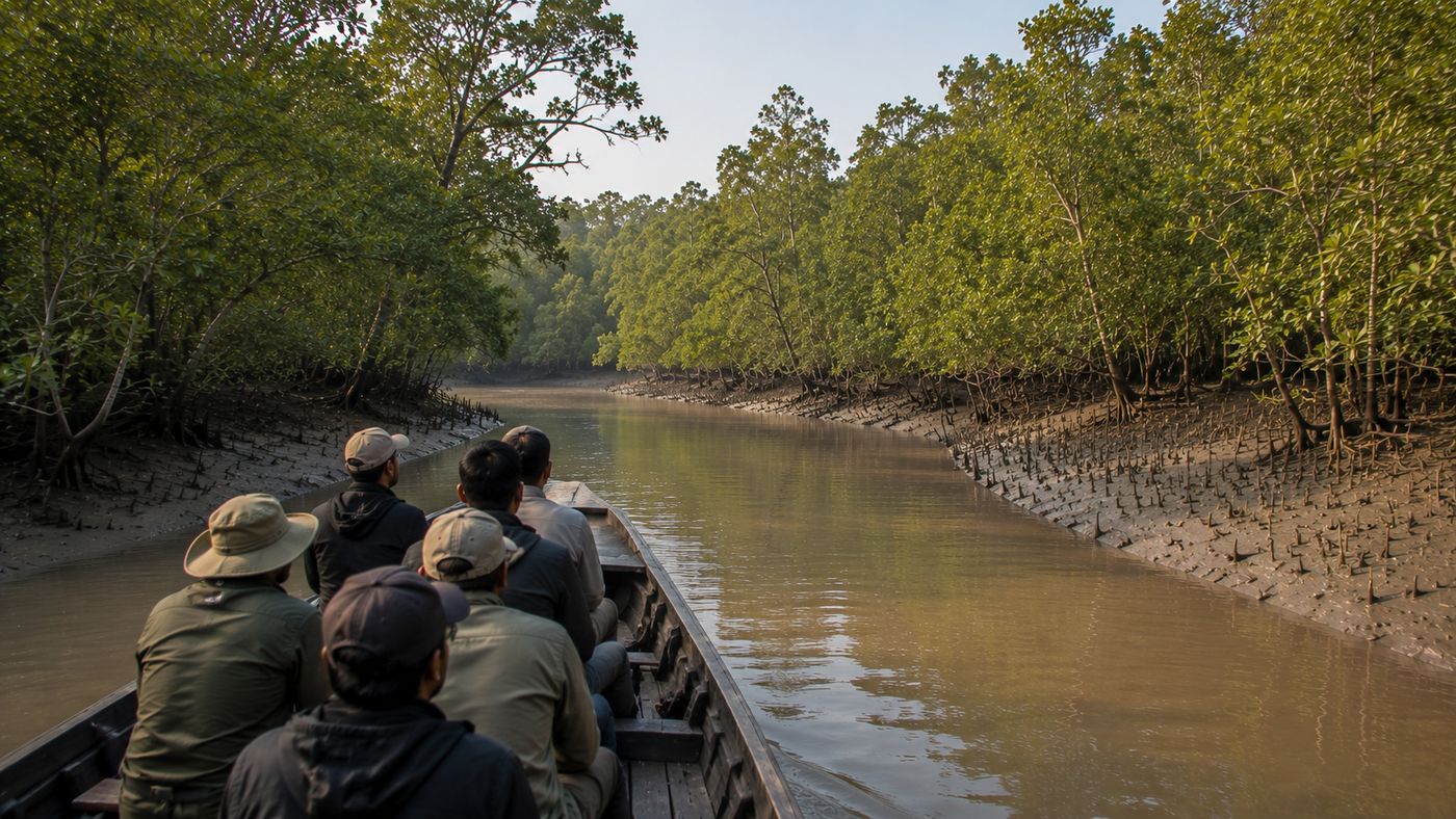
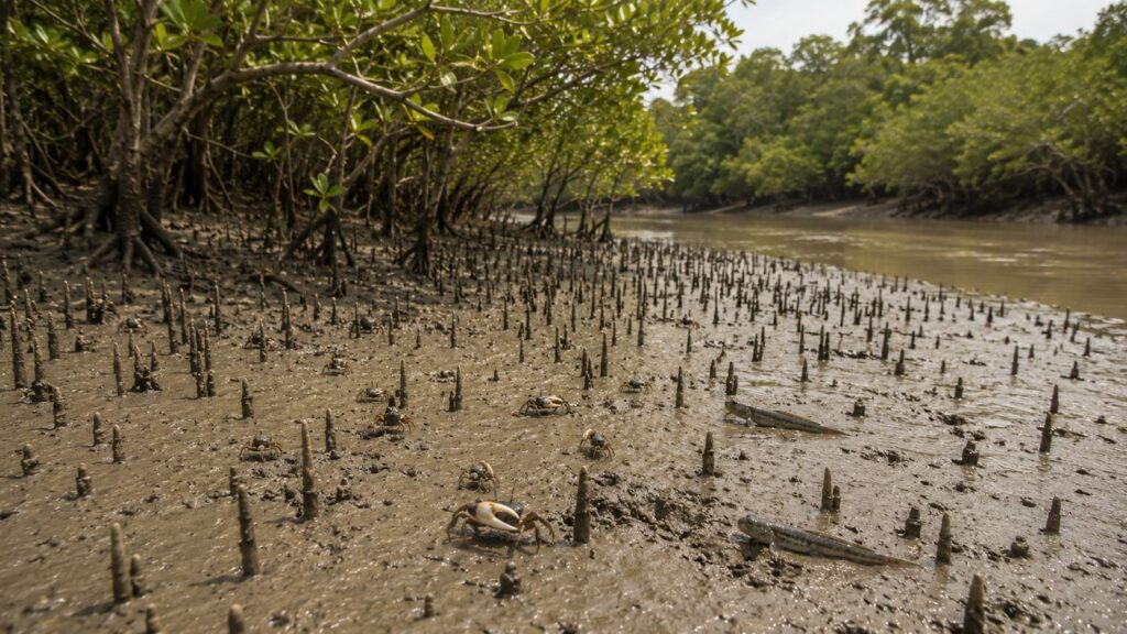
The first impression is often one of remarkable stillness. Dense walls of mangroves line the riverbanks, their lower trunks hidden beneath the tidal water. During low tide, however, the scene changes dramatically. Wide expanses of exposed mud appear, revealing thousands of pencil-like pneumatophores—the specialised aerial roots that allow mangrove trees to breathe in oxygen-poor sediments. Fiddler crabs emerge from their burrows, mudskippers move across the wet surface, and the intricate texture of the intertidal landscape becomes visible.
The forest itself is structured by subtle differences in elevation. Slightly higher ground supports taller mangrove trees, while lower areas experience more frequent tidal flooding and are dominated by salt-tolerant species adapted to prolonged inundation. This fine-scale variation creates a mosaic of microhabitats that support diverse plant and animal communities.
Light behaves differently here than in many terrestrial forests. Sunlight reflects from both water and mud, producing constantly changing patterns beneath the canopy.
- During the monsoon, clouds soften the landscape into muted shades of green and brown.
- In winter, clearer skies and lower humidity reveal sharper contrasts between the dark mangrove foliage and the silty rivers.
The sounds of Netidhopani are equally distinctive. Rather than the continuous chorus typical of inland forests, the dominant rhythm comes from tidal water moving through creeks, the calls of kingfishers and herons, the clicking of crabs across exposed mud, and the occasional alarm call of a Spotted Deer echoing through the mangroves. These sounds offer subtle clues to ecological activity that may otherwise remain hidden from view.
Because visibility within mangrove forests is naturally limited, much of the island's wildlife remains unseen. Tigers can move silently through dense vegetation, crocodiles may rest almost completely submerged along muddy banks, and Fishing Cats often hunt under the cover of darkness.
Consequently, the landscape rewards patience rather than expectation. Its ecological richness becomes apparent not through dramatic spectacles but through careful observation of countless small interactions between water, sediment, vegetation, and wildlife.
This dynamic character also explains why Netidhopani is more than an isolated island. It functions as one component of a much larger living delta, where each tidal cycle reinforces the ecological processes that sustain the entire Sundarbans. The island's appearance may change from hour to hour as tides rise and fall, yet the underlying relationship between mangroves, rivers, wildlife, and sediment remains the defining feature of this extraordinary landscape.
Rivers and the Tidal System
Unlike rivers in upland landscapes that flow primarily in one direction, the waterways surrounding Netidhopani are governed by the rhythm of the tides. Approximately every six hours, seawater advances inland before reversing direction as the tide ebbs. This twice-daily exchange influences nearly every aspect of the island's ecology.
Incoming tides transport suspended sediments, organic matter, plankton, and nutrients into the mangrove forest. As tidal waters spread across the forest floor, they nourish microorganisms, enrich the soil, and create productive nursery habitats for juvenile fish, prawns, and crabs. When the water recedes, it carries organic material back into the estuary, linking terrestrial and aquatic food webs.
The tidal regime also regulates salinity, one of the most important ecological drivers in the Sundarbans. Seasonal rainfall, upstream freshwater discharge, and marine influence combine to produce varying salinity levels across different parts of the delta. Mangrove species occupying Netidhopani have evolved remarkable adaptations—including salt filtration, salt excretion, and specialised root systems—that allow them to survive in these challenging conditions.
For larger wildlife, the rivers surrounding Netidhopani serve both as barriers and as corridors. Tigers are accomplished swimmers and frequently cross tidal channels while moving between forest islands. Saltwater Crocodiles patrol river margins, while numerous fish species migrate through these estuarine waters during different stages of their life cycles.
The island therefore cannot be understood independently of its rivers. They are not simply features surrounding the landscape—they are the forces that created it, continue to shape it, and sustain the remarkable diversity of life found within the mangrove wilderness.
Mangrove Ecosystem
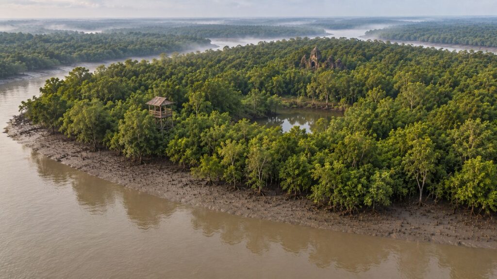
Standing on the watchtower at Netidhopani during a rising tide, the transformation begins almost imperceptibly. Brown estuarine water slowly advances across the mudflats, filling shallow depressions before creeping into the mangrove forest. Within a few hours, land that seemed expansive is partially submerged, while fish, crabs, prawns, and countless microscopic organisms move with the incoming tide. When the water retreats, it leaves behind nutrient-rich sediments that sustain one of the world's most productive coastal ecosystems.
This constant exchange between land and sea defines the mangrove ecosystem of Netidhopani. Unlike terrestrial forests that depend primarily on rainfall and groundwater, mangrove forests exist within an intertidal environment where the daily rhythm of tides governs soil chemistry, salinity, nutrient availability, and species distribution. Every plant and animal inhabiting this landscape has evolved to survive conditions that would be hostile to most other forms of life.
Netidhopani forms part of the Indian Sundarbans, the western section of the Ganges–Brahmaputra–Meghna Delta, the world's largest contiguous mangrove ecosystem.
The island's forests contribute to a vast ecological network that extends across thousands of square kilometres, supporting biodiversity while protecting the coastline from cyclones, tidal surges, and erosion.
Unlike tropical rainforests, where towering trees dominate the landscape, mangrove forests derive their ecological strength from adaptation rather than size. Trees withstand fluctuating salinity, oxygen-poor soils, tidal flooding, and unstable sediments through specialised root systems, salt-management mechanisms, and unique reproductive strategies. Together, these adaptations allow the forest to flourish where few other plant communities can survive.
The Foundation of the Forest
Mangroves are often described as "coastal forests," but they function more accurately as living interfaces between terrestrial and marine ecosystems. Their ecological importance extends far beyond the trees themselves.
The tangled roots stabilise riverbanks, reducing erosion caused by tidal currents and storm surges. Fallen leaves decompose into organic matter that fuels an intricate detritus-based food web. This nutrient-rich material supports bacteria, fungi, worms, molluscs, crustaceans, juvenile fish, and eventually larger predators, linking microscopic life with apex carnivores such as the Royal Bengal Tiger.
Because of this exceptional biological productivity, the mangrove ecosystem surrounding Netidhopani serves simultaneously as:
- A natural coastal defence system.
- A nursery for commercially important fish and crustaceans.
- Habitat for resident and migratory birds.
- A refuge for endangered mammals and reptiles.
- One of the most efficient natural carbon storage systems on Earth.
Every tidal cycle renews this productivity, making the ecosystem remarkably resilient while also highly sensitive to environmental change.
Major Mangrove Species
Although the forest may appear uniformly green from a distance, Netidhopani supports a diverse community of mangrove trees, shrubs, and associated coastal vegetation. Species distribution varies according to salinity, soil elevation, tidal frequency, and sediment composition.
Sundari (Heritiera fomes)
The Sundari tree, from which the Sundarbans derives its name, historically dominated many parts of the delta. It prefers areas where freshwater influence moderates salinity and remains one of the region's most ecologically important mangrove species.
Its extensive root system stabilises sediments while providing shelter for countless aquatic organisms. However, increasing salinity and changing hydrological conditions have reduced its abundance in parts of the Sundarbans.
Gewa (Excoecaria agallocha)
Gewa is among the most widespread mangrove species throughout the Indian Sundarbans. It tolerates a broad range of salinity conditions and often occupies areas regularly inundated by tides.
Its milky latex can irritate human skin and eyes, an adaptation believed to discourage herbivores. Despite its toxicity, the tree contributes significantly to forest structure and habitat diversity.
Goran (Ceriops decandra)
Goran frequently forms dense stands in slightly elevated portions of the forest. Its compact growth creates excellent shelter for small mammals, reptiles, and nesting birds while helping stabilise muddy substrates.
Avicennia Species
Several Avicennia species occur within the Sundarbans, recognised by their numerous pencil-like pneumatophores that protrude above the mud surface during low tide.
These specialised aerial roots absorb oxygen from the atmosphere because waterlogged mangrove soils contain very little available oxygen. During low tide, thousands of pneumatophores transform the exposed mud into a remarkable natural pattern unique to mangrove landscapes.
Keora (Sonneratia apetala)
Keora is commonly found along newly deposited riverbanks and recently formed mudflats. As a pioneer species, it often colonises unstable sediments before other mangrove trees become established.
Its rapid growth plays a crucial role in stabilising young landforms, gradually enabling more diverse mangrove communities to develop.
Extraordinary Adaptations
See it for yourself
A private journey shaped around you — your group, your pace, your interests. Book a free consultation.
Few forests on Earth require such specialised survival strategies. Mangrove trees at Netidhopani have evolved several remarkable adaptations:
Breathing Roots
Waterlogged sediments contain little oxygen. To overcome this challenge, many mangrove species produce aerial roots known as pneumatophores that extend above the mud and absorb oxygen directly from the atmosphere.
Salt Management
Different mangrove species employ different methods to cope with salinity.
- Some filter salt through their roots before water enters the plant.
- Others actively excrete salt through specialised glands on their leaves.
- Certain species store excess salt within older leaves, which are eventually shed.
Vivipary
Instead of producing dormant seeds, many mangrove trees begin germination while the propagule remains attached to the parent tree.
Once mature, the elongated propagule falls into tidal water, where it may float for considerable distances before becoming anchored in suitable sediment.
This remarkable reproductive strategy increases the chances of successful establishment within constantly changing tidal environments.
Habitat Diversity Within Netidhopani
Although often perceived as a single forest type, Netidhopani contains numerous interconnected habitats.
Riverbanks
These zones experience the strongest tidal influence and support pioneer mangrove vegetation capable of tolerating erosion and sediment deposition.
Mudflats
Twice each day, exposed mudflats become feeding grounds for:
- Fiddler crabs
- Mudskippers
- Wading birds
- Herons
- Egrets
- Sandpipers during migration
These habitats provide abundant invertebrate prey and represent one of the most productive components of the ecosystem.
Dense Interior Forest
Farther from the riverbanks, denser mangrove stands provide shelter for terrestrial wildlife including:
- Royal Bengal Tiger
- Fishing Cat
- Wild Boar
- Spotted Deer
- Rhesus Macaque
Visibility inside these forests rarely extends more than a few metres, allowing predators and prey to move largely unseen.
Tidal Creeks
Countless narrow creeks dissect the forest interior.
These waterways serve as movement corridors for:
- Saltwater Crocodiles
- Monitor Lizards
- Fish
- Otters (occasionally recorded within the wider Sundarbans)
- Juvenile marine organisms
Many creeks disappear beneath high tide and re-emerge several hours later, illustrating the constantly changing nature of the landscape.
Wildlife of Netidhopani
Mammals
The mangrove forests surrounding Netidhopani support one of the highest concentrations of wildlife within the Indian Sundarbans.
Royal Bengal Tiger (Panthera tigris tigris)
No species better symbolises Netidhopani than the Royal Bengal Tiger.
Unlike tigers inhabiting dry forests or grasslands, Sundarbans tigers have adapted to an environment dominated by tides, mud, and waterways.
They are accomplished swimmers, frequently crossing rivers several hundred metres wide while patrolling territories that may encompass multiple forest islands.
Their diet includes:
- Spotted Deer
- Wild Boar
- Rhesus Macaque
- Occasionally aquatic prey under certain circumstances
Because dense mangrove vegetation restricts visibility, tiger sightings remain uncommon despite their presence.
Spotted Deer (Axis axis)
The Spotted Deer represents the primary herbivore of Netidhopani's forest ecosystem.
Small herds browse on leaves, grasses, fruits, and young shoots in areas where tidal inundation permits vegetation growth.
Their sharp alarm calls often provide the first indication that a tiger may be moving nearby.
Fishing Cat (Prionailurus viverrinus)
Perfectly adapted to wetlands, the Fishing Cat occupies tidal creeks, mudflats, and mangrove channels throughout the Sundarbans.
Unlike most small cats, it readily enters shallow water to capture fish, crabs, frogs, and other aquatic prey.
Its partially webbed feet and powerful forelimbs make it one of Asia's most specialised wetland predators.
Wild Boar (Sus scrofa)
Wild Boars forage extensively across exposed mud and forest floor, feeding on roots, fruits, molluscs, crabs, and invertebrates.
Their rooting behaviour helps recycle nutrients while influencing seed dispersal and soil structure.
Rhesus Macaque (Macaca mulatta)
Groups of macaques occupy higher branches near rivers and forest edges, feeding on fruits, leaves, insects, and occasionally crabs.
Their adaptability allows them to exploit a wide range of food resources throughout the year.
Birds
Netidhopani supports a remarkably rich avifauna due to its diversity of habitats.
Frequently recorded species include:
- Brown-winged Kingfisher
- Black-capped Kingfisher
- Collared Kingfisher
- White-throated Kingfisher
- Grey-headed Fish Eagle
- Brahminy Kite
- Lesser Adjutant
- Purple Heron
- Great Egret
- Little Egret
- Oriental Darter
- Cormorants
- Various sandpipers and migratory shorebirds during winter
Kingfishers frequently perch on overhanging branches before diving into tidal creeks, while fish eagles patrol the river channels searching for fish near the water's surface.
Reptiles
The reptilian fauna reflects the estuarine nature of the island.
Important species include:
- Saltwater Crocodile (Crocodylus porosus)
- Water Monitor (Varanus salvator)
- King Cobra (Ophiophagus hannah) in suitable habitats within the wider landscape
- Various sea snakes and freshwater snakes associated with tidal environments
The Saltwater Crocodile occupies an especially important ecological role as an apex aquatic predator.
Aquatic Life
Although largely hidden beneath opaque estuarine waters, aquatic biodiversity forms the foundation of the ecosystem.
The rivers surrounding Netidhopani support:
- Mullets
- Catfish
- Gobies
- Prawns
- Mud crabs
- Horseshoe crabs in parts of the wider delta
- Numerous estuarine fish that use mangrove habitats as nursery grounds
Many commercially important marine species begin life within sheltered mangrove creeks before migrating into deeper coastal waters.
Ecological Relationships
No species survives independently within Netidhopani.
- Mangrove leaves become food for microorganisms.
- Microorganisms sustain worms and crustaceans.
- Crustaceans support fish.
- Fish feed birds, crocodiles, Fishing Cats, and larger predators.
- Herbivores convert plant biomass into prey for tigers.
Even fallen branches contribute by creating habitat for fungi, insects, and decomposers that recycle nutrients back into the ecosystem.
Rather than functioning as isolated populations, the island's plants and animals form an interconnected ecological network sustained by twice-daily tidal renewal.
Documentary Field Observation
As low tide exposes the forest floor, hundreds of tiny mud volcanoes appear where crabs emerge from their burrows. Kingfishers perch silently above narrow creeks, waiting for the movement of small fish trapped by the retreating water. A distant alarm call from a Spotted Deer briefly interrupts the stillness before fading into the mangrove canopy. Within minutes, the advancing tide begins to erase footprints from the mud, submerging the breathing roots once again. In Netidhopani, every tidal cycle reshapes the landscape, reminding observers that this forest is defined not by permanence, but by continual renewal.
Where Nature Preserves Human History
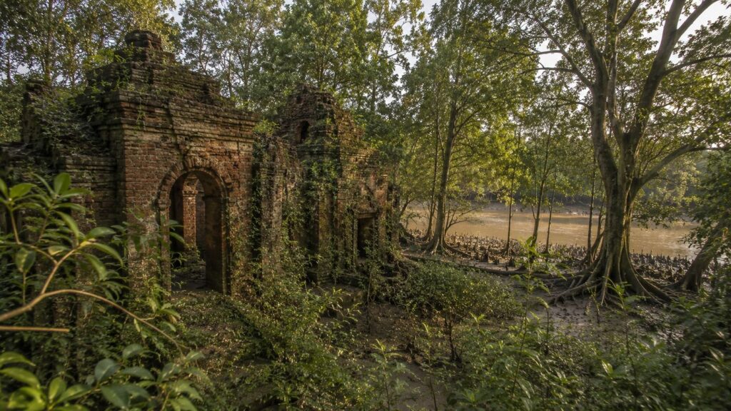
In most parts of the Sundarbans, the mangrove forest conceals traces of earlier human activity beneath layers of sediment deposited over centuries. At Netidhopani, however, one archaeological site continues to emerge from the wilderness, offering a rare glimpse into a time when parts of today's protected tiger habitat supported organised human occupation.
The ruins known as the Netidhopani Temple stand as one of the most significant archaeological landmarks within the Indian Sundarbans. Surrounded by tidal rivers, dense mangrove vegetation and wildlife habitat, the structure represents a remarkable meeting point between environmental history and cultural heritage. It reminds visitors that the Sundarbans has not always been an untouched wilderness. Instead, it has experienced repeated cycles of settlement, abandonment, natural transformation and ecological recovery.
Understanding the history of Netidhopani therefore requires viewing archaeology and ecology together. The surviving ruins are not isolated monuments but components of a landscape continually reshaped by rivers, tides, cyclones and changing coastlines.
Historical Background
The lower Ganges delta has supported human activity for well over a thousand years. Historical records, archaeological discoveries and medieval literature suggest that several areas within today's Sundarbans once contained settlements, trading centres, places of worship and river-based communication routes.
Compared with the modern landscape, historical coastlines were likely very different. River channels shifted gradually over centuries, while some settlements disappeared beneath sediment or were abandoned following changes in hydrology, salinity or repeated flooding.
Netidhopani is considered one of the clearest surviving examples of this historical transformation.
Although many details remain uncertain, archaeological evidence indicates that the area once supported permanent or seasonal human occupation long before it became part of the protected mangrove forest.
Researchers generally agree that the surviving temple ruins date to the late medieval period, although the precise date of construction and the identity of its builders remain subjects of continuing study. Because definitive inscriptions have not been found, historians avoid assigning an exact construction date with certainty.
Rather than diminishing its significance, this uncertainty makes Netidhopani one of the most intriguing archaeological sites in the Sundarbans.
The Netidhopani Temple
Hidden within the forest stands the partially preserved brick structure commonly referred to as the Netidhopani Temple.
Built primarily from baked bricks typical of medieval Bengal architecture, the structure reflects construction techniques used across eastern India during the medieval period. Although much of the original building has collapsed, portions of the walls continue to survive despite centuries of exposure to tropical weather, saline conditions and repeated cyclones.
The temple's architecture suggests that it once formed part of a larger religious complex or settlement rather than existing in complete isolation. Archaeologists have identified additional structural remains in the surrounding area, indicating that religious activity may have been accompanied by habitation.
The surviving structure has endured extraordinary environmental pressures.
Over hundreds of years, it has experienced:
- Cyclones
- Storm surges
- Salt-laden winds
- Seasonal flooding
- Vegetation growth
- Soil movement
- Continuous tidal influence
Its survival illustrates both the quality of its original construction and the remarkable resilience of historical brick architecture.
Today the temple remains protected within the Sundarbans Tiger Reserve and may only be viewed under regulated visitor access.
Archaeological Importance
The archaeological significance of Netidhopani extends beyond the temple itself.
The site provides evidence that parts of the Sundarbans now covered by dense mangrove forests were once used differently by human communities.
Archaeological investigations have documented:
- Medieval brick structures.
- Pottery fragments.
- Structural foundations.
- Evidence suggesting organised settlement activity.
Together, these discoveries contribute to a broader understanding of how people historically interacted with the delta environment.
Unlike many archaeological sites situated in stable inland landscapes, Netidhopani exists within one of the world's most dynamic coastal environments. Consequently, preservation presents unique challenges. Soil movement, tidal erosion, vegetation growth and extreme weather all threaten the long-term survival of archaeological remains.
Legends and Folklore
Like many ancient places within Bengal, Netidhopani has accumulated numerous legends over generations.
Among the most widely known is the story of a king whose prosperous settlement was destroyed through divine displeasure or natural catastrophe. Different versions attribute the destruction to floods, cyclones or supernatural intervention.
Another tradition associates the temple with the legendary king Pratapaditya, although definitive archaeological evidence linking him directly to the existing ruins has not been established.
Local folklore also connects Netidhopani with Bonbibi, the revered guardian of the Sundarbans. According to traditional belief, Bonbibi protects those who enter the forest with honesty and respect while punishing greed and arrogance.
Honey collectors, fishermen and woodcutters have historically invoked Bonbibi's protection before entering the forest. Although these traditions belong primarily to the cultural history of the wider Sundarbans rather than specifically to Netidhopani, they form an important part of the landscape's intangible heritage.
From an editorial perspective, it is important to distinguish folklore from historical evidence. These stories remain culturally significant regardless of whether they can be verified archaeologically.
A Landscape Reclaimed by Nature
Perhaps the most remarkable aspect of Netidhopani is not that humans once lived there—but that nature reclaimed it.
Following the abandonment of historical settlements, mangrove vegetation gradually recolonised the landscape.
- Seeds dispersed by tides established pioneer vegetation.
- Mud accumulated around young trees.
- Successive generations of mangroves stabilised the sediments.
Wildlife returned.
Eventually the forest expanded around the remaining structures until they became embedded within one of the most important tiger habitats in the world.
This natural succession demonstrates the extraordinary regenerative capacity of mangrove ecosystems when ecological processes remain undisturbed.
Ecological Importance
Although Netidhopani is often recognised for its archaeological heritage, its ecological significance is even greater.
The island contributes to multiple ecological functions across the Indian Sundarbans.
Habitat Connectivity
Wide-ranging species such as the Royal Bengal Tiger depend upon connected landscapes rather than isolated forest patches.
The network of rivers surrounding Netidhopani allows tigers to swim between neighbouring islands, maintaining genetic exchange across the wider population.
Similarly, birds, crocodiles and aquatic organisms move freely through interconnected habitats.
Carbon Storage
Mangrove ecosystems rank among the most efficient natural carbon sinks on Earth.
Carbon becomes stored in:
- Tree biomass.
- Root systems.
- Waterlogged soils.
- Organic sediments.
Unlike many terrestrial forests, mangrove soils can retain carbon for centuries if left undisturbed.
Consequently, protecting forests like Netidhopani contributes not only to biodiversity conservation but also to climate-change mitigation.
Nursery for Aquatic Life
The tidal creeks surrounding Netidhopani function as nursery habitats for numerous estuarine and marine species.
Juvenile fish, prawns and crabs find shelter among submerged mangrove roots where predators are less abundant and food is plentiful.
Many commercially valuable fisheries along the Bay of Bengal ultimately depend upon these nursery habitats.
Coastal Protection
Dense mangrove vegetation absorbs wave energy during cyclones.
- Root systems stabilise riverbanks.
- Tree canopies reduce wind velocity.
Together, these natural processes help reduce erosion while protecting adjacent landscapes from tidal surges.
Although no natural ecosystem can eliminate cyclone impacts entirely, healthy mangrove forests significantly improve coastal resilience.
Conservation Significance
Netidhopani lies within one of India's highest-priority protected landscapes.
The island forms part of:
- Sundarban Tiger Reserve
- Sundarban National Park
- UNESCO World Heritage Site
- UNESCO Biosphere Reserve
- Ramsar Wetland of International Importance
This overlapping protection reflects the exceptional ecological importance of the area.
Conservation objectives include:
- Protecting tiger habitat.
- Conserving mangrove biodiversity.
- Preserving estuarine ecosystems.
- Safeguarding archaeological heritage.
- Supporting scientific research.
- Regulating ecotourism.
- Reducing illegal exploitation of forest resources.
Forest management seeks to balance biodiversity conservation with carefully controlled public access, ensuring that tourism does not compromise the ecological integrity of the landscape.
Threats to Netidhopani
Despite its protected status, Netidhopani faces numerous environmental pressures.
Climate Change
Sea-level rise presents one of the greatest long-term challenges for low-lying deltaic islands. Even relatively small increases in sea level can influence:
- Salinity.
- Sediment deposition.
- Mangrove distribution.
- Habitat availability.
Cyclones
The northern Bay of Bengal experiences some of the world's most powerful tropical cyclones.
Events such as Cyclone Aila (2009), Cyclone Amphan (2020) and Cyclone Yaas (2021) demonstrated the vulnerability of the Sundarbans to extreme weather.
Repeated storm surges accelerate erosion while damaging vegetation and archaeological remains.
Salinity Changes
Reduced freshwater flow combined with sea-level rise can increase salinity across portions of the Sundarbans.
Some mangrove species tolerate these changes better than others, potentially altering forest composition over time.
Erosion
Riverbanks throughout the delta naturally undergo erosion and deposition.
Although these are normal geomorphological processes, they pose particular risks for archaeological sites situated close to tidal channels.
Human Disturbance
Visitor access remains carefully regulated.
Strict management helps minimise:
- Wildlife disturbance.
- Litter.
- Noise pollution.
- Damage to archaeological structures.
- Illegal resource extraction.
Maintaining this balance is essential if Netidhopani's ecological and historical values are to be preserved for future generations.
The Wild Orbit Perspective
Approaching the ancient brick ruins by boat, it is difficult to separate history from nature. Mangrove branches cast shifting shadows across weathered walls while tidal water flows through creeks that have shaped the landscape for centuries. A Brahminy Kite circles overhead, and the distant call of a kingfisher echoes across the river. The temple no longer stands at the centre of a settlement—it stands within a living forest where tides, roots and wildlife have quietly reclaimed the land.
Netidhopani reminds us that in the Sundarbans, history is not frozen in stone; it continues to evolve alongside one of the world's most dynamic mangrove ecosystems.
Visiting Netidhopani
Unlike many historical sites in India, Netidhopani is not a destination that can be explored independently on foot. The island lies within the highly protected core landscape of the Indian Sundarbans, where wildlife conservation takes precedence over tourism. Every visit is therefore governed by regulations established by the West Bengal Forest Department and the management of the Sundarban Tiger Reserve.
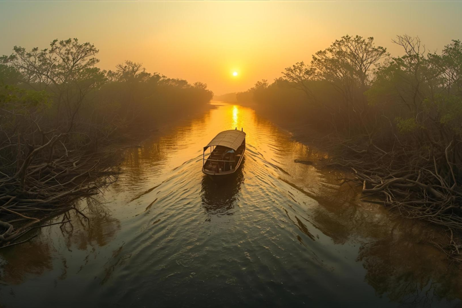
For most visitors, Netidhopani is experienced from the water. Boats travel through winding tidal rivers before reaching the designated landing point and watchtower. The journey itself forms an essential part of the experience, as it reveals the gradual transition from inhabited islands to uninterrupted mangrove wilderness.
Visitors should understand that the purpose of travelling to Netidhopani is not to guarantee wildlife sightings but to observe one of the most ecologically significant landscapes in the world with patience and respect. Every journey through these forests offers different conditions, shaped by tides, weather, season and the natural behaviour of wildlife.
The Netidhopani Watchtower
The watchtower provides one of the safest and most informative viewpoints within the protected landscape. From here, visitors can observe the surrounding mangrove forest without disturbing sensitive habitats.
The elevated platform overlooks sections of forest, open clearings and nearby waterways, offering opportunities to appreciate the structure of the mangrove ecosystem. During quieter periods, Spotted Deer may emerge to graze near the forest edge, while kingfishers, egrets and raptors are often seen along the riverbanks.
The watchtower also provides an appreciation of the island's geography. From above, it becomes easier to understand how tidal creeks, mudflats and mangrove stands combine to form an interconnected ecosystem rather than isolated patches of vegetation.
Nearby lie the remains of the historic Netidhopani Temple, where regulated access allows visitors to appreciate one of the Sundarbans' most significant archaeological sites without compromising its preservation.
Responsible Exploration
The Sundarbans is a living ecosystem rather than an outdoor museum. Every visitor shares responsibility for protecting its biodiversity and cultural heritage.
Responsible behaviour includes:
- Follow all instructions issued by Forest Department staff and authorised guides.
- Remain within designated visitor areas.
- Avoid loud conversations, music or unnecessary noise.
- Never attempt to attract or approach wildlife.
- Do not feed animals under any circumstances.
- Dispose of all waste responsibly and avoid introducing plastics into the environment.
- Respect archaeological remains by avoiding contact with fragile structures.
- Observe wildlife patiently without expecting guaranteed sightings.
Responsible ecotourism contributes to conservation by fostering public appreciation for mangrove ecosystems while minimising ecological disturbance.
Best Time to Visit with The Wild Orbit
Netidhopani can be visited during much of the regulated tourism season, but environmental conditions vary considerably throughout the year.
Winter (November to February)
Winter is generally regarded as the most comfortable season for exploring the Indian Sundarbans.
Cooler temperatures, lower humidity and clearer skies improve visibility across rivers and forest edges. Many migratory birds also arrive during this period, increasing avian diversity throughout the region.
Comfortable weather makes winter particularly suitable for photography, birdwatching and extended boat safaris.
Early Summer (March to April)
As temperatures rise, wildlife often concentrates near available freshwater sources and shaded areas.
Although afternoons become warmer, mornings frequently provide excellent opportunities for observing bird activity before the heat intensifies.
Monsoon (June to September)
The southwest monsoon transforms the entire landscape.
Heavy rainfall replenishes freshwater systems while lush vegetation reaches its seasonal peak. Rivers carry greater volumes of water and tidal currents become stronger.
However, frequent rain, rougher boating conditions and operational restrictions may limit tourism during parts of the monsoon.
Post-Monsoon (October)
Following the retreat of the monsoon, the forest appears refreshed.
New vegetation flourishes, water levels gradually stabilise and improving weather marks the beginning of the primary tourism season.
Seasonal Character
The appearance of Netidhopani changes continuously throughout the year, reflecting the combined influence of tides, rainfall, river discharge and seasonal climate.
Winter
Morning mist often lingers above the tidal rivers before gradually lifting to reveal dense mangrove forests. Migratory birds become a prominent feature of the landscape, while pleasant temperatures encourage prolonged wildlife observation.
Summer
Higher temperatures increase evaporation and influence salinity across portions of the delta. Wildlife activity becomes concentrated during the cooler hours of the morning and late afternoon.
Monsoon
The forest becomes intensely green as rainfall replenishes freshwater inputs. Rivers swell, sediments shift and tidal currents transport enormous quantities of suspended organic matter throughout the estuary.
Post-Monsoon
Improved visibility, stable river conditions and renewed vegetation create excellent opportunities for appreciating both the ecological and scenic character of the island.
The Wild Orbit’s Interesting Facts About Netidhopani
- Netidhopani contains one of the best-known archaeological sites within the Indian Sundarbans.
- The island forms part of the core protected landscape of the Sundarban Tiger Reserve.
- The surrounding mangrove forest belongs to the world's largest contiguous mangrove ecosystem.
- Royal Bengal Tigers inhabiting this landscape regularly swim across tidal rivers while moving between forest islands.
- Twice-daily tides shape every aspect of the island's ecology, from soil chemistry to wildlife movement.
- Mangrove trees surrounding Netidhopani possess specialised adaptations that allow them to survive in saline, oxygen-poor environments.
- The island supports both exceptional biodiversity and significant cultural heritage within the same protected landscape.
- Archaeological remains demonstrate that parts of today's mangrove wilderness were once occupied by human communities.
- Netidhopani illustrates how abandoned settlements can gradually be reclaimed by natural ecological succession.
- Conservation at Netidhopani protects both living ecosystems and irreplaceable archaeological heritage.
FAQs
Where is Netidhopani Island located?
Netidhopani lies within the protected forest landscape of the Indian Sundarbans in South 24 Parganas district, West Bengal.
Why is Netidhopani famous?
The island is known for its medieval temple ruins, rich mangrove ecosystem, Royal Bengal Tiger habitat and ecological importance within the Sundarbans Tiger Reserve.
Is Netidhopani inhabited?
No. Netidhopani is an uninhabited forest island located within a protected area.
Can visitors enter the forest freely?
No. Access is strictly regulated by the Forest Department. Visitors may only enter approved areas as part of authorised boat safaris.
Is the Netidhopani Temple still intact?
Only portions of the original brick structure survive today. The ruins remain one of the most important archaeological sites within the Indian Sundarbans.
Are Royal Bengal Tigers found around Netidhopani?
Yes. Netidhopani forms part of the natural habitat of the Royal Bengal Tiger within the Sundarbans Tiger Reserve, although sightings are never guaranteed.
Why are mangroves important here?
Mangroves stabilise sediments, reduce coastal erosion, store significant amounts of carbon, provide nursery habitats for fish and crustaceans, and support an exceptionally diverse food web.
What wildlife can visitors expect to see?
Depending on season and conditions, visitors may observe Spotted Deer, kingfishers, herons, Brahminy Kites, egrets, crocodiles, monitor lizards and numerous estuarine birds. Much of the wildlife remains naturally elusive.
What is the best season to visit?
Winter, from November to February, generally offers the most comfortable weather and excellent opportunities for birdwatching and landscape photography.
Why is Netidhopani important for conservation?
The island protects valuable mangrove habitats, supports endangered wildlife, preserves archaeological heritage and contributes to the ecological integrity of the wider Sundarbans ecosystem.
How do tides influence Netidhopani?
Tides regulate salinity, transport sediments and nutrients, shape riverbanks, support aquatic life and determine the distribution of mangrove vegetation across the island.
Can the archaeological ruins be preserved indefinitely?
Preservation remains challenging because the site is exposed to cyclones, saline conditions, tidal erosion and natural weathering. Ongoing conservation efforts seek to protect the surviving structures while respecting the surrounding ecosystem.
The Living Legacy of Netidhopani
As the afternoon tide begins its slow advance, the exposed mudflats gradually disappear beneath opaque brown water. Pneumatophores that stood as thousands of small stakes above the sediment vanish beneath the rising tide, while the creeks once again become silent waterways threading through the mangrove forest.
A Brahminy Kite glides above the canopy before settling on a riverside branch, and somewhere beyond the dense vegetation, the alarm call of a Spotted Deer briefly interrupts the stillness.
Netidhopani is often introduced through its ancient temple, yet the island's true significance extends far beyond archaeology. It represents a landscape where geological processes, tidal dynamics, ecological succession, wildlife conservation and human history converge within one of the world's most remarkable estuarine ecosystems. The surviving ruins remind us that people once lived where mangrove forests now flourish, while the surrounding wilderness demonstrates nature's extraordinary capacity to reclaim and reshape the land.
In an era of rising sea levels, intensifying cyclones and increasing pressure on coastal ecosystems, Netidhopani offers lessons that reach well beyond the Sundarbans. Its mangroves protect shorelines, store vast quantities of carbon, sustain fisheries and provide refuge for globally significant biodiversity. Its archaeological remains preserve evidence of the region's historical past, while its protected status reflects a modern commitment to safeguarding both natural and cultural heritage.
To understand Netidhopani is therefore to recognise that the Sundarbans is not simply a collection of islands, rivers and forests. It is a living delta where tides govern ecological rhythms, wildlife adapts to an ever-changing environment and history survives within a landscape that never stands still. Every rising tide, every shifting mudbank and every generation of mangroves continues the story of a place where nature and time remain inseparable.
CTA: Continue Your Journey with The Wild Orbit
Plan your private Sundarban expedition
A private journey shaped around you — your group, your pace, your interests. Book a free consultation.