 Encyclopedia
The river arrives first.
Long before Sandeshkhali reveals itself, before a single house becomes visible, before the outline of an embankment emerges from the morning haze, there is only water.
At dawn, the river between Dhamakhali and the northern Sundarbans appears almost motionless. The tide is still rising. A pale ribbon of silver stretches toward the horizon. The ferry engine hums steadily beneath the feet of passengers who seem entirely untroubled by the vastness surrounding them.
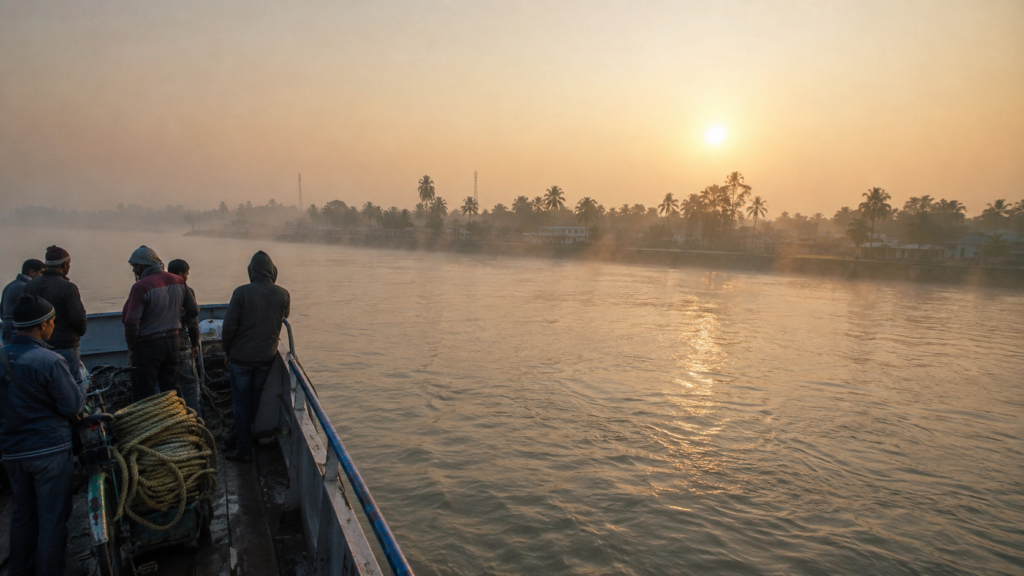
- A fisherman sits near the bow, repairing a net he began mending before sunrise.
- A schoolteacher balances a stack of exercise books on her lap.
- Two vegetable traders discuss market prices in voices barely louder than the engine.
Nobody is looking at a watch.
Everyone is watching the river.
In Sandeshkhali, time has always belonged more to the tide than to the clock. As the ferry pushes deeper into the delta, the landscape begins to assemble itself slowly.
First come the birds.
- A Brahminy Kite circles above a distant mudflat.
- A kingfisher flashes across the water like a fragment of blue glass.
- White egrets stand motionless along a tidal edge where the river appears to dissolve into wetlands.
Then comes the land.
- A low dark line materialises through the mist.
- Not a mountain.
- Not a skyline.
- An embankment.
Long, unbroken, and stretching across the horizon.
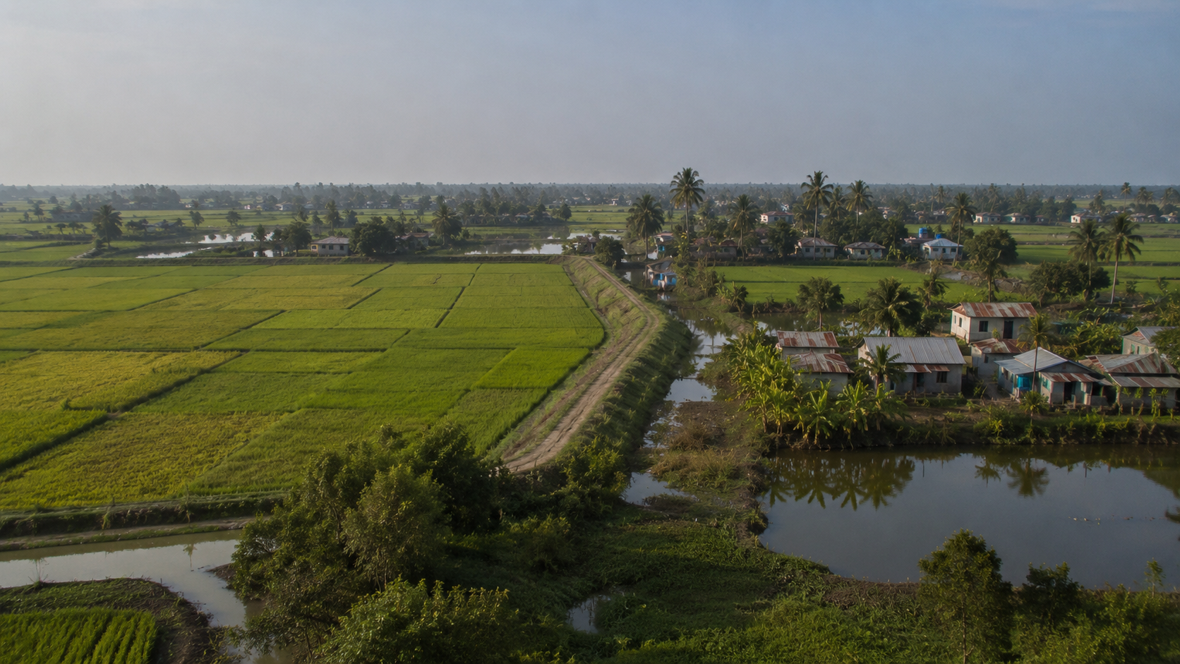
Behind it rise coconut palms, electricity poles, mango trees, water tanks, fishing nets, village roofs, and the unmistakable signs of human settlement.
At first glance, it appears ordinary.
Yet nothing in Sandeshkhali exists without that embankment.
The road, the school, the pond, the rice field, the tea stall, the mosque, the market, the homes scattered across the landscape—all stand behind a barrier built to hold back a river that never fully stops pushing inland.
This is the first lesson Sandeshkhali teaches.
The island is not a product of geography alone.
It is a product of persistence.
- The ferry slows.
- Wood scrapes against the jetty.
- Passengers rise without urgency.
- Bicycles are rolled ashore.
- Fish baskets change hands.
- A motorcycle disappears up a muddy ramp.
- The river crossing is over.
The expedition begins.
Most visitors come to the Sundarbans searching for the forest.
Sandeshkhali tells a different story.
This is not the frontier of wilderness. This is the frontier of settlement. A landscape where people have spent generations negotiating with tides, storms, rivers, salinity, isolation, and uncertainty.
Every embankment tells part of that story. Every village tells another. And every tide rewrites the ending.
First Encounter
The path from the jetty climbs immediately onto higher ground.
- Not a hill.
- Not natural elevation.
- An embankment.
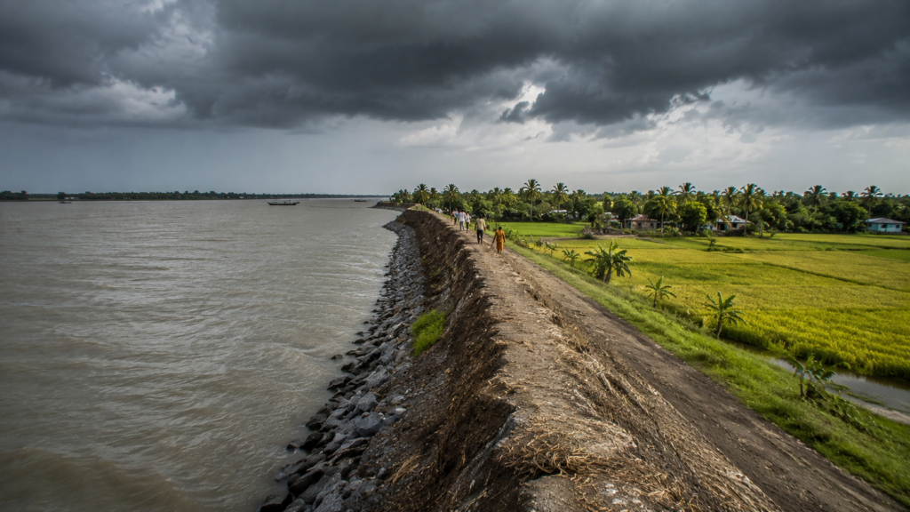
Like much of the inhabited Sundarbans, Sandeshkhali depends on these raised earthworks for survival. They function simultaneously as roads, flood barriers, transportation corridors, and community gathering spaces.
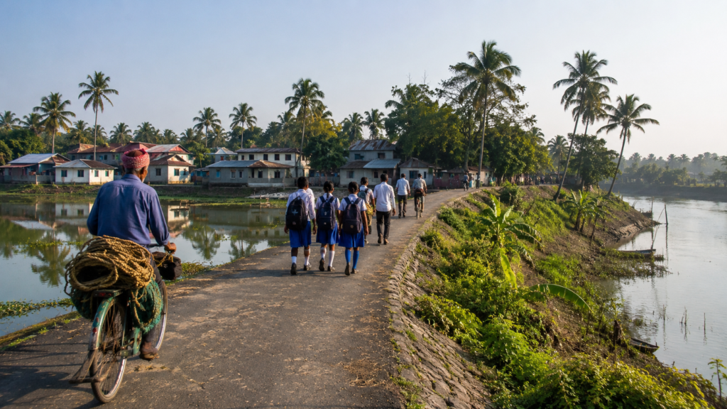
Standing atop the embankment, the landscape unfolds in two directions.
- To the left lies the river.
- To the right lies human life.
The contrast is immediate. On one side, moving water. On the other hand, a carefully maintained world of homes, ponds, fields, schools, shrines, shops, and village lanes.
A cyclist approaches carrying crab traps tied precariously to the rear of his bicycle. Behind him walks a group of students in blue-and-white uniforms.
A woman spreads fish to dry on a woven mat beside her courtyard.
Smoke rises from breakfast fires. The smell drifting through the air is unmistakably deltaic.
- Wood smoke.
- Wet earth.
- River mud.
- Fish.
- Salt.
And somewhere beneath it all, the faint scent of mangroves carried inland by the night tide. Sandeshkhali does not announce itself dramatically. It reveals itself gradually. Every few hundred metres, another detail emerges.
- A pond reflecting the morning sky.
- A small temple shaded by banyan roots.
- A mosque loudspeaker mounted above a cluster of palms.
- A tea stall where fishermen discuss water levels before heading out toward the creeks.
The island feels lived-in.
Not visited.
Not displayed.
Lived-in.
That distinction matters.
Many landscapes in the Sundarbans are shaped by nature. Sandeshkhali is shaped equally by human effort. The longer one walks, the more visible that effort becomes.
Sandeshkhali’s Identity
By mid-morning, the mist has vanished.
- The horizon expands.
- Fields appear beyond the villages.
- Narrow canals intersect agricultural land.
- Fishing ponds glimmer between clusters of homes.
From the embankment, Sandeshkhali reveals its true character.
It is not a single island in the conventional sense.
Rather, it forms part of a complex inhabited riverine landscape in the northern Sundarbans of North 24 Parganas district, administered through Sandeshkhali-I and Sandeshkhali-II community development blocks.
The geography can be confusing to first-time visitors.
- Rivers divide land.
- Creeks divide villages.
- Settlements appear close yet remain dependent on ferry crossings.
- Administrative boundaries rarely align neatly with ecological realities.
The result is a landscape best understood from the water.
Historically, the region developed through successive phases of reclamation and settlement. Areas that once consisted largely of tidal wetlands and mangrove-covered terrain gradually transformed into agricultural and inhabited landscapes through embankment construction and land development.
That history remains visible today.
The villages do not appear randomly placed.
- They follow elevated ground.
- They follow embankments.
- They follow river logic.
Everything in Sandeshkhali follows river logic. Even the human geography. The population numbers, administrative maps, and census figures tell one version of the story.
The landscape tells another.
A more revealing one.
Because standing on an embankment, watching fishermen prepare nets while children walk to school and a ferry disappears around a bend in the river, Sandeshkhali feels less like a collection of statistics and more like a living negotiation between people and water.
That negotiation has been continuing for generations.
And it remains unfinished.
The Rivers That Shaped the Island
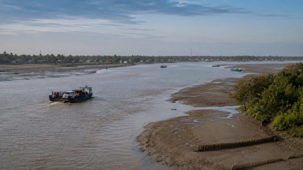
Near noon, the river no longer looks gentle.
The same water that appeared calm at dawn now moves with visible force.
- The tide has turned.
- Mudbanks emerge.
- Channels narrow.
- Currents accelerate around bends.
- A boatman points toward a distant waterway disappearing into the horizon.
“Everything depends on that river,” he says.
The statement could apply to almost any river in Sandeshkhali.
The region exists within a network of tidal waterways influenced by major river systems of the northern Sundarbans, including channels connected to the Vidyadhari, Kalindi, Raimangal, and numerous smaller distributaries that continue reshaping the delta.
The rivers determine far more than geography. They influence where villages develop.
- Where markets emerge.
- Which ferry routes survive.
- Which agricultural fields remain productive.
- Which banks erode.
- Which settlements require stronger embankments.
Even today, movement across Sandeshkhali remains fundamentally tied to water.
- Roads connect villages.
- Rivers connect worlds.
For centuries, these waterways functioned as transportation corridors, trade routes, migration pathways, and sources of food.
They still do. To understand Sandeshkhali, one must stop thinking of rivers as boundaries.
Here they are, arteries. Everything flows through them.
- People.
- Fish.
- Sediment.
- Goods.
- Stories.
And occasionally, disaster.
Because the same rivers that sustain life can also erase years of human effort in a single season.
- The river gives.
- The river takes.
Every resident understands both truths. That understanding shapes the island more deeply than any map ever could.
Historical Footprints
The oldest stories in Sandeshkhali are not found in archives.
They are written into the landscape itself.
Walking away from the main ferry route, the embankment narrows and bends around a stretch of agricultural land. Beyond the fields, a line of older trees follows what appears to be a forgotten boundary. Locals point toward it casually.
“That side was once closer to the river.”
The remark sounds simple.
In the Sundarbans, it is never simple.
- Rivers move.
- Banks collapse.
- Land emerges.
Entire landscapes rearrange themselves over decades.
To understand the history of Sandeshkhali, one must imagine a very different world from the one visible today.
Several centuries ago, much of this region was dominated by tidal forests, creeks, mudflats, and mangrove wilderness. Human settlement existed, but it was sparse and often temporary. Much of the northern Sundarbans remained difficult to access, vulnerable to flooding, and heavily influenced by wildlife and disease.
The transformation accelerated during the colonial era.
As British administrators sought to expand agricultural production across Bengal, large sections of the Sundarbans were gradually surveyed, leased, reclaimed, and settled. Forests were cleared. Embankments were constructed. Wetlands were converted into farmland. Communities from different regions were encouraged—or compelled by economic circumstances—to establish new settlements in landscapes that remained unpredictable and often dangerous.
What appears today as ordinary countryside was once frontier territory.
- The risks were immense.
- Malaria was widespread.
- Transportation was difficult.
- Storms regularly damaged new settlements.
And beyond the embankments, mangrove forests remained home to wildlife that did not easily surrender territory.
Yet people came.
And they stayed.
Sandeshkhali emerged from that process.
Not as a planned town.
But as a lived experiment in survival.
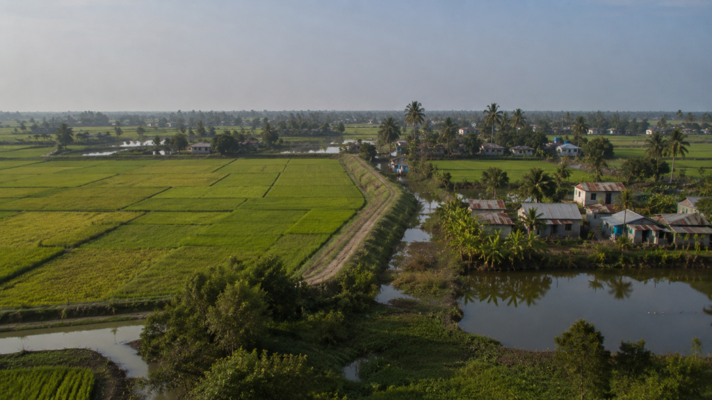
Historical Personalities &Transformations
Around midday, the tea stalls become busier.
- Farmers pause for conversation.
- Boat operators wait for the next tide.
- News travels quickly here.
It always has.
Long before mobile phones and internet towers appeared above the villages, information moved through ferries, markets, and river networks.
Unlike many historic settlements in Bengal, Sandeshkhali is not associated with a single ruler, palace, or monumental figure.
Its transformation was collective.
The most important personalities were often ordinary people whose names rarely entered official records.
- The settlers who cut channels through wetlands.
- The labourers who strengthened embankments.
- The teachers who established schools in isolated villages.
- The religious leaders who built institutions that became community anchors.
- The boatmen who connected settlements before roads existed.
Their influence remains visible even when their names do not.
The wider history of Sundarban reclamation is often associated with colonial administrators and landholders who encouraged settlement and agricultural expansion across the delta. Yet standing in Sandeshkhali today, the more compelling story belongs to the communities that transformed policy into reality.
- Every pond.
- Every field.
- Every village lane.
- Every embankment.
They are monuments, even if nobody calls them that.
Folklore and Legends
The stories emerge after sunset.
Not because people become more imaginative in the dark. Because darkness has always mattered in the Sundarbans. Even today, sitting beside a river after dusk, it is easy to understand why folklore flourished here.
- The water reflects almost no light.
- Mangrove silhouettes dissolve into shadow.
- Distances become difficult to judge.
The known world shrinks.
For generations, communities across the Sundarbans developed stories that helped explain the uncertainties surrounding them.
Among the most enduring is the story of Bonbibi.
Although most closely associated with forest-dependent communities, Bonbibi’s presence extends far beyond the protected mangrove wilderness. Throughout the inhabited Sundarbans, she remains a symbol of protection, balance, and survival in a landscape where nature can be both generous and unforgiving.
Her counterpart in many traditions is Dakshin Ray, often associated with the power of the forest and the tiger.
Together with Shah Jongoli and other figures of regional folklore, these stories form one of South Asia’s most remarkable cultural traditions.
In Sandeshkhali, folklore is rarely treated as mythology alone.
It exists alongside lived experience.
A fisherman may discuss tides, weather forecasts, engine repairs, and Bonbibi in the same conversation.
No contradiction is perceived.
Because the stories were never merely about religion.
They were about risk.
And few places understand risk better than the Sundarbans.
Life Between the Tides
By early afternoon, Sandeshkhali appears deceptively quiet.
- The ferry ghats are less crowded.
- Village lanes empty.
- The sun presses heavily against the landscape.
But look closer. The island is working.
- A fisherman repairs a torn net beneath a mango tree.
- A woman washes freshly harvested vegetables beside a pond.
- Two boys cycle along an embankment carrying fishing gear.
- An elderly farmer examines water levels in a canal before deciding whether a field requires irrigation.
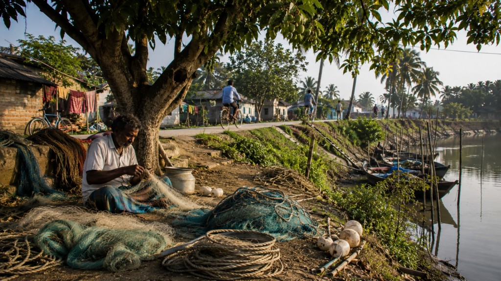
Life here unfolds in relation to the tide. The rhythm influences almost everything.
- Fishing schedules depend on water movement.
- Boat departures depend on water depth.
- Aquaculture depends on water quality.
- Agriculture depends on balancing freshwater and salinity.
Unlike urban environments governed primarily by clocks, Sandeshkhali still responds strongly to environmental cycles.
- The tide arrives.
- People adjust.
- The tide retreats.
- People adjust again.
This adaptability has become one of the defining characteristics of the island. Not because residents romanticise hardship. Because adaptation remains necessary.
Walking Through the Villages
The most revealing journeys in Sandeshkhali are rarely the longest.
A single walk through a village often reveals more than hours spent studying maps.
- The lane narrows between ponds.
- A courtyard appears behind banana plants.
- Children play cricket beside a small temple.
- A bicycle leans against a wall painted with political slogans fading beneath monsoon weather.
Further ahead, a mosque emerges between coconut palms. Its loudspeaker faces the river.
A few hundred metres later, a tea stall appears. Three generations occupy the same bench.
- An elderly fisherman.
- A middle-aged trader.
- A student returning from school.
Each views the island differently.
Yet all share the same geography. Many homes remain organised around courtyards.
Ponds continue serving multiple purposes, including fish cultivation, household needs, and rainwater storage. Schools function not only as educational institutions but also as social anchors. Religious structures provide continuity across generations.
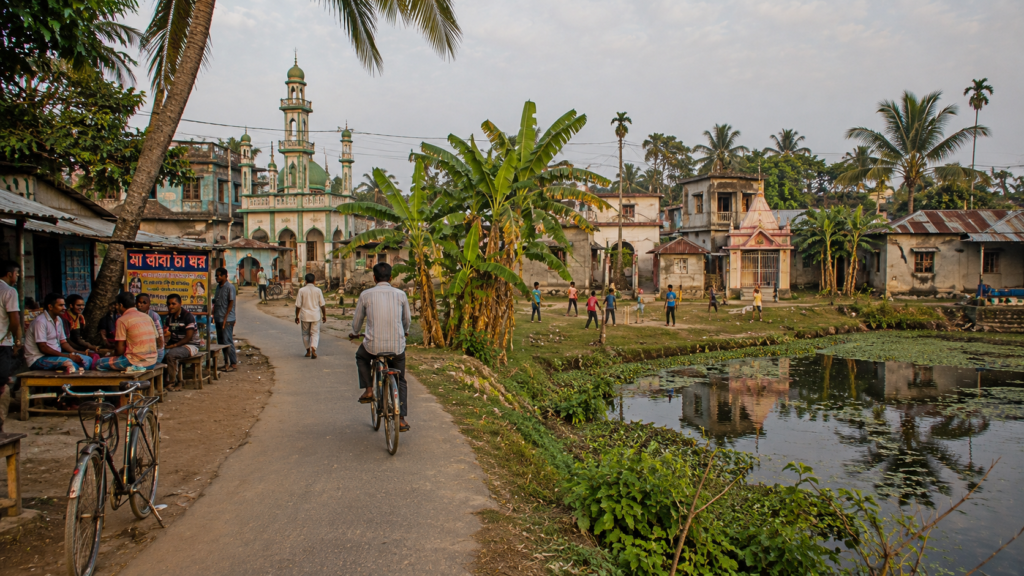
Village life in Sandeshkhali is not isolated from the modern world. Mobile phones are everywhere. Internet access continues to expand.
Young people increasingly travel for education and employment. Yet the spatial logic of village life remains unmistakably deltaic.
The river is never far away.
Sounds of the Sandeshkhali
Every landscape has a soundtrack.
Sandeshkhali’s begins before sunrise. The first sound is often an engine.
- Not a car.
- A boat.
Somewhere beyond the embankment, a vessel moves through darkness toward a fishing ground or ferry route.
Then come birds.
- Kingfishers.
- Mynas.
- Egrets calling across wetlands.
Morning gradually layers additional sounds.
- School bells.
- Bicycle bells.
- Conversations drifting from tea stalls.
- Water splashing against wooden jetties.
The afternoon becomes quieter.
- Heat suppresses movement.
- Even the birds seem less active.
The evening arrives.
- Temple bells ring.
- The call to prayer carries across open fields.
- Crickets emerge.
- Frogs begin calling from ponds.
The river resumes its dominance. At night, Sandeshkhali often sounds larger than it appears.
The darkness amplifies distance. A boat engine several kilometres away can seem surprisingly close. Water carries sound efficiently.
As it always has.
Wildlife Expedition
Wildlife in Sandeshkhali rarely announces itself dramatically.
It rewards patience. The first kingfisher appears on a bamboo pole overlooking a narrow creek. For several minutes, it remains perfectly still. Then it dives. The splash lasts less than a second.
The bird emerges with a fish. And the creek becomes quiet again. This pattern repeats throughout the day.
Wildlife appears in moments.
- A Brahminy Kite circling above agricultural fields.
- An egret stalking through a wetland margin.
- A pond heron disappearing into vegetation.
- Mudskippers moving across exposed tidal mud.
The wider ecological landscape surrounding Sandeshkhali forms part of one of the world’s most important delta ecosystems. While the island itself is heavily inhabited, nearby mangrove habitats, wetlands, rivers, and estuarine environments support a remarkable diversity of species.
Birdwatchers often find the region especially rewarding.
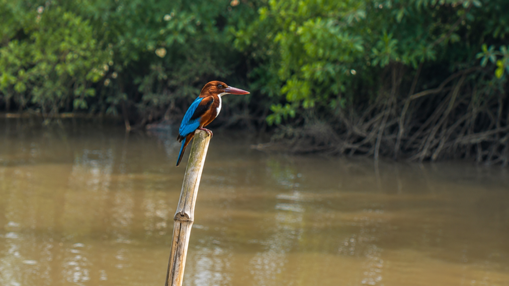
The mix of freshwater ponds, agricultural landscapes, tidal creeks, and river corridors creates varied habitats capable of supporting both resident and seasonal species.
The secret is attention. Not luck. Sandeshkhali reveals wildlife gradually. Just as it reveals everything else.
Mangrove Chronicles
See it for yourself
A private journey shaped around you — your group, your pace, your interests. Book a free consultation.
Toward late afternoon, the wind shifts.
The air begins carrying a familiar scent.
- Salt.
- Mud.
- Mangroves.
The forests themselves may not dominate Sandeshkhali in the same way they dominate the protected core of the Sundarbans, yet their influence remains everywhere.
The mangroves shaped the land before the settlements arrived.
- They influenced soil formation.
- Fish populations.
- River behaviour.
- Sediment movement.
Even today, fragments of mangrove vegetation persist along creek margins and less-developed stretches of shoreline.
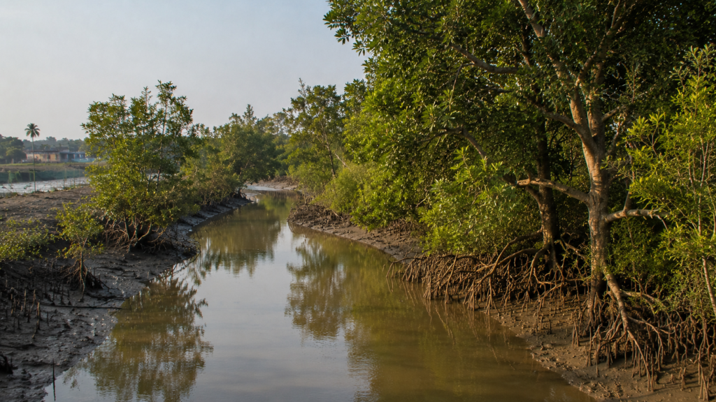
For local communities, mangroves are more than vegetation.
- They are infrastructure.
- Living infrastructure.
- Their roots stabilise banks.
- Reduce erosion.
- Provide habitat for aquatic life.
- And contribute to the ecological productivity upon which regional fisheries depend.
The relationship is complex.
Human settlement required clearing the forest. Long-term survival increasingly depends on protecting what remains. Standing beside a tidal creek at sunset, that contradiction becomes impossible to ignore. The future of Sandeshkhali and the future of the mangroves remain closely connected.
Neither can be fully understood without the other.
Explorer’s Field Notes
5:42 AM
The river is still carrying the last traces of night when the ferry leaves the mainland. The passengers speak softly. Most are commuters rather than travellers. Ahead, Sandeshkhali is still hidden behind fog and distance.
6:18 AM
The first embankment emerges from the mist.
At this distance, it appears insignificant.
Only later does it become clear that entire villages exist because of structures like this. In Sandeshkhali, embankments are not infrastructure. They are a condition of survival.
7:05 AM
Schoolchildren begin appearing along the embankment road.
Some travel by bicycle.
Others walk in small groups carrying bags larger than they are.
The embankment functions as a road, a footpath, a playground, and a community space simultaneously.
8:30 AM
Near a village pond, ducks glide across still water reflecting coconut palms.
The pond appears older than many of the houses surrounding it.
Across much of the delta, freshwater storage shaped settlement long before modern development arrived.
10:15 AM
A tea stall conversation begins with fish prices.
Ten minutes later, the discussion shifts toward ferry schedules. Shortly after that, someone mentions riverbank erosion. The subject changes repeatedly.
The river remains constant.
12:40 PM
The sun now sits high above the island.
- Fishing nets dry beside courtyards.
- Agricultural fields shimmer beneath the heat.
- Movement slows.
Only the rivers seem unaffected by the afternoon.
2:20 PM
A fisherman repairing nets beneath a tree pauses occasionally to watch the tide. Even while working, attention rarely drifts far from the water. The river continues dictating decisions long after people stop speaking about it.
4:05 PM
Standing atop the embankment reveals something maps rarely show. In many directions, the embankment is the highest visible ground. The difference may only be a few metres.
Here, a few metres can determine whether land remains habitable.
5:48 PM
The evening light softens.
- Boats become silhouettes.
- Visitors lift cameras toward the river.
- Residents continue inspecting embankments, water levels, and moorings.
The same sunset serves different purposes depending on whether one is leaving or staying.
6:37 PM
The final ferry departs.
Village lights begin appearing one by one beyond the embankment. The island slowly dissolves into darkness. The river remains visible the longest.
As it has throughout the day.
As it always will.
Nightfall on the Sandeshkhali
The transformation begins quietly.
- The sun drops lower.
- The fields darken.
- The river loses its afternoon glare and becomes bronze.
- Fishermen return.
- Children disappear indoors.
- Shops switch on lights one by one.
- A ferry crosses the river carrying the final commuters of the day.
Then darkness arrives.
Not urban darkness softened by distant city lights.
Delta darkness.
- Deep.
- Layered.
- Complete.
The river vanishes first.
Then the opposite bank.
Then the horizon itself.
Only scattered lights remain.
- A lantern near a jetty.
- A house beyond a pond.
- A fishing boat preparing for the night tide.
The sounds become more important than the landscape.
- Water is moving through creeks.
- Insects are calling from the vegetation.
- A distant engine somewhere beyond the darkness.
Standing on the embankment after sunset, it becomes easier to understand why Sandeshkhali inspires such powerful stories.
The island feels suspended between certainty and uncertainty.
- Land and water.
- Settlement and wilderness.
- Security and risk.
It has occupied that position for generations. And perhaps that is its defining character. Not merely survival. But persistence. Every dawn the river returns. Every tide reshapes the landscape.
And every morning, Sandeshkhali begins again.
The Seasons of the Sandeshkhali
No map can explain Sandeshkhali as clearly as a full year spent watching it change.
The island encountered in January is not the same island that exists in May. Nor is the monsoon landscape recognisable when compared with the dry months that follow.
Here, seasons do not merely alter the weather.
They transform the entire relationship between people and place.
Winter: The Season of Distance
A January morning begins with fog drifting low across the rivers.
The opposite bank disappears.
Fishing boats emerge from the mist one by one, appearing first as sounds, then shadows, then shapes. Winter brings the clearest skies and the most comfortable temperatures to the northern Sundarbans.
- Visibility improves.
- Travel becomes easier.
- Fields remain productive.
- Markets become busier.
Birdlife often becomes more noticeable as migratory species join resident populations across wetlands, ponds, and tidal flats.
For explorers, winter reveals the widest horizons.
For residents, it offers a brief season of relative calm.
Spring: The Quiet Transition
Spring arrives almost unnoticed.
- The air grows warmer.
- Mango trees prepare for fruiting.
- The colour of the fields changes subtly.
- Days lengthen.
- The rivers seem slower.
Yet beneath the apparent stillness, preparations are underway.
- Farmers assess water availability.
- Fishermen watch weather patterns.
- Communities begin anticipating the harsher months ahead.
Summer: The Season of Heat
By April, the embankments shimmer beneath intense sunlight.
- The soil dries.
- Ponds shrink.
- Afternoons become quiet.
- Even the birds seek shade.
The challenge of summer is not simply temperature.
It is water. Freshwater remains one of the most valuable resources anywhere in the Sundarbans.
- Every pond.
- Every canal.
- Every storage system matters.
Summer exposes the fragile balance upon which settlement depends.
Monsoon: The Season of Transformation
Then the rains arrive.
The first storms often arrive dramatically. Dark clouds gather above the delta. Wind sweeps across the river.
The landscape changes almost overnight. Fields become brilliant green.
- Canals fill.
- Ponds recover.
- Creeks expand.
- Travel becomes slower.
- River crossings become less predictable.
Yet monsoon also brings renewal. Agriculture depends upon it. Fisheries benefit from it. The island drinks deeply from every storm.
Post-Monsoon: The Season of Reckoning
When the rains retreat, the real assessment begins.
- Which embankments survived?
- Which riverbanks eroded?
- Which fields suffered salinity intrusion?
- Which villages escaped flooding?
The answers vary each year.
But the questions remain constant. Because in Sandeshkhali, every season leaves evidence behind.
Cyclones and Survival
The most deceptive thing about Sandeshkhali is how peaceful it appears.
On a calm winter afternoon, standing atop an embankment overlooking the river, it is difficult to imagine that this landscape periodically experiences some of the most destructive storms on Earth.
- The water appears gentle.
- Fishing boats drift lazily with the tide.
- Children play cricket on an open ground beside a school.
- Goats graze along the roadside.
- The villages seem permanent.
Secure.
Established.
Yet the people of Sandeshkhali know better. Because permanence is one of the great illusions of the delta. Every generation carries memories of a storm that changed the landscape. Sometimes those memories are attached to dates.
More often, they are attached to names.
- Aila.
- Bulbul.
- Amphan.
- Yaas.
A single word is enough. No explanation required. Everyone understands. The conversation changes immediately. The storm becomes a shared reference point. A marker in personal history.
Life before the cyclone.
Life after the cyclone.
When Water Crosses The Embankment
The greatest threat is not always the wind.
Visitors often imagine cyclones primarily as violent storms. Residents frequently fear something else.
The water.
When powerful cyclonic systems move northward from the Bay of Bengal, they can generate storm surges capable of raising river levels dramatically above normal tidal conditions.
For islands protected by embankments, the difference between survival and disaster may depend upon a few critical metres.
If an embankment holds, villages remain protected.
If it fails, the consequences can be immediate.
- River water rushes inland.
- Roads disappear.
- Fields flood.
- Freshwater ponds become contaminated.
- Homes suffer damage.
- Livestock are displaced.
Transportation networks break down. And long after the wind disappears, another challenge begins.
Salt.
The Long Shadow Of Salinity
One of the least visible consequences of cyclones arrives after the floodwater retreats.
The soil remembers.
When saline water enters agricultural land, the impact may persist for months or even years, depending on local conditions. Farmers across the Sundarbans have repeatedly faced the challenge of restoring productivity after major cyclonic events.
A field may appear unchanged.
Yet crops struggle. Ponds that once supplied freshwater become unsuitable for household use. The damage is no longer dramatic.
It becomes gradual. Persistent. Economic. And therefore often more difficult to recover from.
Aila And The Memory Of Water
Among all recent cyclones affecting the Sundarbans, few remain as deeply embedded in public memory as Cyclone Aila in 2009.
Across large parts of the delta, embankments failed, settlements flooded, and livelihoods suffered extensive disruption.
For many residents, Aila remains the storm against which all subsequent storms are measured.
Conversations about later cyclones often begin with comparison.
“Worse than Aila?”
“Not as bad as Aila.”
The event became more than a meteorological disaster.
It became a reference point in collective memory.
Living With Uncertainty
What distinguishes Sandeshkhali is not exposure to cyclones.
Many coastal regions experience storms.
What distinguishes Sandeshkhali is the necessity of preparing for them repeatedly. The possibility of future cyclones influences decisions throughout the year.
- How homes are repaired.
- How embankments are maintained.
- How ponds are protected.
- How crops are selected.
- How emergency supplies are stored.
The storm may not arrive this year. Or next year. Yet preparation remains part of everyday life.
The Morning After
Perhaps the most remarkable aspect of Sandeshkhali’s cyclone story is not destruction.
It is recovery.
- The morning after a cyclone often follows a familiar pattern.
- People emerge cautiously from homes and shelters.
- Neighbours check on neighbours.
- Damage assessments begin immediately.
- Fallen trees are cleared.
- Fishing boats are inspected.
- Roads are reopened.
Temporary repairs appear along damaged embankments. The landscape may look devastated. The community rarely remains still for long. Because survival in the delta has always depended upon action.
Not optimism.
Action.
A Landscape Of Resilience
By sunset, the embankment appears unchanged.
- Children once again play nearby.
- Boats return to the river.
- The tide continues rising and falling as it always has.
To an outsider, recovery may seem complete.
Residents understand the reality is more complicated. The memory of every cyclone remains embedded within the landscape.
- A repaired embankment.
- A rebuilt home.
- A pond restored after saline intrusion.
- A field reclaimed from floodwater.
These are the hidden landmarks of Sandeshkhali. Not monuments built to celebrate victory. But evidence of persistence. And perhaps that is the defining story of the island.
Storms arrive.
Storms leave.
The people remain.
Ferry Routes and Hidden Paths
To leave Sandeshkhali entirely to roads would be to misunderstand it.
The island remains a water landscape.
Even today.
As evening approaches, ferries continue moving across the rivers carrying commuters, students, traders, bicycles, vegetables, fish, livestock, construction materials, and stories.
Many journeys begin from Kolkata.
The route typically moves through Barasat, Basirhat, Nazat, or Dhamakhali before transitioning from road to river.
That final crossing matters. Because it changes perspective. From the ferry deck, Sandeshkhali makes sense.
- The embankments become visible.
- The settlement pattern becomes understandable.
- The geography reveals itself.
Hidden beyond the main ferry routes lies another network.
- Narrow creeks.
- Village paths.
- Small jetties.
- Footbridges crossing canals.
These routes rarely appear in guidebooks. Yet they reveal the island’s most intimate landscapes. A map can show where Sandeshkhali is.
Only the waterways explain how it works.
Photography Expedition Guide
The most powerful photographs of Sandeshkhali rarely involve dramatic events.
The island rewards observation. Not spectacle.
Sunrise
The day begins with opportunity.
- Fog drifting across rivers.
- Silhouetted fishing boats.
- Morning markets awakening beside ferry ghats.
- Schoolchildren walking along embankments.
The first light often transforms ordinary scenes into extraordinary photographs.
Rivers and Embankments
The defining visual elements of Sandeshkhali are not monuments.
- They are relationships.
- River beside embankment.
- Water beside the settlement.
- Movement beside stillness.
The strongest compositions often emerge from these contrasts.
Cultural Photography
The island offers exceptional opportunities for documentary photography.
- Courtyard life.
- Fish markets.
- Net repair.
- Agricultural work.
- Boat maintenance.
- Ferry crossings.
Each reveals a different aspect of daily life.
Wildlife Photography
Patience remains essential. Birdlife is often abundant, particularly around wetlands, ponds, and creek systems. The goal is not quantity. The goal is observation.
Sunset
The final ferry crossings often provide the most memorable light. The river becomes copper. The embankments become silhouettes. The entire landscape appears suspended between day and night.
Expedition Notes
Observation One
The most important structure in Sandeshkhali is rarely the most visible. Without embankments, much of the settlement would not exist in its current form.
Observation Two
People often describe rivers as boundaries. In Sandeshkhali, they function as connectors.
Observation Three
The farther one moves from major ferry routes, the quieter the landscape becomes.
Observation Four
Every village appears different.
Yet every village shares the same relationship with water.
Observation Five
The horizon always feels larger from the river than from the land.
Connected Landscapes
No island exists in isolation.
Especially in the Sundarbans. The rivers surrounding Sandeshkhali connect it to a broader network of settlements, ecosystems, and histories.
To the north lie mainland connections through Basirhat and surrounding regions.
To the south, waterways gradually lead toward increasingly mangrove-dominated landscapes.
To the east, river systems move toward international boundaries and the larger delta shared with Bangladesh.
To the west, trade, migration, and transportation corridors link Sandeshkhali with other inhabited islands of the northern Sundarbans.
- Fish move through these waters.
- Birds move through these skies.
- People move through these ferry routes.
The island is not an endpoint.
It is a node within a much larger living delta.
Oral Histories
Ask older residents about the past and the conversation often begins with water.
Not politics.
Not economics.
Water.
Someone remembers a river that once flowed differently. Another recalls crossing creeks by wooden boat before engines became common. A third remembers embankments that no longer exist.
These recollections rarely follow chronological order.
They follow geography.
The stories move from one river bend to another. One cyclone to another. One harvest to another. Together they form an alternative archive.
Not written in documents. But carried through memory. And in Sandeshkhali, memory remains one of the most valuable historical resources available.
Food of the Sandeshkhali
By late afternoon, Sandeshkhali begins preparing for dinner.
The signs appear first in the markets.
Fish sellers arrange the final catches of the day on wooden tables still wet from melted ice and river water.
Vegetable vendors call out prices beneath temporary tarpaulin roofs.
Bicycles arrive carrying sacks of pumpkins, gourds, potatoes, and leafy greens harvested from nearby fields.
The island’s food culture begins here.
Not in restaurants. Not in cookbooks.
In the daily exchange between river, field, and household.
Rice forms the foundation of most meals. Around it gathers whatever the season provides. A typical meal in Sandeshkhali may include rice, lentils, seasonal vegetables, and fish. The exact ingredients change throughout the year, but the relationship between food and landscape remains constant.
Fish occupy a special place on the island.
The rivers, creeks, ponds, and aquaculture systems surrounding Sandeshkhali support a variety of species commonly found in local kitchens. Rui, Katla, Tilapia, Tangra, Pabda, Parshe, and Bhetki appear regularly in markets depending on availability and season. Small indigenous fish often find their way into household curries, particularly in fishing communities where freshness matters more than size.
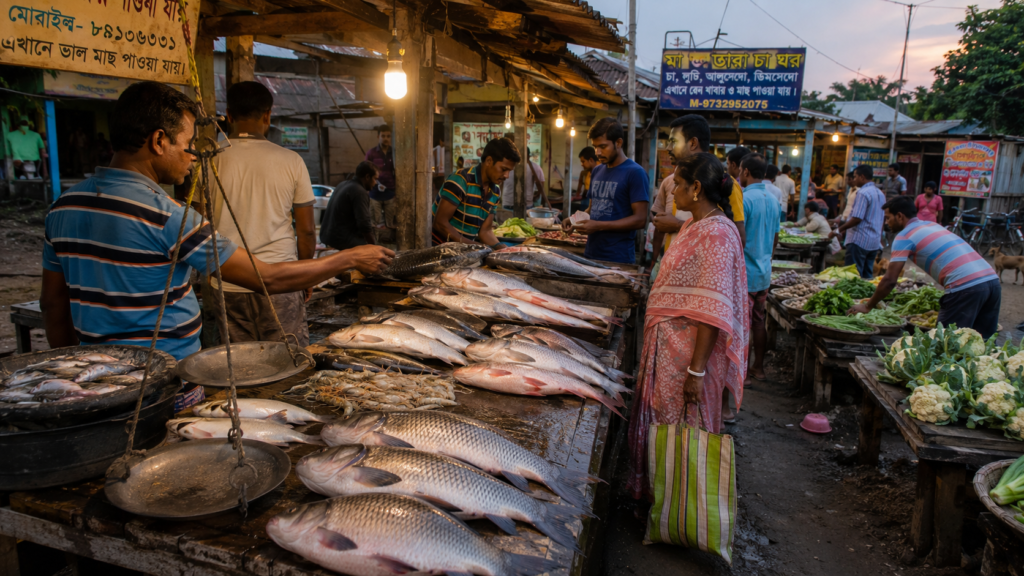
Many dishes remain simple.
- A lightly spiced machher jhol.
- Fish cooked with mustard paste and green chillies.
- Fresh catches fried and served beside rice and dal.
The goal is rarely complexity.
It is freshness.
The delta supplies the ingredients.
The kitchen does the rest.
Crabs and prawns also play an important role in parts of the island economy and occasionally on family tables. Mud crabs harvested from nearby waterways are especially valued, while different varieties of shrimp contribute both to local consumption and livelihoods.
The agricultural landscape appears just as clearly on the plate.
Winter markets often display radishes, spinach, cauliflower, cabbage, beans, and various leafy greens. During other seasons, pumpkins, bottle gourds, ridge gourds, brinjals, potatoes, and locally grown vegetables dominate household cooking.
Tea stalls provide another important layer of food culture.
Throughout Sandeshkhali, small roadside shops serve tea alongside muri, biscuits, singara, and telebhaja. For many residents, these stalls function as gathering places as much as food outlets. Ferry passengers stop before crossing rivers. Fishermen discuss tides. Farmers exchange information about crops.
The conversations are often as important as the refreshments.
Festivals bring their own traditions.
Special sweets, rice-based preparations, community feasts, and family meals appear during religious celebrations and important gatherings. While recipes vary between households, the emphasis remains firmly on sharing rather than display.
Perhaps the most distinctive characteristic of food in Sandeshkhali is its honesty.
- The meal reflects the day.
- The fish reflects the river.
- The vegetables reflect the season.
- The menu reflects the realities of life on a tidal island.
Long after sunset, when the rivers have disappeared into darkness and the ferries have stopped running, the story of Sandeshkhali continues around dinner tables illuminated by kitchen lights and evening conversation.
Sandeshkhali’s Economy
The economy of Sandeshkhali reveals itself through movement.
- A fishing boat leaving before sunrise.
- A farmer transporting vegetables to market.
- A ferry loaded with goods.
- An aquaculture pond is being maintained.
- A student preparing to leave for higher education.
Agriculture remains a major economic activity.
- Fishing continues to support numerous households.
- Aquaculture has become increasingly important.
- Trade links villages with larger regional markets.
Seasonal migration contributes to the income of many families. No single livelihood defines the island.
Instead, Sandeshkhali operates through a network of interconnected activities shaped by environmental conditions and market realities.
The economy remains deeply local.
Yet increasingly connected to the wider world.
Then and Now
The easiest way to understand change in Sandeshkhali is to compare horizons.
A century ago, the horizon would have contained more forest and fewer settlements.
- Fewer electric poles.
- Fewer roads.
- Fewer schools.
More uncertainty.
Today, the island is more connected than at any point in its history.
- Education has expanded.
- Communication has improved.
- Healthcare access has increased.
- Transportation networks have strengthened.
Yet some realities remain remarkably unchanged.
- The tide still dictates movement.
- Cyclones still threaten livelihoods.
- The rivers still reshape geography.
Modernity has arrived.
But the delta has not surrendered its influence.
The Wild Orbit Quick Facts
Island Identity
Frontier of Settlement
Region
Northern Sundarbans
District
North 24 Parganas
Administrative Units
Sandeshkhali-I and Sandeshkhali-II
Primary Landscape
Reclaimed deltaic islands, agricultural land, rivers, creeks, wetlands
Major River Systems
Vidyadhari, Kalindi, Raimangal-linked waterways and associated tidal channels
Primary Livelihoods
Agriculture, fishing, aquaculture, trade, services
Nearest Access Points
Dhamakhali, Nazat, Basirhat
Best Season for Exploration
November to February
Photography Highlights
Ferry crossings, embankments, riverscapes, village life, wetlands
Wildlife Highlights
Wetland birds, estuarine ecology, mangrove-associated species
The Wild Orbit Expedition Snapshot
Accessibility: 7.5/10
A rewarding combination of road and river travel.
Wildlife Potential: 6.5/10
Subtle rather than spectacular, especially for birdwatchers.
Photography Potential: 9/10
Among the strongest documentary landscapes in the northern Sundarbans.
Cultural Richness: 9/10
Settlement history is visible everywhere.
Historical Interest: 8.5/10
A remarkable story of reclamation and adaptation.
Solitude Level: 7/10
Move beyond major ferry routes and quiet landscapes emerge quickly.
The Wild Orbit Explorer Connections
After Sandeshkhali, continue the journey through:
- Hingalganj
- Gosaba
- Basanti
- Vidyadhari River corridors
- Raimangal frontier waterways
- Mangrove restoration landscapes
- Bonbibi cultural traditions
- Cyclone adaptation stories across the Sundarbans
Each reveals another chapter in the story of the delta.
FAQs
1. Is Sandeshkhali a single island?
Not exactly. Sandeshkhali is best understood as a riverine region within the northern Sundarbans consisting of multiple inhabited islands, villages, embanked landscapes, tidal creeks, and interconnected settlements.
2. Where is Sandeshkhali located?
Sandeshkhali lies in the North 24 Parganas district of West Bengal within the inhabited northern Sundarbans delta.
3. What makes Sandeshkhali unique?
Unlike islands primarily known for wildlife tourism, Sandeshkhali is defined by human settlement, embankments, agriculture, fisheries, and centuries of adaptation to a constantly changing delta landscape.
4. Is Sandeshkhali inside the Sundarbans?
Yes. It forms part of the inhabited Sundarbans region, although it is not part of the core protected tiger reserve landscape.
5. Are there mangroves in Sandeshkhali?
Yes. Mangrove vegetation occurs in patches along creeks, riverbanks, and nearby landscapes, though not at the density seen inside protected forest areas.
6. Can Bengal Tigers be found in Sandeshkhali?
Tiger habitat is primarily associated with the protected mangrove forests farther south. Sandeshkhali itself is predominantly a settled human landscape.
7. Which rivers influence Sandeshkhali?
The region is influenced by waterways connected to the Vidyadhari, Kalindi, Raimangal, and numerous tidal channels of the northern Sundarbans.
8. What is the best season to visit?
Winter, from November to February, offers the most comfortable weather, clearer skies, and excellent visibility.
9. How do people travel around Sandeshkhali?
Movement relies on a combination of roads, embankments, ferries, boats, motorcycles, bicycles, and footpaths.
10. Why are embankments so important?
They protect settlements and agricultural land from tidal flooding and saline water intrusion.
11. What are the primary occupations?
Agriculture, fishing, aquaculture, trade, transportation, and service-sector employment.
12. Are there markets in Sandeshkhali?
Yes. Local markets remain essential centres of trade, social interaction, and daily life.
13. Is Sandeshkhali good for birdwatching?
Very much so. Wetlands, ponds, agricultural landscapes, and tidal habitats attract numerous bird species.
14. Does Sandeshkhali experience cyclones?
Yes. Like much of the Sundarbans, it remains vulnerable to cyclones originating in the Bay of Bengal.
15. What is the landscape like?
A mosaic of villages, embankments, rivers, agricultural fields, aquaculture ponds, wetlands, and scattered mangrove habitats.
16. Is Sandeshkhali suitable for photographers?
It is one of the most rewarding documentary and cultural photography landscapes in the northern Sundarbans.
17. Are ferry journeys necessary?
For most visitors, yes. River crossings remain an essential part of reaching and understanding the island.
18. What wildlife can be seen?
Birds, reptiles, amphibians, fish, estuarine species, and various wetland-dependent animals.
19. Are there historical sites?
The history of Sandeshkhali is embedded more in its reclaimed landscapes, embankments, settlement patterns, and oral traditions than in monumental architecture.
20. Is Sandeshkhali connected to other islands?
Extensively. Its river networks link it with numerous settlements across the northern Sundarbans.
21. What food should visitors look for?
Fresh fish dishes, seasonal vegetables, local crab preparations, and traditional Bengali riverine cuisine.
22. What role do rivers play today?
They continue shaping transportation, livelihoods, trade, ecology, and settlement patterns.
23. Is Sandeshkhali changing?
Yes. Improved infrastructure, communications, education, and economic opportunities continue to reshape the region.
24. What is the biggest challenge facing Sandeshkhali?
Maintaining a balance between development, environmental sustainability, river dynamics, and climate-related risks.
25. What should explorers pay most attention to?
The relationship between people and water. Everything else begins there.
How to Reach Sandeshkhali
Every journey to Sandeshkhali begins with a transition.
The city must gradually disappear.
- Concrete gives way to wetlands.
- Highways give way to rural roads.
- Eventually, roads give way to rivers.
Only then does the island reveal itself.
From Kolkata
Most travellers begin from Kolkata and head north toward Basirhat or Dhamakhali.
By Road
Kolkata → Barasat → Basirhat → Dhamakhali
Approximate travel time:
3–4 hours, depending on traffic and road conditions.
Dhamakhali serves as one of the most important gateways into the northern Sundarbans.
By Rail
Travellers can reach the Basirhat region through the suburban rail networks connecting Kolkata with North 24 Parganas.
From the railway station, onward road transport leads toward ferry points serving Sandeshkhali.
By Ferry
The ferry crossing is not simply transportation.
It is part of the experience. As the mainland recedes, the geography of the delta begins revealing itself.
- The rivers widen.
- The settlements thin.
- The embankments appear.
For many visitors, this crossing becomes their first real introduction to the Sundarbans.
During Monsoon
Travel remains possible but requires greater flexibility. Weather conditions, water levels, and ferry schedules may influence journey times.
Explorer Tips
- Begin early in the morning.
- Allow extra time for ferry connections.
- Carry drinking water during the summer.
- Respect local communities when photographing.
- Remember that tides influence schedules.
In Sandeshkhali, patience remains one of the most useful travel skills.
Things to See Around Sandeshkhali
Sandeshkhali rewards curiosity more than checklists. The most memorable experiences often emerge unexpectedly.
Embankment Walks
The embankments provide some of the finest observational routes in the region. Walking them reveals the relationship between the river and the settlement better than any map.
Ferry Ghats
Watch daily life unfold at local ferry crossings. These are places where economies, communities, and stories intersect.
Village Landscapes
The villages themselves are among Sandeshkhali’s greatest attractions.
Observe:
- Courtyard life
- Fishing activities
- Local architecture
- Agricultural practices
- Community spaces
Wetlands and Ponds
Many of the island’s most productive ecosystems are found in its ponds, canals, and seasonal wetlands. Birdlife can be particularly rewarding.
Local Markets
Markets reveal the economic heartbeat of the island. Fish, vegetables, household goods, and conversations move together through these spaces.
River Viewpoints
Sunrise and sunset transform the waterways. Few experiences capture the character of Sandeshkhali more effectively than watching light change across the river.
Nearby River Corridors
Exploring connected waterways reveals the broader ecological and cultural landscape of the northern Sundarbans.
Seasonal Photography Opportunities
- Winter fog.
- Monsoon clouds.
- Fishing activity.
- Agricultural harvests.
- Cyclone recovery landscapes.
Each season reveals a different version of the island.
Continue the Journey
No Sundarban island tells the complete story.
Each reveals a different chapter. Sandeshkhali introduces the story of settlement.
Travel farther south and the mangroves become stronger. Follow the rivers eastward and international frontiers emerge. Explore neighbouring islands and new relationships between people, water, wildlife, and history become visible.
The delta is not a destination.
It is a network.
- Every river bend leads to another story.
- Every crossing reveals another landscape.
- Every island offers another perspective on survival at the edge of land and sea.
As Darkness Settles Over the Delta
The last ferry leaves on a falling tide.
The river that carried us into Sandeshkhali at dawn now carries us away.
Evening settles slowly across the delta.
- The embankments turn dark.
- Palm trees become silhouettes.
- A fisherman pulls in his final net of the day.
- Children disappear from the riverbank.
Smoke rises from evening kitchens and drifts above the villages before dissolving into the gathering darkness.
For a few moments, the island seems suspended between water and sky.
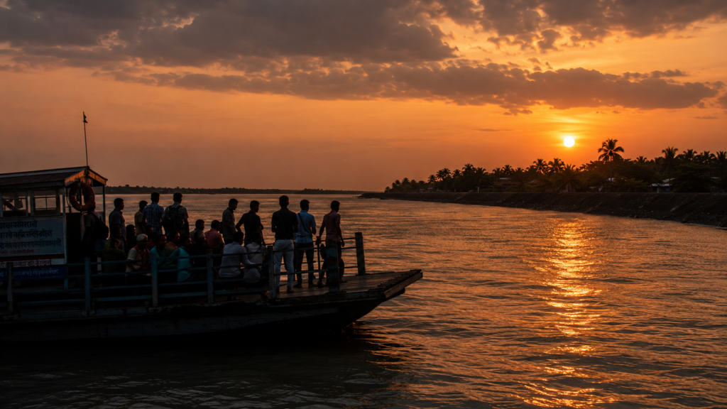
- Then distance begins its work.
- The details vanish first.
- The tea stalls.
- The ponds.
- The bicycles.
- The fishing nets.
- The people.
Soon, only the outline of the embankment remains.
A thin dark line holding back an immense river. It is impossible to leave Sandeshkhali without thinking about that embankment.
Because it represents something larger than engineering. It represents the central story of the island. Generation after generation has chosen to build a life here despite uncertainty.
- Despite storms.
- Despite erosion.
- Despite tides that never stop moving.
Sandeshkhali is not a landscape that overwhelms visitors with spectacle.
- Its power is quieter.
- It emerges through observation.
- Through conversations.
- Through ferry crossings.
Through the realisation that every field, every village, every road, and every pond exists because people refused to surrender ground to the delta. As the ferry rounds the final bend, the island slowly disappears into the evening haze.
The river remains.
The tide continues its ancient journey toward the sea. And somewhere beyond the darkness, behind embankments and village lights, Sandeshkhali begins preparing for another dawn.
Another tide.
Another day on the frontier of settlement.
Plan your private Sundarban expedition
A private journey shaped around you — your group, your pace, your interests. Book a free consultation.