 Encyclopedia
The eastern sky has only begun to pale when the first sounds of Haroa stir the morning.
A rooster calls from somewhere beyond a grove of coconut palms.
The echo travels across ponds still veiled in mist.
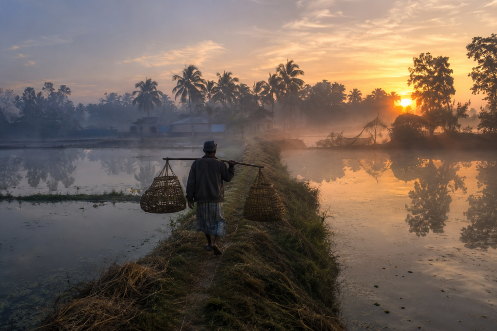
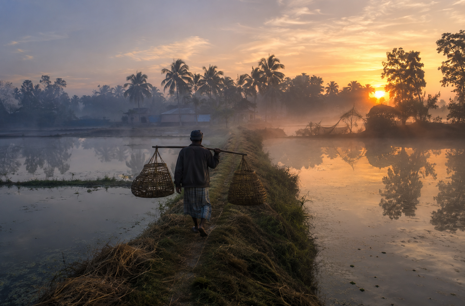
A fisherman, balancing two empty baskets across his shoulders, walks quietly along an embankment that separates cultivated fields from a narrow tidal canal.
Somewhere beyond the haze, the water is already moving—not with the urgency of a mountain river, but with the patient rhythm of the delta, rising and falling to the unseen pull of the Bay of Bengal.
This is not yet the Sundarbans that most people imagine.
There are no towering mangrove walls closing around narrow creeks. No watchtowers scanning tiger country. No tourist boats are waiting at a jetty.
Instead, there is something quieter.
Something older.
A landscape where the rivers begin teaching the lessons that the mangrove forest will later complete.
This is Haroa.
Haroa sits on the eastern edge of Bengal’s inhabited plain, where agriculture, wetlands, fisheries, and tidal waterways slowly merge into one another.
It is a place of transition:
- Between freshwater and brackish influence
- Between cultivated land and tidal marsh
- Between settled villages and the increasingly complex river networks
To pass through Haroa without stopping is to miss one of the most important chapters in the story of the lower delta.
- Because before there were forest expeditions, there were villages.
- Before there were wildlife sanctuaries, there were embankments.
- Before there were protected mangroves, people were learning how to survive beside water that never stayed still.
First Encounter
The road into Haroa does not announce itself dramatically.
It unfolds through gradual change. Leaving the denser settlements of North 24 Parganas behind, the landscape begins to breathe.
- Buildings become lower.
- The sky grows wider.
- Roadside ponds appear with increasing frequency.
Canals begin accompanying the road, sometimes hidden beneath water hyacinth, sometimes reflecting the morning sky like polished glass.
The villages seem to emerge from the greenery rather than interrupt it.
- Palm trees rise above tiled roofs.
- Bamboo groves soften the edges of homesteads.
- Banana plants lean over narrow footpaths connecting one courtyard to another.
Water is never far away.
Even when no river is visible, the land carries its presence.
- The soil is rich.
- The air feels heavy with moisture.
- The vegetation appears denser than in inland Bengal.
Everything suggests a landscape that has spent centuries negotiating with water rather than resisting it.
As the morning market begins to awaken:
- Bicycles arrive carrying vegetables harvested before sunrise.
- Motorcycles weave carefully between handcarts loaded with fish.
- Tea stalls fill with conversations about rainfall, crop prices, and the previous night’s tide.
The first impression is not one of wilderness. It is one of coexistence.
Haroa’s Identity
Haroa lies within the North 24 Parganas district of West Bengal and serves as the administrative centre of the Haroa Community Development Block.
Yet administrative boundaries reveal only part of its story.
The true identity of Haroa is geographical. It occupies one of the most fascinating transition zones in eastern Bengal.
To the west lie increasingly urbanized landscapes connected to Kolkata.
To the east and southeast stretch wetlands, tidal rivers, fisheries, reclaimed agricultural land, and eventually the river systems that flow toward the Indian Sundarbans.
The settlements are neither entirely inland nor fully coastal.
They belong to the delta.
- Fields alternate with ponds.
- Villages follow embankments.
- Roads frequently parallel canals first established for drainage and navigation.
Every element of the landscape reflects generations of adaptation to an environment shaped by water.
Haroa is best understood not as a destination in isolation but as a living chapter within the larger story of Bengal’s deltaic civilization.
The Rivers That Created Haroa
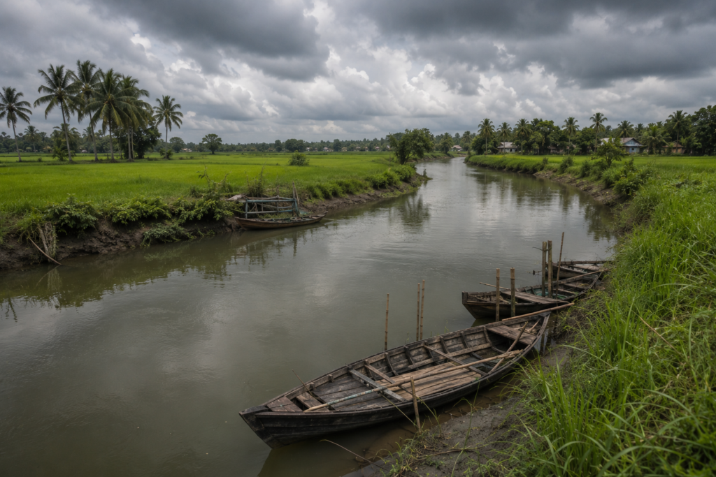
Long before roads reached this landscape, rivers had already written its geography.
The lower Bengal delta has always been a place of movement. Sediment carried from the Himalayas settled here over thousands of years, gradually creating new land while simultaneously eroding older landscapes.
- Channels shifted.
- Wetlands expanded.
- New waterways emerged.
- Old ones disappeared.
Human settlement followed these changes rather than controlling them.
Haroa developed beside this restless hydrological system. Numerous tidal channels, distributaries, and drainage canals have historically connected the region with larger river systems flowing toward the Bay of Bengal.
These waterways were more than natural features.
- They were transport routes.
- Sources of fish.
- Boundaries between villages.
- Irrigation networks.
- Drainage systems.
And sometimes, threats.
During periods of heavy rainfall or cyclonic weather, these same waterways could overflow, flooding fields and settlements.
Generations of residents responded by raising homesteads, constructing embankments, excavating ponds, and developing remarkable knowledge of seasonal water behaviour.
The landscape visible today is the result of centuries of conversation between people and rivers.
Neither has ever completely dominated the other.
Historical Footprints
By mid-morning, as sunlight settles across the fields, Haroa begins revealing its history.
Not through monumental ruins or grand palaces.
But through patterns.
- Settlement patterns.
- Agricultural boundaries.
- Village names.
- Old embankments.
- Religious institutions.
The history of Haroa belongs to the broader history of eastern Bengal’s deltaic expansion.
Large parts of this region were once dominated by wetlands, marshes, tidal creeks, and forests. Over centuries, communities gradually reclaimed land for cultivation.
- Agriculture expanded.
- Villages grew.
- Trade developed.
The Mughal administration integrated much of the region into wider systems of governance and revenue collection, encouraging further settlement.
During the colonial period, reclamation accelerated.
British administrators viewed the delta as land that could be converted into productive agricultural estates.
- Embankments multiplied.
- Canals were modified.
- Forest cover declined in many areas.
- Rice cultivation expanded.
These transformations generated prosperity for some communities while also altering ecological systems that had evolved over millennia.
Haroa’s contemporary landscape still bears the imprint of these changes. What appears permanent has often been repeatedly reshaped.
Historical Transformations
The arrival of modern infrastructure changed Haroa profoundly.
- Road connectivity improved.
- Educational institutions expanded.
- Healthcare gradually became more accessible.
- Markets grew into regional centres serving surrounding villages.
- Agricultural techniques evolved.
- Fish farming increased.
The relationship between Haroa and Kolkata strengthened through commerce and transportation.
Yet unlike rapidly urbanizing suburbs closer to the city, Haroa retained much of its rural identity.
- Fields continued producing rice.
- Ponds continued supporting fisheries.
- Seasonal rhythms continued to guide livelihoods.
Modernity arrived without entirely replacing the older relationship between people and landscape.
That coexistence remains one of Haroa’s defining characteristics.
Folklore and the Water’s Memory
As the afternoon approaches, conversations drift from practical matters toward older stories.
In Haroa, folklore is less about dramatic encounters with tigers than about rivers, storms, sacred groves, ponds, and ancestral memory.
Many villages maintain shrines beneath ancient trees where local deities continue receiving offerings before important agricultural seasons.
Older residents sometimes recall stories explaining unusual bends in canals, ponds believed to possess protective qualities, or stretches of water regarded with quiet respect after generations of floods.
These narratives are not easily verified through historical records.
Nor should they be treated as literal history.
Instead, they reveal how communities understand the landscape emotionally.
In a delta where rivers continually alter the physical world, stories become a different kind of map.
They preserve memory when geography changes.
They remind younger generations that survival has always depended upon paying attention—not only to water levels and weather, but also to the accumulated wisdom of those who lived here before.
As afternoon light spreads across Haroa’s wetlands and cultivated fields, the landscape begins revealing itself as something far richer than a rural settlement.
It is a place where Bengal’s long conversation with water continues every day, quietly shaping lives that remain inseparable from the rivers flowing beyond the horizon.
Life Between Water and Soil
Unlike the deeper Sundarbans, where rivers often dominate the horizon, Haroa presents a more intimate relationship with water.
Here, water is woven into daily life rather than standing apart from it.
Almost every village contains ponds of different sizes.
- Some support household fisheries.
- Others store rainwater.
- Many provide irrigation during drier months.
- Some have existed for generations, dug by families whose descendants still live nearby.
From above, Haroa resembles a mosaic.
- Green fields.
- Silver ponds.
- Narrow canals.
- Earthen embankments.
- Clusters of homes shaded by mango and coconut trees.
The pattern is neither accidental nor decorative. It is the architecture of survival.
For centuries, people here have shaped the land just enough to live with water rather than fight against it.
The result is one of Bengal’s most enduring cultural landscapes.
Walking Through the Villages
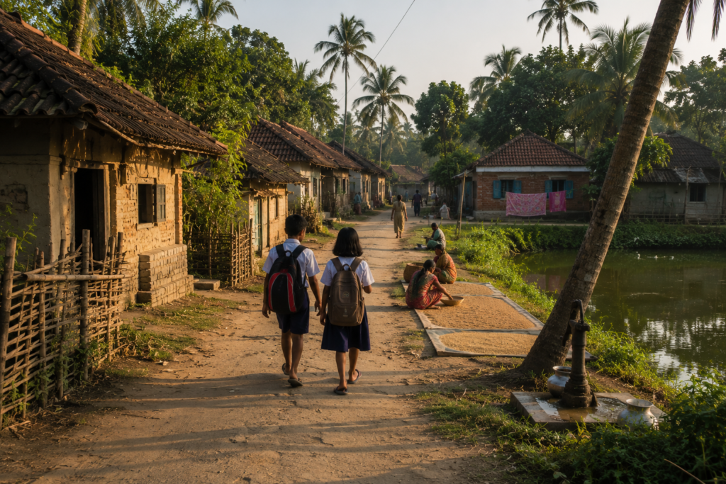
The village roads are rarely straight.
They curve gently around ponds, skirt agricultural plots, and follow embankments first built to protect fields from seasonal flooding.
Walking these paths reveals details impossible to notice from a vehicle.
- An elderly man repairs a bamboo fishing trap beneath the shade of a neem tree.
- Children chase dragonflies across the edges of a pond.
- A woman spreads freshly harvested paddy across a courtyard to dry beneath the afternoon sun.
- Goats wander freely between homes.
- The smell of cooked rice drifts from open kitchens.
- The villages possess a quiet order shaped by necessity.
Fruit trees surround nearly every homestead.
- Mango.
- Jackfruit.
- Guava.
- Coconut.
- Banana.
- Areca palm.
These are not ornamental plantings.
They are part of the household economy. They provide food, shade, timber, fodder, and seasonal income. Many homes still preserve traditional courtyard layouts.
The central open space functions as a kitchen, workshop, drying yard, gathering place, and playground all at once.
Life unfolds collectively.
Even today, village architecture reflects centuries of adaptation to climate.
- Raised plinths help reduce flood damage.
- Sloping roofs shed monsoon rain.
- Trees soften the summer heat.
- Ponds moderate temperature and provide water.
Every element has evolved through experience rather than design theory.
Where the Delta Meets Itself
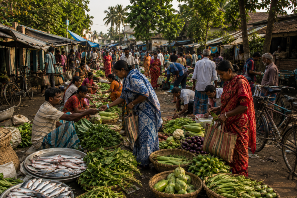
By late morning, Haroa’s markets have become fully alive.
These are more than commercial spaces. They are the social heartbeat of the region.
- Farmers arrive carrying vegetables harvested only hours earlier.
- Fishermen unload baskets filled with freshwater fish.
- Small traders display agricultural tools, spices, household goods, and woven baskets.
The market speaks through smell before sight.
Fresh coriander.
Green chilies.
Wet earth clinging to newly harvested vegetables.
- Fish.
- Mustard oil.
- Tea leaves.
- Wood smoke.
- Jaggery.
The conversations are as important as the goods themselves.
- News travels quickly here.
- Rainfall predictions.
- Crop diseases.
- Wedding invitations.
- Employment opportunities.
- Political debates.
The market functions as an information network every bit as valuable as its economic role.
For an explorer, these conversations reveal the priorities of the landscape. Everything eventually returns to water.
- Will the rains arrive on time?
- Has the canal filled?
- How are the ponds?
- Is the fish harvest improving?
The market reflects a society that still measures prosperity through environmental stability.
Schools, Shrines, and Everyday Faith
Scattered among the villages are institutions that quietly shape community life.
- Government schools.
- Primary health centres.
- Mosques.
- Temples.
- Small shrines beneath banyan and peepal trees.
Unlike monumental religious architecture found elsewhere, Haroa’s sacred spaces often feel deeply integrated into everyday life.
- Morning prayers blend naturally with agricultural routines.
- Temple bells mingle with the sounds of bicycles and school assemblies.
- The rhythm is unforced.
Faith here is woven into ordinary existence rather than separated from it. Village festivals remain important markers in the annual calendar.
- Harvest celebrations.
- Religious observances.
- Community gatherings.
These occasions reinforce relationships that extend far beyond individual households. In the delta, resilience has always depended upon community.
The institutions that nurture those communities remain central to Haroa’s identity.
The Sounds of Haroa
Every landscape possesses its own language.
Haroa speaks softly.
At dawn, birds dominate.
- House Crows announce the morning from rooftop antennas.
- Common Mynas patrol village paths.
- Asian Pied Starlings chatter in small groups across harvested fields.
- The liquid whistle of the Oriental Magpie-Robin occasionally cuts through the stillness from a shaded courtyard.
As the day progresses, human sounds gradually replace birdsong.
- Cycle bells.
- Hand pumps.
- The rhythmic strike of sickles against paddy.
- Children reciting lessons from classrooms.
- Conversations drifting from tea stalls.
- Motorcycles crossing narrow bridges.
The distant horn of a bus travelling toward Basirhat.
Then, as evening approaches, another orchestra emerges.
- Tree frogs begin calling from ponds.
- Crickets fill the fields.
- Fruit bats pass overhead.
The occasional splash from a fish disturbs an otherwise still pond. The soundscape reminds the listener that even in cultivated landscapes, nature never retreats very far.
Wildlife Expedition
See it for yourself
A private journey shaped around you — your group, your pace, your interests. Book a free consultation.
To those searching only for large mammals, Haroa may seem ordinary.
To a field naturalist, it is anything but.
The landscape supports a remarkable diversity of life precisely because it contains so many different habitats.
- Agricultural fields.
- Ponds.
- Canals.
- Marshes.
- Village groves.
- Seasonal wetlands.
Each supports its own community of species.
- The birdlife is particularly rewarding.
- Cattle Egrets accompany grazing livestock.
- Indian Pond Herons vanish against muddy banks until they suddenly take flight.
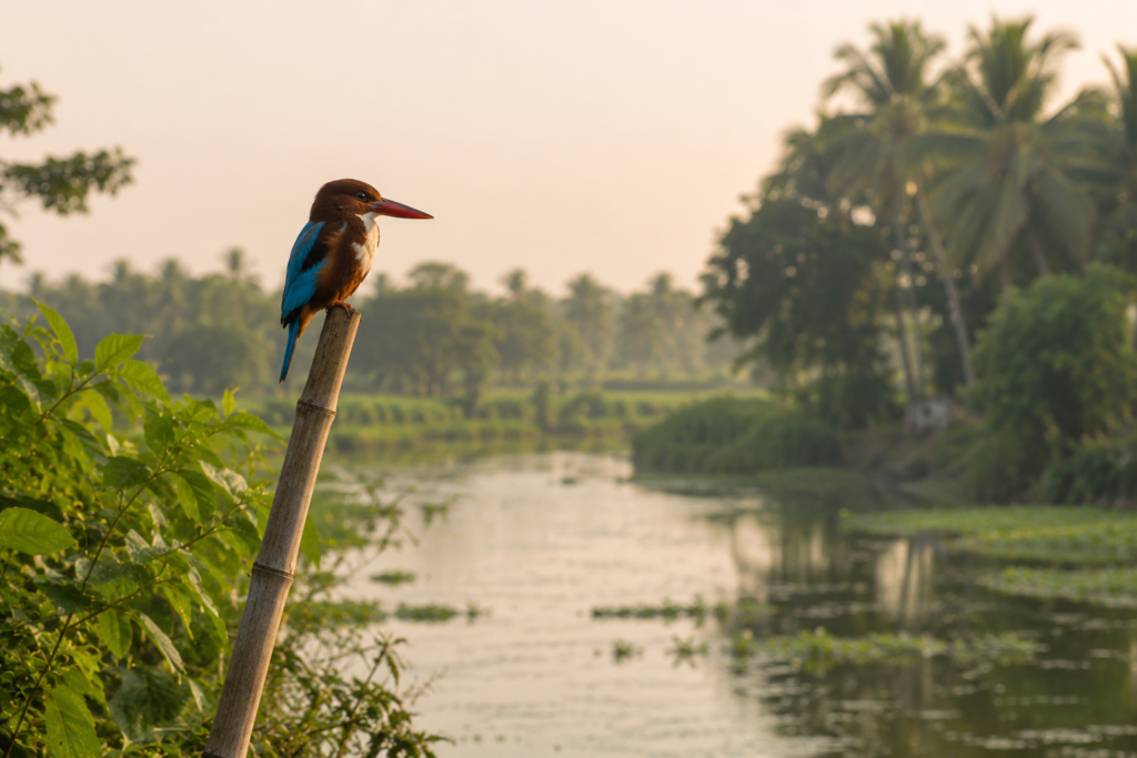
- White-throated Kingfishers flash brilliant turquoise above canals.
- Black Drongos patrol open fields for insects.
- Green Bee-eaters gather along exposed wires.
During winter, migratory visitors add new dimensions to the wetlands.
Depending on seasonal water conditions, observers may encounter ducks, waders, and other waterbirds using Haroa’s wetlands as feeding or resting grounds during their long journeys.
- The reptiles are less conspicuous but equally important.
- Garden Lizards bask on fence posts.
- Water Snakes glide silently through canals.
- Skinks disappear beneath leaf litter.
The monsoon awakens an astonishing amphibian chorus.
- Tree frogs call from every direction after heavy rain.
- Dragonflies patrol ponds in dazzling numbers.
- Butterflies move between flowering shrubs and vegetable gardens.
Wildlife here is subtle.
It rewards patience rather than spectacle.
Explorer’s Field Notes
Field Note 01 — Ponds as Archives
Each village pond tells a story.
- Some were excavated generations ago by wealthy landowners.
- Others were community efforts.
- Some support fish farming.
- Others exist primarily for domestic use.
Together they form an archive of settlement history.
Field Note 02 — The Geometry of Agriculture
Seen from elevated ground, the fields reveal an intricate geometry shaped by canals, embankments, and property boundaries.
The pattern reflects centuries of negotiation between cultivation and seasonal flooding.
Field Note 03 — Trees That Build Villages
The vegetation surrounding homesteads is remarkably consistent.
- Mango.
- Coconut.
- Jackfruit.
- Banana.
- Areca palm.
These species define not only the skyline but also household economies.
Field Note 04 — Water Never Leaves
Even during the dry season, evidence of water remains everywhere.
- Canals.
- Ponds.
- Low-lying marshes.
- Moist soils.
The landscape never completely escapes its relationship with the delta.
Field Note 05 — A Landscape Best Explored Slowly
Haroa reveals itself gradually.
Its greatest discoveries are rarely visible from highways.
They appear while walking village paths, waiting beside ponds, or listening to conversations beneath a tea stall roof.
Nightfall on Haroa
As evening settles over the wetlands, the transformation feels almost theatrical.
- The markets begin closing.
- Farmers return from the fields.
- Smoke rises from dozens of kitchens at once.
- The smell of cooking rice drifts through the villages.
- Mosques complete the final call to prayer.
- Temple bells ring briefly before fading into the growing darkness.
- The ponds become mirrors.
- Bats replace swallows in the evening sky.
Fireflies occasionally flicker above damp vegetation during humid months.
- The roads grow quieter.
- The wetlands do not.
- Frogs begin their chorus.
- Insects take over the soundscape.
Somewhere beyond the darkness, the tidal rivers continue their slow movement toward the mangrove forests of the Indian Sundarbans.
Haroa settles into the night without ever becoming silent.
It simply changes shifts.
The people rest.
The wetlands keep watch.
And by dawn, the conversation between land and water will begin again.
The Seasons of Haroa
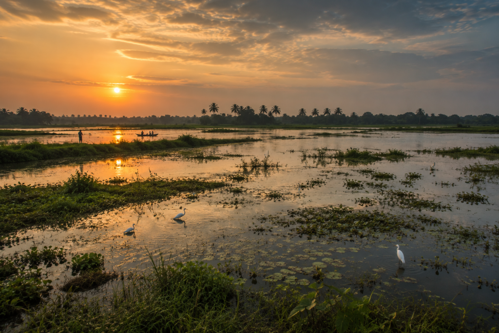
The year in Haroa unfolds as a continuous conversation between sky, soil, and water. Each season leaves its own signature upon the landscape, changing not only its appearance but also the rhythm of village life.
Winter — The Season of Clarity
Winter arrives gently.
There is no snowfall.
No dramatic transformation.
Instead, the air becomes lighter.
Humidity retreats.
Morning mist settles across ponds and wetlands, softening the outlines of coconut palms and bamboo groves. Sunrise takes on a golden clarity that photographers often wait patiently to capture.
This is the busiest agricultural season.
Fields of ripening paddy shimmer beneath clear blue skies. Vegetable cultivation reaches its peak, and village markets overflow with cauliflower, cabbage, radish, spinach, tomatoes, beans, and freshly harvested greens.
For birdwatchers, winter offers Haroa at its finest.
Seasonal wetlands attract migratory waterbirds that travel thousands of kilometres along the Central Asian Flyway. Species vary from year to year depending on rainfall and wetland conditions, but the season consistently brings greater avian diversity than any other time of year.
The comfortable weather also encourages longer walks through villages and along embankments, revealing details often hidden during the hotter months.
Spring — Quiet Renewal
Spring is brief in southern Bengal.
Almost before it announces itself, it begins preparing the landscape for summer.
- New leaves appear on mango trees.
- Jackfruit begins forming.
- The countryside turns a brighter shade of green.
- The mornings remain pleasant, but afternoons grow steadily warmer.
Birdsong becomes particularly noticeable during this season as many resident species enter their breeding cycles.
The villages seem full of quiet anticipation.
Everyone knows the heat is coming.
Summer — Waiting for Rain
By April and May, Haroa enters its most demanding season.
- The midday sun becomes relentless.
- Dust gathers on village roads.
- Ponds begin shrinking.
- Canals carry less water.
- Farmers constantly watch the sky.
The landscape feels suspended between exhaustion and expectation.
- Work begins earlier.
- Tea stalls become refuges from the afternoon heat.
- Children seek shade beneath large banyan and mango trees after school.
Even the birds become quieter during the hottest hours. Yet beneath this apparent stillness lies hope. Every conversation eventually returns to the same question:
“When will the rains arrive?”
Monsoon — The Delta Awakens
The first heavy rain transforms Haroa almost overnight.
- The dry earth drinks deeply.
- Canals refill.
- Ponds overflow.
- Rice fields become mirrors reflecting immense skies.
- The countryside turns into countless shades of green.
For the wetlands, this is the season of abundance.
- Fish breed in newly flooded waters.
- Frogs emerge in astonishing numbers.
- Dragonflies patrol every pond.
- The calls of amphibians fill the evening air.
For farmers, the monsoon brings both opportunity and uncertainty.
The rains sustain agriculture, but excessive rainfall can inundate fields, damage roads, and overwhelm drainage systems.
This dual nature of the monsoon has shaped local knowledge for generations.
People celebrate the rain.
But they also respect it.
Post-Monsoon — A Landscape Reborn
When the rains begin to withdraw, Haroa enters one of its most beautiful periods.
- The fields remain lush.
- Wetlands retain abundant water.
- The air grows clearer.
- Harvest preparations begin.
- Bird activity increases once again.
The countryside feels refreshed after months of rain.
For photographers, this season often provides dramatic cloud formations, rich colours, and exceptional reflections across ponds and flooded fields.
Cyclones and Survival
No discussion of Haroa can ignore the storms.
Although it lies inland from the Bay of Bengal, Haroa remains deeply connected to the cyclone history of southern Bengal.
The winds may weaken before reaching here.
The storm surge may not arrive with the same intensity experienced by coastal islands.
Yet the effects are still profound.
- Heavy rainfall.
- Flooded fields.
- Fallen trees.
- Damaged homes.
- Interrupted transport.
- Lost harvests.
The names of major cyclones have become markers in local memory.
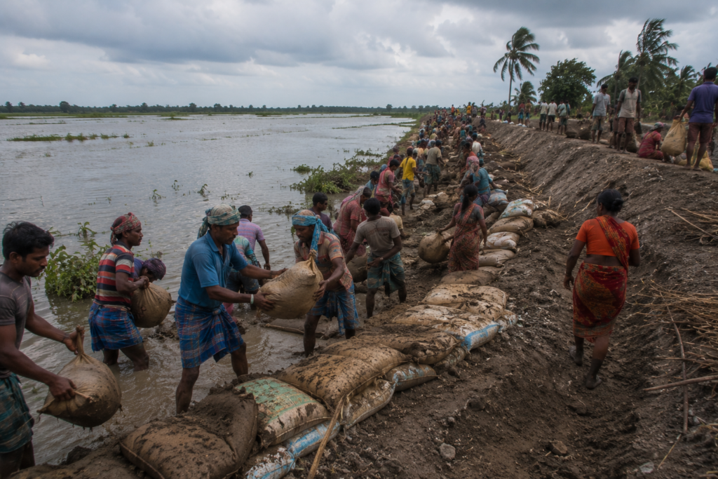
Aila (2009) demonstrated how interconnected the delta truly is. While the worst devastation occurred farther south, Haroa experienced flooding, agricultural losses, and disruptions that rippled through the local economy.
Bulbul (2019) brought destructive winds and heavy rain, reminding communities that even inland settlements remain vulnerable.
Amphan (2020) left perhaps the deepest recent impression. Powerful winds uprooted countless trees, damaged electrical infrastructure, affected homes, and caused widespread disruption across southern Bengal.
Yaas (2021) once again tested the resilience of delta communities through intense rainfall and regional flooding.
Ask older residents about these storms, and they rarely begin with statistics.
Instead, they remember moments.
- The night electricity disappeared.
- The sound of corrugated roofs rattling in the wind.
- Neighbours helping repair damaged houses.
- The first market reopening after the storm.
The first successful harvest followed.
Resilience in Haroa is rarely dramatic.
- It is practical.
- People rebuild.
- Replant.
- Repair.
And prepare for the next season.
Photography Expedition Guide
Haroa rewards photographers who appreciate atmosphere rather than spectacle.
Its beauty lies in subtle transitions.
- Changing light.
- Human activity.
- Water.
And the relationship between people and landscape.
Sunrise Photography
Winter mornings are exceptional.
- Mist rising from ponds.
- Palm silhouettes against golden skies.
- Farmers walking to fields before sunrise.
The stillness of early morning often produces some of the most evocative images in the lower delta.
Wetland Photography
The wetlands surrounding Haroa provide opportunities throughout the year.
Monsoon and post-monsoon seasons produce dramatic reflections, while winter offers better visibility for bird photography.
Patience is essential.
Many of the finest images emerge after long periods of observation rather than constant movement.
Village Life Photography
Haroa’s villages are rich in visual detail.
- Courtyards.
- Traditional homes.
- Fish ponds.
- Bamboo fences.
- Children cycling to school.
- Women drying paddy.
- Elders gathered beneath the tea stall awnings.
Photographs succeed here when they document ordinary life with respect.
Agricultural Landscapes
The changing agricultural calendar continually transforms the scenery.
- Freshly planted rice.
- Harvesting.
- Vegetable cultivation.
- Flooded fields.
Each season tells a different story.
Storm Photography
When undertaken safely and responsibly, the skies before and after monsoon storms can produce extraordinary atmospheric images.
Towering cumulonimbus clouds above the open delta plain create dramatic compositions unlike those found in more mountainous landscapes.
Explorer’s Field Notes
Field Note 01 — The Wetlands Are Working
The wetlands are not empty spaces waiting for development.
They regulate floods, support fisheries, recharge groundwater, and provide habitat for wildlife.
Their ecological value is inseparable from the livelihoods they sustain.
Field Note 02 — The Delta Lives in Layers
Haroa is a landscape built one generation at a time.
- Each embankment.
- Each pond.
- Each field.
- Each grove of trees.
Together they form a living archive of adaptation.
Field Note 03 — Water Shapes Settlement
Even where rivers are distant, water determines everything.
- Village locations.
- Road alignments.
- Agricultural boundaries.
- The placement of ponds.
The delta remains the unseen architect.
Field Note 04 — Watch the Sky
Few places reward attention to the sky more than Haroa.
- Clouds become weather forecasts.
- Bird movements hint at seasonal change.
- The quality of light transforms the landscape hour by hour.
Field Note 05 — Explore Slowly
Haroa reveals itself gradually.
Its greatest discoveries rarely appear in guidebooks.
They emerge while listening to conversations at a tea stall, following a canal beyond the village, or waiting beside a wetland as evening birds return to roost.
Connected Landscapes
Haroa is not an isolated destination.
It forms part of a wider network of wetlands, rivers, agricultural landscapes, and historic settlements that stretches across eastern Bengal.
To the east lie the ecologically rich wetlands and river systems leading toward the Indo-Bangladesh border.
To the south, the tidal influence becomes increasingly pronounced as waterways connect with the northern reaches of the Sundarbans.
Nearby regions such as:
- Minakhan
- Sandeshkhali
- Hasnabad
- Hingalganj
Each reveals different expressions of life in the lower delta.
Some are shaped more strongly by fisheries. Others by tidal rivers. Others by the proximity of the mangrove frontier.
Together, they form a continuous landscape rather than separate destinations.
Understanding Haroa enriches every journey that follows into the eastern Sundarbans.
Oral Histories
As dusk settles and conversations lengthen beneath verandas, memories surface.
Older residents speak of a Haroa with fewer roads and more waterways.
- They remember travelling by country boat, where buses now run.
- They recall ponds that once seemed enormous but have gradually silted over.
- Some describe agricultural seasons that were more predictable.
- Others remember years when floods lingered for weeks.
Many speak of how education, electricity, and improved roads transformed village life.
Yet despite these changes, certain themes remain constant.
- Respect for water.
- Dependence on community.
- The importance of land.
- The unpredictability of the weather.
And the belief that survival in the delta has always depended less on conquering nature than on learning to live with it.
These stories may differ in detail from one village to another, but together they form Haroa’s unwritten history.
A history carried not in monuments, but in memory.
As darkness settles across the wetlands:
- Frogs replace birdsong
- Lanterns glow in distant courtyards
- The day’s final breeze ripples across the ponds
Haroa becomes quieter, but its story continues—waiting for another dawn, another season, and another generation to add its own chapter to the living history of Bengal’s eastern delta.
The Food of Haroa
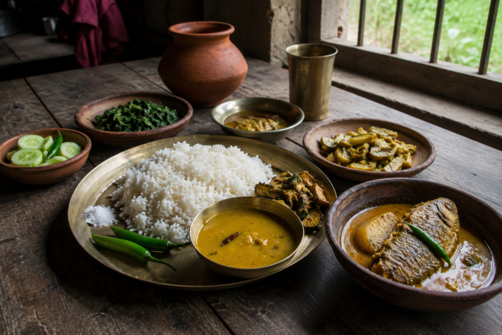
Food in Haroa is inseparable from the landscape.
The rivers may not dominate every horizon, but water influences almost every meal served here.
Rice remains the foundation of daily life.
Morning begins with steaming rice or flattened rice preparations in many households, while lunch and dinner continue the long-standing Bengali tradition of rice accompanied by vegetables, lentils, and fish.
Unlike urban kitchens that depend increasingly on distant supply chains, many families in Haroa continue drawing ingredients from their immediate surroundings.
- Vegetables arrive from nearby fields.
- Fish come from ponds, canals, wetlands, or local aquaculture farms.
- Fruit grows in household courtyards.
Seasonality still matters.
The menu changes because the landscape changes.
Fish: The Delta’s Daily Companion
Walk through any morning market and one fact becomes immediately obvious.
Fish is not considered a luxury.
It is part of everyday life.
Freshwater species dominate local trade.
- Rohu.
- Catla.
- Mrigal.
- Tilapia.
- Pabda.
- Magur.
- Shingi.
Various small indigenous fish continue appearing according to season and local availability.
Fish farming has become increasingly important alongside traditional capture fisheries. Thousands of village ponds support aquaculture, providing both nutrition and household income.
For many families, these ponds represent security.
They produce food even when agricultural harvests become uncertain.
Rice and Seasonal Agriculture
The surrounding fields shape Haroa’s culinary identity.
Rice remains the principal crop, and harvest seasons continue to influence community life. Freshly harvested rice often carries cultural significance beyond its economic value.
- Festival meals.
- Family gatherings.
- Religious observances.
Many traditions remain connected to agricultural cycles that have persisted for generations.
Vegetables complement this rhythm. Winter markets become especially vibrant.
- Cauliflower.
- Cabbage.
- Spinach.
- Radish.
- Beans.
- Tomatoes.
- Pumpkin.
- Bottle gourd.
- Brinjal.
Many households cultivate small kitchen gardens that supply daily cooking throughout much of the year.
Sweet Traditions
Although Haroa is not associated with a single iconic sweet in the way Jaynagar is known for its Moa, sweet-making remains deeply rooted in Bengali culinary culture.
During festivals and family ceremonies, local confectioners prepare a variety of traditional sweets using milk, sugar, jaggery, coconut, and rice flour.
Seasonal date palm jaggery also finds its way into winter kitchens, linking Haroa with the broader food traditions of southern Bengal.
The emphasis remains less on commercial fame and more on community.
Food is prepared to be shared.
The Economy of Haroa
The economy of Haroa resembles the landscape itself.
It is interconnected.
- Agriculture supports markets.
- Markets support transport.
- Transport supports education.
- Education creates new employment.
- Migration supplements household income.
Each element depends upon the others.
Agriculture
Agriculture remains the economic foundation of Haroa.
Rice cultivation occupies much of the surrounding countryside, supported by fertile alluvial soils deposited over centuries by the rivers of the Bengal delta.
Farmers increasingly balance traditional knowledge with modern agricultural practices.
- Improved seed varieties.
- Mechanised equipment.
- Better irrigation techniques.
- Changing market demands.
Yet success still depends upon rainfall, water management, and seasonal stability. No technology has replaced the importance of understanding the land.
Fisheries and Aquaculture
If agriculture defines the fields, fisheries define the ponds.
Fish farming has expanded significantly over recent decades, becoming one of the most important rural industries in the region.
Family-owned ponds often serve multiple purposes.
- Fish production.
- Water storage.
- Duck rearing.
- Microclimate regulation.
Some ponds have remained within the same families for generations. Others have been adapted to modern aquaculture techniques.
The result is a landscape where food production occurs both on land and in water.
Rural Trade
Haroa functions as a commercial centre for numerous surrounding villages.
Markets connect farmers, fish producers, traders, transport workers, shopkeepers, and consumers.
Fresh produce moves outward. Essential goods move inward. The marketplace remains one of the region’s most important economic institutions.
Unlike large urban wholesale centres, Haroa’s markets still preserve a strong sense of personal relationship. Transactions often occur between people who have known each other for years.
Trust remains an important currency.
Education and Emerging Livelihoods
Over the past several decades, education has steadily expanded opportunities beyond agriculture.
Many young people now pursue careers in teaching, government service, healthcare, small businesses, information technology, and skilled trades.
Some commute daily to nearby towns.
Others travel to Kolkata.
Still others work elsewhere in India while maintaining close ties to their ancestral villages.
Migration has altered the economic landscape without breaking community connections.
Many families now rely upon both agricultural income and earnings from relatives employed outside the region.
This dual economy has become increasingly characteristic of Haroa.
Then and Now
Standing beside an old canal at sunset, it is tempting to imagine Haroa as unchanged.
- The ponds still reflect the evening sky.
- Rice fields continue stretching toward the horizon.
- Children still play beneath mango trees.
Yet beneath these familiar scenes, transformation has been constant.
Yesterday’s Haroa
Older residents describe a landscape where waterways carried far more traffic than roads.
- Country boats transported rice, jute, vegetables, fish, and people between villages.
- Agriculture depended almost entirely upon seasonal rhythms.
- Communication with Kolkata required far greater time and effort.
- Electricity reached villages gradually.
- Schools were fewer.
- Healthcare facilities were limited.
- Life moved more slowly.
But it also demanded greater self-reliance.
Today’s Haroa
The Haroa of today remains rural, yet it is deeply connected to the wider world.
- Road networks have expanded.
- Mobile phones link villages instantly.
- Educational opportunities have improved.
- Healthcare has become more accessible.
- Markets operate more efficiently.
Agricultural practices continue evolving. Even so, the defining elements of the landscape endure.
- The ponds remain.
- The wetlands remain.
- The fields remain.
- The seasonal rhythms remain.
Perhaps Haroa’s greatest achievement has been its ability to modernize without completely losing the ecological relationships that shaped it.
The Wild Orbit Quick Facts
Location
North 24 Parganas District, West Bengal, India
Administrative Status
Community Development Block
Headquarters
Haroa
Approximate Coordinates
22.62° N, 88.68° E
Landscape Type
Deltaic agricultural plain with wetlands, ponds, canals, and tidal influence
Elevation
Low-lying alluvial landscape
Dominant Land Use
Agriculture, fisheries, rural settlements, wetlands
Best Season for Exploration
November to February
Monsoon Season
June to September
Ecological Character
Transitional wetland landscape connected to the eastern Bengal delta
Primary Livelihoods
Agriculture, aquaculture, fisheries, trade, education, and small businesses
Nearest Major Urban Centre
Kolkata
The Wild Orbit Expedition Snapshot
Accessibility
8.5/10
Well connected by road while retaining a distinctly rural character. Ideal for slow exploration.
Wildlife Potential
7/10
Excellent for wetland birds, amphibians, reptiles, insects, and freshwater ecosystems. Less suitable for those expecting large mammals.
Photography Potential
9/10
Outstanding opportunities for documenting village life, wetlands, agriculture, monsoon landscapes, and environmental storytelling.
Cultural Richness
8.5/10
Traditional villages, markets, agricultural heritage, and enduring community life provide a rich cultural landscape.
Historical Interest
8/10
Represents centuries of delta settlement, wetland management, agricultural expansion, and environmental adaptation.
Solitude Level
7.5/10
Away from the busiest tourist circuits, Haroa offers a quieter, more contemplative exploration of the lower Bengal delta.
The Wild Orbit Explorer Connections
Haroa forms part of a much larger network of interconnected delta landscapes.
Explorers wishing to understand the eastern approach to the Sundarbans should continue toward:
Wetland and Delta Settlements
- Minakhan
- Sandeshkhali
- Hasnabad
- Hingalganj
- Basirhat
Each settlement reveals another chapter in the evolving relationship between people and water.
River Landscapes
The rivers and canals surrounding Haroa eventually connect with larger tidal systems that shape the northern reaches of the Indian Sundarbans.
Exploring these waterways provides valuable insight into how freshwater landscapes gradually transition toward mangrove ecosystems.
The Mangrove Frontier
Farther south, the great mangrove forests begin.
By the time an explorer reaches those tidal creeks, Haroa has already explained many of the ecological processes that make the Sundarbans possible.
The forest does not begin suddenly.
It grows from landscapes like this.
FAQs
1. Where is Haroa located?
Haroa is located in the North 24 Parganas district of West Bengal.
2. Is Haroa part of the Sundarbans?
It is not within the core mangrove forest but forms part of the broader lower Bengal delta connected to the eastern Sundarbans.
3. Is Haroa an island?
No. Haroa is a Community Development Block and rural settlement landscape.
4. What defines Haroa’s landscape?
Agricultural fields, wetlands, ponds, canals, and village settlements.
5. What is the best season to visit Haroa?
Winter, from November to February.
6. Does Haroa have wetlands?
Yes. Wetlands are one of its defining ecological features.
7. What wildlife can be observed?
Wetland birds, kingfishers, egrets, pond herons, reptiles, amphibians, butterflies, dragonflies, and freshwater fish.
8. Is Haroa suitable for birdwatching?
Yes, particularly during winter and post-monsoon months.
9. What is the main occupation in Haroa?
Agriculture and fisheries remain the primary livelihoods.
10. Is aquaculture common?
Yes. Fish farming in ponds is widespread.
11. Does Haroa experience flooding?
Seasonal flooding can occur during heavy monsoon rainfall and cyclonic weather.
12. Are there rivers near Haroa?
Yes. The region is interwoven with rivers, canals, and tidal waterways characteristic of the lower Bengal delta.
13. Is Haroa good for photographers?
Yes. It is especially rewarding for documentary, cultural, landscape, and wetland photography.
14. What crops are commonly grown?
Rice is dominant, alongside seasonal vegetables and fruit.
15. Are village markets worth visiting?
Yes. They provide an authentic insight into local livelihoods and food culture.
16. Is Haroa easily accessible from Kolkata?
Yes, by road via North 24 Parganas.
17. Does Haroa have mangrove forests?
Not extensive mangrove forests, though it is ecologically connected to the wider Sundarbans landscape.
18. Are ponds important here?
Very much so. They support fisheries, water storage, irrigation, and biodiversity.
19. What role do wetlands play?
They regulate water, support wildlife, and sustain local livelihoods.
20. Is Haroa affected by cyclones?
Yes. Severe cyclones impacting southern Bengal can also affect Haroa.
21. Is Haroa suitable for a day trip?
Yes, though a slower, full-day exploration provides a much deeper understanding of the landscape.
22. How has Haroa changed over time?
Improved roads, education, healthcare, and communication have transformed the region while preserving much of its agricultural character.
23. Why is Haroa important?
It demonstrates how people have successfully adapted to life in a dynamic wetland environment.
24. What makes Haroa different from the Sundarbans islands?
It represents the inhabited wetland frontier before the mangrove ecosystem begins.
25. Why should explorers visit Haroa?
Because it reveals one of the least understood chapters in the story of Bengal’s great delta.
How to Reach Haroa
Reaching Haroa is relatively easy compared to many destinations in the Sundarban region.
Located in North 24 Parganas, Haroa is well connected by road and suburban rail, making it an excellent starting point for exploring Bengal’s eastern wetlands.
By Road from Kolkata
- Distance: Approximately 50 km from central Kolkata
- Travel Time: 1.5–2 hours (depending on traffic)
- Recommended Route:
- Kolkata
- Barasat
- Berachampa
- Haroa (via State Highway 2)
- Private cars, taxis, and app-based cabs are readily available.
By Train
The nearest railway station is:
- Harua Road Railway Station (HRO)
- Located on the Sealdah–Hasnabad suburban railway line
- Frequent EMU local trains operate from Sealdah Station
- Train journey: 60–75 minutes
- Distance from Harua Road Station to Haroa: 4–6 km
- Local transport:
- Auto-rickshaw
- Toto (electric rickshaw)
- Shared vehicles
By Bus
Regular buses operate from:
- Esplanade
- Barasat
- Basirhat
Many buses heading toward Haroa, Hasnabad, and nearby villages pass through the area.
Monsoon Travel Notes
The monsoon transforms Haroa into one of the most visually striking landscapes in southern Bengal.
- Roadside wetlands expand.
- Rice fields become brilliant green.
- Cloud formations dominate the sky.
However, heavy rainfall may occasionally affect rural roads. Travellers should allow additional time and remain flexible with schedules during the rainy season.
Best Season for Exploration
November to February
The ideal period for exploration.
- Comfortable temperatures.
- Excellent visibility.
- Migratory birds.
- Active agriculture.
- Outstanding photography.
- Comfortable walking conditions.
July to September
Perfect for understanding Haroa’s wetland ecology.
Expect dramatic skies, lush vegetation, and flooded landscapes. Rain protection becomes essential.
March to May
Hot but rewarding for those interested in observing seasonal transitions before the arrival of the monsoon.
Things to See Around Haroa
Haroa rewards curiosity rather than checklist tourism. Its attractions are not monuments standing apart from everyday life.
They are landscapes shaped by centuries of coexistence between people and water.
Village Wetlands
The interconnected wetlands surrounding Haroa reveal the ecological foundation of the region.
Each season transforms these landscapes.
- Winter attracts birds.
- Monsoon creates immense reflections.
- Post-monsoon reveals remarkable aquatic productivity.
Agricultural Countryside
Few places demonstrate the agricultural richness of the lower Bengal delta as clearly as the villages surrounding Haroa.
Walking these landscapes reveals rice cultivation, vegetable farming, household ponds, fruit orchards, and traditional settlement patterns that have evolved over centuries.
Traditional Rural Markets
Morning markets remain among Haroa’s most authentic experiences.
- Fresh fish.
- Seasonal vegetables.
- Local spices.
- Agricultural tools.
- Conversations.
These markets function simultaneously as commercial centres and community gathering places.
Canal Networks
Many canals crossing Haroa were historically important transport routes.
Today, they continue supporting irrigation, fisheries, drainage, and biodiversity.
Following these waterways often reveals quiet corners rarely visited by outsiders.
Rural Temples and Mosques
The villages preserve numerous places of worship that continue serving as community centres.
These sites are significantly less for monumental architecture than for the continuity of local traditions they represent.
Wetland Birding Locations
Seasonal wetlands and ponds provide excellent opportunities for observing common wetland birds, kingfishers, egrets, pond herons, jacanas (where suitable habitat exists), and migratory visitors during winter.
Responsible observation from a respectful distance ensures minimal disturbance.
Monsoon Landscapes
During the rainy season, Haroa becomes an extraordinary study in water management.
Fields, canals, embankments, and ponds all function together within a living hydrological system.
For photographers and researchers, few times reveal the region’s ecological character more clearly.
Continue the Journey
Haroa is not an endpoint.
It is one chapter within a much larger expedition. Understanding Haroa naturally leads to other landscapes that continue the story of Bengal’s eastern delta.
Toward the Wetland Frontier
Continue toward:
- Minakhan
- Sandeshkhali
- Hasnabad
Each settlement reveals another variation of life shaped by wetlands and tidal rivers.
Toward the International Delta
Farther northeast lies Hingalganj, where rivers increasingly define both geography and international boundaries.
The transition from agricultural plains to tidal landscapes becomes especially apparent.
Toward the Mangrove Forest
Journeying farther south eventually brings the explorer to the Indian Sundarbans.
By then, Haroa had already introduced many of the ecological principles that sustain the world’s largest mangrove forest.
- The wetlands become tidal.
- The rivers widen.
- Mangroves replace agricultural fields.
The story continues.
Toward Bengal’s Historic River Settlements
Returning toward Kolkata offers opportunities to explore additional settlements that illustrate how rivers have shaped the social and economic history of southern Bengal.
Together, these places form a continuous narrative rather than isolated destinations.
Where the Wetlands Keep the Memory of Water
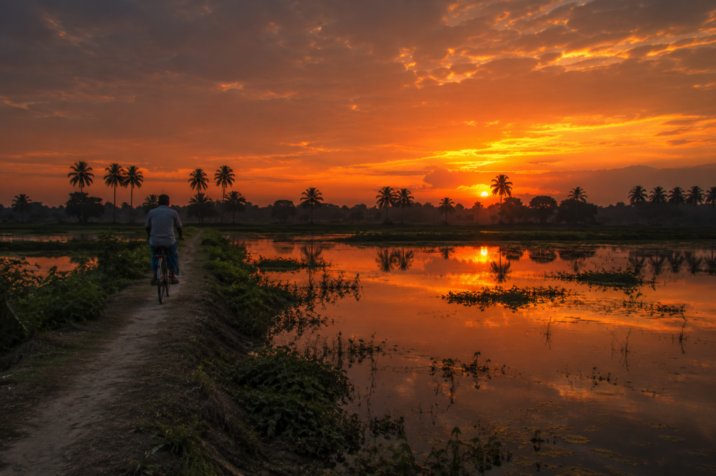
The final light fades slowly across Haroa.
- The western sky glows amber before surrendering to deep blue.
- A lone cyclist follows the embankment toward a distant village.
- The silhouettes of coconut palms sharpen against the evening horizon.
From somewhere beyond the wetlands comes the rhythmic splash of a fisherman lifting his final net for the day.
- The ponds grow still.
- The fields disappear into shadow.
- Only the calls of frogs and crickets remain.
It would be easy to remember Haroa simply as another rural landscape.
- Another collection of villages.
- Another stretch of fertile land in Bengal.
But that would overlook its quiet significance.
Haroa teaches that the Sundarbans do not begin where the mangroves appear. They begin much earlier. They begin in landscapes where people first learned to read water.
- Where ponds became reservoirs of resilience.
- Where wetlands became both pantry and protector.
- Where agriculture, fisheries, and seasonal rhythms evolved together over centuries.
Places like Haroa remind us that the great mangrove forest is only one chapter in the story of the delta.
The chapters before it are equally important.
As the road carries us back toward the brighter lights of Kolkata, the wetlands gradually dissolve into darkness.
The villages disappear behind lines of bamboo.
The canals become invisible. Yet something of Haroa remains. Not because it overwhelms the traveller with spectacle. But it quietly changes the way one understands the landscape.
After Haroa, every river seems more meaningful.
Every wetland appears more alive.
Every journey toward the Sundarbans feels incomplete without remembering the villages where the dialogue between people and water has continued, season after season, for generations.
The road bends north.
The delta remains behind.
But its story travels with us.
Plan your private Sundarban expedition
A private journey shaped around you — your group, your pace, your interests. Book a free consultation.