 Encyclopedia
Dayapur
An Expedition Across The Edge Of Land
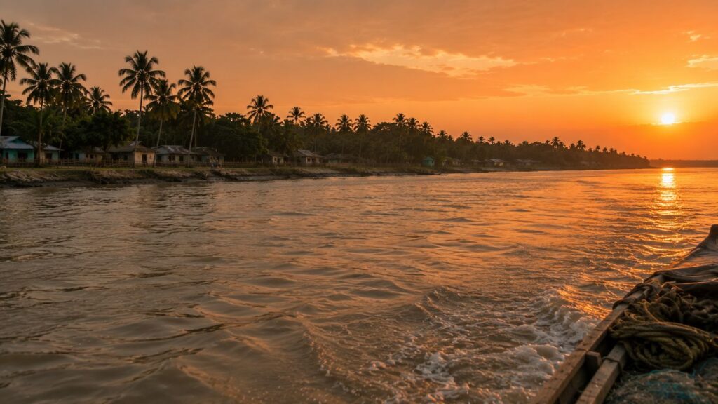
The first light does not arrive over Dayapur.
It gathers first upon the water.
Long before sunrise, the Matla River is still more sound than sight. Somewhere beyond the darkness, tidal currents push against wooden hulls with slow, deliberate force, while the distant drone of a diesel engine echoes across water too vast to belong to a single river.
At Gadkhali jetty, lanterns sway gently beside moored boats. Tea is already boiling in blackened kettles. Fishermen speak quietly, not because the morning demands silence, but because the tide seems to.
The journey towards Dayapur always begins with water deciding the pace.
Unlike many islands of the inhabited Sundarbans that reveal themselves through clusters of houses or distant coconut palms, Dayapur remains hidden until the river chooses to surrender it.
- There is no dramatic skyline.
- No temple spire announcing arrival.
- Only an endless horizon where muddy tidal water meets an equally muted sky.
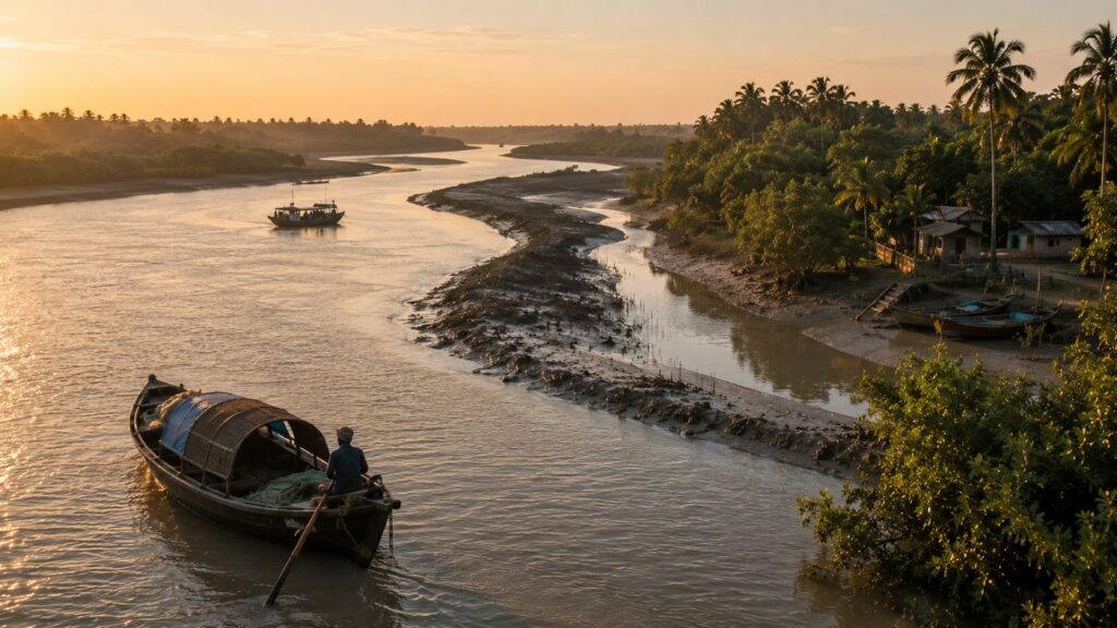
As the eastern horizon slowly turns silver-grey, the outlines of embankments begin to emerge.
- Mangrove shadows appear first.
- Then, the fishing boats.
- Then, narrow landing ghats were built from concrete, bamboo and weathered timber.
Only after that does the island reveal its people.
- A woman walks along the embankment carrying two aluminium water vessels balanced with effortless rhythm.
- A boy pedals a bicycle that seems too large for him, a schoolbag tied to its carrier with blue nylon rope.
- Near the riverbank, fishermen kneel beside tangled nets, checking every knot before the day's first tide begins to strengthen.
Nothing feels staged.
Everything feels inherited. Dayapur does not announce itself through monuments or architecture. Its identity unfolds through movement.
- Boats arriving.
- Boats leaving.
- Children crossing narrow brick pathways.
- Crab baskets waiting beneath the shade.
- Smoke rising from kitchens before the sun has fully broken the horizon.
Here, the river is not simply scenery.
It is the first resident. And every human life begins by learning its moods.
That relationship explains why Dayapur occupies such a distinctive place within the inhabited Sundarbans.
The island stands at one of the most important interfaces between settlement and protected mangrove wilderness. To one side lie villages shaped by agriculture, fisheries, schools, markets and generations of human resilience. Across connected waterways begins another world entirely—the protected forests of the Sundarbans Tiger Reserve, where tides dictate every path and the mangroves reclaim certainty with every season.
Few inhabited islands exist with such immediate proximity to both civilisation and wilderness.
That boundary has shaped Dayapur for generations.
It has influenced where people built homes.
- How they cultivated fields.
- When they fished.
- What stories did they tell their children before entering the forest?
Even today, conversations often drift naturally towards rivers, tides, embankments or distant reports from the forest department. The protected mangroves may stand across the water, but they remain part of everyday consciousness.
The closer one observes Dayapur, the more the island begins to resemble a frontier rather than a destination.
- Not a frontier waiting to be conquered.
- A frontier waiting to be understood.
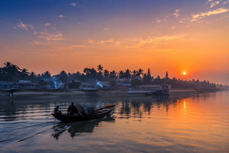
As sunrise finally reaches the river, bronze light spreads across the tidal surface in long shimmering bands. Egrets lift silently from exposed mudflats. A Brahminy Kite circles above a fishing boat before disappearing downstream. Somewhere beyond the visible channels, mangrove forests continue southward towards one of the largest remaining tidal mangrove ecosystems on Earth.
The expedition has barely begun.
Yet Dayapur has already revealed its first lesson.
Nothing here stands apart from the river.
- Not history.
- Not wildlife.
- Not memory.
- Not survival.
First Encounter
Stepping onto Dayapur is less an arrival than a gradual adjustment of the senses.
The landing ghat is modest, functional and unmistakably tidal. Its concrete surface bears dark stains left by countless high tides, while bamboo poles along the river's edge reveal how frequently water levels rise and fall. Boats arrive not according to fixed schedules but according to currents, weather and experience accumulated over generations.
The first impression is openness.
Unlike dense urban settlements where buildings dominate the skyline, Dayapur offers uninterrupted views across embankments, ponds and distant tree lines. Coconut palms rise above clusters of homes, while mango, jackfruit and banana trees soften the edges of village courtyards. Between them run narrow brick lanes, some disappearing towards agricultural fields, others leading quietly back to the river.
The embankments immediately command attention.
- They are more than flood barriers.
- They are roads.
- Meeting places.
- Observation points.
Children walk them on their way to school. Cyclists use them as village streets. Elderly residents pause there during the evening to watch the changing tide. Visitors naturally gravitate towards them because every bend reveals another relationship between land and water.
From the embankment, the wider geography begins to unfold.
Across one channel lies Pakhiralay, another well-known settlement associated with journeys into the Sundarbans. Beyond connected waterways stands Sajnekhali, one of the principal gateways to the protected forests. The distance separating these places appears deceptively small, yet every river crossing reminds travellers that geography in the Sundarbans is measured less by kilometres than by tides.
The island itself carries remarkably few visual distractions.
- No towering hotels interrupt the landscape.
- No broad highways cut through villages.
Instead, everyday life establishes the rhythm.
- A tea stall opens beside the road.
- Fresh vegetables arrive in woven baskets.
- A mechanic repairs the propeller of a riverboat beneath a corrugated tin roof.
Goats wander patiently between courtyards while ducks gather around freshwater ponds reflecting the morning sky.
These scenes may appear ordinary, yet together they explain the remarkable resilience of inhabited delta communities.
Everything here has adapted to uncertainty.
- Homes are often built on slightly raised ground.
- Ponds serve multiple purposes beyond simple domestic use.
- Boats remain essential even for residents whose primary livelihoods are not directly connected with fishing.
The closer one looks, the clearer it becomes that Dayapur has never attempted to dominate its environment.
Instead, it has learned to negotiate with it.
Even vegetation tells this story.
Near the embankments grow salt-tolerant species accustomed to periodic saline intrusion. Slightly inland, agricultural plots reveal careful management of freshwater resources, while homestead gardens demonstrate generations of practical knowledge about what can thrive within a landscape constantly influenced by tides.
There is another subtle characteristic that distinguishes Dayapur from many riverine settlements.
The horizon never truly closes.
Stand almost anywhere along the embankment and some element of water remains visible—a creek disappearing between trees, a distant river glinting beyond paddy fields, or the broad tidal channels connecting the island to neighbouring settlements. Water does not merely surround Dayapur.
It continually reminds residents where they are.
On the edge of one of the world's most dynamic deltas.
Island Identity
Every island in the Sundarbans develops its own personality through geography.
Dayapur's identity is that of a Wildlife Interface Settlement—an inhabited island whose daily life unfolds in immediate relationship with one of the world's most significant mangrove wildernesses.
Administratively, Dayapur lies within the Gosaba Community Development Block of the South 24 Parganas district, West Bengal. It forms part of the inhabited northern reaches of the Indian Sundarbans, where villages, agricultural land and fisheries coexist alongside internationally recognised conservation landscapes.
The island falls under the wider administrative framework of local Gram Panchayat governance serving the Gosaba region, while its social and economic life remains deeply interconnected with neighbouring settlements through waterways rather than highways.
Yet maps reveal only part of Dayapur's identity.
Its true boundaries are ecological.
To the north and west, inhabited islands continue through networks of rivers, canals and reclaimed agricultural landscapes.
Southward, however, the atmosphere begins to change. Human settlement gradually yields to protected mangrove forests where tidal creeks replace village paths and wildlife increasingly defines the landscape.
Few communities experience this transition as directly as Dayapur.
Generations have grown up understanding that the forest is not an abstract national park located somewhere beyond the horizon.
It begins across the river.
This proximity has shaped occupations, education, folklore, conservation awareness and even architecture. Homes, embankments and livelihoods all reflect an ongoing dialogue between human settlement and a dynamic estuarine environment.
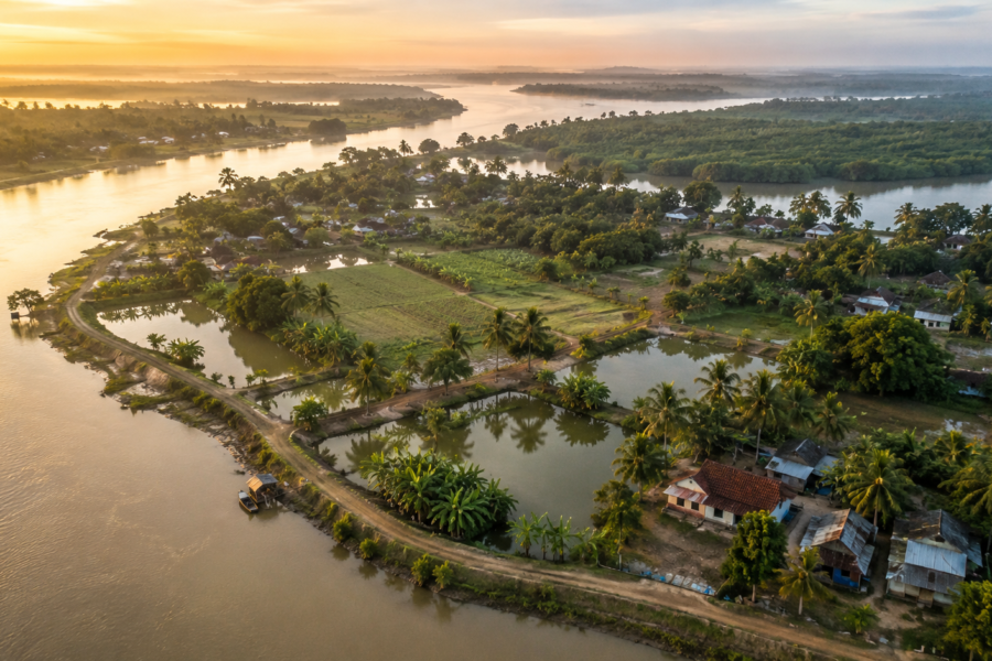
The island's settlement pattern follows the logic common to much of the inhabited Sundarbans, yet with subtle local distinctions. Villages cluster along relatively secure embankments where transport remains easiest and flood protection strongest. Agricultural fields extend inland wherever soil conditions permit cultivation, while ponds—carefully maintained as valuable freshwater resources—occupy spaces between homes and cropland.
Population figures have changed over successive census periods, reflecting migration, environmental pressures and broader demographic trends common across the delta. Rather than expanding rapidly into new territory, Dayapur has largely evolved through adaptation, improving infrastructure within long-established settlement zones while responding to recurring challenges posed by erosion, salinity and cyclonic weather.
Its surrounding rivers are not simply physical boundaries.
They are living systems that determine almost every aspect of island life.
And it is those rivers that truly explain why Dayapur exists where it does.
The Rivers That Shaped The Dayapur
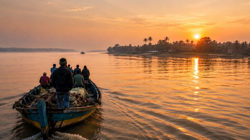
By mid-morning, the tide has begun to turn.
The muddy water creeping quietly along the embankment now gathers confidence, filling side channels that only an hour earlier exposed cracked mud, crab burrows and mangrove roots. Boatmen glance towards the current almost instinctively. Nobody announces that the tide has changed. There is no need. The river announces it first.
To understand Dayapur, one must first understand that it is not defined by land.
It is defined by moving water.
Like every inhabited island of the lower Gangetic delta, Dayapur owes its existence to an intricate network of tidal rivers that have deposited, reclaimed and reshaped land over centuries.
Yet unlike islands located deeper within reclaimed agricultural belts, Dayapur occupies a particularly significant position near the interface between settled villages and protected mangrove wilderness. Its rivers therefore carry more than sediment. They carry history, livelihoods and ecological transitions.
The Matla River dominates this wider landscape.
Once among the most important navigational arteries of the eastern delta, the Matla remains a powerful tidal river whose enormous fluctuations continue to influence surrounding waterways. During spring tides, its currents become visibly stronger, while monsoon rainfall transforms its already broad channel into an immense corridor of silt-laden water flowing towards the Bay of Bengal.
Connected to this wider hydrological system are rivers and tidal channels, including the Gomor River and numerous creeks that weave between Dayapur, Pakhiralay, Gosaba and Sajnekhali. These waterways do not behave like conventional rivers flowing steadily in one direction. Twice each day, they reverse character with the tide, drawing saline water inland before releasing it once again towards the sea.
The consequence is a landscape that is perpetually negotiating its own boundaries.
An embankment standing secure today may require reinforcement within a few monsoon seasons. A creek wide enough for motorboats during the rains may narrow considerably during winter low tides. Mudbanks appear where open water existed only months before, while fresh channels quietly develop elsewhere.
Dayapur has never resisted these changes entirely.
Instead, its people have adapted around them.
- Agriculture follows the availability of freshwater.
- Fishing follows tidal movement.
- Boat schedules acknowledge currents more readily than clocks.
Even conversations carry the vocabulary of rivers.
Older residents often describe distance not by kilometres but by waterways crossed.
- A neighbouring village is "across the Gomor."
- A market lies "beyond the next creek."
- A school is "one ferry away."
- The river becomes the island's map.
Trade has always depended upon these waterways.
Before roads improved elsewhere across the district, boats connected Dayapur with larger commercial centres, transporting rice, fish, vegetables, timber, fuel and household supplies. Even today, river transport remains essential for goods too bulky or impractical to move solely by road within the island network.
The rivers also shape ecology in quieter ways.
- Nutrient-rich sediments nourish agricultural fields.
- Tidal exchange sustains estuarine fisheries.
- Mudflats provide feeding grounds for wading birds.
Mangrove-lined creeks become nursery habitats for countless fish and crustaceans before they disperse into larger river systems.
Nothing within Dayapur exists independently of this hydrological rhythm.
The rivers do not merely surround the island.
They continually create it.
Historical Footprints
Walking inland from the embankment, the landscape gradually changes.
- Paddy fields replace tidal mud.
- Freshwater ponds appear beside family courtyards.
- Brick pathways link one settlement to another with quiet efficiency.
It is easy to assume these villages have always existed.
They have not.
For much of recorded history, large parts of the Sundarbans remained inhospitable to permanent settlement. Dense mangrove forests, saline soils, tidal flooding, malaria and the presence of crocodiles and tigers made sustained habitation extraordinarily difficult. Early travellers often described these lower deltaic islands as landscapes where rivers changed course more quickly than maps could record them.
Dayapur emerged from that uncertainty.
The wider Gosaba region witnessed significant transformation during the eighteenth and nineteenth centuries as colonial administrators encouraged the reclamation of selected parts of the Sundarbans for agriculture. Embankments were constructed, forests cleared in designated areas and settlers gradually introduced to cultivate alluvial soils capable of supporting rice production.
This process was never straightforward.
- Reclaimed land is frequently returned to water.
- Cyclones breached newly built embankments.
- Salinity destroyed crops.
- Disease remained common.
Yet communities persisted because the delta also offered opportunity. Fertile soil, abundant fisheries and navigable waterways created livelihoods that were impossible elsewhere for many landless families.
Dayapur developed within this larger story of reclamation.
Its growth reflected practical necessity rather than grand urban planning.
- Homes clustered where embankments offered relative protection.
- Agricultural fields expanded cautiously behind them.
- Ponds became indispensable reservoirs of freshwater.
Every stage of settlement acknowledged that permanence could never be taken for granted.
The island's history therefore differs from that of mainland towns.
It is not marked by forts or palaces.
Its historical record survives in repaired embankments, altered river courses and generations of families who repeatedly rebuilt after storms.
Cyclones became defining historical events.
Long before modern meteorological forecasting, residents learned to read changes in wind direction, river colour and cloud formation. Oral memory often preserves these events more vividly than written archives.
People remember the year when saline water entered every pond.
The season when embankments failed.
The storm after which familiar trees disappeared.
History here is measured not solely by political milestones, but by the river's ability to reshape everyday life.
Historical Personalities & Transformations
The afternoon sun falls sharply across the village school, where children begin drifting home in small groups, their conversations dissolving into the wider sounds of the island. It is an appropriate place to consider another kind of history—one shaped less by monuments than by institutions.
Unlike historic cities where individual rulers dominate public memory, Dayapur belongs to a landscape where transformation occurred gradually through education, cooperation, agriculture and community organisation.
The wider Gosaba region remains closely associated with Sir Daniel Hamilton, the Scottish entrepreneur whose cooperative experiments during the early twentieth century left a lasting imprint upon parts of the inhabited Sundarbans. Through initiatives promoting rural credit, education and cooperative farming, Hamilton sought to create a more self-sufficient model of island development. Although his principal activities centred around Gosaba, their influence extended across neighbouring settlements, contributing to broader patterns of social and economic change within the region.
Schools became important symbols of that transformation.
Education gradually expanded opportunities beyond traditional livelihoods centred exclusively upon fishing and agriculture. Young people increasingly connected the islands with universities, professions and employment beyond the delta, even while many families retained deep cultural ties to Dayapur.
Healthcare, transportation and communication also evolved steadily.
Where journeys once depended almost entirely upon country boats, motorised vessels gradually improved connectivity between islands.
Electrification reached many settlements in phases.
Mobile communication reduced the isolation that had characterised island life for generations.
Yet transformation has never erased traditional knowledge.
- Boatmen still read currents with remarkable accuracy.
- Fishermen continue interpreting the weather through observations refined over decades.
- Farmers understand subtle variations in salinity that rarely appear within scientific reports.
The island therefore, embodies two histories simultaneously.
- One recorded through administrative development.
- The other was preserved through lived experience.
Both remain equally important.
Folklore & Legends
Evening approaches gently across Dayapur.
The heat softens.
- Tea stalls become livelier.
- Conversations stretch longer than shadows.
It is during these quieter hours that folklore naturally returns to the surface.
In the Sundarbans, stories have always served practical purposes.
- They explain danger.
- They encourage restraint.
- They remind people that human confidence has limits.
No cultural tradition reflects this more clearly than the reverence shown towards Bonbibi, the guardian figure whose presence continues to unite communities across religious traditions throughout the delta. Before entering forested areas, many forest-dependent workers historically sought Bonbibi's protection, recognising the mangroves as spaces requiring humility rather than conquest.
Alongside Bonbibi stands Shah Jongoli, her loyal companion within traditional narratives, while Dakshin Ray remains one of the most recognisable figures associated with the tiger and the untamed forest.
These stories are deeply rooted across the Sundarbans.
However, Dayapur itself does not possess a widely documented body of island-specific legends distinct from the broader cultural traditions of the delta. Responsible documentation therefore requires acknowledging that absence rather than inventing local myths.
What survives are shared beliefs.
Older residents sometimes describe the forest as a place deserving respect regardless of one's faith.
Boatmen speak about never treating tidal rivers casually.
Families remind children that the river can change character within minutes.
Such advice often sounds practical.
Yet beneath it lies generations of accumulated cultural memory.
The supernatural language of the Sundarbans frequently reflects ecological realities. A story warning against wandering alone into unfamiliar creeks also teaches awareness of tides. A tale about respecting the forest reinforces caution around wildlife.
Legends become another form of environmental knowledge.
In Dayapur, the boundary between folklore and experience remains intentionally blurred.
No one claims the forest belongs entirely to people.
Nor entirely to animals.
It belongs, perhaps, to an older order that demands patience, restraint and respect from everyone who enters its shadow.
As darkness slowly gathers beyond the river, lanterns begin appearing one by one along the embankment.
The tide has turned once more.
Tomorrow morning, it will tell another story.
Life Between The Tides
By late afternoon, Dayapur has settled into its most familiar rhythm.
- The early rush of boats has eased.
- Schoolchildren have returned home.
- Smoke curls gently from outdoor kitchens where the evening meal is already beginning to take shape.
Yet beneath this apparent calm, the island continues to move according to forces far older than clocks.
Here, daily life is organised not simply around sunrise and sunset, but around tides.
- A fisherman preparing his nets before dawn is already thinking about the evening current.
- A farmer checks not only the weather but also the salinity of irrigation water after successive high tides.
- Boat operators know that a journey delayed by an hour can become a journey delayed by an entire tide.
The river quietly dictates everyone's timetable.
Fishing remains one of Dayapur's defining livelihoods.
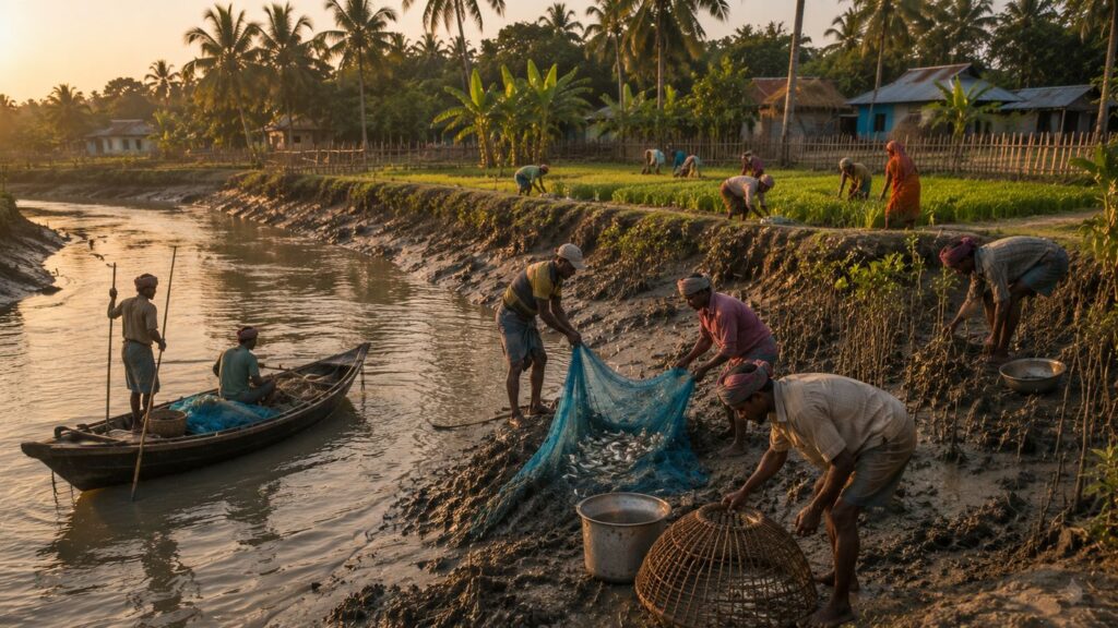
Before daylight reaches the embankments, small wooden boats slip into nearby rivers and tidal creeks carrying nets, traps and generations of accumulated river knowledge. The catch changes with the seasons and with the river itself.
Estuarine fish, prawns and other aquatic resources continue to support both household consumption and local markets, although environmental pressures have altered traditional fishing patterns over time.
Alongside fishing, crab collection has become increasingly significant across parts of the inhabited Sundarbans.
The demand for live mud crabs in national and international markets has provided valuable income for many families. Yet the work remains physically demanding and often hazardous. Collectors navigating tidal creeks near mangrove edges must constantly remain aware of shifting mud, tidal currents and the possibility of encounters with wildlife.
The prosperity offered by the river is never unconditional.
Agriculture provides another pillar of island life.
Rice continues to dominate cultivated land wherever freshwater availability and soil conditions permit. Around homesteads, families grow vegetables, bananas, papayas and seasonal fruits in carefully managed gardens that make efficient use of limited space. Coconut palms sway above ponds that serve multiple purposes—washing, fish culture and, where protected from saline intrusion, freshwater storage.
Every crop reflects adaptation.
Farmers have learned to recognise subtle differences in soil salinity, adjusting planting schedules according to seasonal rainfall and previous cyclone impacts. Years of abundant harvests are remembered warmly. Difficult years remain equally vivid.
Water determines both.
Household life unfolds with similar practicality.
Morning begins early.
Women collect water, prepare meals and organise the day's routines before the heat intensifies.
- Courtyards are swept meticulously.
- Livestock are fed.
- Clothes dry on bamboo lines stretched between fruit trees.
- Children leave for school carrying backpacks that appear remarkably bright against the muted colours of mud, brick and vegetation.
Education occupies an increasingly important place within the aspirations of island families.
- Schools represent more than classrooms.
- They represent possibility.
Many parents hope education will provide future generations with choices beyond livelihoods made increasingly uncertain by environmental change, even while maintaining deep emotional ties to their island home.
There is no clear separation between work and landscape in Dayapur.
- Fishing happens because rivers exist.
- Agriculture succeeds because embankments hold.
- Families endure because adaptation has become a cultural inheritance rather than an emergency response.
Life here is not lived despite the tides.
It is lived with them.
Walking Through The Villages
Leave the embankment and follow one of the narrow brick pathways inland.
Within minutes, the character of Dayapur begins to change.
The river slips quietly from view, replaced by ponds reflecting coconut trees, vegetable gardens bordered by bamboo fencing and clusters of homes arranged with remarkable practicality. The villages do not appear planned according to architectural ideals. They have evolved according to generations of lived experience.
Every path seems to lead somewhere purposeful.
One lane connects neighbouring households. Another reaches agricultural fields.
A narrower track disappears beside a freshwater pond before emerging unexpectedly near a small shrine shaded by banyan roots.
Walking without urgency reveals details often missed by hurried visitors.
- Walls decorated with simple lime wash.
- Hand-painted signs outside local shops.
- Fishing nets hang carefully to dry.
- Children chase each other between mango trees while elderly residents observe quietly from shaded verandas.
Homes reflect adaptation rather than ornamentation.
Older mud-plastered houses still survive in parts of the island, their thick earthen walls naturally regulating indoor temperatures during the intense summer months. Nearby stand more recent brick structures with corrugated metal roofs, built to better withstand heavy monsoon rainfall and simplify post-cyclone repairs.
Nothing feels excessive.
Everything appears functional.
- Courtyards remain central to domestic life.
- Vegetables are cleaned there.
- Fishing nets repaired.
- Rice dried beneath winter sunlight.
Family conversations unfold in these shared spaces long after evening arrives.
- Religion is woven gently into everyday geography.
- Small temples appear beside village roads.
- Mosques serve local communities with equal familiarity.
Neither dominates the landscape.
Both belong naturally within it, reflecting the long-standing coexistence that characterises much of the Sundarbans.
Schools stand among these familiar landmarks.
Children in blue-and-white uniforms walk confidently along brick lanes that previous generations once travelled barefoot. Their classrooms represent continuity as much as change—a reminder that while the landscape remains tidal, opportunities continue to broaden.
Tea stalls deserve special attention. They are far more than places to drink tea. They function as the island's newsroom.
- Ferry timings.
- Weather forecasts.
- Fish prices.
- Crop conditions.
- Political discussions.
- Forest department updates.
- Stories of neighbouring islands.
Everything eventually arrives at the tea stall before travelling onward through conversation.
Spend an hour there and Dayapur gradually introduces itself through voices rather than maps. Markets remain modest in scale but remarkably complete.
- Fresh vegetables.
- River fish.
- Engine oil.
- Fishing hooks.
- Solar lamps.
- Household utensils.
- School supplies.
Every item reflects the practical realities of island living, where supply chains remain inseparable from river transport.
Walking through Dayapur never feels like passing through a tourist destination.
It feels like observing a community whose routines have been refined over generations by water, weather and quiet resilience.
Sounds Of The Island
Close your eyes for a moment.
Dayapur is easier to understand through sound than through sight.
Before dawn, the island belongs to engines.
Small diesel-powered boats announce the beginning of another fishing day long before sunlight reaches the river. Their steady rhythm echoes across tidal channels, mixing with the soft splash of water against wooden hulls.
Then birds take over.
- White-throated Kingfishers call sharply from electric wires.
- Black Drongos dart above open fields.
- Cattle Egrets move noisily between grazing livestock.
Somewhere overhead, the unmistakable cry of a Brahminy Kite drifts across the widening morning sky.
As daylight strengthens, human sounds gradually become more prominent.
- Cycle bells.
- Children laughing on their way to school.
- Metal buckets striking hand pumps.
- Vendors greet familiar customers.
- The distant hammering of boat repairs.
None overwhelms the others. Together, they create an acoustic landscape unique to inhabited river islands.
By midday, even sound slows down.
The afternoon heat softens conversation.
- Many boats remain tied to the embankment awaiting the next favourable tide.
- Dogs sleep beneath fishing boats turned upside down for repair.
- Leaves move only when the river breeze reaches inland.
Silence becomes another presence. Yet complete silence never exists here. Listen carefully and the island continues speaking.
- Water flows gently beneath wooden jetties.
- Wind moving through coconut fronds.
- Mangrove leaves rustling beyond the river.
- The occasional splash of fish breaking the surface.
As evening approaches, familiar rhythms return.
- Children play beside village paths.
- Temple bells ring softly.
- The call to prayer carries across open fields.
- Families gather outdoors where cooler air finally replaces the afternoon heat.
- Generators begin humming as darkness settles.
- Boats return one by one.
- Conversations lengthen.
The tide continues its patient work beneath the stars. Long after the lights disappear from village homes, the river remains awake.
Its breathing never stops.
Wildlife Expedition
Beyond the last cluster of houses, the atmosphere changes almost imperceptibly.
The cultivated landscape begins yielding to reeds, tidal creeks and scattered mangrove vegetation. Human voices fade behind the calls of birds. The transition is subtle, yet unmistakable.
This is where Dayapur's true identity reveals itself.
Unlike islands deep within agricultural landscapes, Dayapur exists close to one of the world's most significant mangrove ecosystems. Wildlife therefore forms part of everyday awareness even when direct encounters remain uncommon.
Birdlife provides the most immediate reward for patient observation.
- White-throated Kingfishers flash electric blue across village ponds before vanishing into shaded branches.
- Brahminy Kites circle above tidal rivers searching for fish disturbed by changing currents.
- Little Egrets and Intermediate Egrets stalk exposed mudflats with extraordinary patience.
- Pond Herons seem almost invisible until they suddenly take flight.
During winter, migratory birds enrich this already diverse avian landscape, using wetlands and tidal habitats throughout the wider Sundarbans as seasonal refuges.
Reptiles occupy quieter corners of the island.
Water Monitor Lizards occasionally appear near creeks and wetlands, moving with surprising confidence between mudbanks and vegetation. Several snake species inhabit the wider region, although encounters depend heavily upon season, habitat and weather conditions. Increased caution during the monsoon remains part of everyday local knowledge.
Fishing Cats continue to inhabit suitable mangrove and wetland habitats across parts of the Indian Sundarbans, though sightings remain genuinely uncommon. Their secretive behaviour makes them one of the delta's most elusive predators.
Smooth-coated Otters have also been documented from sections of the Sundarbans landscape, particularly where healthy riverine habitats persist, although observing them requires exceptional patience and considerable luck.
The waterways surrounding Dayapur belong to a larger estuarine ecosystem supporting remarkable aquatic diversity. Further downstream, where river channels broaden and conditions become more favourable, the endangered Ganges River Dolphin and the Irrawaddy Dolphin have both been recorded within parts of the Sundarbans. While dolphin sightings are not characteristic of Dayapur itself, the island remains connected ecologically to these wider river systems that sustain them.
Then there is the tiger.
Dayapur should never be described as a place where tigers are commonly seen.
That would be inaccurate.
What is true is something more subtle.
The island exists within the broader landscape influenced by the Sundarbans Tiger Reserve. Nearby protected forests support one of the world's most remarkable tiger populations, and their presence shapes local consciousness far beyond the boundaries of the reserve itself.
People notice unusual livestock behaviour.
They pay attention to the forest department advisories.
News of tiger movement travels quickly across neighbouring islands.
The animal's influence extends far beyond direct observation.
For many residents, the tiger is experienced less as a frequent sighting than as a constant reminder that the forest remains genuinely wild.
As the afternoon light begins turning golden, dragonflies skim across ponds while butterflies move between flowering shrubs. Fiddler crabs emerge from tidal mud, waving oversized claws before disappearing once more into carefully engineered burrows.
The expedition naturalist eventually realises something important.
Wildlife around Dayapur rarely performs.
It reveals itself only to those willing to slow down.
Mangrove Chronicles
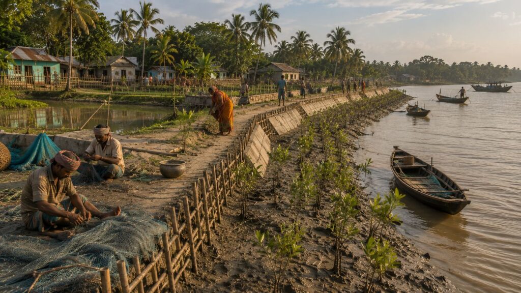
As the afternoon tide reaches its highest point, the boundary between land and water begins to dissolve.
Creeks that appeared narrow only hours earlier now seem broader and deeper.
Mudbanks disappear beneath opaque brown water, while mangrove branches lean quietly over channels reflecting fragments of the sky.
The transformation is so gradual that it is almost impossible to notice while watching. Leave for an hour, however, and the landscape has quietly rewritten itself.
This is the world that surrounds Dayapur.
Although the island itself is inhabited, its identity is inseparable from the mangrove ecosystem that begins almost immediately beyond its settled edges. Across nearby waterways lie the protected forests of the Sundarbans, recognised globally as the largest continuous mangrove forest on Earth and one of India's most significant coastal ecosystems.
Unlike inland forests, where trees compete primarily for sunlight, mangroves survive by overcoming conditions that would overwhelm most other plants.
- Salt.
- Soft sediment.
- Twice-daily tidal inundation.
- Limited oxygen within waterlogged soils.
The species that thrive here are extraordinary precisely because the environment is so unforgiving.
Near Dayapur and across the wider Sundarbans, mangrove communities are composed of species such as Avicennia, Sonneratia, Excoecaria, Ceriops, Bruguiera and the iconic Heritiera fomes, locally known as Sundari—the tree from which the Sundarbans derives its name. Each occupies slightly different ecological niches depending upon salinity, sediment stability and tidal influence.
At first glance, the forest appears motionless.
Look closer.
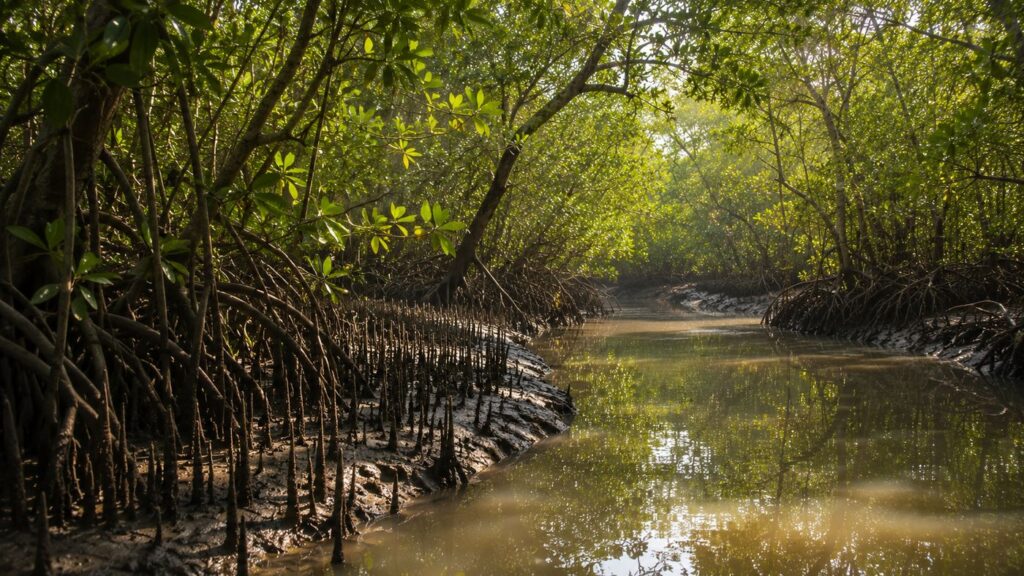
Thousands of pencil-like breathing roots rise vertically from the mud around Avicennia trees, allowing oxygen to reach underground root systems submerged by tides for much of the day. Prop roots arch elegantly from other species, anchoring trunks against shifting sediments while trapping fresh deposits carried downstream by rivers.
The forest is continually building land.
- Every tide delivers sediment.
- Every root slows the current.
- Every trapped grain of silt contributes, almost invisibly, to the future shape of the delta.
For Dayapur, this ecological process is far from theoretical.
Healthy mangrove belts reduce the force of storm surges before they reach inhabited embankments. They stabilise riverbanks vulnerable to erosion. Their submerged root systems provide nursery habitats for prawns, juvenile fish and countless invertebrates that later support local fisheries.
The connection between village and forest is therefore reciprocal.
The island depends upon the mangroves.
The mangroves, in turn, benefit when surrounding communities recognise their value and support their protection.
Across the Sundarbans, conservation efforts increasingly acknowledge this relationship. Community-led mangrove plantation programmes have emerged following major cyclones, particularly in areas where erosion exposed the vulnerability of embankments once protected by natural vegetation. While restoration cannot immediately replace centuries-old forests, it represents an important recognition that engineered structures alone cannot defend the delta.
The people of Dayapur understand this instinctively. When discussing mangroves, they rarely speak only about biodiversity.
They speak about storms.
- Riverbanks.
- Fish.
- Crabs.
- Future harvests.
- Safe embankments.
For them, conservation is not an abstract environmental ideal.
It is part of everyday survival. Stand quietly beside a tidal creek as evening approaches and the forest reveals another lesson.
Nothing here exists in isolation.
- The roots support the mud.
- The mud supports the trees.
- The trees protect the riverbanks.
- The river sustains the fish.
- The fish sustain the villages.
And the villages, whether consciously or not, have become custodians of the very ecosystem upon which they depend.
Explorer's Field Notes
Field Note — Winter Dawn
A thin veil of mist lingers over freshwater ponds while the first sunlight reaches only the upper leaves of coconut palms. Egrets gather along exposed mudflats created by the retreating tide, moving slowly between small pools left behind by the river. Visibility is at its clearest during winter mornings, making this one of the most rewarding seasons for landscape observation.
Field Note — Midday Embankment
By early afternoon, activity shifts noticeably away from the river. Fishing boats remain moored while crews repair nets beneath temporary bamboo shelters. Cyclists pass intermittently along the embankment carrying vegetables, fishing gear and household supplies. The river appears calm, yet the incoming tide has already begun covering lower mudbanks.
Field Note — Mangrove Edge
Where tidal creeks meet mangrove vegetation, countless fiddler crab burrows become visible during low tide. Their activity briefly intensifies before advancing water forces them back beneath the mud. The transition happens quickly, demonstrating how precisely intertidal species respond to changing water levels.
Field Note — Village Pond
Freshwater ponds remain among the most carefully managed spaces within the island landscape. Besides supporting domestic needs, many also sustain small-scale fish culture and contribute to household resilience during periods of environmental stress. Their condition often reflects the broader health of surrounding settlements.
Field Note — Evening Jetty
The final boats return gradually rather than simultaneously. Some carry fishing equipment, others transport passengers returning from neighbouring islands. Conversations begin before engines stop, suggesting that news travels almost as quickly as the tide itself.
Nightfall On The Island
The last sunlight disappears not behind mountains or buildings, but behind water.
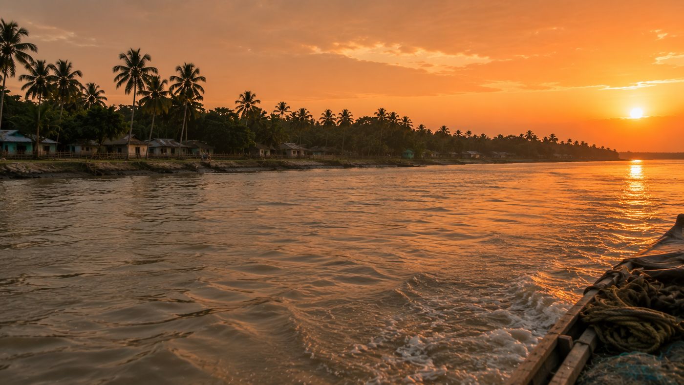
For a few moments after sunset, the western sky burns softly in copper and amber, reflected across tidal channels that now appear wider than they did during the day. Coconut palms become silhouettes. The outlines of fishing boats blur into the gathering dusk.
Then darkness arrives with remarkable speed.
Dayapur changes character after sunset.
The embankments that served as busy village roads during daylight become quieter. Children are called home. Shops lower their shutters one by one. The final ferries complete their crossings before river navigation becomes increasingly difficult beneath the night sky.
Artificial light remains modest.
- A handful of streetlights.
- Windows glowing softly through curtains.
- The occasional beam of a motorcycle headlamp crosses the embankment.
Most illumination comes not from the island itself but from scattered reflections dancing upon the river.
Listen carefully.
- Generators hum in the distance.
- A dog barks somewhere beyond the next courtyard.
- Crickets begin their evening chorus.
Occasionally, the steady rhythm of a boat engine echoes across the water before fading into silence once more.
The river never truly sleeps.
Its tides continue moving unseen through creeks, canals and estuaries long after the villages have settled for the night. Somewhere beyond the visible horizon, the mangrove forests remain equally alive.
- Nocturnal birds begin calling from dense vegetation.
- Fish continue riding tidal currents.
- Mud crabs emerge cautiously from flooded burrows beneath the cover of darkness.
The island may appear still.
The ecosystem is anything but.
Power interruptions, although less frequent than in previous decades, occasionally remind residents how profoundly darkness shapes life within the delta. When electric lights disappear, the night sky immediately expands.
Constellations emerge with startling clarity.
The Milky Way, invisible across many urban landscapes, stretches faintly above the rivers during clear winter nights. Reflections shimmer across ponds and tidal channels alike, making it difficult to distinguish where the sky ends and the water begins.
It is at this hour that Dayapur feels most remote.
Not isolated.
Simply removed from the urgency that defines cities.
The island no longer introduces itself through markets, schools or fishing boats.
Instead, it reveals something quieter.
- Where tides continue their ancient work beneath starlight.
- Where mangroves breathe unseen beyond the river.
- Where every dawn will begin exactly as this one ended.
The Seasons Of The Island
The calendar changes in Dayapur.
The island changes with it.
Unlike places where seasons are marked mainly by temperature, here each season rewrites the landscape itself.
- Rivers expand and contract.
- Salinity rises and falls.
- Birdlife shifts.
- Agricultural routines adapt.
Even the colour of the embankments changes as moisture, sunlight and tidal influence leave their marks upon the soil.
Every season offers a different version of the same island.
Winter
The first cool mornings arrive quietly.
Mist settles over ponds before sunrise while the rivers reflect pale blue skies rarely seen during the humid months. Visibility improves dramatically, revealing distant tree lines and broad tidal channels with exceptional clarity.
For local communities, winter is often the most predictable season.
River crossings become easier. Agricultural activity continues under relatively stable weather conditions. Migratory birds enrich wetlands and mudflats throughout the wider Sundarbans, making this one of the most rewarding periods for naturalists and bird photographers.
The pace feels unhurried.
Even the afternoon light appears softer.
Spring
Spring in Dayapur is subtle.
There are no dramatic floral displays announcing its arrival.
Instead, homestead gardens become greener, fruit trees prepare for another growing cycle and agricultural fields gradually shift between harvest and preparation. Temperatures begin rising, yet the oppressive humidity of summer has not fully arrived.
This is a season of transition.
- Boats continue their routines.
- Schools remain active.
- The rivers flow with familiar confidence before the more demanding months ahead.
Summer
By late April, the heat dominates everything.
The embankments radiate warmth long after midday. Humidity clings to the air while freshwater becomes increasingly precious. Afternoon journeys become shorter as residents seek shade beneath trees, verandas and tea stalls.
The rivers remain active, yet their appearance changes.
Water levels fluctuate. Salinity becomes a growing concern for agriculture. Clouds often gather dramatically during late afternoons, occasionally releasing short but intense thunderstorms that momentarily cool the landscape before humidity quickly returns.
Summer demands endurance.
Monsoon
The first sustained rains transform Dayapur almost overnight.
- Dust disappears.
- Vegetation deepens into vivid shades of green.
- Canals refill.
- Ponds overflow.
Fields absorb enormous volumes of freshwater while rivers swell with combined tidal influence and upstream discharge.
- Movement becomes more uncertain.
- Brick pathways grow slippery.
- Boat schedules become increasingly dependent upon the weather.
- Visibility across the rivers often narrows beneath heavy rain.
Yet monsoon also restores life.
- Freshwater replenishes ponds.
- Agricultural fields recover.
- Mangrove ecosystems receive the seasonal rhythms upon which they have depended for centuries.
Post-Monsoon
As rainfall gradually decreases, the island begins repairing itself.
- Fields become accessible once more.
- Fishing activity increases.
- Communities inspect embankments for damage caused during the previous months.
The atmosphere carries a renewed sense of activity.
- Markets become busier.
- Construction resumes.
- Agricultural planning enters another cycle.
Cyclone Season
Unlike conventional seasons, the cyclone season is measured less by dates than by vigilance.
Every developing low-pressure system over the Bay of Bengal attracts attention across the island.
- Weather bulletins become regular conversation.
- Boats return earlier.
- Families review emergency preparations almost instinctively.
For Dayapur, the cyclone season is not merely meteorological. It is psychological. Generations have learned that preparation begins long before landfall.
Cyclones And Survival
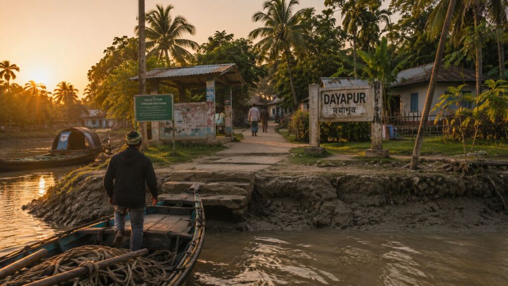
Walk along almost any embankment in Dayapur and history becomes visible.
Not through monuments.
- Through repairs.
- Fresh concrete joins older sections.
- Bamboo reinforcements support vulnerable slopes.
Young mangrove plantations line stretches of riverbank where erosion once advanced more aggressively.
These are the island's memorials.
The Sundarbans occupies one of the most cyclone-prone coastal regions in the world, and Dayapur has repeatedly experienced the consequences of powerful storms crossing the Bay of Bengal.
Cyclones such as Aila (2009), Bulbul (2019), Amphan (2020) and Yaas (2021) left lasting impacts across the inhabited delta.
While each storm differed in intensity and track, its consequences followed familiar patterns.
- Storm surges overtopped embankments.
- Saline river water flooded agricultural land.
- Freshwater ponds became contaminated.
- Roads disappeared beneath water.
- Fishing boats suffered damage.
Livelihoods paused while communities focused first on recovery. Perhaps the greatest challenge was not the wind itself.
It was the salt.
Once saline water enters agricultural fields, recovery can require months or even years, depending upon local conditions.
- Crops fail.
- Drinking water becomes scarce.
- Livestock suffer.
- Household economies weaken.
Yet resilience in Dayapur is rarely described dramatically. It appears through routine actions.
- Neighbours repairing damaged roofs together.
- Families cleaning ponds.
- Fishermen rebuilding boats.
- Farmers reclaiming fields one season at a time.
Communities reinforcing embankments before the next monsoon arrives. The island has never assumed storms will stop coming.
Instead, it has learned to prepare, recover and adapt. This quiet resilience remains one of Dayapur's defining characteristics.
Ferry Routes & Hidden Paths
Every meaningful journey to Dayapur begins before reaching the island itself.
From Kolkata, travellers move southeast by rail towards Canning, the historic gateway to much of the inhabited Sundarbans.
From there, roads continue towards Godkhali (Gadkhali) Jetty, where asphalt gives way to water.
The river completes the journey.
Motor launches and ferries cross tidal channels linking mainland jetties with the islands of the Gosaba region, including Dayapur. Unlike highways, these routes remain living corridors shaped by weather, currents and tides.
The final approach always feels gradual.
- Mangroves appear intermittently.
- Fishing boats become more numerous.
- The horizon opens.
- The mainland slowly disappears behind widening rivers.
Within Dayapur itself, exploration continues mostly on foot, by bicycle, electric rickshaw where available, or by small local boats connecting nearby settlements.
The hidden paths are rarely marked on maps. They emerge naturally through repeated use.
- Brick lanes crossing agricultural fields.
- Embankment trails overlooking tidal rivers.
- Village shortcuts shaded by coconut and mango trees.
- Creek-side tracks leading quietly towards lesser-used landing points.
The most rewarding discoveries often lie beyond the obvious routes. Not because they are famous. Because they remain part of everyday island life.
Photography Expedition Guide
Dayapur rewards observation rather than speed. The finest photographs often appear after waiting rather than searching.
Sunrise Photography
The eastern embankments overlooking tidal rivers provide excellent opportunities for capturing soft winter mist, fishing boats preparing for departure and the first reflections of sunlight across the Matla-connected waterways.
Sunset Photography
Western-facing embankments become particularly rewarding during clear winter evenings when copper-coloured light reflects across calm tidal channels before disappearing behind distant tree lines.
Wildlife Photography
Patience matters more than equipment.
Early morning remains the most productive period for photographing kingfishers, egrets, Brahminy Kites and other common estuarine birds.
Telephoto lenses are essential. Wildlife should never be disturbed for photography.
Landscape Photography
Low tide reveals textured mudflats, exposed mangrove roots and intricate creek systems, while high tide emphasises reflections, river width and the relationship between settlement and water.
Both conditions tell different stories.
Cultural Photography
Village life unfolds naturally around ferry ghats, tea stalls, local markets, embankments and fishing activities.
Respect for privacy remains essential. Meaningful documentary photography begins with permission.
Seasonal Opportunities
- Winter offers the clearest atmosphere.
- Monsoon provides dramatic skies and lush vegetation.
- Post-monsoon reveals recovery, repair and renewed agricultural activity.
Each season contributes its own visual identity.
Expedition Notes
The highest point visible from many embankments is often not a building but a coconut palm.
Freshwater ponds remain among the island's most valuable resources despite appearing deceptively ordinary.
Boat repair is as important to island life as boat building.
Many residents instinctively observe cloud formations before discussing weather forecasts.
Older embankments reveal successive generations of reinforcement, recording environmental history through layers of engineering.
Morning conversations frequently begin with tides before shifting towards politics or markets.
Even short journeys between neighbouring islands often require careful planning around river conditions.
The landscape appears peaceful.
Its logistics are remarkably sophisticated.
Connected Landscapes
Dayapur is best understood not as an isolated island but as one element within a much larger ecological and cultural network.
Across nearby waterways lies Pakhiralay, another important settlement closely associated with journeys into the Sundarbans.
Further downstream stands Sajnekhali, whose interpretation centre and watchtower provide one of the principal gateways into the protected forests of the Sundarbans Tiger Reserve.
Beyond these begin increasingly wild landscapes.
- Dobanki, known for its canopy walk.
- Sudhanyakhali, famous for wildlife observation.
- Netidhopani, where archaeology, folklore and mangrove wilderness intersect.
The rivers connecting these places remain equally significant.
- The Matla River shapes much of the region's hydrology.
- The Gomor River supports transport, fisheries and settlement.
Countless unnamed creeks complete the network, carrying nutrients, wildlife and people between landscapes that might otherwise appear separate.
Ecologically, nothing stands alone.
- Fish move freely.
- Birds ignore administrative boundaries.
- Mangroves stabilise riverbanks supporting multiple islands simultaneously.
- Cyclones affect entire river systems rather than individual villages.
Dayapur's story therefore belongs not only to one island.
It belongs to the wider living delta.
Oral Histories
The oldest stories in Dayapur rarely begin with dates.
They begin with rivers.
An elderly resident remembers when the embankment stood several metres farther towards the river than it does today.
Another recalls travelling primarily by country boat before motorised launches became common across the region.
Farmers speak about seasons when freshwater remained plentiful for longer than recent generations have experienced.
Others remember the aftermath of Cyclone Aila less through wind speeds than through the taste of salt lingering in ponds once used for drinking water.
These recollections matter.
They preserve environmental history that scientific measurements alone cannot fully capture.
Yet responsible documentation also requires restraint.
- Many memories remain deeply personal.
- Some vary between families.
- Others cannot be independently verified.
Rather than presenting every recollection as historical certainty, they are best understood as lived experiences contributing to the island's collective memory.
Together, they reveal something important.
The history of Dayapur is not written only in government archives.
It also survives in conversations held on embankments overlooking the same rivers that shaped every previous generation.
Food Of The Island
As evening kitchens come alive, the aromas drifting through Dayapur reveal another relationship with the river.
Rice remains central to daily meals.
Alongside it appear estuarine fish, freshwater catches, prawns and, where available, mud crab prepared using recipes refined across generations.
Mustard oil provides much of the island's distinctive flavour profile.
Green chillies, turmeric, onions and seasonal vegetables complete meals that reflect availability rather than extravagance.
Food changes with the seasons.
A successful fishing period becomes visible in local markets.
Agricultural harvests influence household menus.
Cyclones and saline intrusion occasionally reshape diets by temporarily affecting fisheries and crop production alike.
Nothing reaches the table without first passing through the wider ecology of the delta.
In Dayapur, eating is another conversation with the landscape.
Island Economy
Dayapur's economy rests upon diversity rather than dependence upon any single livelihood.
Fishing continues providing employment for numerous households.
Agriculture supports others wherever freshwater and soil conditions remain favourable.
Crab collection contributes significantly to incomes connected with regional export markets.
Boat transport generates additional employment through ferry services, goods movement and river logistics.
Small shops, repair workshops, educational institutions and local markets sustain the everyday commercial life of the island.
Tourism contributes indirectly because of Dayapur's proximity to important Sundarbans gateway locations, yet the island itself remains more residential than overtly commercial.
Migration also forms part of the economic story.
Many younger residents seek employment elsewhere in West Bengal or other parts of India while maintaining close family connections with the island.
Economic resilience therefore depends upon both local opportunity and broader regional mobility.
Then & Now
Stand upon the embankment at sunset.
Imagine the same view half a century ago.
- The river would still dominate the horizon.
- Fishing boats would still depart before dawn.
- Children would still walk to school.
Yet many subtle details have changed.
- Motorised boats replaced many traditional vessels.
- Brick houses gradually became more common.
- Electricity reached settlements once illuminated primarily by kerosene lamps.
- Mobile phones connected islands that previously depended upon physical travel for communication.
Environmental changes have been equally significant.
- Cyclones have become defining modern memories.
- Salinity pressures continue challenging agriculture.
- Riverbank erosion demands constant vigilance.
- Climate change increasingly influences both scientific research and local conversation.
Yet despite these transformations, one characteristic has remained remarkably constant.
Dayapur continues negotiating rather than conquering its environment.
- The river still sets the rhythm.
- The embankments still guard the villages.
- The mangroves still define the horizon.
And every generation continues learning the same enduring lesson. On this island, survival has never meant resisting nature. It has always meant understanding it.
The Wild Orbit Quick Facts
Location: Dayapur Island, Gosaba Community Development Block, South 24 Parganas District, West Bengal, India.
Geographic Region: Indian Sundarbans Delta.
Approximate Coordinates: Around 22.19° N, 88.80° E, representing the island's approximate central location.
Administrative Block: Gosaba Community Development Block.
Subdivision: Sundarban Subdivision.
District: South 24 Parganas.
State: West Bengal.
Gram Panchayat: Dayapur Gram Panchayat.
Nearest Major Mainland Jetty: Godkhali (Gadkhali) Jetty.
Nearest Railway Station: Canning.
Landscape Type: Inhabited tidal delta island positioned along the transition between settled communities and protected mangrove wilderness.
Dominant Identity: A Wildlife Interface Settlement where everyday village life exists alongside one of the world's largest mangrove ecosystems.
Primary Ecosystem: Mangrove delta influenced by tidal rivers, estuarine creeks and seasonal freshwater inflows.
Major Surrounding Rivers: The wider Matla River system, the Gomor River and an extensive network of interconnected tidal creeks.
Nearest Protected Forest Gateway: Sajnekhali.
Nearby Islands: Pakhiralay, Gosaba, Bali and Satjelia.
Major Livelihoods: Fishing, agriculture, crab collection, boat transport and tourism-related services.
Best Visiting Season: November to February, when weather conditions are generally cooler, clearer and more suitable for river exploration.
Wildlife Highlights: Kingfishers, Brahminy Kites, Water Monitors, estuarine birdlife, diverse mangrove fauna and the possibility of elusive Fishing Cats within suitable habitats.
Major Environmental Challenges: Cyclones, embankment erosion, salinity intrusion, tidal flooding and long-term climate pressures affecting the delta.
Explorer Profile: Ideal for wildlife enthusiasts, documentary photographers, researchers, conservationists and travellers seeking an authentic understanding of the inhabited Sundarbans.
The Wild Orbit Expedition Snapshot
See it for yourself
A private journey shaped around you — your group, your pace, your interests. Book a free consultation.
Accessibility: ★★★★☆
Reaching Dayapur requires a combination of rail, road and river travel, beginning from Kolkata through Canning and Godkhali before the final ferry crossing. Although the journey demands a little patience, it remains one of the more accessible inhabited islands of the Indian Sundarbans while retaining its authentic delta character.
Wildlife Potential: ★★★★☆
Dayapur's greatest strength lies in its proximity to the protected mangrove forests of the Sundarbans Tiger Reserve. The surrounding rivers, mudflats and mangrove edges support rich birdlife, reptiles and estuarine biodiversity. Wildlife here should be appreciated as naturally occurring rather than guaranteed, making every observation feel genuinely rewarding.
Photography Potential: ★★★★★
From mist-covered winter mornings and working fishing boats to expansive tidal rivers, mangrove creeks and everyday village life, Dayapur offers exceptional opportunities for documentary photography throughout the day. The constantly changing light and tides ensure that no two visits produce identical images.
Cultural Richness: ★★★★★
Life on Dayapur continues to reflect generations of adaptation to the delta. Fishing traditions, agricultural practices, Bonbibi customs, river-based livelihoods and close-knit island communities create an authentic cultural landscape that remains deeply connected to its environment.
Historical Interest: ★★★★☆
The island forms part of the broader historical narrative of the inhabited Sundarbans, including colonial-era land reclamation, the cooperative legacy of the Gosaba region and the continuing story of human resilience against cyclones, erosion and changing rivers.
Solitude Level: ★★★★☆
Although Dayapur is closely connected to neighbouring islands and important forest gateways, it retains a noticeably quieter atmosphere than several more frequently visited locations in the Sundarbans. Its slower pace allows explorers to experience the rhythms of island life without the distractions of heavy visitor traffic.
The Wild Orbit Explorer Connections
No island exists alone in the Sundarbans.
Understanding Dayapur naturally leads towards understanding the wider delta. From here, explorers can continue learning through interconnected landscapes:
- Gosaba — Administrative and historical heart of the inhabited Sundarbans, associated with Sir Daniel Hamilton's cooperative experiments.
- Pakhiralay — A neighbouring settlement closely linked with river journeys and forest-bound expeditions.
- Sajnekhali — One of the principal gateways into the Sundarbans Tiger Reserve, combining conservation, interpretation and wildlife observation.
- Dobanki — Known for its elevated canopy walk and mangrove interpretation facilities.
- Sudhanyakhali — Among the best-known wildlife observation zones within the Tiger Reserve.
- Netidhopani — A remarkable meeting point of archaeology, folklore and mangrove wilderness.
- Matla River — One of the defining tidal rivers of the Indian Sundarbans.
- Gomor River — A vital artery connecting settlements, fisheries and agricultural landscapes.
- Bonbibi Traditions — The shared cultural framework that continues shaping human relationships with the mangrove forest.
- Mangrove Ecology — The ecological foundation upon which every inhabited island of the Sundarbans ultimately depends.
FAQs
1. Where is Dayapur located?
Dayapur is an inhabited island within the Gosaba Community Development Block of South 24 Parganas district in the Indian Sundarbans, West Bengal.
2. What makes Dayapur unique?
Its close relationship with both inhabited settlements and the protected mangrove forests makes it one of the region's most important wildlife interface landscapes.
3. Is Dayapur inside the Sundarbans Tiger Reserve?
No. Dayapur is an inhabited island located near important entry points into the protected reserve.
4. Which rivers surround Dayapur?
The island is influenced by the wider Matla and Gomor river systems together with numerous tidal creeks.
5. Is Dayapur connected by road?
Road access reaches only Godkhali Jetty. The final journey to Dayapur requires ferry or motorboat transport.
6. What is the island mainly known for?
Its riverine culture, proximity to mangrove wilderness, fishing communities and documentary-worthy landscapes.
7. What are the main occupations?
Fishing, agriculture, crab collection, boat transport and tourism-related employment.
8. Can visitors see Royal Bengal Tigers in Dayapur?
Tigers inhabit the protected forests of the wider Sundarbans. Direct sightings from Dayapur itself are uncommon.
9. Is Dayapur good for birdwatching?
Yes. Kingfishers, Brahminy Kites, egrets, herons and seasonal migratory birds are regularly observed.
10. What is the best season to visit?
Winter, particularly between November and February.
11. Why are embankments so important?
They protect settlements from tidal flooding and storm surges while serving as roads and community spaces.
12. Does Dayapur experience cyclones?
Yes. Like much of the Sundarbans, it remains vulnerable to severe tropical cyclones.
13. Was Dayapur affected by Cyclone Aila?
Yes. The wider Gosaba region, including Dayapur, experienced significant impacts during Cyclone Aila.
14. Are mangroves found on the island?
Mangrove vegetation occurs around nearby tidal zones, while extensive protected mangrove forests lie across connected waterways.
15. What wildlife can be seen?
Birds, reptiles, estuarine fish, mud crabs and, with considerable luck, elusive mammals such as the Fishing Cat.
16. Is Dayapur suitable for wildlife photographers?
Yes, particularly those interested in documentary and landscape photography rather than guaranteed animal encounters.
17. Is freshwater available naturally?
Freshwater is carefully managed through ponds and rain-fed resources because salinity remains a continuing challenge.
18. Are Bonbibi traditions important here?
Yes. Bonbibi remains an important cultural figure throughout the wider Sundarbans.
19. Does Dayapur have schools?
Yes. Education plays an important role in community life and future aspirations.
20. How do people travel between islands?
Primarily by ferries, motor launches and smaller local boats.
21. Is Dayapur heavily commercialised?
No. It remains primarily a residential island with authentic community life.
22. Does climate change affect Dayapur?
Yes. Rising salinity, stronger cyclones and riverbank erosion continue influencing the island.
23. What is the landscape like?
A mosaic of embankments, agricultural fields, freshwater ponds, tidal rivers and nearby mangrove forests.
24. Can Dayapur be explored in a day?
A day introduces the island, but understanding its rhythms requires much longer observation.
25. Why does Dayapur matter?
Because it represents the continuing relationship between people, rivers and mangrove wilderness within one of the world's most dynamic delta ecosystems.
How To Reach Dayapur
Dayapur is an inhabited island in the Gosaba block of South 24 Parganas, located on the northern edge of the Sundarbans National Park. The island is accessible by a combination of rail or road travel from Kolkata, followed by a ferry or mechanized boat across the delta's tidal rivers.
From Kolkata:
Dayapur is approximately 105–120 km from Kolkata, depending on the route and ferry crossing. The journey generally takes 4 to 5 hours.
By Rail:
The most common route begins with an Eastern Railway suburban train from Sealdah Station to Canning Railway Station, a journey of around 1 hour 45 minutes to 2 hours. Canning is one of the principal gateways to the Indian Sundarbans.
From Canning Railway Station, travelers continue by road for approximately 30 km to Godkhali (Gadkhali) Jetty, the main embarkation point for the Gosaba region.
By Road:
Travelers may also drive directly from Kolkata to Godkhali Jetty via Baruipur, Canning, and the Basanti Highway. The drive usually takes 2.5 to 3.5 hours, depending on traffic and road conditions.
By Ferry and Boat:
From Godkhali Jetty, regular government ferries and mechanized boats cross the Gomor River to Gosaba. From Gosaba, local ferries, country boats, and motorized launches provide onward connections to Dayapur Island. Water transport is the primary means of reaching the island, as no bridge connects Dayapur to the mainland.
During Monsoon
- Ferry timings may vary because of weather conditions.
- Strong currents can increase travel time.
- Heavy rainfall occasionally affects visibility.
- Cyclone alerts should always be monitored before departure.
Explorer Tips
- Start early from Kolkata.
- Carry waterproof protection for electronics.
- Allow extra travel time for tidal delays.
- Follow local advice regarding river conditions.
- Respect ferry schedules, especially during adverse weather.
Things To See Around Dayapur
- Dayapur village embankments
- Traditional fishing landing ghats
- Freshwater ponds and village gardens
- Local tea stalls and community gathering spaces
- Agricultural landscapes shaped by tidal ecology
- Pakhiralay
- Sajnekhali Forest Interpretation Centre
- Sajnekhali Watch Tower
- Mangrove-lined tidal creeks
- Low-tide mudflats supporting estuarine birdlife
- Sunrise viewpoints along the river
- Sunset embankments overlooking the Matla-connected waterways
- Local village temples and mosques
- Seasonal fish markets
- Boat repair yards reflecting traditional river craftsmanship
CTA: Explore Our Sundarbans Expeditions
Continue The Journey
Dayapur never feels like the end of an expedition.
The rivers continue beyond every bend.
Northward lie the reclaimed settlements that tell the story of human adaptation across the inhabited Sundarbans.
Southward begin the protected mangrove forests where rivers grow quieter and wildlife increasingly replaces human presence.
- Follow the waterways towards Pakhiralay.
- Continue through Sajnekhali into the mangrove wilderness.
- Walk the canopy at Dobanki.
- Wait patiently at Sudhanyakhali.
- Listen to the legends surrounding Netidhopani.
Every crossing reveals another chapter of the delta. No single island explains the Sundarbans. Together, they do.
The Island Recedes
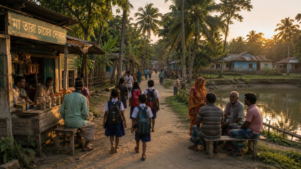
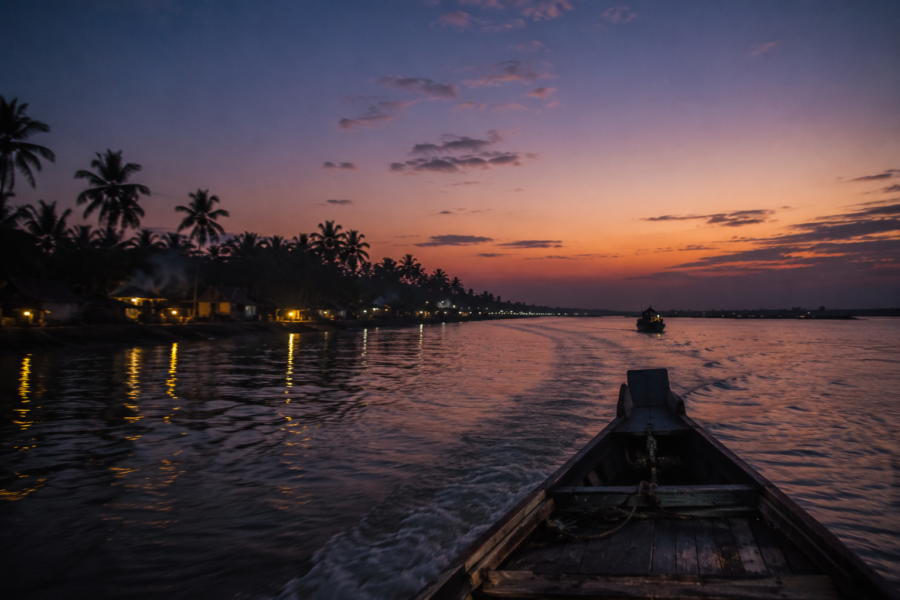
The return boat leaves just as the last colour drains from the western sky.
Dayapur recedes slowly.
- First the individual houses disappear behind the embankment.
- Then the coconut palms dissolve into silhouettes.
- Soon even the landing ghat becomes impossible to distinguish from the darkening shoreline.
Only the river remains.
- Wide.
- Restless.
- Ancient.
The engine carries the boat steadily towards the mainland, yet the island lingers in quieter ways.
- In the memory of morning mist rising above the Matla.
- In the rhythm of fishermen preparing for another tide.
- In the careful geometry of embankments holding back the river.
- In the breathing roots of mangroves patiently trapping tomorrow's land.
Dayapur never demanded attention.
It earned it.
It revealed that life in the Sundarbans is neither a struggle against nature nor a romantic coexistence with it. It is a continuous negotiation—measured in tides instead of hours, in seasons instead of calendars, and in resilience instead of certainty.
Long after the lights of the island disappear behind the evening river, one truth remains unmistakably clear.
Dayapur is not simply a place within the Sundarbans.
It is one of the many quiet frontiers where land, water, forest and human endurance continue writing the story of the world's greatest mangrove delta—one tide at a time.
CTA: Read More Island Dossiers